The North Branch

We paddled the North Branch back in 2015 (specifically 5/1/15 and 5/2/15). After driving to Chatfield and locking up our canoe and paddling gear, we drove to Whalen where we left our car and got on our bikes. For most of the Root River there is an accompanying paved bike trail. We took the bike trail as far as Fountain, where it ends, and then hopped on some county roads to get back to Chatfield.
By the time we got to paddling, it was late afternoon. Hence, we only made it as far as the Pilot Mound campsite, about 13 miles downstream. The campsite was OK, better because it was spring and the vegetation hadn’t had much of a chance to grow up too much. There was a picnic table to mark the DNR site.
The next morning we paddled about 8 miles to Moen’s Bridge. We were marathon training, and so I figured we ought to do a run – 10 miles at that. Thus we stashed our canoe and gear and ran, Erik complaining that the route was too long and hilly for mid-day sun. After the run, we canoed another 10 miles to the Power Plant Campsites. Only, when we got to the campsites, there were no signs, no picnic tables, and no evidence that camping was OK. This didn’t detour us and so we cooked dinner and set up our tent. We were getting ready to paddle across the river to check out the old power station.
And then the cows came. Like an entire herd of cattle. We tried to shoo them away multiple times, unsuccessfully. We didn’t want to get in our tent for fear we’d be trampled. We debated packing up and canoeing farther downstream, but there was nowhere else to camp and we were meeting Erik’s grandpa in Rochester the next day so had to spend the night somewhere. The cows wandered off and we thought we were safe. But then they wandered back.
As night fell, we realized we had to pack up and leave. This was OK as long as we had light to see, but about the time we met the South Branch of the Root it got completely dark and we found ourselves slipping over weird current lines we couldn’t see. This was disconcerting and so when we came upon a sandy island, we stopped immediately and set up our tent and fell into peaceful sleep, safe from the cows.
The next morning we had a very short paddle to Whalen. We drove back to Chatfield to retrieve our bikes and then to lunch with Erik’s grandpa before going home.
The South Branch
Water levels: 2.90 ft at Lanesboro on 7/3/25; 5.15 feet in Houston on 7/4/25
Zoom ahead to Fourth of July weekend 2025 and we decided to canoe the South Branch and remainder of the Root River given high water levels. After driving to Lanesboro and locking up Erik’s bike, we drove to Preston where we put-in at mile 70.1 where there is a small carry-in launch. The current was fast and there were almost constant ripples as we made our way down to Lanesboro. The banks were plentiful with blooming renegade day lilies and hydrangeas. It was only the mile above the dam in Lanesboro that the water finally slowed down. As we averaged 6 miles per hour, we passed a few tubing parties.

Once we got to Lanesboro, we had to portage around the dam. This is a ridiculously long portage considering that it could be significantly shorter. It was 0.4 miles to portage, but the way-the-crow-flies distance is like 300 feet. The map said to portage left but from satellite and our view, this didn’t look good. There’s a put-in just below the dam where we had locked Erik’s bike and so we portaged right, through the campground and then to the put-in, getting very close to the brink of the dam to cut down on the portage distance. After we portaged, Erik got on his bike and rode the Root River Valley Trail back to our car in Preston. He then drove a bit farther downstream, to the town of Whalen proper (where there weren’t any signs for “No overnight parking” like at all the canoe landings) and then biked back to Lanesboro. This all took about 2 hours.

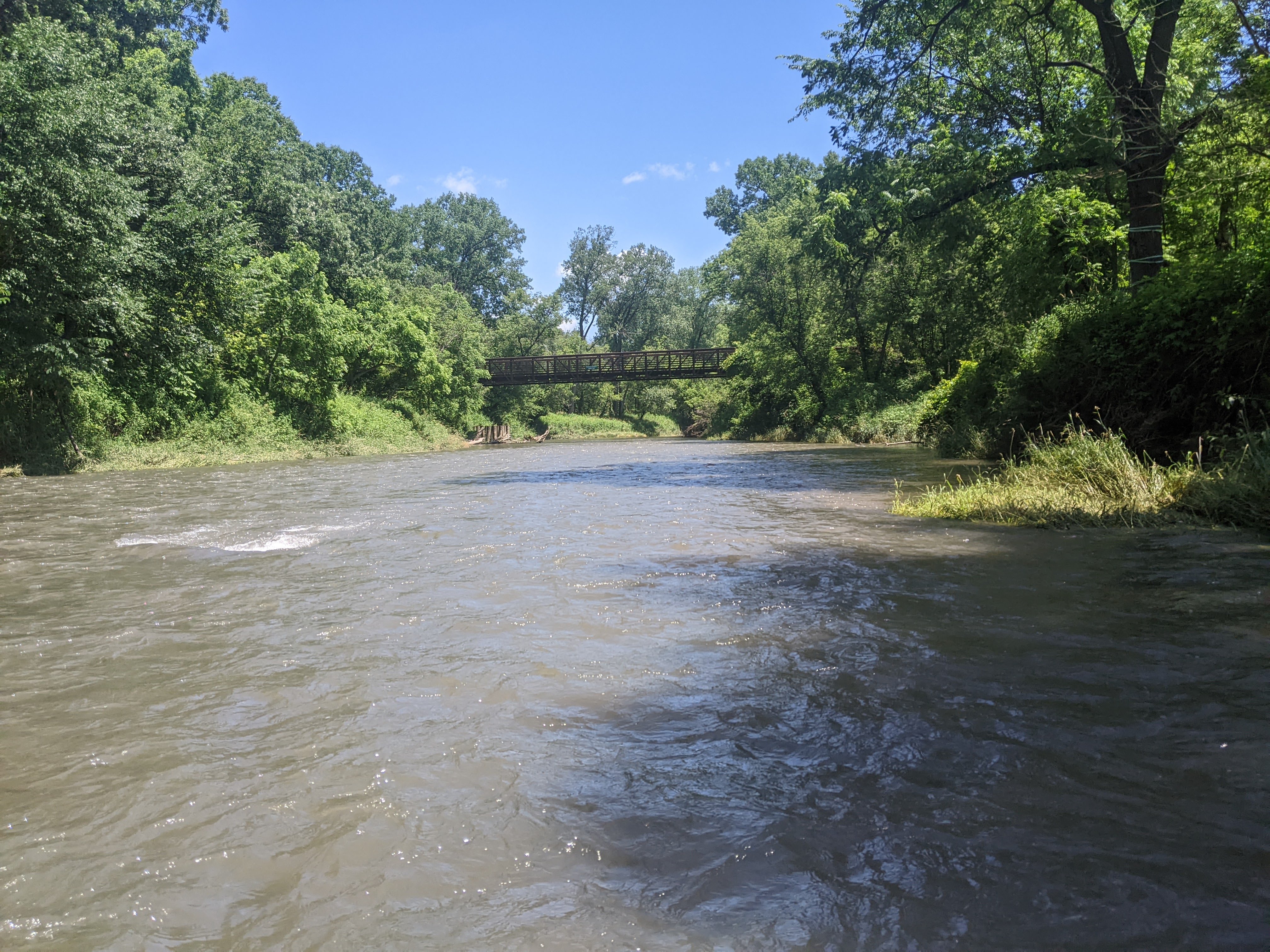
The weather was uncomfortably hot and we were drinking lots of water. Like way more than I had planned so it was good there were a couple places along the route to fill up. Once Erik got done with the bike shuttle we got back in the canoe. There was still some swift water, even after the North Branch joined in. The end of the “rapids” came just past the town of Whalen where the river noticeably dropped and there was some fast water.
We were still cruising, making 6 mph, aiming for the Raaen Creek Campsites. Supposedly there were two. As we rounded the bend in the location of the campsites we saw a small trail leading into the woods. The landing wasn’t super easy and we had to paddle upstream to get back to it since the current was flowing well. I got out to scout and found quite the network of mowed trails but no designated camping areas. Eventually I walked downstream far enough to find a sandbar with some open area where I figured the bugs wouldn’t be so bad and it would be easier to land the canoe.

Erik paddled down to me after some shouting communication through the trees and we ate a cold soaked dinner of quinoa flakes and instant potatoes that wasn’t quite edible but it was what we had and I didn’t want to make Erik choke down much more than his fair share. We’d had the partially full box of quinoa flakes in the cupboard for some time but neither of us could remember exactly how long, or when we’d ate them previously, and whether we’d bought them or been given them. Let’s just say, quinoa is never my favorite, but these flakes were straight up nasty.

It was still warm and humid, like 80 degrees air temp by the time we were getting ready for bed so we cooled off in the river which helped some but not enough. Instead of our sleeping quilt we’d just brought a sheet but we didn’t need it for a couple hours. We woke early, the temp having only dropped down to the mid-70s and the humidity still thick. Sunrise was around 5:30 am and we had ate breakfast and packed up camp and were on the river by 6:20 am.
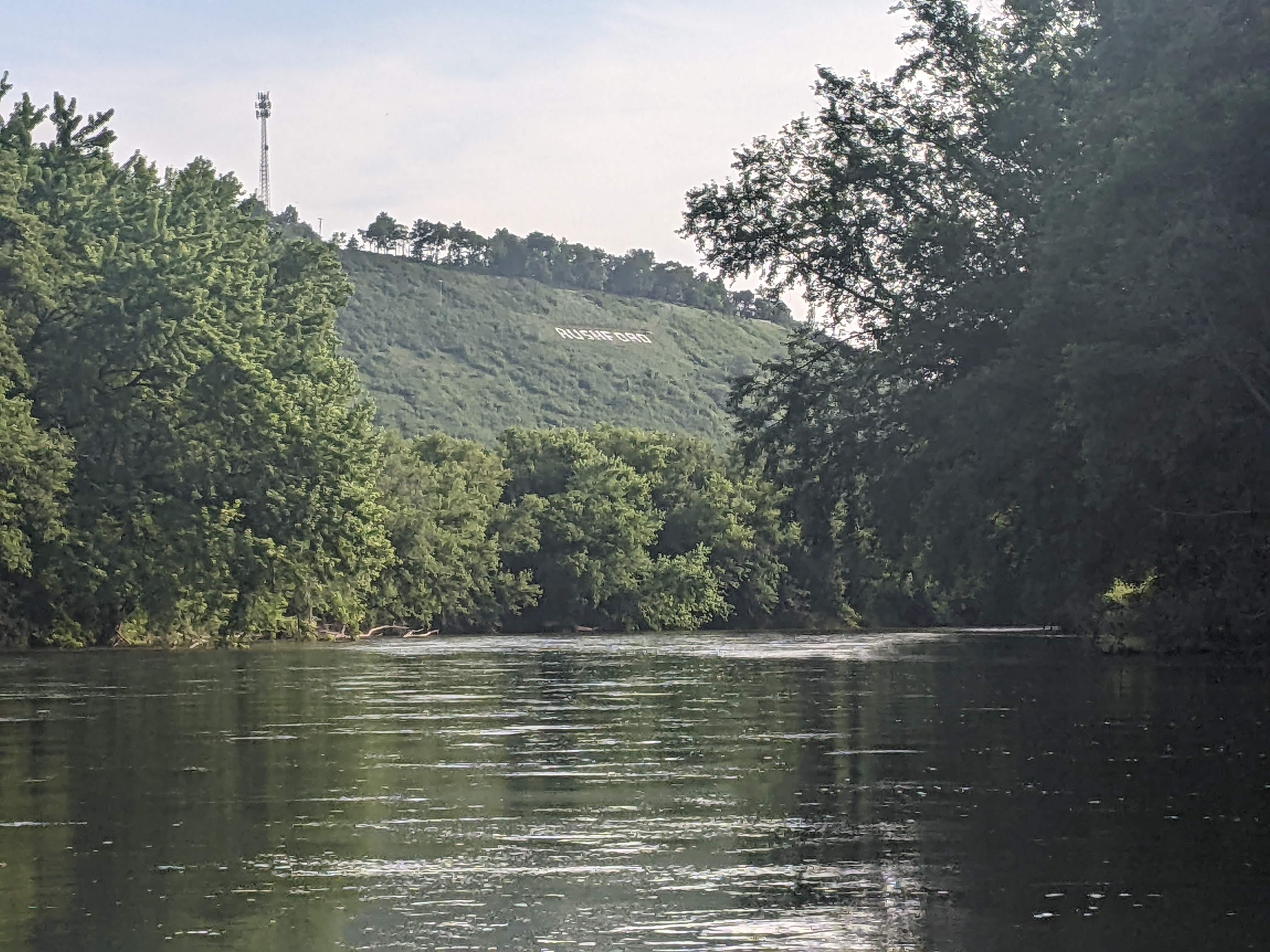
The current continued and a couple hours later we arrived in the small hamlet of Rushford. The canoe carry-in was marked barely downstream of an old dam on our map but we didn’t see any launch there so we kept paddling and found a good launch just downstream of the bridge in town on river left. Erik got on his bike and peddled back to the car in Whalen, serendipitously running into some friends who were doing a bike camping trip. I studied the map, read more of my book, and filled up on water. There was also a group of kayakers who came to lock up their bikes for a short shuttle. It was nice to see others doing the same thing we were doing, except they were going 6 miles compared to our 90.
When Erik got back to the car, he drove farther down river to Houston and then biked back up to me. This stop took 2.5 hours and then we were back on the river. The wind had picked up and sometimes when we turned south we had a decent breeze. It felt good as we baked in the sun. The scenery continued – big bluffs in the distance. We took our second lunch break on a very small sand bar (the water levels were nearing high so many of the sand banks were hidden) and I had my feet in the water while eating our bagels and Erik submerged his body a couple times.

As we paddled past Houston, the river which had been curvy until this point, got really straight. Likely it was ditched in the past. We passed a few more parties of tubers before taking out for the day at the Mound Prairie Bridge. I waited in the shade and kept moving because the mosquitoes were bad while Erik biked back to Houston to retrieve the car.
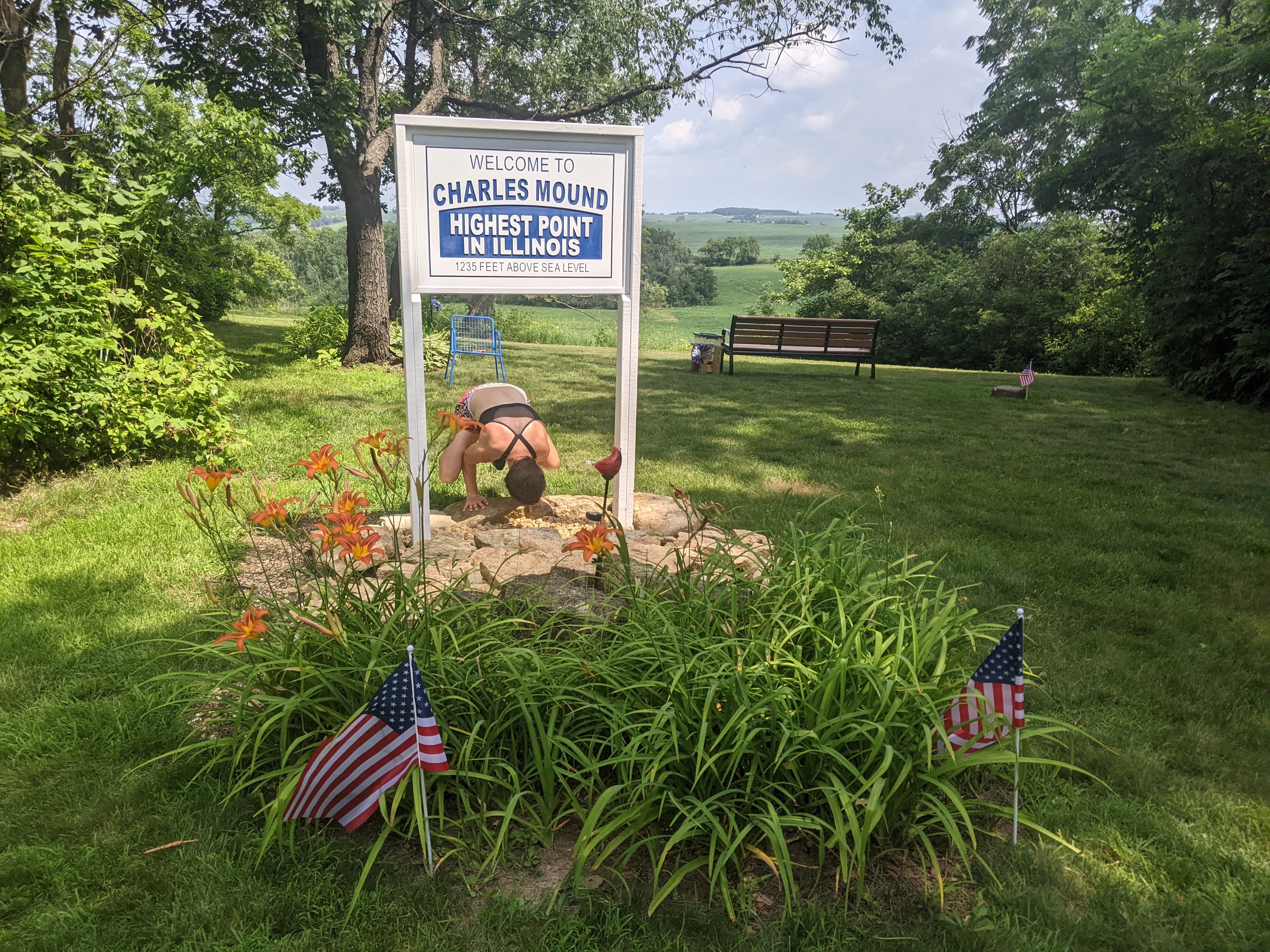
Our plan from here was perhaps a bit odd, but the other goal of this trip was to visit the Illinois high point which is only open a handful of days per year. I’m not a fan of heat and humidity so thought if we broke up our 3 nights of camping with one in a hotel it would make the other nights a bit more tolerable. So we locked up our canoe with the plan to return to the Mount Prairie Bridge in 24 hours to eliminate the drag on top of our car and drove through the beautiful hilly countryside of Minnesota, Iowa, and Wisconsin to our hotel in the town of Boscobel.
By the time I was ready to get up the next morning it was sunny and temps were already in the mid-70s. I had no motivation to go for a run and so instead we chowed down on continental breakfast and then drove 1.5 hours to the Illinois high point, Charles Mound, where we did a 2.5 mile out-and-back run with 250 feet of elevation to the top of Illinois.

Then we got back in our car, cranked the air conditioning, and drove back to Minnesota to return to paddling. We enjoyed driving through the farm country, up and down hills, looking at the planted crops and even some terraced fields. We dropped Erik’s bike off at the farthest south boat launch (the south Millstone Landing) in Minnesota on the Mississippi which was partially flooded, and then drove back to the Mound Prairie Bridge. The mosquitoes were every bit as ferocious as the previous day and we got the canoe unlocked, loaded, and floated as fast as we could.
The weather forecast threatened rain around 6 pm, and then again later around 8 pm. The skies were clear though at 4 pm when we returned to paddling the Root River for its last 12 miles. The valley here was broad and sometimes the bluffs weren’t in view, or they were farther away. The current was still moving well.


We thought about stopping for dinner at the canoe launch at the Hwy 26 bridge but the landing wasn’t very good so we kept paddling. As we came to the last mile of the Root we encountered three motor boats who were a bit out of their league in the shallow river. They had decided to turn around and were putting downstream slowly. Erik and I quickly gained on them and I heard one say “if we don’t hurry up that canoe is going to catch us!” and catch them we did before the confluence with the Mississippi.
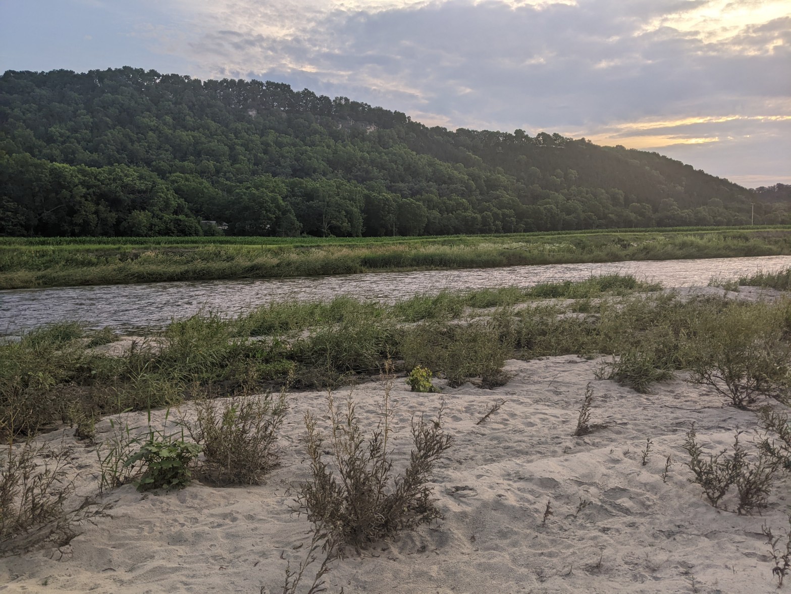
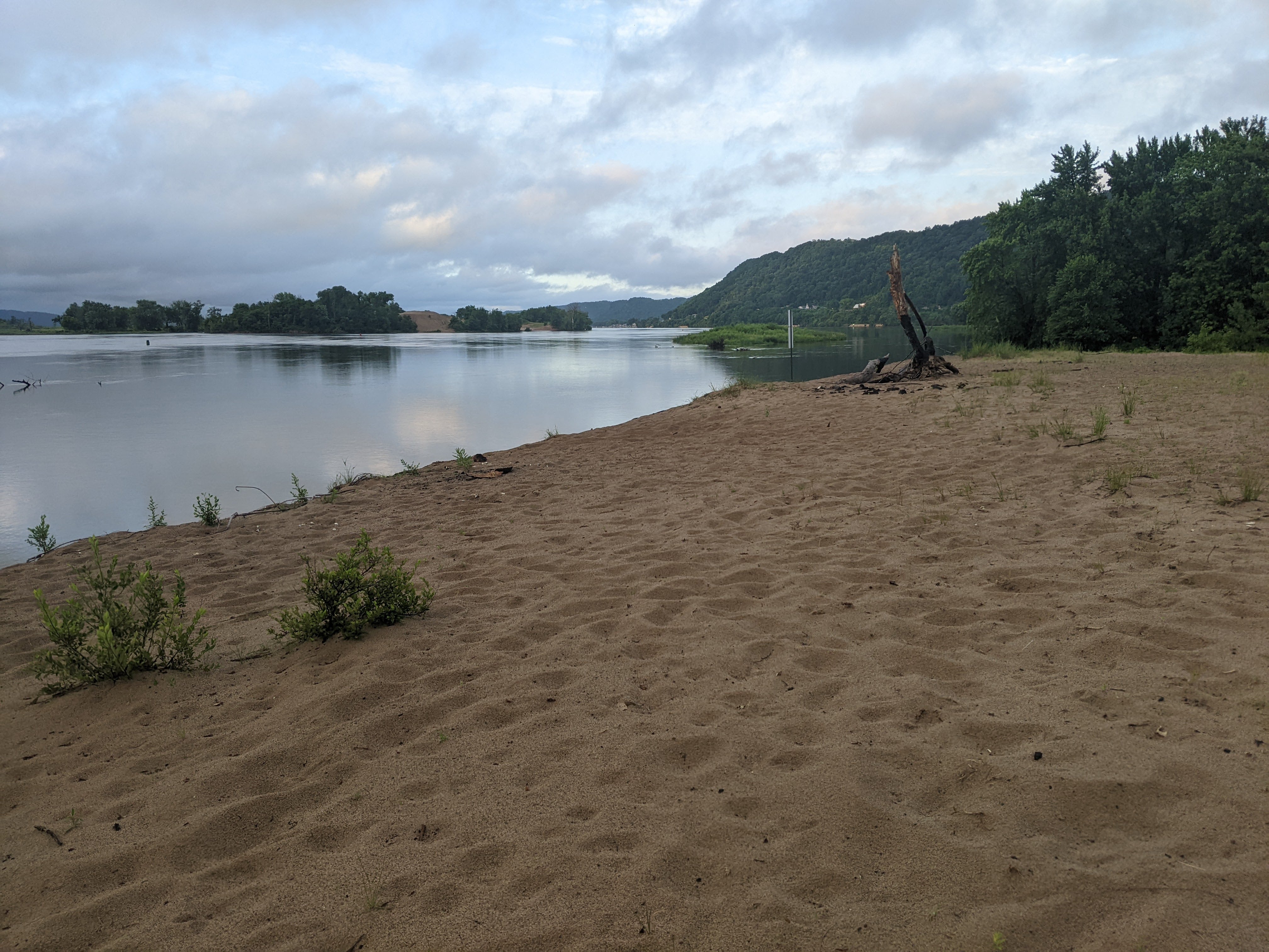
Once on the Mississippi there were some waves, a culmination of power boats and a south wind that would soon be switching to the north. Almost immediately we saw some sand banks, the result of dredging the commercial channel, that would have made for good camping but I wanted to make a few more miles and for awhile there were no more sand banks. As we turned a bit towards the west, we could see the clouds were threatening and I looked for a place to camp in earnest. Soon we came upon a big sandy island. We stopped, I prepared a cold dinner while Erik set up the tent.
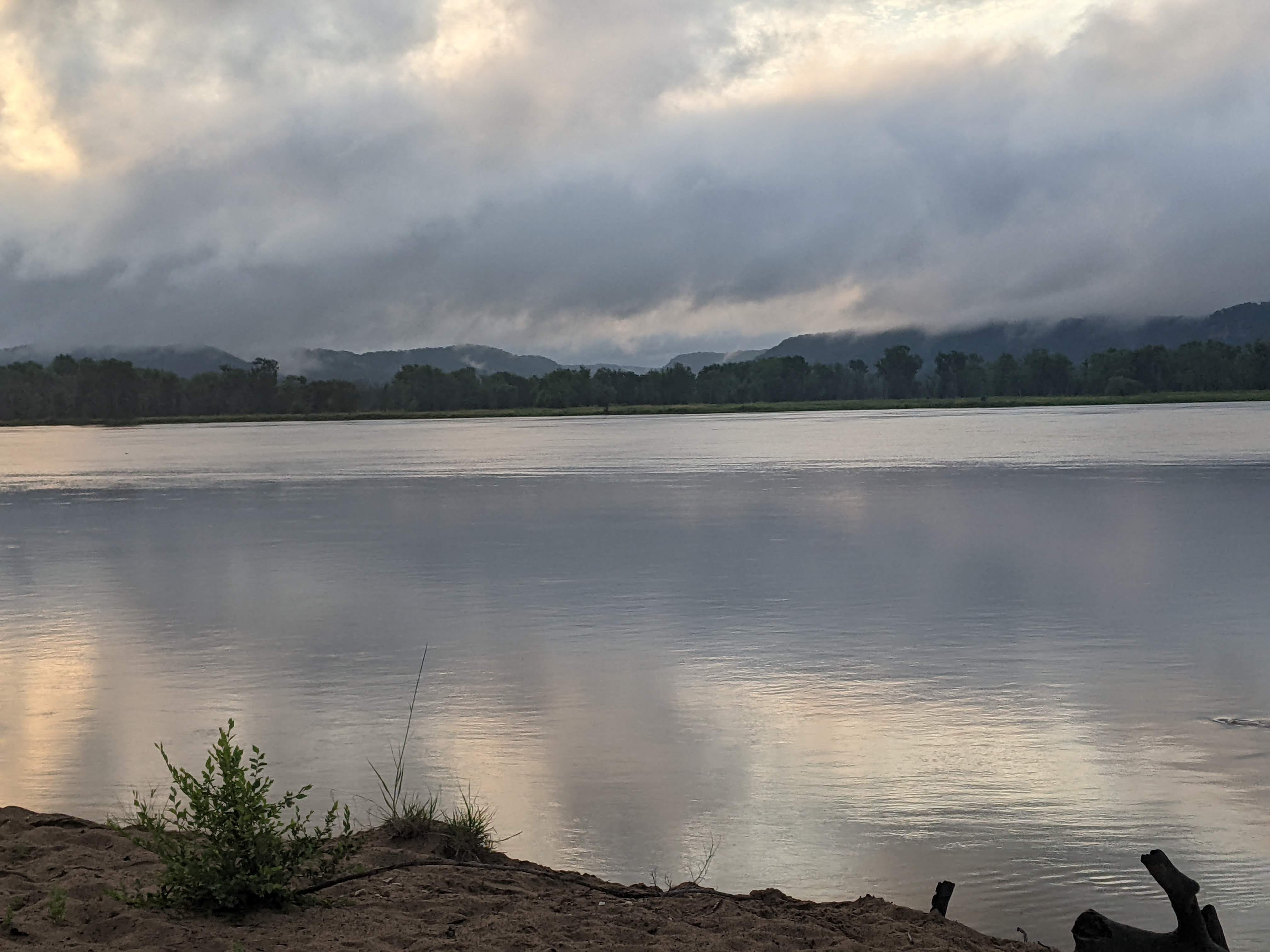
Erik barely had the tent up when it began to rain. It was a hot humid rain that kept us in the tent and sticky. It kept raining until bedtime and we didn’t get out to cool ourselves in the river and so we went to bed uncomfortably clammy.
In the morning we woke to sunny skies and fog and got to canoeing rather promptly.
Erik heard a barge coming downstream and thought we should go to the left side of the channel. That barge wasn’t going much faster than we were though and eventually we wanted to go right and so we had to pass in front of it a little close for comfort. But then we were over in a small channel near the Minnesota shore that was mostly easy to follow save for a couple times when it seemed to end and we had to paddle harder through some lily pads.

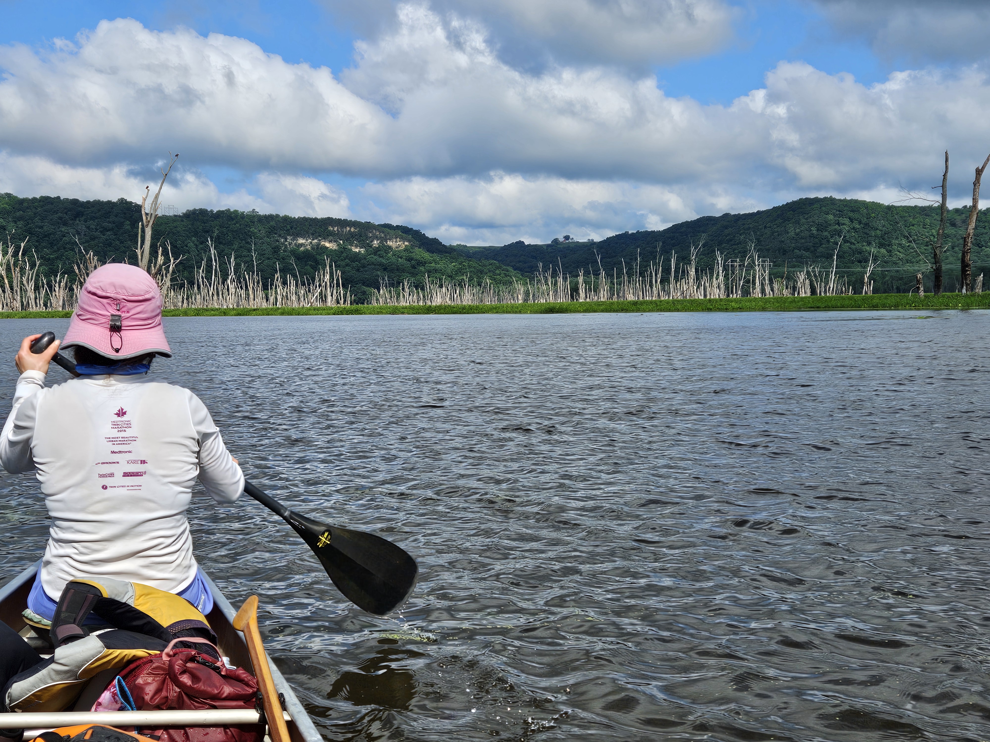
Soon we arrived at the dyke that makes up Lock and Dam #8, the start of the Reno Bottoms Canoe Trail. We didn’t want to take the main channel and deal with either portaging the lock or locking through, so we did a very short portage over the dyke and then were cruising through the river bottoms. The channel here was small for awhile and the flooded trees tall on either side so we couldn’t see either the bluffs of the Minnesota or Wisconsin shoreline. After a bit the channel opened up and we followed the canoe signs to get through the backwaters.
A couple motor boats came by us and it was weird seeing only the passengers curving around, the boats themselves hidden in the reeds. Now there were a bunch of dead trees and we could see the distant shorelines. I knew we were getting close to the end and this is always when time seems to slow down. We passed both the Millstone Landings and then I knew we were almost to Iowa but it ended up being closer than I thought as Erik was reading the map. Once we got to Iowa we turned around and paddled two miles upstream to the boat launch where Erik had locked his bike. It took him a bit over 3 hours to ride the scenic way back to our car and then come back to pick up me and the canoe but there were no mosquitoes, I was able to stay in the shade, and the boat launch was hopping so there was plenty of people watching.
If we had to do this trip again: Well, obviously the water levels would be just as high, there wouldn’t be any mosquitoes or rain, AND it wouldn’t have been so hot and humid.
Best decisions: Filling up on fresh drinking water every chance we got, swimming when able, paddling the Mississippi during threatening skies on a stormy day and early morning when the party boat atmosphere was absent. Canoeing on the Mississippi River was much more pleasant than I was expecting, although this was largely because by the time we got to the river on Saturday, the weather predicted rain (and indeed it had been raining on and off all day) and we got an early start on Sunday and then stuck to the back channels. The Mississippi, especially the tall sandbanks, can have quite the party scene with fancy motor boats as we saw on Friday when we were driving south and again on Sunday as we drove north, both times in the mid to late afternoon.
Next time: This route is a true gem in the state. It makes me look forward to paddling more of the lower Mississippi (on calm, maybe cold days without so many party boats). We have a lot more of Minnesota’s designated water trails to paddle but we just might have to go back and paddle some of the Root River again because it was that good.
Despite the very hot and humid weather, I was rather enamored by the scenery – the tall bluffs, either near us, or on the distant shoreline – and that made the heat much more tolerable.
