The Red Lake River flows west out of Lower Red Lake in northwest Minnesota before turning south, dropping down lower into ancient glacial Lake Agassiz, and then eventually meandering northwest to meet up with the Red River of the North in Grand Forks.

Three years ago we’d thought about paddling this river and continuing down the Red to the Canadian Border but that April brought snow melt and significant flooding of the Red Lake River in Crookston, as well as on the Red River, that persisted into May. We heard on the news that in one area the Red River was eight miles wide. This would mean fast current and miles traveled easier but also brought high water hazards and make land breaks difficult to find as the river had well breached its banks. So that year (2022), we shifted gears and canoed the Big Fork.
This year saw little snow and not much spring rain. Water levels were barely medium and a foot below recommended, particularly in the section between Thief River Falls and Red Lake Falls. But everywhere in Minnesota the water levels were meager and fires raged north of Duluth. We didn’t have any options for paddling high rivers but we did have a good shuttle option on the Red Lake River thanks to my mom, so we committed.
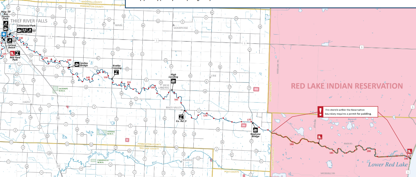
Note that the first 20-ish miles of the Red Lake River is on the Red Lake Indian Reservation and per our Minnesota DNR map requires a “Red Lake Reservation DNR permit and guide.” So we looked into getting said permit and guide and learned three things. First, there is a separate Red Lake Reservation DNR from the Minnesota DNR. Second, according to Shane Boe, in the Water Resources department at the Red Lake Reservation DNR as of 5/3/22, there is no official permit and such travel by canoe is “usually not allowed.” Third, they may have been able to procure some kind of guide. Shane knew somebody who may know somebody who “maybe could guide” us. That person never got in touch with us. And so to not break any rules, we opted but to forego this section of the Red Lake River.
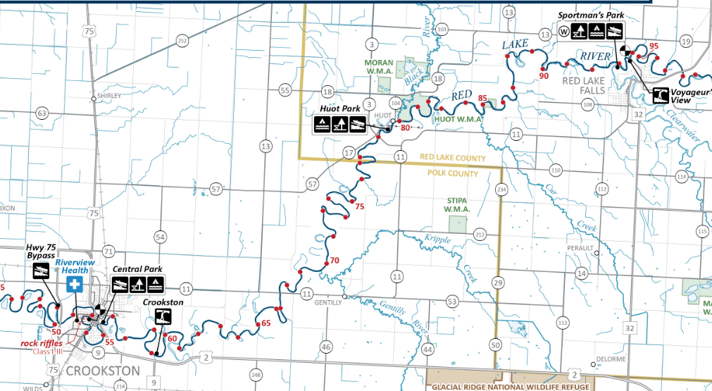
So this brings me to our route of four days that would begin at the “Neptune Bridge” on County Road 27 on the Red Lake River, about 20 miles west of its outlet on Lower Red Lake, down 175 miles to the confluence with the Red River.
Day One 5/18/25: Neptune Bridge to Thief River Falls (44 miles)
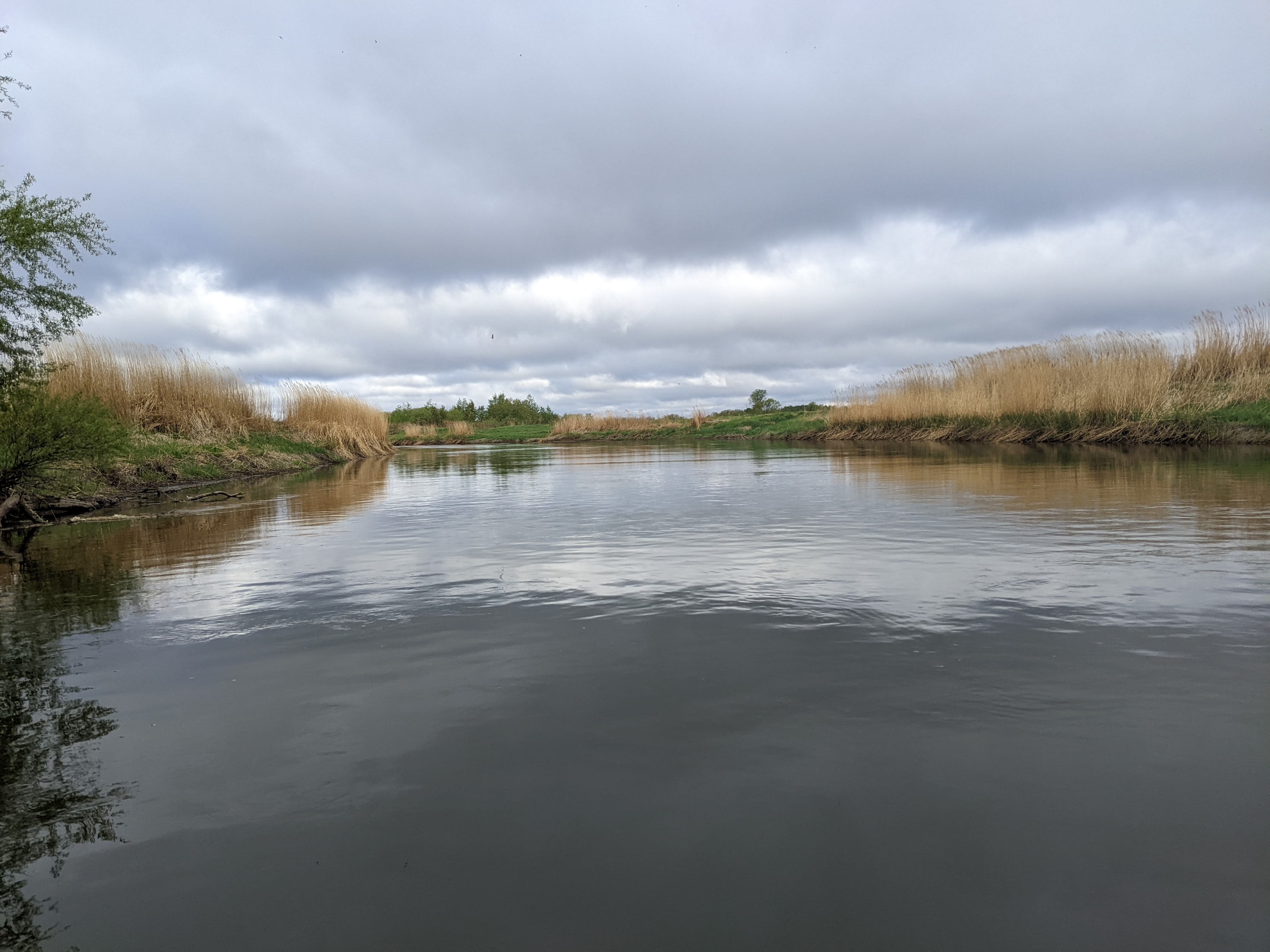
We got up early, about an hour after the sun at my mom’s house in Bemidji. She made us some yummy omelettes and then we did our final loading of the car which included our niece and nephew who were going to see us off again (as they had two years previous when we canoed the Ottertail River. Those kiddos were easy to wrestle into the car and as we drove we looked for wildlife. As soon as we started the game we didn’t see as much as one bird as we drove west along Hwy 2 but once we turned off heading north on Hwy 92 we spotted a bald eagle, several more birds, some cows, horses, a couple deer, and a horse and buggy! North of Gully the hills ended as we dropped down in ancient Glacial Lake Agassiz and the land got flat.
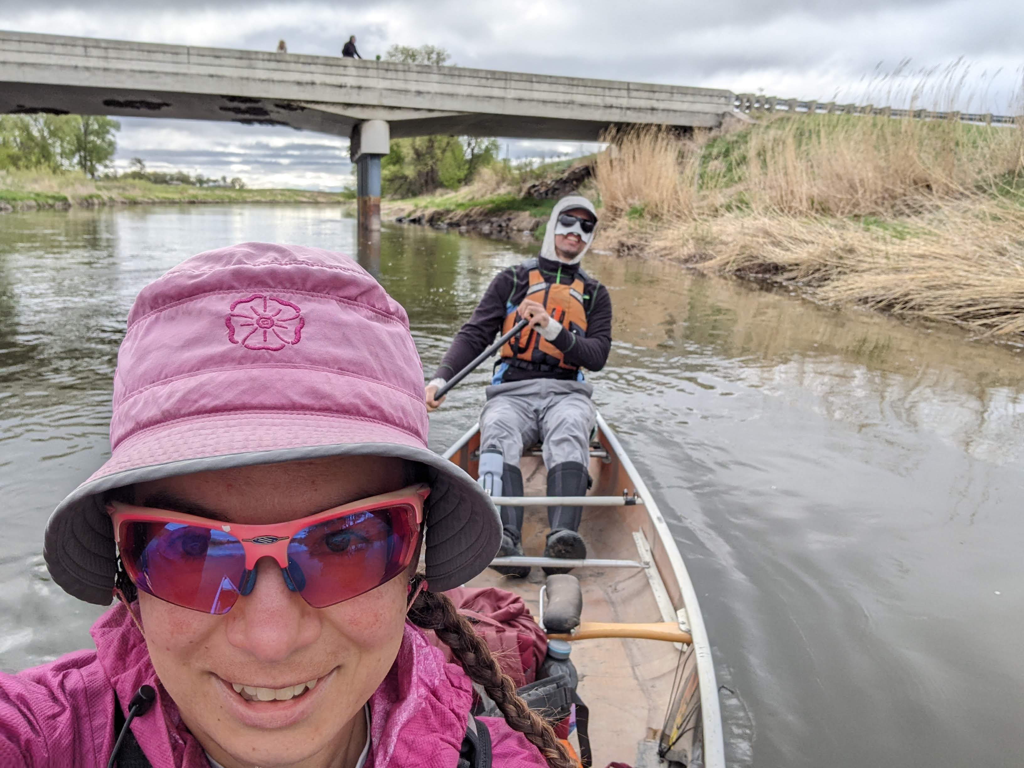
Once we arrived at the Neptune Bridge we quickly unloaded our canoe and gear and the clock struck 9 am as we passed under the bridge and waved our family good-bye. And then we were off, paddling downstream in cool temps with a moderate tailwind. The first few miles of the river were relatively straight as they had been ditched but we saw some goldfinch and evidence of beaver. After five miles we got some bends in the river. We saw a rope swing that had multiple levels of a wood platform to jump off.
Soon enough we’d gone 12 miles and arrived at the High Landing boat launch. We stopped for first lunch and discovered it was quite windy from the east. The temps were in the mid-40s and being out of the boat, even though we tried to stay behind trees to provide a windbreak, chilled us. Thus our stop was short as we took down bagels with peanut butter and dried fruit, and then we were back in the canoe, paddling to warm ourselves up. I wore a long sleeve shirt, my rain jacket, and my life jacket and this combo was barely enough. The week before had been in the 80s. Erik launched into a long discussion about satellites and outer space travel, perhaps moreso to amuse himself than me.

Just about the time we got warm we saw a bright green kayak. Initially I thought this was tied up but then we saw two scantily clad boys on the right shore. They flagged us down and then we saw the kayak was floating down the river. Turns out they had been fishing and fell off the kayak when they tried to get out and the kayak got away from them. We retrieved the kayak for them but I though what are the odds that a canoe would come down the river just at that moment on a 45 degree day?
We were trying to wait for the Kratka Crossing canoe launch for second lunch but I wasn’t following the bends on the map and we were growing inpatient and didn’t check GPS to see where we really were so stopped on some grass for second lunch in a spot that was mostly out of the wind. It warmer than first lunch but within half a mile we came to the boat launch which was also protected and would’ve been a bit nicer for second lunch.
As the miles continued, Erik told me all about what he had learned the previous evening in a magazine about Minnesota railroads. On shore we saw a racoon and muskrat. We saw turkey vultures perched above us on trees and a bald eagle soaring high. Then, we both happened to see a medium-sized bird devour a large bug out of mid-air. Given that the shoreline around Thief River Falls, about a quarter of the way into our trip, was heavily developed, we had booked a room at the C’mon Inn. We wouldn’t be there until 7 pm or so which would be getting late for dinner so as we approached the Smiley Bridge, we thought about stopping there to cook dinner and we did. Erik found some wind break under the bridge and even a bit of sunshine. Unfortunately the closest neighbor took the opportunity to mow and we weren’t too sad when it sounded like they hit one too many rocks and killed the mower.

After dinner we paddled another ten miles until we got to a powerline crossing upstream of town where we locked up the canoe in some woods and walked a mile to the hotel where we got a balcony room that overlooked a large common area with fake trees and a large tropical fish tank. We warmed up in the hot tub and went to bed.
Day Two 5/19/25: Thief River Falls to Red Lake Falls (34 miles)

Temps were down into the low 30s overnight so we had a lazy continental breakfast and didn’t leave the hotel until 8:20 am. It took another half hour to walk back to our canoe and get to paddling. Despite temps hovering around 40, the morning May sun was strong and we had a good tailwind to the dam. It was the only time on the trip I got wet from sweat. There were conflicting reports on our map about whether to portage on the left or right but the left side seemed pretty obvious from satellite (there was a park there and the power house was on the right).
Erik had to get a closer look at the dam before we could continue. Our map said there were numerous class I and II rapids from St. Hilaire to Huot (river miles 114.5 to 66) but ten miles upstream of there we began encountering riffles. There was a very strong wind from the east and although our general direction of travel was south, the river weaved back and forth, often heading east, and then west. When we zig-zagged east we paddled hard to not get blown upstream.

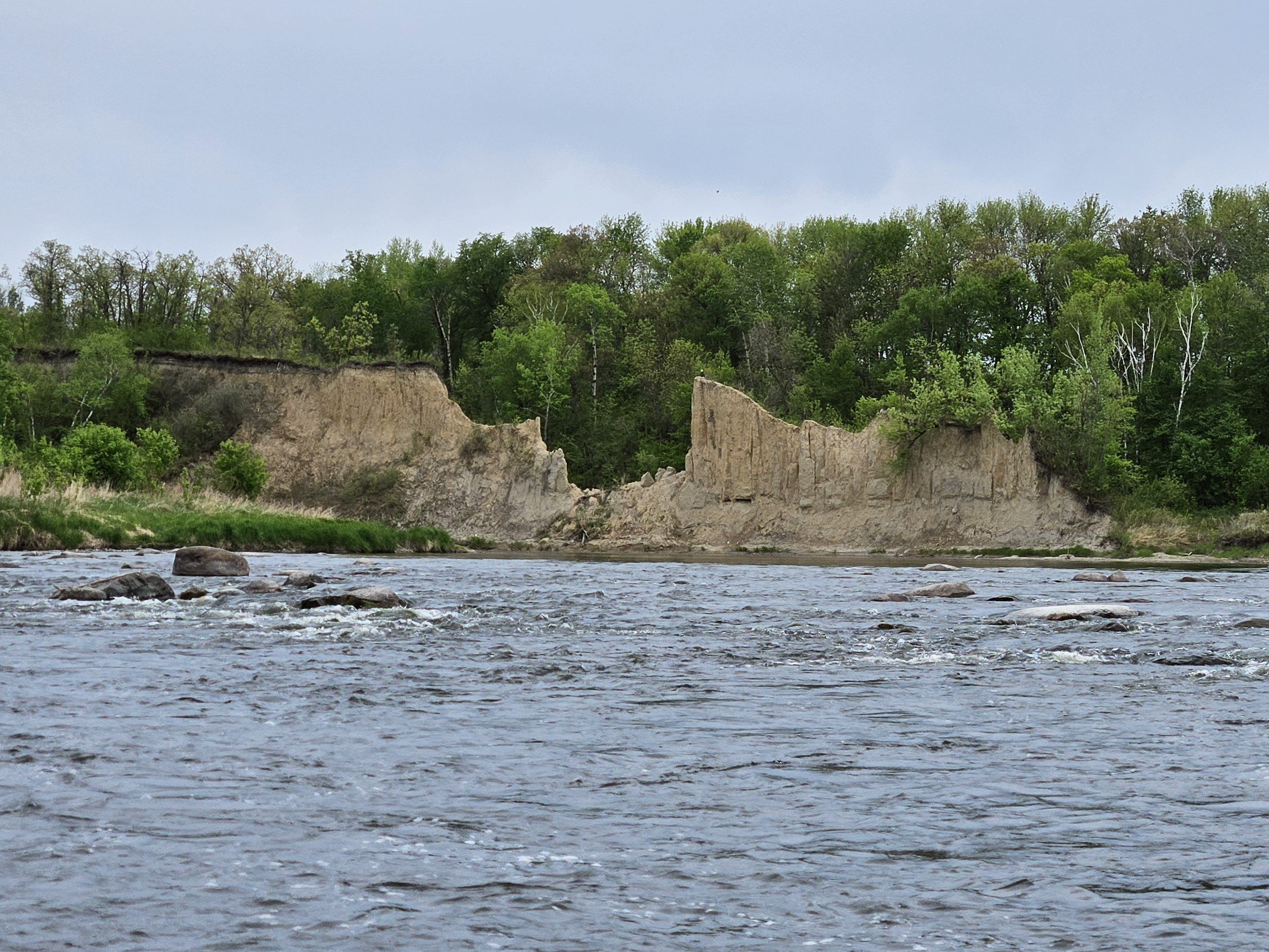
Frequently the river widened and became excessively shallow. There was no channel deep enough for our kevlar canoe and we would bump along on the rocks on bottom. The miles continued on slowly like this, the deeper pools seeming to last as long as the rapids. We often tried to slow ourselves down in the rapids by dragging our beater paddles to allow us time to scout the deepest line, to minimize the scraping on the rocks. Sometimes there was no deep enough line. The forecast predicted more and more rain the next day and Erik lamented that we should have waited a couple days to begin our trip instead of setting out a foot below suboptimal levels, as we hit a rock with the front of the canoe, got stuck, and the current spun our boat around. At least the current was mild enough that it was a very slow motion spin and we never got off balance. What is this? Rapids for ants in a toy boat?
But we kept going. I thought about bailing, calling my mom to come pick us up. But I really wanted to check this river off my list. To complete what we had set out to do. And so I gave into this challenge, trying to avoid hitting every rock, accepting that we would often fail and scrape up our old canoe that already had many patches, and thankful that for some reason, most of the rapids didn’t occur in those sections where we were battling the easterly wind and needed to dig our paddles in deep.
The trees swaying above us on the tall banks howled. Rarely could we hear the sound of rushing water over that roar and so when we did we expected a narrower stream and bigger rapids. There were no conversations about railroads or satellites. Reading the river required all our mental energy and we wouldn’t have been able to hear each other anyway.
The miles wore on very slowly between the intermittent headwind and backpaddling in the rapids. According to the map “Below St. Hilaire (…) a chain of boulder-field rapids and pools interrupts the Red Lake in this 17-mile stretch where the river drops 110 feet.” This would presumably mean good current, but we weren’t appreciating any speed today. The weather forecast grew more ominous and Erik suggested we get a hotel in Red Lake Falls (at the only hotel there). Given our low mileage, it was looking like a stretch to even make it to Red Lake Falls. We stopped for first lunch, and then second lunch, and then snack, all with few miles in between, but we needed the break. At least the break from the constant pillow rocks and riffles. I’d already seen more pillow rocks than I’d seen in my entire life of paddling, and by the last break, we weren’t even done with this stretch of river.
Once we got totally duped. Typically the deeper channel follows the outside bend of the river, but on this particularly shallow bend, the deepest water was actually on the inside and we totally missed the line and got hung up on a rock. Erik had to crawl forward to finally get the weight off the rock. The current was so mellow we were never in danger but it was frustrating to bang up the canoe and learn we’d taken a poor line.

Then we had a series of rapids where the river really dropped. The first we were headed west. I suspect these might have been a solid class II in different water levels but instead we slowly maneuvered down mini drop after mini drop, following tiny V’s. Then as we headed back east, just before the river turned south it got much deeper and there was a car-sized boulder in the middle. We could’ve taken either the right line or the left line and for some reason I thought right but said left. Why are we headed towards the giant boulder? Then I used my echoic memory, realized I’d said left when I meant right and quickly drew us very hard left to skirt around a few rocks that were farther left of the giant boulder. That got my heart rate up. Then we had another rapid that was shallow, so shallow, and was obvious we were just going to bump our way down through lines that were much too narrow for our canoe, no matter how tightly we tried to turn.
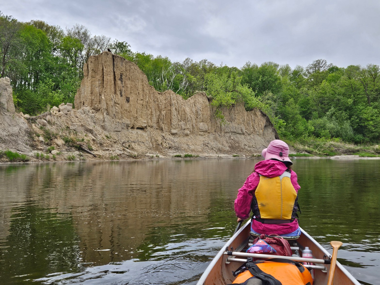
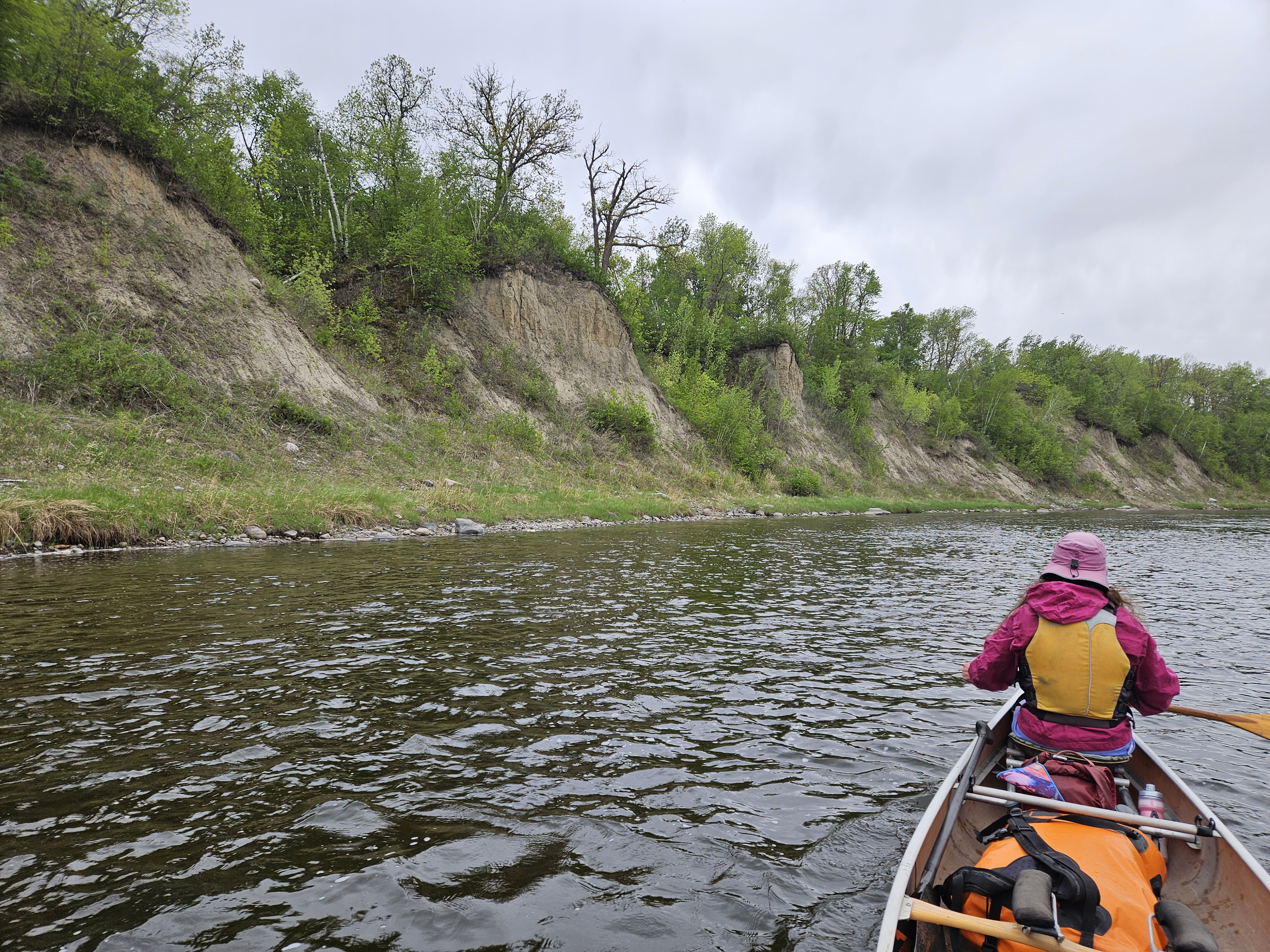
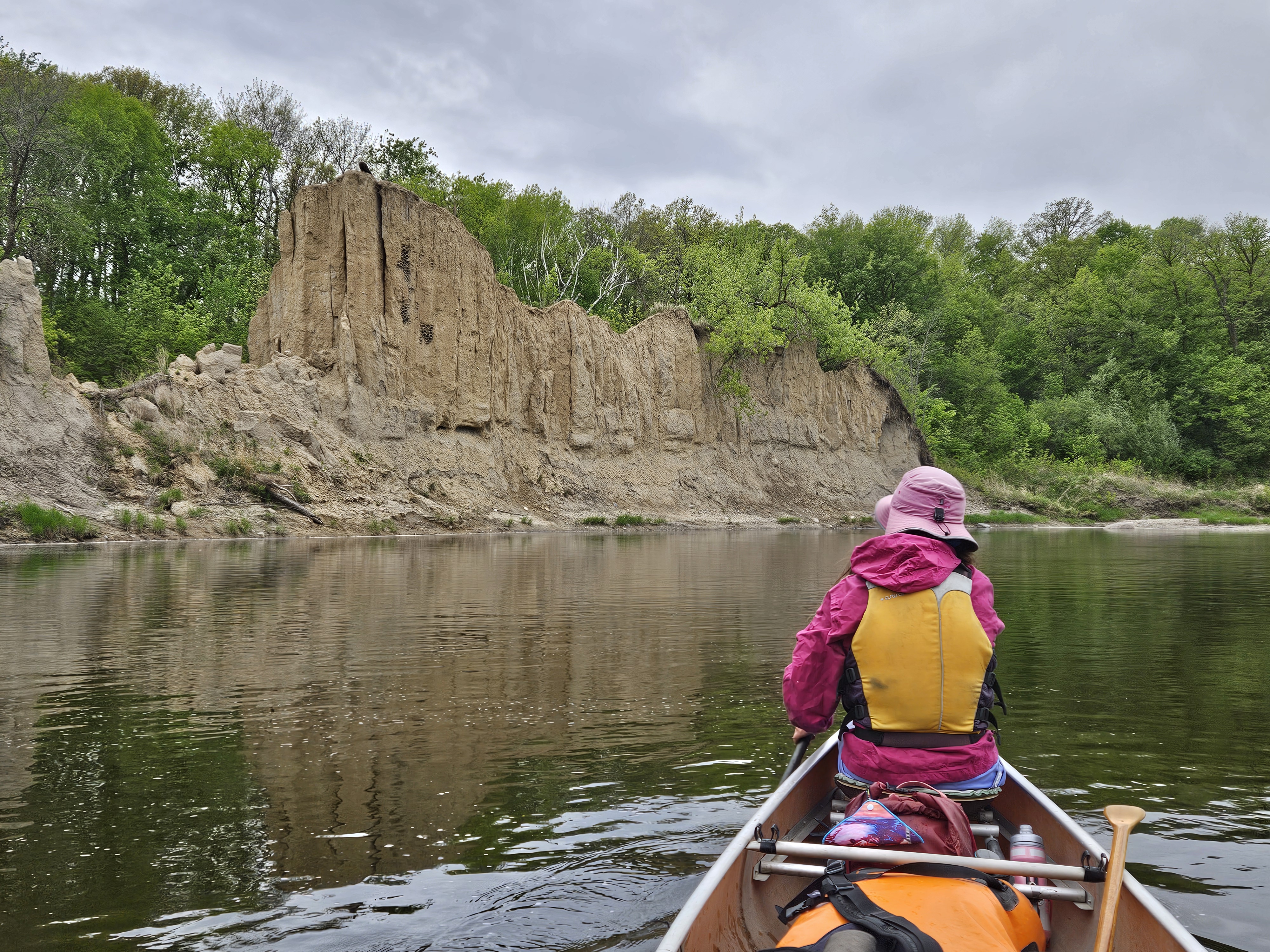
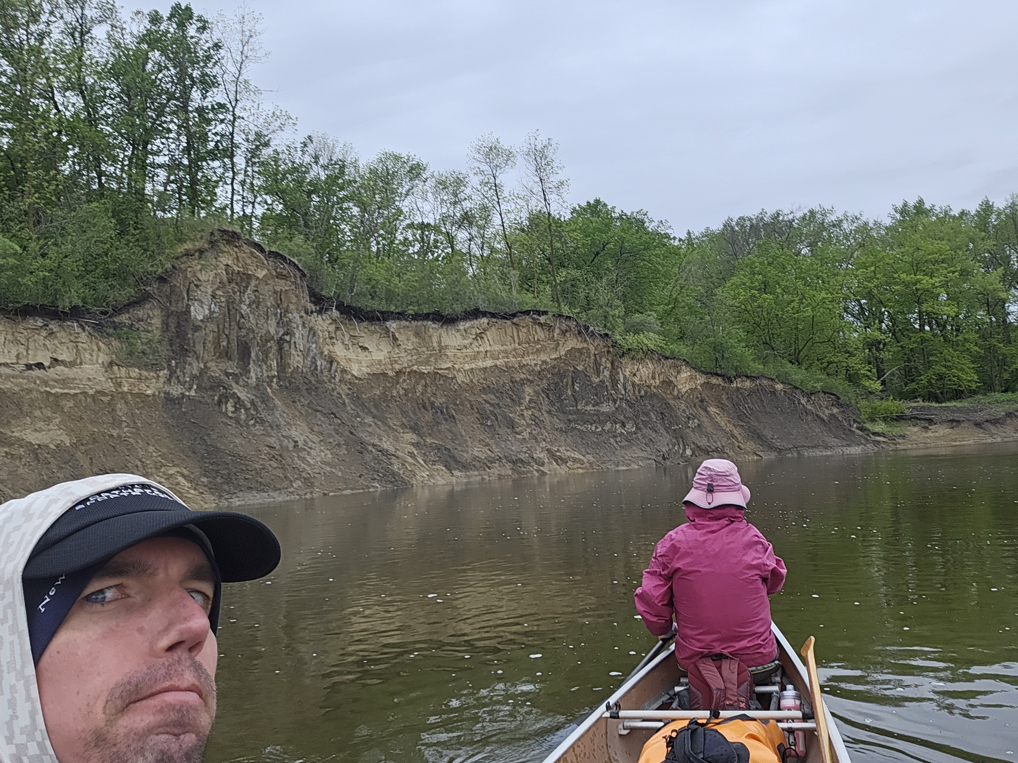
The benefit to moving so slowly was that we got to better appreciate the tall eroded banks in this stretch of river. And after making it through one long bouldery rapid, we came to the most spectacular of these eroded formations and found an eagle perched.
The clouds got darker as 6:30 pm approached and we got to the Hwy 32 bridge. I agreed to that hotel in Red Lake Falls. Perhaps had the weather been predicted to be excellent, we would have foregone the hotel. But the forecast called for temps dropping to 40 degrees and upwards of an inch of rain. And so at the Hwy 32 bridge, we locked up our canoe in the woods and hiked uphill 0.7 miles to the Paradise Falls Motel.
The price was right, albeit perhaps a bit steep considering the place was fairly run-down and the location. But it was warm and dry and attached to a liquor store where we bought some Barefoot Moscato. Not long after arriving at the motel it began raining. Not a hard rain, just a light, very steady rain, all night long.
This day reminded me of one we’d done 18 years previous on the St. Louis River. Water levels were low that year and I had to keep my eyes peeled to avoid rocks just below the surface. The current was so abysmal they didn’t make any riffles, yet they were shallow enough we’d hit them with the canoe. And there had been a strong wind that day and we were almost blown back up through the rapids. I remember being so tired at the end of that day that I wanted to quit. But today was different. I’d had 18 more years of paddling, 18 more years of working my body, and 18 years of perspective. I’m not a whitewater junky and so, with the exception of the highest volume rapid with the car-size rock that we got a bit too close to, the rapids had been tedious but not scary. It was a different challenge in picking lines, occasionally back-ferrying, drawing, and cross-drawing, and learning more to read the river.
I dreamed of pillow rocks and V’s and scraping our canoe and trying to find perfect lines.
Day Three 5/20/25: Red Lake Falls to Crookston (44 miles)
We woke to more steady rain so fine it was almost hard to see against the gray sky. But there were small puddles in the parking lot. Erik kept checking the radar. It was supposed to lighten up by 9 am, then it became 10 am, then it became noon. I was determined to make it to the Red River of the North by the next evening and so deliberated how long we could stay warm and dry in the hotel before we needed to brave the elements to make 50 miles on the day. Erik looked at the positive that the rain would raise the water levels.
I’ve spent enough time at 40 degrees and raining to know the cold slowly seeps in. We humans aren’t meant for such conditions. I planned to wear my paddling shirt, scrub pants, lifejacket, hat, and rain suit over all this plus socks and neoprene boots. It seems like, especially sitting in the canoe, that no matter what, the pooling water on the lap always soaks through the raingear. I figured I had two hours at such conditions to stave off hypothermia. Thus if we left at 10 am we should still be able to hit our miles and stay reasonably warm.
And so at 10 am we hiked across a soggy lawn and down the big hill on Hwy 32 to put-in on the Red Lake River. Water levels were indeed a tad bit higher, but not quite enough. I’d scoped out all the riffles on satellite the night previous and at least it looked like there’d be fewer than the previous day, but still plenty. And so we shoved off in the steady rain, alternating between deeper pools and riffles. I wasn’t wearing my prescription sunglasses and had my hood tied close to my eyes and couldn’t see terribly well. There was a small class I rapid under the old train bridge in Red Lake Falls that had enough water. A nice little easy chute. The banks continued to be high and eroded and the rain continued.
The farther downstream we went the deeper the water. Our hands were freezing and we alternated turns trying to warm them up. I put mine under my rainjacket on my abdomen but this got my shirt all wet. After a couple hours we were passed noon and it was still raining. I didn’t want to stop for lunch because I knew this would get me colder but the rain wasn’t stopping and eventually Erik said he needed a break. And we needed to dump out the canoe from the rain collection.
When we stopped I ate and helped empty the canoe as fast as I could but I was shaking and my hands were feeble from cold. I wondered if I was cold enough that we needed to stop and set up the tent and crawl inside and shake to get warm in the cold but humid air. But then we wouldn’t make it to the Red River tomorrow.
Within ten minutes we were back in the canoe. I would have loved to hammer the paddling but we were still navigating riffles. After a couple bends we got to a flatter section and I asked Erik if I could warm my hands. I put them on my abdomen while simultaneously doing toe raisers in a reclined position so as to work my leg and abdominal muscles. This worked quite well but it also helped that the rain was easing ever so slightly. And what a difference that made to have the rain let up. Within an hour it was just about done.
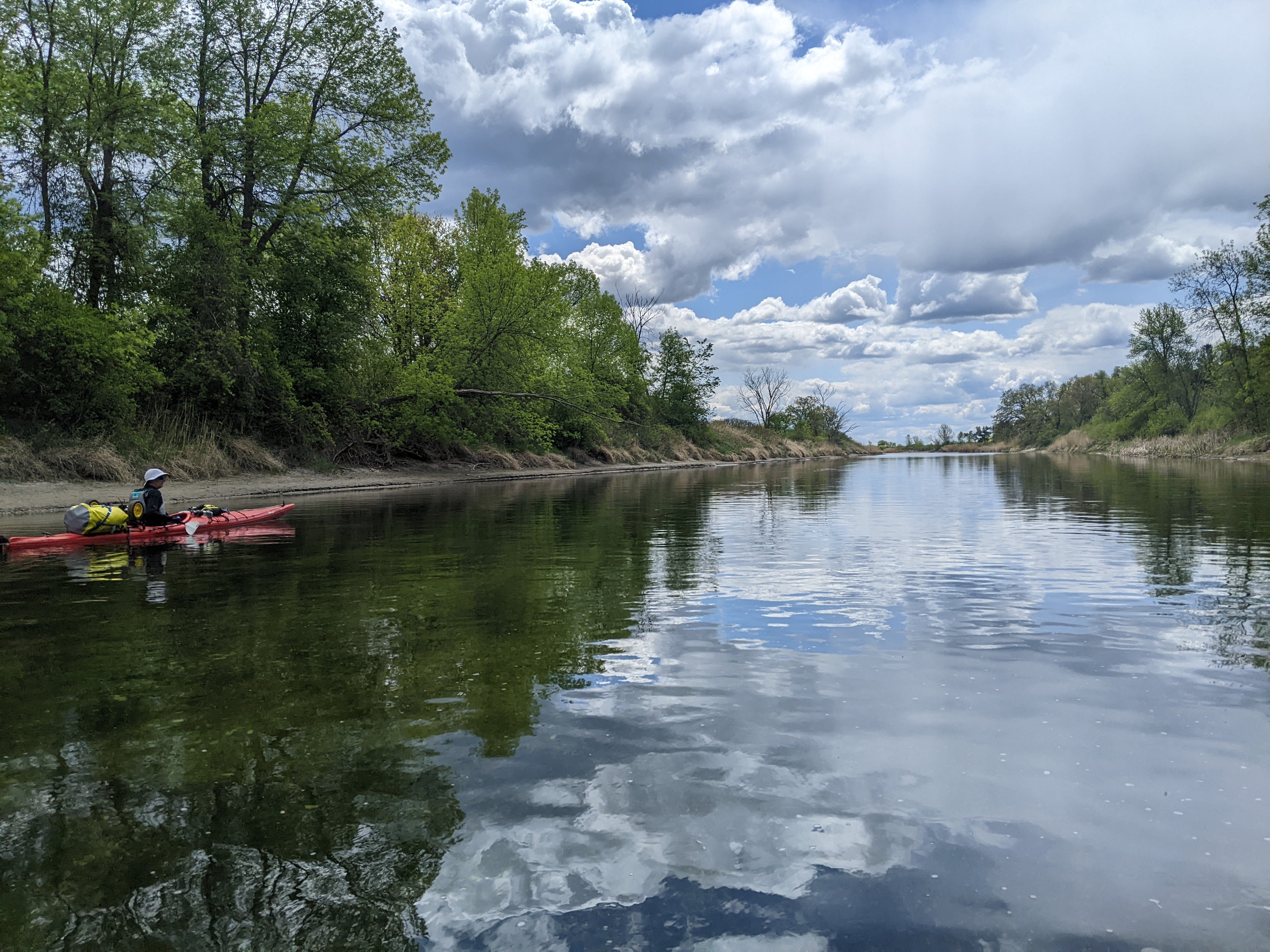
We passed Huot, an incredibly small hamlet known for the historic site where the Ojibwa ceded almost 10 million acres of land in 1863. The riffles officially ended (at mile 80 rather than 66 as noted on our map) and there were fewer eroded banks. A couple hours after our previous stop, we took second lunch. I was still chilled as it had only been an hour since the rain had ceased and my clothes were damp under my raingear. Then we were back on the river and the miles kept passing. We still had a few occasional tall eroded banks but they were becoming less frequent.

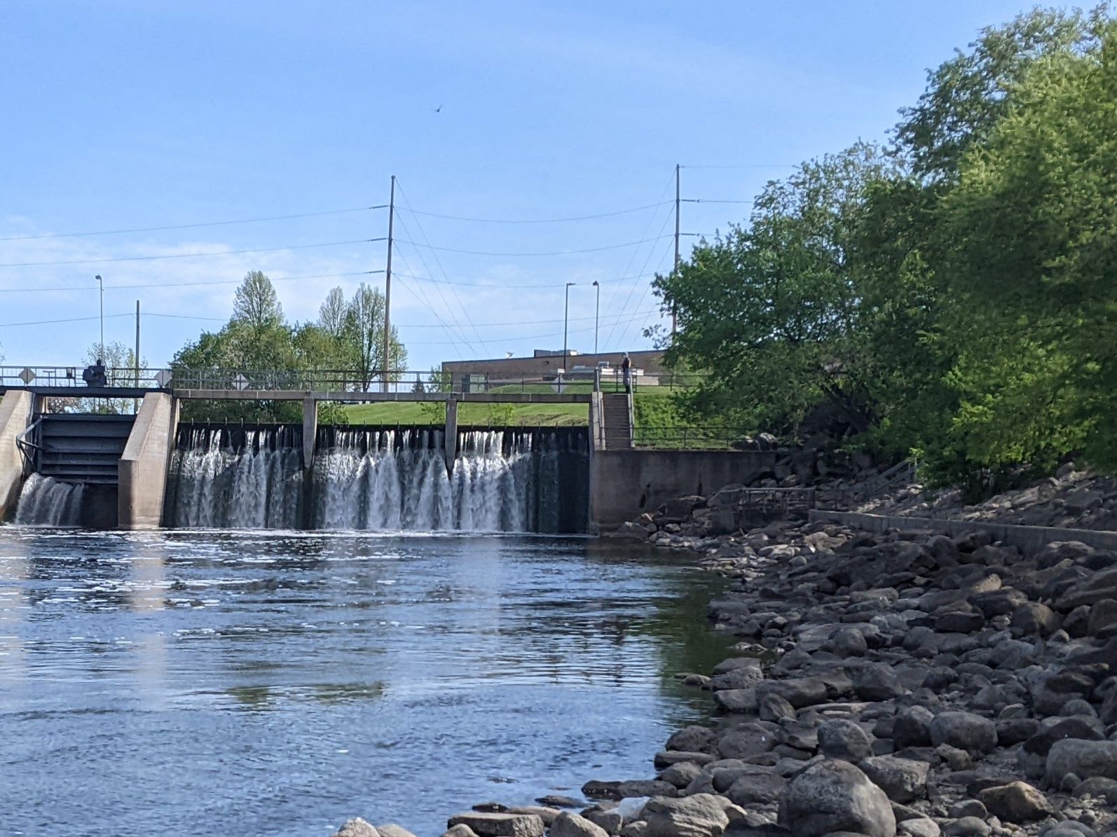
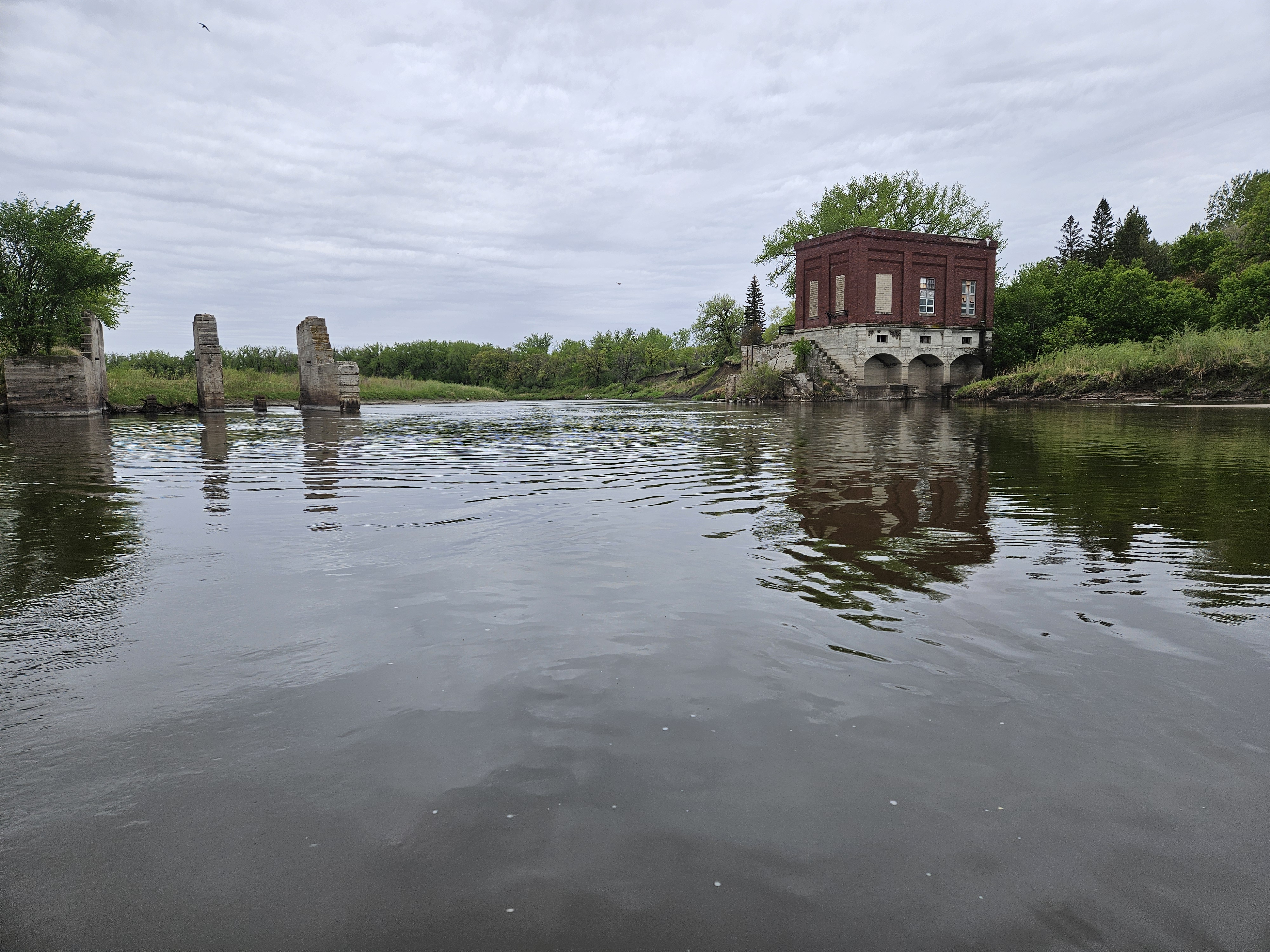
The river curved back and forth as we meandered to Crookston. Almost ten miles above Crookston the new map noted the dam was gone and as we paddled near we saw the old power house and some gates were all that remained.

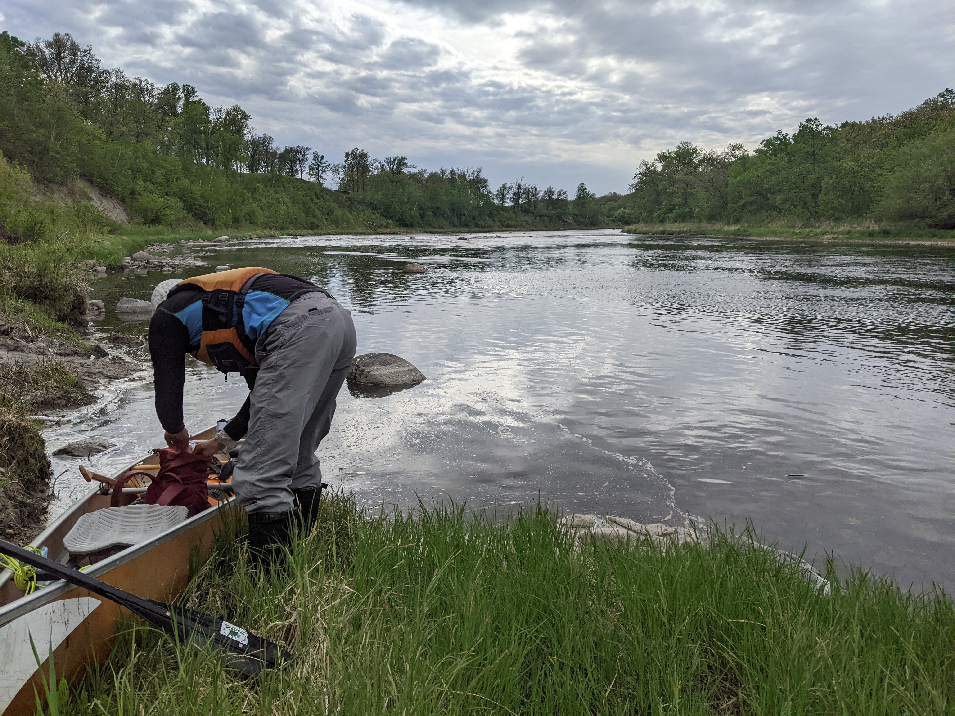
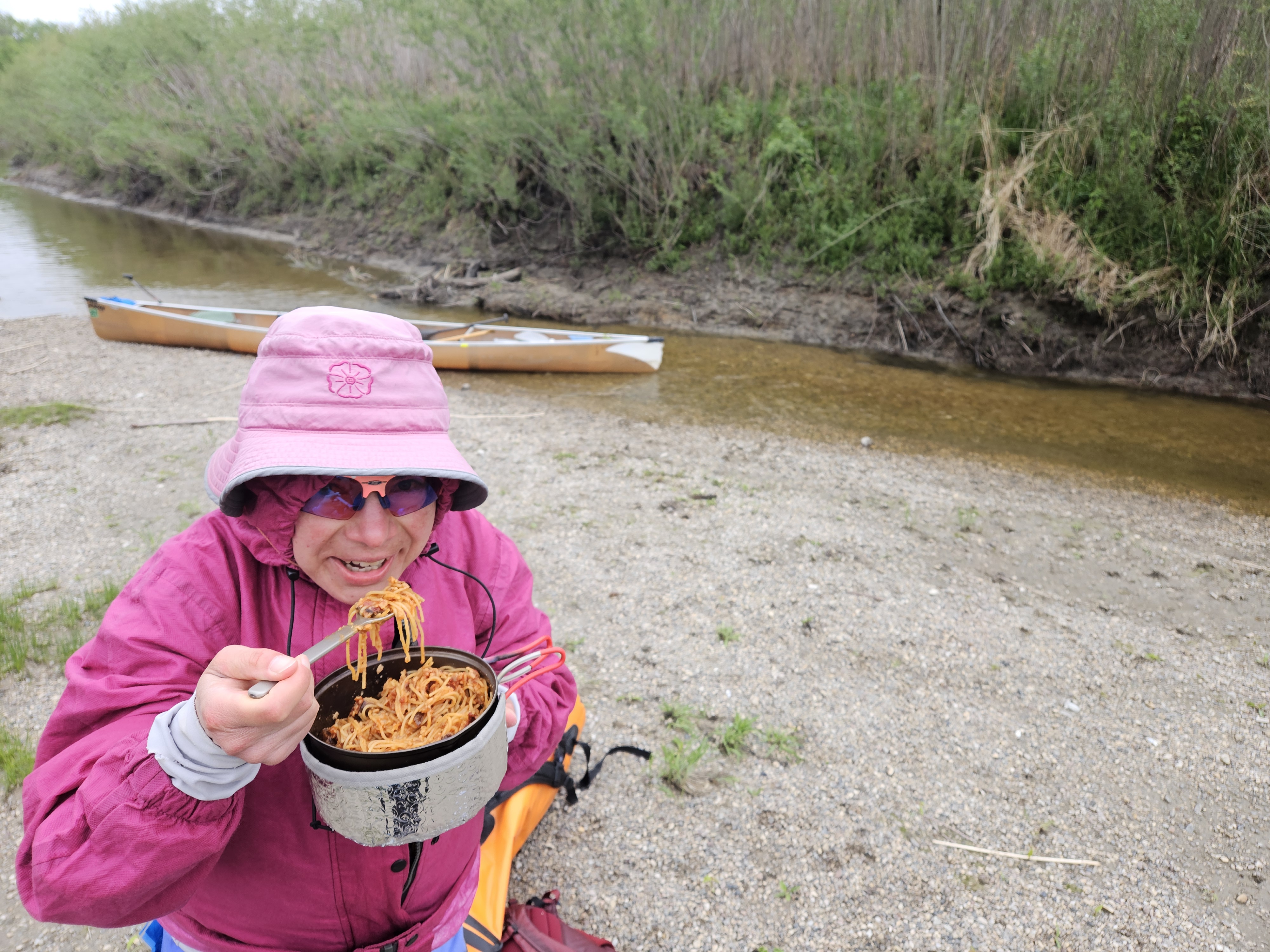
Shortly after the old dam we stopped and cooked dinner. We found a small gravel bar at the end of a tiny island and got to cooking while we pulled down/up our raingear to try to dry out our clothes underneath. Even though the temps were in the mid-50s there was a breeze and it was cloudy so it didn’t feel very warm.

Once back on the river it wasn’t long until we came to the outskirts of Crookston. Erik taught me about the call of the morning dove, which I’d always mistaken for an owl. And then we heard a barred owl as well.
I figured since we’d brought our camping gear that we should camp at least one night. Erik suggested we get another hotel but I reckoned that would take more time than bush camping.
It was after 8 pm as we paddled through Crookston proper. We were coming up on the new rock dam and a couple subsequent riffles. The sky threatened rain and as we paddled through a section of undeveloped shoreline on both sides I was thinking perhaps we ought to camp and deal with the rapids the next morning when we were fresh. Ideally I would’ve paddled another ten miles to ease our load on our final day, but we’d already made it 44 miles on the day having not started until 10:30 am and it would soon be dark.
Then we saw this log lodged into some mud on the right bank that would provide a perfect spot to get out of the canoe like it was meant to be. We pulled over, hiked up onto the embankment and set up camp within view of a streetlight through the trees.
Day Four 5/21/25: Crookston to the Red River (54 miles)

I woke around 5 am when it was first light but Erik said he needed to sleep more. When I woke again around 5:30 am he agreed we could get moving. We’d slept with our food in the tent since we were in town and didn’t want to get our Ursack all wet. Technically not best practice but this now meant we could have breakfast in bed. Our granola with powdered milk and protein powder seemed a little too dangerous though so we had bagels with peanut butter and dried fruit.
Then we packed up the tent and camp and were on the water by 6:20 am with 54 miles to paddle on the day in a little over 12 hours. Before we got to the dam it began misting. After a couple bridges we turned north and were coming up to the dam – a series of multiple big boulder ledges. Erik saw it and agreed we should portage. The unofficial take-out was slippery mud and after a couple bad steps we were portaging. Fortunately the put-in was on some nice sand.
Around the next bend we encountered our first ripple, a nice Class I with a simple V. The second ripple though, after the next bend, looked more suspicious. The drop was bigger. All the water also funneled into a V but the waves were bigger and off-camber which had gotten us a few times in the past. Erik agreed to portage the short drop which was about four feet. Then we were back to paddling and the current had picked up after the dams.
After the Hwy 75 bridge there were a couple huge meanders. Typically when the river floods it cuts off these meanders and eventually carves out a channel and the river becomes shorter and straighter. We passed a couple meanders where the engineers were determined to not let this happen and had heavily fortified with big boulders and even some concrete and metal. And so there would be no cheating here.

Unlike the river farther upstream, it became narrower and deeper. The hours passed by as we paddled and paddled around bend after bend, the river sometimes deceptively looking like it just ended as it made a greater than 90 degree turn and the still reasonably tall banks came down to the shore. There were still the occasional gravel bars where we stopped for a snack and then later for our granola that we hadn’t had for breakfast. The temps were still cold. It drizzled or sprinkled on and off. The sun didn’t come out and it very slowly warmed up from 40 degrees to the upper 50s as the day passed. We walked and ran around on the sand at our stops to try to warm our bodies and especially our feet.
Even with a couple stops we were still making excellent time. The current was cruising and we were doing five miles an hour. After our granola stop I got really drowsy. We came to near hairpin turns a few times where it wasn’t immediately obvious where the river went. Mostly we just kept turning and turning and twisting and my eyes didn’t focus terribly well but I just kept a paddling.
With around 15 miles to go we took our final break out of the canoe and I got out of my trance-like state. It was back to business once in the canoe. The sun burned through the clouds. There were some really tight corners and then finally, our first cut-through. As we approached the Hwy 220 bridge there was a large meander and I was really hoping for another cut-through but no such luck as we paddled a half mile around. The current slowed to a crawl. Erik needed to take a break and did so floating. He laid down in his seat and ate a bar while I paddled us a half mile.
The current stalled. We had to work harder to keep up our same pace and Erik wasn’t able to match my faster tempo so I had to slow down. And by now he was getting really loopy. We passed what appeared to be a garbage dump and he asked me if I was going to have a dump there what I would call it. He came up with RoRo’s Red River Refuse Refuge. He said the business plan would be to buy the floodplain land cheap, charge people $10 per ton of garbage (the going rate), wait for a big flood, let it all float away, and then sell the land.
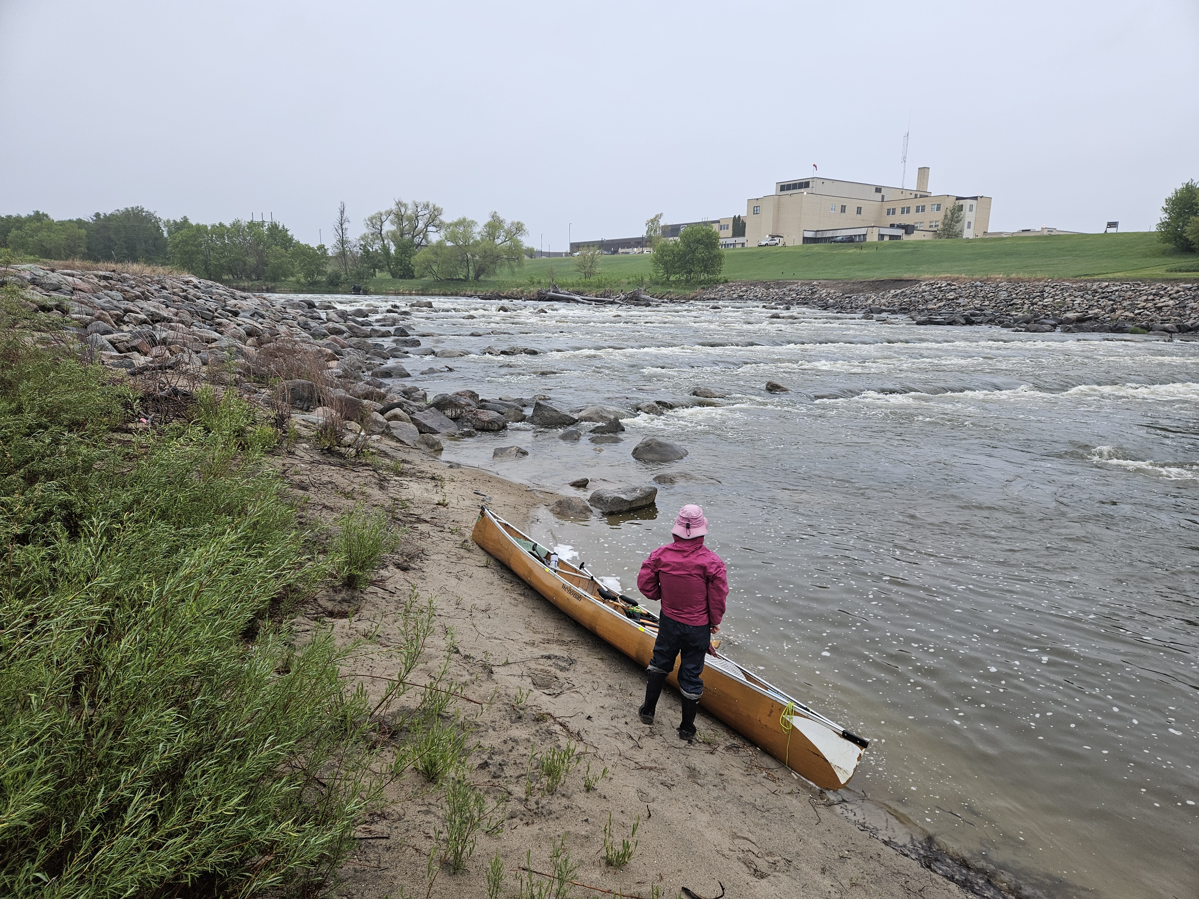
We passed a couple houses, including one with horses, another place with some really old cars that oozed out of the river bank, and one couch. There were also a couple dikes and pump houses and diversion channels. Then we passed under our last bridge and came upon the dam. This was a combo of a concrete low-head dam followed by a rock dam with more giant boulders. This one didn’t have a clear V. As we approached from the upstream side I couldn’t see any waves which usually means the drop is rather substantial. Erik stood and scouted and finally acquiesced to portaging. There was no good line to take through the dam and we likely would’ve hit some rocks and possibly even got hung up.
Usually such dams, particularly those in town located near a boat ramp and park (technically the Red River State Recreation Area) are heavily developed from foot traffic. This one was hemmed in on both sides by thick willows. There was a nice boat launch back up at the bridge but that would mean a long portage. The small open area on our right had a short but steep and muddy bank that looked very slippery given all the recent rain. So we landed on some rocks on the right.
Unlike our previous dam where there was a short but good dirt trail around the dam, no such trail existed here. There was a small trail heading away from the dam through the willows that I figured we should take. What I failed to realize was that the trail petered out after just five feet. We hoisted the canoe out of the river and soon were bashing through the thick willows. It was so frustrating to be so close, so ridiculously close, like 0.2 miles from the confluence with the Red River of the North, after paddling 175 miles, my mom to pick us up a quarter mile away, and us bashing through another unpenetrable forest.
Fortunately, just then a truck drove by. Well, not exactly where we were, but drove by on presumably a road that we couldn’t see. The road curved and from the truck we could now bash our way a shorter distance to the road. Once on the road I thought we should just portage to the boat ramp where my mom waited. There were a couple social trails leading through the thicket back to the river. Erik went to look to scout the dam. It would have been a hard put-in and didn’t seem worth the effort so I suggested we just portage to meet my mom at our planned take-out on the Red River, just downstream of the confluence with the Red.
I wasn’t happy at all about that stupid dam that slowed down the current and then had no portage. As we walked up to my mom, Erik carrying the canoe she said, “I thought you were going to paddle up from the river.”
“So did we,” Erik and I chorused in unison. I wanted to complete our journey on the water, meeting the Red River of the North in our canoe. Life is like a box of chocolates: you never know what you are going to get. Such an anticlimactic and frustrating end to an otherwise interesting journey.
There was a weekly catfish tournament taking place though and my mom had parked behind the weigh-in trailer so we got a good look at some iconic fish from the Red River of the North.
If we had to do this trip again: Before we left, Erik thought perhaps we should delay by a day, or two, or three. We technically had all week with a plan to spend time in Bemidji with family when not canoeing. Hence, we were flexible. We knew going in that water levels were low (technically reported as “medium”). There were conflicting weather reports, two calling for zero inches of rain on that Tuesday, and one calling for an inch of rain. It would warm up as the week went on.
Because we didn’t delay our trip, the water levels were a foot lower than needed to not scrape on so many rocks between Thief River Falls and Huot. Had they been a foot higher, I think we still would have encountered near continuous riffles and rapids throughout this section and so would have had to be ever mindful for this 47 mile stretch. As a result of the low water levels, the current was feeble, and the rapids were not in the least bit scary (except when my brain wasn’t working and we almost slammed into that car-size rock). It also posed a different challenge.
Also, because we went when we did, we got to attend our niece’s Color Run in Bemidji and it set us up for a good day of paddling some of the Mississippi River, including Lake Winnie.
Best Decisions: Definitely getting a hotel in Red Lake Falls to keep us dry and warm and staying put until 10 am so we didn’t have to endure the elements for as long.
Next time: This was a neat river with three distinct parts: an open meandering stream, a bouldery wide stream, and a deep forested narrow stream that made this river fairly unique and a good trip. As we descended, it was like a box of chocolates – we didn’t really know what we would get – especially near the end as the stream became surprisingly intimate. Hence, I wouldn’t be so opposed to paddling this river again, and I very rarely say that. Just next time that dam in East Grand Forks would be flooded over.
We may need to packraft that section from St. Hilaire to Red Lake Falls at very high water levels sometime. I’d be curious to know if the waves washout or if there are some big rollers! So stay tuned…
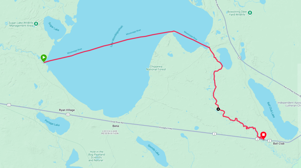
Encore: Lake Winnie and the Mississippi River 5/24/25
Eighteen years ago Erik and I paddled from Bemidji to Cloquet including the Savanna Portage. We encountered a strong east wind the day we were to do Winnie and hence had called my parents who gave us a ride around the lake and cut-off 13 miles of the Mississippi. It’s been on my radar to go back and paddle that section ever since but on Saturday May 24th, the wind was predicted to be only 2 mph from the east and only pick up to 5 mph as the day wore on. We needed to seize our opportunity.
Erik had paddled the lake previously on a trip from Lake Itasca to Minneapolis and given the wind forecast, he didn’t want to set any alarms to get going early. I was more fidgety and not super happy about our 7:30 am start. The water was placid and we could see down to the bottom. Then it got deeper and the shoreline receded as we picked the far point and took the shortest line, confident in the forecast.
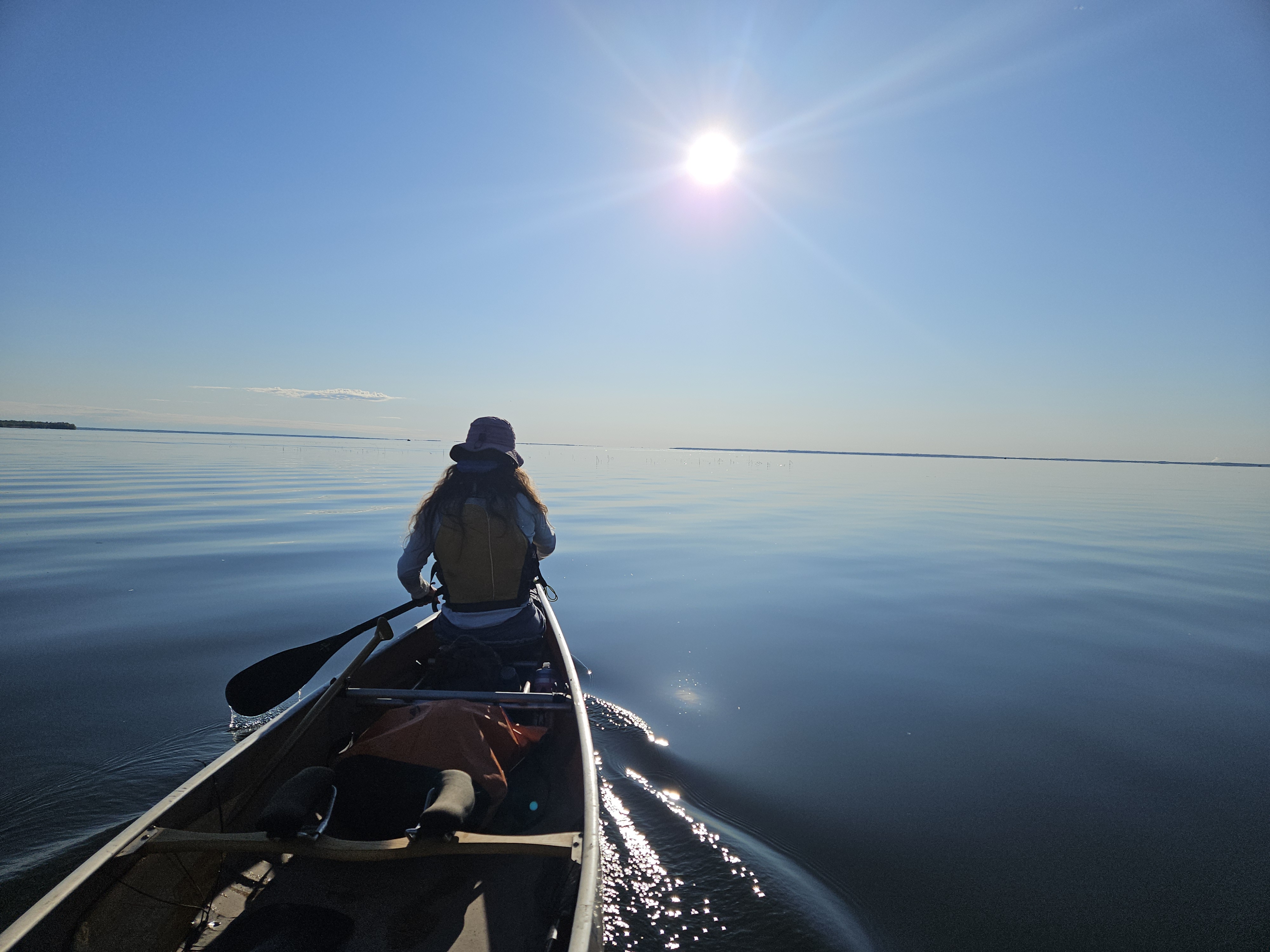
We both had our Garmins going but Erik’s was in auto-lap. “15 minutes” he kept calling out as the miles ticked by. The very distant shoreline came into view, the smokestack from Cohasset dropped below the horizon, and the radio towers near Bena got close together, became one, then two again.
There were a few boats out on the big lake, only one of which did we get close enough for conversation. “Are you floating the Mississippi?” they asked us. I can never understand, particularly when crossing a lake and we are obviously paddling at a good cadence, why anyone can think we can just float across a lake, or down a river without steering.
There were a few boats out on the lake and eventually the waves picked up, likely from a combo of wind and boats. The point we were aiming for was definitely closer than when we’d started, but still seemed so far away. Erik was bored and asked me how I could figure out how far away the clouds were. I couldn’t wait until our niece would join us for the second half of the paddle for some different company. But slowly, stoke after stroke, the individual trees came into view and then we were essentially paddling alongside the point. The lake got shallow and we could see the bottom again.
We stopped for a potty break at the point. Then it was back in the boat as my mom, brother, nieces and nephew were meeting us at the Winnie Dam. Initially we were tucked behind the point. The water was still shallow and we could see the sand on the bottom, some fish, and a gosling that went under. Then the water got deeper and we were out in the exposed southeast part of the lake. Perhaps the wind was stronger than predicted but we caught a tailwind and surfed as Erik called out we had done a 12-minute mile. This made for a fast final three miles to the Winnie Dam where the remainder of the party arrived about the time we did. We portaged the dam and through the park at the Winnie Dam Recreation Area on the left side where there was a play area and we had lunch.
The skies darkened and it sprinkled some but we still had 13 miles to paddle. We collected our oldest niece who would paddle the remaining stretch with us. There was also a kayaker who was section paddling the Mississippi on his way from the Headwaters to Grand Rapids who happened to be there at the same time as us and so we paddled the first few miles with him to the Crazy James Campsite.
The water was again strikingly clear. It was hard to not just look into the water, at the sand ripples, at a dead frog belly up, the occasional plants, shelves, and rare fish. Mostly the river was shallow. We paddled through some marshy land, the river having been ditched in some sections. The wind remained favorable. At Little Winnie Lake we saw a pelican. Then we saw some swans. There were a few beaver lodges.

After the Crazy James Campsite the river got more shallow and the current picked up. Here there were a few rock ripples to avoid and we taught our niece about finding V’s and looking for water lines that indicated rocks. This section was short lived and soon we were back into marshier area. We took a short break to pick up some shells our niece was collecting.

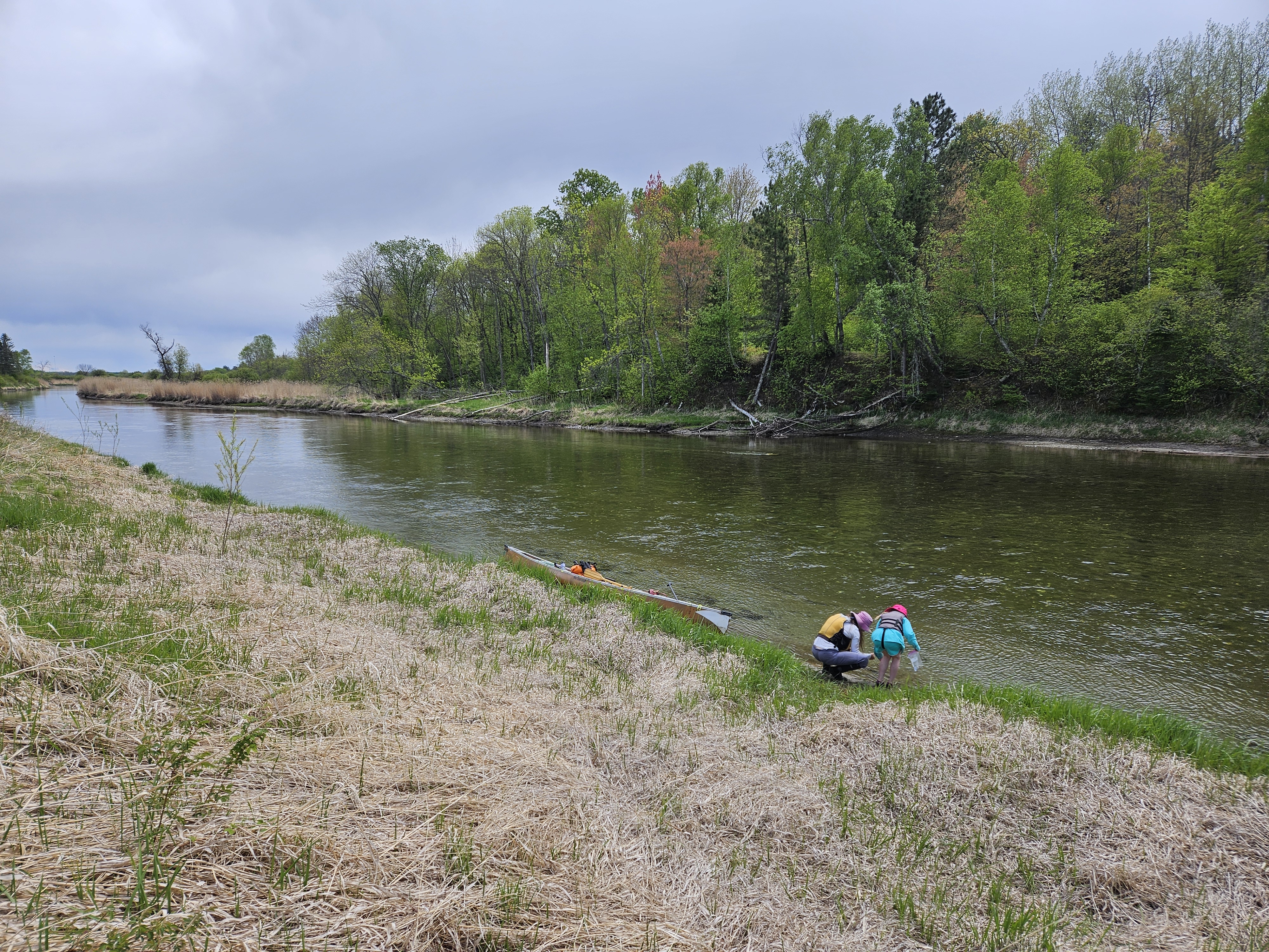
We were soon back in more ditched sections. Erik wanted to try an old oxbow. It dead-ended but when it did, we found some long and delicate shells for a necklace for our niece.
Shortly after re-tracing our route, we came upon a pair of geese with several goslings. Just a few days earlier I’d told Erik I always wanted to go in search of the goslings when their parents take off, feigning injury, beckoning us to follow them away from the goslings. Those geese don’t fool me but we always follow them because I’m always in a hurry, trying to get somewhere. But this day we had time and our niece to amuse. The grouping was initially onshore and Erik thought we should try to catch them there but our canoe hit a sand bar and as we were getting off that, the geese all took to the water and some of the goslings went under.
We were successful in breaking up the group and caught one gosling on the far right shore by itself. As we neared, it dove underwater. Since the water was so clear, we could see it went about two feet under, near the bottom, elongated its neck, and swam like a turtle with its back feet. We lost sight of the gosling but one of the geese, likely the father per our niece, kept up the feigning injury and honking, persistently moving/flying farther downstream with us. This replayed over and over until finally, the goose gave up and flew back to the others.
Our niece, who had been thinking about making a zoo said, “Those geese are so annoying. I’m going to have a sign in my zoo that says ‘No geese allowed.'””
Now paddling along in peaceful silence, we saw an eagle and then came to a deep pool where we could look down several feet. There was a beaver lodge on our right and we could see the lodge extend far down into the clear pool. It was like the beaver exhibit at the Minnesota Zoo.
Around a couple more bends we came to yet another deep pool and beaver lodge. Here Erik caught a glimpse of a beaver swimming.
“I’m satisfied with all the wildlife we saw,” our niece said as we rounded the last couple turns and came to the Hwy 2 bridge where my mom and brother had parked our car. Our niece gathered a few more shells as Erik and I put the canoe on top of the car.
This trip on Lake Winnie and the Mississippi River was 18 years in the making. We seized the day and I’m glad we made this a day paddle. It’s so surreal to paddle across open spaces and then to have caught the tailwind we did for the end of Lake Winnie. And then the Mississippi River, with its clear water, was mesmerizing. There was so much to see on the river bottom alone. I wasn’t expecting it to be so good. My new favorite stretch of the Mississippi River. The whole paddle transpired over eight hours, but it felt like we’d been gone 18 years.

One thought on “Life is Like a Box of Chocolates: Canoeing the Red Lake River”