Three years ago we had our first experience on the Red River of the North, canoeing the first 65 miles after completing the Otter Tail River. The banks were incredibly muddy which made stops, camping, and the takeout difficult and dirty. Two years ago we returned to the Red River, paddling from Grand Forks to the Canadian Border, this time with some higher water conditions the river levels were up to the grass on the banks and there was much less mud.
This year water levels have been very low. We were spending the week in Bemidji with family and found a three day window with good weather to canoe 120 miles of the Red River. My mom had offered to drop us off and pick us up but this would be considerable driving for her so I planned on doing the bike shuttling, except the forecast called for a headwind on the prairie.
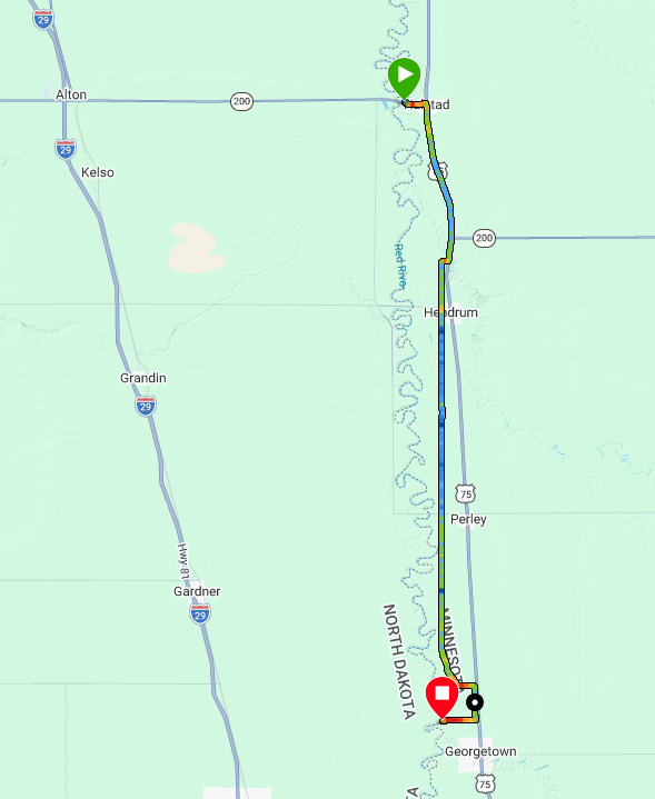
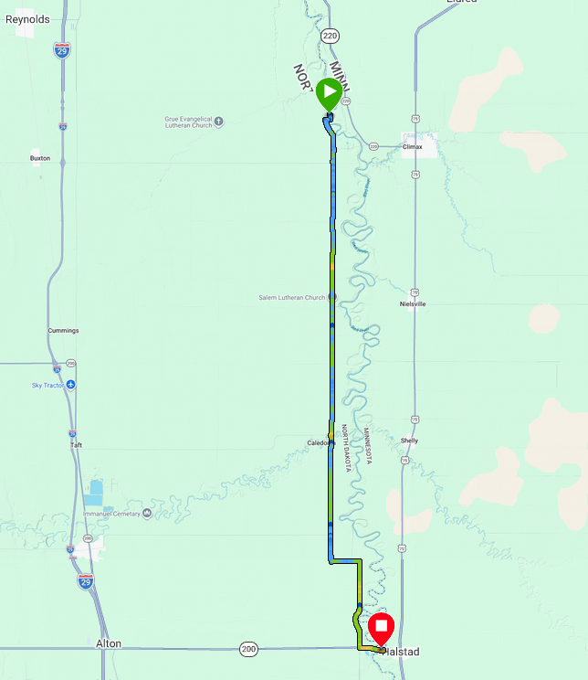
Day One 5/20/26: Georgetown Bridge to a little before Halstadt
River gauge at Fargo: 860 cfs
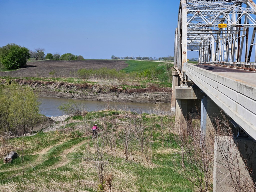
Even though we left Bemidji by 7 am, it was over a two hour drive to our put-in just slightly northeast of the small town of Georgetown, and not far north of the Fargo-Moorhead area. I dropped Erik and the gear off minus my bike. He was stoked because this was a historical marker site which meant there were some signs for him to read and he could check out the old bridge. Meanwhile I drove 20 miles north to the Halstadt boat launch and got on my mountain bike heading south into a 15 mph headwind.
I’d decided on my mountain bike because there were likely to be some gravel roads and it’s easier to get in and out of the canoe than my gravel bike. This was my fifth time on the bike this year and while I’d done a 19 mile ride a few days earlier without much difficulty, that ride wasn’t into a stiff headwind and had all been on pavement. I’m not much of a biker. Just after 5 miles I took my first “butt break” which meant I hopped off my bike and ran with it for a couple minutes to give myself a break.
When I was a kid, my grandparents lived way up north in the Red River Valley. Hence, I knew about the flat land and seeing the grain elevators in the distance that marked the towns, always on a railway. And so as I headed south, I had my eyes set on the grain elevator in Henderson, exactly 6 miles south of Halstadt, this land so flat the roads are on a nearly perfect grid every mile. 6 miles = one township. It wasn’t too long before I was there but a little south of Henderson I hit dirt road. Half of it had been freshly graded. I chose to ride on the half not graded, trying to find the firmest dirt. And the wind pushed against me. I tried to increase my cadence and when my butt got numb, I got off my bike again to run.
That grain elevator in the town of Perley, another 6 miles down US-75, slowly got bigger and bigger. Mostly I tried to not look at it. But eventually, I came even with it and passed it. Then it was on to looking for the Georgetown grain elevator, even though I wouldn’t be quite making it to Georgetown, I would be getting within a mile of it.
Now I was getting tired. Why am I doing this? I asked myself more than once. Certainly not spectacular scenery. Certainly miserable on the bike. Certainly have done more interesting things in my life. Fortunately the road turned to pavement again but I wasn’t used to the bike position and that next grain elevator didn’t seem to be getting any closer. I kept my legs moving (whether on or off the bike) and eventually I made it back to Erik, the last mile with a crosswind. The best part of the ride was the short trail section down to the canoe.
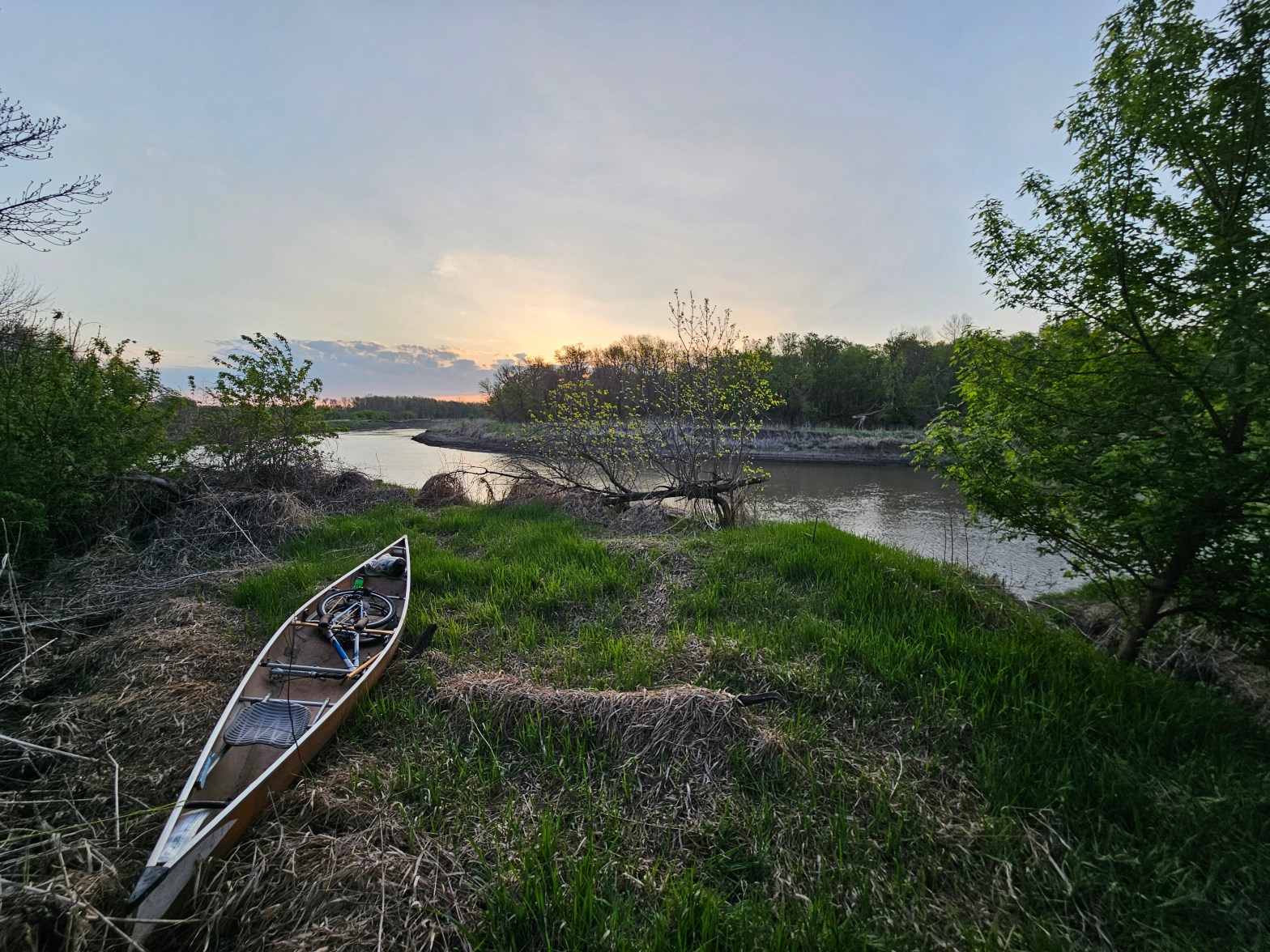
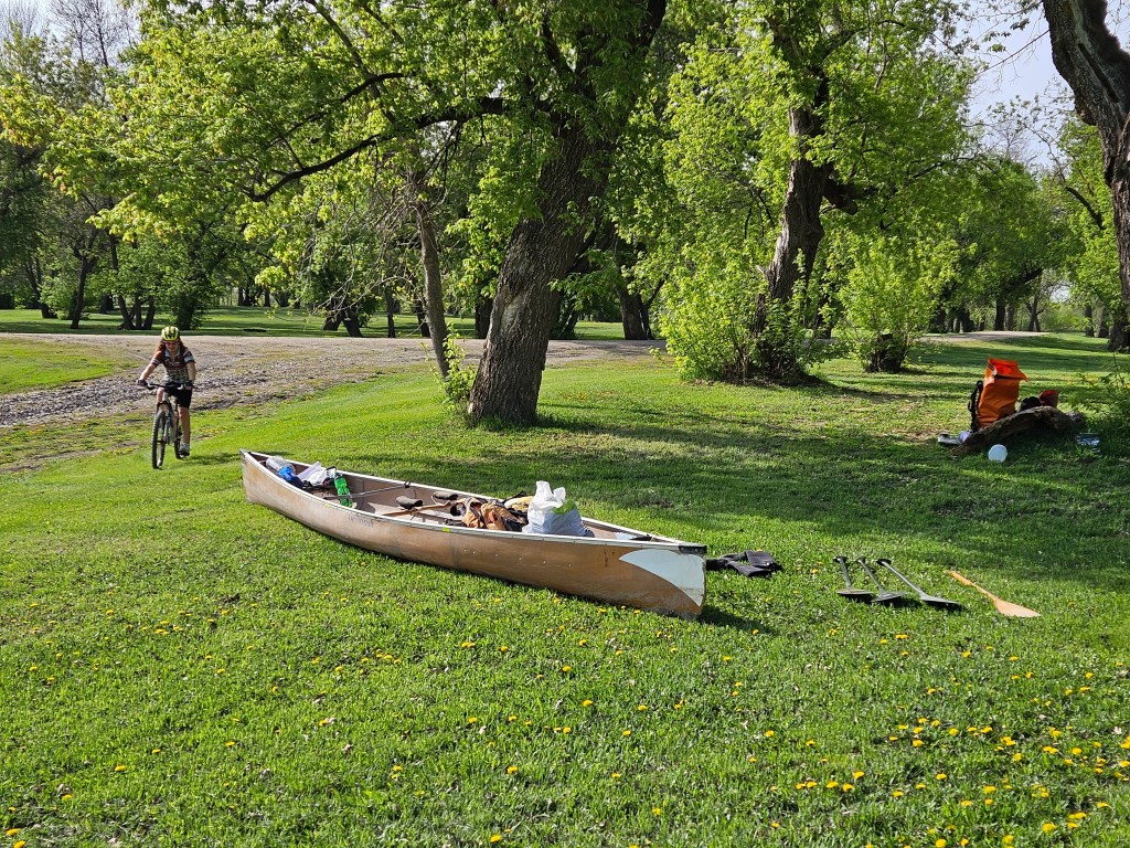
It took us what seemed like way too long to load the canoe with my bike. This was an official canoe launch and we found a small piece of concrete to help us avoid some mud, or what I believe the locals refer to as “gumbo,” that is extremely sticky when wet and rock hard when dry.
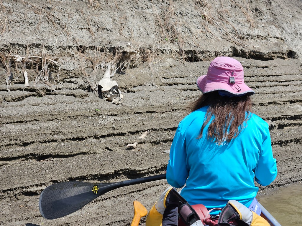
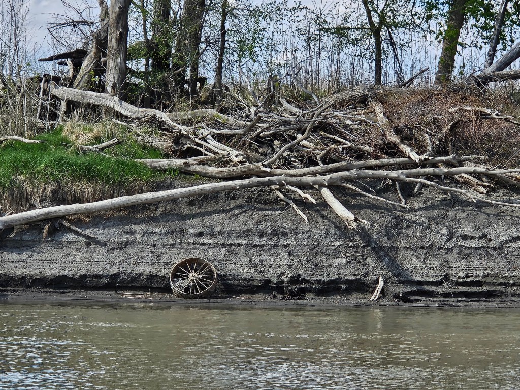
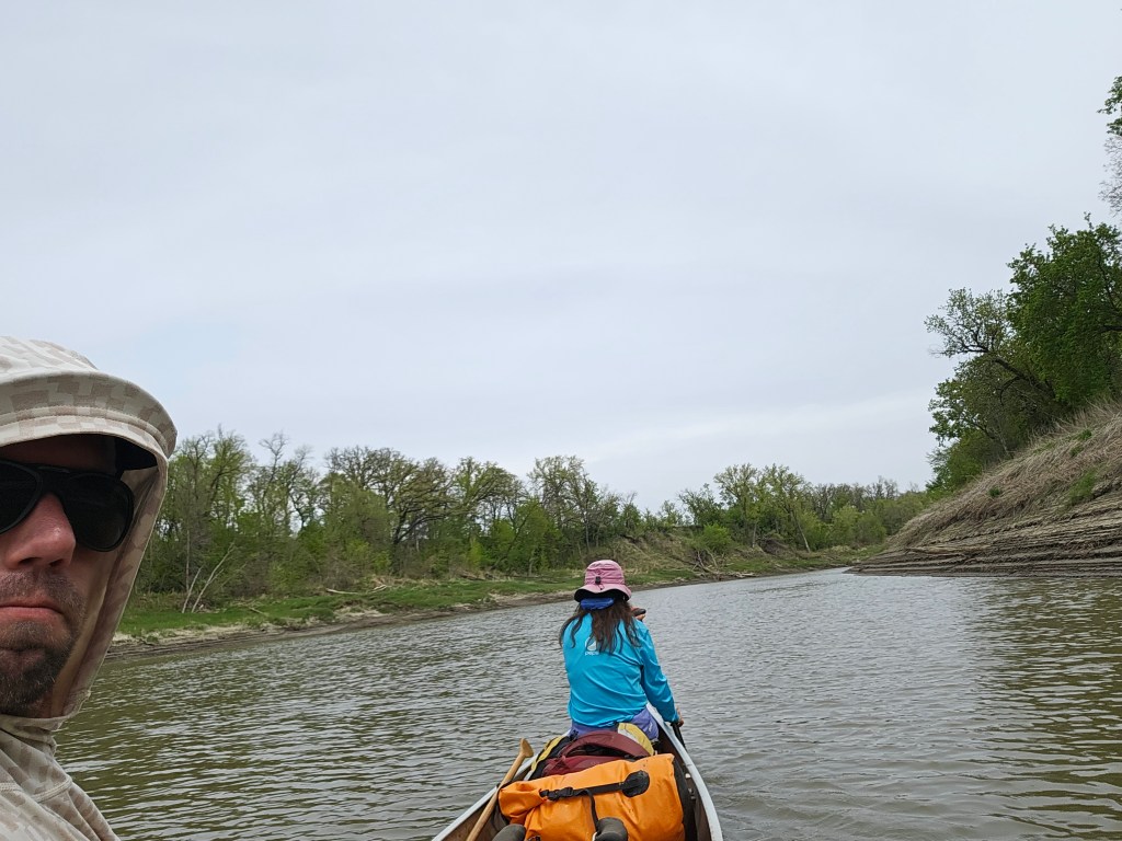
By the time we got to paddling, it was 12:15 pm. It didn’t help that there wasn’t much current and I ate my sandwich for the first bit as Erik paddled me down the river. The sun was out but temps were only into the 60s and the air was dry which made for pleasant weather. The scenery was lackluster. At least the beavers kept things interesting, sliding down the bank quickly when they heard or saw us coming. That and a few pieces of rusting relics embedded within the shore.
For our first break we found some grass that was near water line. We clamored out onto it and then Erik scavenged some downed wood to put down on the gumbo to give us a stepping place to get back in the boat. For our second break, nearing 6 pm, we cooked dinner. Again we sought some grass by the bank and then fortified our re-entry with downed wood. It was our angel-hair pasta bacon ranch meal for dinner.
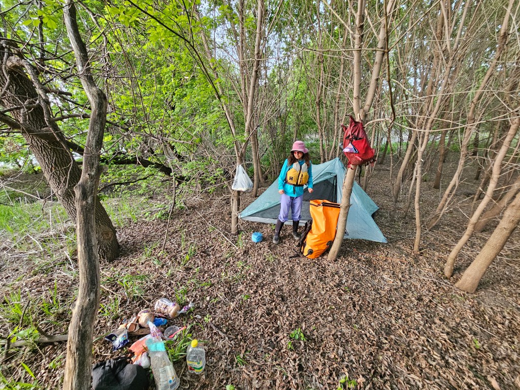
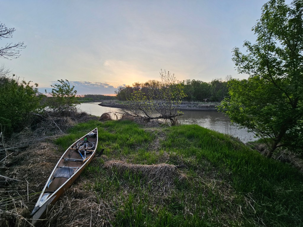
Then we got back in the boat and paddled two hours until it was near sunset. The goal for the day had been 40 miles, back to that boat launch in Halstadt, but we weren’t going to make it before dark and so having paddled just 33 miles, we gave up for the day and set up a bush camp in some protected alders, high above the riverbank.
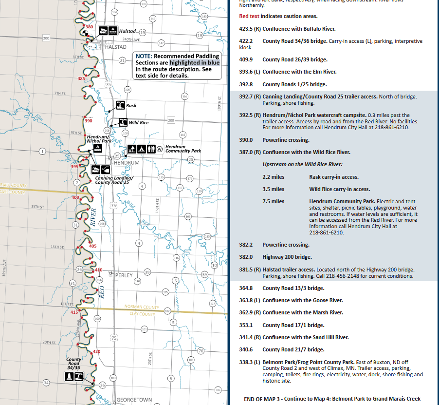
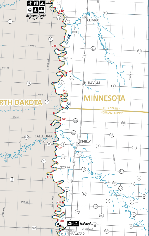
Day Two 5/21/26: Just before Haldstadt to Belmont Park
River gauge in Fargo: 800 cfs
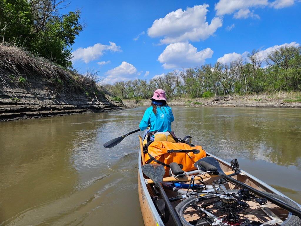
We woke early to a deer snorting. Having not made our goal from the previous day, we had 48 miles to paddle, plus a 21 mile bike shuttle, again into the wind, for my part. Hence we were back in the canoe at 6:40 am. While we weren’t paddling hard, we weren’t dogging it either, doing 60 strokes a minute. Despite this, Erik kept clocking us at just under 5 mph. At 8 am we came to the Halstadt boat launch. We stopped where there were some nice rocks and a concrete boat ramp and grabbed more water out of our car. We brought all the water we needed with us because the Red River is incredibly muddy (silty) and we didn’t want to drink the water.
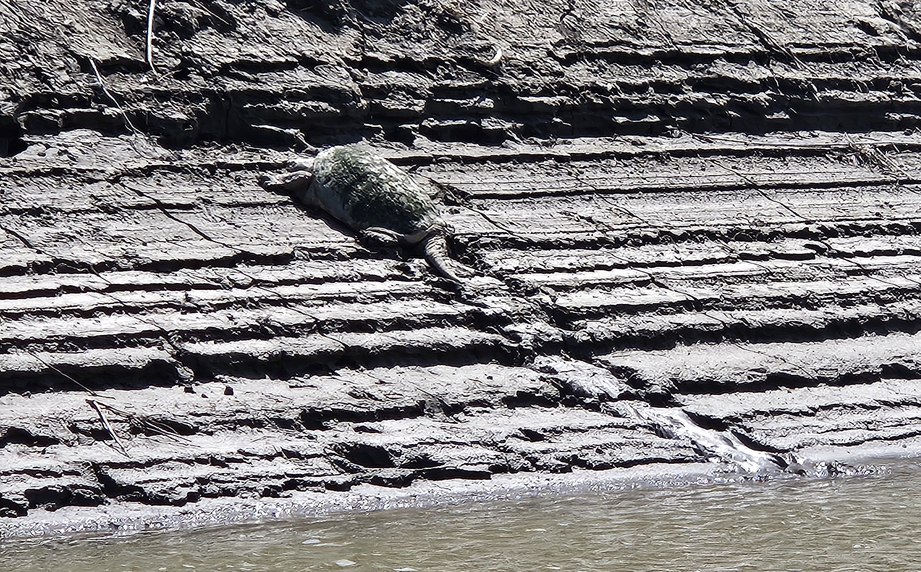
It was a quick stop though cause we still had 41 more miles of paddling on the day plus that shuttle. Another hour or so later we stopped for “first lunch.” Then we were back in the canoe. There wasn’t much to note other than unlike most rivers, the inside bend banks were actually much steeper than the outside ones. We passed more beaver slides and saw a few more beavers. We saw a couple giant snapping turtles. There was a heron somewhere in there and some bald eagles and vultures.
And another 12 miles later we stopped for second lunch, bagels with squeeze peanut butter and dried fruit, just like first lunch. Back in the boat. A few miles later Erik mumbles from the back of the canoe, “Elspeth, why do we just paddle all day. Why do we have to push so far. When can we just go on a relaxing trip?” I don’t have an answer then, but I do a few hours later. “Because this is so boring I just want to get it over with,” I finally respond. Then why have this goal of paddling all of Minnesota’s designated waterways? Why? Why if it’s not fun? Why if it’s not enjoyable?
A couple more hours of paddling, Erik calling “huts” approximately every 11 strokes when we switch sides, paddling in sync, still 60 strokes per minute with little variability, we stop for snack. I eat some almonds. Despite the meager current we’ve made good time on the day. We should be to camp around 6 pm and then I’ll bike 21 miles south back to the car, practically a straight route through North Dakota.
Somehow we made really good time, arriving to Belmont Park at 5:15 pm but the boat launch was full of slippery gumbo and it took us 15 minutes to unload the canoe. I decided to have Erik cook me dinner, our “taco” pasta meal, before I headed out on my bike at 6:15 pm. There was a hill heading out of the park. OK Elspeth, if you just average 7 mph, you can get this thing done before dark. 7 mph, that’s my running speed. I’m just not in shape to run 21 miles.
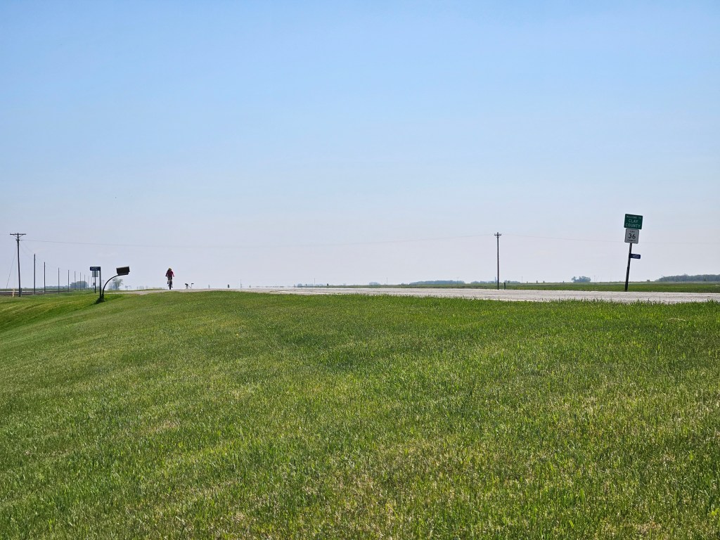
I turned south and that headwind struck me. The gravel road was soft. I was barely doing 7 mph. Then I hit the pavement for half a mile. I thought the next road, the main road I’d be taking for the next nearly 20 miles, would be paved, but it wasn’t. You’ve got this Elspeth! I kept my eyes glued to my GPS. Look, you’re doing amazing, you are going 9.8 mph. That’s ahead of pace! And so the cheerleading began. Mile 1 working on mile 2. Big celebration at mile 3, whoop, whoop! OMG, look at that 10.7 mph, you’re kicking butt, you’re flying, you’re going to do this!!!
By miles 7, 8, 9 the cheerleading got harder. I just wanted to get off my bike and run. And so I did, trying to go 2-3 miles before I’d let myself have that break. And slowly the miles accumulated on my watch. I made it through the tiny town of Caledonia which offered a short downhill over a small brook. Then it was heading back south. Occasionally there were some wind breaks and wow, but I could feel the wind lessen in those short sections.
When I had the option to go east or south, I mistakenly took the south way figuring this would get me faster to the pavement on hwy 200. But the gravel road was more like dirt here and felt slower so when I had my chance after another mile, I took the next road east. That one, too, seemed more like a logging road than a gravel road. I was relieved to get back on the gravel road for the last three miles before I got to the pavement on 200 and could enjoy a crosswind for the final mile before getting back to the car.
I felt thankful to get to the car and put my bike inside but also not stoked for my ride the next morning. Then I drove back to our campsite and felt the fatigue in my legs upon getting out of the car. Erik had the tent all set up though.
Day Three 5/22/26: Belmont Park to LaFave Park in East Grand Forks
River gauge at Fargo: 760 cfs
This was the third year in a row that we were either starting or ending our May trip at LaFave Park in East Grand Forks. Erik had suggested that I do the bike shuttle first. The bike was already in the car and this meant he could sleep in (he needs more sleep) and pack up camp while I biked.
It was full on daylight when I got myself out of bed around 5:40 am. I changed my clothes, used the bathroom, and was on my way to LaFave Park. The last part of my drive would be the same as the start of my bike so it was nice to get a little lay of the land. This was my most complicated route of the three and I did my best to memorize it so I wouldn’t have to consult my phone numerous times.
After the drive, it was 6:30 am when I got to biking. Not too many others were out at this hour and I largely had the roads to myself. I still had the headwind to keep me company and not enough windbreaks as I left town and headed into farm country. The wind didn’t seem as stiff though and I made it over an hour before I took my first walk/running break (except that I had stopped once briefly to consult the map and a second time to stuff my jacket). On that first break I multi-tasked by eating an energy bar.
After a couple more miles in Minnesota, I got to cruise with a slight tailwind on a bridge across the Red River before turning south in North Dakota. I thought this would be a gravel road but surprise, it was pavement! Unfortunately the pavement didn’t last forever, the last 5 miles were still on some rough gravel/dirt road, but at least it was mostly pavement. By now I was on the home stretch, still trying to stretch out the running breaks, especially as the time wore on. And I was getting really hungry!
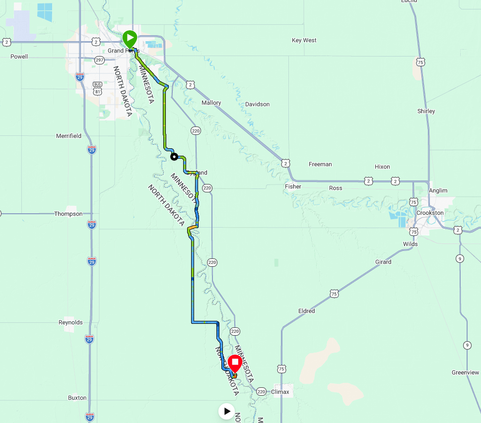
By the time I made it back to Belmont Park, I felt like my work for the day was done. We had a pretty terrible transition. It took us 45 minutes for me to change, eat some food, load the canoe, and then Erik had to poo. Seriously, couldn’t he have already done that? So it was nearly 10 am by the time we shoved off on the Red.
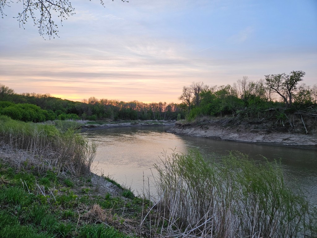
The sky clouded over and we suspected rain by late afternoon. There was likely no way to out-paddle the rain but at least it would only be the tail end of our paddle. I preferred my canoe seat to that of my bike. The shore remained rather monotonous but we kept seeing beavers and our least favorite, the new parent geese. Except I did see one geese brood where they just stayed on shore and one of the parents turned into the most convincing rock. That was my most favorite goose I’ve ever seen.
And there were some swans and ducks and a few more rusting relics and also some “waterslides.”
We stopped for first lunch and ate our usual breakfast as Erik had cooked our dinner for true breakfast. A few hours later we were thinking about stopping again but the rain closed in on us and so we just kept going and going and going. Fortunately it was just a light rain and temps were in the 50s.
A few river miles from Grand Forks we passed by some houses but due to the way the river floods, as we got closer and closer to town, there were no houses or infrastructure of any kind that suggested we were near a metropolitan area of 100,000 people. Erik kept asking how far. I was marking every bend on the map and the answer always seemed “too far” but soon enough we paddled under the ped bridge and then did our last meander.
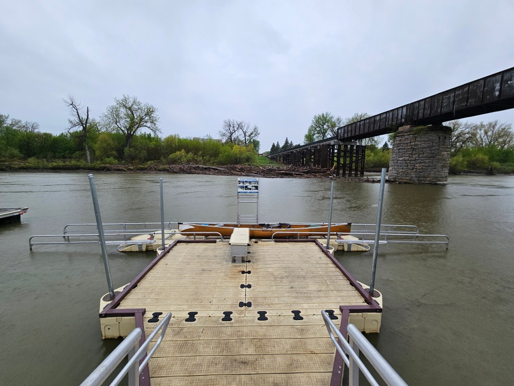
Despite the rain, we paddled the short distance up the Red Lake River to the dam that we’d portaged around last year and given up on the confluence with the Red. Then we took out at the boat launch at LaFave Park, only after doing so Erik saw there was an accessible ramp and so he paddled around and on to that.
We were done sometime around 6 pm. The dampness was seeping in and I was glad to be done and blast the heat in the car. It rained the whole drive back to Bemidji.
Best decisions: Doing the last bike shuttle in the morning when it wasn’t raining and Erik could use the time to sleep, pack up camp, and make me food (but apparently didn’t have time to poop).
If we had to do this trip again: Why? I asked a lot of whys. I still would’ve pushed the pace. I only have the patience to commit so much of my life to this mundane goal. Perhaps we would’ve taken my mom up on the car shuttle. But I dunno, there’s something about doing something difficult (the bike, not the paddle) about this incredibly flat land, marking the grain elevators, trying to be OK with going on effort, not speed, enduring. I just finished the book Endure and I definitely thought about that some. Good mental training I guess. Just not sure if mental training helps or can burn us out if we do it too much.
Next time: There’s most definitely NOT going to be a next time. This is one of the most boring sections of river I’ve ever paddled. BUT we still have 70 miles of the Red River left, the area around Fargo. There’s four dams in that stretch so I don’t think it can possibly be as boring as the section we just did. It’s about half that distance in bike shuttling. Between the driving, paddling, and shuttling, we’d better make it a relaxing three day trip and then Erik can have some time to read the signs.
