
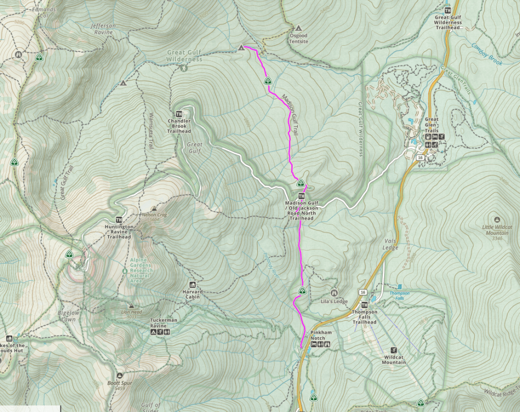
Mount Washington
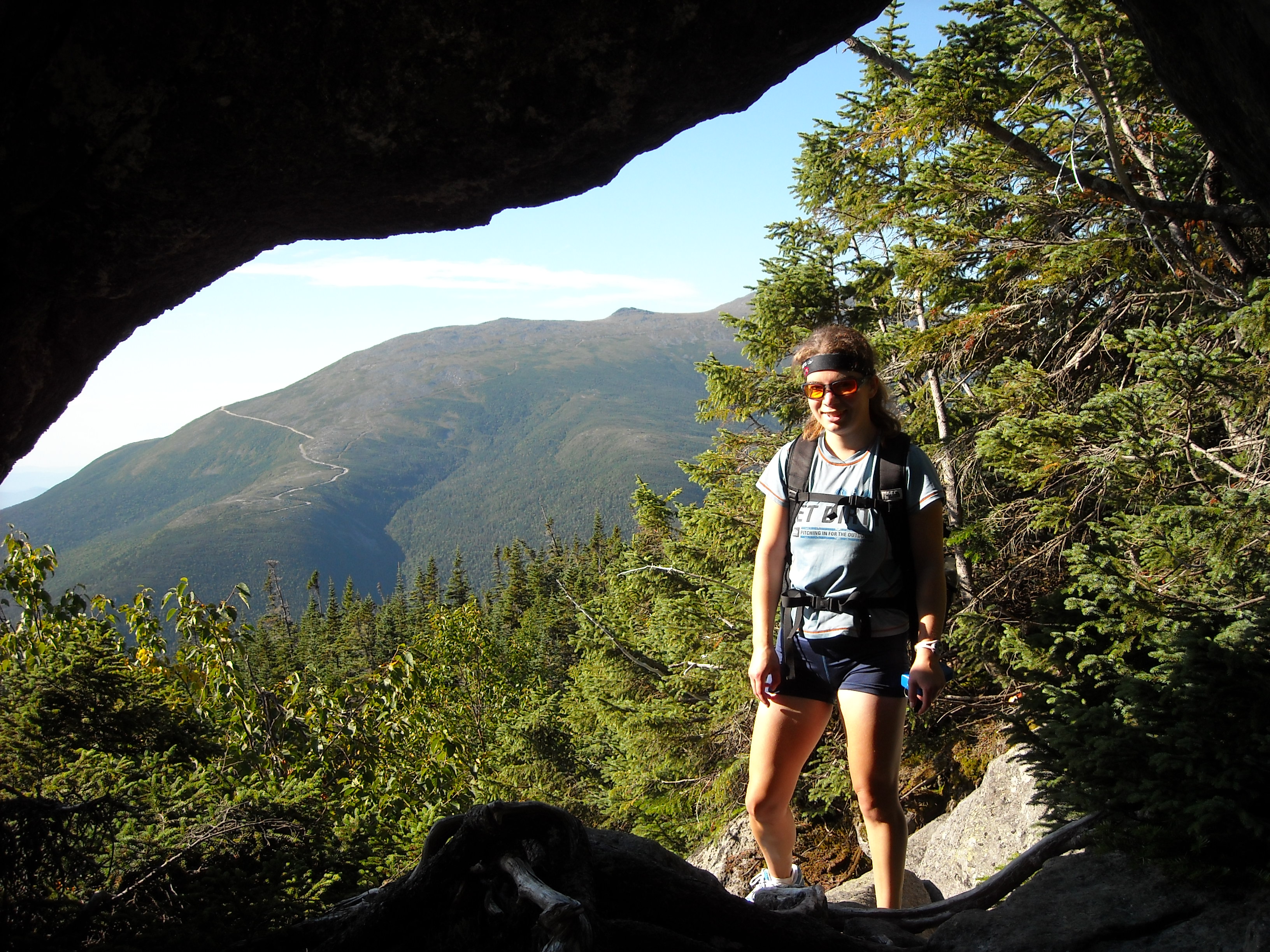
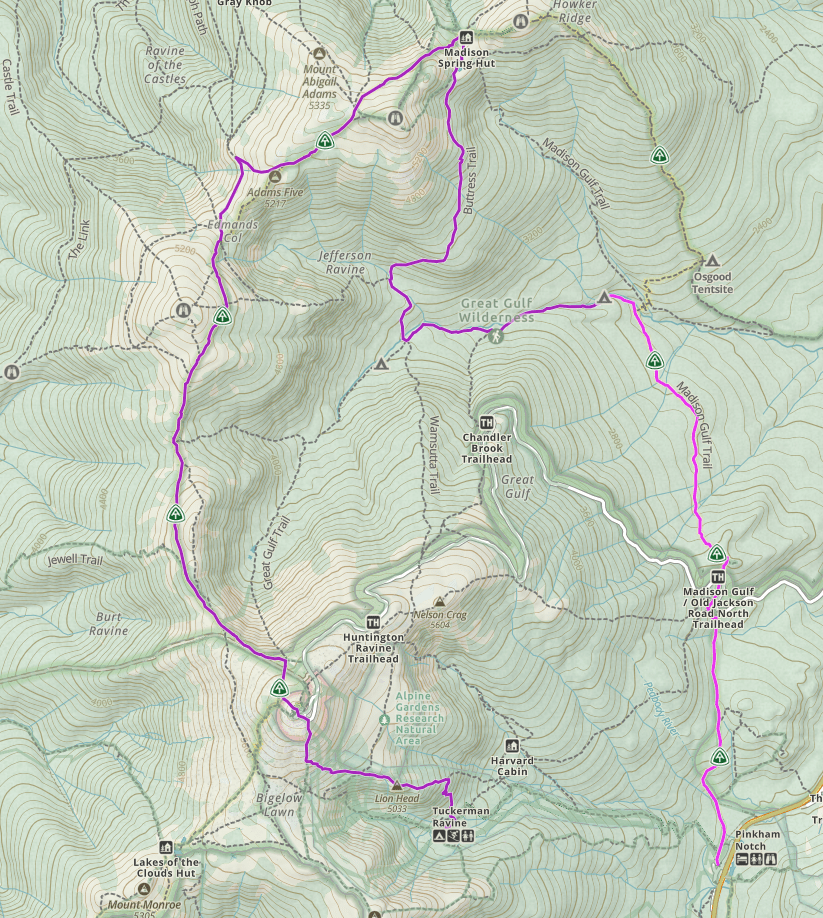
A couple years after summiting New York’s Mount Marcy, we continued on our quest to climb the highest state peaks in the northeast United States. First, we went to the Presidential Range of New Hampshire’s White Mountains where we planned a two-night backpacking loop including some of the Presidential Traverse based out of Pinkham Notch that would include Mount Washington, the state high point. After arriving mid-day, we began our route hiking north on the Old Jackson Road Trail, but technically the south-bound direction for a stint on the Appalachian Trail. We crossed over the road that goes to the top of Mount Washington and when we got to the West Branch of the Peabody River, we diverged from the Appalachian Trail to instead follow that small stream uphill. We camped at a designated area not far up the river. The day had been easy enough, albeit almost entirely in the trees with few good views.
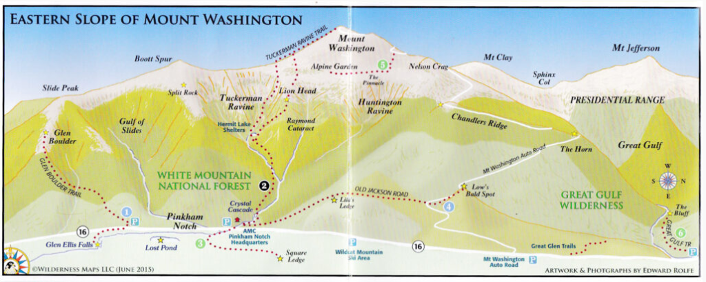
The next morning we got up and followed the Great Gulf Trail to the Buttress Trail. Soon the trail crossed a boulderfield. Only there was no real trail through the rocks, unlike other trails where crews have gone to significant pains to place small rocks amidst the big boulders to create a more level walking surface. No, on this trail, it was just big boulders. I used my hands to balance and carefully placed each footstep while Erik patiently waited for me. We fell behind pace. Fortunately the boulderfield didn’t last long and soon we began steeply ascending to a plateau of sorts at Star Lake.
From here the going was easier, albeit a bit rocky, as we descended a short ways to the small and squat Madison Spring Hut, constructed entirely of thick stone that almost blended into the surrounding rocky landscape. Our original intent had been to bag as many of the Presidents (Mount Washington is one of several summits named for the early presidents of the United States) as we could. We had planned on detouring east to summit Mount Madison which loomed above us some 500 feet in a pile of rocks. Seeing as we were already behind schedule though we let this go and instead followed the more direct route to Washington over Mount Adams
Leaving the Madison Spring Hut, we regained the Appalachian Trail as we climbed towards Mount Adams. The terrain was rocky and wet, not a smooth path, and we made slow progress. The Appalachian Trail itself doesn’t go over Mount Adams and again we had the option to take the trail up and over Adams or take the more direct route around. After not much debate, knowing we still had the opportunity to hike Jefferson, we took the lower route. This route was still slow going with occasional larger boulders and I had to use my arms to help me get over the rocks. The smaller rocks weren’t smooth on top but rather jagged and off-camber. Sometimes they even moved under me, throwing me off balance.
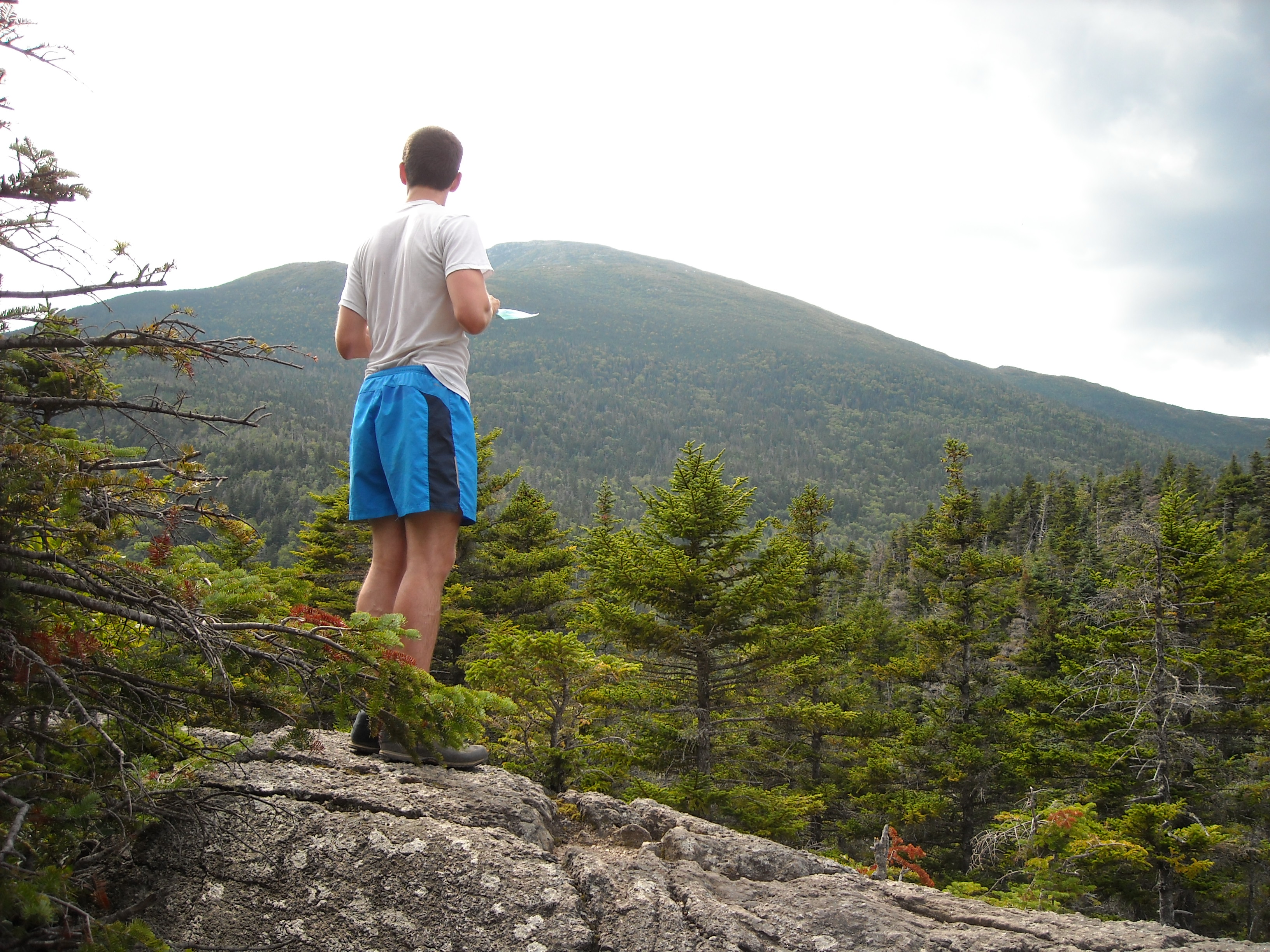
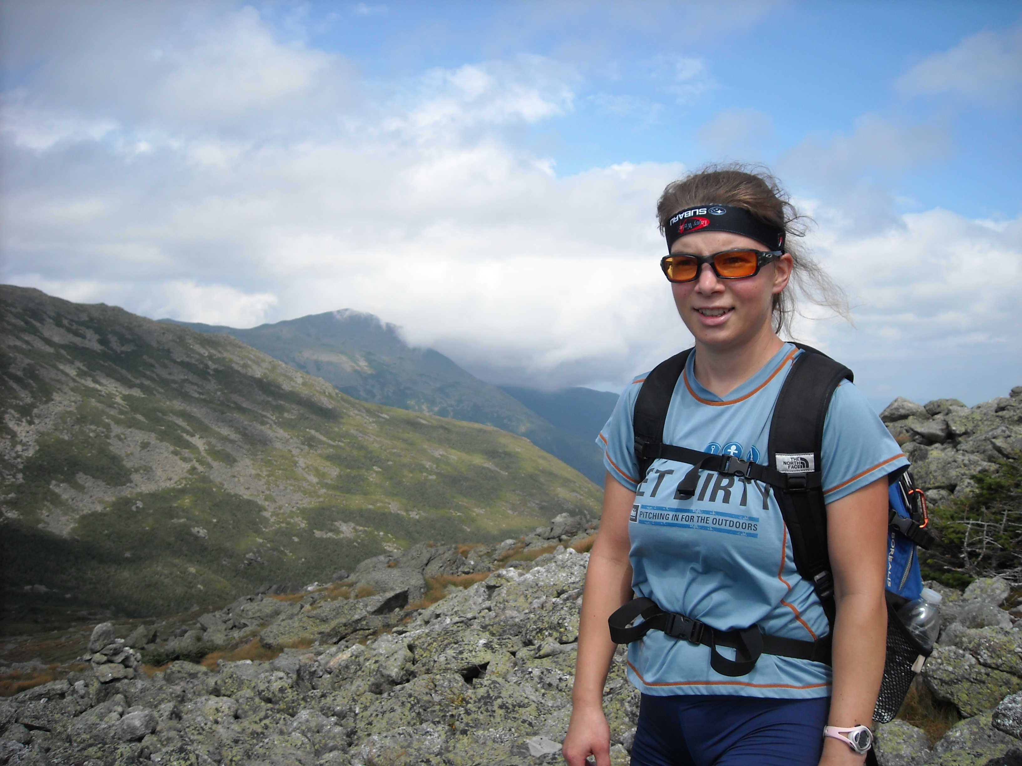
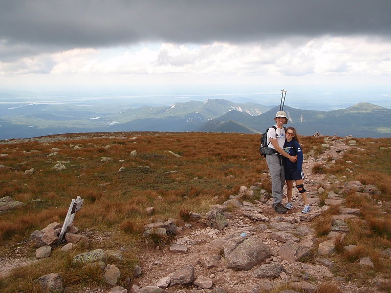
After Adams the trail got flatter with nearly a mile to the Jefferson summit. I’d been looking forward to this trip for months. Everyone said they loved the Whites (name of the mountain range that included the Presidential Range; called the “whites” owing to the color of rock on the top). This stretch of trail was entirely above treeline and I was excited for the views. I envisioned grassy slopes. I thought about sitting on tops of mountains, the sun warming me, a gentle breeze, as I looked down. I imagined hiking along on a wide dirt trail without any rocks that walked more like a newly paved bike trail than a ladder.
Instead of enjoying the views, I spent the entire time looking at my feet, taking tedious steps over large pointy rocks and small rolling ones. That mile between the base of Adams and the base of Jefferson took us an hour. Erik was faster and waited often for me but he quickly grew tired of my complaining about how hard this trail was and how long it was taking us. As my grunts intensified in sound and frequency, he waited for me less often. After skipping Madison and Adams, we were determined to summit Jefferson.
As we descended off Jefferson, we missed a trail intersection marker and mistakenly followed the cairns for another trail which skirts the side of Mount Jefferson and drops down to meet another trail. We realized our mistake and so Erik suggested we just climb up to the parallel trail we had originally planned to take. The slope didn’t look too steep and so I agreed.
But there was a voice in my head saying “Elspeth, what the hell are you doing? You are never supposed to take a shortcut, especially not in the mountains.” I headed up the hill anyway, following Erik, the slope so steep I crawled.
“Hey, let me get a ways above you in case I knock a rock loose,” Erik called.
I let him go ahead while my feet rested on two rocks which I hoped wouldn’t give way. My hands gripped alpine grass. My face was thick in blueberry bushes. I held on tight. It was a steep 2,000 feet roll and tumble down to the valley floor.
Once he was safely above me, I began following my own path up the slope, testing each handhold and foothold, looking for dense tundra plants or rocks embedded in the moss. I used my meager bouldering skills to contortion my body to reach for or make use of those holds. Eventually we made it up to the next trail.
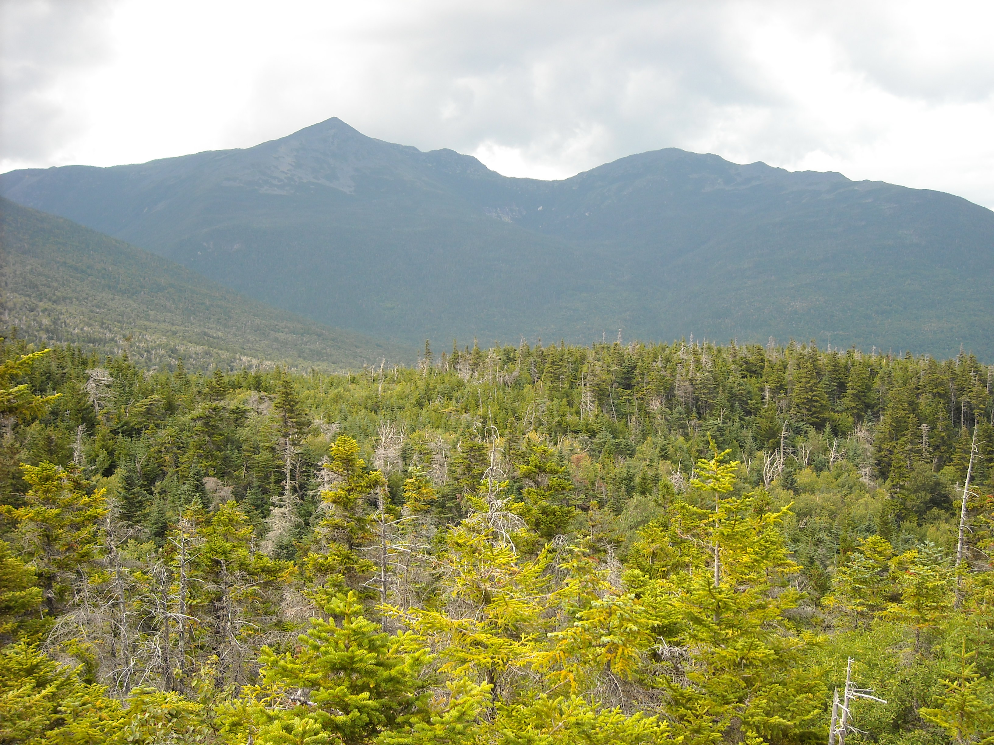
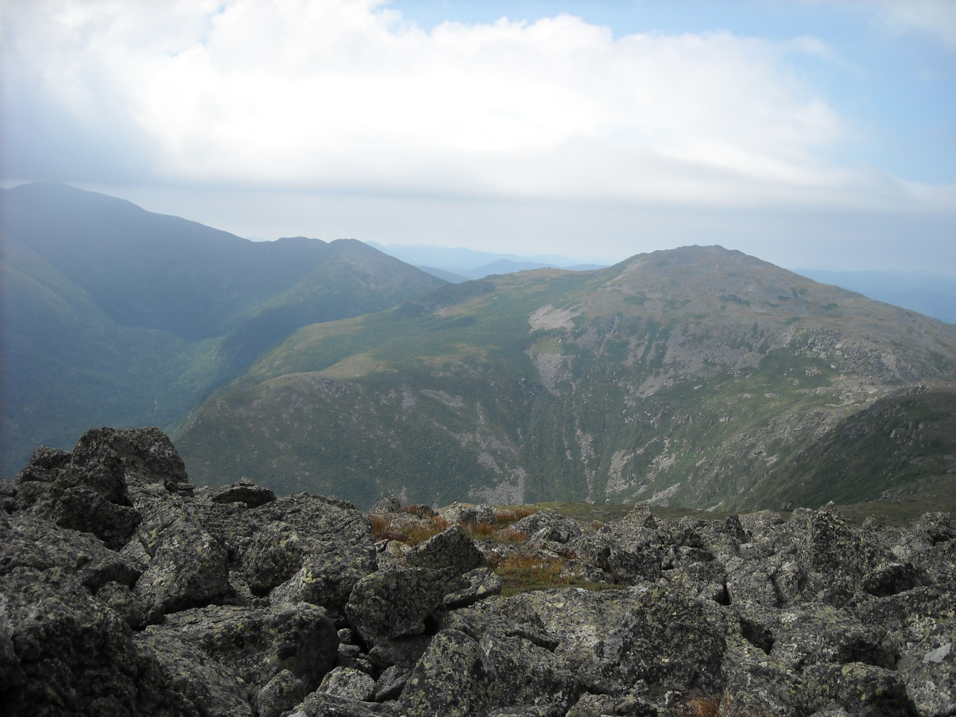
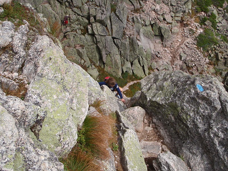
By now we we’re back up on the ridge and a big cloud over Mount Washington swallowed us, decreasing our visibility. We continued on, balancing on the pointed slippery rocks that frequently rolled under us. There wasn’t much of a trail to follow. It was all just boulderfield with occasional blazes – painted markers on the rocks – that we had trouble discerning in the low light without landmarks in the distance. Each footstep was slow, methodical, calculated. We had the option to bag yet another peak, this one oddly named Mount Clay, not one of the presidents, but we didn’t even debate whether we’d go for its summit. It was a foregone conclusion as we silently went around. Erik now stayed closer to me as he scouted the route ahead.
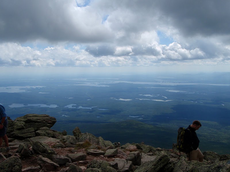
The cloud was so dense that after another hour we stumbled onto the tracks from the cog railway. We hoped the train didn’t move too fast as we couldn’t see more than 20 feet and thus were clueless as to whether there was a train approaching as we slowly stepped over the rails while navigating the boulders. From here we were almost to the summit of Mount Washington but in the fog couldn’t make out the big building on top. We kept going, first side-sloping cautiously on the boulders, then finally faster going as we climbed to the summit at 6,288 feet, highest point in New Hampshire and reputable for recording the highest winds on earth. At least today the winds were mild.
The summit of Mount Washington was frustrating. Everywhere there were people who took the cog railway up or their cars. It was so easy for them while we spent most of the day climbing over rocks. There was no view as we remained socked in. We spent what felt like hours inside the large building on top that doubled as restaurant and museum. Erik wanted to read all the signs. I pondered the futility of our last several hours to sit inside a building and stare at a concrete wall. We didn’t take any summit photos.
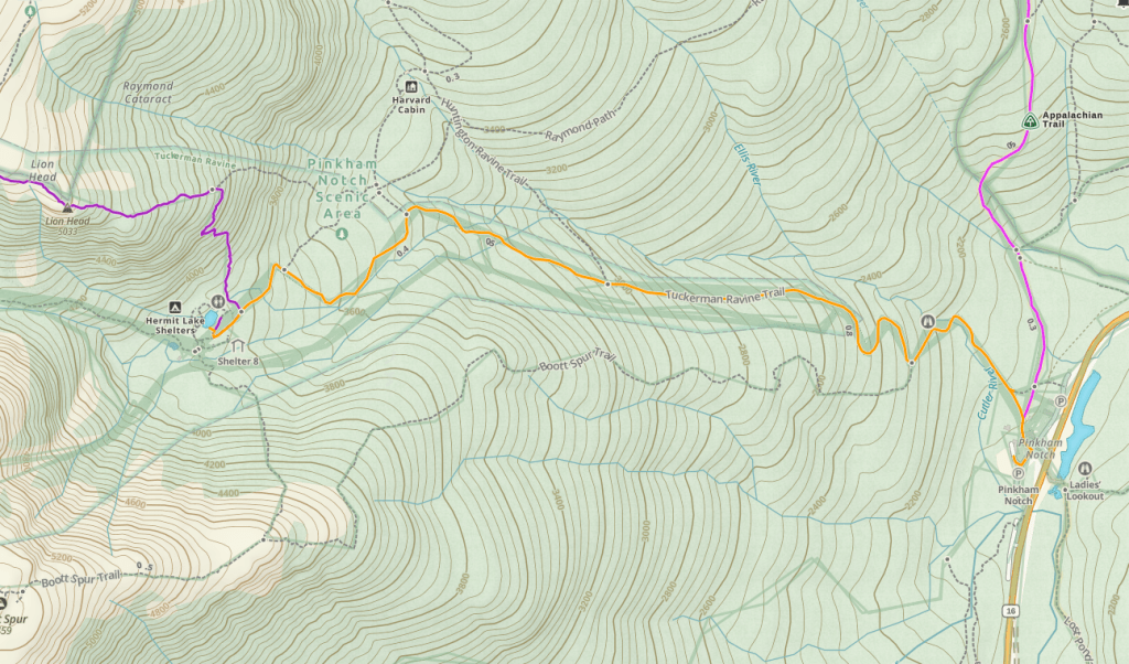
After reading all the signs and getting an updated weather report, Erik and I debated hitching a ride with someone back down to the base but that would be too easy. Without any good views though it felt rather pointless to continue down the mountain on our own power. There was concern about rain, the rocks ware all wet, and we still had to descend to a reasonable camping place. We had wanted to take either the Tuckerman’s or Huntington’s Ravine routes down. These are said to be the steepest maintained hiking trails in the United States and every year because they are so precipitous hikers fall to their death. It’s easier climbing up steep terrain than going down and seeing as the rock was wet, we bailed on the steepest trails and instead descended on the Lion’s Head Trail to the Hermit Lake Shelter.
Despite being the easier option, the Lion’s Head Trail was still plenty challenging with more rocks. Near the crux of the trail, I was downclimbing using my upper body, employing those rock climbing skills, but this time to go down, rather than up. This was difficult and I was immediately glad we hadn’t taken either of the Ravine Trails. By the time we arrived at the Hermit Lake Shelter, it was almost dark. Our day hiking the Whites, 11 miles, had taken us from sun-up to sun-down.
The next morning we hiked back to Pinkham notch on a relatively wide trail – a road mostly – that was still fairly steep and rocky. My quads got tired from trying to hold back my body. Back at the car we packed up and drove to Maine for our next adventure.
On the map the route from our Presidential Traverse had looked so easy. Two miles onto the ridge, eight miles on the ridge, and another mile descent. But I hadn’t expected so many arduous rocks! After Marcy, my introduction to hiking in the eastern United States, I learned the trails were quite steep. Despite this, I somehow assumed Washington and the other Presidents wouldn’t be that difficult. I failed to consider that everyone who said they loved The Whites was from “out East.”
Katahdin
Two days later we were back at it again. This time on Katahdin, Maine’s highest point. The Katahdin Massif includes three peaks: Pamola, the South, and Baxter. Of the three, Baxter is the highest at 5,268 feet. Kathryn, my flatlander friend from high school, was our tour guide. After earning a Bachelors in Geology back in Minnesota, she was now living in Maine, working towards her Masters in Geology. For the last several years she had been working in boulderfields and was adept at rock climbing and hopping.
When we did this trip in 2010, permits were required to park at the Katahdin Trailheads. I believe there was some deal for Maine residents and Kathryn took care of this for us. Permits are still required.
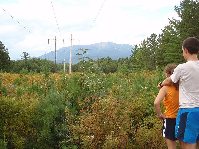
Maine is spattered with a few big mountain ridges. The Katahdin Massif seemingly rises out of nowhere, over 4,000 feet above the valley floor. After our efforts on Mount Washington, I wanted something a bit easier. “It’s only 5,268 feet tall, how hard can this be?” I pondered in reference to the height of Katahdin. The valley sits at 1,000 feet. Kathryn described our route as two miles of relatively flat terrain, then assuming the weather held a steep mile trail she’d never been on, a mile-long traverse of the infamous Knife’s Edge ridge as wide as Kathryn’s outstretched arms which plummets 2,000 feet on either side, a “sketchy” mile descent which then flattens out, and back on our two mile approach trail.
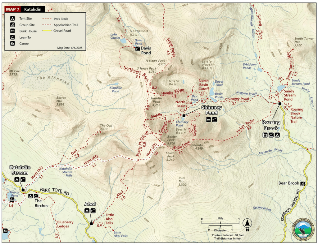
I soon learned the two miles of relatively flat terrain was rocky, like all trails out east, and climbed noticeably. This brought us to Chimney Pond. Then we began climbing a trail called “Dudley,” the steep mile-long trail Kathryn had never been on, which ascends from the picturesque Chimney Pond to the summit of Pamola. Up to this point in my life, I’d never been on a “trail” that resembled anything like Dudley. Growing up in Minnesota, I liked hiking on the wide state park trails. Sure, there were hills, but I never once thought about using my hands.
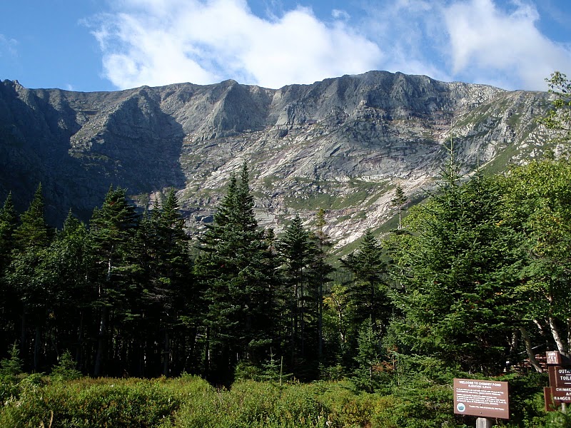
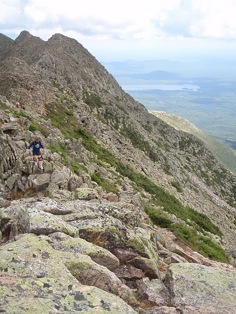
As we turned south onto Dudley we traversed a boulderfield with giant rocks that I had to contort myself around. Then the trail climbed, not on firm ground, but on large rocks. Really big rocks. Every step brought me a foot farther above the valley. Initially we were in the trees and protected from the wind but soon we were above the canopy. The wind pushed hard on us. I focused on the rock in front of me. Erik and Kathryn were well above me, both having longer limbs and more climbing experience. I felt for each hand hold, preferring big ones that I could wrap my palm around, and looked down to secure my foot holds.
I felt like the wind was going to blow me off the mountain. Every five minutes I came to a new wall with few hand or foot holds and spent considerable time figuring out how I was going to meet this next problem. I had bouldered in an indoor cave but that was much different with plastic holds. Now I had granite. I tried to reach my hand to the top of the rock but sometimes it was out of reach. Each time I figured out a way to get my body to the next level. I was using every bouldering move I’d ever learned and devising more. I hoped the route down was going to be easier. The vastness of the land around us was now in view and a constant reminder of how far the fall would be back down to the valley. As I continued bouldering up the mountain the moves got harder, the wind stronger, and the valley farther away. I wanted to have a meltdown. I wanted to stomp my feet and cry and scream “I want a fucking top rope,” but the boulders left little ground for stomping and the exposure from the sun and wind and cold and the fear of becoming paralyzed by vertigo kept me climbing higher and higher.
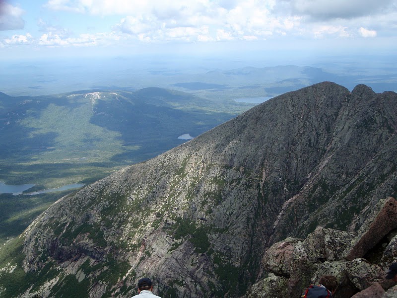
Finally I reached the summit of Pamola. Kathryn and Erik were waiting for me. Dudley climbs 2,000 vertical feet in a mere mile. Yet, it is not the steepest maintained trail in the United States. That honor goes to the route up Mount Washington through Huntington’s Ravine. Perhaps I’d attempt that in a future lifetime.
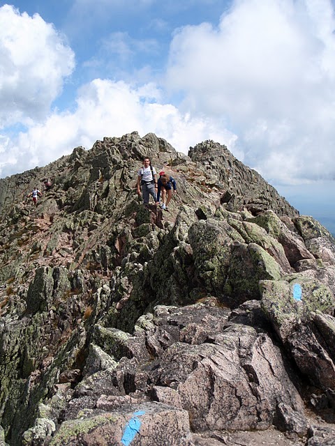
With my knees still shaking, we next conquered the Knife’s Edge. The route began with a few bouldering moves down from the Pamola summit and then required more bouldering to climb an adjacent point. From there the going got easier. When Kathryn first described the Knife’s Edge to me I envisioned a dirt path, five or so feet wide, with 2,000 foot ravines on either side. The real Knife’s Edge was lots and lots of jagged rocks without flat surfaces. I’m timid on these surfaces where a misstep carries a significant danger of strained ligaments and broken bones, not to mention falling over the edge. Hence I was reduced to crab walking much of the mile to the Baxter Summit. At least it was a bluebird daily and there was no threat of a thunderstorm.
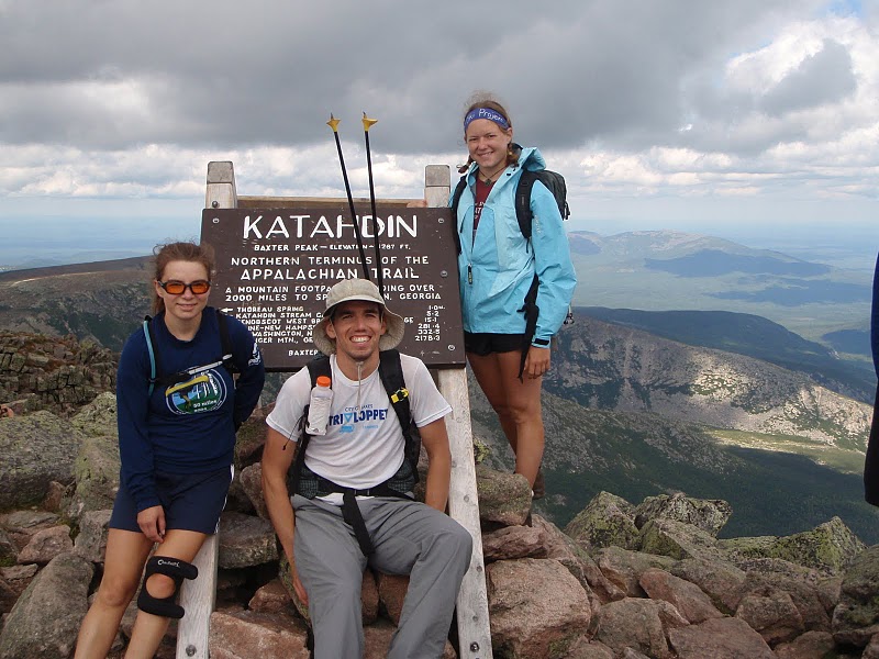
After an hour of focused effort, we arrived at the summit of Baxter. Finally I could sit and take in the view, although I was apprehensive about the route down. Unlike being on top of Mount Washington, Katahdin has no road to the top so it was nice to be with only those who had earned this mountain, climbing it on their own power.
Fortunately the route down involved no boulderfields or even any bouldering maneuvers. It was almost like eating cake. Well, not quite. It was still steep gravel but I got into a good rhythm following Kathryn, largely let myself go, and developed a sizeable lead on Erik. The final two miles, now descending, were much less taxing than climbing, and we arrived back to the car by mid-afternoon, feeling accomplished rather than defeated.
Dudly was the most intense route I’d ever done between the exposure and the bouldering. And I sure was surprised to find it in Maine. Perhaps it would finally abolish my idea of a hiking trail as a flat dirt path and I would give hiking in the east the real respect it deserves. I put forth an insane amount of gumption that left me mentally exhausted as I was pushed beyond my limits, but proud as well, and would give me good experience for my future state high points.
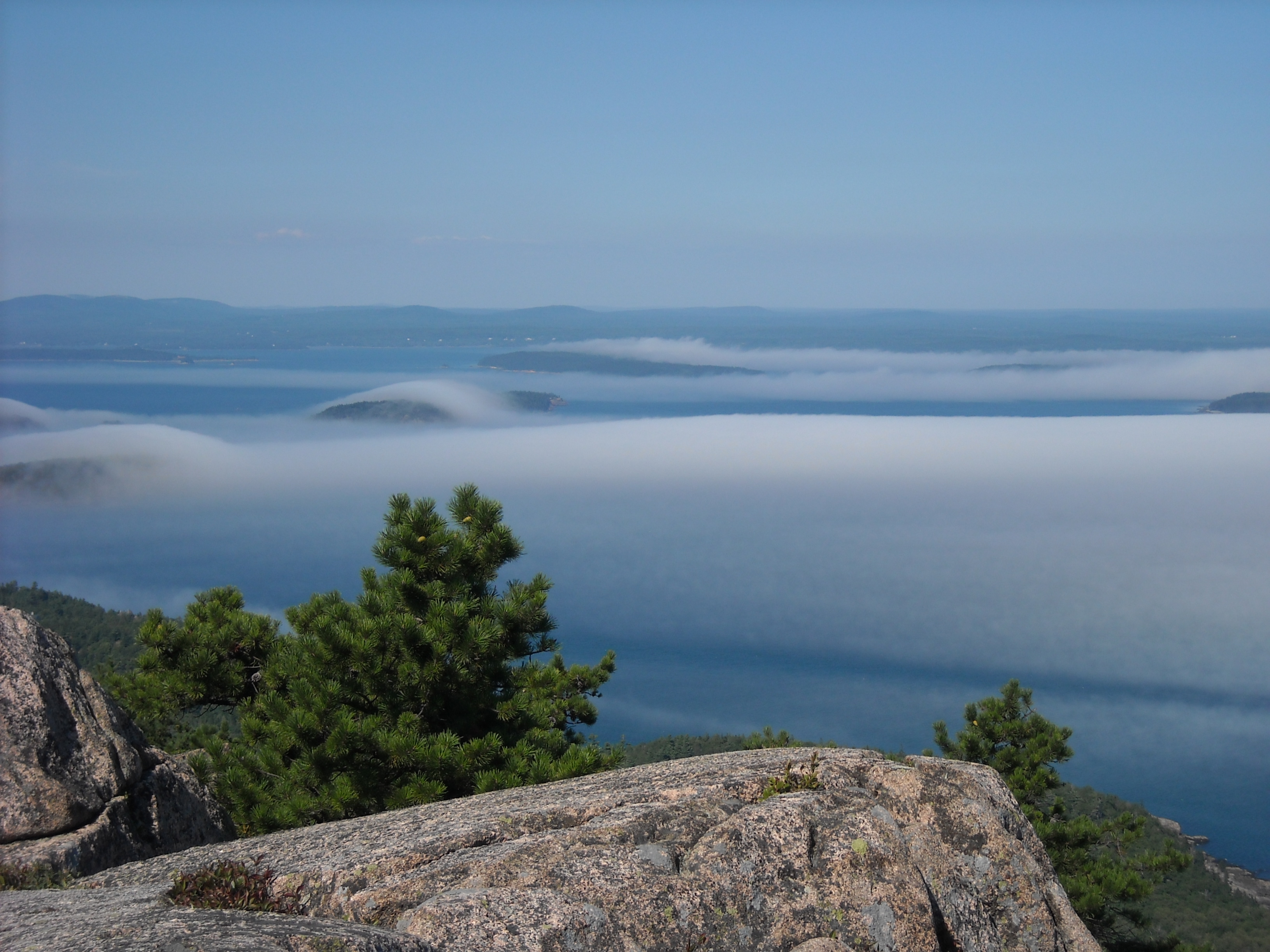
Acadia
I’d never been to the ocean before and so at age 25, we went to Acadia National Park and I got my ocean fix.
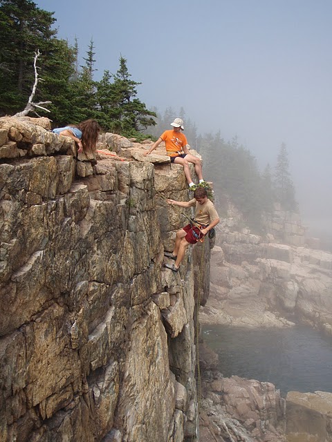
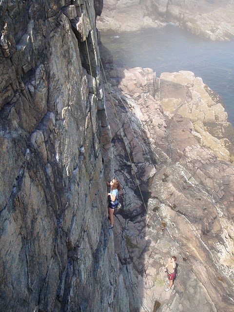
Kathryn joined us with some rock climbing gear and we did an easy 5.6 route as I’m not much of a climber.
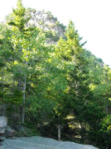
Then we “hiked” the Beehive. It was kind of like Dudley but with much less exposure and cables to hang onto.
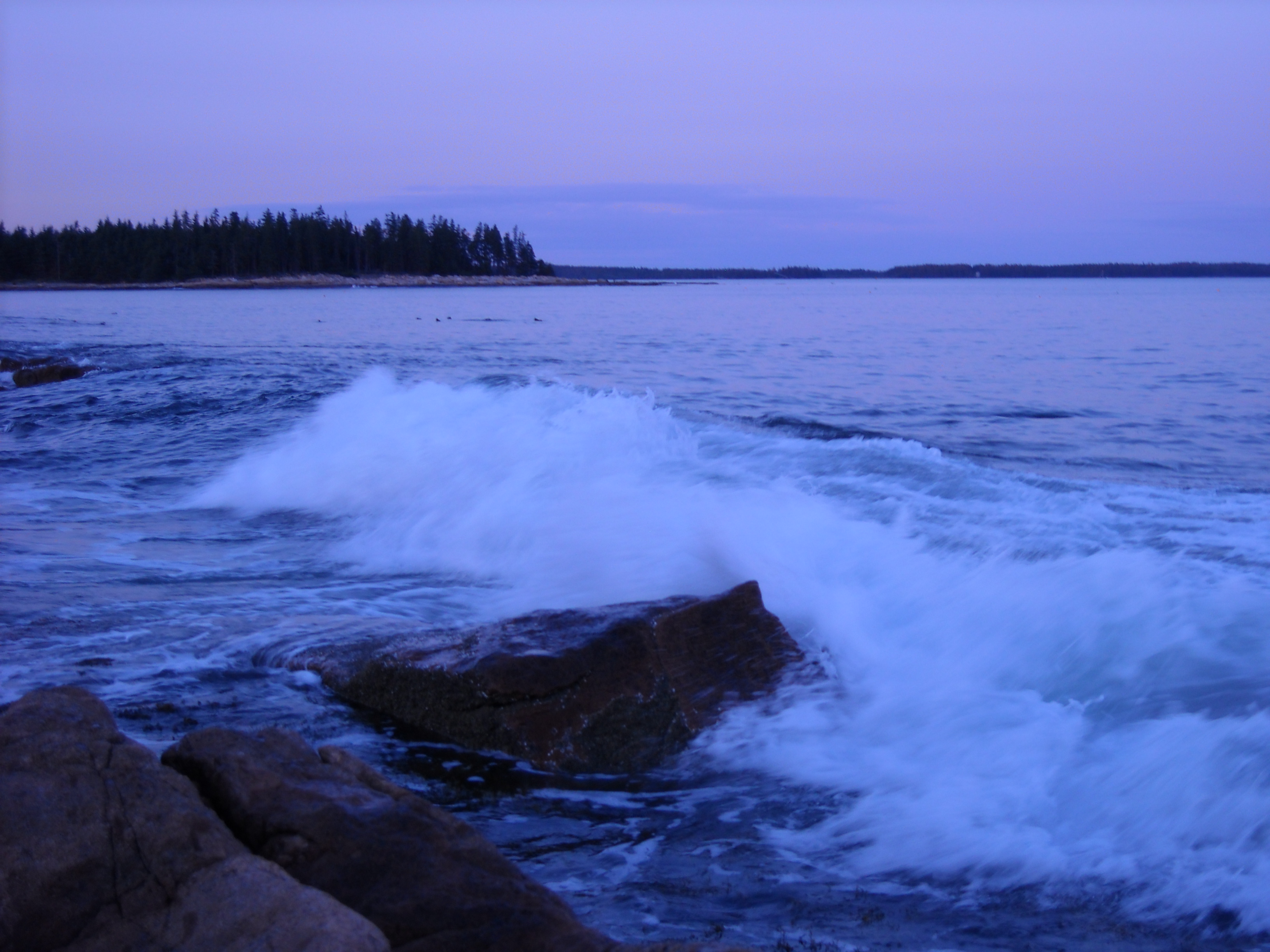
Erik and I tented at the Seawall Campground. It was close to the ocean and so we spent our evenings checking out the waves and tide pools and smelling the salty air.
If I had to do this trip again: I would have had different expectations for our Presidential Range Traverse. I suppose the only way to get experience is to try (and often fail) and practice and keep doing it again and again. I gained just a little of that on our traverse day and it has paid dividends for more adventures to come.
Best Decisions: Going to Maine when my friend Kathryn lived there so she could serve as tour guide. That and allowing some time to smell the ocean air, swim in the ocean, and just spend time by the water.
Next time: I don’t think I’ll go back to Katahdin. It was simply one of those “best days ever” between good weather, a challenging route, and being done by dinner. On the other hand, I don’t think I’ll feel quite satisfied in my life without doing the Huntington and Tuckerman’s Ravine Trails so those remain on the bucket list.
