
Soon after moving to upstate New York, my husband and I learned about the 46ers – the 46 peaks above 4,000 feet in the Adirondacks. Technically, it’s the 46 peaks initially deemed to be above 4,000 feet. Subsequently three have been to be found just under 4,000 feet (but these still count) and one additional peak was found to above 4,000 feet (this one doesn’t count). As both a goal-oriented person and someone who wanted to climb mountains, I thought we should get after the list.
There were a couple problems though. We lived a solid five hour drive from the heart of the peaks and as a nurse, I would spend most of my weekends working over the course of the four years we lived in New York. This greatly limited our time to get these done. And, as we’d discovered when doing our first 46er, the tallest, Mount Marcy, these were hard earned summits.
That didn’t stop me from trying and so in the summer of 2009 we found four days to do a few of the 46ers.
7 Adirondacks 46er Outliers
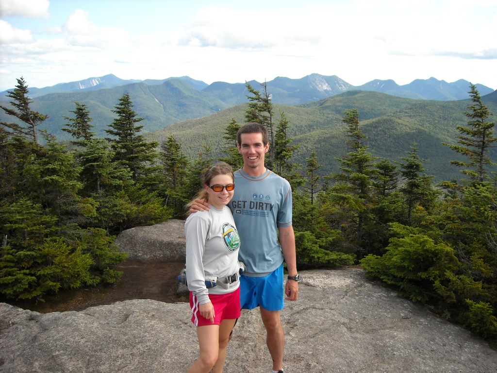
Day One: 8/7/09: Porter and Cascade Mountains
We left our home in Rochester and headed up to the Adirondacks. Our first stop was the Cascade Mountain Trailhead to hike Porter and Cascade Mountains. Compared to some of the trails in the Adirondacks, we found these relatively well-maintained and not quite as steep or challenging and we made good time. There was even a splendid view.
We spent all three nights at a privte campground in the Keene Valley where it was nice to establish a base camp.
Day Two: 8/8/09 Street and Nye Mountains
If the previous day was relatively easy and rewarding, this day was not. There were wet sections of trail, stream crossing, crawling over downed logs, and alas, absolutely no views! It was a day hiking in the forest.
Day Three 8/9/09: Esther and Whiteface
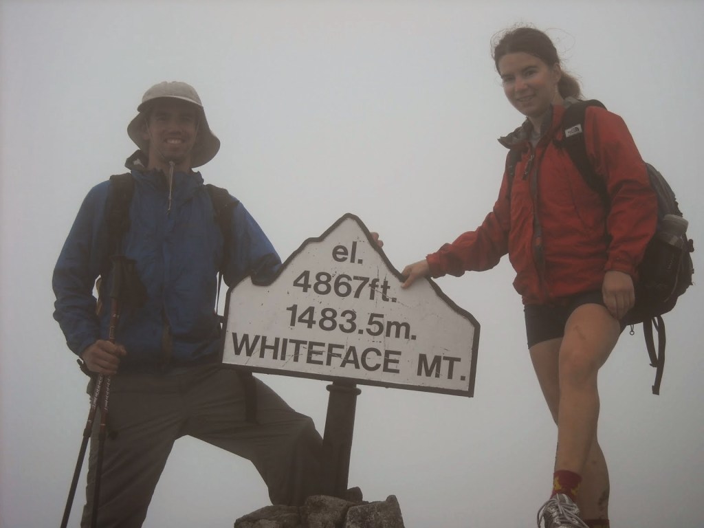
Next up we encountered quite the debate about whether or not it counted to drive the road up to the top of Whiteface as opposed to taking the hiking trail. Whiteface is the only 46er with a road to the peak. Erik reasoned that by convention we take a road to some place near every summit so therefore it counted.
Eventually we settled on driving to the last switchback on the road up Whiteface where we took the hiking trail to Esther. Initially we had to hike downhill, then back uphill to gain the summit of Esther. Along the way there was a very small view from which we could see Whiteface.

After hiking to the top of Esther, we re-traced our steps back to the car. I wanted to hike to the top of Whiteface and so I did that while Erik drove the car up to the summit. I did agree to a ride back down in the car, especially seeing as by then the weather had turned rainy.
Day Four 8/10/09: Big Slide
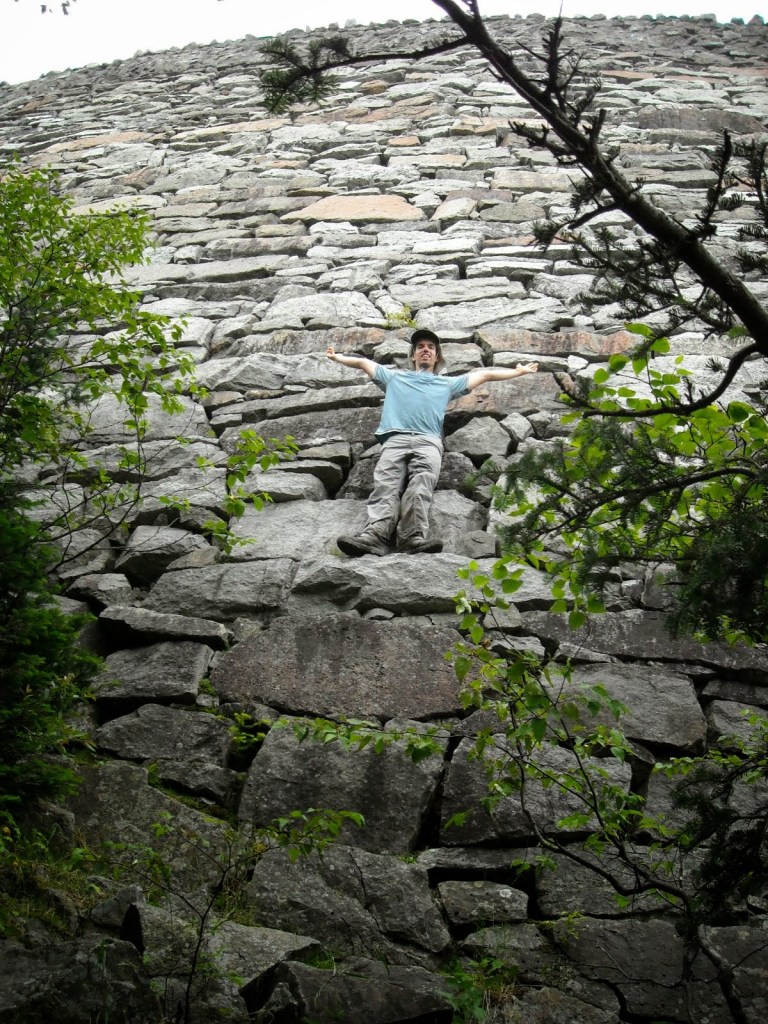
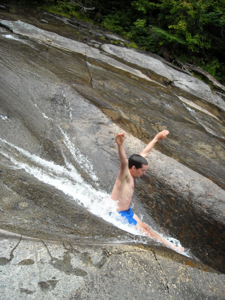
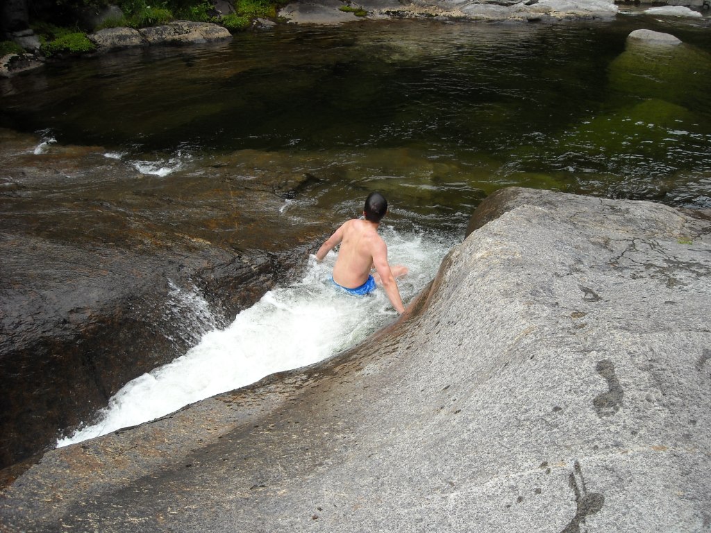
The Adirondacks humbled me like few things or people ever have. On paper (map that is), the distances look so short and so of course it seemed reasonable that we should be able to do a loop hike of Big Slide, Gothics, Armstrong, and Upper and Lower Wolfjaw Mountains. Of course, in reality, Big Slide sits well over 2,000 feet above the trailhead. To do the loop, we’d have to drop almost 2,000 feet down to the valley before ascending another 2,000 feet to the ridge of the other four mountains. Add to this very steep trail and some exposed slick rocks, and, well, after our other hikes, we simply decided on just doing Big Slide and then dropping down to John’s Brook where we found some natural waterslides.
It began as a wet day and so on the final pitches of Big Slide we encountered some slippery slabs. Fortunately they were drying out a bit by the time we made our descent. It was still a big hike, and then we had a drive back home.
Backpacking the Adirondacks
Two years later, in 2011, our friend Bjorn from Minnesota joined us for a backpacking trip in the Adirondacks. I strung together a route that would include some of the more iconic 46ers that we hadn’t yet done. By now the likes of us ever becoming 46ers was diminishing, especially as we planned to move away from New York and would prefer vacationing to the bigger mountains out west rather than the forested Adirondack peaks.
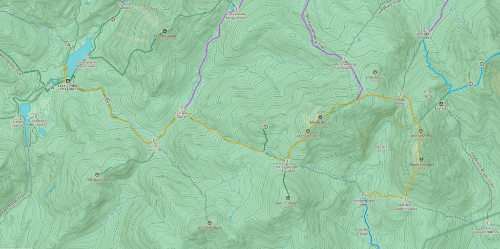
Day One: 8/21/11: South Meadows to Slant Rock
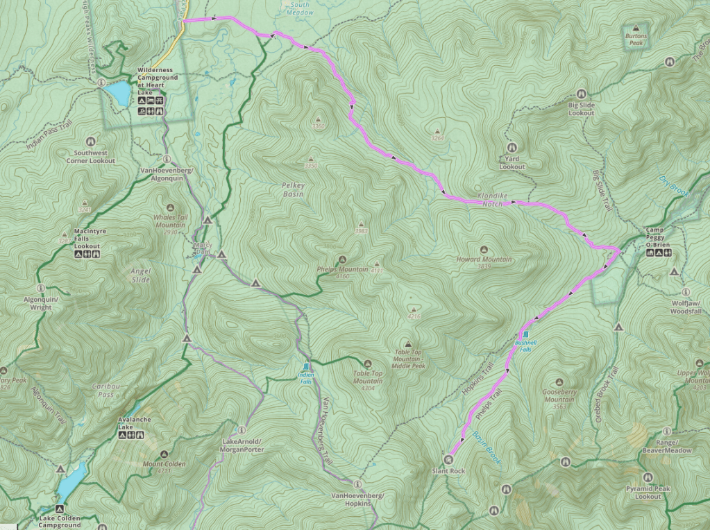
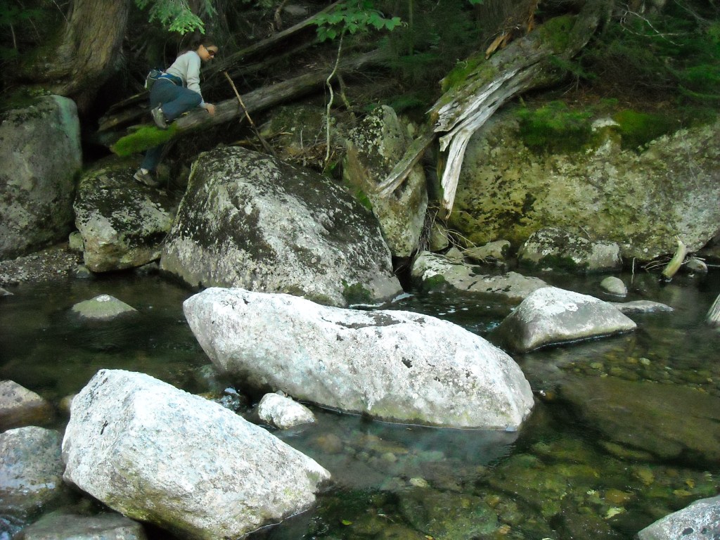
One of the nice things about backpacking the Adirondacks are that many campsites offer three-sided shelters. This is particularly helpful if it’s raining which the forecast for this evening and night predicted. We didn’t start hiking until near noon due to drive time. The weather threatened rain as we started out. We came upon Bushnell Falls. It was a steep hike down to look at the falls and I decided it wasn’t worth it. But Bjorn headed down there and captured a photo for us.
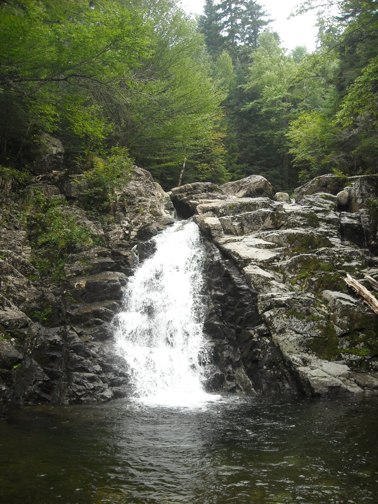
Then we kept hiking at a brisk pace given the threatening weather. We were hoping to make it to the Slant Rock lean-to before it started raining. Indeed, we got there right about the time it started raining. Or at least, we got to the general vicinity. For a few hurried minutes we did our best to locate the lean-to, but it proved too difficult to find and we surmised it was missing altogether.
Given it was raining, we settled in under Slant Rock to cook dinner and hang out. It was still raining a few hours later. Erik was nice enough to go out in the rain and set up our tent. And so we went to bed, disappointed we didn’t find the lean-to.
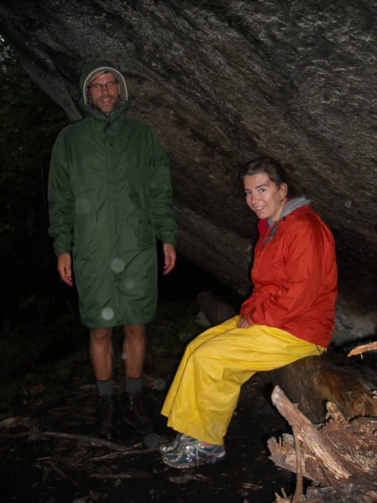
In the morning it had stopped raining and as we packed up camp and started hiking, we incidentally found the lean-to.
Day Two: 8/22/11: Basin, Saddleback, and Gothics
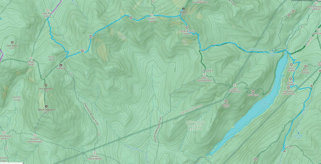
Today’s ridge route included some of the more iconic 46ers. I’d also heard there were some cables up there. Hence I was ready to get an early start and get some climbing in. And climbing we did as we gained the ridge.
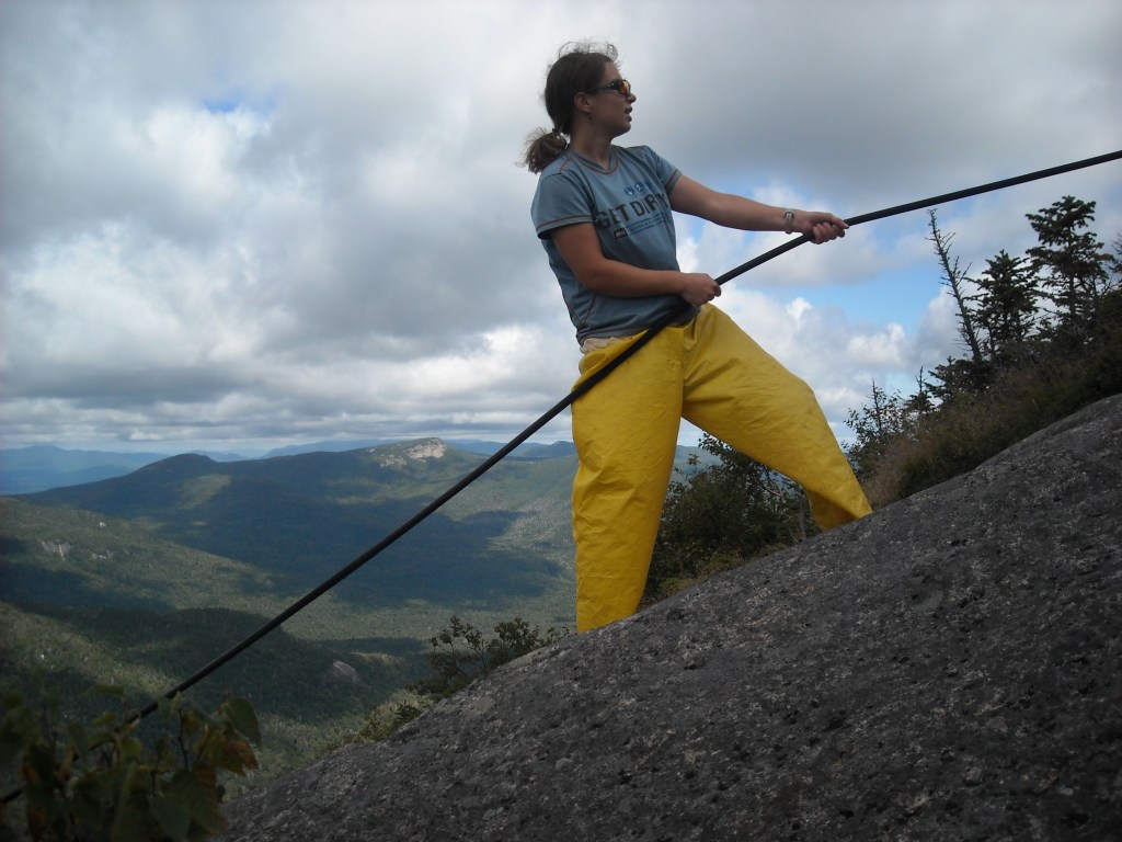
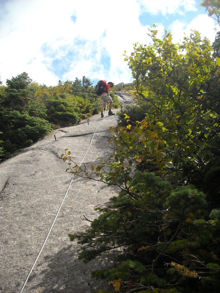
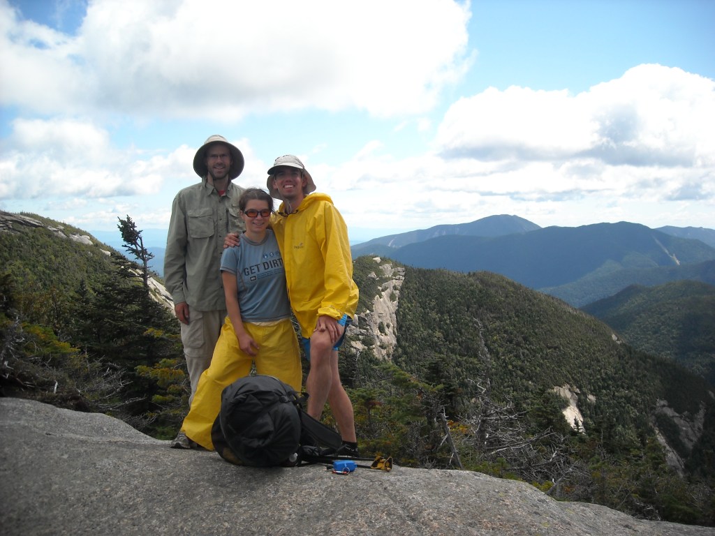
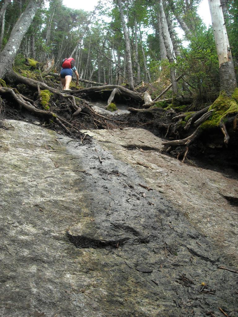
Despite being only 8 miles on the day, a distance I usually cover running on pavement in a little over an hour, this took us about 8 hours. It was steep up, and steep down. OK, like really really steep up and down. Not like Grand Canyon up and down on switchbacks suitable for horses, like no switchbacks and loose and so steep we were often slipping out.
Day Three: 8/23/11: Nippletop, Colvin, and Blake to Panther Gorge
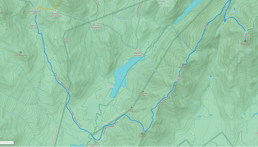
I’ve learned that expectation is everything and I full on expected this day to be a bunch of steep, rooty, rocky ups and downs and it certainly didn’t disappoint.
We had to get to Blake Peak since our Minnesota friend, Blake, had been with us on that first surprising Mount Marcy summit. It certainly didn’t disappoint in difficulty or view. There was absolutely none of the latter from the summit.

It was late afternoon by the time we stumbled into camp at the Panther Gorge area. The river was a little ways below the campsites but otherwise the camping area was nice and open. The weather was good and we set up our tents and got to cooking dinner.
Day Four: 8/24/11 Haystack and Marcy to Lake Colden
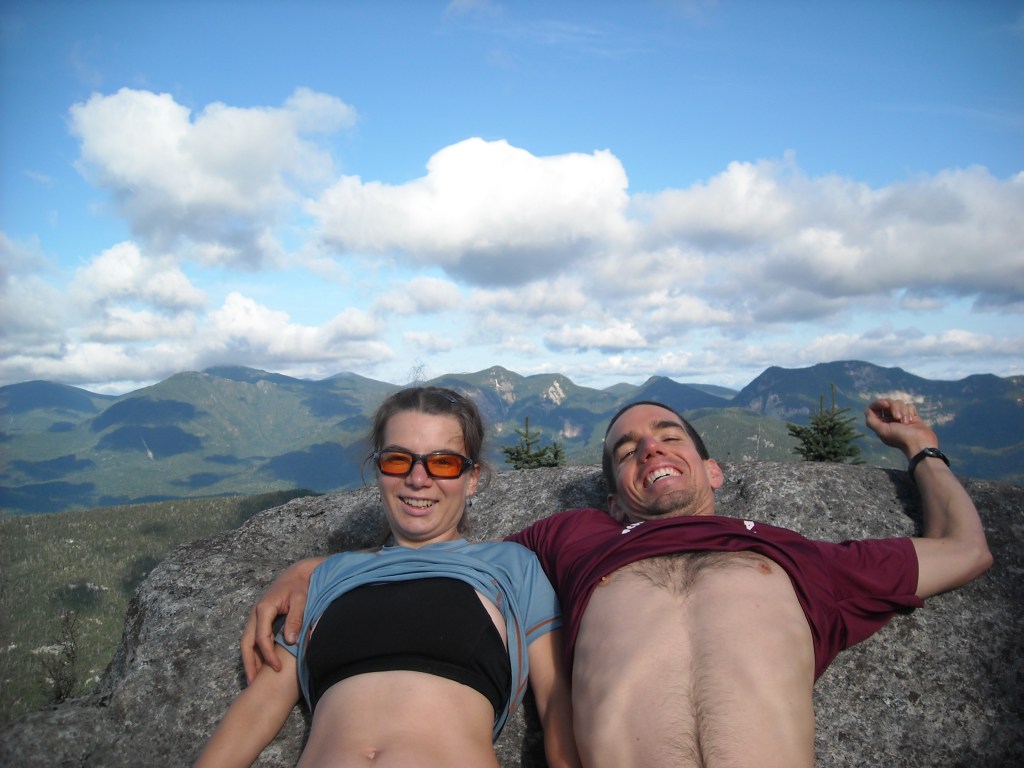
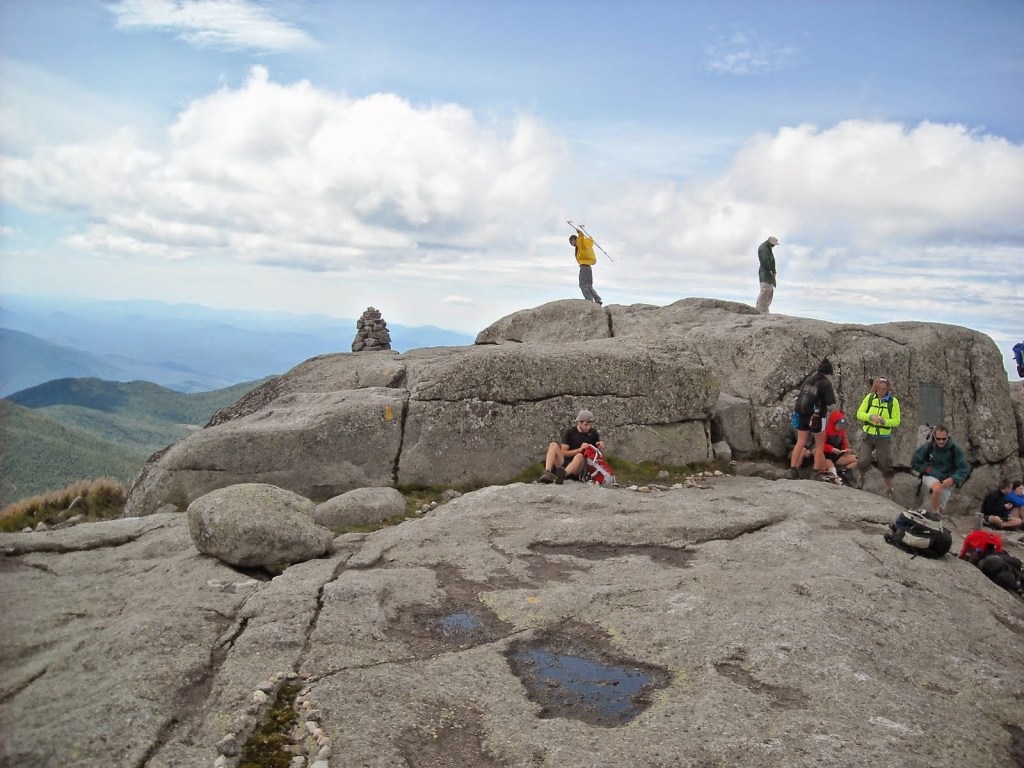
Even though Erik and I had previously done Mount Marcy, Bjorn hadn’t and we figured it was a good enough view that we ought to do it again. To continue with our loop, we first headed up over Mount Haystack. The trail was of course, ridiculously steep but it was short enough. From here we proceeded down and then up Little Haystack and caught more good views looking to Mount Marcy. We dropped down to the col and then began our ascent of Mount Marcy.

It was fun to see the bog again that had surprised us three years before on our first summit of Mount Marcy. Once we got to Mount Marcy, we took a good view break. It was really windy and so we all played with leaning into the wind at usually impossible angles to maintain standing.

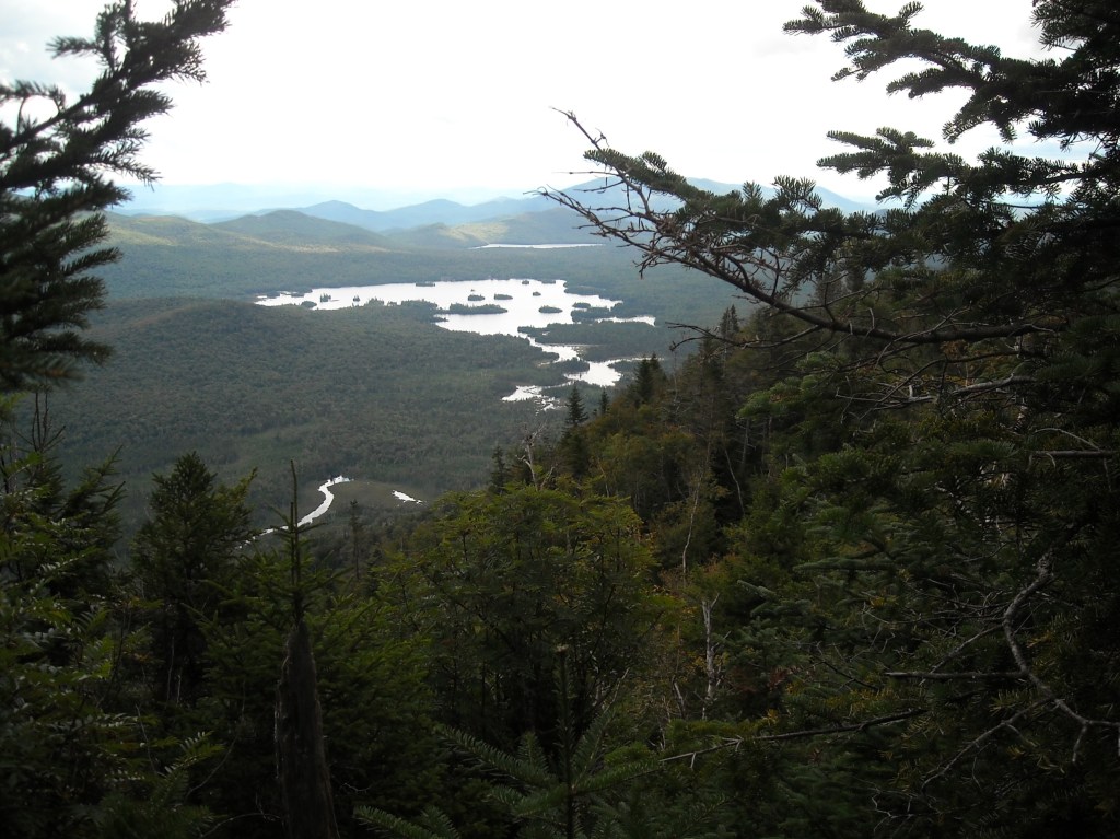
After our break, it was back to steep business, descending the slabs and then boulders on the trail off the backside of Marcy heading down to the junction with Mount Skylight. I knew better than to take the out-and-back trail up Mount Skylight, even if it was only an additional 500 feet of vertical. So we turned northwest, hiking along Elk Lake – Marcy Trail that was so so ridiculously wet so I took my time, stepping between boulders, trying to keep my feet dry and occasionally there were even some logs to go over or under.
Then we proceeded on to Lake Colden where the trail was more of the same: wet, and so I slowly and painfully made my way along on pokey rocks and slanted hillsides, to keep my shoes dry. Finally, we made the three-sided shelter at Lake Colden, found it empty, and called it ours for the night.
Day Five: 8/25/11: Up Algonquin and back to the car
We woke to cloudy skies and visited with the ranger at the outpost. She said the forecast called for rain and high winds up on the summits. The plan was to climb Algonquin (well, and per usual, to try to bag a couple others like Iroquois and Boundary) Even though we were likely to be in the clouds and have no view, Bjorn was determined to climb Algonquin. I didn’t want to let a summit get away from me AND if Bjorn was going, well I should, too. The other factor in my decision was that if I took the “flat” way out, the trail was likely to be tediously difficult with many rocks and boulders and even some down trees obscuring the path, not to mention that the muddy low spots of the trail would be water-logged that sometimes just going up is easier (although not back down).

As we diverged from the trail that headed towards Avalanche lake and we began climbing, the trail was cairned up a waterfall. I would have previously thought this absolutely ridiculous, but now I accepted as normal for the Adirondacks. From here the trail continued climbing precipitously and it wasn’t long before we had gained our 2,500 feet for the day and arrived on the incredibly windy and foggy Algonquin summit. Fortunately there were cairns so we could follow the trail.
At the summit we ran into a ranger whose glasses had blown off her face. She was headed back down the mountain as soon as she could find her glasses. We left before she did without taking any photos. The hike down was again incredibly steep. I went slowly, holding onto the rocks and roots and carefully placing each foot step, trying to get into a rhythm. We were all wet and somehow I was buoyed knowing that we’d be browsing some shops in Lake Placid for a couple hours before driving to Vermont to do Mount Mansfield.
Mount Mansfield
I’d made plans to camp at Underhill State Park and so after we got done with the Adirondacks, we took the couple hour drive. By now it had stopped raining and the sun had even come out which made camping and setting up our tent so much nicer. We chatted with the ranger about which route to take up and down Mount Mansfield (there are several) and he suggested for the way up the trail that gains the summit ridge between The Nose and The Upper Lip (this trail was called Halfway House) which was steeper and the “gradual” Sunset Ridge Trail for our return trip.
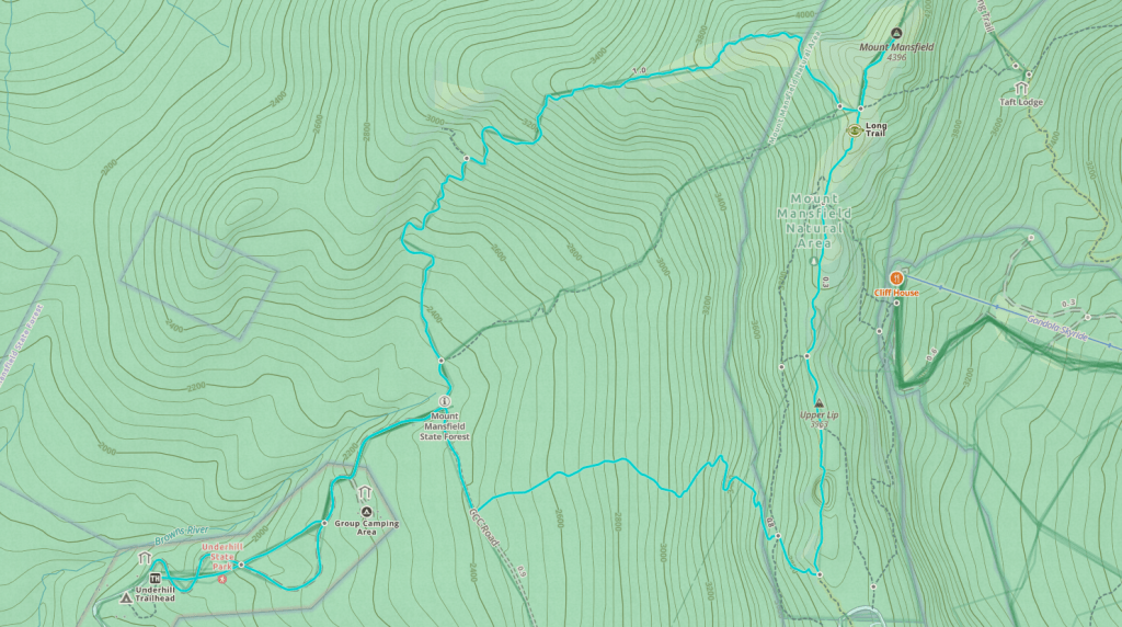
In the morning we got up early and began our hike which initially paralleled a road and then became the road. Soon enough we turned off on the old CCC road for a bit before starting on the Halfway House Trail. This was a steep go, no switchbacks, and eventually, we got to a cliff section. The trail went up this, of course, and so we scrambled up, Erik having to help me a few times with some of the bigger moves where big wingspan would’ve been an advantage.
Once breaking out of the trees, we gained the long ridge of Mount Mansfield with multiple false summits (from south to north these are named after features on the face, starting with the forehead and ending in the actual highest point, The Chin). We hiked north, up and down, until finally, we got to the very top. It was time for lunch but the flies were horrendous. It was a bluebird day and the summit was busy, including some people who were hiking Vermont’s Long Trail. Even after finishing lunch, the flies were buzzing around like crazy and made it hard to appreciate the view. I wasn’t having it so started heading down ahead of the guys.
As I headed down the “gradual” Sunset Ridge Trail, it cemented that these people from out east are truly crazy. The trail dropped 1,000 vertical feet in a mile. Hence, I was frequently using my hands to grab onto rocks and trees to ease myself down big drops. My brain certainly would not call this gradual. I went slowly and before I was off the trail, the guys had caught me.
We hiked back to camp and that night had a well deserved campfire and celebrated our last night of adventuring.
If we had to do this trip again: Had I not already been indoctrinated into hiking out east (Mount Marcy the first time and Mount Washington and Kahtadin), I can only assume that this trip would have been absolutely miserable for me. Hence, perhaps this is more of a “best decision” but I’d advise day-hiking before committing to a longer backpacking route.
Best decisions: Given the difficulty of the trails, relatively low mileage days and skipping a bunch of extra summits.
Next time: Now that we live in Minnesota, we much prefer to avoid the traffic and drive west to the mountains, usually to the Wind River Range in Wyoming. After gaining much more mountain experience, I’d be curious to go back to the Adirondacks again, maybe like once, to see if they really truly are so wet and technically difficult.
