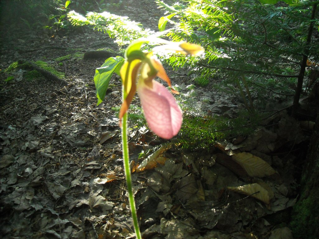
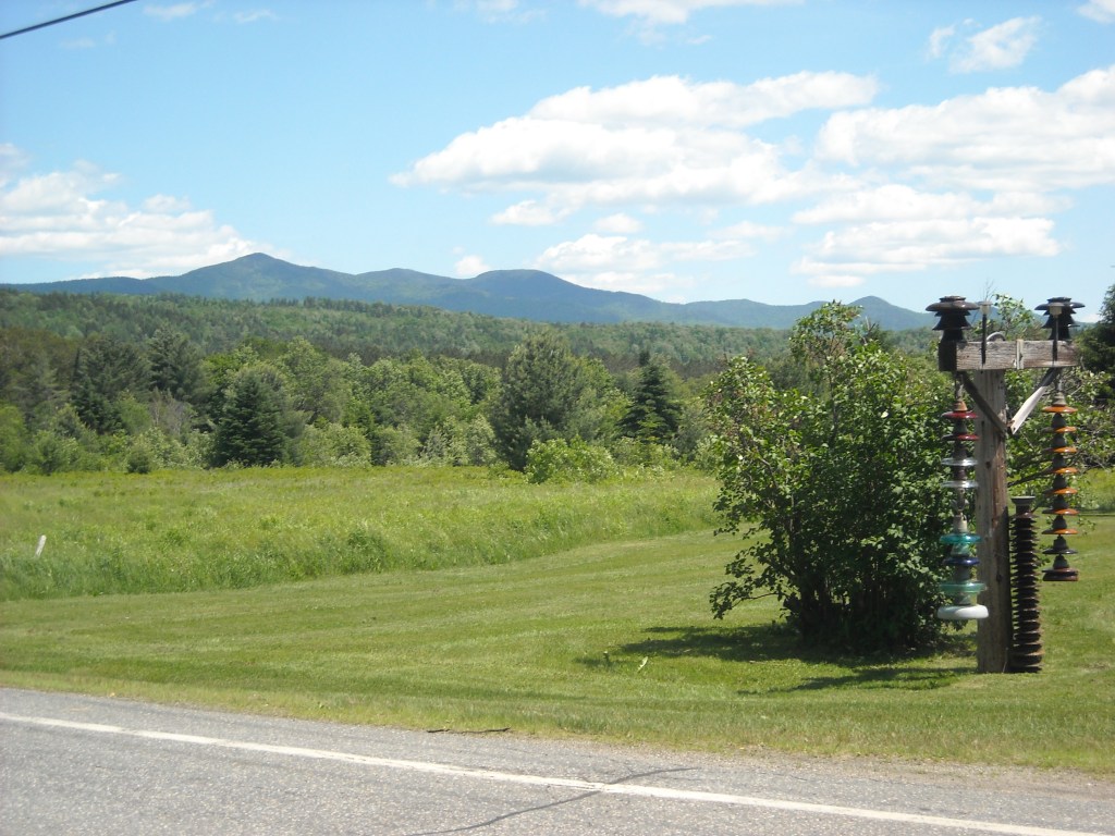
Around 2007, back when Erik and I were dating, we loved going to the Midwest Mountaineering Outdoor Adventure Expo and there we learned about the Northern Forest Canoe Trail (NFCT). A few years later, after doing Minnesota’s Savanna Portage (link is to my book where that story resides) and our “canoe to the ocean trip-” 470 miles from our apartment in Rochester, NY to the Chesapeake Bay via the Erie Canal, the Finger Lakes, and tributaries of and the Susquehanna River- we began seriously thinking about the NFCT.
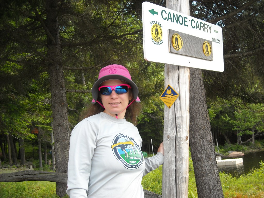
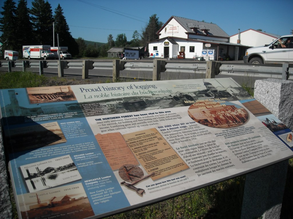
Touted as 740 miles in length, the NFCT links historic waterways from Old Forge, NY to Fort Kent, ME. It passes through pristine wilderness, towns, and rural communities on rivers, lakes, and portages in New York (147 miles), Vermont and Quebec (174 miles for both), New Hampshire (72 miles), and Maine (347 miles). The NFCT publishes 13 maps of the route and an official guidebook. While section paddling makes the most sense, with mostly downstream paddling, we decided to thru-paddle which meant significant upstream paddling.


This blog is merely meant as a trip report. In the ensuing decade since our trip, the NFCT has made significant upgrades along the trail so we would suggest purchasing up to date maps and the latest guidebook version as well as Katina Daanen’s Northern Forest Canoe Trail Through-Paddler’s Companion guidebook.
Given that the NFCT takes about a month to complete, Erik proposed that when I finished my Master’s of Nursing in 2012 and we were planning to get new jobs and move back to Minnesota from New York, we take the summer off and first do the NFCT and later hike the John Muir Trail. It took me some convincing, but eventually I agreed and never looked back.
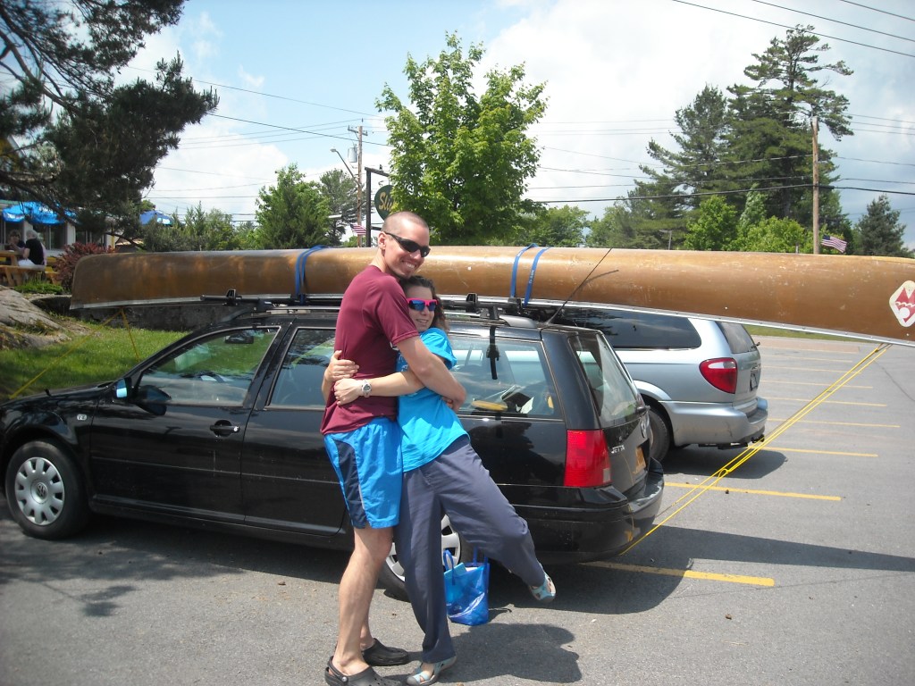
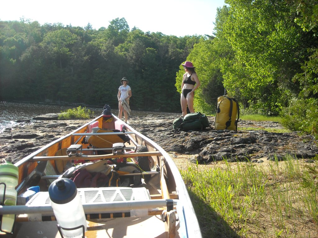
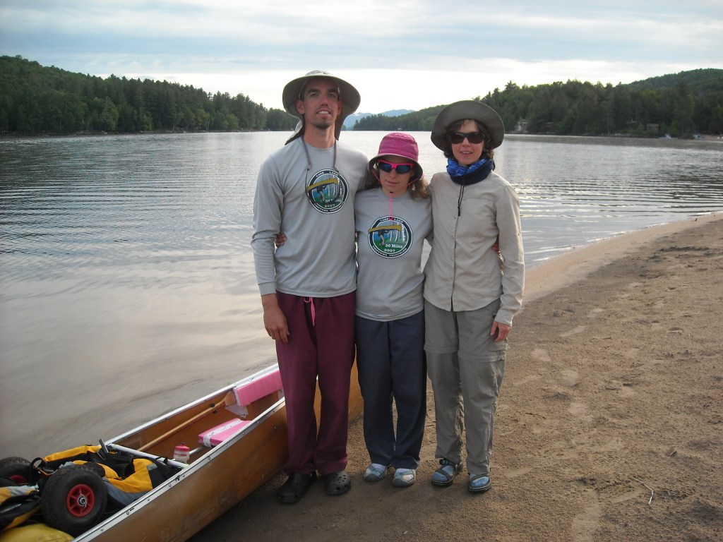
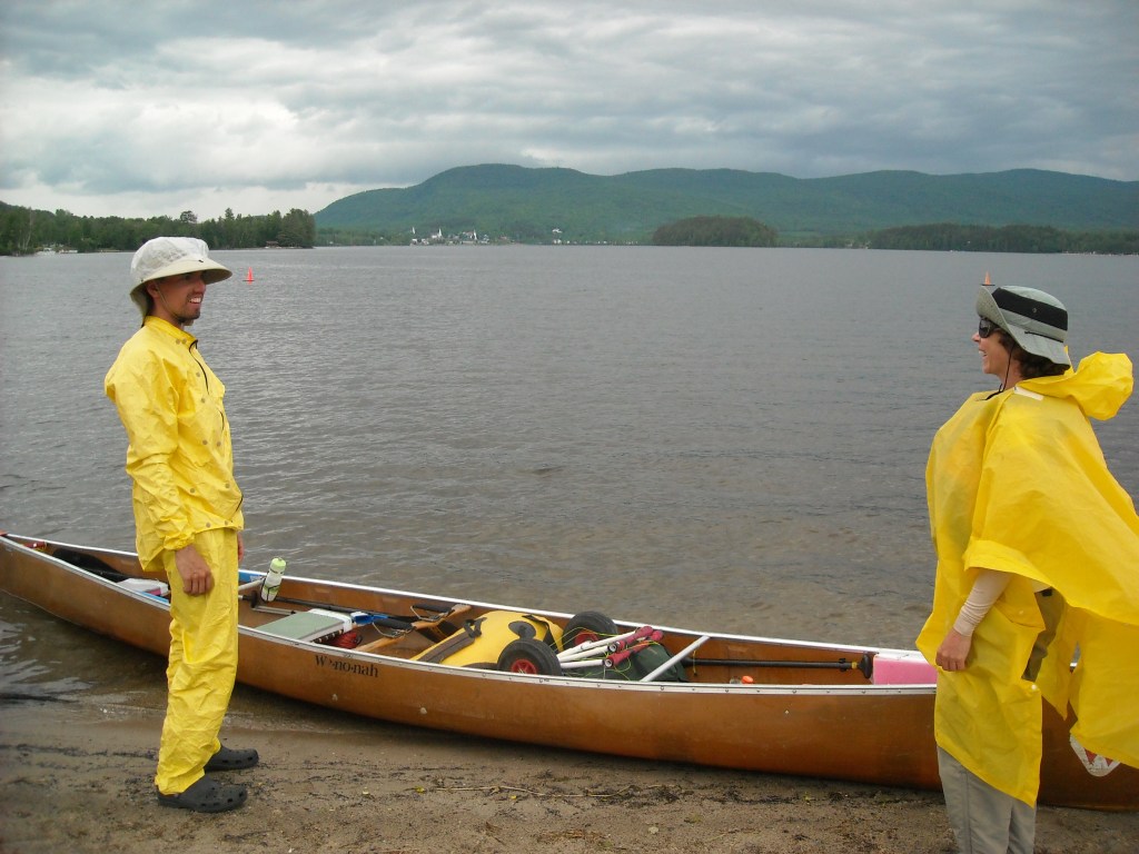
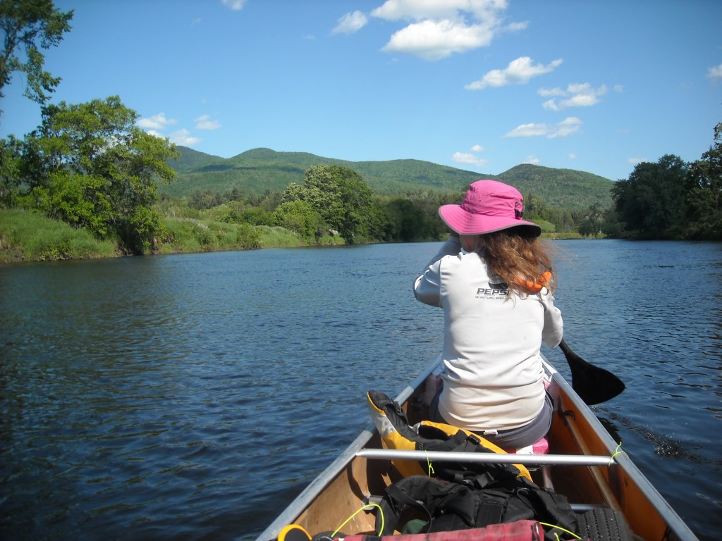
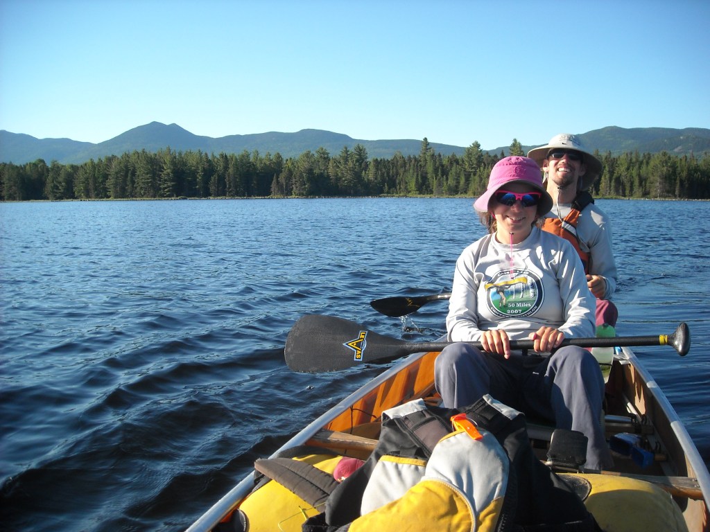
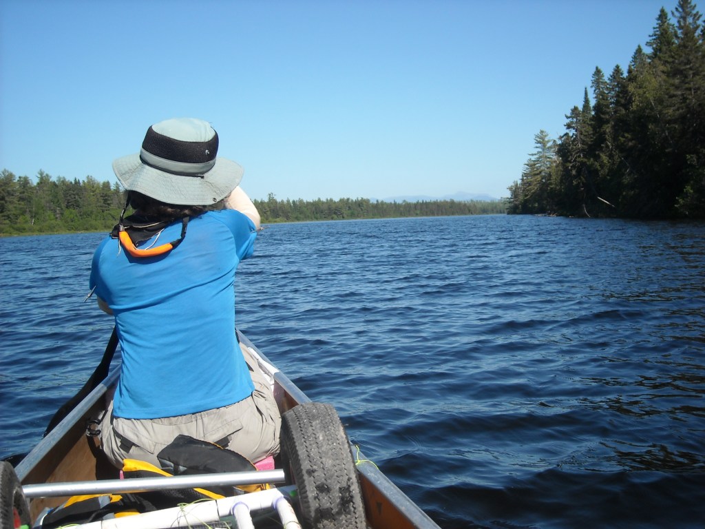
We invited our friends to join us on the NFCT but only Emily did- likely because as an agency nurse her schedule was flexible. To maximize efficiency and to prevent anyone from getting lost, we decided a three person canoe would be the best vessel. Emily purchased a 20 foot, five year old, Wenonah Minnesota III Kevlar canoe used from a Boundary Waters outfitter with numerous scratches which had been patched and we added more. The canoe was on its second skid plate.
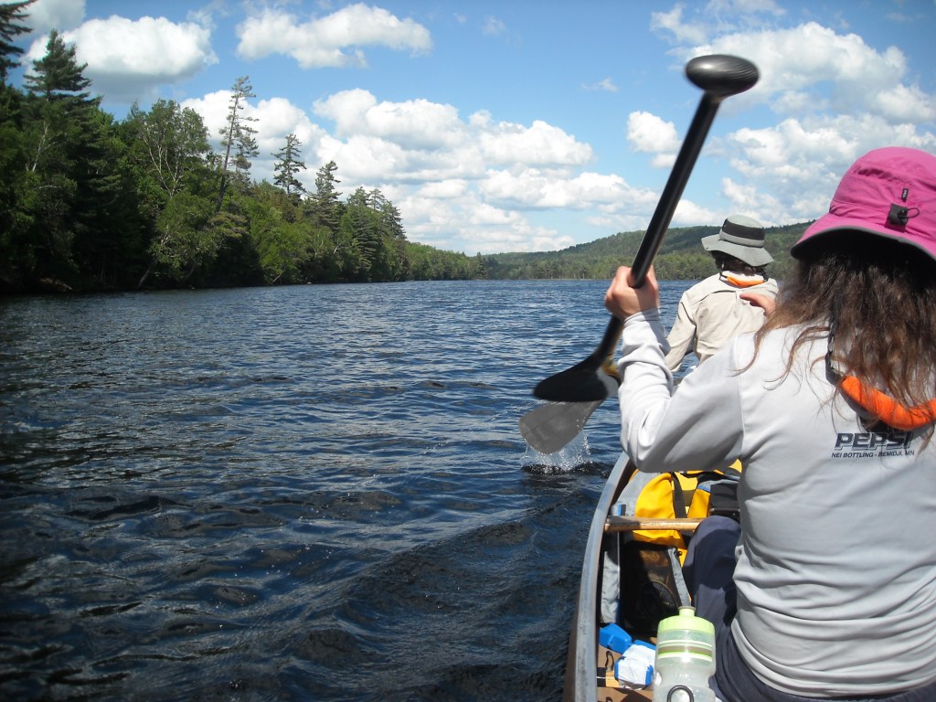
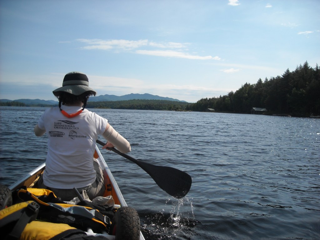
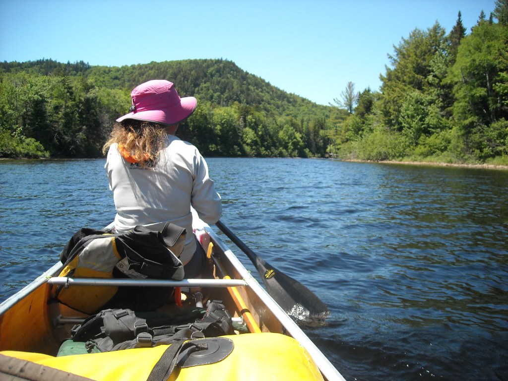
Before starting on the NFCT we “pimped” out the canoe. Emily, Erik, and I all come from canoe racing backgrounds. We brought with two paddles each – one carbon fiber paddle weighing approximately 7 ounces and a second wood or metal paddle for rapids and pushing upstream. Paddle clips and securing methods were placed in the canoe enabling Erik to portage the canoe containing the paddles. We added foot braces for all seats and knee braces for the bow and stern positions. We added foam to the low wood and webbed bench seats to make them more comfortable and to raise them to for easier paddling. In addition we added three water bottle holders (bike water bottle cages) for easy access to water while paddling.
Throughout the NFCT we used “hut” steering, also known as Minnesota Marathon Technique. We found it best for the bow and middle persons to paddle on the same side and the stern person on the opposite side. When we needed to switch sides for steering purposes the “hut” was called by the stern person. In rapids the stern person used J-strokes/rudders and the bow person would draw when necessary.
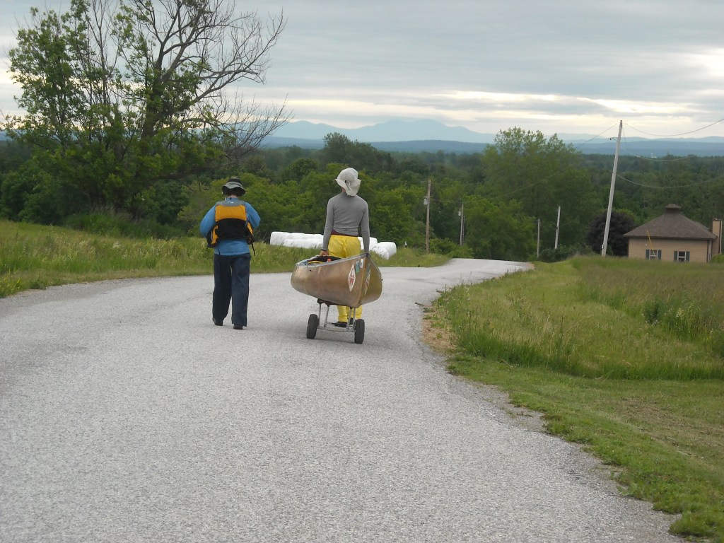
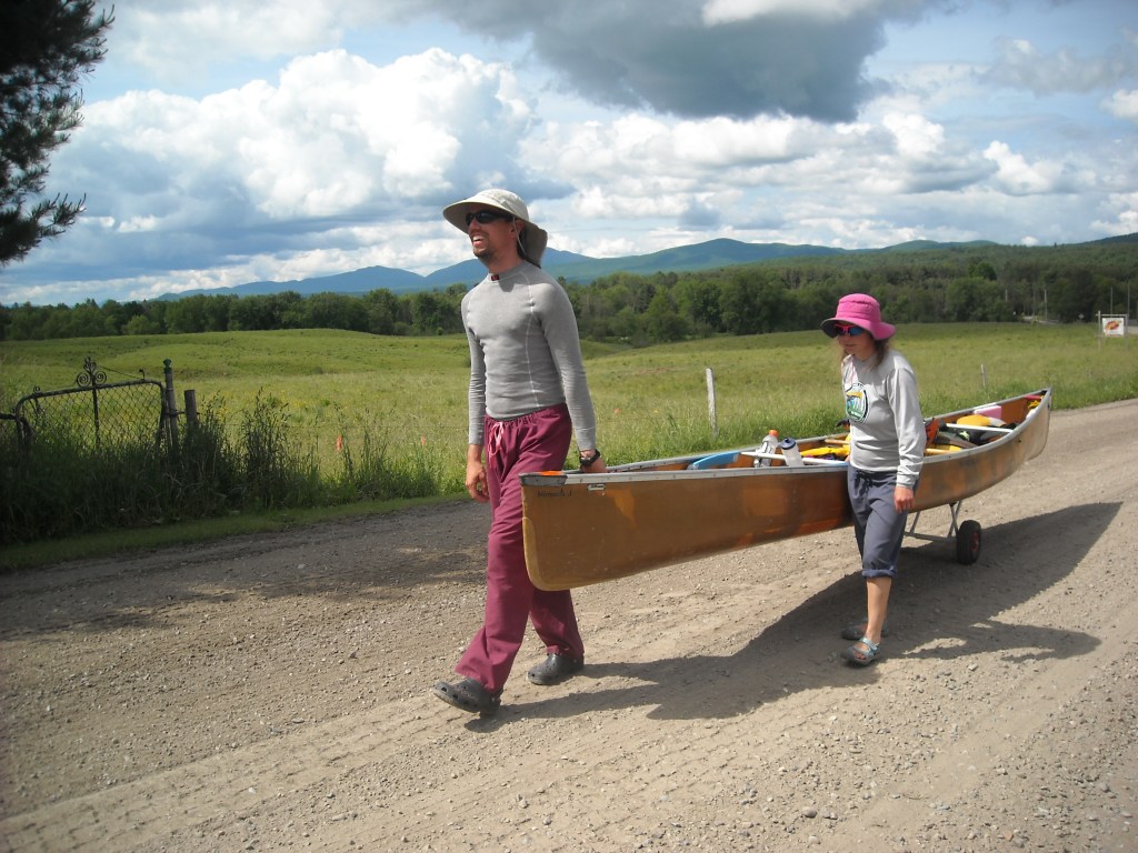
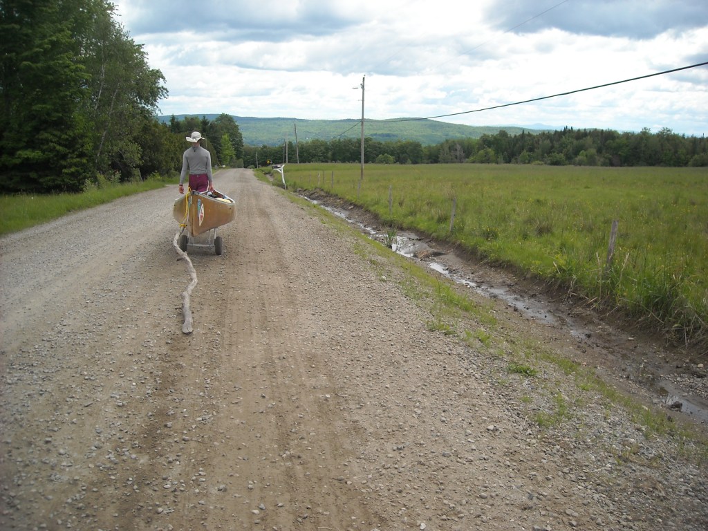
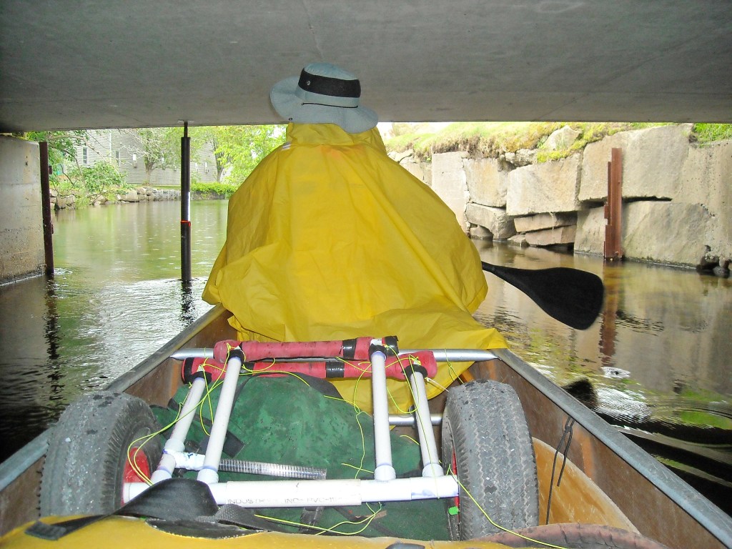
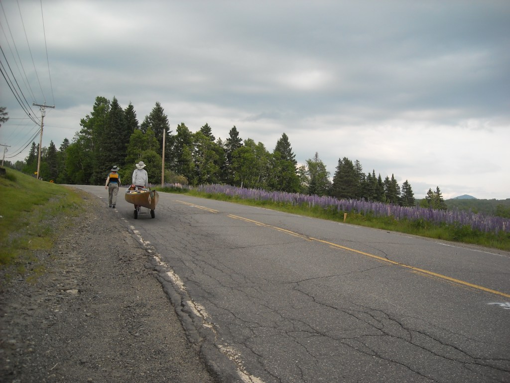
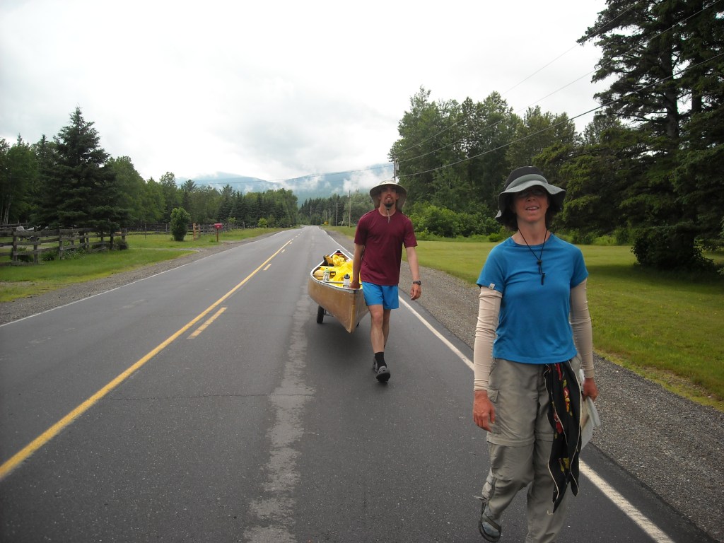
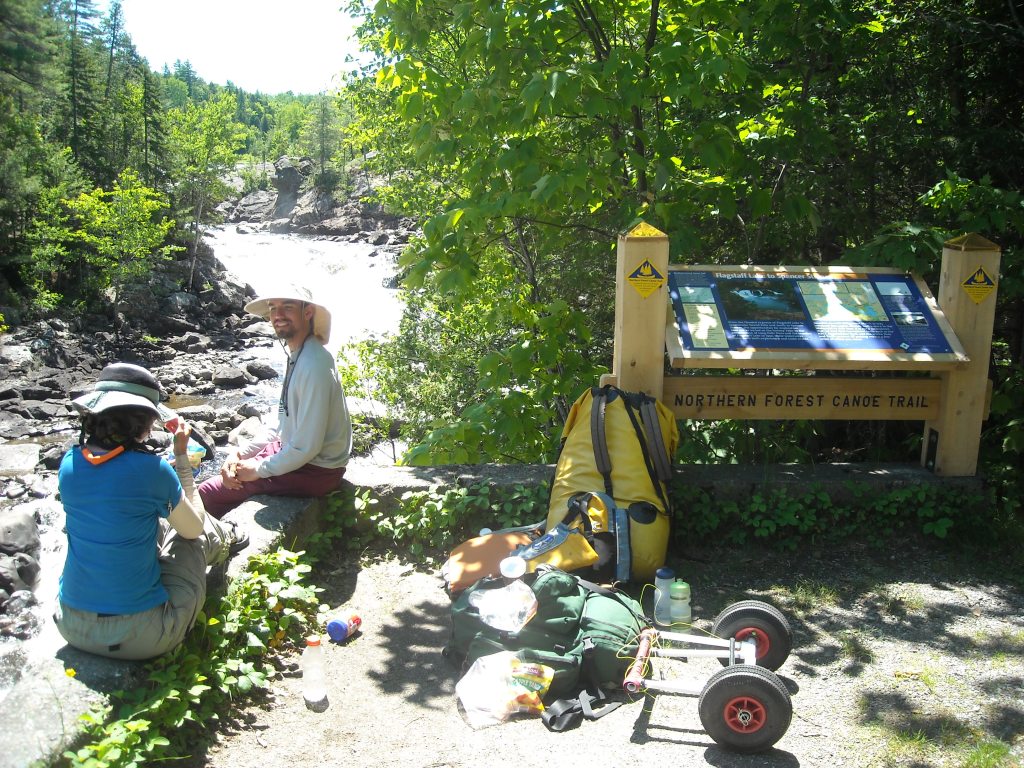
We also brought a set of portage wheels engineered by Erik based on previous experience. Erik made a cart out of PVC pipe and wheels from our original canoe cart. Handlebar tape cradled the canoe on the PVC pipe and lightweight rope secured the cart onto the canoe.
We roughly had a goal of completing the NFCT in 28 days. This was based on the idea that we could average approximately 25 miles per day. I was interested in attempting to go faster to break the record of 25 days, largely because I like to keep moving and because, moreso at the time, disliked camping and the faster we went, the fewer nights we would have in a tent. Erik and Emily didn’t want to be physically exhausted every day. Emily was only interested in pushing the pace “as long as we’re having fun.” We slept-in almost every day which meant starting around 7 am. We never set an alarm and therefore knew we were getting enough sleep to feel fully rested and recovered. On average, we arrived to camp sometime between 5 pm and 6 pm. Throughout the day we took food breaks or shopping breaks as needed.
Emily later dubbed our trip “efficient.” Essentially this meant paddling and portaging about 12 hours a day, using the “hut” stroke rather than the J- and C-strokes, sharing one pot, 2 spoons, and 2 cups amongst the three of us, and NO DINKING AROUND WITH CAMPFIRES!
Day 1: 5/30/12 start 12:55 pm from Old Forge, NY to Eighth Lake

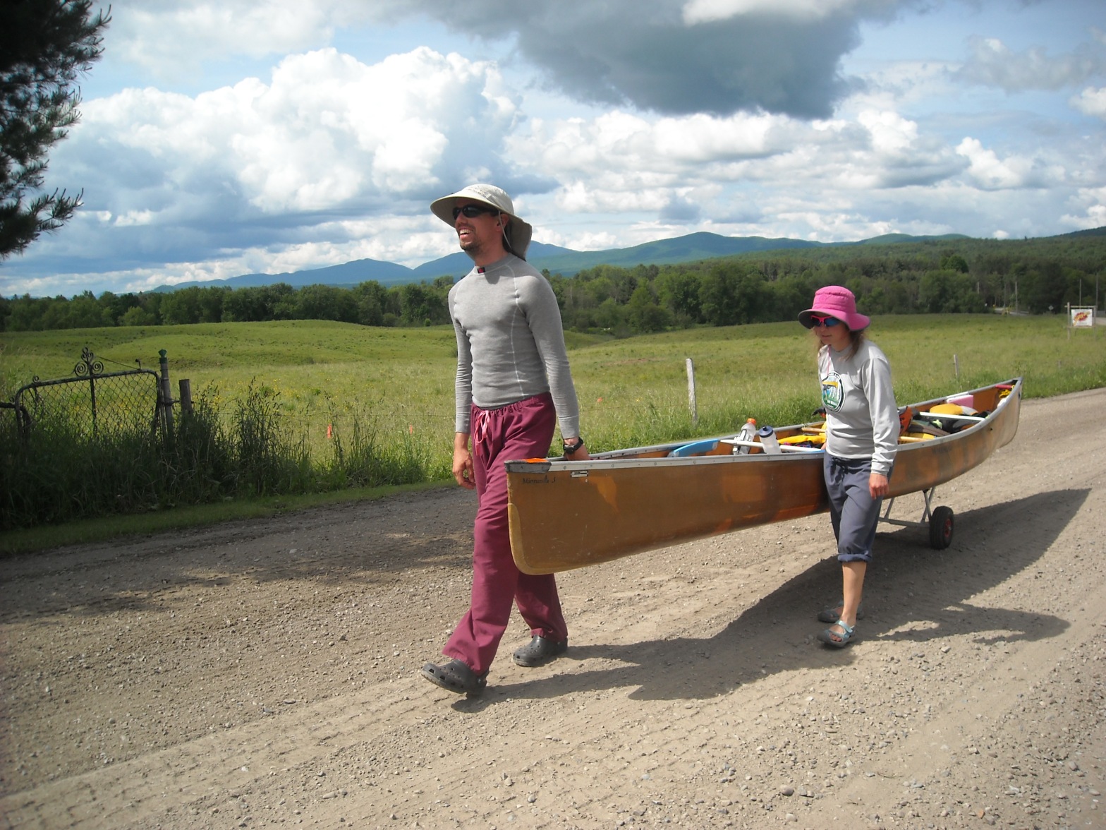
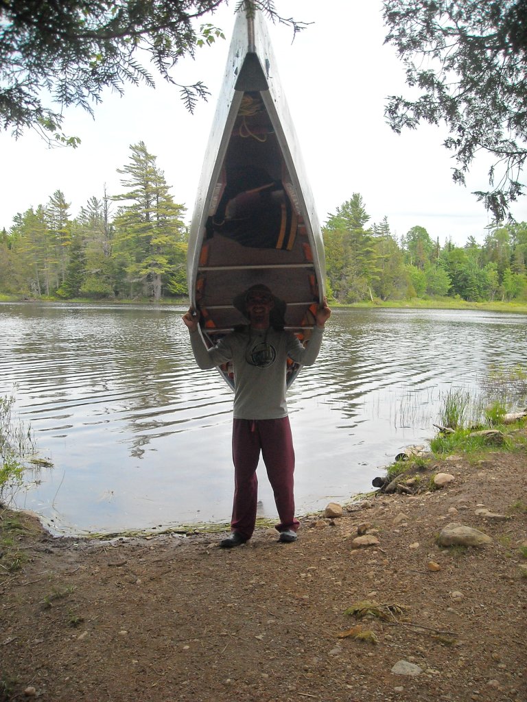
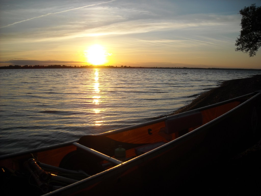
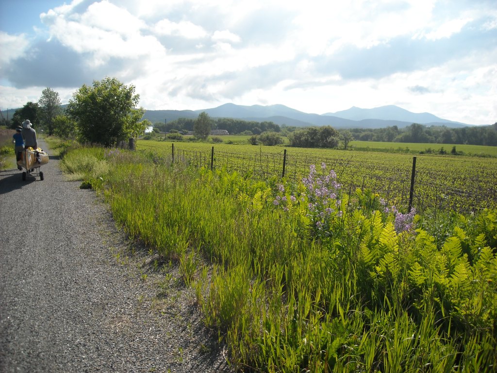
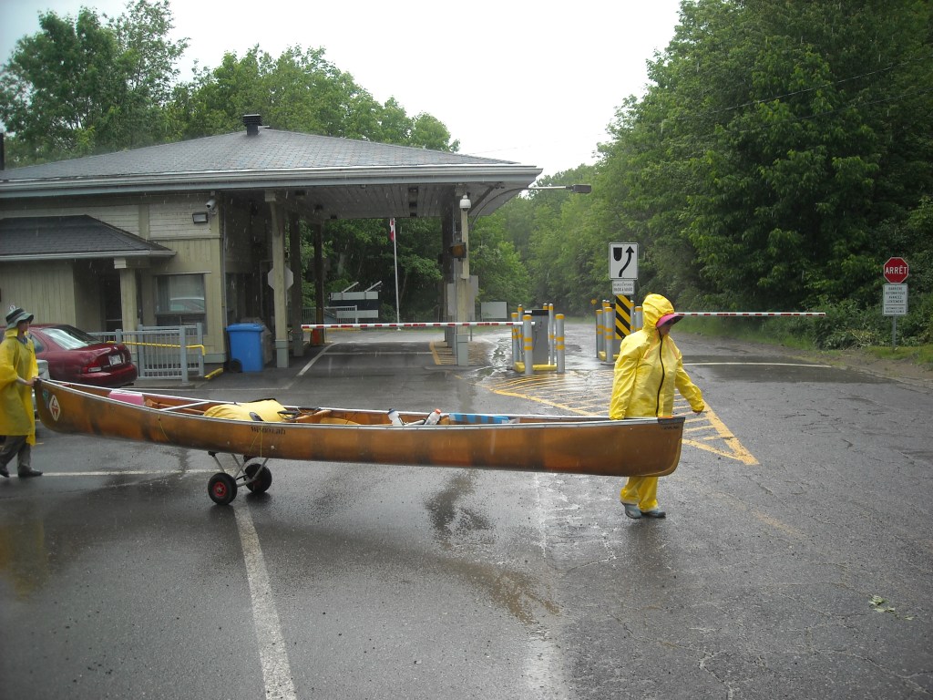
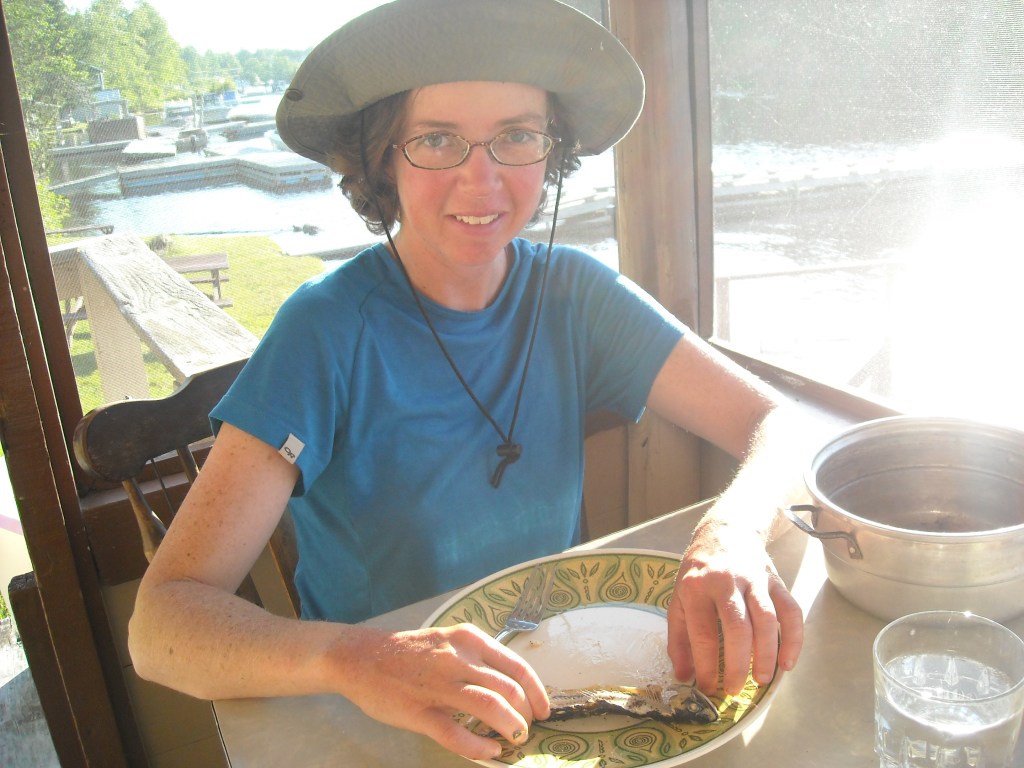
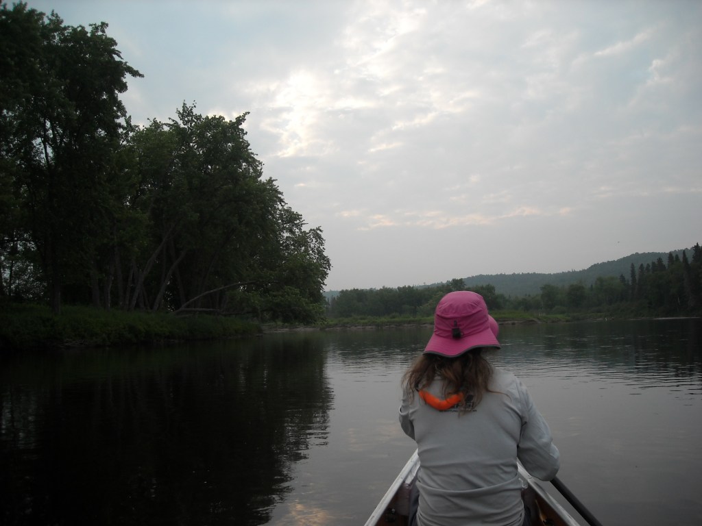
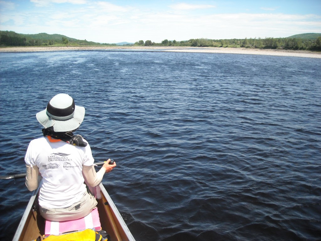
And so, on May 30th Erik, Emily, and I found ourselves in Old Forge, NY with six paddles, two gigantic bags, and a 20 foot Minnesota III Wenonah Kevlar canoe about to embark on the NFCT.
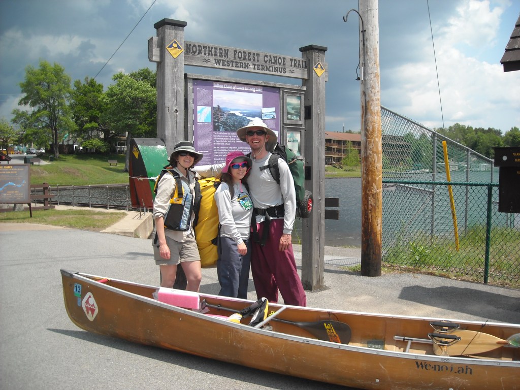

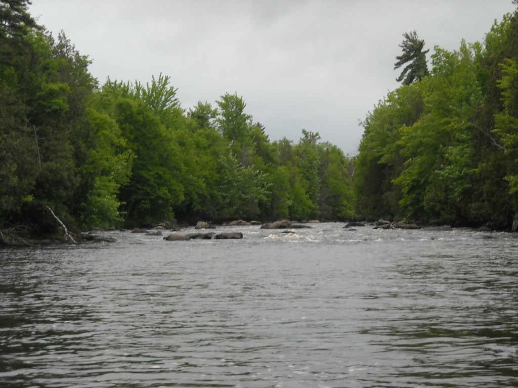
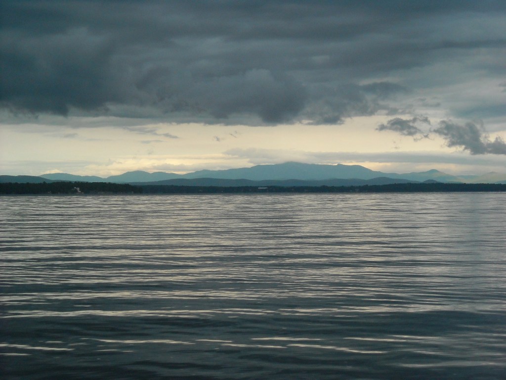
Our friend Priscilla gave us and our canoe, (which we named the E3) a ride from Rochester, NY to Old Forge, NY. We started in the early afternoon with a strong tailwind as we crossed the Fulton Chain of Lakes (number one through eight). The sky was partly cloudy and threatened rain which was common weather for the first half of our trip.

At our first portage between the tiny Fifth and the slightly larger Sixth Lakes, we saw a group of middle school boys.
“We’re canoeing to Maine,” we told them exuberantly.
“That’s impossible!” they retorted.
Then we were off paddling onto Sixth Lake where we stopped at a rope swing and Emily and I “went out on a limb trying to be Jane to Erik’s Tarzan” as Emily put it.
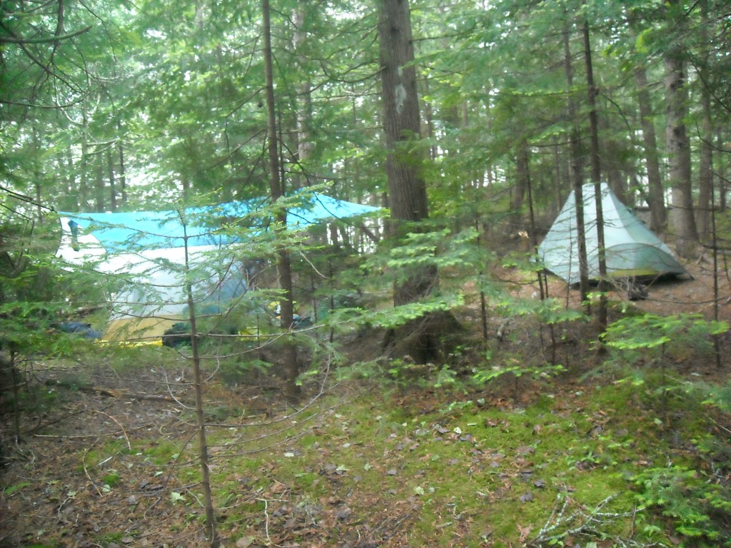
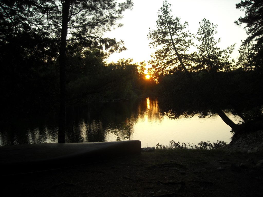
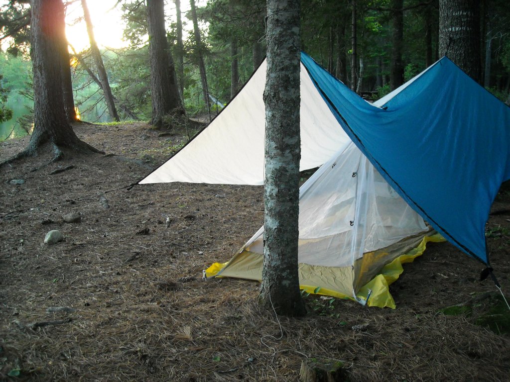
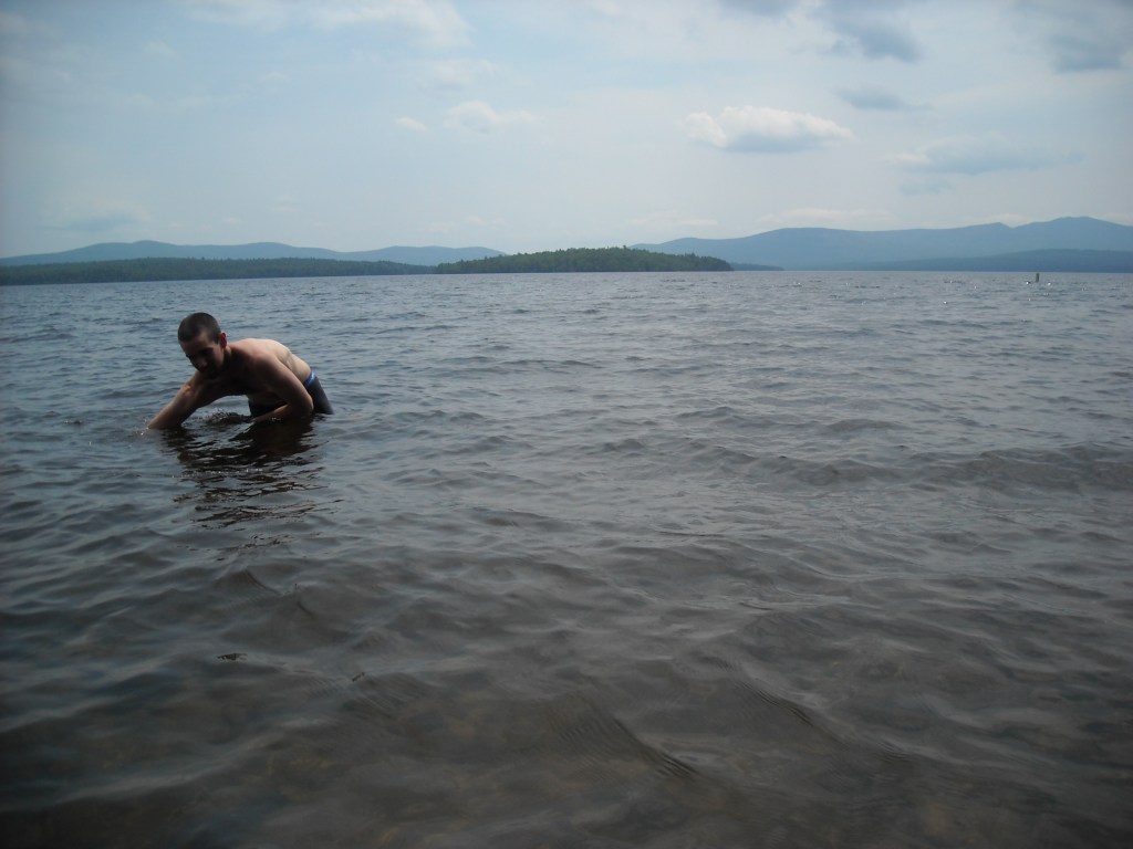
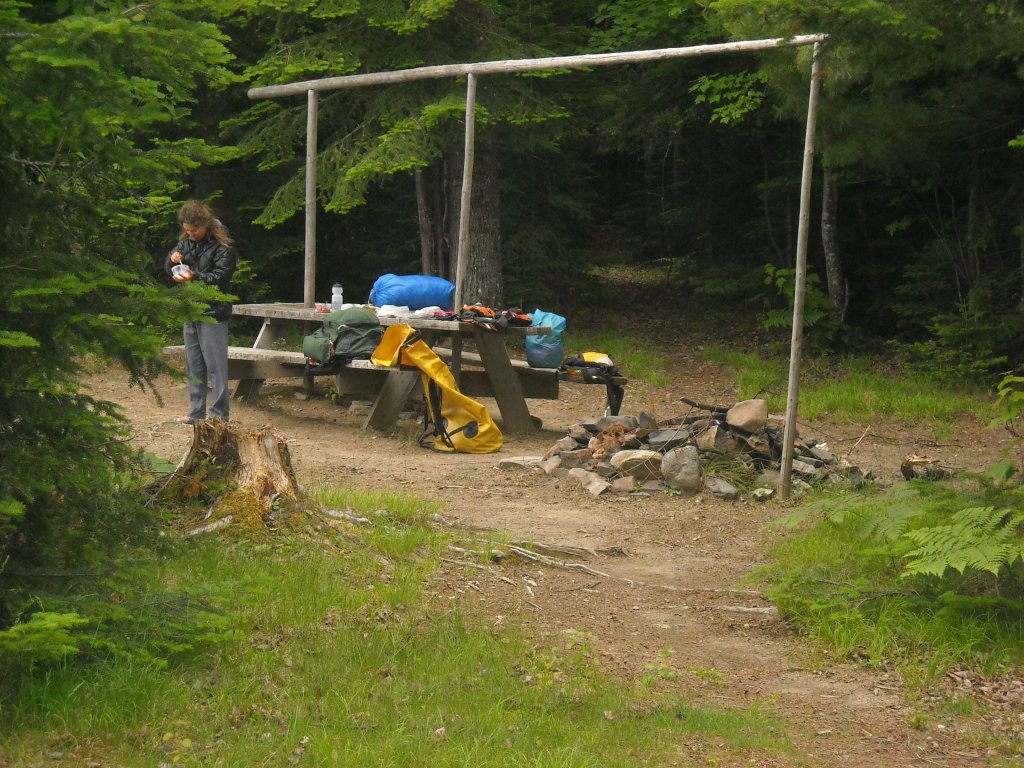
By Eighth Lake it was still plenty early by our standards but a ways till more campsites on Raquette Lake. So when we passed an island campsite with a lean-to on Eighth Lake, we decided it was too good to be true and stopped for the day. The bugs weren’t bad and we were able to sleep without a tent.
Day 2: 5/31/12: Eighth Lake to Long Lake, NY

The sun woke Erik and I up early. Emily is a better sleeping so she stayed in bed. We enjoyed the long days, ate breakfast at camp, and poked around a bit in the woods.

This day was nice and sunny for us. We had friends who had invited us to stay at their cabin in Long Lake and so that was our goal for the day. None of us had done much canoeing in the week previous to our departure and we figured we would take it easy for the first two days of our trip and ease into the rhythm of long paddling days.
The day began with a portage over the highest point on the NFCT. Although the portage trail was rough, we used the portage wheels. We frequently had to lift over big rocks, roots, or wet sections on the trail. The trail was well maintained but not exactly wheelable.
Soon enough we made it to the marshy Brown’s Tract Inlet where we enjoyed the first downstream paddling of the trip as well as ramming over beaver dams.

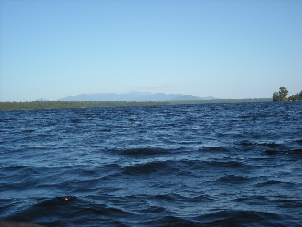
Then we came out onto the large Racquette Lake, framed by mountains in the distance. There still wasn’t much wind and we made good time as we crossed from south to north and then took “Outlet Bay” to the well signed and wheelable portage into Forked Lake.

While taking a break on the portage we realized the axle of our portage cart had become badly bent. It just so happened there were some nice fisherman at the boat launch on Forked Lake who had PVC pipe and a saw in their truck. This was quite a lucky coincidence for us! Erik was able to add an additional piece of PVC pipe to the portage cart to prevent the axle from bending more.

Portage cart fixed, we crossed Forked Lake and began paddling down the Racquette River with several portages around waterfalls and rapids. On the first portage we found an outhouse where we were able to visit the “basement of the outhouse.” This was not nearly as gross as it sounds as there was a plastic tank holding the nasty stuff but somehow we thought this was quite funny. Then we went onto Long Lake which didn’t feel so long this day but got longer the next day.

In Long Lake our friends picked us up and brought us to their cabin. It was late afternoon and we enjoyed cleaning our clothes, showering, and good company.

Day 3: 6/1/12: Long Lake to Lower Saranac Lake
The next morning our friends gave us a ride back to Long Lake and we resumed our paddling and started on the second NFCT map!
We began at the town of Long Lake and paddled north on Long Lake. It turns out the lake is very appropriately named as it took us two hours that morning to get to the Racquette River.
Once we made it to the river we enjoyed an hour of downstream paddling before portaging around Racquette Falls.

Here I’ll admit that I’m quite afraid of going over waterfalls and this was one of my concerns about this trip. Most of the waterfalls or big rapids were well marked.

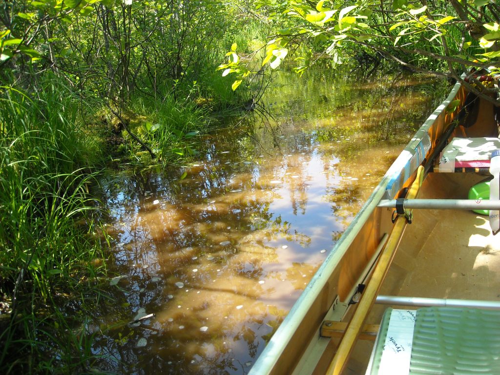
Then we continued downstream until the intersection with Stony Creek where we diverged from the Raquette River. We canoed up the curvy stony creek which required some navigation. The current was strong. The map showed a wide open river but we found a narrow channel through the rushes. Once we got to Stony Creek Ponds the rushes went away and we paddled across the lake.

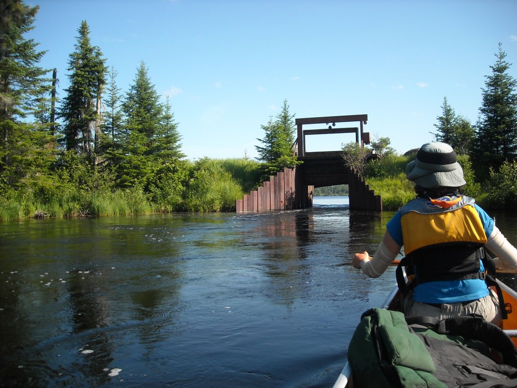
We easily located the Indian Carry which brought us into Upper Saranac Lake. The first half of the portage wasn’t wheelable; after Hwy 3 the portage was wheelable but not knowing what was ahead, Erik elected to keep yoking the canoe.


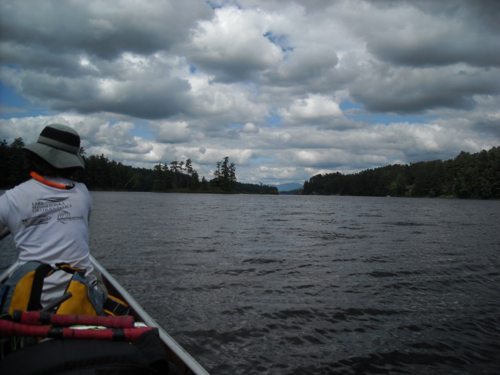
Then we were on the Saranac Lake Chain! Upper Saranac Lake went by very fast as there wasn’t much paddling as the route headed toward Middle Saranac Lake. The portage into Middle Saranac Lake was a bit confusing. First, we took a right on the road, heading south. Then the road curved east. When the road curved back south, we continued on the portage trail heading east. Middle Saranac Lake offered a nice surprise as it is largely undeveloped and had views of the high peaks in the distance.

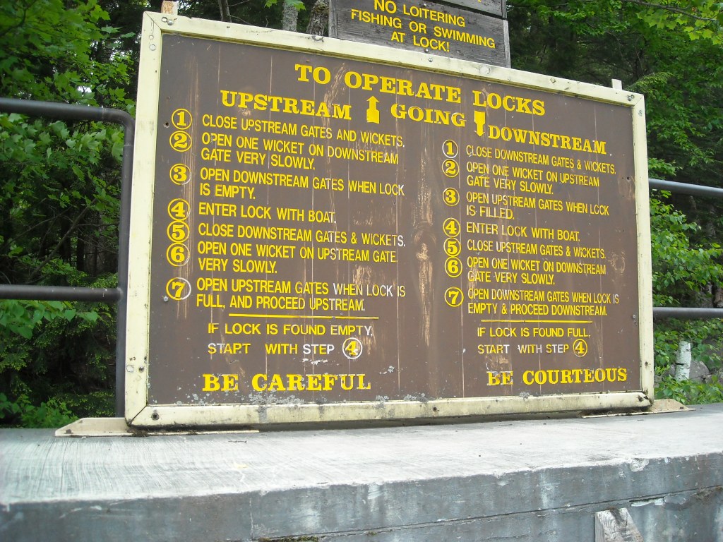
On the east end of Middle Saranac Lake we had a bit of difficulty locating the channel which leads to the Upper Locks and Lower Saranac Lake. It was quite overgrown with rushes despite being early in the season and didn’t seem as wide as it appeared on our map. We made it to the Upper Locks and Erik helped the lockmaster lower us. There was a small motor boat which went through the locks with us. We were ahead of the motor boat leaving the locks and the marked channel wasn’t wide enough for the motor boat to pass us. We figured we were able to canoe at least 5 mph which was the speed limit anyway.


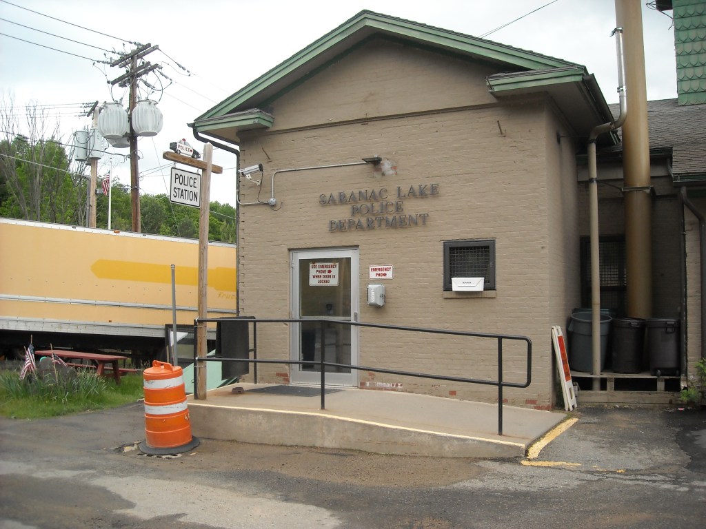
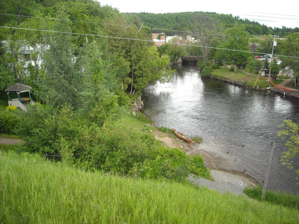
Lower Saranac Lake was one of my favorite places on the NFCT. I enjoyed the rocky shoreline and trees on this undeveloped lake. It reminded me of the Boundary Waters Canoe Area in northern Minnesota. We stayed at a new lean-to on Norway Point and got there just as it was beginning to rain. That night and the next morning we were forecasted for a lot of rain and were glad to get to spend the night in a lean-to.
We also had some fun doing the bear hang!
Day 4: 6/2/12: Lower Saranac Lake to Trail Rapids on the Saranac River

Overnight it didn’t rain much. In the morning it was sprinkling and being so close to the town of Saranac Lake, Emily was able to check the NOAA radar on her smartphone while she was still in her sleeping bag. The radar showed the storm cell had passed over and so we broke camp and started paddling. Despite the clear reading on the radar this day proved to be our only 100% overcast day.

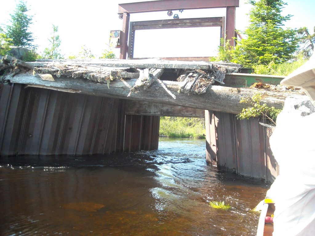
We were such early risers that when we got to the Lower Locks between Lower Saranac Lake and Oseetah Lake the lockmaster wasn’t yet on duty – lucky for us we got to do it all ourselves! Erik and I got out of the canoe and operated the hydraulic locks while Emily took pictures.


As we continued along the river and into Oseetah Lake it was surprising that the channel was well marked for motor boats with green and red buoys. It was interesting to be in such a wilderness area and yet to have a channel so well defined. This was obviously for the motor boats but it was also a good idea for the canoes. Outside the channel there were many rocks- especially ones right below the surface. One time we got outside the channel a few feet and hit a rock. After that we stayed inside the buoys.
When we got to Saranac Lake we portaged the dam and the rapids just downstream and then we went into town. While Emily charged her phone at the gas station we enjoyed some free samples at the Farmers Market.
Then we started Map 3 and headed down the serene upper Saranac River which offered some mountain views when the clouds occasionally lifted. The river had lots of turns but was wide and deep enough we didn’t need to worry about hitting rocks.
Our plan was to portage the Permanent Rapids which ended the serenity but I was reading the map and missed the campsites preceding the rapids and the take out. I never saw a sign at the take-out despite scrutinizing the left bank given my concern of spilling in rapids. Previously many of the rapid portages had been very well marked with obvious signs.

And so all of a sudden the river narrowed, the current picked up, and we were sucked into the mile-long Permanent Rapids. Emily accidentally dropped her shirt into the water at the start of the rapids and it was never to be seen again. A series of Class II rapids, these were the most difficult we ran on the NFCT. Emily was in bow, I was in the center, and Erik in stern. I spent most the the rapids backpaddling to slow us down while calling out directions so Emily could draw and Erik rudder. In the middle of the rapids we quickly approached “The Narrows” where the river narrowed and there was a big wave bordering on Class III. Somehow, luckily, we slid over that unscathed. We were able to rest in eddies a few times to scout what was ahead but we continued to shake with adrenaline. Inevitably we hit a fair number of rocks as the rapids were very shallow. I was glad we got through the rapids without tipping.
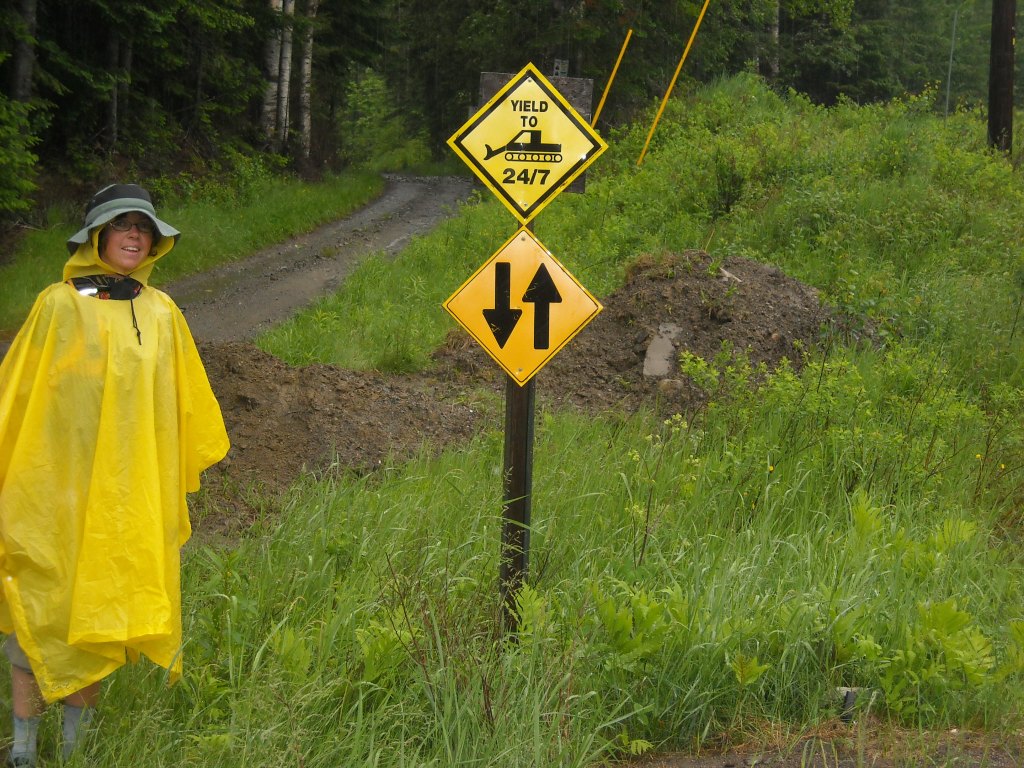
Next we came upon a series of lakes and dams (Franklin Falls, Union Falls Pond, and Union Falls) before finally running a couple Class I-II sections before camping at Trail Rapids. From here our plan was to portage to Casey Road on the newly cut and marked portage trail and take Casey Road to Clayburg, thus bypassing a section of the Saranac River marked as rocky with several waterfalls, rapids, and unmarked portages. We had a bit of difficulty locating the portage trail but found the orange ribbon. We never saw the “rock gate” that was described on our map although I’m not sure any of us really knew the definition of a “rock gate.” There was a small channel which headed north just above the Trail Rapids portage.
Once we got to Trail Rapids we were ready to set up camp for the night. Although not a designated campsite, the spot was in the pinetums and it appeared as though others had camped there previously as there were several potential tent locations. The NFCT has since built a campsite here.
Day 5: 6/3/12: Trail Rapids to Plattsburgh, NY
When we got up this morning we had some intention of getting to Plattsburgh, and potentially getting a hotel there seeing as there was only one private campground along the way.
Our plan was to take the new portage trail at Trail Rapids to Casey Road, then to Silver Lake Road to the village of Clayburg where we would put back into the Saranac River. This was largely to avoid Class III-V rapids, some of which had portage trails while others didn’t. We all agreed we didn’t have the Class III-IV skills required to run this section into Clayburg and so we decided to portage.

When I had read the guidebook, this section of river scared me as it seemed to offer no good solution. Fortunately Erik found the road portage alternative which I was glad about since I’m not too keen on running rapids.
We started out early in the morning on the new portage trail leaving Trail Rapids. Erik had to carry the canoe on his shoulders as the portage trail wasn’t wheelable. We had to help guide the canoe from the front and back as the portage trail was very narrow. Before long we made it out onto Casey Road where we were able to begin wheeling. Shortly thereafter Silver Lake Road came in.

Halfway down Silver Lake Road, Erik was wheeling when we heard a loud pop as one of our tires on the portage cart exploded. It got a hole in it big enough for Erik to stick his pinky finger into. We had a small patch kit but nothing that would be able to do this job. We contemplated our options. It was 8 am on a Sunday morning in rural upstate New York. Option one involved someone hitching a ride into Clayburg to fix the canoe cart but it seemed unlikely that there would be any shops open in Clayburg at 8 am on a Sunday morning where we could get a replacement wheel.

Option two involved portaging right down to the river where a series of Class II-III rapids would be waiting us. The guy whose house we stopped near said plenty of people ran those rapids. I’m not sure how many flatwater paddlers in a flatwater boat ran those rapids. We decided that wasn’t a good idea.
Option three included calling AAA. We thought about that for awhile and then decided they most likely didn’t cover canoe cart wheels so we moved onto option four which was portaging the old fashioned way. So we set off down Silver Lake Road with the canoe on Erik’s shoulders while Emily and I each carried a pack. Mine had all the potable water we were carrying since it was advised not to drink from the Saranac River and Emily could’ve easily fit in her pack.
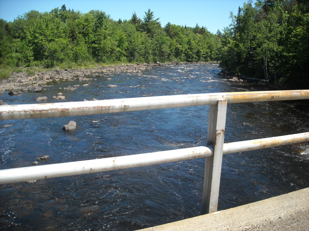
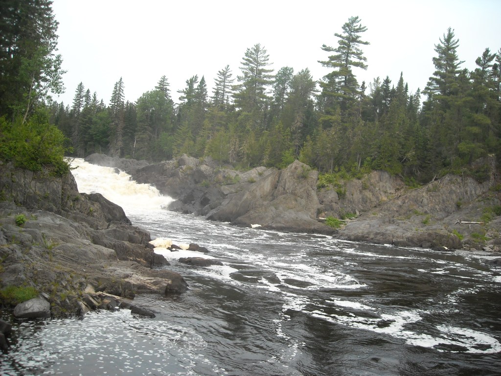
Once we got to Clayburg we put in on the Saranac River but were disappointed to find the water very low creating almost a continuous series of Class I rapids which called for great attentiveness to miss every rock. We portaged Separator Rapids and continued on hoping to get to some deadwater behind the High Falls Dam. Since the water levels were so low we wouldn’t encounter deadwater until a mile before dams and this was rather consistent for all the dams on the Saranac River. We walked downhill a long ways on the High Falls Dam carry and when we put back on the Saranac had to contend with miles of Class I rapids before the water finally backed up behind the Cadyville Dam and carry. This carry was well marked although Erik didn’t enjoy much of it with the 75 pound canoe on his shoulders. Nonetheless we managed to do the portage in only one “pause.” Near the put-in there was a huge green hydroelectric pipe transporting water to the turbines. It was an engineering marvel and I’m not an engineer. Once we did put in, the current was very swift. The map reported Class I-II rapids to the Treadwell Mills Dam but after the initial swift current the rapids were really only Class I although they really were continuous, requiring a high level of attention.


At the Treadwell Mills Dam the clouds were threatening and I thought a huge thunderstorm was going to pound down but fortunately it missed us. We portaged down another huge hill. It’s no joke that the Saranac River drops 1,400 feet in 63 miles- the same elevation drop of the Mississippi River which is over 2,000 miles long. When we put in below the Treadwell Mills Dam there was an initial Class II drop we were able to scout from the put-in followed by a series of intense Class I rapids. By the time the whitewater subsided we were almost on top of the Indian Rapids Dam. We recognized that we must be approaching the Indian Rapids Dam and so began looking for the portage which was incredibly overgrown and unmarked. There were several down trees which we had to crawl over and under on the very short portage with a 20 foot canoe. And the mosquitoes were very thick – the worst of the entire trip.
Once we put back in it was a very short paddle to the Imperial Mills Dam which was mis-marked on our map. Fortunately we realized this and adjusted to the correct portage around the left side of the dam. This was another difficult portage involving a very steep scramble up loose gravel to a small hole in the fence. Then we had to climb over a six foot fence with packs on. From there the portage was straightforward.
Upon putting back in we were greeted with a series of Class I-II rapids as we made our way through Plattsburgh. These rapids were often continuous, especially just upstream and downstream of the Hwy 22 bridge. I thought we were going to flip a few times. There is nothing like scouting from the canoe and often finding no good route through the rocks. A short ways past the Hwy 22 bridge we came across a floating barrier in the river and a mandatory portage sign. We got out not knowing what the hazard was downstream. Erik and I spent considerable time in Plattsburgh scouting the rapids to determine if there was some new obstruction of which we were unaware. Finally we decided it seemed as though there was some landscaping work on the shore and so after portaging a short bit we got back in and continued running the Saranac River until we got to Lake Champlain.
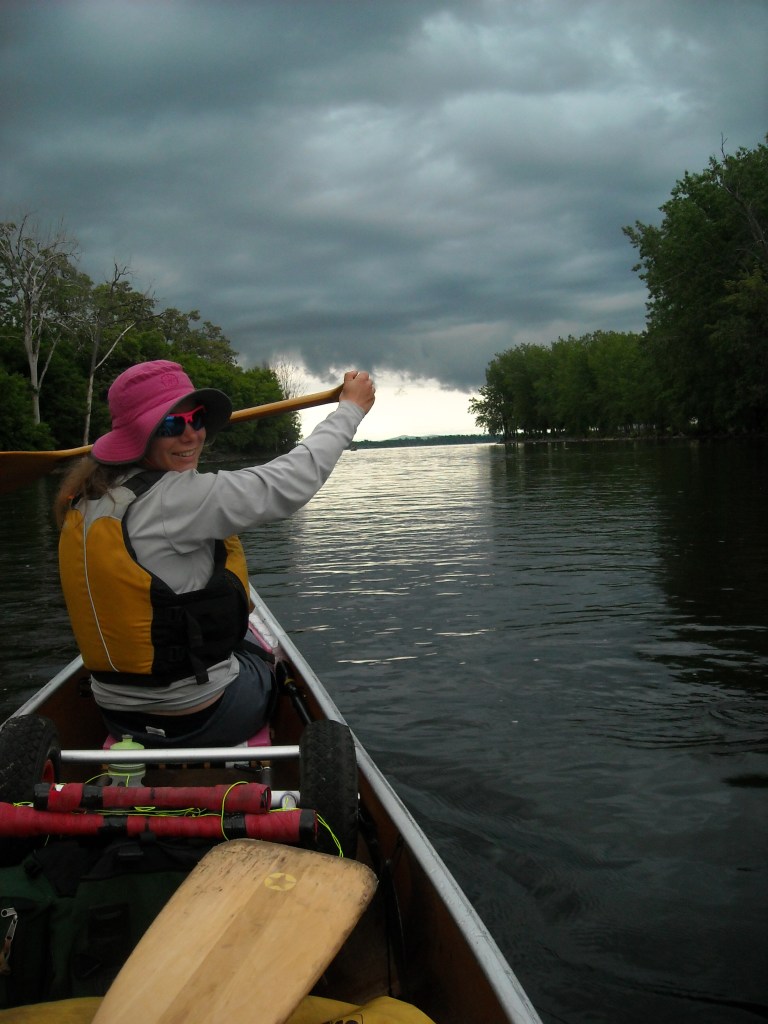
At that point it was 7:30 pm, we had just finished Map 3, and the ominous clouds all around made it seem later than it really was. The water on the Cumberland Bay was placid and we thought about attempting a crossing but decided we were too tired and so we headed north toward the junction of Hwy 314 and Hwy 9 where we stayed at the Super 8 motel.
Day 6: 6/4/12: Plattsburgh, NY to Isle la Motte, VT

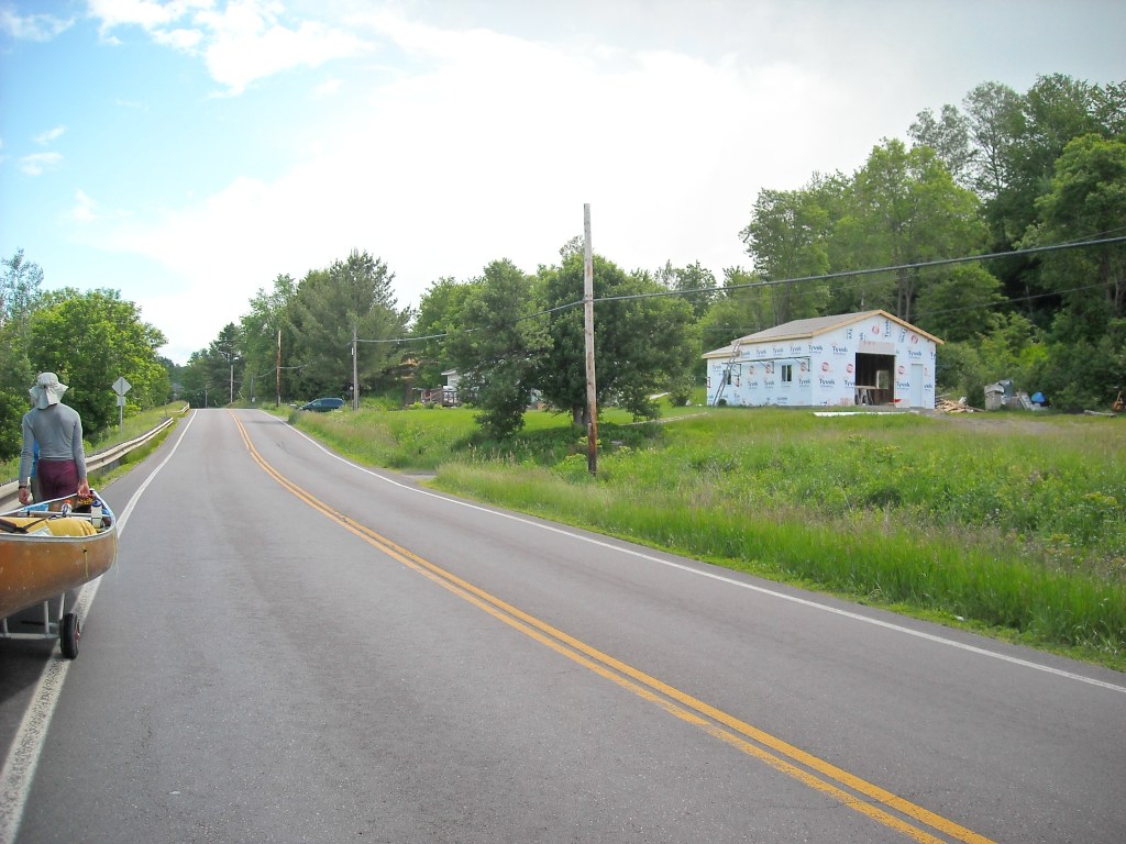
Emily and I got our money out of the continental breakfast at the hotel while Erik fixed the portage cart. He caught a cab to Tractor Supply and outfitted the cart with bigger, heavier, sturdier wheelbarrow tires. He said changing the tires was very difficult.

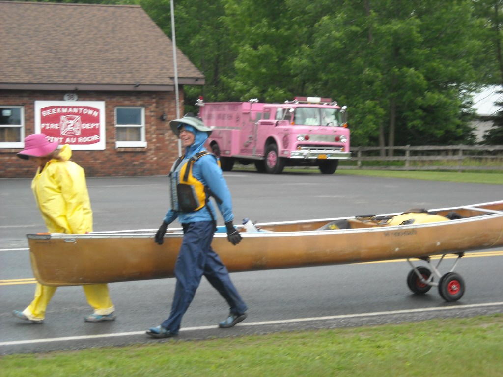
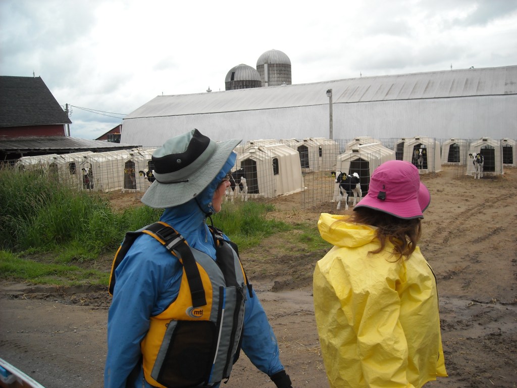
The weather forecast called for two days of winds out of the north-northeast. Unfortunately this was the direction we needed to head across Lake Champlain. Given the wind direction and the location of our hotel, we decided to portage Cumberland Bay and instead checked out the new portage wheels and wheeled north to where we put in on Treadwell bay because I was hell bent on no zero days. Despite the protected nature of this bay the waves were still quite large. Had they been any bigger we would have taken on water. After crossing the bay we took refuge at Point au Roche State Park and pondered how we should continue. We tried canoeing north but quickly found ourselves in dangerous large swells so we put on the portage wheels and continued wheeling north. We did see a pink firetruck, picturesque countryside, and baby cows.

Given the weather forecast for continued winds out of the north the following day in combination with my stubborn determination to continue moving forward rather than waiting for favorable winds, we decided to wheel north to the Hwy 2 bridge. From there the plan was to continue wheeling along Hwy 78 until we reached the Missisquoi River in Vermont.
Around 7 pm we were wheeling next to Dunn Bay. The bay looked calm and we couldn’t distinguish any whitecaps for the crossing to Isle la Motte so decided to try canoeing. We were able to make it to Isle la Motte without any water coming into the boat although the waves were still rather large and we were very close several times. The winds had died down some as it was evening. That night we camped at the St. Anne’s Shrine.
Day 7: 6/5/12: Isle la Motte, VT to Enosburgh Falls, VT

We awoke to a howling wind and whitecaps on Lake Champlain so we decided to portage. Having gotten to Isle la Motte placed us in a much more strategic position than being in New York. Now we wouldn’t have to wheel so far north. We wheeled the canoe to the peninsula (Alburg Tongue) which comes down from Canada and cut across on a road to Hwy 2. The road climbed very high and we were offered a nice view of Vermont and Jay Peak to our east.

After assessing the water conditions on the east side of the peninsula at a boat ramp off Hwy 2, we decided the waves were favorable for canoeing so we started paddling. The official NFCT water trail continues up Lake Champlain to the Missisquoi delta and then up the Missisquoi River. With the wind direction from the north, this would be a long open expanse paddling into big waves so ultimately we decided to short cut to Swanton. At this point we committed to travel from Old Forge to Fort Kent on our own power, but not always following the water trail when conditions were unfavorable. True, we could have waited many a times for favorable winds or water levels, but ultimately this would’ve taken several years which is not feasible.
So we paddled around the north end of North Hero Island and then cut east to the Vermont mainland where we wheeled on Hwy 36 into Swanton. I was in the bow and while we had several waves come over, the bow never completely submerged. We joked that we were testing the seaworthiness of the Minnesota III and it passed.


In Swanton we decided to stay on Hwy 36 to cut off some upstream paddling where the Missisquoi goes around a big bend. Once we put-in we found the current wasn’t too strong and we were able to make good time. We portaged around the Highgate Falls Dam and continued paddling upstream. As we neared East Highgate the current got stronger and we portaged around some rapids. Knowing the river got narrower upstream, we made the decision to portage along Hwy 78 to Sheldon Junction to cut off some upstream paddling and also seeing as there was a long portage around the Sheldon Springs Dam anyway. Leaving East Highgate we wheeled up a very large hill with an 11% grade.

When we got to Sheldon Junction we enjoyed some ice cream at a small shop which sold Giffords Ice Cream, which I had previously been told was the best ice cream in Maine (yeah, I get that we were in Vermont- perhaps Ben and Jerry’s has the monopoly there). While we were eating our ice cream it started raining really hard. After the rain stopped, we portaged along the gravel bike trail which roughly parallels the Missisquoi to avoid paddling up the Class II Abbey Rapids which we could see from the trail high above the river. While wheeling along the trail it rained on us really hard again and we had to bail the canoe.

We put back in on the Missisquoi at the junction of Hwy 120 and paddled upstream to Enosburg Falls against strong current and a few Class I rapids. As we got close to Enosburg Falls there were more rapids so we had to get out at the canoe put-in rather than the red dotted portage marked on our map. As we wheeled through Enosburg Falls we experienced another downpour!

We camped at Lawyer’s Landing although we weren’t very sure where to camp. We think perhaps we were supposed to camp in a farmer’s field but we ended up camping close to the bridge. There was no toilet and no place to eliminate not in view of the road or houses. In the evening we were able to go into town to use the library though which was nice. And we moved on to Map 5!
Day 8: 6/6/12: Enosburg Falls, VT to Canoe and Co in Quebec

The day started with sunshine as we started canoeing above Enosburg Falls. We were hoping the Enosburg Falls Dam would provide some deadwater but this didn’t last long. Despite the current, we were still able to make good time, reaching the rapids in Samsonville within an hour.

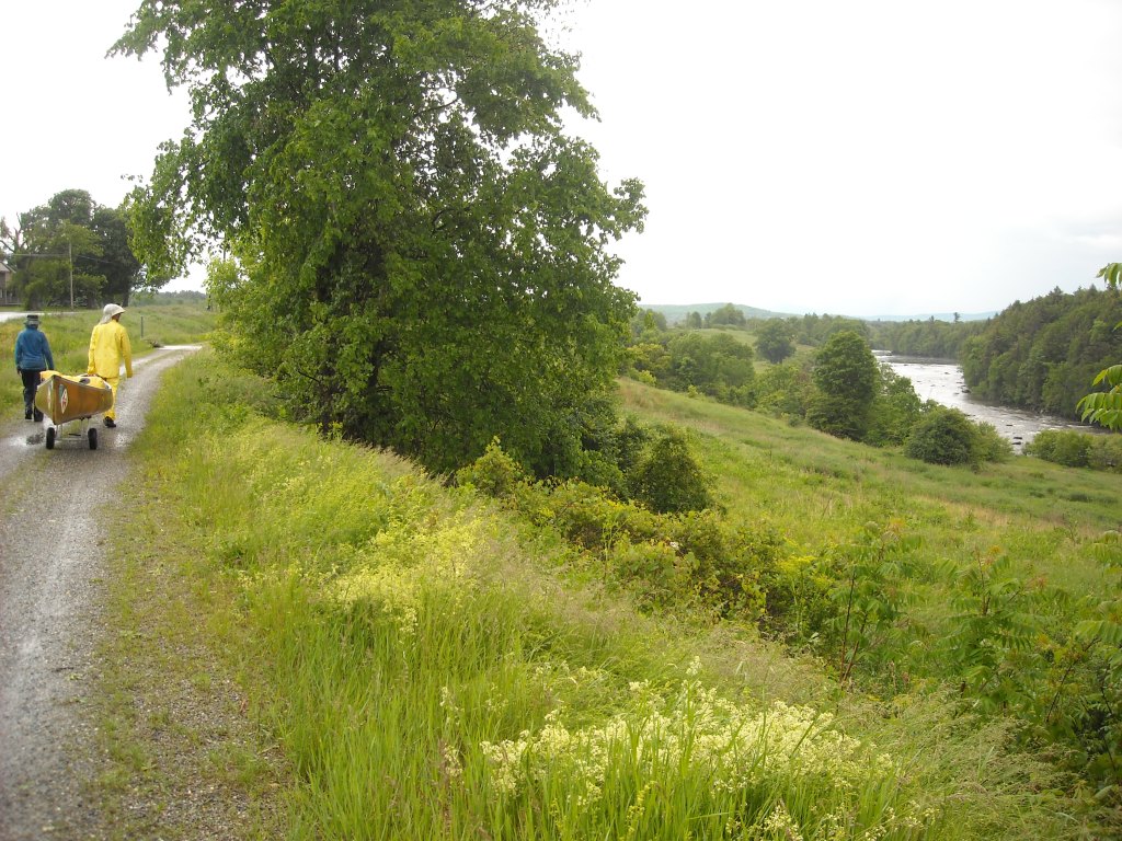
At these rapids there was no marked portage. We ended up portaging river right. We climbed up a muddy grassy bank and then walked across a farmer’s field where we got on the bike trail. We decided to just wheel along the bike trail all the way to Richford. We figured we could make better time and not exhaust ourselves paddling up the winding Missisquoi on what often felt like a treadmill.
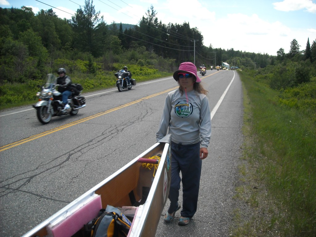
We definitely had some misgivings about wheeling so much of the route as opposed to paddling. Perhaps part of what makes the NFCT challenging is that it’s kind of a wilderness trip but essentially through urban areas. This makes camping on public lands often impossible but also means that modern amenities like bike trails and roads are plentiful. I’m a competitive person and I’d be lying to say that I didn’t want the record, but I also wanted to minimize time camping because I’m a fair weather camper. The guy who had the record- 25 days- had notably wheeled most of Vermont and New Hampshire. It was simply more efficient to wheel than to paddle upstream through rapids (we probably would have paddled had there not been rapids and the water adequately deep for our carbon blade paddles) and so efficiency prevailed.
The bike trail ended in Richford and so we took Hwy 105 and then 105A to East Richford.

We kept wheeling all the way to customs. We found the Canadians (or maybe we should say the Quebecois) very nice. They had a bathroom for us to use and we were able to get a water refill from their Culligan tank. It was early afternoon and the weather was acting up on us again with pop-up showers. It seemed as though it would only rain on us if the sun was shining. As soon as we got our rain gear on the rain would stop. Then we would dry our rain gear. When it was dry we would put it away and then it would start raining on us again. As we wheeled through customs it was pouring rain again.
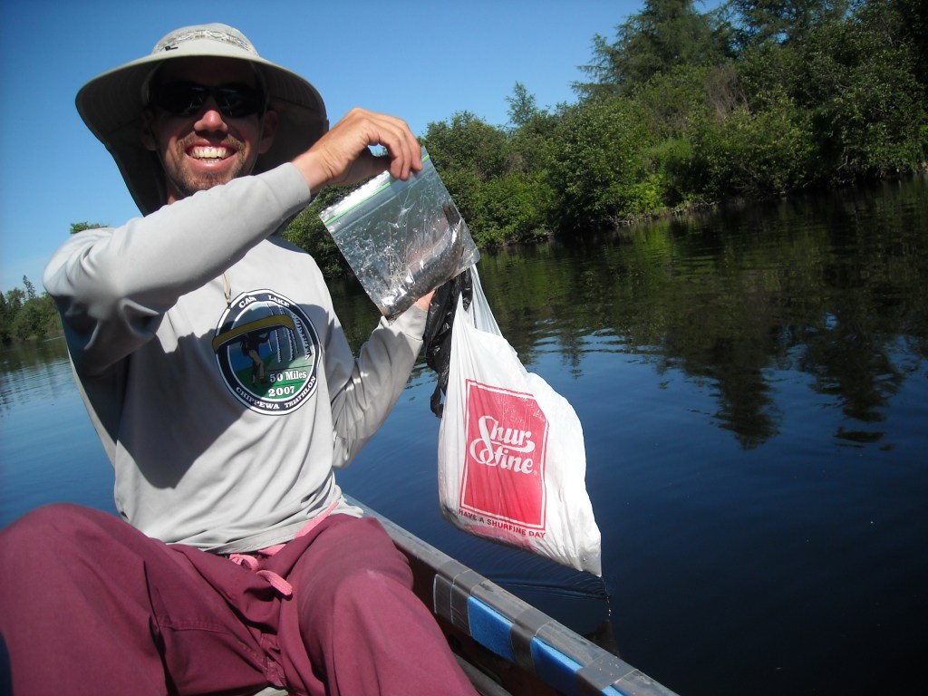
We had to bail the canoe more. There wasn’t enough water in the boat for our main bailer- a cut-off plastic laundry detergent container- so we mostly used our mini bailer- a plastic cup- and rarely, our micro bailer- a plastic spoon. Oh, we had fun with our different sized bailers!
Shortly after making it through customs and into Quebec, exactly one week after we started on the NFCT, it stopped raining. We searched for a good put-in on the Missisquoi but wheeled two miles until we found one. It ended up being a farmer’s field where we saw a whole trailer full of short kayaks. We put in there and started canoeing upstream. The canoeing was difficult as the river was narrow and had very strong current. Every once in a while we put in lots of effort to canoe up a Class I rapid.
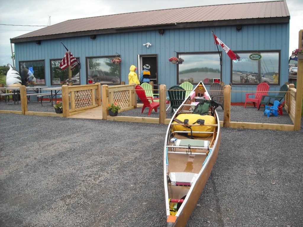
We had somewhat of a goal of making it to the Canoe and Co campsite which Erik had bought me as a Christmas present. When we arrived at Canoe and Co we were welcomed by stone steps which made it easy to get out of the muddy bank. Even though it was only 3:30 pm, we decided the amenities at the Canoe and Co campsite were too good to pass up: friendly owners (the campsite is located near their house on their mowed lawn), shelter under their house on stilts, a picnic table, running water, and a flush outhouse!

Day 9: 6/7/12: Canoe and Co to Newport, VT

The next morning we got up early and were on our way. The owner of Canoe and Co thought it would take us six to seven hours to canoe upstream to Mansonville but it only took us three. The current was swift but we paddled hard. We persevered up several Class I rapids, only having to get out a couple times to get our boat around shallow sections. Emily even took a video of us canoeing up a Class I rapid.
When we got to Mansonville we were looking forward to getting some bakery goods at the infamous bakery but we arrived an hour too early. Fortunately the owner saw us looking in the window and opened up just for us! The croissants were amazing!
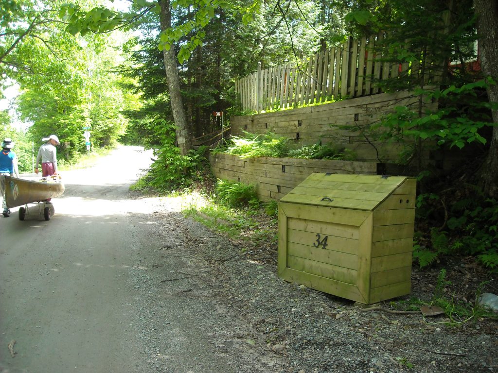
We decided to just continue wheeling from Mansonville rather than getting in and canoeing the north branch for only a mile. We passed some funny looking garbages – wooden boxes. We weren’t sure of the purpose- perhaps to look nice- since it seemed pretty easy for bears to get in.
Next was the Chemin Peabody portage between the Missisquoi River drainage and Lake Memphremagog. It was one of the only gravel roads we had to wheel on and since it climbed up a big hill, it took all three of us pulling the canoe to keep it going. It was long and hard and one of the more difficult portages of the trip, but not the most difficult. On the way down the Chemin Peabody, Erik tied a log to the back of the canoe to act as a brake. There were very nice views on the Chemin Peabody looking westward to big hills and eastward to Lake Memphremagog and the Owl’s Head.


At Lake Memphremagog we power washed our canoe before enjoying just over two hours of flatwater paddling on the lake as we headed south back towards Vermont and the town of Newport. We even had a slight tailwind.
When we got to Newport we had some difficulty locating customs as we were looking for an actual house although it turned out to just be a phone on the wall!

Even though the weather was nice we opted for a hotel since there weren’t good campsites in the area. We stayed at the Newport City Motel where we were able to fit our canoe into the room. It made walking around the room rather difficult.

And we made our way to Map 6!
Day 10: 6/8/12: Newport, VT to Brighton State Park

We slept in and enjoyed a continental breakfast so we didn’t get started until 8 am. This day marked the start of a new river – the Clyde River – which required more upstream paddling. We decided to portage from Newport rather than canoe upstream with lots of rapids. We particularly weren’t interested in canoeing the section between Clyde Pond and Salem Lake which had no portage so we wheeled on our favorite VT 105. Unfortunately we started during rush hour and had to contend with some traffic.
When we got to Salem Lake we found some Inn owners who let us use their dock. We paddled across Salem Lake and Little Salem Pond and starting canoeing up the Clyde River. It didn’t take long before the current got very strong, especially around corners, and we encountered our first Class I rapid. At this time we decided we liked VT 105 so much that we should do more portaging along the road. I got rather grumpy. From reading the guidebook it seemed like we would be portaging most of Vermont and New Hampshire and so far we had portaged most of Vermont. I realized it was more likely we would get hit by a car then drown in rapids, and this was a CANOE trip. Fortunately this was a short portage and we were able to put in on Pensioner Pond.
In this section the Clyde River meandered. We came upon a giant turtle sculpture and a short time later it started to rain. The rain didn’t last too long. The banks were very muddy and the current was strong so we paddled until we got to Cross Road in East Charleston where we were able to take out. The forecast called for thunderstorms and so we had made reservations at Brighton State Park and were supposed to get there by 6 pm and we figured that if we continued canoeing up the Clyde River we wouldn’t get there in time so we decided to portage to Island Pond along VT 105. We knew this would also allow us to skip the section of Class I-II rapids just before Island Pond.
As we wheeled along, Emily and I exchanged medical case studies to help me prepare for my nurse practitioner boards I would later sign up for in Stratton, ME and take two weeks after finishing the NFCT.
Again, we had mixed feelings about wheeling as opposed to paddling. Perhaps had it been a nice day without rain with more camping opportunities we would have paddled more. Paddling upstream through rapids is fun for awhile, like a couple hours, but it takes lots of energy and we weren’t ready to commit several days as it would have taken us to paddle up the rivers in Vermont and New Hampshire. The lure of the road was simply too great. As we neared the intersection with Hwy 114, we looked up the Clyde River and saw beautiful flatwater under cloudy skies. As much as that flatwater lured us, it would take 15 minutes to get the canoe off the cart and us in the water, plus another 15 minutes to get out of the water and the canoe back on the cart should we have come to rapids.
Traditionally poling is used for upstream canoe travel in rapids. We decided that rather than investing in a pole (including making one) and learning the technique, we would just wheel if the upstream paddling was too futile. Another option is lining but we’ve yet to find shores that either aren’t too rocky or don’t have too much underbrush to make this a worthwhile option.
When we got to Island Pond it started raining again. We got in the canoe and took refuge under the Clyde River Motel where it smelled like French fries. When the rain stopped we canoed across Island Pond.
Halfway across Island Pond we realized there was a storm approaching which made us canoe even faster. We landed on the Brighton State Park beach before we got struck by lightening and took refuge in the beachouse. From this point on we only had one day of rain and all the rivers flowed directly into the Atlantic Ocean without going through the St. Lawrence.
When the skies cleared we wheeled into Brighton State Park where we stayed in another lean-to. The mosquitoes were bad though so we set up our tents inside the lean-to.

Day 11: 6/9/12: Brighton State Park to the Samuel Benton campsite on the Connecticut River

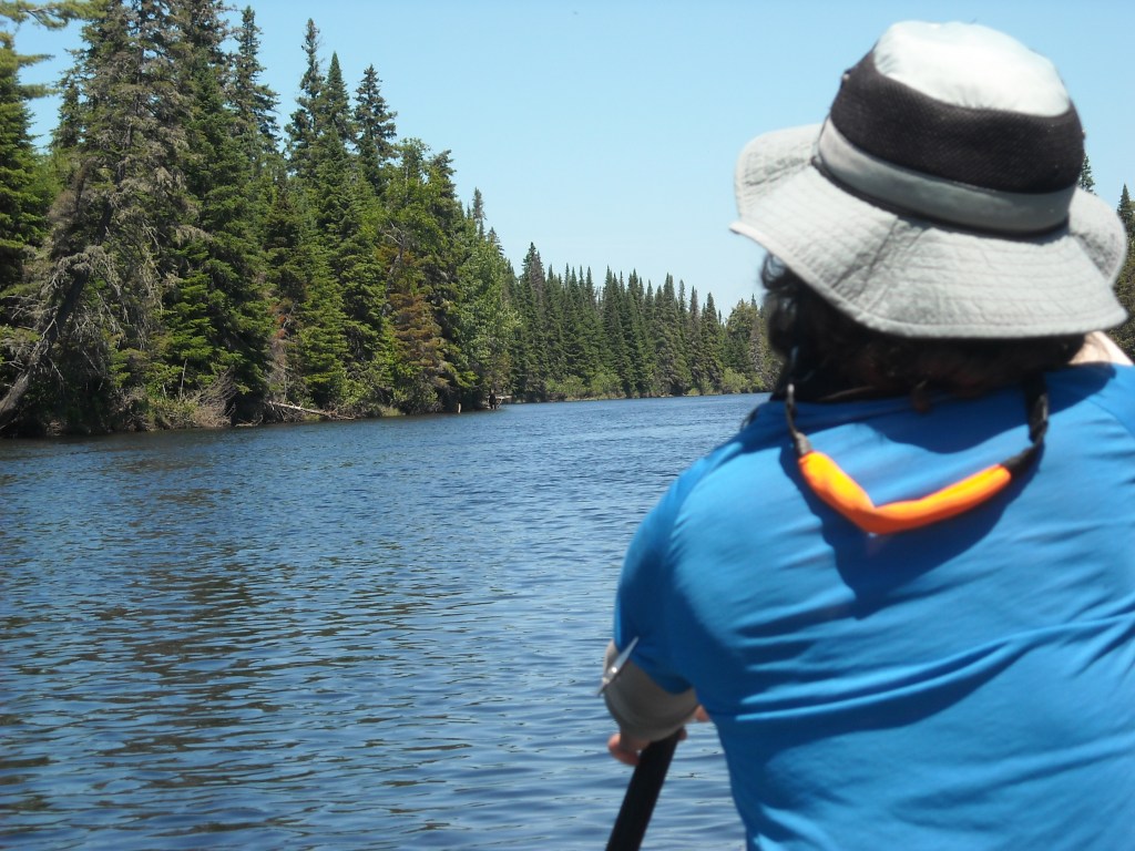
We were excited for this day because we had spent the previous five days crossing big lakes and canoeing upstream and were ready for some downstream paddling. After portaging to Lake Nulhegan we canoed across the pretty lake and then down the narrow, twisty stream that was the headwaters of the Nulhegan River. We barged our way across several beaver dams and occasionally had to get out to pull over. We used many steering techniques in the front and back to get our long canoe to make sharp turns in the narrow river, slowing our progress, but at least we were going downstream.


After we crossed under VT 105 the second time, the Nulhegan got wider and we made fast progress. The set of rapids near the train tracks was rather confusing. At the first set of Class I-II rapids the water levels weren’t high enough to canoe. Erik walked the canoe downstream while Emily and I bushwacked through the forest. This rapid was fairly short and then we got back in and ran another small section of Class I-II rapids. Then the train tracks got really close and it seemed like there were bigger rapids ahead so we decided to portage. We didn’t see a portage trail so we carried along the railroad tracks.
When we got to where the railroad crosses the Nulhegan we couldn’t find a good place to put in so we continued portaging along the railroad tracks until we got to VT 105 which we then wheeled for awhile. We figured a canoe trip isn’t complete without a portage along the railroad tracks.
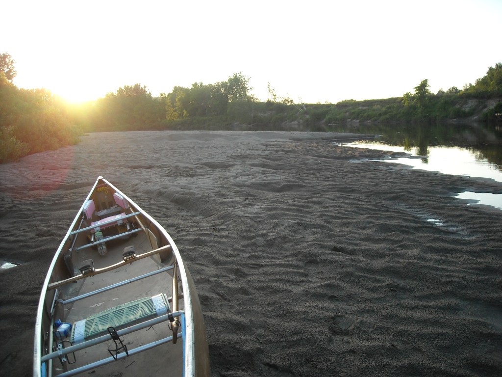
Our intentions were to put in on the East Branch of the Nulhegan River where it crosses our favorite VT 105 but the water levels were too low so we continued portaging until we got almost to Bloomfield. Then we put in, officially made it to Map 7, and canoed down the Connecticut River swiftly with the help of some current. We stayed at the Samuel Benton campsite. It had a nice looking beach that turned out to be sinking muck. The grass was very tall although there was a picnic table. There was no outhouse.

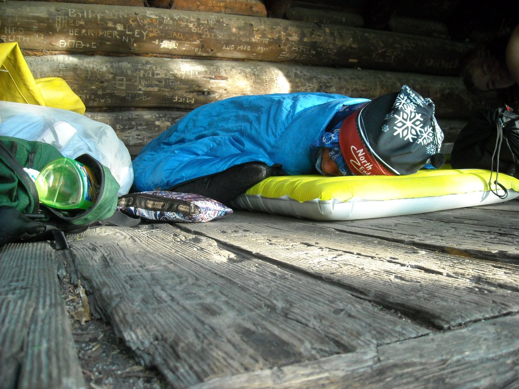
Emily started her trend of sleeping on picnic tables at this site.
Day 12: 6/10/12: Connecticut River to West Milan, NH

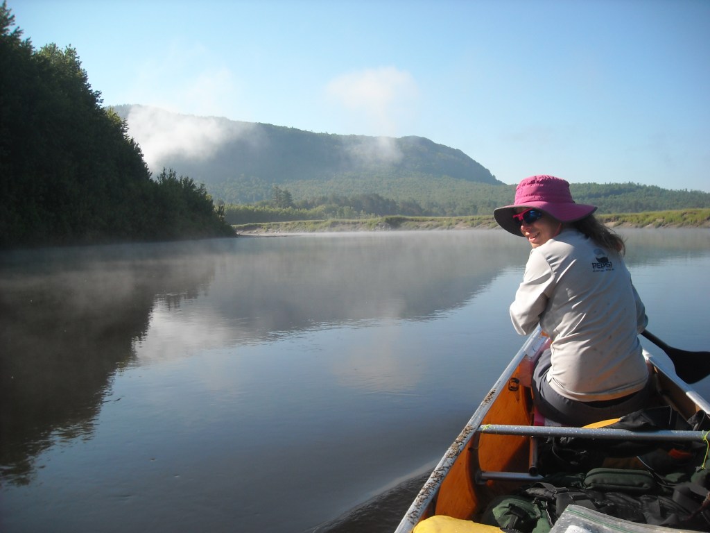
We got up early and found a heavy dew. Erik and I had been camped near the tall grass, not under any trees. Emily was soaked on the picnic table. By far this seemed to be the coldest morning of the trip. For the first hour we paddled in a dense fog down the Connecticut which gradually lifted by the time we got to the junction with the Ammonoosuc River which also ended our downstream paddling for awhile after just a mere three hours. Alas, all good things must come to an end.

Immediately the current on the Ammonoosuc River was very strong and we had difficulty canoeing up the many bends in the river. The water was shallow creating some Class I rapids. At times Erik got out and using the rope pulled up the canoe with me and Emily. It took us an hour to go the two miles upstream on the Ammonoosuc from its mouth with the Connecticut River to Groveton.
We portaged through Groveton around the dams and then stayed on river right with the plan to put in above the third of three dams in Groveton. The plan went well until we realized the deadwater above the third dam lasted less than one quarter mile and before long we were paddling up a shallow river with lots of rapids and fighting to not loose ground. We decided to scramble up the steep bank and make NH 110 our new best friend.
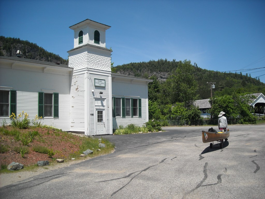
This plan went well except for the cars and heat boiling in. We wheeled through the picturesque town of Stark with a funny sized library. We thought about starting to paddle in Stark but there were too many rapids so we continued wheeling. During this stretch we saw a couple groups of people floating down the river in inner tubes. Floating downstream obviously made more sense than trying to canoe upstream.


By the time we got to Bell Hill Road we tried to paddle and this time were successful. Although there was a fast current the river here had a narrow channel and was deep so using good power we made steady progress.
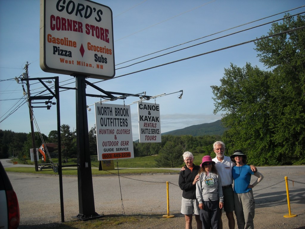
We made it to Gord’s store in West Milan and from there we were picked up by Sue and Brad Wyman, from WarmShowers, where we spent the night. They offer free lodging to bikers or canoers. They biked across the country together and had great hospitality. It was very nice to take a shower, sit on chairs, and sleep in a bed!
Day 13: 6/11/12: West Milan, NH to Lake Umbagog in Maine

The morning began with a portage into the Androscoggin watershed. We had to wheel the canoe up another large hill. Once we got to the Andoscoggin we knew there were continuous rapids below the Pontook Reservoir Dam so we continued wheeling until just above that dam.

When we finally put in we were glad to be paddling rather than walking and enjoyed a few miles of deadwater; however, before too long we came to the rapids at the south end of Thirteen Mile Woods. Since there was no easy way to the road we started canoeing up the rapids on river right. We stayed close to the shore and had to take several breaks, resting by grabbing onto trees. This was tiring and nerve racking as the rapids were continuous Class I-II. I would have been scared canoeing down them! One time we got stuck on a rock really bad and Emily, who was sitting in the middle, had to get out of the boat so we could get off the rock.
After that section we had an easy upstream paddle with gentle current to the Seven Islands Bridge. From there we decided to portage along the road again to avoid a considerable section of upstream paddling through Class II rapids. We wheeled all the way just past Molidgewock State Park. During this section of wheeling we had our scariest encounter with a full 18 wheeler logging truck. There was no shoulder and we were as close to the side as we could go and I swear that driver didn’t move over an inch.
Once we got back in the water we had an easy, fast canoe to Errol. We found the portage around the Errol dam and rapids downstream to be somewhat confusing. The take-out on Bragg’s Bay was easy to find. Once crossing Hwy 26 we walked through the campground at Northern Waters Outfitters. We talked to a nice employee there who said camping was free at that location for NFCT thru-paddlers. He also told us that the Cedar Stump campground on Lake Umbagog was owned by Northern Waters Outfitters and that camping there was also free for thru-paddlers. We portaged down the dirt road owned by Northern Waters Outfitters until it intersects Hwy 16. It seemed like there we were supposed to put in and canoe across the Androscoggin below the dam and then portage around the dam on river left and put in at the boat launch. These directions are shown on Map 8. Instead we mistakenly continued portaging along Hwy 16 as is shown on Map 7 (circa 2010). We put in on a private dock.
We enjoyed canoeing across Lake Umbagog, now on Map 8, especially since it truly was flatwater, although we were all fading and split a Cliff bar three ways in the middle of the lake. We spent the night at Cedar Stump Campground. This was our first night in Maine and we were surprised that above the picnic table was a skinny log held up by two skinny logs on either end. We reasoned that this must be a bear hang although it seemed like the bears could get to our food pretty easily by climbing on the picnic table so after we hung our food we moved the picnic table out from under the “bear hang.”
Day 14: 6/12/12: Lake Umbagog to Rangeley Logging Museum

The day started with a very slow traverse of the Rapid River portage. Erik initially tried to take the canoe on his shoulders seeing as the portage was very rocky but this was uncomfortable. Next we tried wheeling the canoe without any gear in it. This involved Emily and I jointly carrying the canoe from the front while Erik lifted the canoe from the back to avoid rolling over all the rocky sections. Eventually we were able to put in and canoe across Pond in the River before we had to portage again with Erik carrying the canoe on his shoulders. By the time we reached Lower Richardson Lake we had traveled 3.8 miles in three hours. Things were not looking good for our goal destination of the day (the Rangeley Logging Museum) but once on water we were quickly able to make good time.

We had a good tailwind for the Richardson and Mooselookmeguntic Lakes. It was really hot and we even stopped for a swim on Mooselookmeguntic.
We took “Carry Road” from Mooselookmeguntic Lake to Rangely Lake. In Oquossoc we stopped at the general store where we ate some ice cream.

On Rangeley Lake we largely had a side wind. It made difficult paddling and several times we almost got water over the front of the boat.

By the time we arrived in Rangeley there were some clouds brewing to the west. We moved to Map 9 and started portaging to the Rangeley Logging Museum where we found an NFCT log book and our choice of picnic shelters. We were glad to be under a picnic shelter because that night it rained a lot.


Day 15: 6/13/12: Rangeley Logging Museum to Flagstaff Lake

Maine presented us with three big challenges. The first was the South Branch of the Dead River. We expected to encounter low water on this section. The picture on the back of Map 9 of a very rocky, boulder strewn South Branch didn’t ease our spirits. Given that we had portage wheels and seeing as there were some potential Class III rapids on the South Branch with no marked portage, we wheeled from the Logging Museum to Stratton for six hours and then took a break at the library where we caught up on email. While Emily and I went grocery shopping Erik conducted a phone interview for a job.


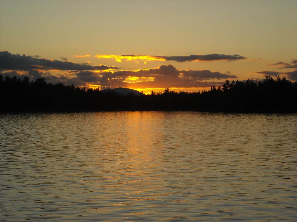
Then we finally got to do some canoeing as we paddled out on Flagstaff Lake which was named after the town which was flooded in 1950 to dam up the Dead River. We only canoed one hour that day to the Savage Farm Campsite on Flagstaff Lake which had a really nice sand beach, pinetums, and a rocky point. I enjoyed a quick swim. It reminded me of the Boundary Waters.


Day 16: 6/14/12: Flagstaff Lake to Middle Deadwater on Little Spencer Stream
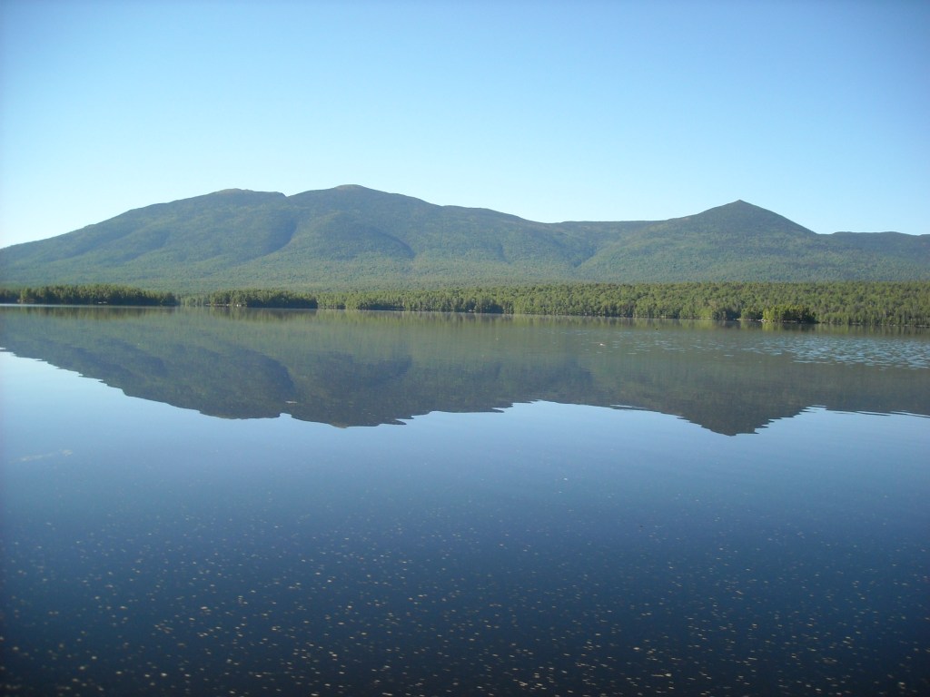
We got an early start on Flagstaff Lake and enjoyed placid water and good views of the Bigelows until we turned north. Then we canoed into big whitecaps.
We thought the portage around Long Falls Dam was going to be wheelable but it proved to be a single track trail. There was a spot halfway through where the NFCT had recently installed a new kiosk that offered a good view of the rapids. We stopped there for lunch.

When we got to the end of the portage we found the river too rocky to put in. We continued portaging to the Big Eddy campsite where we were able to begin canoeing although there were several riffles almost all the way to Grand Falls.
The Grand Falls portage was confusing. We had looked at the map at the kiosk and from there decided to take the Maine Huts Trail. This was fine on river right but once we crossed the river on the bridge the trail was difficult going although it did afford some great views of the falls. The trail down to the river was very steep. In talking to some other people we should have taken the road after crossing the river. When we put in we canoed upstream as close as we could get to the falls.

Our second big challenge in Maine was Little Spencer Stream. We could tell from its confluence with the Dead River that it was too shallow to paddle and too deep for me to comfortably walk up. It was 4 pm when we got there and since it was too early to camp we cracked open Map 10 and took some time figuring what to do. Eventually we decided to take the Enchanted Road to the first logging road which then intersects Little Spencer Stream. That section was really nice and smelled of red pines. If I ever become a professional runner, I would move to Maine to train on the logging roads. When we got to Little Spencer Stream we found an old zip line that, unfortunately for Erik, was locked, so we got to paddling, or rather, trying to paddle.
Previously in a blog for the Minnesota Canoe Association, I described our paddling up Little Spencer stream as “grotesque: three hours of gut wrenching paddling upstream over Class I-II rapids repeatedly. At our best we would dig in deep with our paddles in sync and make it up the rapid, although often this required a second or even third try, sometimes with surfing. Other times we would trade off bracing and trying to pull ourselves up the rapids by locking our hands or paddles on rocks. We were glad to have sturdy wood and metal paddles along for this challenge. We longed for flat water and when we would reach small stretches of flat water it felt like heaven. At one point Erik was uber-man and got out of the canoe and pulled it upstream through the rapids while Emily and I braced in the canoe, paddles ready, just in case Erik took a misstep on the slippery rocks.”
Emily and I (especially me) were bad at walking upstream on the rocks. I find them really slippery and I’m always worried about rolling, or worse, breaking, my ankle. I also have this thing where if the water is above my knees I’m afraid it will sweep me downstream. It was helpful to use one of the “beater” paddles as a walking stick. Eventually we found it was best if Erik just got out and pulled Emily and I upstream in the canoe.
We were able to paddle up most of Little Spencer Stream but it was incredibly difficult. There were many turns and many sets of small rapids. Near the Lower Deadwater the rapids got even bigger and that’s when Erik got out and pulled up Emily and me. About this time it was starting to hint at getting dark and we were longing for a camp. We were hoping to find a portage trail on Lower Deadwater but nothing looked good so we went up the rapids to Middle Deadwater with Erik again pulling the canoe up and through. This part of the trip- Erik’s strength at pulling the canoe up rapids- really stands out for Emily.
After we crossed Middle Deadwater we looked for a spot to camp or a trail and we found a decent area with little underbrush. It was in the pine trees and appeared as though maybe people had camped there before. It wasn’t very nice but it was 8 pm – we had spent four hours canoeing up 6 miles of Little Spencer Stream! That night at camp the no-see-ums were particularly bad. Erik found they flew through his head net. Good thing it was almost dark and we got into our tents after quickly making and eating some dinner.

Day 17: 6/15/12: Middle Deadwater on Little Spencer Stream to Attean Lake
In the morning we were able to locate the portage trail which led to the snowmobile trail which led to Spencer Lake.

We canoed across Spencer Lake into a strong headwind and had good views of the Bigelows behind us.


Fish Pond proved to be overgrown with cattails on the north end. We had some difficulty locating the channel but eventually found it a little more on our left than we were expecting. Soon the stream became narrow and we had to go up and over a couple beaver dams before arriving at Hardscrabble Road.
The portage route was marked with yellow (on top) and navy blue (on bottom) blazes. We followed Spencer Road to a four-way intersection where we turned left on Spencer Rips Road. This was overall a relatively short six mile portage to the Moose River.
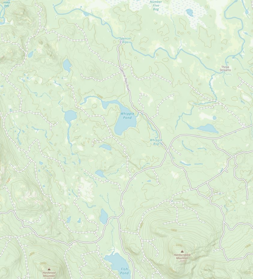
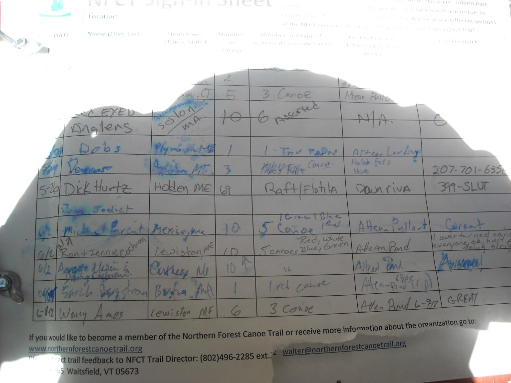
When we got to the Moose River we signed in at a NFCT kiosk. This was the last log book we signed. We particularly enjoyed an entry from Dick Hurtz from Holden, ME who had 69 in his raft/flotilla and they were headed “downriva.”
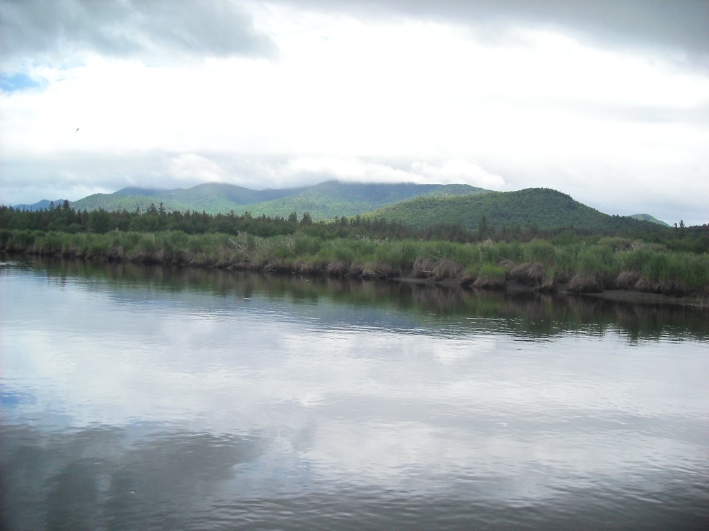
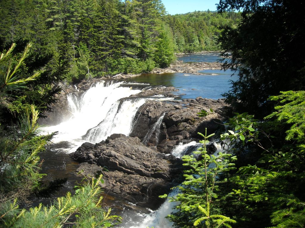
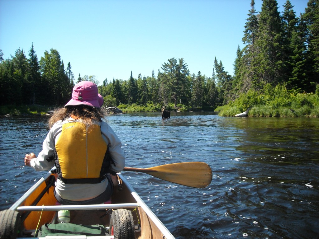
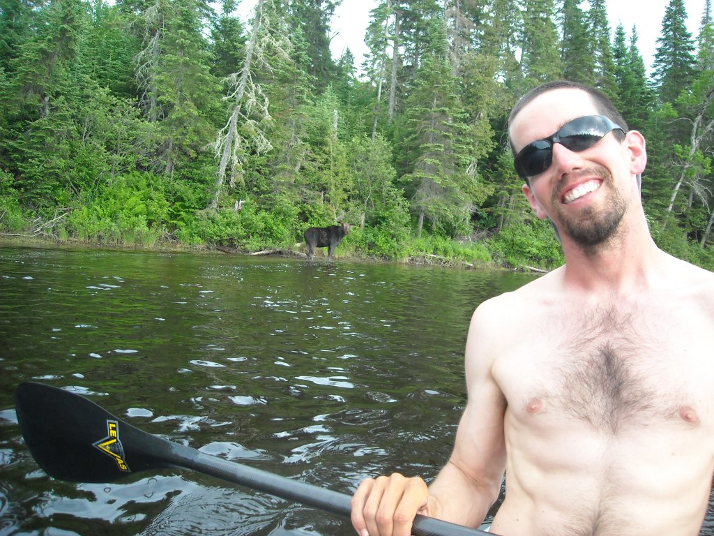
The Moose River was beautiful- it was lined with coniferous trees, surrounded by bogs, and had the downward appearance as if we were about to fall off the earth. After an hour of downstream paddling in mild current we came upon Attean Falls whose name should really be changed to rapids. We scouted the first drop from the canoe and then ran the big waves with few rocks to avoid. After wrapping around a corner we surprised a moose in the pool between the rapids. The moose looked at us for awhile. Finally, as we got even closer the moose decided to get out of the water and retreat into the forest.

The second rapid had bigger water. We scouted and I was too chicken to run the rapid. We portaged the gear around the rapid and I took a video as Erik and Emily ran it.
We canoed across Attean Lake and stayed at the farthest west Sally Beach campsite which had a good beach. Even though it was only 4:30 pm we just couldn’t pass up such a nice place to stay.
Day 18: 6/16/12: Attean Lake to Rockwood
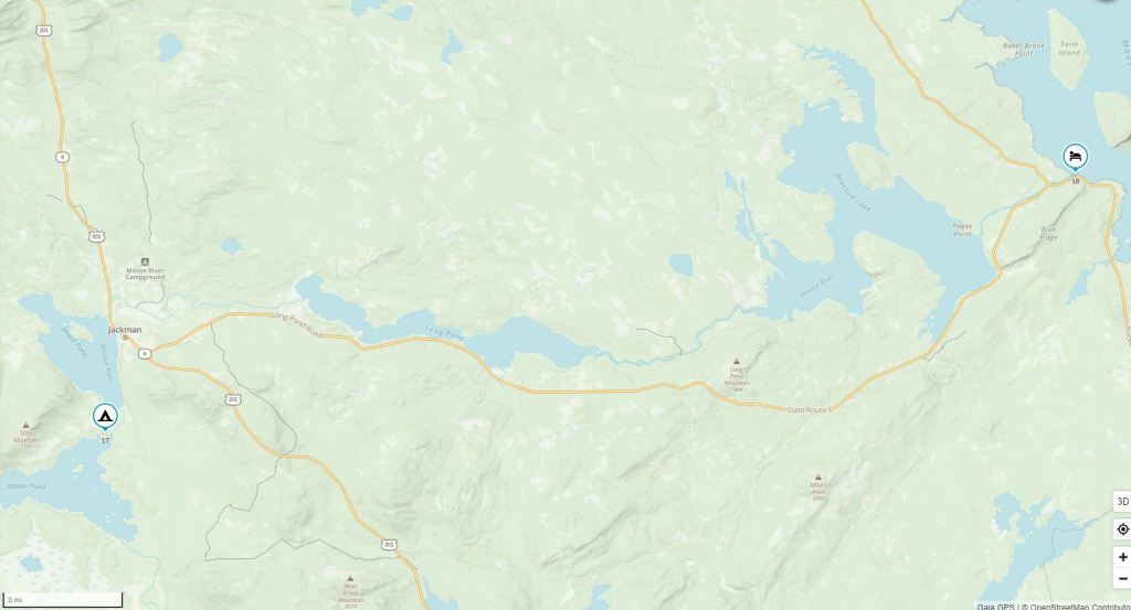

Since we had taken an easier day yesterday we had a long way to go into Rockwood where we made reservations at the Lincoln’s Camps where we had arranged to get a food drop.
After Jackman we were canoeing down the Moose River when we came upon a black plastic bag floating down the river. The bag said “thank you” on it and was just like the one Emily kept her poncho in. We thought it might be Emily’s poncho so we plucked it out of the river. It turned out to be two small trout partially gutted each in their own individual plastic bag. Erik and Emily decided they wanted them for dinner so we kept them and put them in the very back of the canoe in as much shade as we could find.
Before long we came to Long Pond which probably could have been named Long Lake. It was pretty long. I was reading the map, which I’m admittedly bad at, and thought we were to the end of the lake when we were only to the narrows! I was disappointed. The rapids once on the Moose River were relatively straightforward but we made certain to take out at the Demo Road bridge as under the bridge there was a solid Class III I surely didn’t want to run.
While we were wheeling along Demo Road, the Maine Game Warden stopped us and by then things smelled pretty fishy. Fortunately he didn’t have a good sniffer (we didn’t have fishing licenses or fishing equipment). The Game Warden was more interested in what we were doing and seemed to think we were crazy and I’m not sure he really believed that 18 days earlier we had been in Old Forge, NY. Anyway he let us go and shortly thereafter we came upon a wild strawberry patch.

We were able to find the new portage trail to Little Brassua Lake which initially was an old jeep trail that then turned onto a single track trail. Soon we were back on the water for the Brassua Lakes. We portaged around the Brassua Dam and ran the Class I-II rapids on the way to Rockwood.

We found our cabin to be only five feet from the water. It kind of looked like a fun house inside as it definitely had a tilt. We’ll suffice it to say the owners obviously had too many cats and the kitchen sink drained straight down onto the lawn, five feet from the water. I kind of wished we were camping!
Day 19: 6/17/12: Rockwood to Chesuncook Lake

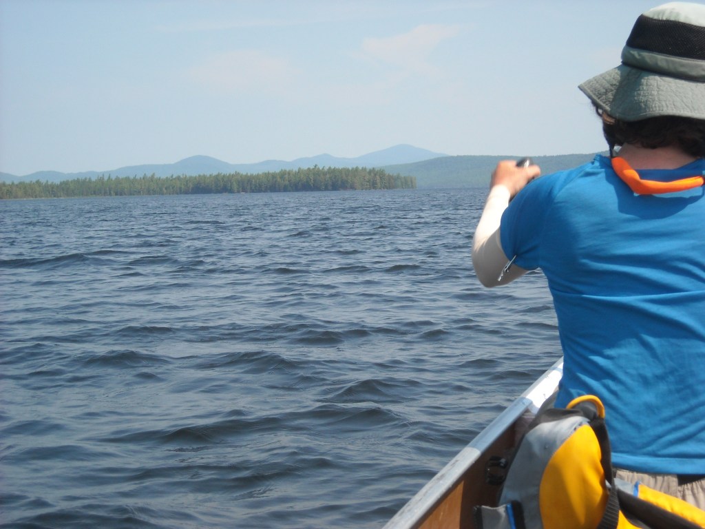
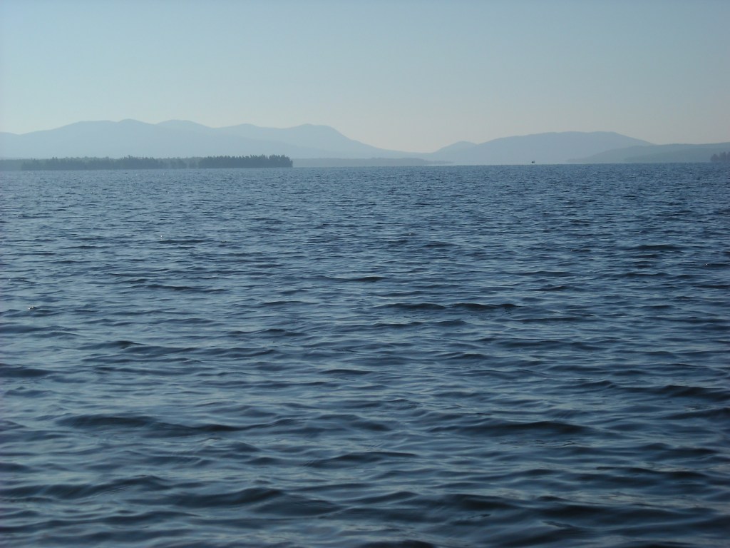
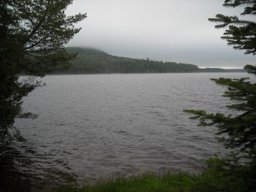
We were able to get internet service at Rockwood and were relieved to learn we would have a south-southeast wind for crossing Moosehead Lake as we started Map 11. Perhaps we should have stopped to climb Mount Kineo which had a trail to the top, but we were in too much of a hurry and wanted to get across the giant Moosehead Lake, about 16 miles of it, before the waves got too big. The tailwind was amazing- it really turned up some big waves that were even kind of scary but we made it all the way across the lake with two stops in just four hours and then we embarked on the Northeast Carry which was short except that after the four-way intersection the trail got kind of rough and was no longer conducive to wheeling and was really muddy.


Then we were on the Penobscot River, amazingly paddling downstream again. I thought that the Moose River was prettier though. The Penobscot had good current and we saw three moose and lots of moose tracks at the Big Ragmuff campsite where we stopped for lunch.
The Penobscot spilled into Chesuncook Lake.
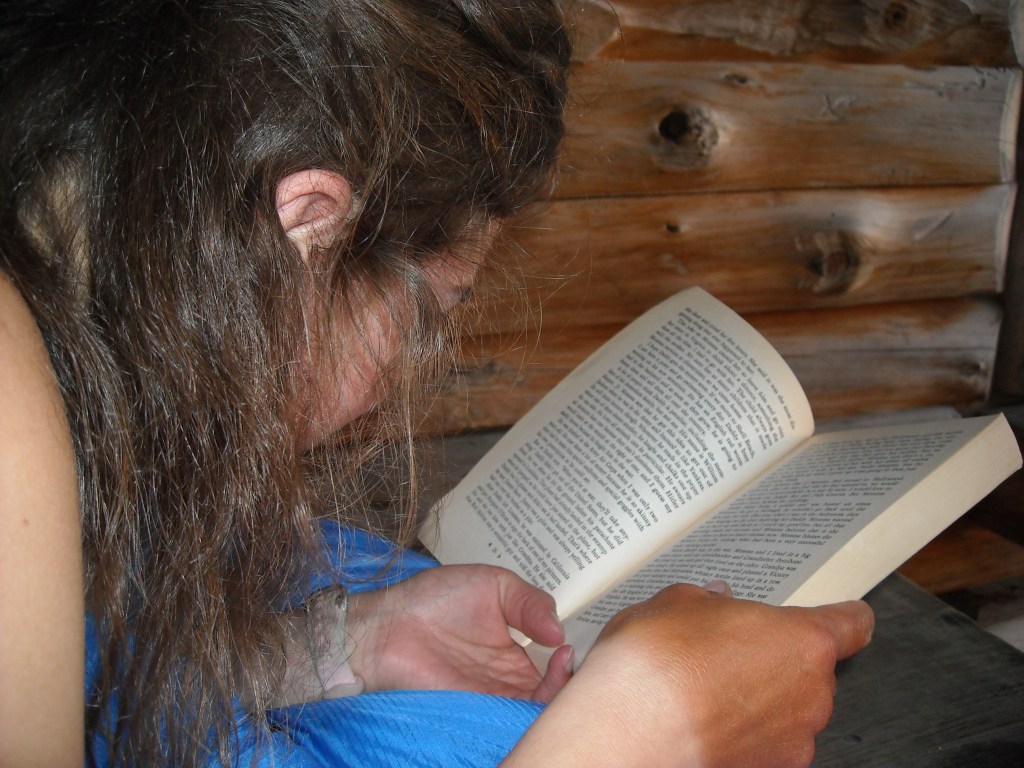
Initially our plan was to camp at the Boom House but when we got there it was full. This was the first time on our trip where someone was camping where we wanted to camp. We decided to head to Gero Island. We were glad we did because we got to stay in a nice lean-to that had lots of late night sun and we were finally able to start reading our book! We didn’t even need to pitch a tent because there were so few mosquitoes.


Day 20: 6/18/12: Chesuncook Lake to Lake Churchill

That night the winds never died down. Fortunately they were headed the right direction for us as the next morning we paddled up Umbazooksus Stream. We had to portage the Umbazooksus Bridge. In the meandering marsh above the bridge we saw several otters playing and a bull moose. We were able to canoe up the old dam at the outlet of Umbazooksus Lake on our second try. The first I had been taking a video, but apparently we needed all three of us paddling. I guess we were too cocky.
Then it was on to Maine’s third challenge: the infamous Mud Pond Carry, which can be avoided by paddling and portaging a route further west; however, we decided the NFCT wouldn’t be complete without the Mud Pond Portage. We had previously read that this portage is notoriously, well, muddy. It completely lived up to its expectations.

The beginning was very nice – a clear stream 1.5 feet wide and four inches deep with a rocky bottom. Then right before we got to the road which crossed the carry there was a big muddy section. That was the first time Erik lost his croc in the mud. After the road crossing there got to be a lot of muck. I describe it as what happens when there appears to be a bottom to the water about six inches deep but when I go to take a step I sink in at least another six inches. I found the biggest difficulty in this section was that my sandals would fill up with sticks which were very painful to walk on. Erik was able to go much faster and so was Emily so for the most part I was left in misery by myself.

There were also some mosquitoes but they didn’t hurt nearly as bad as the sticks in my sandals. Every once in a while I would stop to get the sticks out but soon after there would be another mucky section. Towards the end there was more mud than muck. The mud was slippery and when not covered in water and I rarely sank in below my ankle. I liked the mud more than the muck. When we were almost to the end of the portage there was another mucky section. This time I couldn’t seen the bottom and I was leading with a heavy pack on. I waited for Erik and when he came he pulled me across the section in the canoe…and this was a portage trail!
After 1.5 hours and 1.5 miles, we arrived at the end of the portage at Mud Pond and Map 12. We canoed across Mud Pond- dangling our legs over the edge of the canoe trying to get them clean. To get into Chamberlain Lake it looked like we could either portage or run Mud Brook. Emily and Erik were up for running Mud Brook even though it looked like it dropped 11 feet in a quarter mile. Essentially Mud Brook was for those toy boats I used to play with as a kid. There wasn’t much water and there was just one main flow that at times was barely big enough for our boat. We really had to work hard to maneuver- it seemed that every five feet there was a rock we had to turn around and with a 20 foot boat…It was so shallow though that it was like rapids without consequence as we weren’t sure our canoe could even flip over.
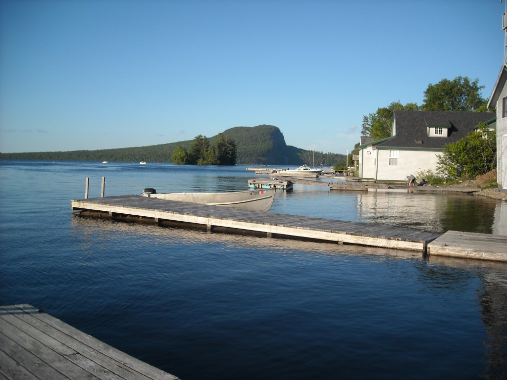
Once on Chamberlain Lake we were officially on the Allagash. We decided to portage around Lock Dam rather than do the Tramway Carry because it involved less portaging. At the Lock Dam we ran into a group of canoers who were very excited to learn about our trip. The Lock Dam was interesting because where we put in there was a giant whirlpool where the water from Chamberlain Lake came in. Then we canoed across Eagle Lake and into Churchill Lake. We camped at the High Bank campsite which was made nice by a wind that again never died down and kept the bugs away.
Day 21: 6/19/12: Churchill Lake to Michaud Farm
We purposely slept in late as our map said the Churchill Dam was only open from 8 am-noon to allow sufficient water to paddle the legendary Chase Rapids. When we got to the ranger station at Churchill Dam we learned the dam had actually been open all night. The ranger seemed pretty surprised that we were only spending two nights (we had to pay for permits) in the 90 mile Allagash and had to consult with another ranger to see if that was even possible!
There was a lot of hype about the Chase Rapids. The ranger told us to run them left, then right, then middle. That’s what we did and they didn’t seem very bad. There weren’t any ledges; however, the rapids persisted for quite a ways downstream with lots of pillow rocks. At one point just a little below Chase Rapids we briefly got stuck on one and almost tipped. The rapids were almost continuous to Umsaskis Lake. We were glad to find that the Long Lake on the Allagash was the shortest of the Long Lake/Ponds we had to traverse and then we were onto Map 13- the last map!
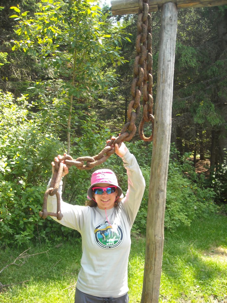
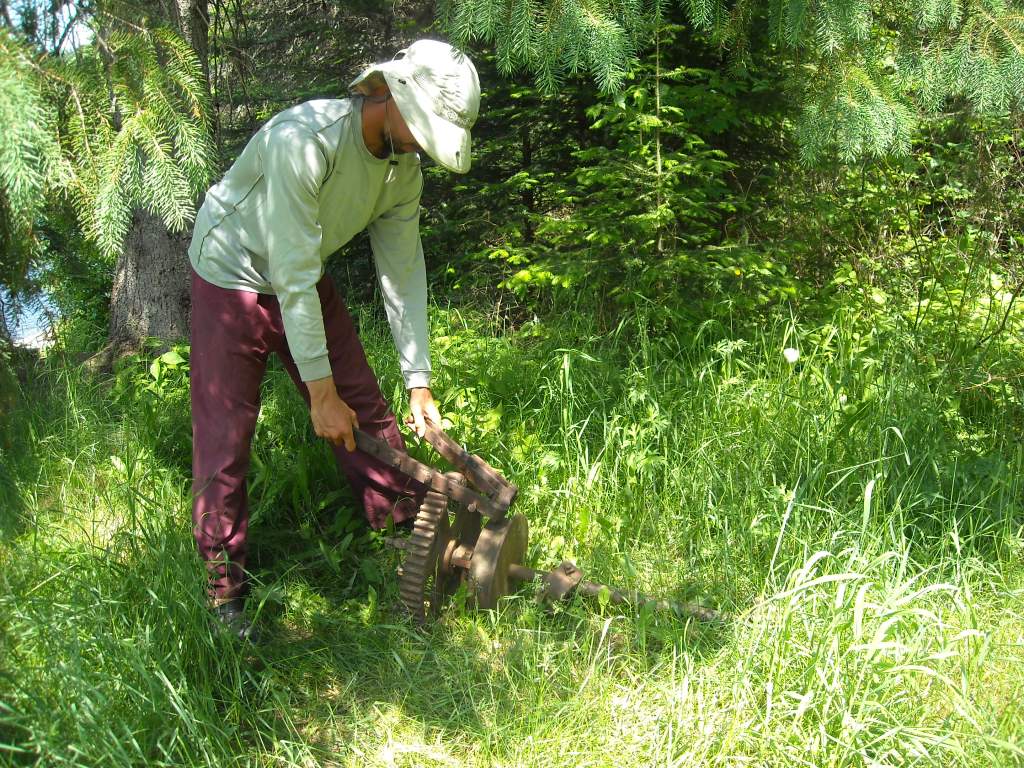
We portaged the remains of the Long Lake Dam and had lunch at the corresponding campsite where we found some rusting relics. My mom had read the map descriptions and wanted me to bring her back some rusting relics but they were heavy so we decided pictures would have to suffice.
Once back in the water we saw three chipmunks swimming across the river- all going from river left to river right. We figured maybe there was a lynx or something the chipmunks were trying to get away from. None of us had ever seen a chipmunk swim before and we were amused! We even took a picture.
Before Round Pond we saw the big elm trees that looked out of place amidst the otherwise coniferous forest. There were some storm clouds while we were on Round Pond but it didn’t rain on us. As we continued paddling north we saw seven moose on the Musquacook Deadwater between 5 pm and 6 pm including a mother and her calf. The last moose we saw was particularly photogenic and let us get really close enabling me to get some good pictures with Erik and the moose.


After the Musquacook Deadwater we passed several campsites with people who had already set up camp. None of us were particularly tired and so we continued paddling with the intent of stopping at Ramsey Ledge. However, when we got there the campsites were full. We then realized the campsites could be accessed by road. We found no one at the Michaud campsite and decided to stay there as it was almost 8 pm. We checked out of the Allagash Wilderness at the neighboring ranger station before going to bed.

Day 22: 6/20/12: Michaud Farm to Ft. Kent

We knew we had a long ways to go and so we decided that whoever woke first would wake the others as long as it was daylight. Emily woke first and she didn’t have a watch. She got us up at 4:15 am. It was after all, June 20th in northern Maine. There were several rabbits in our campsite. We thought that by getting on the water so early we might see lots of moose but we only saw one.

Overall our progress on the Allagash was severely hindered by low water. We had the expectation that we would have deep water and a current of at least 2 mph and we would be able to make good time. Instead we found constant riffles necessitating us to slow down and scout for the deepest channel. Often we used our heavy wood paddles and the whole process became rather tedious.
We saw our last moose of the trip, number sixteen, just above Allgash Falls which we portaged on the right.

We hoped for more water when the St. John came in but only found a wider, still shallow river. Indeed the character of the St. John River was much different than that of the Allagash. The St. John had a very wide river basin and small cream colored rocks filled the shoreline. There were many islands marked on our map that were just extensions of the shoreline at these low water levels. There were many class I-II rapids as well.


There was no more water once the St. Francis came in. There was one spot where the river seemed to dead end into a pile of small rocks but when I stood I was able to make out a narrow channel.
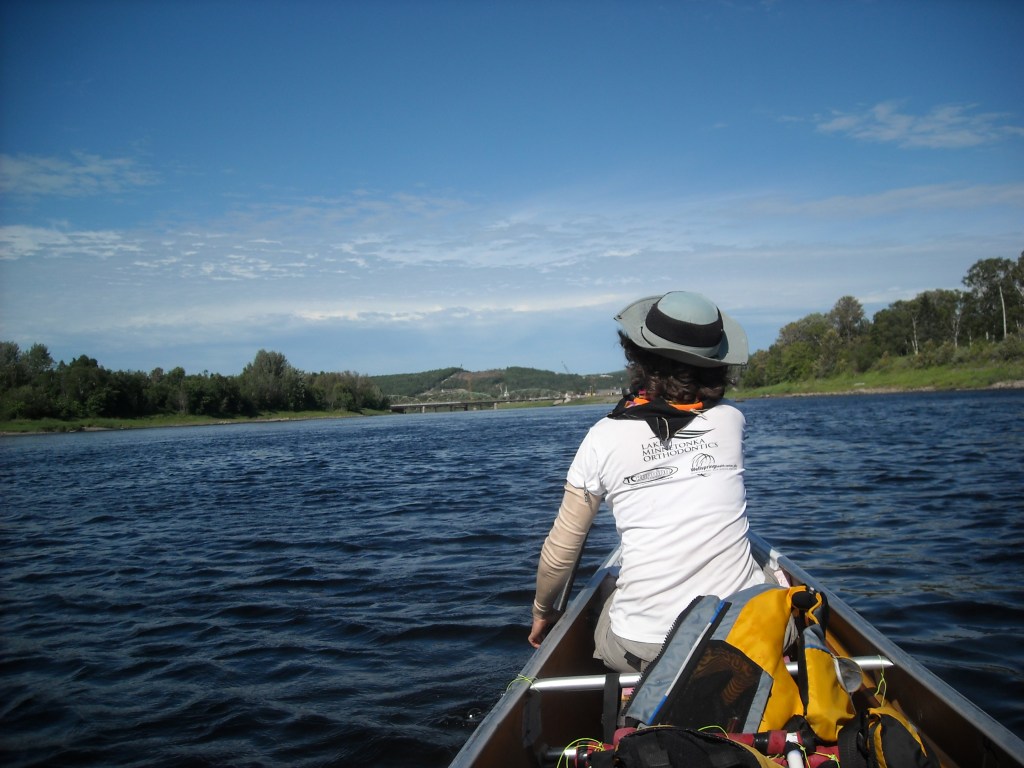
The Canadian side of the map in this section was very undeveloped making map reading difficult especially since the Canadian side of the river seemed to have more water. It was also hard to determine where we were based on islands because the water levels were too low for there to be islands. The St. John River seemed to go on forever. When we finally rounded the last corner and saw the bridge in Ft. Kent we were all very excited.

In total the NFCT took us 21 days, 3 hours, and 45 minutes.
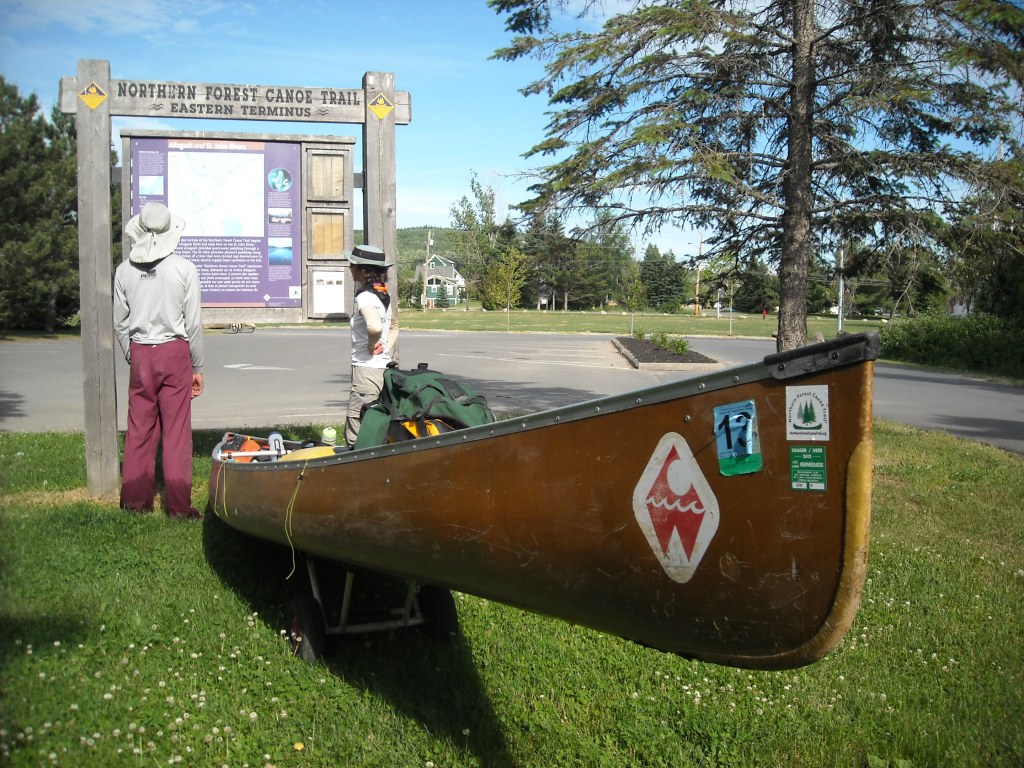
Once we got to the boat ramp we took pictures in front of the kiosk and then wheeled our canoe through town to the Northern Door Inn where we spent the night. For dinner we walked into New Brunswick for a celebratory meal of poutine- only to discover there were few restaurants open seeing as New Brunswick is in Atlantic Time and it was already 8 pm there.

The next morning we got a ride from the Allagash Outfitters to Bangor where we rented a car to drive back to Rochester, visiting Emily’s godparents in Portland, ME en route.


It’s difficult to put into words my emotions regarding a canoe trip spanning 21 days, 4 states, one province, and 700 miles. Perhaps those boys who we met on our first day back in New York can best summarize my feelings when they declared our trip impossible. Being just a few miles into our journey at that point, it did seem impossible that anyone could canoe from the middle of New York to the top of Maine. As we paddled and portaged day after day, it seemed slightly more plausible but once we finished, Old Forge felt and looked very far away in our minds and on the map.

I suppose that may be the definition of an expedition but is really just a metaphor for life, taking things second by second for years on end.
While there were parts of the NFCT I can’t wait to get back to- the Adirondacks, perhaps some downstream paddling in the middle section, and the lakes region of Maine, I wouldn’t thru-paddle the NFCT again and can’t necessarily say I would recommend it either. All that upstream paddling through rapids is only for the foolhardy- or the few who have mastered poling. I’m still glad we did it and we did enjoy the views as we portaged but am happy we had the portage wheels. In total, I added up that we went 680 miles, 153 of that portaging- mostly across Vermont and New Hampshire.
The NFCT pieces together wilderness with urban areas. While we most appreciated our time in the wilderness with designated campsites and pristine scenery, it was ultimately our time in towns and roads and meeting people that provided the most memorable experiences. Long after the trip was over we exchanged holiday cards with our friends in New York and from WarmShowers, thought about those who helped with the canoe cart failures, imagined Dick Hurtz on his flotilla of 69, and joked about the lady from the Newport City Motel who could’ve sunk our canoe.
It was a good adventure.

You are??amazing!
Sandra Pilmoor ________________________________
LikeLike