A few years ago, someone was telling me about how they were a guide in the Boundary Waters. I almost said “oh, yeah, I go there all the time.” I stopped myself and realized “Elspeth, you hardly ever go to the Boundary Waters.” Somehow, because most people I know frequently go to the Boundary Waters and because I canoed the Border Route in 2014, it seems I always go there. But that is far from true.
I went to the Boundary Waters once as a kid, with my family. We put in at Sawbill and canoed like five lakes total. Erik and I did a 5 day trip in the Boundary Waters near Lac La Croix when we were dating, back in 2006, and then there was the Border Route trip. Hence, I have yet to explore most of the Boundary Waters.
In the past many years, Erik and I have spent our vacation time in the mountains, in Alaska, and Europe- all places I deem to have more spectacular scenery than the Boundary Waters. Don’t get me wrong, I love the Minnesota topography, the water (what I always crave when I’m in the arid west) and the northern forest, but the mountains always provide a greater feast for my eyes- probably because I didn’t grow up with them and don’t see them very often.
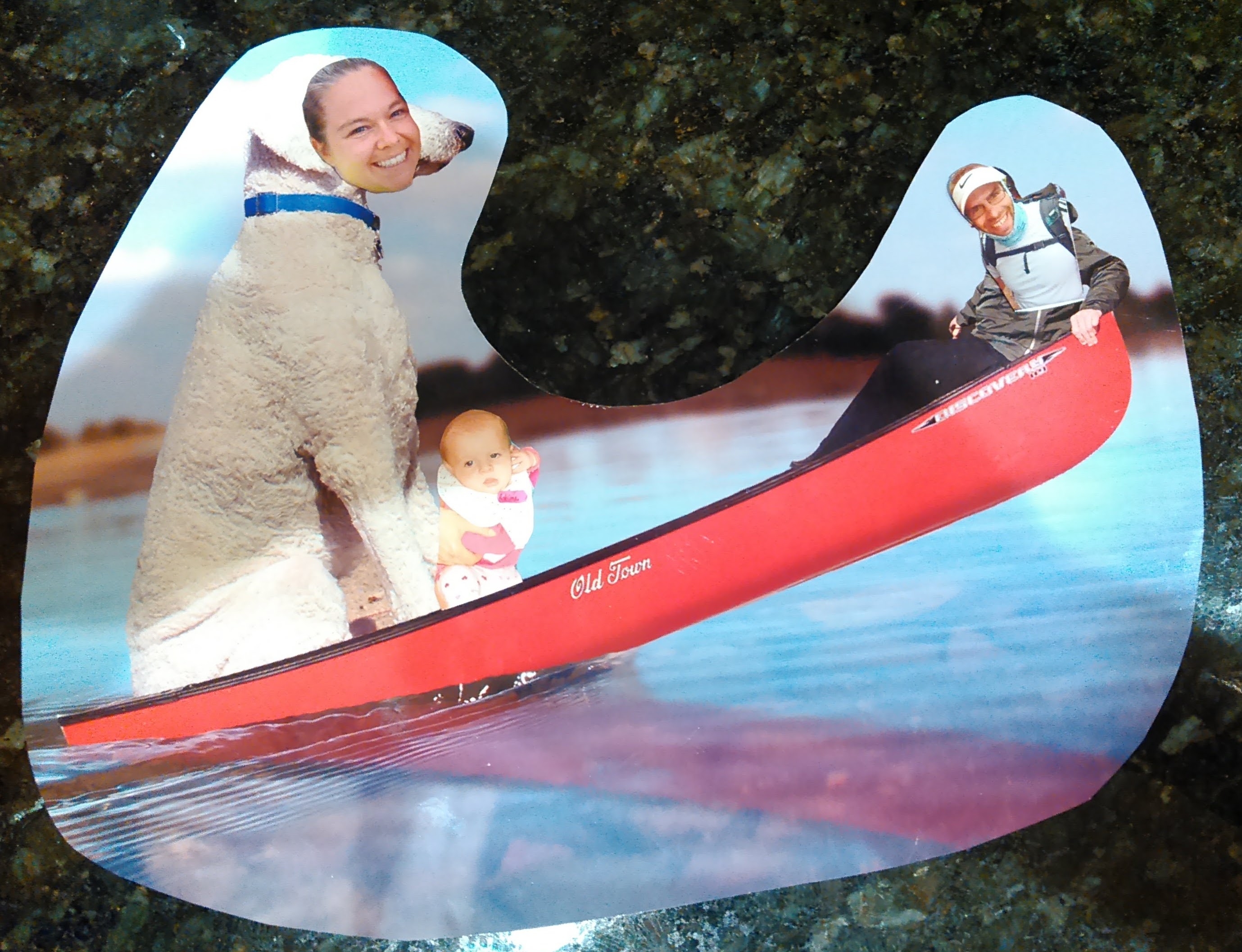
Due to COVID and gifting my 3 year old niece a canoe we decided to buy at an Ely Outfitter (because doesn’t every 3 year old want a canoe?), Erik and I decided to take a September trip to the Boundary Waters this year. It just so happened that Erik’s parents were planning a trip to the Boundary Waters the same week, also to the Ely area. I asked Erik’s dad about his favorite lakes in the Boundary Waters and accordingly planned our trip to visit those lakes and also to meet up with Erik’s parents for a couple nights.
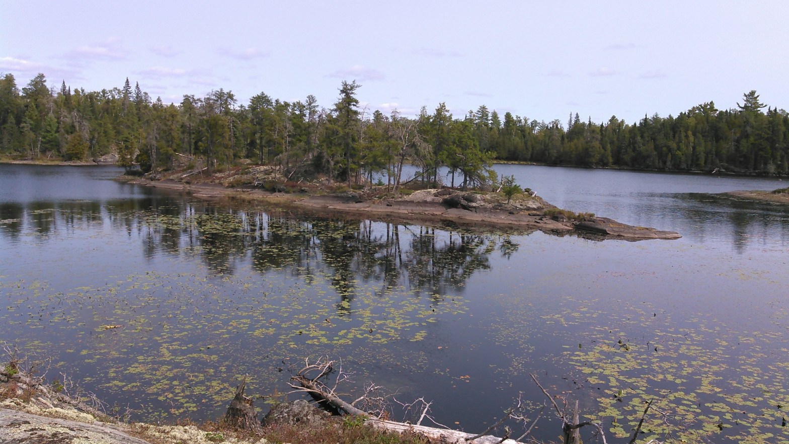
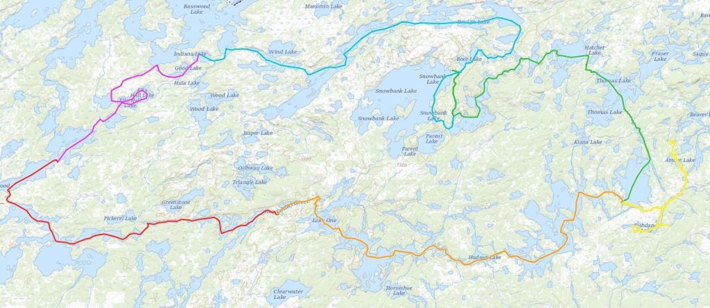
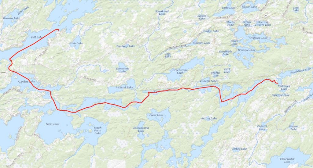
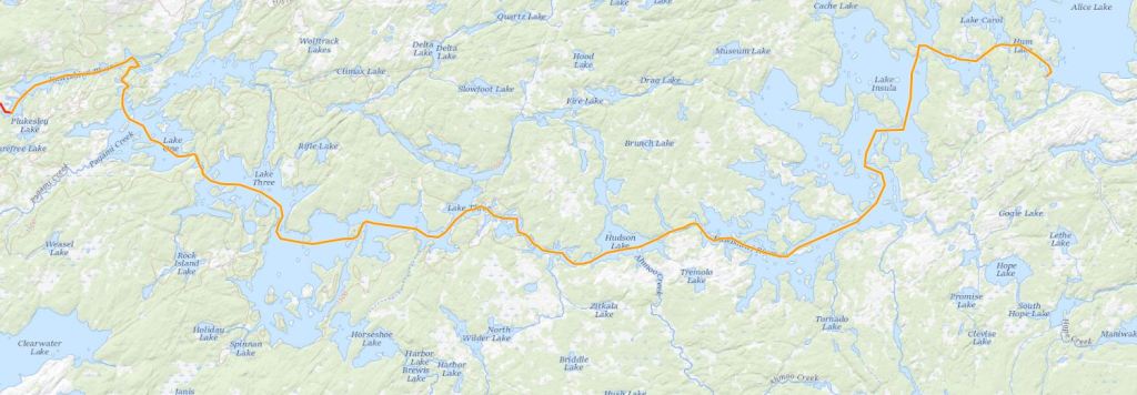
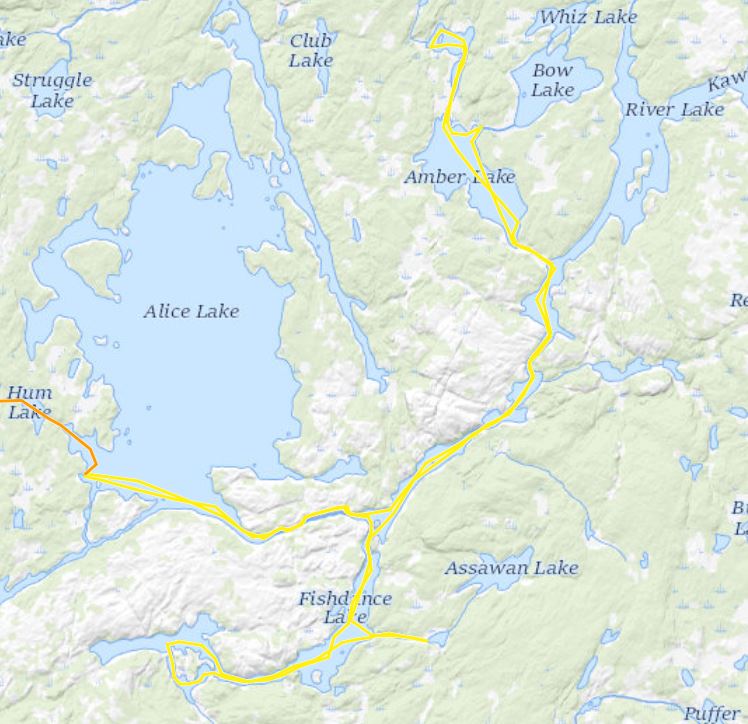
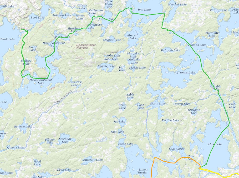
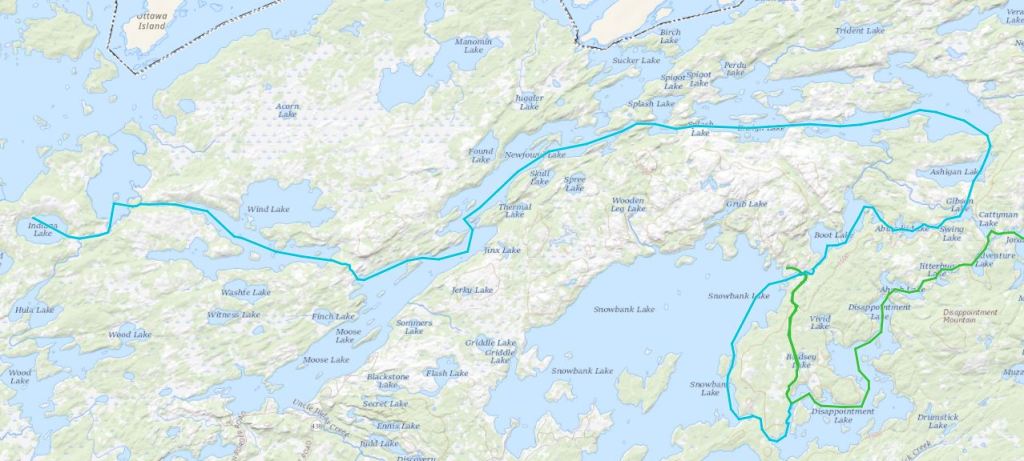
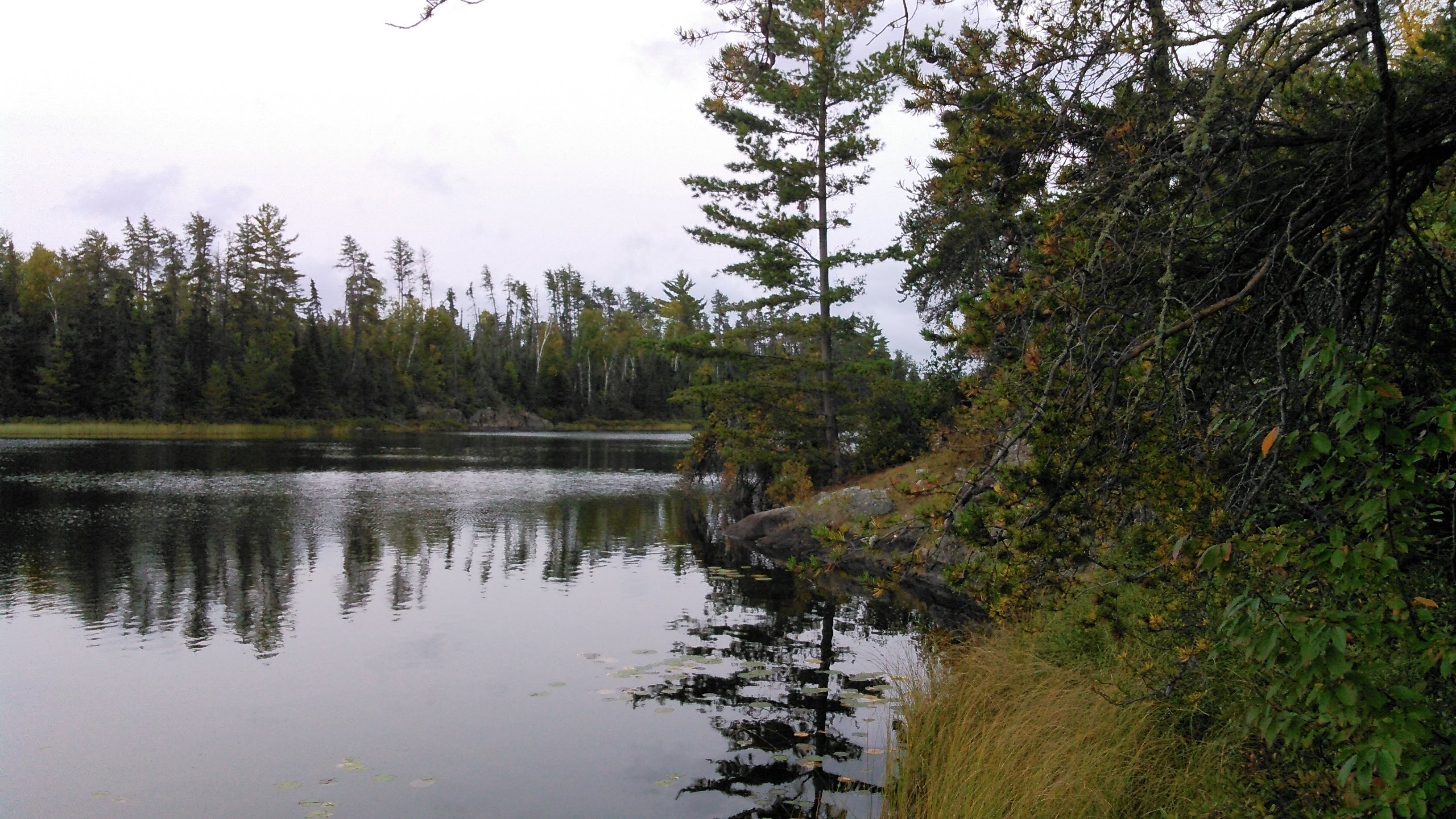
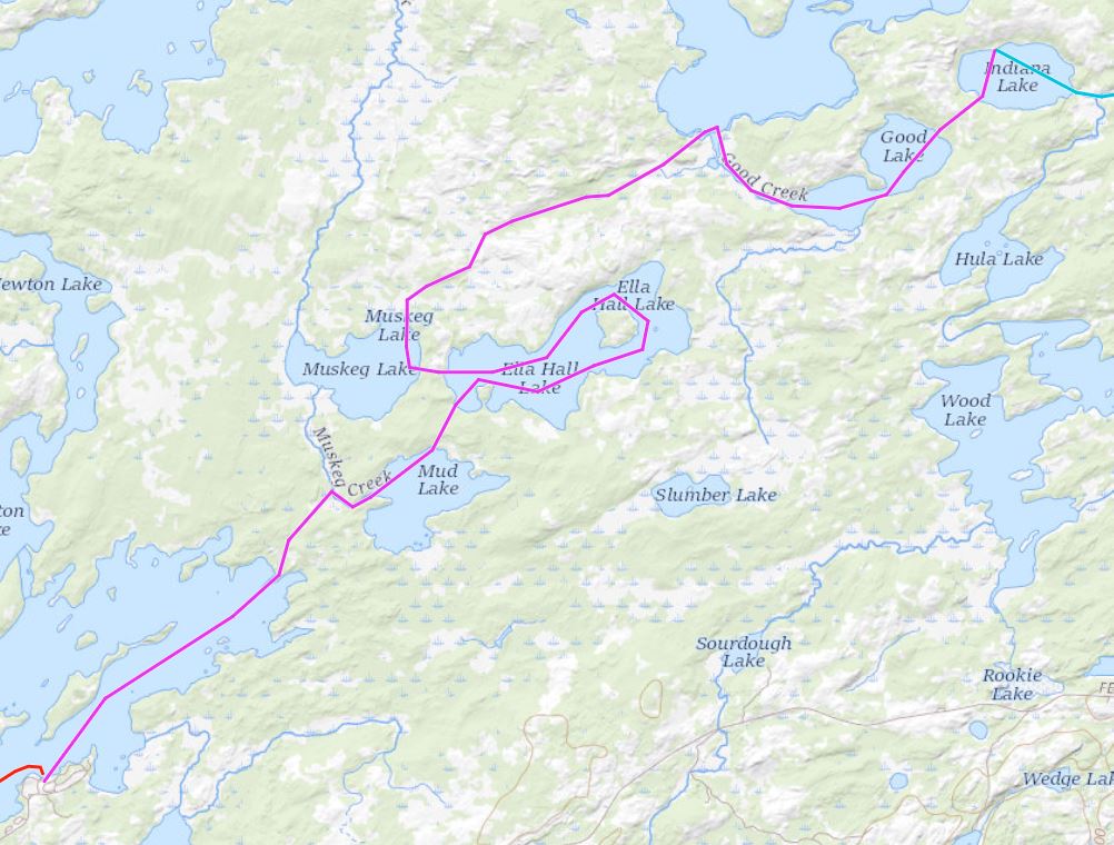
The resulting route, beginning and ending at Fall Lake, a loop Erik noted to be around Fernberg Road, often kept us close to entry points but took us through a large number of iconic Boundary Waters lakes- all but one of which were new to me!
Day One 9/12/20: Fall Lake to almost Lake One
After driving to Ely and buying the aforementioned canoe, we put in on Fall Lake at 1:30 pm. This allowed the morning’s rain to clear out. We started under overcast skies which our weather report promised to not deliver any precipitation and much appreciated calm winds. While 1:30 pm might seem late to get started, this still gave us a few hours to paddle before dusk- plenty of time as we weren’t in canoe shape to paddle all day.
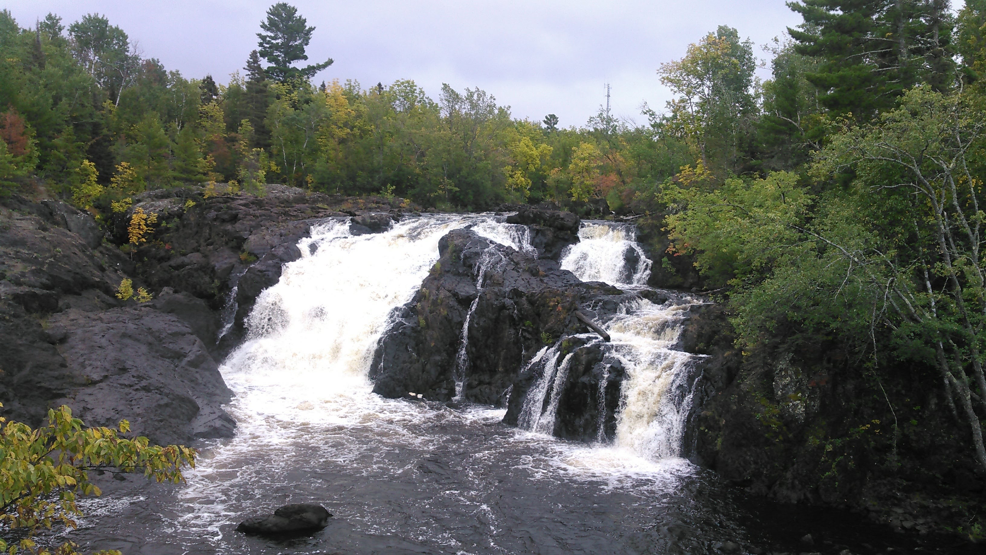
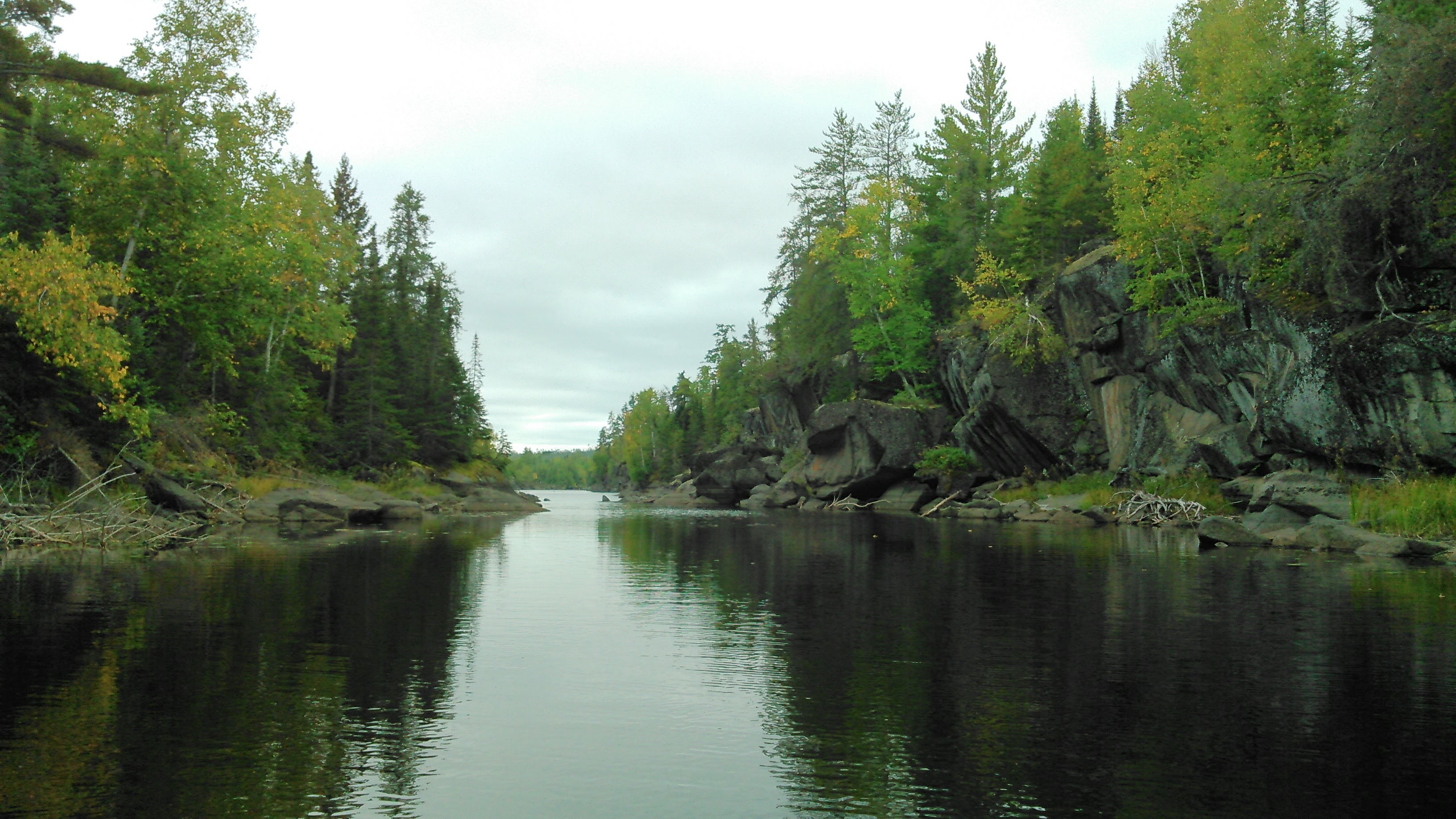
Within an hour we started on the portage around Kawishiwi Falls. There’s a designated portage but there are also hiking trails here. The falls is big- but likely used to be more spectacular before a dam was built above them. We briefly paused and Erik set down the canoe as we looked at the falls.
The portage was short and before long we were canoeing on Garden Lake. We briefly skirted the north end of Farm Lake before beginning our paddle on the Kawishiwi River. It was our understanding that water levels were low so we were a bit surprised that we didn’t need to portage either of the first two portages marked on our map at narrow sections of the river. The third marked portage, however, did require a real portage.
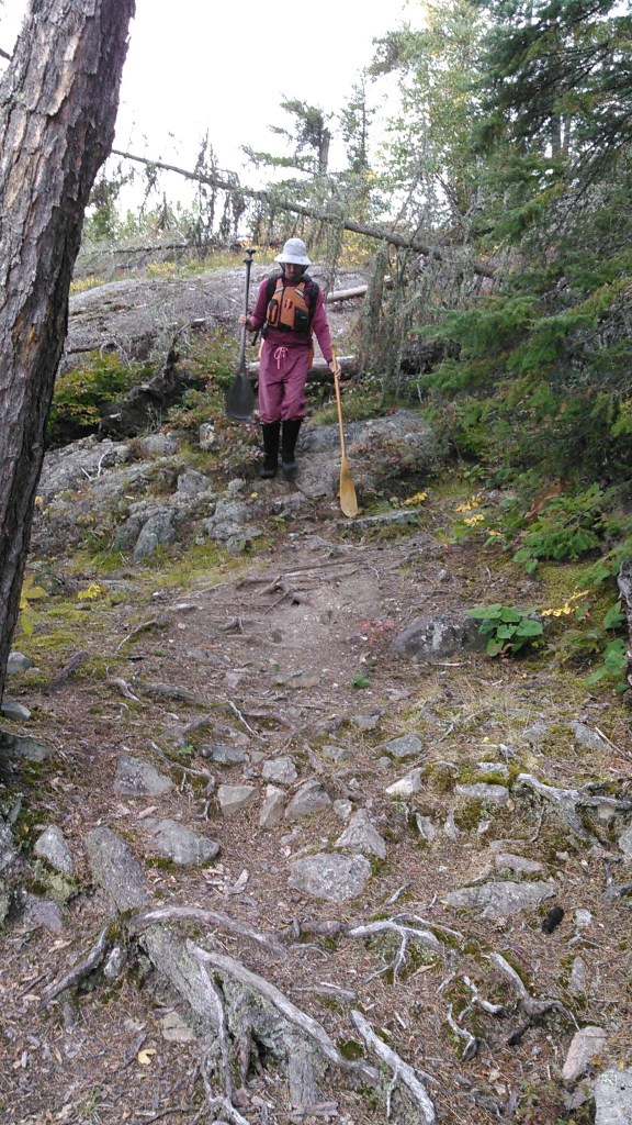
After another short portage and a bit of paddling, we came to our first long portage of 209 rods. This portage seemed super long to me. I’m not entirely sure why, but I think it has something to do with my definition of a “trail.” To me, when I’m on a maintained trail I shouldn’t be hitting side brush, but on this trail, I was continually hitting brush. Top it off with some rocks underfoot, a heavy pack with all our food, and cloudy skies, I wasn’t having too much fun. When we finally got to the end of the portage it was quite mucky.
It also likely seemed long because I couldn’t remember how many rods were in a mile. This is such a goofy measurement to me. A few weeks earlier I had asked Erik and he had told me, and then I promptly forgot. I vowed not to ask him again and in my head had something like 480 rods was a mile…or was it 520? Or even 640? It was something that when divided made sense so I knew it was at least an even number:)
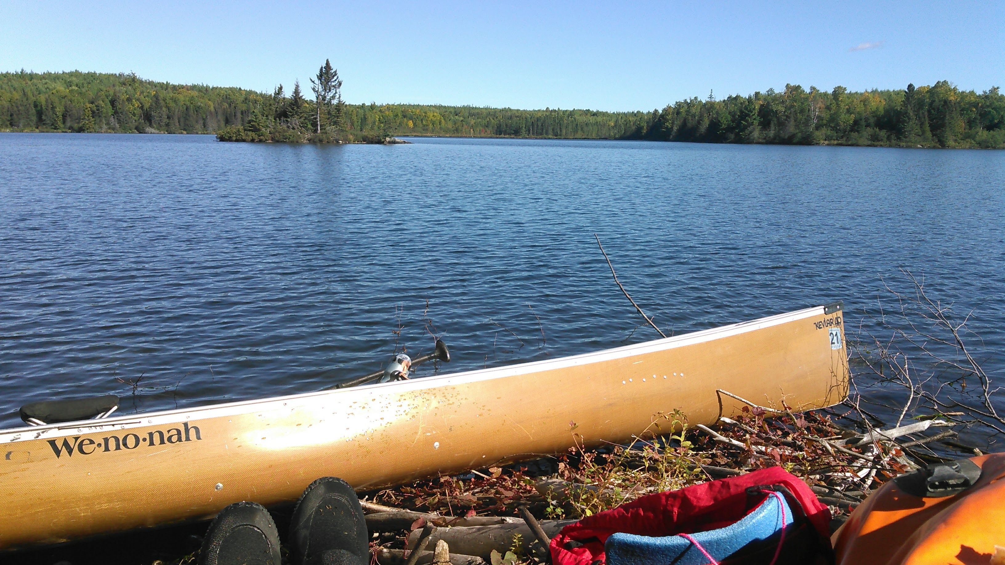
I was glad to be back in the canoe but not terribly excited for all our longer portages ahead of us on our route. Soon we came to a series of campsites. We decided to camp at one of these sites, eying one on an island and a second on a point as a backup, but these were all full. So were our other less desirable sites. And then we couldn’t find one marked on our map. We thought about camping in that area anyway, but the bush camping was exceedingly bad with lots of rocks were we would want to set up the tent.
There was one more site marked on our map after the next portage and we aimed there. When we got to that site, we couldn’t find a fire grate but the area was a bit cleared out and so we camped there. By then it was starting to get dark. We could see a camp just up the river on the opposite shore. A different map we found later had the campsite there even though both our maps, National Geographic and GAIA, showed the campsite where we were camped.
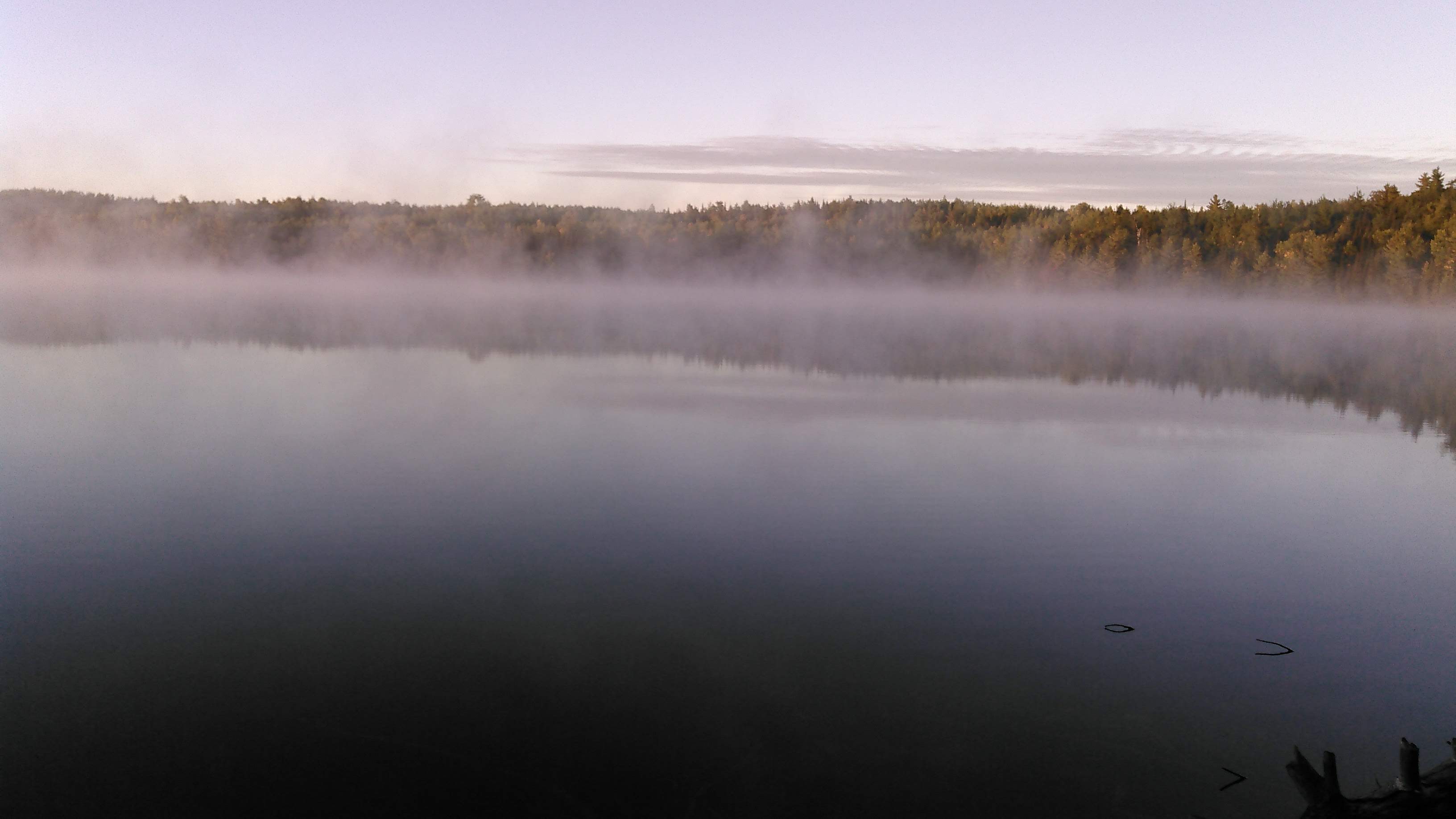
It seemed the sky was clearing and we saw stars before we went to bed, but alas the clouds came in overnight and we awoke to mild temperatures.
Day Two 9/13/20: almost to Lake One to Lake Alice
The weather forecast called for a nice tailwind this day as we chased down Erik’s parents. Our first portage was remarkably short and instead of Erik yoking the canoe, we each just picked up an end. Unfortunately I got the heavier end with the packs. This made the portage a bit harder for me. The next portage was also short but Erik yoked the canoe for it. After one more short portage, we arrived at Lake One.
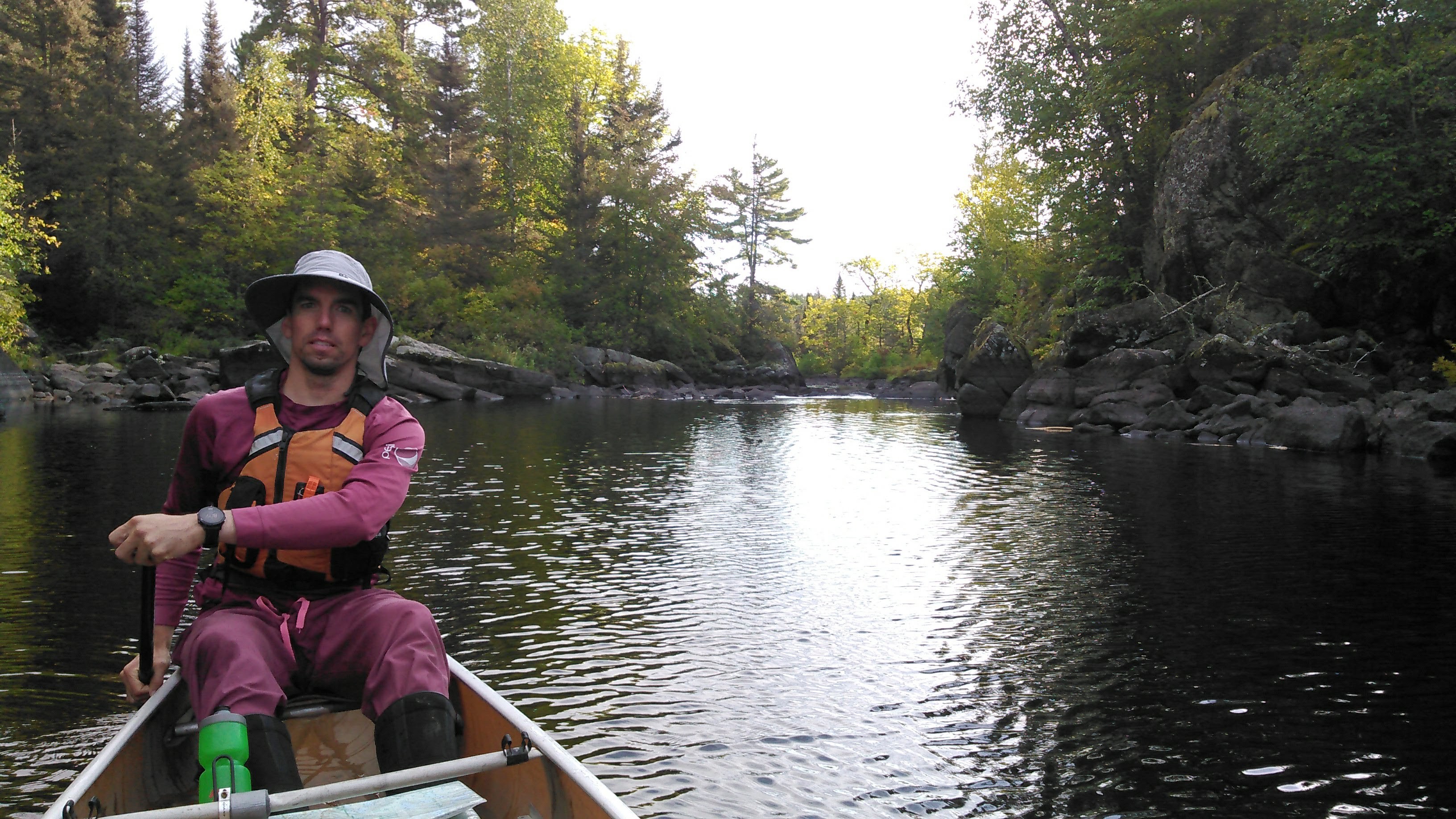
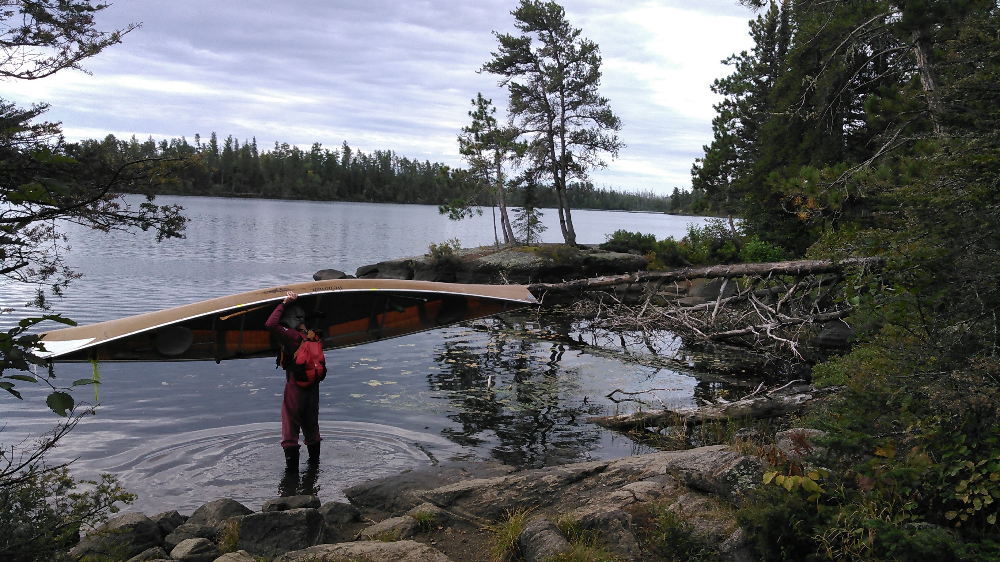
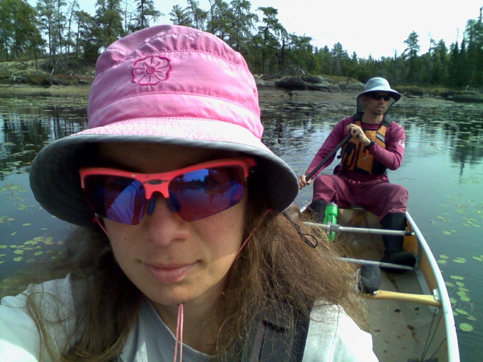
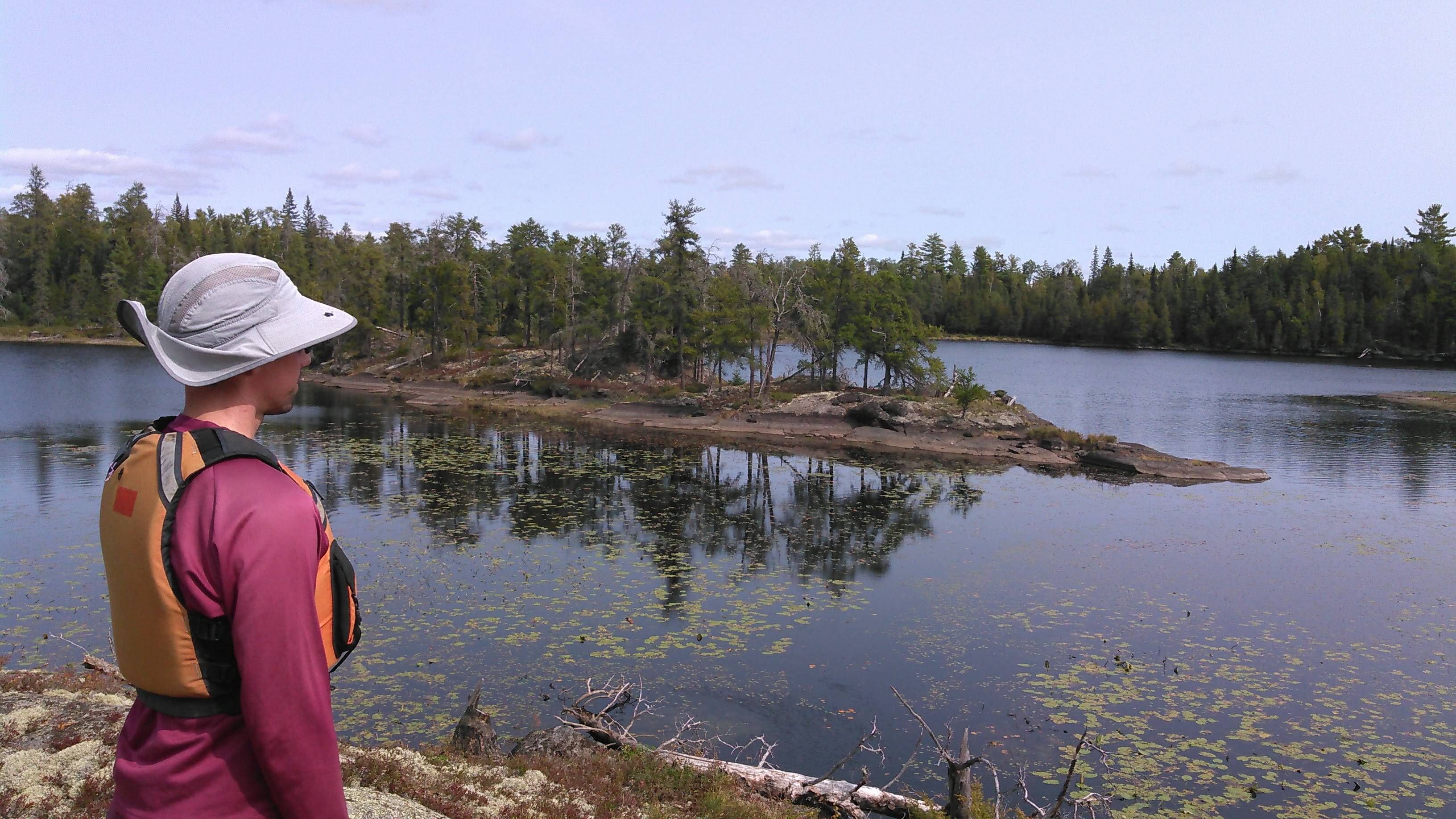
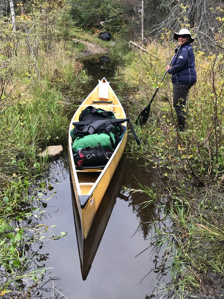
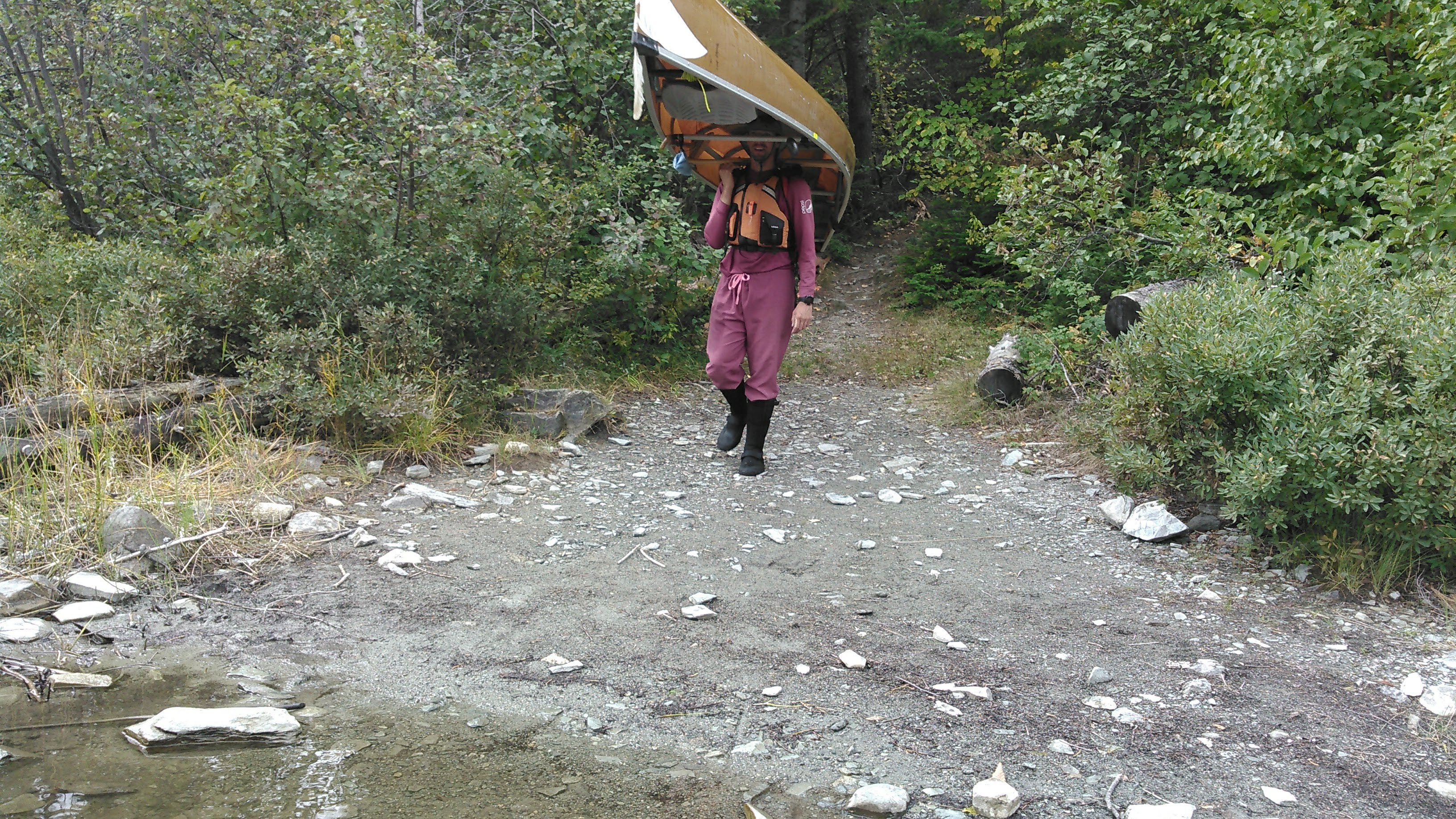
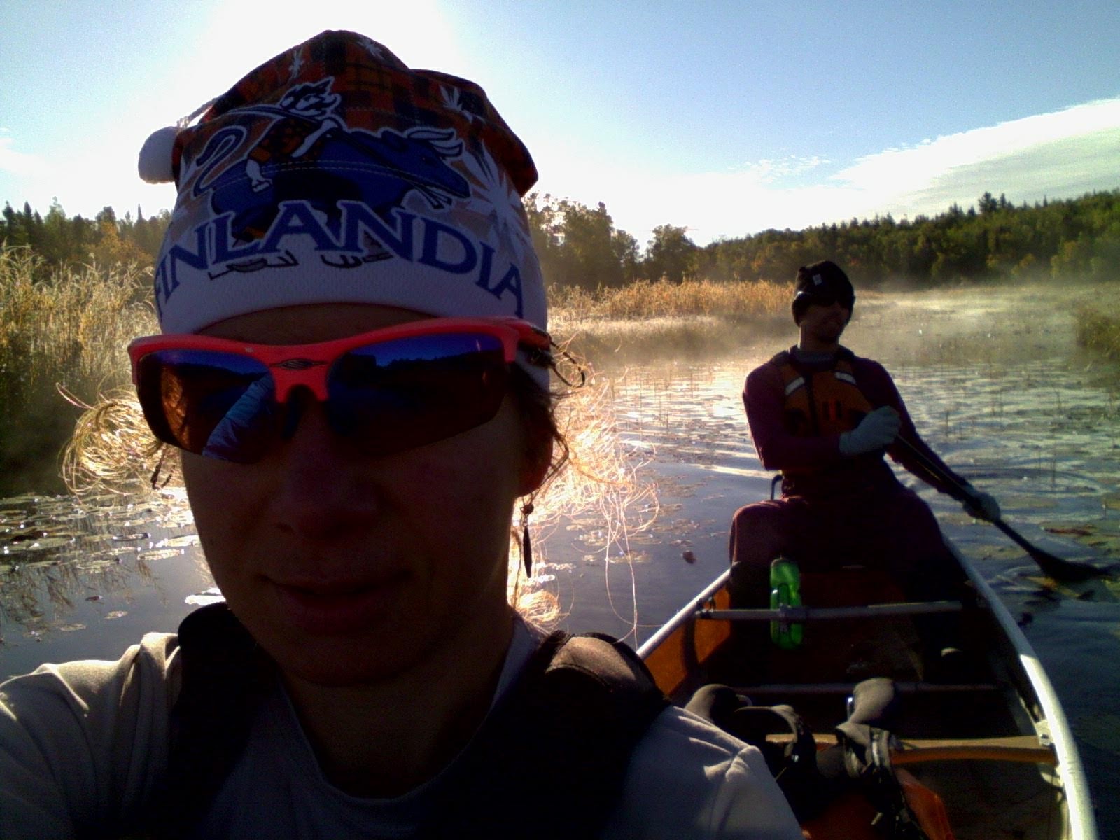
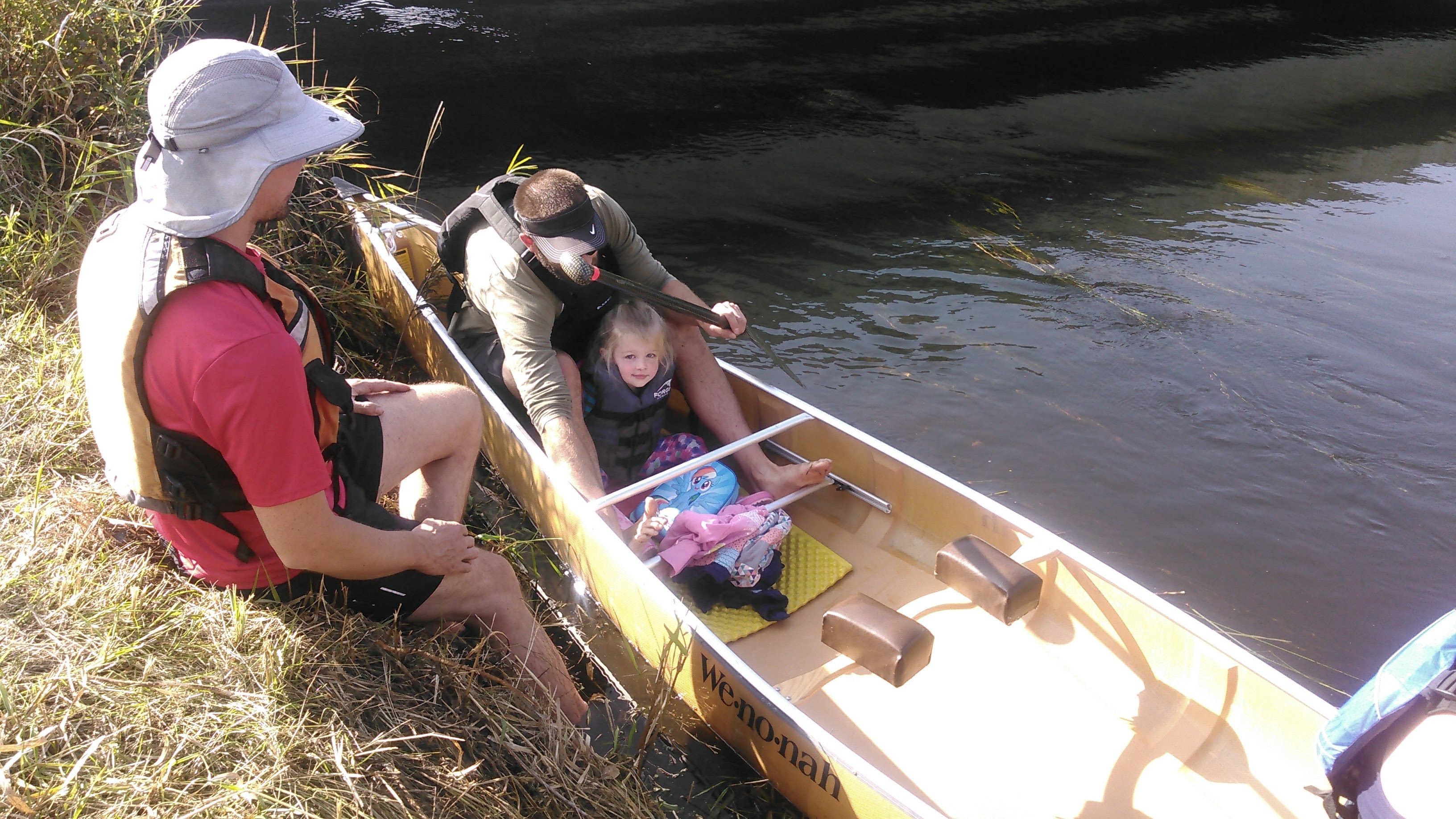
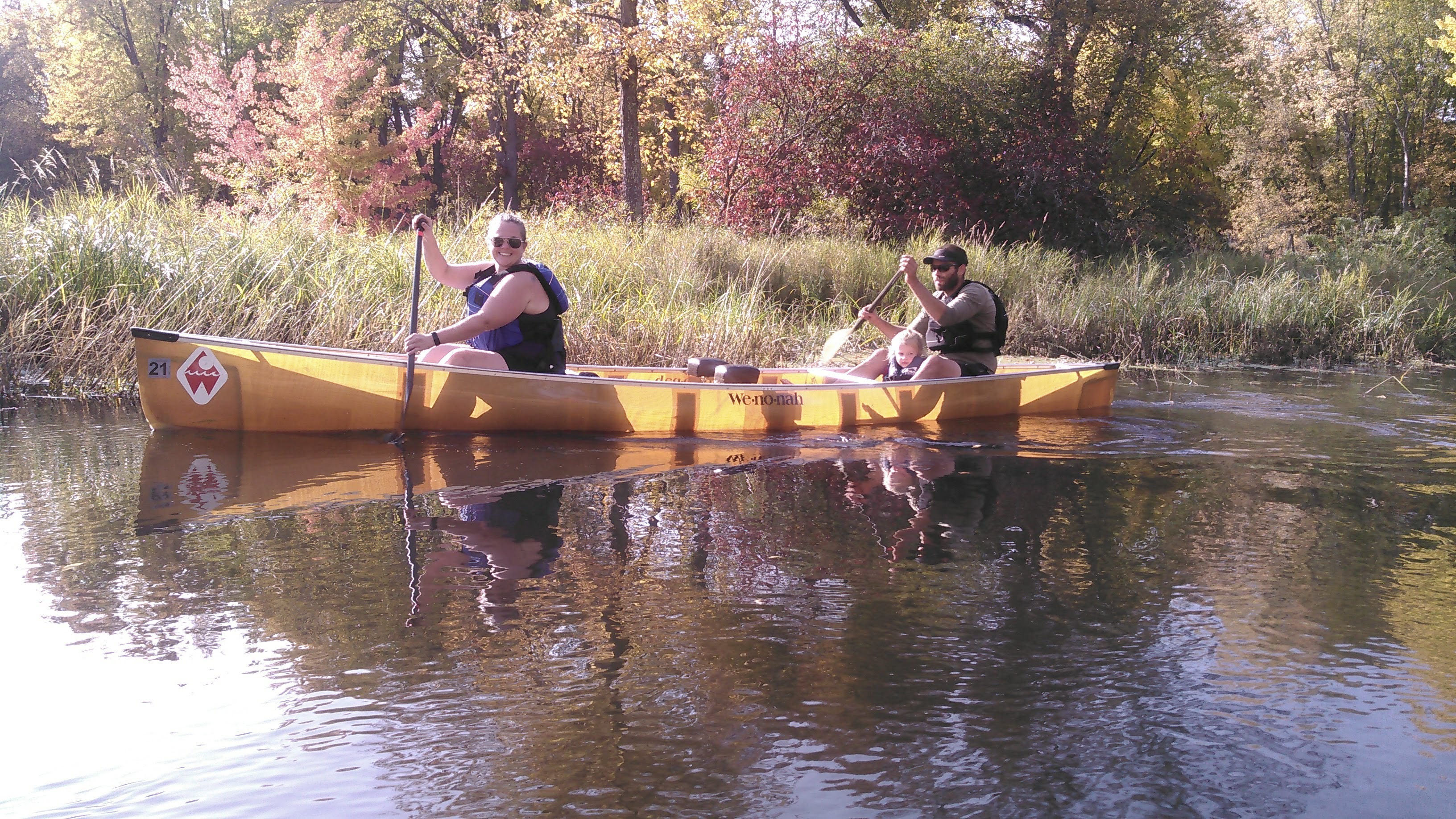
Our paddle across Lake One was uneventful but as we got to the east end we saw the dead trees from a big fire about a decade ago. As we neared the portages to Lake Two we also met a whole parade of canoes. Even though Erik and I haven’t spent much time in the Boundary Waters, we have spend a lot of time in a canoe together, portaging, and even canoe racing. We know how to be super efficient on the portages. It was comical watching some of these group with all their gear. In the photo above, you can see Erik’s day pack is quite small. I had a much larger dry bag backpack that even on the first day with all the food only weighed 32 pounds.
Once we got to Lake Two, Erik declared it was my turn to navigate. This was no easy task on our super zoomed out National Geographic map but given how fast we travel this map does make sense. I made a few minor navigational errors but nothing serious. We stopped for “first lunch” on the border between Lakes Three and Four, still within the fire range.
After Lake Four, we enjoyed our brief return to the Kawishiwi River. The terrain played some tricks on us as I navigated us to a portage on an island. Then we were onto and across Hudson Lake and doing the portage into Lake Insula.
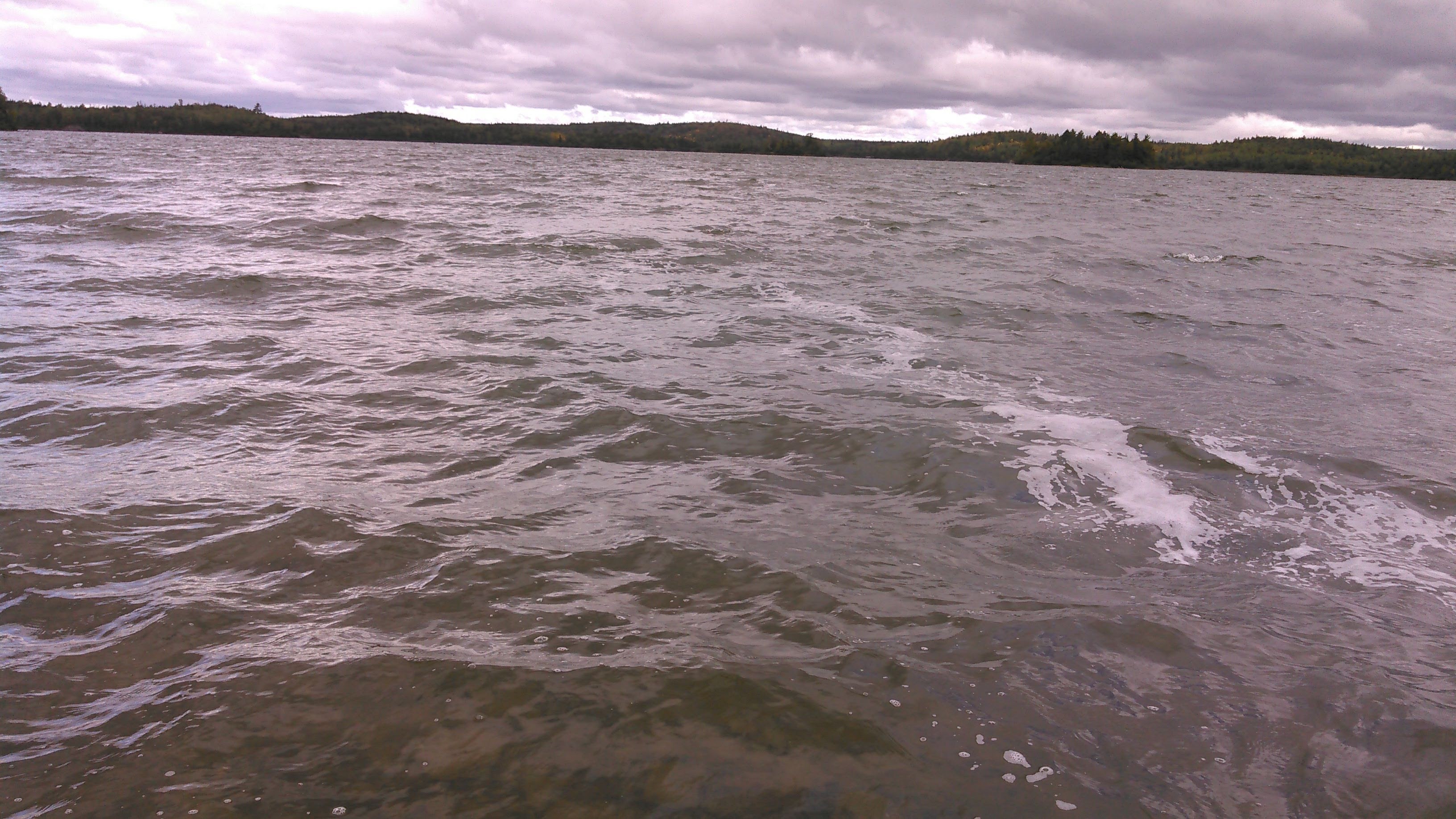
Next we were out onto the very very long Lake Insula. It had some nice sandy places to stop but mostly we paddled and paddled. The wind was coming from the west-northwest and so we had a couple areas where we fought the wind and waves but much of the time we were able to duck behind islands.
At the very end of Lake Insula we had the option of either a short portage and continuing up the Kawishiwi River to Lake Alice or doing three total portages and hitting up two extra lakes. Since I’m too goal oriented for my own good and kind of have this idea that I should make it to every lake in the Boundary Waters we opted for the extra portage route through Carol and Hum Lakes.
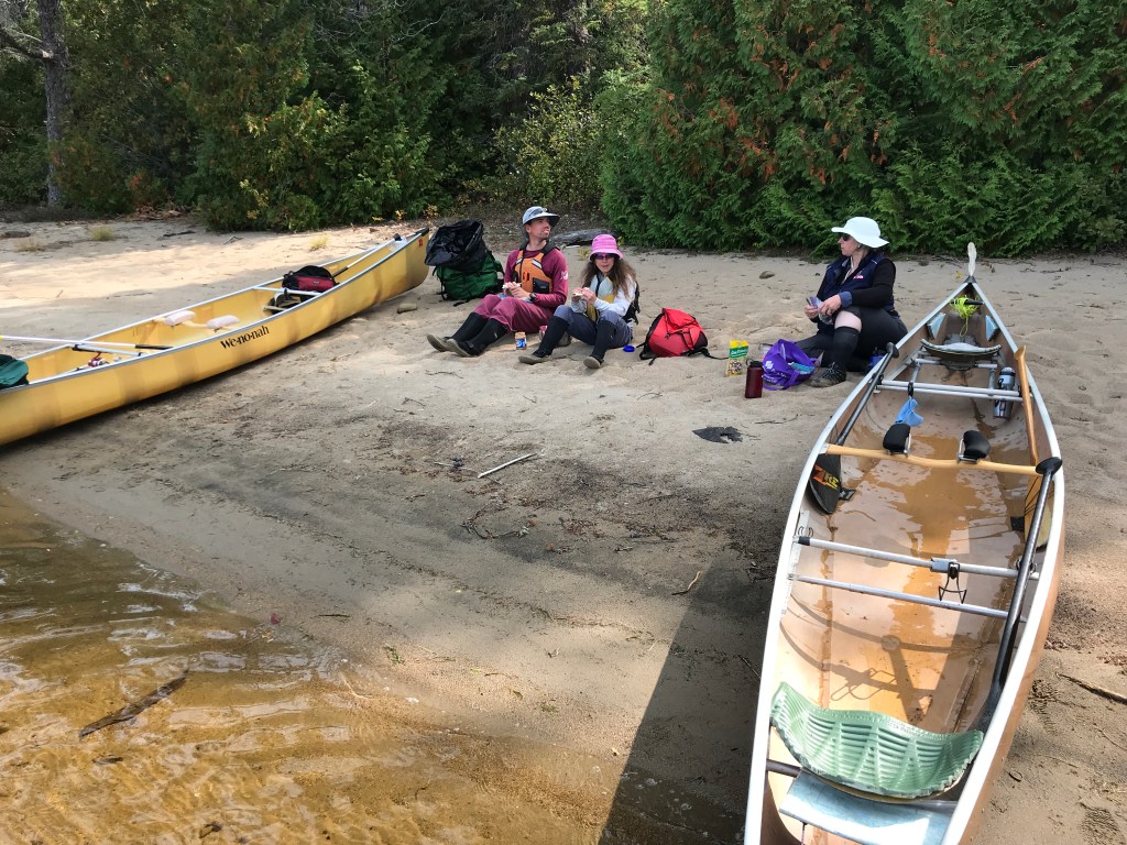
Once we got to Lake Alice, it was time to locate Erik’s parents. The initial plan was to find a campsite on the east shore where there are a number of sandy beaches. Even though there was a strong wind and waves, we decided to stick with our original plan of canoeing the lake counterclockwise, checking out all the campsites as we did so. Given we hadn’t come across Erik’s parents yet, we either assumed they were ahead of us and already on Lake Alice or that they had taken the river route.
We paddled past the two campsites on the southwest shore and noted they were empty. As we got out into the bigger lake, we saw something unusual, quite shiny, in the area I called “the boot” on the southeast shore. We had already planned to paddle down that way but this looked extra suspicious, like they were trying to signal us.
As we got closer, the shiny object seemed to be moving at times. We kept paddling and as we got closer, we finally realized this shiny object was Erik’s dad holding his paddle up in the air while standing on shore.
Erik’s parents had entered Lake Alice from the Kawishiwi River and reported white caps at that time. Hence, they didn’t want to canoe north, into the wind, to the beach campsites on the east side. Instead they hunkered down in an open area that was not an official campsite. They didn’t want to stay there and the official campsites on either side of this opening were occupied so we retreated to one of the campsites we had seen on the southwest side of the lake.
It was nice to pass the evening with Erik’s parents and we even did some fishing- the first time I’d ever been fishing with Erik. He turned out to be lucky and caught two fish within 10 minutes. Erik’s parents built a big campfire and we enjoyed our time together before bed.
Day three 9/14/20: Loop from Lake Alice to Fishdance Lake and Amber Lake
Given our campsite was nice and the logistics of moving camp, we decided to spend two nights at our campsite on Lake Alice. Erik and I haven’t spent two nights in one spot in the wilderness ever!
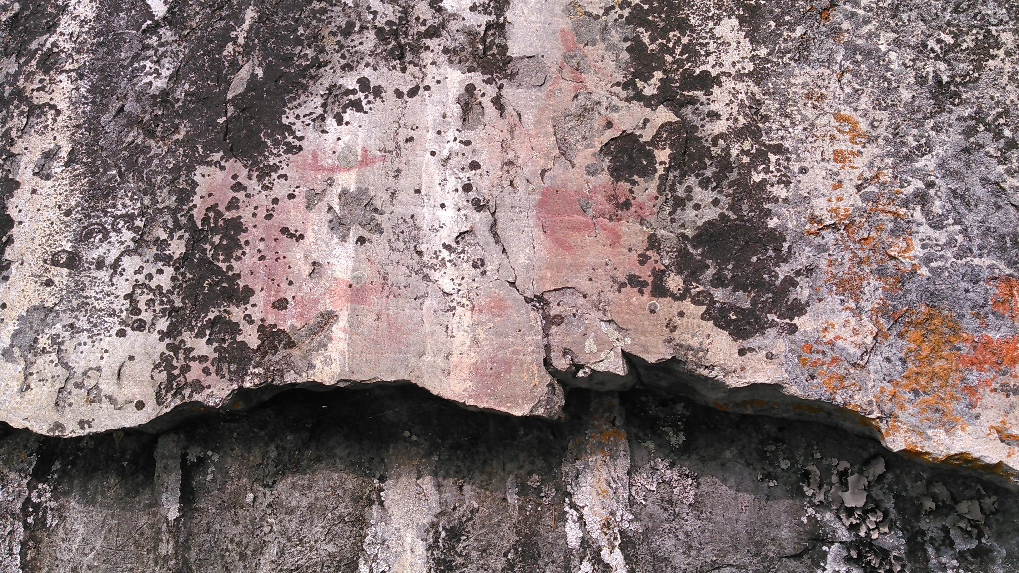
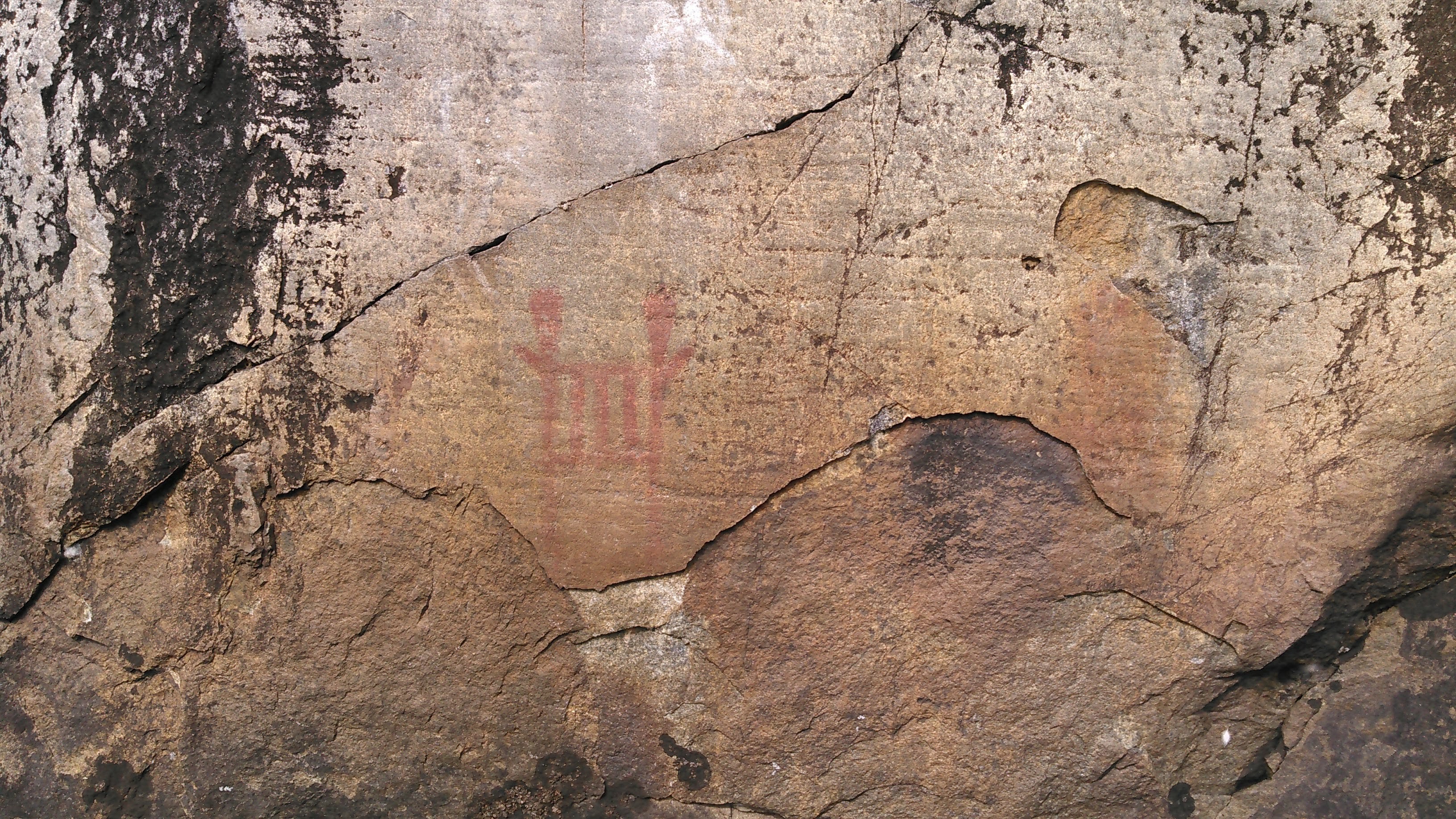
After a leisurely morning and Erik helping his dad fix his stove, Erik and I set out independent of his parents for our day adventure although we largely had the same route planned. We headed up the Kawishiwi River and after a couple portages, into Fishdance Lake to the pictographs. There were fairly faint but just like in the pictures.

Next Erik suggested we go on more of an adventure and attempt to paddle to Assawan Lake. When we got to the creek coming from Assawan Lake, it was clearly not paddle-able due to too many small rocks and overhanging trees. We beached our canoe on the mud and decided to try to bushwhack there instead. After following a faint trail for a ways, we came to a small lake created by a big beaver dam. We decided this was far enough and returned to our canoe.

There’s an island on Fishdance Lake and I decided we should paddle around it, so we did. The backside of the island had low water and lots of lily pads. Then we paddled towards Amber Lake to chase Erik’s parents down for a lunch stop.
The campsite on the south side of Amber Lake is prime with a huge sandy beach. We were surprised to find it empty, but less so since the channel into Amber had low water with rocks from River Lake and after we couldn’t find the portage trail into Bow Lake.
After lunch we headed north towards the un-named lake north of Amber. On that lake there is a giant blueberry patch and that’s where Erik’s dad wants his ashes when he dies. We paddled towards the stream that goes to that lake but found water levels low. Erik and I went over a beaver dam and found the channel incredibly low water- a couple inches on top of that mud that’s like quicksand. Erik’s parents turned around here but Erik and I pushed on. There were dead lily pad roots everywhere that looked like cactus. I wish I would’ve taken a photo. We just kept pushing through until we got to the lake.
And this lake was special complete with a long skinny island. We got out at the blueberry patch and Erik weighed the gravity of the location. The next time we come back it might be with ashes and Erik’s dad will no longer be here.
As we paddled back down the low river, it got me thinking about where I’d like my ashes some day. Oh no, it will have to be four difficult to get to but drop-dead gorgeous places here on earth: Manarola, South Piney Lake, Eroded Mountain, and maybe just maybe Steve’s Lake. In winter. Because it’s just too easy to get there in summer.
Eventually we moved on back to camp to spend another evening with Erik’s parents- another campfire, an unlucky fishing attempt (Erik lost four fish off his line in a row!), and another cloudy warm night.
Day four 9/15/20: Lake Alice to Disappointment Lake
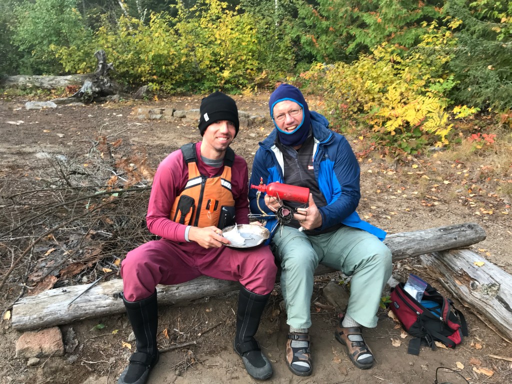
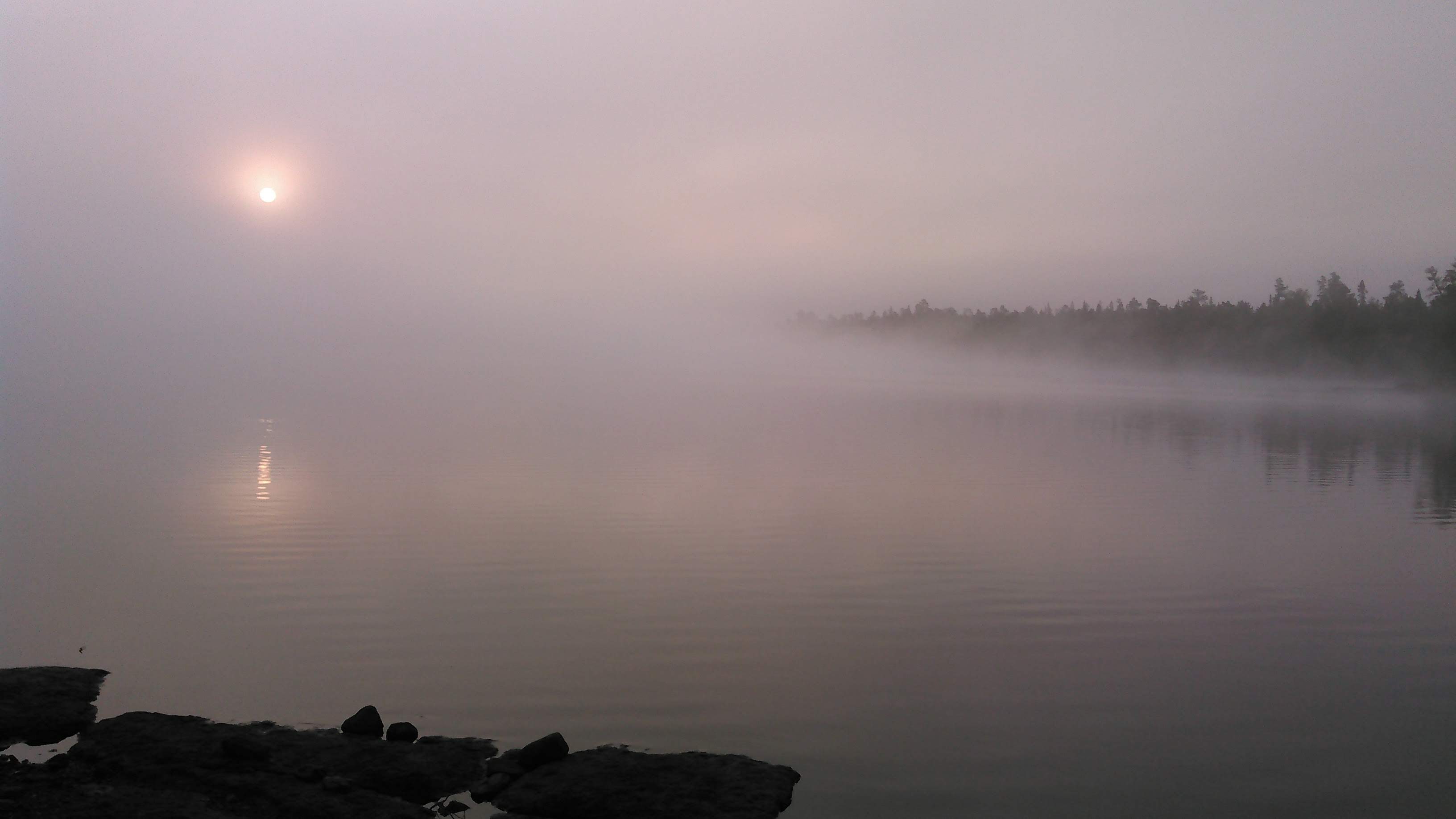
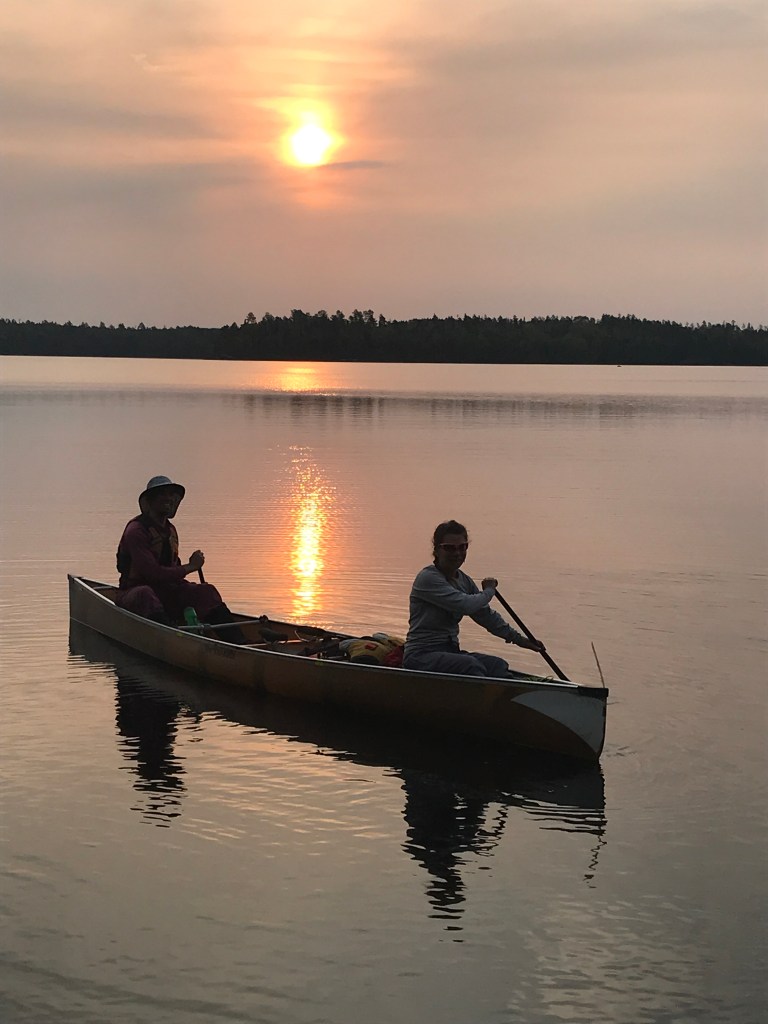
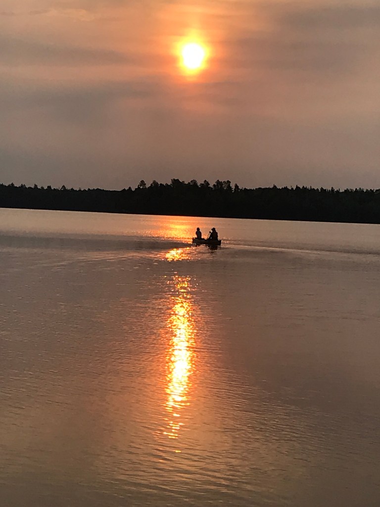
Erik and I got up early and were off under another orange sun, appreciative of the hot breakfast we got from the old tea kettle that heats water on the fire grate over an open flame that Erik’s parents hauled along. We travel too light weight for such shenanigans.
We cruised across Lake Alice with a tailwind and soon we were portaging into the narrow stream that led into Cacabic Lake and then taking the longer portage into Thomas Lake. This portage had about a 30 meter completely submerged area that was almost over the tops of our boots!
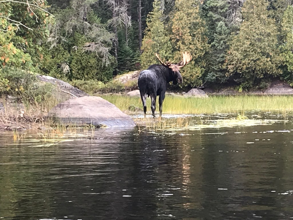
Erik’s parents also saw a moose close up prior to their portage into Thomas Lake.

The wind almost seemed a bit more out of the west as we made our way north on Thomas Lake. Then we did a few short portages to get to Ima Lake. Here the portages weren’t always marked as they showed on our map. Erik and I were signed up for an ultra marathon a few weeks after our Boundary Waters trip and hence discussed doing a hike/run on this day. We checked out the Kek Trail as we crossed it. I deemed it not run-able with its overgrown brush. It took me awhile to convince Erik of this and that we should wait until we got to camp on Disappointment Lake.
We passed a couple large groups of people in Grumman canoes with matching Duluth packs both before and after the portage into Ima Lake. The very end of the portage into Ima becomes a small, rocky gorge. Erik’s dad likes the campsites on the east and north shores of Ima. We now had a fairly strong west wind and were still planning a long-ish hike/run for that afternoon so we didn’t check out those campsites. There are so many places to explore.
Instead we pointed our canoe towards a large island with a campsite on the north side. We got out there to have first lunch and do some washing. We noted this campsite as a place to return to under warmer conditions as there was a rock that appeared to be perfect for jumping into the water (we didn’t fully scout this out from below to make sure it was safe from obstructions. This campsite was obviously popular as it was quite beat down with lots of “rooms.”
After crossing Ima Lake, we did a short portage that dropped a bit of elevation and we found ourselves in a small gorge. We really liked this area.
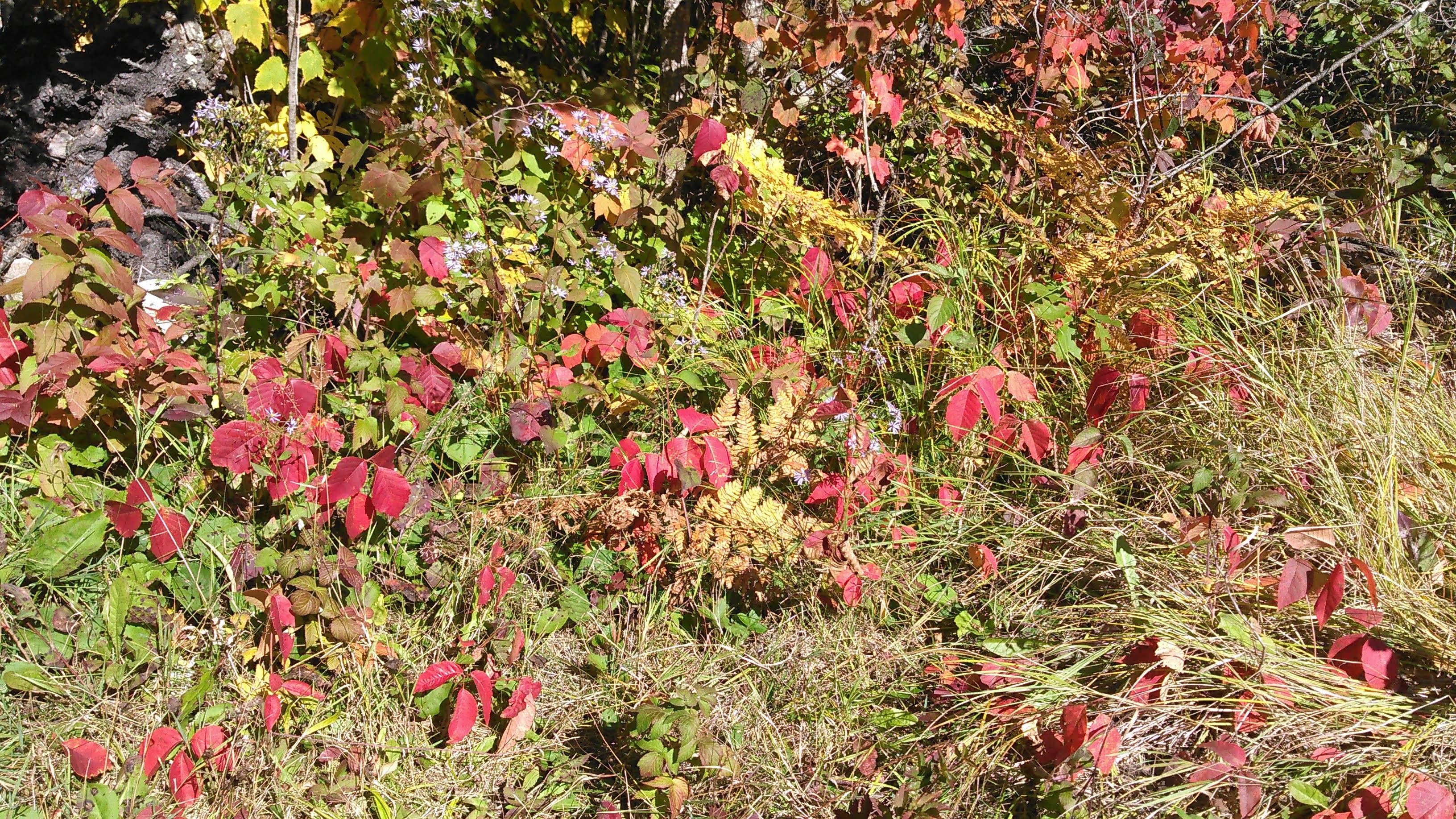
Then we did a series of portages through smaller lakes. We greatly liked this section except for one short area where the water was too low and we hit some rocks. Adventure Lake, with a big hill to the south (Disappointment Mountain) was our favorite with the nice fall color.
We noted a campsite perched above Ashub Lake on the west end. We were surprised to find it empty given its proximity to entry points and key location on the Disappointment Lake Trail. On our portage into Disappointment Lake, we took a second lunch break and went exploring while we ate our peanut butter-dried fruit tortillas. I hiked up to that campsite.
We got back in our canoe and paddled across Disappointment Lake, heading towards a campsite on the southwest end located on the Disappointment/Snowbank Lake Trail. That site was open and also far above the water so it had good views owing to blow-downs. Unfortunately the water we got from shore at the campsite had some swimmers in it as it was located far into a bay.
After setting up camp we took off on our hike/run. Our original plan had been to do the entire Disappointment Lake Trail which we had estimated to be around 10 miles. Given it was already after 3 PM and I’d been nursing a foot injury all summer, this seemed a bit too aggressive. This was quickly confirmed by the trail conditions. Moving at 3 miles per hour was quite swift on this rocky overgrown trail.
Erik wanted to get to the campsite on Ashub Lake but we missed the intersection and ended up on the Snowbank Lake Trail. After climbing to a good overlook, we decided to head back to camp.
By the time we were back to camp, we’d been gone 1 hour, 45 minutes and had only traveled 5.5 miles. That’s actually how far Erik clocked- he was more up for running than I was and so he did a bit of running ahead and then back to me. I moved as fast as I thought safe through raspberry patches and other flora through which I couldn’t see where I was planting my feet as we went up and down re-entrants.
Given all the underbrush, I had elected to hike/run in my adventure pants. This was good to protect my skin but once I get sweaty, I hate how my pants stick to my knees. Yuck.
Back in camp we discovered there were some aggressive chipmunks who really wanted our food as we cooked and then ate dinner. They certainly took away the ambiance of the loons out on the water. Erik thought he maybe saw a moose down by the waters edge to our north but after it didn’t move for an hour, he decided it must be a rock.
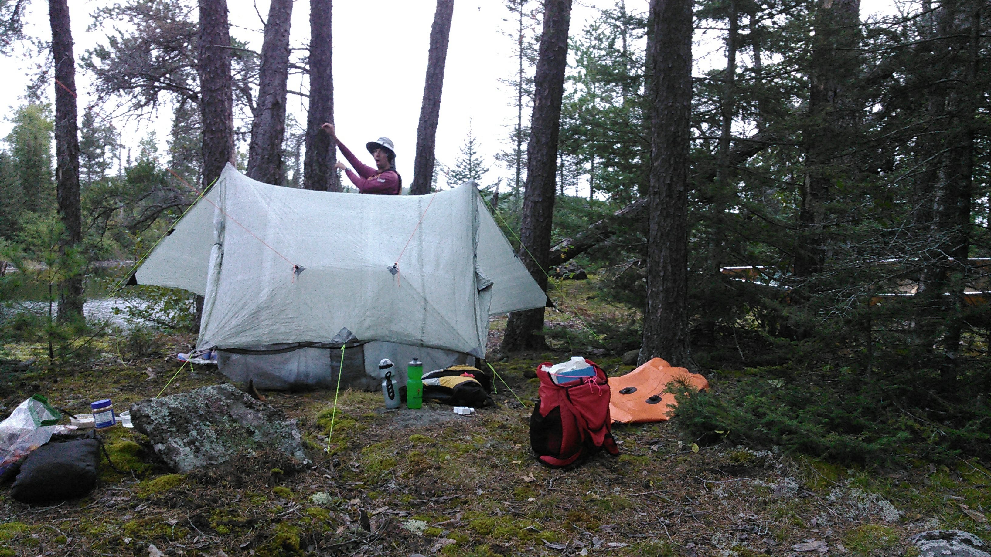
By the time we did an expert chipmunk hang and got ready for bed, we didn’t have much time to hike south on the trail before it got completely dark. We retreated to our tent and had yet another cloudy and warm night.
Day five 9/16/20: Disappointment Lake to Indiana Lake via Ensign Lake
I woke to the trees rustling in the wind up on our ridge campsite. I was hoping for at least some early morning calm to get us across Snowbank Lake, but no such luck. We set out for a high mileage-high portage day because why not. That’s how we roll.
We paddled down to the portage into Snowbank Lake and then up the east shore of Snowbank Lake. The waves were a bit fierce but within our comfort zone. Then we paddled and portaged through some smaller lakes: Boot, Haven, big hill on the portage into Abinodji, Swing, Gibson, Ashigan, and finally into the monster Ensign. The portage into Ensign led to a pebble beach onto which the waves crashed ashore. We pointed the bow away from shore and we got into the canoe real quick and shoved off into the waves. Fortunately by the time we started heading west we ducked behind the north shore for a wind reprieve.
Ensign was, no kidding, our 10th lake of the day after 10 portages and it was only 10 am when we got there! It was time for first lunch and so we decided to land on a point where we also thought there was a campsite. As we neared this point, another canoe was headed to it as well from the south. We were merely hoping to stop here for lunch but we thought these guys wanted to camp. Once we got to the point, we discovered the campsite was already taken anyway. Erik and I still made a quick stop on a pebble beach behind some bushes. It turned out that Ensign is quite the popular lake. We may have seen more canoes on this lake than any other despite the wind.
After our first lunch, we kept paddling west towards Splash Lake. We had heard about “The Narrows” on the small river leaving Ensign Lake but after a very short portage (perhaps there would be a rapids here in high water) I found The Narrows quite dull, especially after the small canyon we had been in the day before on the west side of Ima. The Narrows almost seemed like a canal to me.
Soon we were across Splash Lake and onto the short but very nice portage to Newfound Lake. Erik maintains that this is really Moose Lake. I made a big navigation error and Erik took over the map reading after that. We mostly had a side wind on Newfound Lake. Once we got to Moose Lake we looked for our second lunch site and found it at an unoccupied campsite. The bummer here was the ubiquitous motorboat traffic as we tried to enjoy our peanut butter-dried fruit tortillas. We knew we had to stop for lunch before we got to the aptly named Wind Lake.
Once back out on Moose Lake, it took us about 5 minutes to canoe to the portage into Wind Lake. This was another nice portage trail through a poplar forest that was just beginning to change color. It was also relatively high ground. Out on Wind Lake we battled the waves as the entire length of the lake was exactly in the direction of the oncoming wind. A few waves even made it in over the bow.
At the west-northwest side of Wind Lake there is a river that heads downstream to Wind Bay of Basswood Lake. This river was super low. We paddled along in mostly muck until we got to what we thought was the portage. There was a big takeout but when we headed into the woods on the trail, it quickly petered out. We could follow it but there were way too many low branches to easily get the canoe through. After retracing our steps, we found a well-beaten trail through the swamp grass. As we continued towards Wind Bay, we found two more good take-outs. At the next take-out the trail indeed went into the woods but was a good portage trail. Our GAIA map did show that we were originally on the portage trail but I suspect years of high water has made this trail fairly obsolete.
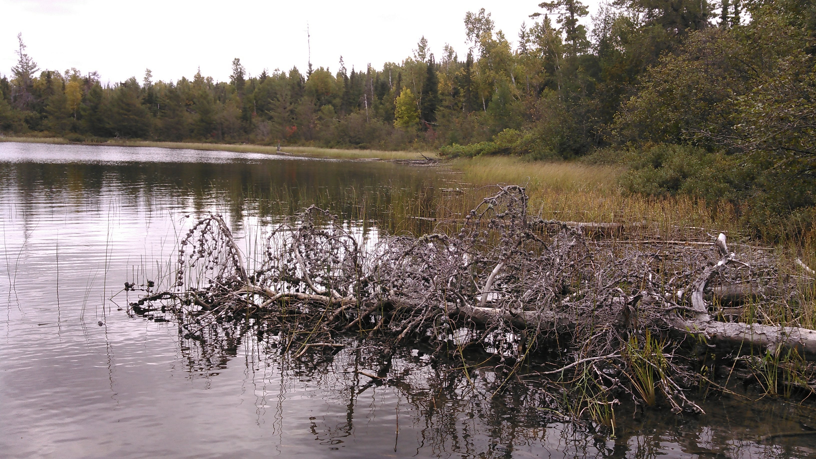
When we got to Wind Bay it didn’t exactly look like the map as a good chunk of the bay was overgrown with reeds. We headed west towards the island until we found the main channel heading south to the river that leads to Indiana and Hula Lakes. After we did a couple S-turns, the stream got quite shallow and we found ourselves paddling through the mud again as we looked at a 5-foot high beaver dam. This was quite the dam.
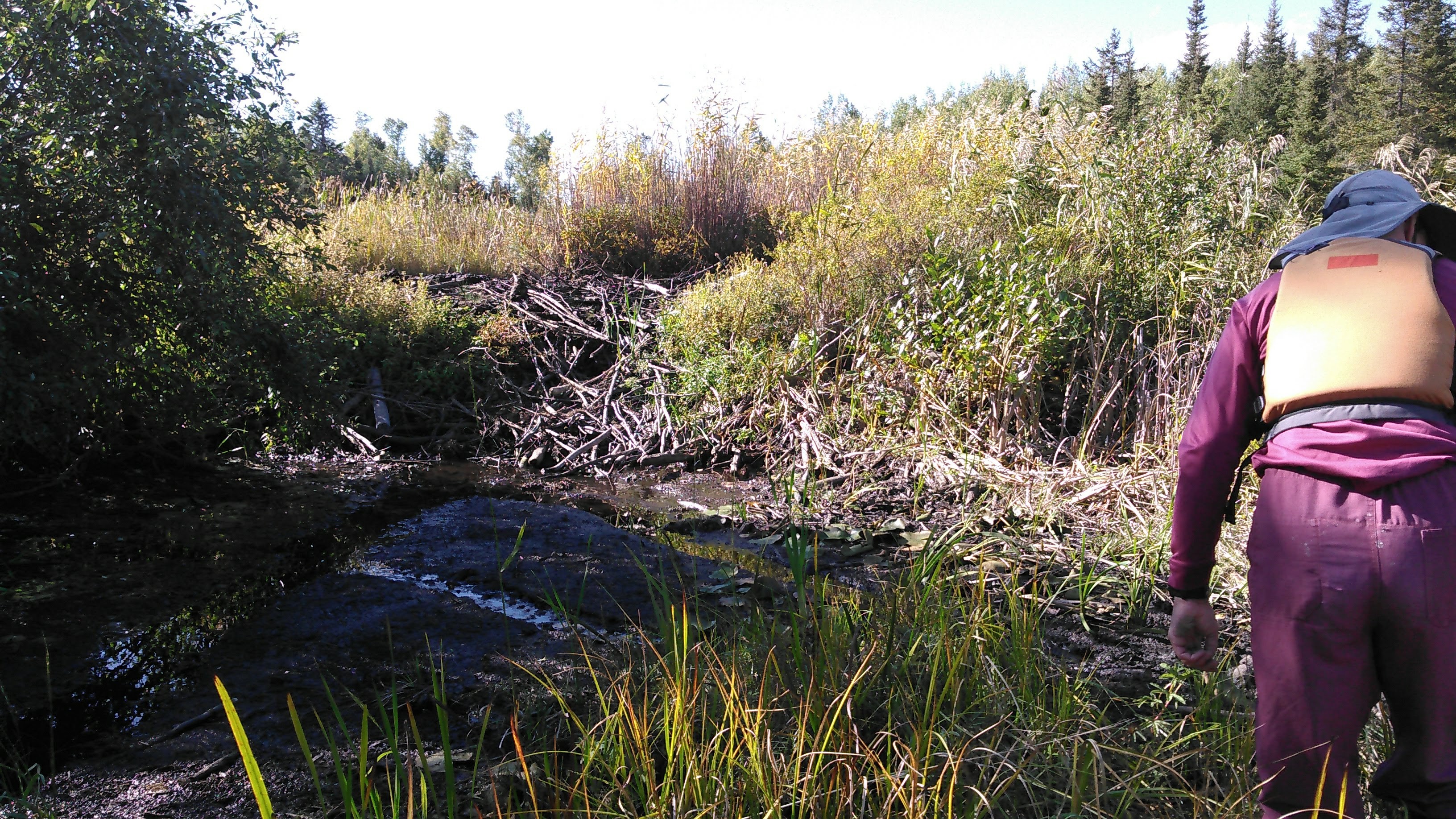
As we hauled our canoe over the dam, we met a couple older guys in a canoe. The one guy, wearing blue jeans, complained that they canoed in yesterday but had to go all the way to Indiana Lake before they found an open campsite. He told us the other campsite on Indiana Lake was open but that as of yesterday both campsites on Good Lake, where we had been aiming for were occupied “and the people were just getting there so they will likely stay a few days.”
With this new info, Erik and I thought about our end of day plans as we made our way to the portage to Indiana Lake. Due to that high beaver dam, the portage into Indiana Lake was about half a rod instead of the 19 rods on our map.
Given it was nearing 4 pm, we decided to just head for the campsite on Indiana Lake. After setting up camp, I went for a swim. The bottom was nice- sandy, not mucky or rocky- but there was lots of sunken dead wood. While the water temperature was warm enough, the air temperature was only 60 degrees and with the sun setting quickly, I didn’t spend too much time in the water and didn’t get my hair wet, a decision I was glad of half an hour later when I got quite cold.
That campsite was very near the portage trail to Basswood Lake and there was a nice social trail leading to the actual portage trail so we made this our evening walk. It also helped warm me up. There was another social trail leading to the other campsite on Indiana Lake as well. Therefore, with trail opportunities and a good bottom for swimming, I’d highly recommend Indiana Lake as a camping spot. This was our only clear night of the trip and so I stayed outside looking at the stars.
Day six 9/17/20: Indiana Lake to Fall Lake
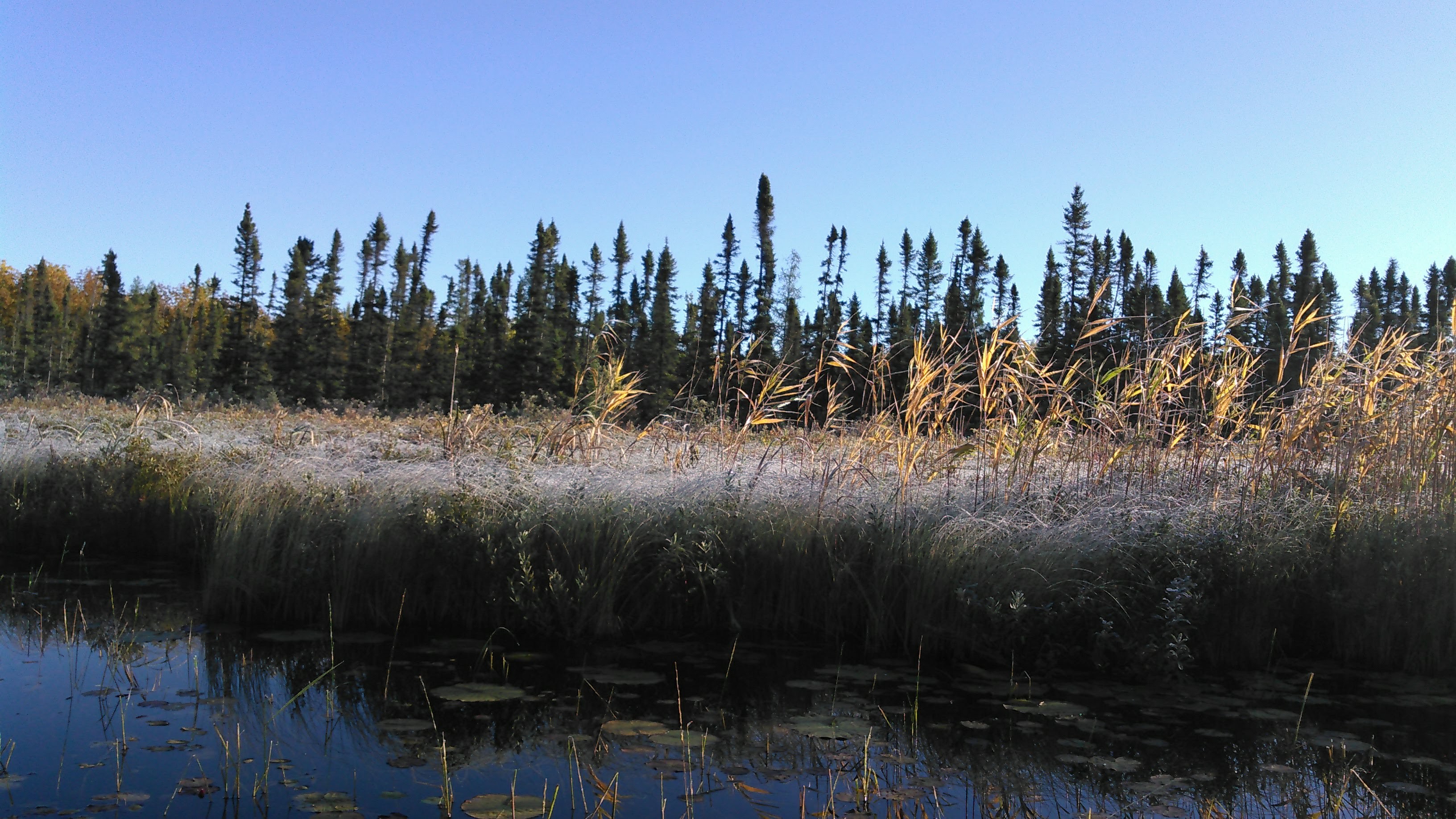
Given that it stayed clear all night, it was 30 degrees when we woke in the morning. We had places to go and people to see- my family in Bemidji- so I wanted to get moving. There was a nice fog on Indiana Lake as we headed across it and into the portage to Good Lake. The blue jeans guy we had met the day before complained about the big hill between Good and Indiana Lakes. Erik joked that it was good we had brought our ice axes. The hill was pathetic, about half the size of the one that led from our camp on Indiana.
Good Lake was also shroud in fog. I hadn’t kept my long underwear on and so my hands got really cold on Good Lake. Then we got to the outlet with Good Creek. Although there was a portage marked on our map, we were able to paddle through the broken rock dam with some careful maneuvering.
A beaver dam a bit downstream slowed our travel and also meant there was less water. Good Creek wasn’t good to us as we bashed through cattails, swamp grass, and lily pads. My hands kept freezing and I was getting wet as the frost fell off the cattails and grass we were bashing through and landed on my lap. There was briefly more water but this only meant another beaver dam to cross and then low water again.

I was quite cold by the time we made it out to Hoist Bay and pulled up onshore for the start of the Four Mile Portage.
This portage has become legendary. It was once an old train tracks to haul logs in the early 20th century and then later became a small road to shuttle tourists before the Boundary Waters became a wilderness area. When my brother found out we planned to do this portage, he was stoked. He did it 5 years ago and noted a beaver dam along the trail, deep enough to push a canoe through.
Erik’s parents had warned the portage was no longer maintained as they had been on it in May for “a city block” while they were looking at the Hoist Bay remains and declared that it was overgrown. That was in May, so surely by the end of the summer it would be even more overgrown. When we mentioned this to a couple other parties we passed on our trip, they said it was the “sunken portage.” We had looked at the satellite map and figured since we’d be portaging with a canoe, we could always just canoe if things got too bad. We did always have the option of canoeing around the long way on Basswood Lake.
The very start of the portage was overgrown with half a dozen very small trails but these quickly merged into one very defined trail. As we walked along on a railroad grade, this was actually a nice portage with good dirt footing underneath instead of rock. A couple times I moved branches out of the way for Erik but only once was there a tree that necessitated him setting down the canoe.
Before too long we arrived at the beaver dam, aka the sunken part of the portage. We just got in our canoe and paddled through the trees. It was beautiful!
We found the trail again after 100 meters or so and continued portaging. Again, the trail remained perfect. Once we got to Muskeg Lake we paddled a small ways across the lake in lieu of portaging- partly because Erik’s shoulders were hurting and partly so we could canoe another lake!
Next we got out of the canoe and portaged into Ella Hall Lake. The Four Mile Portage trail is very well maintained from Fall Lake to Ella Hall Lake. This is likely because an outfitter that shall not be named rents carts so people can haul all their stuff into Ella Hall on a heavy duty cart. We found these carts stashed in the woods before we put in on Ella Hall.
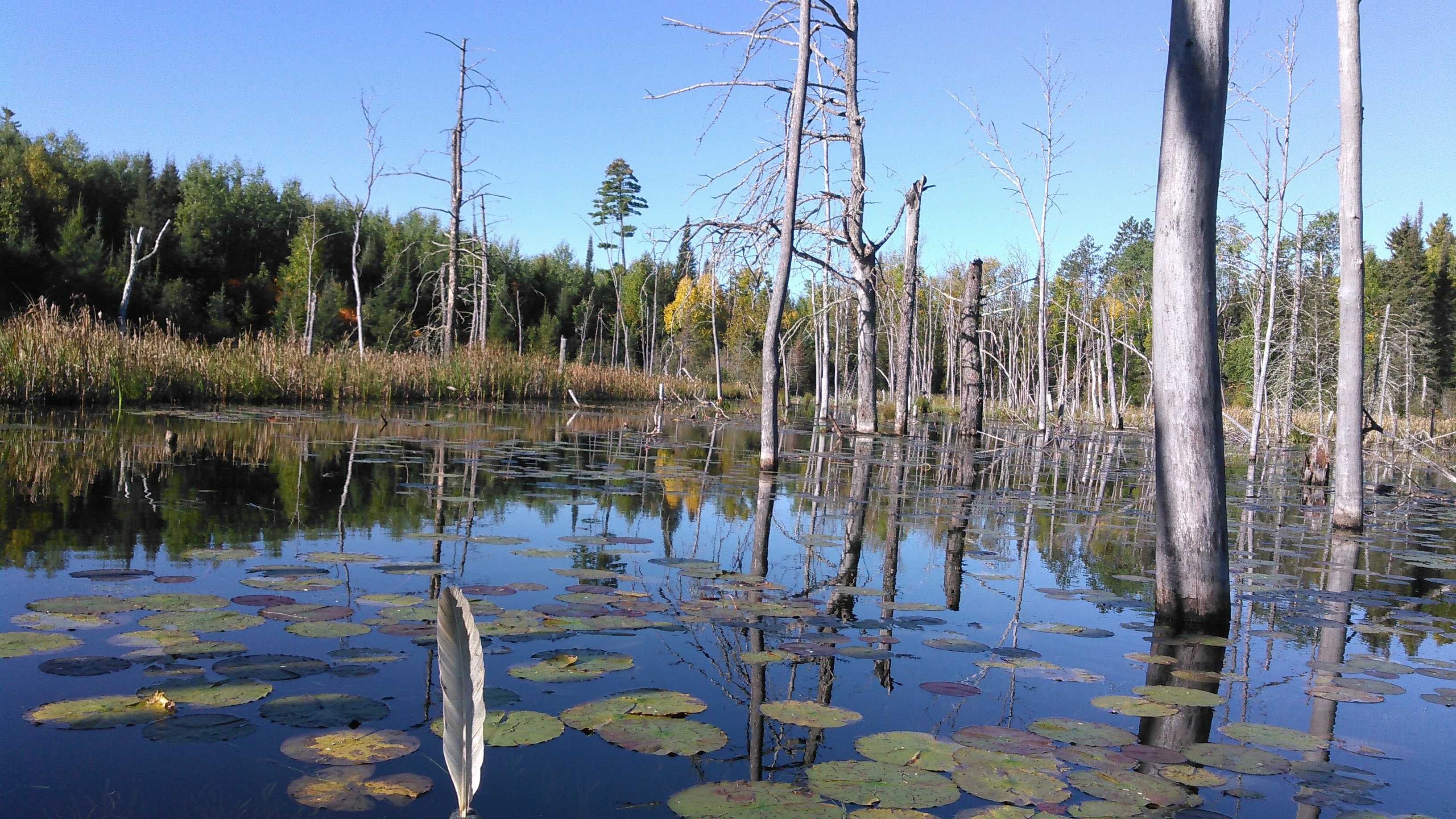
Since we were paddling Ella Hall, it seemed we should canoe around the island. We were due for first lunch but found the island entirely unbeaten down so we lunched on a beaver lodge. Hopefully the beavers didn’t mind! When we did get back in the canoe, we scared up two bald eagles who had been on shore. We wonder what they were doing!
Then we paddled over to the portage into Mud Lake. This lake seems a bit unfairly named. Instead of getting back on the Four Mile Portage, Erik suggested we paddle down the Muskeg Creek to the Four Mile Portage. I agreed and things were good until we crossed a beaver dam and found the stream too low to paddle below. We pulled the canoe along in the sinking mud for a bit before we eventually got back in and paddled through the muck. I wasn’t really having it at this point. Fortunately it was a fairly short ways before we got back on the Four Mile Portage and by then we had paddled so much that it wasn’t long before we arrived at Fall Lake.
The wind was such on Fall Lake that Erik mostly kept me paddling on my left side and for some reason this was causing my right shoulder to cramp. Hence I was glad we didn’t have to paddle the entire way across this lake. We could see the boat ramp, our take-out for about 20 minutes or so and could see a group waiting to start. Before we got to the take-out we discussed how to portage up to our car so that Erik could set our canoe up on the car rack. I don’t know that those people waiting to start out were impressed with Erik and I and our swiftness and efficiency but we were impressed!
We headed to Bemidji, spent the next few days with my family, delivered my niece’s 3rd birthday present, and even got us out for a canoe on the very winding, snake-lake Mississippi River in what ending up being a fairly intense half hour!
If we had to do this trip again: I can’t say we’d do much differently. It ended up being a good adventure with all the low water levels we encountered, high mileage, and of course doing the Four Mile Portage.
Best decision: meeting up with Erik’s parents.
Next time: This will likely be our only circumnavigation of Fernberg Road. Even though not entirely in the Boundary Waters, I would like to do a loop that starts in Ely at Shagawa Lake, goes to Burntside, crosses the Echo Trail, enters into the Boundary Waters and loops back through Fall Lake. I would also like to make use of those sandy beaches on Lake Alice sometime, jump off the mini-cliff on the island campsite on Ima, and paddle through the mini-gorge to the west of Ima again.

From the other side of the pond we are deeply envious of the vast areas of water available to you. To paddle the Boundary Waters is an ambition, but hard to fulfil under current circumstances.
LikeLiked by 1 person