Alaska has been on my radar since I learned the place existed. It’s larger than life and has mountains. But it’s huge with infinite places to explore. In 2015 I saw photos from Gates of the Arctic National Park and decided we had to go there.
After much planning and changing our itinerary, we eventually settled on a combo backpacking and packrafting trip from Anaktuvuk Pass to Bettles.
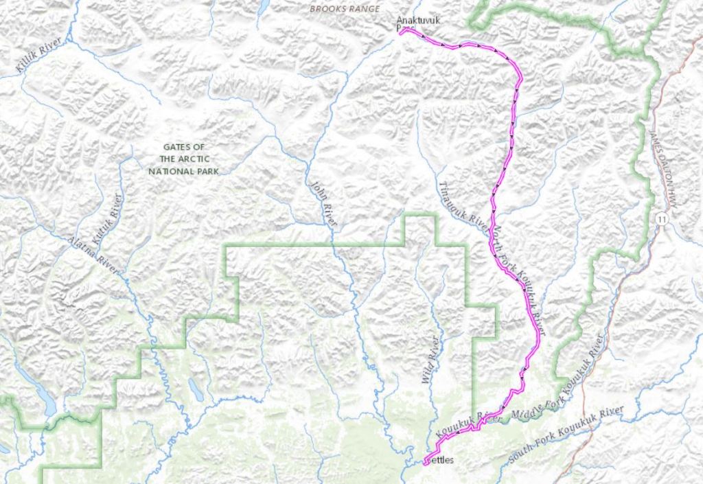
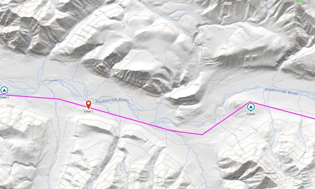
More photos and my sensational account of this adventure can be found on my ski team blog. This post will primarily include maps and more logistical information.
Given that it’s safer to travel with more people, we invited lots of our friends and family on our trip. We only had two takers- Sarah and Tiffany. Sarah had an extensive trip history with Widjiwagan. Tiffany had never been on a trip of this caliber but had a lot of what I call “related experience” living off the grid and on the farm.
We flew to Fairbanks and took a layover day with a short practice paddle down the Chena River.


While in Fairbanks we stayed at Sven’s Basecamp Hostel– a place where we encountered all sorts of other adventurers. Motorcycling and bicycling the Dalton Hwy seemed to be the most popular adventures but we met a couple guys who were also heading to Anuktuvuk Pass and then hiking out to the Dalton Hwy.

Day 1: 7/2/18

From Fairbanks, we took a semi-commercial flight on Wright Air Service to Anuktuvuk Pass. If you fly Wright Air, pay attention to their rules regarding flying with fuel, etc. Even though we had read the rules and thought we were following them, we were still left scrambling with our fuel as we couldn’t have it in our MSR fuel bottle with the pump attached. After running back to Sven’s, we found a secure container for our fuel. Moral of the story: fly with your fuel in its original container!
This was my first time in a small plane. There was a single pilot and 10 passengers- our group of four, the two guys we had met at Sven’s, and four others. The flight was noisy (we wore ear plugs) but not unreasonably so. And it was the absolute most amazing flight I’ve ever been on as we flew over the Yukon River and close to the mountains.


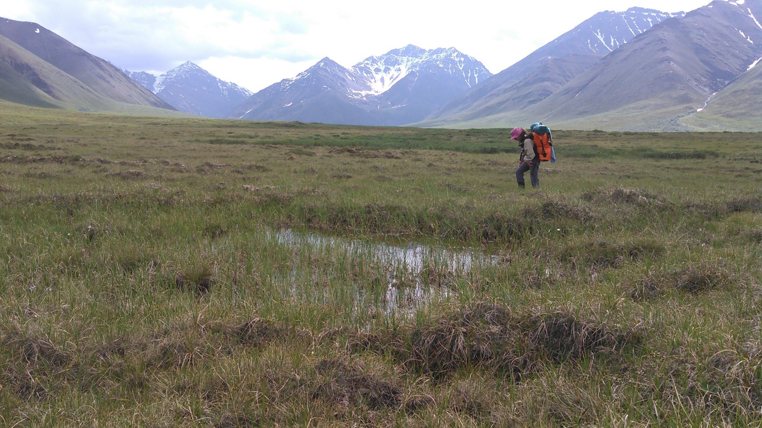
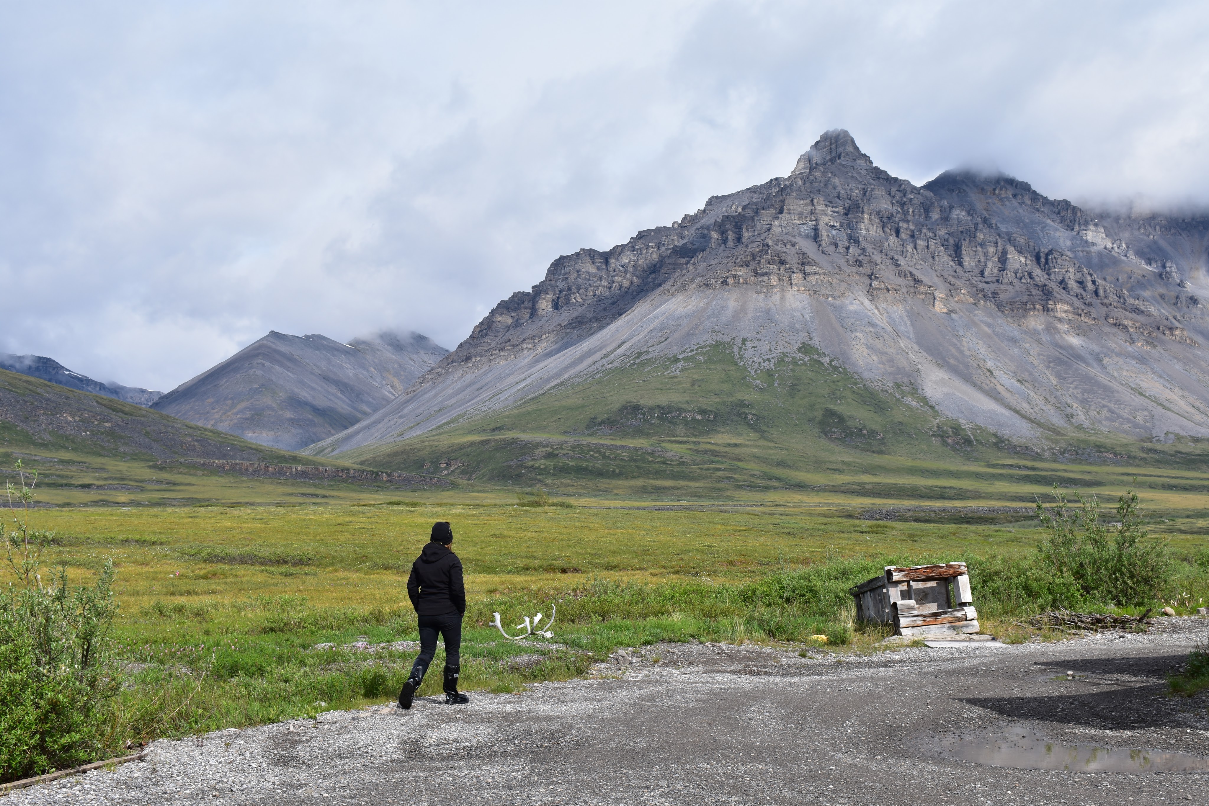
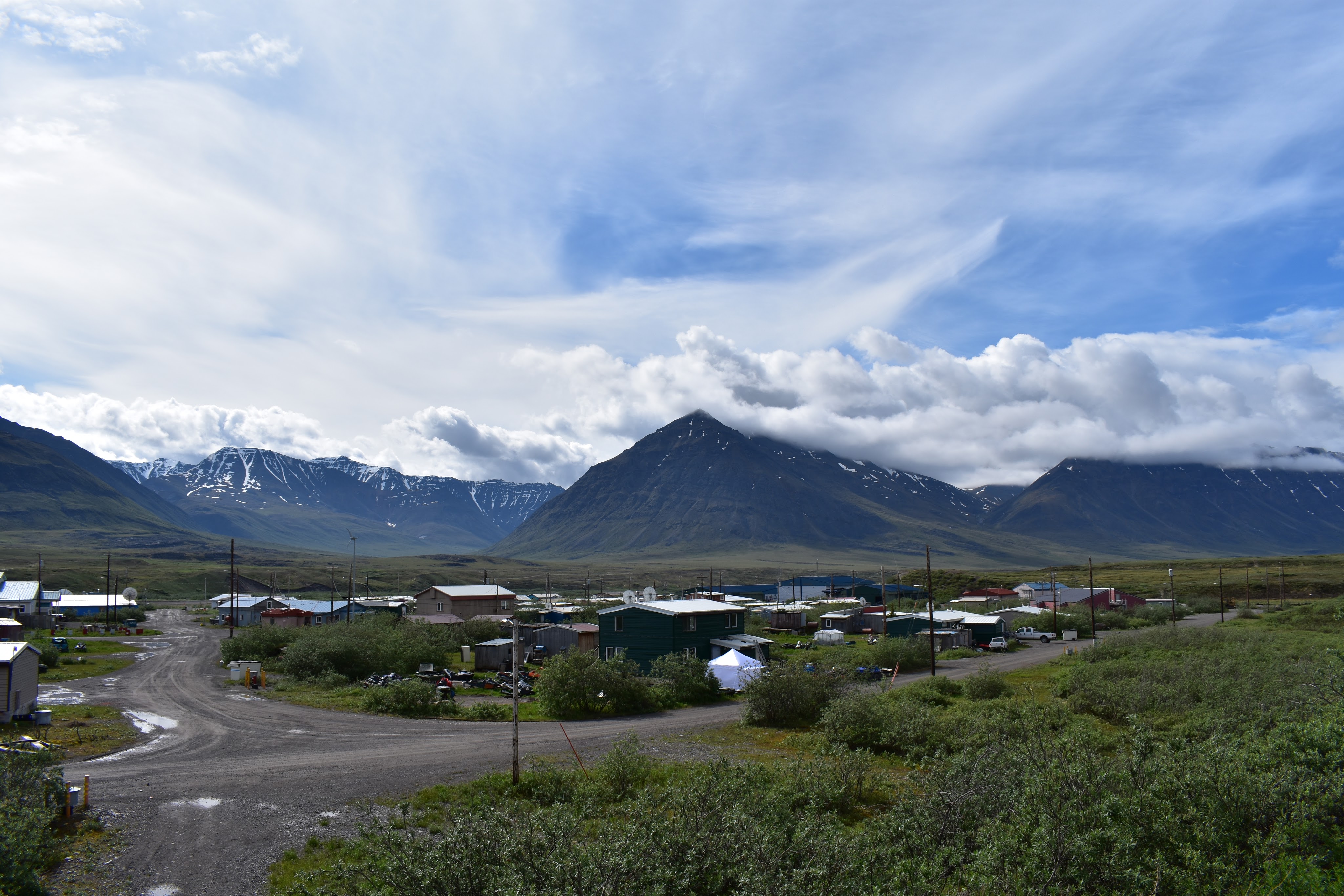
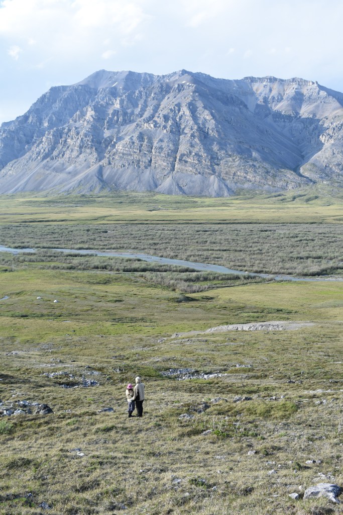
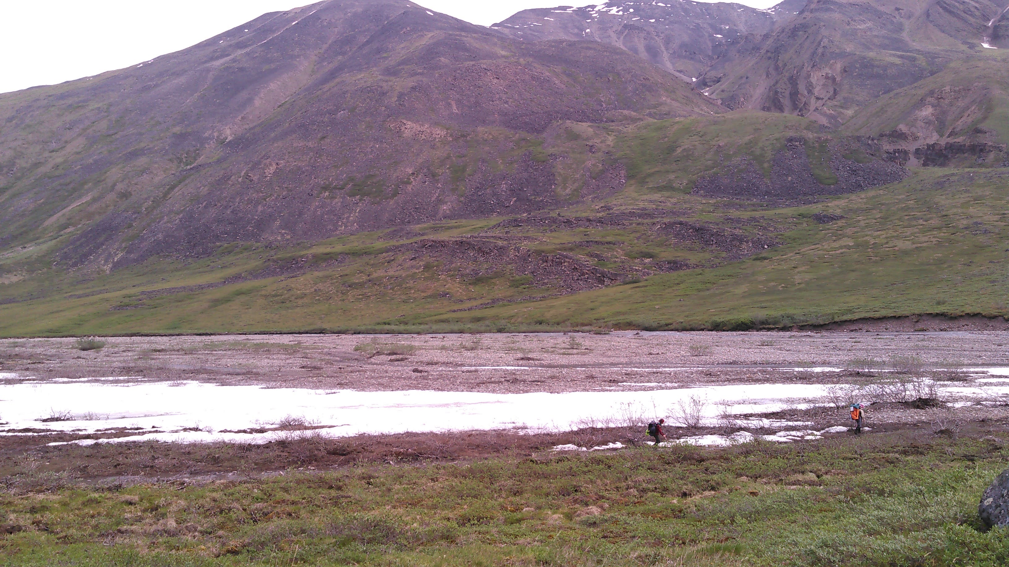
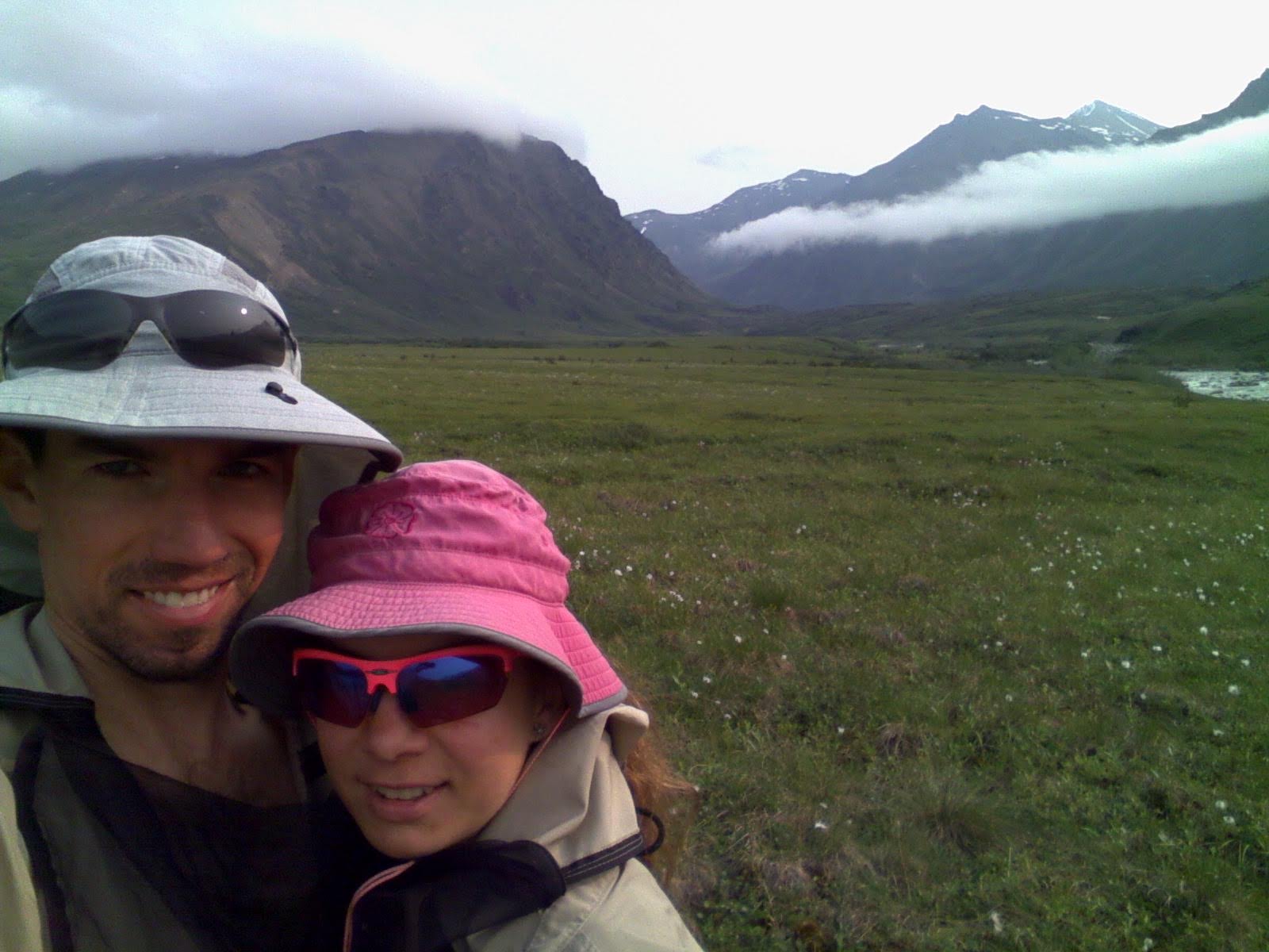
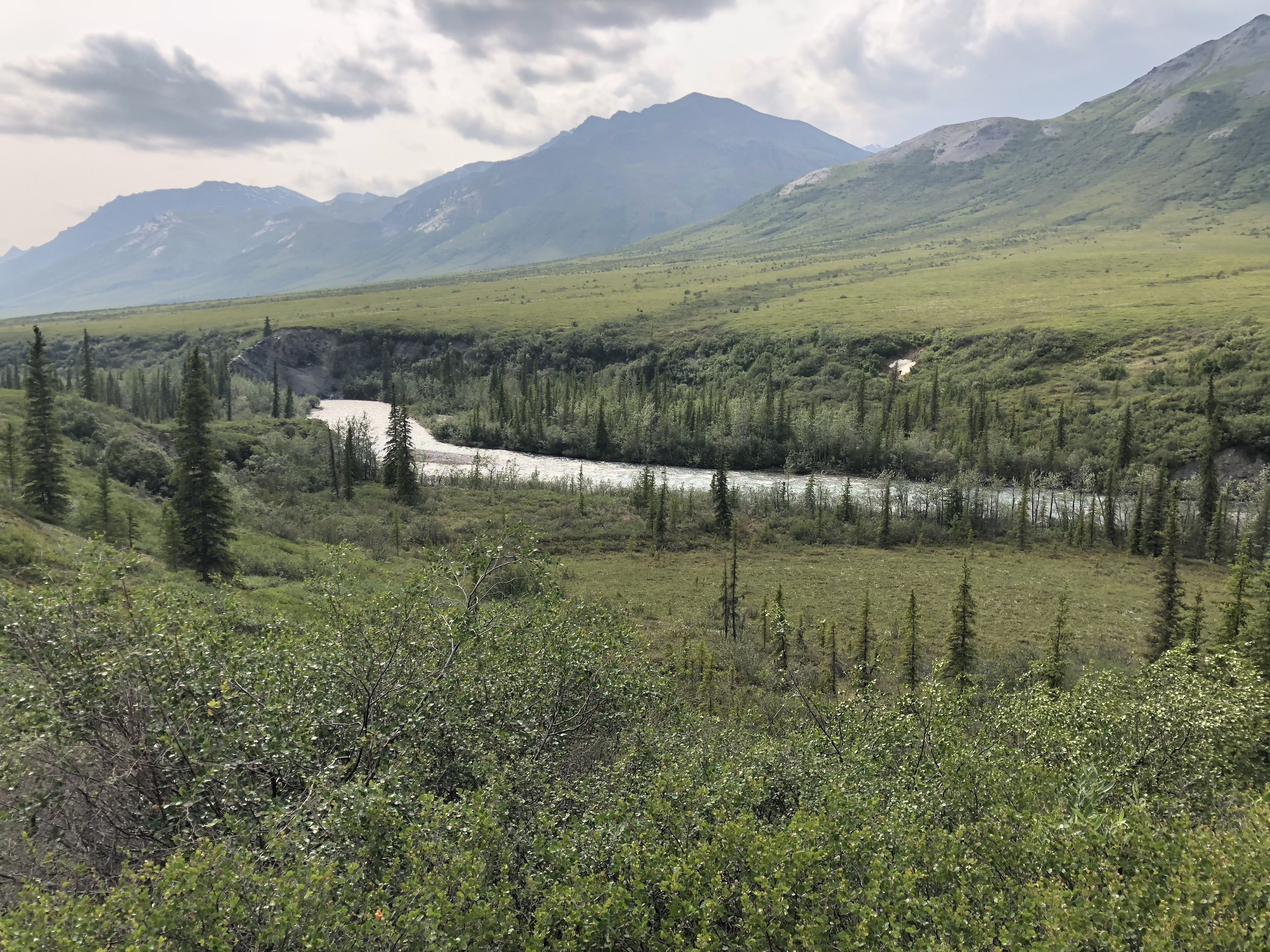
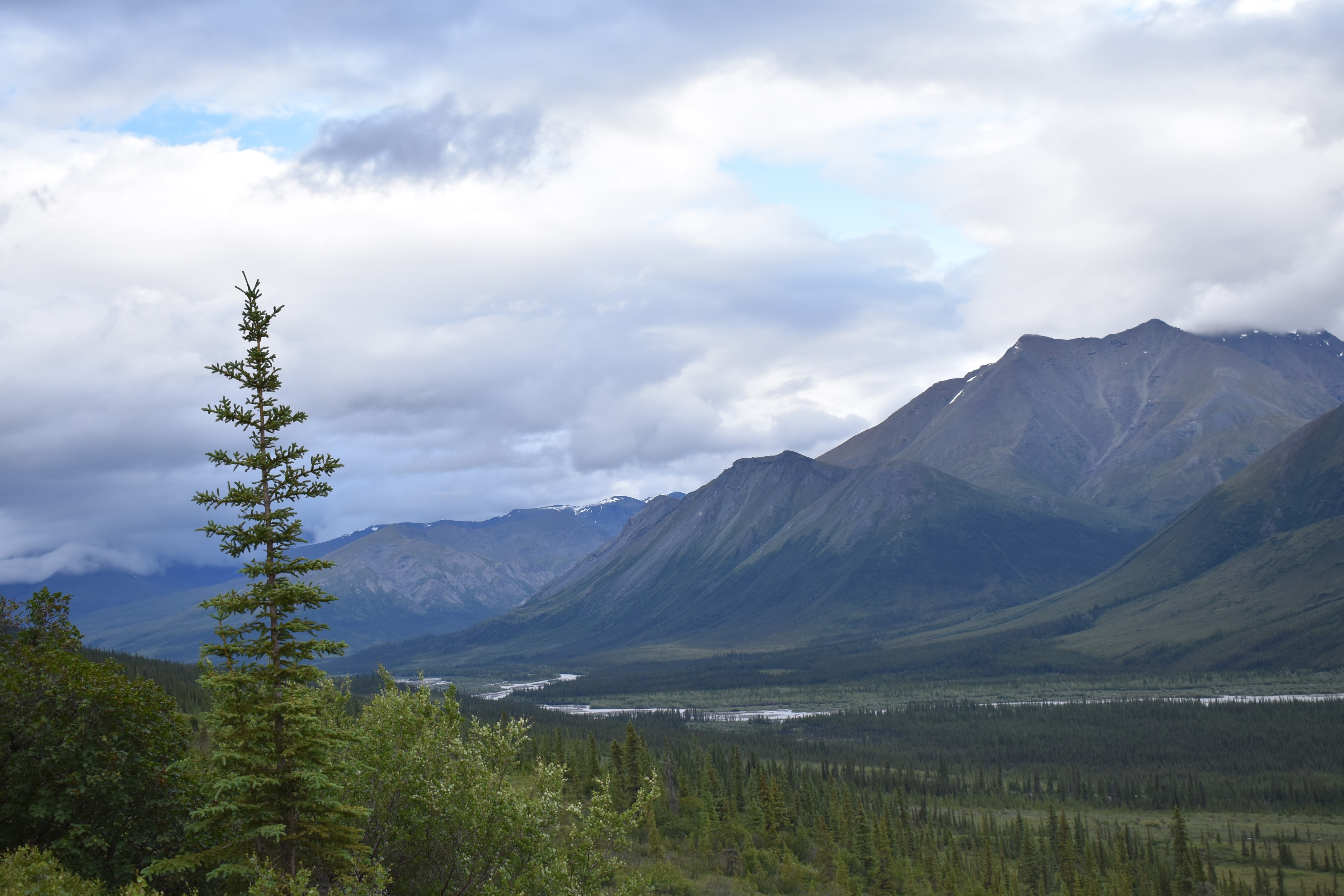
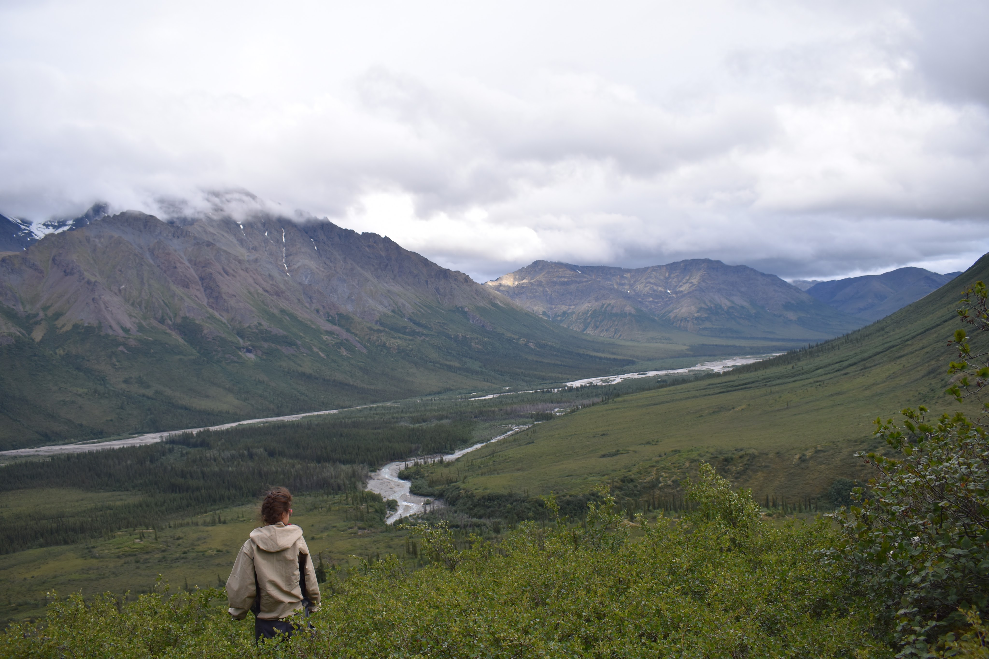
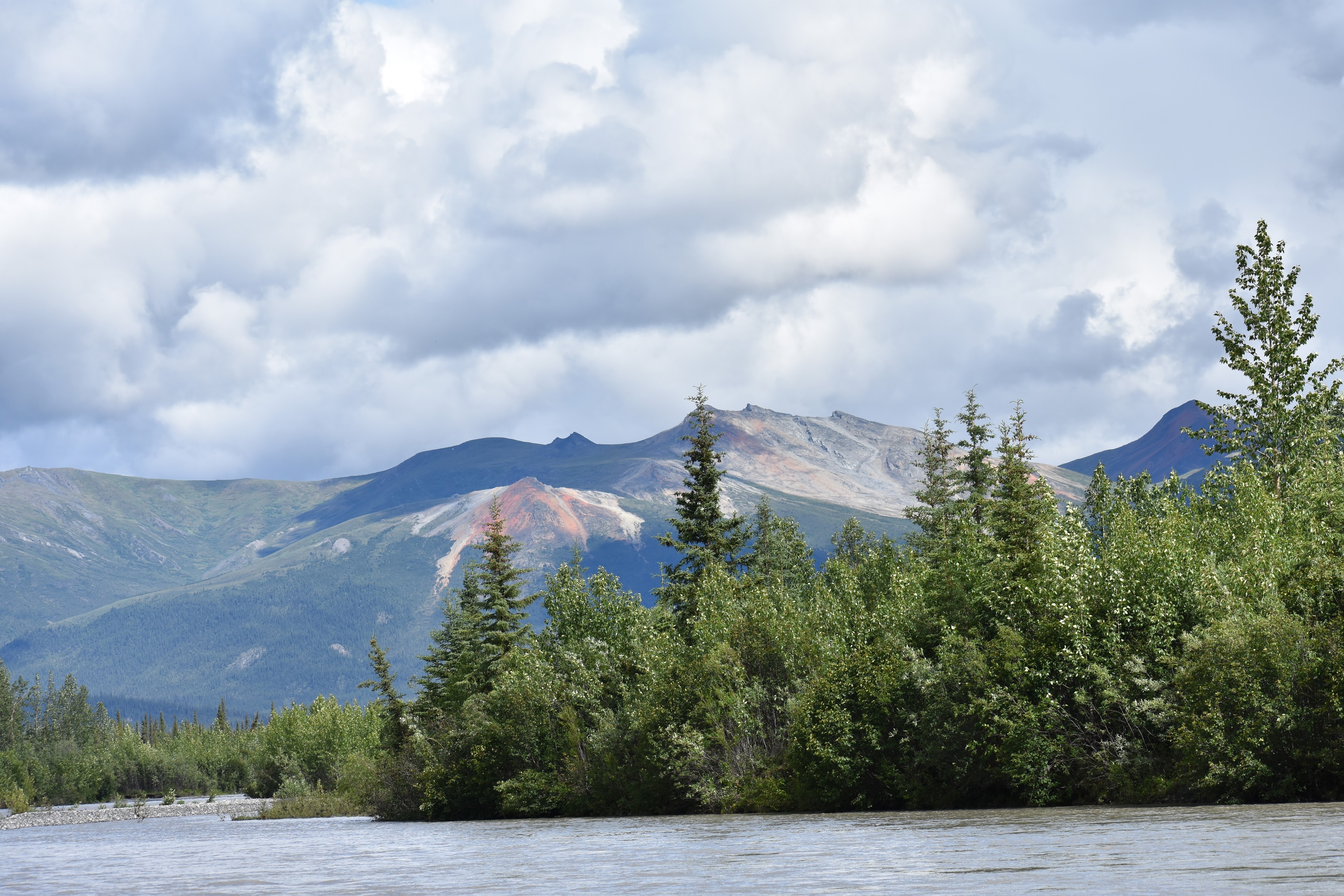
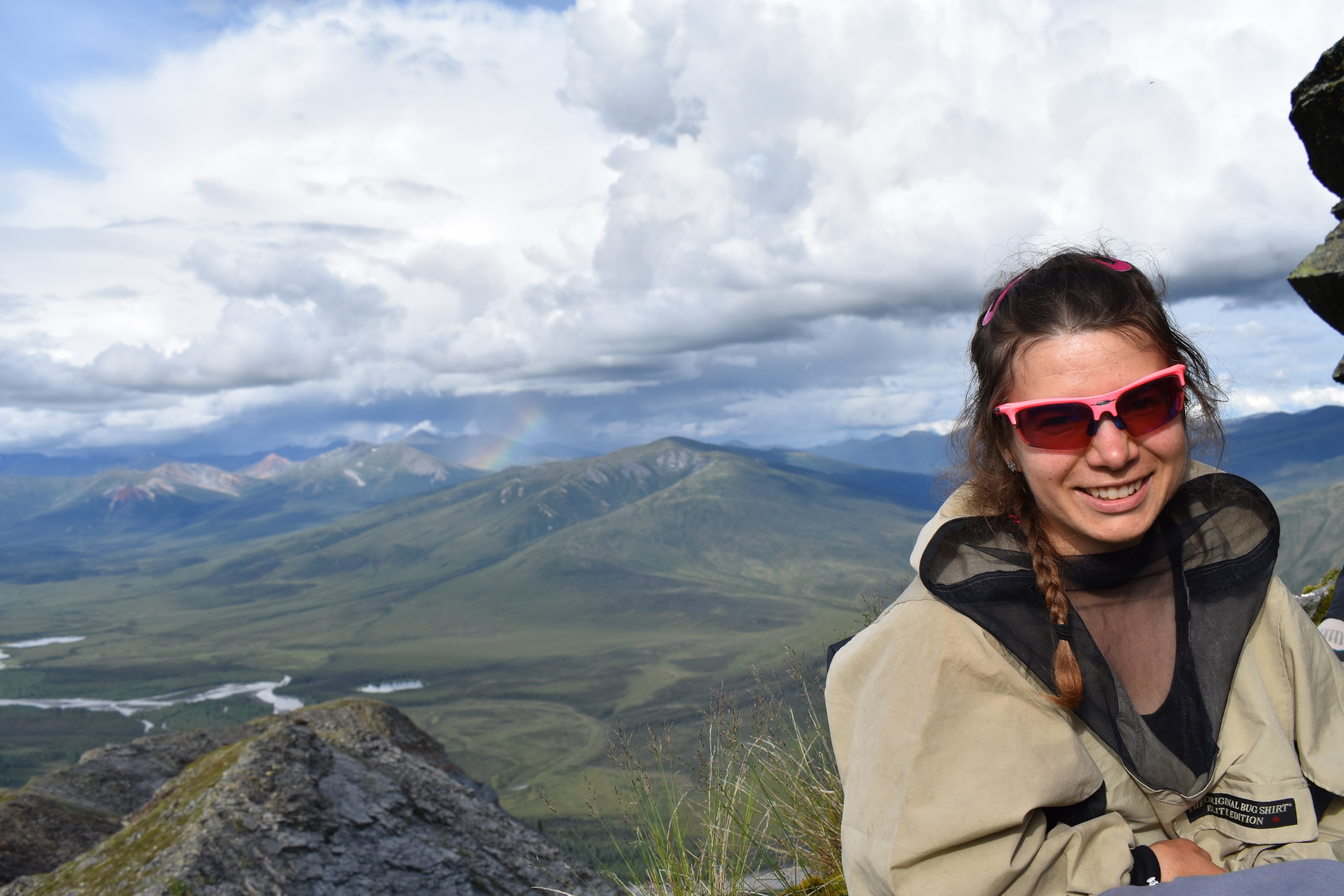
When we arrived at Anuktuvuk Pass, there were some passing clouds and it was cool- probably around 60 degrees. The landscape was vast- mountains jutting up everywhere with broad valleys in between. After months of planning and imagining being here, it was definitely surreal.
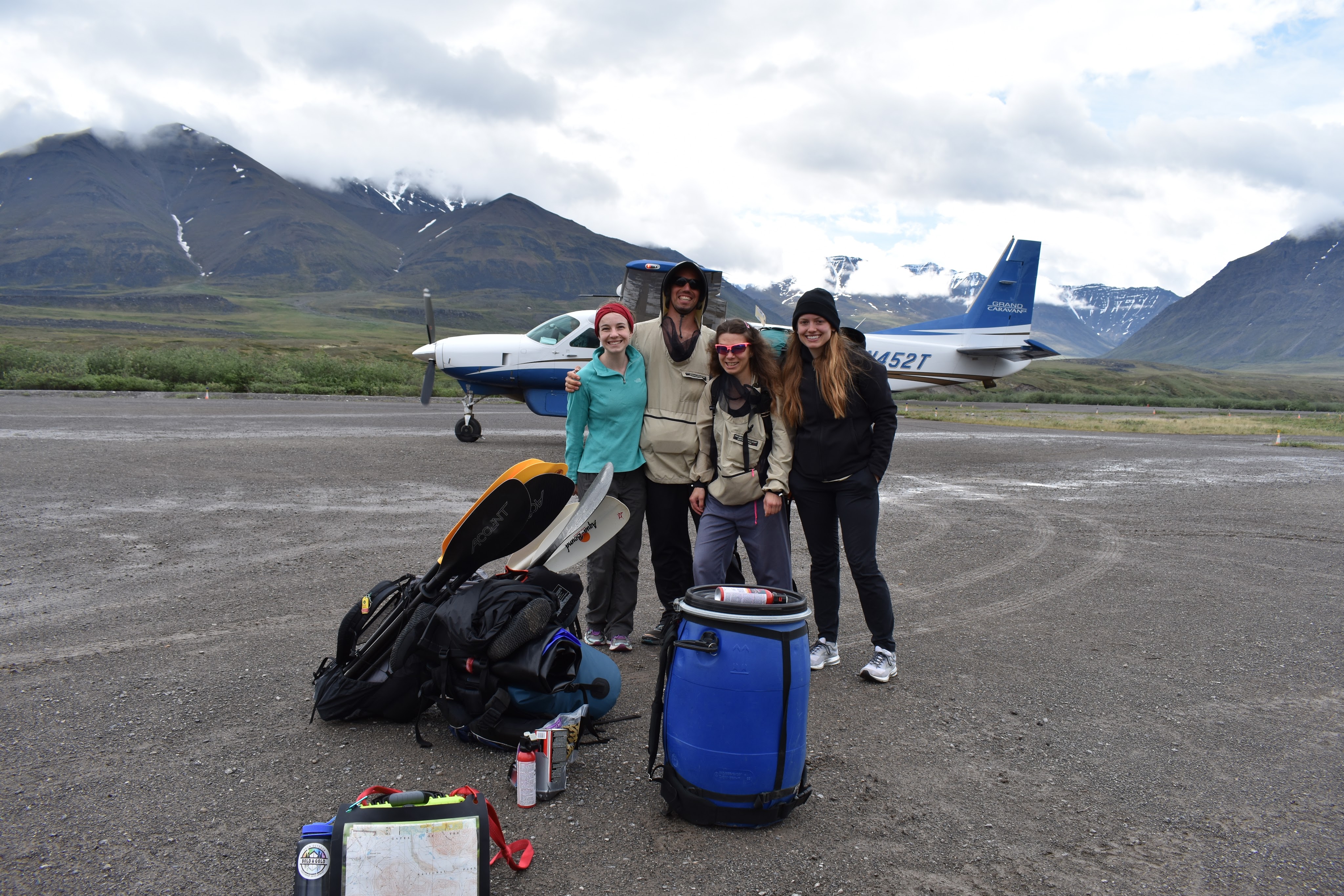
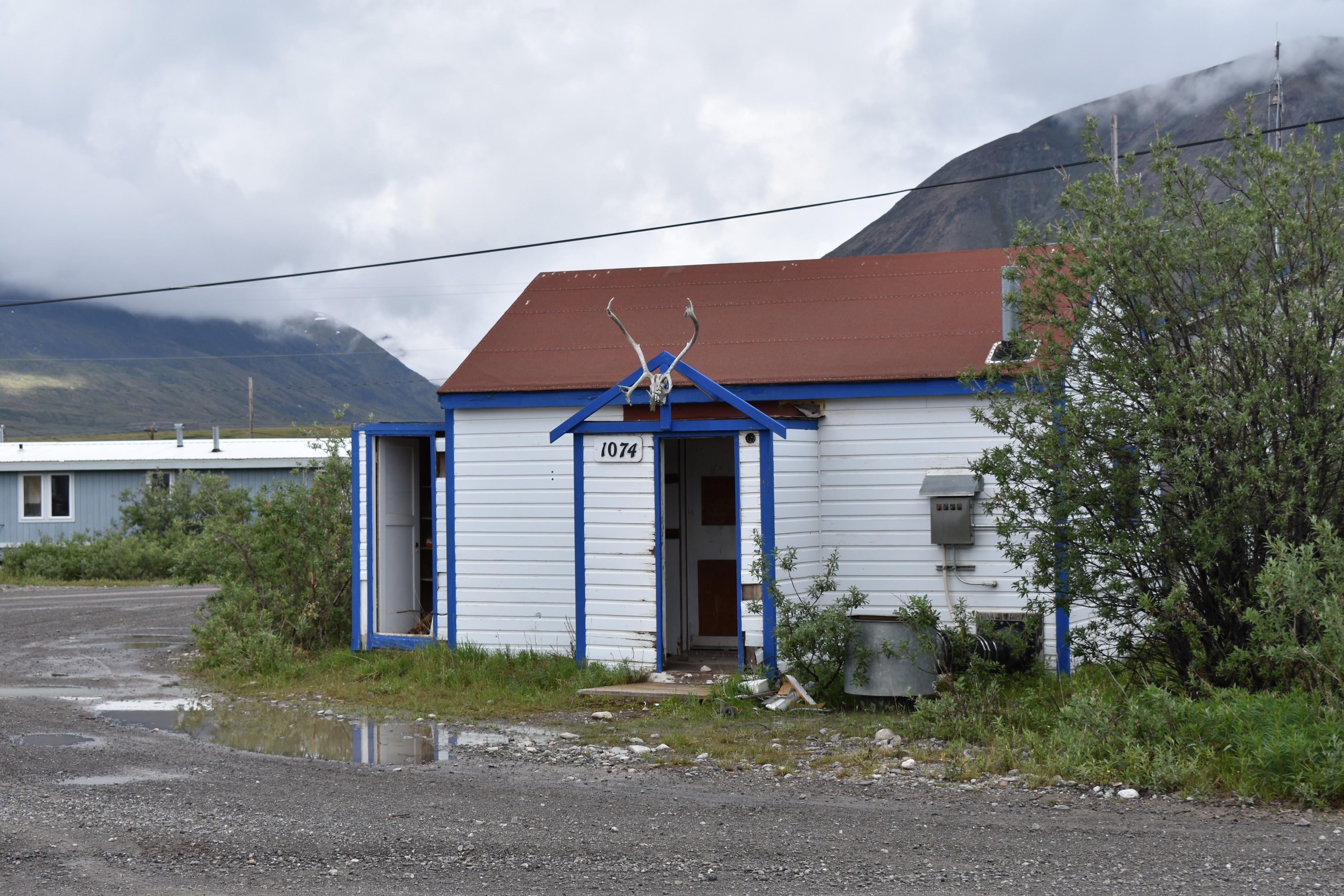
The town was incredibly sleepy. There were a number of small residences, all adorned with caribou antlers above the front door. No one was milling about. There was no big sign for the store. We stopped by the Simon Paneak Memorial Museum but it was closed. After a snack, we started off east and slightly north to head into the valley with the Anuktuvik River, around noon.

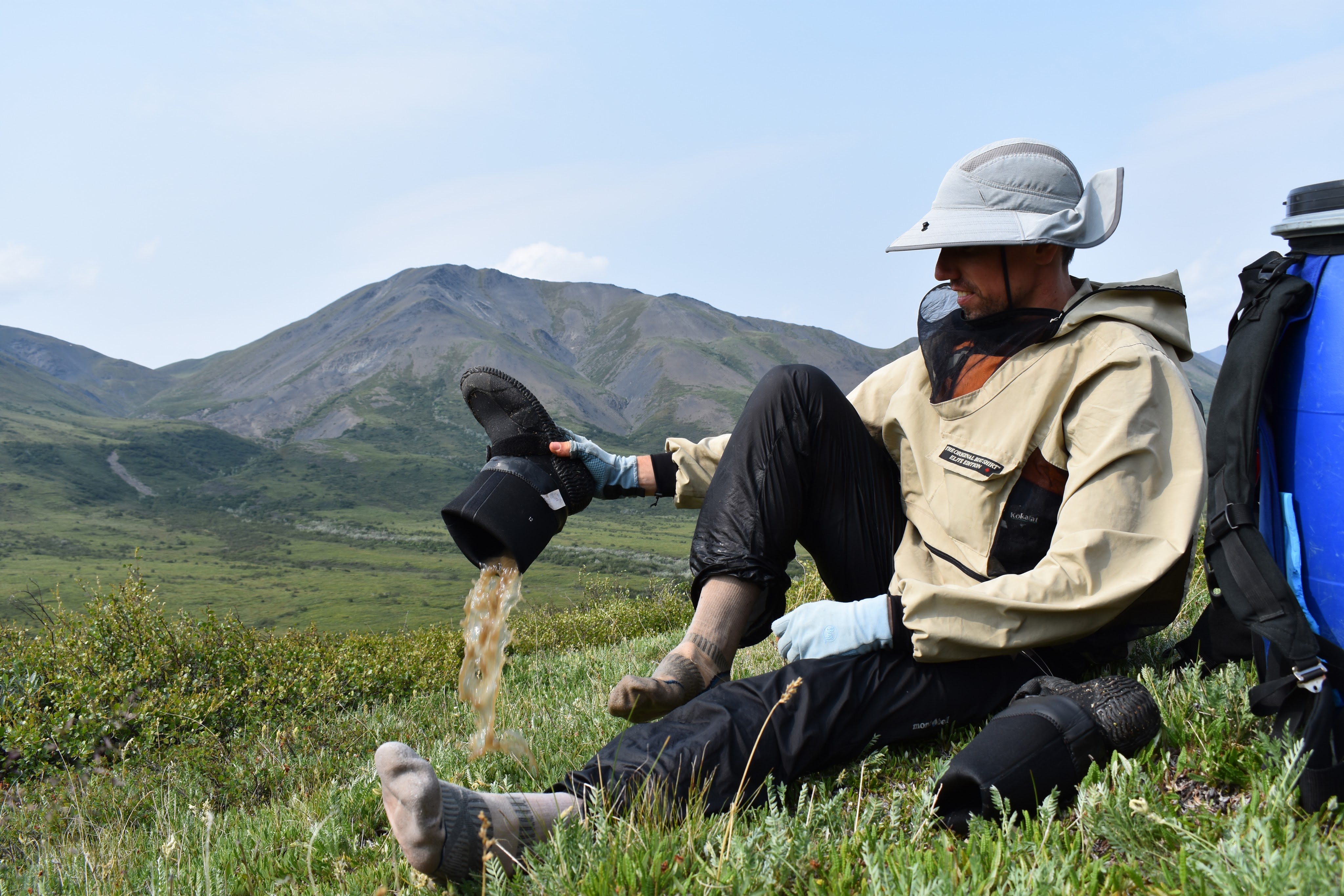
Previous to our trip, we heard we’d be walking on the tundra on tussocks, grass that grows in clumps. Between these clumps the dirt erodes away and so it’s difficult to walk. We also heard this area was wet, wet, wet. As we flew into Anuktuvuk Pass, we could see the water catching the sun everywhere on the ground and up the sides of mountains. To prepare for this wetness, we bought “Alaska” NRS boots (the style we got are no longer available). These were key.
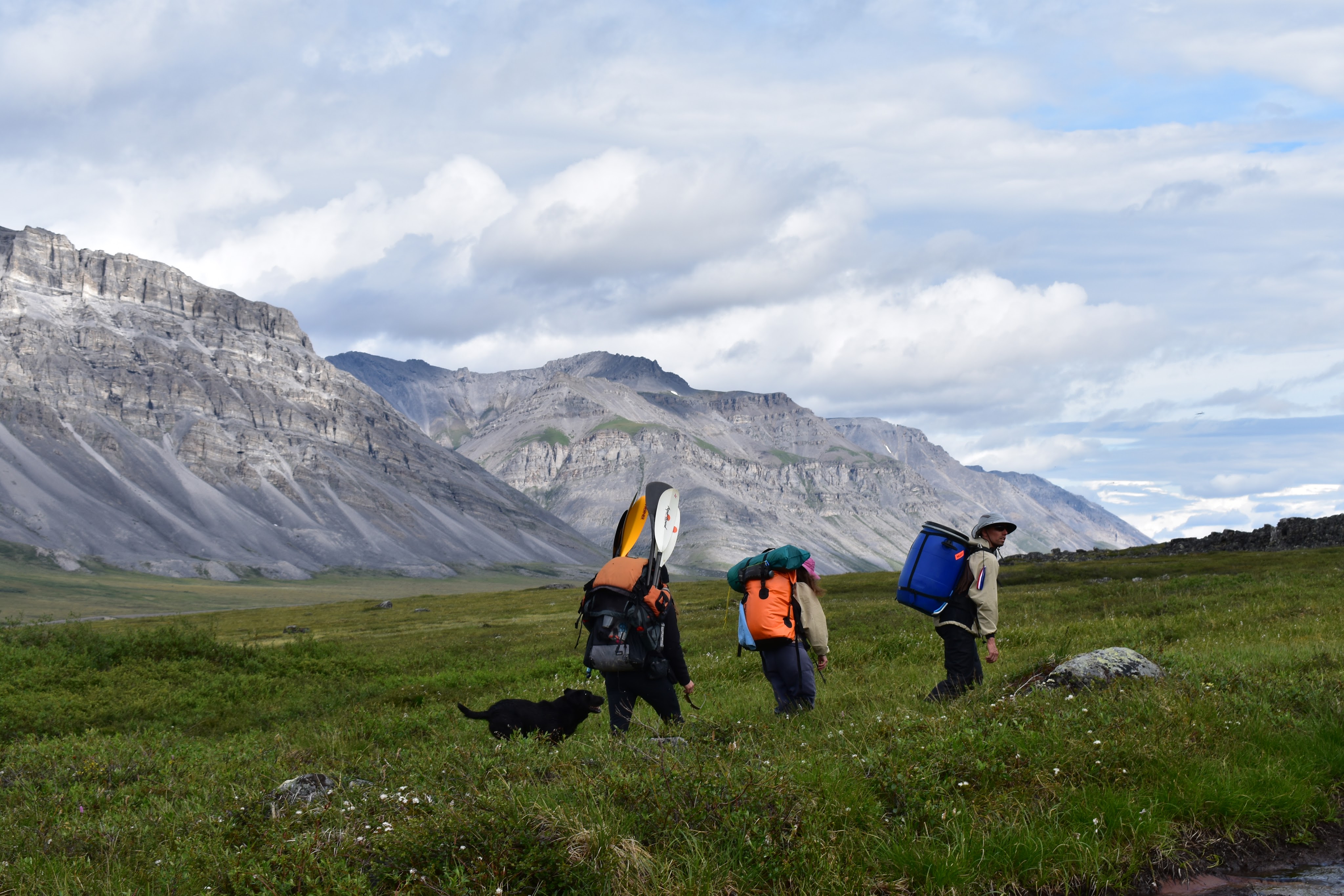
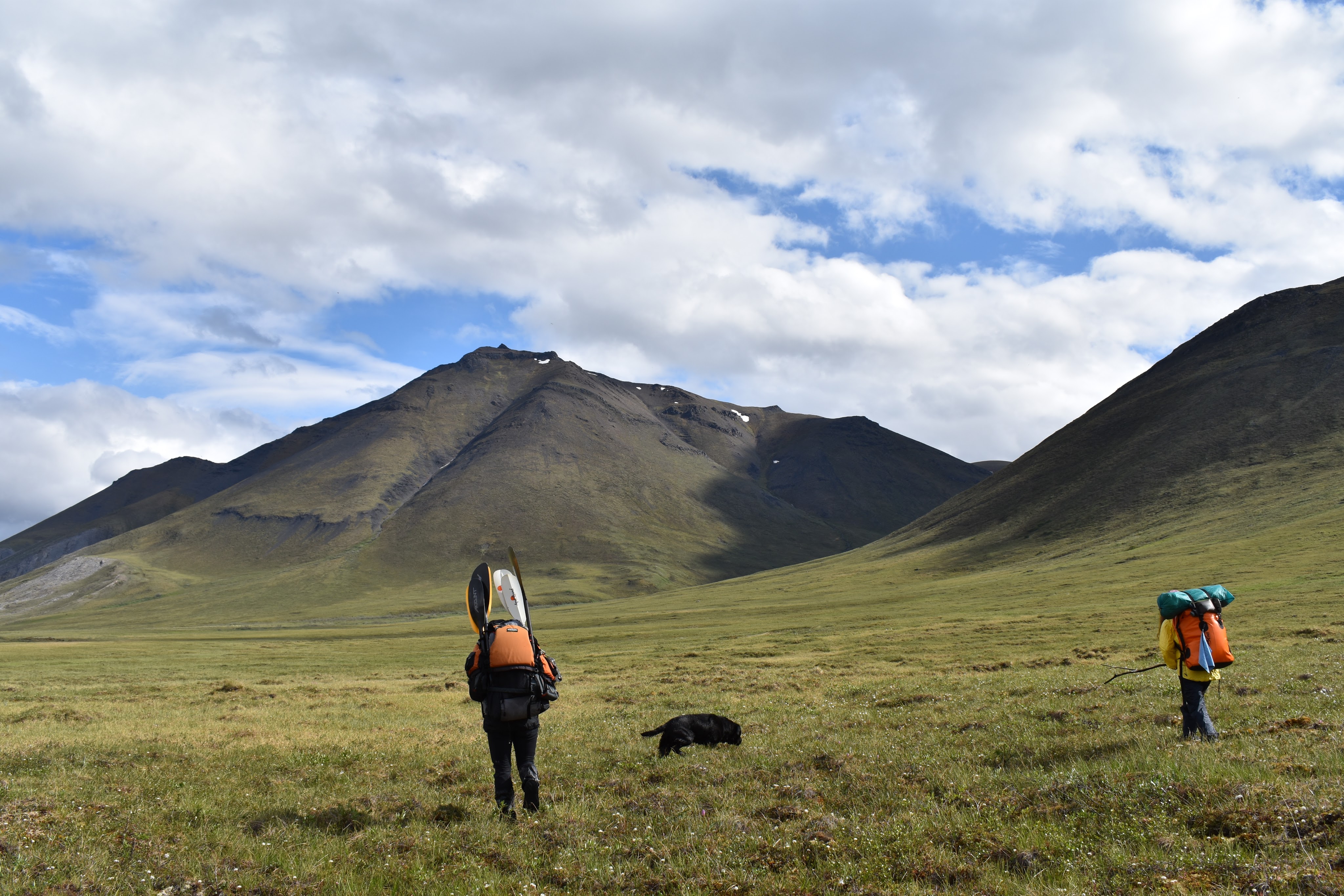
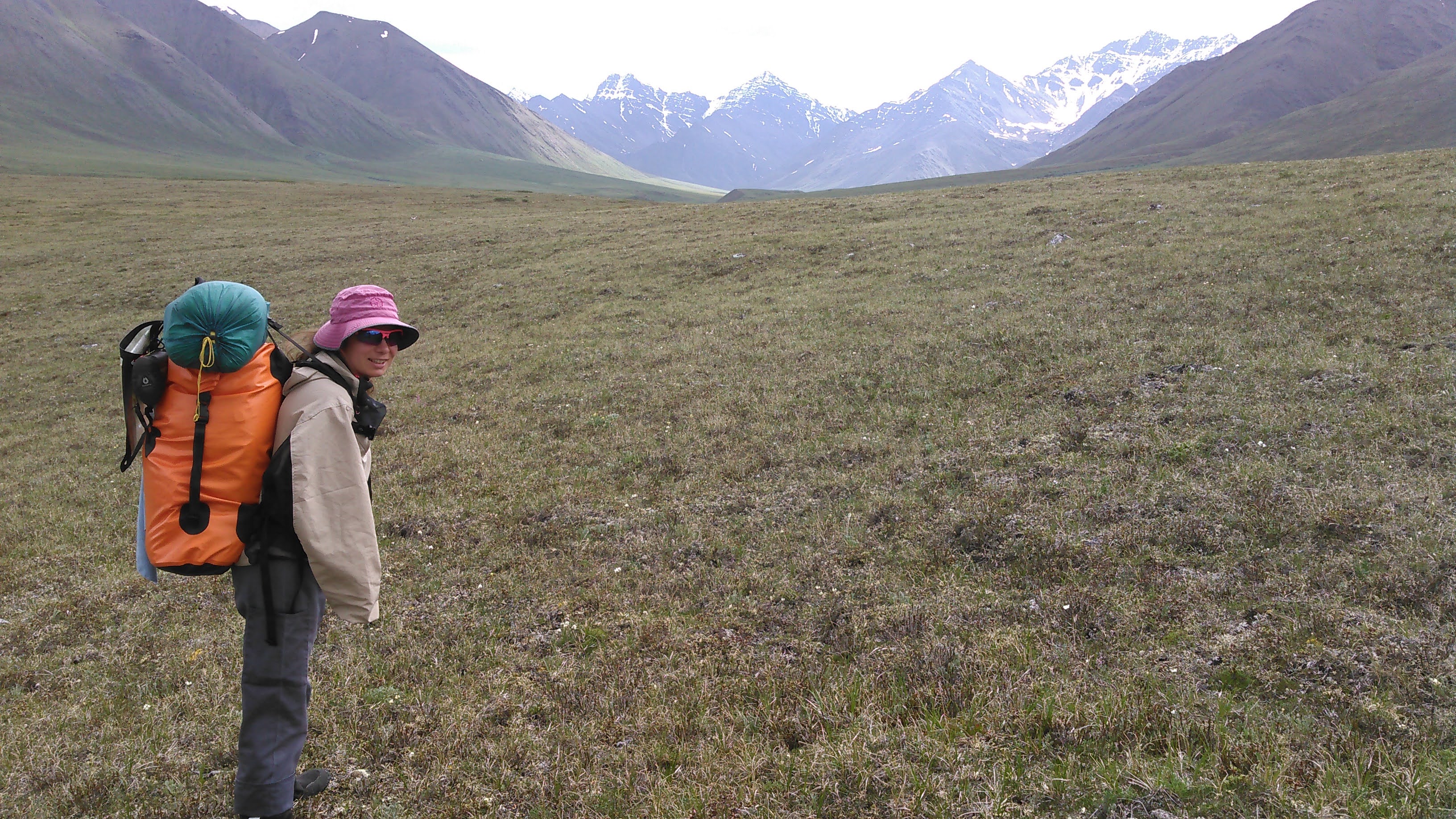
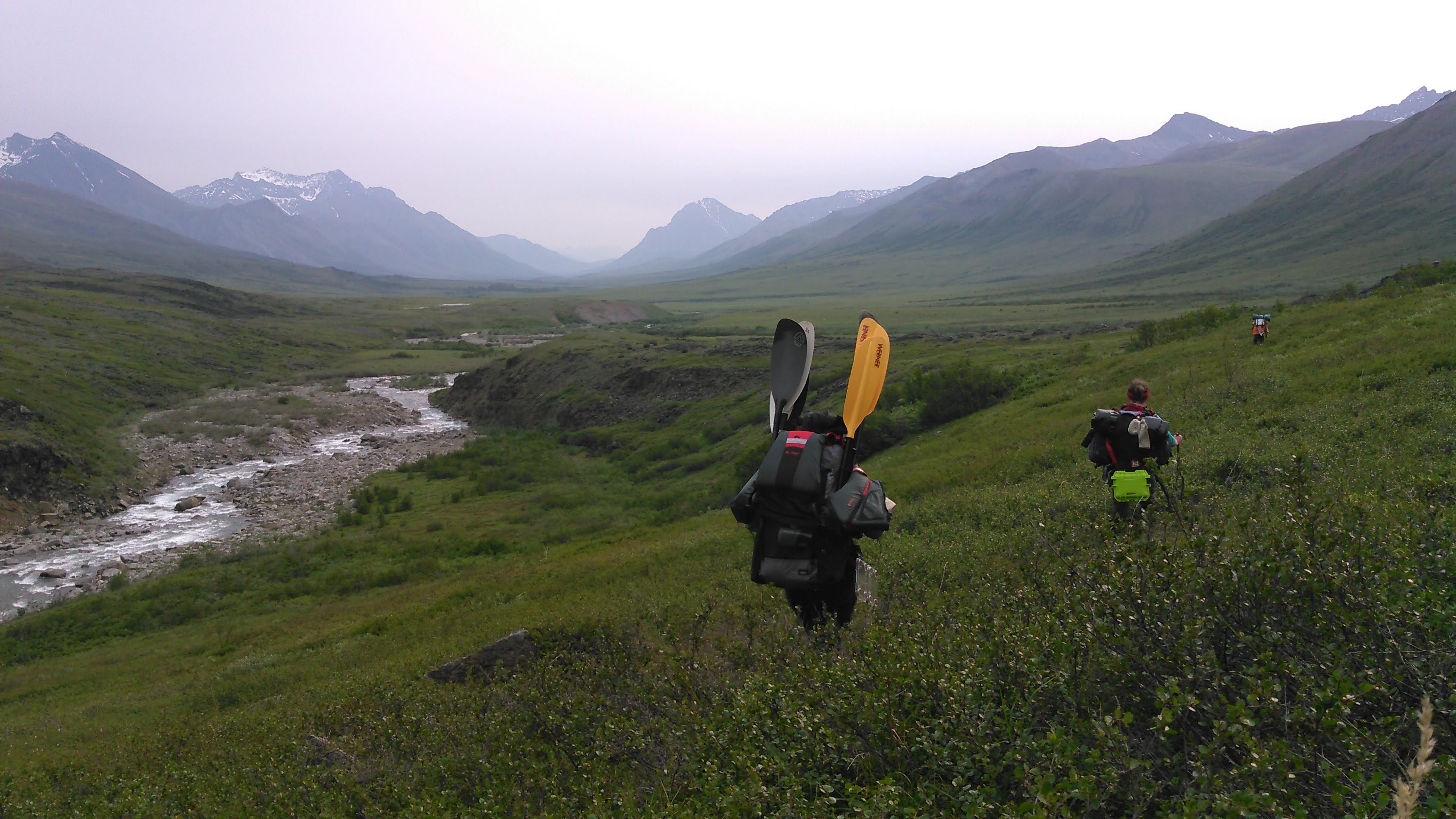
The scenery was spectacular as we hiked along the south side of the Anuktuvuk River. Unfortunately our packs were quite heavy. Sarah and I both had 70 liter SealLine Dry Packs. These are not good for carrying heavy loads for long periods of time. I had all of the gear for Erik and I, including our packraft but minus our food. My pack only weighed 32 pounds but without any kind of frame, all the weight rested on my shoulders and not my hips, even with the hip belt as tight as it would go.
Meanwhile, Erik had the mega load with all of our food for 10 days in a bear barrel (thanks to Dave and Josie Nelson for letting us borrow this!). This weighed something like 80 pounds when we started out. He switched out with “Tough Tiff” who otherwise borrowed Erik’s backpacking pack that carries weight like a dream. We did load her down with all the paddles as these fit nicely on the sides of her pack.
In regard to our packrafts, Erik and I bought a used 8-pound Alpacka two-person Gnu raft (that style is most similar to the Racing Gnu that is now available). Sarah opted for a two-person DIY packraft. As is typical with most DIY kits, she found it took her about four times as long to make the packraft than estimated time.
So much for worrying about bear. A black lab followed us out of Anuktuvuk Pass. We mostly ignored him and thought he would turn around at some point. After three or four hours, we realized we needed to be aggressive in sending him back to town. He simply could not come with us. Even though Sarah toyed with the idea, we did not have food for him and he was already starting to act funny when we did stop for a snack. Sarah named him Argo after the argo ATVs used in wet areas of the world.


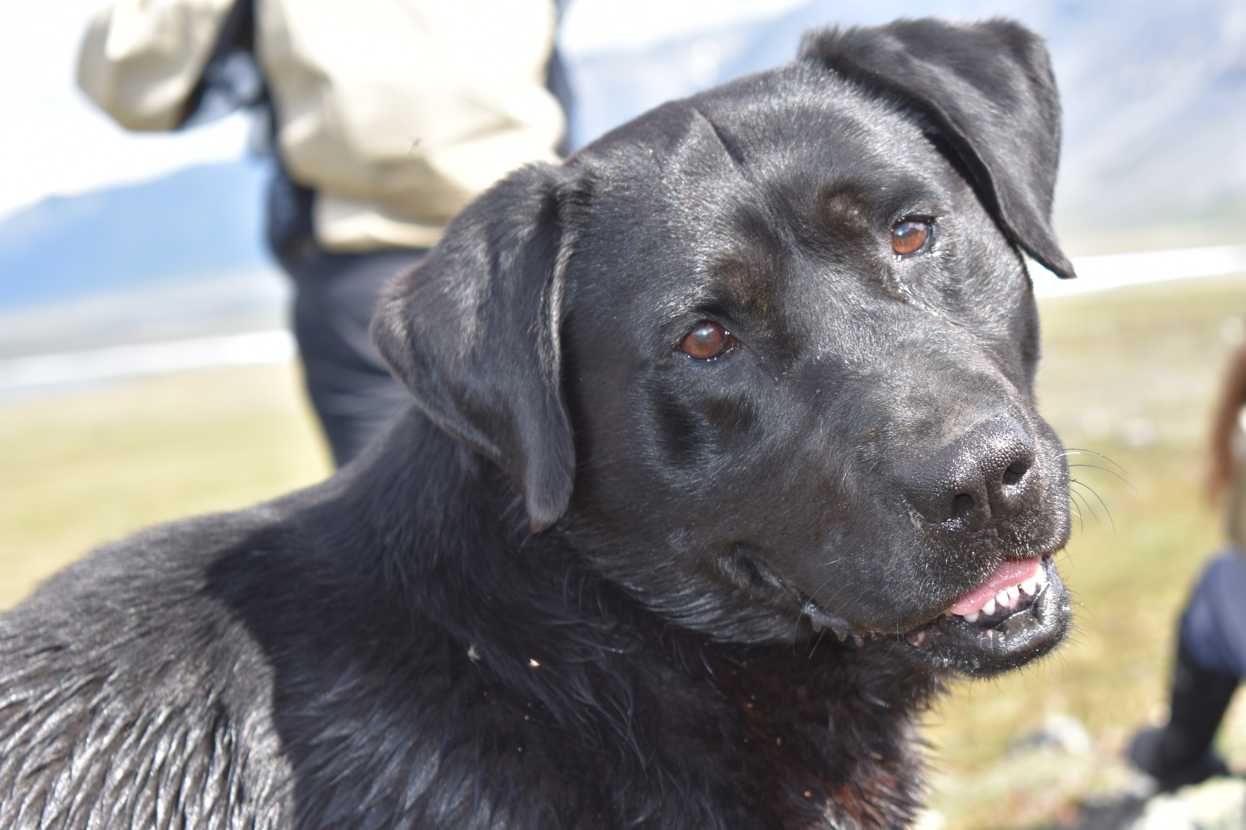
We started yelling at the dog to go back home. He didn’t listen and kept following us. Finally, Tiffany, who is usually quite sweet, found a stick and started beating Argo. After this we all had to keep a united front that he needed to go back home. We spent the better part of an hour yelling at Argo and threatening him with any sticks we could find (these were hard to find on the treeless tundra but there were a few scrub trees around near streams). We even debated using our bear spray.
Finally it seemed Argo was defeated and he retreated home. We then crossed a small but deep stream and hoped we wouldn’t see him again.
Fortunately, we never saw Argo again.
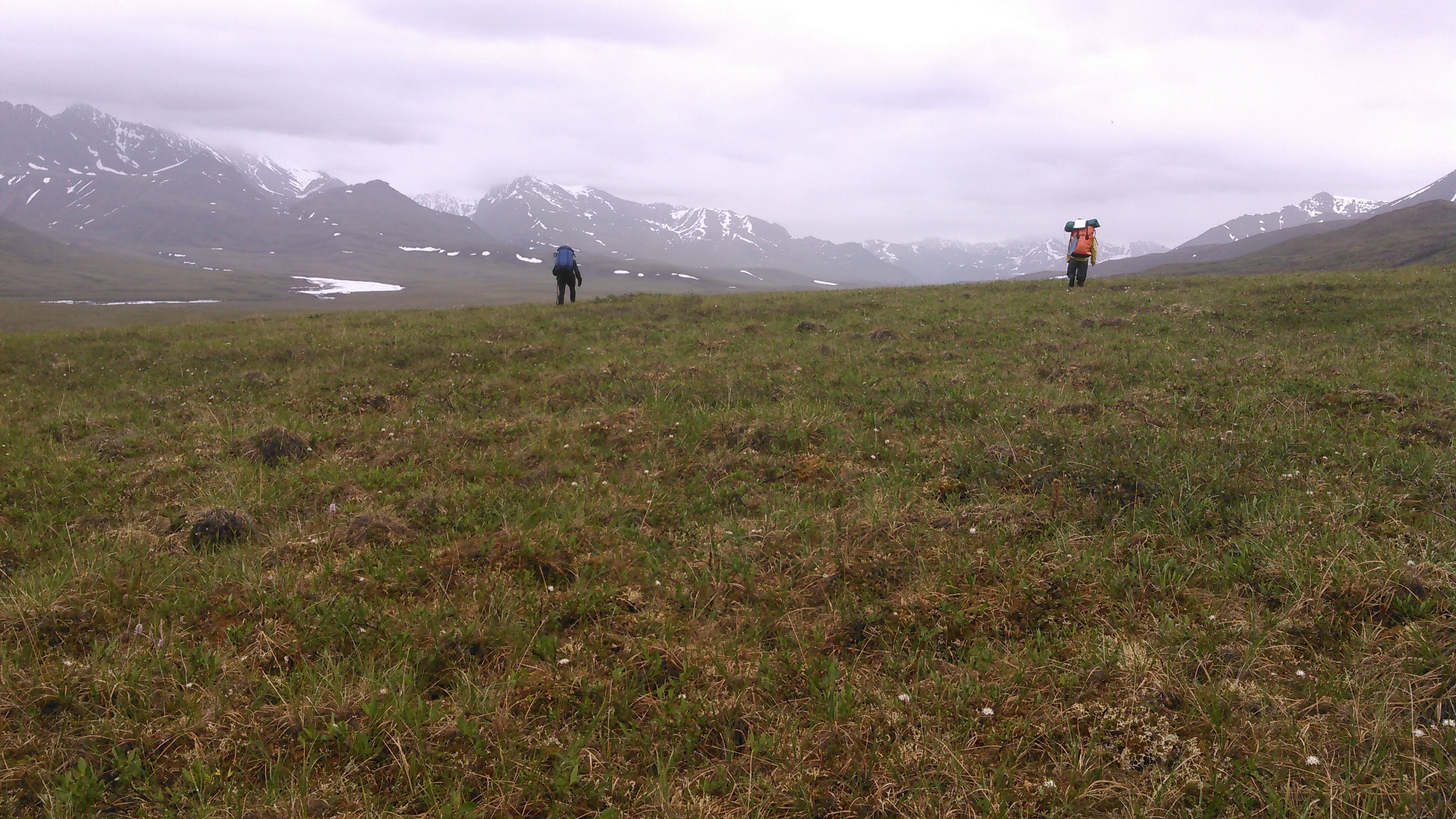
Despite our best intentions, we didn’t get terribly far for the day. I had set some goals for how far to get each day but had also built in two layover days when we planned to do side hikes. Given that the most dramatic scenery occurred early in the trip while we were still in the mountains, we planned to have these layover days earlier rather than later.
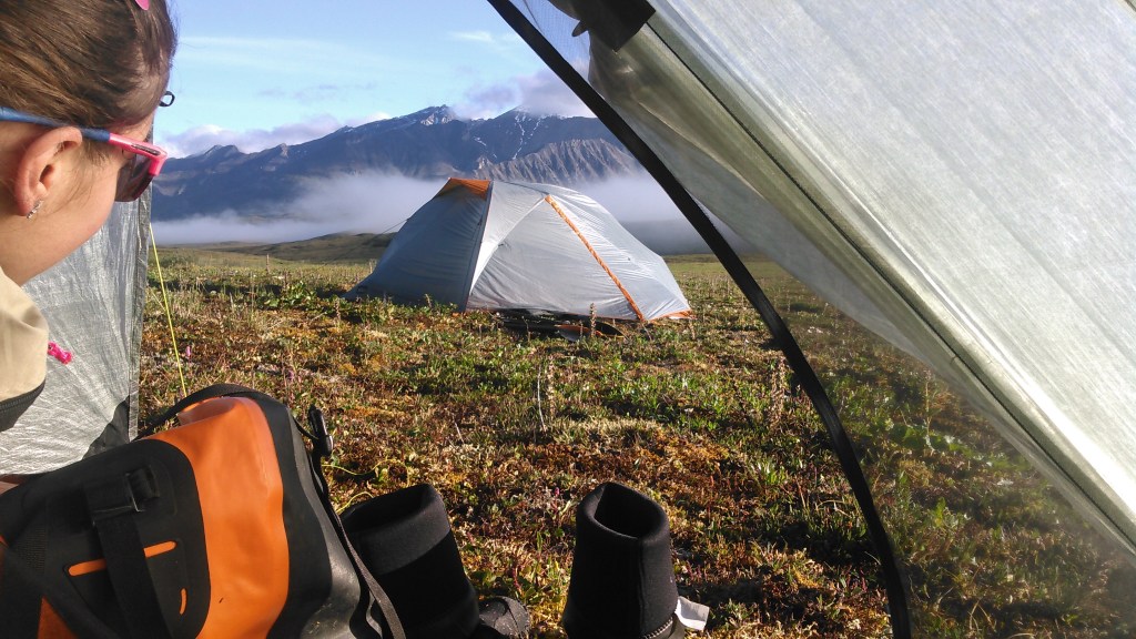
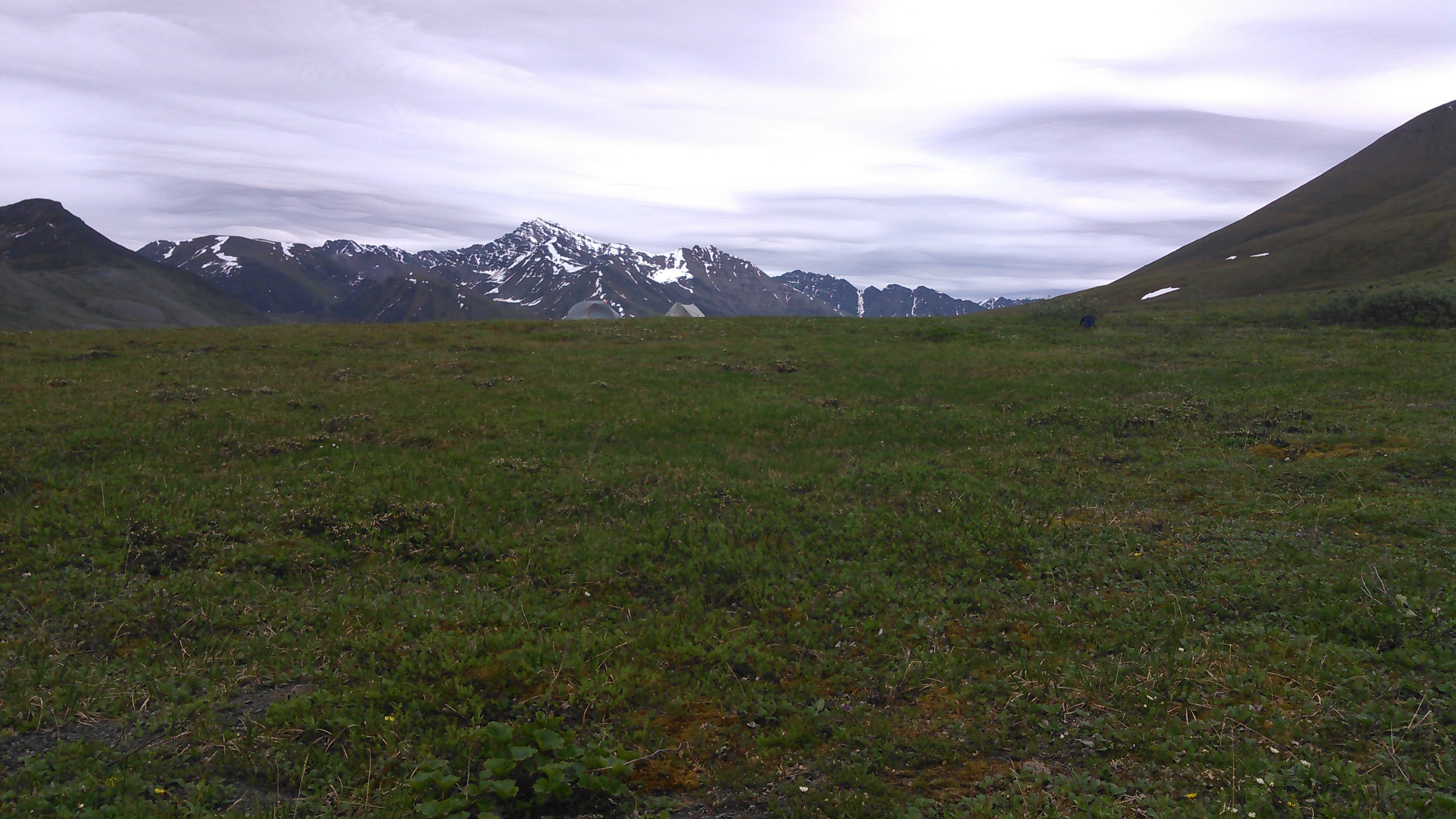
We found a dry place to camp on a very minor ridge- not an easy thing to do amidst the wet ground. The sun never set on our trip and so we took a leisurely hike part way up the mountain to the south to enjoy the scenery after dinner.

Day 2: 7/3/18
The next day proved to be a trudge for me. My heavy pack had worn into my shoulders and as a result made me fairly sore. I was so glad every time we stopped for a while and could put my pack down. We encountered more wet ground and some stream crossings. Many of these stream crossings were above my knees and hence the water came rushing into my boots. This was less than ideal and after the crossing I would take my boots off and pour the water out of them. As we started climbing higher, we found a good campsite by a small lake.

We again took an evening hike. By now we had hiked above the Anuktuvuk River and had a good view down to the river as it passed through a small gorge. For some reason we didn’t take many photos this day- maybe we were all feeling the weight of our packs.
Day 3: 7/4/18

The day started cloudy and not too long after we left camp it began to drizzle. It was a light rain all day long that made us not want to sit and take breaks. Hence we covered the same distance as the previous day in two-thirds the time. As we got to Ernie Pass, we decided we’d had enough for the day and set up our tents. We got inside, tried to dry out, and all promptly fell asleep. A couple of hours later we woke from our naps. It was still drizzling and Erik cooked dinner in the vestibule of our tent. Sarah and Tiffany came over for dinner inside our tent. This probably isn’t the best thing to do in bear country but we try not to spill and it sure is nice to stay dry.

Happy 4th of July! No fireworks around us anywhere!
Day 4: 7/5/18

When we woke the sun was shining and there was blue sky everywhere. I got out of the tent and started dancing around singing “The hills are alive with the sound of music!”
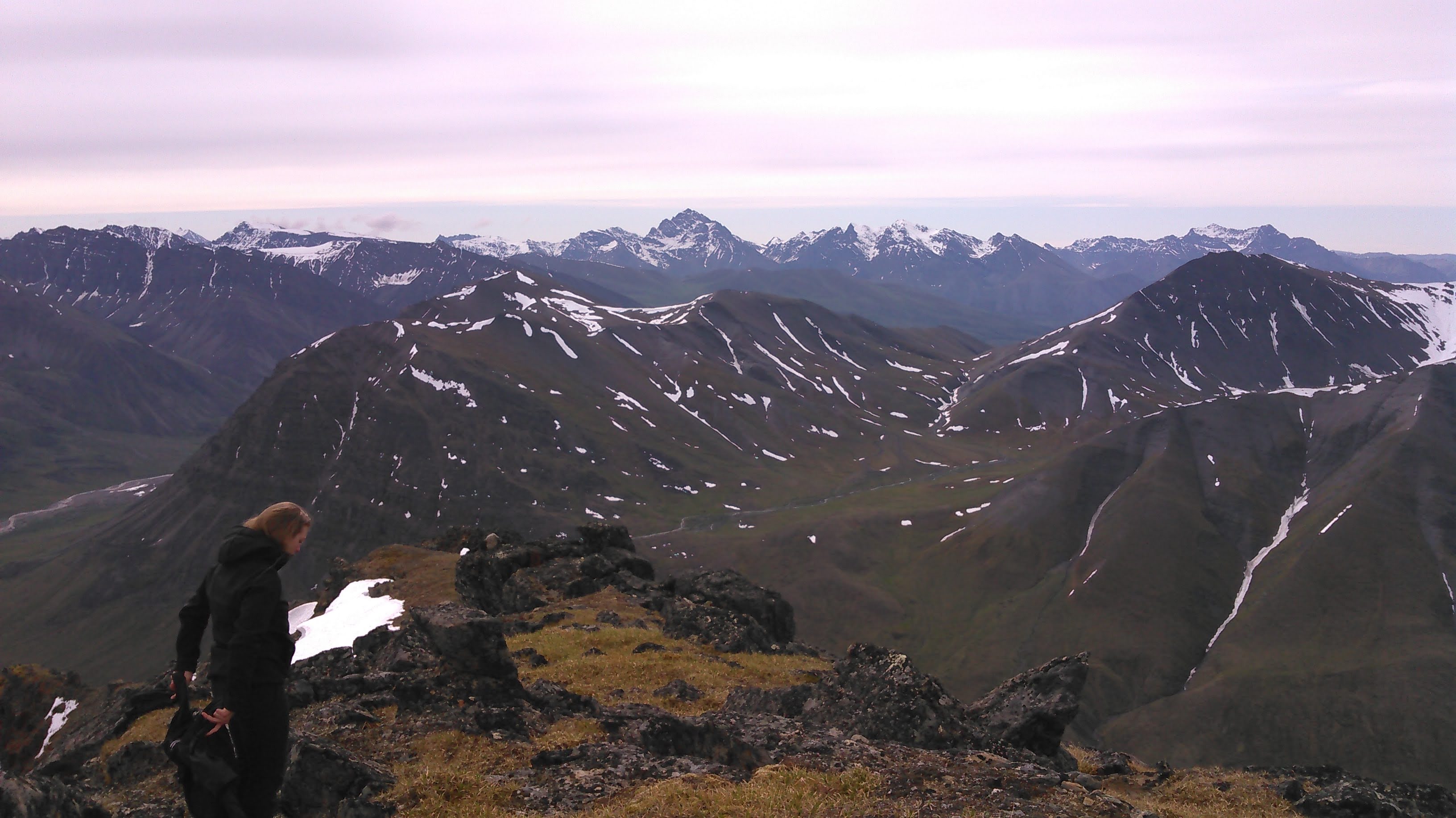
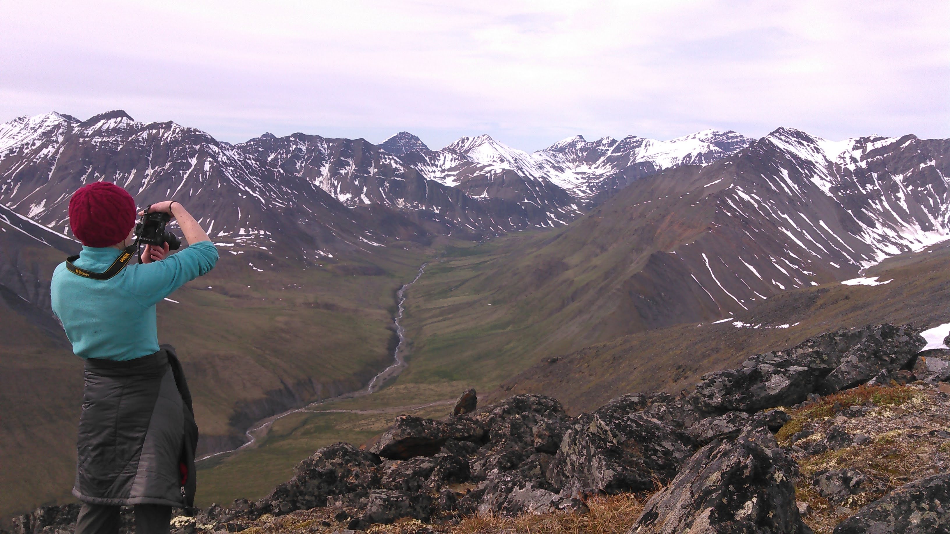
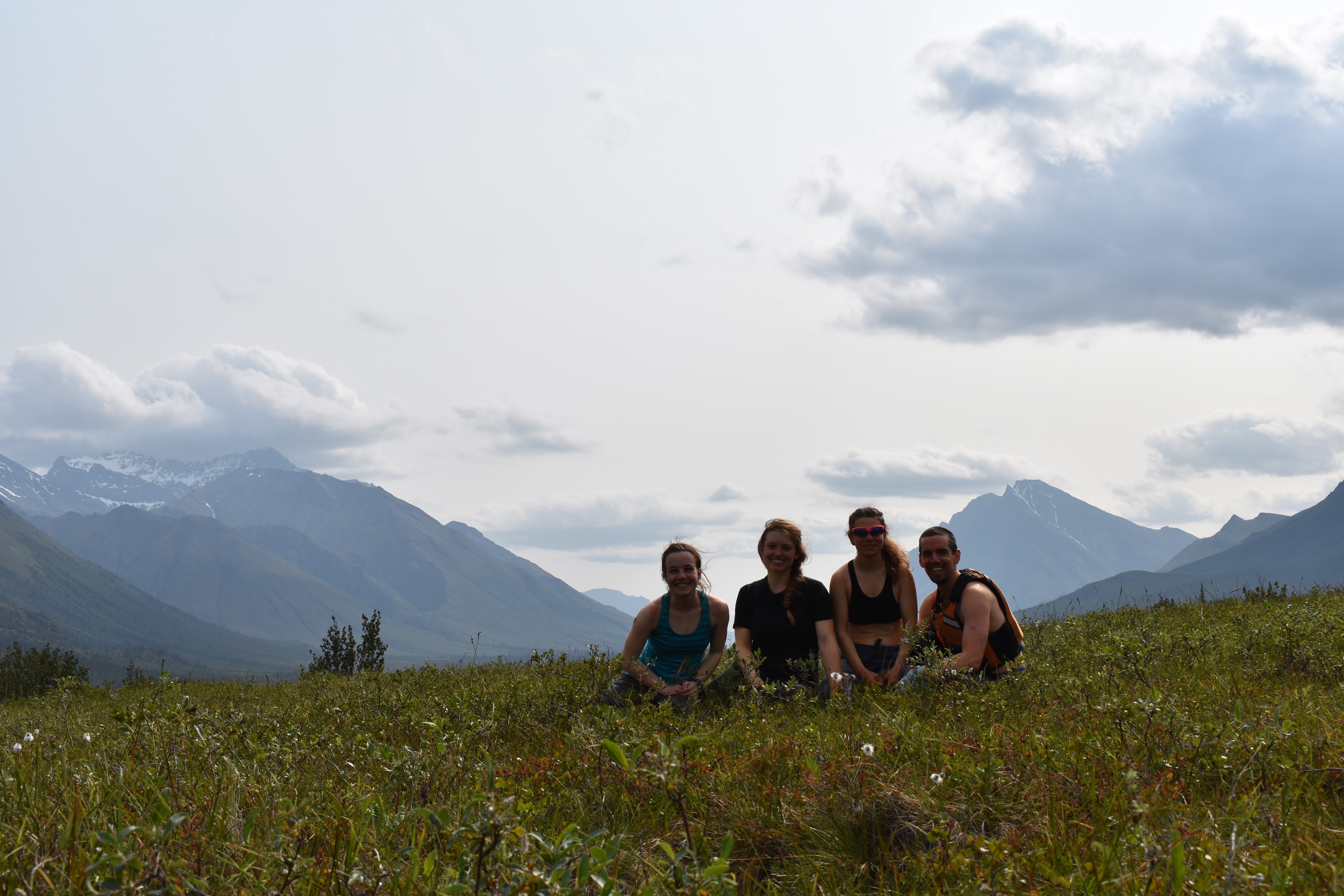
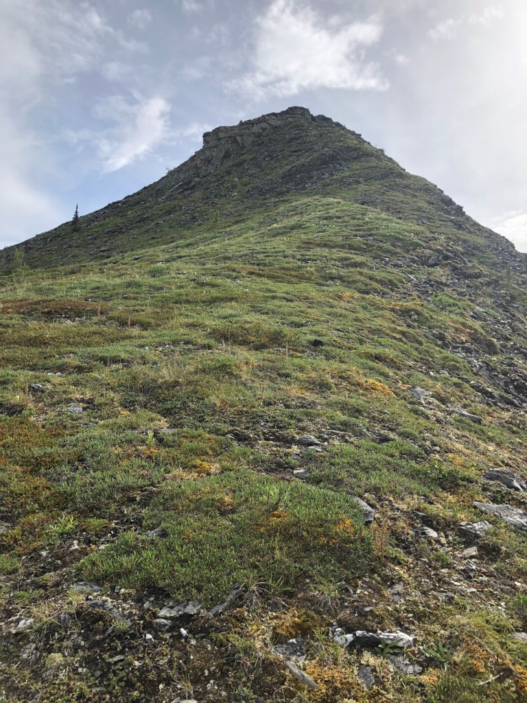
I declared we take a layover day and climb the mountain to the south of Ernie Pass. I scouted a route on our map, then got out of our tent to take a look. The northwest ridge looked possibly do-able but like we might get cliffed-out so even though it was farther, we walked around to the more gradual northeast ridge.
This was the first mountain Tiffany ever climbed! It was mostly straightforward with just a bit of boulders. There was a lot of snow on top of the north ridge but once we got up to the ridge, we were able to travel along the south face snow-free.


We got back to our camp by early afternoon. There was a small creek near our camp that allowed for some washing up and where a few alders had grown up.
After dinner Erik and I took a small hike on the north side of the pass. The clouds were interesting and ubiquitous and so the sun had gone away and everything was eerily dark.


Day 5: 7/6/18

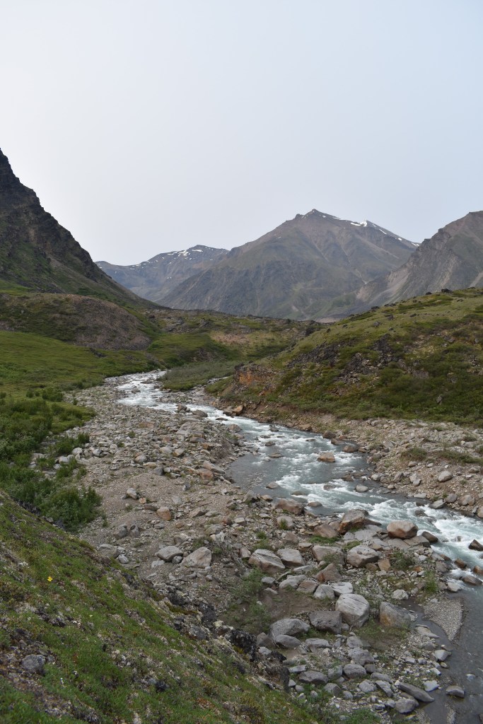
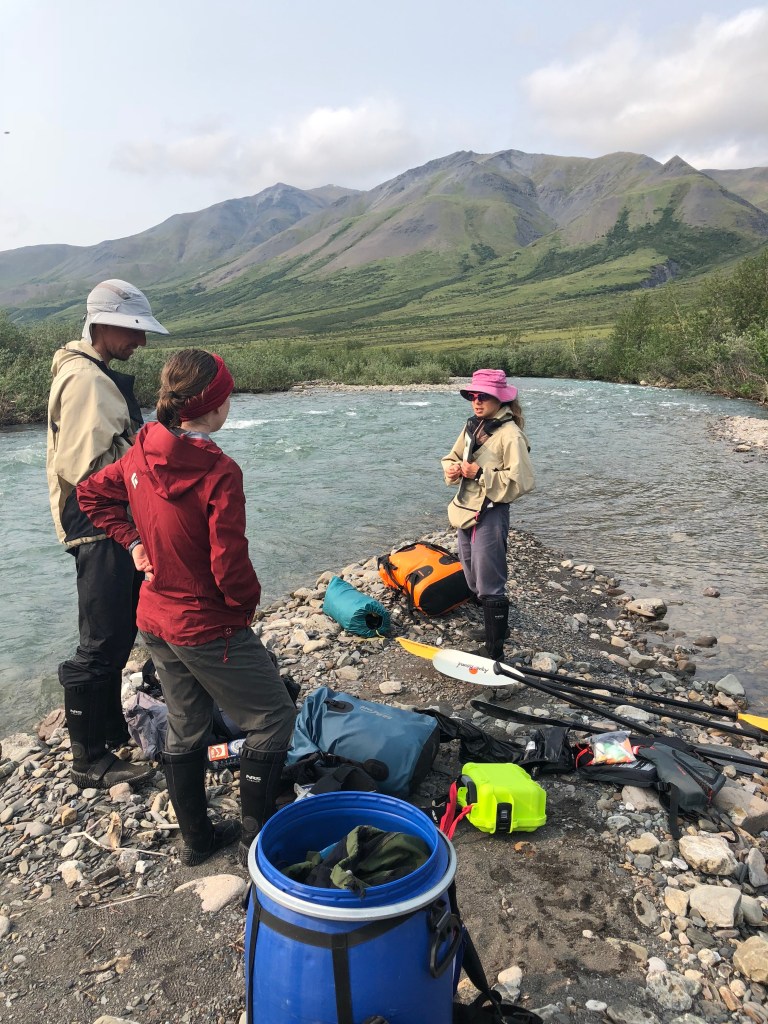
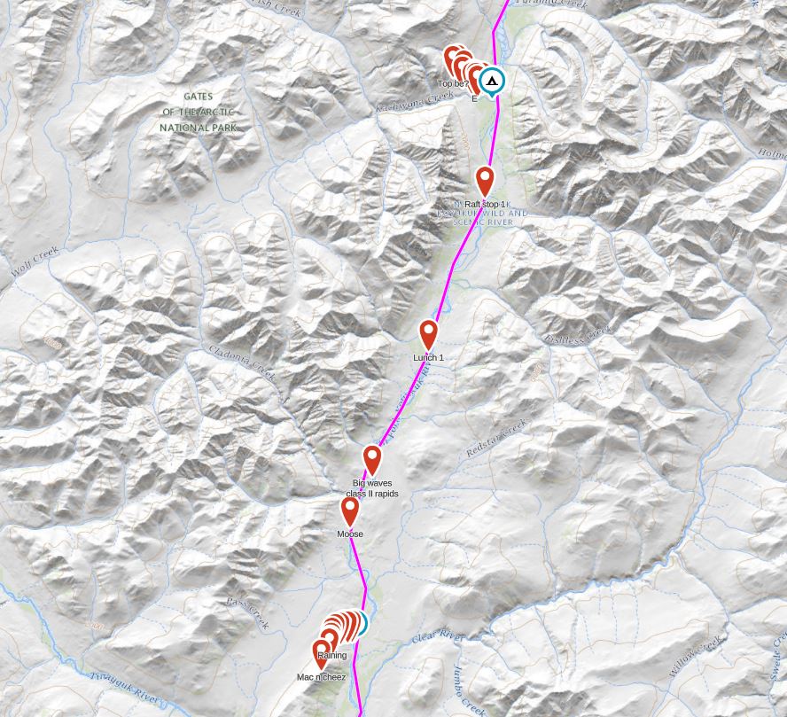
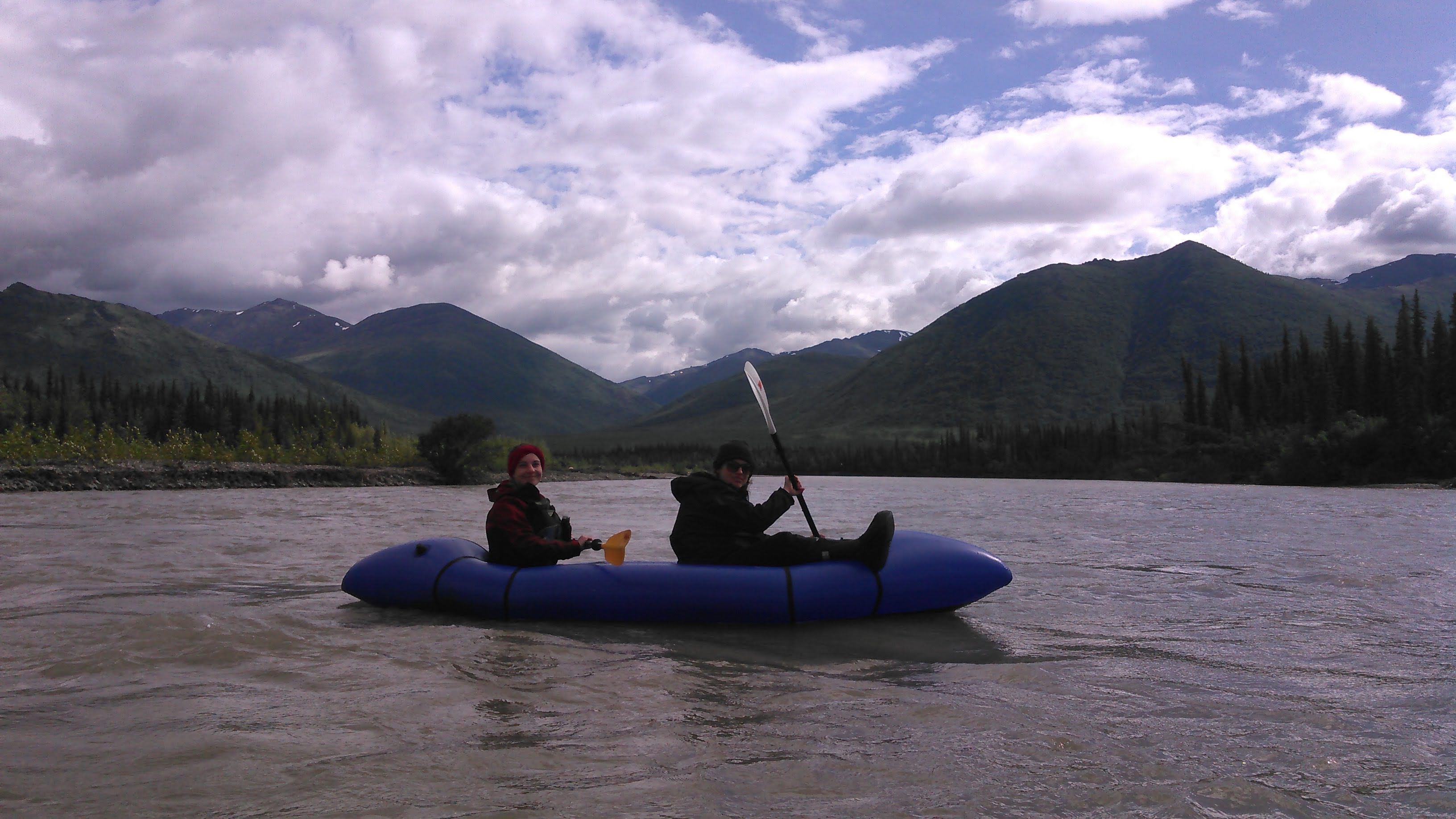
Ernie Pass marks the divide between the North Slope (that which drains north to the Arctic Ocean) and the rest of Alaska that drains into the Pacific Ocean. We started out this day excited with the prospect of finally blowing up our packrafts and doing some paddling. As we left Ernie Pass, we traveled along the south side of Ernie Creek which begins in a gorge.
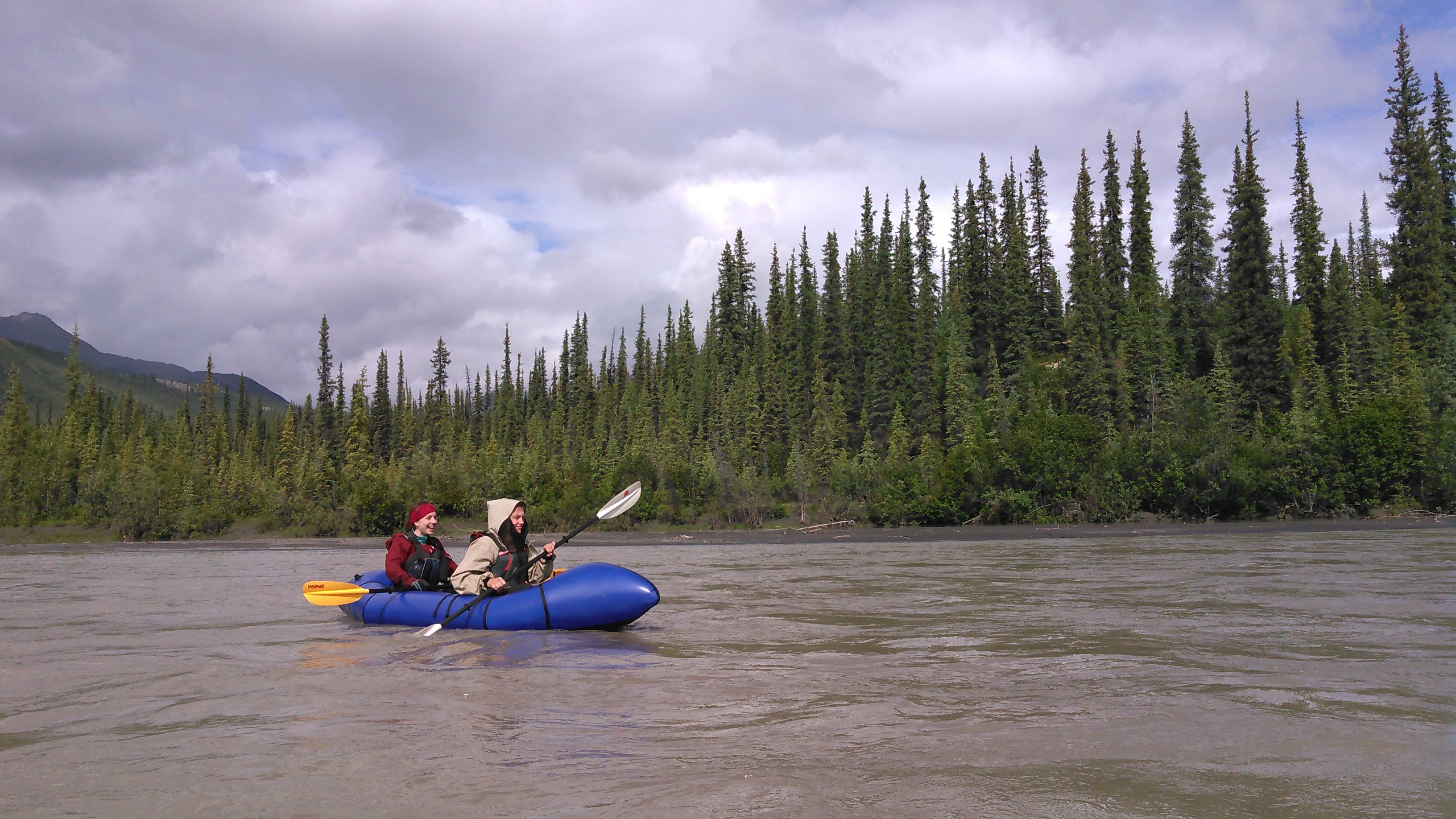
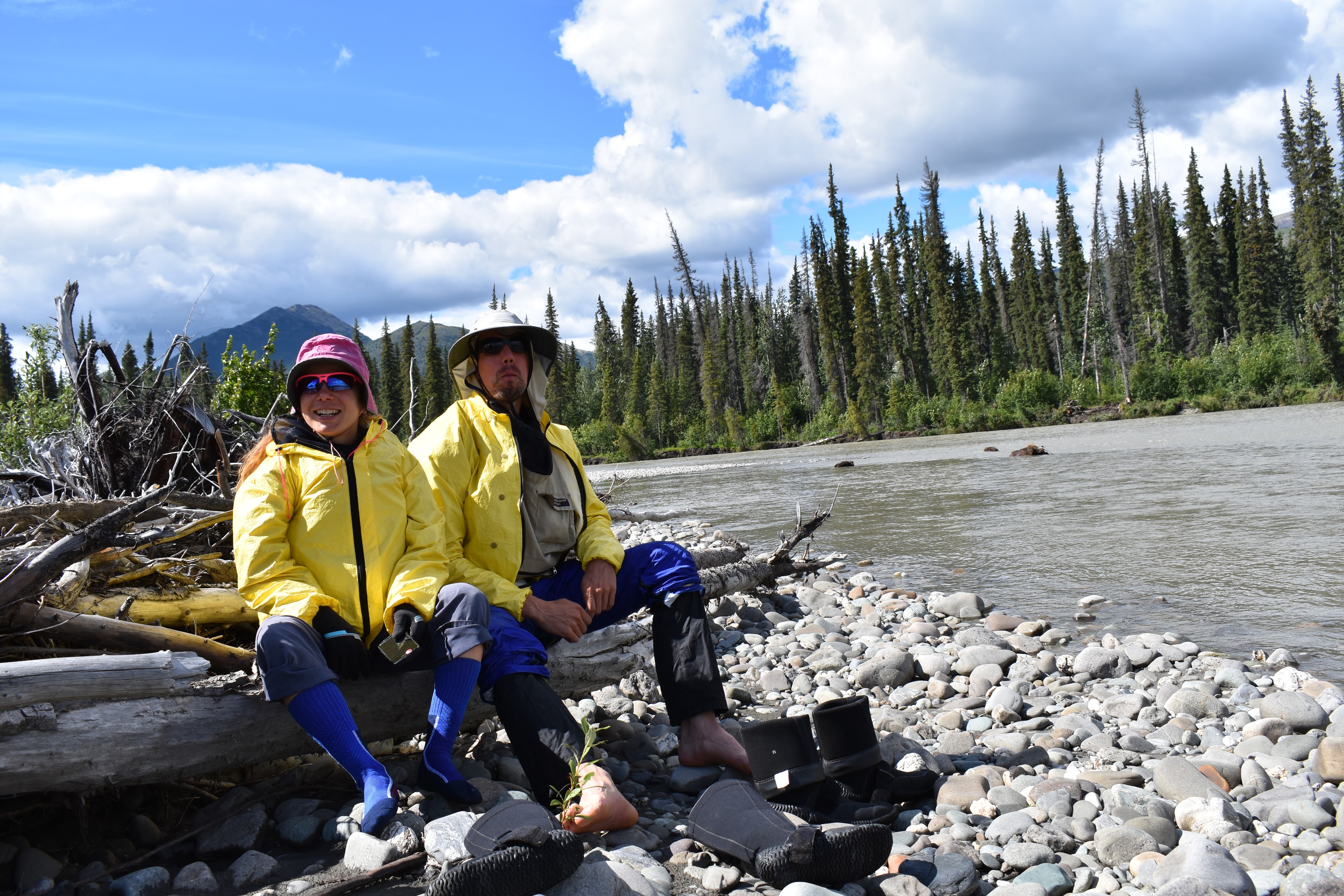
At the junction of Kenunga Creek, Ernie Creek leaves its upper gorge and we decided to try paddling. Just before this, we had taken our first food break and found the mosquitoes atrocious. This was the first time we’d encountered really any mosquitoes thus far. We were ready with our Elite Edition Bug Shirts (these are the funny looking shirts we have been wearing in the photos- and I loved the gigantic kangaroo pocket in the front of my shirt where I stowed about half my gear) but they were still annoying. Interestingly enough, as we made our way to a gravel bar in the river to blow up our rafts, the mosquitoes went away.
Ernie Creek was flowing fast here, was narrow, and very shallow, only about a foot deep. We were excited to paddle though. After inflating our packrafts, we bumped down the river, hitting the rocks on the bottom for a couple hundred meters, before deciding to backpack again. Erik and I got a small hole in the bottom of our raft.
As we hiked on, the grasses and shrubbery got taller and thicker. It was still mostly easy going. At one point we walked down a side river. Then Ernie Creek entered another gorge and we climbed above it on the right bank. Here we got our first views of the “Gates” of the Arctic- Frigid Crags on the right and Boreal Mountain on the left. We could tell our energy was waning. This wasn’t a great place to camp- it lacked great water access as we were 30 feet above the river on a cliff, but it had a great view. Erik and I also needed to patch our packraft so we set up camp.


Day 6: 7/7/18

We began with more hiking, hoping we might be able to packraft at some point.


After a couple hours of walking, we thought Ernie Creek looked more conducive to paddling and so we blew up our packrafts again.
This effort proved much better than the day before. We again frequently hit bottom or rocks, but not quite as often. As Erik and I peeled out into the current in a slightly fancy move of starting out upstream in the eddy and then letting the current spin us, we found that the spin caught us by surprise and Erik fell off the back of the raft into the icy water. Fortunately it was a warm sunny day and he was able to keep a hold on the raft (with me in it) and he could stand so he just pulled us the few feet back to shore. The channel was often narrow and deep, leading to an exhilarating ride. After not too long though, we decided this was a bit too exciting and we were hitting rocks too frequently and so we decided to backpack again, this time along the left side of the creek.
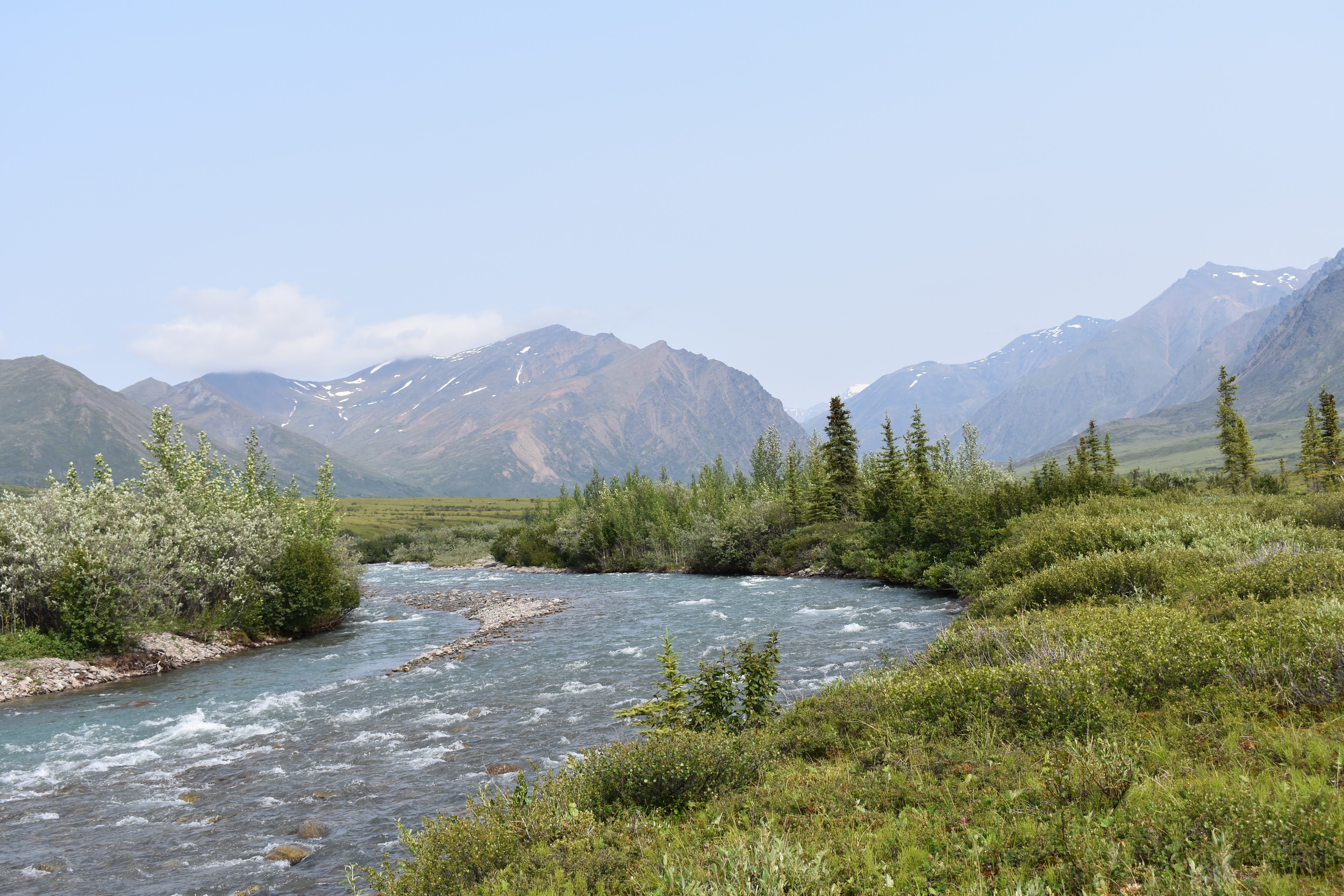
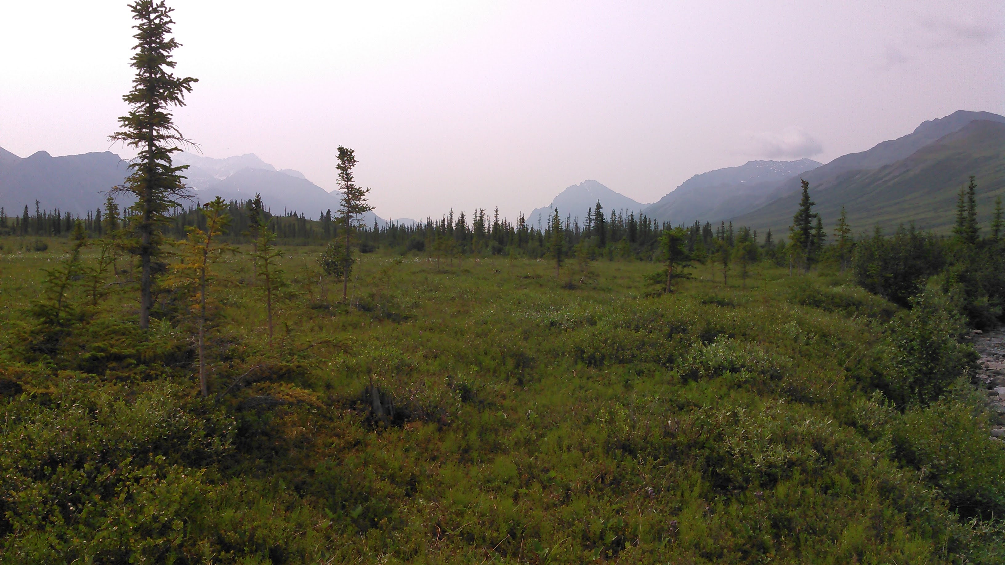
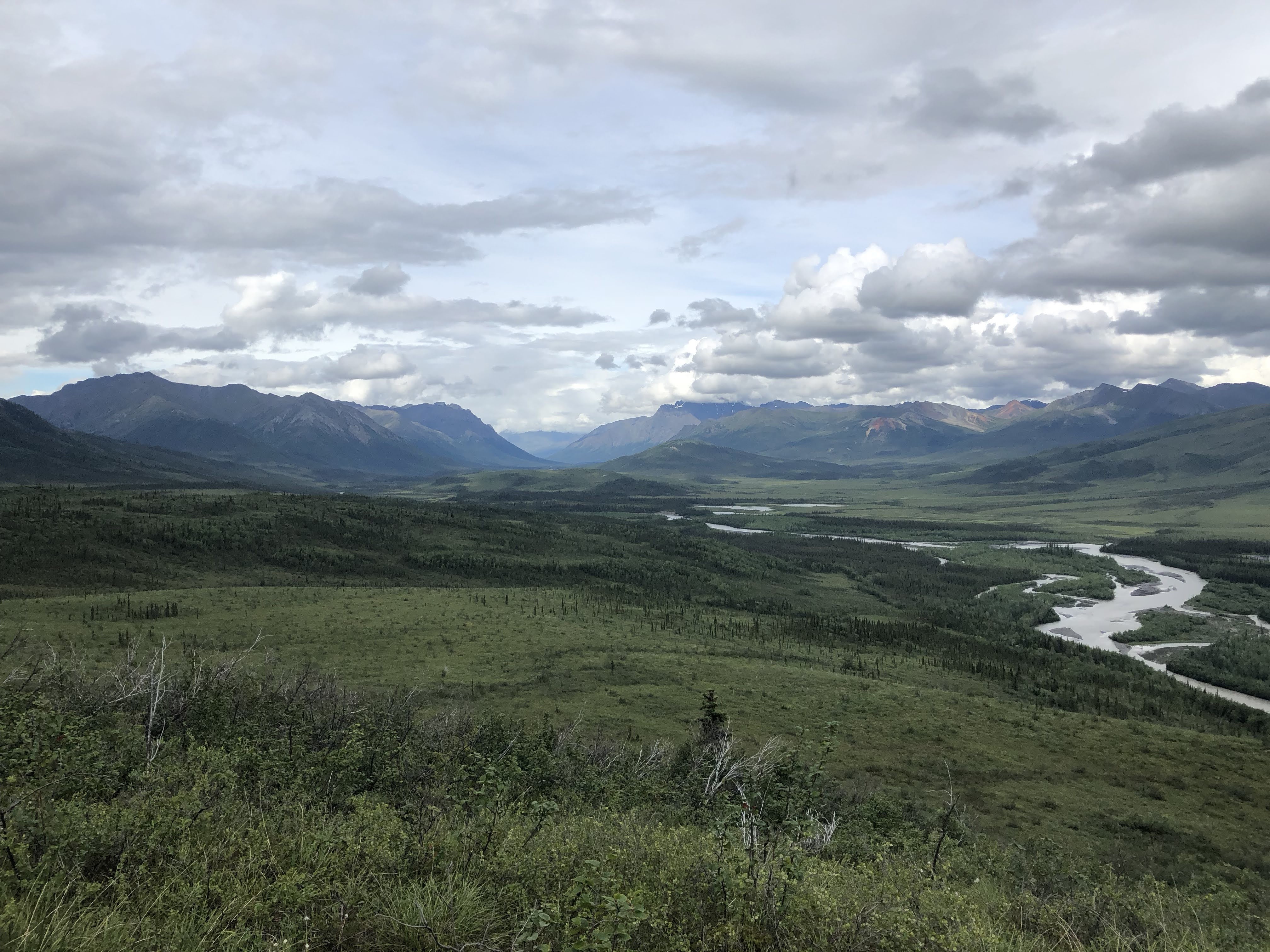
This was likely a good idea as soon thereafter Ernie Creek ran into its last gorge and that looked way too thrilling. Up above the gorge, we had great views of the Gates before we headed into the forest, down to the North Fork of the Koyukuk River. It was weird being in the trees again. The forest wasn’t too thick and it was easy hiking.


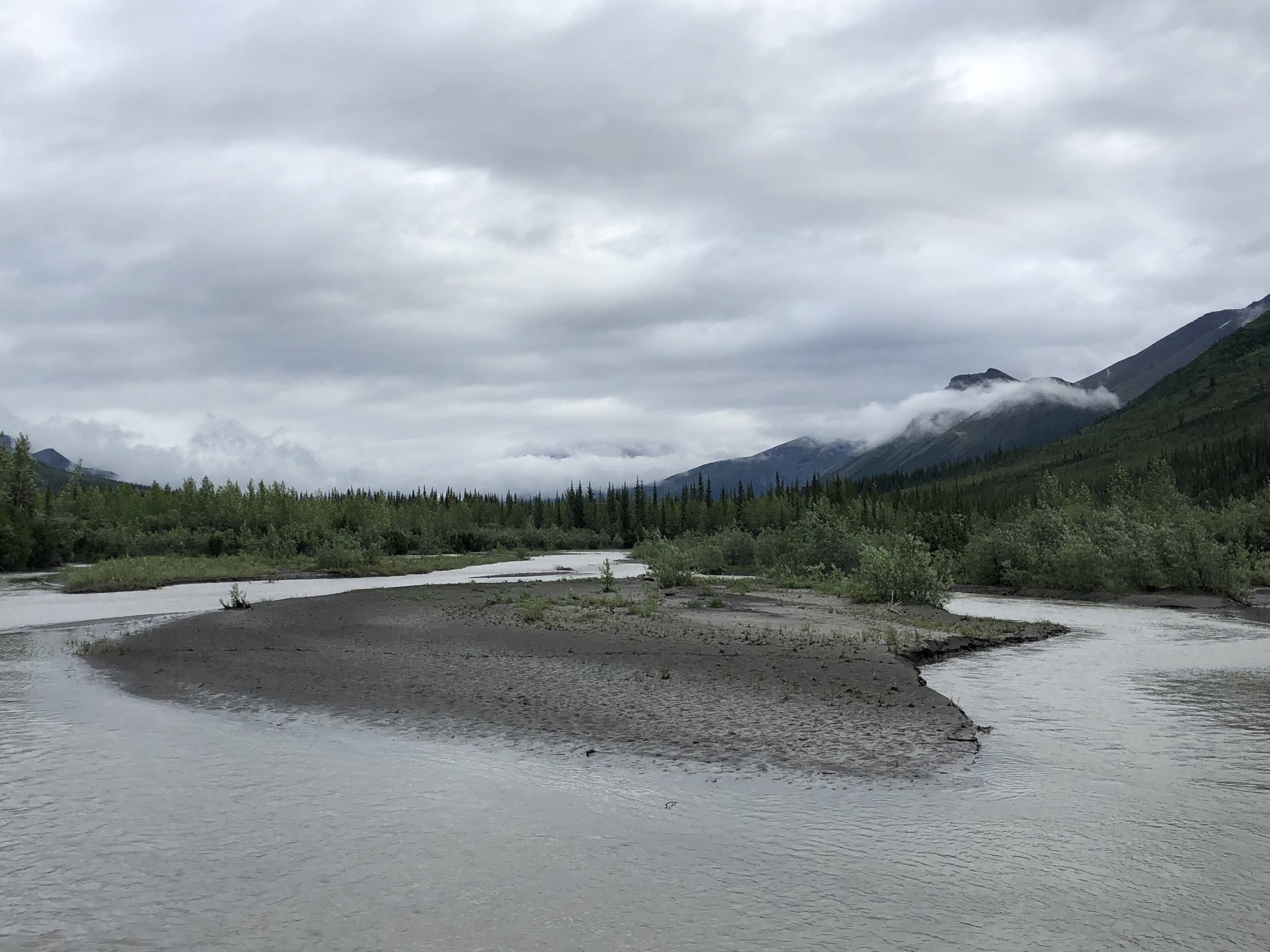
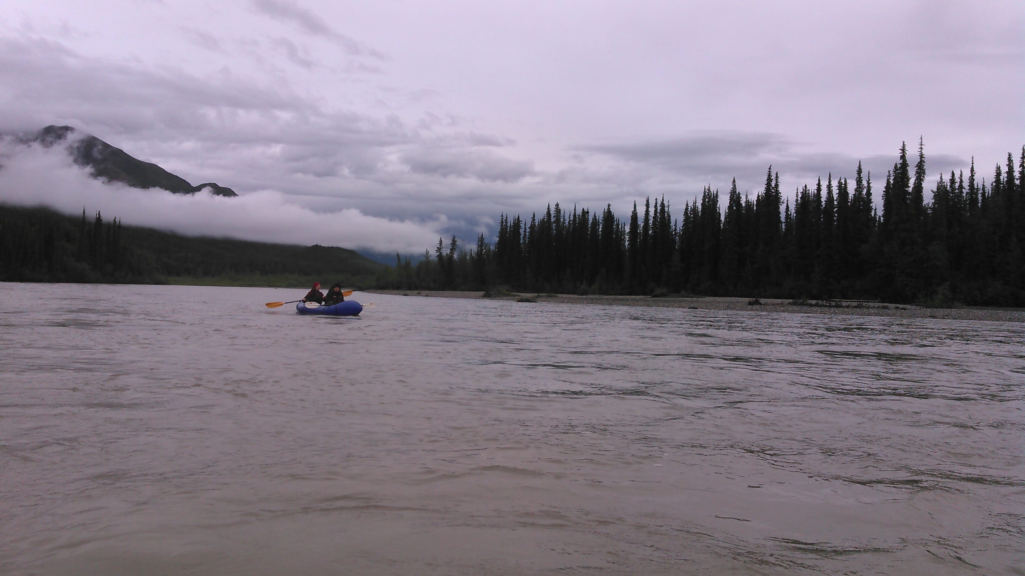
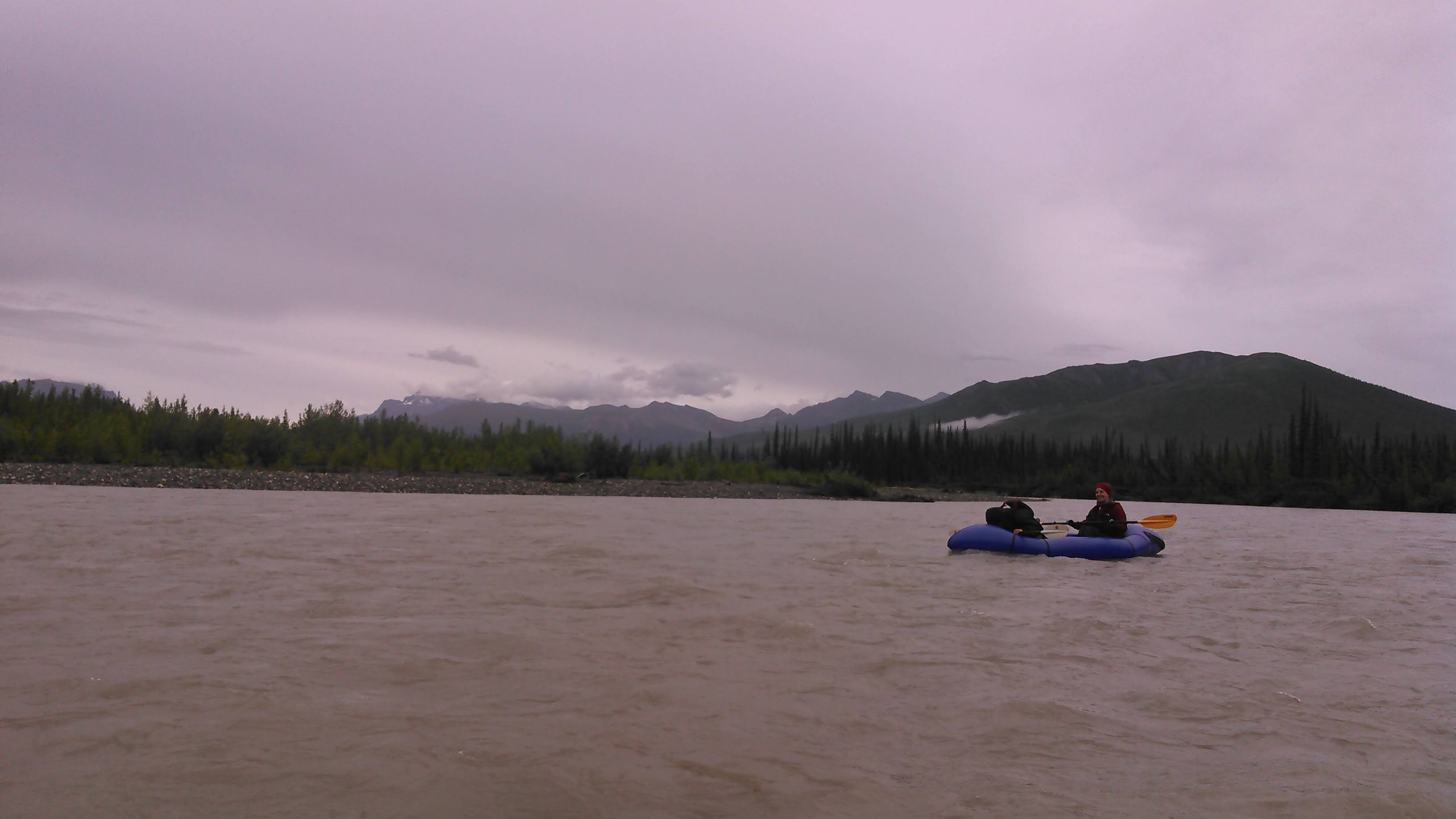
Once we reached the gravel bars of the Koyukuk, we decided to start paddling again. It was getting late in the day, but we weren’t ready to quit yet. Once we had to walk our rafts before the river got deeper from Ernie Creek’s flow. The river was divided into lots of channels and we were constantly picking the deeper channel. The current was flowing like crazy, and we were cruising- happy there was a strong south wind pushing against us and slightly slowing us down.


As three channels came together, Erik and I again got surprised by the current lines and our raft almost tipped. I had brought a canoe paddle to use, largely because I’m more used to a canoe paddle than a kayak paddle. I can brace much better with a canoe paddle. I put in a super hard brace on my right side as I felt that side of the packraft lift high above the water and my abs screamed with the effort. We didn’t tip but that definitely got my adrenaline pumping.
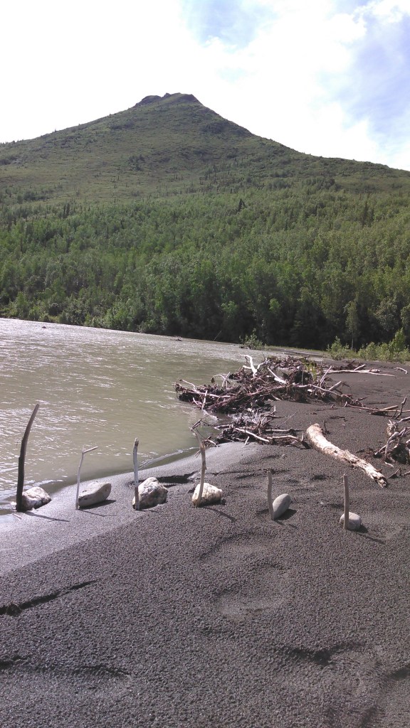
We had some plans of climbing Frigid Crags and so we found a campsite on river right, just above Kachwona Creek. The landing was difficult, up a 5 foot steep sand bank. Somehow we made it up but it wasn’t easy. The other places to land on the mainland (not on a gravel bar island) were covered with thick underbrush. It was obvious the moose liked our campsite and there seemed to be some “trails” that were likely overflow channels from high water.
It was getting late when we got to camp. We set up our tents, cooked dinner, enjoyed the nice warm weather, and not too long after we went to bed.
Day 7: 7/8/18

Some time in the middle of the night, it began to rain. With 24 hour daylight, it was impossible to know when dawn came. We kept sleeping and when I finally checked my watch, it was near 10 am. The crazy thing about this trip was that even though the sun never set, I slept about the best I had slept since I was a kid. Erik brought a black hat to put over his eyes. I opted instead to cover my head with our sleeping quilt.
Anyway, it was still raining at 10 am so we stayed in our tents. About noon it stopped raining. We decided to get out of our tents and make some hot food. Much to our surprise, the river had risen about 3 feet! We were glad we had camped on some “high ground” and that we were safe although we were only about 3 feet above the new water level.
We lounged around in camp throughout the afternoon as the clouds slowly cleared. We thought about climbing a nearby mountain but no one was too enthused with them being buried under the clouds. Finally, after dinner the clouds really cleared out and we decided to start hiking up the closest mountain. Normally it would be a bad idea to push for a summit starting at 6 pm, but seeing as the sun wouldn’t set for another 10 days or so, it didn’t matter.
Initially the hiking was easy as there wasn’t much underbrush, likely because this area floods frequently. As we began gaining elevation, however, we discovered this mountain was covered in bushes that were all pointed downhill. The going was quite slow and tedious. The slope wasn’t much but it felt like we were climbing the bushes as we ascended.

After a couple of hours we got a good view of the Koyukuk River. We enjoyed the view and took some funny pictures and then ultimately decided to go back to camp. This just wasn’t our mountain to climb. By the time we got back to camp, it was bedtime and we slept even more.
Day 8: 7/9/20
We broke camp and started paddling down the river. Given the rise in water levels, we actually found the paddling to be much easier. We no longer had to pick the deepest channel as all channels were deep enough. Even without paddling we traveled downstream swiftly under a cloudy sky.

Erik sat down lower in our packraft and we didn’t have any further issues with almost tipping while crossing eddy lines.
We only knew of one significant rapids on the Koyukuk (Squaw Rapids that we wouldn’t come to for a couple more days) but as we paddled near Redstar Mountain, we went around a big bend in the river and were suddenly in a Class II rapid. Despite this, the packraft handled marvelously, bouncing out of small holes and handling big waves without much excitement.


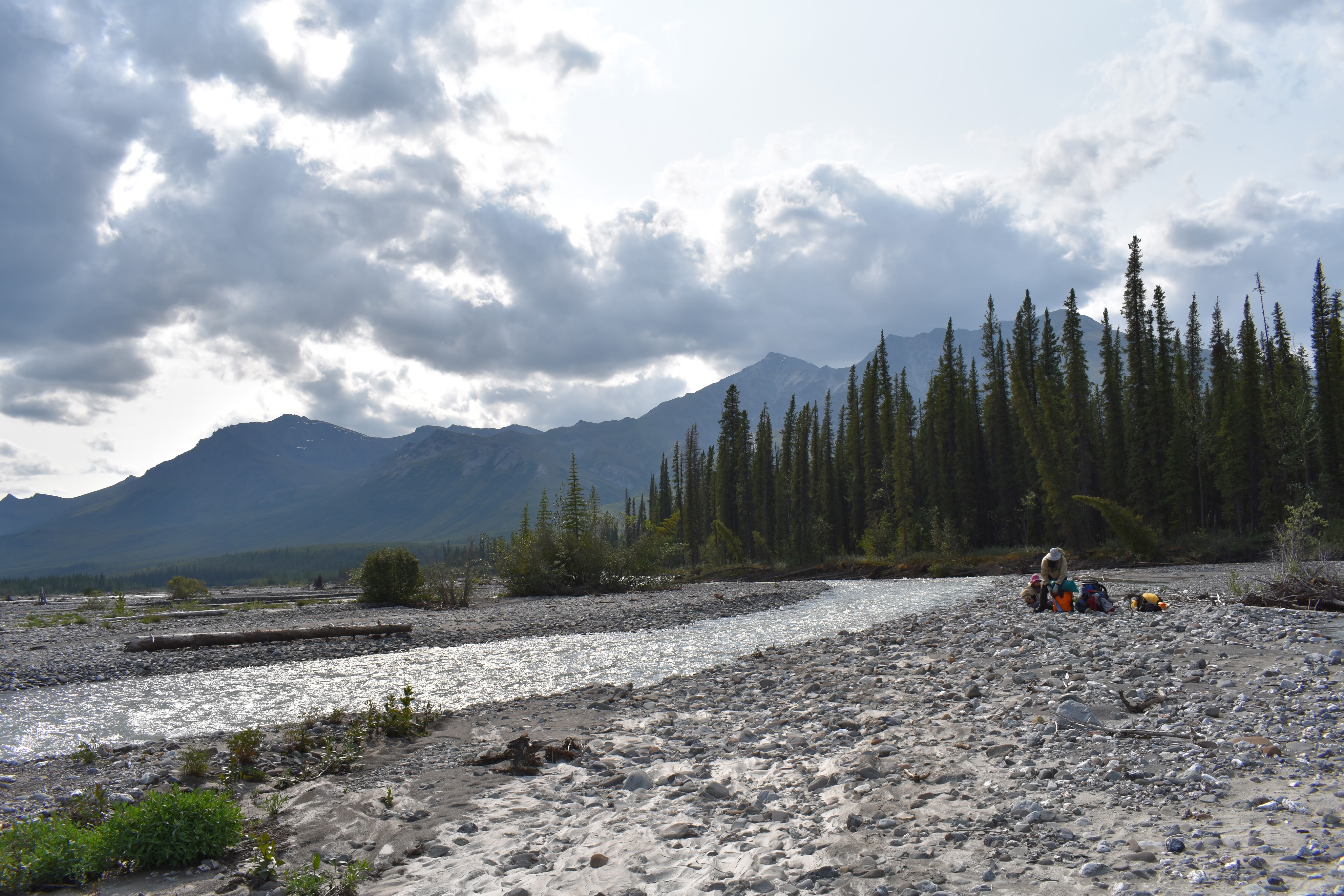
Our planned stopping point for the day was at the base of Eroded Mountain, just upstream from where the Tinayguk River comes in. With the fast current, we were to this area by early afternoon. We found a gravel bar that was barely above water-level to camp on. Erik was worried that water levels would rise and built a water gauging station. After we set up our tents, we decided to try to climb Eroded Mountain.
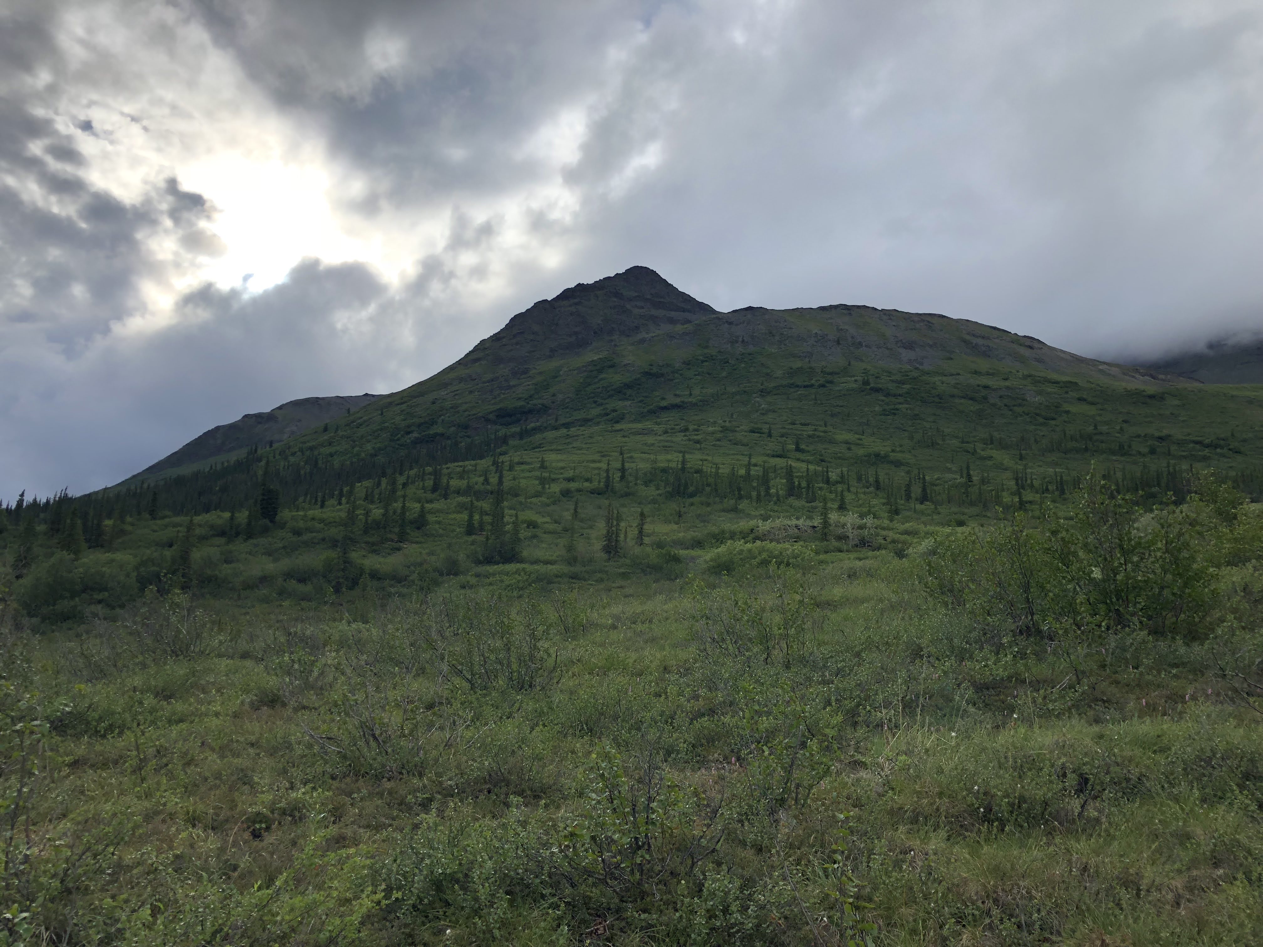
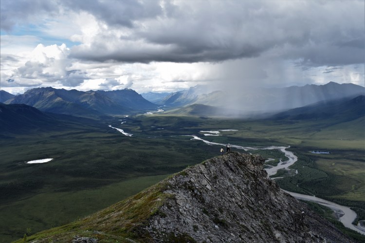
After our failure the day before, we worried about encountering more of those bushes growing against us but as we started out, we found favorable vegetation for bushwhacking. It wasn’t long and we were above tree level having gained the ridge. The view to the north was spectacular looking back towards the “Gates.”
Many false summits later, we arrived at the true summit. From here we could look down to the southeast over the very eroded face. Unfortunately the view to the south with the confluence of the Tinayguk and Koyukuk Rivers was obstructed by the long ridge of Eroded Mountain but otherwise the view was amazing.


We had brought our pot and Erik cooked us a warm dinner of Mac and Cheese on top of the mountain. We all agreed it was the best Mac and Cheese we’d ever had. There was a great rainbow to our east and we took more photos. In the distance we could see a rain cloud but our spirits were high. As we descended we briefly had a deluge come over us but fortunately it was short.
Back in camp we were all very glad we had climbed Eroded Mountain given the absolutely amazing view.

Day 9: 7/10/20

Per Erik’s water gauge, the river level went down overnight. After not making many miles thus far in our trip, today was a high-mileage day, albeit with only 20 planned. The weather was volatile- occasionally sun breaking through clouds, sometimes entirely sunny, and once we had a thunderstorm come up on us so fast we didn’t have time to seek refuge on shore.

There were lots of great gravel bars to get out on and we made use of a few of these. By late afternoon, as we looked for a place to camp, we were too hasty as there was an approaching storm. We were looking in some areas with high underbrush. Finally we paddled on a bit farther downstream and found another great gravel bar. The storm barely dropped any rain on us and we had a pleasant evening although some clouds continued to drift by.

Once we got in our tents for the night, around 10 pm, the sun came out and the sky was blue without a cloud in sight. It was clear the weather pattern had changed but we were ready for sleep so slept away what looked like a perfect weather day.
Day 10: 7/11/20
Fortunately the weather was as perfect when we got up as it was when we went to bed. We had another high mileage day planned- at least as far as packrafting goes- as well as the only notable rapids on the Koyukuk River called Squaw Rapids, just below the confluence with Glacier River.
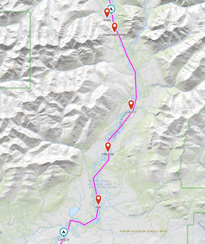
In the morning we packed up camp and began mostly floating downstream. A couple bends later, Erik and I realized our water bottle was missing. We had most likely left it back on the gravel beach at our campsite and had forgotten to strap it to our packraft. After a bit of contemplation, we decided to paddle back to get it.
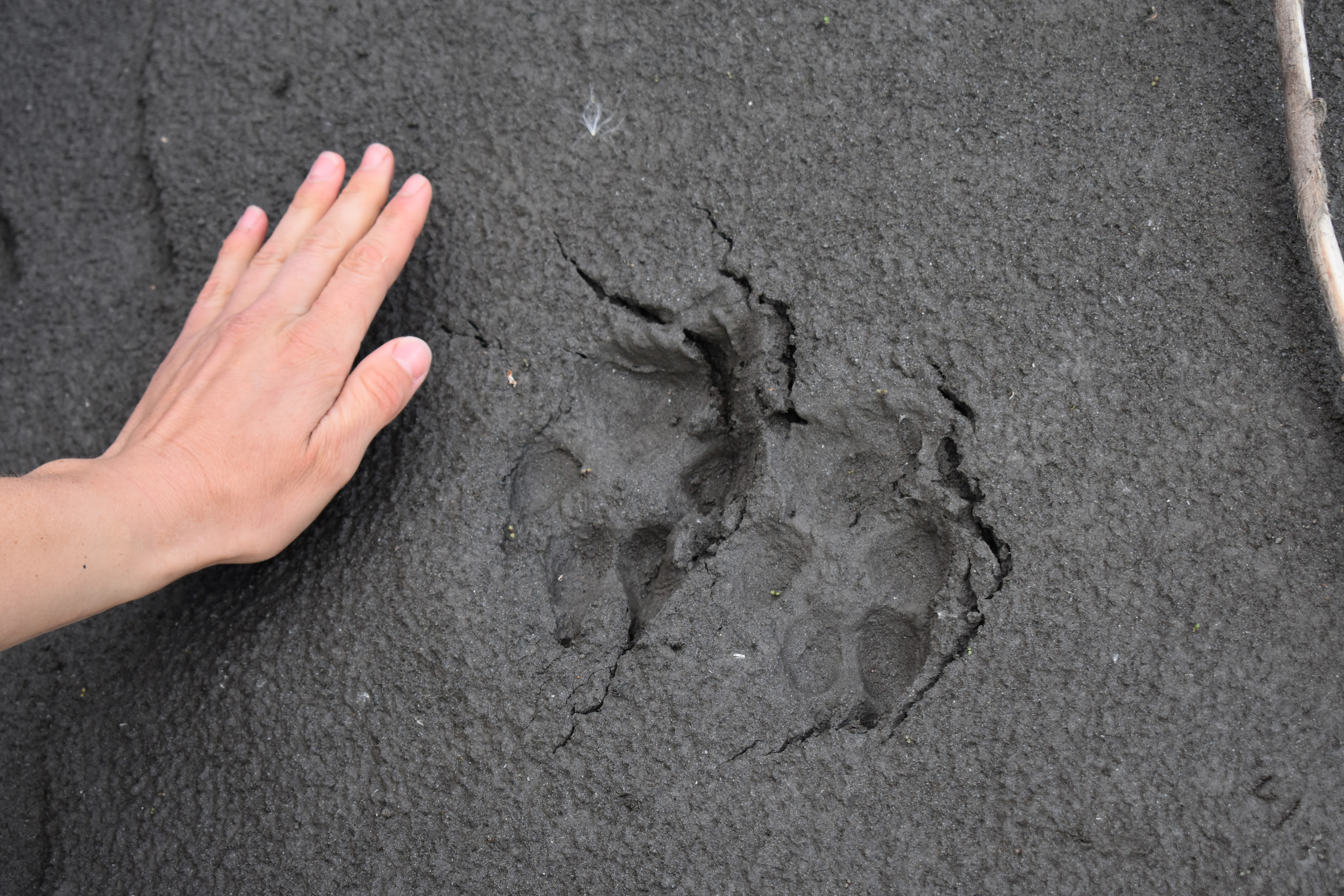
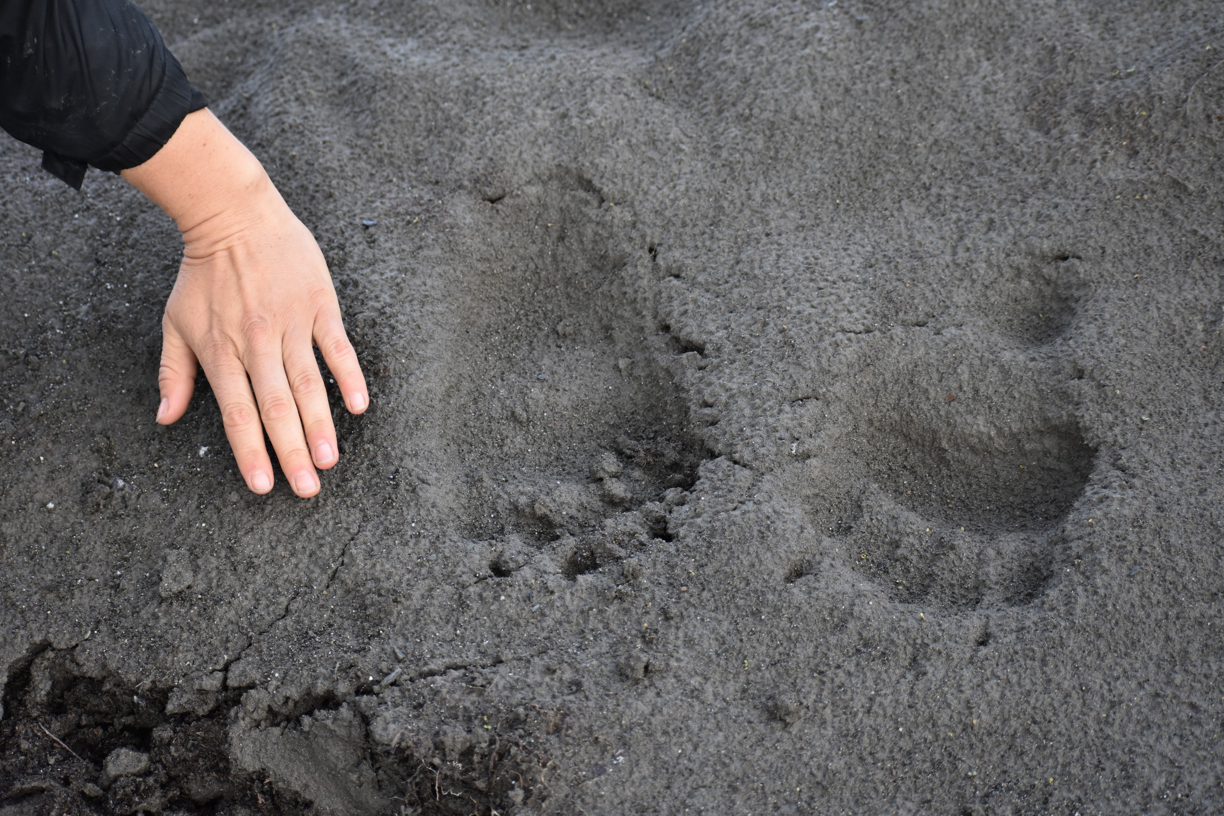
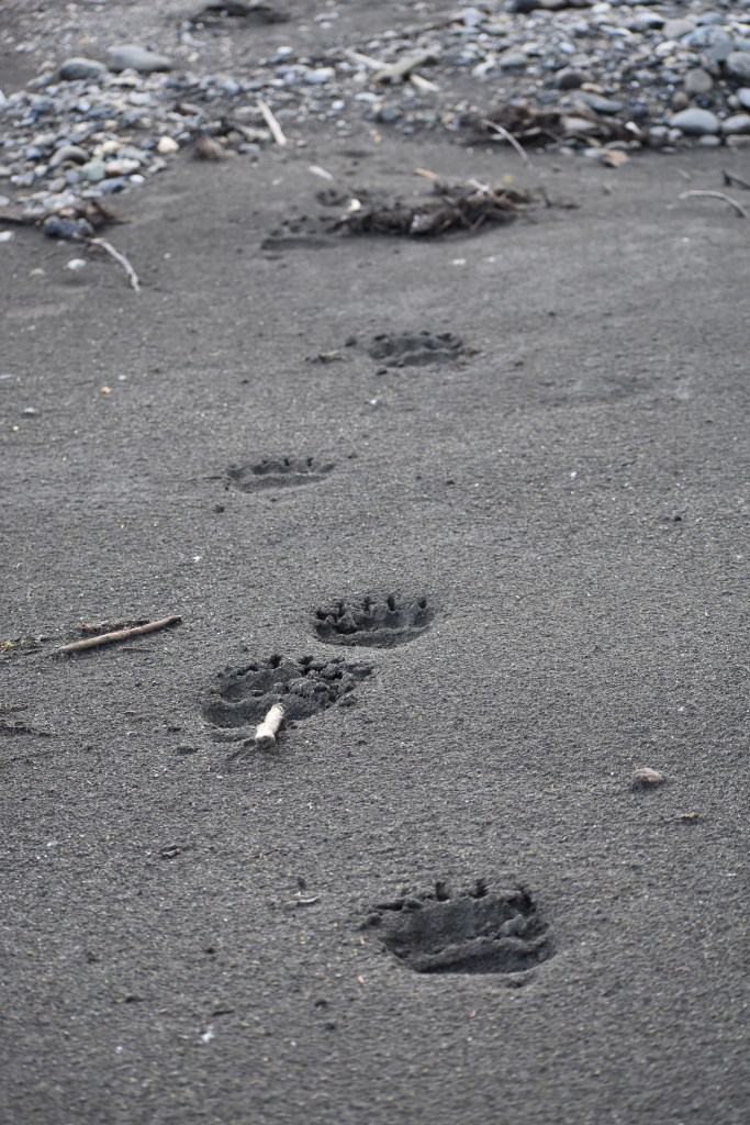
Tiffany and Sarah waited for us on another gravel bar- this one with grizzly tracks.
Meanwhile Erik and I found it nearly impossible to paddle upstream in the packraft. That boat is much too wide. Mostly we ended up going from shore to shore, walking along the gravel bar on the inside shore to make progress. When we finally reached our campsite we found our water bottle! It was a quick ride back to Sarah and Tiffany.
Soon it was time to tackle the rapids. I’m always scared of rapids. I guess I have always been and this only seems worse as I get older. Fortunately for me we found water levels favorable and the rapids mostly ended up being Class I-II waves requiring minimal navigation. These rapids did go on for about a mile which was a bit longer than I expected but then we were done with the rapids. Unfortunately, this also meant we were about done with the mountains, too.


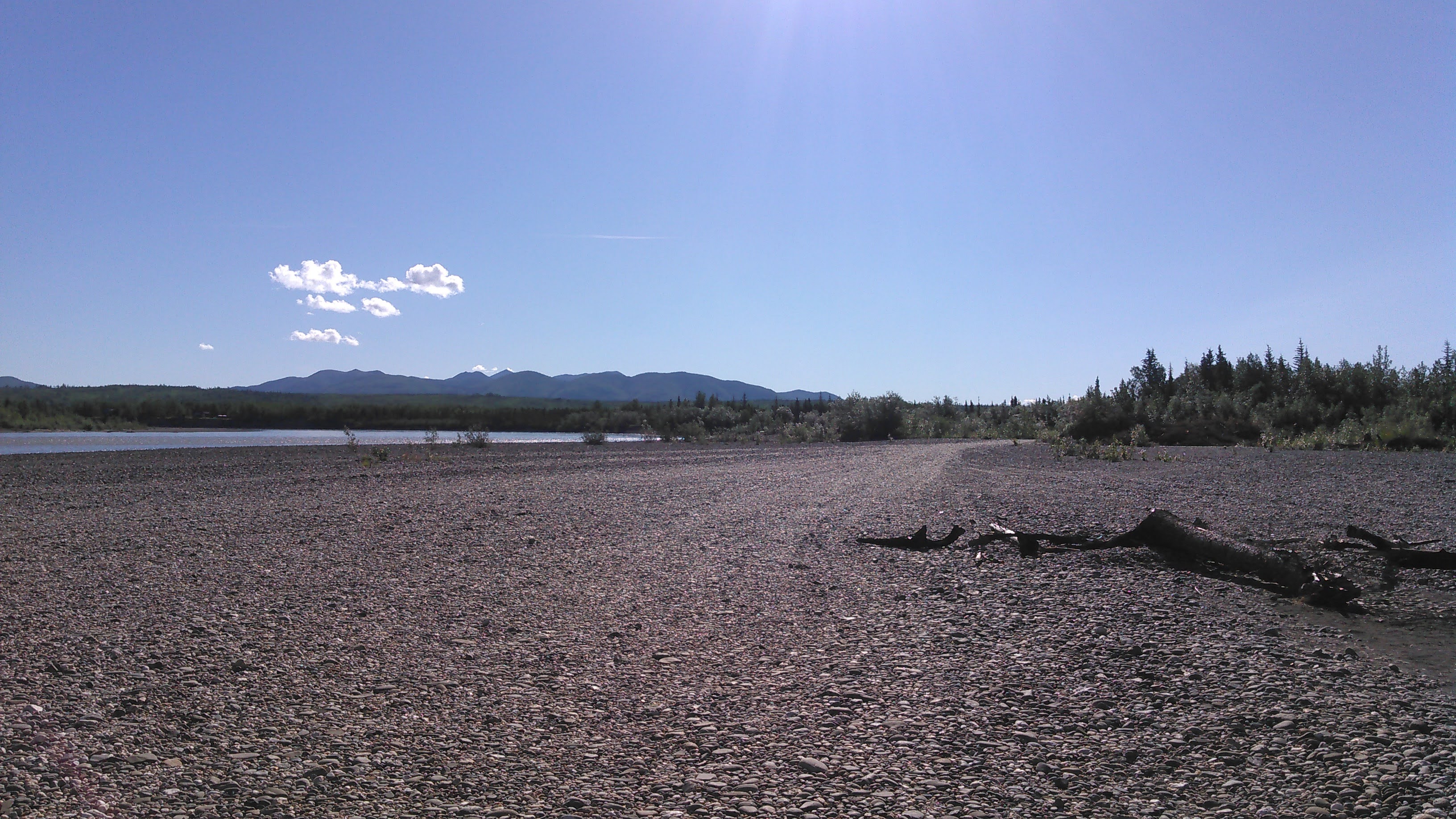
The rest of the day we floated downstream as we watched the mountains get smaller and smaller behind us. There were still ample gravel bars and we stopped a few times and found another one for camping.


Day 11: 7/12/20
This was our last full day on the river. And it was a fairly full day of mostly floating. Sometimes we paddled a bit as we had some miles to make up and to get some exercise, but mostly we floated. I’d never been on such a chill trip before! I had said I didn’t want to do anything too extreme on this trip as merely being in the middle of nowhere with no way to communicate as we didn’t have a satellite messenger is pretty good adventure, but this floating was quite chill.


There were more gravel bars along the whole way. We had ample time to take in the scenery on the bank which appeared to be constantly eroding away. Erik says, “The Koyukuk River was exploring new territory, just like us!”

We camped on an island at the confluence of the Wild River. When we first got to the Koyukuk, the water was blue but after all that rain, the water turned brown. The water in the Wild River was nice and clear. We paddled over to the Wild to fill up our dinner pot and our water bottles.


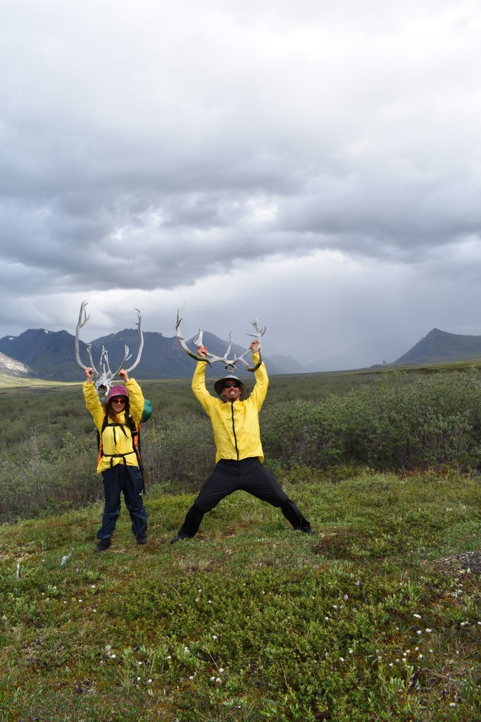
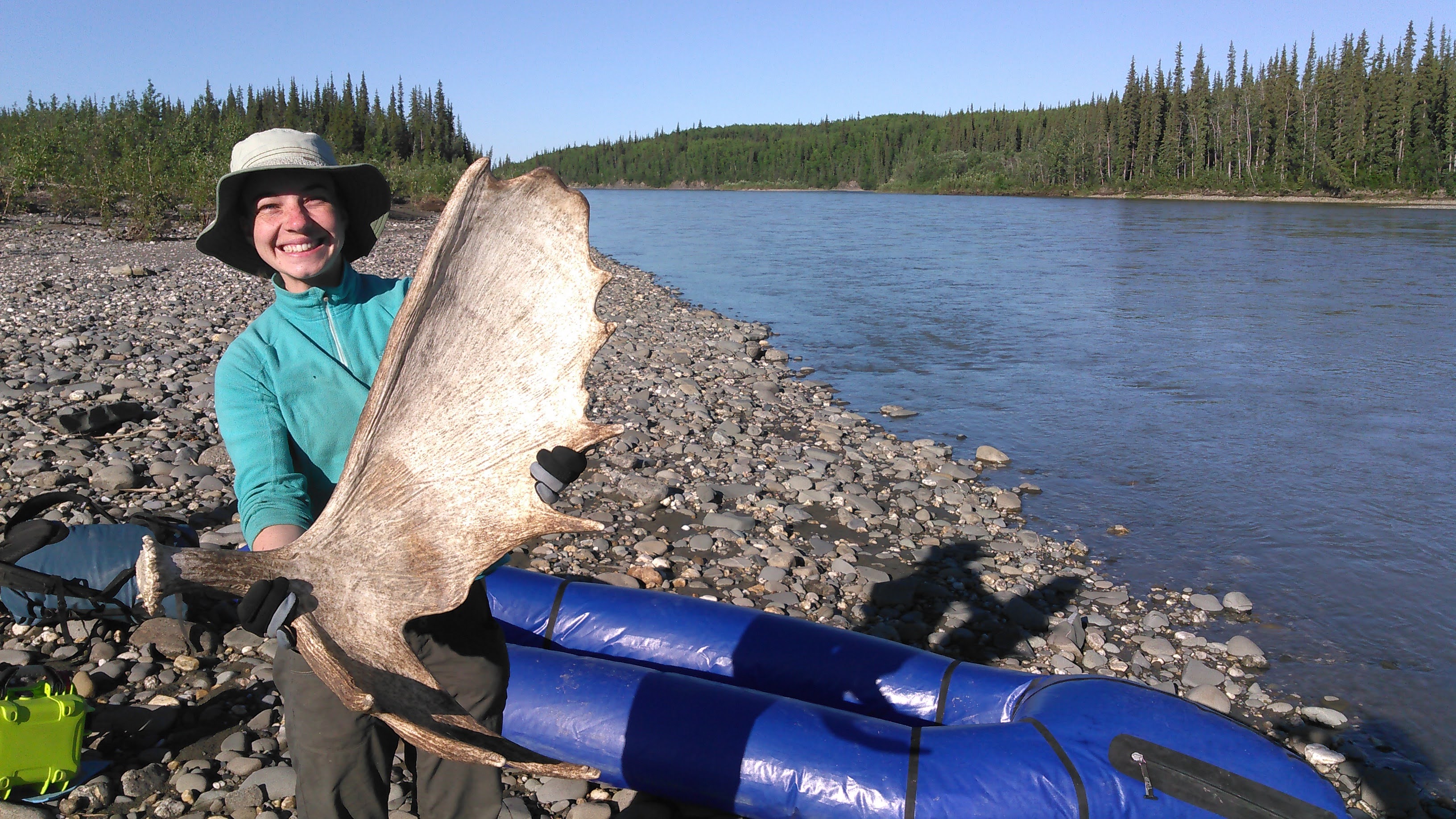
Sarah was hoping to bring home a rack but this isn’t allowed in the national park. Finally we were camped outside the national park and while walking around our island she found a nice moose shed!
Day 12: 7/13/18
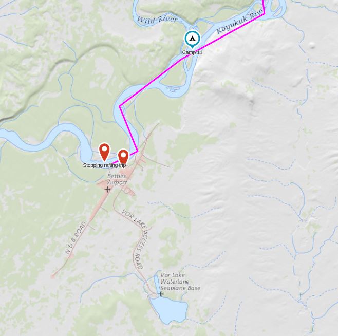
We had a short and very easy paddle/float to Bettles. If you do this trip, note that it isn’t super obvious where to take out in Bettles. Remember that Bettles is not a metropolis- there are no skyscrapers dominating the skyline, or even airport tower. There are a few scattered small houses along the east bank, the river turns west and on the south side of the river there is a gravel bar with an unobtrusive motor boat ramp.

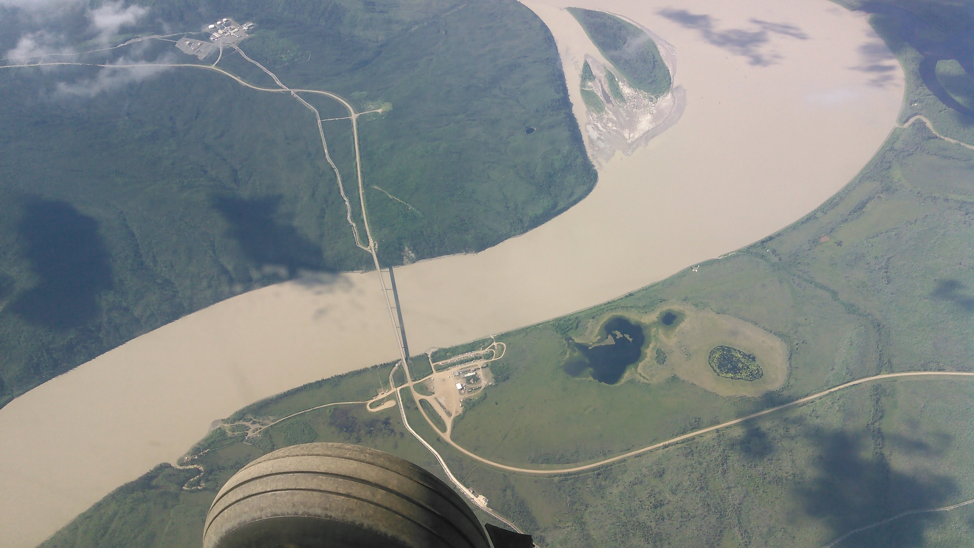
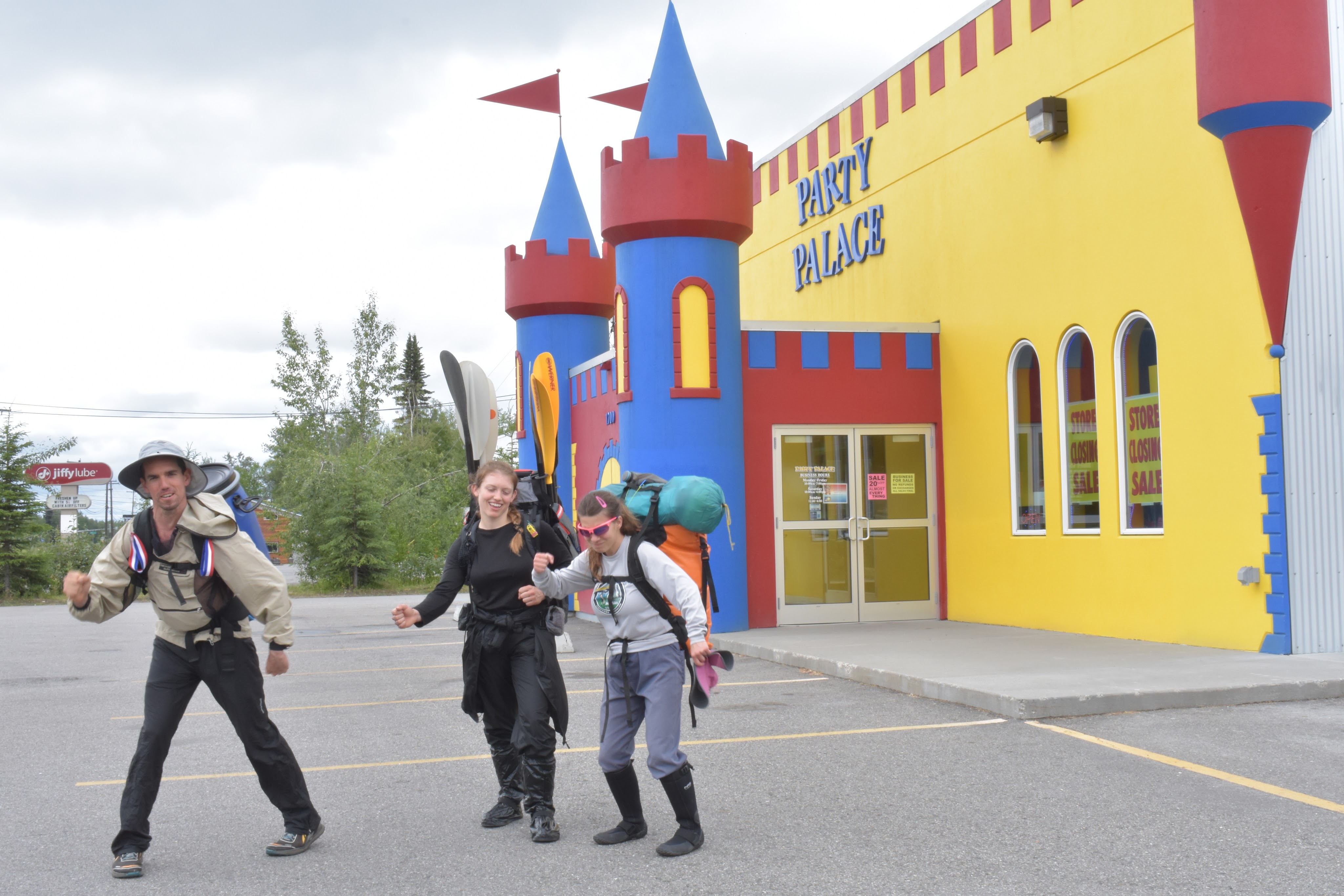
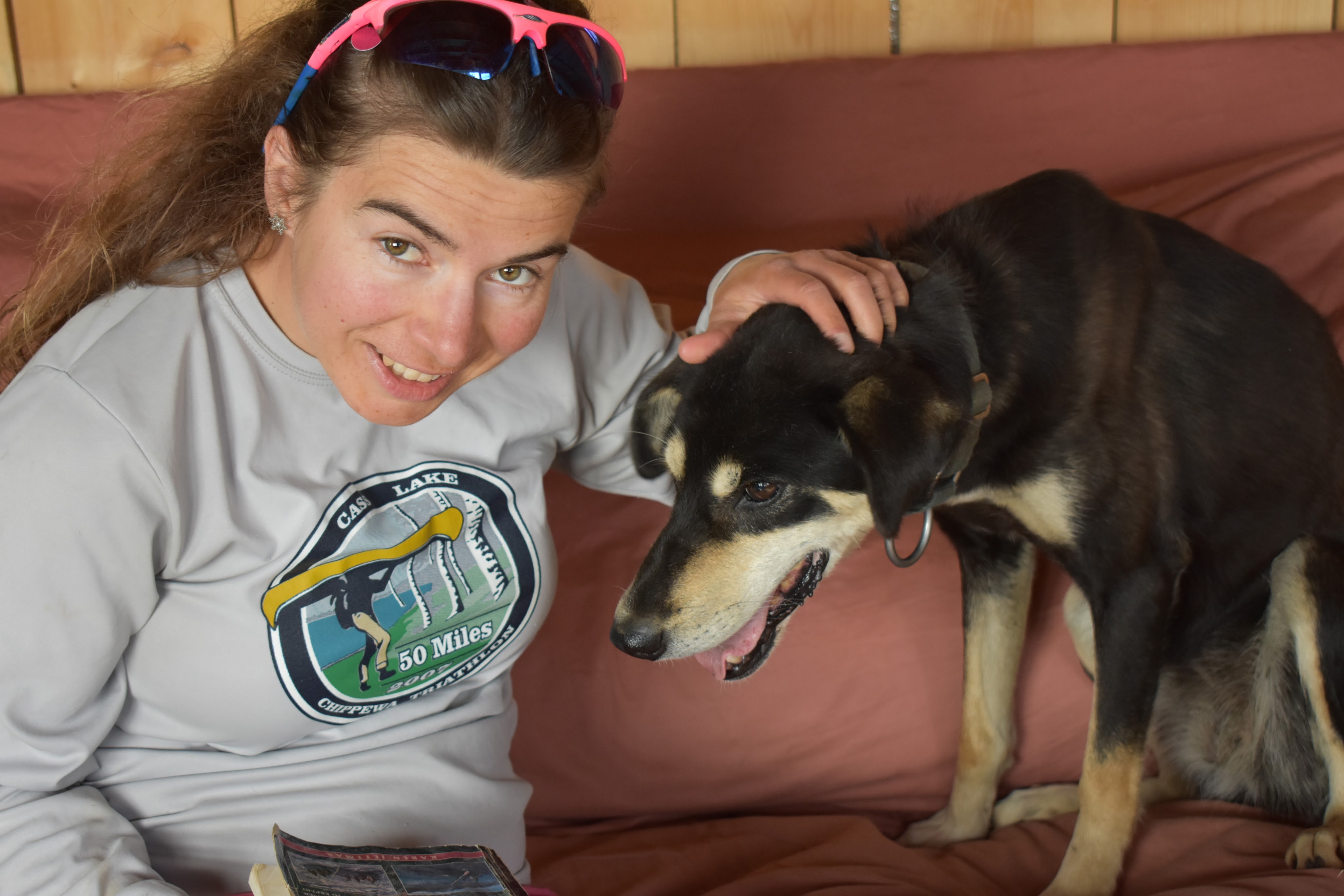
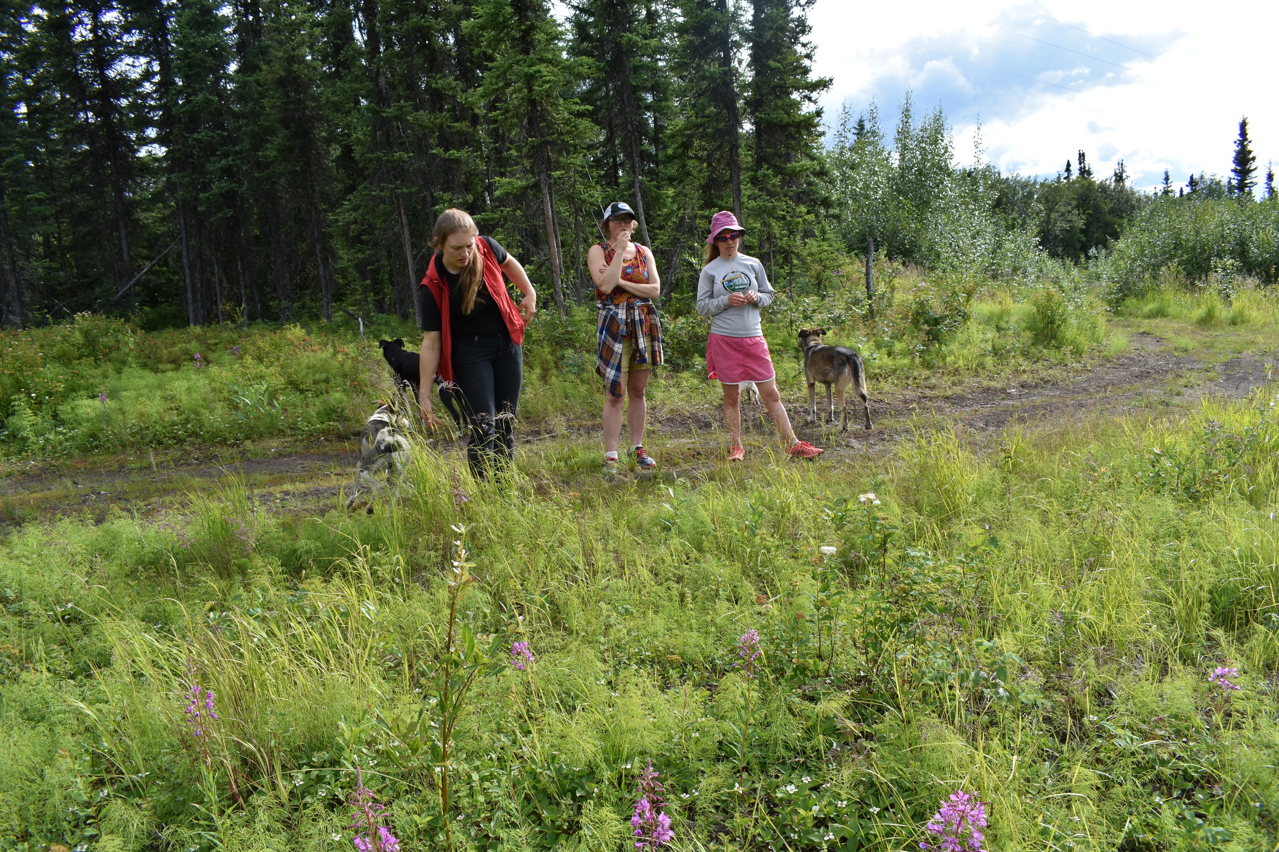
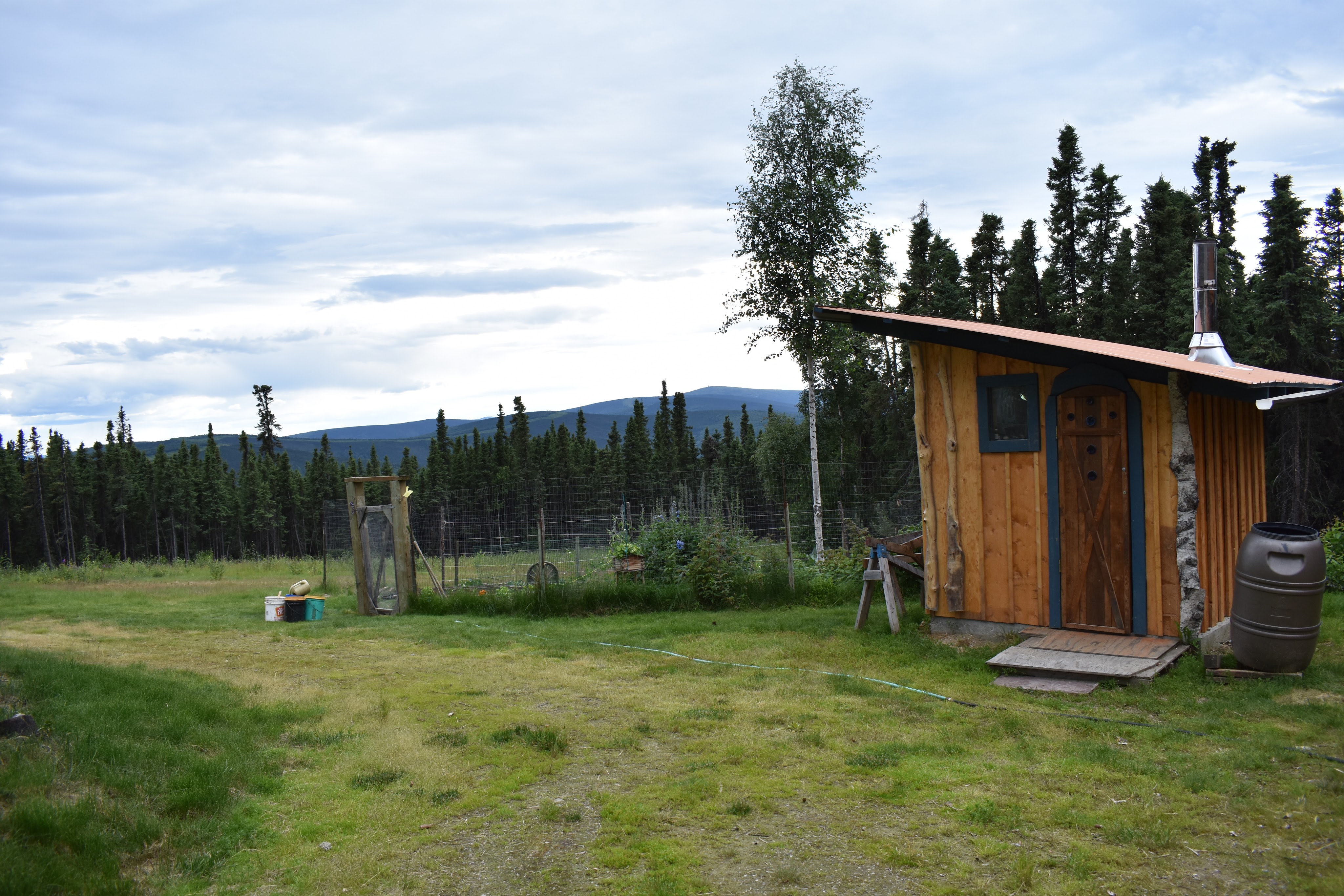
We had an extra lay-over day in Fairbanks before our flight back to MSP. I looked up my long lost second cousin-once-removed (or something like that) who lives off the grid north of Fairbanks and races sled dogs. Here’s some photos.


If we had to do this trip again: Erik and I have been on many trips that felt like “a trip of a lifetime” and this one was no different. We lucked out on the weather and this was amazing.
Best decisions: Hiking the peak at Ernie Pass (aka Tiffany’s Mountain) and climbing Eroded Mountain
Next time: We’d like to go from Anaktuvuk Pass to Bettles again but on a different route. We like going between these villages simply because it’s easy to fly in and out of them. Our route would take us mostly south of Anaktuvuk Pass, heading towards the Tinayguk River which we would catch at it’s 90 degree bend where it changes directions from flowing west to south. We’d packraft the Tinayguk to near it’s confluence with the North Fork of the Koyukuk, but then portage into Wild Lake and paddle the Wild River back to just above Bettles where it joins the Koyukuk. We would travel lighter and think about ridge walking as opposed to valley walking.

7 thoughts on “Backpacking and Packrafting Gates of the Arctic National Park”