
In many respects, after hiking off trail in the Beartooths the year before and above the Arctic Circle in Alaska earlier in the year, I wanted an easy New Mexico hiking trip. Easy means trails and that’s at least what I thought I wanted but as I planned and scouted a route, my eyes drifted from the established trails to the many trail-less peaks and I began to wonder what was possible and what we should consider.
Because the reality is, trails often give me a known experience. For the most part (and there are certainly some exceptions here- the cable route up Half Dome and just about everything in the East) trails are going to get me from point A to point B in a fairly reliable amount of time.
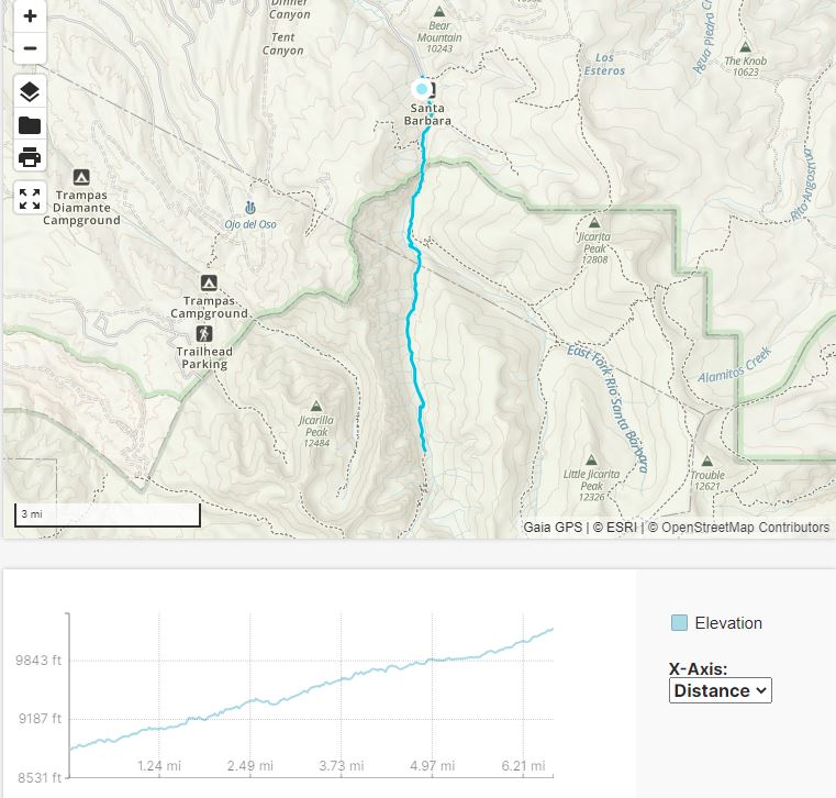
We planned our route- a high mileage 4 days of backpacking venture mostly on trails with a couple off trail sections in the Sangre de Cristo mountains of the Sante Fe National Forest. The Pecos Wilderness, where we would be hiking, is within part of the Sante Fe and Carson National Forests.
Then three days before we left we had a conjoined bike accident that left Erik with a sore and swollen knee. Nothing was broken and there were no ligament or meniscus injuries, just some soft tissue injury. Erik had brought his hiking poles as usual but once we got to New Mexico we made a stop at Goodwill to get him some crutches as his knee was still sore.

On our drive to the trailhead, rain clouds constantly threatened and our bus driver on the way to the rental car place warned of monsoon season. Our trip was from 9/2/18-9/5/18. We had planned to hike a few miles into our route and camp but given Erik’s knee, the rain, and our neglect that darkness would actually fall after never having the sun set on our most recent adventure, Erik proposed we sleep in our rental SUV and that’s just what we did.
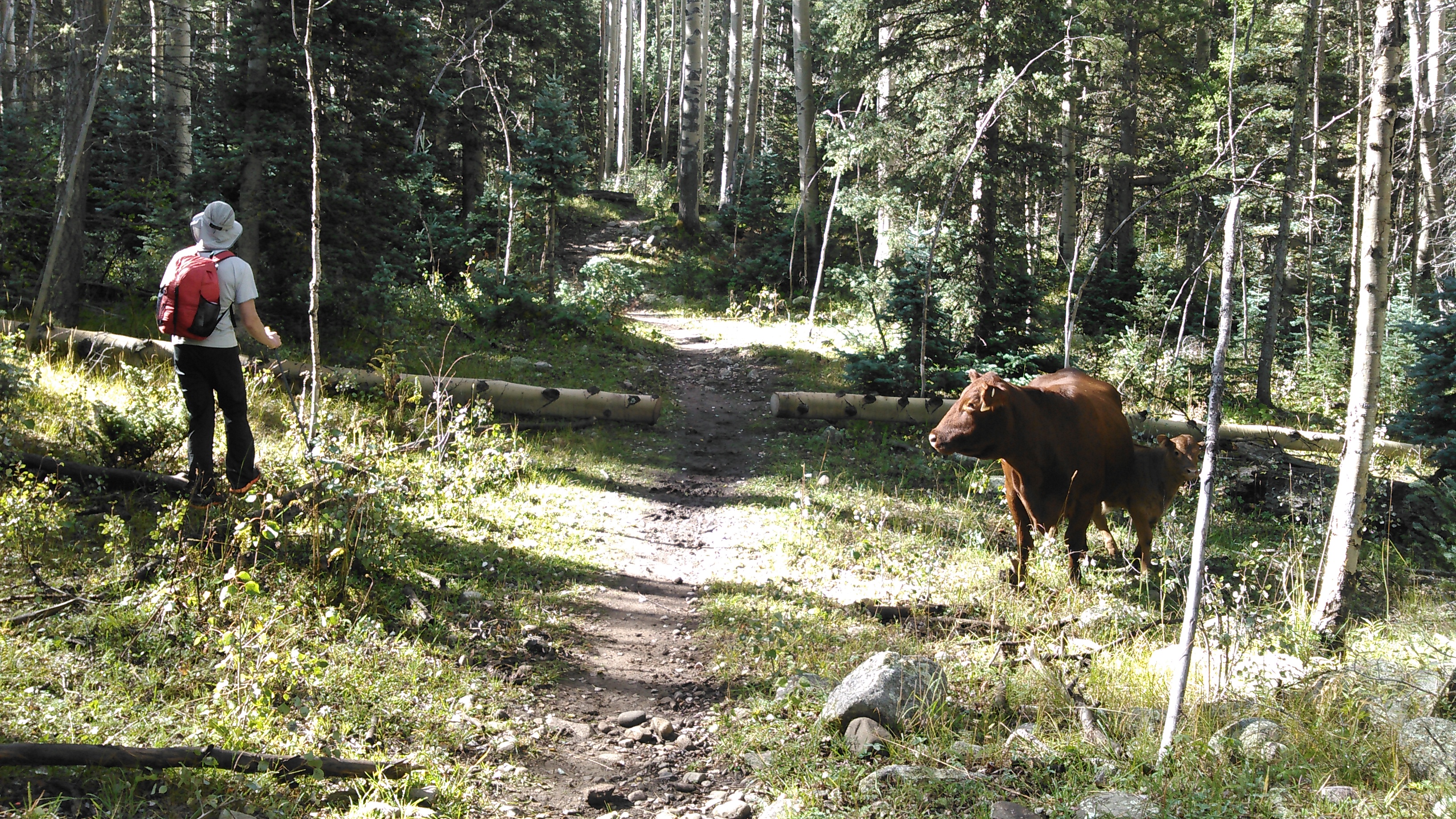
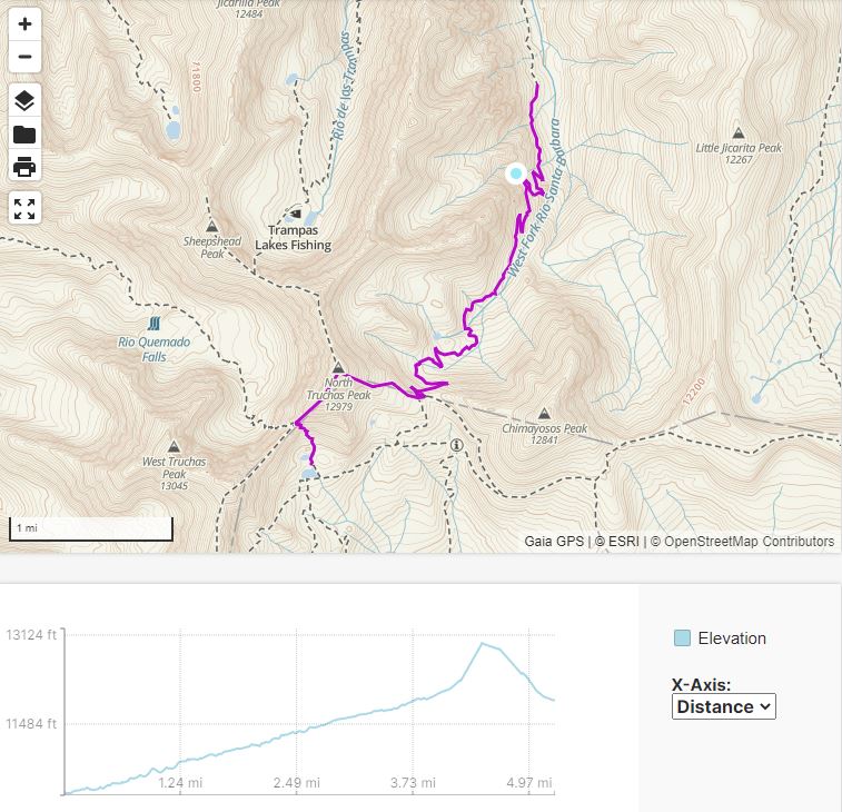
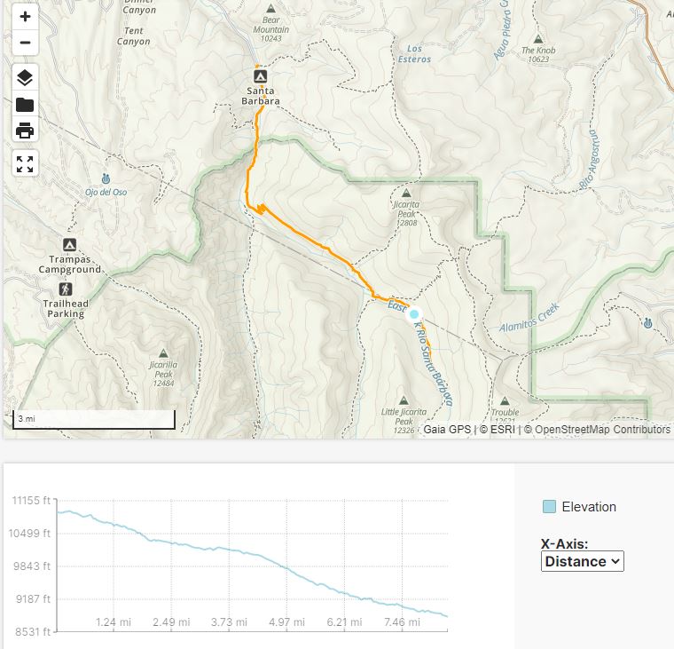
The next morning we set out on our backpacking trip, starting from the Santa Barbara Trailhead. Erik’s knee was feeling better and he forewent the crutches for his usual hiking poles. He was still hiking much slower than his usual pace. I had thought about hiking a longer route to our planned campsite but Erik had no idea how far he could hike and so in the end we hiked together; however, I constantly turned around for a bit and then hiked back up to him to get in an extra workout as we hiked up the West Fork Rio Santa Barbara.
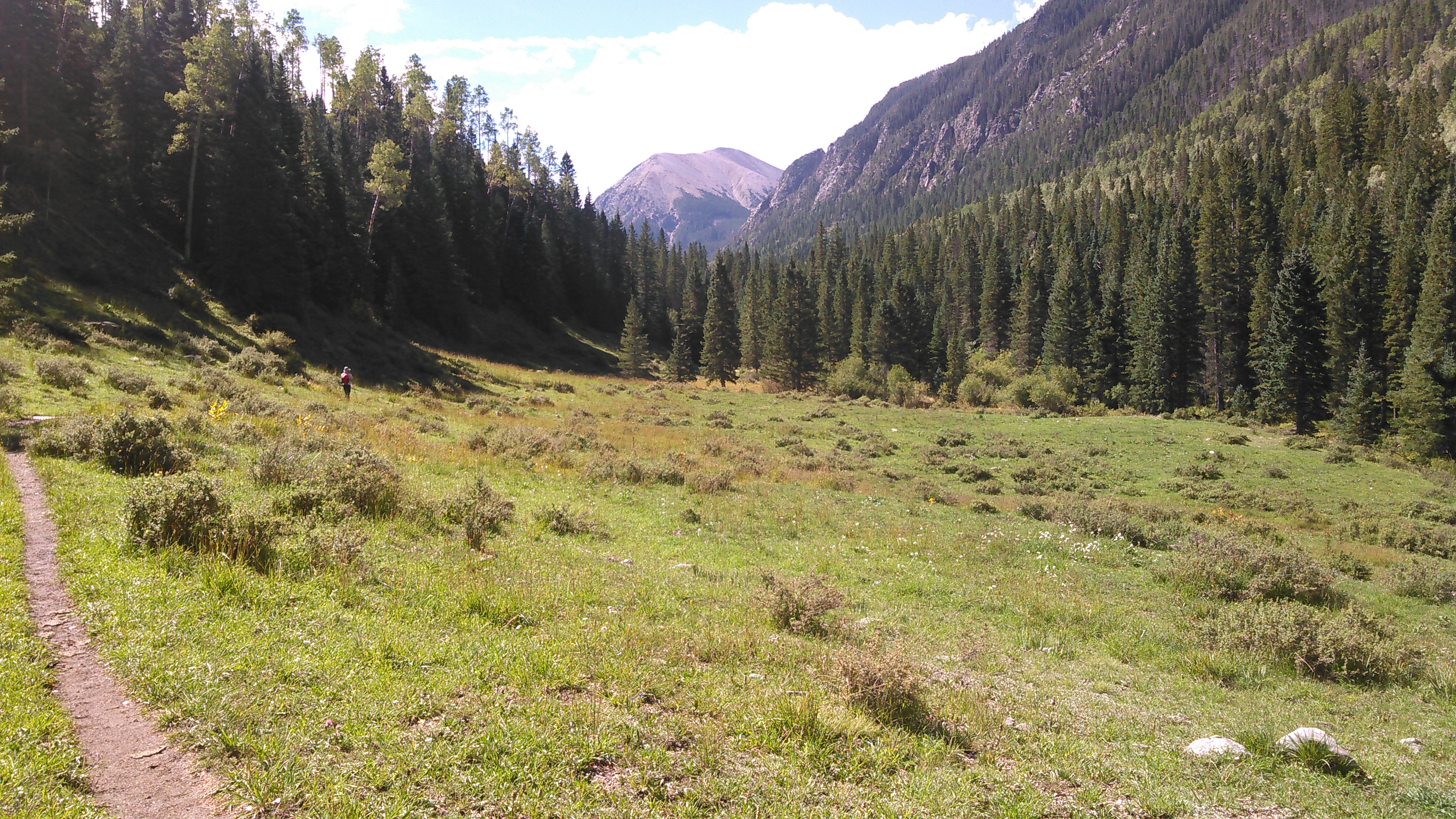

By late morning the clouds rolled in. And at 1 pm it started to rain. We put on our rain jackets, then tried to stay dry under a tree. It kept raining and we came upon a decent looking camping area. We debated whether we should set up the tent for a couple minutes and in the end figured that since we didn’t have that much farther to go until we got to the pass above No Fish Lake, we should just set up the tent before we were soaked through and while it wasn’t raining too hard.
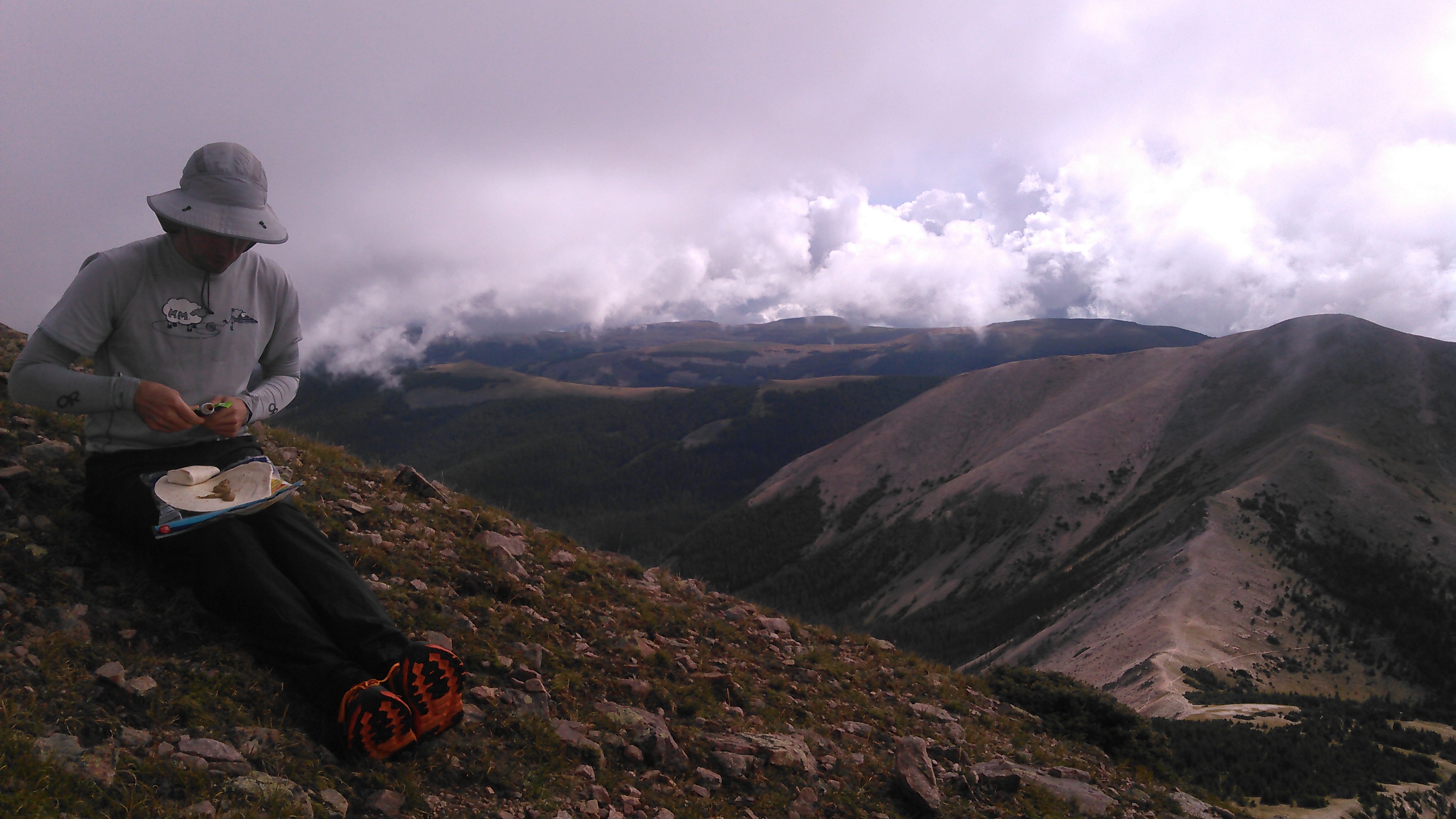
So we set up the tent and not too long after we did the rain came down harder, there was thunder and lightning, and then hail for a good long time. Like hours. Given Erik’s knee, he had brought with two books to read and so we read these. We had previously been told that monsoons come up quickly, pour super heavy then, and then move on. But it kept raining all afternoon and evening and when it finally let up, I ran down to the creek to get drinking water and fill the dinner pot. Erik cooked dinner in the vestibule of the tent. It rained most of the night.
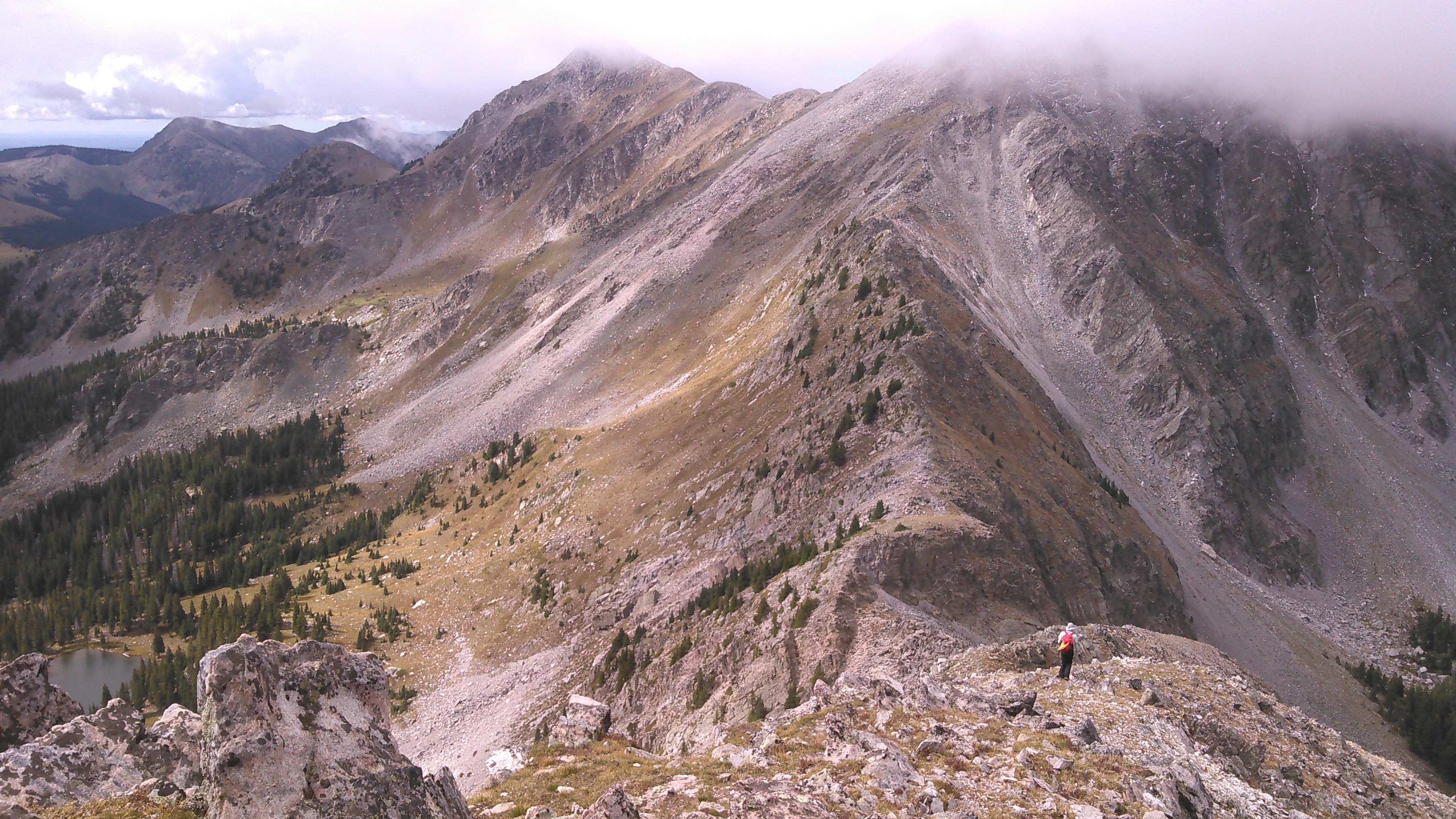
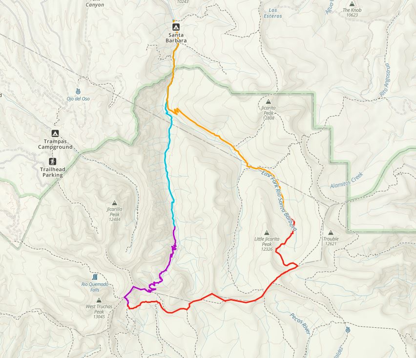
By the next morning the rain had passed through and we started out under sunny skies. While it was raining the night before, we looked at the map and made a plan that would get us off any high ridges by noon in case it stormed again. We had thought about hiking up Truchas Peak but this was a very long off-trail ridge walk that looked steep in places. Instead I suggested we just bag North Truchas Peak, a much closer and shorter off-trail hike, and then descend to the Truchas Lakes.
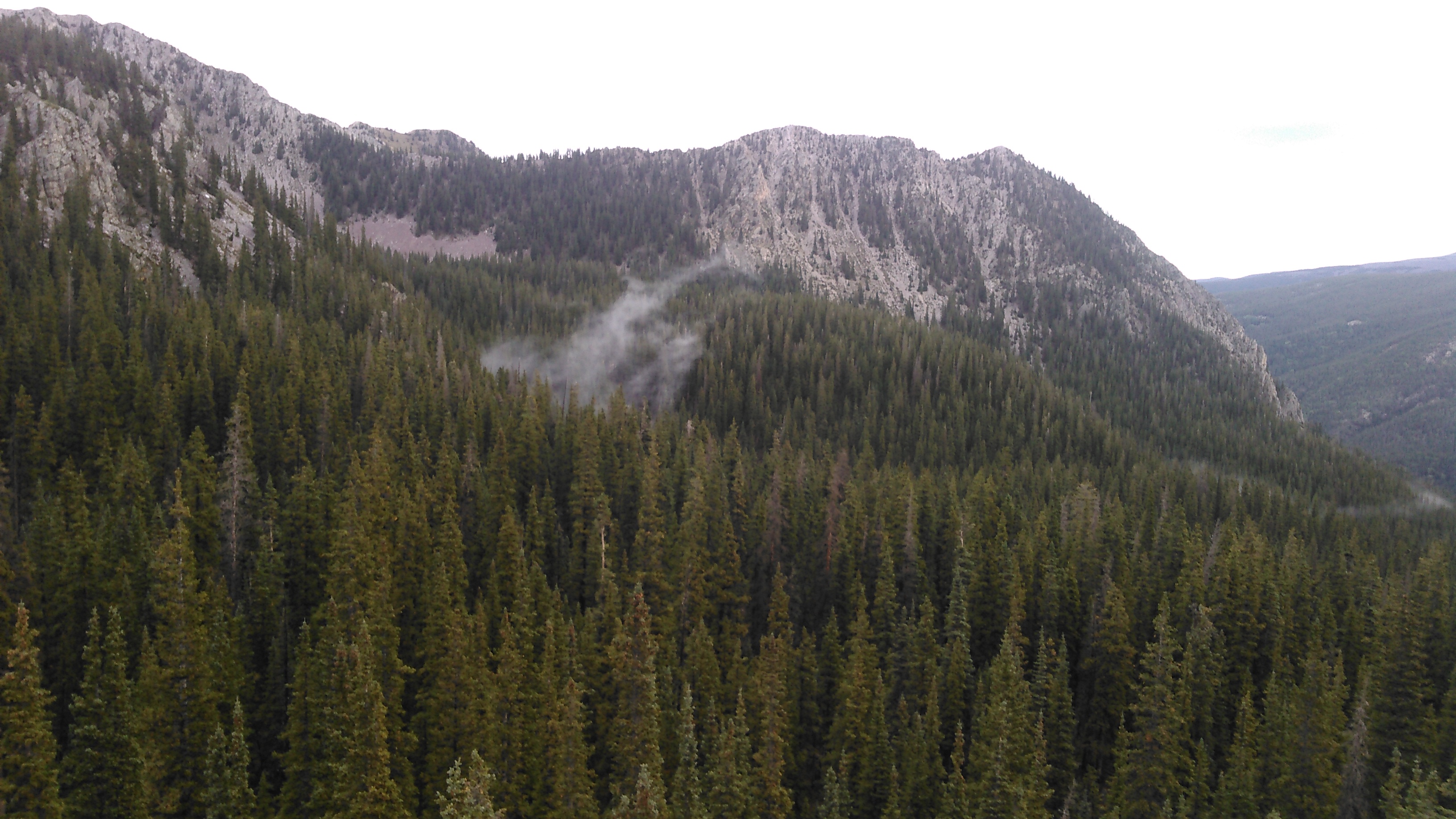
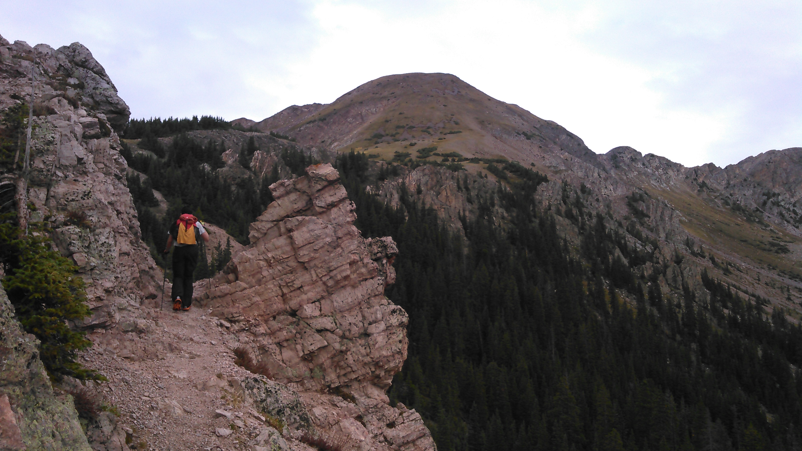
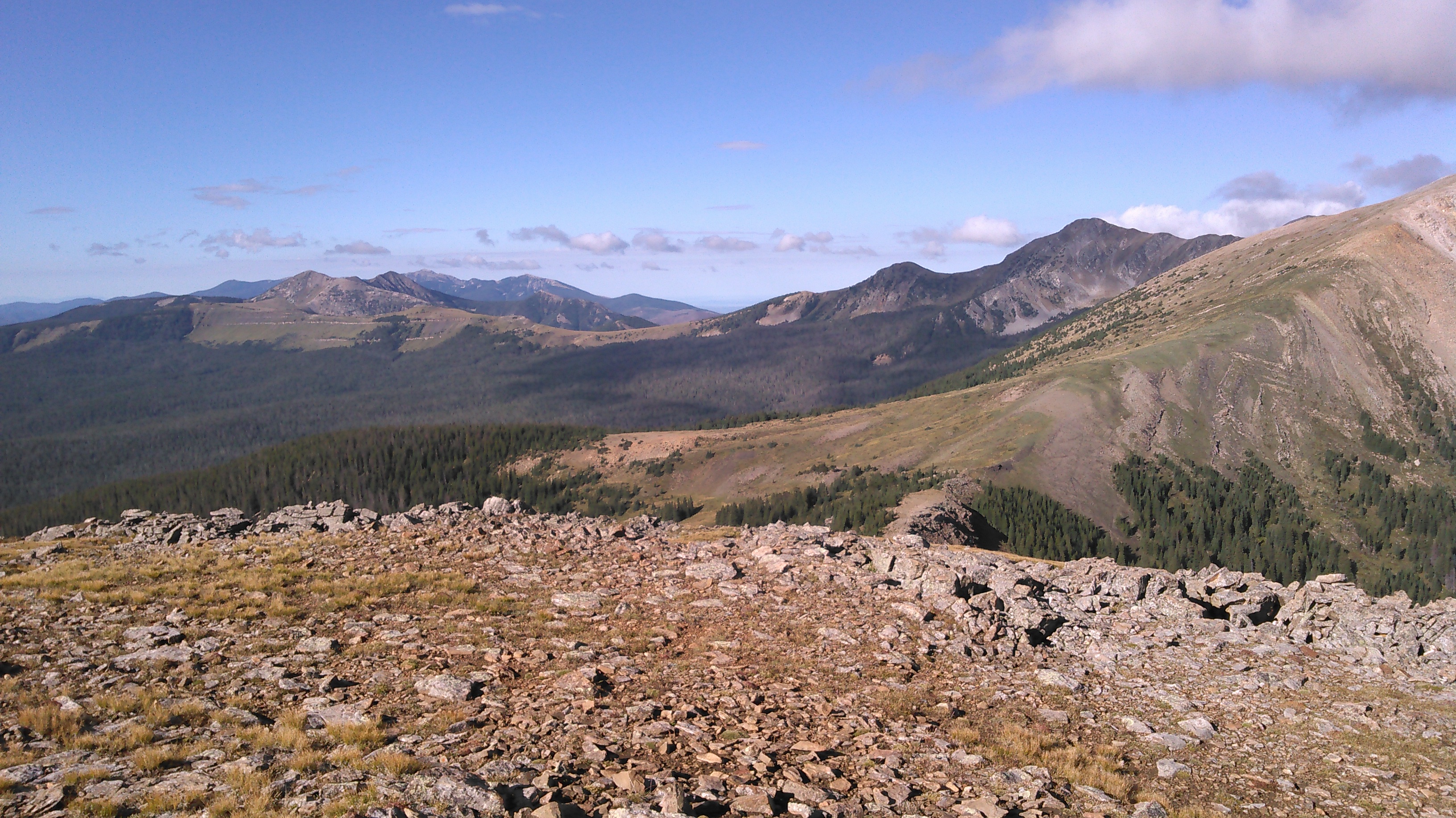
The trail completely skirted No Fish Lake. It looked like there might be some good camping in the area but we didn’t see anything obvious. There was a big switchback before we got to the pass and then we were above treeline. From the pass we could see that North Truchas Peak was a nice grassy slope to our west so we headed up. Before we were to the top we noted there were some clouds in the sky. This was quite unusual for 9 am. This didn’t stop us as we knew the route was quite short.


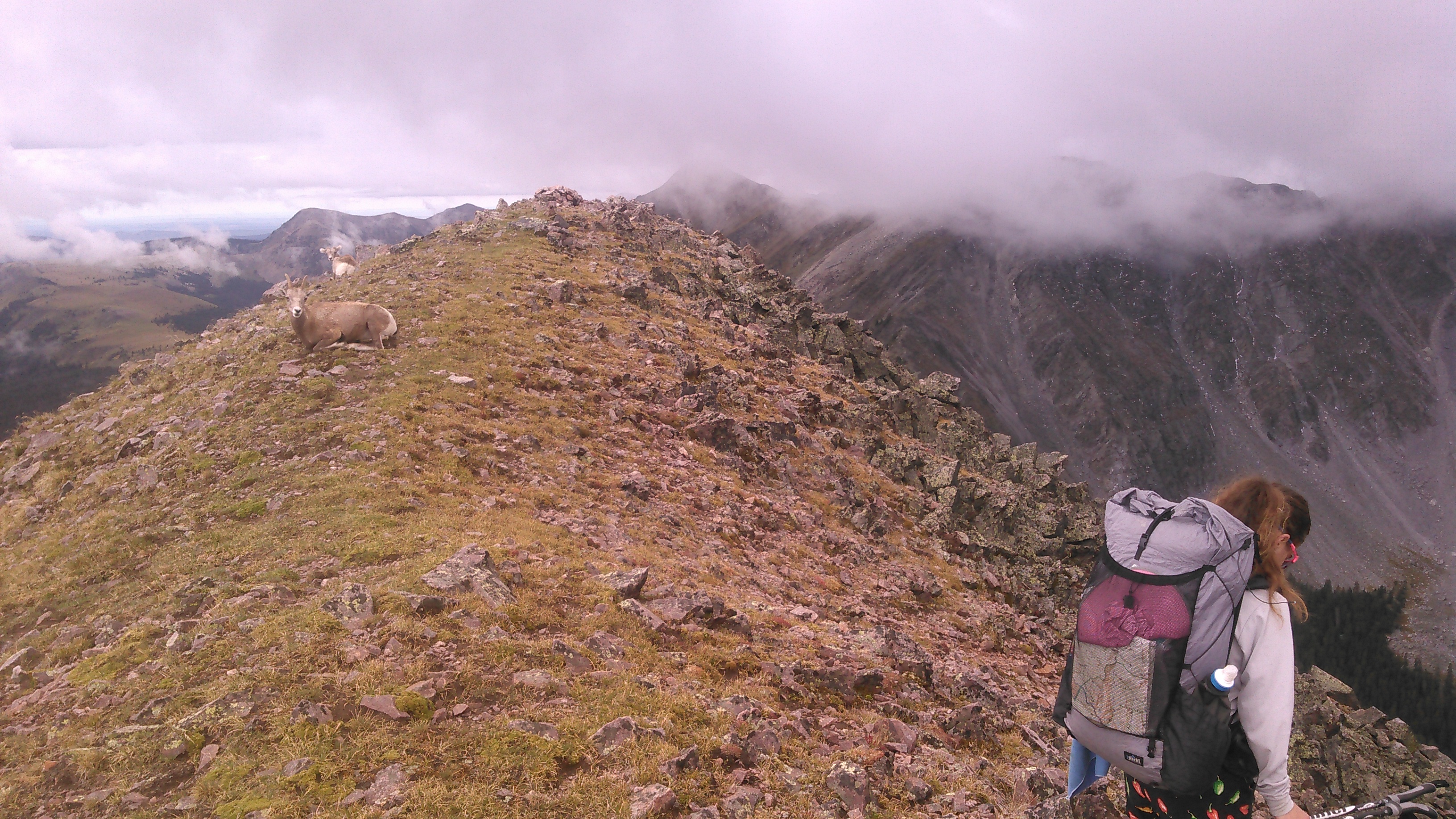
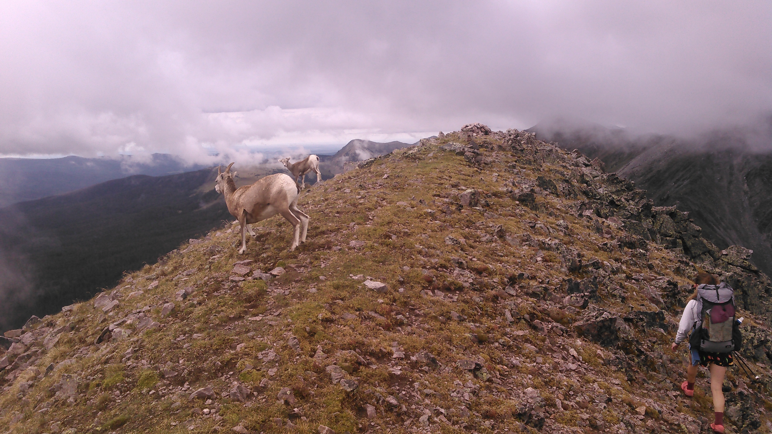
Once we got to the top of the peak, we were greeted by many female bighorn sheep (without the characteristic big horns) and their babies. This was pretty cool. Given that there looked to be clouds building to the west, we didn’t dawdle too long and soon began our descent, heading along the ridge going south to the pass between Middle Truchas and North Truchas peaks.

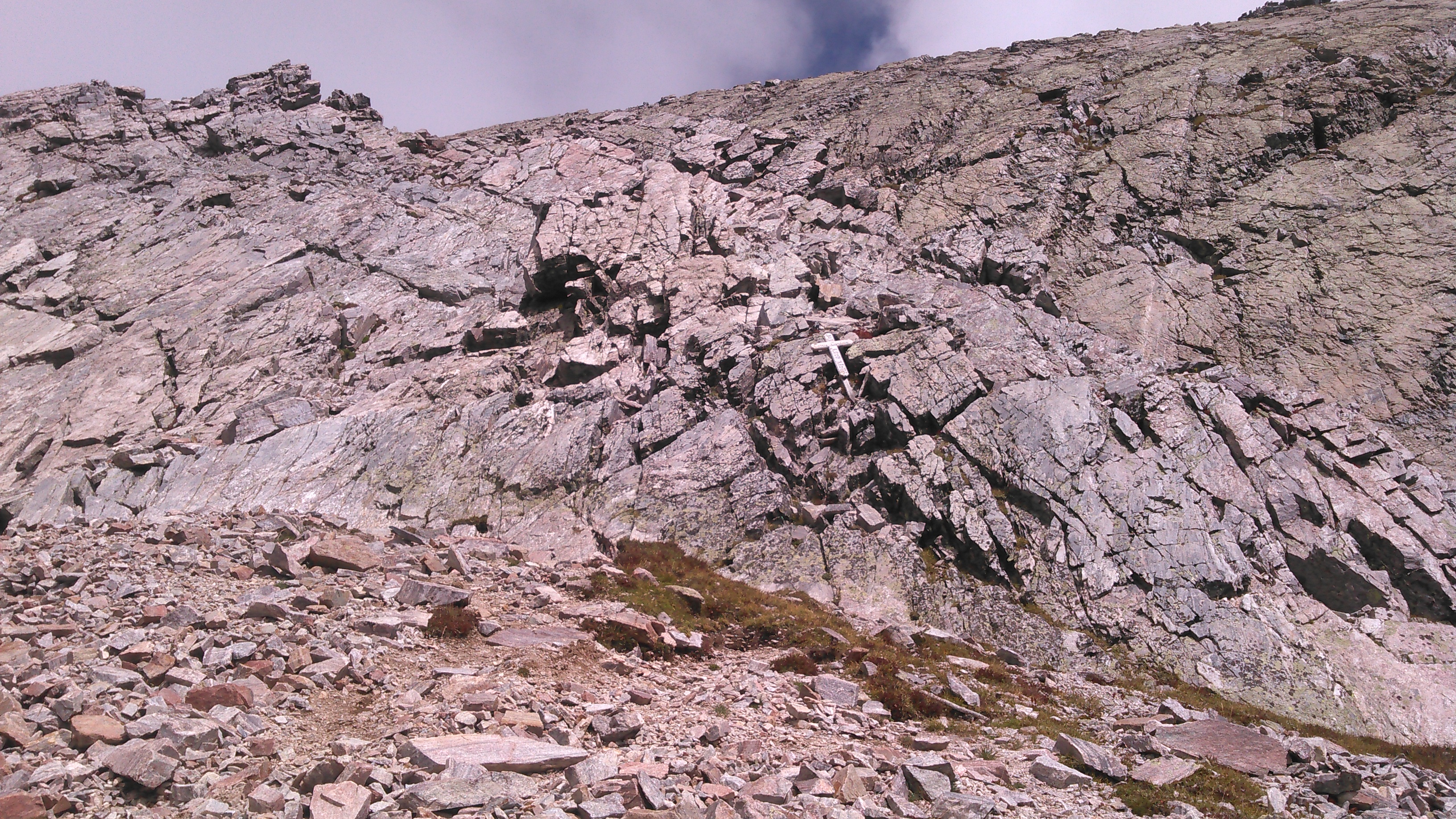
As we got near the pass, we realized we were getting mildly cliffed out. We looked to the west but this looked very steep. Just east of the pass there was a reasonable route down that involved a bit of bouldering as we downclimbed.
When we made it to the pass, there was a cross marking where someone had died. We wondered what had happened- my thoughts drifted to winter and snow.
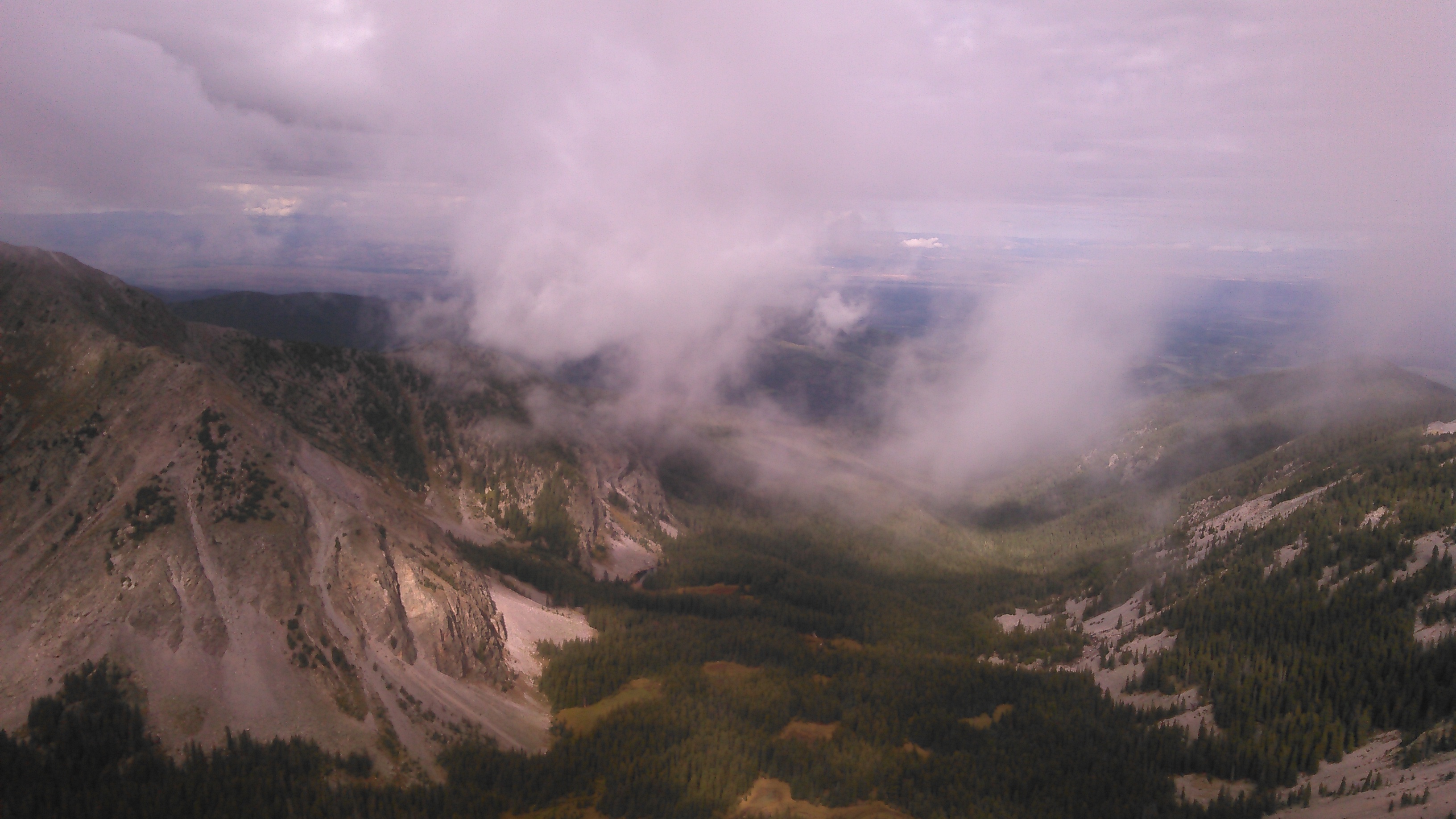
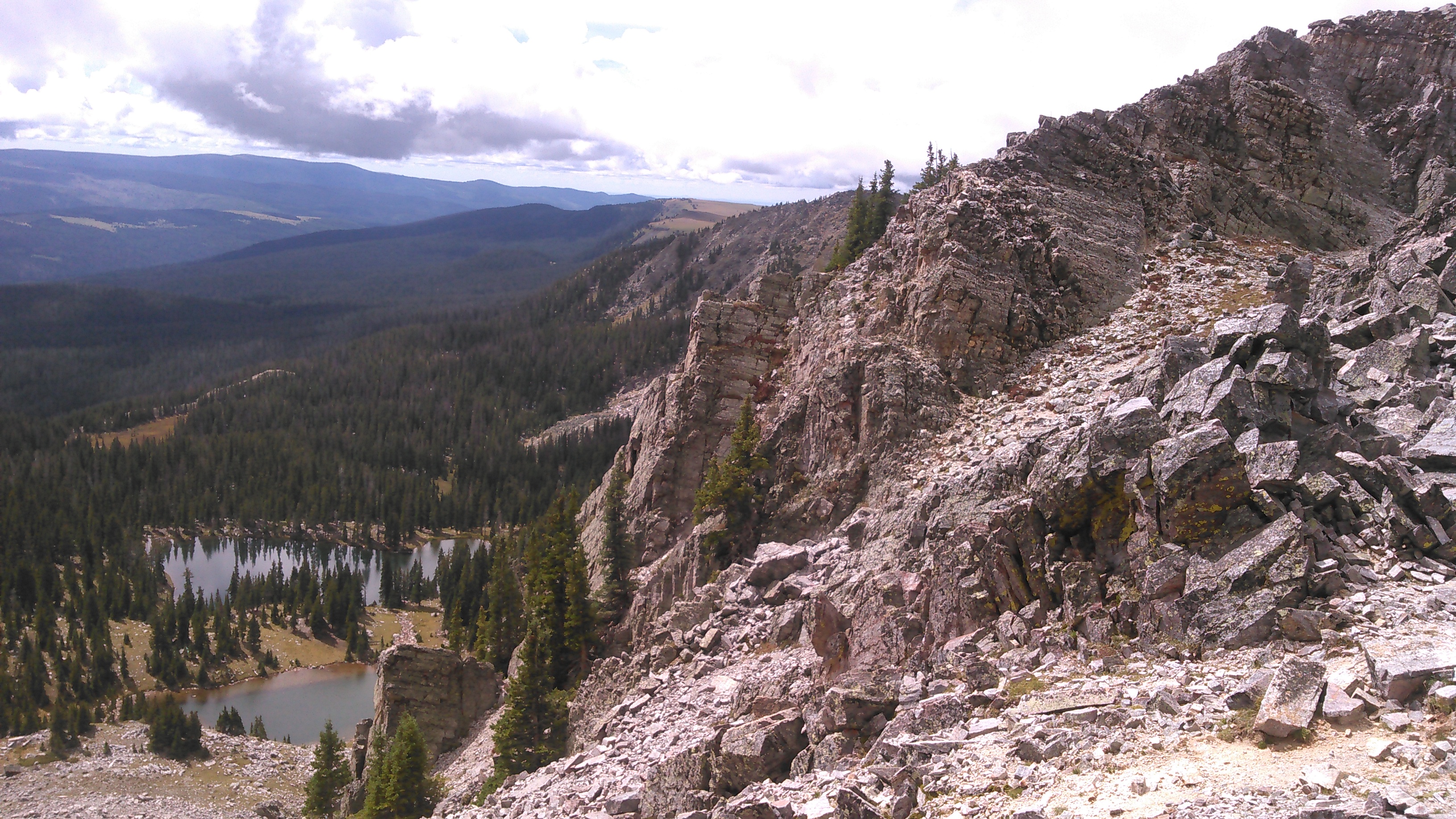
The trail heading down to Truchas Lakes was hardly a trail at all but more of a scree-field. This was surprising to me given that most of the other trails in the area were in good shape. The clouds were getting thicker even though it was barely noon. We found a great campsite between the Truchas Lakes and headed down to the lower lake to go swimming. Before we could swim though, it started raining and we headed back to our tent.


Unlike the previous day, it only rained a bit this afternoon. Still, between the threatening clouds and Erik’s knee, we decided to stay put and not hike farther.
While we were hanging out in the tent, a particularly loud plane flew over.
“That’s a low flying plane,” I said.
“We’re some high lying people,” Erik responded. Yes, we were camped at about 11,800 feet so we certainly were high lying.
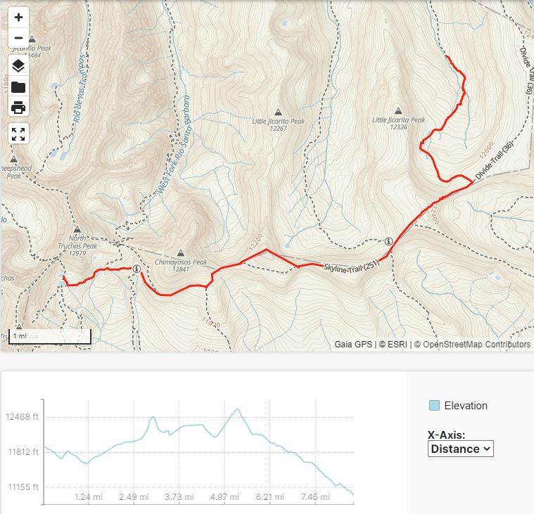
The next day we were again greeted by blue skies. We planned a route heading east with mostly on-trail ridge-walking. Given we were unsure what the weather would do, we didn’t make any specific plans. The hiking was good and the scenery fine. After hiking for a few hours, we had made our way to the high point just to the west of Rincon Bonito. We were enjoying the view when suddenly we realized storm clouds complete with lightning were coming towards us.
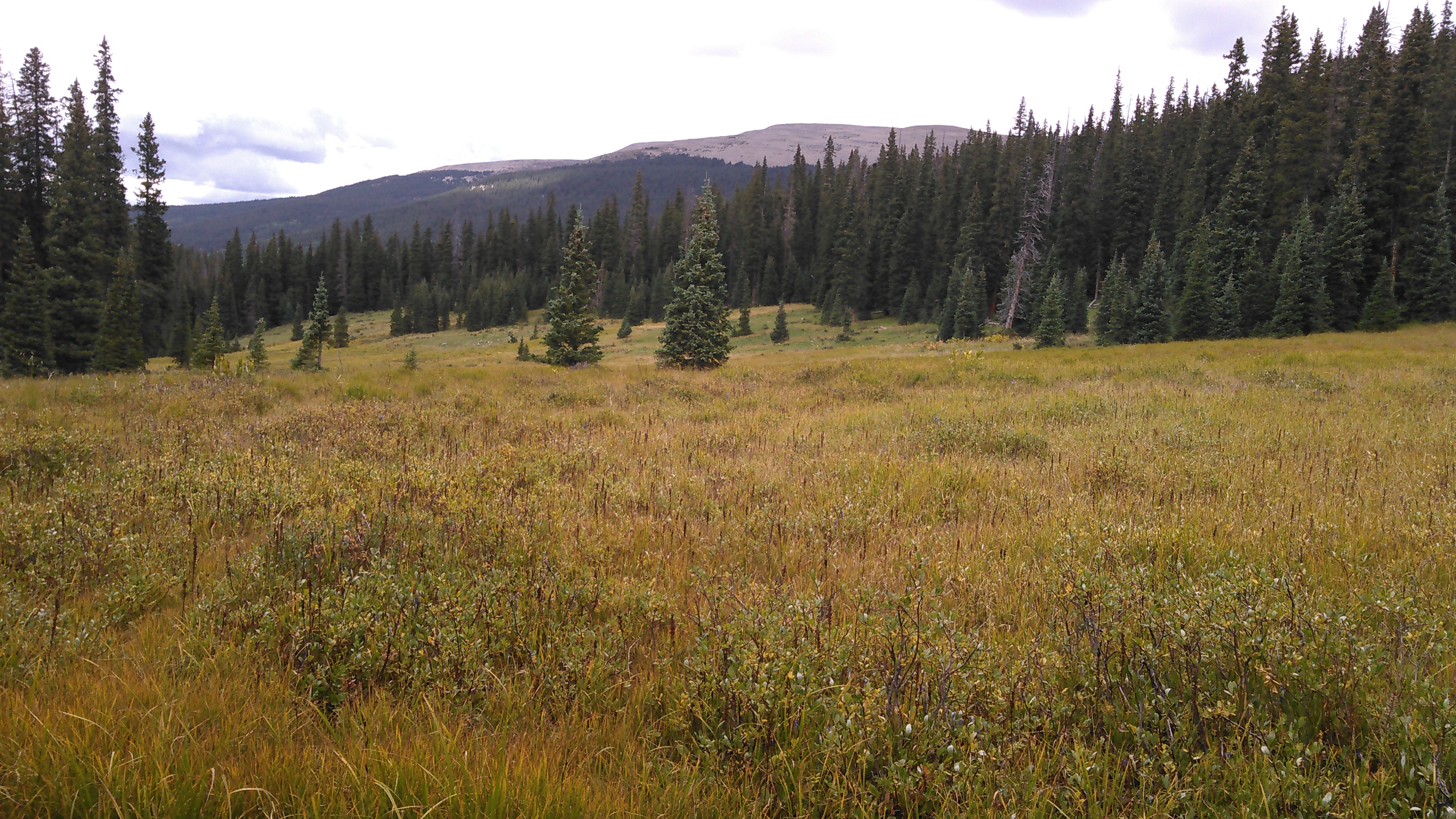
This got us running off the ridge down to the safety of the valley. We headed down the trail that goes along the the East Fork Rio Santa Barbara. Ideally we would have continued our ridge walking, but the weather had other plans for us. Even though it hadn’t rained on us, by the time we got to a nice meadow we decided to set up camp as the weather was intermittently threatening.


That afternoon we enjoyed looking out at our meadow under mostly sunny skis. It only rained on us briefly but it sure was threatening at times.
The East Fork of the Santa Barbara trail was incredibly wet- the meadows were wet almost like the tundra in Alaska even w/ tussock-like grass, there were tons of mushrooms, dense foliage, ferns; yet 5 miles to the west the way the crow flies completely desert.

Here at this campsite, and just about everywhere in the Pecos, there were lots of blue spruce.
After another dry night, we woke to more blue skies the next day. We had a relatively short hike out, along the Santa Barbara River as it gradually got more and more water as the various forks joined together. As we neared the Trailhead, the trees got bigger and bigger.
In New Mexico there were cottonwoods, just like we had seen in the tundra in Alaska- saw these in the same year just a couple months apart.
Although we had originally planned for a much more aggressive hike, our plan was foiled by the monsoon season and Erik’s knee injury. We still had a good time and since we didn’t make it very far, we still have plenty of the Pecos Wilderness to explore in the future.
If we had to do this trip again: Erik obviously wouldn’t have been injured and the weather would have been better. Unfortunately monsoon season is June 15-September 30 which also corresponds to the best hiking season. Of course this wouldn’t be such an issue if we were content to stay below treeline:)
Best decisions: Camping early the first day when it started to rain and settling for North Truchas Peak the second day.
Next time: Start near Sante Fe and hike a loop that would include Sante Fe Baldy and East Pecos Baldy.

2 thoughts on “Pecos Wilderness Backpacking”