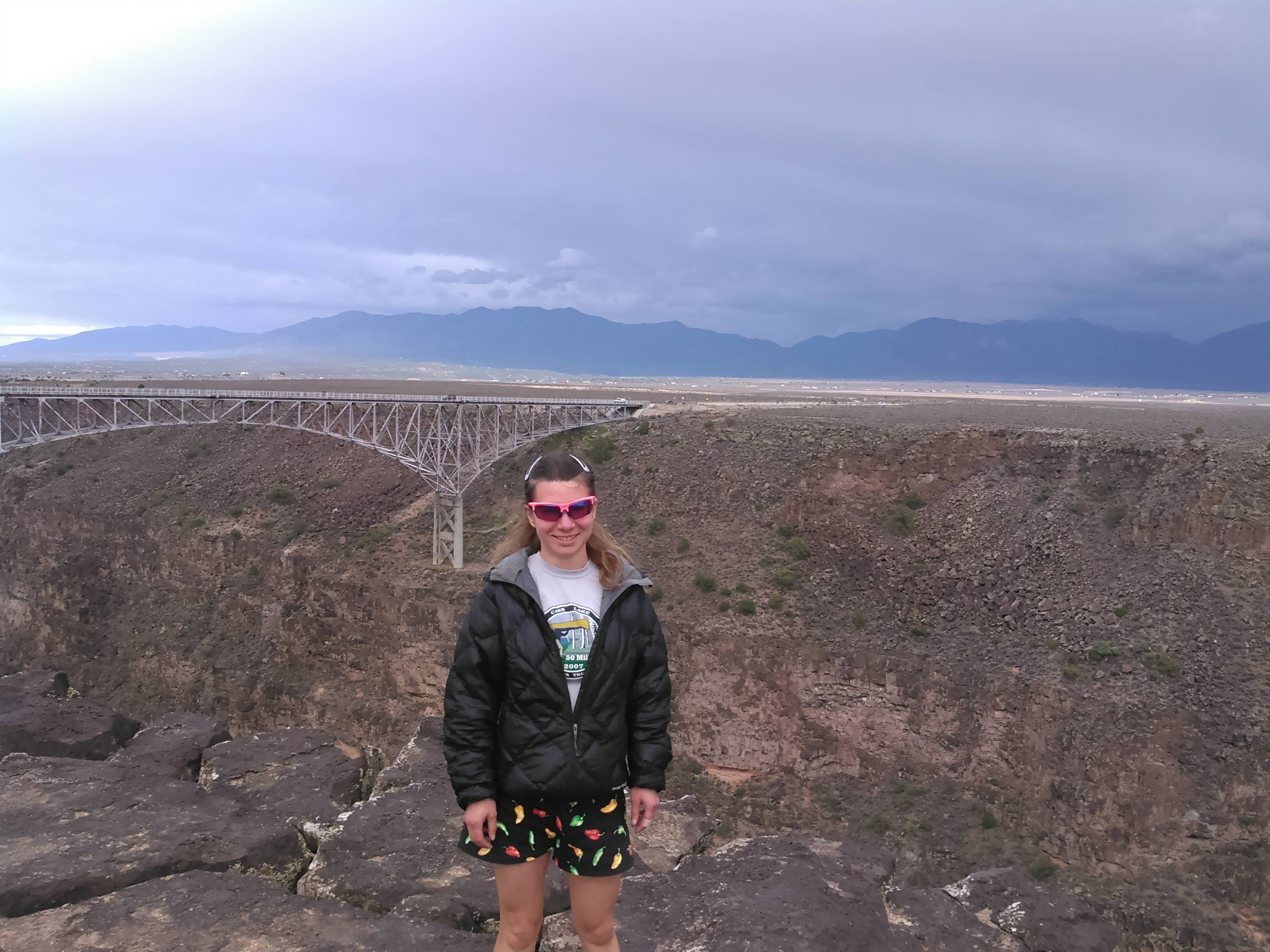
At 13,159 feet, Wheeler Peak is the highest point in New Mexico, located near the town of Taos in the northeast part of the state. We hiked Wheeler following a three day backpacking trip in the Pecos. After the Pecos, it was threatening rain so we detoured to the Rio Grande Gorge Bridge over the Rio Grande on highway 64. It’s the second highest bridge on the United States highway system.

Then we drove to the Wheeler Peak Trailhead located in the Taos Ski Valley. By now it was almost evening. We had some intentions of backpacking into Williams Lake to get an earlier start in the morning, but as we had done our first night in the Pecos, we elected to just sleep in our SUV rental car.
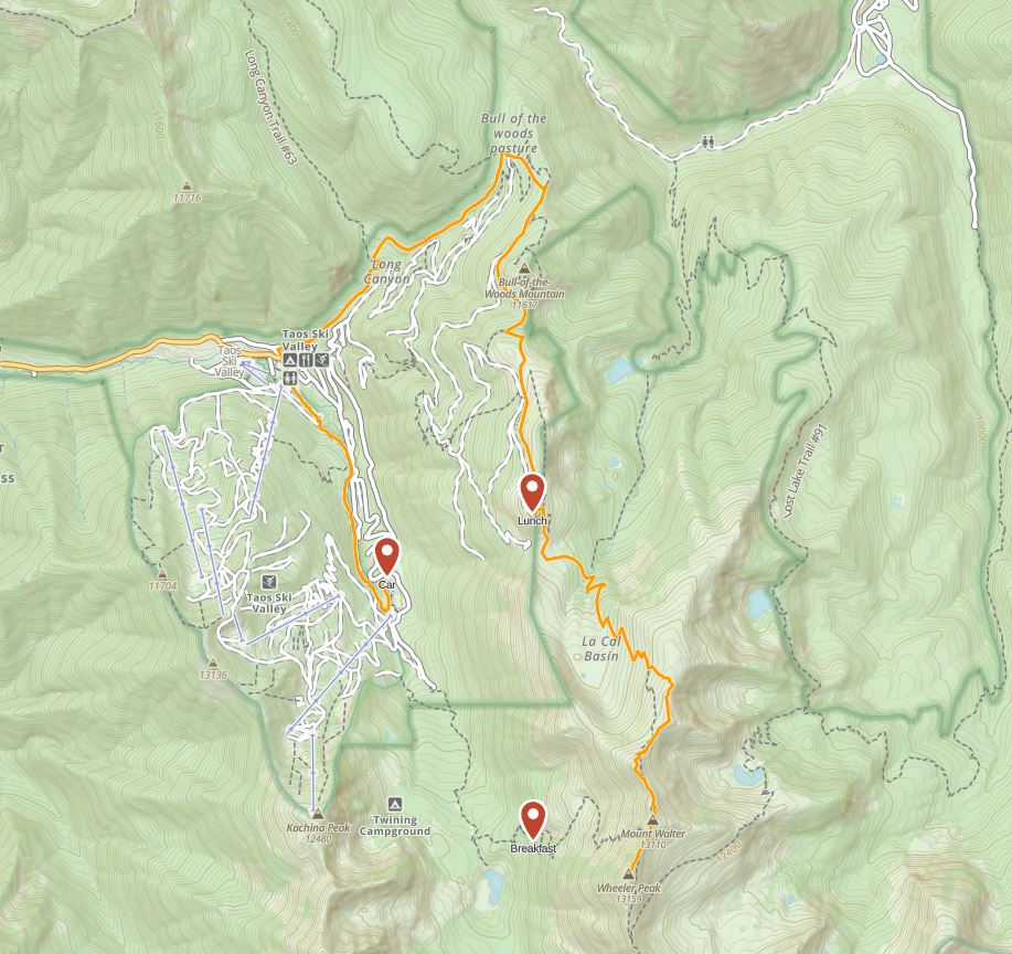
There are two trail routes up Wheeler, both approaching from the Taos Ski Valley. The shorter route (Williams Lake Trail #62) heads south towards Williams Lake. The first two miles are gradual until just before Williams Lake, when a series of switchbacks gain most of the 3,000 feet of elevation to the saddle just north of Wheeler Peak. The other route is longer (Wheeler Peak Trail #90) with some possible forest service road options, but essentially wraps around the range that Wheeler is on, first to the east and then to the south. We planned to hike up the route that goes to Williams Lake first and then assuming the weather looked good, take the long way back down.

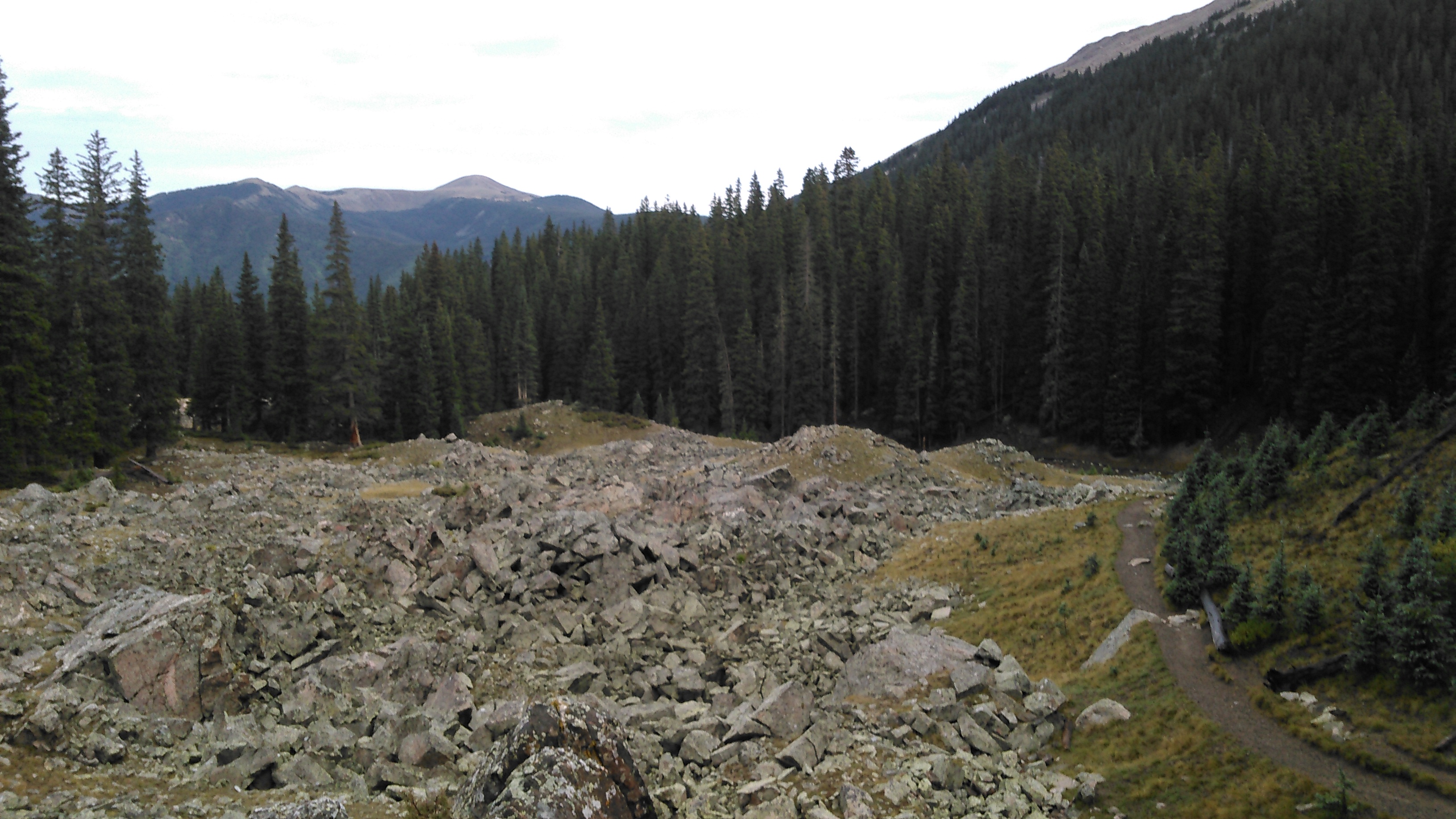
The next morning (9/6/18) we got up early and I declared we should wait on breakfast until we got somewhere with a good view. I thought that good view might come just before two miles in where we seemed to reach a small knoll above Lake Williams, but no such luck. Our last state high point had been Granite without any trails, and so I stopped and took a photo and marveled at the really nice trail we walked on that skirted a boulder field.
We didn’t want to walk all the way to the lake so we gave up and started climbing the switchbacks. Erik got too hungry before we got above tree line so we stopped for breakfast amidst a view of trees.
After that we quickly broke above tree line and took in some views. The trail here is relatively new (Google Satellite shows some evidence of the old trail) and easy going.


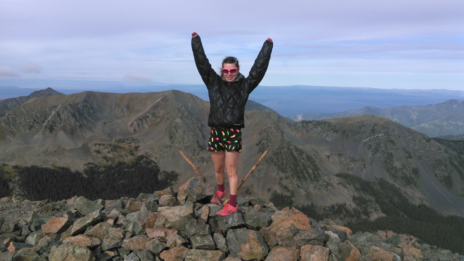
Once on the ridge we took in the view off the other side to the east. Then we hiked a short distance (less than half a mile) south with a bit of elevation gain to Wheeler Peak. This route is only 4.5 miles and climbs 3,000 feet. Including our breakfast stop and a few view stops, it took us 2.5 hours.
Under slightly cloudy skies we took in the view and then since the weather looked OK, started on the longer route back down.


We slowly made our way back down, dropping into Le Cal Basin (one could camp here in the wetter months but it was dry when we went through), hiking back up to and stopping for lunch on Fraser Mountain, and finally descending into the woods at Bull of the Woods Pasture. It was an eight mile descent all the way back to Taos Valley, but then we still had to hike another mile plus uphill back to our car. The loop route is good for some variety and to stay up above tree line on the ridge but it does make for a longer day and doesn’t add much scenery (especially not the part walking by the ski hill). Thus the route going north to Williams Lake would be good even as an out-and-back. I’d probably do that in the rare event I ever do Wheeler again.
Of note, we had thought about doing a backpacking trip in this area but ultimately there isn’t much land with very limited loop options so we did the Pecos instead.

Keep on making this world your own with string and vivid memories. So very happy for you as a retired person seeing your wonderful energy.
Get Outlook for Android ________________________________
LikeLike
As always, an enjoyable read. Thanks to you I am slowly learning the topography of the States, from a perspective very much in accord with my own interests.
LikeLike