
We first learned about the Four Pass Loop within the Maroon Bells – Snowmass Wilderness in Colorado from a couple while we were backpacking in the Grand Canyon. Seeing as this loop would take us less than four days, we combined it with Mount Elbert, the Colorado high point, and a work conference for a week-long trip.
The Colorado High Point
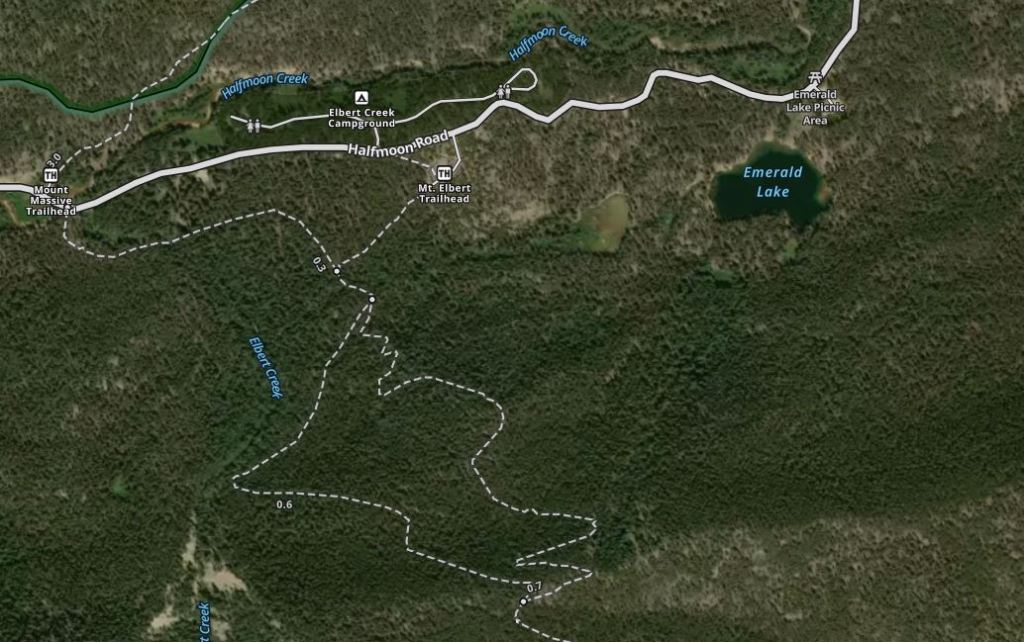
After flying into Denver, we rented a car and drove to the base of Mount Elbert (we approached from the northeast side off Halfmoon Road), stopping in Leadville to poke around town along the way. Thus we went from sea level to two vertical miles high in a few hours.
Our plan was to camp along the national forest road where dispersed camping is allowed (this seems common in the west but is a bit weird coming from Minnesota) but given it was the weekend and before Fourth of July at that, we found all the campsites taken. Hence, we parked at the Mount Elbert Trailhead and then went over a knoll to find a spot out of the way since camping wasn’t technically allowed at the trailhead.

At 14,439 feet, Mount Elbert matches the high points of Washington and California within mere feet. The trailhead sits at 10,000 which meant a 4,500 foot vertical day- not too bad. We woke early, but not too early, with the plan to summit and be back to tree line by the time the afternoon thunderstorms rolled in as they usually do in the Rockies.

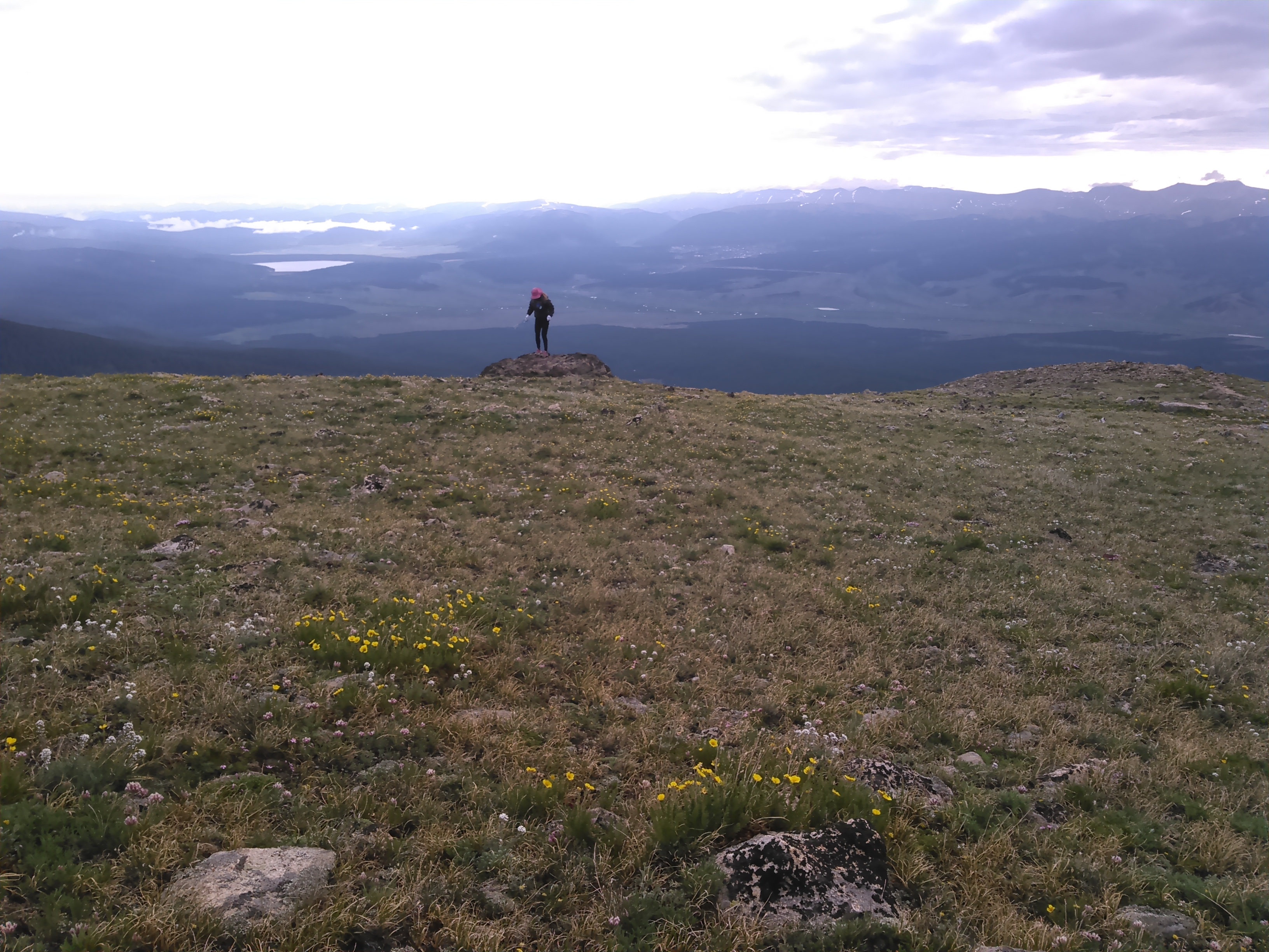
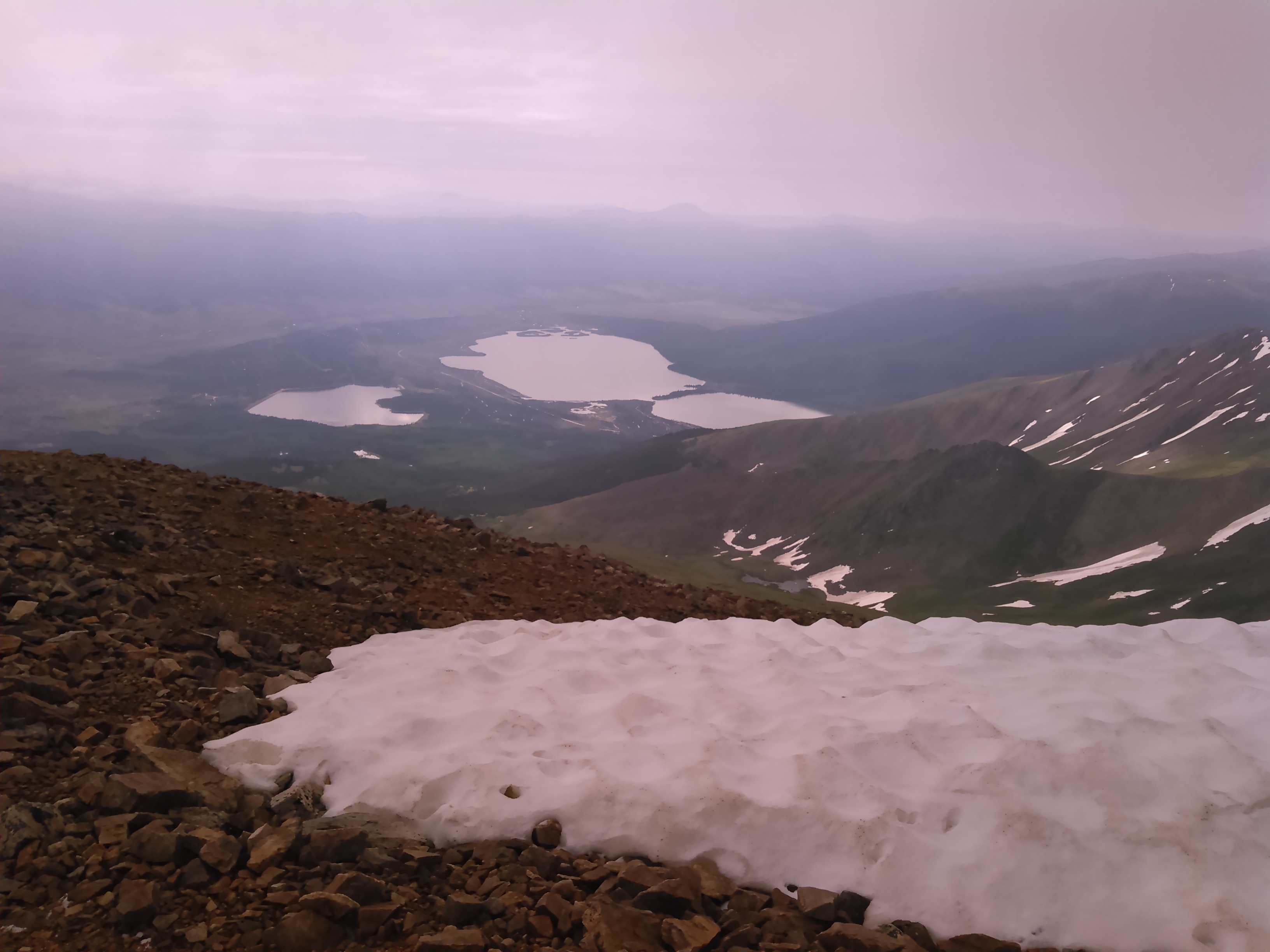
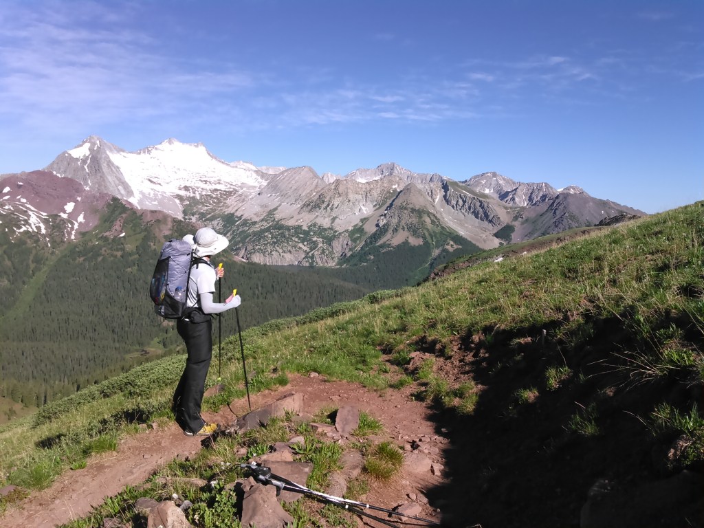
The trail begins through aspen forest and gains steadily but gentle elevation throughout. After a couple hours we arrived above tree line, around 12,000 feet, and had good views of Mount Massive to the north and the Twin Lakes Reservoirs to the south.
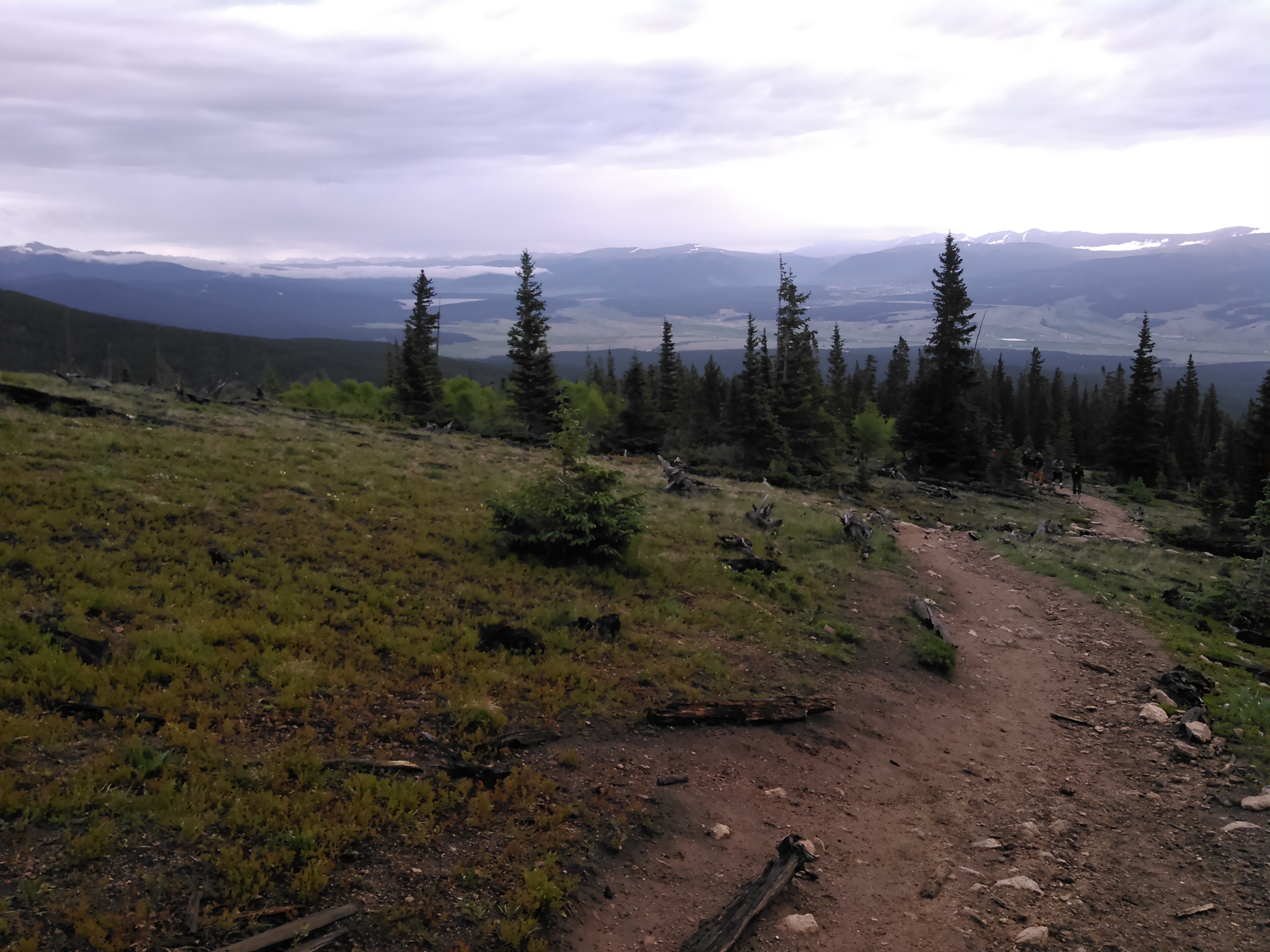

Despite gaining 4,500 feet of elevation over 4.5 miles, the trail only got steep in on brief section about half mile below the summit. Otherwise it was a steady grind on good footing. Within 3 hours time we found ourselves on the top of Mount Elbert.

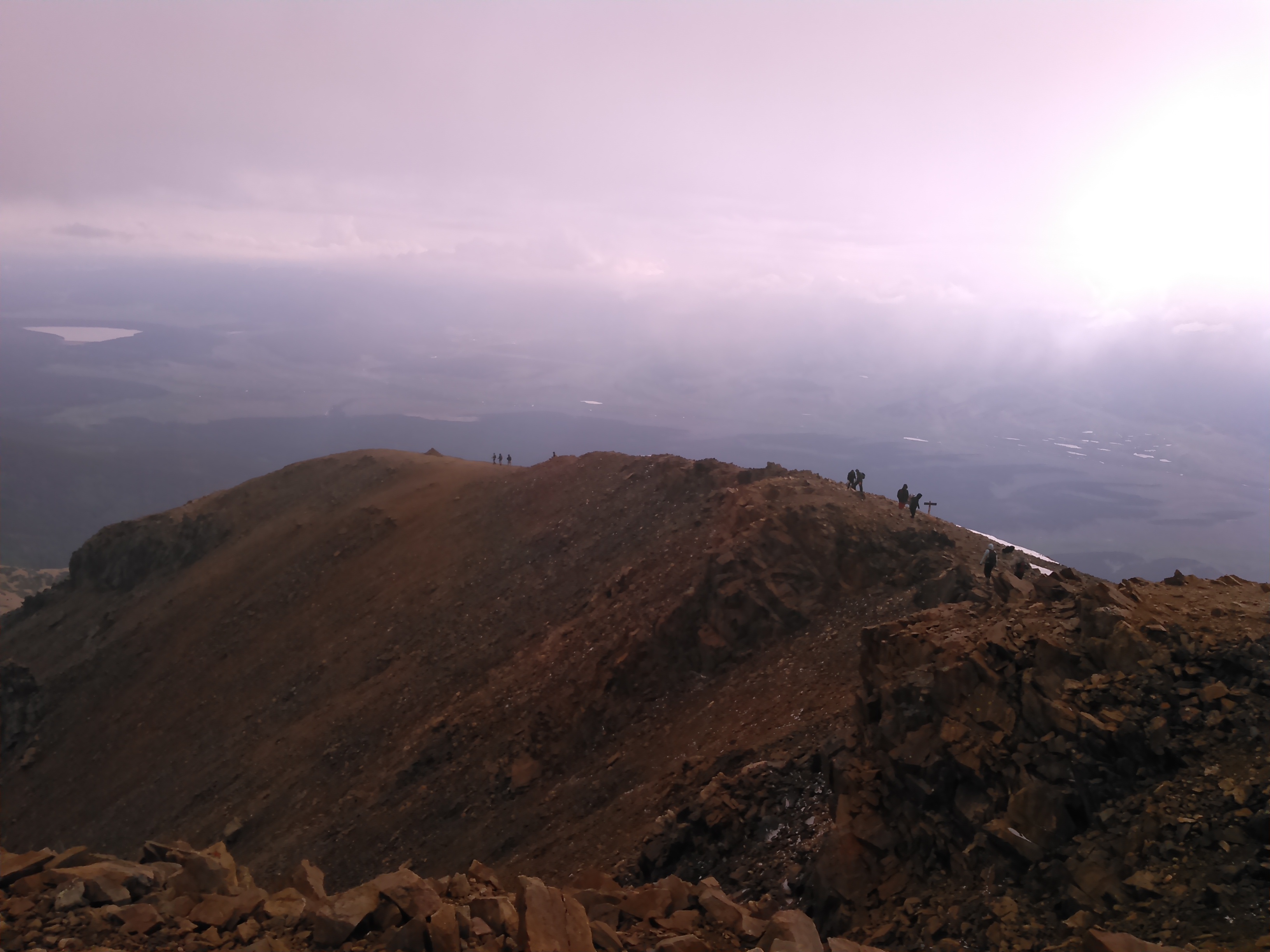
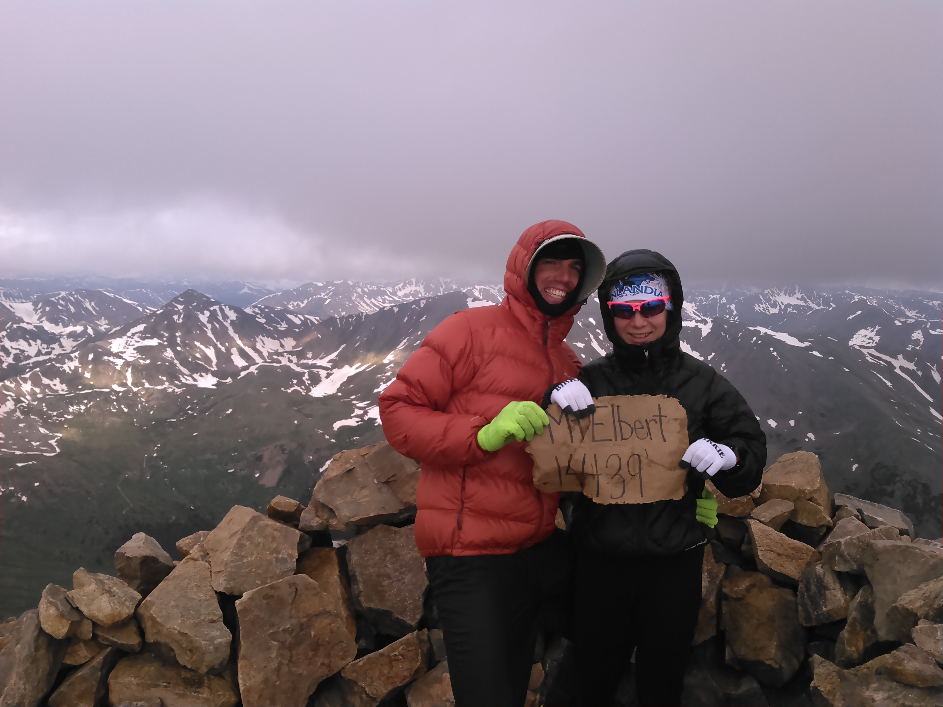


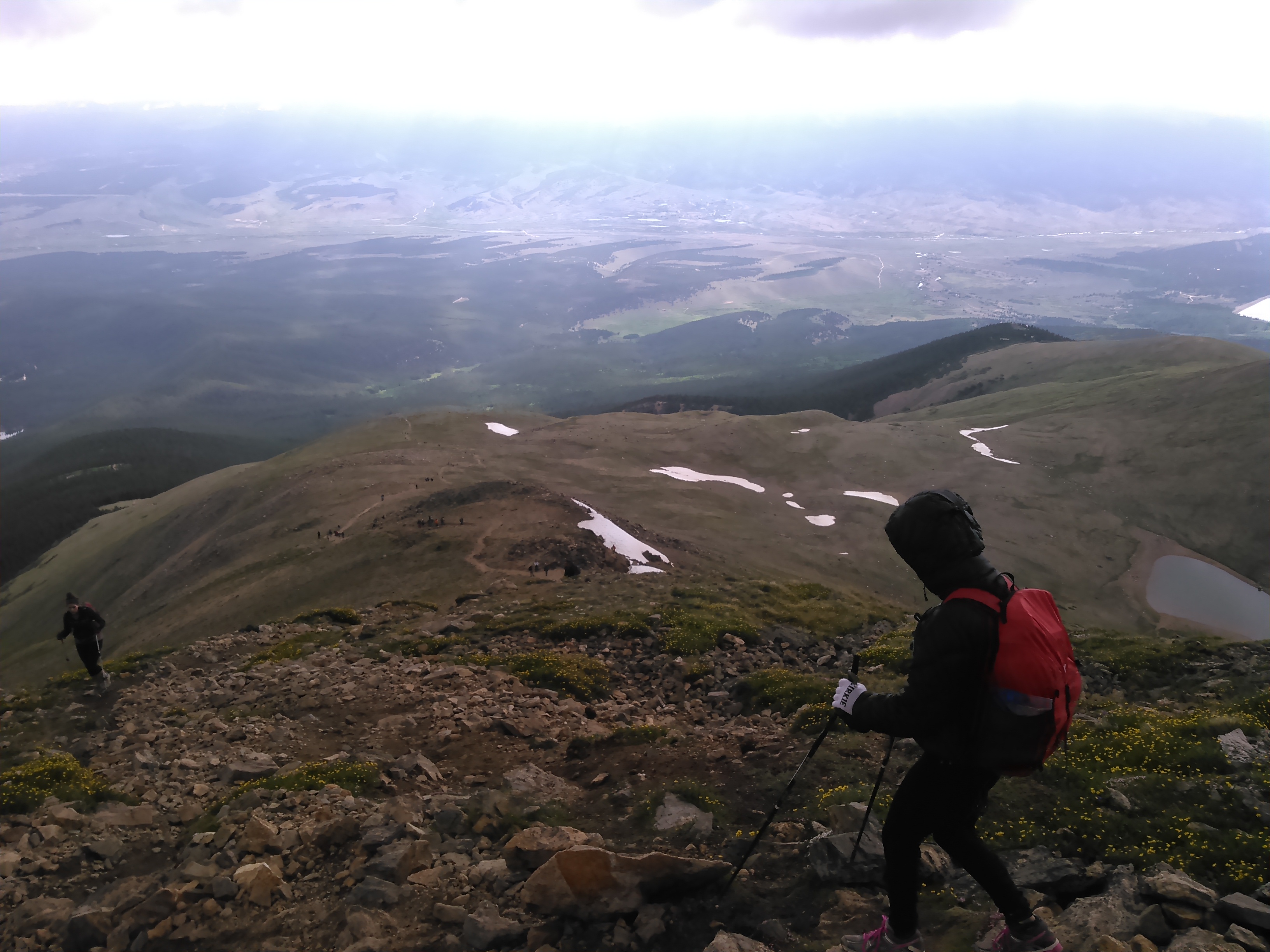
The clouds on the summit were ominous and we didn’t linger long. Aside from the short steep section, we made good time and got back to our car around noon. While Mount Elbert is the fourth highest high point, it was notably easier than many it dwarfs like Granite, Gannet, and even Mount Washington, owing to relatively gradual terrain and a nice trail.

Once back to the car, we were glad to have dodged the rain and started driving to the Maroon Bells via Independence Pass on Hwy 82 through Aspen.
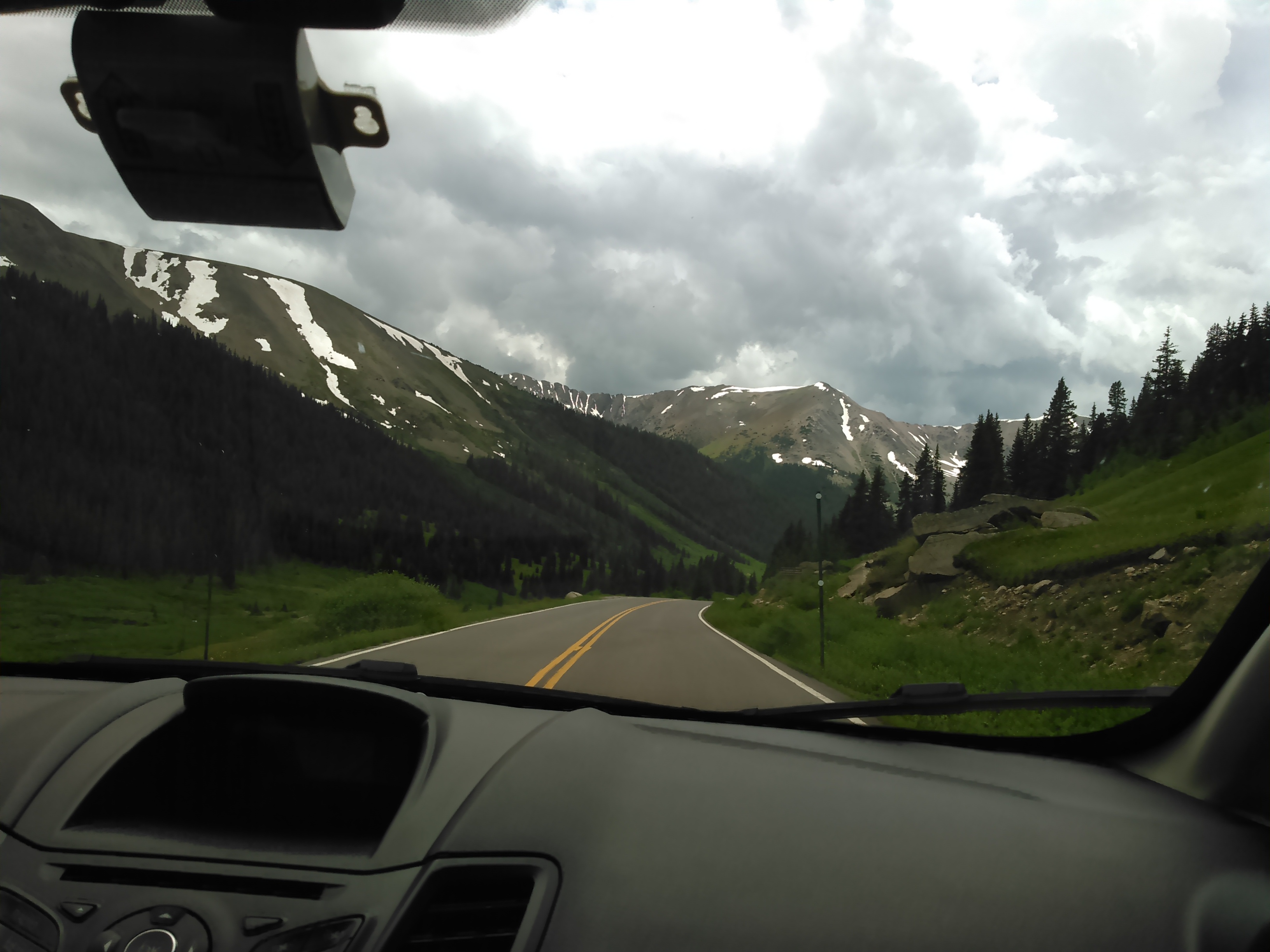
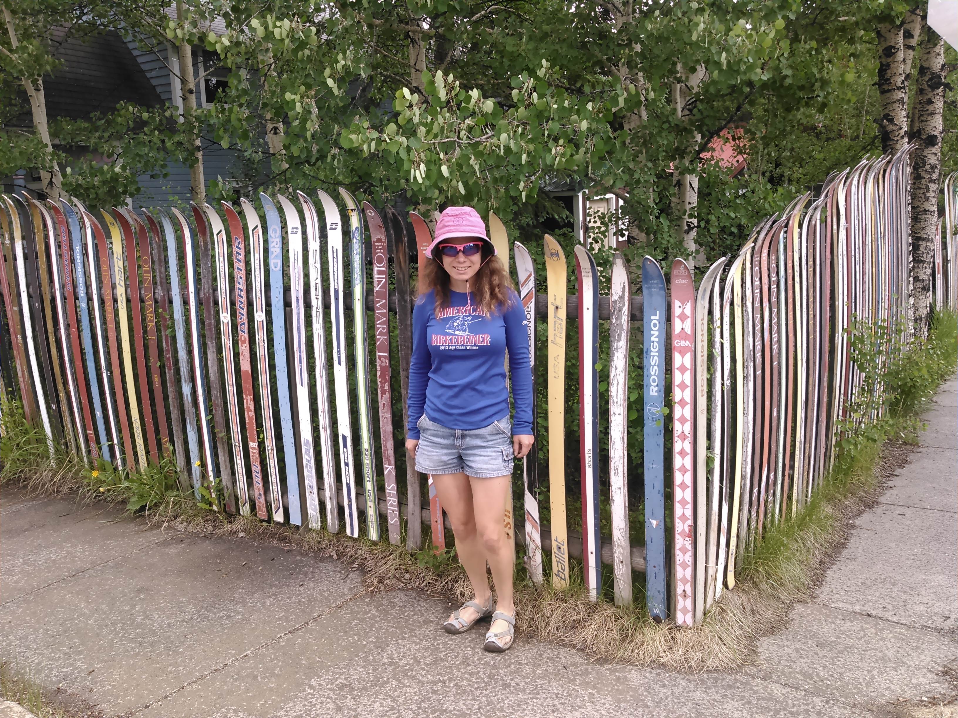
We walked around the town of Aspen while waiting for some rain clouds to pass and the road into Maroon Bells to open for parking. What a swanky place!
Four Pass Loop in Maroon Bells – Snowmass Wilderness
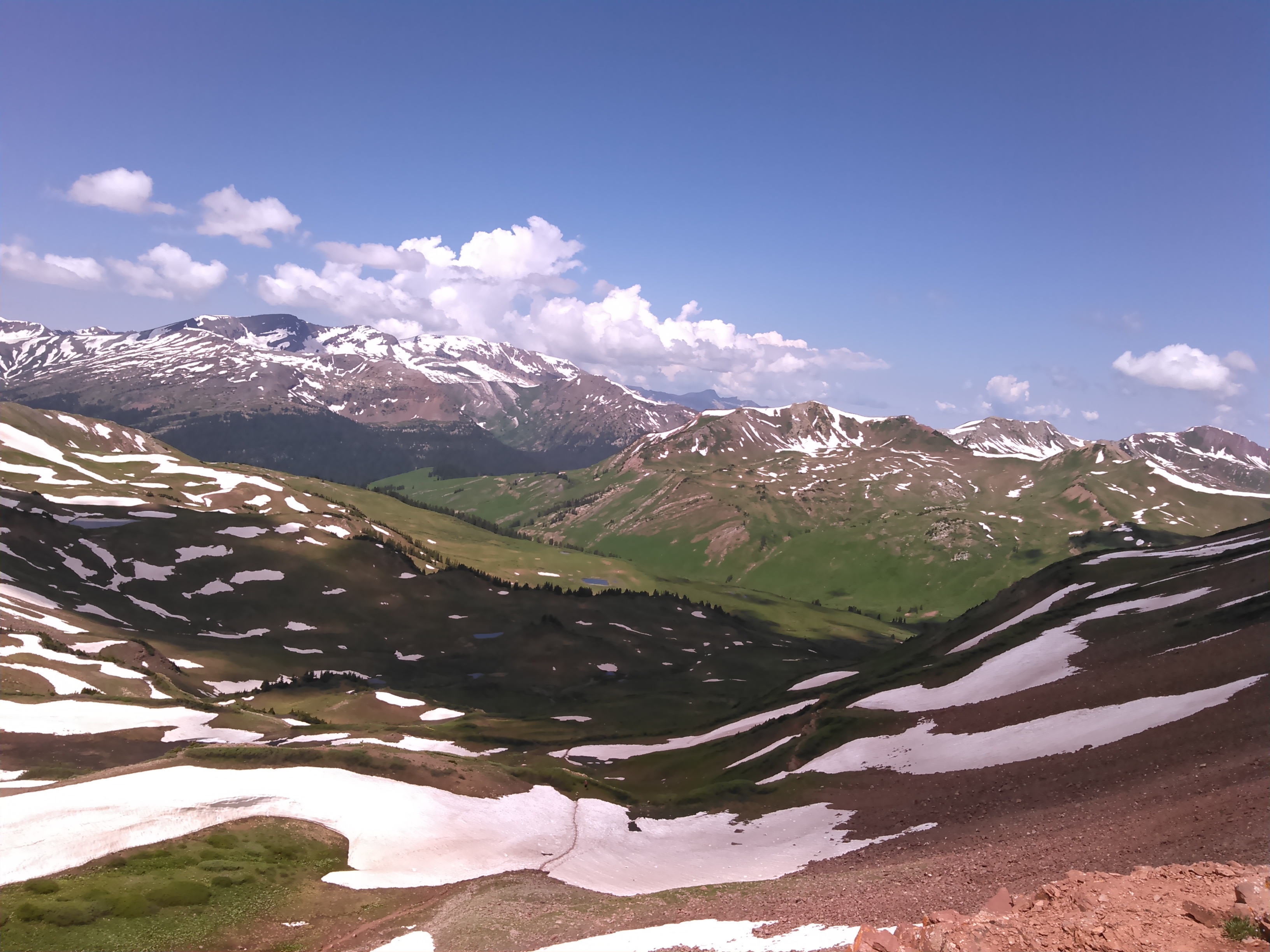
The Four Pass Loop circles around the Maroon Bells, a couple 14ers in Colorado that are some of the most photographed mountains in the United States. Hence when I looked up this trail, it was easy to decide we should go there. We went a bit early season as my conference was the first week in July. Thus we encountered quite a bit of snow and got a bit lucky that the snow had melted as much as it did before we arrived.
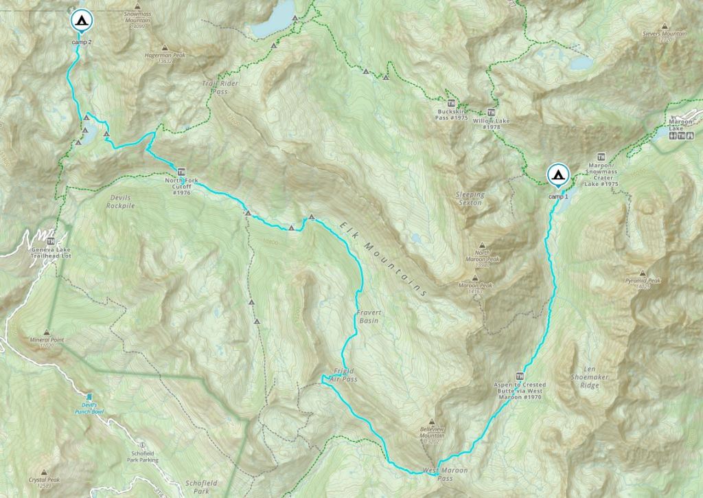
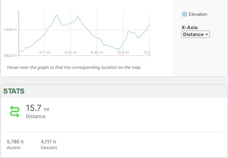
The Four Pass Loop is named for a 28ish mile hike that traverses four passes all above 12,000 feet- West Maroon, Frigid Air, Trail Rider, and Buckskin- if going clockwise direction, with nearly 8,000 feet of elevation gain and loss.
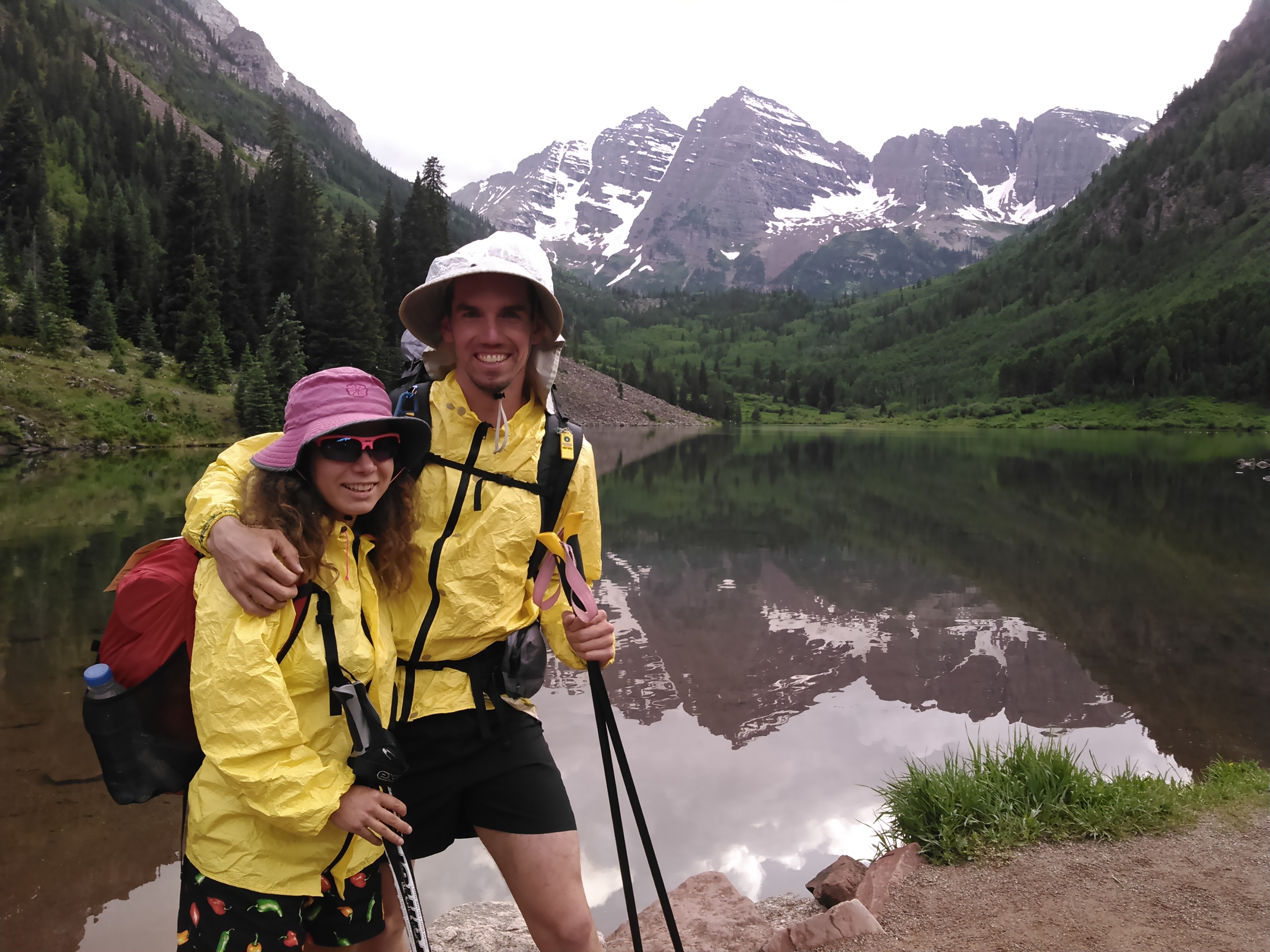
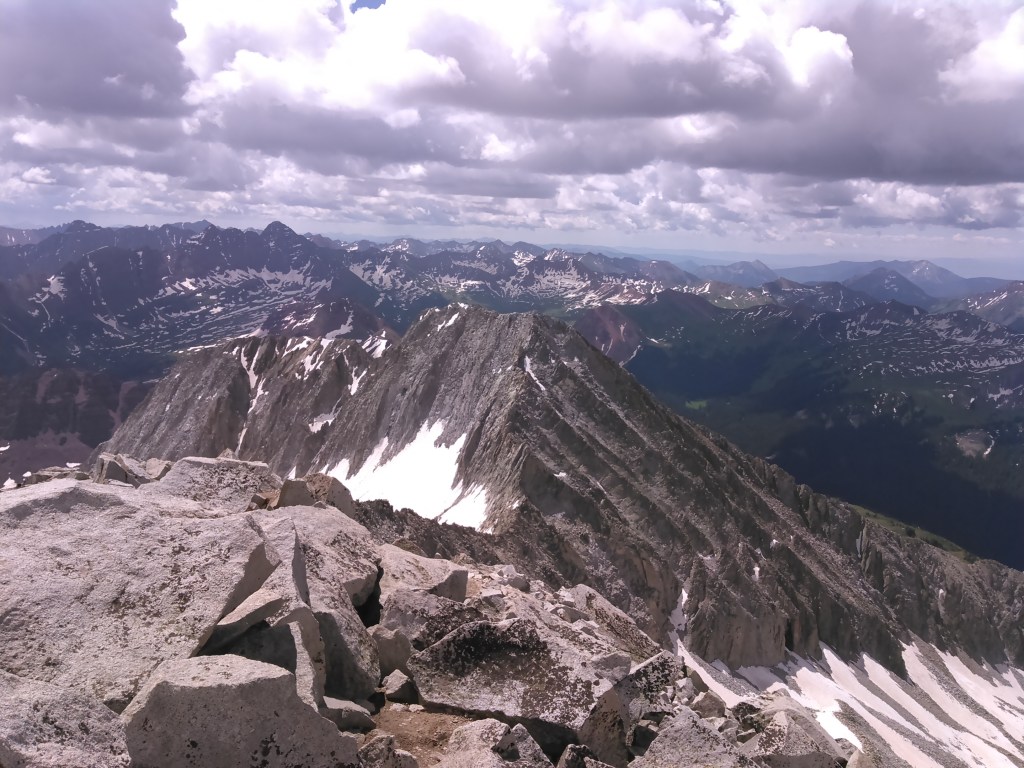
Erik had aspirations of climbing one of the Maroon Bells but they are incredibly steep with crumbling rock and are some of the most difficult 14ers in the state so after much discussion we planned to go up and over Snowmass Mountain instead of taking the lower Trail Rider Pass.
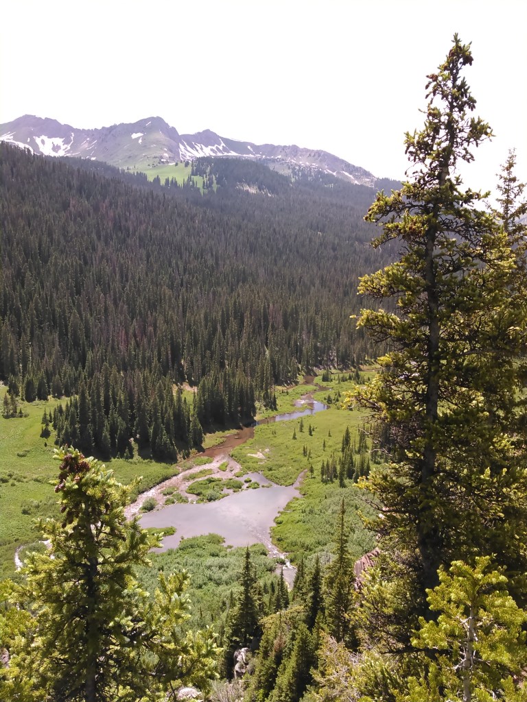
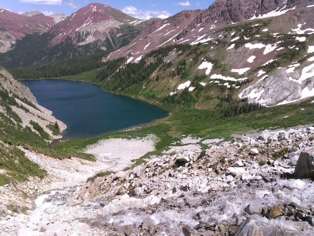
Since we had already hiked Mount Elbert that day, we backpacked only as far as Crater Lake. The next morning we were up early to begin our hiking trip, passing by Crater Lake.
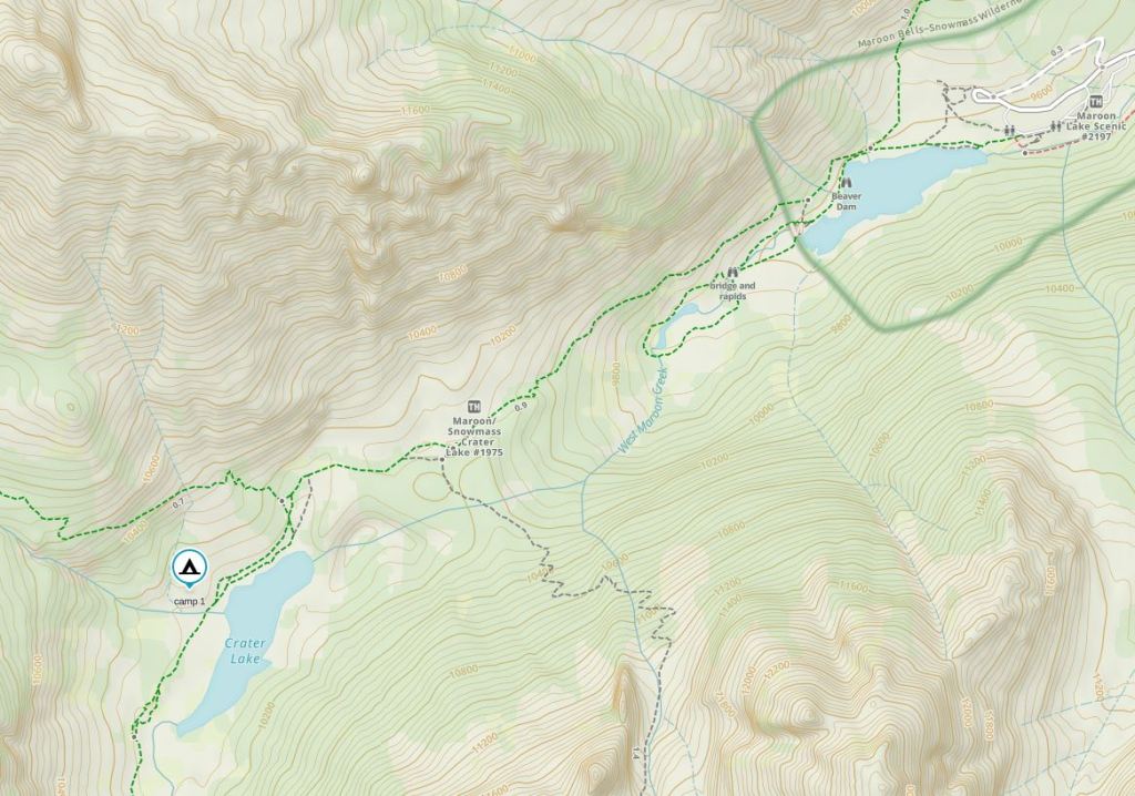

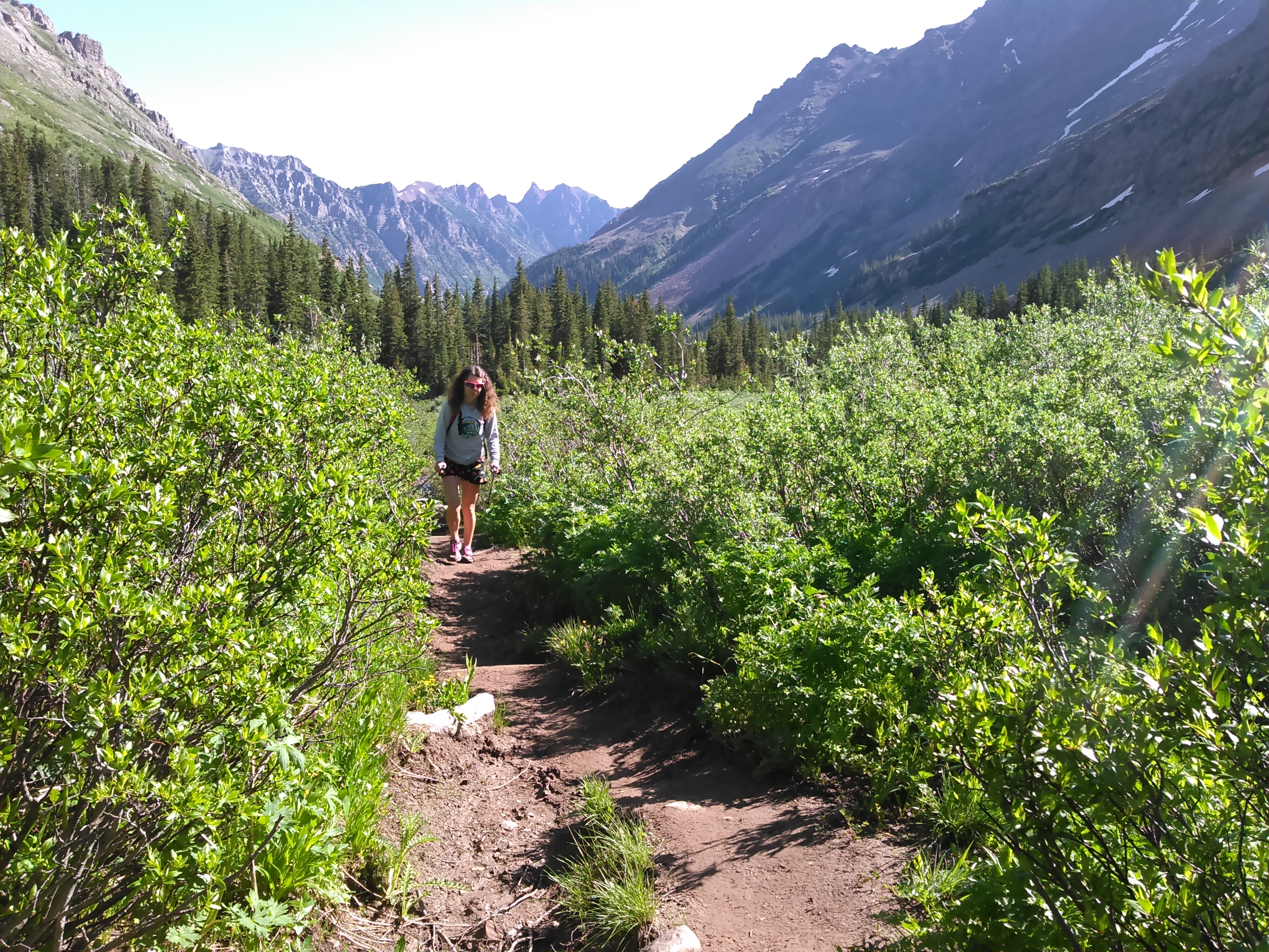
We slowly gained elevation after Crater Lake as we hiked along West Maroon Creek.
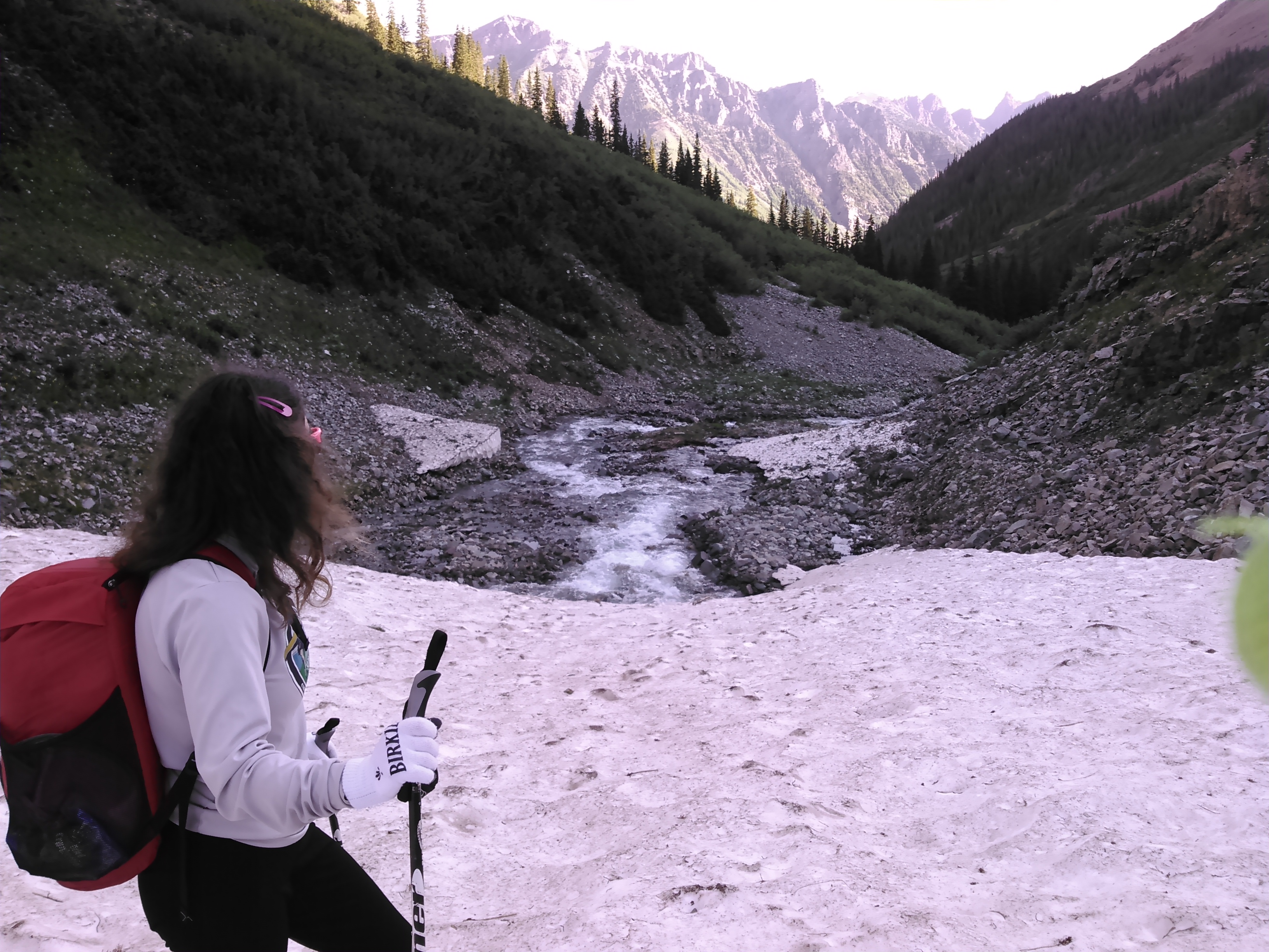
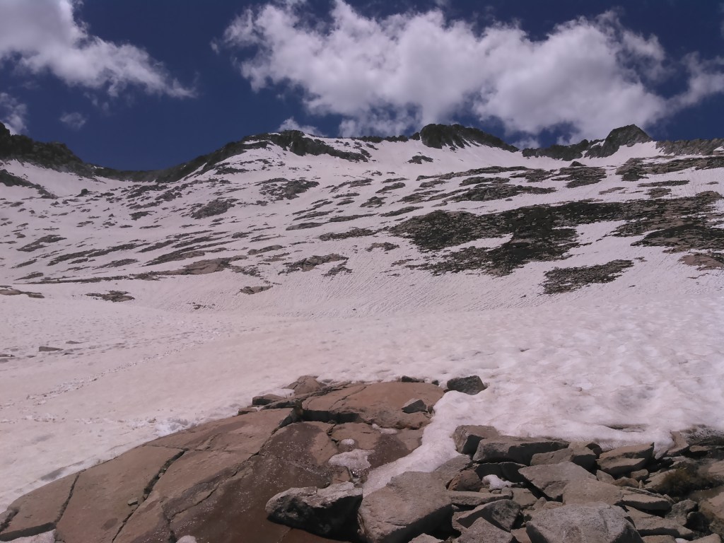
Eventually we left the creek and started climbing to West Maroon Pass. This meant leaving the dense vegetation behind. It also meant more snow. Some hikers told us there had been significant snow melt in the past 24 hours and they had tried the pass the day before but given up after watching a woman slip out and slide a long ways. We only encountered brief patches of snow on a couple of the switchbacks that had good level footing.
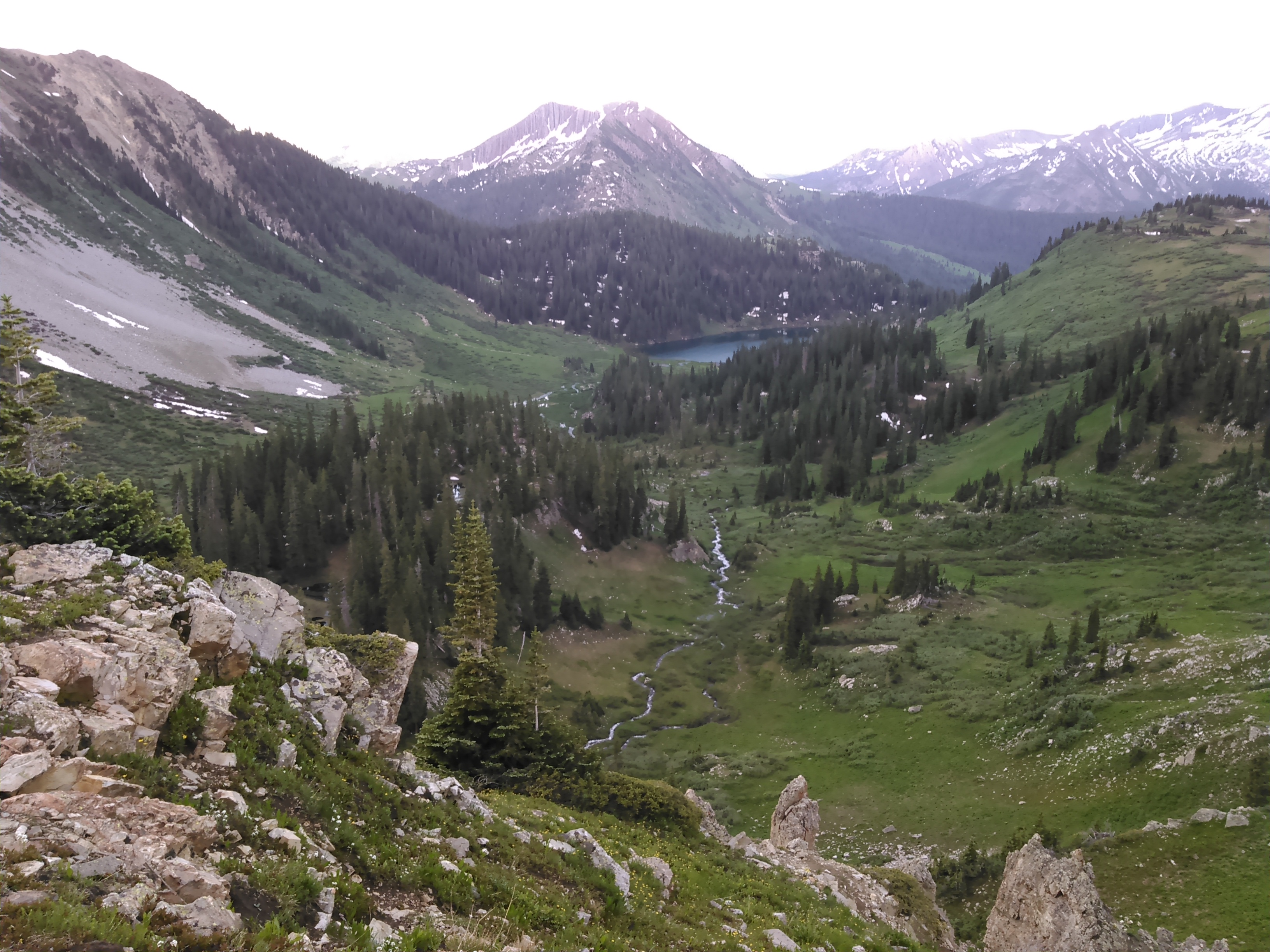
Traditionally the Four Pass Loop is hiked over three days with West Maroon and Frigid Air Passes done the same day as there is only a couple miles between them without much elevation change. Thus as the trail curved back north after West Maroon Pass we quickly saw Frigid Air Pass in the distance. We dropped less than 1,000 feet before hiking back up less than that to Frigid Air Pass.
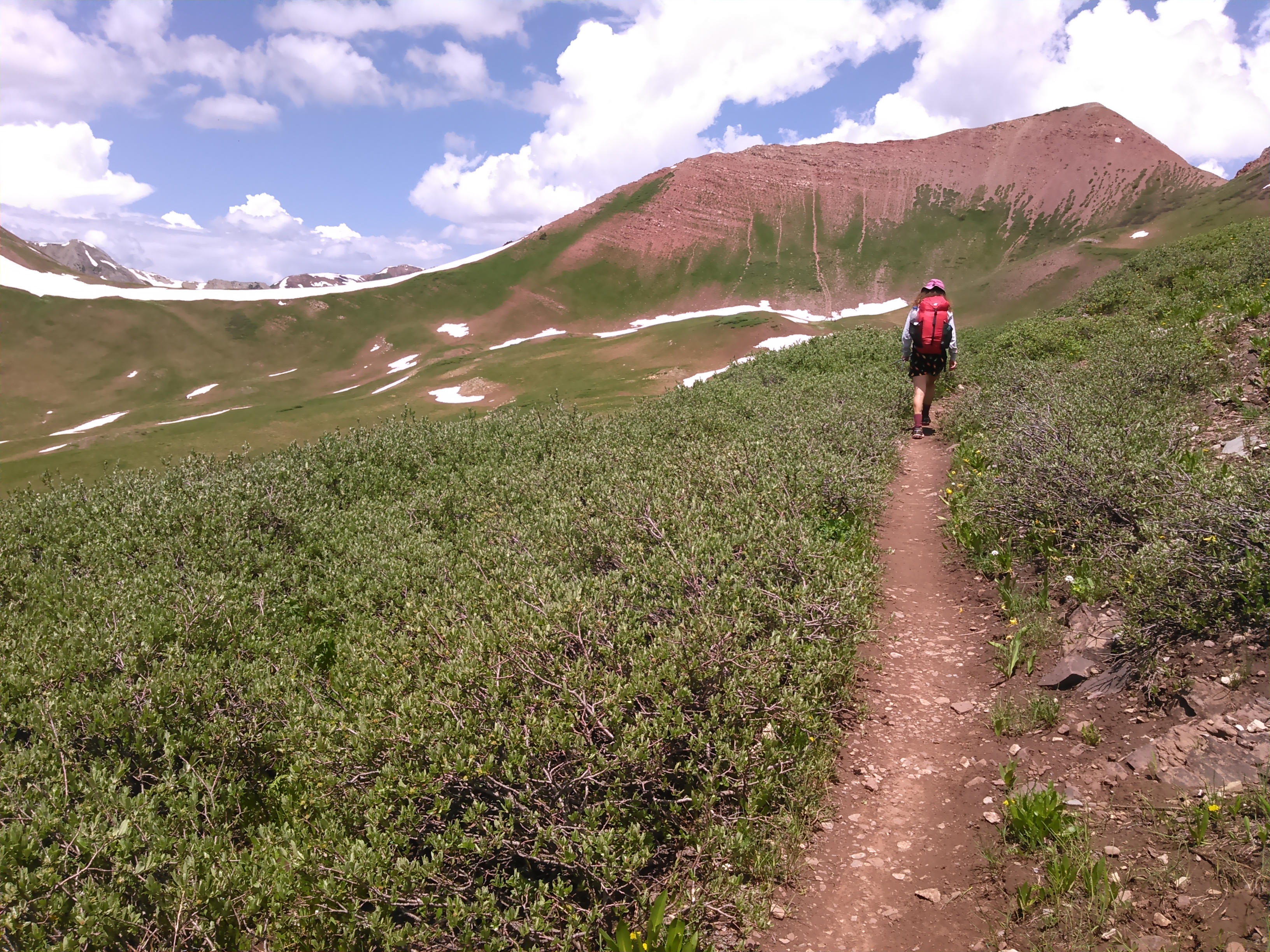

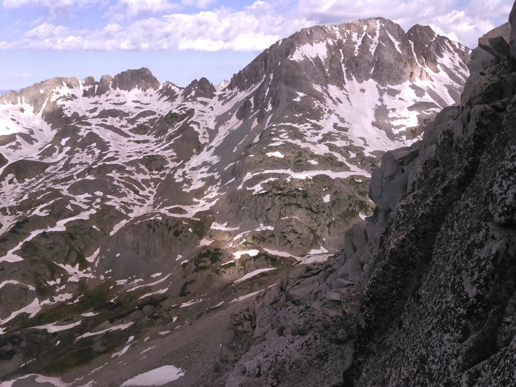
After Frigid Air Pass we still had some serious miles to walk to get to the base of Snowmass Mountain on the west side. Sure we took some photos but mostly we kept up a swift pace.


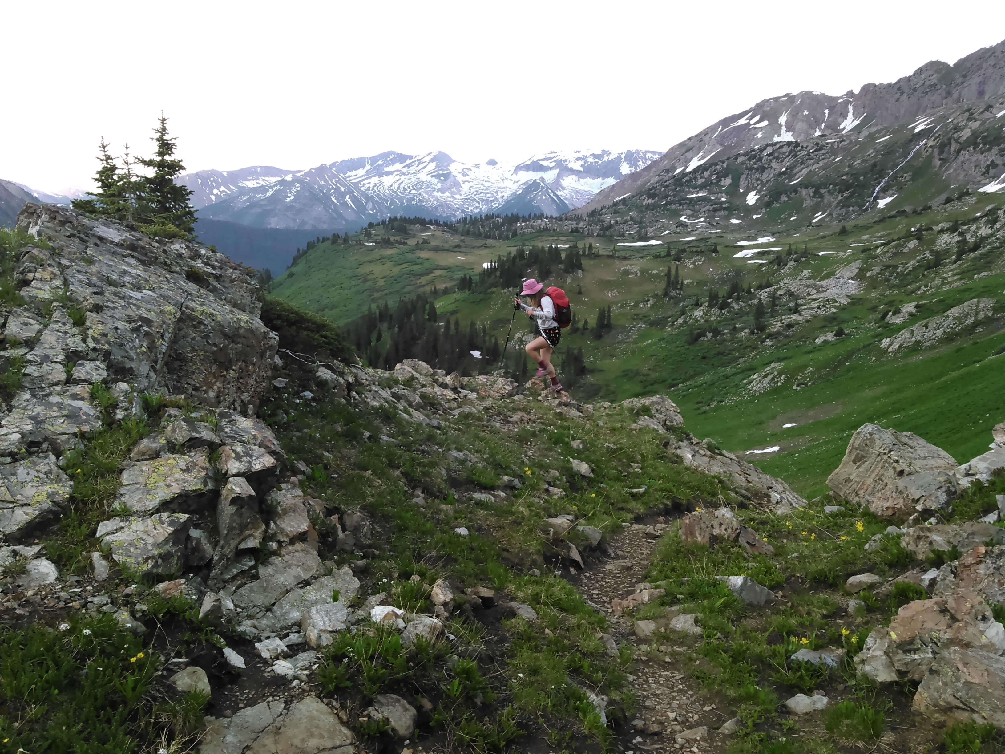

We spent much of the evening looking at the formidable west face of Snowmass. Online reports said if we stuck to the ridges it should be class 3 all the way and no harder than Angel’s Landing. After studying the mountain, we decided to approach in the center and then skirt left, towards the last big north ridge after crossing the big patch of snow. I tried to not worry too much and slept well.

The hiking from camp was relatively easy- we were able to largely stay on grass and small rock until we hit the slope. Then it was talus that was easy to walk on. The snow was soft enough it didn’t pose much sliding hazard. We made it through the cliff band on what was largely stable rock with some vegetation and then above there it was all boulders.

The reports also said to keep looking up to avoid any cliffs. We never saw any cliffs. Class 3 usually means boulders and even though some people can technically rock hop, I largely used my hands and arm strength to climb the mountain.
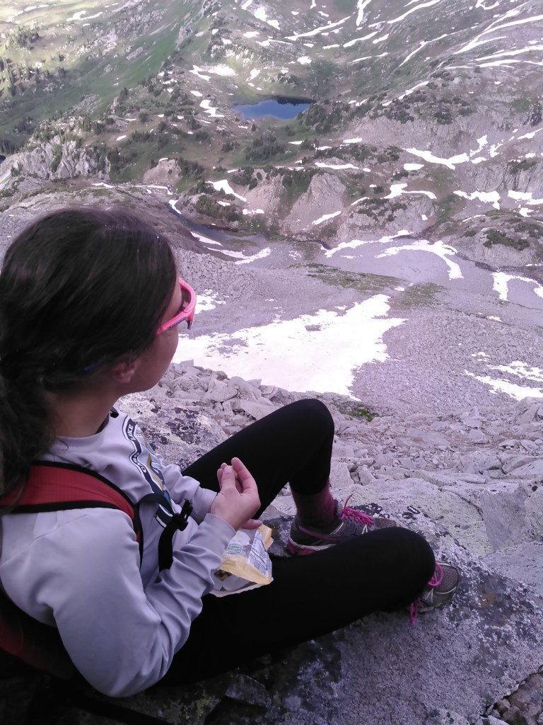
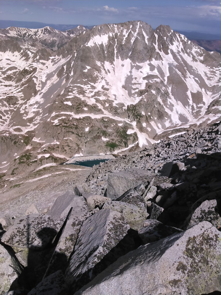
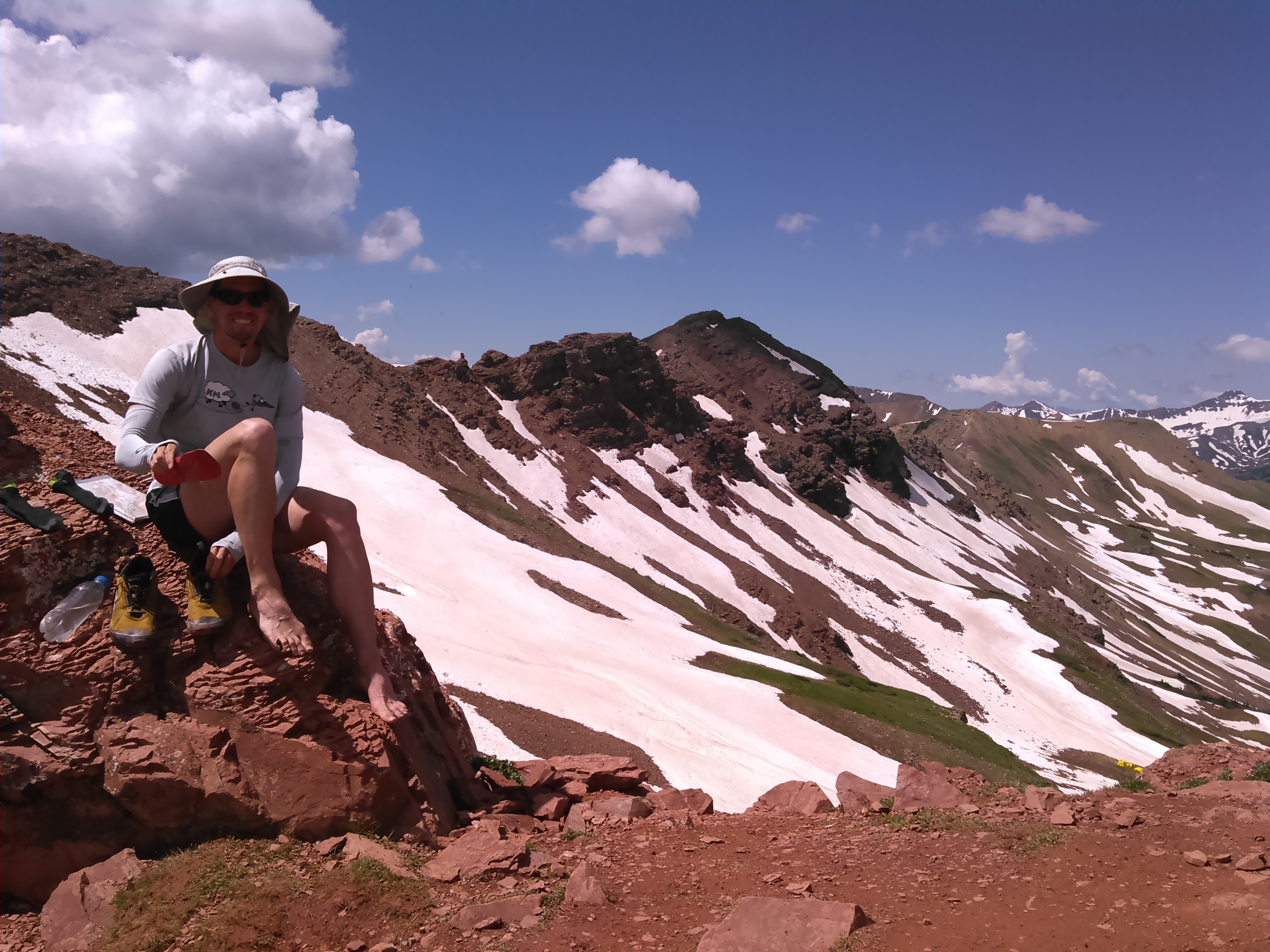
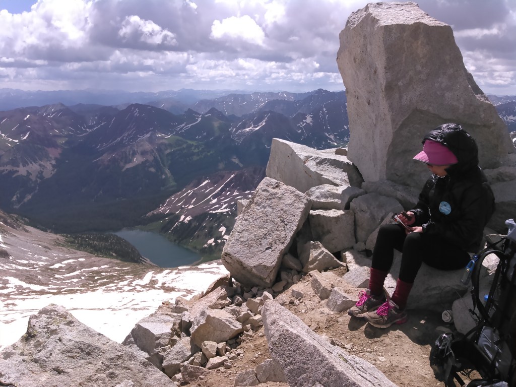
It didn’t take us too long to climb Snowmass and before noon we were on the summit. I was glad we weren’t headed back down the way we came up as I’m not very good at descending boulder fields. Since it was nice and sunny we spent some time on the summit.


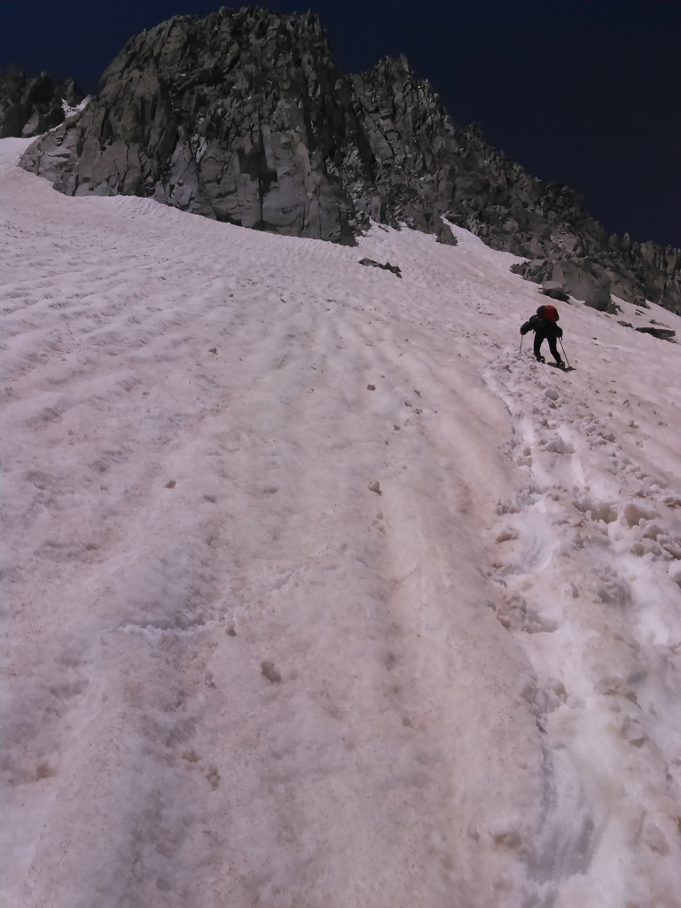
Our next challenge was descending Snowmass to the east. First we began climbing down on the ridge to the south until we met snow level (there was a cliff directly below the summit). Once we found the snow it looked pretty scary to get on since it was melting away from the rock. We put on our Yaktrax and I followed Erik as he kicked in steps. While I’m from Minnesota and used to snow, our slopes aren’t terribly steep.
It turns out I’m an impatient person (OK, I already knew this) and wasn’t paying super good focus at kicking in steps and all of a sudden I slid out and started sliding down the snow on my butt towards a rock pile. I tried not to panic as I rolled over onto my stomach to try to self arrest by digging in my poles as Erik had prepped me to do. This proved futile as the snow was too soft so I went to my next plan. I rolled back over onto my back and figured I should at least try to move laterally to avoid hitting the rocks below. As I did this by pushing my legs and kind of swimming, snow began to pile in my crotch and as the slope eased ever so slightly I came to a stop.
Erik quickly got down to me while I caught my breath. Then we continued on, Erik glissading while I carefully kicked in steps. This was some of my first off trail experience in the mountains and I was woefully under prepared but I like gaining experience on the fly best.

As the terrain got flatter there were more exposed rocks. When we neared the rocks we would post-hole. This got kind of frustrating and I was afraid of breaking my ankle every time I post-holed. Thus when we got the opportunity, we stuck to the rocks.
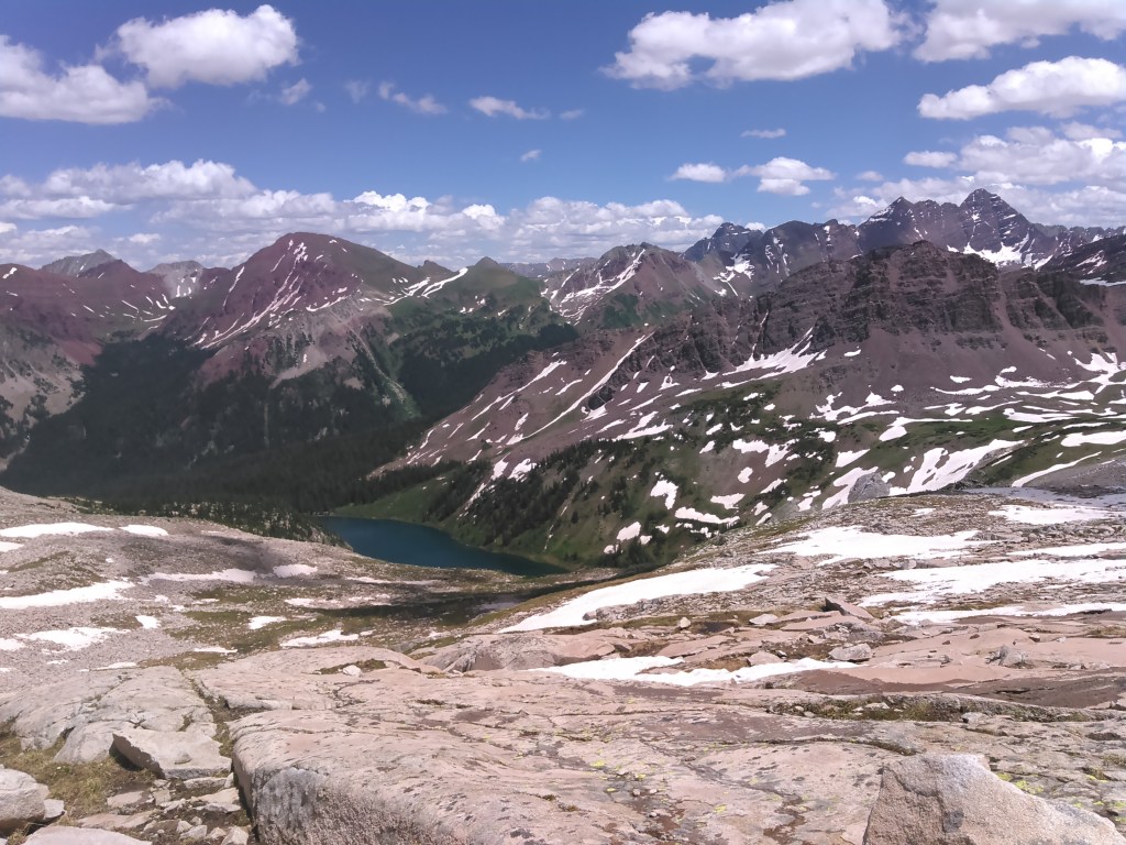

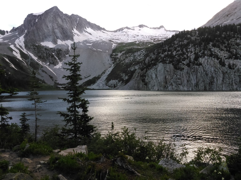
The trail along the south side of Snowmass Lake got better and better as we got closer to the foot of the lake. We made good time and got to the camping area by mid-afternoon. There were a handful of others campers around. Erik and I picked a tent location and set up our tent far away from the others. We walked around the campsite and watched some fly fishermen, found our trail for the next morning, and made dinner by the lake. All the while other backcountry campers slowly filed in and by the time we went to bed there were at least twenty tents within a 50 meter radius of ours. We’d never seen the backcountry so packed.
After making it down Snowmass I was quite obsessed with looking at that mountain and found I couldn’t stare at it enough. So the next morning we ate breakfast down by the lake so I could get one last good look. We could say I was quite impressed with myself. Ridiculously proud.

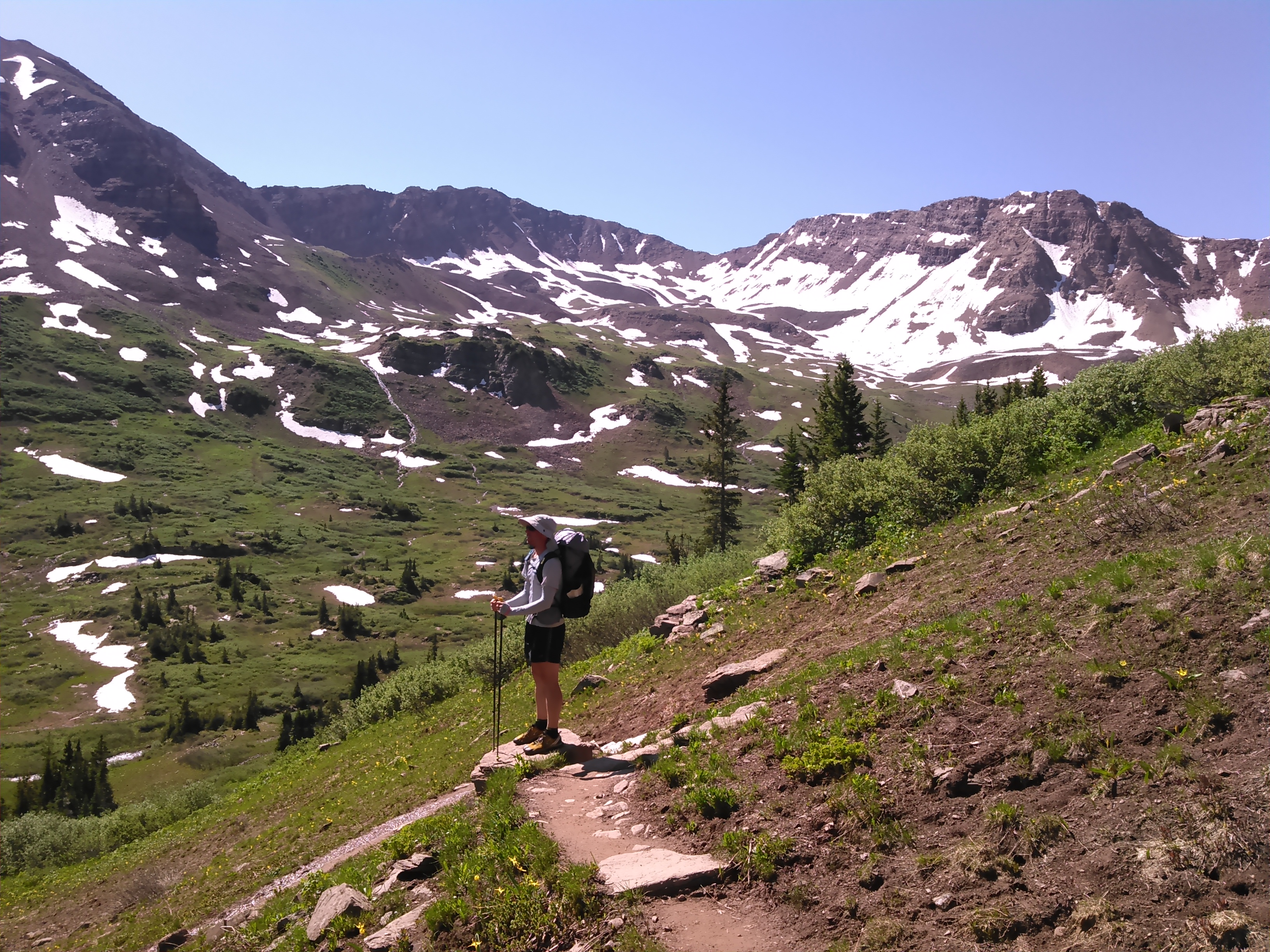
Then we headed out for our last few hours in the wilderness, up and over Buckskin Pass, and then back down to the trailhead at Maroon Lake.

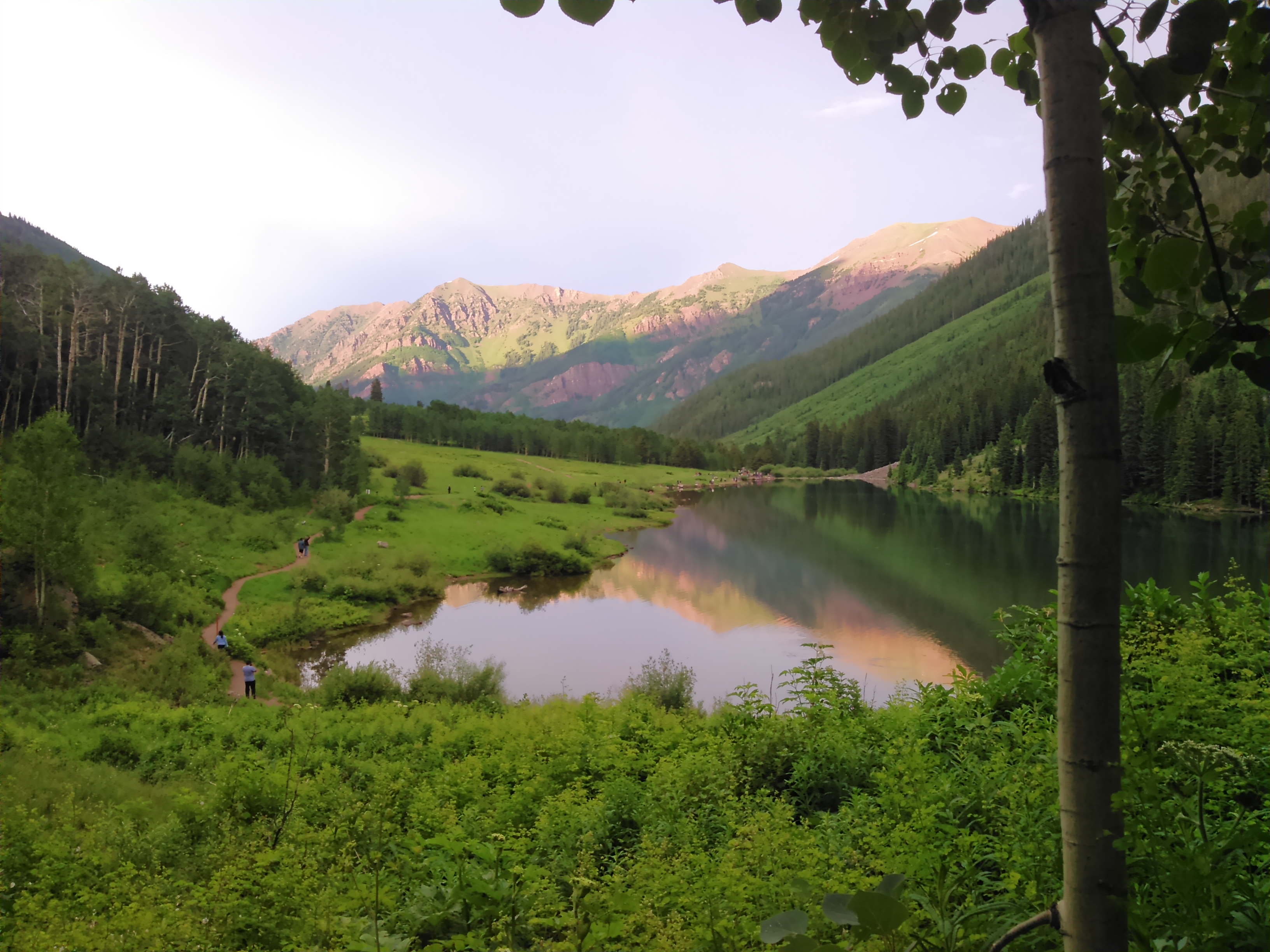
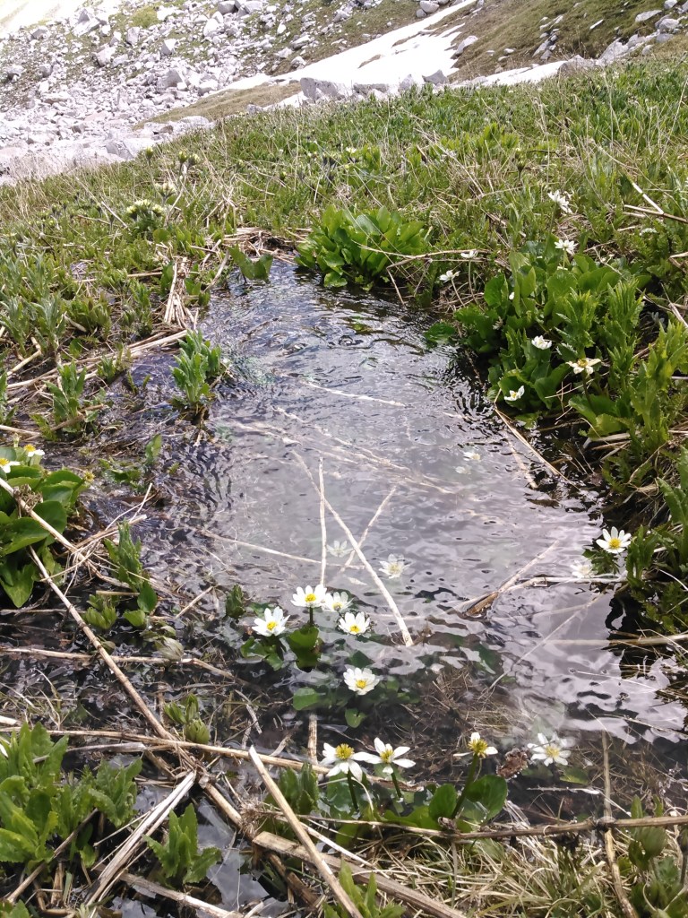
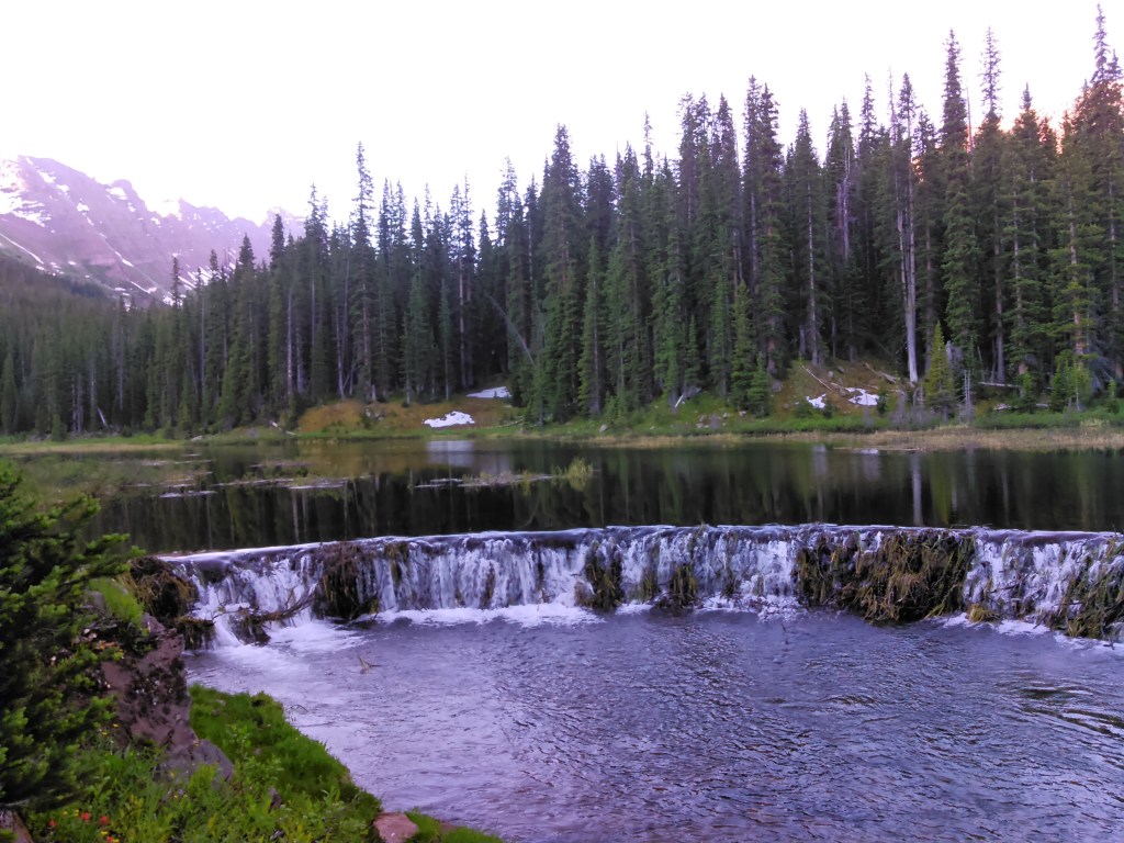
We were hiking before most of our fellow backcountry campers made it out of their tents. Near the meadow section we passed the most impressive beaver dam I’ve every seen. It was even rounded. What an engineering feat!
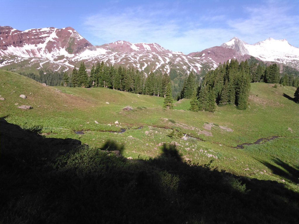
After the meadow area we started gaining elevation and had views back to Snowmass.
At Buckskin Pass we had a snack but I started feeling not so good. Kinda had some brain fog. We didn’t even take any photos on the pass. I kept feeling worse as we descended, eventually getting nauseous. Altitude sickness? I’d never had it before and doubted it. Eventually I realized it was a migraine. I stumbled into the trailhead and was glad to let Erik drive to my conference by Keystone.

Of the high state high points, Mount Elbert is among the easiest- comparable to New Mexico’s Wheeler Peak and Arizona’s Mount Humphrey’s. Easy driving, no glaciers, a really good trail, and not much elevation gain. And there’s other big mountains nearby. It’s almost like cheating!
The Four Pass Loop is certainly stunning and can be made more challenging by bagging some peaks, but after our experience at Snowmass Lake with throngs of people, I worry about its popularity. While permits still aren’t mandatory, registration at trailheads and bear resistant canisters are required. It’s also highly recommended to carry and pack out human waste bags. Check out the Maroon Bells – Snowmass Wilderness website for changing info.
I don’t think I’d go back. There’s simply too many other places to go and I want to minimize my impact on this incredibly beautiful and special wilderness.

A most enjoyable read as always.
LikeLike
Thanks!
LikeLike