This would be the first of several combined work conference and state high point trips. Given that Arizona’s state high point, Humphreys Peak at 12,637 feet only takes a few hours, we added on hiking in the Grand Canyon. I wanted to go rim-to-rim in one day but Erik wanted to take two days to get across, staying at one of the campgrounds along the way. We couldn’t get a backcountry permit though for any of the campgrounds, so I got my wish. Erik convinced me that we should layover a day on the North Rim and I was sure glad we did.
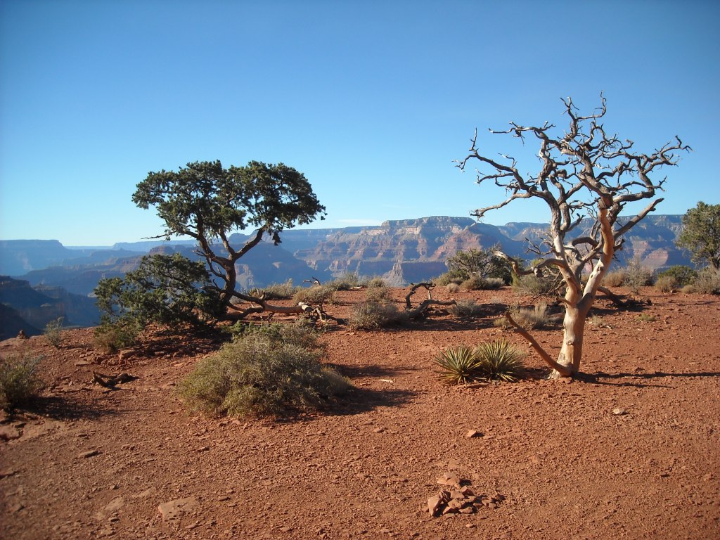
We flew from Minneapolis to Phoenix on a Friday evening and spent the night in a hotel. After breakfast, we made our way north to the South Rim of the Grand Canyon. This was my first time in Arizona and the lack of trees was definitely different from Minnesota.
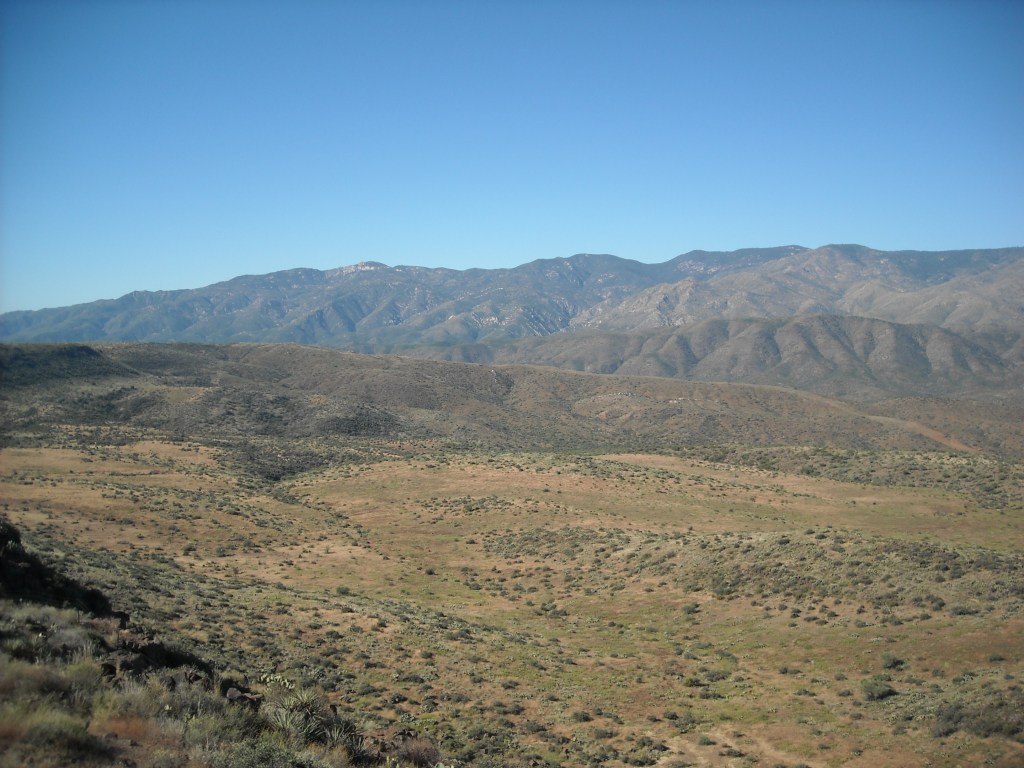
We flew into Phoenix, rented a car, and drove up to the Grand Canyon. I imagined we’d be driving through a flat desert- instead the freeway went over mountain passes with magnificent views!
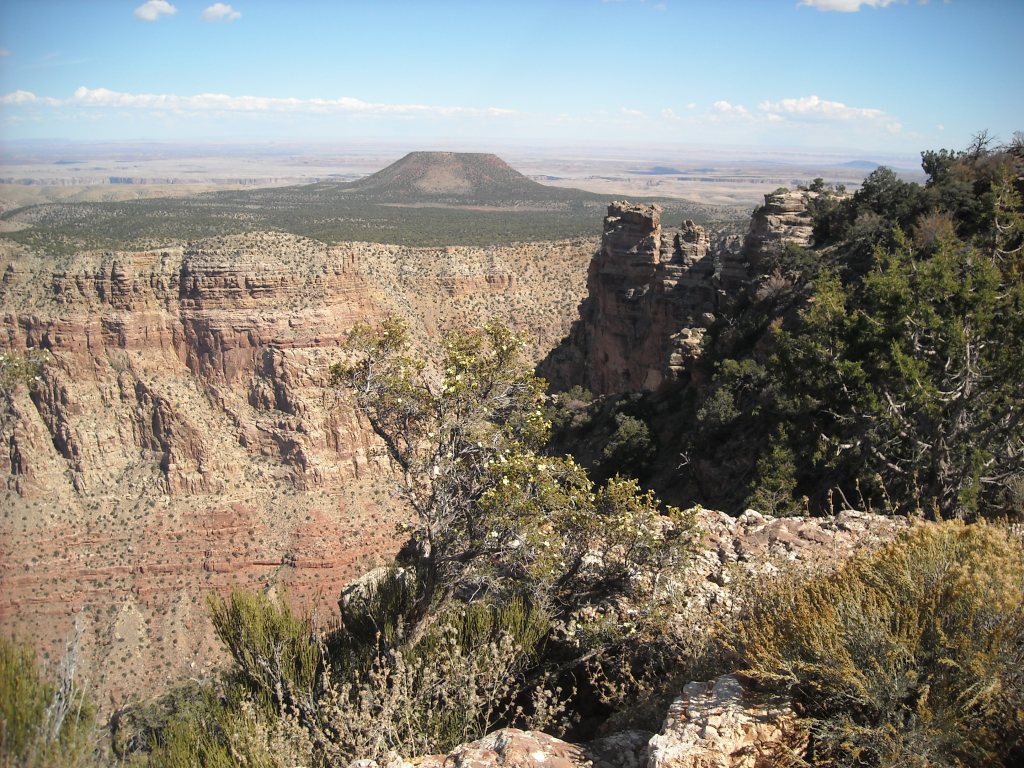
We entered Grand Canyon National Park from the southeast on Hwy 64. Our first stop was the Desert View Watchtower. Click here for interactive map.
My first view of the Grand Canyon from the Desert View Watchtower looking east towards the Little Colorado River.Looking west towards the main canyon from the Desert View Watchtower.
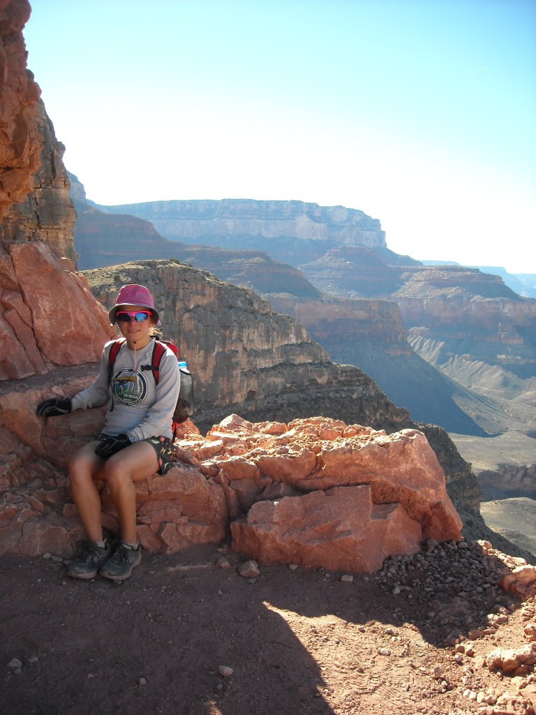
Then we made our way west along Desert View Drive to the main village at the South Entrance. After taking more photos with all the tourists at Grandview Point, we headed for Mather Campground where we spent our first cold night.
Looking west from Grandview Point. We can almost see the river from here!Looking across to the North Rim.
10/12/14: South-to-North Rim-to-Rim Grand Canyon Hike
Our GPS track from this day. Turns out the GPS doesn’t work super well near big canyon walls:) We dropped 4,500 feet, climbed 6,000 feet, and ended the day at about 25 miles after walking an additional mile to our campsite.
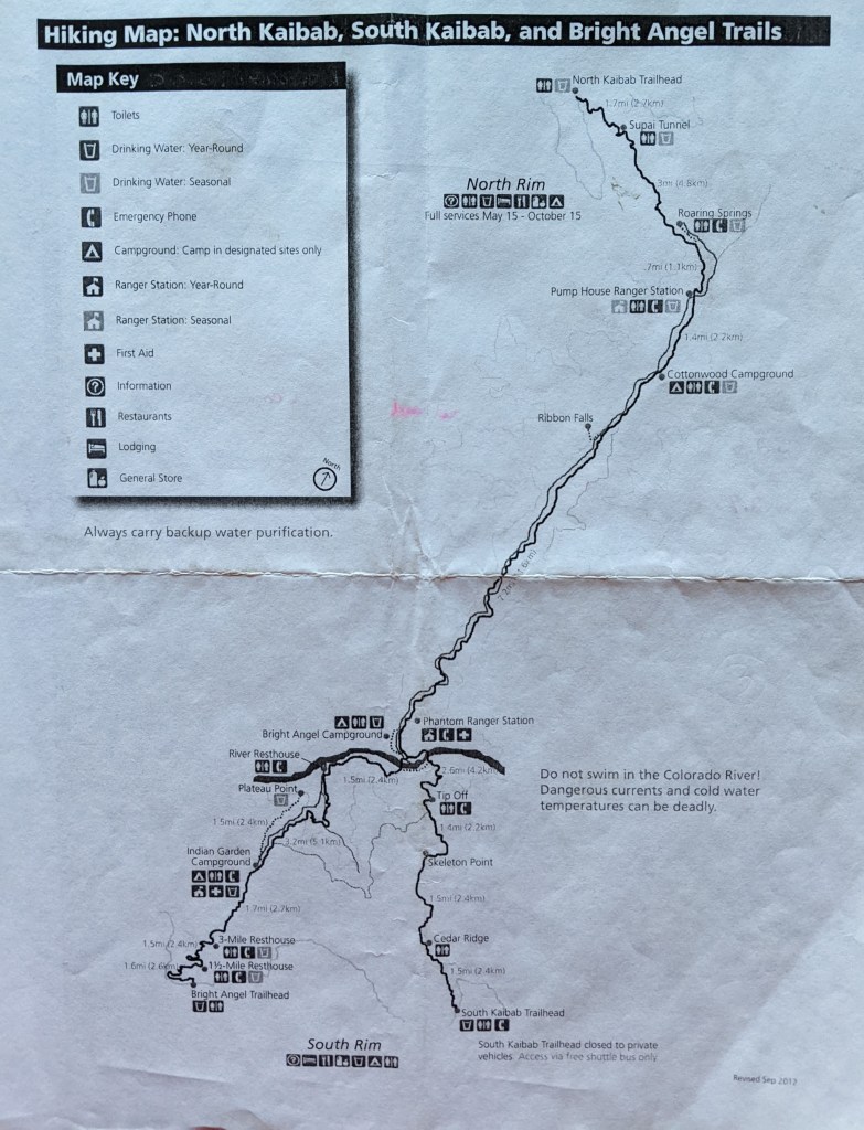
Better map that shows notable locations and relative distances of the rim-to-rim trails.
Here’s a great schematic showing some relative switchbacks and different layers of the Grand Canyon and waypoints. Our goofy stars and squares reference campgrounds we had tried to get in the permit process.
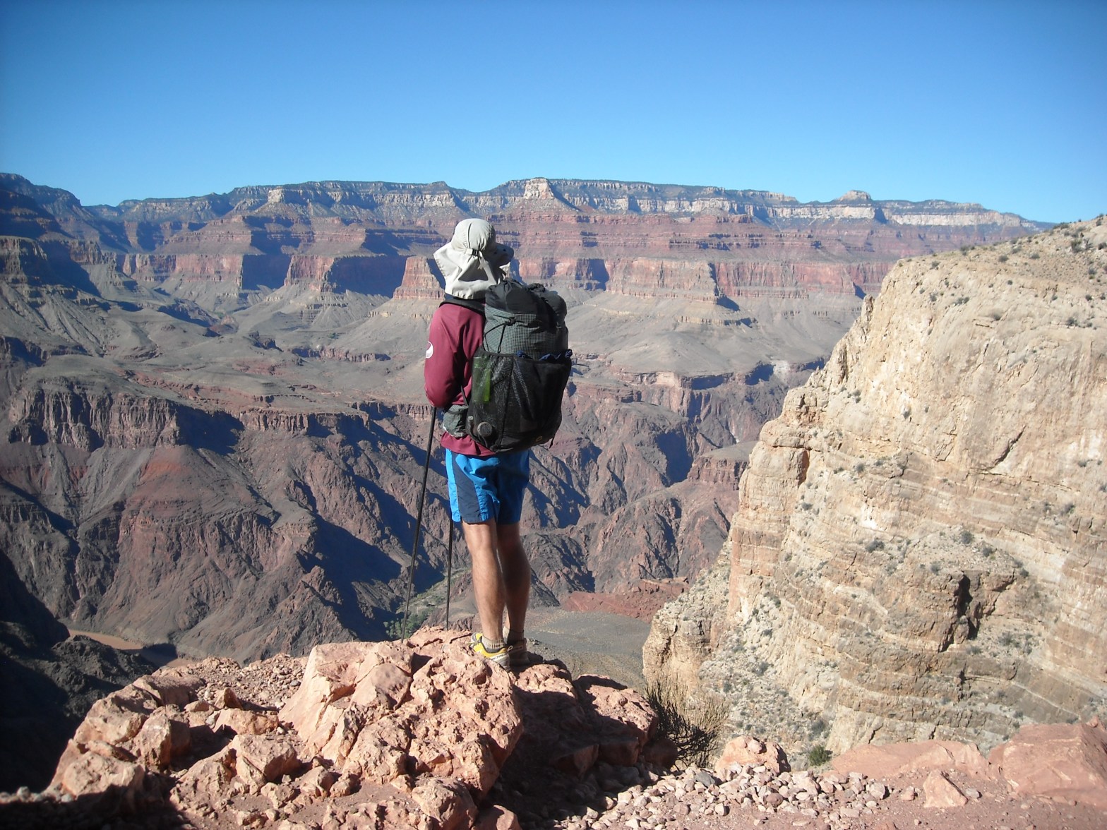
We got up really early, before dawn (it was mid-October) because we had a long ways to go, parked our car near the Bright Angel Trail, and descended into the canyon on that trail.
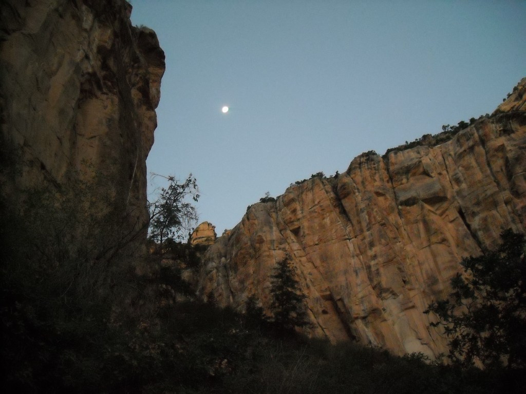
We began our South Rim to North Rim hike just before 6 am in the total darkness. Here’s the moon as we descended the upper layer of the canyon.
There were lots and lots of switchbacks at the beginning of the Bright Angel Trail.
Switchbacks on the start of the Bright Angel Trail from the Grand Canyon Village.
I appreciated that it soon started getting light and the canyon walls came into view. We were really going down a long ways.
By the time we took this photo, we’d already come down a ways but still had a long ways to go. We’re on the Bright Angel Trail here and that’s the same trail you can see down in the canyon.Here’s Three Mile Rest House (because it’s located 3 miles from the South Rim) where there is a shade shelter, water, and pit toilets.
Below the Three Mile Rest House the trail got much straighter.
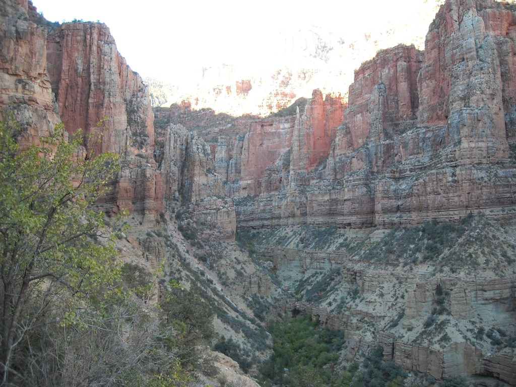
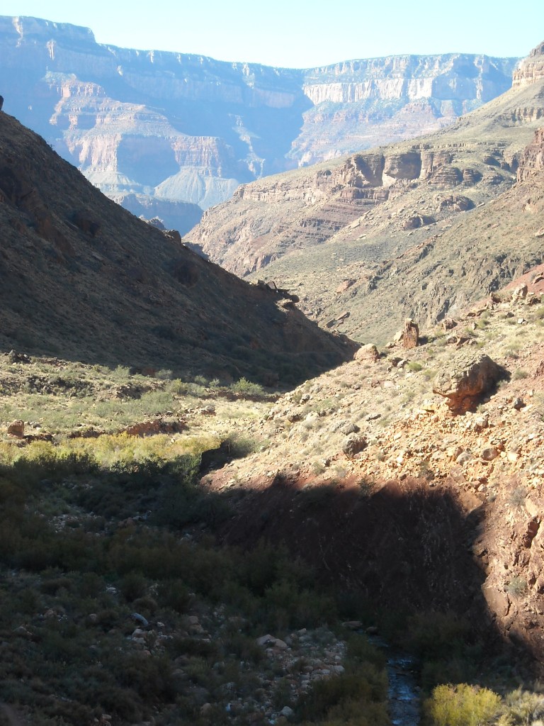
Getting into the trees. We were in the shade for almost the entirety of this trail but the opposite side of the canyon was getting good sunlight.Below the Indian Garden Campground we entered into a more intimate side canyon.Erik has we got down lower.
It was only 9.6 miles to the bridge we took across the Colorado River but given the vertical mile descent, our legs were already feeling it and at this point we had done less than half the mileage on the day and still had a vertical mile of climbing.
This was a nice spot at the Colorado River to have second breakfast and cool off the legs.
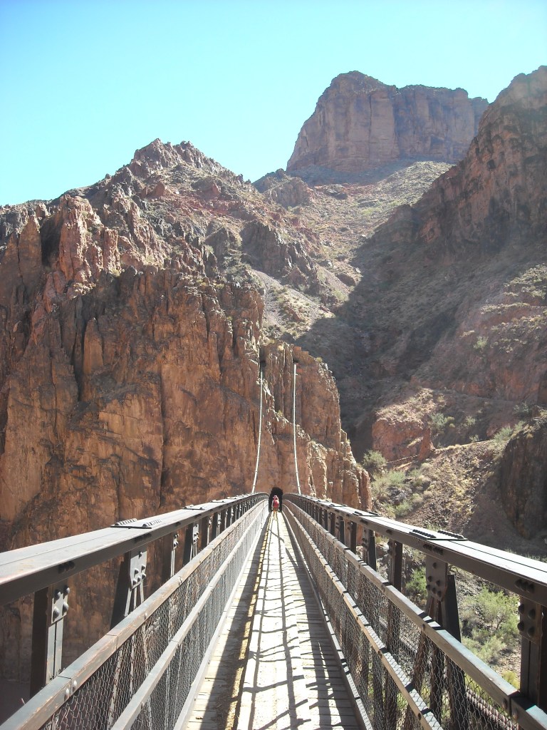
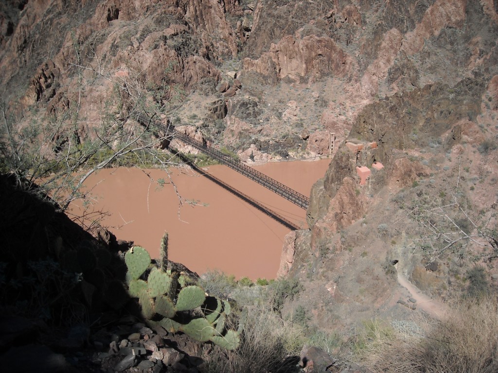
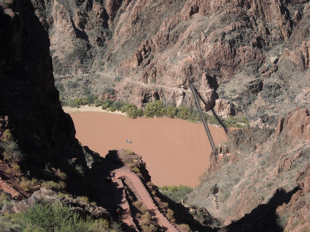
There are only two bridges across the Colorado River in Grand Canyon National Park and they are so close together you can see one from the other. They are both suspension bridges for hikers and livestock.
After crossing the Colorado River on the farther west bridge, we dawdled a bit at the Phantom Ranch area before starting our slow ascent of the North Rim. We filled up on water and noted that down in the canyon it was markedly warmer than up on top.
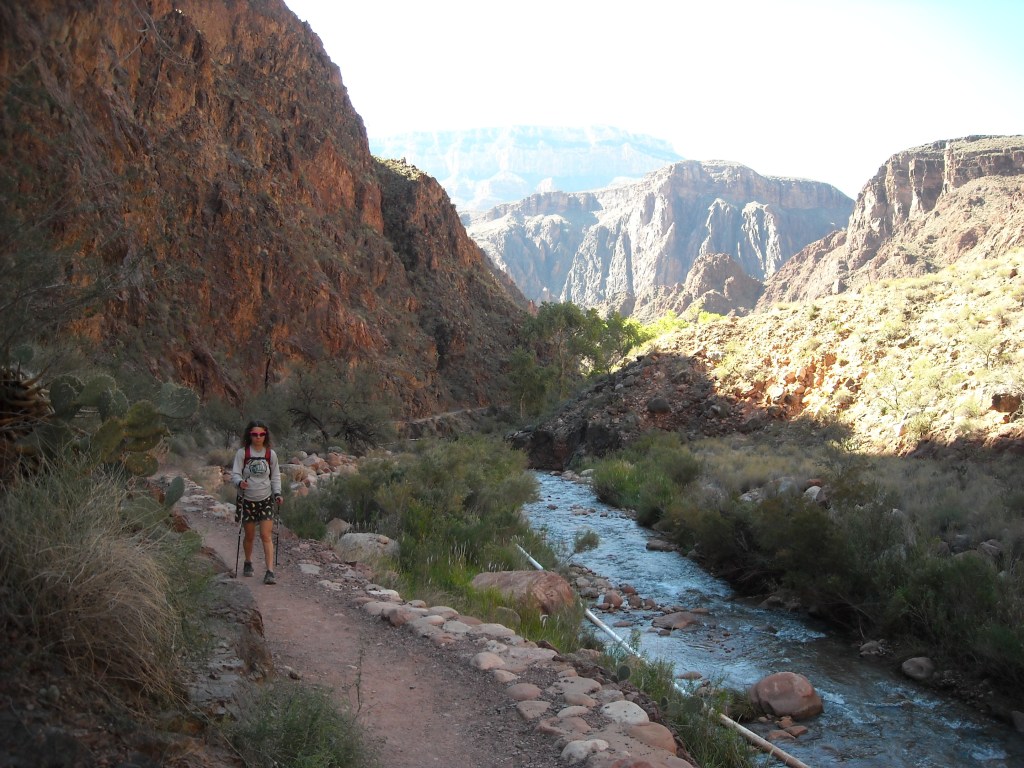
After crossing the Colorado River we passed by the Bright Angel Campground and then began hiking up Bright Angel Canyon next to Bright Angel Creek. You can see a pipe in the creek which they use to divert water down to irrigate the campground to provide more greenery and shade.Hiking out of the shade on the North Kaibab Trail. I was definitely taking in all the desert plants but also noting how high we still had to climb!
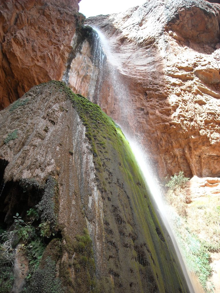
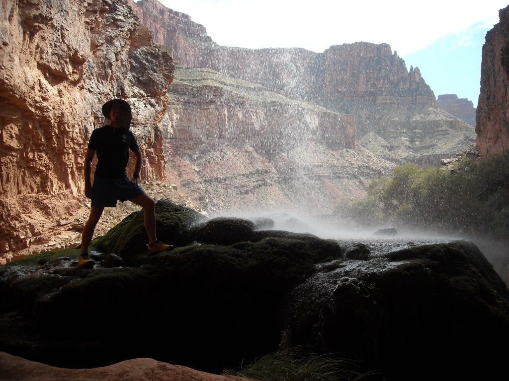
I got a bit annoyed with Erik in this section as he ambled along while I wanted to push. I preferred to take the hare approach, move faster and then take longer breaks, while he wanted to do the tortoise approach. At the detour to Ribbon Falls we debated taking the out-and-back trail and could see just enough of the unique waterfall to decide we should go for it.
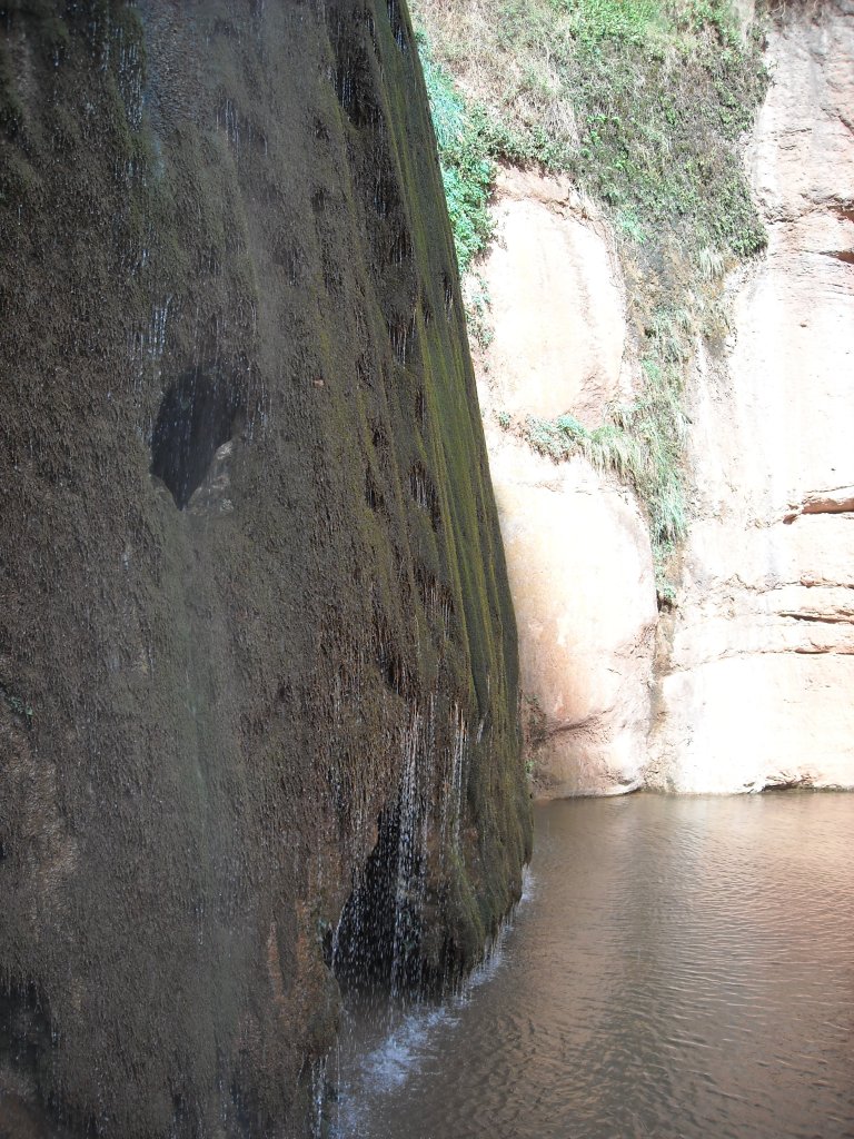
Behind this sign is Ribbon Falls.
The minerals in the water have caused the stalactite to form with moss growing on top.
So much green vegetation here!
This thing looked so weird.
We didn’t swim in the pool beneath the waterfall.
Erik wanted to get as close as he could to the spray. Me chilling behind the waterfall.
After our brief break at Ribbon Falls we kept a move on. It was hot and our feet were burning from the miles.
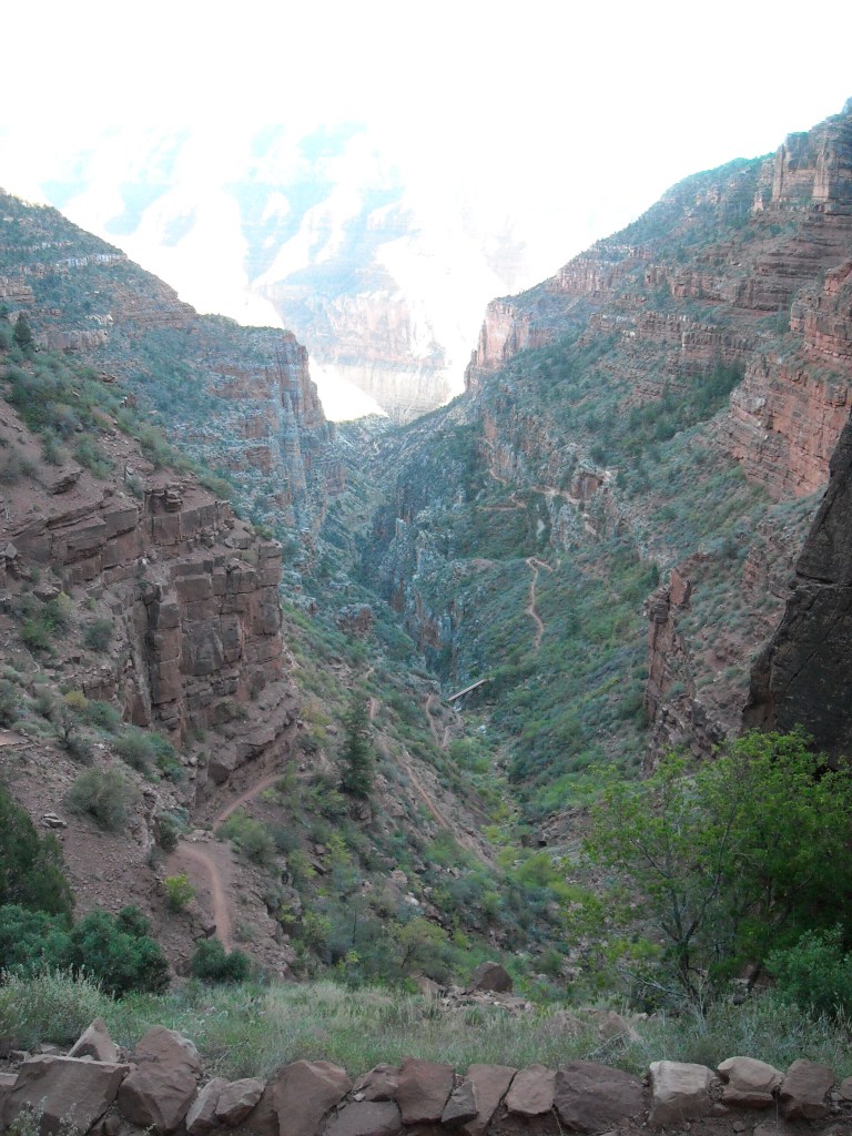
Looking back to the South Rim.And looking up to the top of the North Rim.
A close-up of Roaring Springs.
We hiked up the side trail to Roaring Springs (this didn’t exactly lead us to Roaring Springs- we just found some pit toilets and this pretty tree). Not exactly sure why we did this other than being afraid of missing something good but there was nothing to see here and so we just got some extra mileage instead.
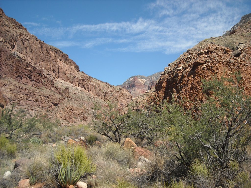
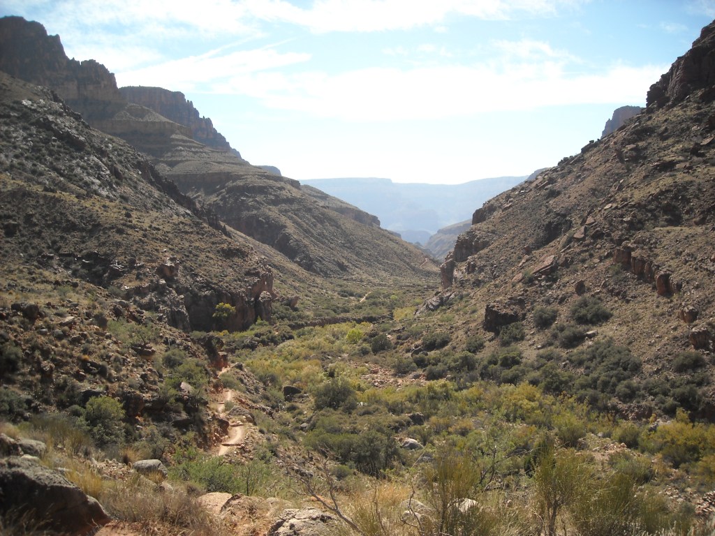
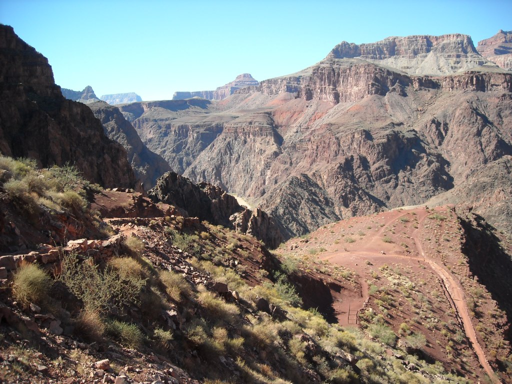
After a “flattish” seven miles, we turned to the west and began some serious climbing with more switchbacks.
The trail goes along this canyon wall somehow.Heading up this canyon looked impossible but the trail was so smooth with a gentle grade and no pointy rocks.
Looking down on the trail in Roaring Springs Canyon.
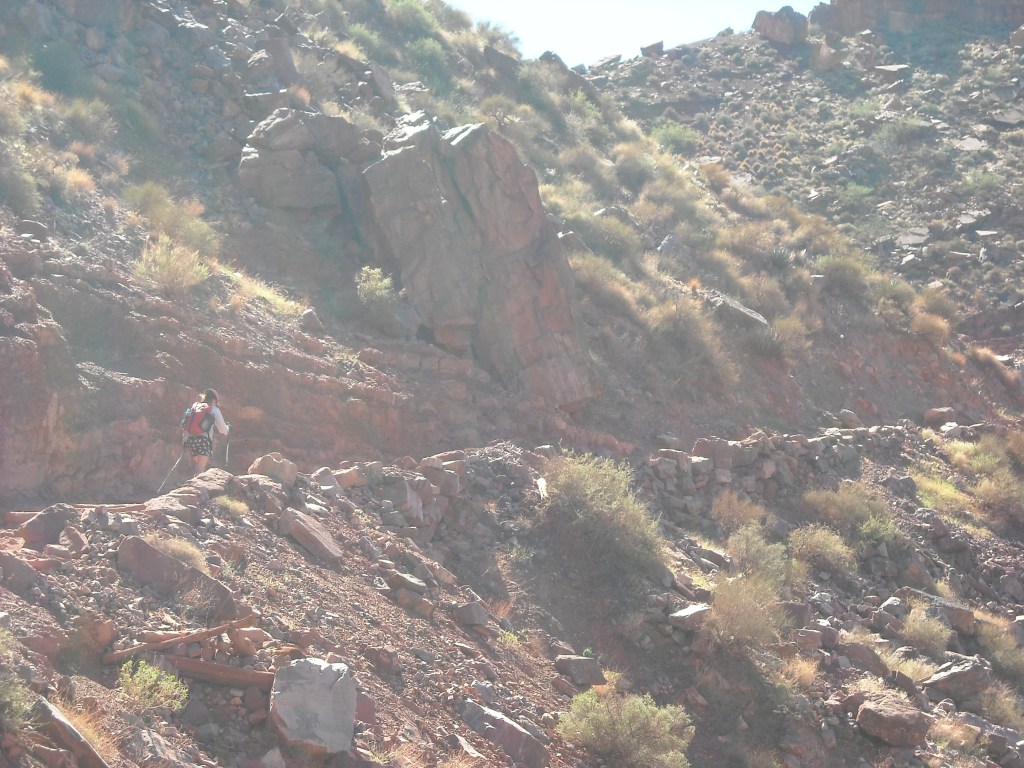
The trail crew had been busy at work moving big boulders to make a nice trail.
After we climbed up from the canyon, we hiked to the North Rim Campground, checked in, and set up our tent.
We got to our campsite on the North Rim with this amazing view at 6 PM- just enough time to enjoy the sunset. We hiked about 25 miles in 12 hours, up and down a vertical mile.Sunset over the North Rim.
Erik and I pack lightweight and had decided not to bring a stove. We tried something different and went for cold savory oatmeal. It was disgusting, barely palatable despite my hunger, and left me cold. Super cold. I got into the tent, inflated the sleeping pad, put on all my clothes, including my down jacket, and lay prone with our sleeping quilt over me. Despite this I couldn’t quite get warm. It was only into the 30s and I told myself there was no way I could get hypothermia.
Meanwhile Erik was walking around to stay warm and found the local village store warm and open. He convinced me to join him in there until they closed at 8 pm. It helped me get a bit warmer before we went to bed. Needless to say, we haven’t made a dinner of cold savory oatmeal since:)
10/13/14: Layover on the North Rim
We stayed in the tent under the quilt until the sun came out to warm us some. Then we got out and took in the views.
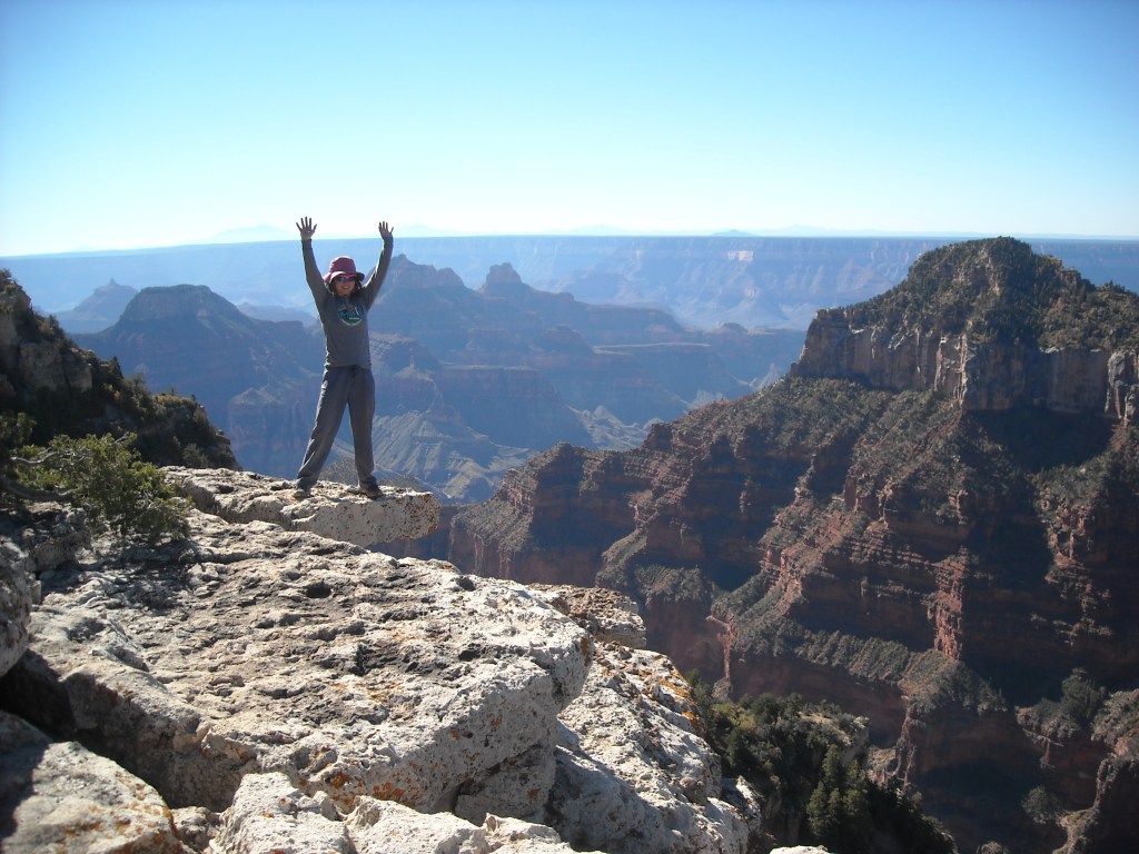
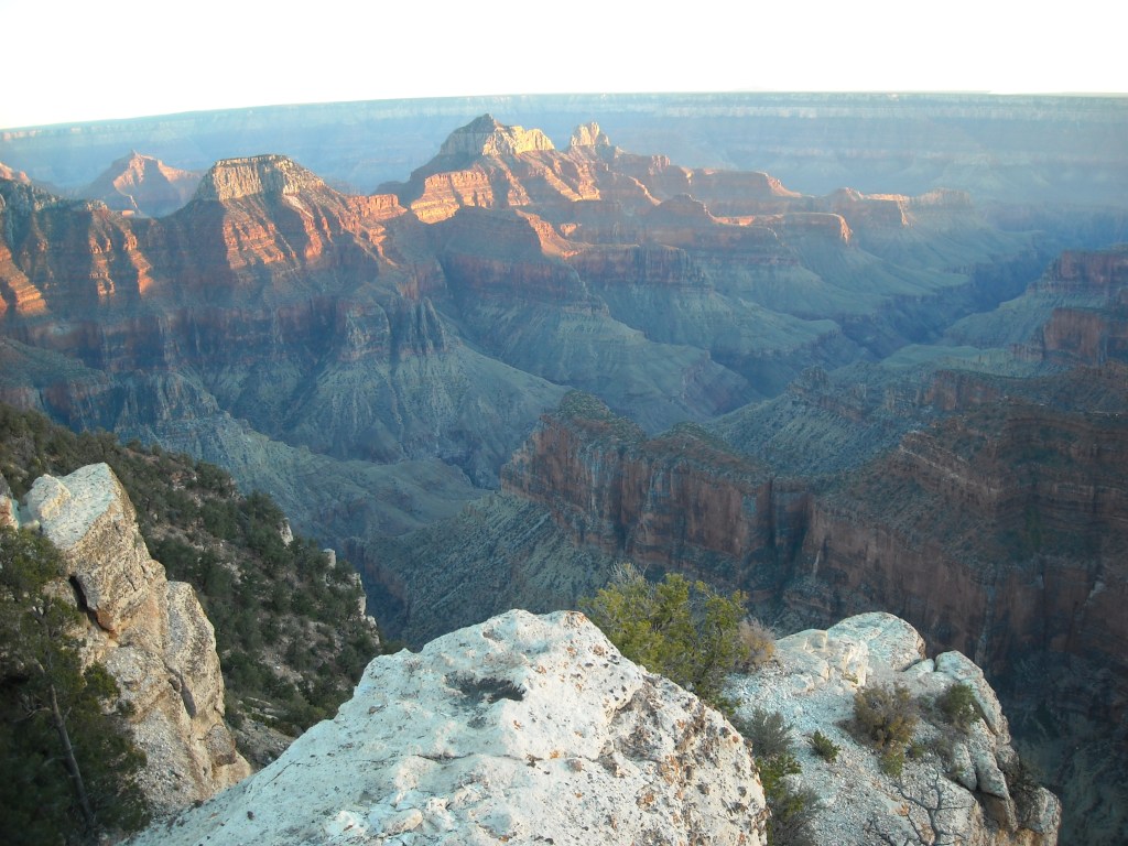
Layover day on the North Rim. We first explored the multiple views of Transept Canyon. This picture is looking towards the South Rim and the San Fransisco Peaks which includes Humphreys Peak that we planned to hike in two more days.On the edge [of glory].Looking towards the South Rim from Bright Angel Point.
I’m not one to just lounge around but between the store, the views, and the North Rim Visitor Center we found plenty to do. We bought lunch at the store and had dinner at the lodge.
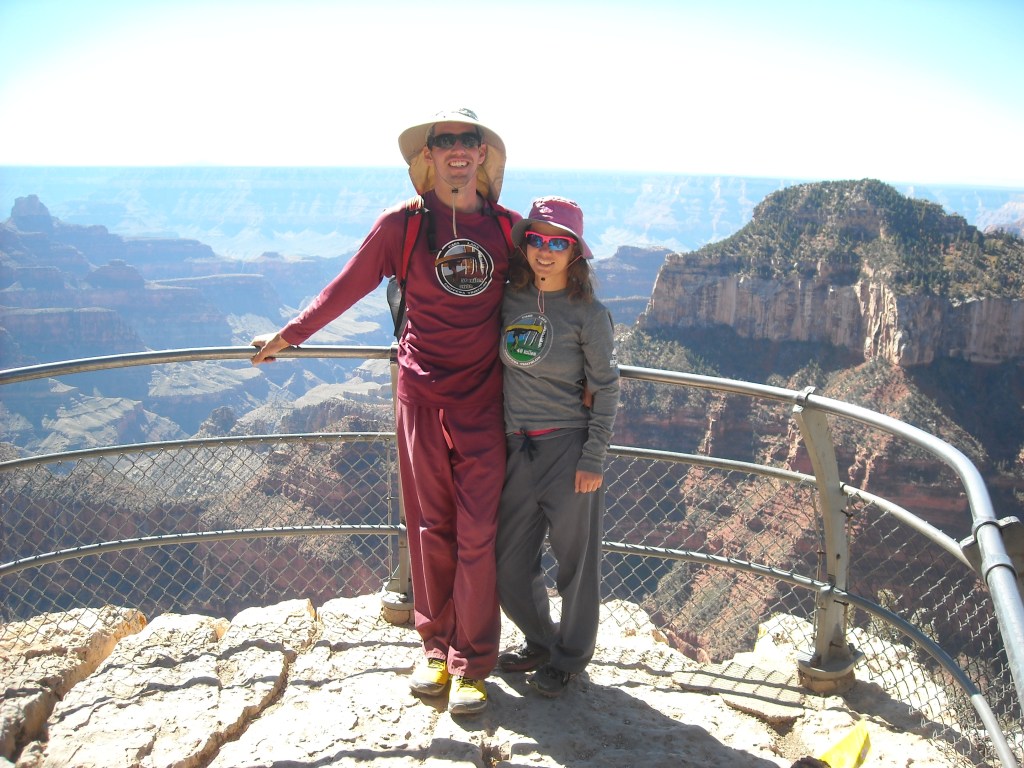
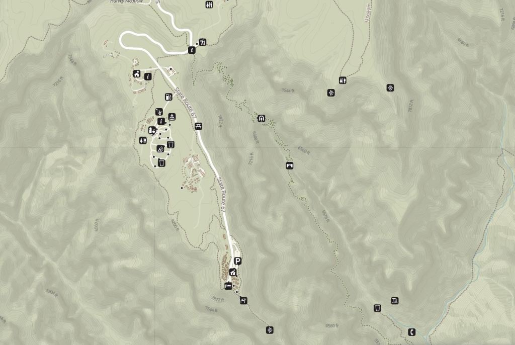
Map of the North Rim of the Grand Canyon and North Kaibab Trail.Writing a postcard with the Bright Angel Canyon in the foreground and the South Rim in the distance.The lodge on the North Rim really sits on the edge of the canyon.One of my all-time fav photos thanks to hubby.Is this the curvature of the earth???
10/14/14: North-to-South Rim-to-Rim Grand Canyon Hike
Because we had a marathon distance to cover back to the South Rim, we didn’t dawdle in bed and wait for the warm sun. Instead we hiked over to the edge of the Roaring Springs Canyon (Cococino Lookout) where the North Kaibab Trail starts, and ate a cold breakfast.
Coconino Lookout for breakfast. Since it was about 40 degrees it was a pretty cold breakfast.Spectacular view into the Roaring Springs Canyon. You can really see where the trail goes!I finished my breakfast and brushed my teeth first and now I was cold waiting for Erik. He told me I should’ve left on my long johns and worn some taller socks:)
Finally Erik was ready to begin our descent.
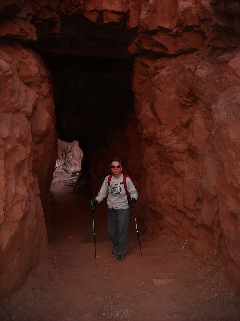
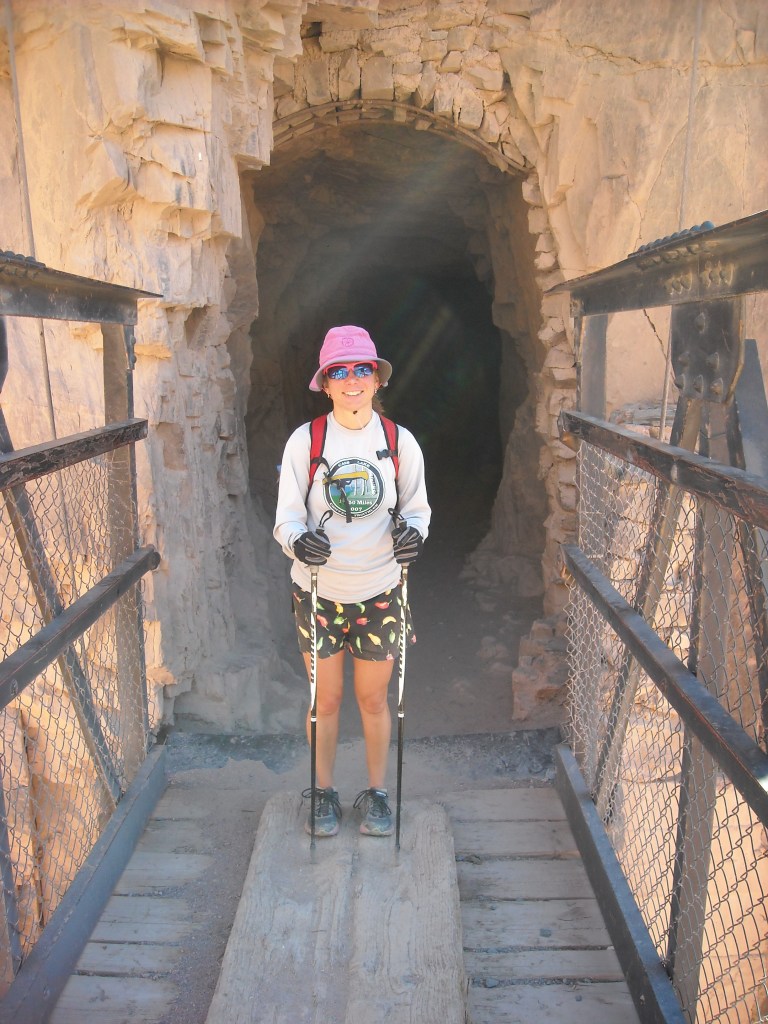
Emerging from the Supai Tunnel on the North Kaibab Trail!
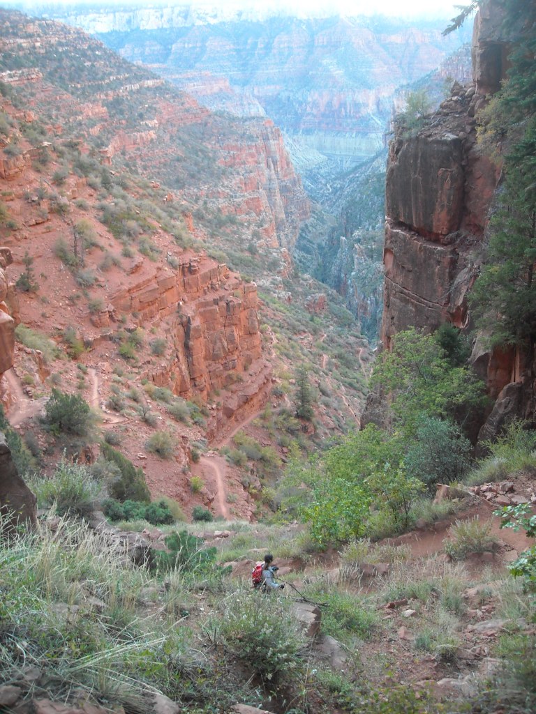
Erik, a switchback or two above me, took this picture looking down on the trail as it makes its way down the Roaring Springs Canyon.
Erik on a bridge.
Heading back by Ribbon Falls — there’s a decent view of it just from the North Kaibab Trail.
Getting closer to the Colorado again. In the distance Mather point is to the right and Yupai Point to the left.
Since I was frustrated by Erik’s pokiness two days earlier on the flatter section of trail, today I tried running for a few minutes, then sitting and waiting for Erik to see if this made my legs any less tired. I can’t say it really did.
Instead of returning on the Bright Angel Trail, on the return route we headed up the much more exposed and sunny South Kaibab Trail after stocking up on water near Phantom Ranch.
We took the “mule bridge” across this time.
At the end of this bridge there was a big tunnel to go through.
Check out the supports of this suspension bridge as we gained height quickly on the South Kaibab Trail. A real engineering feat.
There are two trails down to the Colorado River from the South Rim. We hiked up the South Kaibab trail which is 7 miles long, climbs 4,500 feet, and has no water supply.
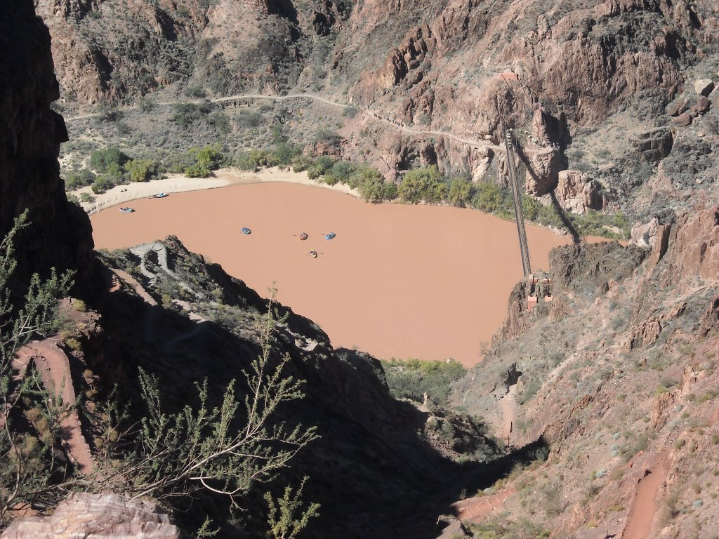
I was pretty excited to see a raft down on the Colorado River.There are lots of switchbacks on the South Kaibab Trail.A flotilla! And a mule train crossing the bridge.Gentle un-ending grade.I deemed this part of the canyon “the ugly layer.” It’s gray-green.After so much climbing we had clearly come up a long ways but still had so far to go.
The trail went on and on. Descending in the cool of the morning was much easier, and arguably why there are signs up everywhere telling people NOT to descend to the floor and return to the rim in the same day. But we’re exceptional right, and don’t need to heed warnings.
Taking a much needed rest break, and in the shade to boot, but legs still fatigued.
Cedar Ridge
The afternoon was waning as we finally hiked up to the rim. My right achilles would have a mild weird pain for the next several months but I guess it was worth it. Unless of course, I compared myself to those crazies who do rim-to-rim-to rim all in one day.
We then proceeded to walk an additional mile along the edge of the canyon back to our rental car. Erik made me climb over the rock barrier to take this picture. It does show a good view of our small packs and our trusty water bladder (i.e. boxed wine bag).And because no visit to a National Park is complete without seeing wildlife at close range from the car…
Our hike took a bit longer than we had hoped and it was already getting dark as we drove out of the South entrance. Such is life. After dinner at the McDonald’s in Tusayan, we drove south and then southeast to try to find a National Forest Campground near Humphreys Peak (specifically the Freidlein Prairie Dispersed Camping area on Fire Road 522). Unfortunately we found the road quite rough for our rented sedan and after the first couple sites were full, we abandoned and went to Plan B which was camping at the trailhead which shares a parking lot with the Arizona Snowbowl Downhill Ski Area. We tried to find a spot to pitch our tent in the trees but there really wasn’t one and there was some ruckus going on at the restaurant and hence we didn’t sleep very well.
10/15/14: Humphreys Peak
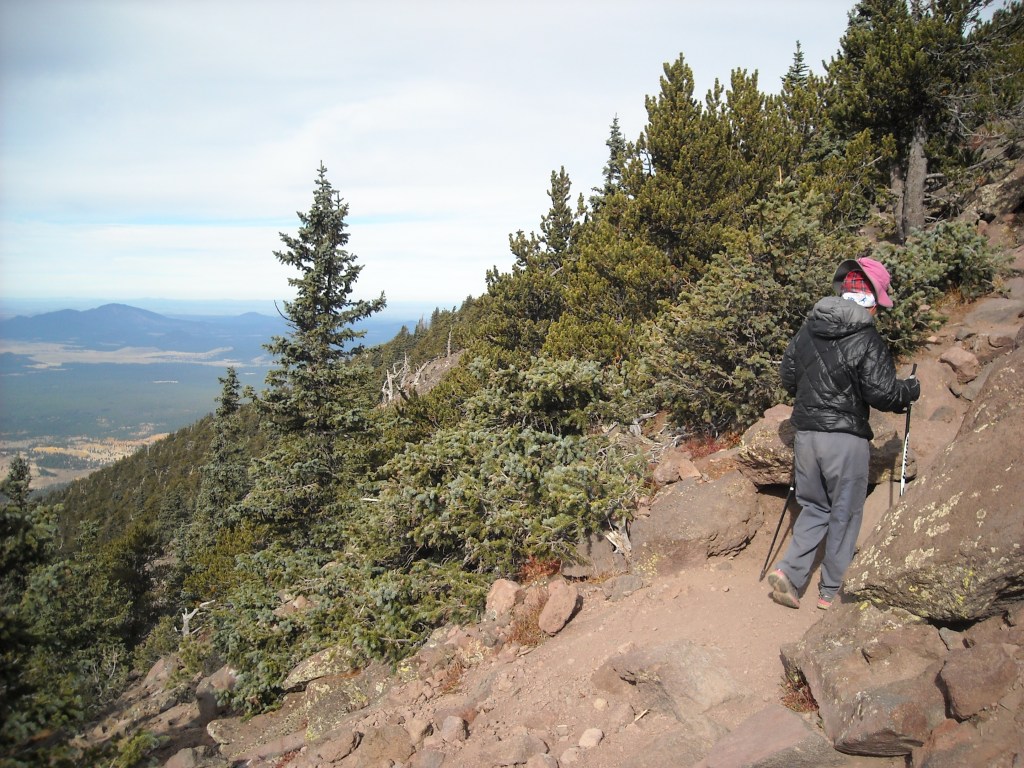
After our restless night, we were more than happy to get out of our tent and start hiking Humphreys even if it was a chilly 36 degrees. The first switchback of the route skirts along the bottom of the downhill run.
Map of the Humphreys Peak Trail from the Snowbowl parking lot. 10 miles round trip. 3,350 feet of elevation gain.Good morning San Fransisco Peaks.Humphreys Peak from the parking lot.
Soon the trail entered into the aspens and began climbing on gradual switchbacks.
We hiked through a colorful aspen (or poplar if you’re from Minnesota) grove on the early part of the trail.Gaining some elevation and light.Towards the col the trail got steep.But the views got better.
At the col, the trail ended and it became more of a route up on the ridge, first climbing up and over a false summit before gaining the final approach. After that false summit the wind picked up in full force.
Above treeline it got windy. Really windy.
It was so windy I struggled with my foot placements on the rocks. I had to be careful that my foot went where I wanted because mostly it just got blown around. At least it was a relatively short ways to the summit.
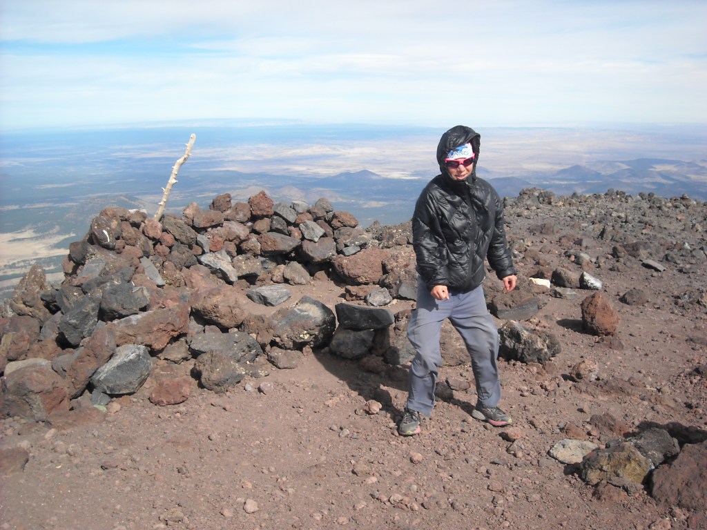
An old volcano could be seen from the top.I had read reports that the summit of Humphreys was really windy. I was posturing very funny here as I braced against the wind. Check out my pants.
Erik and Bjorn tried this a few years ago on top of Mount Marcy (highest peak in New York) but it just wasn’t windy enough there. Top of Humphreys, check out Erik’s lean!
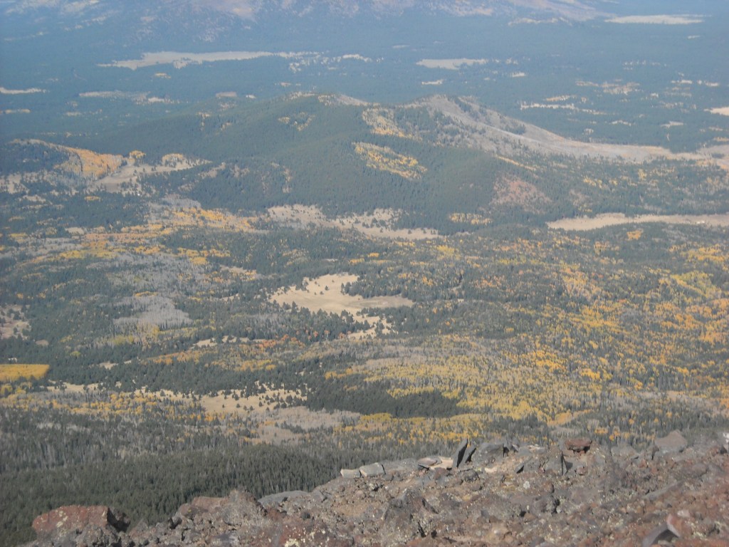
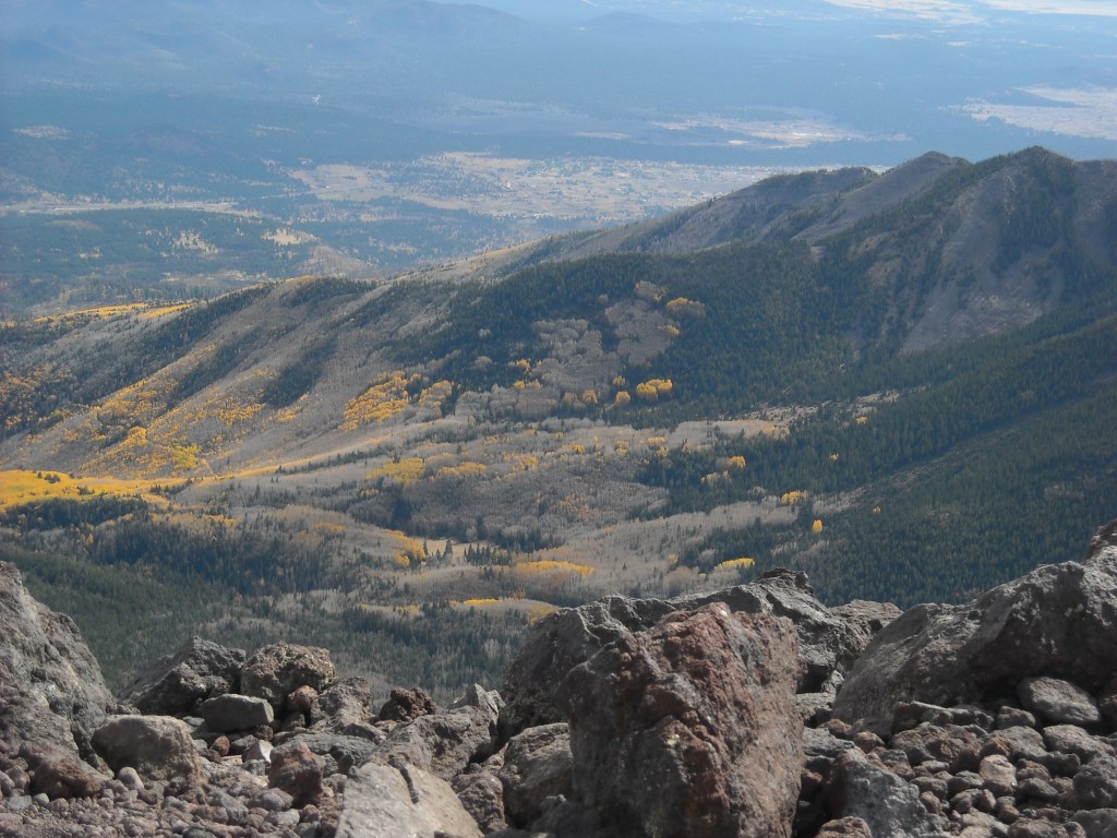
The yellow aspen forest.Pretty pockets of aspen trees.Looking north to the Grand Canyon. We kinda did the two mile vertical challenge from the Colorado River to the top of Mount Humphreys in less than 24 hours.Hiking the open section on the last switchback.Looking back up to Mount Humphreys (tallest peak on the left) from the trailhead at Snowbowl Downhill Ski Area (they do get snow in Arizona!).
Humphreys Peak only took us 6.5 hours with 5 hours of moving time. Crazy wind, aspens in fall color, and a relatively easy day compared to hiking rim-to-rim.
If we had to do this trip again: This was a good trip. The only issue was camping the night before Humphreys although not sure what we could have done about this other than staying an extra night in the campground at the Grand Canyon (or getting a hotel:).
Best decisions: Hiking rim-to-rim x 2 and taking that layover day on the North Rim.
Next time: I’m not sure there will be a next time for either rim-to-rim or Humphreys but we would certainly consider going back to the Grand Canyon and perhaps hitting up the Tonto Trail. And we backpacked the Superstitions in 2019!


One thought on “Hiking the Grand Canyon Rim-to-Rim x 2 and Arizona’s Humphreys Peak”