
Located just east of Phoenix, Arizona the Superstitions are a mountain range with lots of opportunity for day hiking, but also for backpacking if you know where to find the springs. We did this trip in early November of 2019 when it wasn’t quite so so hot! We spent three nights out in the wilderness doing a loop that included both official trails and some “routes” with fun bouldering.

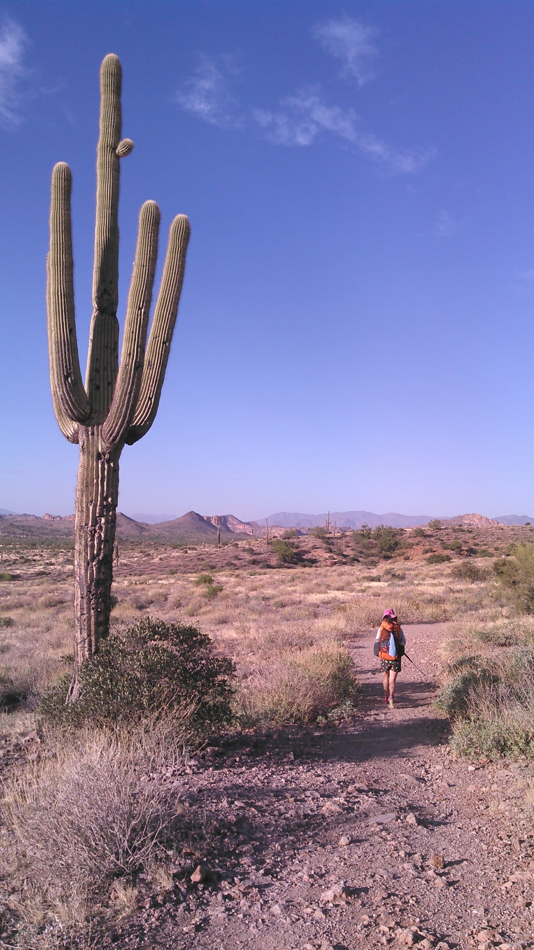
We started from the Peralta Trailhead under a late afternoon blazing sun. Given we were only 6 weeks out from the winter solstice, as we hiked up the trail along Peralta Canyon to Fremont Saddle, we were mostly in the shade. At Fremont Saddle our off-trail hiking began. Unfortunately this coincided with sunset. Our goal was to connect to the Superstition Ridgeline Route. We could have begun our hike with a short road hike to start at the official route (at Carney Springs), but preferring to avoid the road hike, we instead opted for what looked like a short off-trail hike. With the encroaching darkness, this was anything but short and easy.
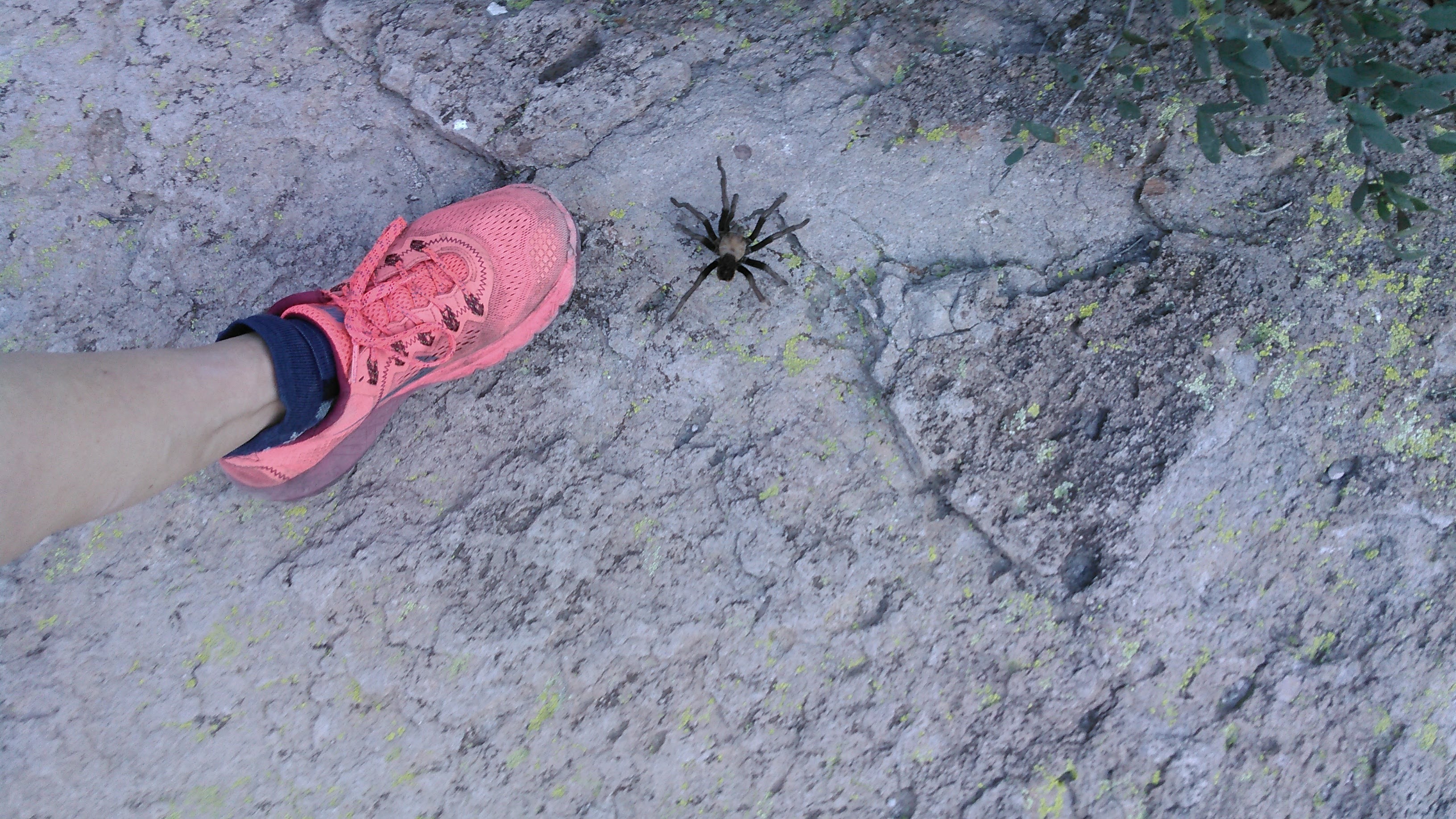

Using Gaia GPS we could find our route but navigating through cactus and small hills in the dark was completely ludicrous. This quickly became frustrating as daylight faded. We moved painstakingly slowly. Hiking in the desert at night, off-trail, was dumb. At one point, I fell over into a bed of cactus going down a steep hill. Besides prickly cactus embedded in my skin, I minorly injured my left shoulder. Even with our headlamps the off-trail travel was difficult. Very shortly after I fell over, we got on the route which was very easy to follow. This made life so much better.
After hiking a bit on the social path, we began looking for a place to camp. The best we found was a dry stream bed. Being from Minnesota, it’s foreign to me that streams run dry, but they do all the time in the desert. Without any rain predicted in the forecast, we camped in this stream bed for the night.

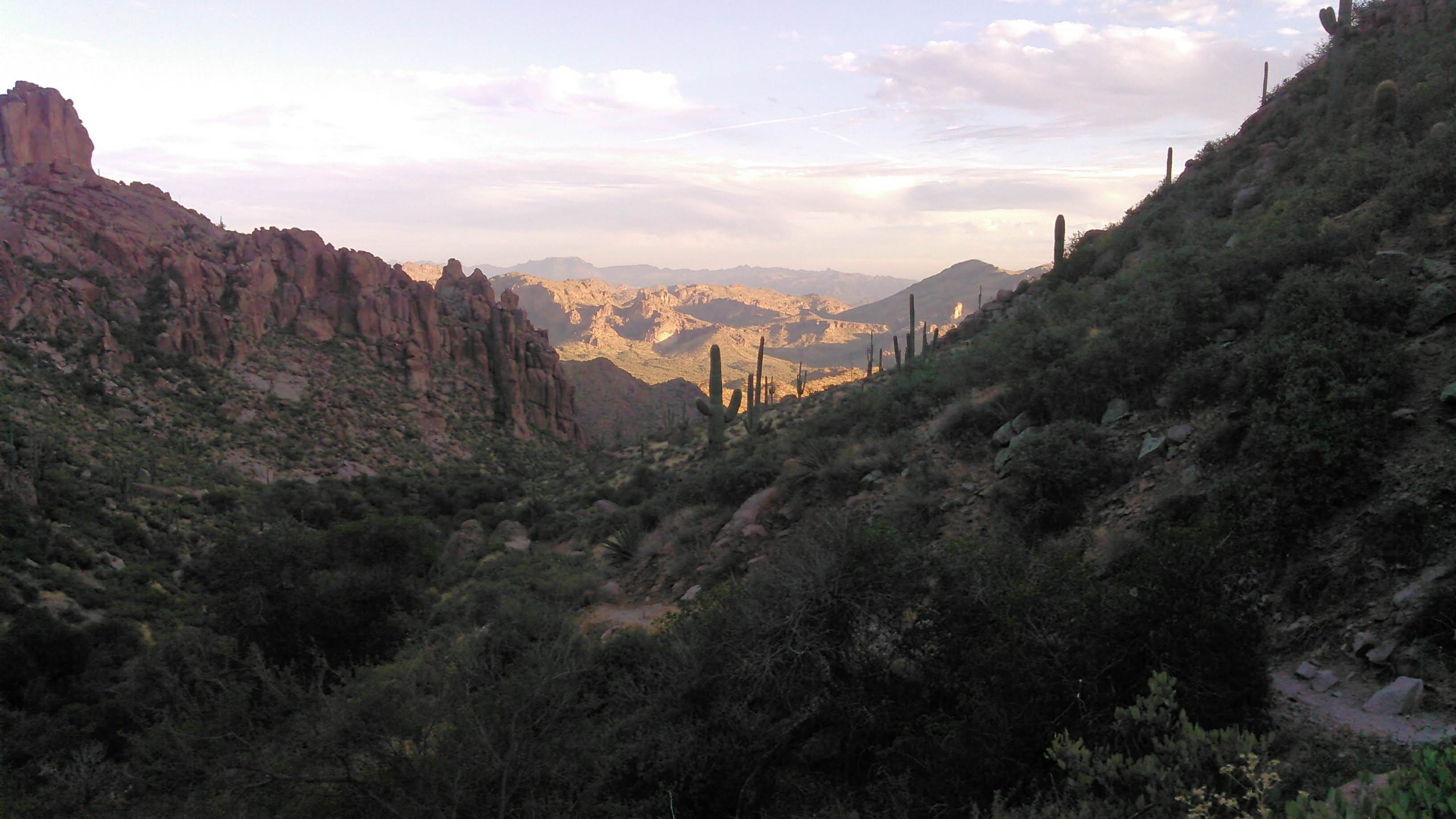
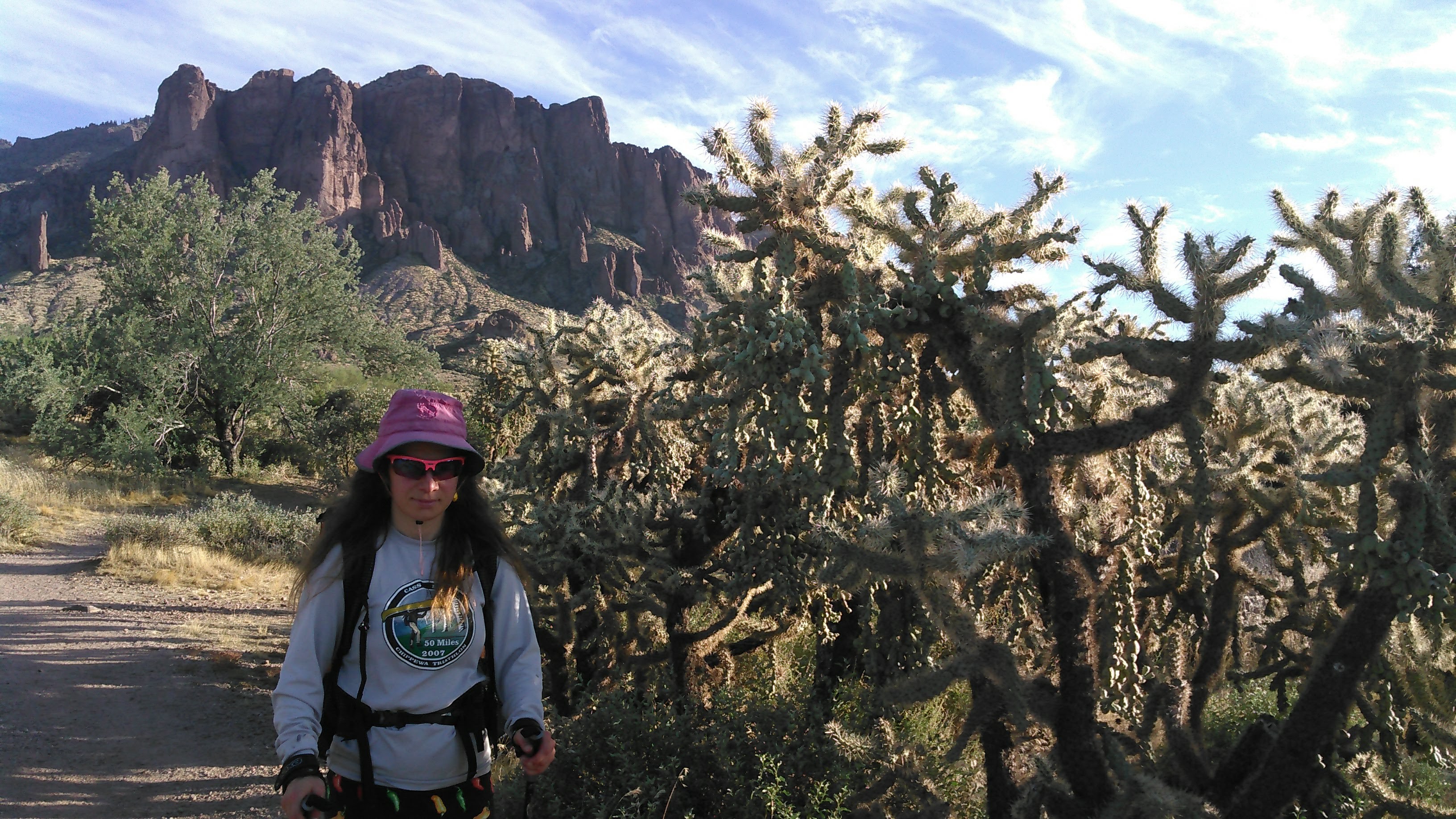
The sun rose plenty early enough for us and we were off hiking, climbing to the ridge. We had to be careful to avoid getting stuck with some prickly pear cactus! The main route skirted Superstition Mountain but we took a side trail to climb Superstition Mountain. The last short section required a bit of bouldering. The view on top was spectacular. It looked out onto the desert and the eastern Phoenix metro area. We didn’t linger too long though because we still had lots of ridge walking.

We had started our hike with 7 liters of water as we wouldn’t get to our first reliable spring for 24 hours. As we hiked along the ridge, we were drinking lots of water and our supply was depleting so we began restricting.
In general, there was a good trail that was almost always easy to follow along the ridge. There were a couple short, fun sections of bouldering. There was almost no shade. We only saw one other group of people until we neared The Flatiron at the end of the ridge.
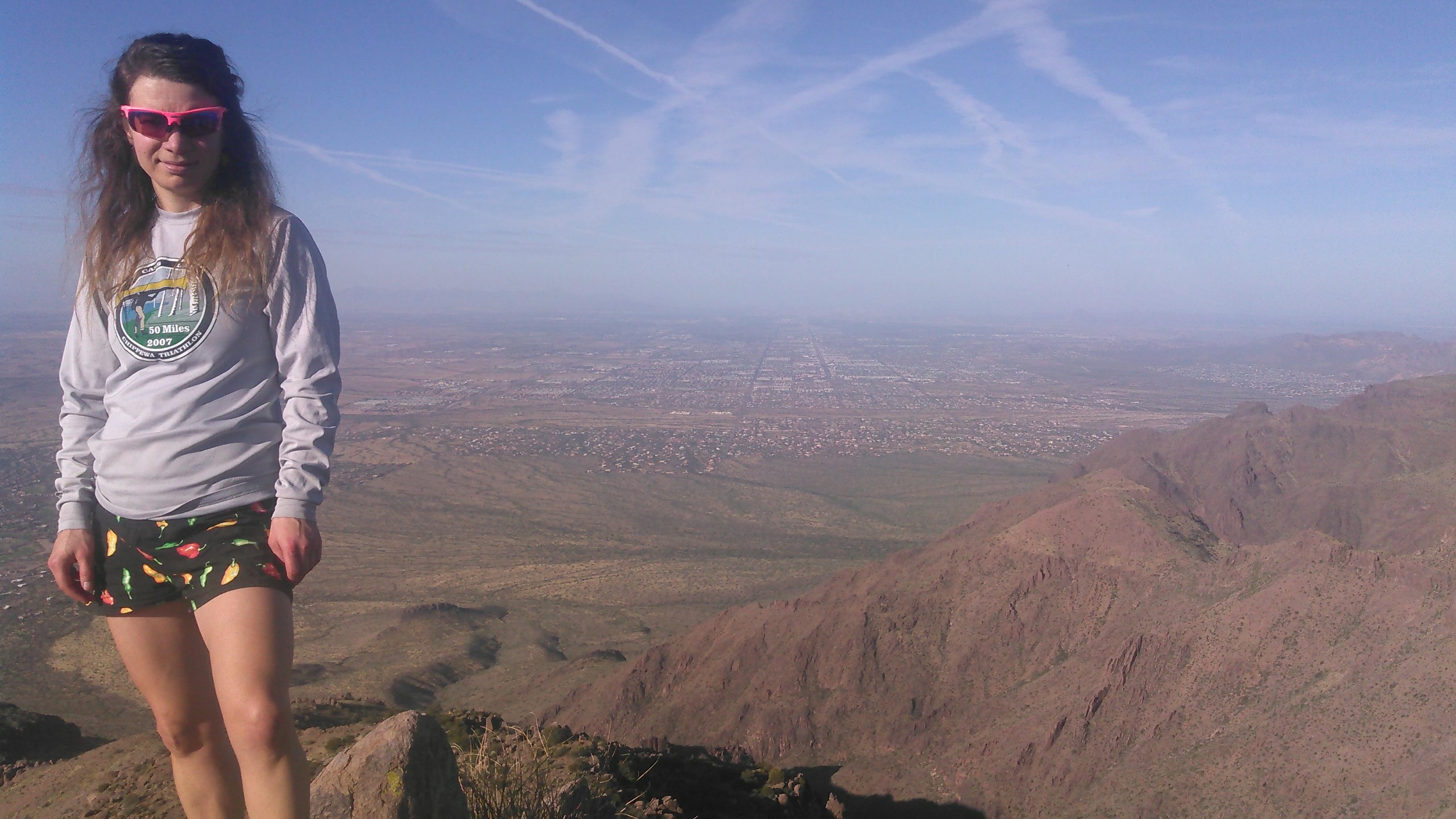
After a few hours of ridge walking we got to The Flatiron with it’s even better view of Phoenix proper (as compared to Superstition Mountain). There were lots of people now.

Next we descended The Flatiron Trail. This was touted as a real bouldering experience and it certainly didn’t disappoint.


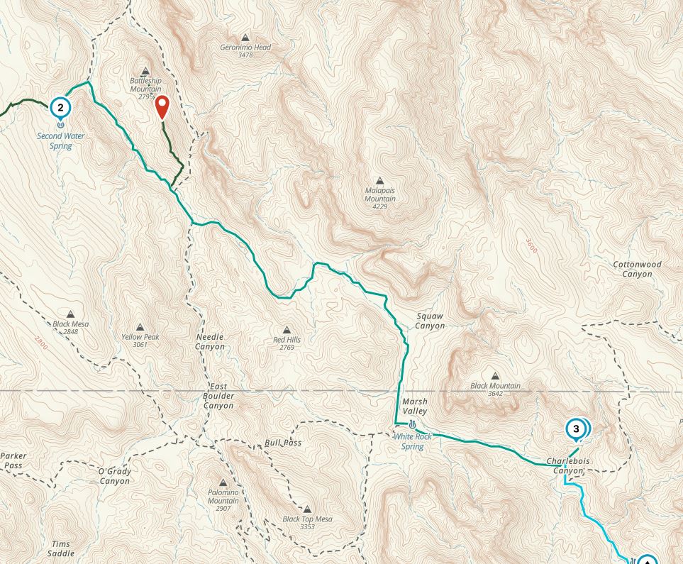
By the time we were off The Flatiron Trail, it was around 4 pm and we only had a couple more hours of daylight. We were both glad to walk on some wider, easier trails for an hour before heading towards Second Water Spring on rougher hiking trails. By now we were chasing daylight and this kept me moving even though I was getting tired. I also finally peed for the first time in 8 hours. Definitely not good and we were worried this spring might not pan out.
As we walked across the Garden Plateau, we came to a small pond. The water didn’t look good but it was evidence we really could find water in the desert. This plateau was beautiful, but soon daylight ran out. While the trail had been easy on the plateau- mostly sand and few rocks- as we descended the trail with headlamps towards Second Water Spring, it got more rocky and I had to step carefully.
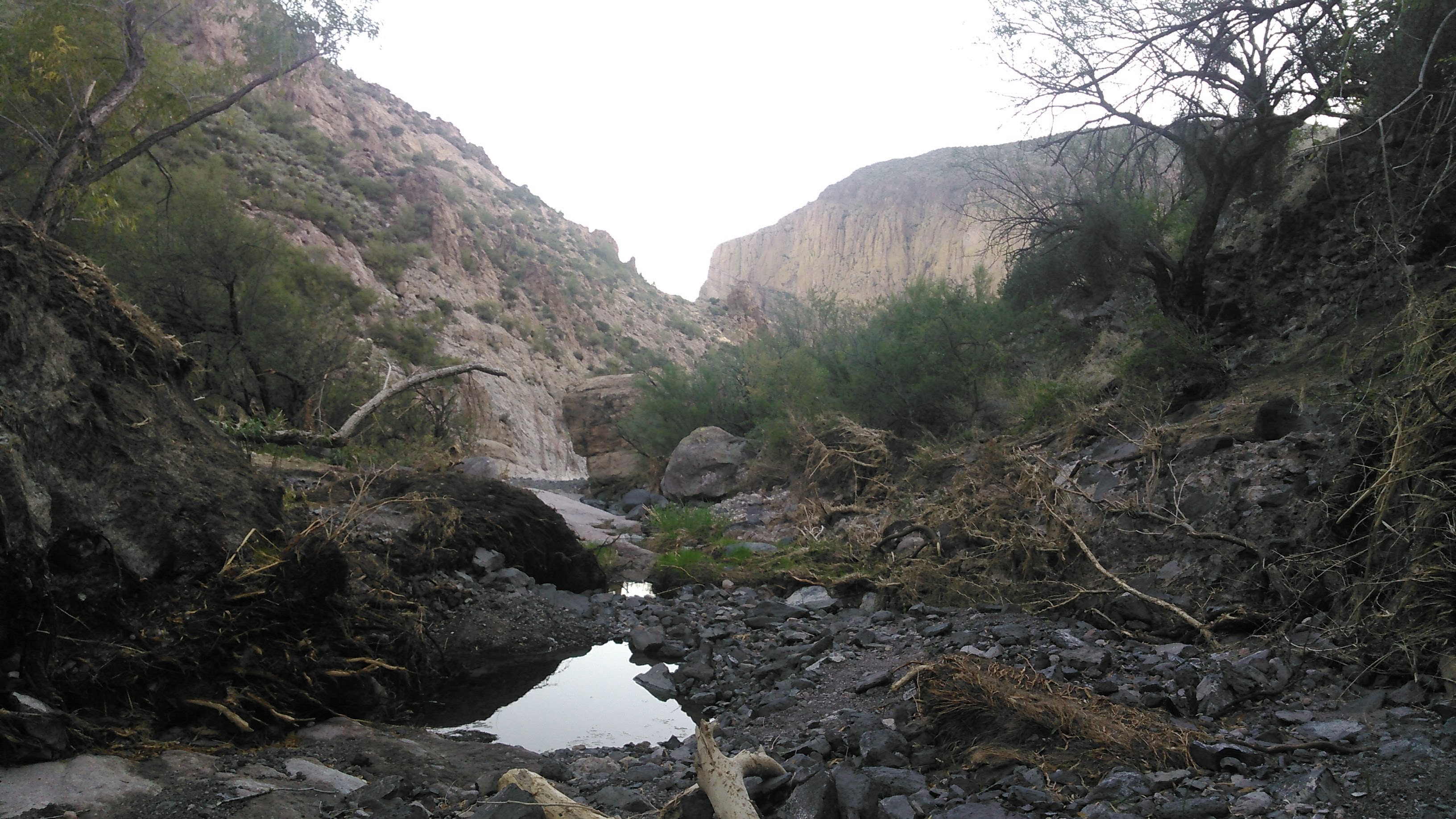
Finally we saw trees and heard some water dripping. We had arrived at Second Water Spring. We descended into the river bottom. The river seemed to be flowing under rocks in between pools with dry sections in between. I was completely exhausted. In the moment, I was more spent than I had been in a long time. My legs were so tired. We got water and drank and drank and drank. Then we set up our tent on a dry portion of the stream bed and cooked dinner.


It was cold the next morning. After loading up on water, we started hiking again. Even though it would have been nice to linger in camp longer to wait for the sun to come out, once the sun did come out we knew it would be sweltering hot. We headed out towards Charlebois Spring with the plan to side hike Battleship Mountain.
After leaving Second Water Spring we didn’t see any more water as we hiked along dry creek beds, but we did come to some odd-looking “carpet” in parts of the stream. Our best guess was this was dried-out algae bloom.

Not too long after the sun warmed us up, we began our side-hike up Battleship Mountain. This was supposed to be a bouldering route after some minor trails brought us to the rock formations. Once we got to the rock the route wasn’t terribly obvious. We got cliffed out on what seemed like the way to go. I looked up and after a short almost vertical wall, there were larger ledges and what looked like a cairn. So we headed up to a plateau on the east side of the ridge. This was definitely the way up. The ridge was nice easy flat walking, but then we had to make our way down the ridge on the west side and across a narrow spot. It looked do-able to descend a bit on the south side away from the exposed narrows, but the exposed narrows looked easier so Erik and I both went that way. Erik walked across but I crawled since there was a good sheer drop off on the north side.
From here the trail skirted the south side of the rock formations, there was some loose dirt and small rocks, and then we began climbing again up a crack to a gully. Erik initially missed the route up. In general the bouldering was easy but as we wrapped around the west side we did a couple bouldering moves that seemed like they would be difficult to go down (there seemed to be multiple routes up in this area on the west side and we took a slightly different way down).
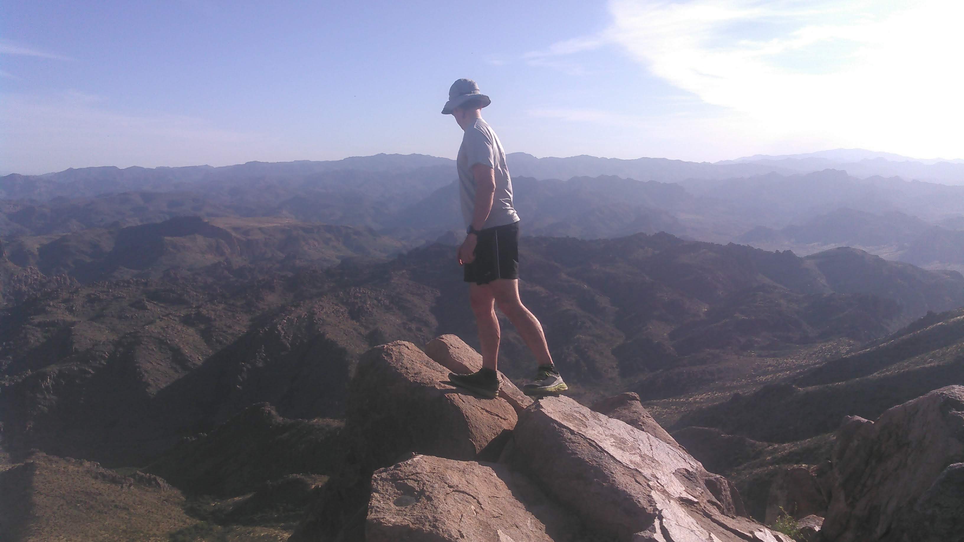
Just before the very top there were a couple easy class 3 sections and then we were on top! It was a great view- we could see out to Canyon Lake to the northwest and Weaver’s Needle to the southeast. There wasn’t a lot of bouldering on the route up to Battleship Mountain, but there was enough to satisfy us.


Then it was time to head down. Again, the route wasn’t super easy to follow but easier than the way up as we had just done it. After we got off the rocks, we hiked down off-trail through the “forest” of cactus-type plants. It was now noon and the sun was baking us. Although we didn’t say anything aloud, Erik and I both eyed a big rock with some shade behind its north side. Fortunately, because it was November and the sun was low in the sky, we got some shade. We hung out under that rock for a solid hour plus, enjoying a brief reprieve from the heat.
Once boredom set in, we resumed hiking towards Charlebois Spring. Lucky for us, the route wrapped behind a mountain as we hiked into La Barge Canyon and so we got to enjoy some more shade! Somehow this part of the hike seemed to take forever. I’m not sure why but we weren’t moving terribly fast. I think it was just the sun draining my energy.

As we hiked up the La Barge Canyon, we couldn’t help but notice the trees growing down by the dry river. We really take greenery and trees for granted in Minnesota. These certainly weren’t Minnesota-sized trees, but they were exciting.
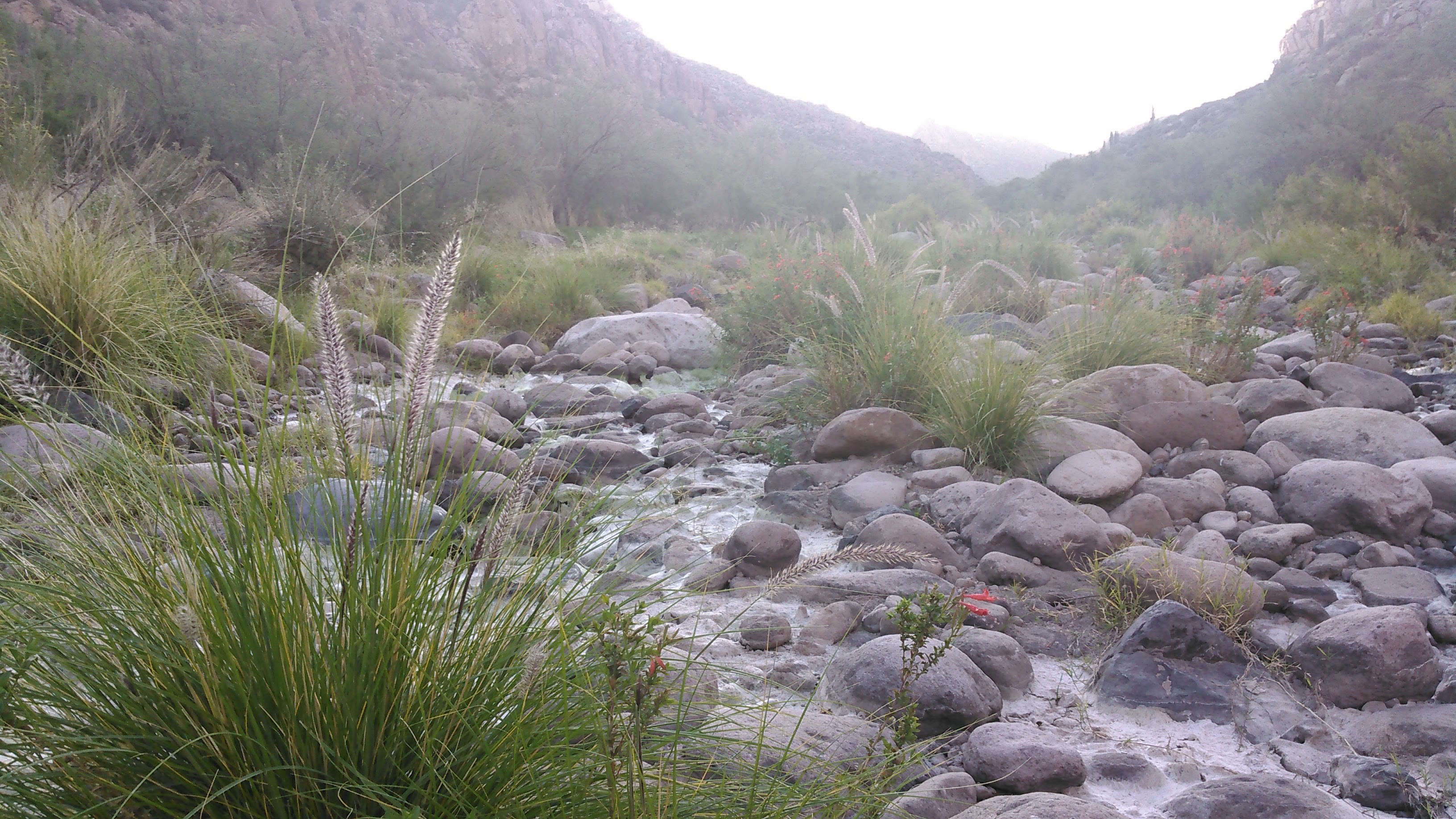
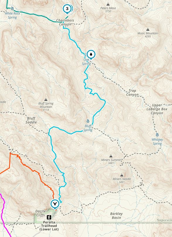
Then we got to the trail intersection with Charlebois Spring. As we got deeper into the mini-canyon, the brush got more dense, the trail fizzled out, and we even had to fight our way through a couple of trees. Soon we arrived at what was clearly a well developed campsite. There was water but it was in stagnant pools. We could hear water running above us but it wasn’t easy to get to. Erik pushed ahead through the underbrush and filled our bottles with running water.

It was near 5 pm when we made it to camp- the only night of the trip we got to camp before dark! We set up the tent and cooked dinner. Before we finished dinner it got dark. This area was teeming with wildlife- including a skunk! That scared me pretty good. I don’t like skunks. Pee-yew!
The next day we again got up around dawn. We were hiking out but still had some miles to cover. The trail briefly climbed before returning to the trees of La Barge Canyon. We didn’t see any water from the trail (and we didn’t look for any) at La Barge Spring, but the ranger told me there is reliable water there.
At La Barge Spring we turned south and headed up the Bluff Spring Canyon Trail. This trail was overgrown and I was upset at constantly hitting my bare legs on bushes and being uber careful at going around cacti. I have “my ideas” and one of them is that I should be able to walk down a trail with bare legs without hitting brush.

As we climbed higher, the underbrush thinned and this was no longer an issue. It again seemed like our hike was taking forever, but it really wasn’t. At the next intersection we headed towards Barks Canyon. This area was pretty with good views and saguaro cactus. Finally, we continued on trail, descending the ridge just above Peralta Canyon, where we had started.


It was nice to be back to the car before the afternoon sun beat down on us. Overall it was a short backpacking trip, but the scenery was quite different from Minnesota and we were on the hunt to find drinkable water!
Prior to leaving for our trip we talked to the ranger at Tonto National Forest who noted the reliable water at the Second Water, Charlebois, and LaBarge Springs. Again, we visually saw water and camped at the first two. The trees near the third suggest the ranger’s report was accurate.
There weren’t any guidelines on food storage and no mention of bears. Given Erik and I prefer to not carry a hard-sided food storage container unless required and there weren’t sufficient bear-hang trees in the area, we did what we usually do in this circumstance- we slept with our food in our tent!
If we had to do this trip again: Not hike off-trail in the dark in the desert…although it did set us up better for the next day.
Best decisions: Doing the Superstitions Ridge Route and Battleship Mountain. We like bouldering:)
Next time: I’m not sure there will be a next time. I can see how frequent camping at the springs could have quite an impact on the area. The springs seem quite delicate to me. There are some other trips in the area though! I’ve heard the Barnhardt Trail and Mazatzal Peak north of Phoenix are good.

3 thoughts on “Backpacking the Superstitions”