
This loop begins near the town of Floodwood. From here, we paddled up the Whiteface River to the Whiteface Reservoir and then portaged into the Saint Louis River and paddled back to Floodwood.
Erik, my husband, found this route on the map. It can be difficult to combine loops when paddling rivers, but this looked like a sure winner. Never mind a bit of upstream paddling!

Paddled 5/9/20-5/15/20 [Floodwood gauge broken; Forbes guage 5/9/20 1000 cfs (good) and 5/15/20 625 cfs (too low); Skibo gauge 5/13/20 210 cfs, 18.8 feet (too low)]
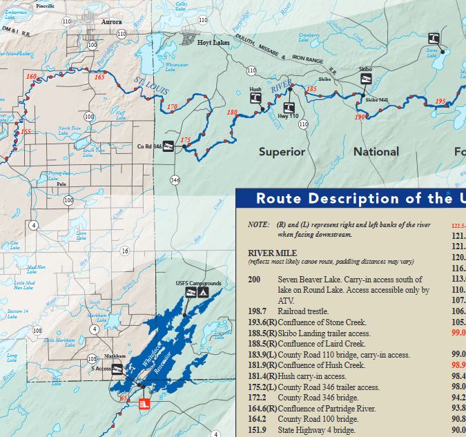
The Minnesota Department of Natural Resources (DNR) makes the go-to maps for exploring Minnesota Rivers. The Whiteface and St. Louis Rivers are on the Upper St. Louis River map.
Erik and I have done a number of canoe trips since we met. We travel light and fast with our Wenonah Kevlar canoe circa 1985 and carbon paddles. However, because we aren’t sure what we might encounter on our trips, we always bring with our heavy beater paddles. I have a wood one and Erik an old metal one.
Day 1: Floodwood, MN to Whiteface River mile 12
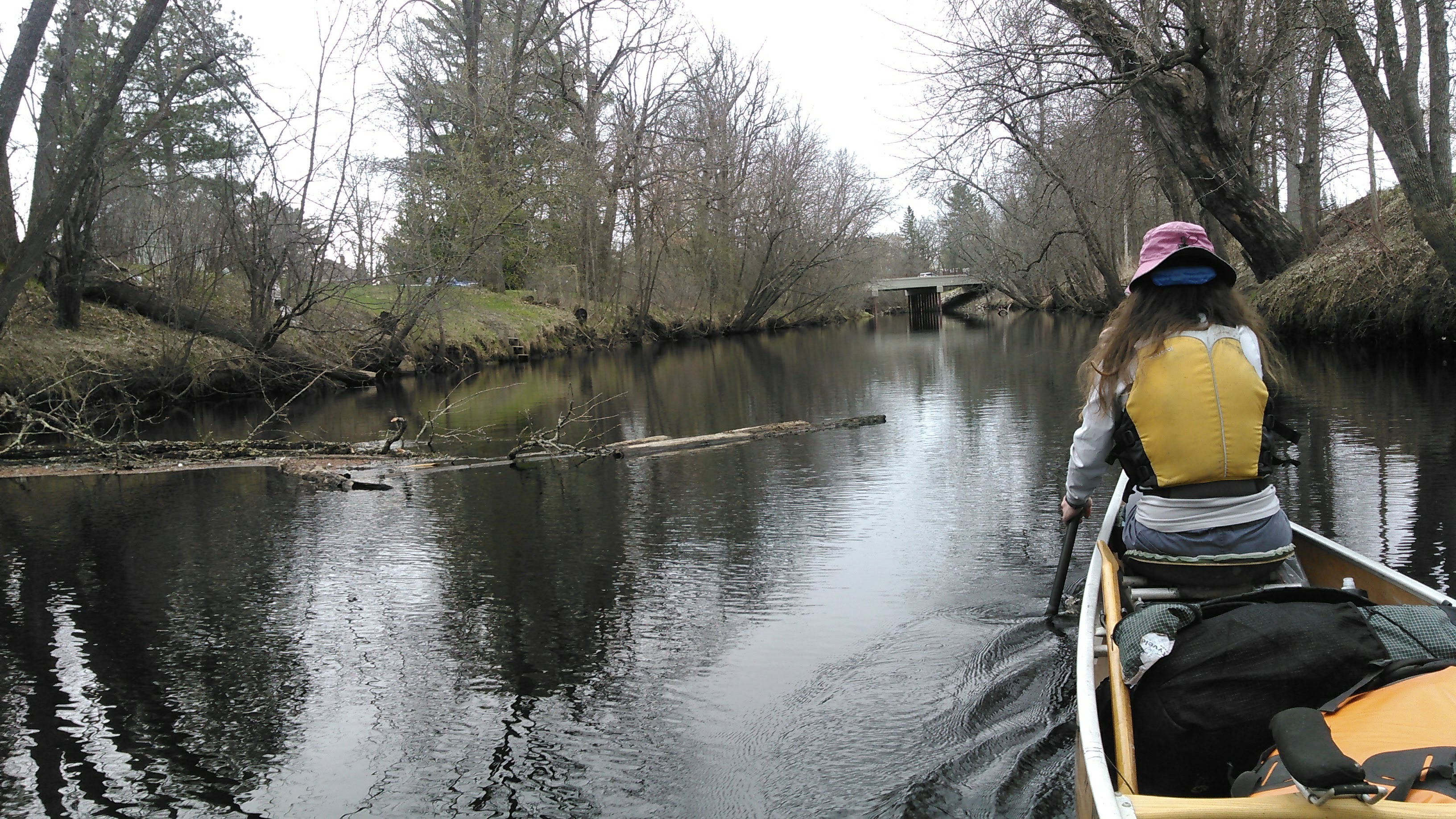
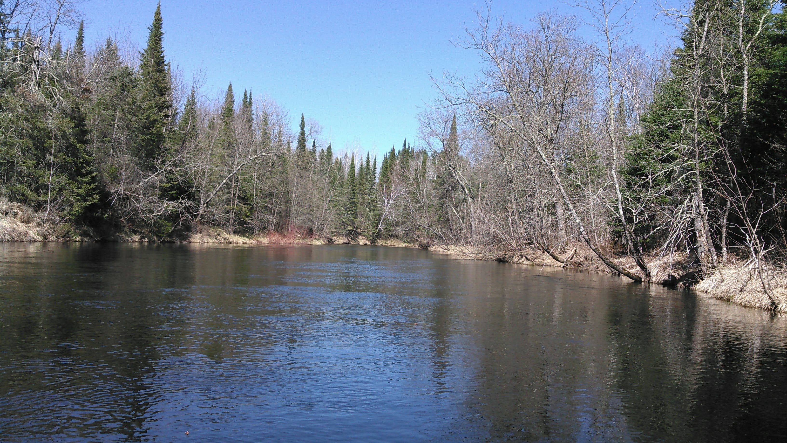
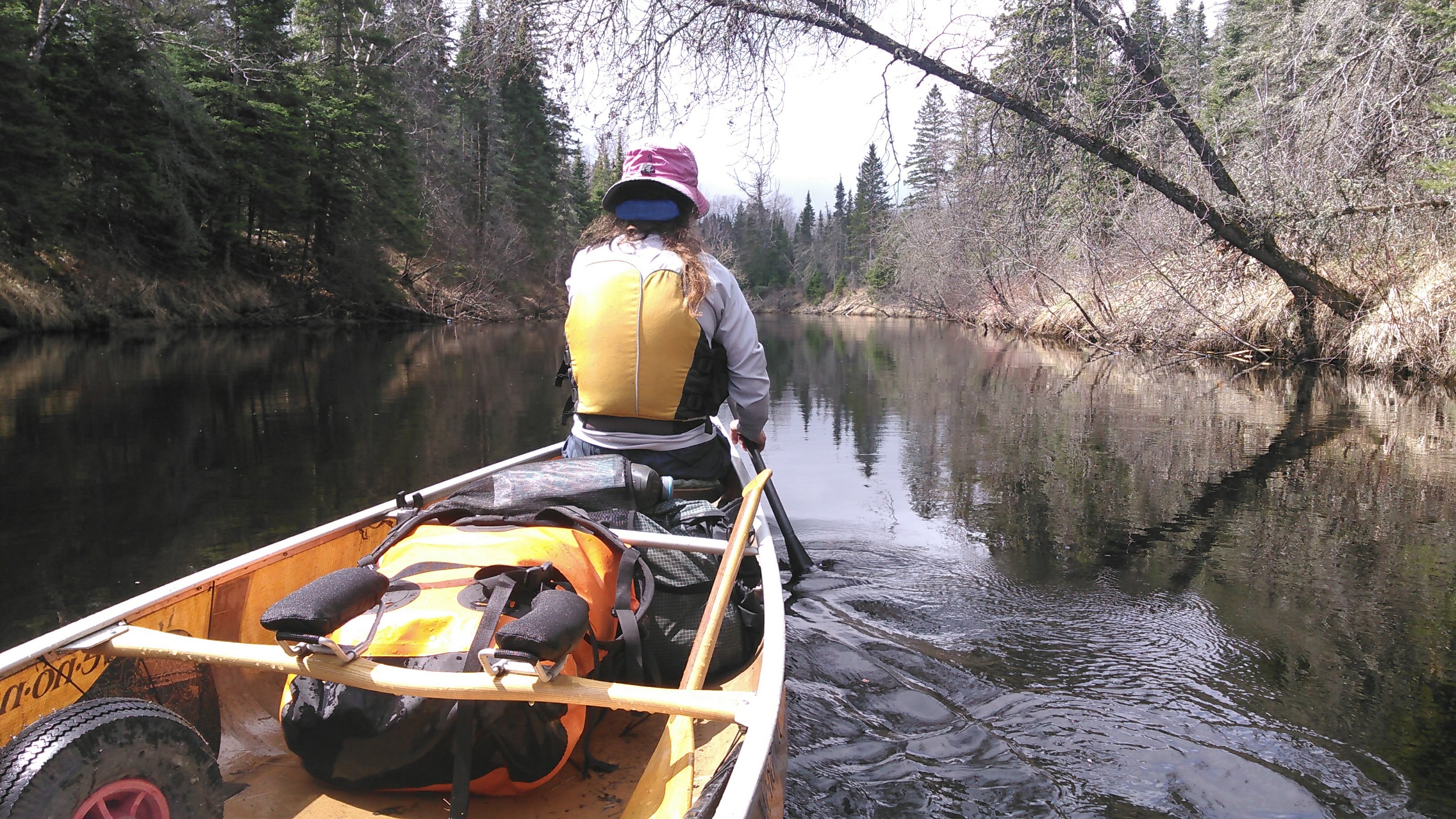
We began our trip from the boat launch in Floodwood which is on the Floodwood River. After paddling the half mile down the Floodwood River, we turned left to begin our paddle up the St. Louis River. The current on the St. Louis was modest and we were able to make reasonable time. The water was plenty deep and we didn’t need to worry about where to place our paddles to avoid rocks. This is my favorite paddling. I just like to work hard and be able to look around me without worrying about hitting rocks. In this section the river was quite wide and we were excited to start up the narrower Whiteface River.
We left the green of St. Paul to head north where there was nary a bud on the trees. It was a cold but dry day with temperatures around 50 degrees and cloudy. Usually when it’s cloudy I’m worried it will rain, but we had a forecast without any rain. I started paddling in my scrub pants, adventure shirt, and lifejacket but by our second stop I was seriously cold and put on my fleece pullover in addition. I wouldn’t take off this combo for two days!
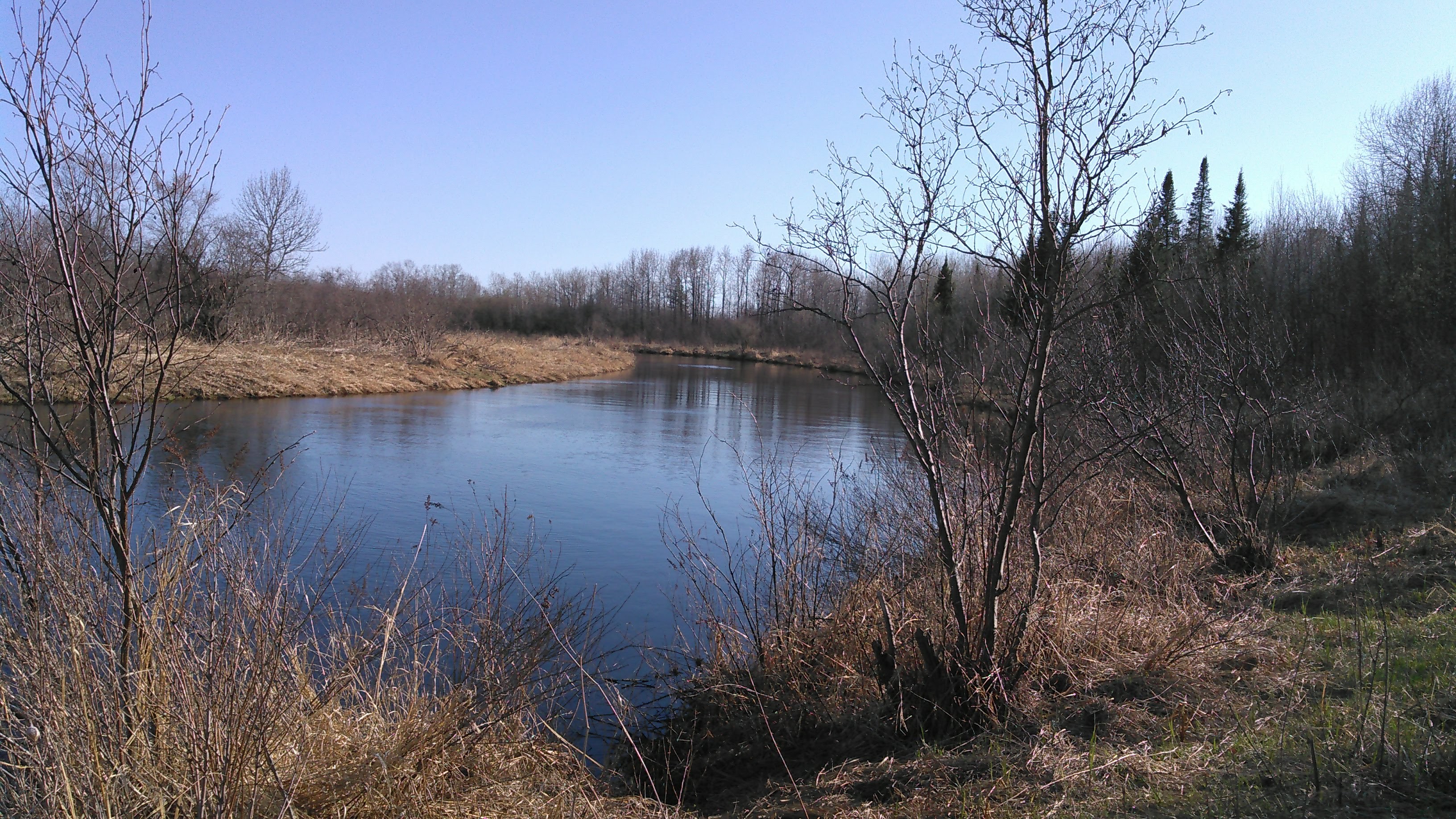
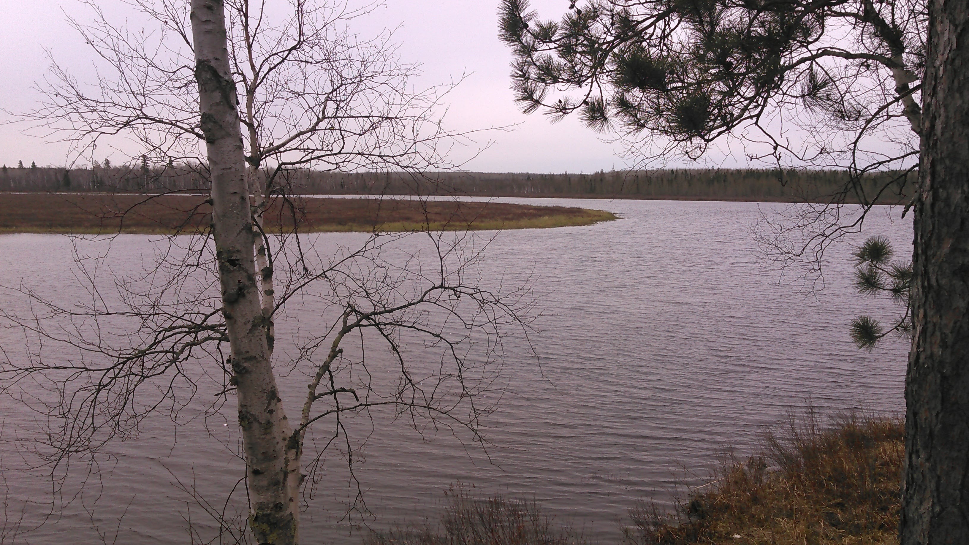
I’ll be honest here and say I tend to prefer mountain scenery, but there is beauty to be had in Minnesota. I admired the red willow along the shore contrasting with the white of poplar and birch and green of the coniferous forest. Being as it was a calm and cloudy day, all the pleasing scenery was perfectly reflected on the “flat” water. On the right shore we passed a giant bald eagle nest!
A dad and 2 sons were camped at the first campsite we came to; they were out fishing. This was the only boat we saw on the water all day.
As we started up the Whiteface River, 7 miles into our trip, we immediately noticed the current pick up. My left wrist was already hurting when I paddled on the left. This wasn’t good. The pain coupled with the strong current made me think we weren’t going to get ahead of schedule. And I always want to be ahead of schedule.
Two miles up the Whiteface we stopped for a break on a very muddy bank- kind of like the Minnesota River. We quickly discovered that the banks were often either muddy or had steep grass making getting out and getting in the canoe difficult. Therefore we learned to pick our breaks where it was easier to get in and out of the canoe.
Here the river went around a big bend and we encountered our first of many rapids. Bummer. I was in search of complete flat water. We were able to get up this little rapid without too much trouble but had to use our heavy beater paddles.
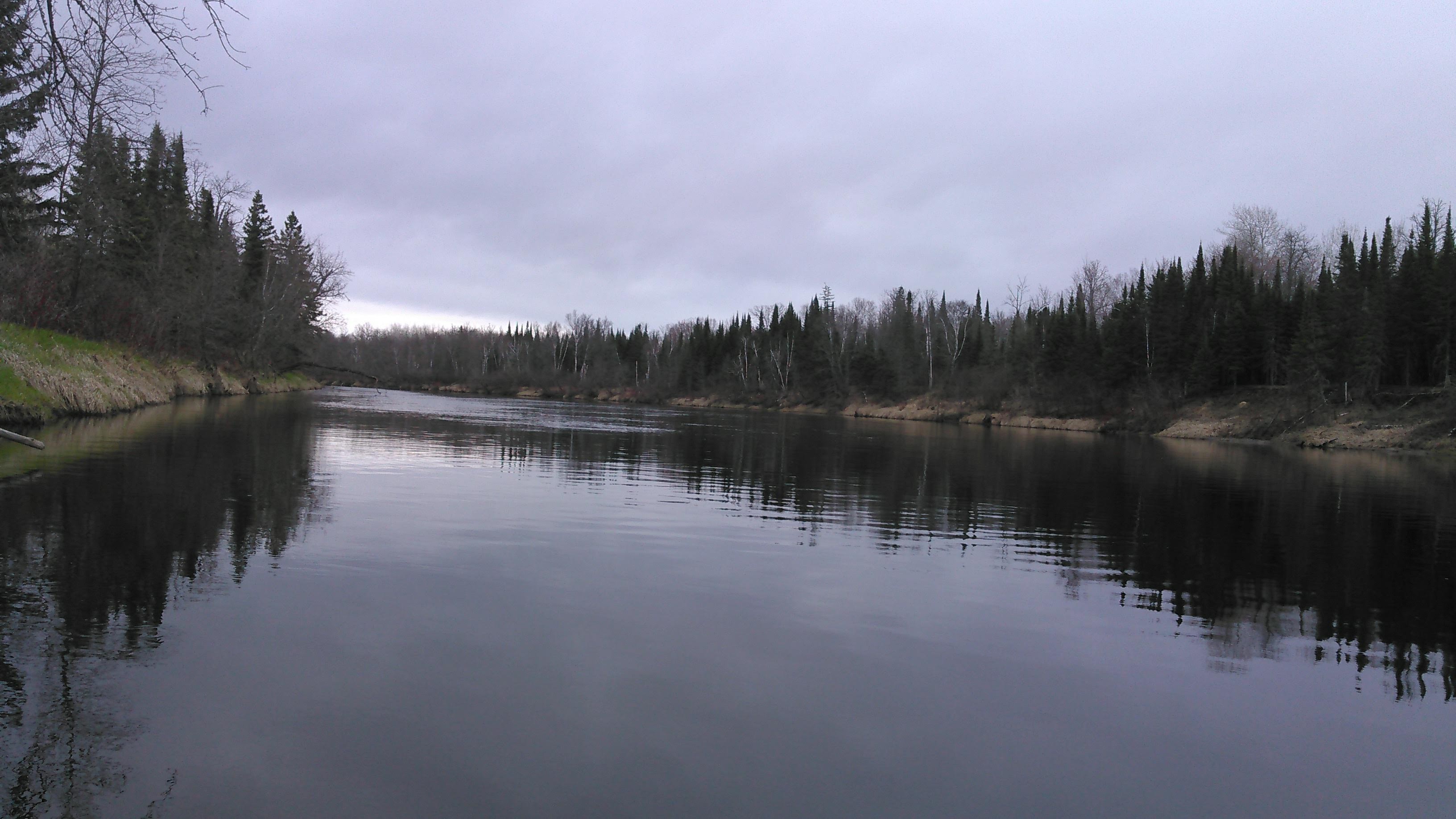
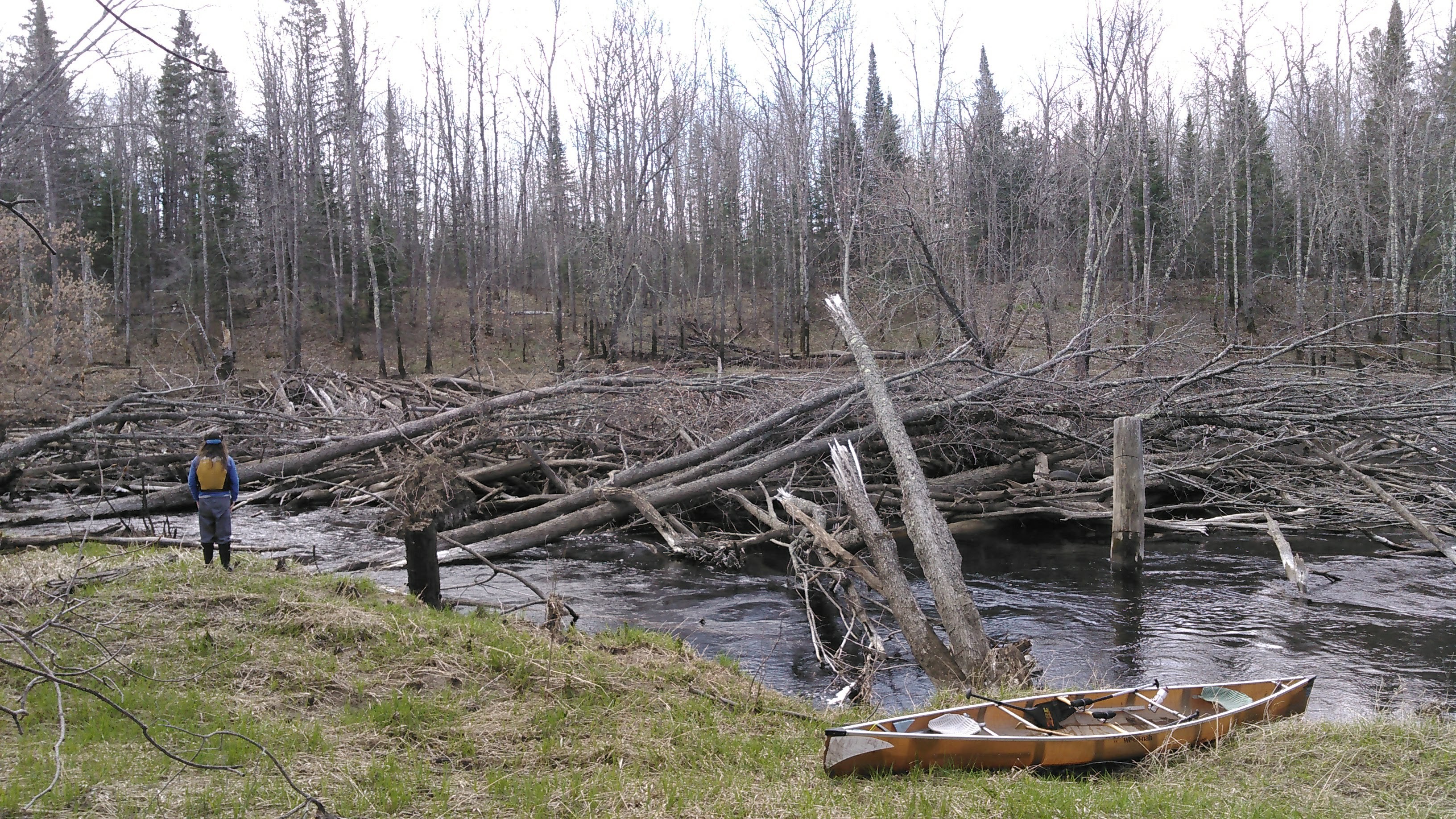
The next several miles were mostly flatwater with moderate current and a few riffles.
“There’s a bear in the field!” Erik exclaimed around mile 9 on the Whiteface River.
I looked to my left and saw some black rustling in the leaves in the forest near the river.
“With cubs?” I asked.
“In the farm field on the left,” Erik replied.
I looked farther left where there was a bright green farm field and there I saw a full grown black bear. Once she saw us, she ran into the forest near the cubs.
“Wooffff!” the mama bear made a sound as 3 cubs ran up a nearby pine tree.
We never saw the mom again but we watched as one of the cubs climbed butt first down the tree, ran along the ground, then up an adjacent tree. As we slowly paddled by, we watched the other 2 cubs also descend butt first and scamper over to the other tree and climb that. This made the whole trip worthwhile and was yet another bear sighting in Minnesota in May for us.
“I guess we should go a while farther before we camp,” Erik said.
Around 6 pm we found a place to camp in an open forest. As noted on the map, there aren’t any designated campsites along the Whiteface River but there is plenty of state land allowing for dispersed camping. My left wrist really hurt so even though the water was completely calm and we were trying to get 3 more miles, we’d already paddled 20 miles upstream.

It was supposed to be down into the 20s that night but due to cloud cover it only got into the 30s. I slept in my adventure shirt and fleece and that was about right.
Day 2: Whiteface River from mile 12 to 32
In the morning I paddled in my spandex pants, scrub pants, muck boots, adventure shirt, fleece shirt, and lifejacket and was quite cold for the first several miles. I tried paddling in my paddle gloves but my hands were just freezing and this amplified my left wrist pain.
The water was completely flat for several miles and this was a nice section of river that I just couldn’t quite fully enjoy until my hands warmed up. Using my bare hands on the paddle kept my wrists from hurting so bad and they weren’t much colder than in the paddling gloves.
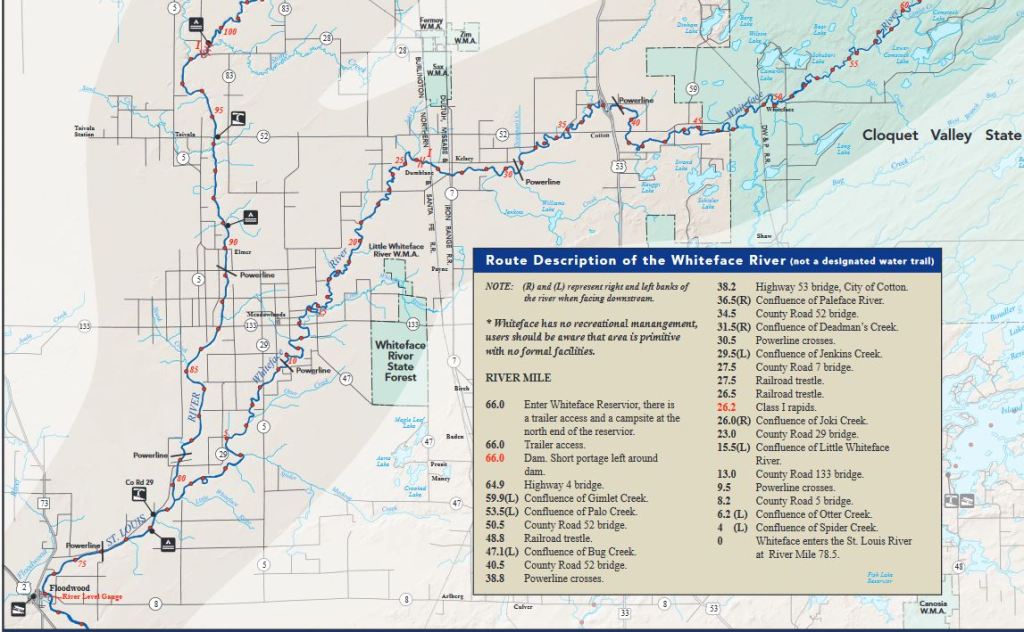
Two hours into our paddle (it was hard to believe 2 hours had already passed) we saw a DNR Portage sign. We thought this was unusual as we didn’t suspect any big rapids but as we rounded a big bend, we came upon a giant log jam! We definitely had to portage this. There was at least 100 feet of log jam. On the upstream side, we didn’t see a portage sign.
Around mile 20 we encountered our first rapids of the day even though they weren’t marked on our map. These were Class I. We spent significant time with our first lining experience along the shore. This was extremely tedious as we had to go around all the trees. Fortunately though there wasn’t any underbrush along the bank and it wasn’t very steep. Near the end of the rapid, after we had turned to the right, and the lining looked very difficult due to thick brush along the shore, we tried some paddling. We thought the rapid might keep going on for awhile but it was shortly over.
A few miles later, just above mile 25, we came to our second rapid of the day. This was marked on the map but ended up being easier than the morning’s rapid and we were able to paddle up it without much difficulty. A couple miles after the rapid my right shoulder started bothering me. We took a longer snack break and then resumed paddling.
Again, I was hoping to make it farther but once we had cleared our 20 miles on the day we stopped for the night. I got super cold that evening once we got to camp. It had been mostly cloudy all day with a couple short bursts of snow. Temps had only climbed into the 40s. After Erik set up the tent, I got inside, blew up the pads, put on more clothes and stayed under the quilt while Erik made dinner.
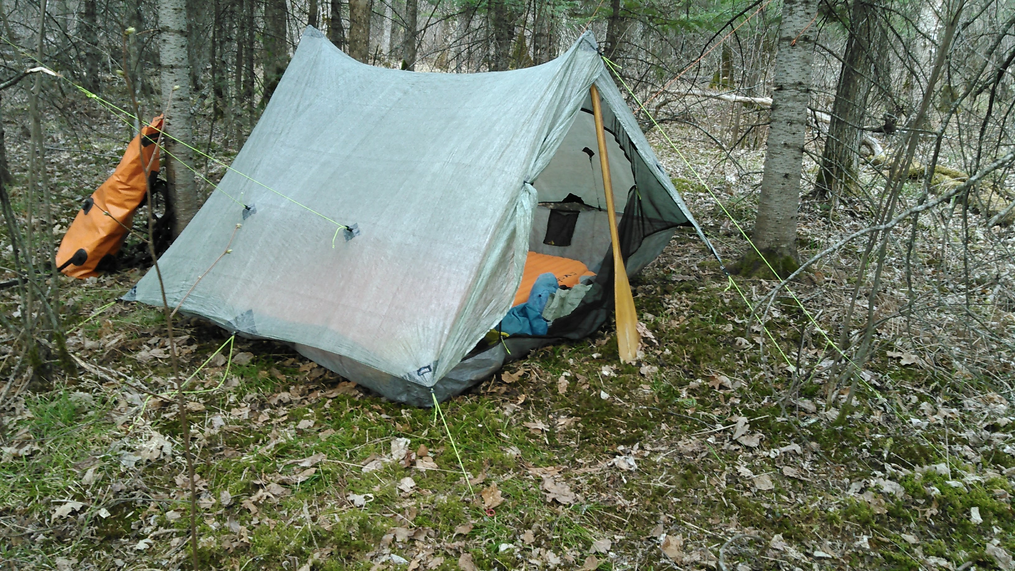
I got out of the tent to eat dinner and then we went for a short walk along the trail at our campsite. I slept in my down jacket that night and the bog area where we had hung our food was frozen in the morning!

Day 3: Whiteface River mile 32 to 52
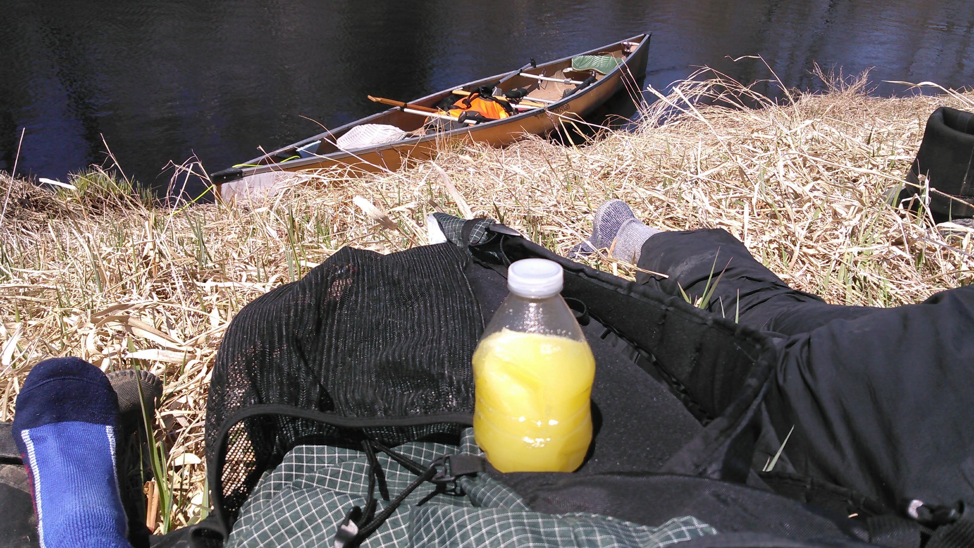
It was another cold morning of paddling but this day we woke to sun. I started paddling in my warm mittens. These helped keep my hands warm. Just before the hwy 53 bridge we took our first rest break on some dried out river grass.
There were more Class I rapids between the split hwy 53 bridges that again weren’t marked on the map. These weren’t terribly difficult but they put more strain on my already hurting wrists and shoulders. After these rapids there was calm water for several miles.
On these flatwater sections it was easy to contemplate why don’t more people want to paddle upstream? On the treadmill? You get to enjoy the landscape for at least twice as long!
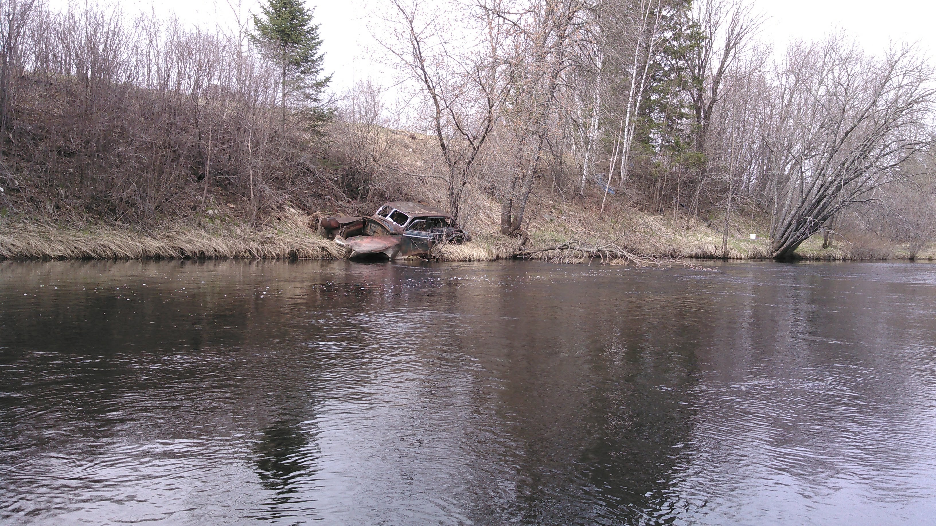
While paddling up the Whiteface River we came across a couple old dumps where people had just rolled their old cars down the bank towards the river. This is such a rural thing to do. Although it feels quite trashy, it does provide a change in scenery! Given we were working relatively hard paddling upstream we didn’t take many pictures- only a few when there was something interesting or extra beautiful.
Although we mostly had flat water we encountered brief riffles followed by pools upstream. We saw a dead beaver floating on the water and after that we saw a huge beaver dam on the right side of the river.
Then we came to our first Class II rapid. We mutually agreed we were portaging this without even discussing the decision. The right shore (remember we were paddling upstream so this would be river left if you were paddling downstream) looked better to attempt a portage and as we began scouting there was a trail along here. It appeared to be private property based on hearing chickens and seeing some chairs at the upstream section of the rapid (we put in stealthily just below there).
We kept paddling in the sunshine for a couple more miles until we came to another Class II rapid. Neither of these rapids were marked on our map. There had just been a house and it looked like there was an obvious trail on the left side of the river. We got out and indeed there was a really good trail. After a bit, the trail left the river and climbed up a steep 30 foot hill. There was an old abandoned and partly taken apart fire tower that we passed before we descended back down to the river level. This rapid dropped about 10 feet or more over 200 meters.
Back in the river we went under another old train bridge and then as we neared the tiny town of Whiteface the river got deep, narrow, and turny. There were a few small rapids. After battling up each rapid, we rested in whatever eddy we could find. We started talking about eddy boosts and shore boosts.
As we kept paddling upstream, the rapids got more difficult. The drops were slightly bigger and the stream narrower. Before we approached one such rapid, we rested in the eddy on the left and then took off up this rapid. The current was pushing us into a strainer on the right. The water was deep and we dug in deep with our good carbon paddles but to no avail.
“Bail!” Erik called.
I immediately went into “save ourselves” mode from the strainer as I drew us left. The current brought us quickly downstream as we tucked into the eddy. The shore was thick with underbrush making a portage unappealing.
“Let’s try again,” I said.
We pulled out of the eddy, paddling with all our might and made it in perfect alignment to the rushing water drop. And here we stalled out despite paddling as hard as we could.
But I really didn’t want to portage through the underbrush. It’s almost always possible to find another gear. If I believe something is possible, then it likely is.
“We’re gonna make it!!!” I screamed.
I think we both dug in just a bit harder and we scooted up that slide.
After resting for a couple minutes and letting our heart rates drop back to normal, we ferried over to the eddy on the other side of the river and then had one more slide to do. Just like when doing intervals, it’s better to just go. I noted the strainer on the left as we headed into the current, all the overflow water draining out of the Whiteface Reservoir slotted into 10 feet.
Digging deep, we managed to paddle up the rapid.
“I felt my pecs on that one!” I noted.
Then we were under the highway bridge and onto a big wetland swamp. The river widened and the current waned. We paddled on easily under the early evening sun. We were thinking about setting up camp but had to wait until we found some dry land. After a couple miles we found this on the left side.
In camp the sun kept us reasonably warm despite the temperatures only in the 50s. I washed my underwear and cleaned up a bit but before long I put my down jacket on and was getting cold. After dinner we noticed a beaver swimming around out on the river. He frequently slapped his tail and dove under, came back up, and repeated the whole scene.
The spot we were camping was the end of a 4-wheel trail and we camped exactly on the trail. Erik set up some branches that any mechanized vehicles would run into before us. We had a nice evening walk on the 4-wheel trails that got my feet warm. When we got back to camp the beaver was still swimming around.
That night got down into the 20s again as puddles were frozen in the morning. There were lots of animal sounds- the beaver, a loon, a woodpecker.
Day 4: Whiteface mile 52 to Whiteface Reservoir
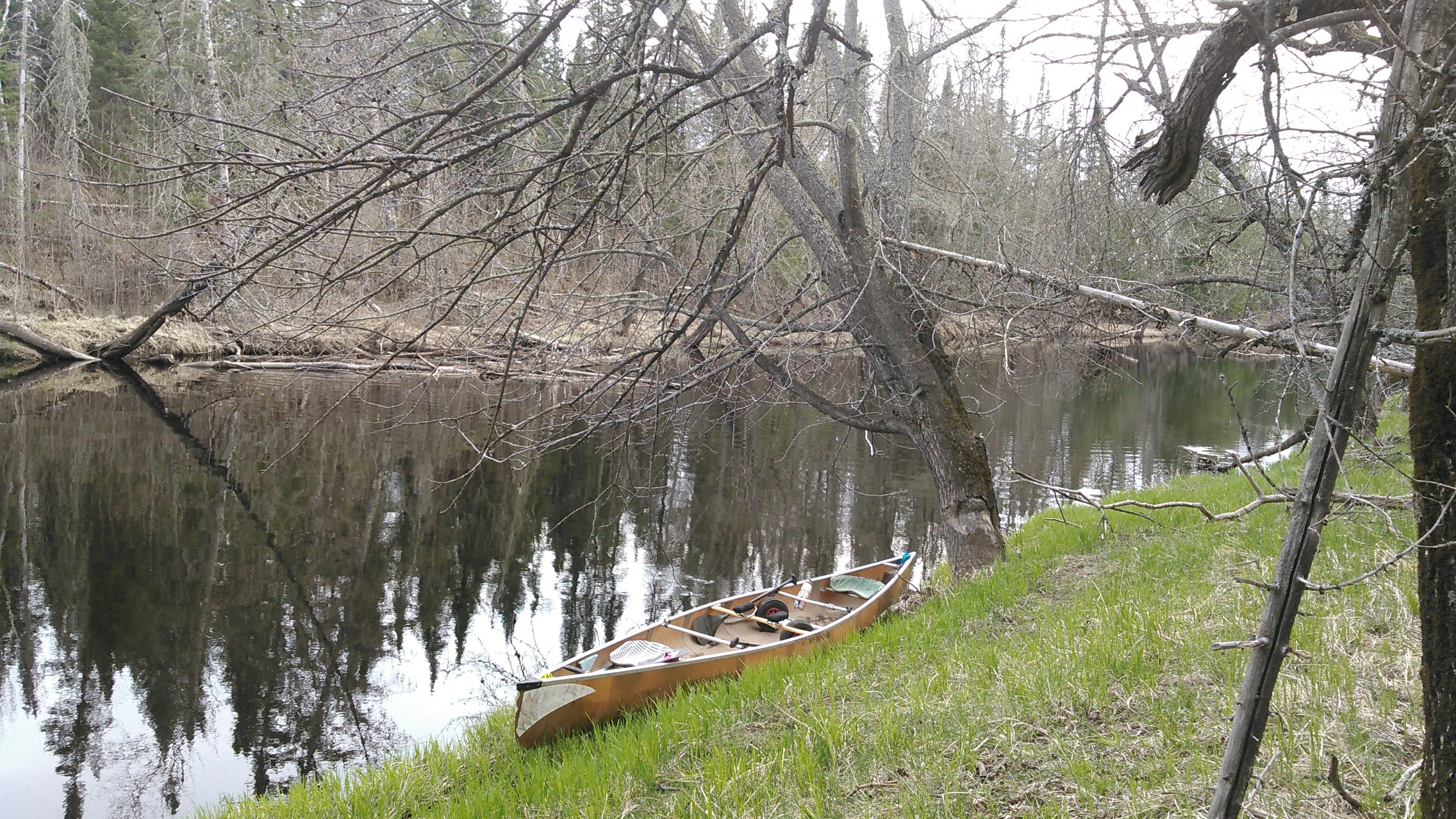
We only had one glorious mile of flatwater paddling in the swamp before encountering our first rapids. We were able to paddle up them, scraping our canoe a few times. The river kept up like this, deeper pools and then rapids. There was ice on the banks where the water had oozed out of the mud. It was that cold!
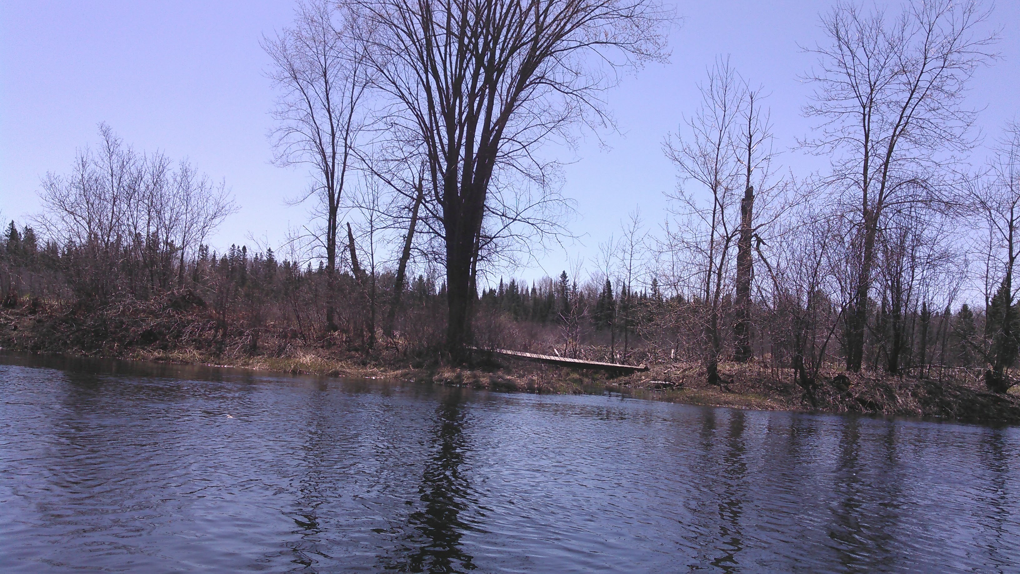
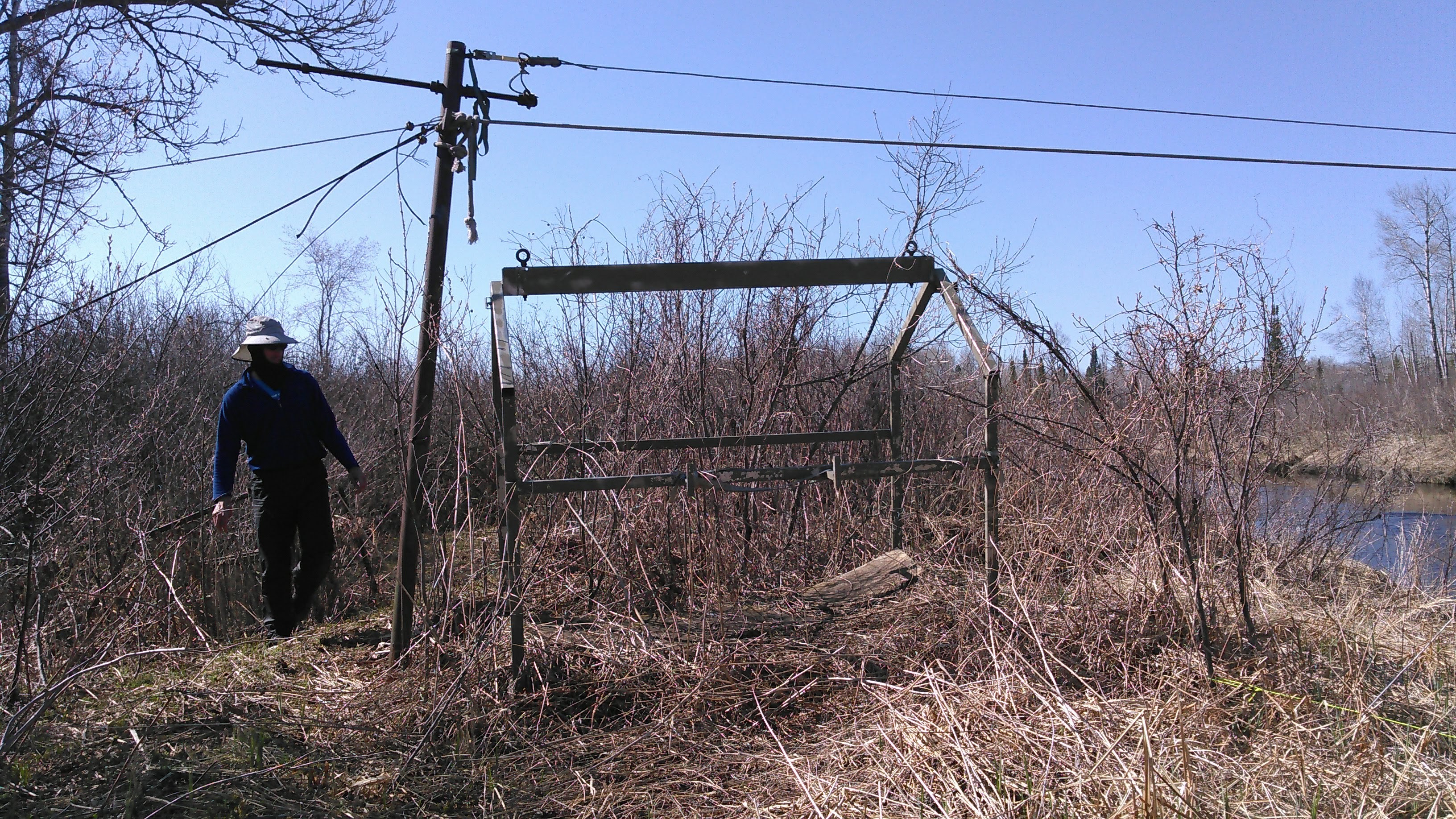
After a couple hours of paddling we were ready for a break. We seized the opportunity where we saw a zipline across the river. Here I found a place where the grass came down to the water where we could more easily get out of the canoe. We ate a snack and then went exploring. Erik checked out the zipline while I walked up the hill on a trail that led to a cabin. No one appeared to be around but this area looked frequently used.

While at the stop I tended to my hands. Both my hands and Erik’s were incredibly dry. Mine started cracking. I desperately needed lotion, but obviously didn’t have any along on the trip. I thought about everything we had and settled on trying bodyglide on my hands. This seemed to help. I just wished I had thought of it the day before to prevent all the cracking. Soon we got back on the water.
A couple miles later of upstream paddling we got to where there was an old road on the left bank marked on our map that we thought about taking versus the work of paddling up rapids and scraping our kevlar canoe. When we came to the best take-out for the road, the water was flat and so we continued paddling.
We continuously encountered class I rapids followed by calmer pools. There was one beaver dam at least a foot in height that took us till the second try to get up it. Twice we tried bushwacking back to the road but both times we were unsuccessful and so we kept paddling up the river.

Frequently we used our paddles to push off the bottom of the river in shallow rapids. I also tried a pulling maneuver where I tried to pull off a big rock in front of me. This wasn’t terribly successful. Erik largely got us up that river.
Near the highway 4 bridge we encountered one rapid with a strainer on our right. The current kept pushing us into that strainer and after we stalled out Erik asked for a portage. That seemed the safest and smartest thing to do. He pulled the canoe through the brush.
After a couple more turns and shallow rapids, we spotted the highway 4 bridge. We could have kept paddling up to the dam at the reservoir but we knew this would entail many more rapids and canoe scraping so we decided to portage up to the reservoir. We were able to get in on the southwest corner, making for a short portage.
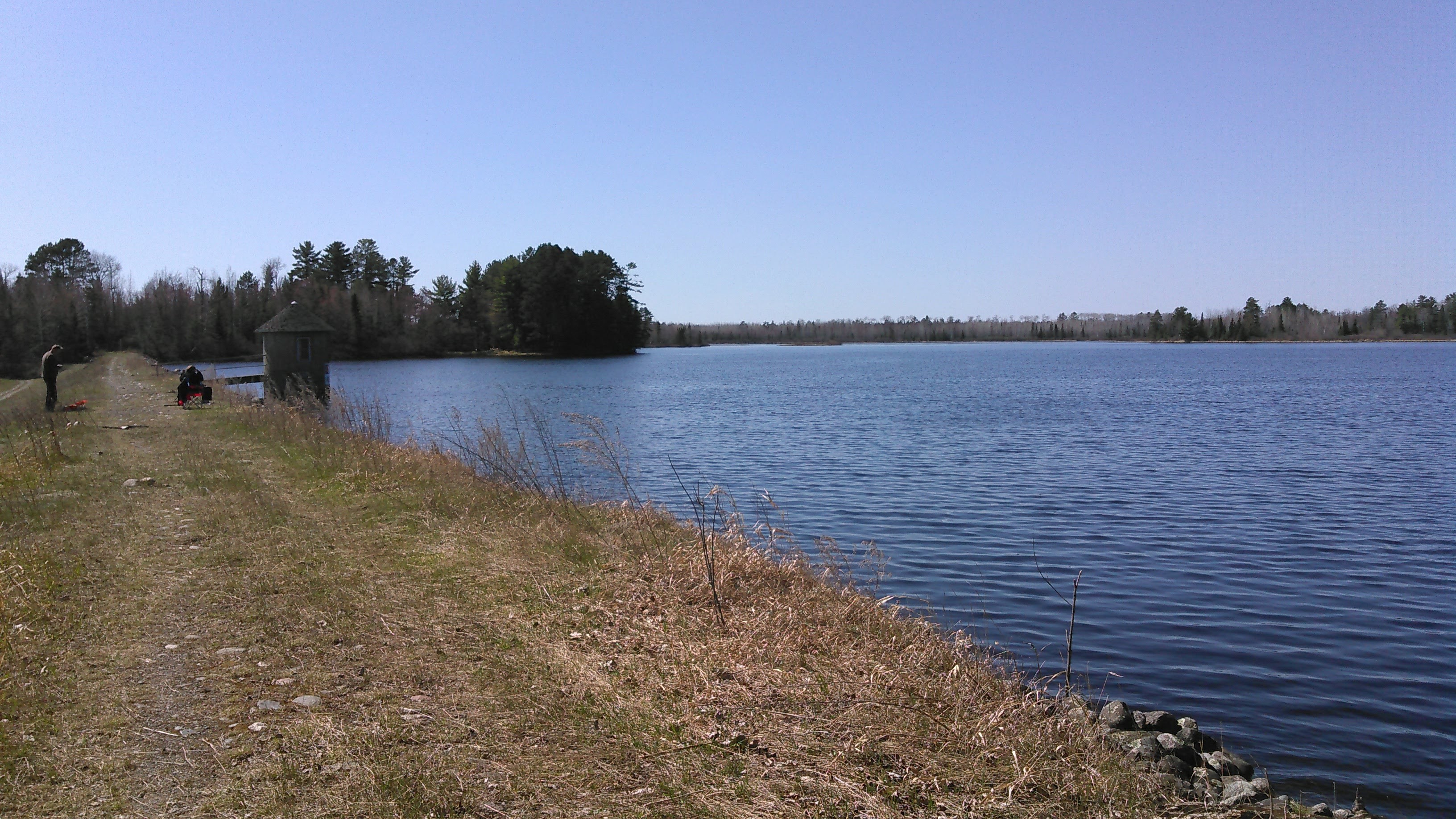
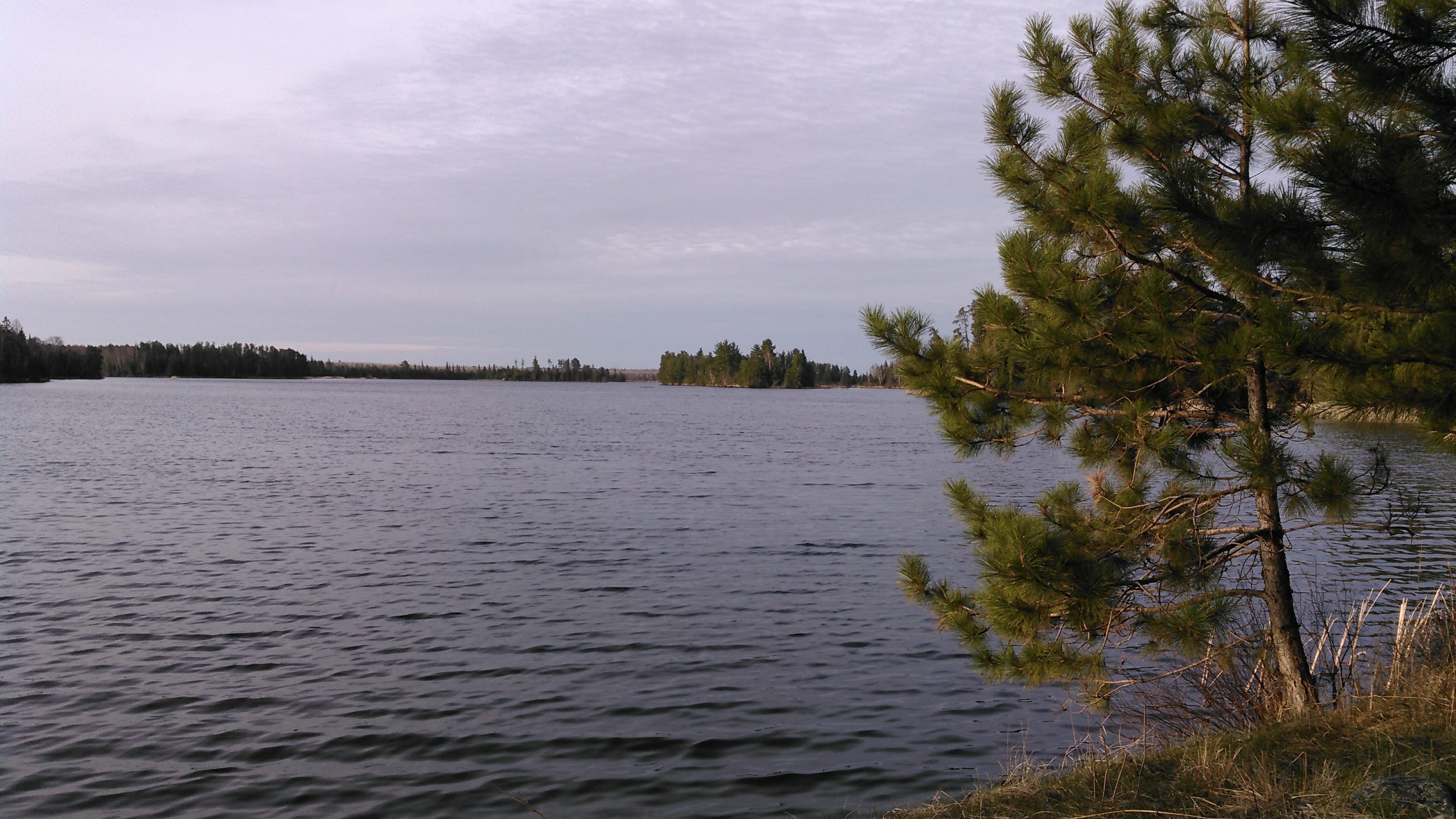
Then we paddled across Whiteface Reservoir. The wind was mild and this was easy. We camped at a backcountry site near the main campground which had a wooden retaining wall leading up from the river. This much infrastructure seemed a bit odd to us but perhaps is better suited to motor boats landing and mooring. It was nice to stay at a designated campsite albeit there was no evening sun so it was cold. We took a nice walk in the evening on the “loop” and to the boat ramp.

It got cold again overnight but seemed a bit warmer, like probably only into the 30s.
Day 5: Portage from Whiteface Reservoir to St. Louis River
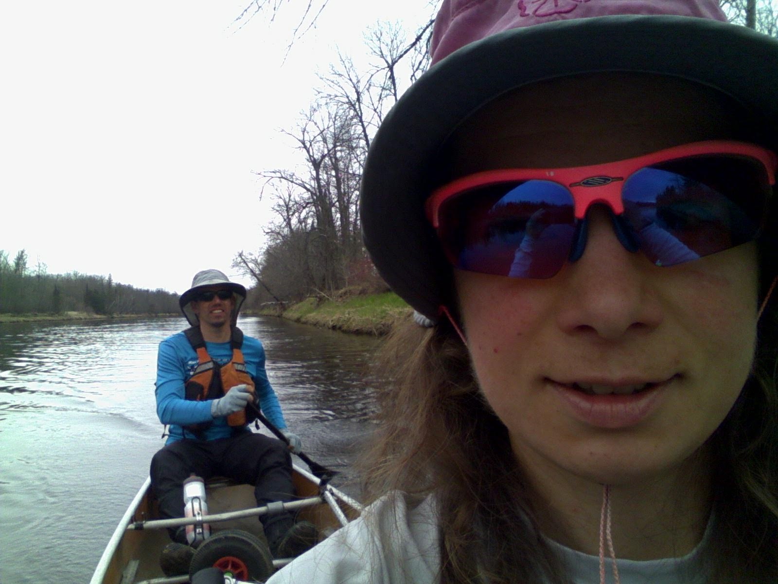
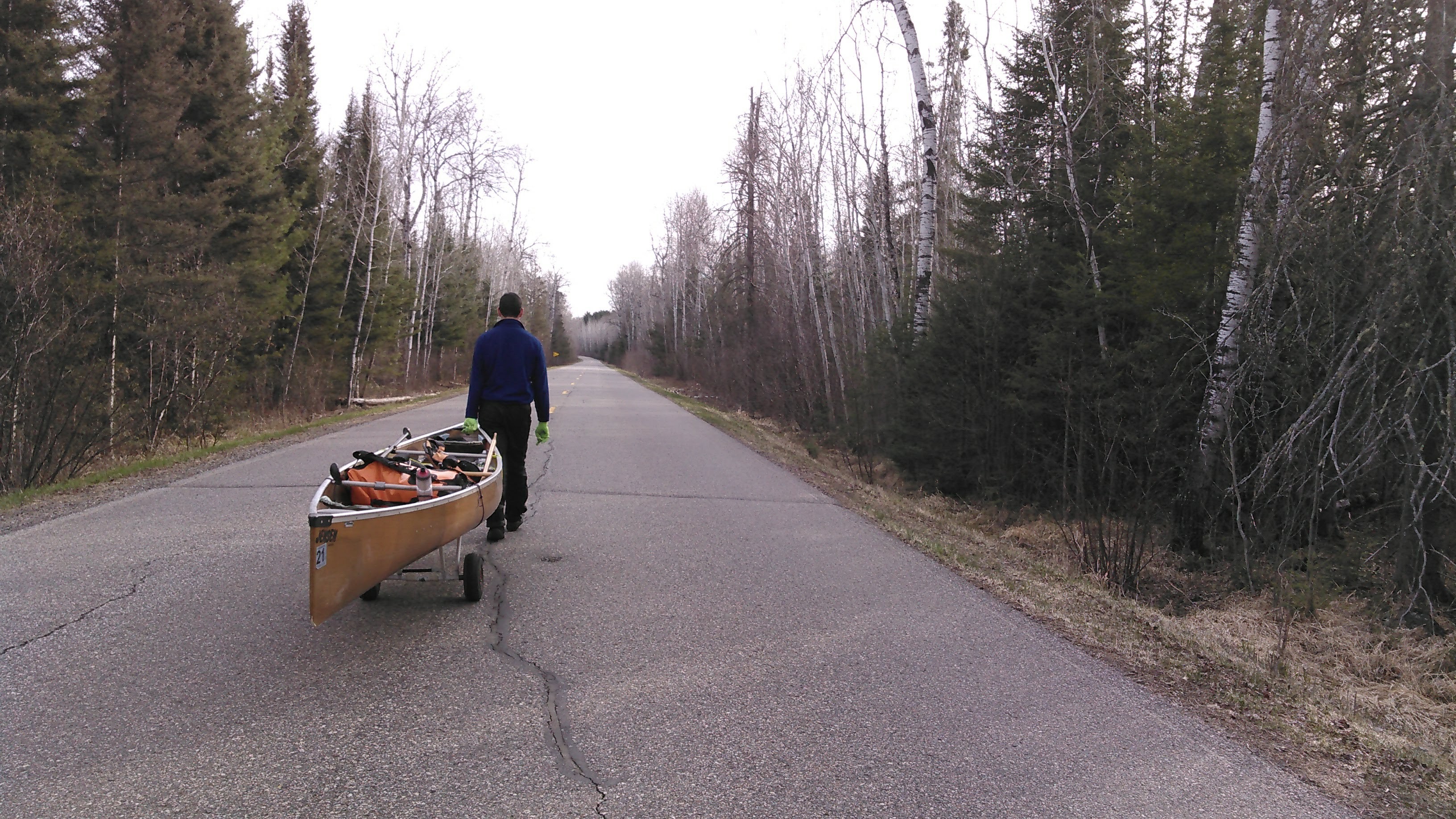
We began our portage by 7 am, wheeling on the trail that led to the group campsite and then down hwy 618, out onto the highway 16, and then down a long gravel road (hwy 130) to connect with the St. Louis River. Given we had planned this portage, we brought with our portage wheels for our canoe. Wheeling along the road, rather than canoeing, was a nice change of pace once we got off the busy highway and so long as Erik was pulling the canoe!
There were a ton of beer cans along the side of the gravel road. I braided my hair as we walked along (I officially learned how to french braid on this trip) while Erik called out all the brands of the beer cans he saw.
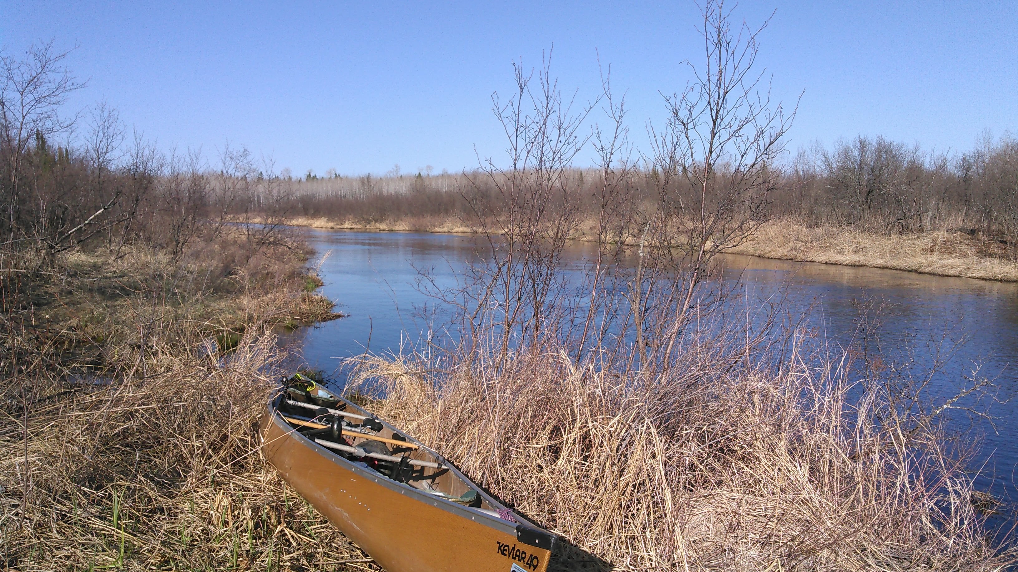
My feet were getting tired by the time we got to the put-in on the St. Louis and wow, but the St. Louis River was huge here! It flowed through a swamp section and was wide and shallow. There was a beaver lodge out in the middle of the river. The wind was wicked but fortunately we were paddling downwind. There were a ton of swans. And occasional big rocks sticking up above the water.
As we rounded a bend to the left, we cut the corner a bit tight and our canoe hit a rock. Now I switched to my beater wooden paddle. At the hwy 790 bridge, all the water funneled into a Class I shoot. From here, as far as we could see, the river was a rock strewn mess. Right before we encountered a second bridge (hwy 130 again), this one for the road we had spent a good deal of time portaging on earlier, there was a rocky drop in the center of the river, where it looked like there may have been an old bridge.
“We have to go left!” I shouted to Erik. This was to follow the deepest water. We back-ferried left and made it through without hitting rocks.
“Let’s eddy out after the bridge!” I yelled to Erik. We did so. I told him I hated hitting rocks with our kevlar canoe, risking putting a full-thickness hole in the boat. Erik got out the map and noted we would have to portage an additional 12 road miles to bypass 8 river miles. So we kept going in the river. Within 50 meters we got stuck on a rock. I again pleaded.
We looked down the river. There was no good way through. The river was impossibly wide and shallow with too many big boulders. These weren’t rapids. This was a rock bed, yet too deep to just walk down.
Erik finally agreed, although reluctantly. We paddled back to the bridge, took the canoe out of the water and put it back on the portage cart.
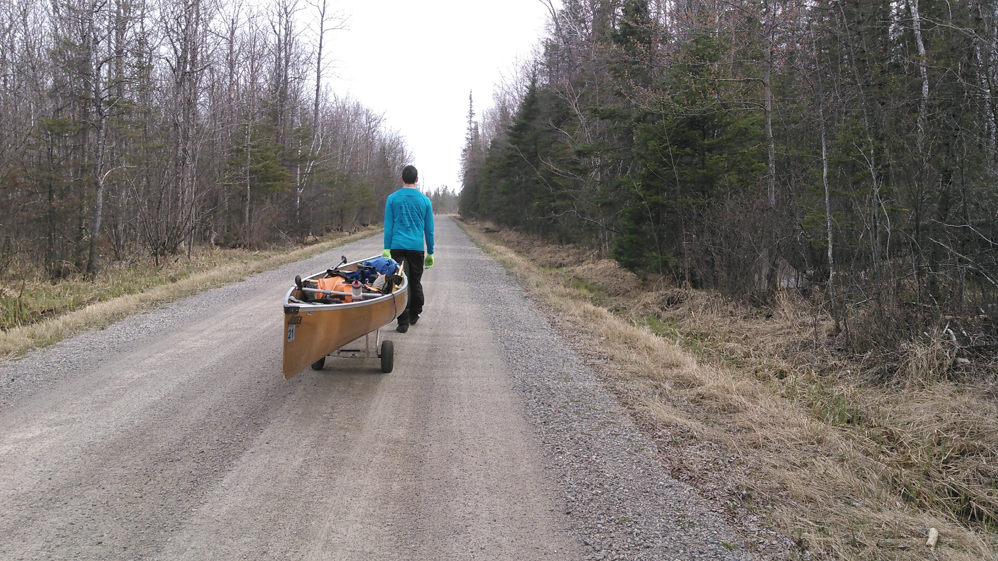
We headed back south on our small gravel road, hwy 130. This time the road grader was out and he went back and forth and back and forth as we slowly walked along. Then we came to the part we had gone up just a few hours before. Finally we turned west, away from the road grader, onto new land on hwy 160. After 2 miles we walked out of the national forest and started passing houses.
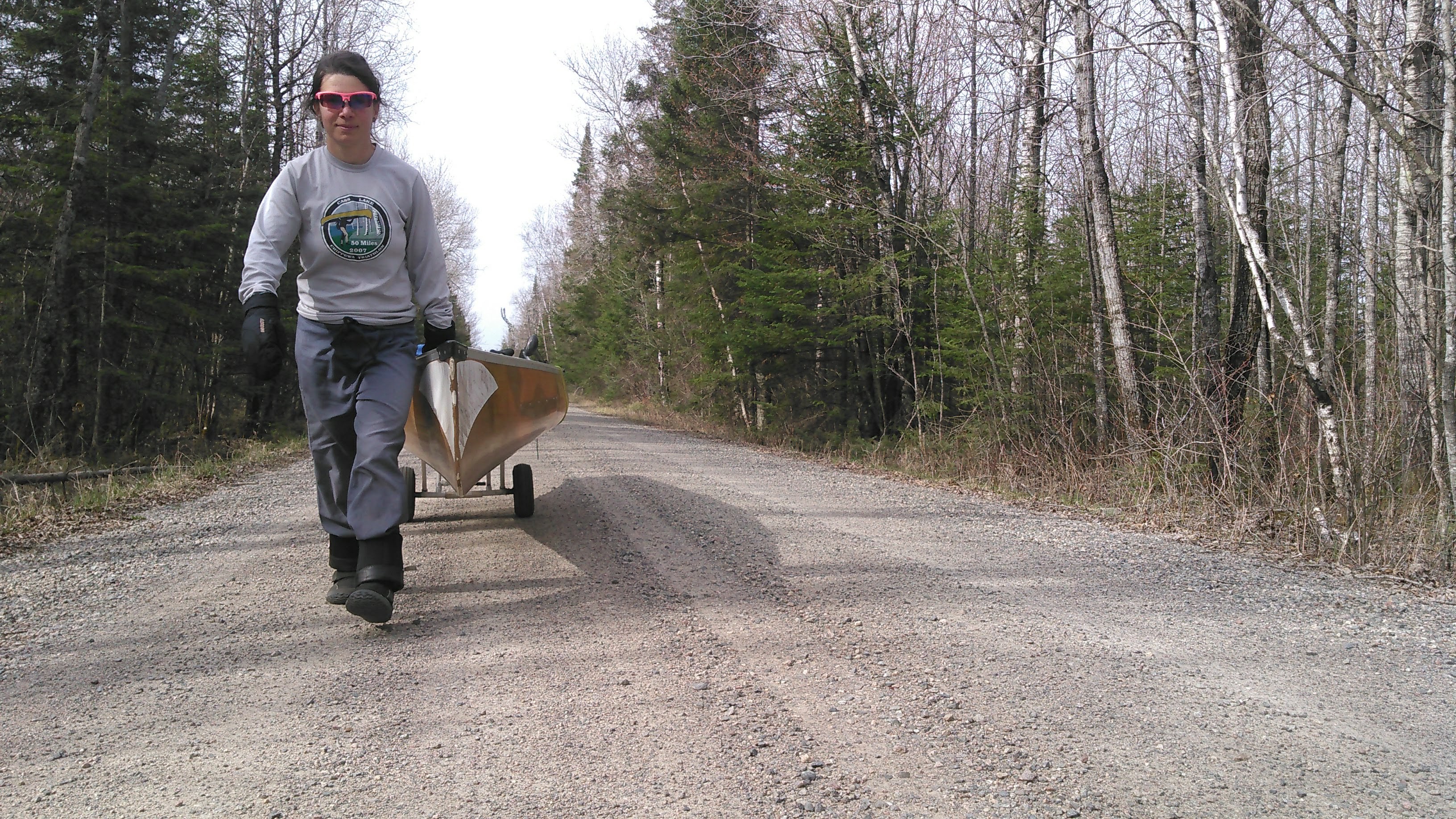
Soon thereafter we made our way onto paved roads. We decided to stay on the busier but paved roads as we headed towards Aurora so it would be easier to wheel the canoe. Before we got to the bigger road, the back of my left knee started to hurt- the same pain I had during my only previously ultra marathon (the Loopet Loppet in 2018). It got gradually worse and by the time we had headed a couple miles back north it was getting really bad.
Sometimes I took a turn pulling but as my leg started to hurt worse I let Erik do most of the work. There was a strong south wind- we were fortunate to be going the “right” way.
We had a bit of fun- mostly when remarking at the craziness of our 22.5 mile portage. But we also saw some fun things that brought back memories. We saw lots of old buses in farm fields. Erik thought they were for bringing pigs or cows to market, just like his pig-farmer grandpa used to do.
I started to get giddy. I was thinking about the book In the Shining Mountains about the guy who went out west in the 70s to be a mountain man but discovered he couldn’t just build a cabin anywhere and that there wasn’t much wild land left. I thought about writing a sequel of sorts: On the Shining Waters: A Search for Minnesota’s Best Flatwater. It would be all about my craziness to find nice deep, reflective water. Oh, I thought this was a bit funny, too.
The last couple miles I got into my meditative state when I no longer felt my leg pain or stiff legs, when I no longer thought about where exactly we were on the map, when I no longer really thought about anything at all. I just kept walking, and then we saw the bridge over the St. Louis River.
Once we put our canoe into the St. Louis River, we could see some minor class I rapids upstream and a lot of waves downstream. Sure enough, we encountered a class II rapid immediately downstream of putting in. This got my heart rate up as our racing type canoe isn’t designed to handle whitewater. We followed the deepest water (biggest waves), first left, then right, then center while trying to avoid all the pillow rocks. We got one wave over the bow. Fortunately all the waves were square and we made it through unscathed.
Erik noted that class II rapid had vision, whereas the previous ones that day had no clear way through and not enough water.
After this we encountered a few riffles and fast current. Around a bend, we spotted a swinging bridge that was partially fallen. It obstructed 75% of the river at water level. We were able to get under it on the left side. The bridge was at a Christian camp designed to look like an old fort. One building said “The Redeemed” on it and another said “The Born Again.”
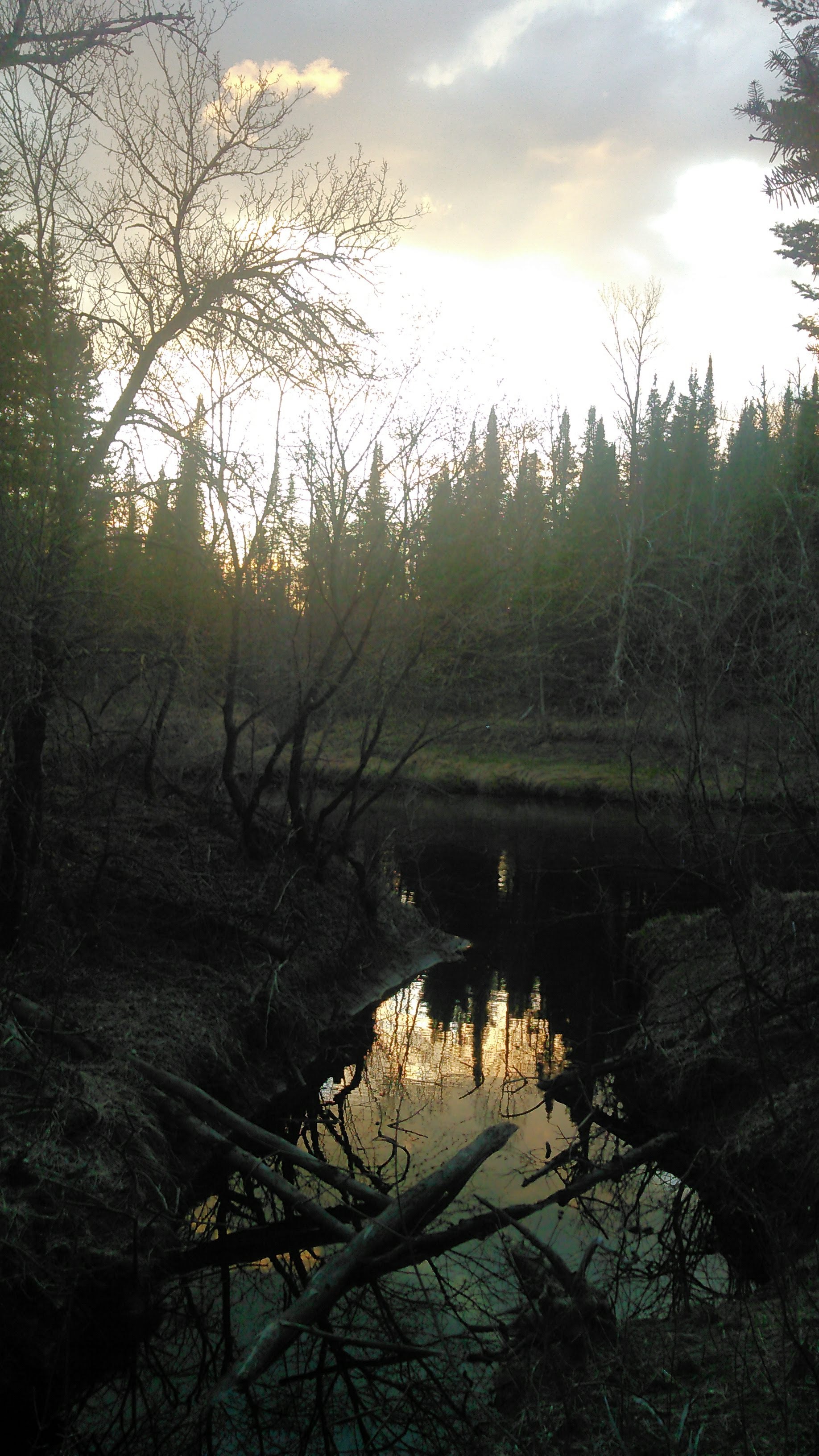
Now we started looking for a good campsite- someplace in the trees that weren’t too thick but had an easy landing. We pulled in behind a bend and Erik went to scout a tent site. He was gone forever. I got us some water, walking around on last year’s dead shore grasses, my leg hurting behind my left knee. Finally Erik came back to lead me through the forest to get to our tent. I got inside, then it started to rain so Erik made dinner from inside the tent. It rained all night, but we had gotten to camp before it started to rain and so that was OK. This was our first “warm” night with temperatures only down into the upper 40s.
Day 6: St. Louis River Mile 162 to 111.5
We woke up with 90 miles to paddle back to Floodwood. I’m always about padding all day and don’t like hanging around in camp (unless it’s nice weather and a nice camp) and so we decided to finish up the trip in two more days.
We started out under a heavy drizzle for 2 hours. There were occasional rocks and riffles that got less and less. The banks were pretty- mostly pines contrasting with birches and poplars. After we went under our first bridge of the day (hwy 4), the land dramatically changed. The river still twisted and turned, but now we were paddling through low land with sugar maples. At one point we encountered a very large log jam that we had to portage on the inside bend. It was super hard to get out of the canoe and get the canoe out of the water as the bank was 5 feet high. We used a tree that hung out over the water. We parked the canoe parallel to shore, I climbed out onto the canoe to at least hold onto the bow. Erik initially stayed in the canoe and threw our packs onto shore. Each throw caused the canoe to swing out into the current. I’d have to pivot the canoe back towards the bank from my tree. Finally we got everything up onto land and then did our small portage.

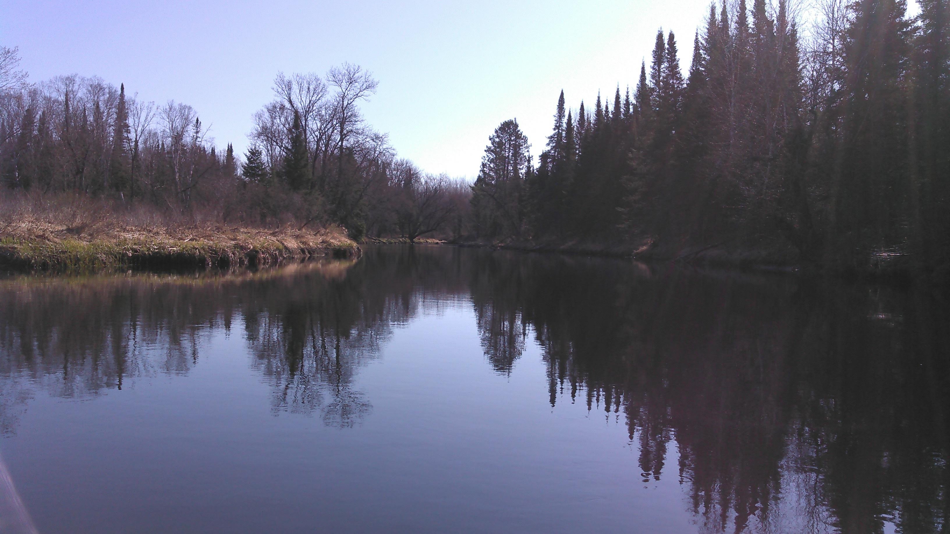
After another bridge or two, the banks got higher and returned to coniferous forest. From here (mile 165) to the hwy 53 bridge was the best paddling of the trip. With the reflection of the trees in the water, this was the flatwater I’d been searching for the previous day. I definitely would love to paddle this section of river again- so many twists and turns and absolutely beautiful.
Just upstream of where the Embarrass River comes in we passed an old house in need of much repair that appeared abandoned, but apparently still owned as there were No Trespassing signs. I had some serious thoughts about trying to buy that house and rehab it to paddle perhaps the best flatwater in the state right out my door. We’d probably spend too much time working on the house though and not have enough time to paddle:(
I was quite obsessed with noting where the Embarrass River comes in as this trip made me note that this is the river that flows up by Giant’s Ridge. It was pretty small but the only notable tributary we passed all day. Maybe in high water!
We took a lunch break under the bridge just before hwy 53. It had been threatening rain but after this stop it was clear blue skies!
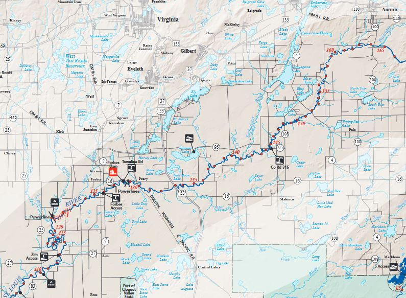
We kept going. As we passed under hwy 53, Erik hoped some passing cars would see us and be inspired to paddle. Here the river was less winding as we approached the Forbes Dam. There were still some bends and turns though before we got to the dam. The portage was easy and there were a ton of people fishing just downstream of the dam. It was the most people we saw all trip.
From here we started to encounter some riffles that picked up to class I rapids as we neared mile 120. For the most part these were easy with small waves and enough water. We passed two women in a doubles kayak just before we got to the campsite by the powerline before the river turns more definitely south.
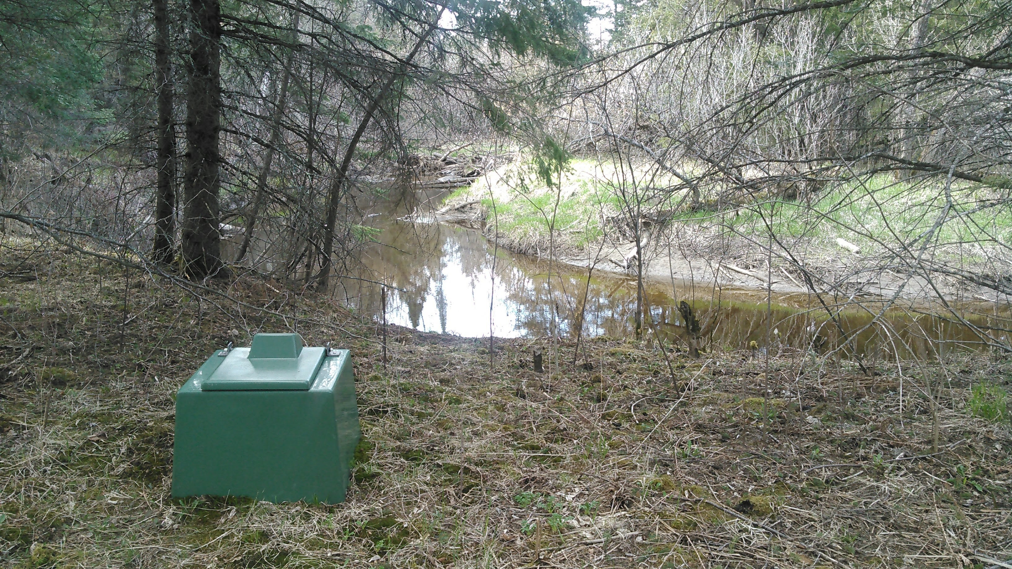
We stopped at the campsite, I pooped in the latrine (my first and only time sitting to poop all trip) and we made dinner. The sun was shining and it was warm enough that I could comfortably wear only my adventure pants and long sleeve shirt. We had arrived at 5 pm and after dinner, we decided to keep paddling!
Once we got back in the canoe, we passed a motorboat with a couple guys fishing. Soon we were in the loopy section of river. We saw innumerable beavers slide or trip down the bank into the river as we passed. It seemed they were sunning themselves up on shore. We saw yet another motorboat!
It was a pretty section of river and we almost missed the campsite as it was actually one bend upriver from where it was marked on the map (closer to mile 111.5). Several of the campsites on this section of river were where a small creek came in and it seemed the landing was slightly up this creek. However, most of the landings were obstructed by down trees. This one was no different and so we landed on the main river and then climbed up a big bank. The campsite was quite pretty, about 20 feet above the river. Again, it only got down to the upper 40s overnight.
Day 7: St. Louis River Mile 111.5 to boat ramp up Floodwood River
Given early sunrise, we’d been waking up around 6 am often and today was no different. We were on the water paddling by 7 am and enjoyed a few more miles of twisty river which ended around mile 98 where there are a few rapids where the Swan River comes in. These rapids were very easy with a set or two of class I.
Then we were onto the much straighter boring river. We stopped for our first lunch break just after the bridge that goes to Toivola. There were no houses in sight. It ended up being private property and the friendly property owner and her sister were out for a walk in the woods. Oops. All I can say is with the water levels being low, but relatively recently so, it was hard to find good landing spots that weren’t so muddy.
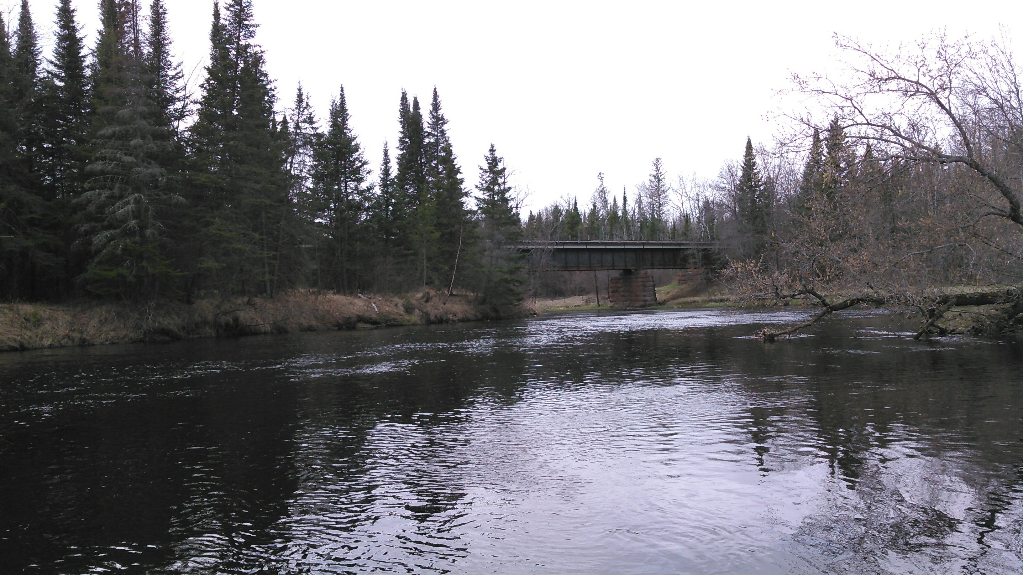
Somewhere we went under an old sketchy railroad bridge, constructed largely of wood. After we were just around the corner downstream of the bridge, we heard a train go over it. We wished we could have seen it but we didn’t want to paddle back upstream. That bridge just seemed so sketchy- like it wouldn’t support the weight of a train! I’m not sure where the bridge was but I think it was mislabeled on our map which showed it near Casco, just upstream of mile 106 but I think it was really closer to mile 100.

Between miles 89-86 the map showed a bridge over the river every mile. We thought this was a bit strange. In reality, there was no bridge at mile 88. The bridge at 87 was a railroad bridge, and the ones at 89 and 86 were there. Several of these bridges in this area had red graffiti showing “6-24-02 high water mark” high up on the bridge, at least 10 feet higher than the current water level.
We stopped for our second lunch on some marshy grass on the east bank. As we neared the confluence with the Whiteface River and went under some powerlines we encountered a very easy Class I rapid/rifle. Then we were back to the confluence with the Whiteface River.
Just above the confluence there was a big zipline across the river. This was the third zipline we saw of the trip (the first one we had seen was just about a mile up the Whiteface River).
The rest of the paddle down the St. Louis River was boring. The leaves were now starting to bud on the trees. I paddled shirtless for the first time all trip- in fact, it was the first time I took off my shirt all trip. I kept my sports bra on the entire trip! It never got sweaty enough to need to take it off. As we neared Floodwood, we noticed some riffles. We hadn’t noticed these on our paddle upstream and assumed the water level had dropped over the week we were out. Indeed, back at the boat ramp the water level was definitely lower than when we started. Back at home, we confirmed the lower water levels on the official DNR water gauges.

If we had to do this trip again: I read the guidebook, Paddling Minnesota, about a year before we did this trip. In regard to the Whiteface River, it noted Class I-II with a gradient of 4.75 feet per mile and “rapids are bouldery but are not technically difficult.” I didn’t re-read this section in the couple weeks prior to embarking on the trip. I think this was largely an ego defense mechanism. When I read the above excerpt I thought “oh, it won’t possibly be that hard. I’m sure those Class II rapids have just become easy Class I.” Sometimes being blissfully ignorant and mentally unprepared is for the better.
Best decisions: Doing this trip- it was so simple to paddle so many miles without a shuttle! Extending our portage. We needed to do something hard on this trip and paddling up those rapids just wasn’t hard enough. But that 22.5 mile portage wheeling a canoe fit the bill.
Next time: I highly doubt we will ever repeat this loop again but it’s a good one, and would be even better if higher water levels could allow for just a 10 mile portage between the Whiteface Reservoir and the St. Louis River. This trip has inspired an early season chasing-snow-melt hike into the headwaters of the St. Louis and packraft back to Aurora. Stay tuned. And I most definitely want to paddle the St. Louis from just below Aurora to the Forbes dam in a bit higher water- maybe even more than once as this just might be Minnesota’s best flatwater!

One thought on “The Great Northeast Minnesota River Loop”