
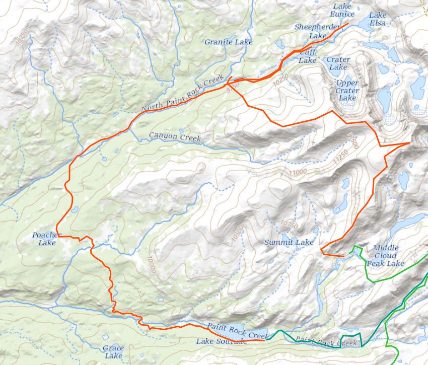
You’ve heard of the Sierra High Route. You’ve heard of the Wind River Range High Route. But have you heard of the Bighorns High Route? Have you ever even heard of the Bighorns?
I had because of my dad. And then I found his old 1970s map of the area.
Located in north central Wyoming, the Bighorns are a mountain range located just a 12 hour drive west of the Twin Cities which further piqued my interest.
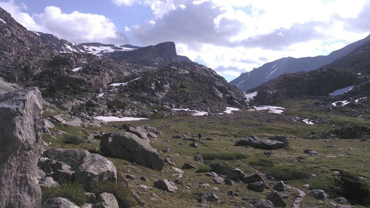
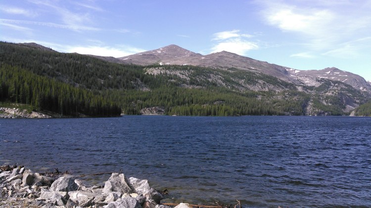
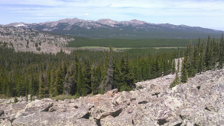
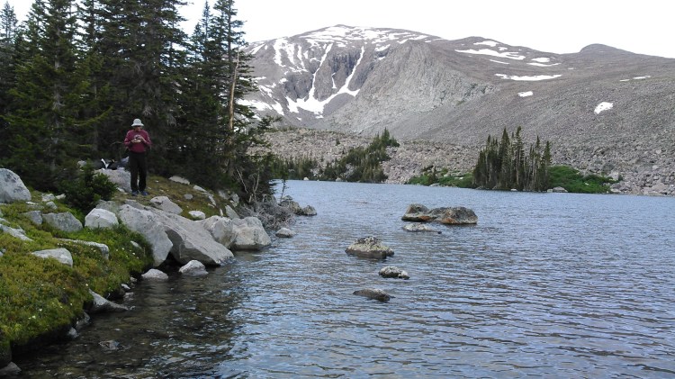
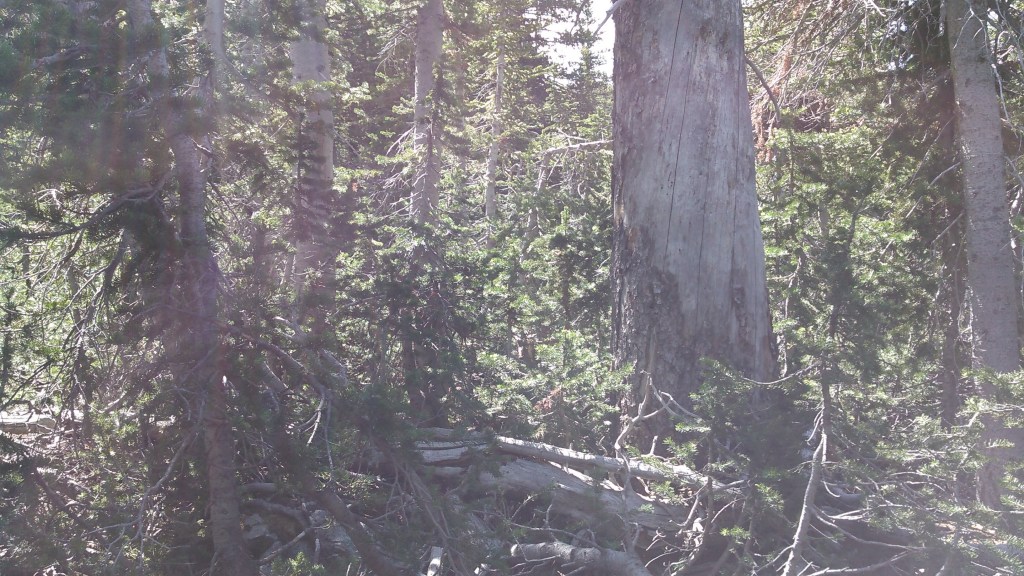
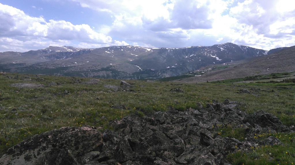
I had driven through the north Bighorns once- back in 2012. They seemed dull. Large plateaus without majestic peaks. They paled in comparison to the Grand Tetons. But there had to be something good there so I scoured the terrain feature on Google Maps, and sure enough in the center of the range was Cloud Peak, towering over 13,000 feet above sea level with a sheer cliff and glacier off the east side. And there were several neighboring peaks nearly as tall, also with cliffs and alpine lakes in the valleys. I had to check it out.
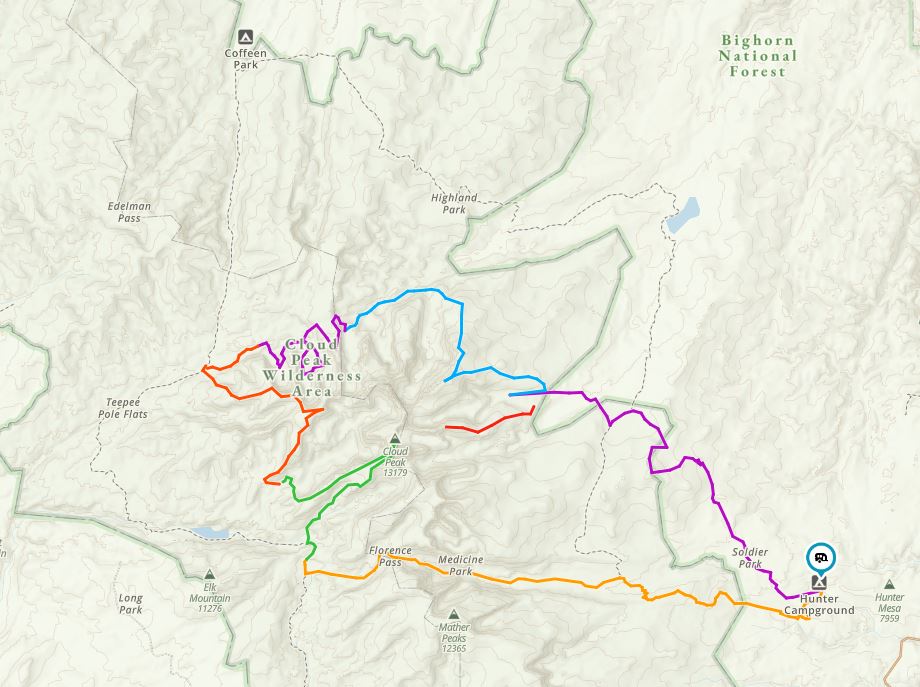
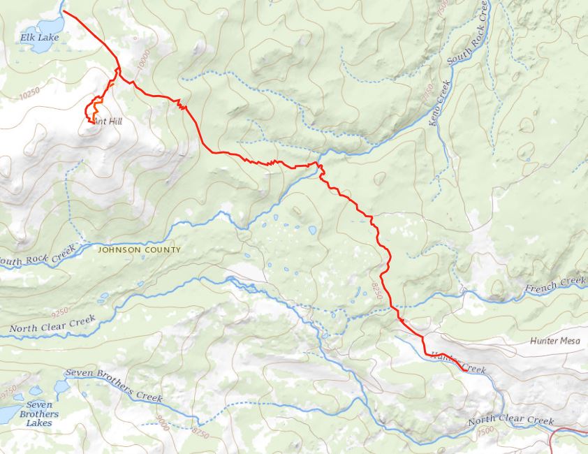
Next I went to hillmap.com (to use hillmap.com, zoom in on an area, then from the drop-down option from the upper right of either map, choose either CalTopo or CalTopo FS for maps in the United States) to search for trails. There was one, the Solitude Trail, that seemed to skirt all the tall peaks in the northern Bighorns except for one high pass in the center of the range. It was obviously a low route. That wouldn’t suffice for this state high-pointer. That Solitude Trail would be way too easy.
First I began looking into routes up Cloud Peak. I looked at the topo map. Oh, there was a fairly obvious route up from the south. Then I read some accounts of people hiking Cloud Peak. It seemed do-able. Then I went to a presentation about a middle-age guy climbing Cloud Peak. This will be easy I noted after that talk.
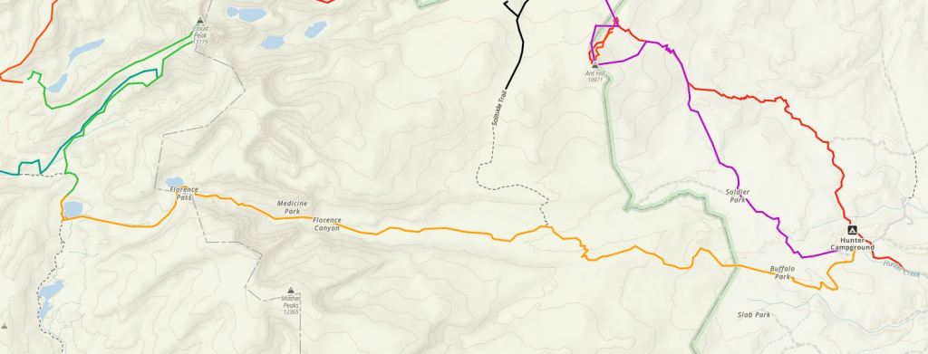
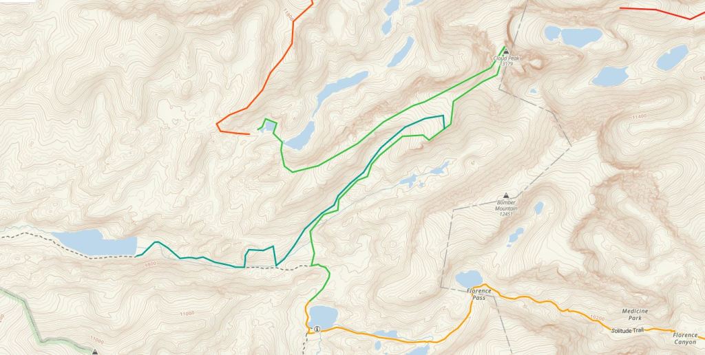
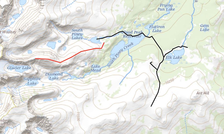
The next step was to link parts of the Solitude Trail with higher passes. Since I always like to drive the shortest distance possible, I decided to start from a trailhead on the east side of the Bighorns and chose Hunter. Front there we would hike to the Solitude Trail, picking it up on the east side where it abruptly turns north to head over Ant Hill Pass. We would head west though, clockwise up to Florence Canyon and over Florence Pass.
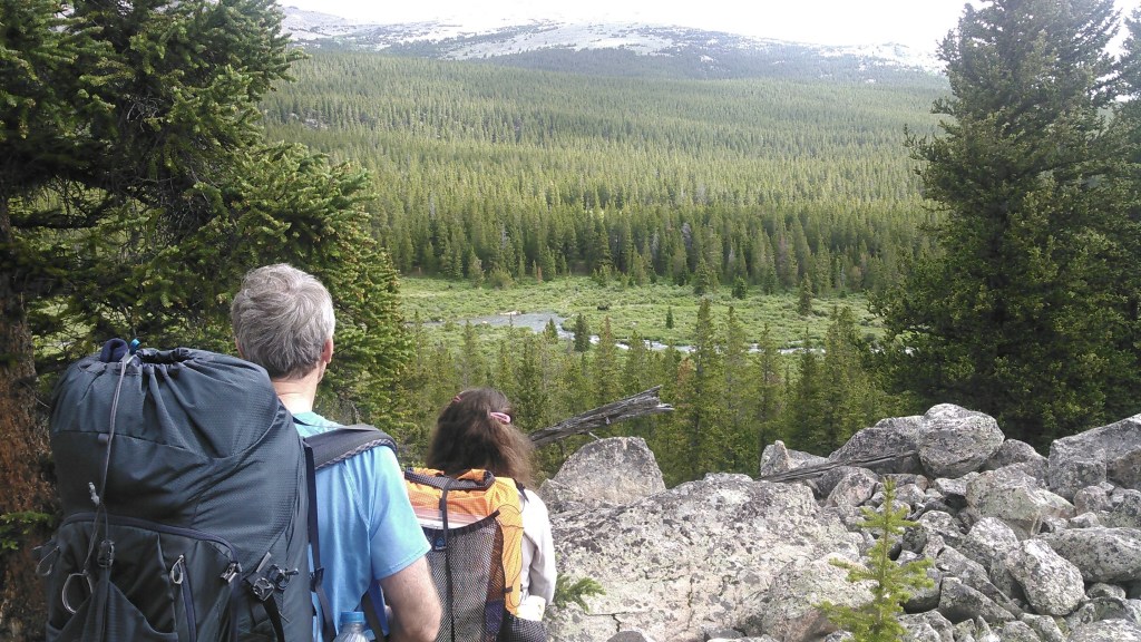
We would camp near Mistymoon Lake and from there climb Cloud Peak, then descend west, down a different ridge than we had come up, and hike down to Middle Cloud Peak Lake for the night. The next day we would resume ridge walking, hike up to 12,000 feet before descending down a north ridge to Cliff Lake.
After a brief trail hike, we would again diverge from the trail, this time climbing onto the divide before hiking down to the Highland Park Lakes for our next camp. We would then do a bit of trail hiking before bushwacking and climbing up Penrose Peak, going down a different ridge, to end up at one of the lower South Piney Lakes. The next day we would hike up the adjacent ridge to the south to get a good view of the glacier off the east side of Cloud Peak, before descending one ridge over to Mead Lake for our final night out. From there we would return to the trail, briefly have one final off-trail foray up Ant Hill, before returning to Hunter Trailhead via trails.
Perhaps there’s a reason we haven’t heard of the Bighorns High Route.
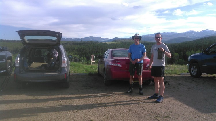
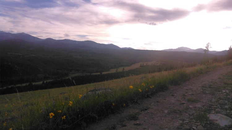
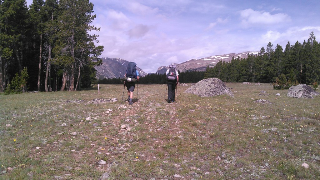
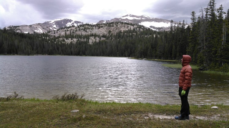
My husband, Erik, and I drove out on a Saturday (6/27/20) from the Twin Cities, arriving at Hunter Trailhead in time to start hiking around 7 pm to get in a few miles before sunset. After a couple of hours, it was getting dark and we set up a dry camp.
Day 1: 6/28/20
The next morning we kept hiking, up towards the Solitude Trail and Florence Pass. To make a full loop, we had detoured a bit and first gained a ridge. While coming off this ridge into the valley, we saw 3 moose in the meadow below us.

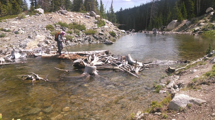
Down in the valley, we encountered our first stream crossing over North Clear Creek. This crossing was relatively shallow, only a couple of feet deep, with relatively mild current, but it was a long one and the snow-melt water was freezing! We elected to go barefoot over the crossing to keep our shoes and socks dry.
Once we got our feet dry and our shoes back on, we started hiking up the trail. Within half a mile, we got to the intersection with the official Solitude Trail. Now we enjoyed about 4 miles of relatively flat hiking, albeit that required crossing North Clear Creek twice more. The last time we were able to cross on some logs. Just prior to beginning the climb to the pass, we crossed Powell Creek, draining the Powell Lakes. Although this drainage basin is relatively small, this creek was flowing like crazy. We crossed on some more logs. This time I got my shoes wet, although I removed the insoles and my socks.
We began climbing but now, the threatening clouds that had been hanging out on the pass all morning came down to us and a sudden thunderstorm came up complete with hail. We found a spot to set up our tent and did so quickly to stay dry. It was also cold outside which can make staying warm difficult even with rain gear.
Experience has taught me it can be impossible to know how long some of these storms will last and rain gear is only good for so long, so we prefer to set up the tent if it looks like there’s a big storm.

The storm was brief. The sun came out. We contemplated staying here for the night versus continuing on. Staying this far away from Cloud Peak wouldn’t set us up well for a summit the next day so eventually we pushed on, although by now it was near 4 pm.
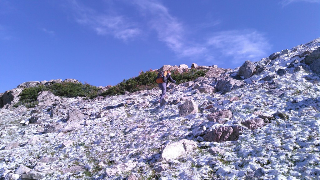
It seemed like it took us forever to hike up to Florence Pass. The trail shouldn’t have been that hard, but we were constantly dodging water puddles from the snow-melt to keep our feet dry. It was also cold. I was wearing a long sleeve shirt and shorts but it was windy and I was right on the brink of needing more clothes. At one point the trail was covered in snow on a rocky slope. We hiked up the snow. I was thankful Erik kicked in the steps for me.
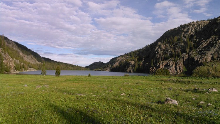
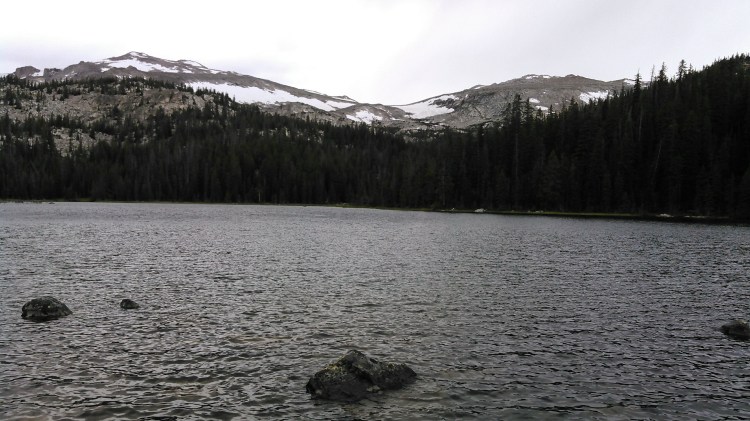
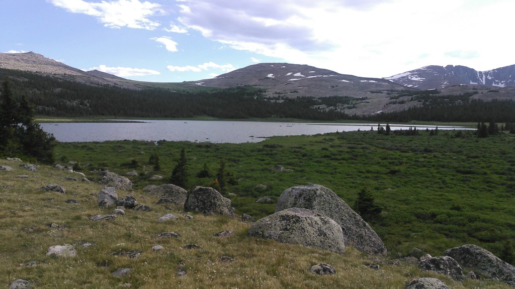
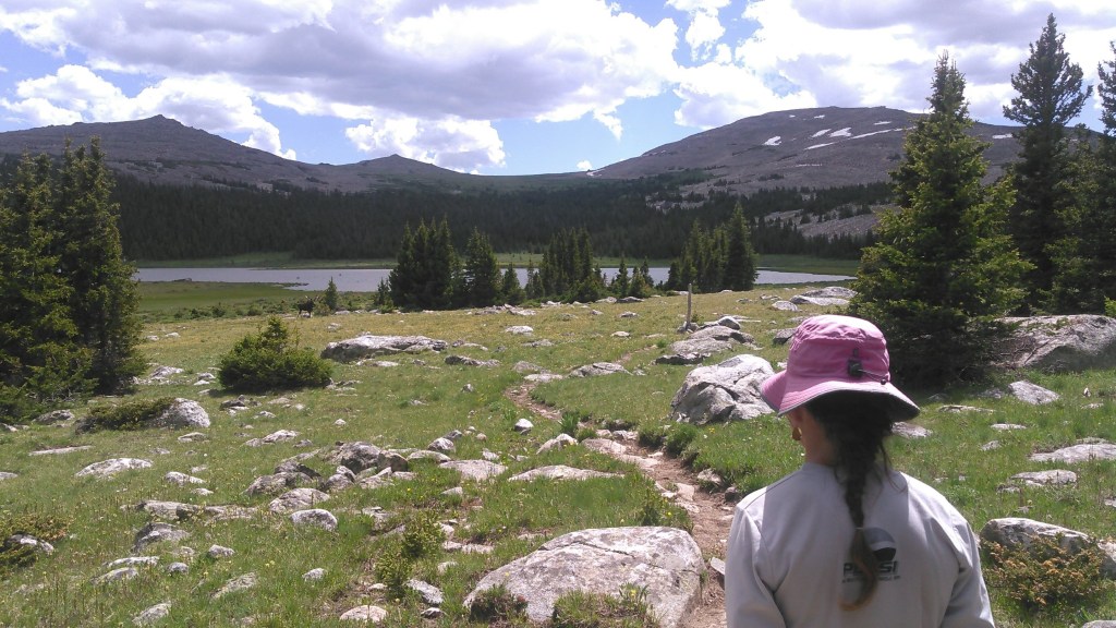
Finally we made it to Florence Lake. We were able to keep our feet dry by rock hopping across the river. From there we walked up less than 100 vertical feet to the pass on easy trail. We had a dinner break and kept going. We thought there might be some camping near Gunboat Lake but this was well above treeline so we hiked down to Mistymoon Lake. It started to rain just as we got to Mistymoon Lake so we set up our tent quickly and got inside. Before long it was bedtime.


Day 2: 6/29/20
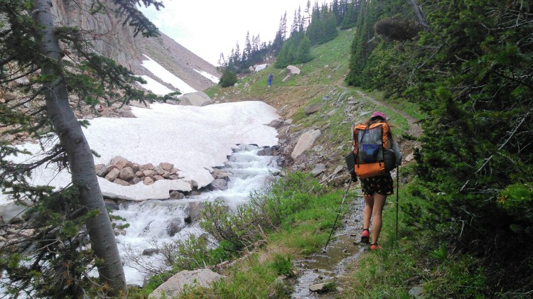
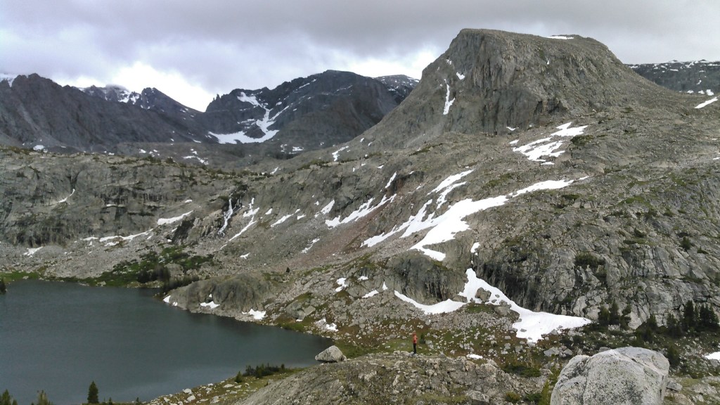
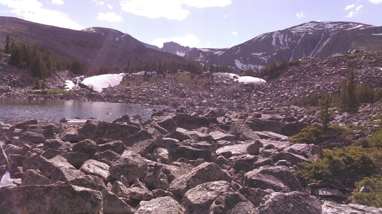
Despite some intermittent rain overnight, we woke to clear skies and decided to go for the Cloud Peak summit. We had a ways to hike to begin the off-trail trek and it was nearly 9 am by the time we got to the waterfall at Paint Rock Creek that marks the start of the climb. We started climbing on the east side of the creek and before long had to cross the creek. This was a short but deep crossing. Once we got across, we found the social “trail” and started making quick progress. As we passed through some small valleys, this meant crossing snow patches and at one point had to jump a deep creek. There was a snow gully but fortunately it wasn’t very steep and we were easily able to walk up it.
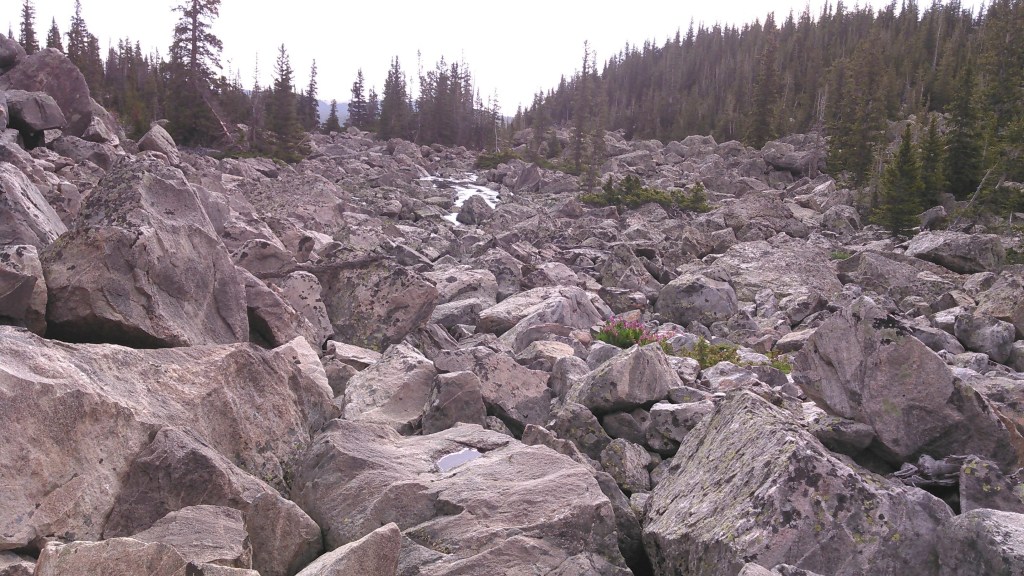
After a snack break we kept heading up. Now we were on boulder field. We climbed towards the ridge as opposed to going up the shallow gully. I’m terrible on boulders and was moving slowly. Erik suggested we try hiking up a snow patch on the gully and he ventured onto the snow and immediately started post-holing. Obviously the snow wasn’t going to be faster. We could look up towards the summit which was mostly shroud in clouds- go figure, Cloud Peak in the clouds. The weather was cold and the wind was howling. It was already getting late in the morning. We had already decided to bail on the route down to Middle Cloud Peak Lake but now we were thinking about bailing on Cloud Peak, too. We had started too late and the summit was cloud covered. We still had at least a third of the way to go of the off-trail portion and it looked to be all boulder field. So we gave up and headed back down.

The weather was a mix between sunny and cloudy threatening rain. As we neared the Solitude Trail, there was a grassy hill to our right. I couldn’t help but detour up this hill. It was early afternoon and I wasn’t ready to head to camp yet. We wondered off-trail. It was easy. No boulder fields. I was thinking that since this High Route thing wasn’t working out, I could do a Medium-High Route. We poked over the ridge and saw an unnamed lake not accessible by any trails. This exploring was fun but after awhile we got cliffed out. Of course, it also started to threaten rain around this time. Erik found us a way down that wasn’t too sketchy. We partly used a steep gully with some loose rocks. Fortunately these sections were incredibly short and we were soon back on trail. It also decided to stop raining.


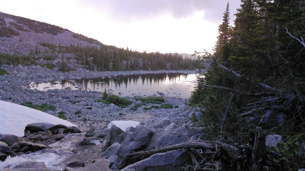
We headed towards Lake Solitude where we planned to spend the night. The Solitude Trail paralleled Paint Rock Creek. We gained a bit of elevation and could see Lake Solitude in the valley. Then the trail began switch-backing downhill. We took off our shoes and socks to cross a creek that we crossed and then spilled onto the trail for awhile. Just after that, there was actually a bridge over a huge waterfall from the creek that drained the Middle Cloud Peak Lakes. That’s where we had planned to get to that night but obviously didn’t make it. There must have been a lot of snow in that valley still.


Once at Lake Solitude we looked for campsites on the northeast side of the lake. There were a couple potentials but Erik wanted to do the stream crossing of Paint Rock Creek before we got to camp so we didn’t have to do it in the morning. The stream crossing had a deep section in the middle that was flowing really fast. Erik went across with his pack on and then came back to take my pack and let me hold onto him as we went across. The water was so cold, Erik was quite crazy to be in it for so long but I was thankful for the support. Somewhere in the deep section Erik stepped on my foot and when I finally got out of the water my foot was bleeding from a small cut.
I walked barefoot to camp- something I never do- sat down and bandaged up my foot. We found a very well established camp in the pines on the southeast side of the lake. Clearly a lot of people camp there. The view wasn’t very good but we were ready to stop for the day. It rained intermittently again that night.
Perhaps we would have made the summit of Cloud Peak had I given a 13,000 foot mountain in Wyoming some respect. I didn’t realize there would be so many boulder fields (potentially if there wasn’t snow it would be easier walking up the shallow gully) and we simply started way too late.
Day 3: 6/30/20
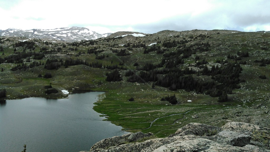
The next day we set off on the Solitude Trail under mostly cloudy skies. The Solitude Trail follows a fairly low route and as much as I wanted to go up high on the ridge, I knew that would be very tough going on boulder fields and down steep terrain. The trail was very wet on the south side of Lake Solitude as we tried to keep our feet dry. There were good views looking back towards the big waterfall draining Middle Cloud Peak Lakes and a nice field at the mouth of the lake to enjoy the view.

We had to cross Paint Rock Creek again. This time Erik and I went together. It was another long crossing. I had previously held onto Erik’s arm but partway across the creek I started holding onto his backpack. We both liked this a lot better. After this Erik and I got quite cold. At our food break we put on our down jackets. The trail went away from Paint Rock Creek and went over a small divide and then back down again to North Paint Rock Creek. There we had yet another stream crossing. This one was rough. It was shallower than the previous ones, but we were cold as the air temperature was barely 50 degrees and it was cloudy. It was only a couple miles before we had to cross Paint Rock Creek again! This crossing was much deeper than the previous. Per the map, this looked to be our last big creek crossing of the day for which I was incredibly grateful.
Apparently the Solitude Trail is aptly named as we only saw a single group of three all day.
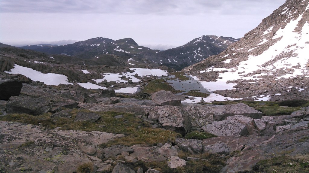
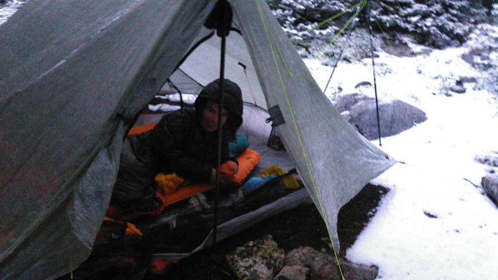
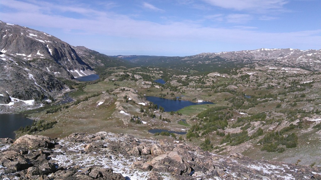
Soon thereafter, the Solitude Trail turned north but we continued heading east towards Cliff Lake and the bigger mountains. We weren’t quite ready to stop yet at Cliff Lake so we kept going, heading towards Lake Elsa. The views here were good looking back to Cliff Lake and up to the Crater Lakes. Just before getting to Lake Elsa it started to hail and snow on us. We had a small stream crossing that I was able to jump with Erik’s help and then we found a tent spot in a bunch of pine trees. It looked like a tent site, but apparently the animals liked to seek shelter there, too, as there were all different kinds of animal poop. We set up our tent and got inside to stay dry. Erik cooked dinner in the tent vestibule and we ate in the tent and then it stopped precipitating so we went out to explore.

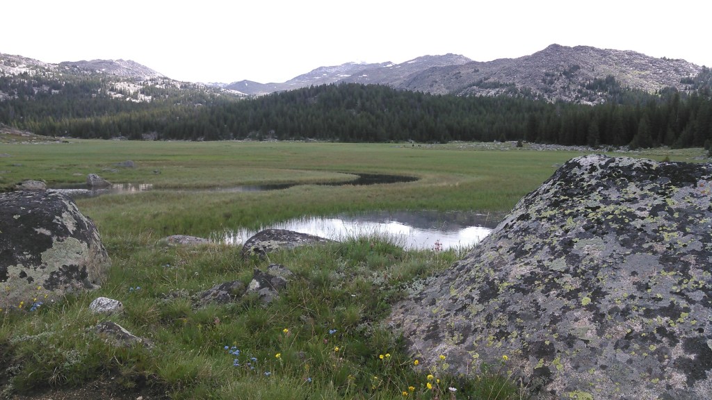
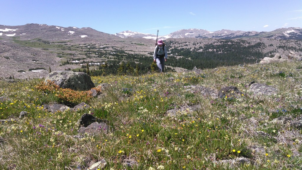
First we headed towards Lake Elsa where we found a couple nice tent sites on the west-northwest side of the lake. From there I was determined to climb the little hills north of Lake Elsa. I did so while Erik headed back to camp as he was tired and concerned about the storm clouds. From here I could scout our route up over the divide. My original plan was to hike up to the Crater Lakes and the lakes above Elsa but from what we could see that would be steep and likely take several hours so we decided to just head straight up to the divide. I was stoked to see the way up to the divide looked to be a grassy slope and looking up onto the divide there appeared to be some grassy slopes, too.
I really liked this evening hike with mostly grassy terrain and big slabs of rock. The country up here was wide open without boulder fields! I would have liked to linger longer but there was some lightning in the distance so I, too, headed back to camp with lower elevation. It still wasn’t storming when I got back to camp so I wandered over to Lake Eunice to check it out.
Given the easy terrain around Lake Elsa and the higher lakes to still explore on a day-trip, we plan to camp two nights at Lake Elsa sometime in the future!
Day 4: 7/1/20
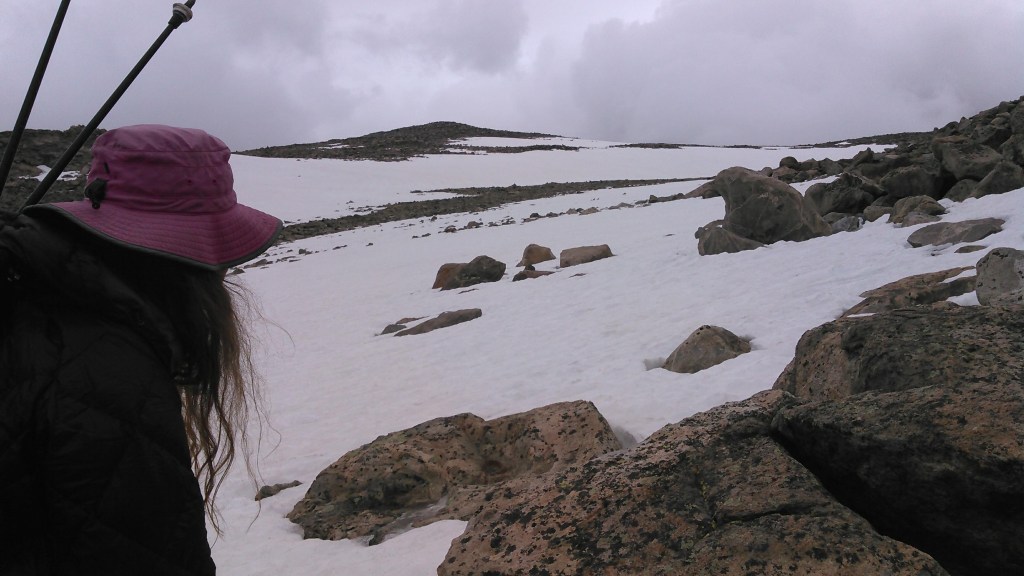
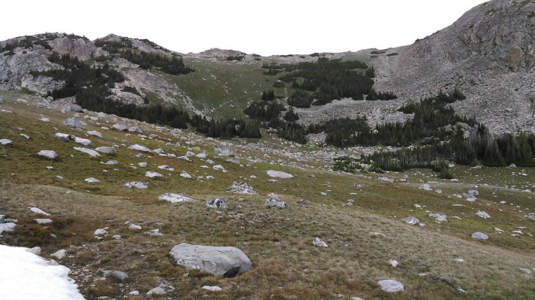
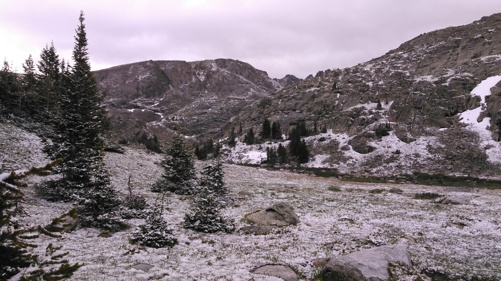
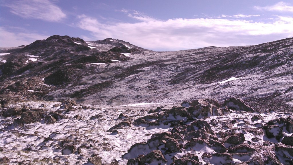
The storm rolled in and this time we got some snow! It stuck to the trees and ground. Overall it was less than an inch and made the world very pretty. It was still around in the morning when we headed up on the divide. The hike up to the divide was easy, even with the snow. There was a strong wind at our backs and we left on our down jackets. As we hiked higher and the wind kept up, we got colder and colder. We stopped behind a pile of rocks to put on our rain pants. Erik said he was tired of the snow we kicked up hitting his ankles. This briefly made me warmer. We hiked awhile on the divide heading north to where the route down wouldn’t be as steep.
Eventually up on the divide the grass gave way to boulder fields. I set my sights on getting to the very top of an 11,700 foot bump. We got close but there were a ton of boulders and the wind was so strong and I was so cold as it was around 40 degrees, I gave up 20 horizontal feet and about 1 vertical foot from the top. I hastily took a couple photos of the view and then we descended to a sunny spot out of the wind to eat a snack.

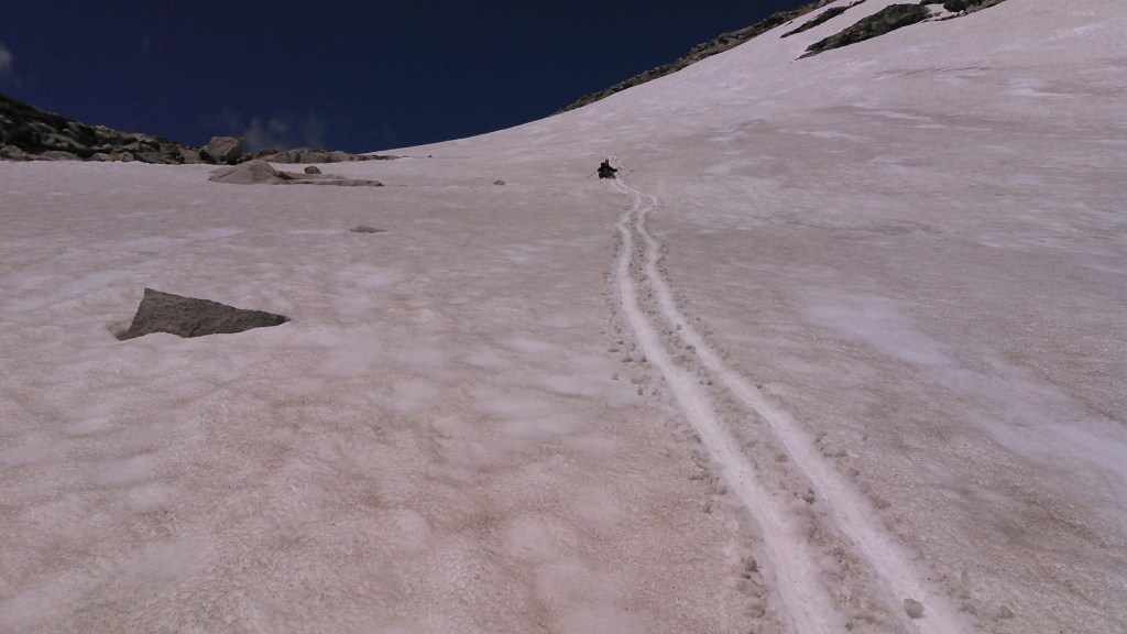
We started our descent on boulder field, trying to walk on grass or snow whenever possible. I know off-trail etiquette calls for being on hard surfaces whenever possible, but boulder fields are just too difficult. The plan was to descend a small ridge toward the Highland Park Lakes, but Erik found an adjacent snow patch perfect for glissading so we wandered over there. Erik glissaded. I did so until I fell on my butt. The snow wasn’t so steep and was soft so I could have gotten up but instead I slid on my butt for a ways.


When the snow ran out we were in low dense wet shrubs. We wandered around trying to find the best way down, often finding big rock slabs with boulder fields or shrub sections in between. We followed some moose paths. Then we came to a big stream crossing above Myrtle Lake. We took off our shoes and waded across and used this as a bathing opportunity. It had been totally sunny until this point but as we started to dry out it began to hail so we moved on and soon got to Myrtle Lake.
I had been struggling with plantar fasciitis prior to our trip but now as I made my way through a boulder field, my right foot inverted and I had an immediate pain exacerbation. My foot now hurt worse than before and I was babying it. Fortunately Erik found a route down closer to Myrtle Lake and we were able to almost exclusively avoid any further boulder fields.
Erik found us a campsite at the northwest corner of Highland Lake where we also found a good social trail. That night we went for a little walk following the social trail to even better campsites on the north and east ends of Highland Lake with much better views than ours. We didn’t see any people that day.

Day 5: 7/2/20
My original plan for the next day was to hike on trail from Highland Lake towards Spear Lake, then veer off-trail, follow a ridge down to Kearney Creek, then continue heading off trail up Penrose Peak, over the other side, and camp at the lower of the South Piney Lakes. Given my foot pain and the extremely slow-going off-trail conditions, we diverged from those plans and started following the main trail to Kearney Lake Reservoir. We soon got to the junction with the Solitude Trail and followed this to Kearney Lake Reservoir where we had a great view looking back west towards the big mountains. We kept going down the trail until we had to cross Kearney Creek. We assumed there wouldn’t be a bridge and so did a somewhat long crossing. There were a couple short shallow creeks to cross and then a boggy section. Once we got across the valley, we realized there actually was a bridge that we had missed. Bummer!

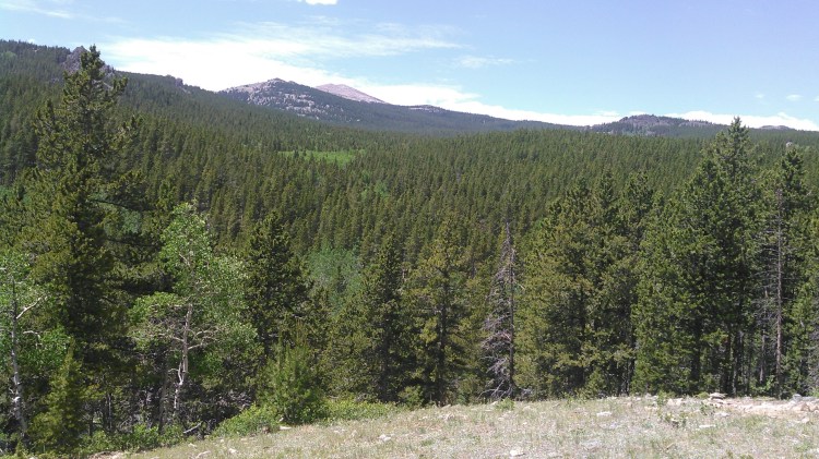
From here we started climbing up the ridge on Tut’s Cutoff trail. There were a few pesky mosquitoes. We came to a nice meadow with a view of Penrose Peak. From here we had the option of either taking a trail down to the valley to re-join the Solitude Trail near Willow Park Reservoir, take a trail marked on only one of several maps that cut across the base of Penrose Peak, or begin an off-trail adventure. It was way too late in the day to attempt Penrose Peak. This meadow would have made an excellent camping place, but it was hardly noon, so I proposed an off-trail medium-high route along the eastern slopes of Penrose Peak. We walked across the beautiful meadow and then headed into the forest. At least somewhat recently there had been free-range cattle in this area and so there were paths everywhere through the woods. This area was also relatively flat. We headed mostly south and gradually up.
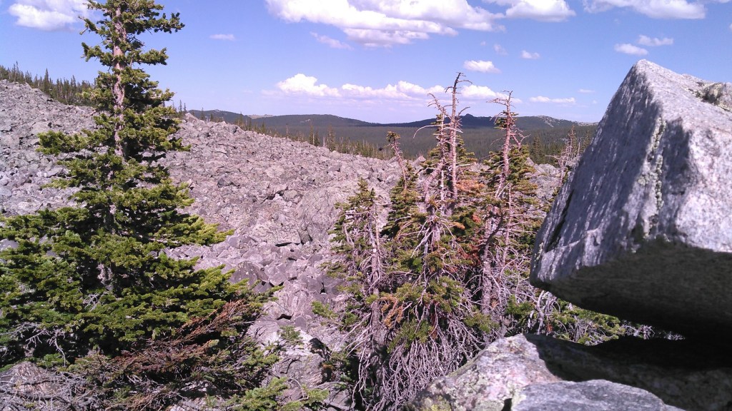
Eventually the terrain got steeper and we ran out of our grazing trails. We got to some boulder fields.
We had been aiming for a small saddle but came out too far to the left. There were lots of boulder fields if we kept heading towards our intended saddle so we just went over the closest saddle.
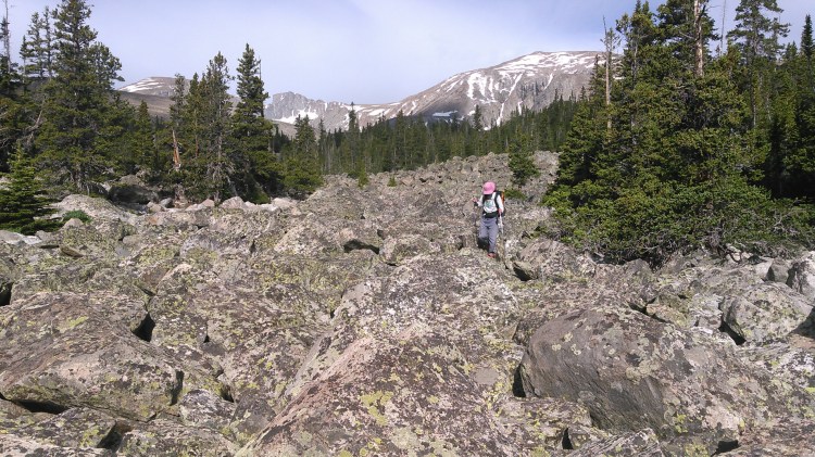
We spent the next couple of hours skirting boulder fields and finding grass as we made our way south towards South Piney Lake. An elk darted down the hill at one point. Things went well until we started heading west. Here there was no more grass. It was either boulder fields, deep forest, or the worst- a combination of both. This didn’t deter us from getting to South Piney Lake. We kept on slowly.
Finally we came out to a big boulder field that gradually climbed up. I thought for sure at the ridge we would be able to see South Piney Lake but instead there were only more boulders. I slowly made my way through until we got to some trees.

Here we descended a bit and came out on the north shore of the very small lowest South Piney Lake. I was done with boulder fields by this time and ready to camp but there was nowhere to camp- too many boulders.
We made our way to the outlet of the lake. Erik went to explore the woods on the southeast side of this lake but the forest was too thick. We started skirting around the south shore heading towards the lower South Piney Lake. Erik went ahead to scout a campsite and found one on the peninsula on the lower South Piney Lake. I followed Erik, knowing we’d likely have to repeat this boulder field the next day.
This campsite was perfect. It was obvious people had camped here before even if it was nearly impossible to get to. There was even an apple core in the fire pit. We weren’t sure if that had been left this season or if it had survived the whole winter. There were huge snow piles everywhere in the woods behind our campsite. It felt incredibly remote. We didn’t see any people that day either. The moon was almost full and we enjoyed spending time outside prior to bed.

Day 6: 7/3/20
It had been my intention to climb onto the ridge to the south of South Piney Lakes and head towards Cloud Peak to get a good view of the glacier on the east side of Cloud Peak and to look down on the adjacent lakes. Given we knew we had substantial bushwacking and boulder fields to overcome before gaining the official trail on the southeast side of Cloud Peak Reservoir, Erik suggested we head that way and forget about the ridge. I obliged.
So we spent most of the morning going through boulder fields and bushwacking until we came to a campsite on the north side of Cloud Peak Reservoir two thirds of the way to the east edge.


From here there were very good social trails that brought us to the dam embankment on the east side of the lake. We crossed South Piney Creek on some log bridges and then headed towards Elk Lake where we had decided to camp.
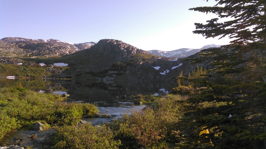
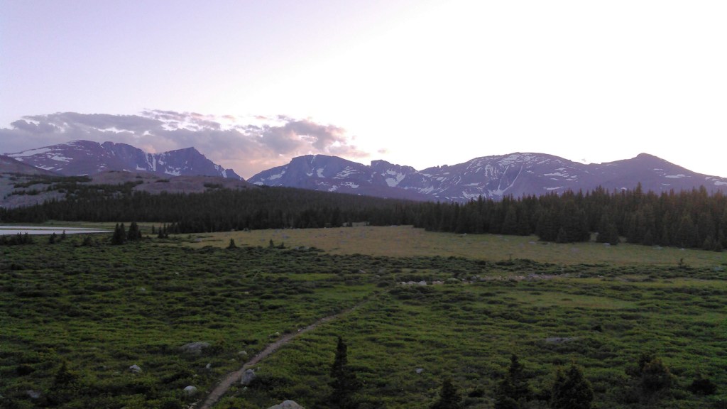
On the east side of Elk Lake, just across Elk Creek, there was a small ridge and some good camping behind. The view of the entire high peaks of the north Bighorns was unexpected. The only downside was the water coming through Elk Creek tasted bad and appeared to be full of algae. It was early afternoon. We set up camp and then debated on an afternoon side hike. Eventually we decided to head up the Solitude Trail towards Ant Hill Pass with the intention of climbing the bump just to the west of there. Before we headed out we watched a moose walk up the Elk Creek. We encountered him on trail and had a brief stand-off, albeit from around 100 meters. Once we were above tree-line hiking to the pass, we watched the moose walk across the lake.
By the time we finally reached the incredibly broad pass, we didn’t have the desire for more boulder fields and so scraped the climb to the peak.
On the way down I found a grassy slope that I really wanted to go up. So I convinced Erik and we made it to a sub-peak. It provided a 180 degree intimate view of the big north Bighorn mountains. It was similar to our campsite, but we were up higher and closer. From this vantage, we could also see that this valley had a grassy slope leading up to the pass with the Powell Lakes…perhaps a route for a next trip!

Back at camp we tried to enjoy our amazing view but the mosquitoes were absolutely ferocious. There’s pluses to being in the mountains in the early season: the snow is pretty hanging onto the mountains, there are waterfalls, and the wildflowers are gorgeous. But there’s also some drawbacks: those sketchy stream crossings, wet trails, and mosquitoes!!! I guess we can’t have it all.
I put up my hood on my down jacket even though this was our warmest evening and paced around the campsite, trying to enjoy the view including the almost full moon without too much distraction from the mosquitoes.
Day 7: 7/4/20
In the morning, our last in the mountains, we lingered in camp enjoying the view. We saw a mom moose and calf wade out into the water and 4 moose on the distant shore! Then we began our hike out with a detour up to Ant Hill.

We tried to walk on as much grass as possible instead of boulders but there were lots and lots of boulders. Even though the side-hike only climbed 1,000 feet in elevation, our detour still took a couple of hours with gawking to enjoy the view on top.


Once back on trail we dropped a couple thousand feet over the next couple hours to get back to Hunter Trailhead. The lower we got, the hotter the weather and the drier the earth. The last hour we hiked on wide ATV trails. Smelling the sweet piney smells in the forest was the plus to the hot sunny weather.
Overall, we only successfully managed one day of off-trail High Route when we went over the ridge on the north side of the loop. We did a second off-trail day along Penrose Peak on what would best be described as a Medium-High Route. There were simply too many boulders out there to complete our intended route as planned. And, I have to admit, I’m just not Andrew Skurka. Or else he has planned better routes:) I do have some ideas for a next trip with a bit more grassy areas and a layover day at Lake Elsa for some side-hiking there! So in summary, this was hardly the Bighorns High Route but rather a mix of the Bighorns Solitude Trail, Medium-High Route, and High Route.
If we had to do this trip again: Obviously I was disappointed to not complete my intended route. If I’m going to travel off-trail, then I need to lower my expectations. In the end, we adjusted our route to our skill level and the weather and learned a lot about the topography of the area. For routes like this, I need to learn to be satisfied with taking things as they come.
Best decisions: Bailing on Cloud Peak and stubbornly making our way to South Piney Lake.
Next time: Oh, because this is so “close” to home, I plan to go back a few more times. I have so many many ideas. First, there’s an on-off trail route in the south Bighorns. Then, there’s a hike starting from our same trailhead but hitting up Penrose Peak, Highland Park, back up over the divide, back to Elsa Lake, day hike to explore the lakes above Elsa, and back, retracing our route but switching it up so we take trails one way and off-trail the other.

I know you did your own route but was there an actual trail where you said only one map had a Penrose peak cutoff from beaver Lake, Tut’s cutoff, to frying pan lake, cloud peak resevior? Just seeing if you thought there was a viable trail there.
LikeLike
It’s been a few years so I just got out the map to have a look. From Kearny Lake Resevoir we took the Solitude Trail to Tut’s Cutoff Trail and then turned west on an un-named trail that heads west and dead-ended. We saw no further evidence of trail in this area towards Penrose Peak. From there we went off-trail to South Piney Lake (a route I do not recommend unless you are OK with significant boulder hopping). Presumably the main Solitude Trail (which has an off-shoot to Frying Pan Lake) would be viable but that trail is much lower and we didn’t go that way.
LikeLike