
My motivation for this trip was to bag the Nevada high point, Boundary Peak. As with Arizona, Colorado, and New Mexico, I combined this with a medical conference just south of Yosemite. After our Wind River Range trip this summer, I realized our itinerary, including a four-day-65-mile-16,000-foot elevation change backpacking loop based out of Luken’s Lake in Yosemite plus Boundary Peak was too aggressive, unless of course, I wanted to cry. As it turned out, the Luken’s Lake Trailhead was closed due to fire. Back in 2012, Erik and I hiked the John Muir Trail and so we were looking for somewhere different in Yosemite to hike. We decided upon a loop hiking east out of the Chilnualna Falls Trailhead in Wawona. I also had some debate between spending an extra day backpacking in the higher mountains versus six hours of drive time to hit up the Nevada high point, but in the end Erik said we should do Boundary Peak.
We flew into Fresno and then spent a harried two hours searching for fuel for the cat food can stove. Previously we’ve had issues finding fuel but have always been able to buy denatured alcohol at hardware stores. Too bad for us but California outlawed this in 2019, along with 95% Everclear, a more expensive option at the liquor store. Fortunately there was an REI in Fresno and eventually we settled on buying the MSR PocketRocket Deluxe Stove. Not exactly Erik’s dream stove, but a significant upgrade from his MSR Dragonfly and it comes with a built-in igniter.
After that we drove up to Yosemite and through Yosemite to the Backpacker’s Campground ($6 per person the night before and after you leave the wilderness) at Tuolomne Meadows. Obviously it was well after dark when we finally arrived just before 10 pm. We couldn’t see much but in the morning we learned all the rocks we’d seen by headlamp were actually tents!
Boundary Peak 9/19/21
Given the two hour time difference between Minnesota and California, I woke before dawn. Once it got light at 6:30 am, I roused Erik and we packed up camp. Before we left, we filled up all our water containers, including our wine bladder, just in case we spent longer than planned on the Nevada high point.
Then we drove to the Ranger Station to pick up our Wilderness Permit for the following day. This was because we assumed we wouldn’t be back from Nevada by 5 pm when the ranger station closed. It also didn’t open until 8 am and so we killed time by eating breakfast and brushing our teeth in the parking lot.
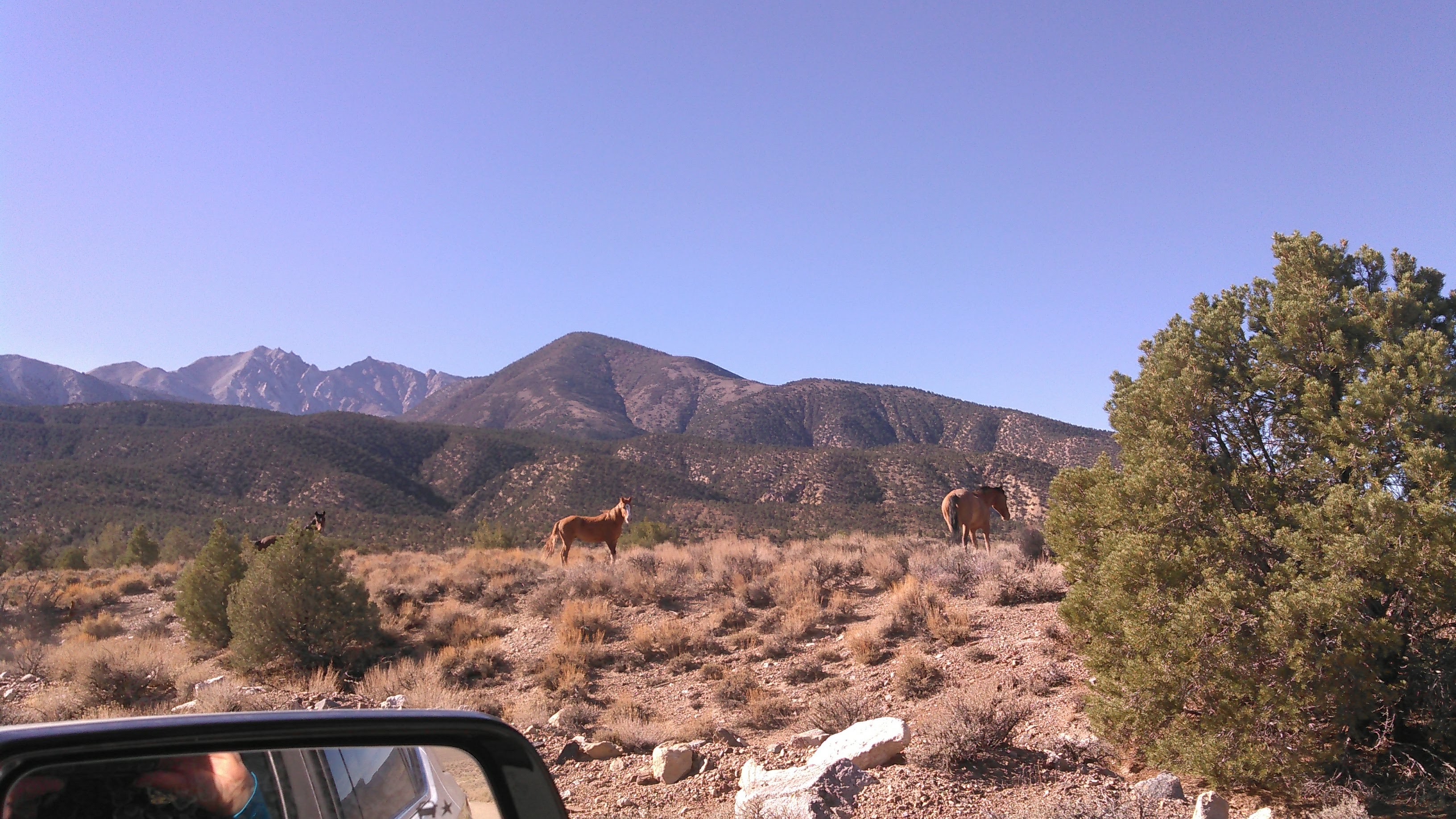
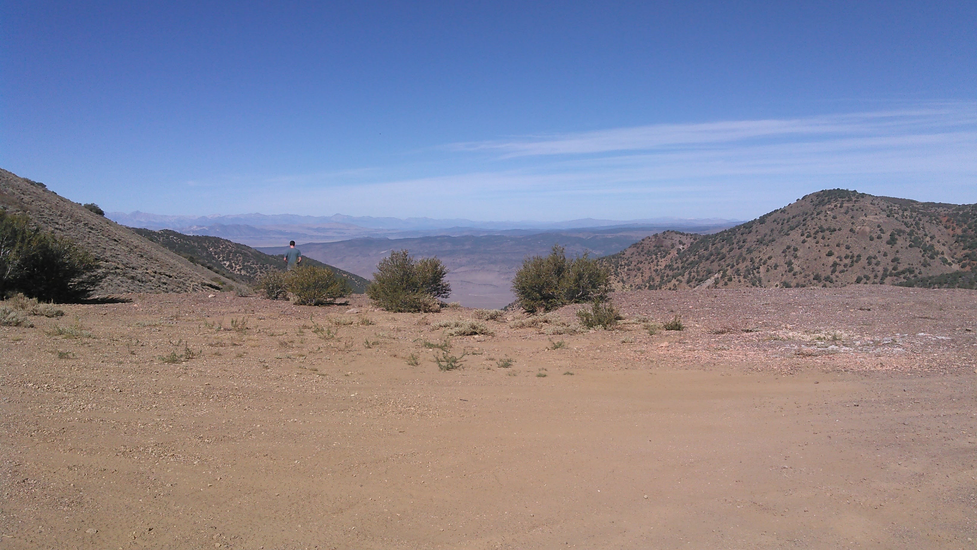
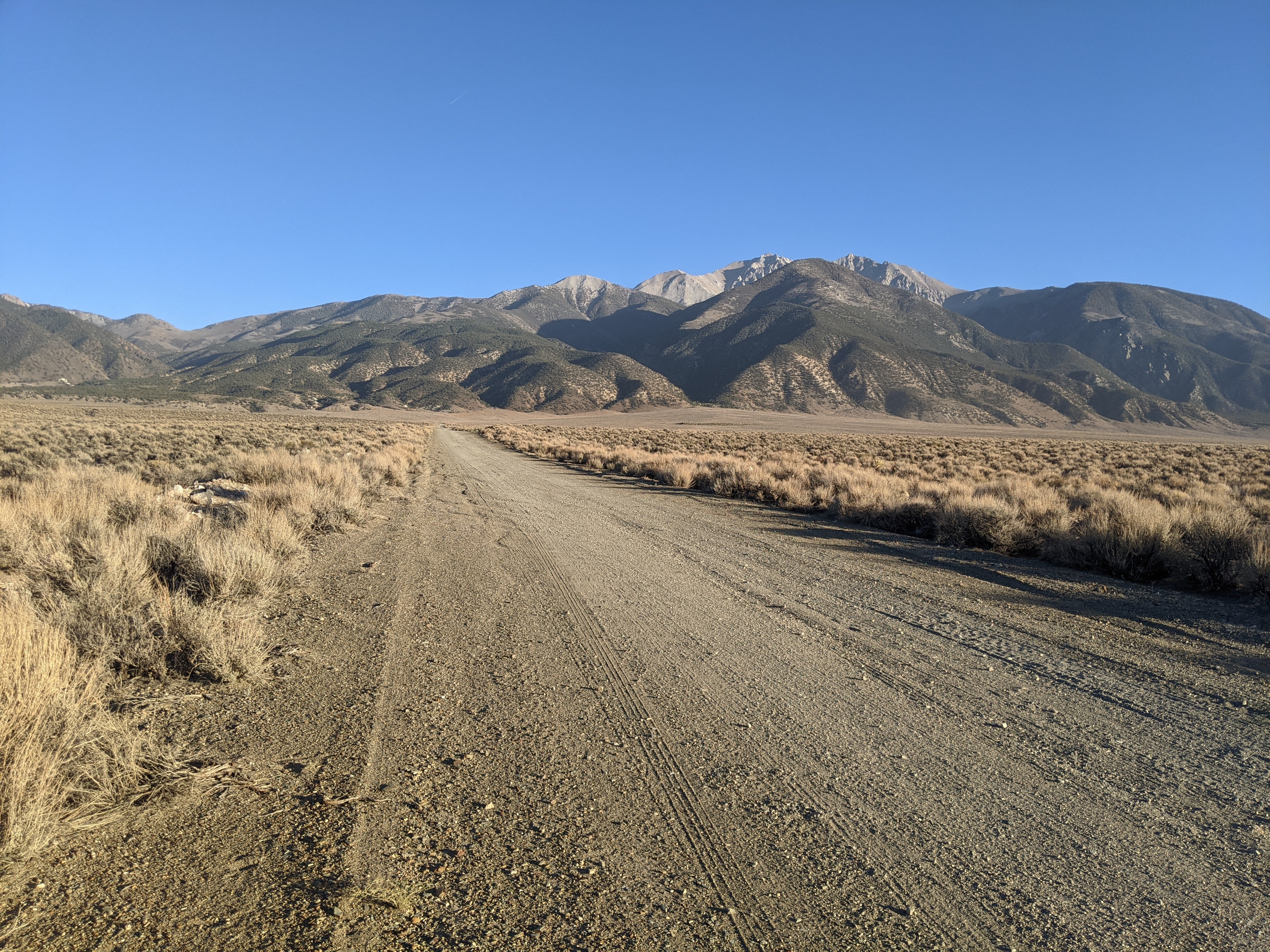
Wilderness Permit obtained, we began driving east, out of Yosemite, towards Lee Vining and eventually into Nevada. Boundary Peak sits just inside Nevada and is really a sub-peak of Montgomery which is in California. As we drove we enjoyed the mountain views, canyons, dessert, the weird Mono Lake, a brief pine forest (where we noted some camping potential), with the White Mountains, home of Boundary Peak, getting closer and closer.
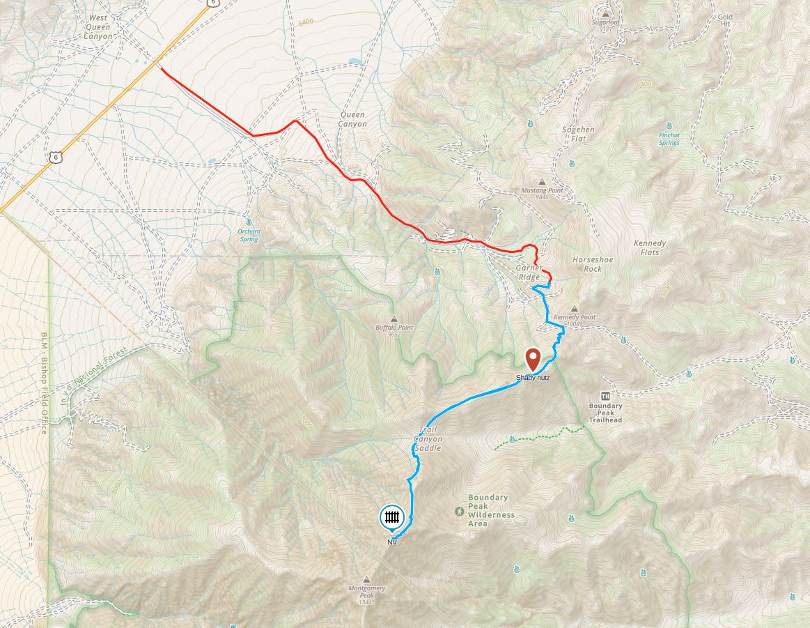
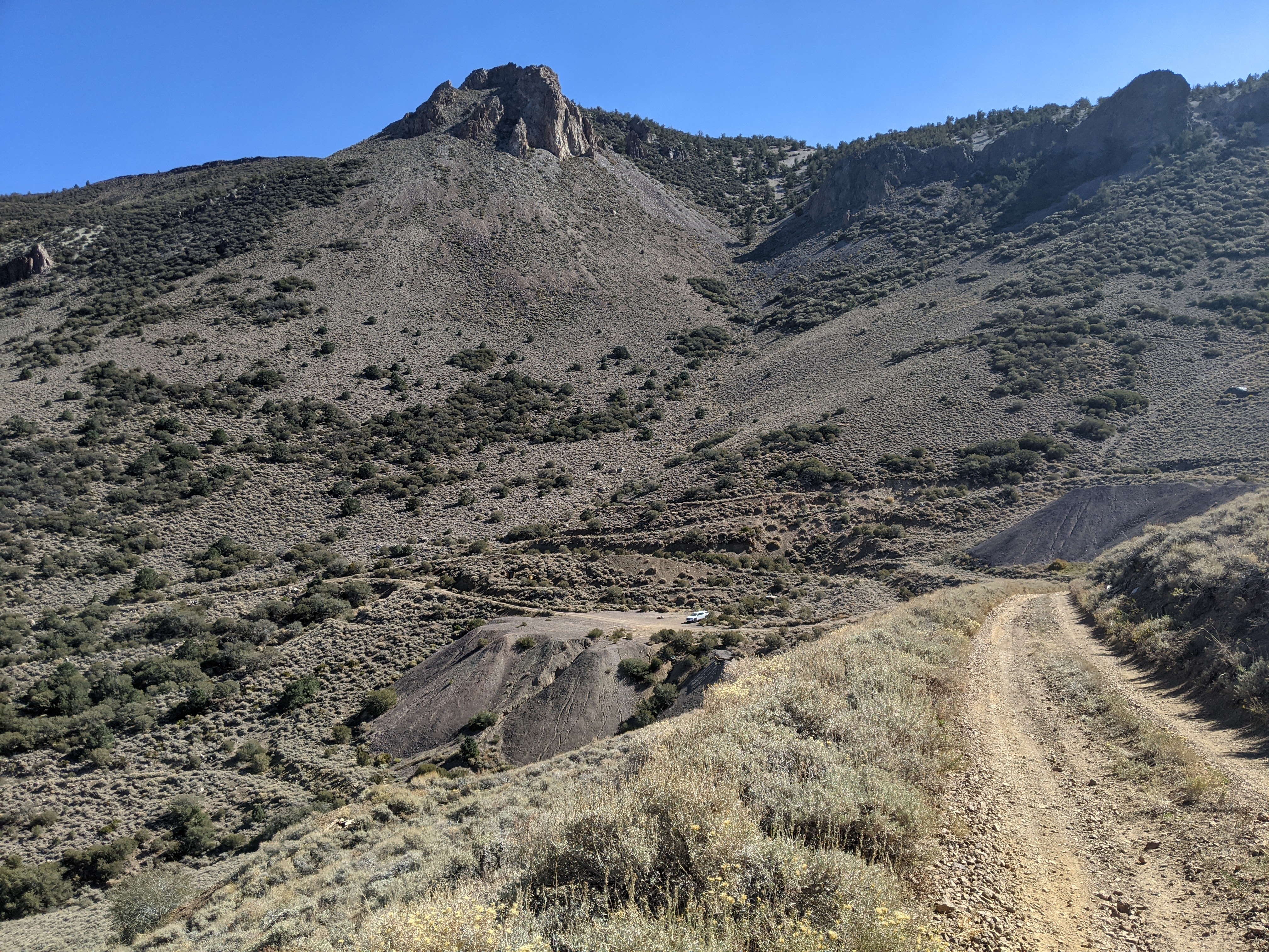
Given it was less driving, we decided to start from the Queen Canyon approach. For us there were two challenges to Boundary: the road in and the hike itself. The road is a low-maintenance gravel road that climbs 3,000 feet in 6 miles. We knew this and so Erik rented an SUV. Except that it was a 2-wheel drive SUV. I don’t know much about cars, but I didn’t know they even made 2-wheel drive SUVs!
I got most of my beta, including the knowledge about the wild horses which I was really hoping to see, from this blog.
Fortunately Erik is a good driver and he only stalled out twice, had to back up, and get another run.

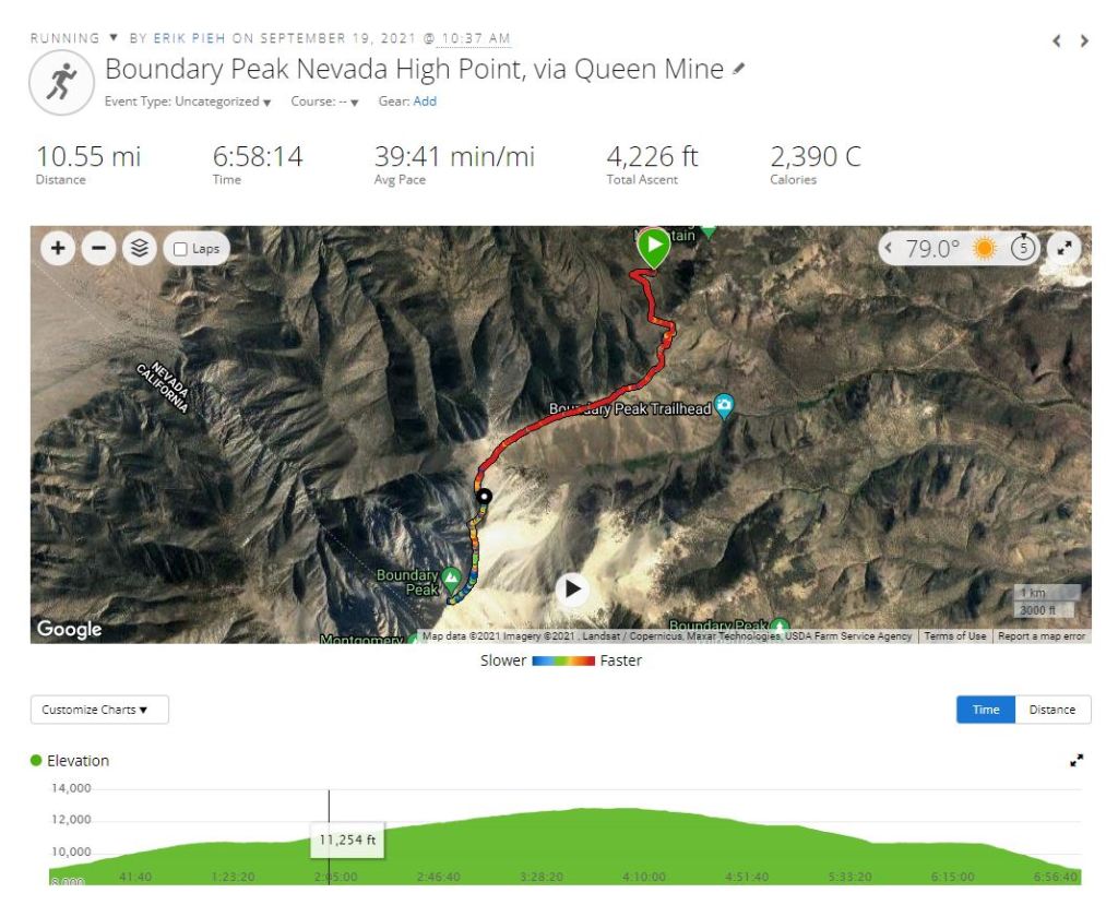
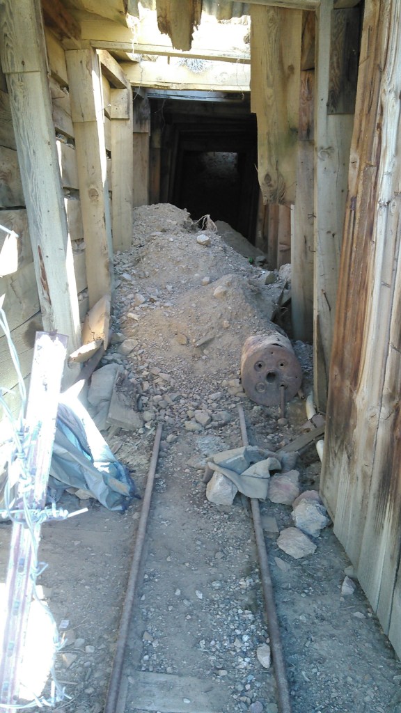
By the time we got to the old Queen Canyon Mine, we parked (this was really about the first spot to do so) and walked the rest of the way up the road to the pass. Had we had a 4-wheel drive we could have kept going but we decided we were close enough. It was just after 10:30 am when we started hiking.
Walking up the road was uneventful and relatively easy. We took the steeper cut-off road.
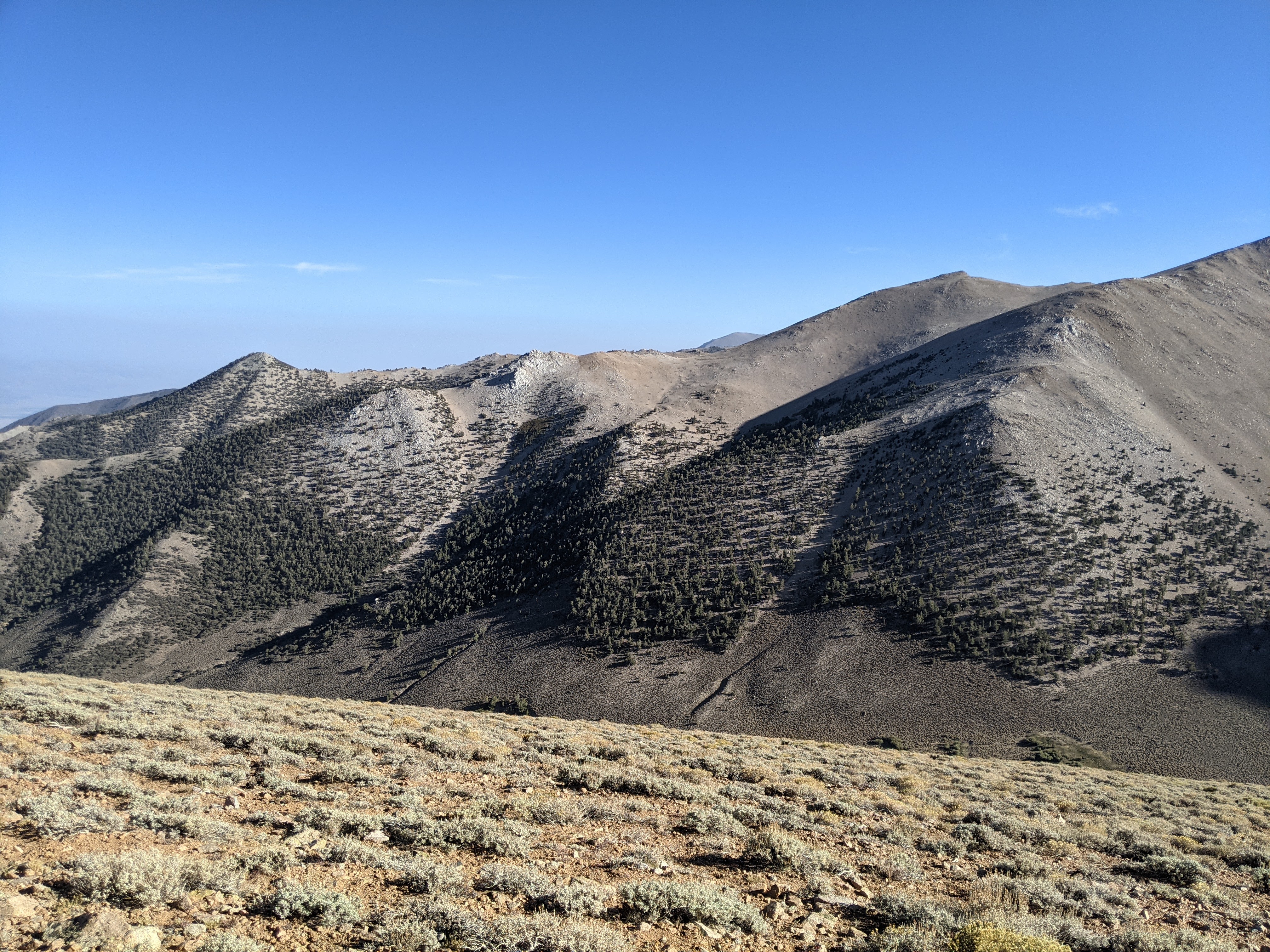
There was one truck at the saddle, what google labels as the trailhead. From here the trail heads south up a series of mild switchbacks before gaining the east-west ridge on the mountain just north of Boundary. Once on the ridge the hike is almost flat before a brief descent to Trail Canyon Saddle.
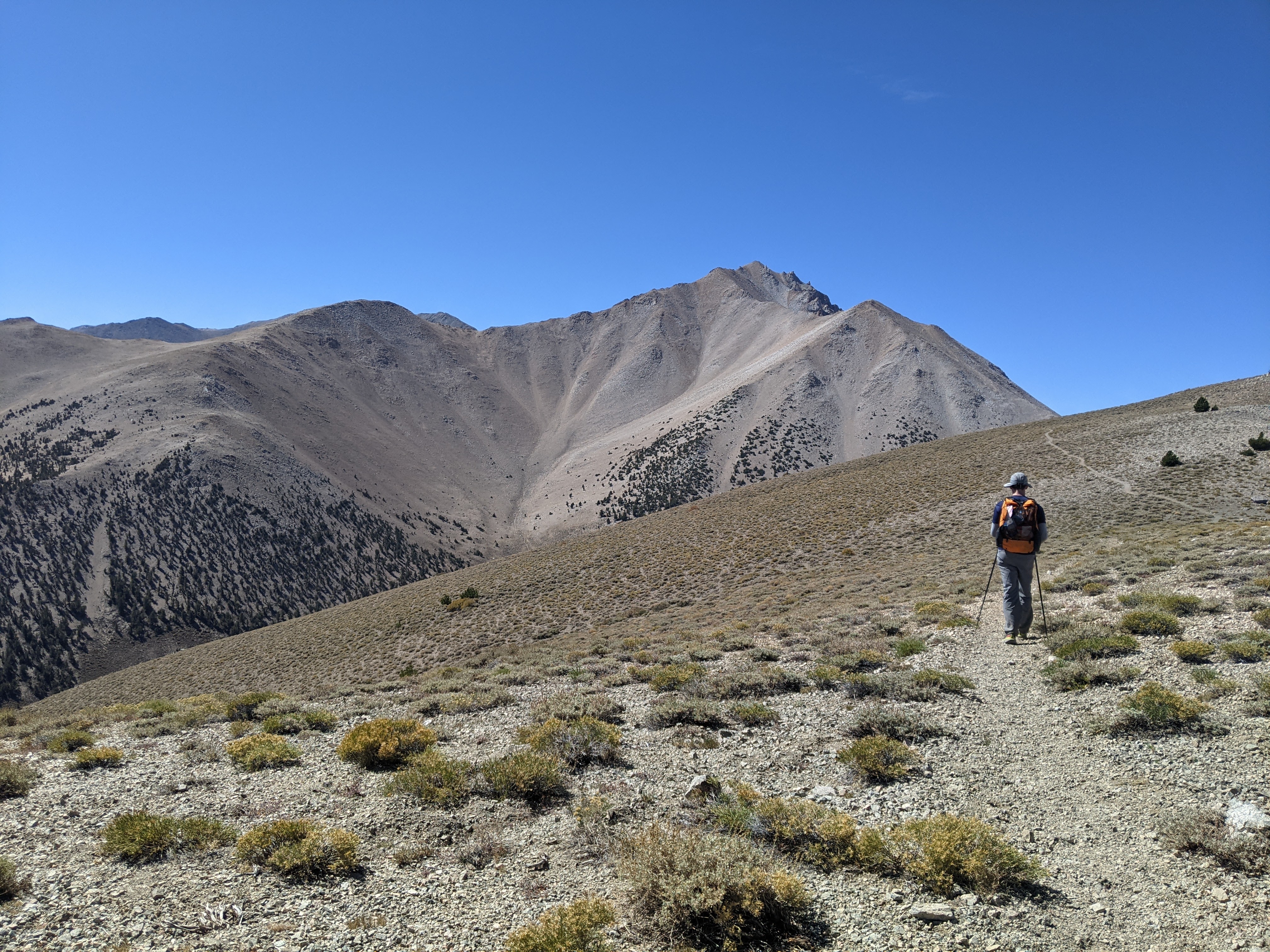
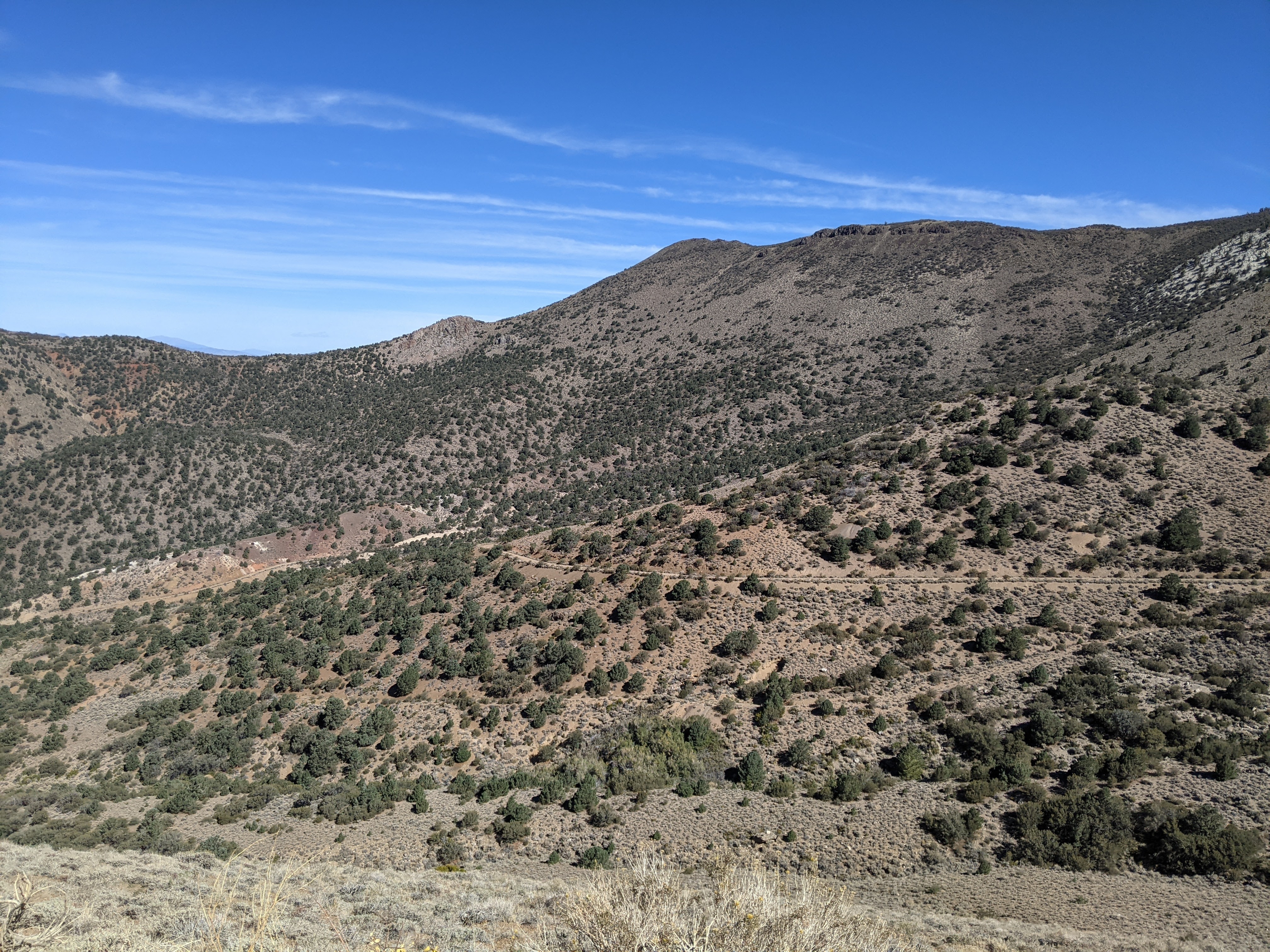
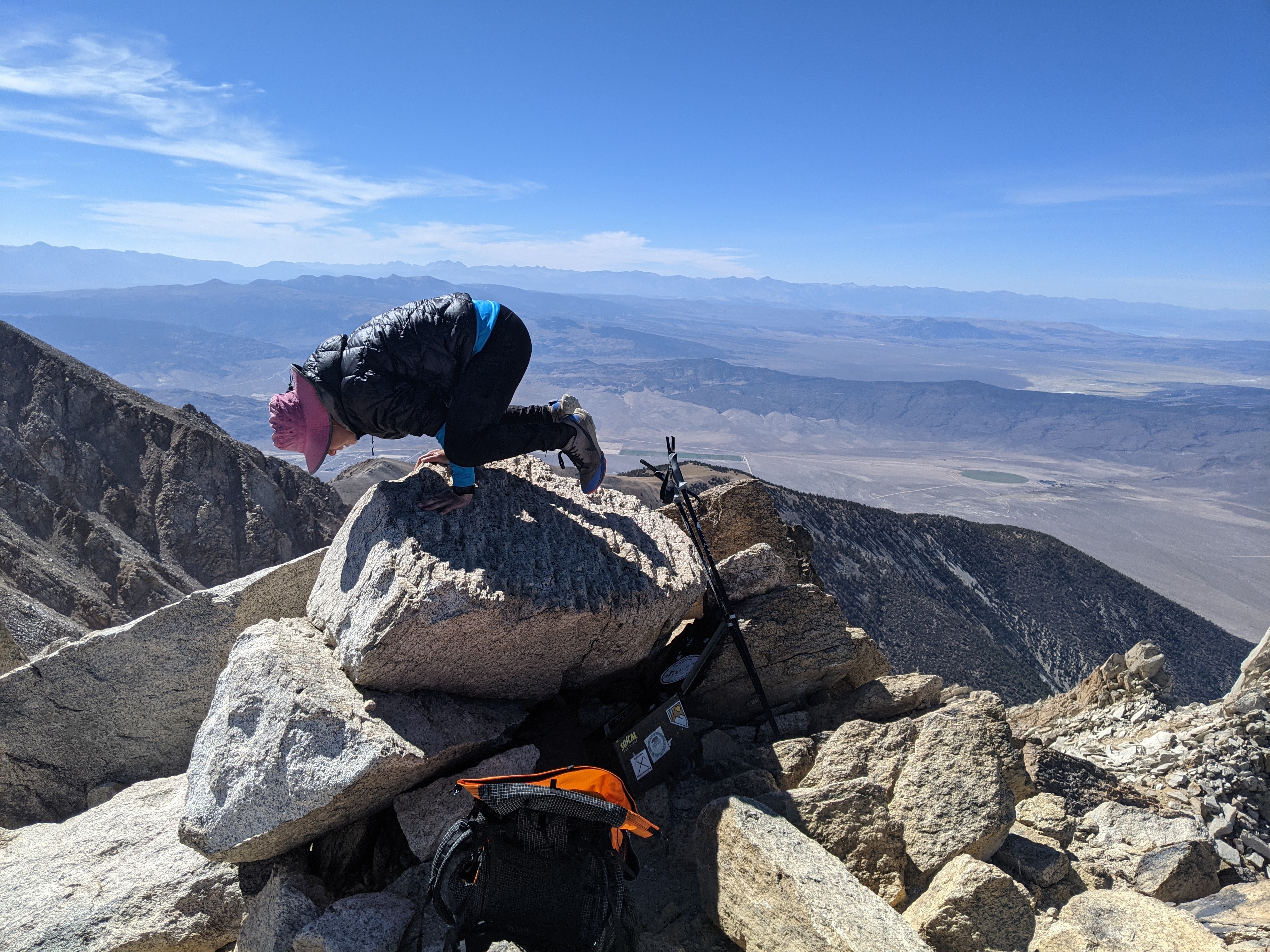
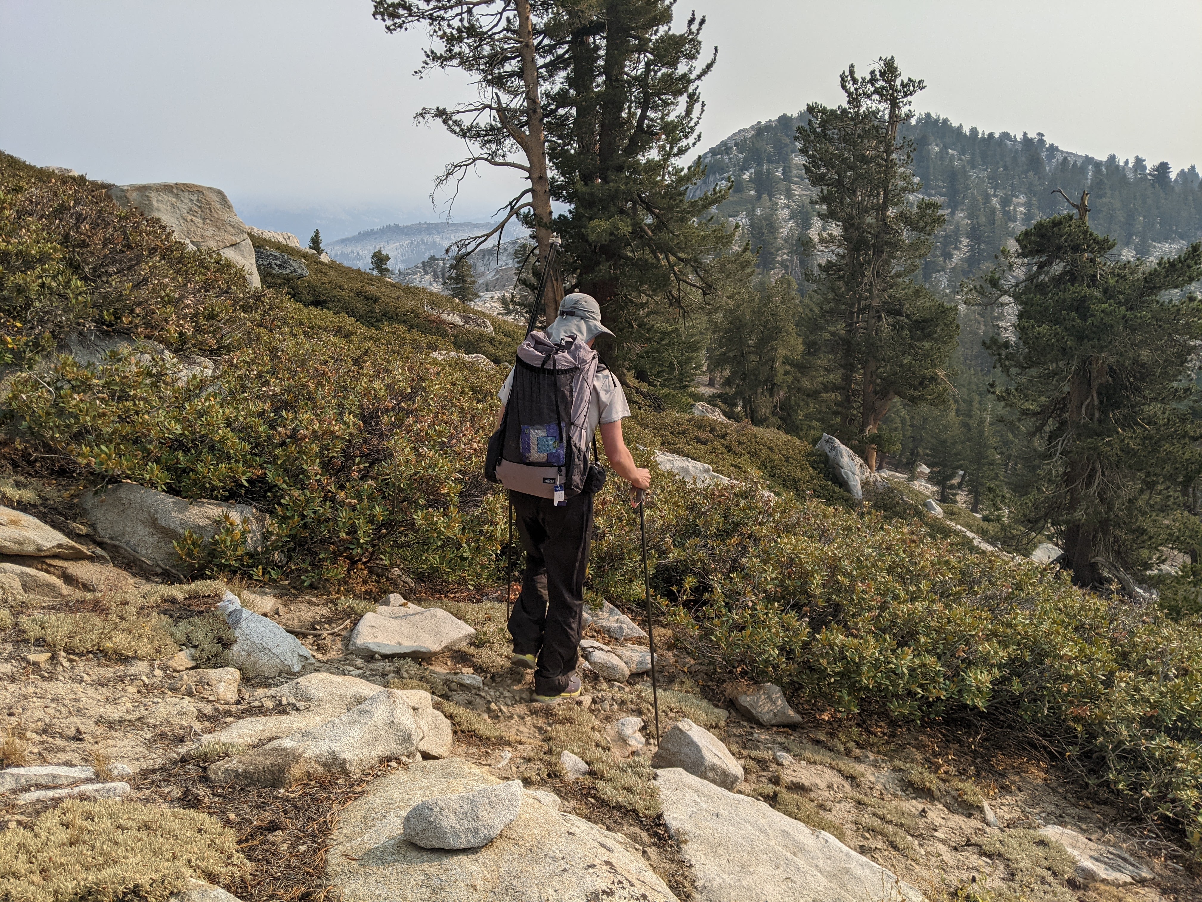
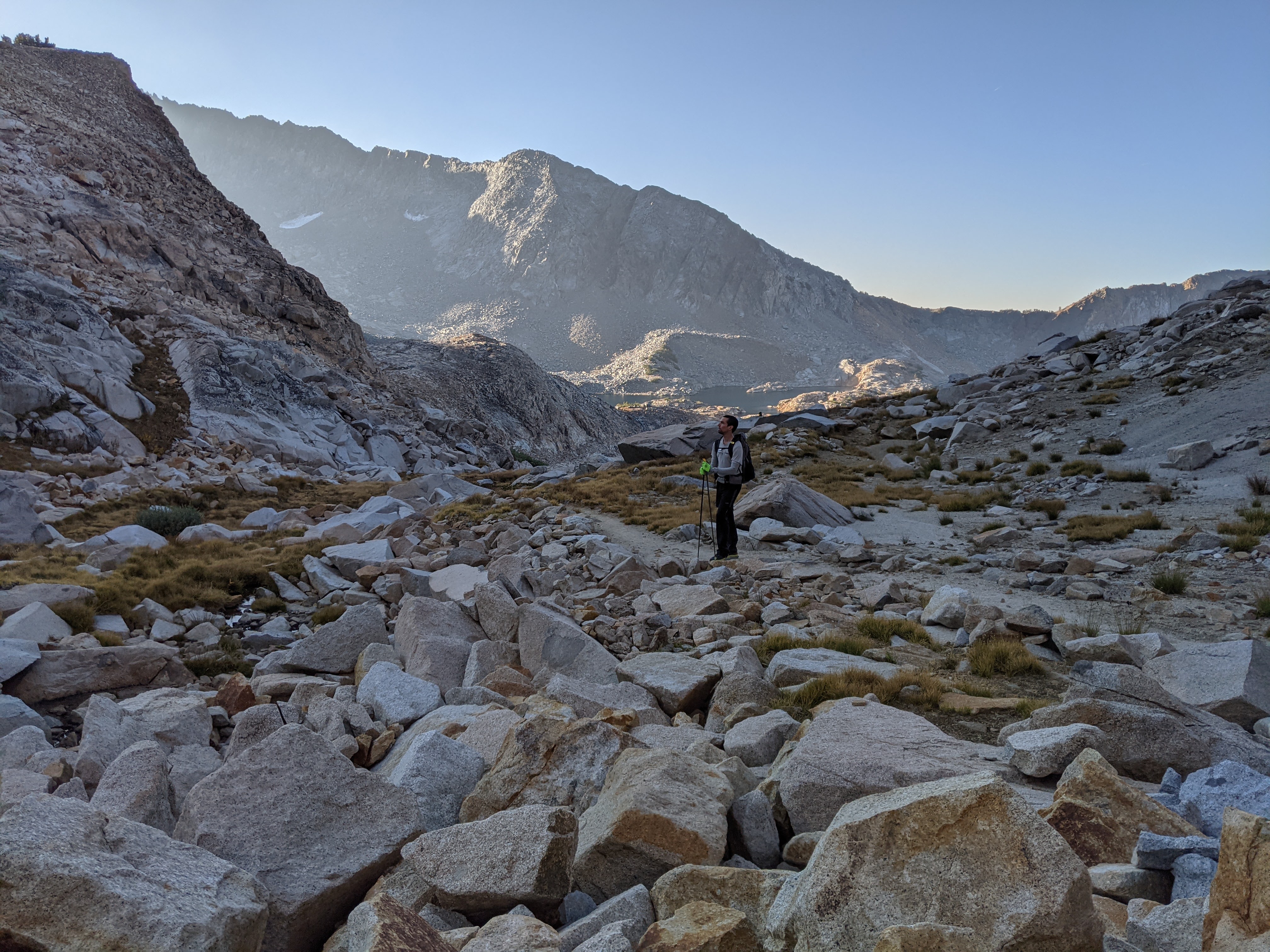
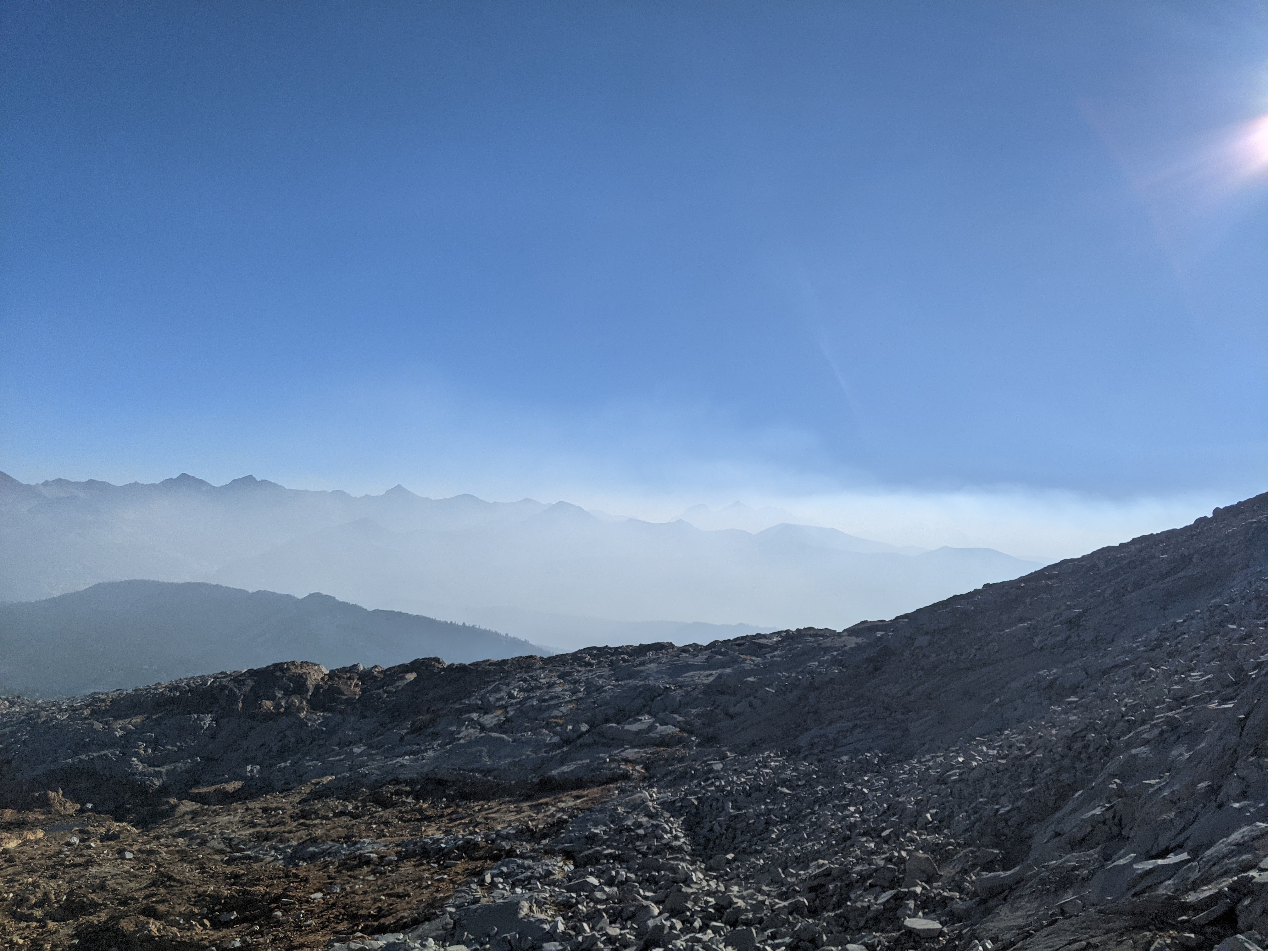
The weather forecast called for strong gales and a high of only 45 on the summit. As we ascended the almost sandy north slope that would bring us from 10,800 feet to 12,000 feet we often lost the trail. It seemed there were multiple ways to go. The wind really began whipping here and I stopped to put on my pants and down jacket. A solid trail picked up as we traversed across to a ridge and the wind died down. We took a brief break and then began the ridge climb.
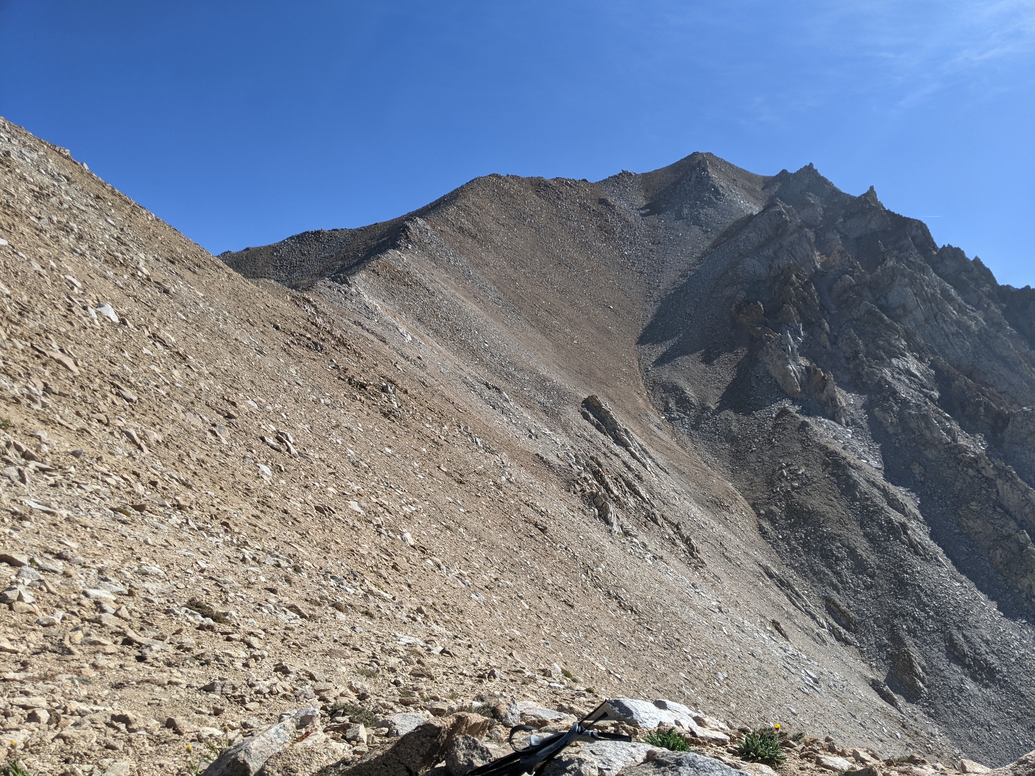
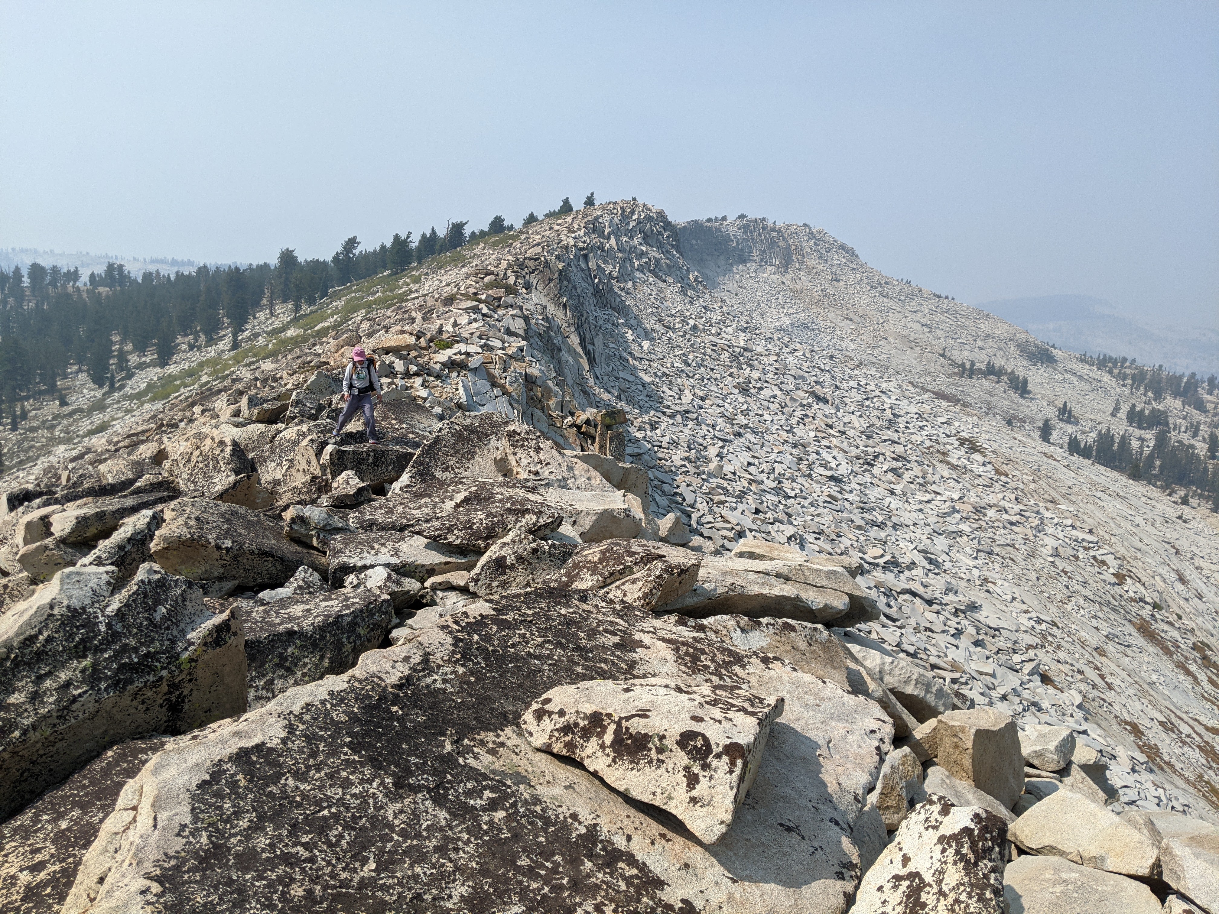
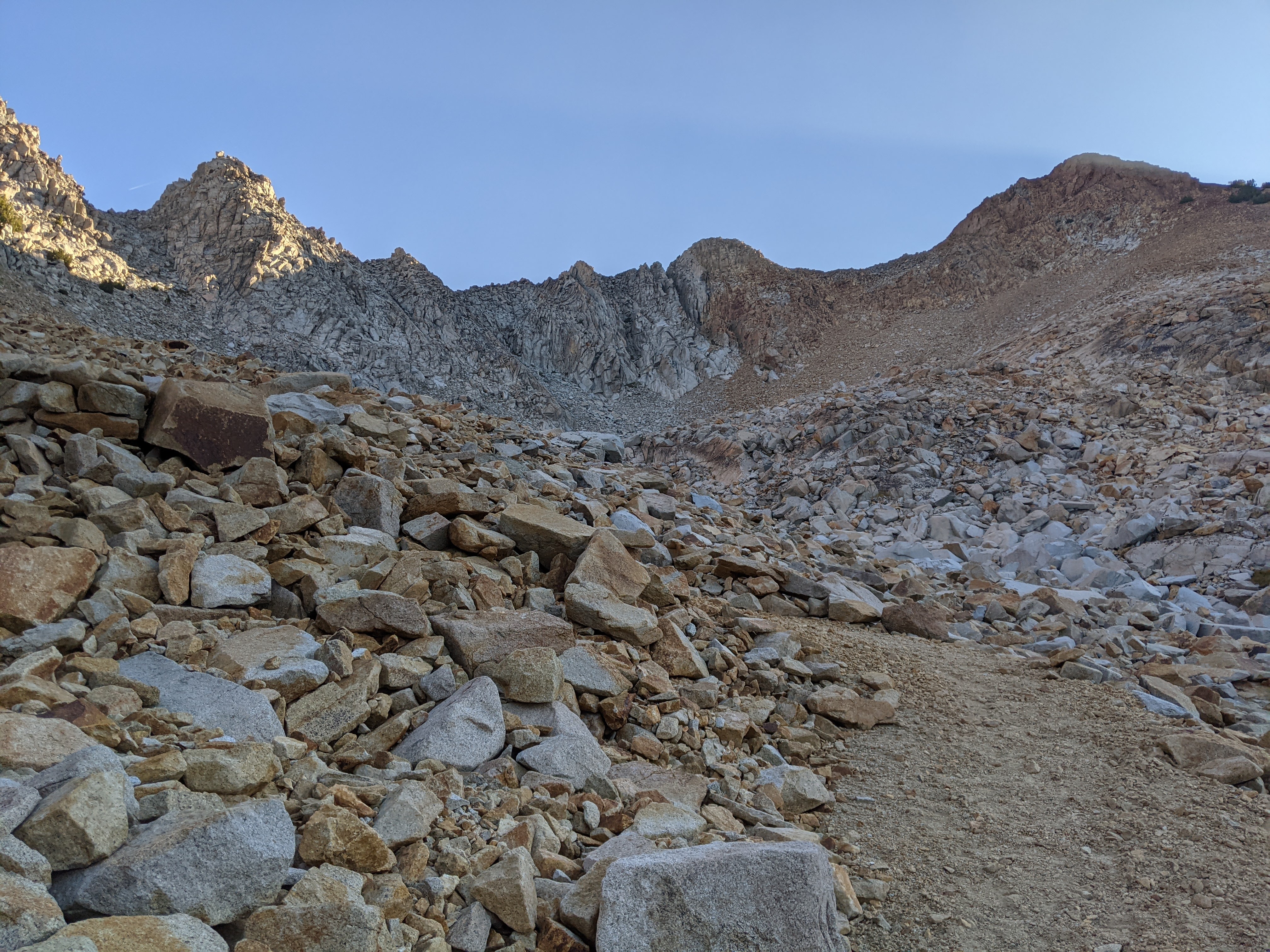
After passing the saddle of the “down route” for Trail Canyon, the trail petered out. I ended up on the west side of the ridge, a bit too low. It was fairly easy going, mostly small boulders and some looser scree with intermittent trail. The boulders got bigger on the last bump before the summit.


Just before the final push to the summit I regained the trail only to loose it amidst the bigger boulders by the last bump. After that bump the terrain leveled out. The final crest to the summit was less steep and quite easy with smaller rock.

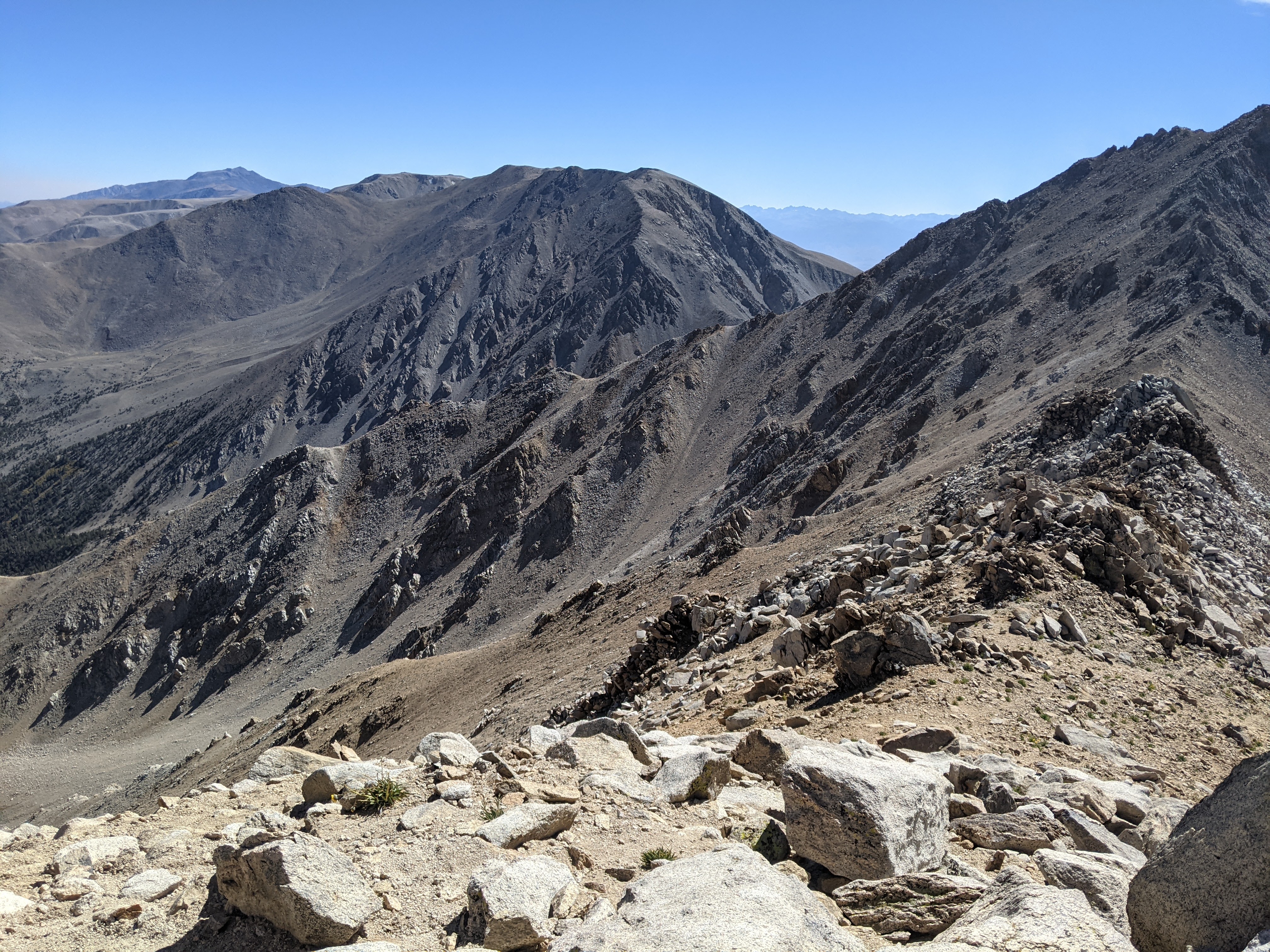
On the way down we followed the ridge more closely and it seemed easier than the west side. Usually I find descending more difficult so if it seemed easier going down to me, it probably would have been easier going up. Again, there is no well-defined trail here and anything will work, but consider sticking to the ridge.
The steep descent from 12,000 to 10,800 was pretty loose. Many times I just slid along in the sand and this was all well and good until I found a deeper smooth rock, which as Erik said, “slides quite differently.” Again, the trails branch here so pick and choose but overall it was doable if you don’t mind getting sand in your shoes! We stopped at Trail Canyon Saddle to dump out the sand.
Then it was back to the long lower ridge, down to the road saddle, and the short road walk back to our car.
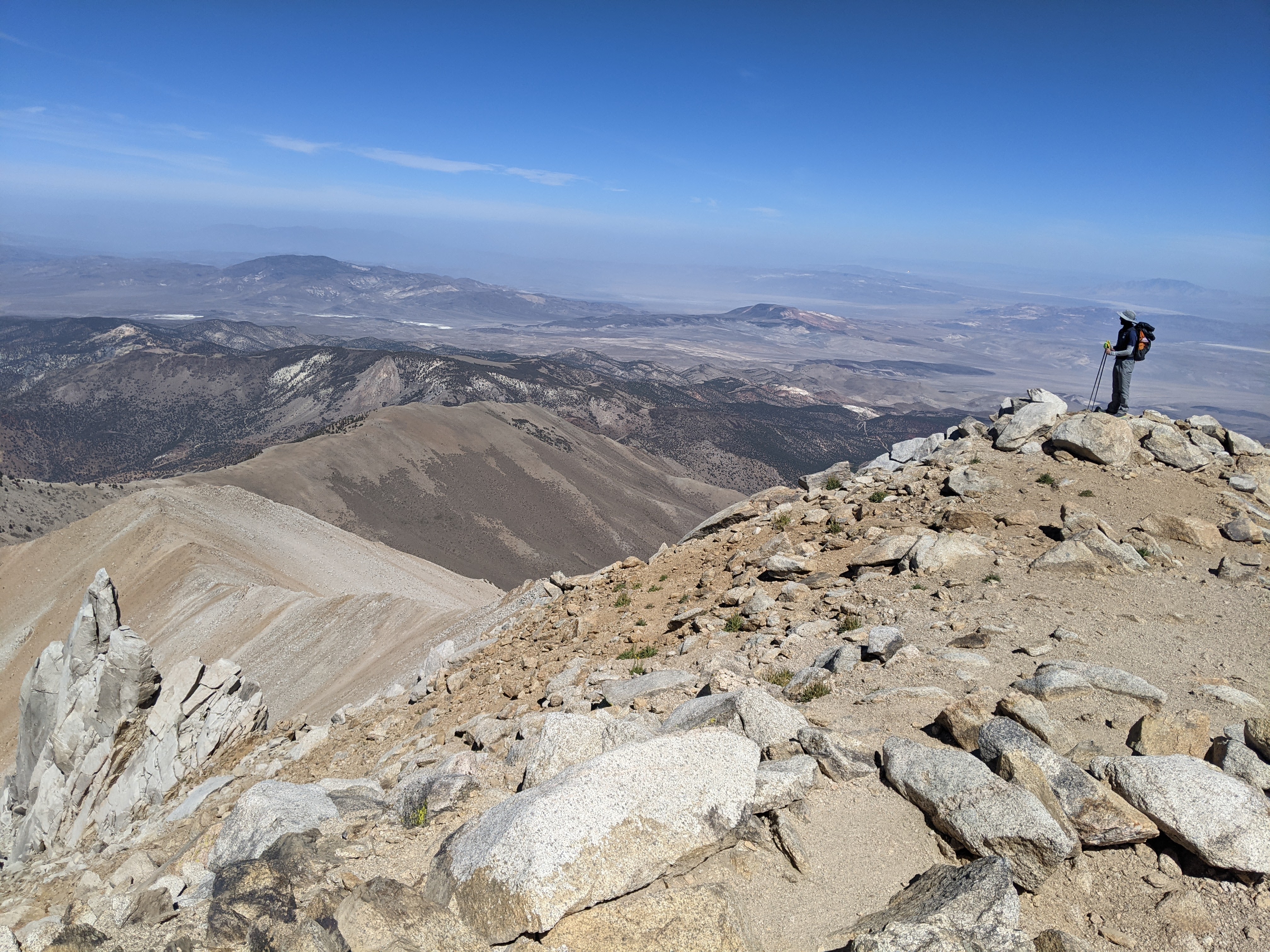
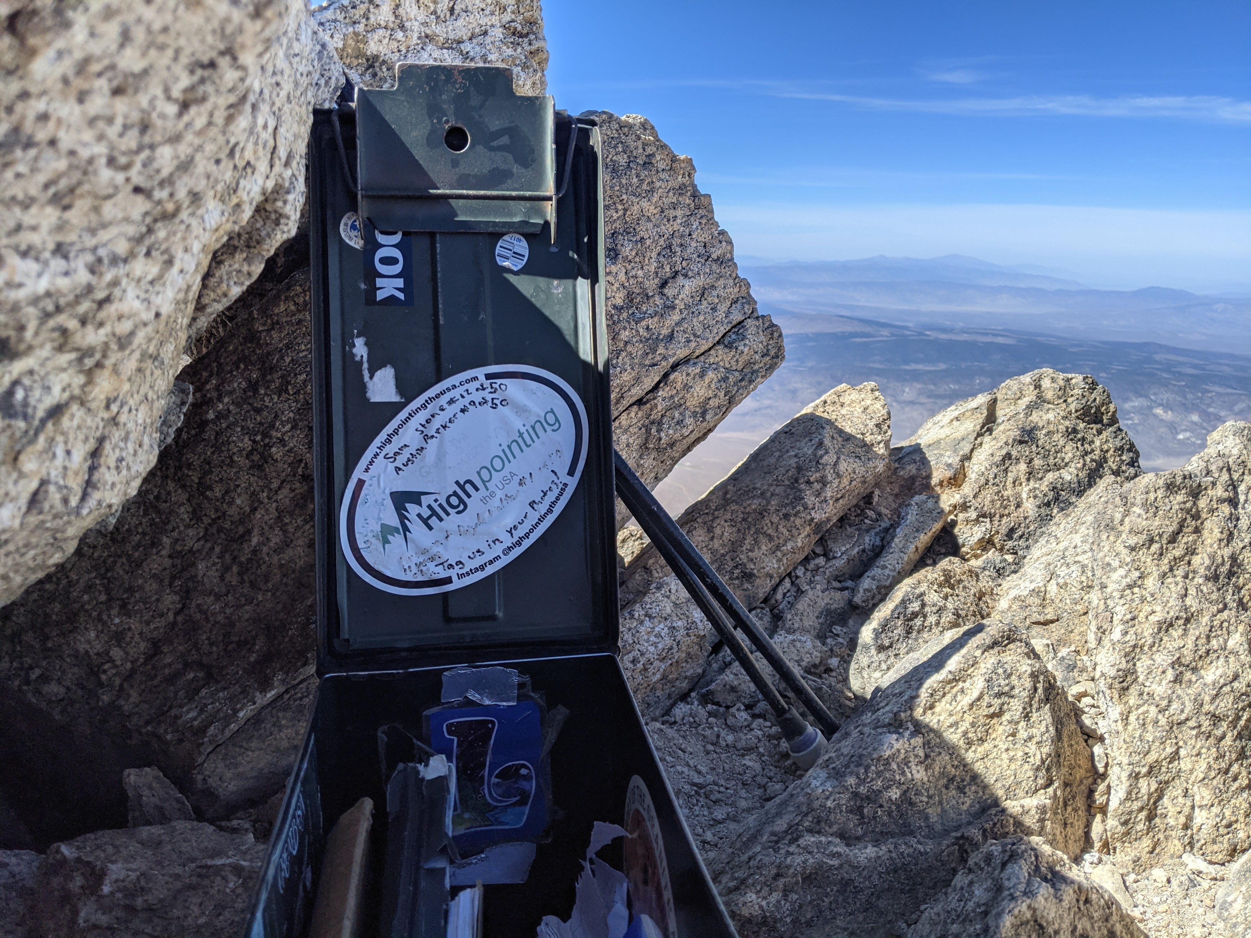
It was 5:30 pm when we got back to our car. Only 1.5 hours until sunset. In general Erik and I kept a move-on and it took us 7 hours. Not too shabby, especially considering we are flat-landers. I don’t take much stock in going from sea level to 13,000 plus feet, but then again, one week before this I ran a half-marathon at 85% max heart rate. Because of this I don’t worry about acclimatizing. I know what my body can handle.
We decided to start driving back to Yosemite with that forested spot by Mono Lake in mind. It was easier going down the low-maintenance road but still a bit sketchy. We could have benefited from a higher clearance vehicle.
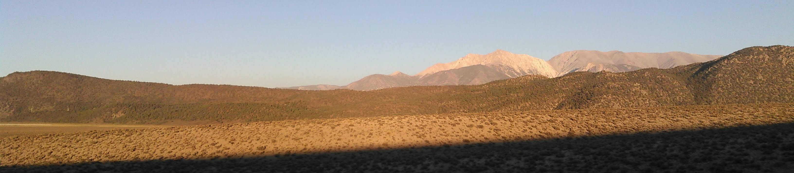
Just before we got back to hwy 6 we stopped for a photo looking back at Boundary Peak.
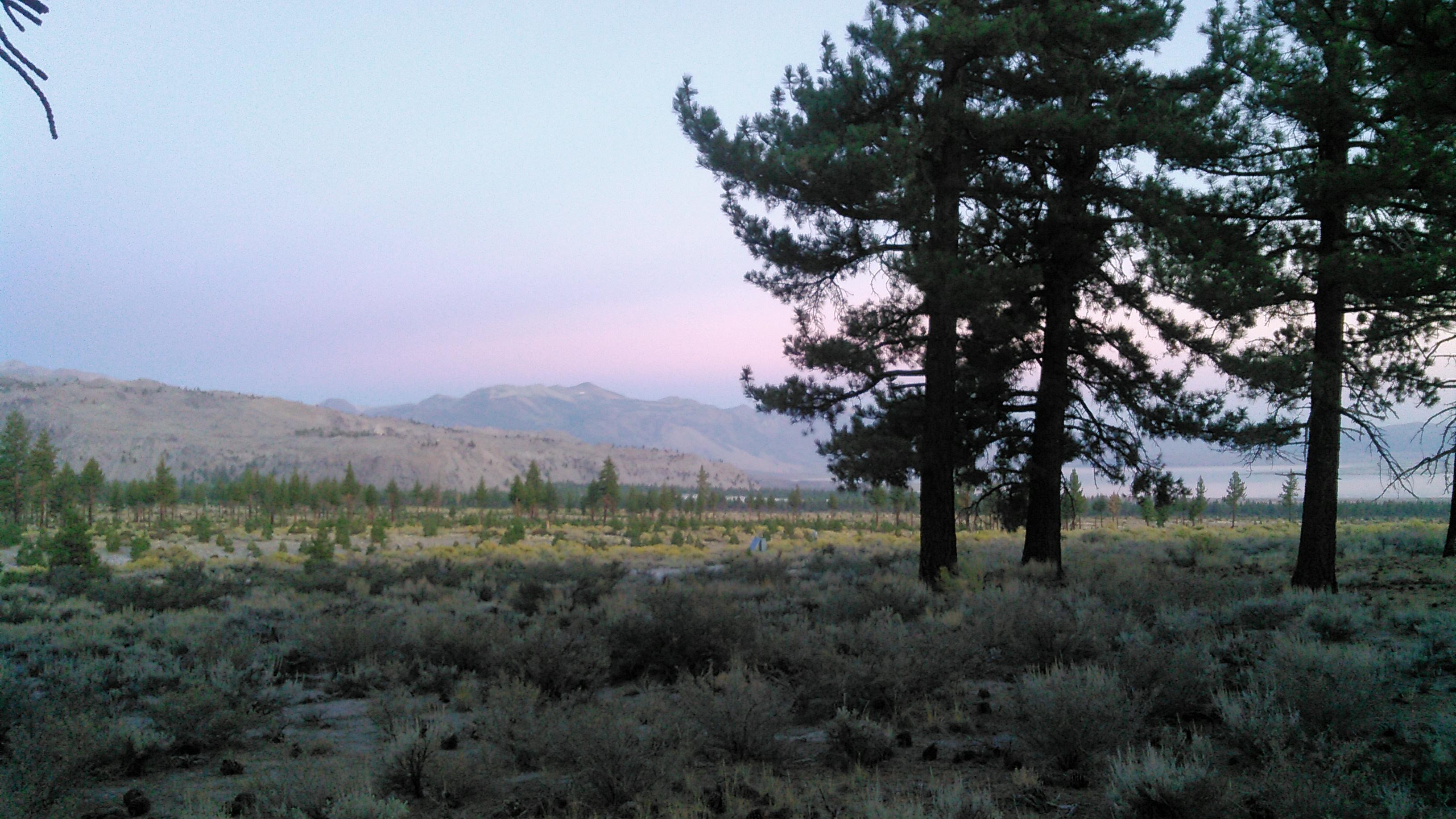
As we drove west on hwy 120 east of Benton, Erik had some fun with the “dips” on the road again as we had in the morning, on what might be the best rollercoaster road in America! By the time we got to Mono Mills it was nearly dark and we decided to stop, make dinner with our new stove, and find a spot to camp off a forest service road.

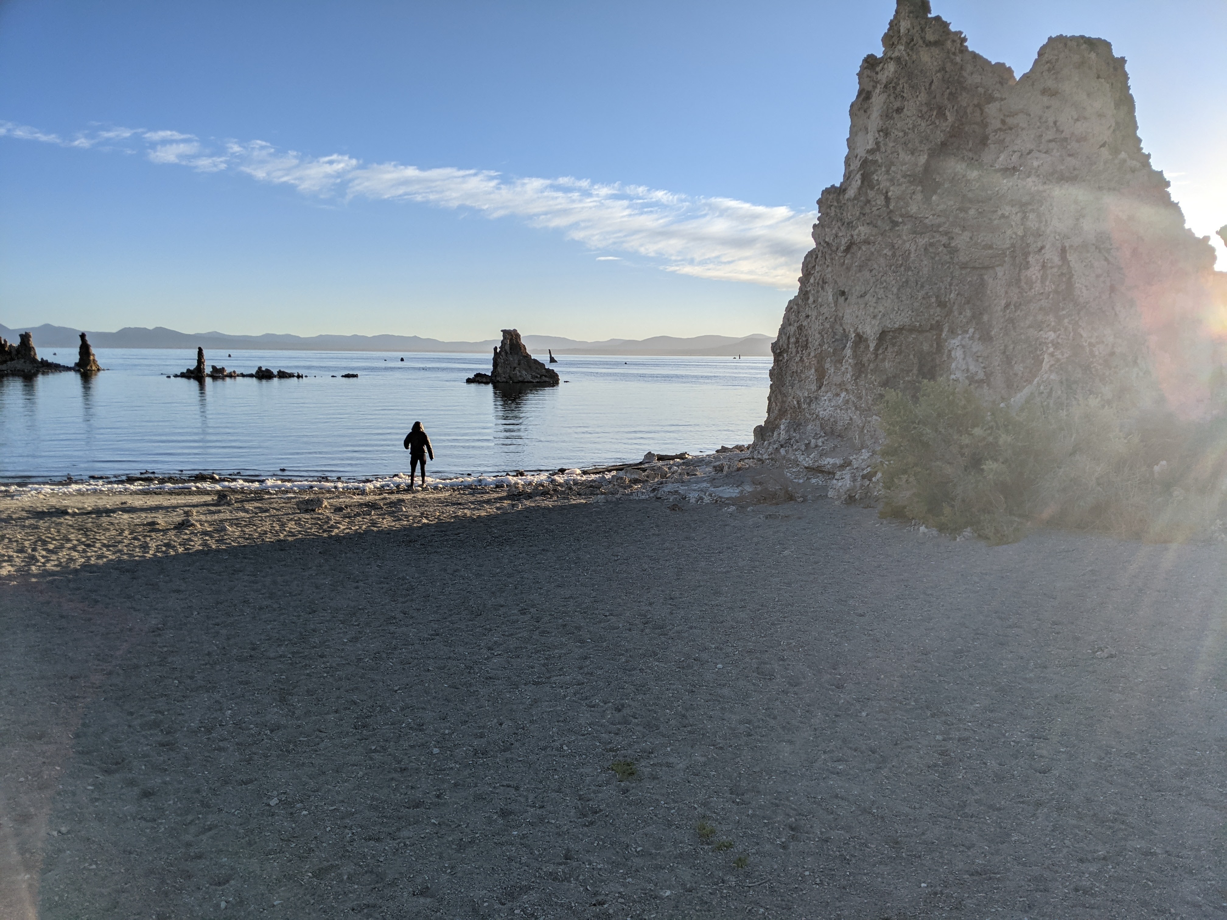
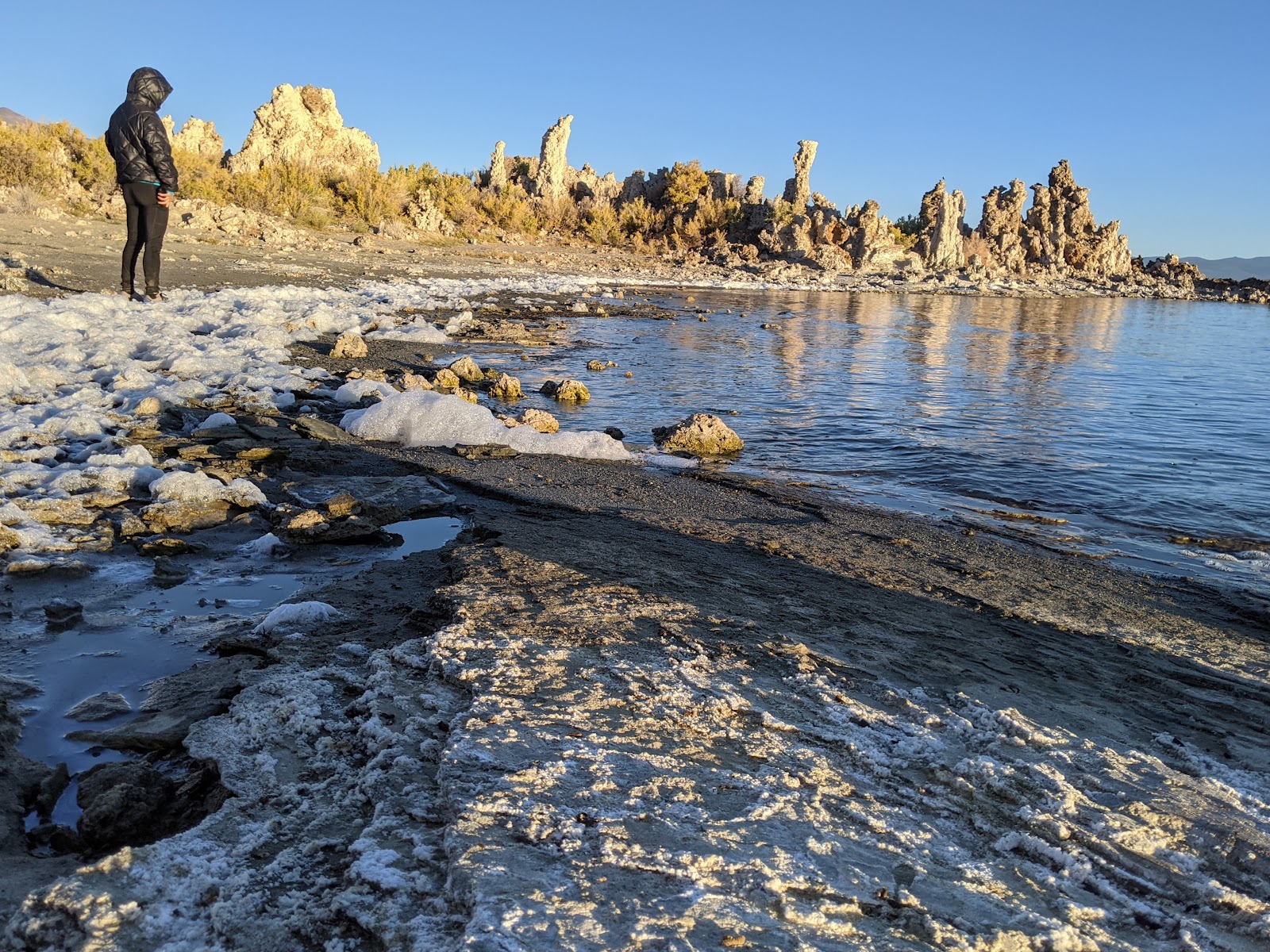
In the morning on our way back to Yosemite we stopped at the South Tufa Area on Mono Lake to see the tufa. We learned Mono Lake, similar to the Great Salt Lake, is also in the Great Basin and salty. I guess this is fairly obvious but we hadn’t thought about it before. The tufa are calcium-rich freshwater springs that form underwater and when mixed with the salt water of Mono Lake that is full of carbonates will form calcium carbonate (aka limestone) deposits that gradually grow and grow.
Erik and I enjoyed Mono Lake but it was time to get back in the car and drive the winding road through Yosemite. After three hours and hardly any stops we arrived at our trailhead in Wawona.
Backpacking Southern Yosemite
Of note, Yosemite National Park requires wilderness permits. They also require bear canisters. We chose to hike out of Wawona because (1) we’d never been in that area before and (2) it’s unpopular so permits were easy to get.
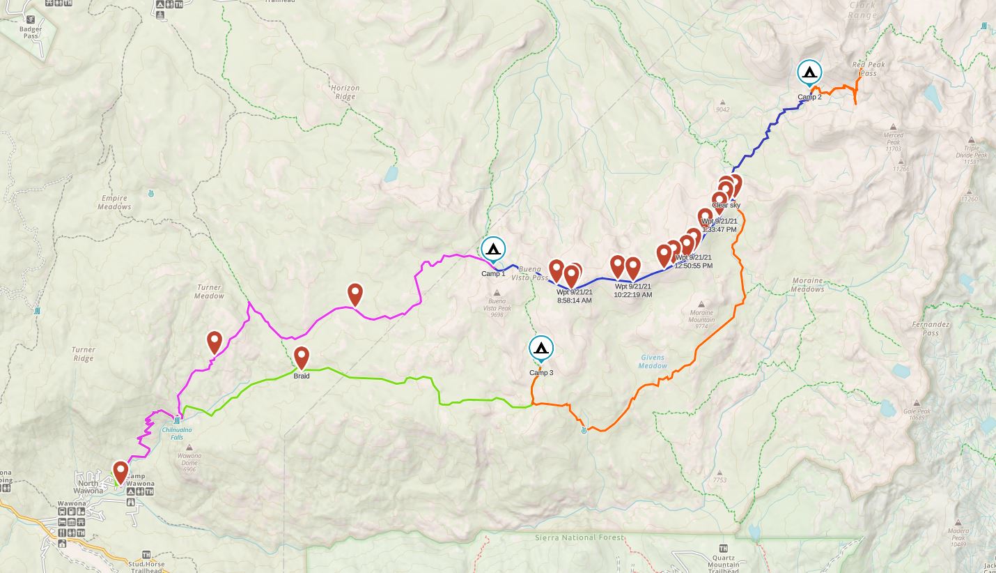
Day 1 (9/20/21): Chilnualna Falls Trailhead to Buena Vista Lake

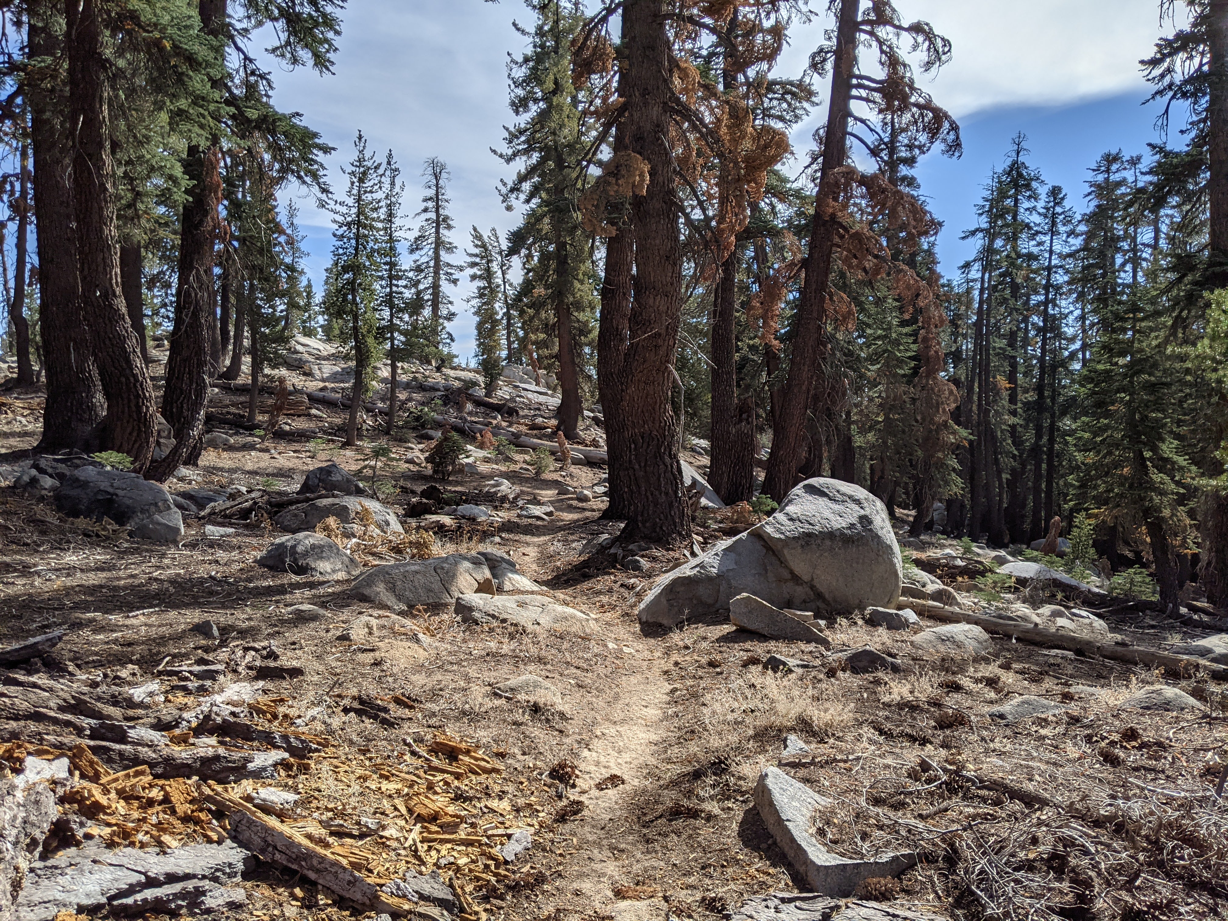
We began hiking from the Chilnualna Falls Trailhead at 12:30 pm, along Chilnualna Creek which was almost dry. There were a few day hikers within the first half mile, then after that, almost no one. It was 75 degrees and sunny and despite the haze, we were dripping sweat as we hiked up 2,200 feet in 4.3 miles. The gnats were getting to me. It made it hard to appreciate the chaparral we were hiking through- a biome we don’t have in Minnesota. Weaving in and our of the re-entrants reminded me of hiking along Cinque Terre, albeit without the Mediterranean.
Once we arrived at Chilnualna Falls, we stopped to cool off in the pools above the waterfall. Given there was only a trickle of water going over the edge, we were plenty safe to do so. We also filled our water bottles as we had been warned by a couple other backpackers we had met that there was only water in the lakes.
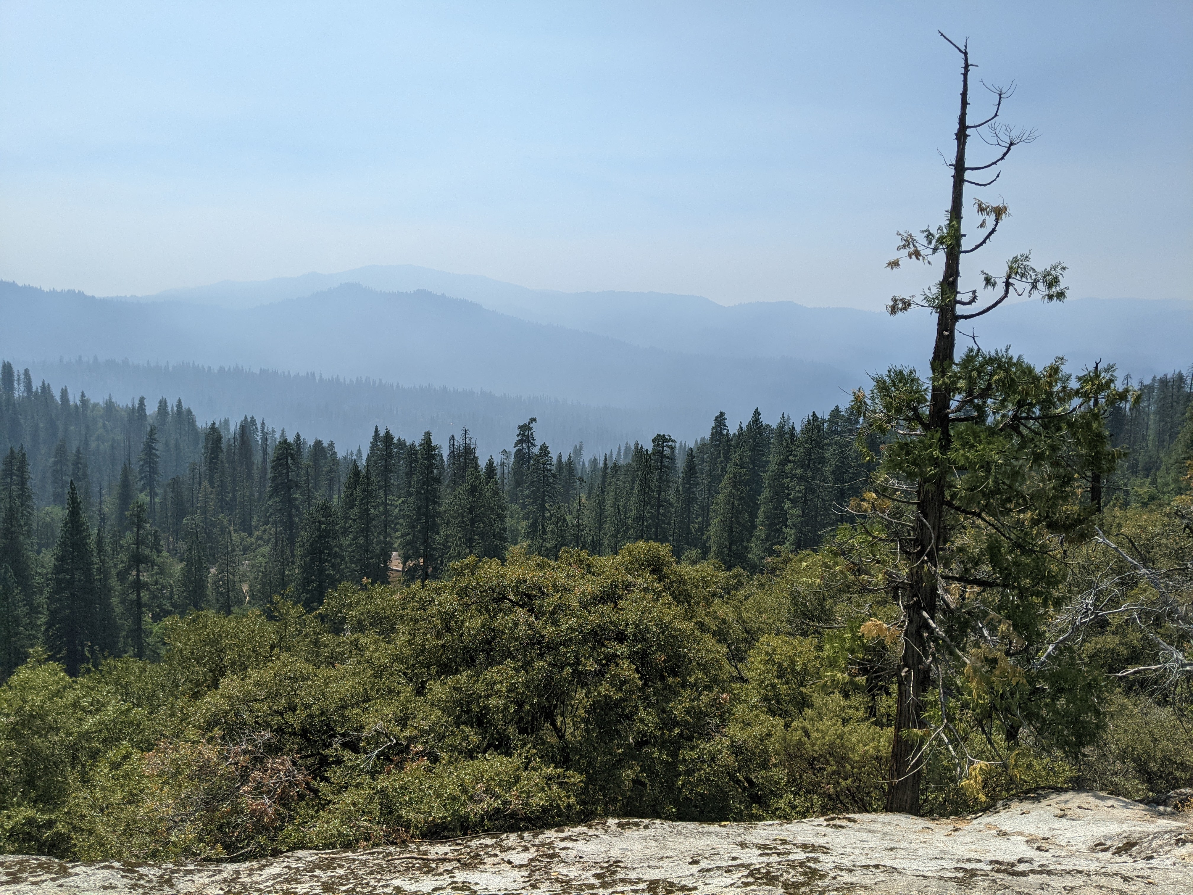
At the trail intersection above Chilnualna Falls we began on the north route to Buena Vista Lake. Here we encountered a wetter environment with ferns and bright green moss climbing up trees. We also crossed a creek that had flowing water. Later we crossed a second creek with a bit of stagnant water. The hike was mostly through the woods with one open area where we could look out to Buena Vista Peak. It still looked to be a long way- and it was. This was a 12.8 mile day and having started after noon we knew we needed to hustle to arrive before sunset.

So we kept up a good clip and were glad that the trail was mostly easy and didn’t gain too much elevation until we neared the Chilnualna Lakes. The trail goes by two of the three Chilnualna Lakes. We thought about camping at each of these but knew the scenery was better at Buena Vista so we pushed on.

Just before Buena Vista Lake we came out at the intersection with the trail that leads north to Yosemite Valley and got a good view of Half Dome and Mount Starr King.
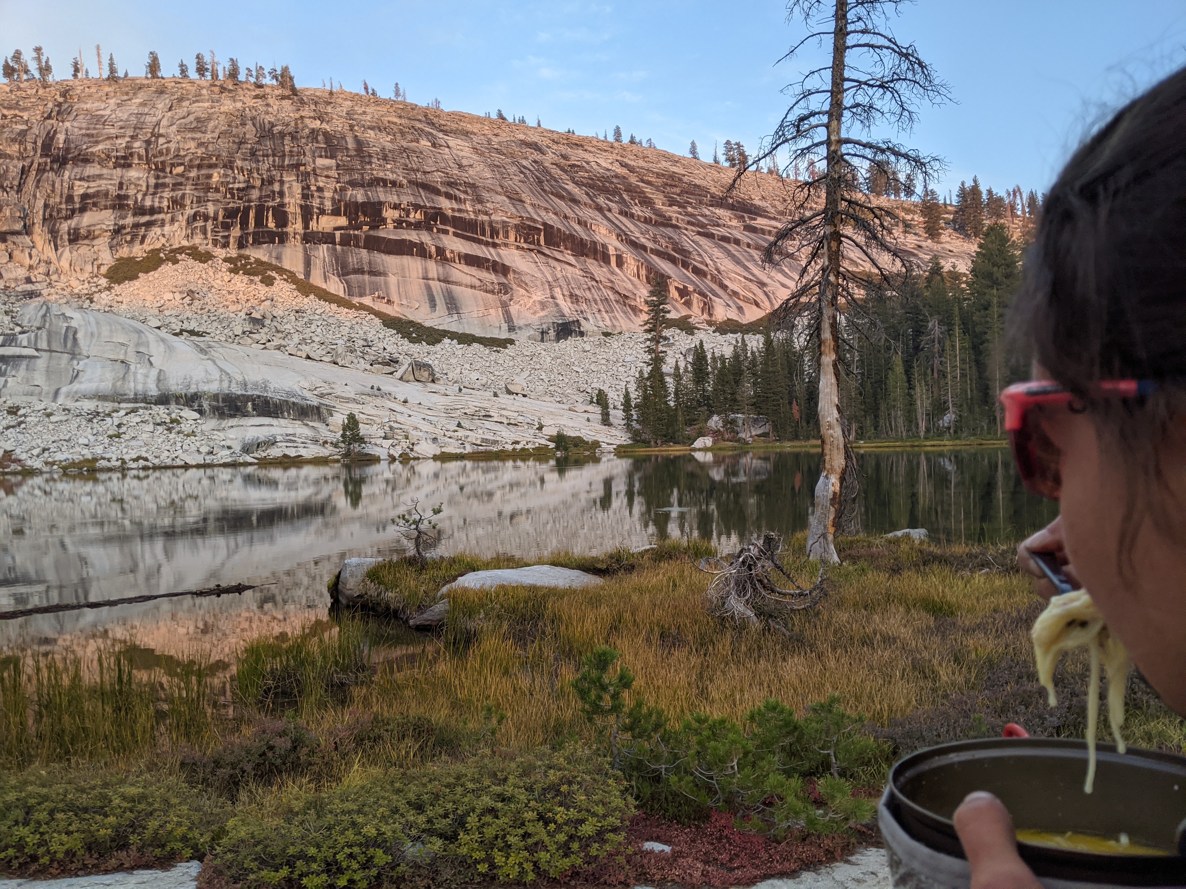
Ideally we would have lingered longer but it was getting dark. Once we got to Buena Vista Lake we picked our tent site and then headed down to the lake to cook dinner. We got to camp just before 7 pm, barely before the sun set which meant after dinner we put up the tent in the dark. Good thing we had our new stove that boiled water in a jiffy! The nice part about September hiking is that it’s cooler. The downside is the lack of daylight.
Day 2 (9/21/21): Buena Vista Lake to Lower Ottoway Lake via the Buena Vista Crest
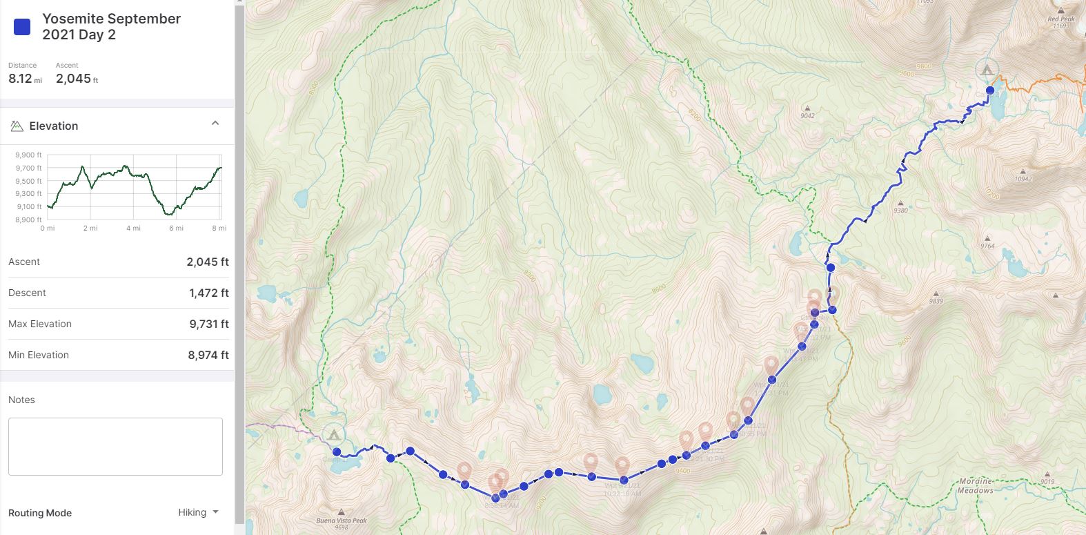
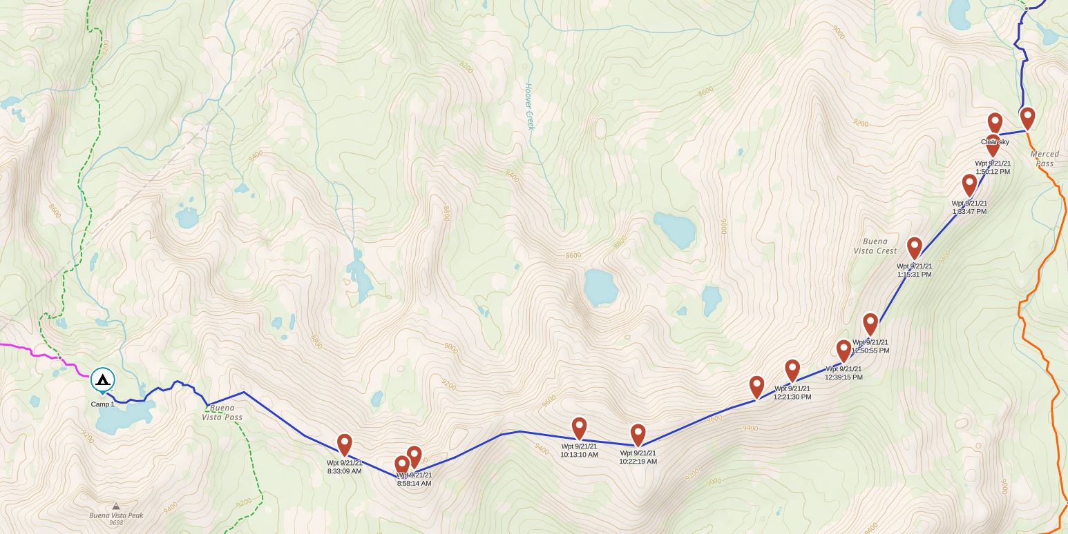
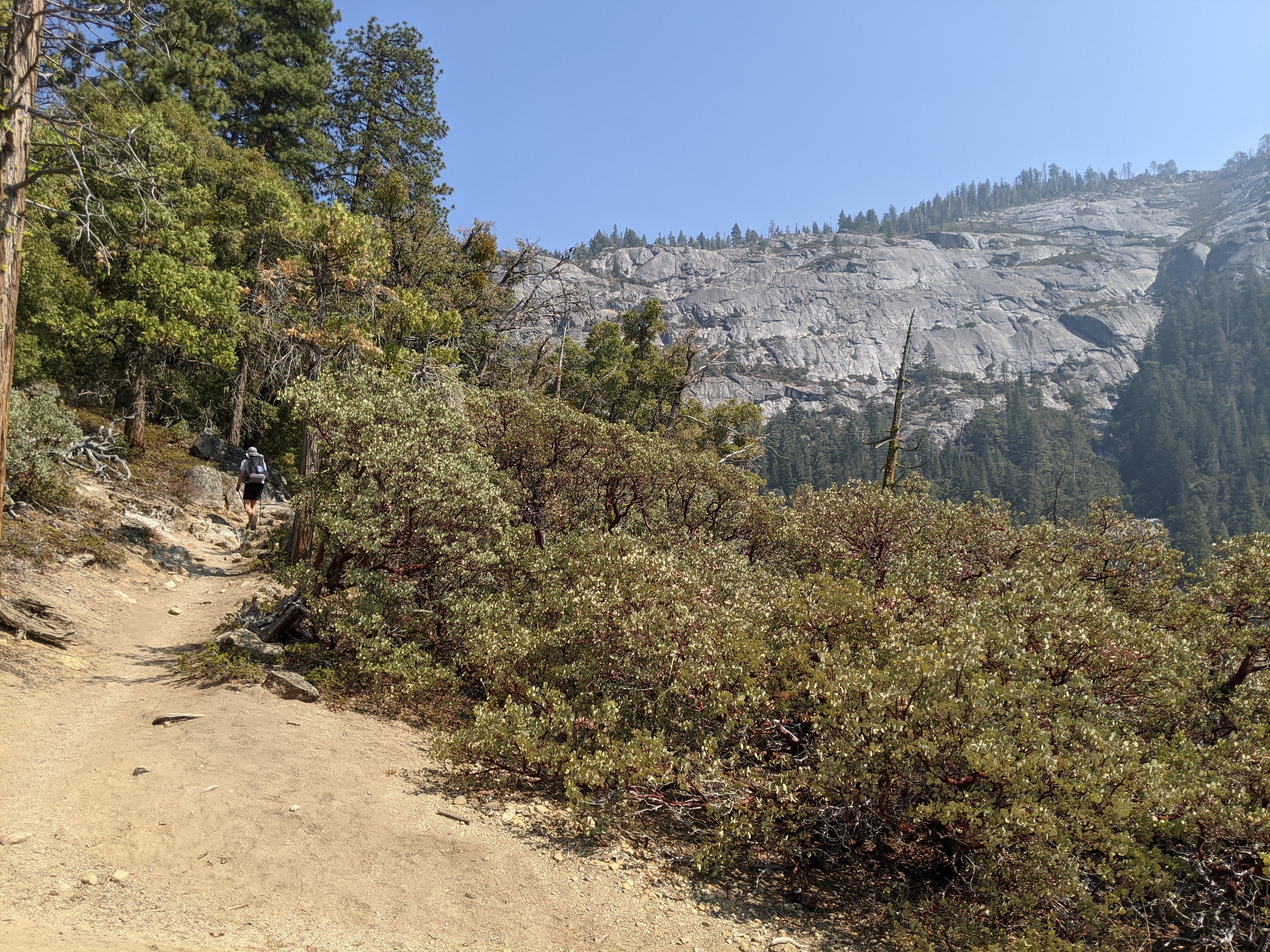
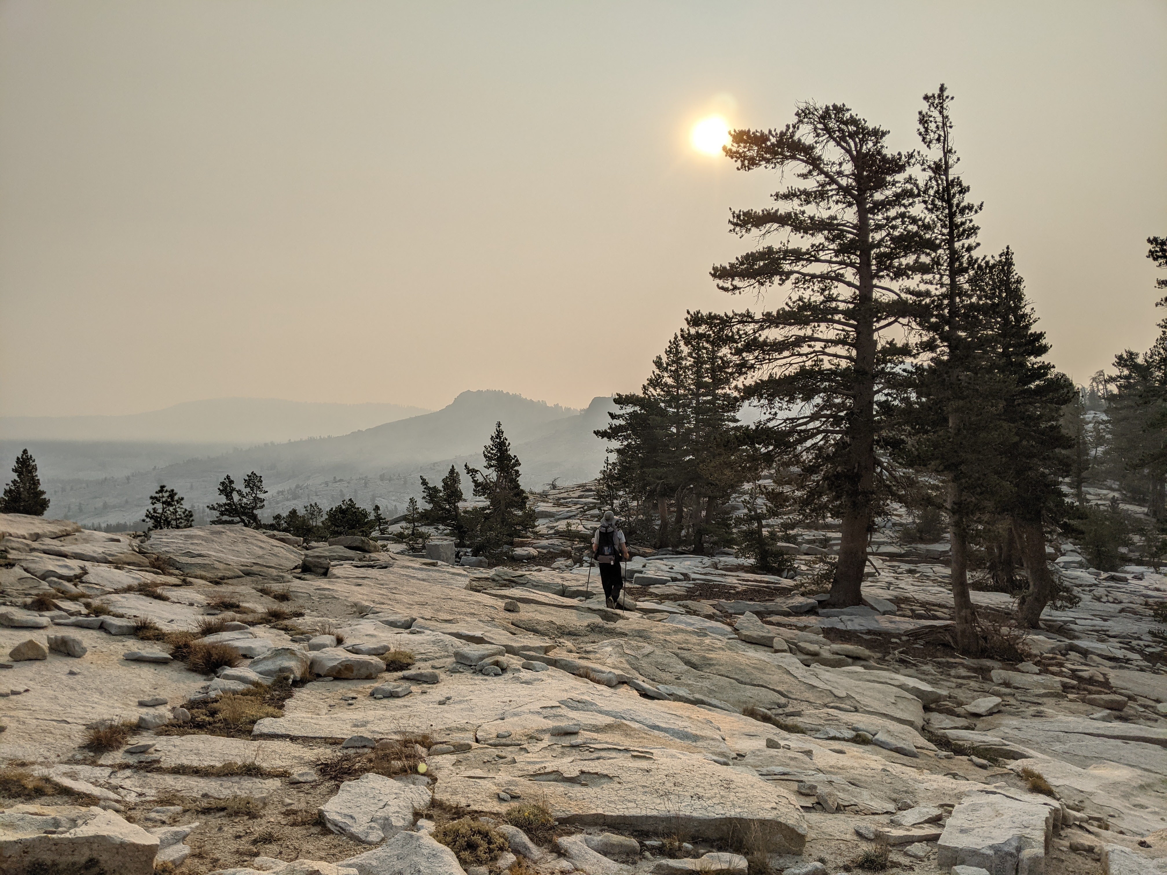
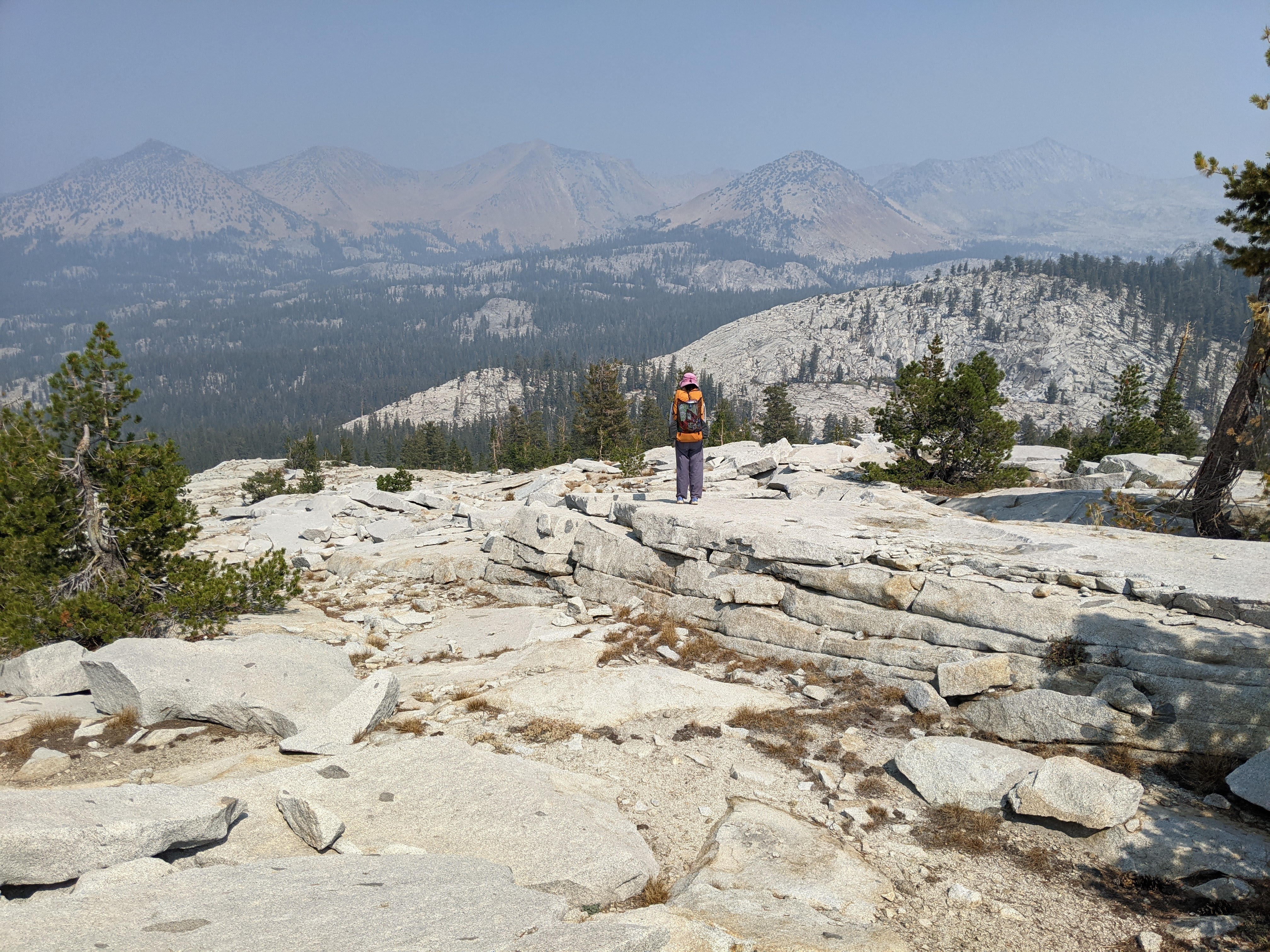
Morning dawned beautiful and relatively warm. After breakfast we hiked up to Buena Vista Pass and then began heading off trail along the Buena Vista Crest. The initial walking was easy- maybe too easy- along large granite slabs and open sandy soil. Just before the summit of Bruce Mountain we hit the boulder field and the remainder of the ridge, at least what we saw, was boulders.

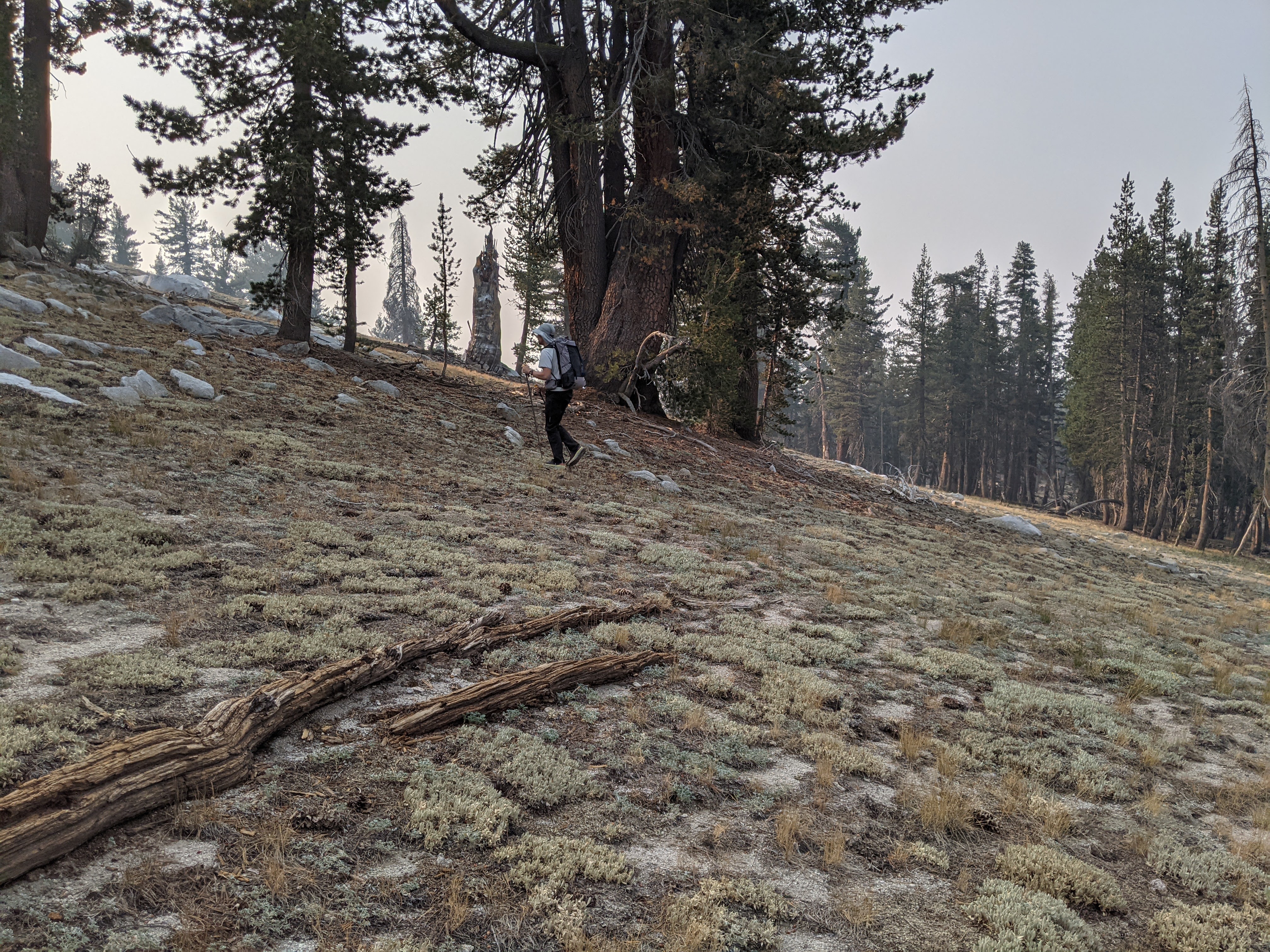
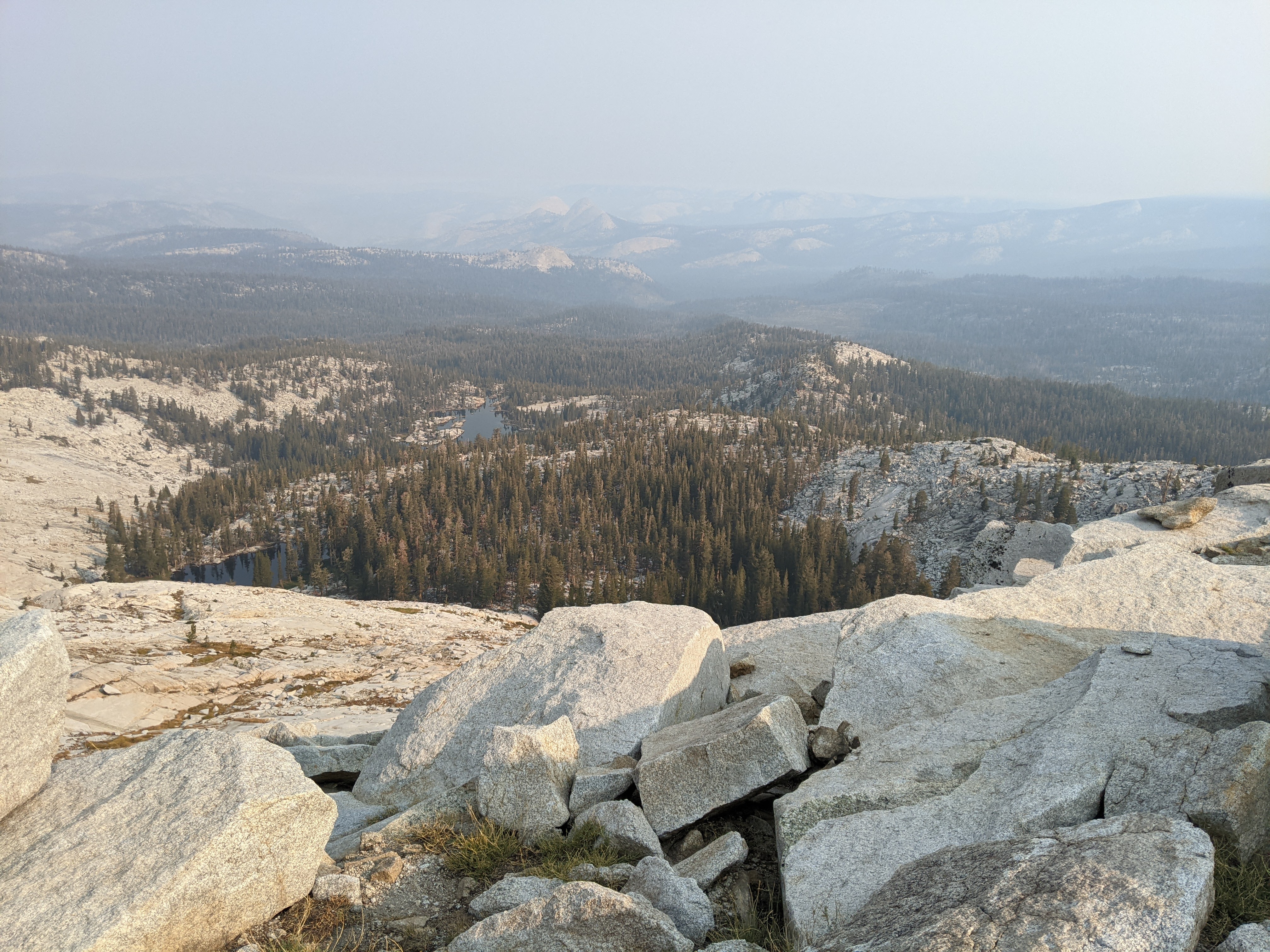
Once off Bruce Mountain we stayed to the south, hiking along the open sandy soil with occasional rocks. There were also a few bushy areas. I don’t like the alpine bushes- the ones that cover up boulders when I’m going down hill.
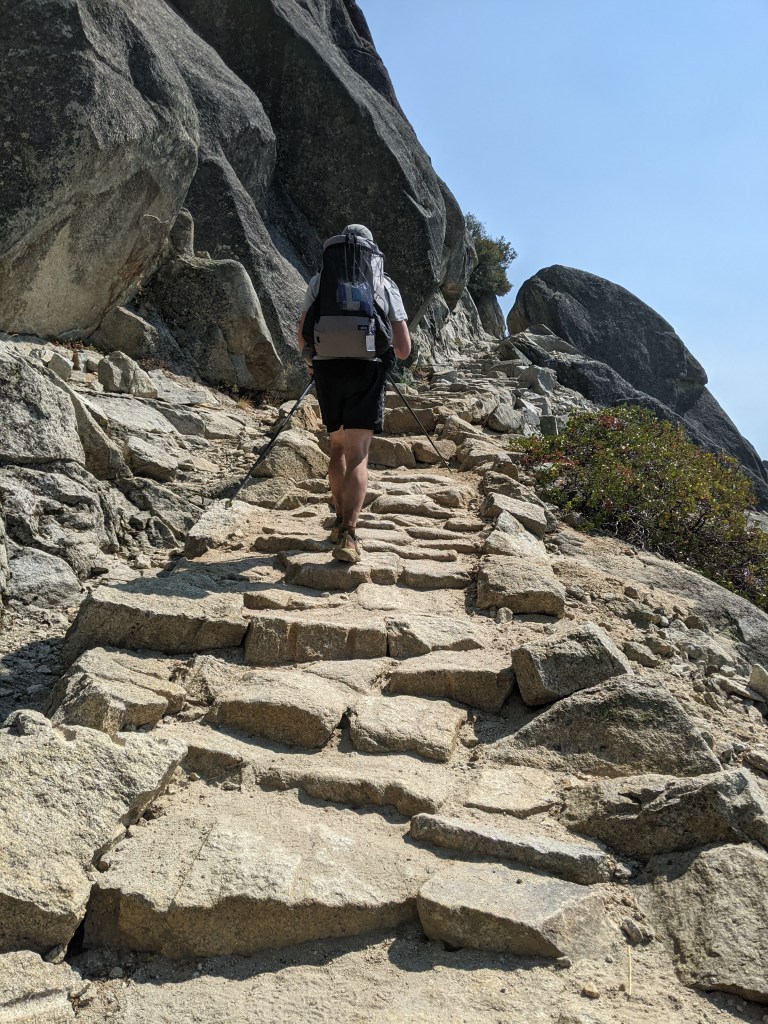
After contouring around on the south side of a couple bumps, we returned to the ridge for the narrow section to get in some good views and get on some boulders cause we didn’t want this day to be too easy:)
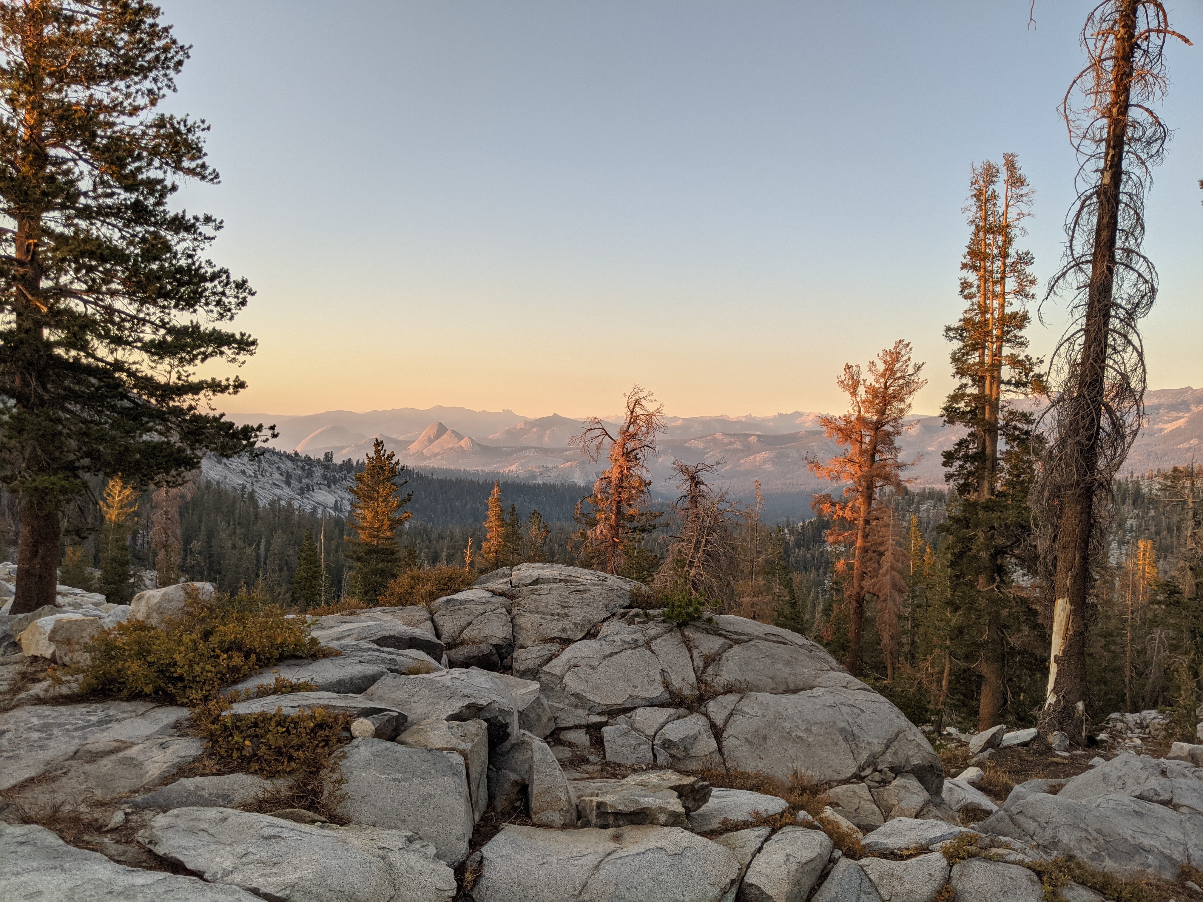
After the ridge we returned to the south side and began contouring north to Merced Pass. Just above Merced Pass we got a great view of Merced Peak and the Clark Range, only it felt like we needed to clean our eyeballs.
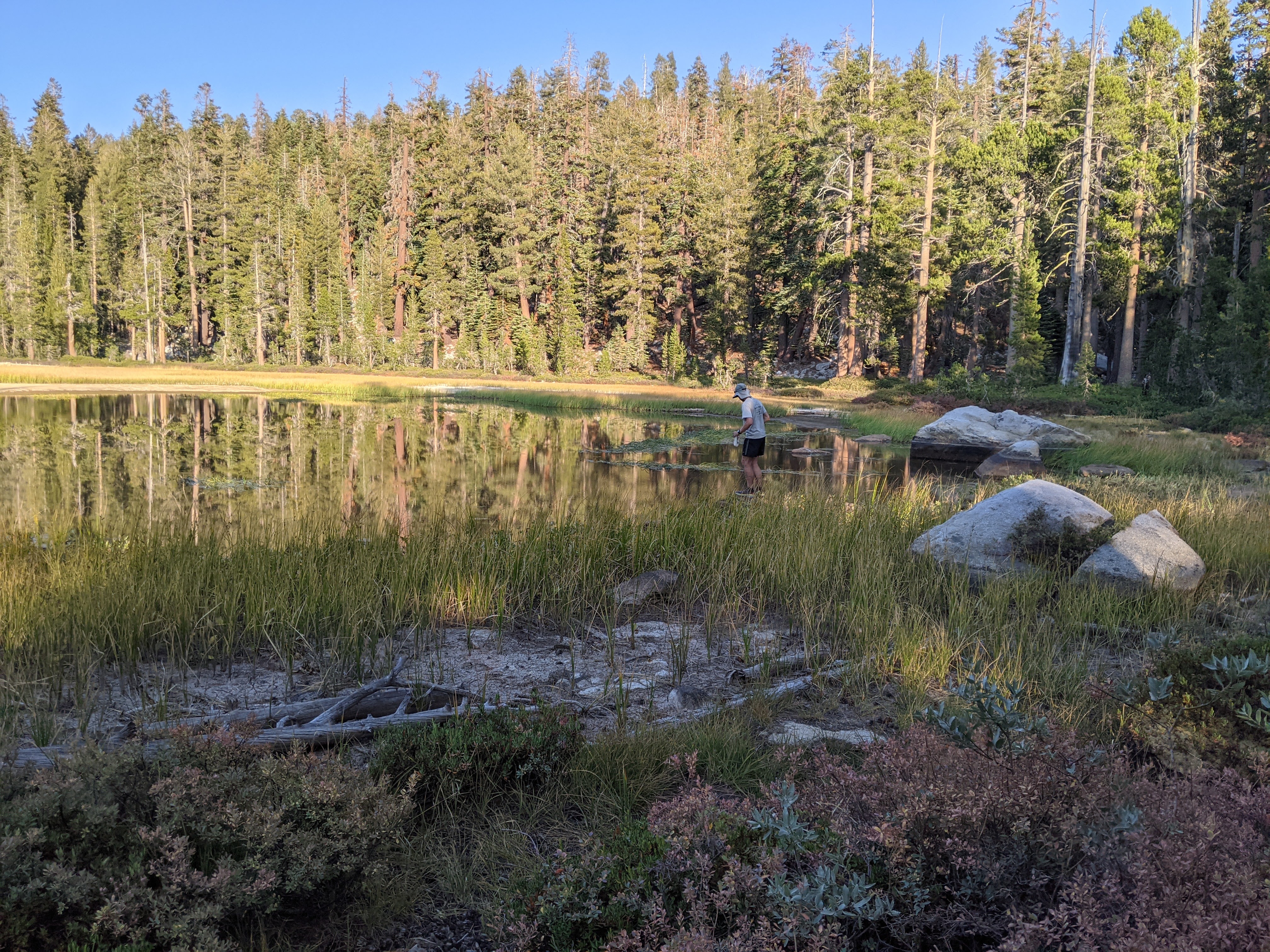
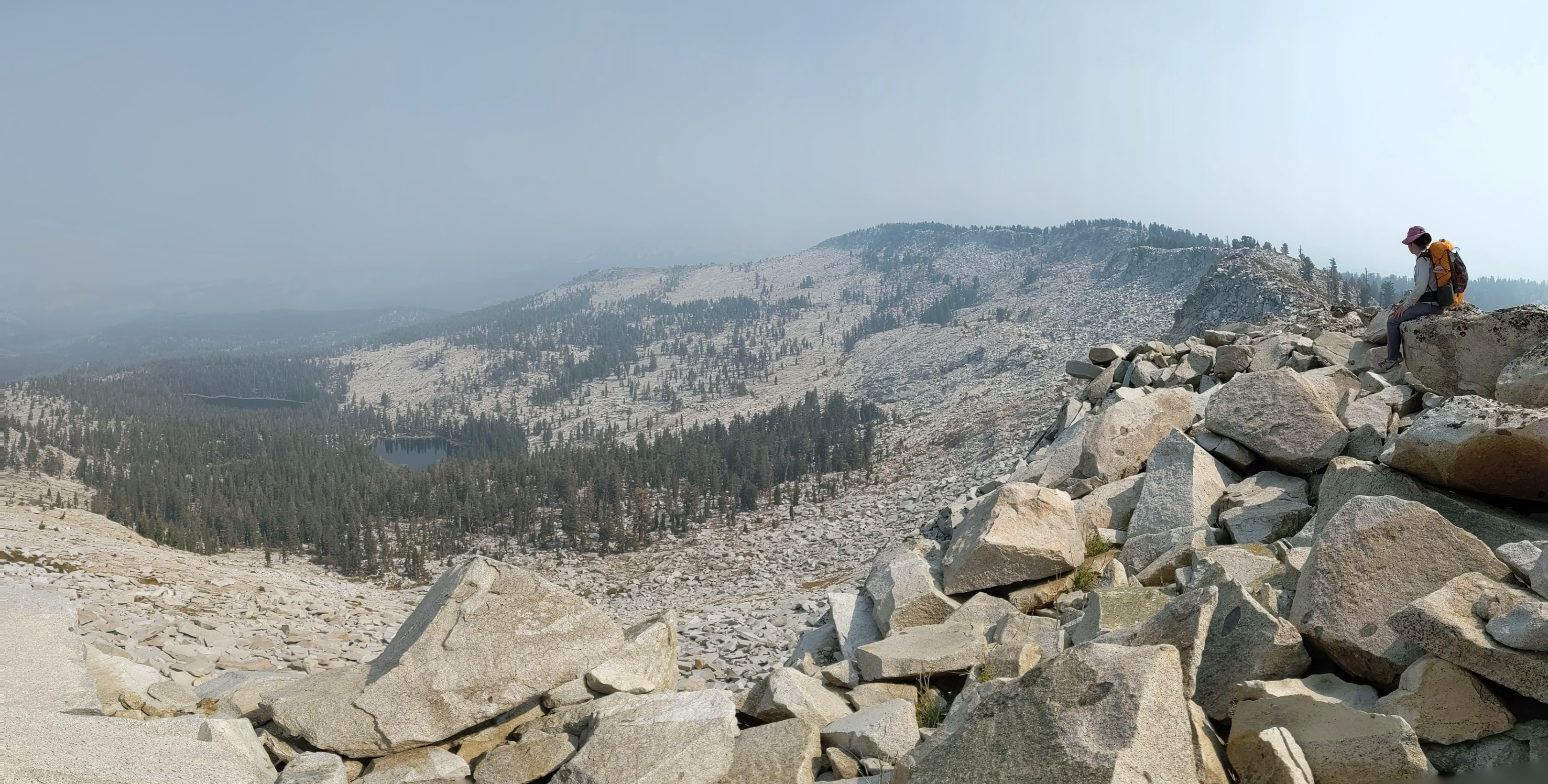
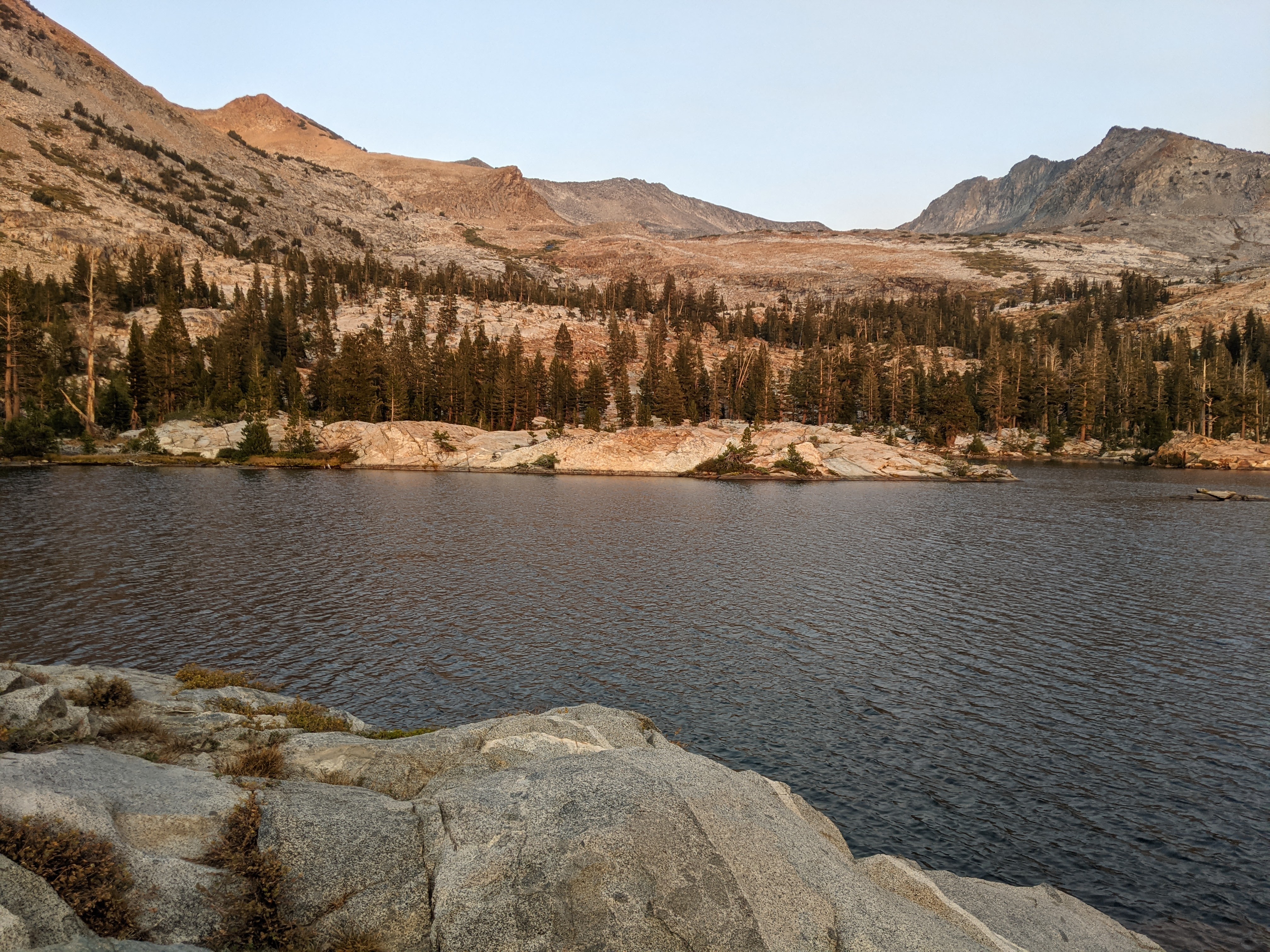
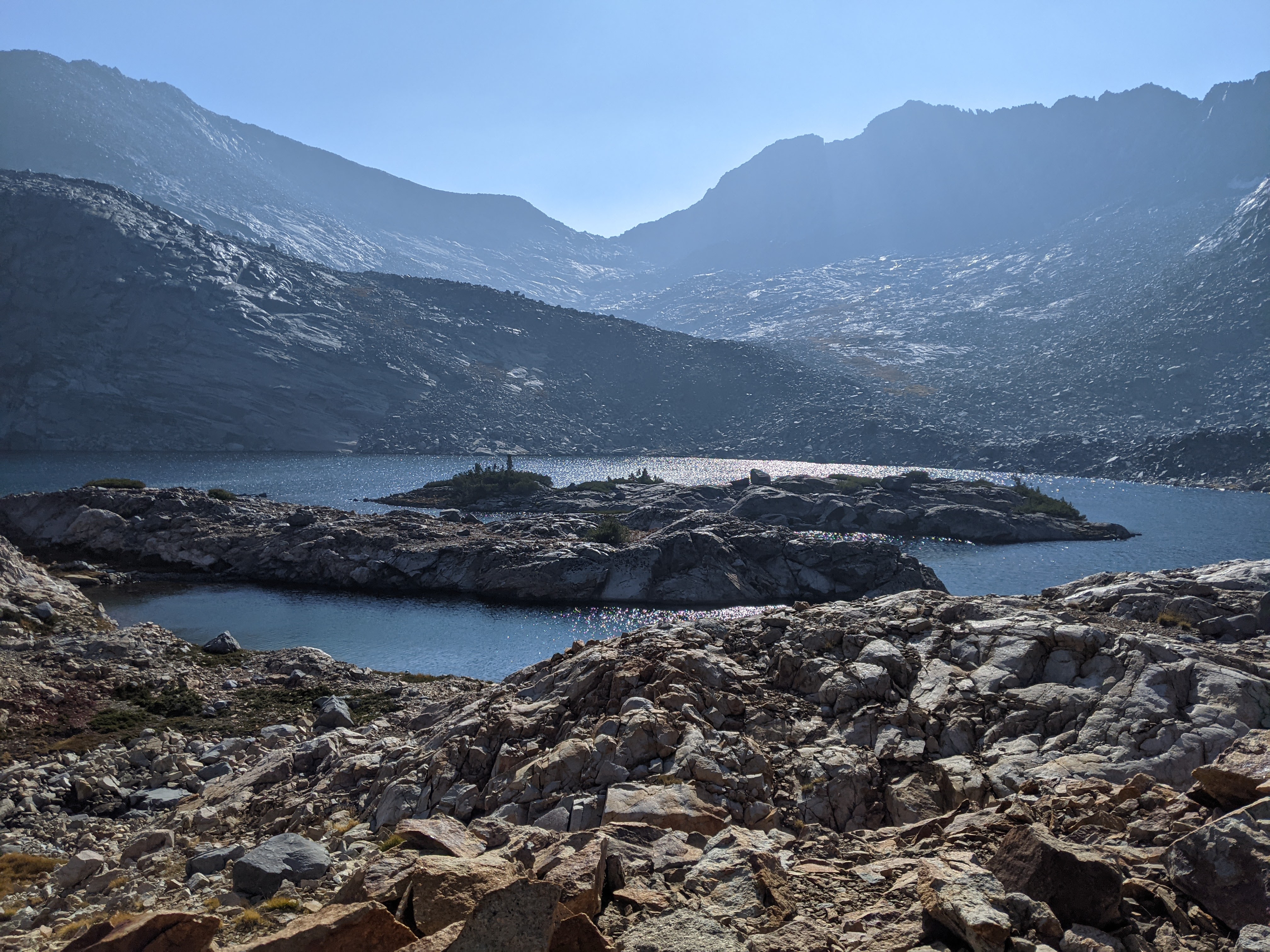
We caught the trail a bit below Merced Pass and took it down to the junction where we then started heading towards the Ottoway Lakes. It was afternoon by now and we were getting warm as we climbed up and then went down a couple times before finally climbing up to Lower Ottoway Lake by 4 pm. Since it was early, or at least early for us, I found a nice deep spot to swim from the northwest peninsula. I meant to dive under but instead spent a long time treading water and trying to breathe before I finally ducked under the surface. Good thing we still had an hour of sunlight to dry off. Meanwhile Erik just jumped in.
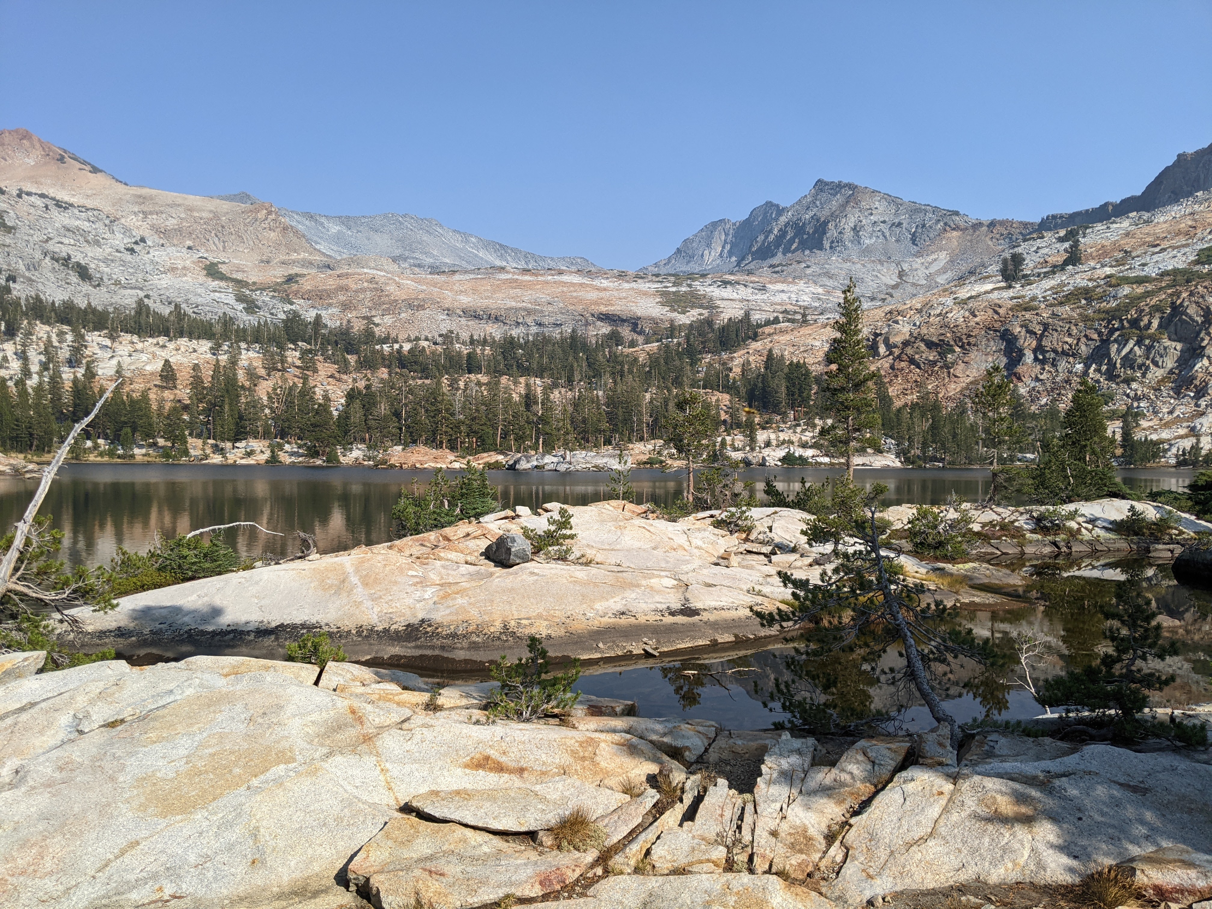

There were abundant tent sites on the northwest side of the lake and as we cooked and ate dinner out on our peninsula two women joined us on the lake. It was the only time we had company of our three nights out.
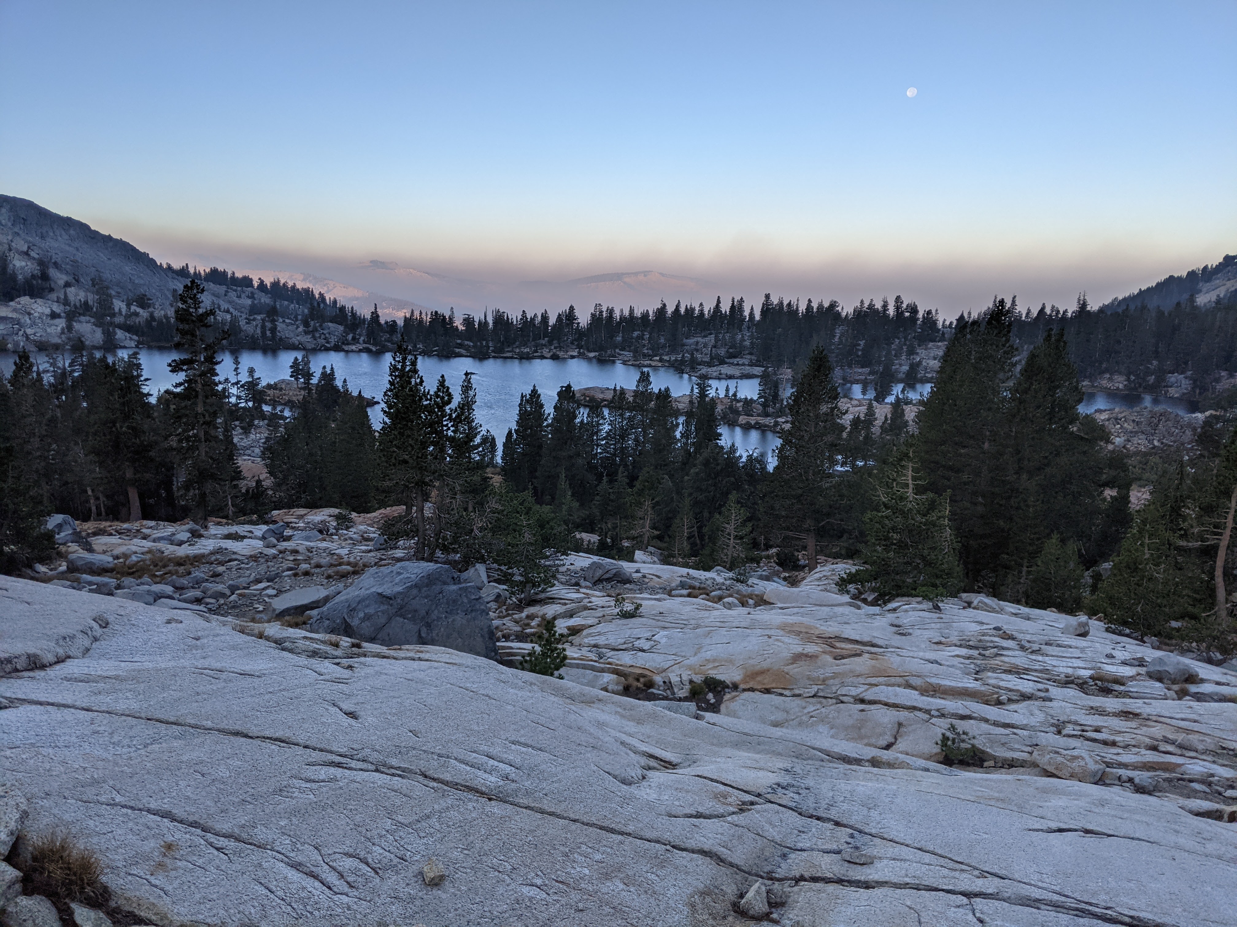
I stayed outside for a long time after dark, enjoying the view, the warm night air, and then finally the full moon came up and then I went to bed.
Day 3 (9/22/21): Out and back to Red Peak Pass and then Lower Ottoway Lake to Royal Arch Lake

Had we had an extra day (or had we not done Boundary Peak) we could have done a much sweeter loop, going up and over Red Peak Pass and by Isberg Peak and Fernandez Pass but life is full of trade-offs and so we had to suffice with an out and back to Red Peak Pass.
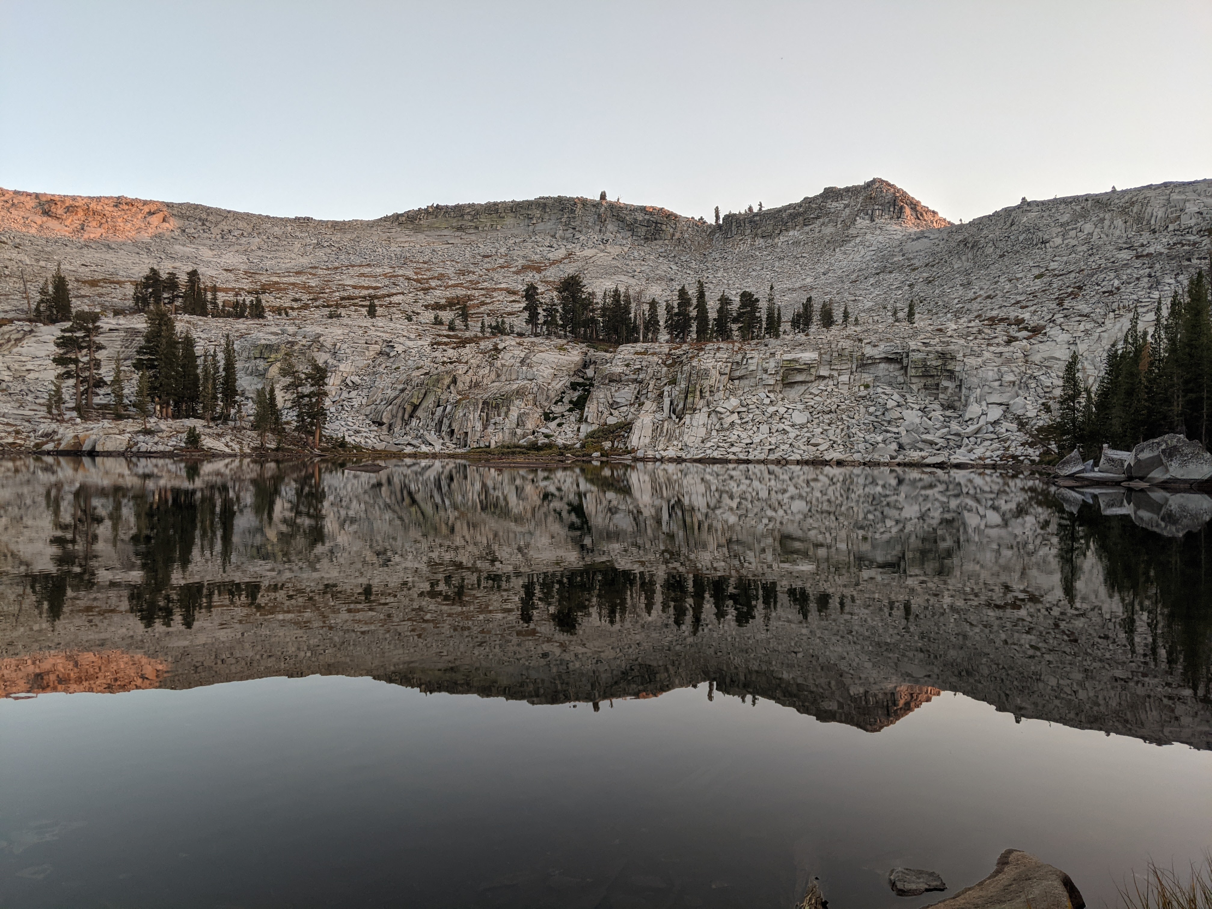
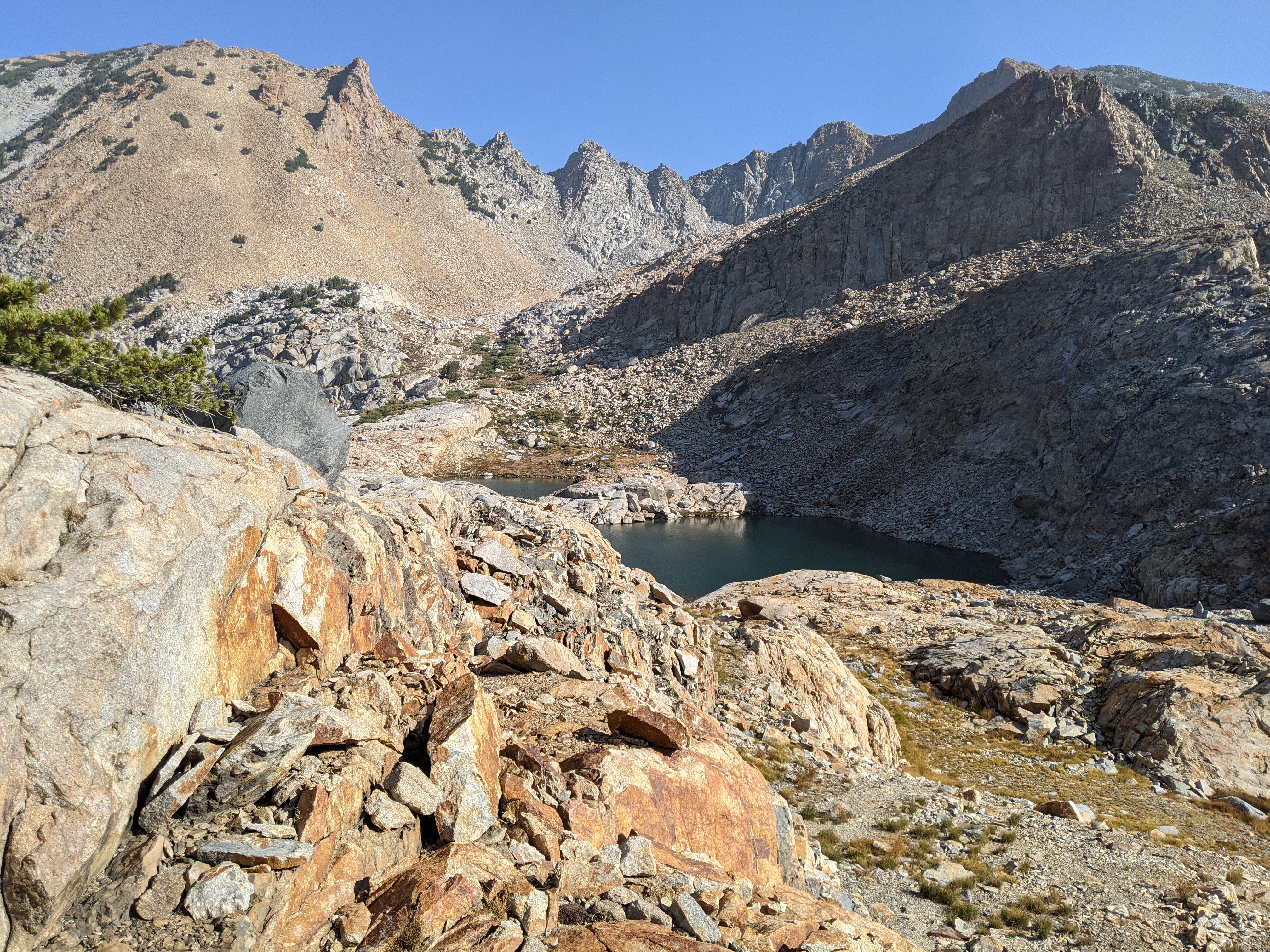
I love high mountain passes and Red Peak Pass did not disappoint. We had some plans of doing Red Peak but we also wanted to do another swim at Lower Ottoway Lake and get to camp before sunset. So when we saw the approach was a solid class 4 from the pass and given it’s not a state high point, we decided to save our energy.


I did convince Erik we should detour to Upper Ottoway Lake. While not in the trees, there is some camping potential here. This would be a good base camp for anyone going for Merced Peak via the pass that’s due east of the lake. It’s also a short hike should anyone have a base from Lower Ottoway Lake.
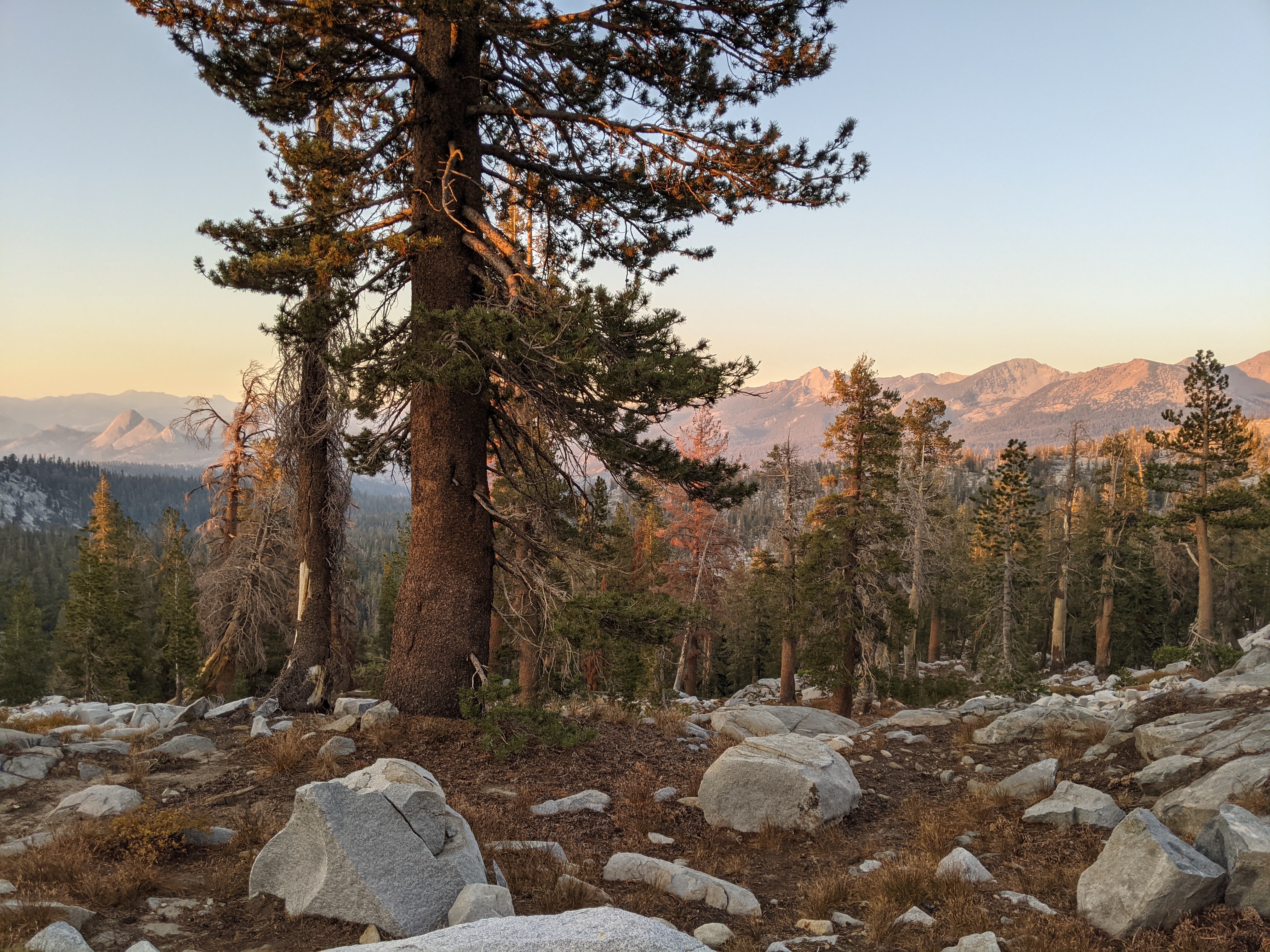
After first lunch, we returned to Lower Ottoway Lake for some late morning swimming. Then we packed up camp and headed back the way we’d come the day before. As we hiked we noted the sky was clearing up and so just before Merced Pass we detoured onto the big granite slabs to appreciate a better view than the day before.

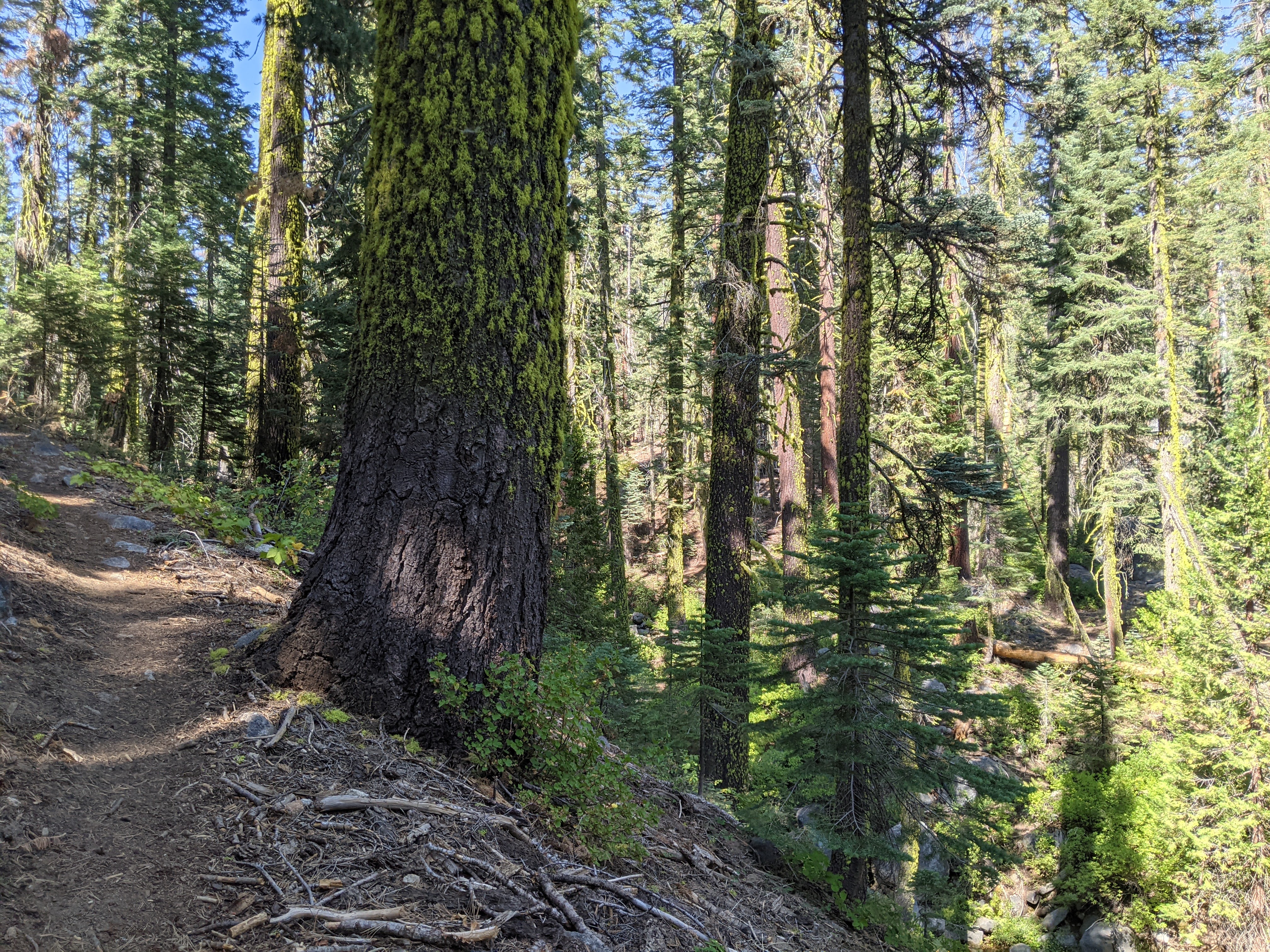
Then we disappeared into the trees for the next four hours until we got to Royal Arch Lake a tad before 6 pm. This allowed us to set up our tent, find a dinner spot, cook dinner, and eat dinner all before it got dark. We used the last of daylight to brush our teeth.

Day 4 (9/23/21): Buena Vista Lake to Chilnualna Falls Trailhead
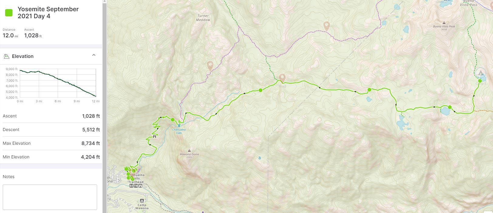
At daybreak we were up, taking down the tent and eating breakfast. Then we were off, ready for our 5,000 feet of descent on the day.
Besides a better view, I also figured the water access would be better at Royal Arch Lake, so even though we had to hike almost an extra mile out and back, I knew it would be worth it. The next morning I confirmed that theory as we hiked past Johnson and Crescent Lakes.


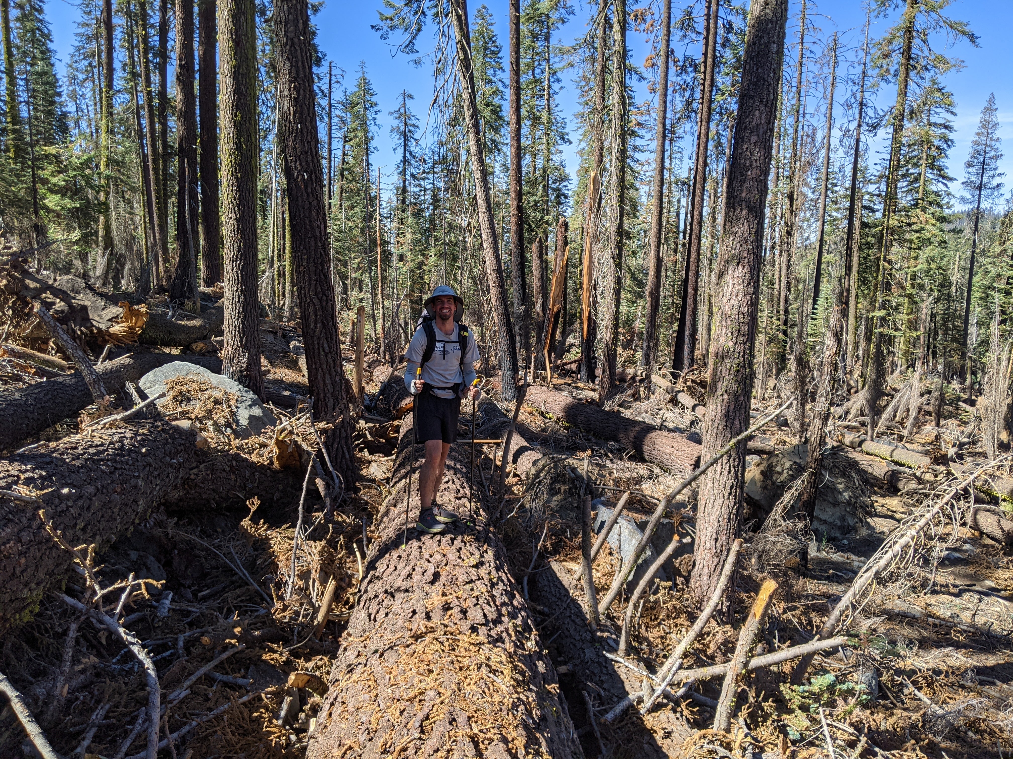
We expected a smooth hike out through the trees but we had our comeuppance in the section of trail just above the Chilnualna Falls Trail where we encountered fire damage and then massive blow-downs. Perhaps we didn’t pick the best route through- Erik liked to walk on the long blow-downs whenever possible- but it took us a very long time to go a mile. It was quite the juxtaposition from the remainder of the very well maintained trail. Erik said we needed something to make the day more challenging.

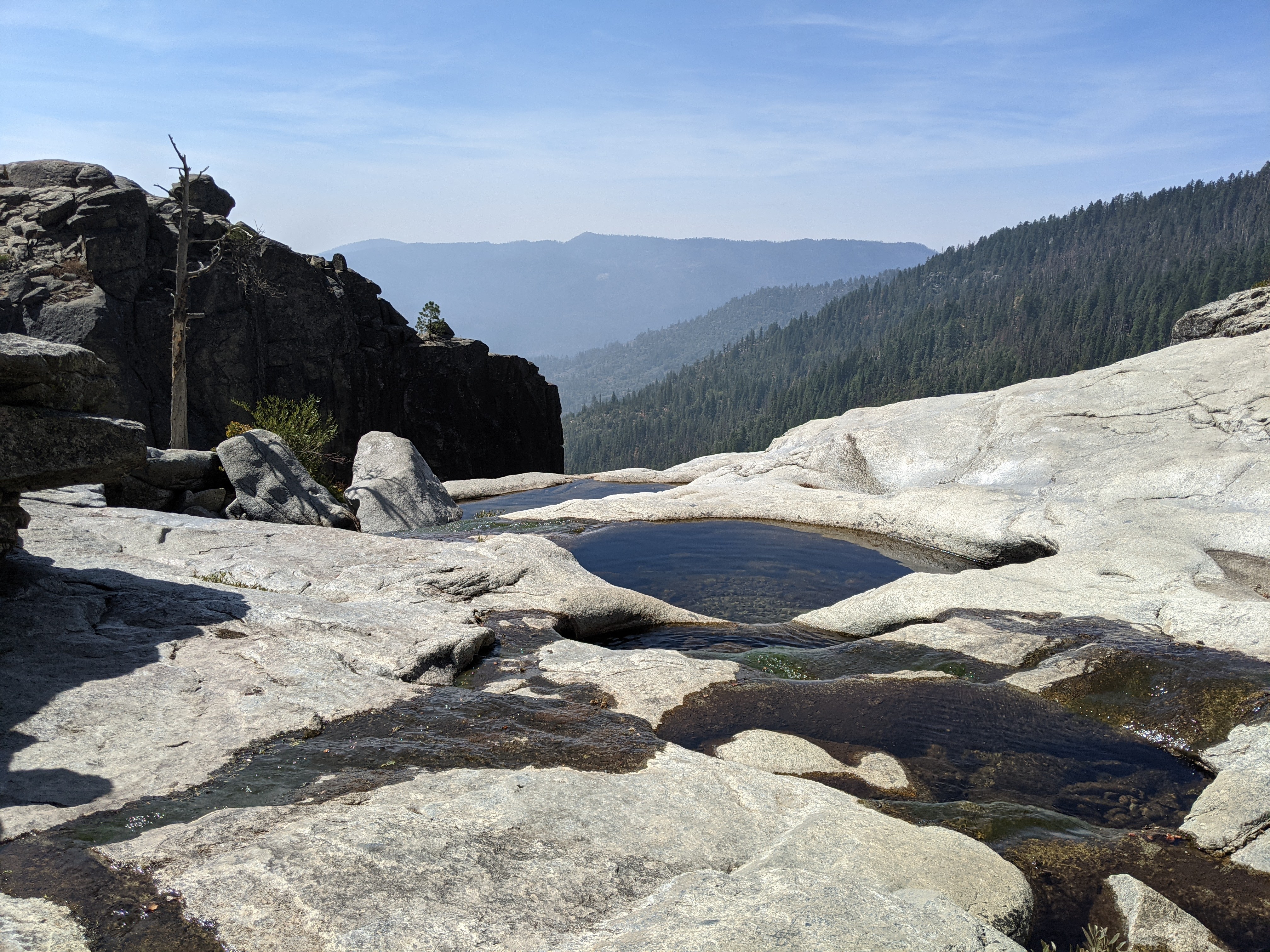
Finally we were through the blow-downs. We stopped at Chilnualna Falls to dip our feet in the clear pools before heading down to the trailhead. It was hot but we didn’t sweat so much with gravity doing most of the work.
I’d highly recommend this route with an extra day for the Fernandez Pass loop. It’s definitely off the beaten track and as such very easy to get permits. There were lots of open permits when we got ours- probably why we only saw five or six people (unsure if we saw the same guy twice or two different guys).
Mariposa Grove
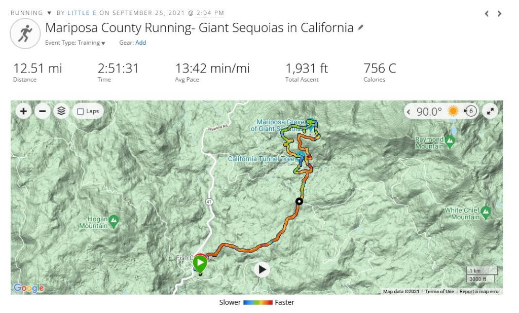
On the second afternoon of my three day conference we did a long run from our hotel up to Mariposa Grove. Technically we were supposed to have reservations to enter Yosemite given COVID but we cheated by entering on the small forest roads. It was National Parks Day so park admission was free anyway. The trees did not disappoint!
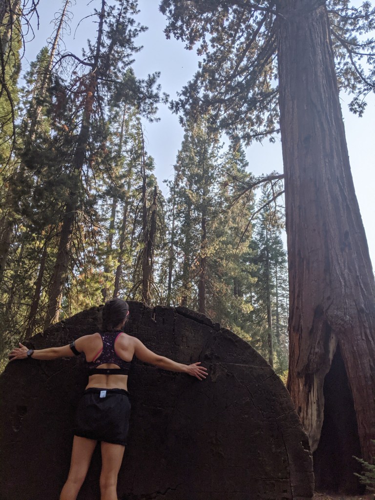
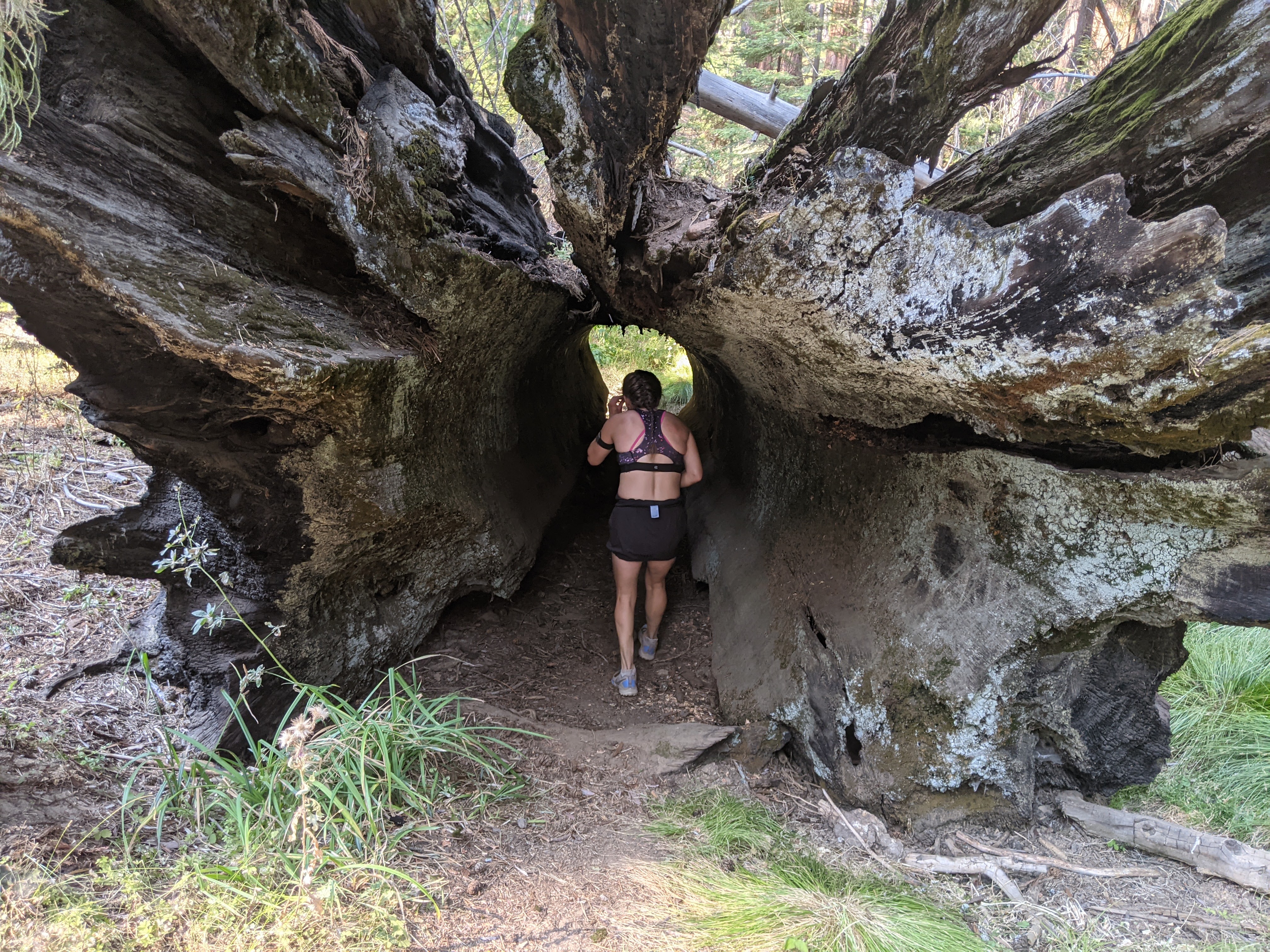
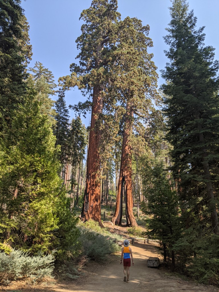
I assumed given National Parks Day that there would be throngs of people but due to COVID, it was a 2 mile hike just to get to the first tree in the grove, and an 8 mile walk (or run in our case) to do the whole loop. It was kinda sad that most people weren’t willing to go the distance because these giant trees are astounding.

Another very enjoyable read. Thank you!
LikeLike
I absolutely loved my trip. You are an amazing writer.
Sent from my iPad
>
LikeLike