In 2012, after Erik convinced me we should quit our jobs and spend the summer adventuring, and after doing just that on the Northern Forest Canoe Trail, we shifted directions and headed west. Well, technically we first drove back “home” from Fort Kent, Maine, to Minnesota, where we shared time with both of our families. Within a month though, we were back on the road, exchanging our friend, Emily, for my brother, Leif.
The main focus of the trip was to backpack the John Muir Trail (JMT). Since there were three of us and we had time, we decided to drive and take in the sights along the way. That summer Erik and I drove ocean to ocean and back to Minnesota from the west coast.
A couple weeks before we left, Erik broke his left thumb in a rock climbing accident. Fortunately he was still good to go for the trip.
Day One pre-JMT: Backpacking Teddy Roosevelt National Park
And so on Wednesday July 25th, we set off west from Minnesota. Teddy Roosevelt is near a solid day’s drive, so we made this our first stop and had our first night backpacking. After securing our backcountry permit, we took the main road north of I-90 to the Peaceful Valley Trailhead where we began our hike up to the Big Plateau.
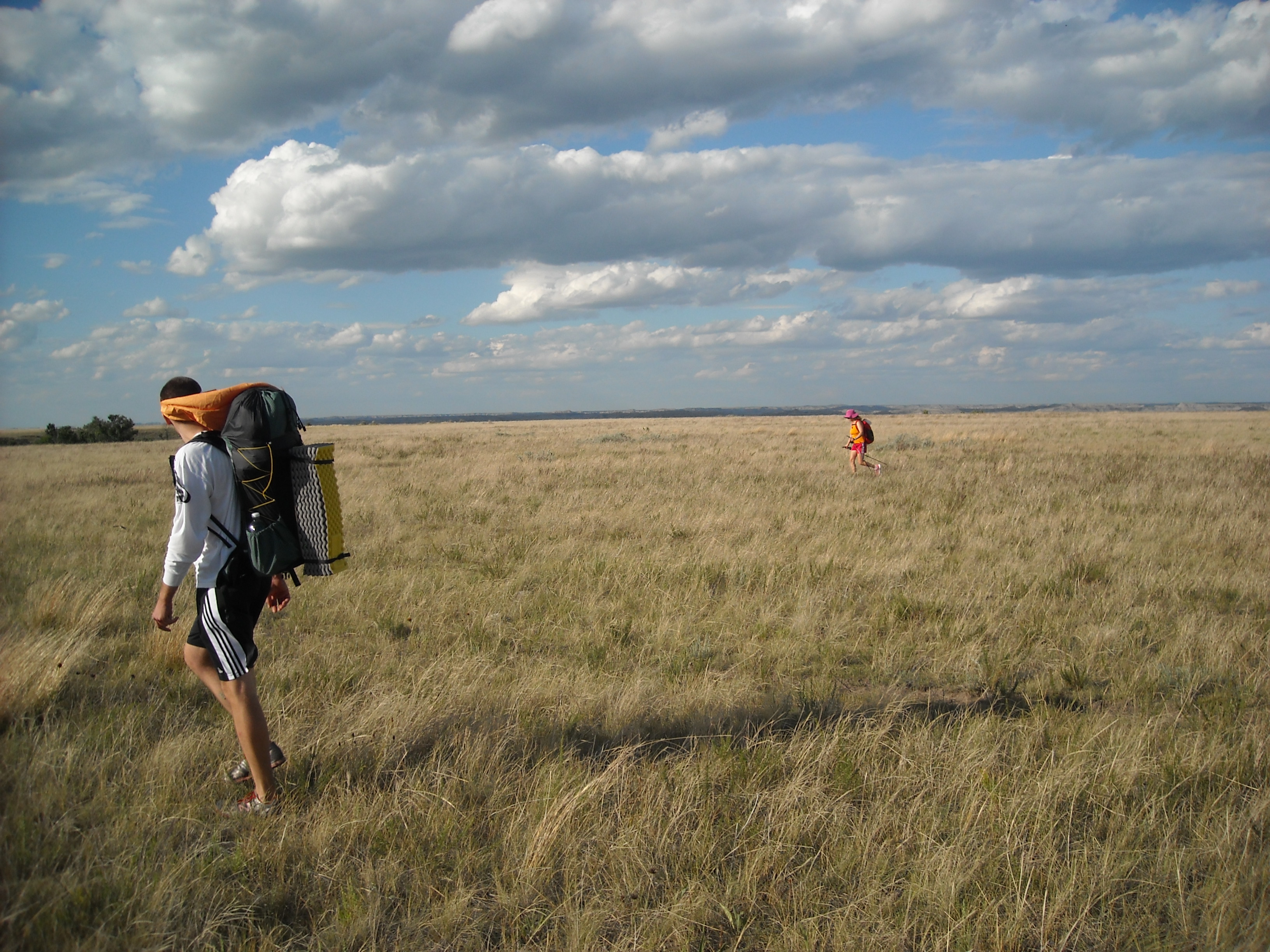
While there was a trail marked on the map, it mustn’t have been terribly popular as there wasn’t much of a worn path in the prairie grass. It was easy enough walking though and we made good time in the arid west weather. We didn’t expect to find any water so had packed all that we’d need to hike a couple hours each direction and the overnight.


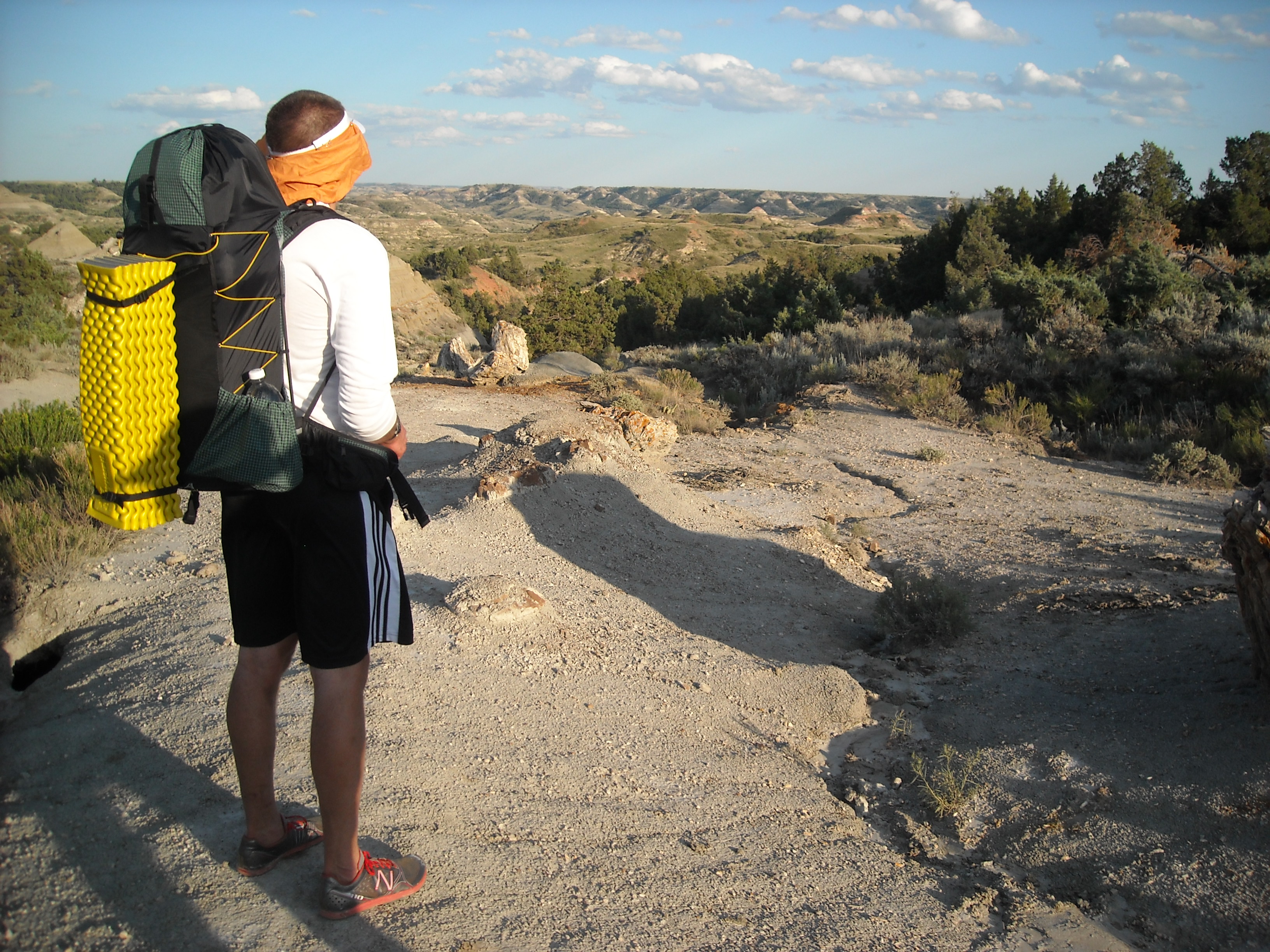
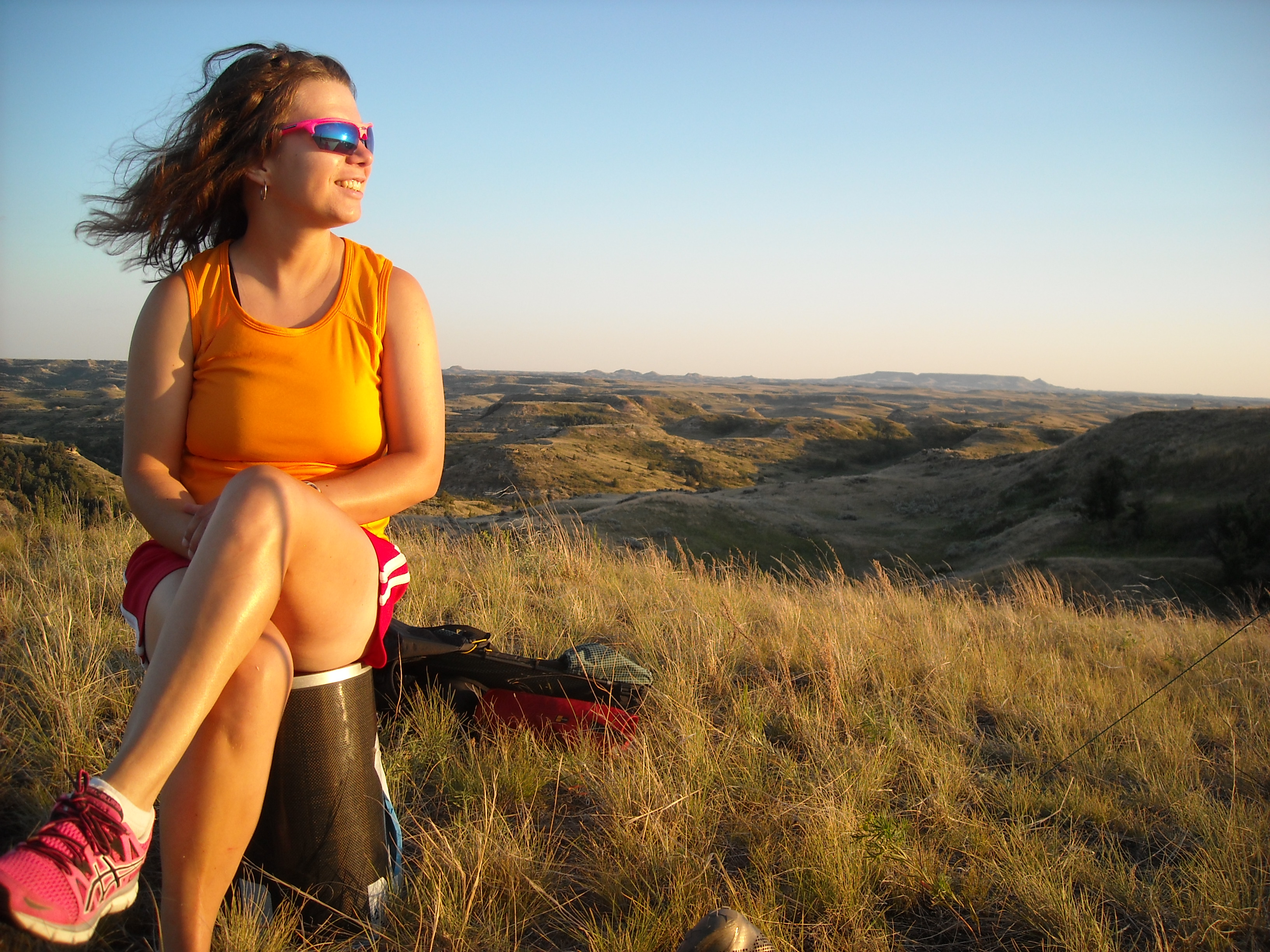
There weren’t any designated campsites and so when we’d decided we had hiked far enough, we set up our tents, cooked dinner, and enjoyed the sunset, and some distant car lights on the freeway.
Day Two pre-JMT: Hike out of Teddy Roosevelt and drive to the Beartooths
Still having many miles to drive, we got up early and began our hike back to the car.
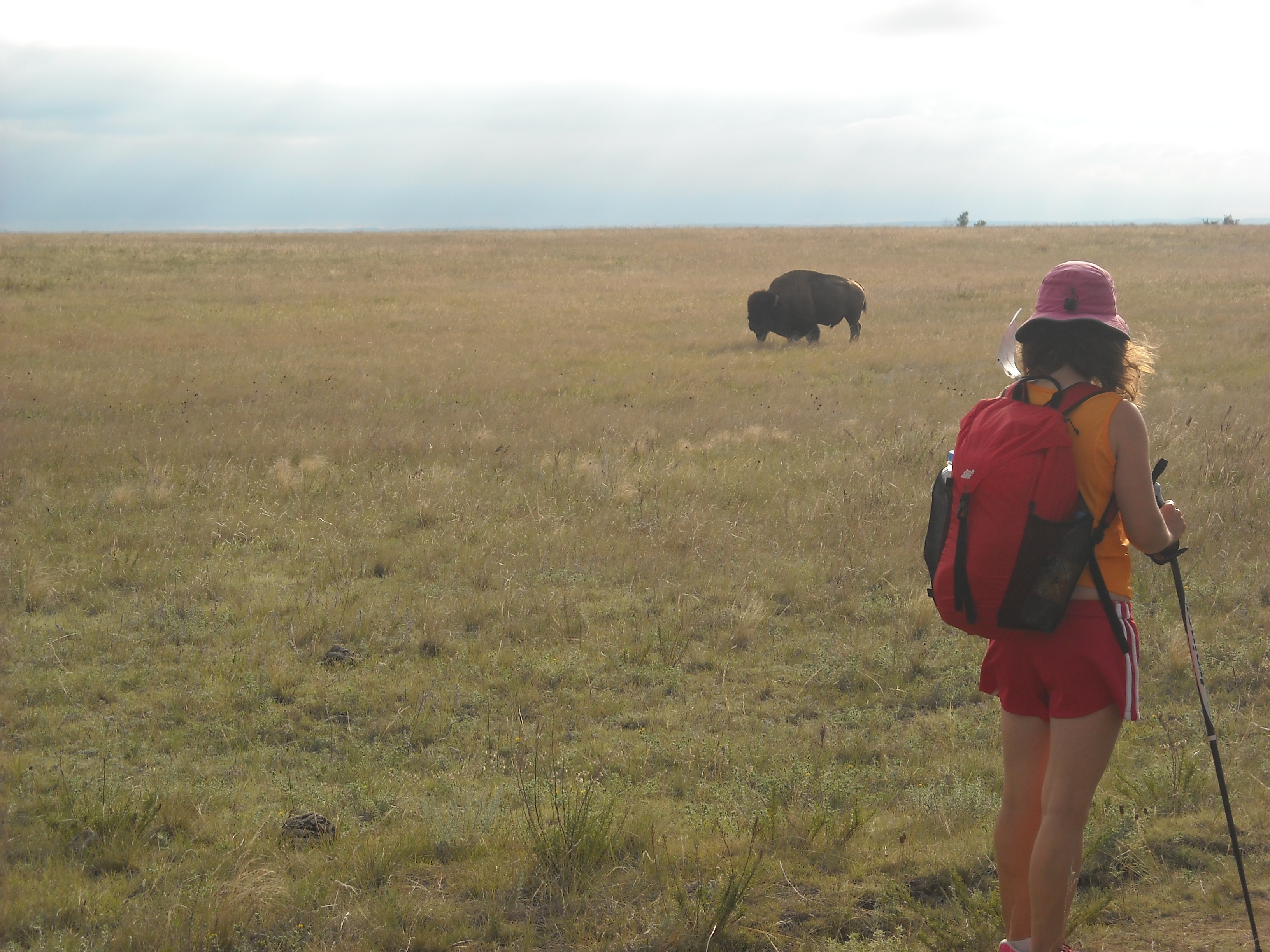
Other than the buffalo, the hike out was uneventful and soon we got back to driving across Montana. That night we only made it as far as the base of Beartooth Pass where we drove down a rough dirt road to the M-K National Forest Campground. They had pit toilets but that was the only amenity.
Day Three pre-JMT: Beartooth Highway and Island Lake National Forest Campground
We got up and drove back down the rough dirt road, hit a big pothole and one of our hubcaps went flying off and we got a flat tire from a nail. Fortunately we had a bike pump and my bro along. He got the tire pumped up and then backtracked to Red Lodge to get the tire better fixed up.
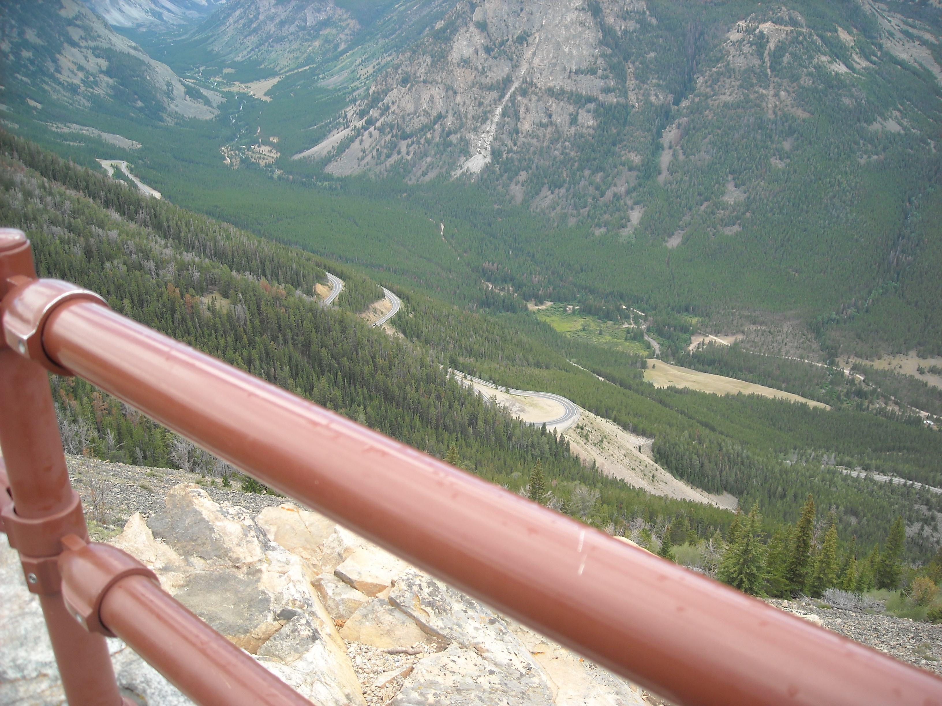
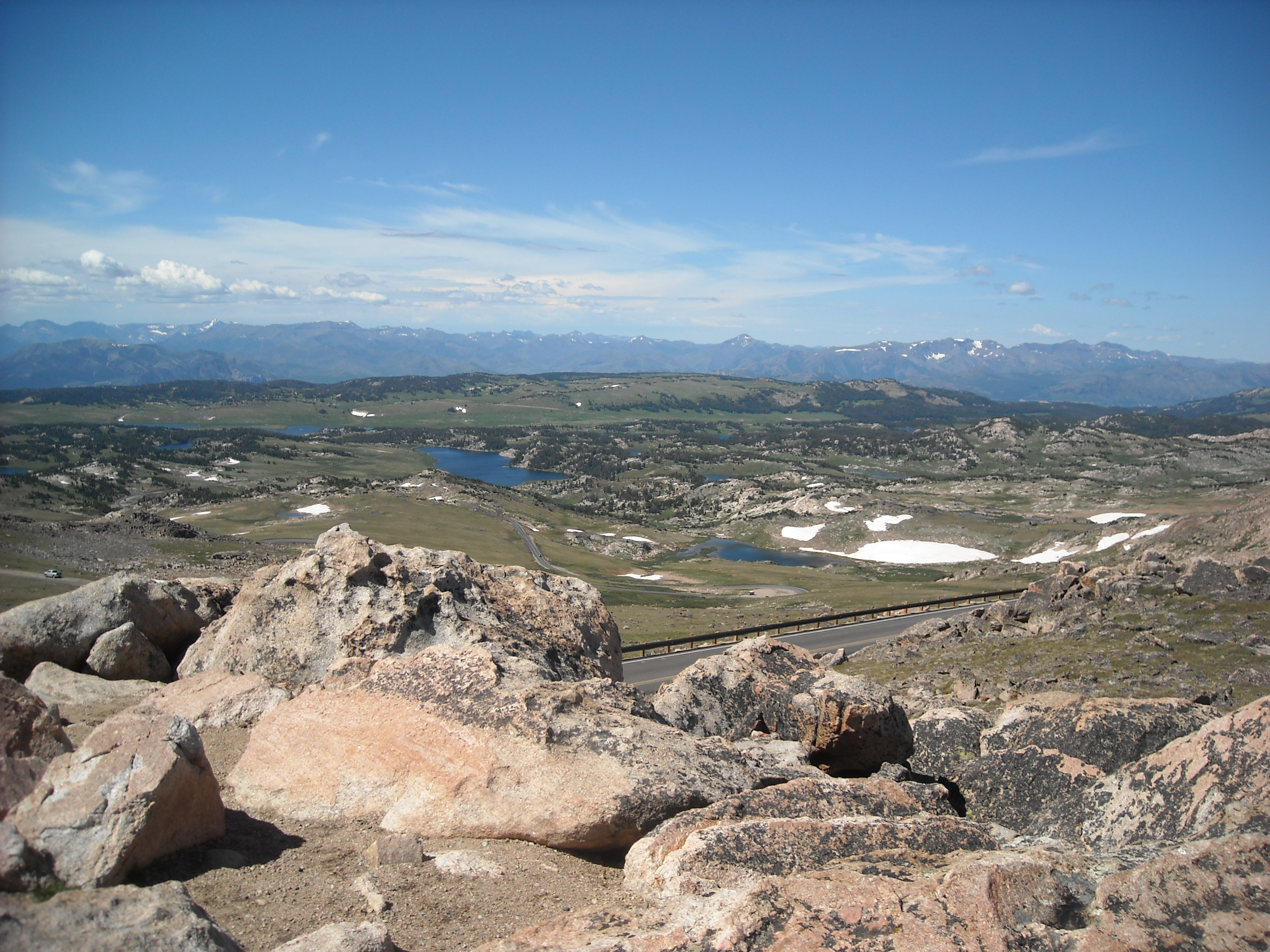
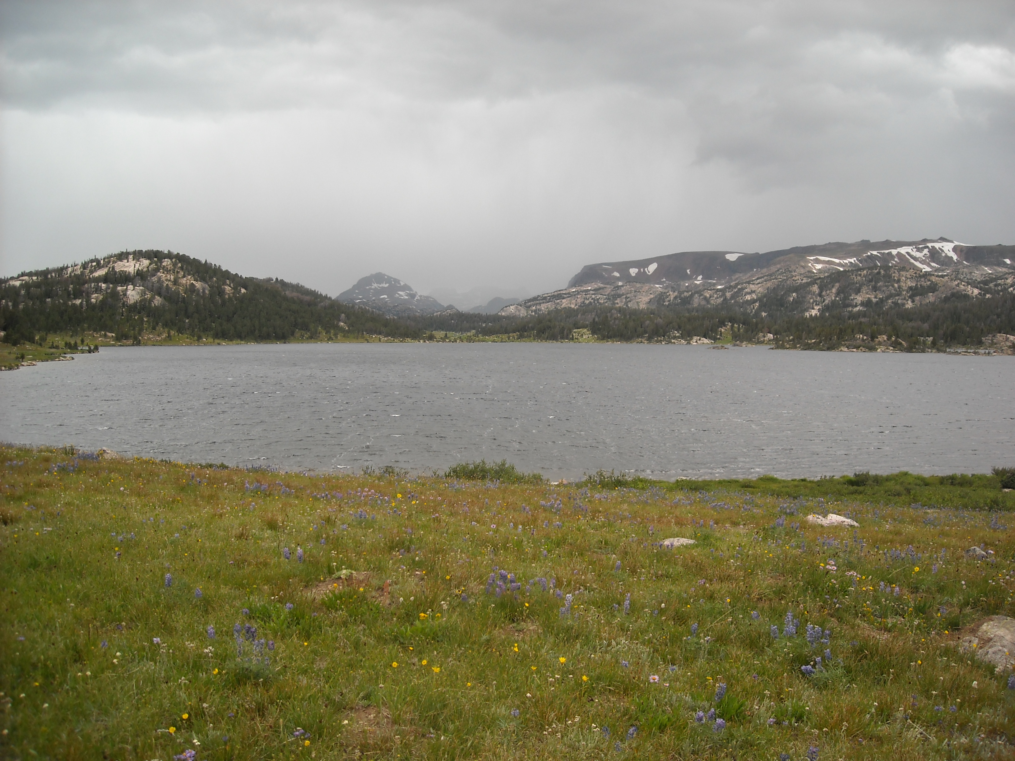
Next up we drove the Beartooth Highway over Beartooth Pass. Between Erik’s broken thumb and my bro’s rough stick driving skills, it was up to me to navigate the hairpin turns in our manual Volkswagen Jetta. The views were stunning. At the top we realized we were at high elevation and we might as well stay at the Island Lake National Forest Campground (about 9,500 feet) to begin our acclimatization. From here we did a loop hike, up to Beauty Lake and then to Beartooth Lake, albeit half of it was on the Beartooth Highway which wasn’t great.

Day Four pre-JMT: Backcountry in Yellowstone National Park
The next day we drove the short distance to Yellowstone National Park where we planned to do one night of backcountry. We spent time at the Mammoth Hot Springs area where we got our permit for the night, an out-and-back hike to the Winter Creek backcountry campsite from the Mount Holmes Trailhead.
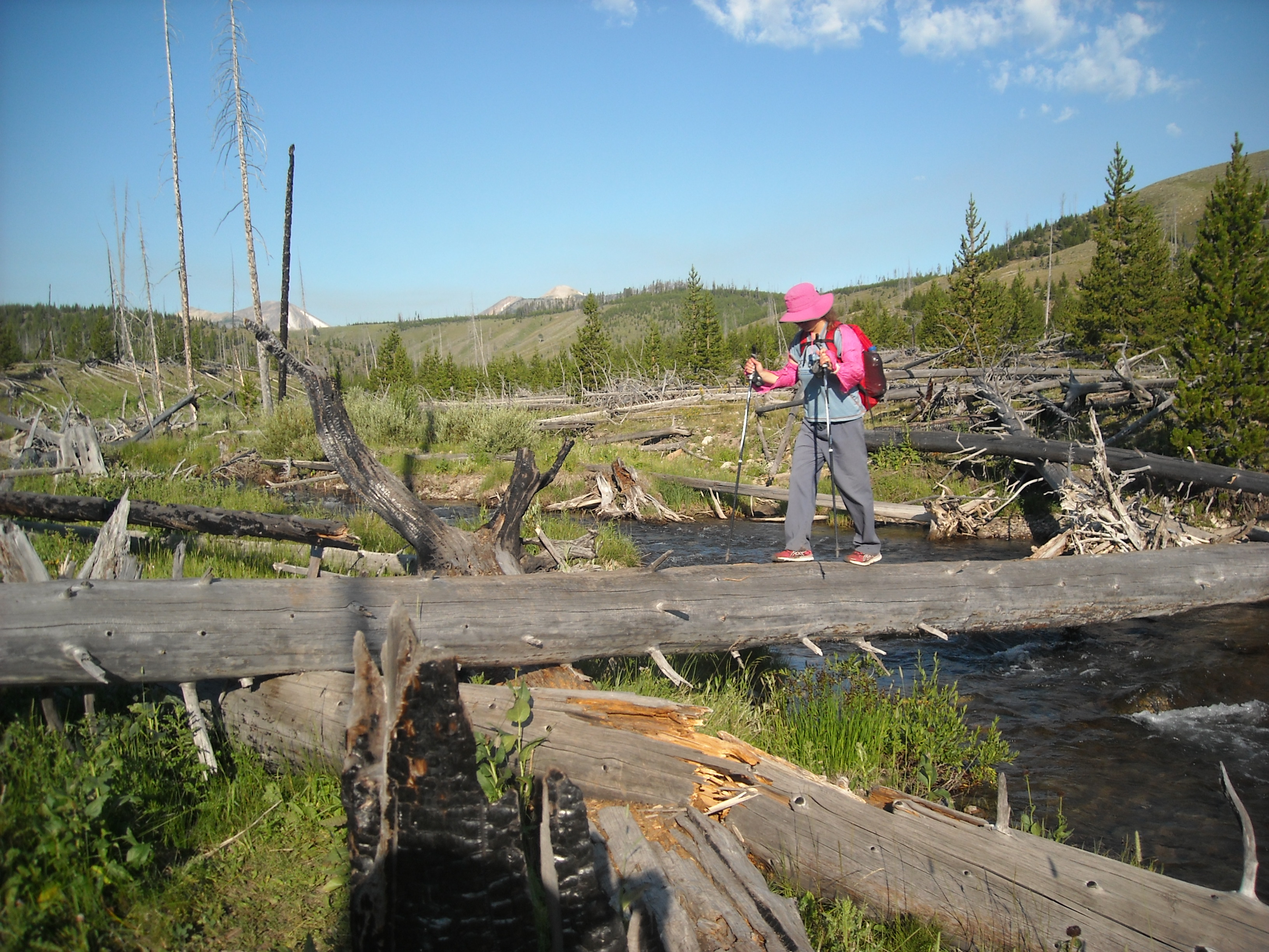
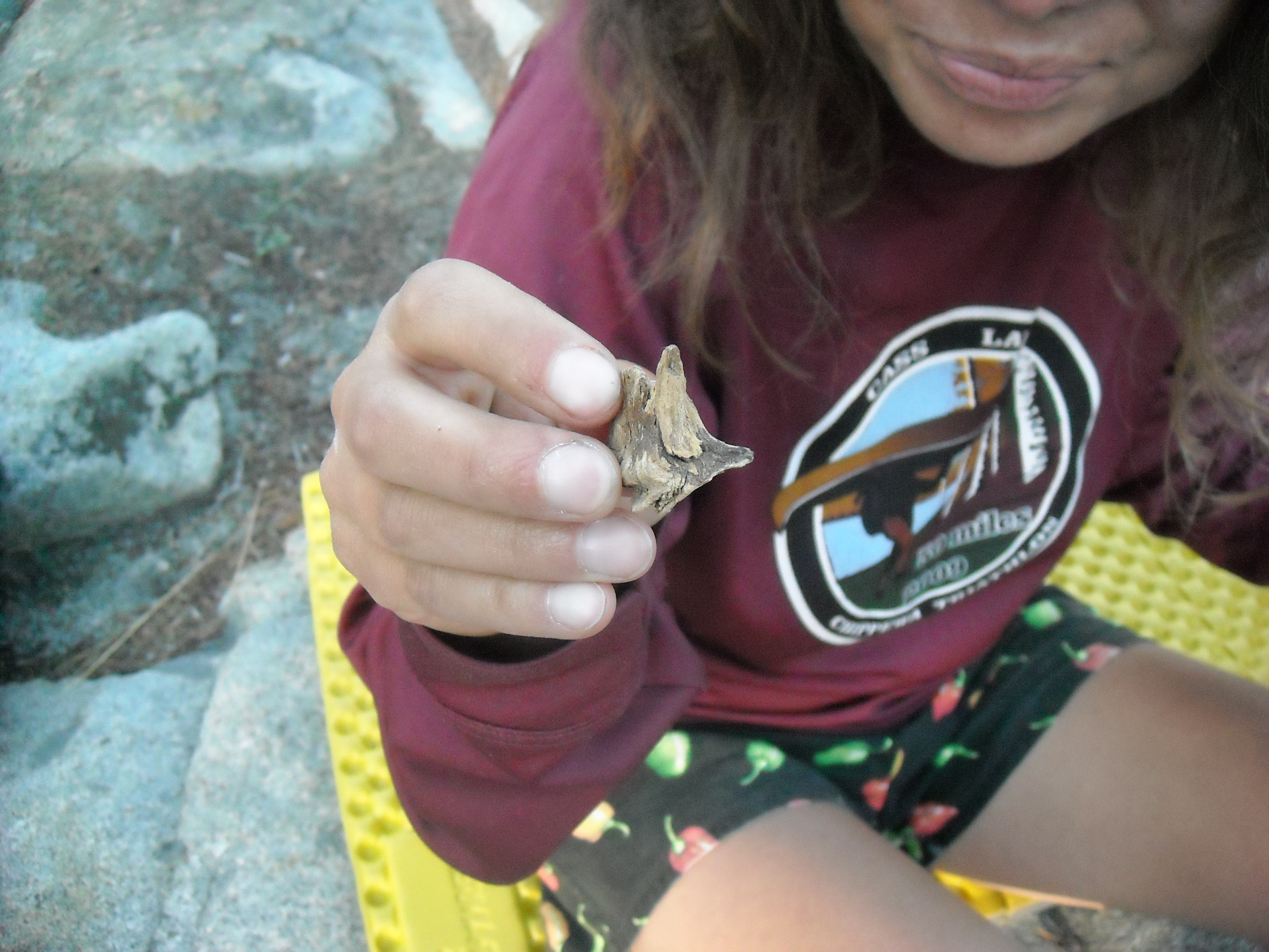
We quickly learned that while the wildlife and thermal features are impressive at Yellowstone, the scenery is not. Don’t come here for jagged mountain peaks. Other than a log stream crossing, finding an elk shed and skull (had to leave it because we were in the national park), and that the rangers had accidentally overbooked the campsite, it was uneventful although my bro was sure we were going to see some grizzlies!
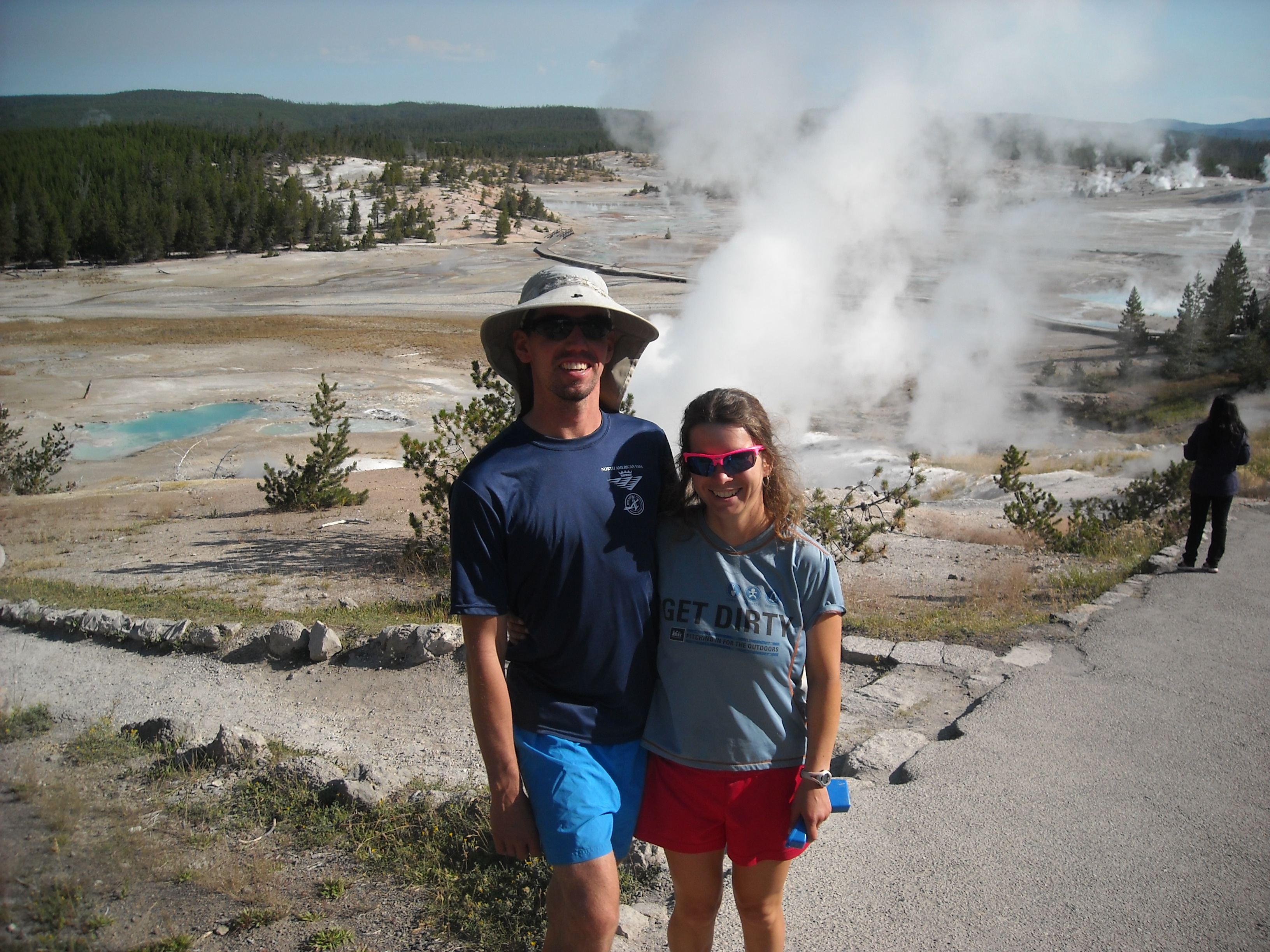
Day Five pre-JMT: Norris Geyser Basin and drive to Utah
The next morning we hiked back to our car and then continued driving through Yellowstone where I was completely enthralled by our stop at the Norris Geyser Basin. This may have been my favorite area in the park.

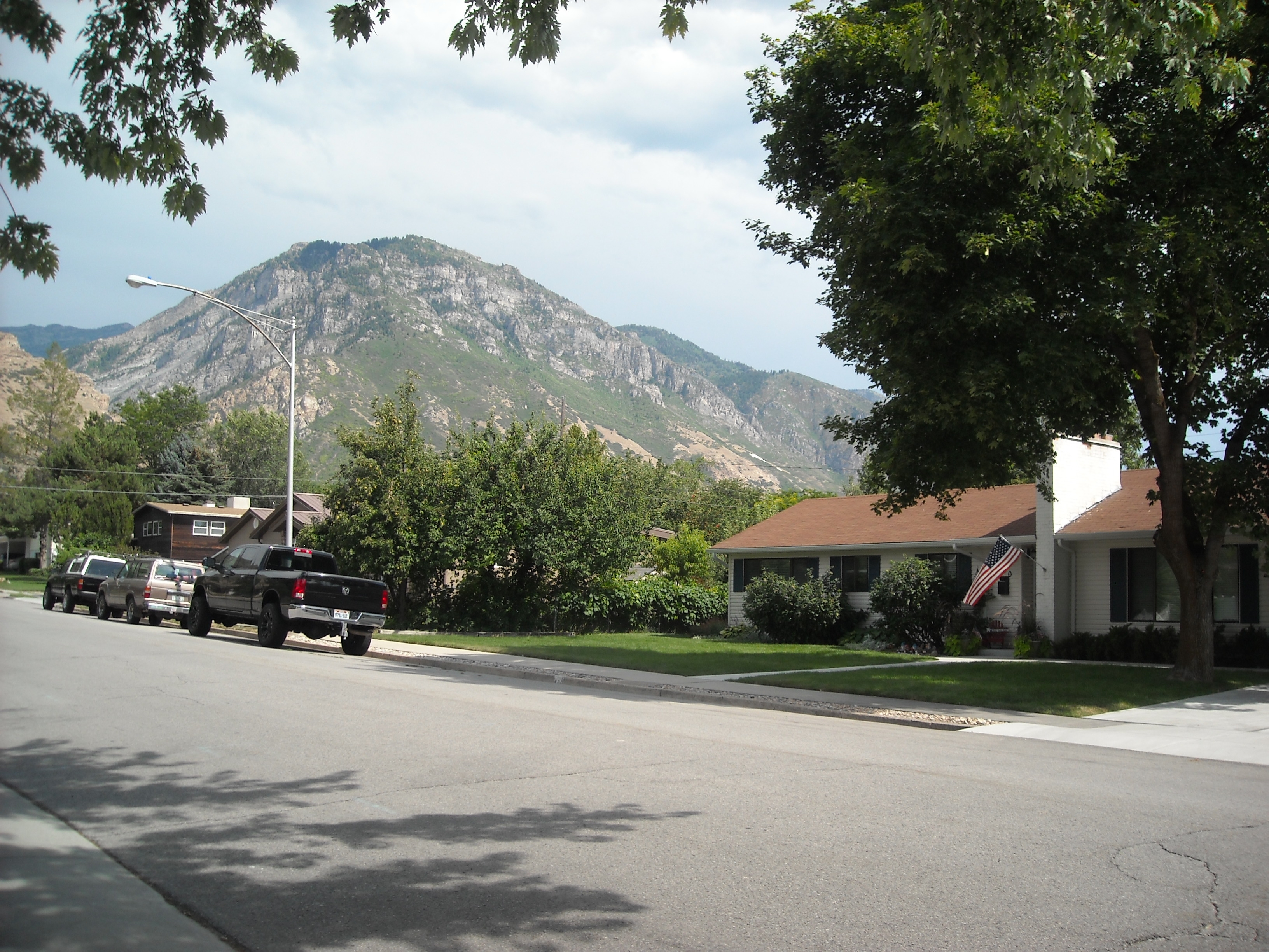
But alas, soon we had to leave to make it to our next destination. One of the unique features of this trip included visiting three of our aunts. The first one on the list was Aunt Mary, my mom’s oldest sister, who had lived in Utah my entire life. Visiting her had been 27 years in the making and was long overdue. That night we were greeted to a feast and spent time with our long lost cousins.
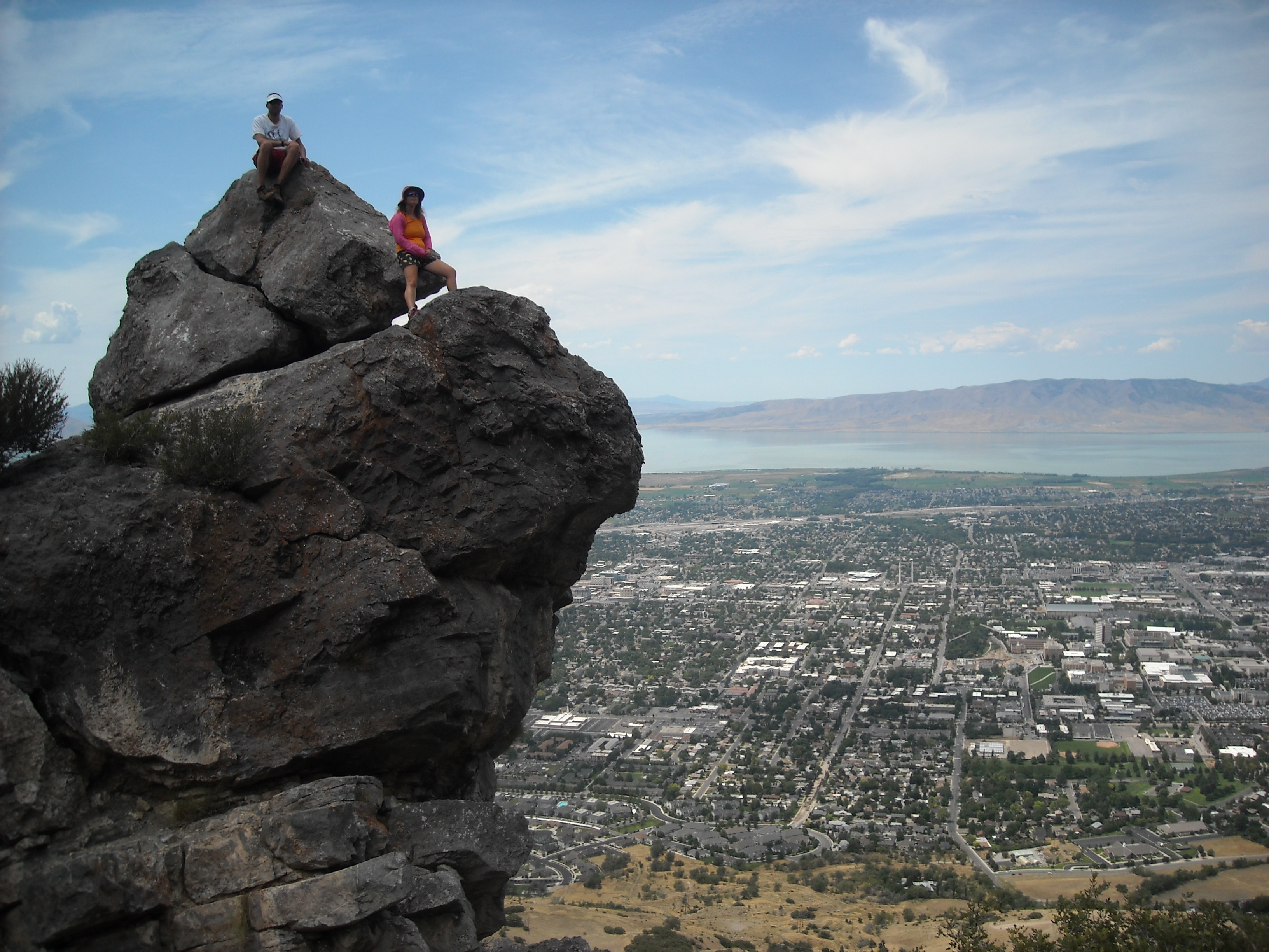
Day Six pre-JMT: Hiking Y Mountain
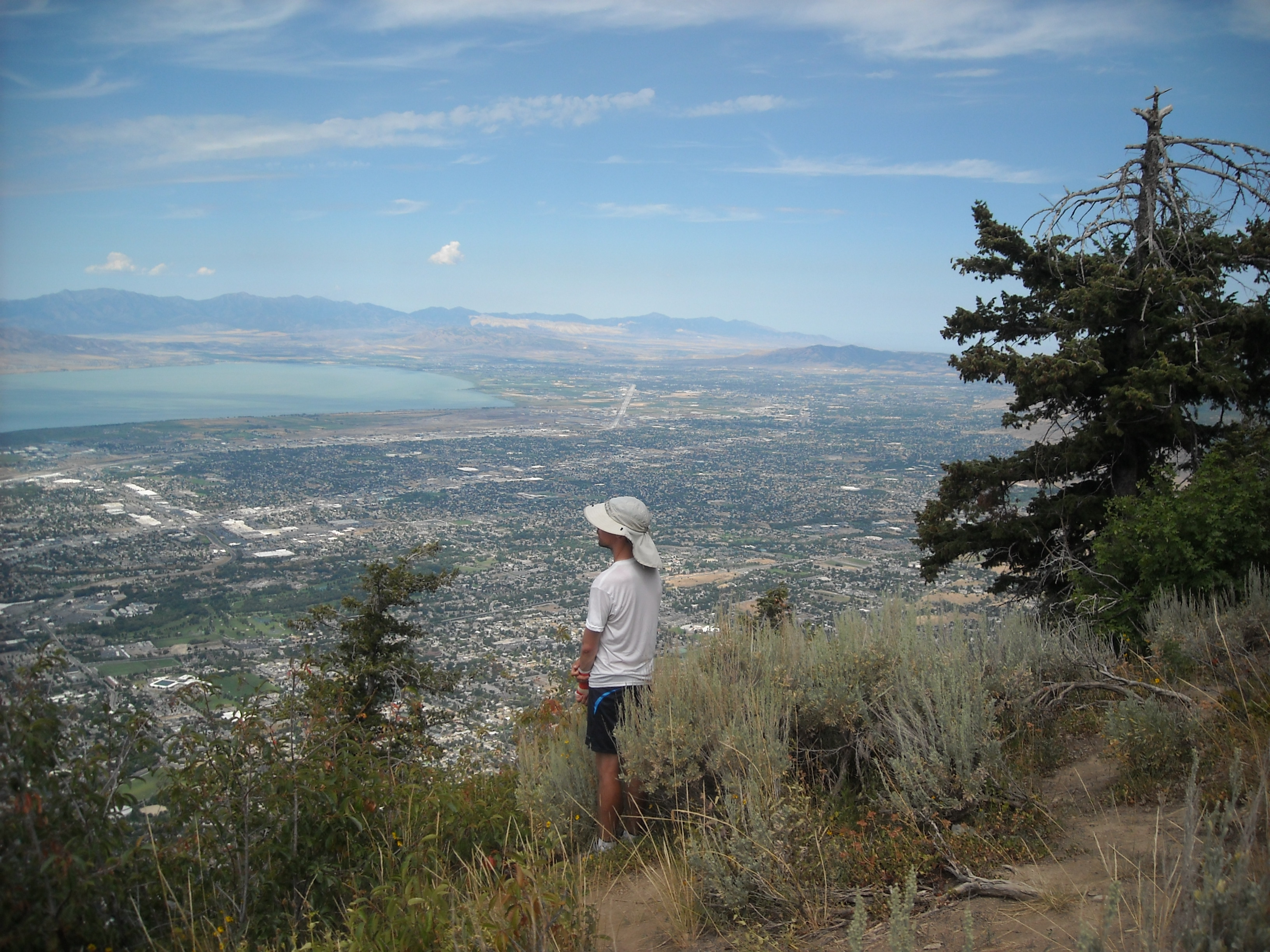
After consulting our cousins, with our one day in Provo, Utah, we hiked Y mountain. This is one of those giant letters painted into the hillside. Instead of a P for the town name though, it was a Y, for Brigham Young. There’s a ton a switchbacks up to the Y which gains about 1,000 feet of elevation. Our cousins had clued us in that there was a trail that kept going up the mountain from here and so we took that to hike uphill for another hour. While the scenery wasn’t exactly wilderness, it was perhaps even better as we could look across the whole valley.
That afternoon we watched some Olympics and had more family time.
Day Seven pre-JMT: Zion National Park
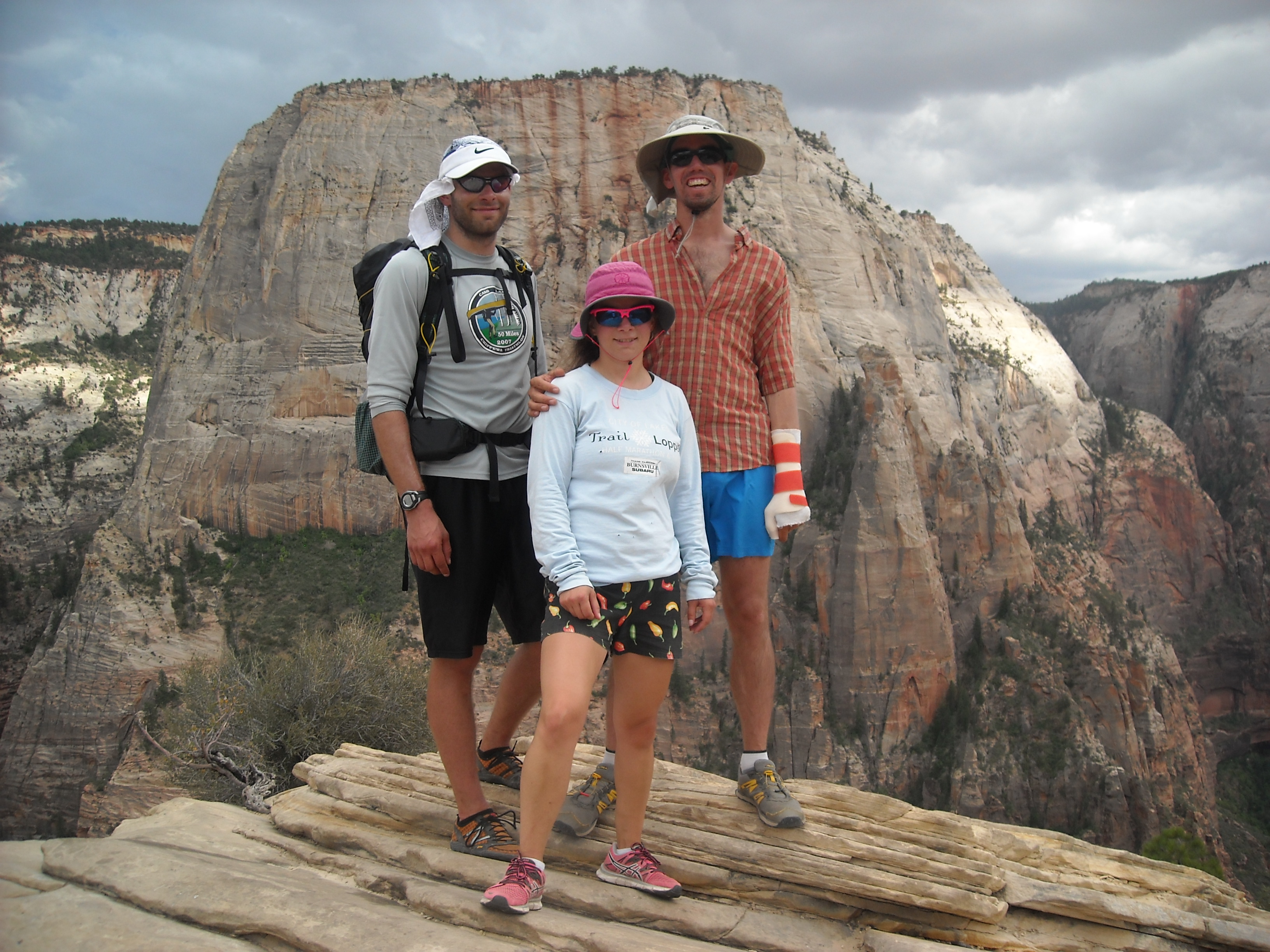
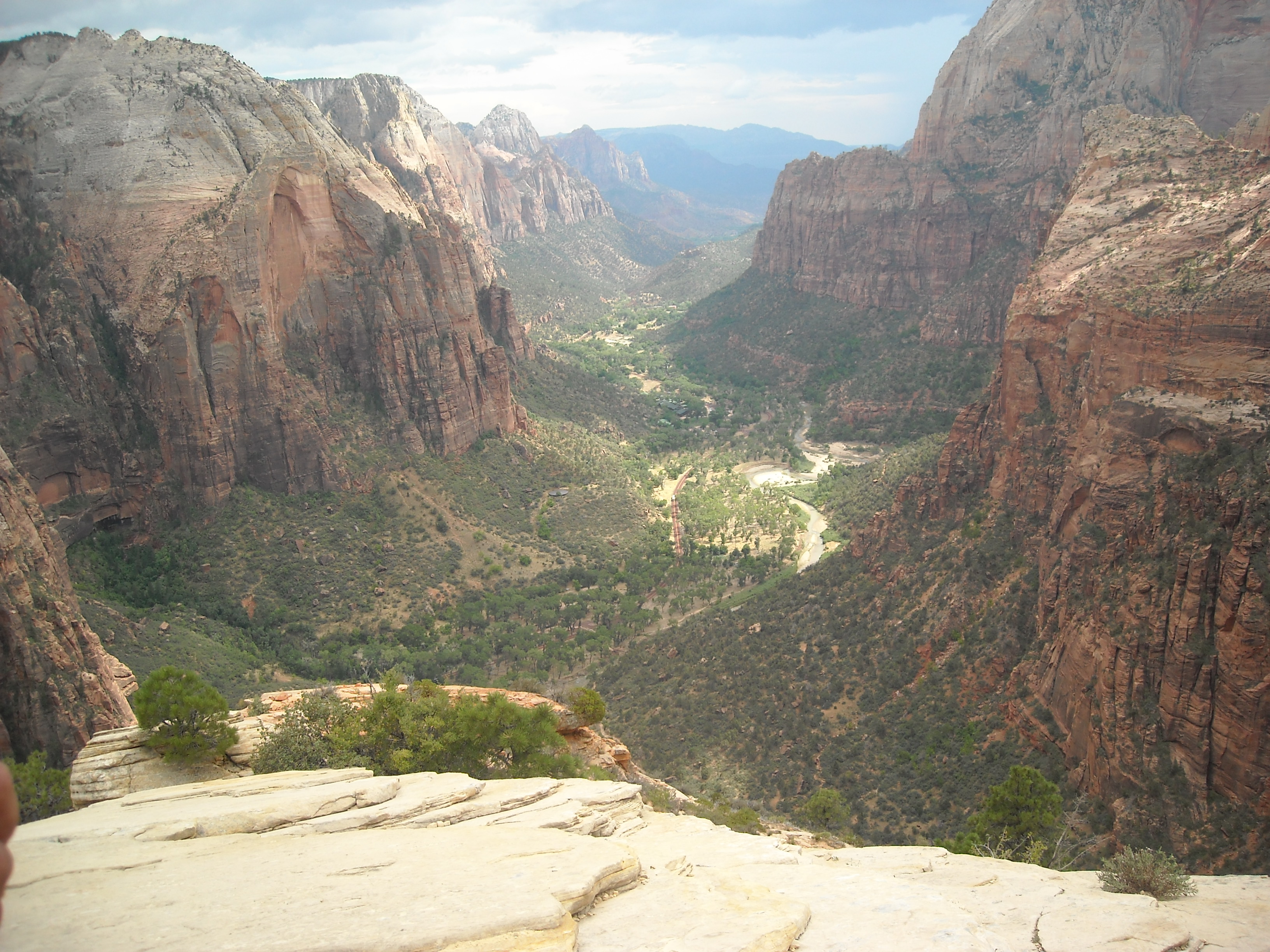
After our aunt treated us to an all-you-can-eat waffle buffet, we packed up and drove south to Zion. The speed limits in Utah are crazy fast, like 85 mph. A little faster than we cared to drive. Once in Zion we set up our tent at the South Campground and then took the shuttle bus to our main event for the day: hiking Angel’s Landing. Erik had attempted this hike as a kid with his dad and brother who was five years younger than him and they hadn’t made it. So this was a revenge trip for him. When we did this in 2012, permits were not required.
It was mid-afternoon when we got to hiking the switchbacks. We didn’t waste time ascending these which was a good thing, because as we got to the spur trail to Angel’s Landing, we realized there was a thunderstorm moving in. Erik was very determined to make it to the end, and so we quickened our pace, even as we moved along the dangerously exposed sections of trail.

By the time we reached the overlook, we took a couple photos and didn’t dawdle. Then we practically ran off the precipice, or at least as fast as we could safely travel next to near vertical walls. As we reached the switchbacks it started to rain, but here the trail afforded some overhangs where we waited out the heaviest precipitation.
That night down in the campground it rained and rained and I learned that it does indeed rain in the dessert.
Day Eight pre-JMT: Drive to Fresno
One of Erik’s aunts conveniently lived in Fresno and was willing to both drive us to the beginning of the John Muir Trail and pick us up from our ending destination. So we spent day eight driving, including through Las Vegas. I saw the Eiffel Tower and the pyramids from I-15 and declared I never had to see Vegas again.
There was a fruit control stop at the border with California and then we drove on into the traffic of California and up the Central Valley to Fresno. It was my bro and I’s first time in Cali and we were kinda awestruck.
Day Nine pre-JMT: Shenanigans in Fresno
Fresno was hot, hot, hot! We went to the Forestiere Underground Gardens and then to a splash pad with Erik’s cousin to try to keep ourselves cool, or at least as cool as we could.
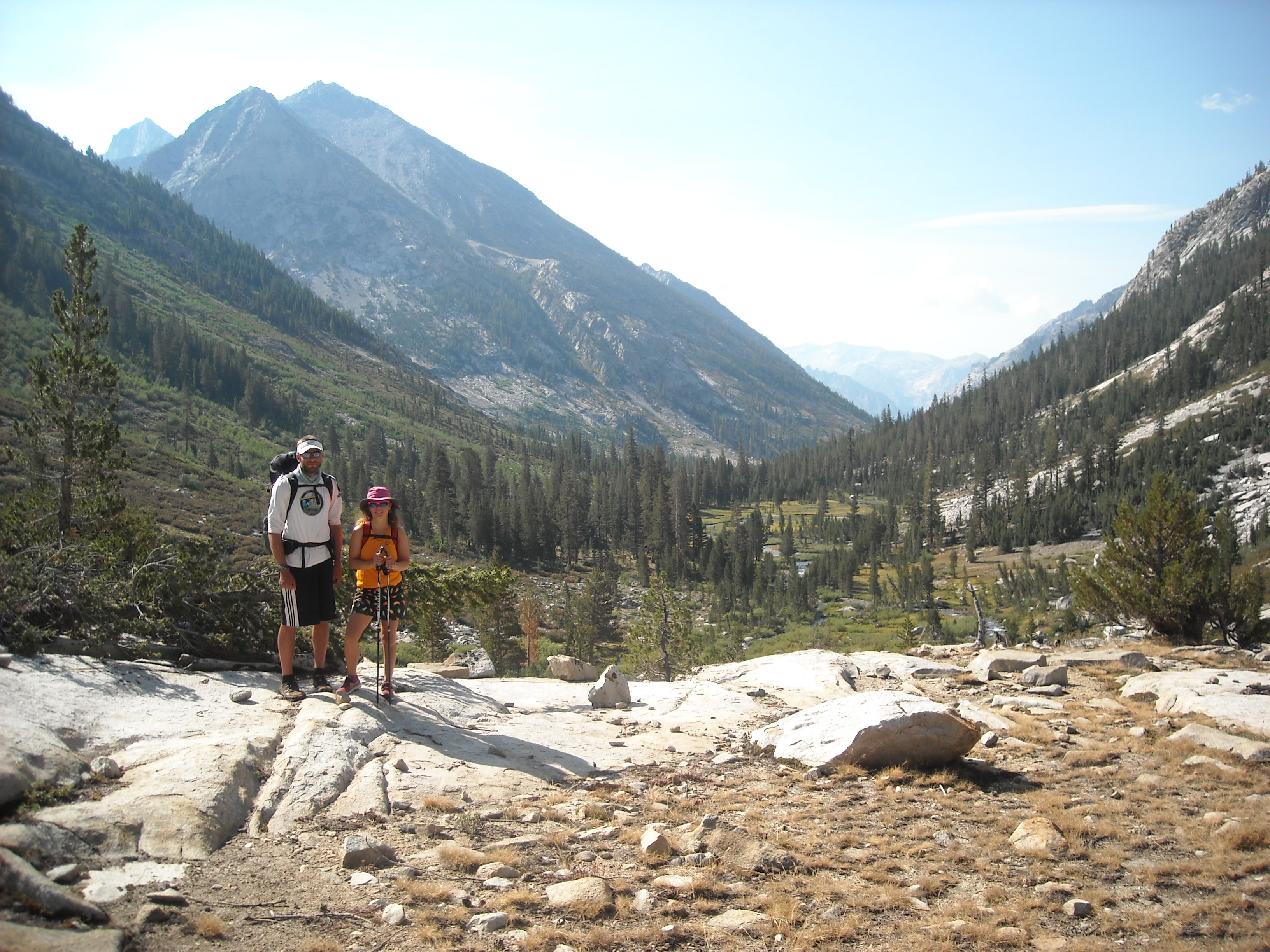
The John Muir and High Sierra Trails
I’ll start over here with my day numbers. Suffice it to say, the John Muir Trail is popular and heavily hiked. I won’t dwell on many details of the route, rather more of our experiences. To make our shuttle ride easier, we combined the John Muir Trail (which technically ends at the top of Mount Whitney — where there is no road) with the High Sierra Trail which more conveniently terminates in Sequoia National Park, a relatively short drive from Fresno.
We started our hike on Friday August 3rd, the day we secured our permit, and would finish three weeks later on Thursday August 23rd.
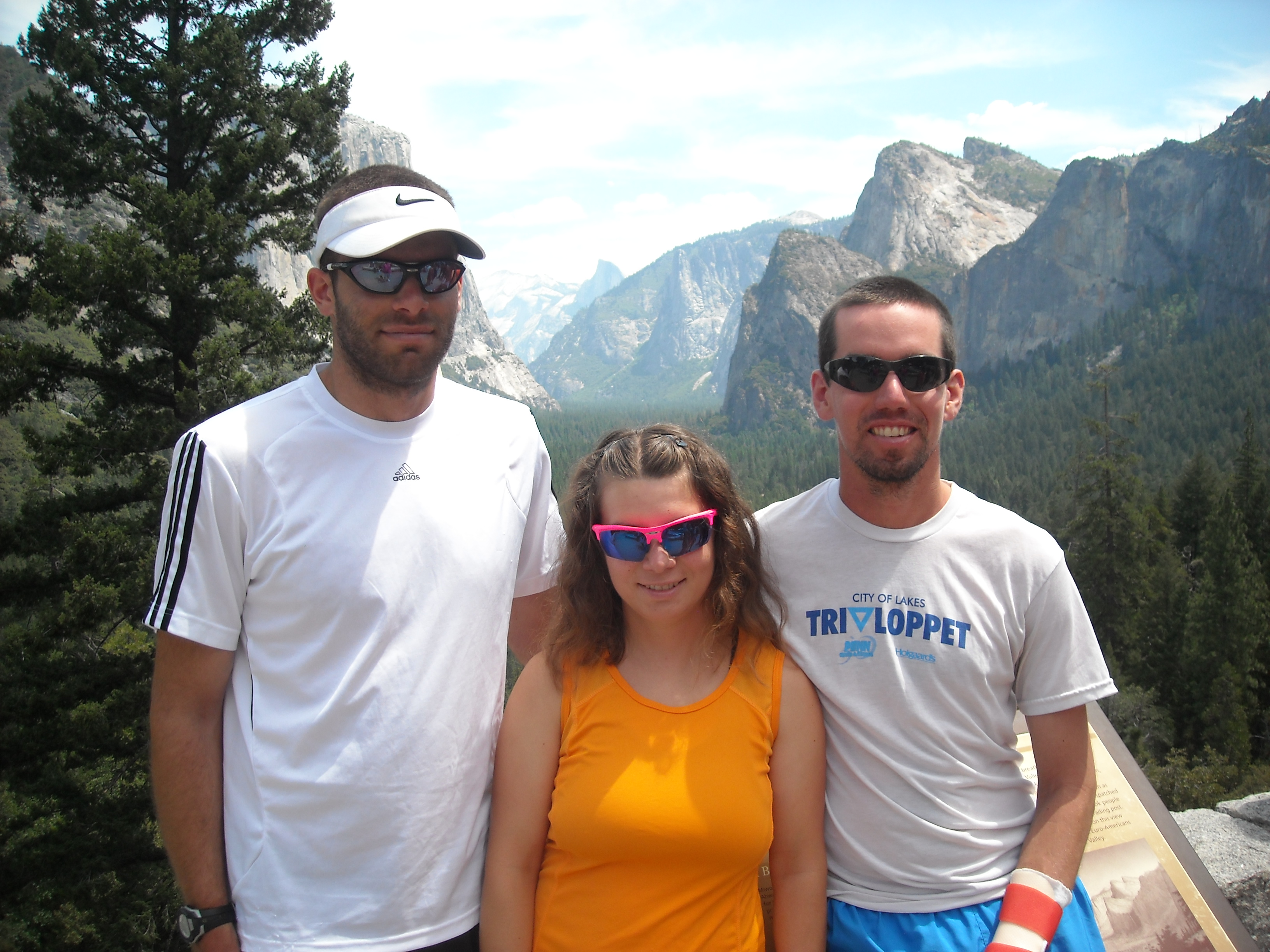
JMT Day One: Yosemite Valley to Illilouette Drainage, 5 miles
We saw the sights, and perhaps more notably, all the people, in Yosemite Valley. After dinking around, picking up our permits, and taking photos, we finally got to hiking. By now it was mid-afternoon and relatively warm as we climbed the worn switchback trail out of Happy Isles to Clarke Point. We hadn’t gotten the permit we wanted (based on a lottery system) and so technically had to camp our first night in the Illilouette drainage. This meant an extra 1.3 mile of trail in either direction on the Panorama Trail, but more importantly, an extra 800 feet of climbing.
To minimize how much extra we had to hike, especially knowing we had big miles the next day, we planned to dry camp at the saddle. We didn’t have enough water to do this when we reached the Illilouette Trail, so tacked on some extra mileage to the water source at Nevada Falls where we made our dinner. Here we learned that our Aquamira water purification source had failed (had opened up under high pressure and much of one of the two bottles had leaked out). We had some back-up water tablets but our next resupply wasn’t for two more nights (fortunately it was that close). This was obviously a huge bummer and we had some discussion about bailing but then our permits would no longer be good so we forged on.
After dinner we enjoyed a pleasant hike up to our dispersed camping site where we had a good view of the back of Half Dome.


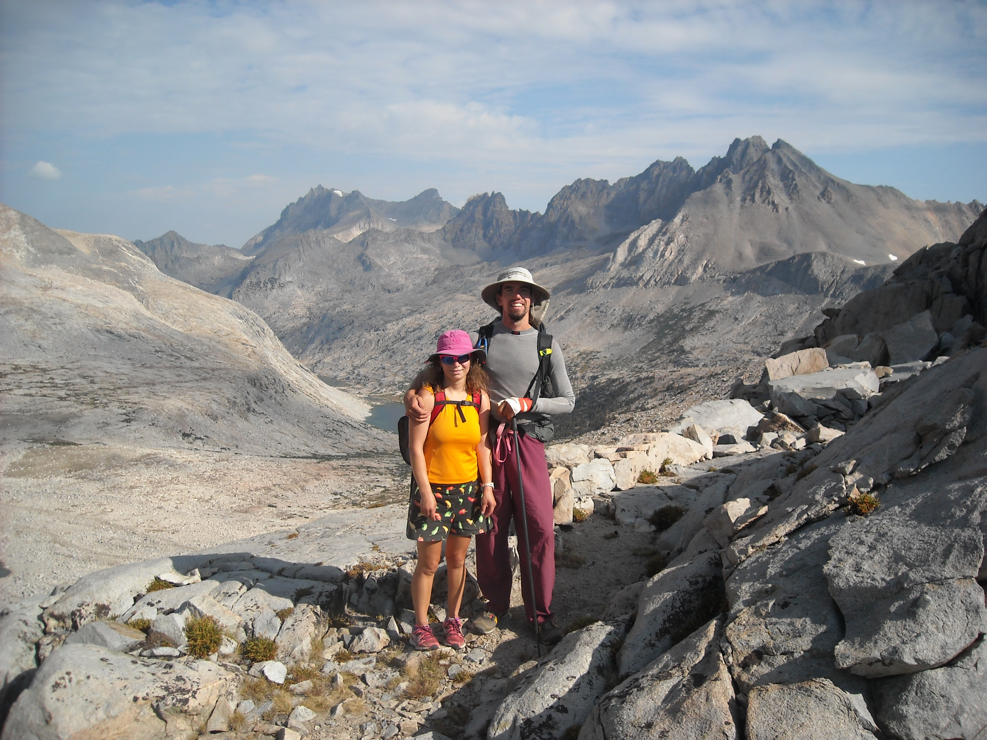
JMT Day Two: Illilouette Drainage to Sunrise Lakes Trail with Half Dome, 17 miles
We got up early, packed up camp, descended down to the main John Muir Trail, and began our approach to the base of Half Dome. Every time I saw Half Dome, it looked impossible to hike up. I’d seen some photos of the “cable route,” the route we were planning to climb, but my only prior experience with cables was in the Adirondacks when their use was generally optional, and only helpful if the rock was wet.
As we got closer and closer, the grade on the rock of Half Dome wasn’t looking any easier. Finally we reached the end of the trail and I realized that the cable route up Half Dome didn’t provide optional hand holds, but that these were absolutely required.
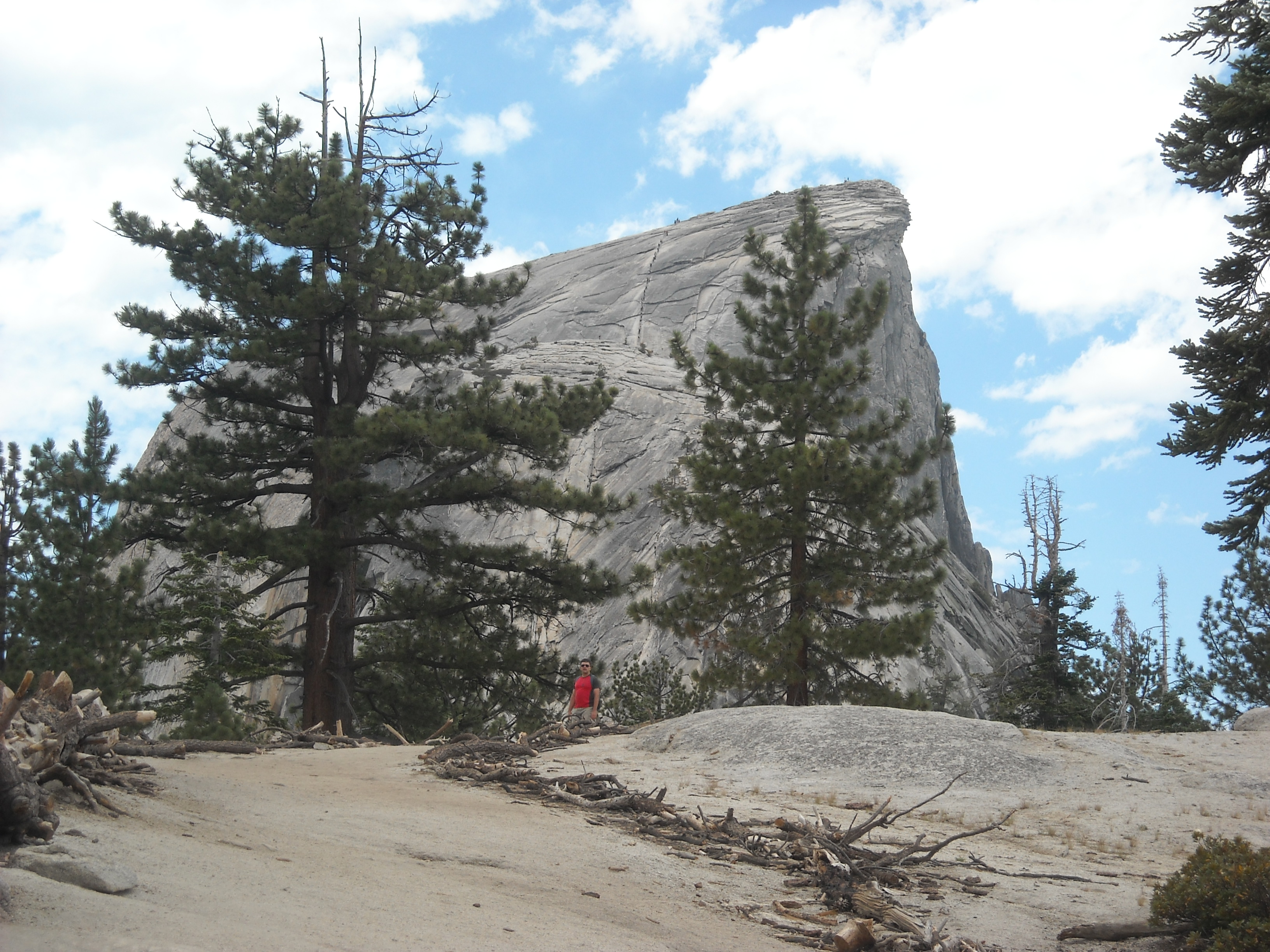
My bro took one look at that smooth rock face and said out loud what I’d been thinking: “I’m not going up there.” He was a 25 year-old male. My hubby, however, despite his left arm in a cast, was not to be detoured. “I’m going,” he said. And we followed. Only thankfully, I went up first.
I’ve definitely done some dumb things in my life. It’s debatable whether climbing the cable route of Half Dome stands atop that list. If not, it’s like a close second or third.
I felt relatively secure climbing up Half Dome’s polished granite, keeping my toes on the 2 x 4’s pounded into the mountain and my hands securely on the rope, preferably one hand on each rope, but sometimes people were coming down and I had to use just one rope. I’m not afraid of heights, but when I turned around and saw Erik holding onto one of those cables wedged in his antecubital fossa, I simply couldn’t look again. That steep pitch gains a couple hundred feet and took me 10 minutes of heavy breathing and focus. I wasn’t looking forward to the descent.
The top was broad and there were so many people up there milling about. We took our time enjoying the view and taking photos.

Then it was inevitably time for the descent. Fortunately I went first and tried to get down as quickly as I could, concerned someone above me would loose their grip and take me down with them. I didn’t want to splat onto the granite below. Erik required the use of both ropes to descend given his cast and there were a lot of people heading up, so he created quite the traffic jam behind him. My bro, who was following Erik, took the opportunity to take a couple stomach-churning photos.

I sure was glad when we were off that section and decided I never had to climb Half Dome again.

By now it was afternoon. We were low on water. Even if we’d had ample water purification, we weren’t finding any water sources anyway. We stumbled along, not really enjoying the scenery, just hoping that we would find some water at camp. The miles, seven of them since we got off the Half Dome approach trail, passed ever so slowly. But finally we made it and Erik went looking for water and found some. It certainly wasn’t abundant.
JMT Day Three: Sunrise Lakes Trail to Vogelsang Trail, 16 miles
This day passed slowly, too. We were dehydrated, greatly looking forward to our resupply in Tuolumne Meadows and again, found it difficult to enjoy the views as we passed by the Cathedral Lakes area. We were all super tired from the previous day. As much as it had been physically hard, perhaps it had been even more mentally draining. We didn’t take any photos and just tried to put one foot in front of the other. As we got close to Tuolumne Meadows, we had to stop to let a horse train pass and I wasn’t happy about that.
Once at the store in Tuolumne Meadows we started to feel better although there was no good water supply. We bought some food and then found a small supply of water purification tablets and were able to barely buy what we thought we’d need. As we got back on trail, we hiked through the Tuolumne Meadows Campground and were finally able to rehydrate ourselves.
From here we passed a more pleasant afternoon. We’d already taken care of most of our daily miles in the morning slog and made it to camp earlier than we had the previous day. The weather was perfect and some of our energy had been restored and we enjoyed the evening sitting out under the sky.
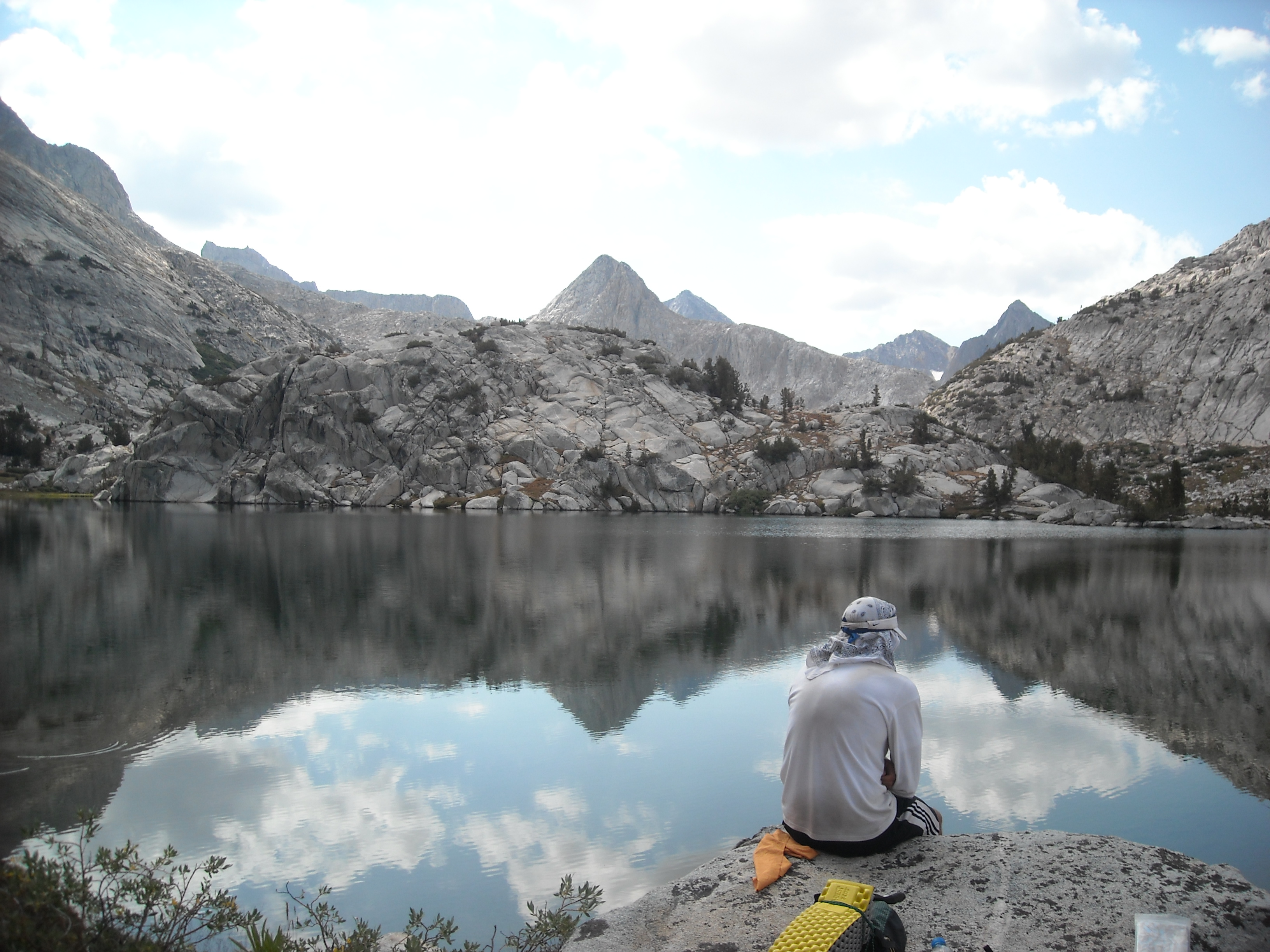
JMT Day Four: Vogelsang Trail to Thousand Island Lake, 14 miles
Today was our first big pass, Donahue Pass, albeit only at 11,073 feet. As we neared the pass, we ran into a trail crew moving some big boulders. It was interested to see them in action. Otherwise we had found our groove on trail and the hiking was relatively easy. We again got to camp at a good hour and enjoyed our setting.

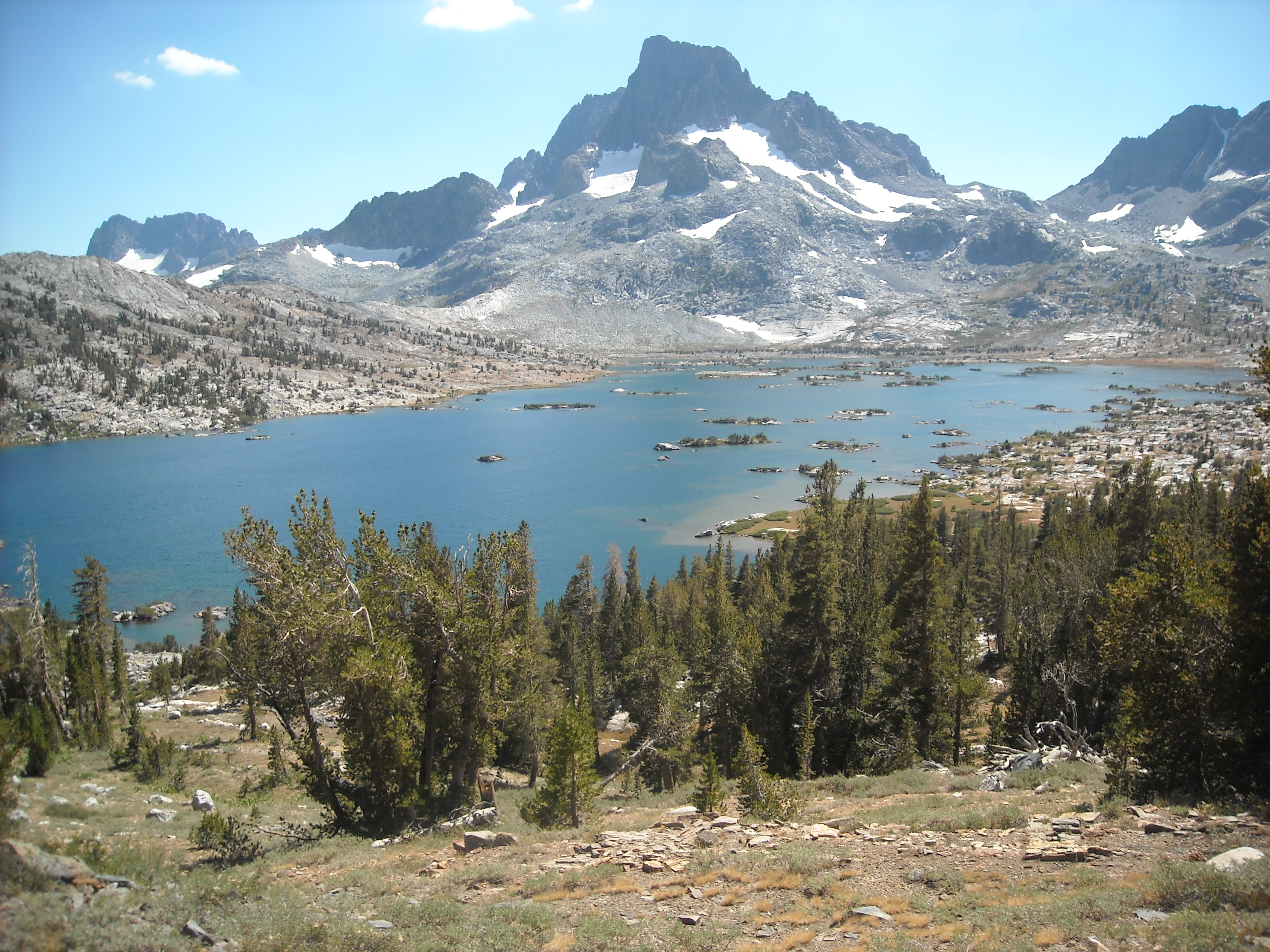
JMT Day Five: Thousand Island Lake to Reds Meadow, 13 miles
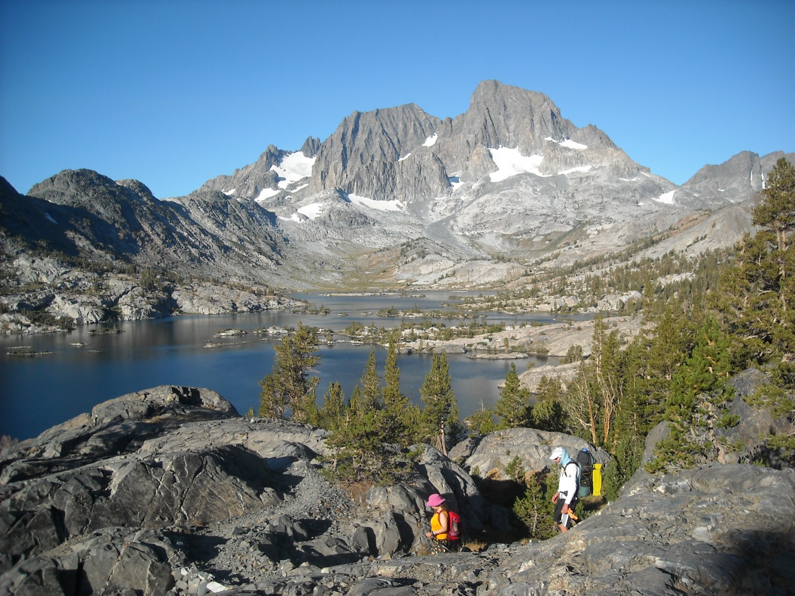
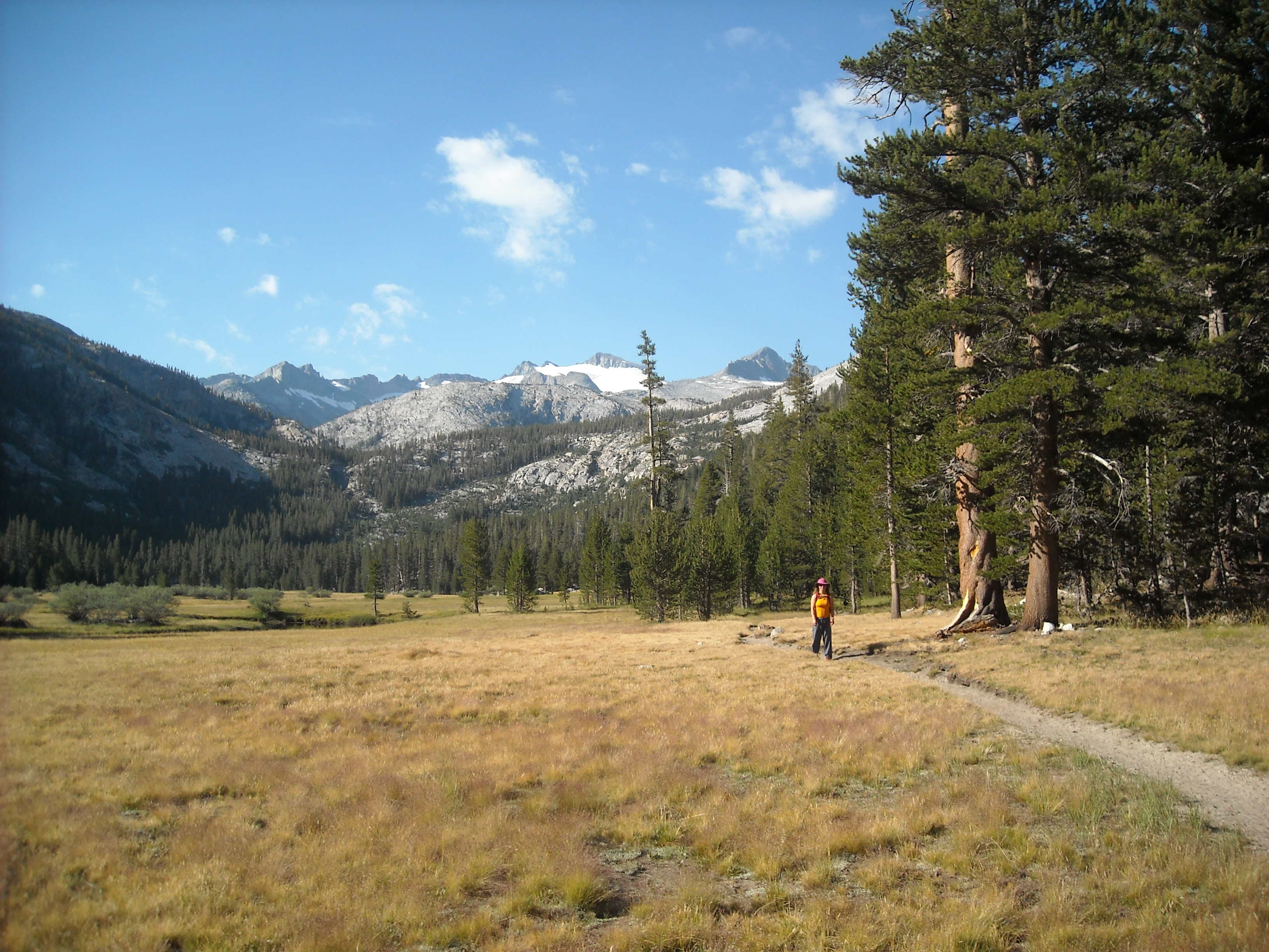
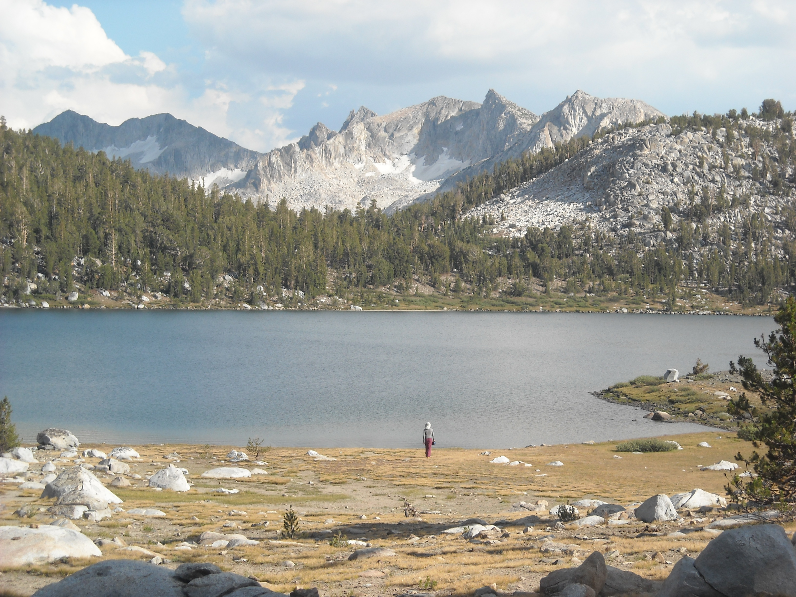
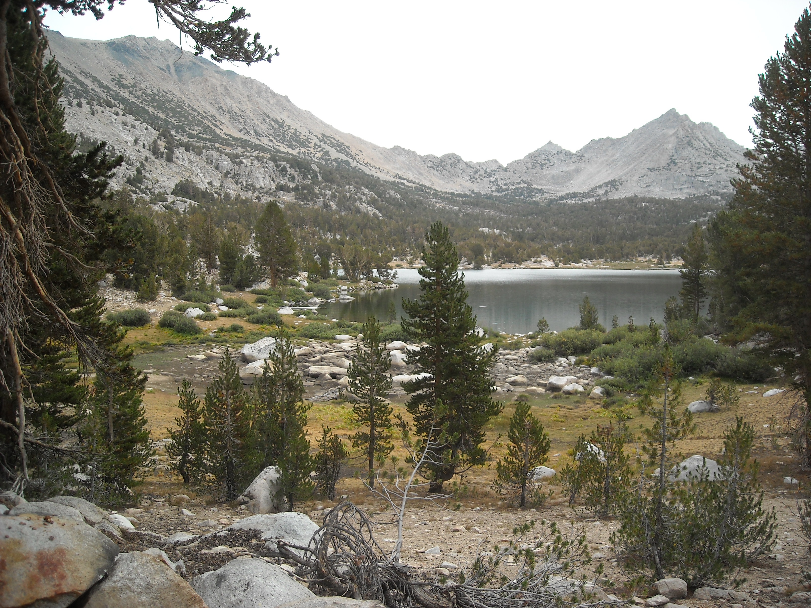
Today we were headed to Reds Meadow where we had a cabin for the night and our first resupply that we’d mailed ahead to ourselves. The morning views of Banner Peak were impressive.

Then we kept hiking, past more lakes, finding water abundant once again, and finally past the Devils Postpile shortly before arriving at Reds Meadow.
In addition to our resupply box and a store, we found a hiker bin brimming with all sorts of castoff trail food from other hikers. I discovered Lara bars and we made dinner and breakfast from our new-found cache.
JMT Day Six: Reds Meadow to Lake Virginia, 17 miles
It was a bit hard to leave civilization and my last shower for over a week, but we hiked on, passing an area affected by forest fire a few years previous. We largely hiked on a ridge without any big mountain views. Our original plan had been to camp at Purple Lake but when we got there we decided to keep going another couple miles to Virginia Lake. Hence, it was very late afternoon when we arrived at camp.
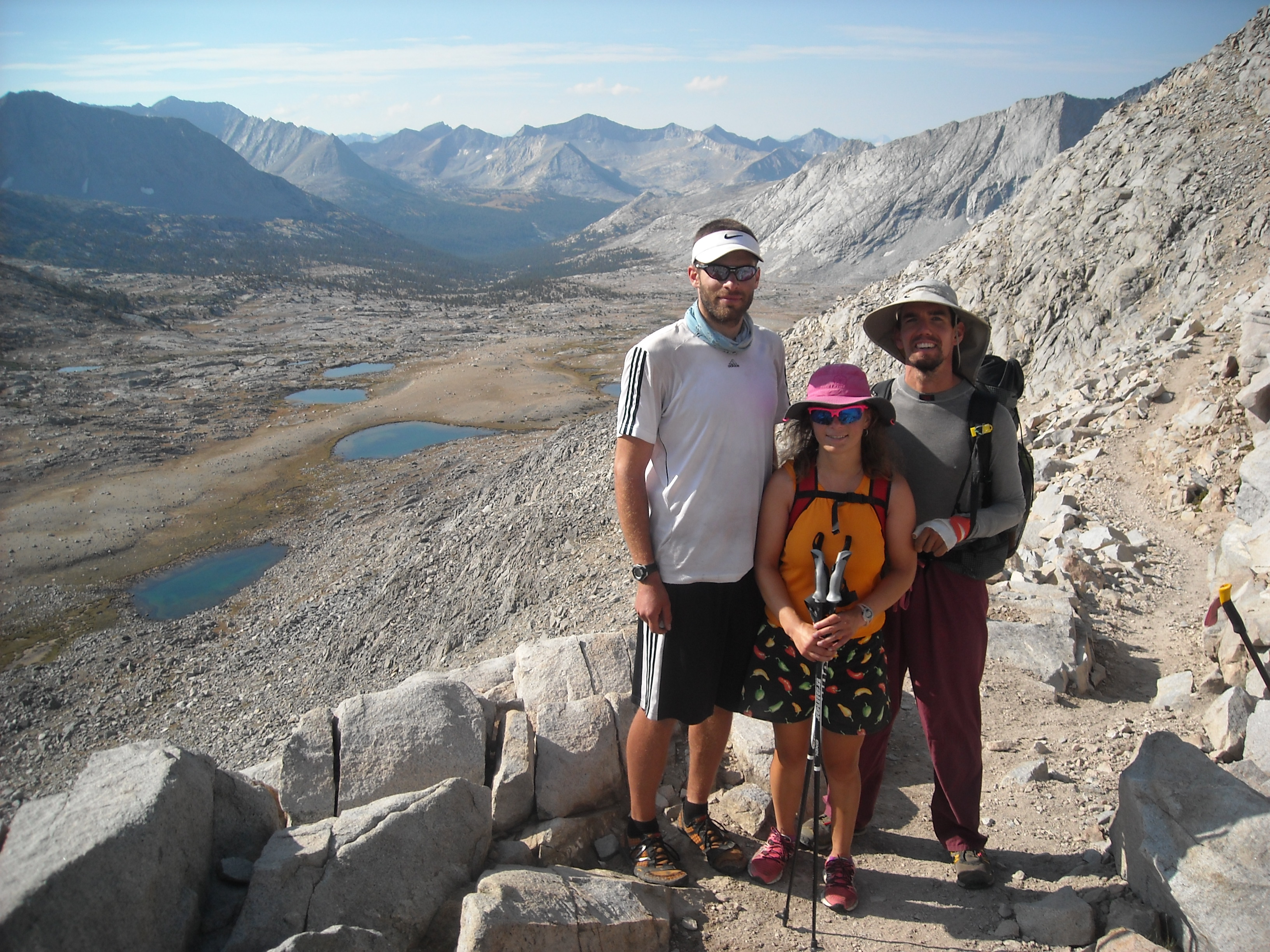
JMT Day Seven: Lake Virginia to Lake Edison Trail, 12.7 miles
Given we’d tacked on a couple extra miles to our hike the previous day, we didn’t have far to go this day. So we took our time with a couple of passes and then bathed in the North Fork of the Mono Creek once we arrived to camp by mid-afternoon. Leif gave trail names to people we kept seeing. There was Berkley Boy and iPod couple. Only these were the names we referred to these others by and never told them.
That night my NeoAir inflatable mattress deflated. I was convinced there was something pokey under the tent and in the morning I found what looked to be a sharp piece of wood. We patched the hole as best we could with some Tyvek tape and continued on.
JMT Day Eight: Lake Edison Trail to Sallie Keyes Lakes, 13.8 miles
This day began with a switchbacking climb. I was still salty about my air mattress:( Our feet had been terribly dusty for most of the trip, owing to the dry dirt, and so we stopped at Lake Marie for a wash-up. We were starting to get our first inclement weather on the John Muir Trail. And I wasn’t a fan of the threat of rain. I’d been promised that it never rained in the Sierra’s and I held firm to that expectation.
Not wanting to get rained on if we could avoid it, we quickened our pace to Sallie Keyes Lakes, arriving just before it began to rain. We got our tents set up in record time and got in them. The lakes were pretty and I hoped the rain would stop so we could go exploring. But every time it stopped and I thought it was safe to get out of the tents, it started up again. “We could have set up our tent in the backyard and gotten this same view,” I grumbled to Erik. He meanwhile, was enjoying the rest time on his back. I was sorry to miss the mountains surrounding Sallie Keyes.
JMT Day Nine: Sallie Keyes Lakes to McClure Meadow, 16 miles
This day we had our second resupply at Muir Trail Ranch. This meant a 1.5 mile detour each way to Muir Trail Ranch where we’d had to specifically ship our food in a 5 gallon bucket. I was personally hoping for a toilet at Muir Trail Ranch, preferably even a flush one, but no such toilet of any kind was to be found.
There was another hiker food cache but this one didn’t seem as exciting as the last and we didn’t take much. Soon we got to hiking again, this time under somewhat threatening skies. It only ended up sprinkling on us, but we never know that ahead of time. We found a nice flat rock for cooking and doing some repairs on our lightweight equipment.

JMT Day Ten: McClure Meadow to Le Conte Canon, 15 miles
To save a tad bit of time, immediately after breakfast we packed up and headed out and then brushed our teeth a mile down the trail. Then we got to hiking a bunch of switchbacks up to Evolution Lake. Thus area was simply stunning and we wanted to stop at every lake for a break.
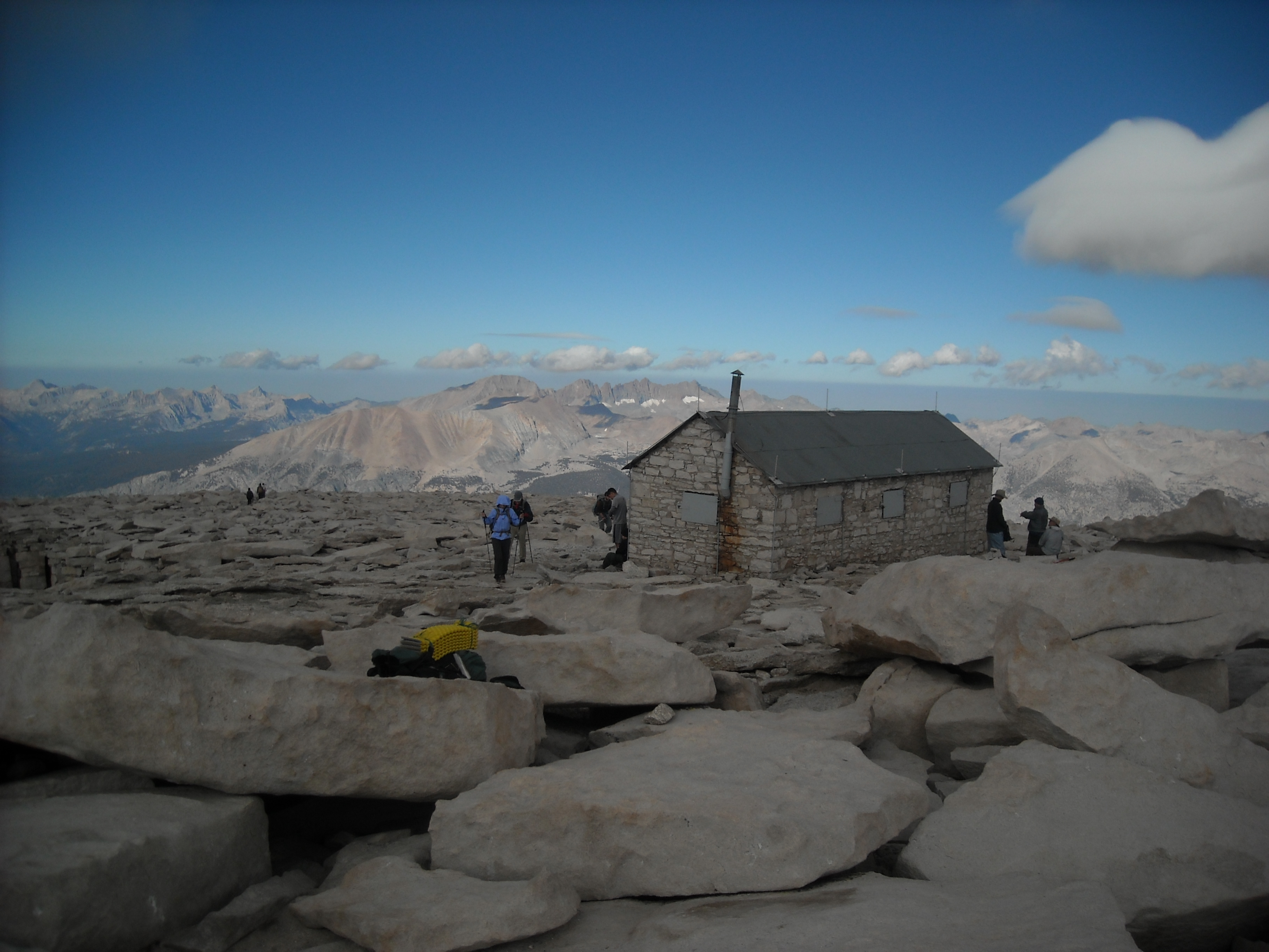
As we began our final climb to Muir Pass, the sky darkened and began rumbling. There was a hut on top and so we sped up to try to reach safety inside the hut, along with quite a lot of other hikers. The problem was, each of us had our climb in which we completely bonked. Erik’s turn came first, as we ascended towards Muir Pass. Even though he wanted to reach the safety of the small stone hut, his body just couldn’t get him there quickly. Fortunately the weather held out just long enough.
Once in the hut on Muir Pass it rained hard and there was thunder and lightening. The stone structure soon began to leak. Every time someone left the hut to brave the elements, we heard a loud clap of thunder. Then a tall guy stumbled in and said “You are the first people I’ve seen in seven days.” He’d been out solo hiking off-trail in the Ionian Basin and said it was beautiful out there…but lonely.


Eventually it was getting very wet inside the cramped hut and we obviously couldn’t all spend the night there and we didn’t know how much longer it might rain so we, too, shoved off. There was hail on the ground and distant mountains and so many puddles on the trail that soon our shoes were soaked through and we were damp under our rain gear. The valley walls we covered in small waterfalls.
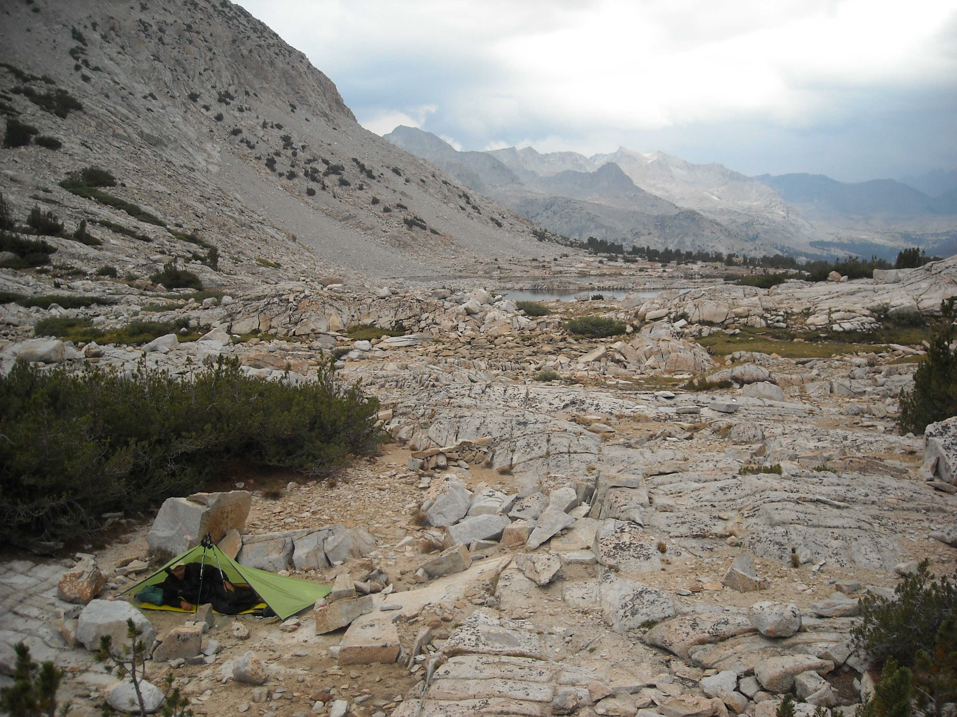
But after an hour or so, it stopped raining and gradually the trail got drier as we descended to Le Conte Canyon. We found a place to camp and although the skies still threatened, it had at least stopped raining and we began to dry out some of our gear.
JMT Day Eleven: Le Conte Canyon to Lower Palisade Lake, 15 miles
We found renewed energy to make it to camp by mid-afternoon should it rain again. It was a sunny morning and we passed a few campsites where hikers were drying their gear before getting on the trail.
Leif had been looking through the maps frequently and had become fixated on something called the Golden Staircase just before the climb up to Palisade Lake.
We each had our day on the JMT when we ran out of energy. It was somewhat ironic that Leif had his on the Golden Staircase since he’d been talking about it for days. Erik and I didn’t want to get caught in the rain again so we really pushed the pace and dropped Leif. Once we got to Lower Palisade Lake we looked for a campsite and found a decent one. Despite dark clouds, it never rained more than a few drops so we got to enjoy some good evening outside time to take in the views up to Mather Pass.
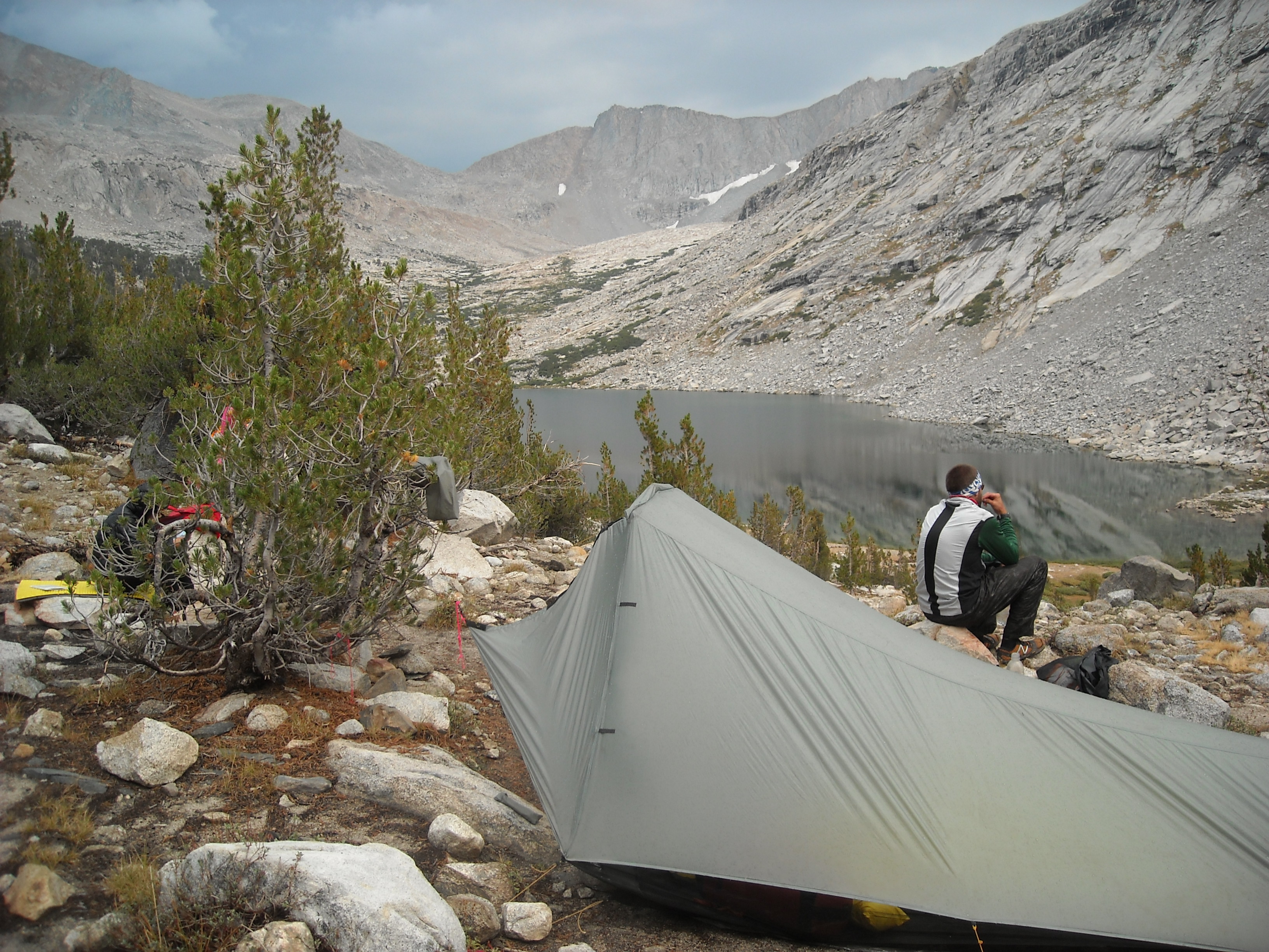
JMT Day Twelve: Lower Palisade Lake to Lake Marjorie, 13.4 miles
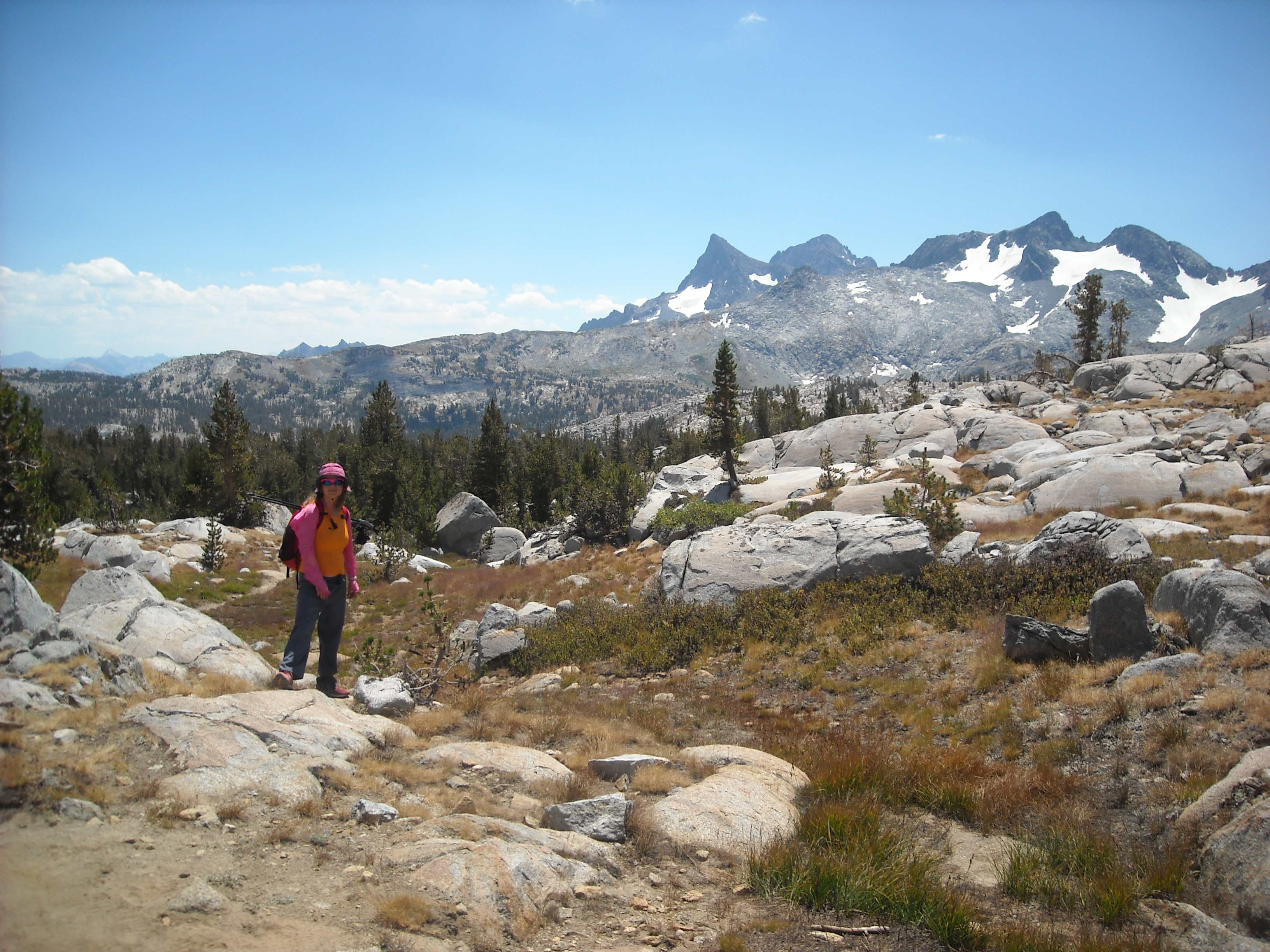
Today was a big pass – Mather – and our first over 12,000 feet. We got an early start and didn’t waste anytime, again quite freaked out about the weather. It was only 1,500 feet above camp and so didn’t take us long to get to the saddle. We took some photos and enjoyed the views for a bit but mostly kept a moving.
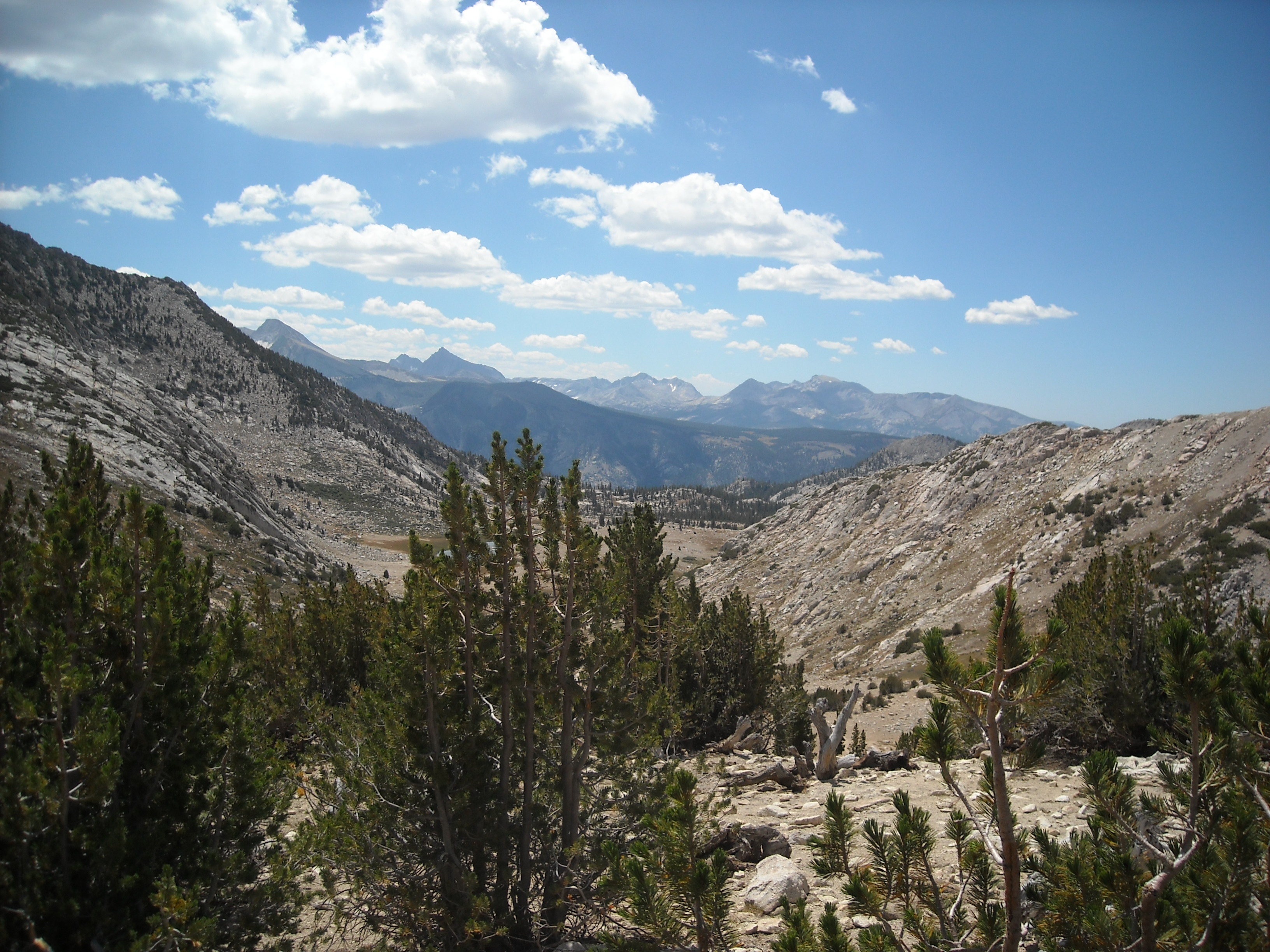
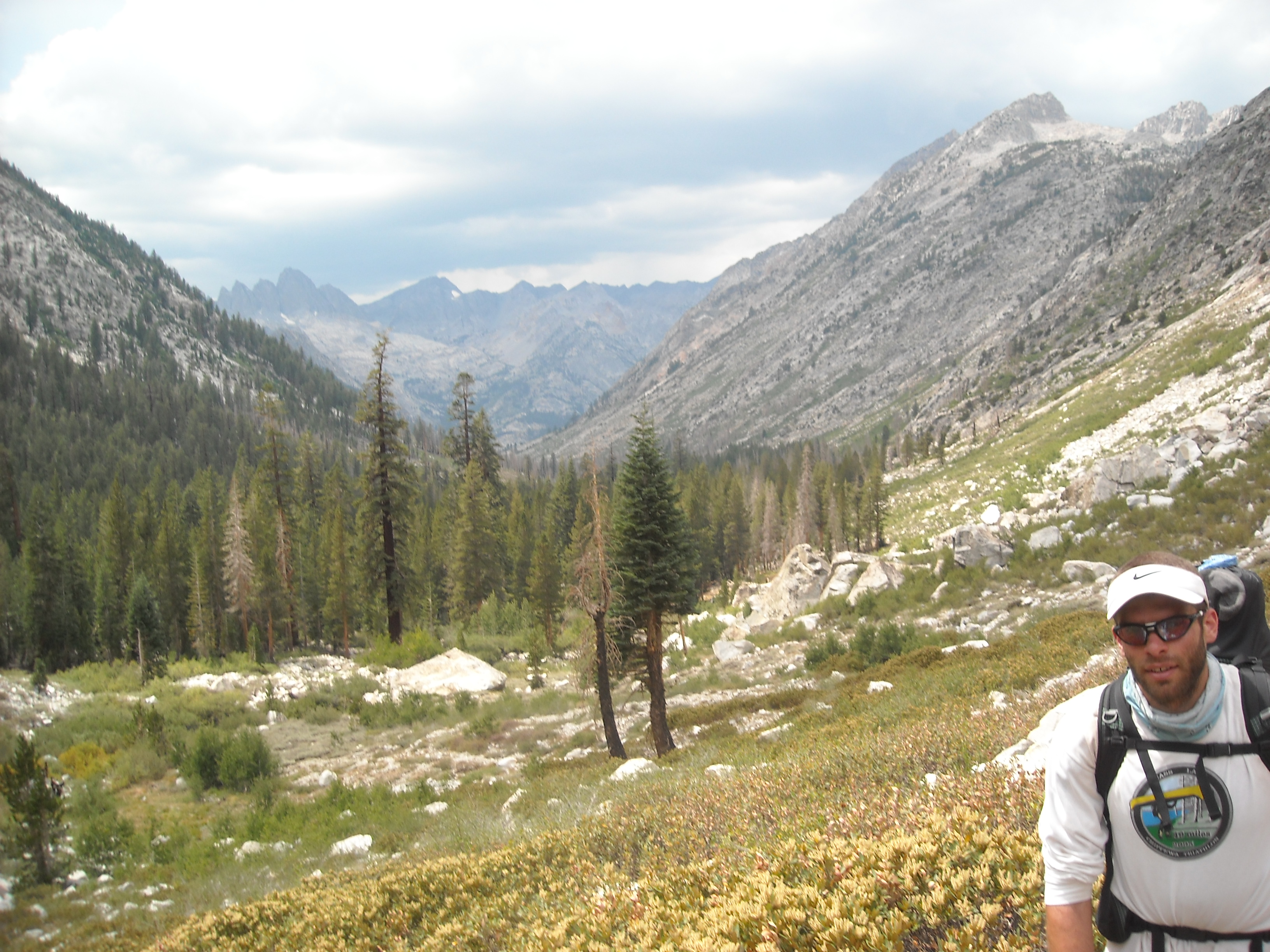
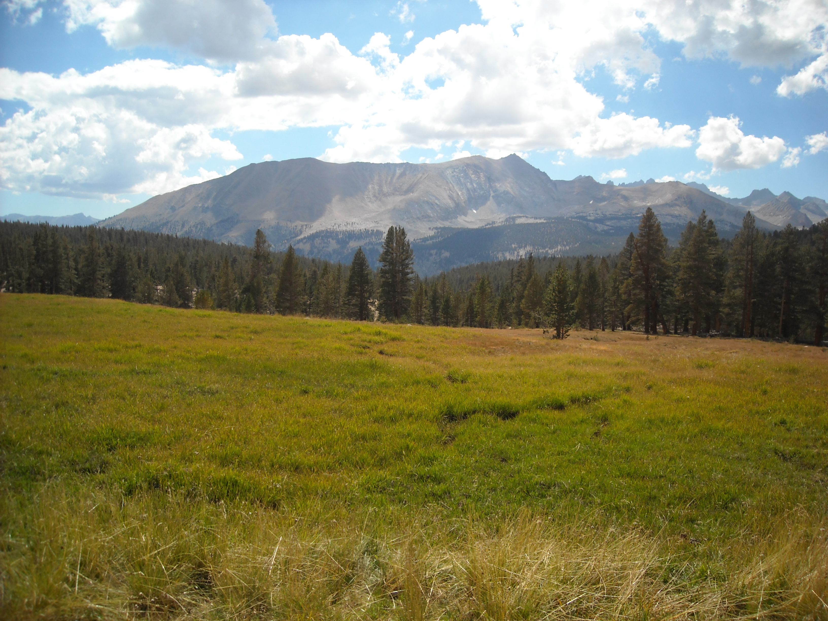
While we would drop into valleys with trees and some dry grass, most of our walking was up high and quite arid. Around this point in our trip, I realized that I was getting “mountain fatigue.” This is a term entirely made up by myself but here it goes. When I learned about the mountains as a seven year old kid in Minnesota, I simply became obsessed with them. I wanted to see them so bad. I wanted to climb them. I’ve written about this ad nauseam. The cool thing about living in Minnesota is that when I get to go see the mountains, I’m in awe and just can’t stop looking at them. But somewhere in this section of the trail, we’d been getting so many stunning mountain views for days, that I began to loose appreciation for them. And this was sad as soon enough we’d be back in Minnesota without any mountains in sight.

We remained leery of threatening clouds, of which there were definitely some, but arrived at camp without any thunderstorms.
JMT Day Thirteen: Lake Marjorie to Middle Rae Lake, 14.1 miles
We had more mostly good weather and we hoped the big thunderstorms, especially anything like we had on Muir Pass, were well behind us. This day we got some different scenery as we continued south.

Prior to the JMT, I didn’t have much backpacking experience (hut-to-hut on the Tour de Mont Blanc for our honeymoon in 2008, and a couple short trips in the White Mountains and Adirondacks). I’d done more canoe camping (Boundary Waters) and most recently, earlier that summer, The Northern Forest Canoe Trail. I still wasn’t sure I liked this camping thing very much. I mean, I loved the hard work of hiking and being, well, “out there,” but I didn’t love crawling into or out of our tent, especially to go pee at night, not washing my hair for long stretches, and just “roughing it.”
I knew I was in for a lot of backcountry camping that summer of 2012, but I had this idea that the Northern Forest Canoe Trail was going to be really nasty. Instead, we sped through it, camped at plenty of shelters, stayed with friends twice, and ended up getting a few more hotels than planned. The weather and bugs also cooperated in our favor and it ended up being way more cush than I’d expected….like only dig a hole once to bury my poo cush.
The JMT ended up being very different. Over 21 days, we only had lodging twice and there were no shelters or other bathrooms we encountered along the way (except once, at Tuolemne Meadows, on just our third day. This meant our stretches without showers were four, then eight, and then seven nights. And so we were in this eight night stretch. I think some of the early parts of this were hardest for me. I was really really counting down the nights. By the last three or so I was feeling a bit better. We were getting close.

JMT Day Fourteen: Middle Rae Lake to Independence, 11.8 miles
Alas, we weren’t hiking all the way to the town of Independence but rather to the trailhead well above town. We were all stoked to be getting a hotel for the night with showers and some different food. Then we’d only have seven nights left of camping on this leg of our big trip out west:)
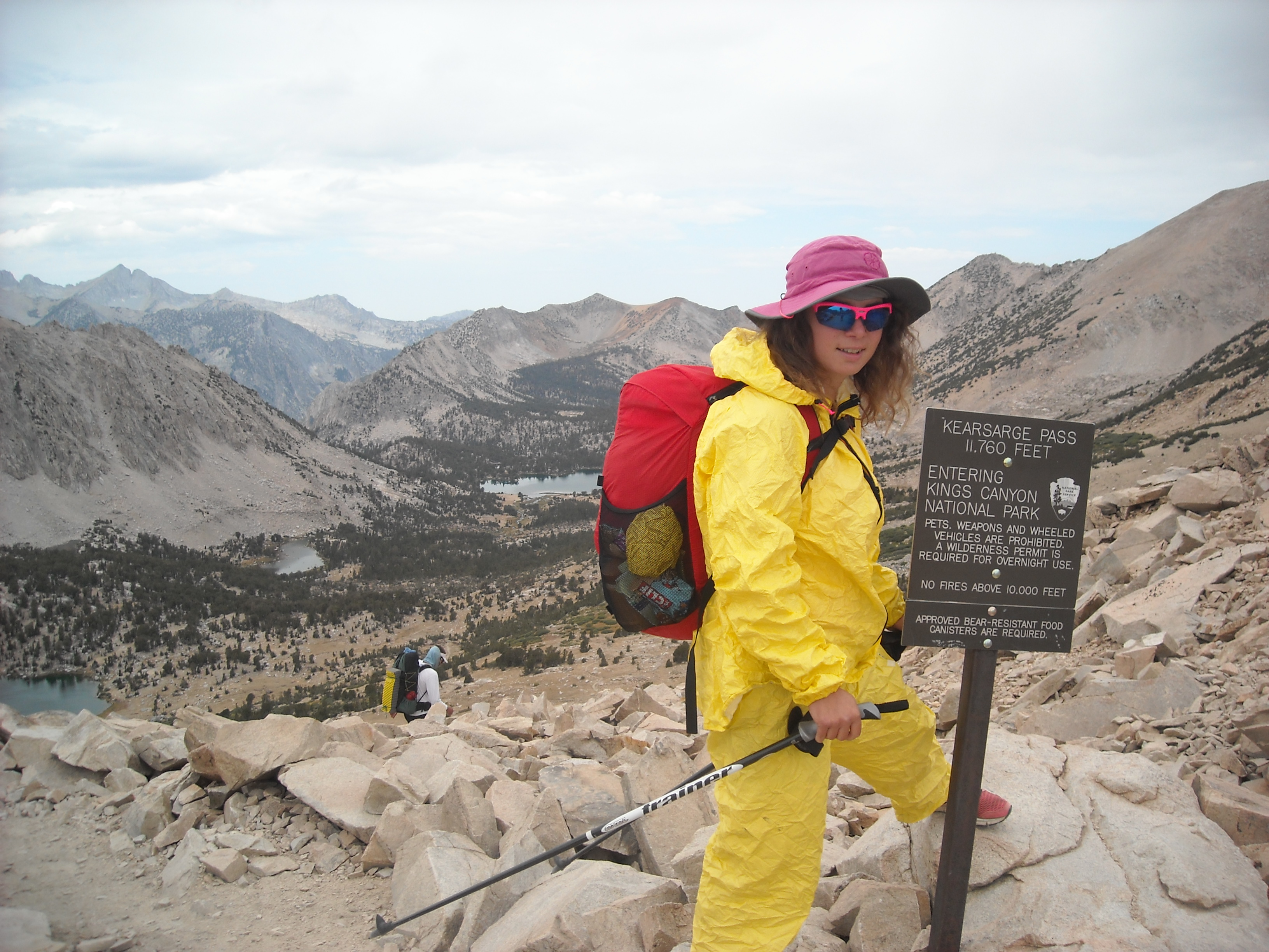
And so we hiked up and over Glenn Pass and then hiked a trail off the JMT, over Kearsarge Pass, to the Onion Valley Trailhead.


I was also very nervous about how we were going to get from the Onion Valley Trailhead to our hotel in Independence. As it happened, we ran into an older couple at the Trailhead who were headed down the mountain anyway and happily gave us a ride.
JMT Day Fifteen: Independence to Upper Vidette Meadow, 10.5 miles
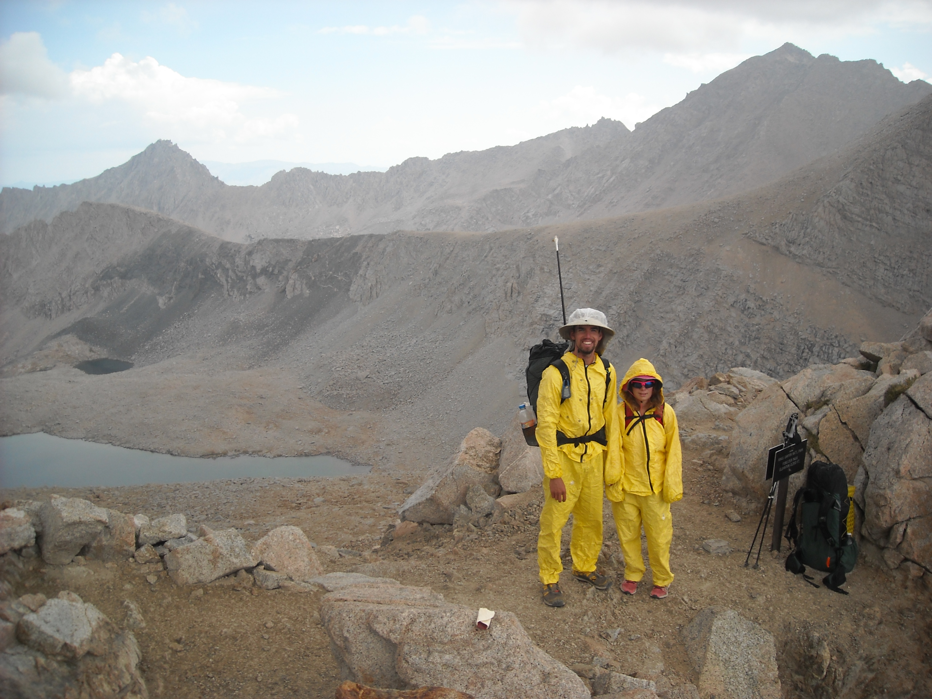
Erik proposed we hitchhike back up to the Onion Valley Trailhead but I preferred to pay for a ride from the hotel. Even though I’m cheap, I guess I thought it was worth it rather than trying to hitchhike. It got us up there early and in good time but as we climbed back to Kearsarge Pass, the clouds rolled in and I didn’t want to chance it so got out my rainsuit and played the raingear games. I got hot in that suit and no precip fell and then I took it off and it began to sprinkle and on and on and on.
We made it to camp by mid-afternoon and the weather held. I called this campsite leaning pine trees since there were three pines all leaning on each other. Since we had time to kill and were below treeline, we made our only campfire of the trip.
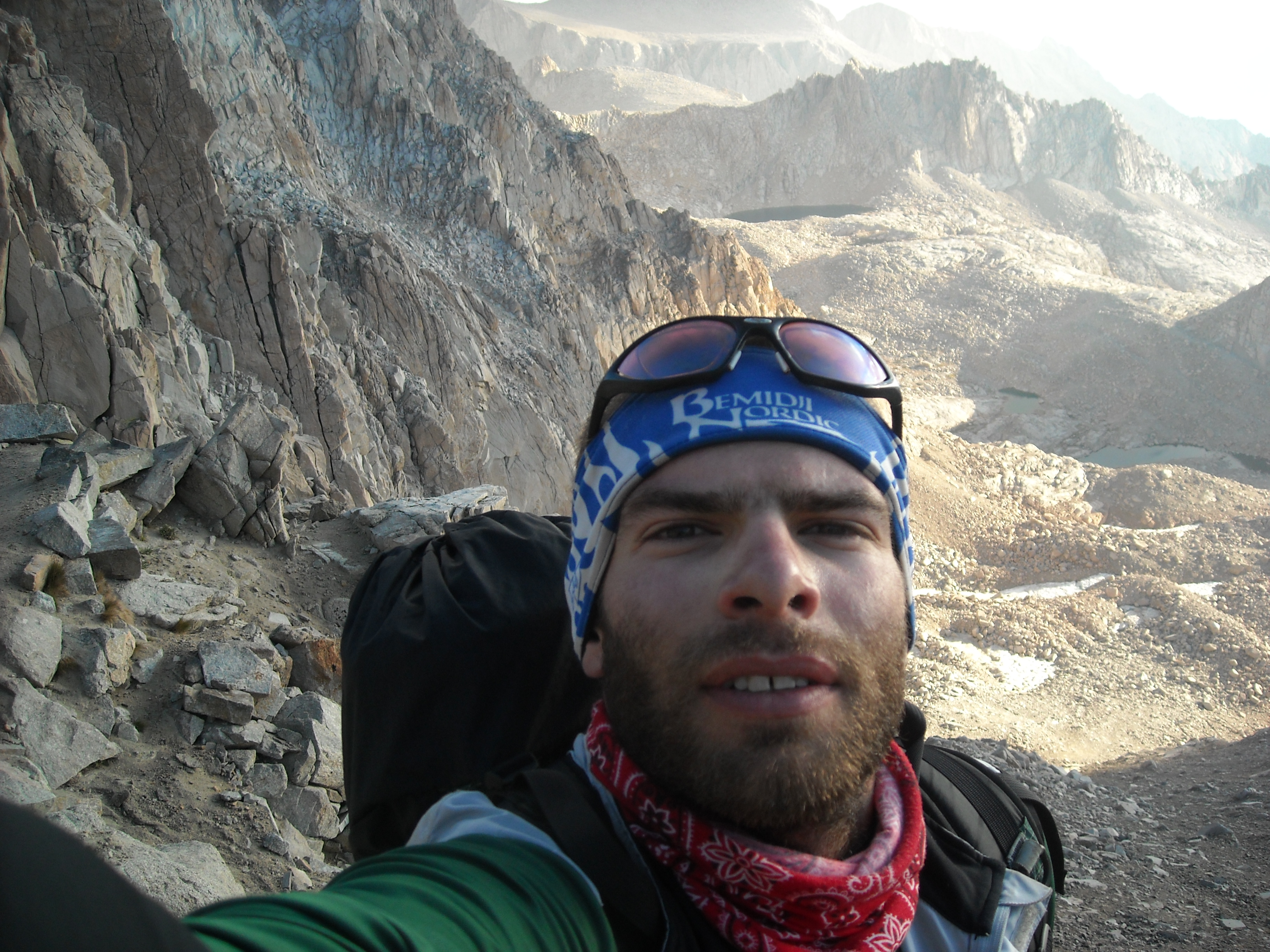
JMT Day Sixteen: Upper Vidette Valley to Tyndall Frog Ponds, 12.1 miles
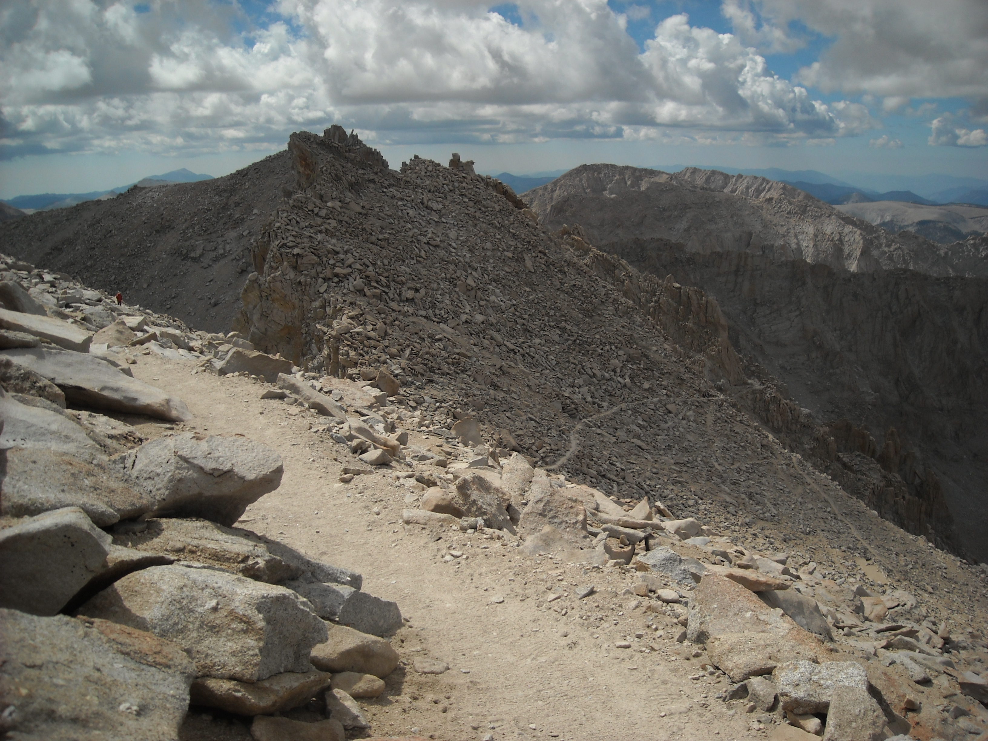
As I previously noted, we each had our day where we bonked, and the climb up to Forester Pass, our first time gaining over 13,000 feet, was mine. It’s hard to describe my bonk and even harder to say why. It felt like the most effort ever to just move one foot in front of the other at any pace. Sure, I was breathing a bit hard, but it wasn’t exactly labored. It was just that my body wouldn’t move, kinda like being in a dream. There was no reason for it either, we’d acclimated, didn’t have any recent hard days, and I was well fed. I just had to will myself up that pass. And the clouds boiled over us.

We did, eventually, make it to the top. I hoped this wasn’t a bad omen for Whitney which we’d do in a couple more days and was 1,500 feet higher, which meant even less oxygen.

It was another early camp for us. I had recovered after Forester Pass and we’d made better time. When we got to the Tyndale Frog Ponds area I’d suggested we keep going, but Erik thought we should be done for the day and he won out.
JMT Day Seventeen: Tyndale Frog Ponds to above Guitar Lake, 10 miles
The topography changed yet again and I thought about how my father-in-law had described much of this region: “like walking on the beach.” He and Erik had taken a backpacking trip here in 2005, doing a loop from where we’d be ending, up Whitney, and then out to Cedar Grove. Hence, Erik had already done this section of trail, albeit in the opposite direction.

From Wallace Creek we would be doing an out-and-back to Mount Whitney before continuing on the High Sierra Trail. We’d done our research and knew there was a bear box there. Technically we aren’t supposed to cache food, not even in a bear box, but we didn’t want to carry all our extra food up and down Mount Whitney so we stashed it in the bear box here.
Then it was a short and easy hike to Guitar Lake (so named because from above it takes the shape of a guitar) where we’d planned to spend the night. When we got there, it was barely noon and there were lots of other people so we hiked a bit farther up the valley. The terrain was incredibly rocky and we spent what felt like two hours under a blue sky trying to find some soft ground to set up camp above the Hitchcock Lakes.


JMT Day Eighteen: From above Guitar Lake, Mount Whitney Summit, and back to Wallace Creek, 16.5 miles
We got our earliest start of the trip. Leif was ready to go and Erik was willing to send him on ahead with the digital camera (before we all had SmartPhones). We had a little less than 3,000 feet of climbing to the Whitney summit.
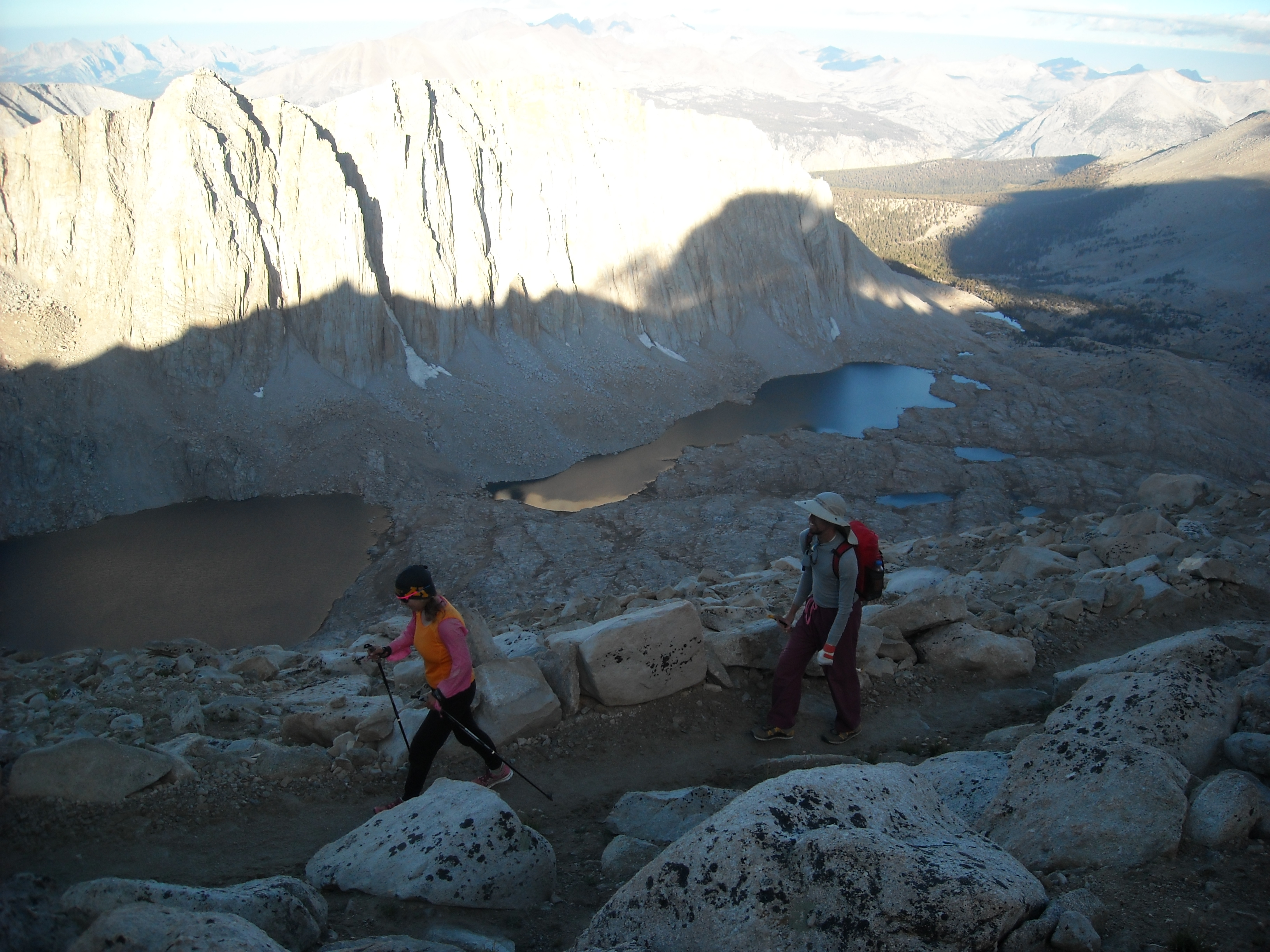
Once we got to Whitney Junction and the trail on the other side of the mountain came in from Whitney Portal, we began a northerly traverse. Here the trail was mostly in good shape but there were still some big rocks and small rocks to navigate. The trail didn’t gain much more elevation and we made good time to the summit of Whitney and none of us bonked.

We took our time on top, enjoying the views after hiking nearly 300 miles to get there. The summit was broad and had a stone hut on top. But alas, we still had some miles to go so headed back down.
We retraced our steps back to Wallace Creek where we’d cached our food and set up camp for the night. Even though it was one of our longest days on trail, we’d been buoyed by the Whitney summit and had plenty of energy to make it to camp.
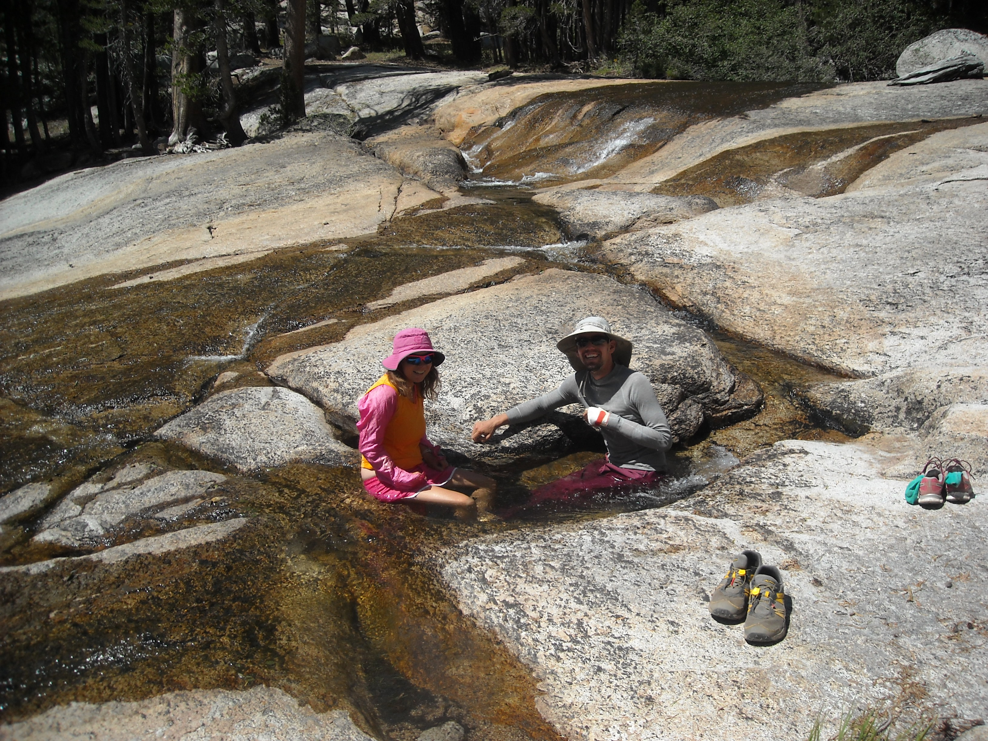
JMT Day Nineteen: Wallace Creek to Kern Hot Springs, 12 miles
This was a light day because the goal for the night was to camp at Kern Hot Springs where we’d heard about the famed hot tub that had been built there. Erik’s dad loved the Kern Hot Springs so we decided it would be worth the stay even if that meant that the next two days would be a fair bit longer. Given we were descending to lower elevations, we got some different topography than we’d had the past few days.
By mid-afternoon we’d made our camp by Kern Hot Springs.
Then we took turns enjoying the hot tub. Apparently at some point someone had brought in a bunch of concrete to make a legit bathtub. There was just a bit of algae:) and some pipes that allowed for the tub to get refiled, stopped up, and then drained.

JMT Day Twenty: Kern Hot Springs to Precipice Lake, 17 miles
We were really counting down the days now as this was our second to last day. After the hot tub, we left camp feeling clean and refreshed but had a couple big days ahead of us and some rain gear games. We hiked up to the Chagoopa Plateau and then towards Kaweah Gap.

The day seemed to drag on forever as we made our way along the trail high above the Big Arroyo River. At least the worst of the clouds seemed to blow over.
And then finally, as it was nearing dinnertime, we hiked up and over our last pass, Kaweah Gap.
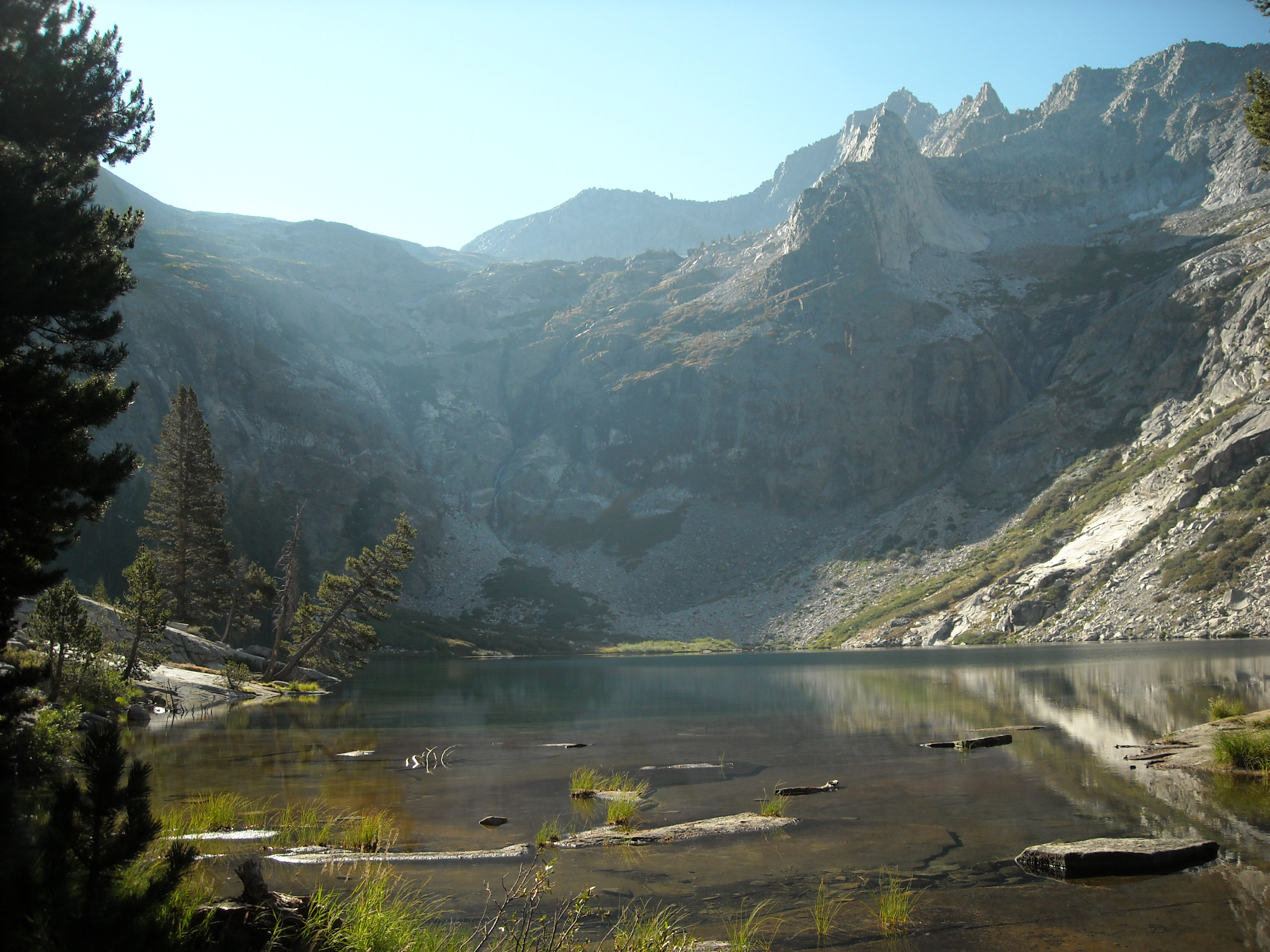
By now we were tired and looked for a place to camp. There wasn’t much soft ground by Precipice Lake but the view was stunning and we were exhausted so we made it work. The weather held and we stayed out late that night admiring the sunlight on the mountains.
JMT Day Twenty-One: Precipice Lake to Crescent Meadow, 16 miles
Given that we had many miles to hike and a pick-up time of 5 pm by Erik’s aunt, we got an early start. Even though it was all downhill, it was still a lot of miles.

Soon we had lost most of our elevation for the day and now began hiking in and out of re-entrants with creeks that gave us the impression we were barely making miles. But we kept at it, hour after hour under the hot sun, and finally Moro Rock popped into view.

Within a mile of the trailhead at Crescent Meadow, Leif was walking a bit in front of us and spotted our only bear, a black one, off foraging below us. Neither Erik or I saw it. Then we arrived at Crescent Meadow, a bit ahead of schedule, and waited for Erik’s aunt who soon came down the road.
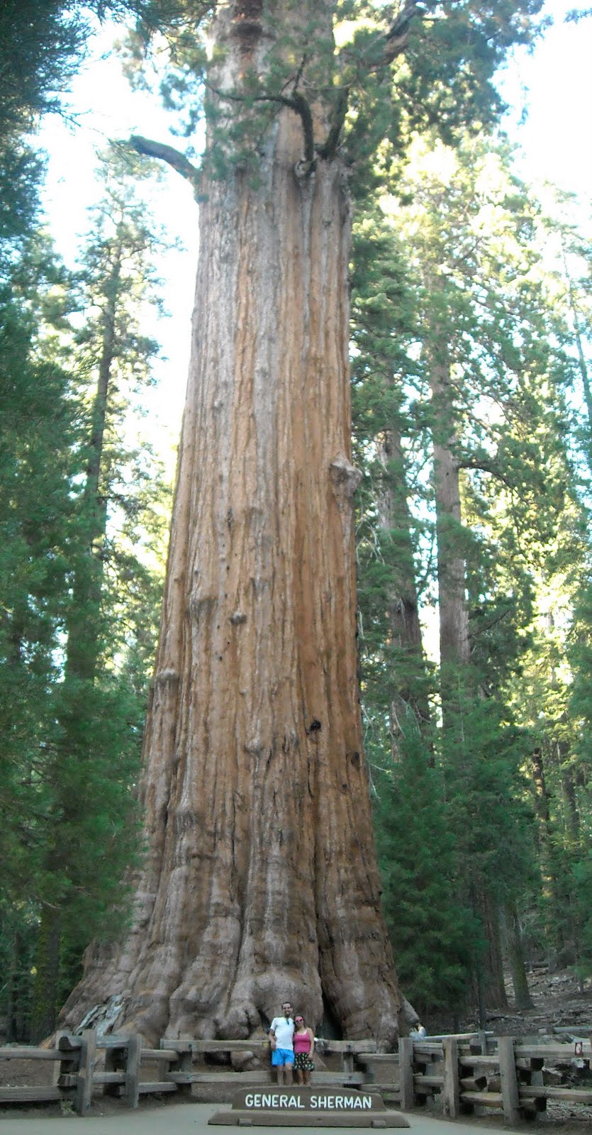
On the way back to Fresno we stopped to admire some of the big trees (we were in Sequoia National Park after all), including the General Sherman Tree.
This marks the end of our John Muir Trail part of the trip, but we still had to make it back to Minnesota!
Post John Muir Trail
Day One post JMT: Fresno to Napa
The JMT now behind us, we set out on our next plan of the trip: to visit Erik’s other aunt in Napa, go to the beach on the Pacific Ocean, and explore San Fransisco. We spent the morning in Fresno as Erik had made a doctor’s appointment to follow up about his broken thumb. Then we got some fresh fruits and vegetables at the local Target before driving up to Napa where we spent a lovely evening with Erik’s aunt and cousin.
Day Two post JMT: The beach and Muir Woods
Alas, the weather wasn’t perfect but Leif and I had never been to the Pacific Ocean so per recommendations from Erik’s cousin, we headed to Dillon Beach. Skies were overcast and it was barely in the 60s. Most people were playing volleyball or just hanging out on the beach wearing heavy clothing but for us Minnesota natives who are used to the cold of Lake Superior, we got right in the water and had a fun time playing in the waves.

After the beach we hiked at Muir Woods. By now we were all a bit beat from the entire trip and had lost the energy we’d had at the beach. Plus, the weather was spitting on us and we didn’t have much motivation for much of a hike so before too long, we headed back to Erik’s aunts house.
Day Three post JMT: San Fransisco
We took Erik’s aunt’s advice and drove to Vallejo where we caught the ferry to San Fransisco. We were treated to much better weather than the previous day as we explored the tourist attraction of Fisherman’s Wharf, saw Silver Man and Gold Man, saw some trolleys, and made our way towards Golden Gate Park and then Telegraph Hill.
But perhaps the biggest attraction of the day, were scoring the Animal Fries (apparently not on the actual menu – something you have to ask for special) at the In-N-Out Burger per recommendations from Erik’s cousin.

Then we took the ferry back to Vallejo and Erik’s aunt’s house.
Day Four post JMT: Drive from Napa to great Salt Lake area
This was a full-on day of driving on I-80: up the Donner Pass, through Nevada, and finally across the Salt Flats at sunset. We didn’t have a great plan for where we would stay and eventually caved and got a hotel a ways north of Salt Lake City. We looked forward to less driving the next day.
Day Five post JMT: Drive to and then backpack in Grand Teton National Park
It was early afternoon when we arrived at the Jenny Lake Visitor Center with plans to get a backcountry permit for one night. After securing our permit for Trapper Lake, we drove up to the Leigh Lake Trailhead. From here we hiked along the east shore of Leigh Lake and up to Trapper Lake. We were more scared here of grizzlies but that didn’t detour us from sleeping out under the stars as it was a very clear night.
Day Six post JMT: Grand Teton hiking and Yellowstone backpacking
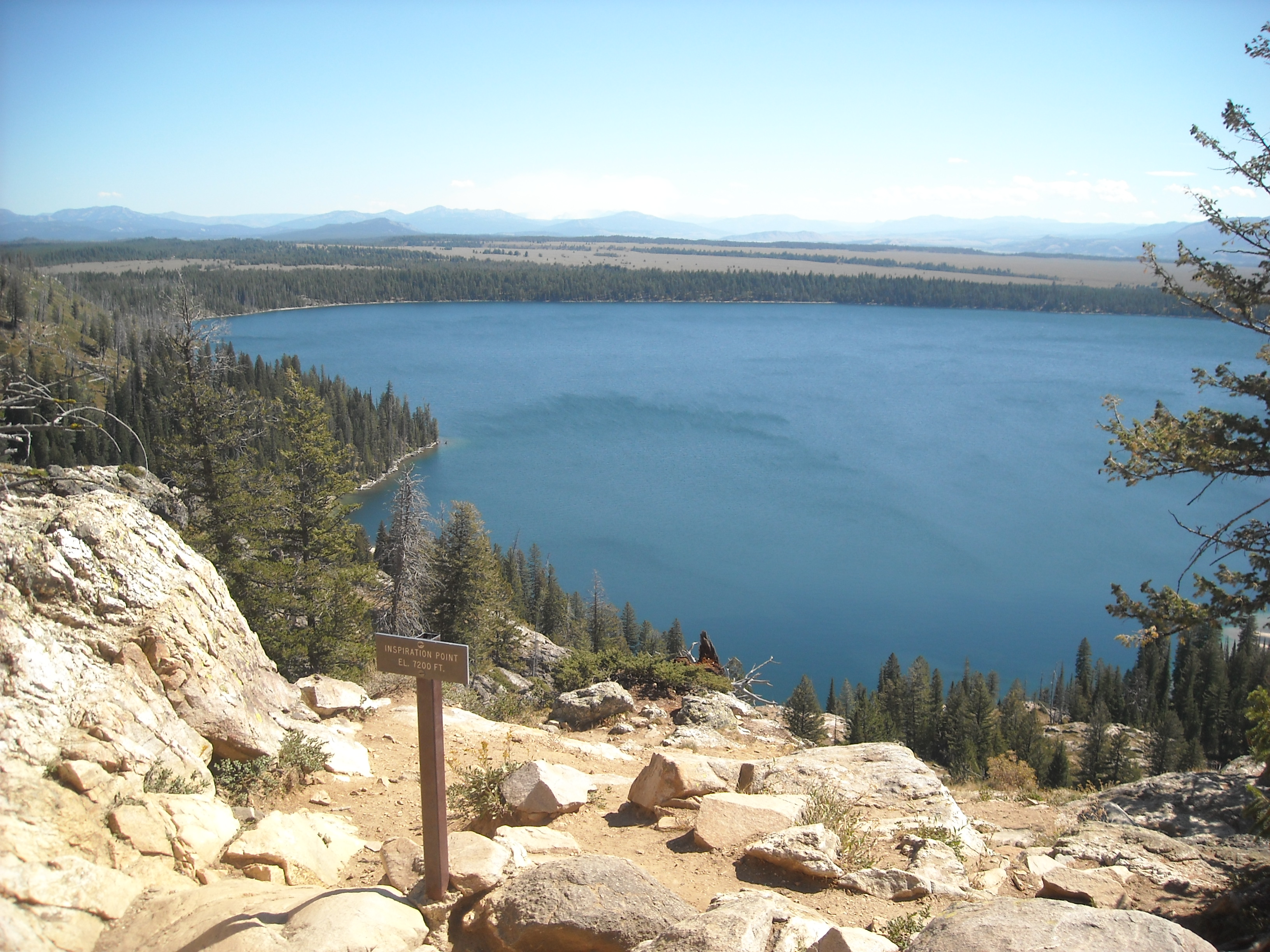
We had enough time so instead of just hiking back to our car (which we initially did), we then continued on to Inspiration Point above Jenny Lake. We had to get out of the way for a horse train which didn’t make me happy again. But otherwise the views were good although we weren’t in the high mountains.

Then we got back in the car and drove north to spend some more time in Yellowstone, this time by the Old Faithful area. We watched Old Faithful erupt, took in the old lodge there, and walked the boardwalk amidst the many other thermal features.
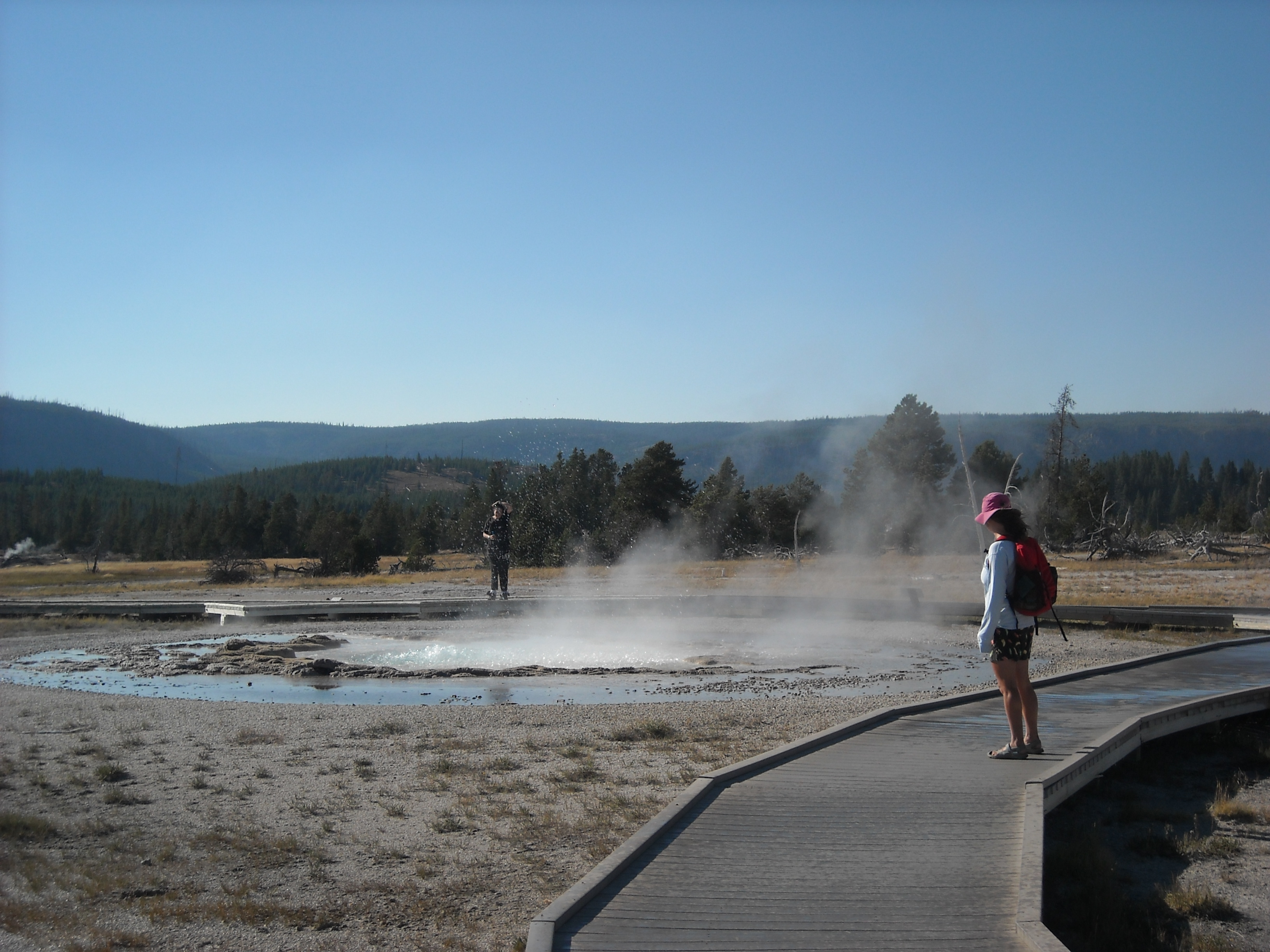
Then we got another backcountry permit, this time just a short hike to Mallard Lake, where we set out from the Old Faithful parking lot. As we hiked and from our campsite, we could see steam rising from a few thermal features.
Day Seven post JMT: Grand Prismatic Spring and drive to Bear Butte State Park in South Dakota
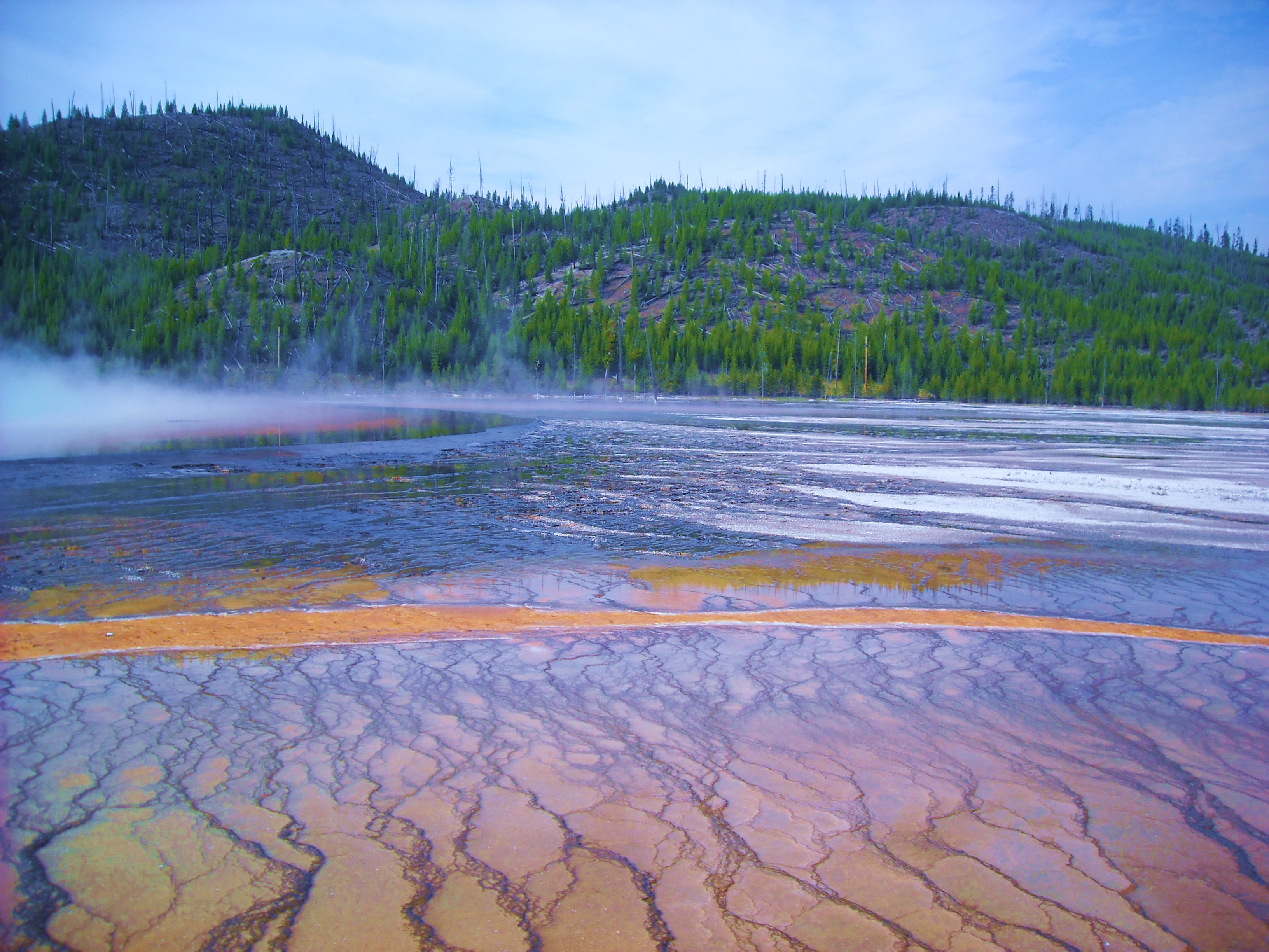
In the morning we got up early and hiked back to our car. During our first foray in Yellowstone a few weeks earlier, I’d seen photos of the Grand Prismatic Spring and decided we absolutely must go there. It was near enough to Old Faithful so we detoured there before beginning our drive back to Minnesota.
The photos of the Grand Prismatic Spring looked absolutely amazing – so many different colors all coming together. What I didn’t know at the time, is that the aerial view is much more impressive than standing next to the spring.
After our visit to the Grand Prismatic Spring, we got in the car for a long day of driving. Highlights included the Buffalo Bill Dam and Visitor Center and Shell Canyon on Hwy 14 through the Bighorns. As it got late, we didn’t have a sleeping plan for the night but then spotted Bear Butte State Park in South Dakota. It was dark when we arrived and we were the only ones in the open grassy campground. We cowboy camped but when a storm came up in the middle of the night, we quickly pitched our tent. The grassy ground was rock solid though and Erik broke a couple stakes trying to get them in. And then it barely rained.
Day Eight Post JMT: Bear Butte State Park back to home in Minnesota
Had we had a bit more energy, we really should have hiked the trail to the summit of Bear Butte. We were all climbed out though and later killed some time at Wall Drug and then at Pipestone National Monument. Both arguably less impressive natural places.
And then, just like that, our five week trip out west was over and so was our summer of adventuring and it was time to go back to work.
If we had to do this trip again: This was a long trip with a few different parts. I’m not sure I’ll have five weeks to do it again until I retire. Anytime someone tells me they are looking for a backpacking trip I tell them to do the JMT. I’m so glad we did it as it was absolutely spectacular. I’d like to say that on the way home it would have been great had we hiked above the Grand Prismatic Spring and Bear Butte but we only had so much energy and time and it is good to leave things for the next trip.
Best Decisions: Driving. Yes, it was a long ways but we had three drivers. There’s something really cool about seeing the country and driving across the salt flats. It was also great to finally visit our aunt in Utah!
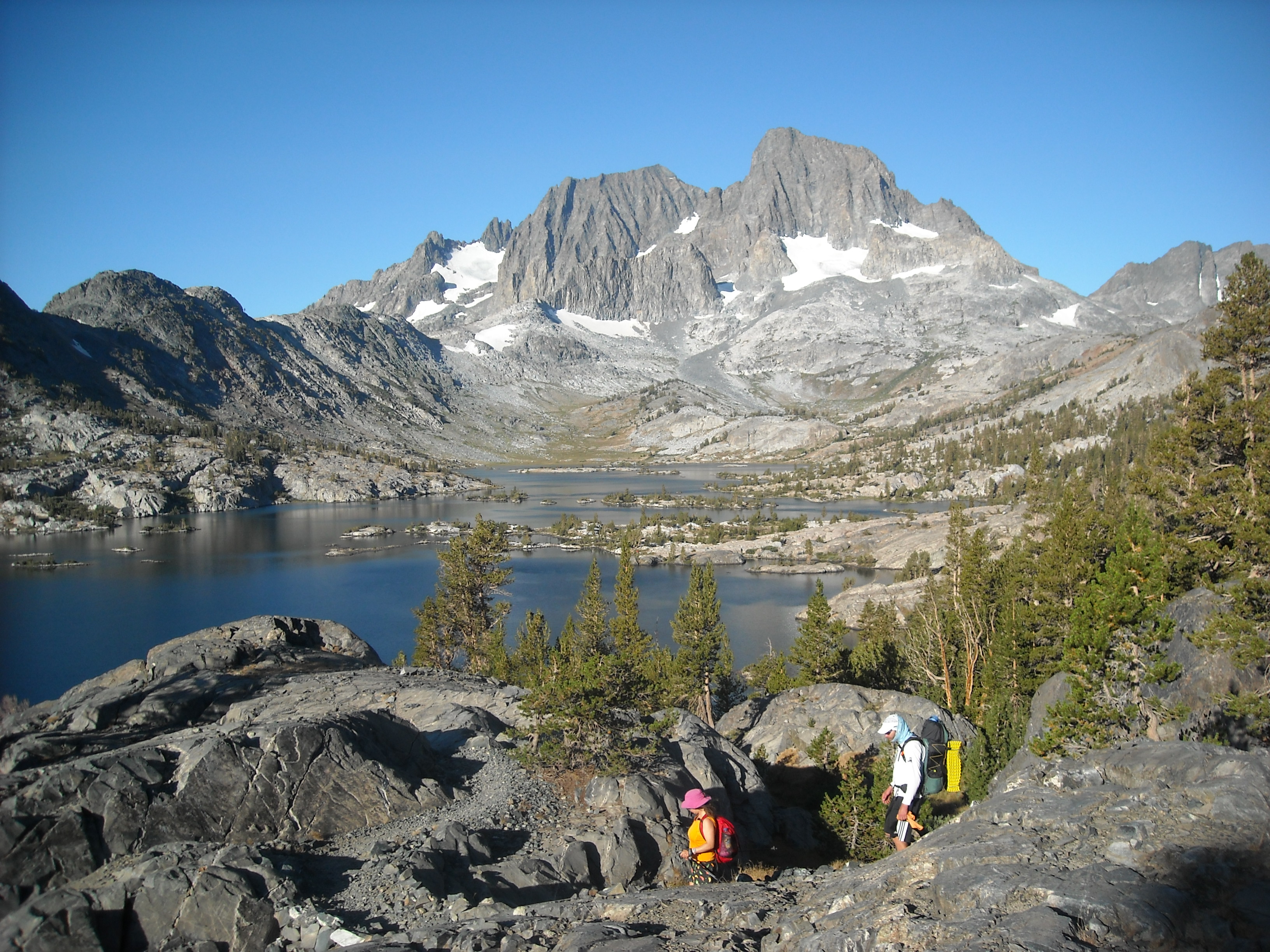
Next time: I’d really like to get back to the John Muir Wilderness, home of Banner Peak and Thousand Islands Lake. Most of this trip was so stunning that I wouldn’t mind hiking parts or all of the trail again. And then since that guy stumbled into the hut on Muir Pass we’ve been thinking about hiking off trail in the Ionian Basin:)

One thought on “5 weeks out west: Teddy Roosevelt, Yellowstone, Tetons, Zion, and backpacking the John Muir Trail”