
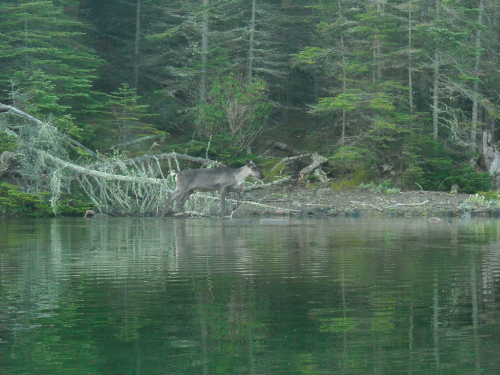
I learned about Slate Islands Provincial Park from my father-in-law. This archipelago extends into Lake Superior off the “real north shore” of Ontario. There are 15 islands total that were formed when a meteorite impact left a crater and the surrounding land rose up out of Lake Superior. There are woodland caribou here and my father-in-law wanted to see them and invited us along on a trip.
We left the Twin Cities on Saturday to spend the night in Duluth. The forecast called for eerily warm temps. On Sunday Erik raced a half ironman triathlon in Duluth. It was super hot. Then we drove farther along Lake Superior, to stay with some friends near Grand Marais. It was hot and sticky that night.
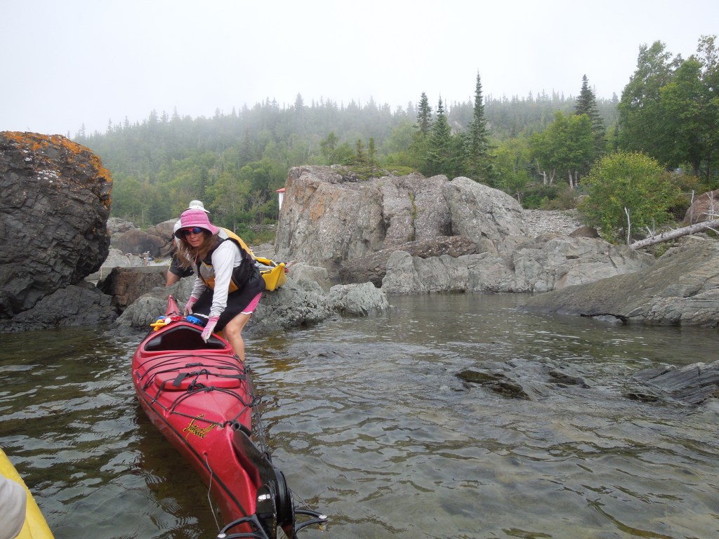
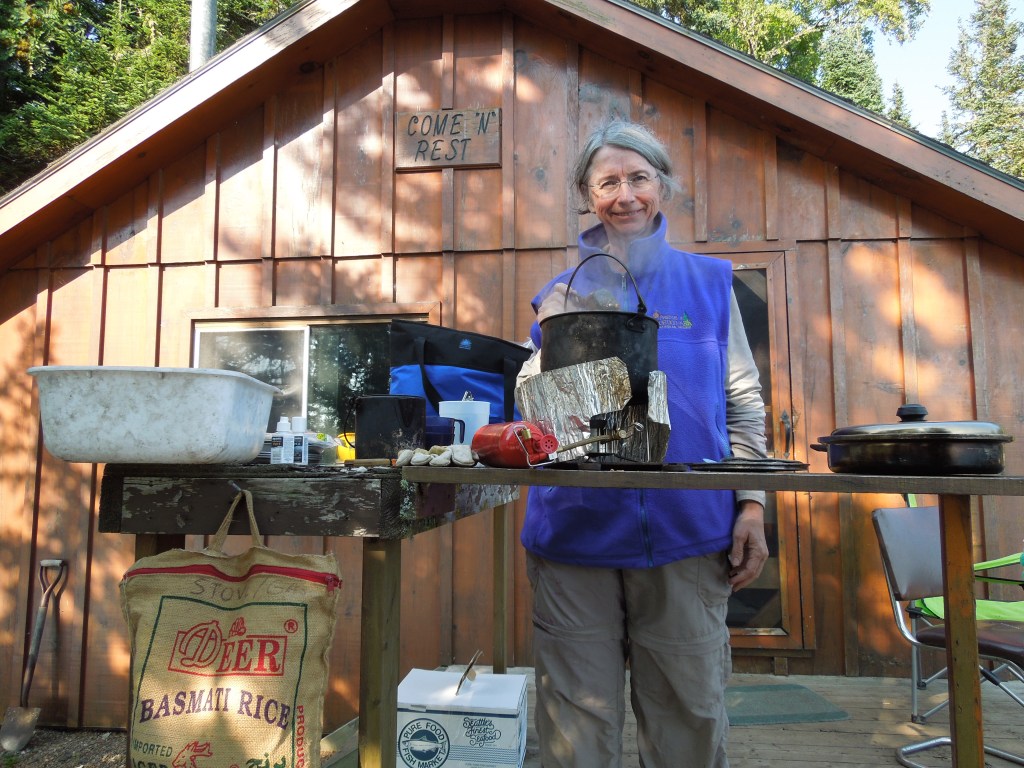
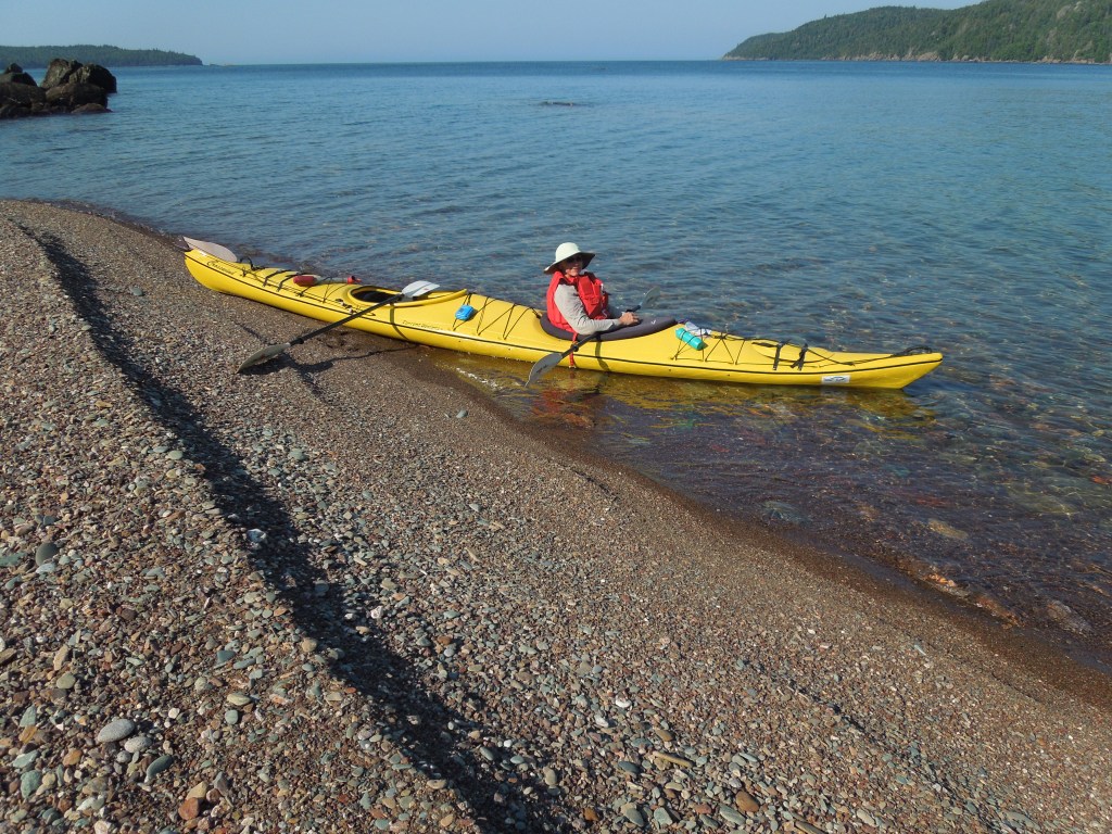
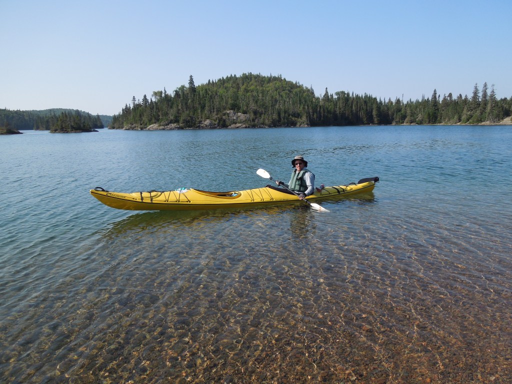
Steve, my father-in-law, took care of many of the trip details. Erik already had a sea kayak, I borrowed a second sea kayak from friends, and the in-laws (including mother-in-law Barb) rented a two-person sea kayak from an outfitter in Rossport. And so on a balmy Monday morning, we left the friends in Grand Marais and continued driving north and east along Lake Superior, crossing the border into Canada, and continuing to Rossport where we picked up the additional kayak.
From here we drove to Terrace Bay where aptly named Terry, had a side business shuttling people and their self-propelled watercraft out to the Slate Islands.
Day One 8/26/13: Arrive at the Slate Islands


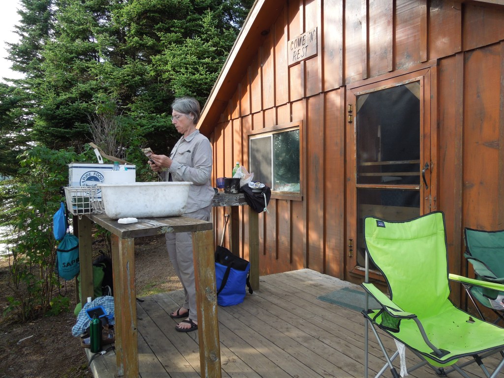
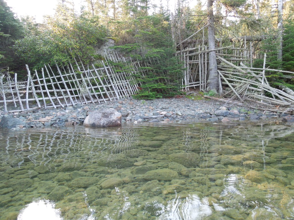
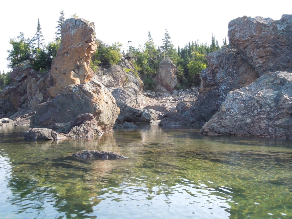
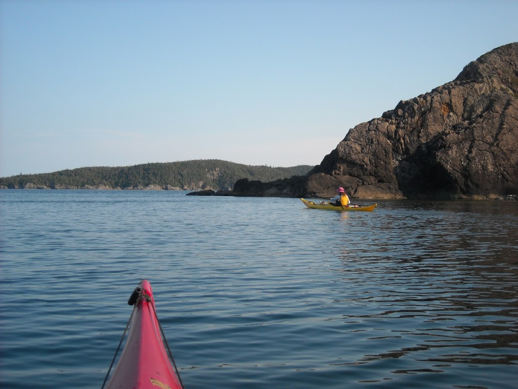
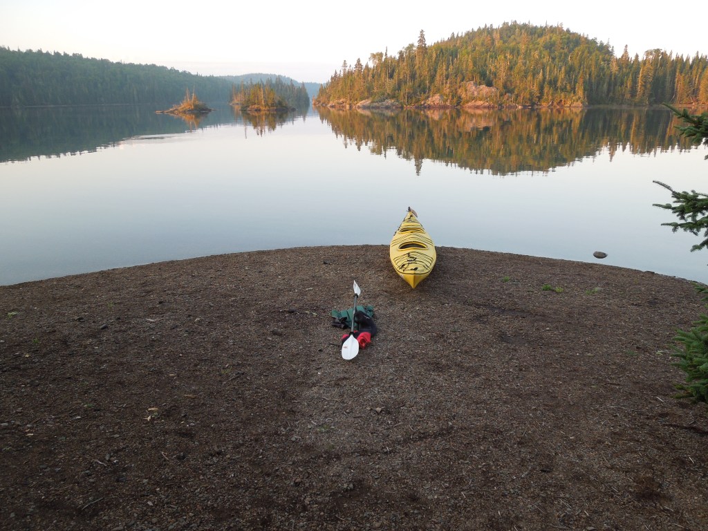
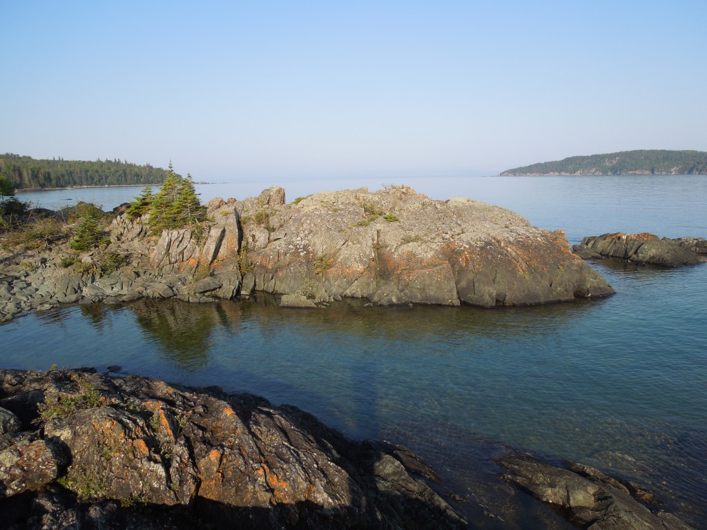
The Slate Islands sit six miles off-shore of Terrace Bay. There are two main islands, one on the north and a larger one on the south, and several smaller islands. Terry had a speed boat outfitted with a couple racks. He knew all the best “campsites” out on the Slates and brought us to the “Come N’ Rest” cabin on the southwest end of McColl Island in what I consider the “inner passage” zone between the two biggest islands.
While the Slate Islands is a Provincial Park and doesn’t allow for personal development, this wasn’t always the case. The park is relatively new, having been established in 1985. Hence, there’s a few leftover cabins and the lighthouse we visited on our second day is an exception as well.


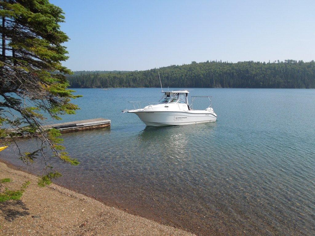
Since we hadn’t gotten a super early start to the day and it was a four hour drive from Grand Marais to Terrace Bay, plus customs, a stop to pick up the kayak, meet Terry, and get the ride to our campsite, it was mid-afternoon by the time we arrived. Barb is a gourmet cook and seeing as she didn’t have to fit everything into kayak hatches, brought a lot of stuff in totes! We set about exploring the cabin and surrounding woods, erected our tents, and unpacked all the foodstuffs.
Typically when in the backcountry, Erik and I establish a new campsite every night. We decided not to do this because 1. Owing to a meager number of visitors each year, there are very few established campsites, 2. We wanted to stay in the inner passage where we could still kayak easily should the winds pick up, and 3. The in-laws wanted a base camp and we were committed to staying with them.


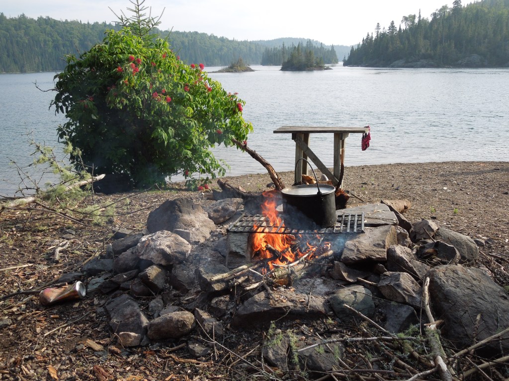
After dinner we took a brief paddle around McColl Island and into the bay across the way. And then we called it a day.
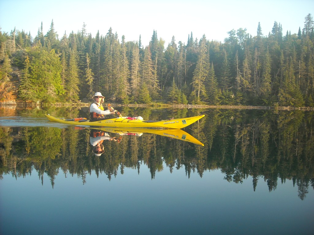
Day Two 8/27/13: Paddle around Patterson Island

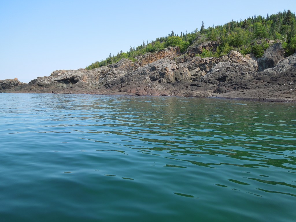
Patterson Island is the biggest island and sits farther south. It has numerous bays and even some small lakes and rivers. It’s about 14 miles around Patterson without hugging the shoreline super close or going into any of the bays. That extra outline in pink in the very south is Sunday Point where the lighthouse sits on private land.
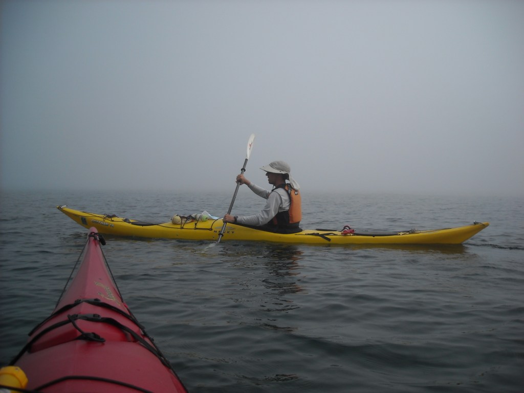
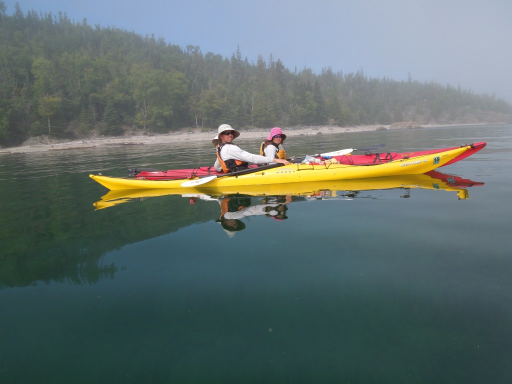
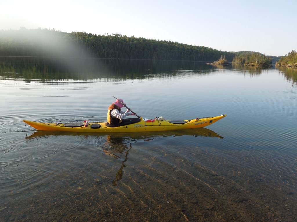
We woke to profound fog. The water was calm and so we kept to our itinerary of paddling around the big island. It was a bummer that we couldn’t see much of the shoreline which was barely perceptible to our left as we navigated. We were careful to keep it and each other in sight, but once, I accidentally paddled a bit farther out into the lake and suddenly couldn’t see anything. I briefly panicked, headed back towards where I thought shore was, and thankfully could see it and the others again.

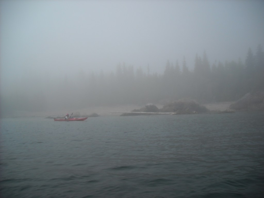
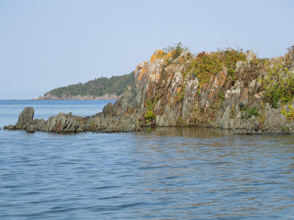
Our first stop was at the lighthouse half way around the island. We stopped and met the lighthouse keeper who lived there with his family. We stayed for a couple hours as he was quite chatty. I suspect a bit lonely, too.


By the time we got back to paddling, the sun was finally starting to burn off the fog and we had much better visibility.

We tried to find some of the shatter cones for which the Slate Islands are known. These form in the bedrock under meteorite impact craters. Terry had pointed out on the map the largest one registered, in one of the northeast bays of Patterson Island (see our map above where it’s hand written). Although we went to see it, we couldn’t really appreciate it.
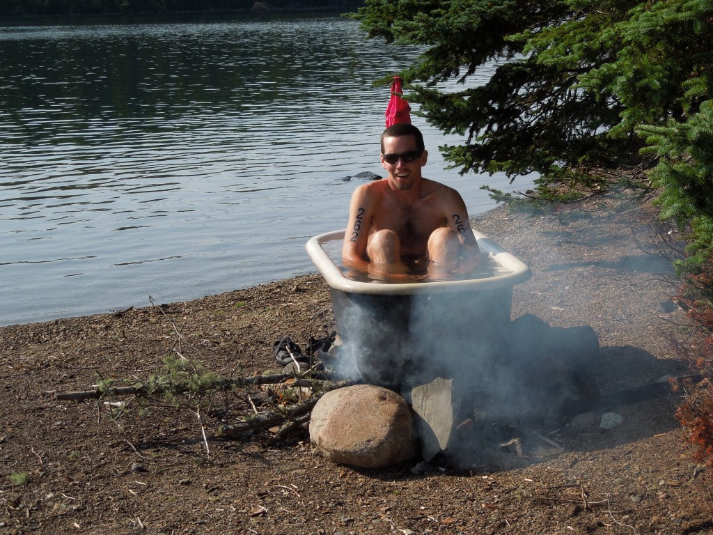
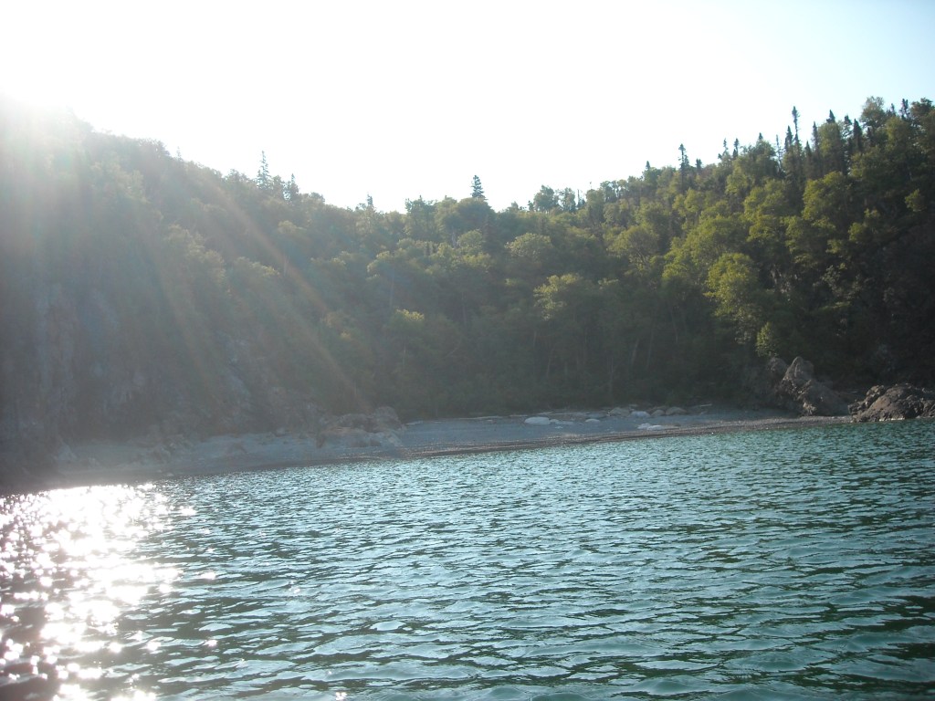
It was mid-afternoon when we arrived back at the Come N’ Rest. The weather was still stable and warm. It was probably hot on the mainland, but just right several miles into Lake Superior. Erik and I swam across the closest channel and back. Despite the warm air temps, the water was take-my-breathe-away cold and I’m not much of a swimmer. I wasn’t sure I was going to make it back across the channel but after I sunned myself for awhile I got up the gumption to swim back across the channel and made it.
Day Three 8/28/13: Paddle around Mortimer Island
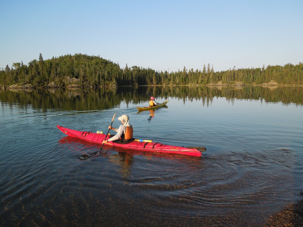
The next morning we woke again to calm seas, but this time there was no fog. We decided to split up, with Barb and Steve exploring closer to camp while Erik and I circumnavigated Mortimer Island, the second largest island which is skinny in the north-south direction but quite wide in the east-west direction. In total, after we detoured to Dupuis Island to get in some more mileage, it was a 12 mile day.


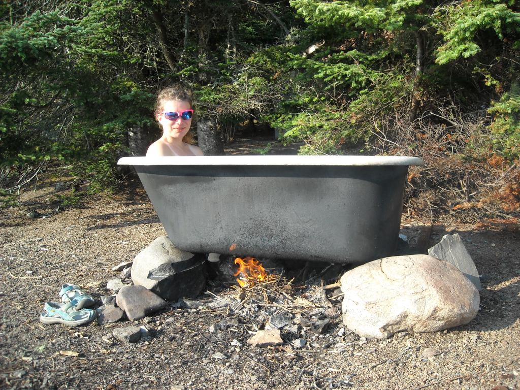
By mid-afternoon Erik and I were back in camp and I enjoyed some time in the bathtub.
Day Four 8/29/13: Paddle back to the mainland
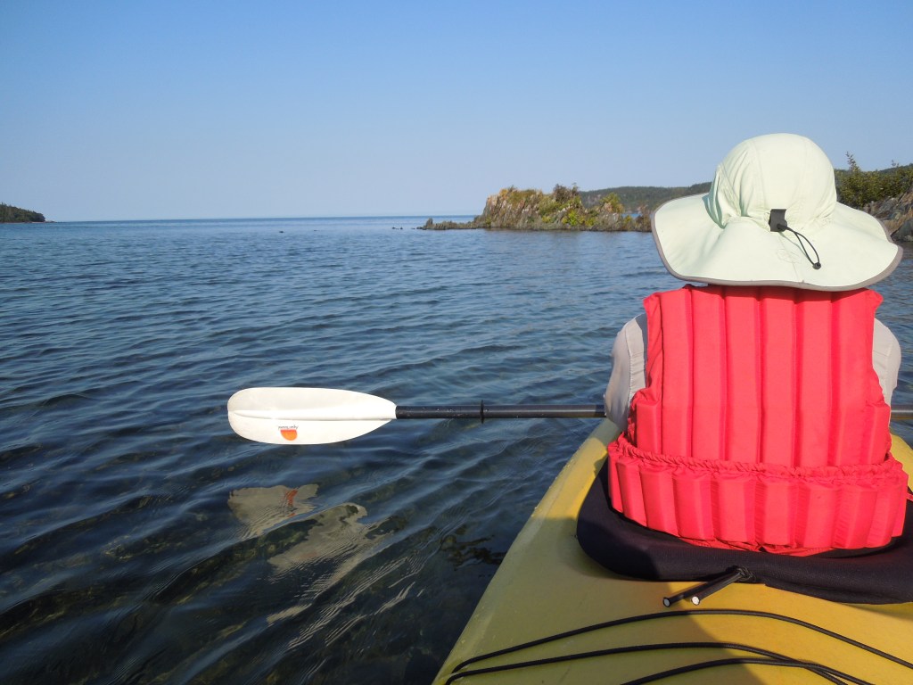
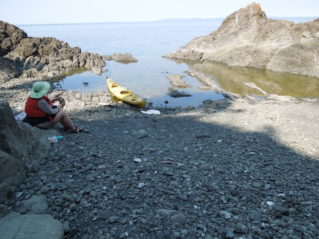
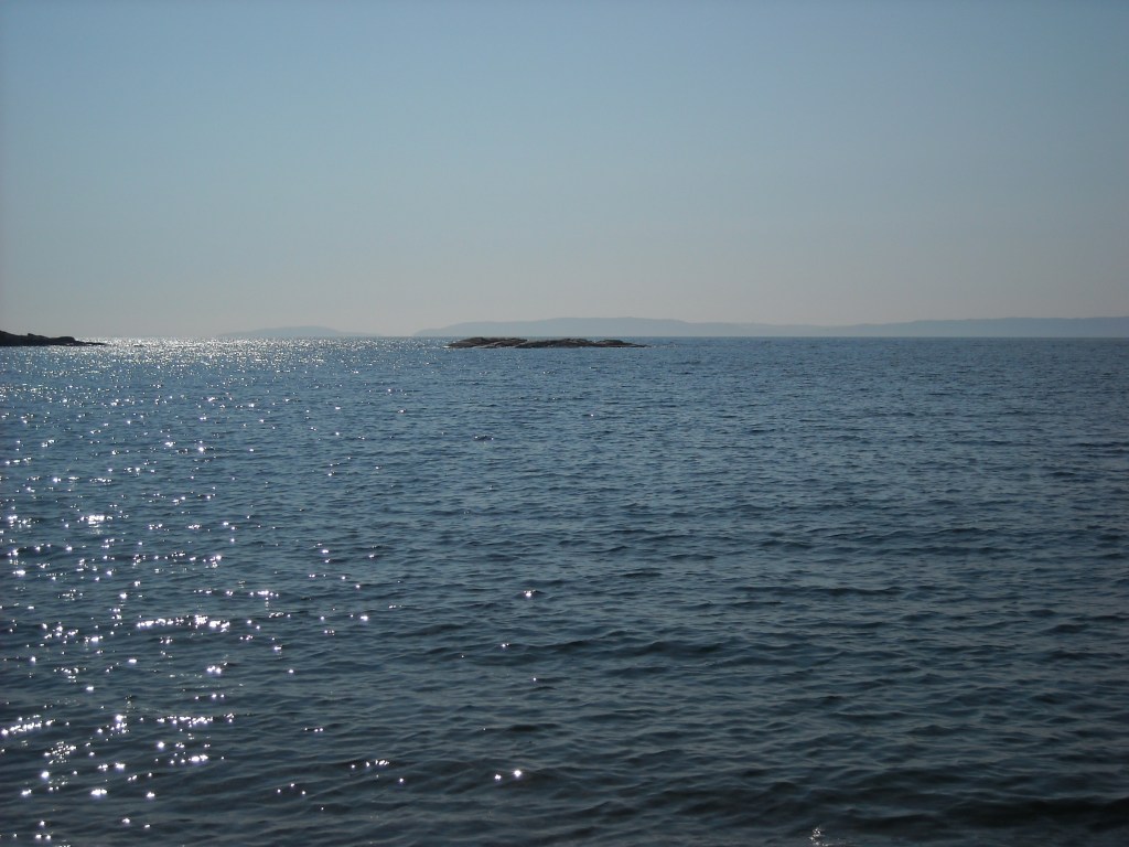
The weather held and so Erik and I paddled back to the mainland while Barb and Steve waited for the boat ride, a distance of a little over 11 miles from our campsite and 7 miles of open water to the Terrace Bay Beach (the extra mile is because we had to go a little northwest to get to our take-out).


The crossing wasn’t very far but we also know that winds and storms can come up at any time so we were both a bit nervous and paddled hard.
Meanwhile, Barb and Steve did a little exploration via kayak before taking the shuttle boat.
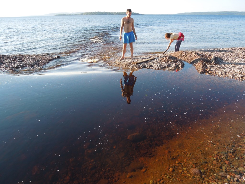
Erik and I made it back to the mainland well ahead of Barb and Steve so we went swimming at the beach. The water was surprisingly warm, likely due to some shifting currents. Then Barb and Steve arrived and we loaded up the car.

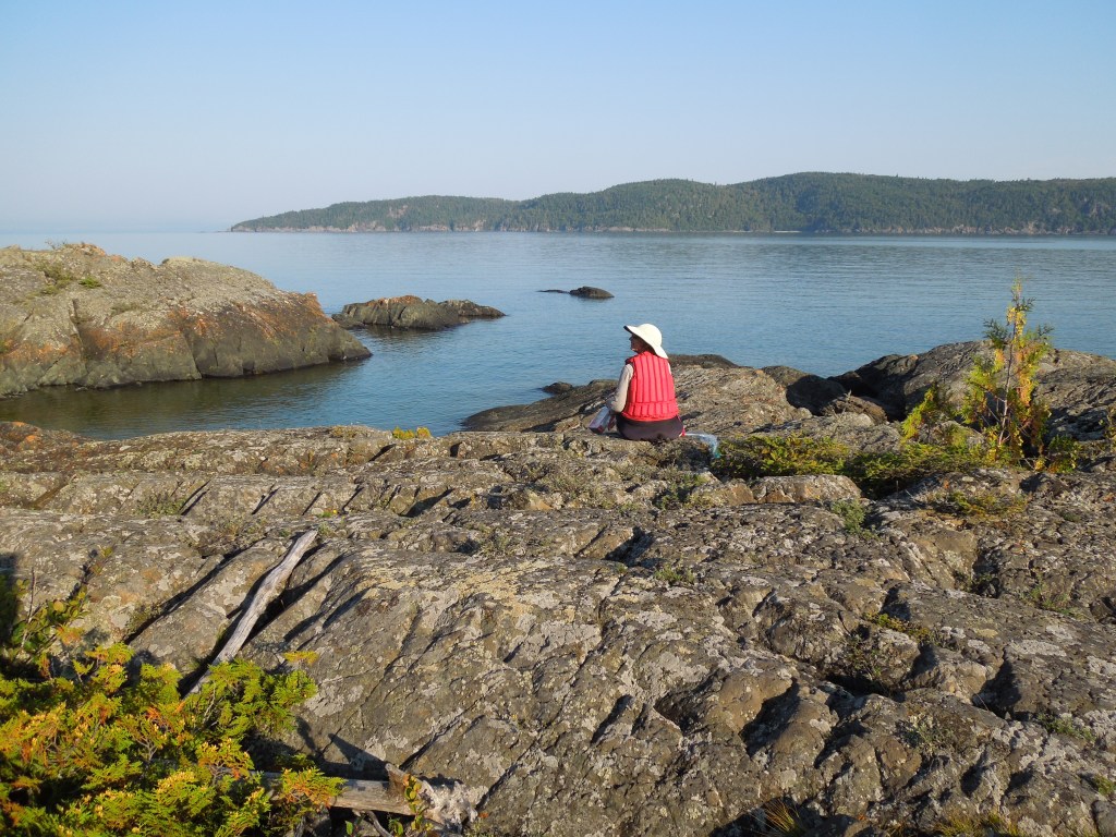
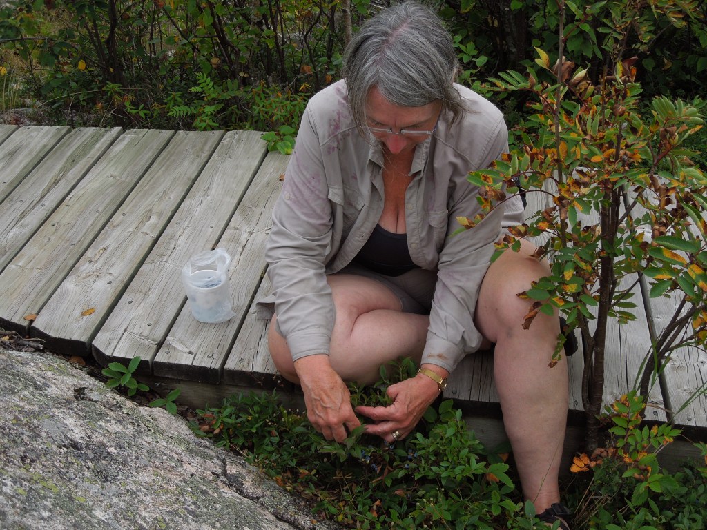
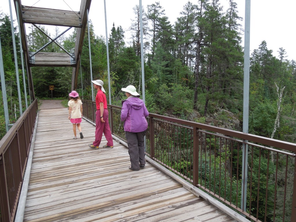
Before leaving the hamlet of Terrace Bay we did some exploring, first heading up the hill to the observation area.

And we found an amazing patch of blueberries!
And we headed back to the beach.
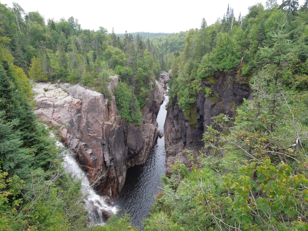
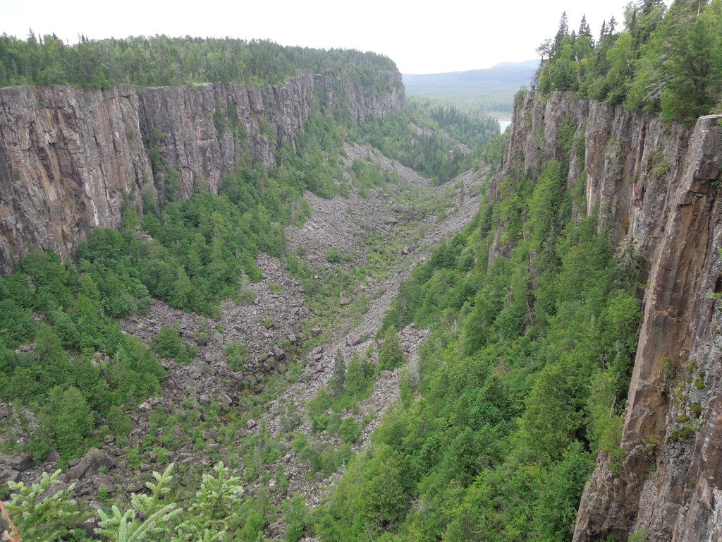
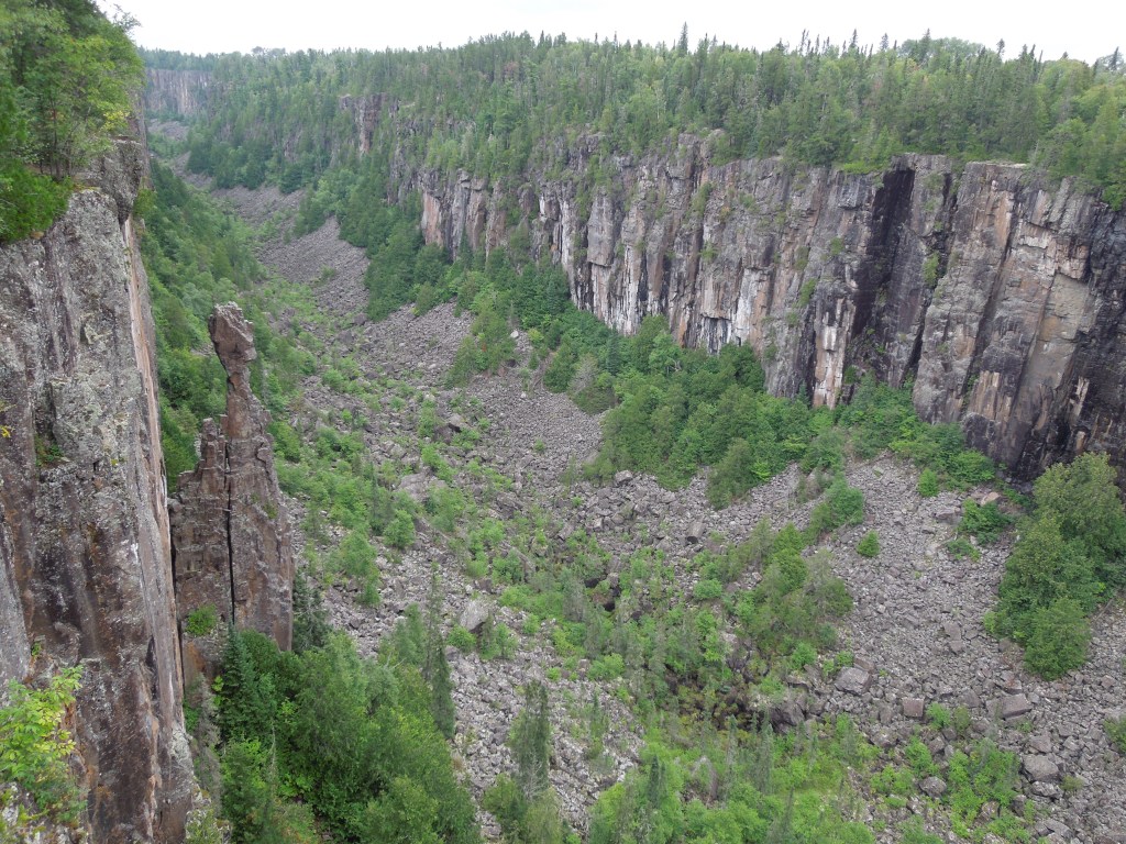
Then we hiked along the Aguasabon Gorge.

By now the afternoon was wearing on and it was time to start driving to Rainbow Falls Provincial Park where we’d secured our next campsite. After all the sun we’d had on our trip, the clouds were now rolling in. We made it to Rainbow Falls Provincial Park before the rain. Barb cooked us up a dinner and we had blueberry pie for desert. There was a loaded down bicyclist who came into the campground who was biking across Canada and we invited him to join us for dinner and he gladly accepted. It began raining and we stayed dry under a big tarp.
Day Five 8/30/13: Ouimet Canyon and Arrive at Sleeping Giant
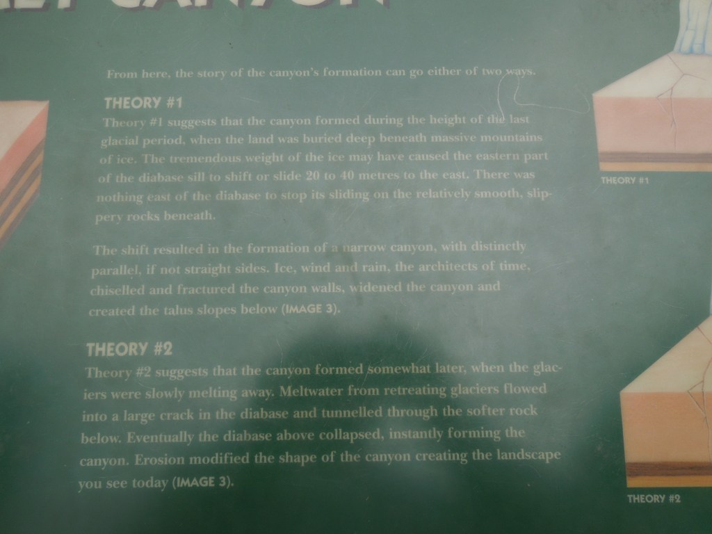
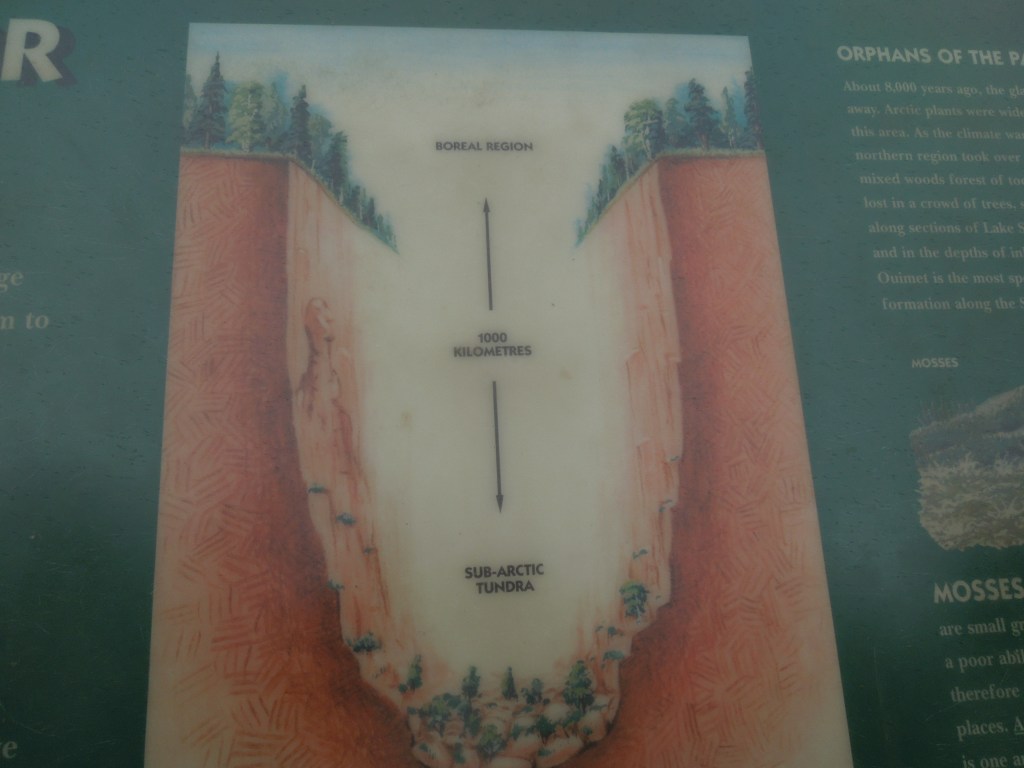
We woke to a cloudy day. After a breakfast of blueberry pancakes, we got a slow start and stopped at Ouimet Canyon Provincial Park along the way. This was a nice detour that was interesting although not particularly stunning.


From Ouimet, we drove on to Sleeping Giant Provincial Park. Erik and I had grand plans of a backcountry camping trip, but were less than eager given the threatening skies. Hence, we camped with Barb and Steve in the Marie Louise Lake campground that first night.

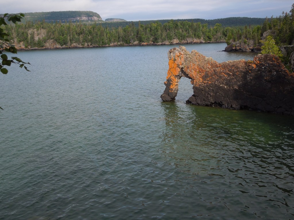
After we got our tents set up and had dinner, the weather was looking a bit better so we drove down to Silver Islet and did a bit of kayaking, including under the Sea Lion. Unfortunately our camera ran out of batteries around this time and so we didn’t get our million dollar photo.
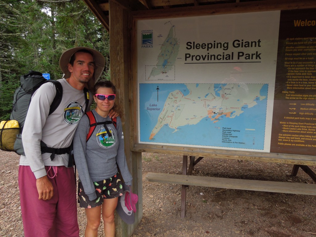
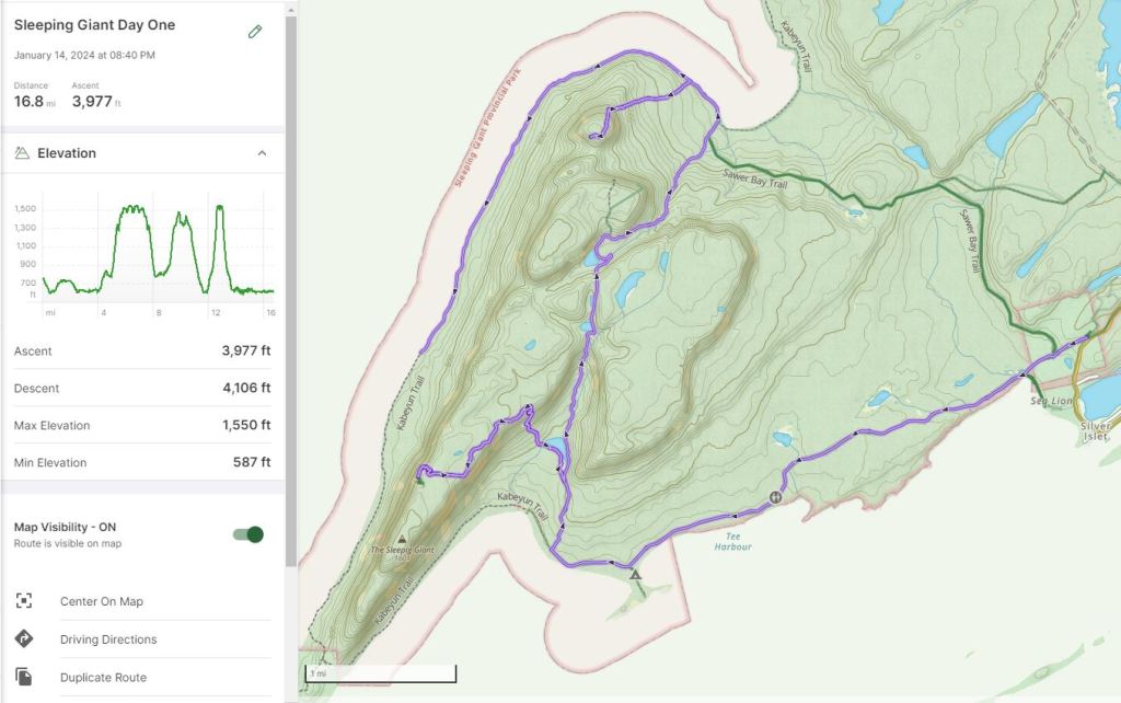
Day Six 8/31/13: Backpacking the Sleeping Giant
I was getting restless and needed some adventure and wanted to get to the top of the giant, I mean, that’s what I came for. So we packed up our tent from the campground and Steve gave us a ride a ways down the road to the trailhead.
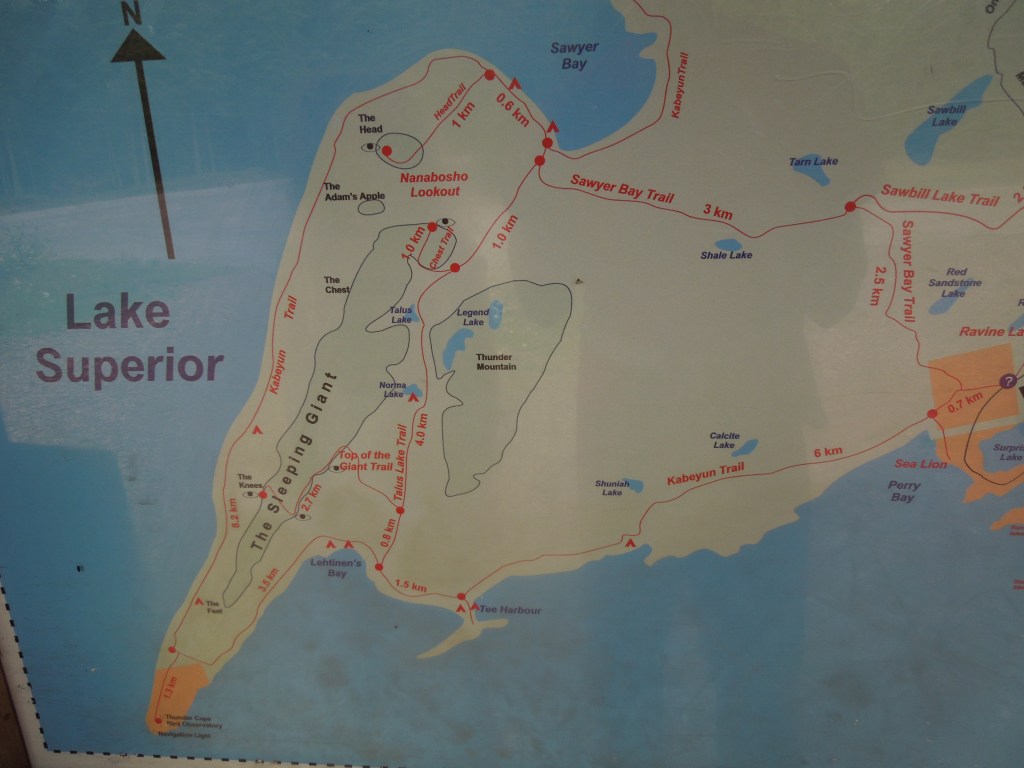
It’s a long hike down the Kabeyun Trail through the forest. We had debated doing more of a loop, but we both wanted to hike the trail next to Lake Superior and the more inside trail with all the opportunities to climb up The Giant. Hence, since those two things didn’t allow for a great loop, we ended up hiking out and back on the Kabeyun Trail.
At our first main trail intersection, we hiked north on the Talus Lake Trail to the Top of the Giant Trail. Next we took the trail up to the Top of the Giant and kept going to The Knees. The trail was fairly steep but reasonable for hiking. The bummer was, we were in the clouds. At least we could appreciate the cliff we were on and had some visibility but it wasn’t good enough to see out to Lake Superior or all the way to Thunder Bay.
We descended back down from The Knees and The Top of the Giant and continued hiking north. We gained some elevation towards a plateau and an area with a few small lakes. There were some rough sections in here reminiscent of the scenery from Ouimet Canyon, hence why it is called Talus Lake, and felt more like hiking in the mountains, minus the giant peaks. There are three total trails that go up The Sleeping Giant but no trail that crosses atop The Sleeping Giant. We decided that two ascents onto The Giant were enough, so we skipped The Chest Trail and instead hiked up The Head Trail.
Fortunately it hadn’t rained too much recently, because The Head Trail was very steep dirt that got muddy in places. It just went straight up without any nice switchbacks. By the time we got to The Head, the clouds had cleared and we had a better view. Then we had to go back down that steep trail, often holding onto the vegetation for some grip.
From here we continued hiking west and then south along the trail that borders Lake Superior. There had been a somewhat recent windstorm and apparently this trail isn’t very popular, so we spent most of our time hiking around and over blowdowns. This took way longer than we wanted and although there are dedicated campsites, it was starting to get dark before we got all the way to the campsite. Hence, we found a suitable spot in the woods and set up our tent. Note, that backcountry permits are required for the 27 backcountry sites.
Day Seven 9/1/13: Finish Sleeping Giant Backpack
The next morning we got an early start as we still had a ways to hike before we were to meet Barb and Steve back at the trailhead at noon. Fortunately there seemed to be fewer blowdowns as we got farther south on the peninsula and we were able to make good time. The weather was still brooding though and our approximately 7 miles of hiking were mostly in the forest without terribly good views.

After arriving back to the trailhead nearly at our pre-arranged pick-up time, we drove to the far outskirts of Thunder Bay where we stayed with Marge, an old friend of Barb and Steve’s from the 1970s whom they had met in the Quetico. She had great hospitality and many stories and the next morning we discovered a bear had tried to get into the car and had bent the license plate!
Drive Home 9/2/13
From Marge’s we drove home, stopping at the Susie Islands Overlook and then at one of Barb and Steve’s favorite places – Sugarloaf Cove Nature Center where there’s a nice pebble beach.

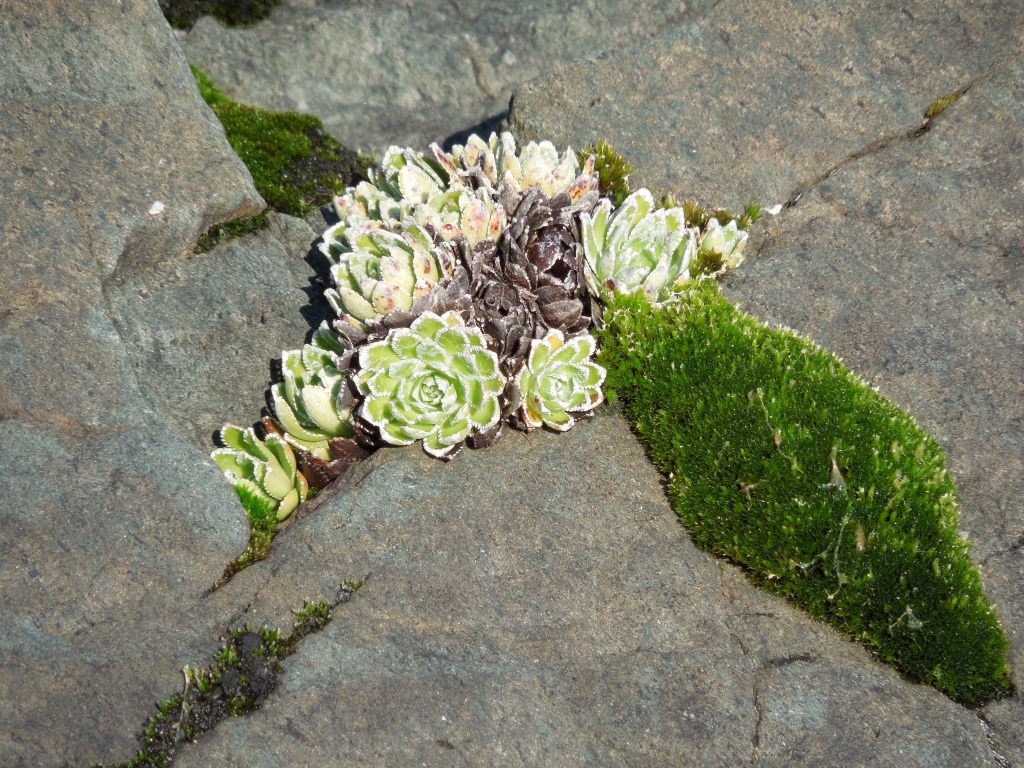
If we had to do this trip again: We really lucked out on the weather conditions. It wasn’t too warm at the Slate Islands and there was barely any wind which made paddling easy. I am a bit sad that we didn’t get to see the west shoreline of Patterson Island since we were paddling in the fog. I’m not sure I’ll make it back to the Slate Islands. If I do, I’d like to explore a bit more inland and look more at the plants. The Dryas drumondii is a famous one on the Slates but I didn’t appreciate it. I’d also like to check out some of the lakes on Patterson Island, although the forest may be too dense.
Best Decisions: I guess that we went precisely at the right time when the weather was warm and calm for Slate Islands. Yes, the weather could’ve been a bit better for Sleeping Giant but we still made the most of it and it wasn’t terrible.
Next Time: My father-in-law recently told me that during a cold winter, the wolves walked out to the Slate Islands and that was the end of the woodland caribou. At least for now. If I do return to the area, I’d be more inclined to backpack the Casque Isles Trail than head out to the Slates. I might also be interested in getting back to The Knee on The Sleeping Giant to see the view out over Lake Superior and back to Thunder Bay.

Another delightful narrative. Coincidentally I am half way through Eric Morse’s ‘Freshwater Saga’, and in this chapter he is canoeing Lake Superior with his wife. He dosn’t mention the Slate Islands but he does the Sleeping Giant.
LikeLike