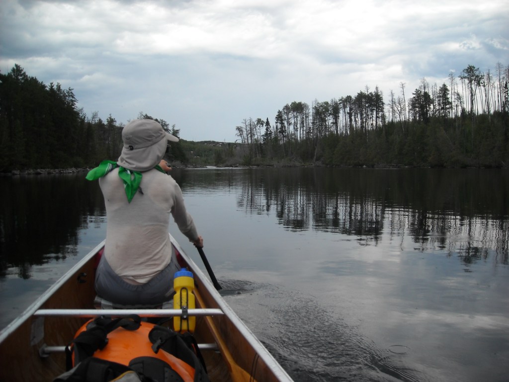
In 2014, Erik decided this should be the trip. I wasn’t super stoked because (1) there aren’t any mountains on the route and (2) it would involve lots of camping, and at the time I felt quite adverse to spending several nights in a row in a tent. In the end, Erik didn’t have to convince me too hard and I agreed to the trip. Our friend, Emily, who had accompanied us on the Northern Forest Canoe Trail, was also interested and so we again took her boat, a Wenonah Minnesota 3.
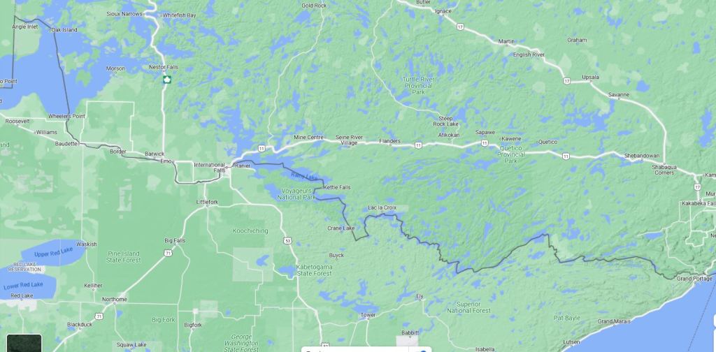
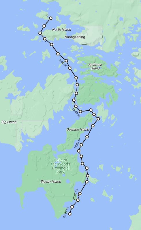
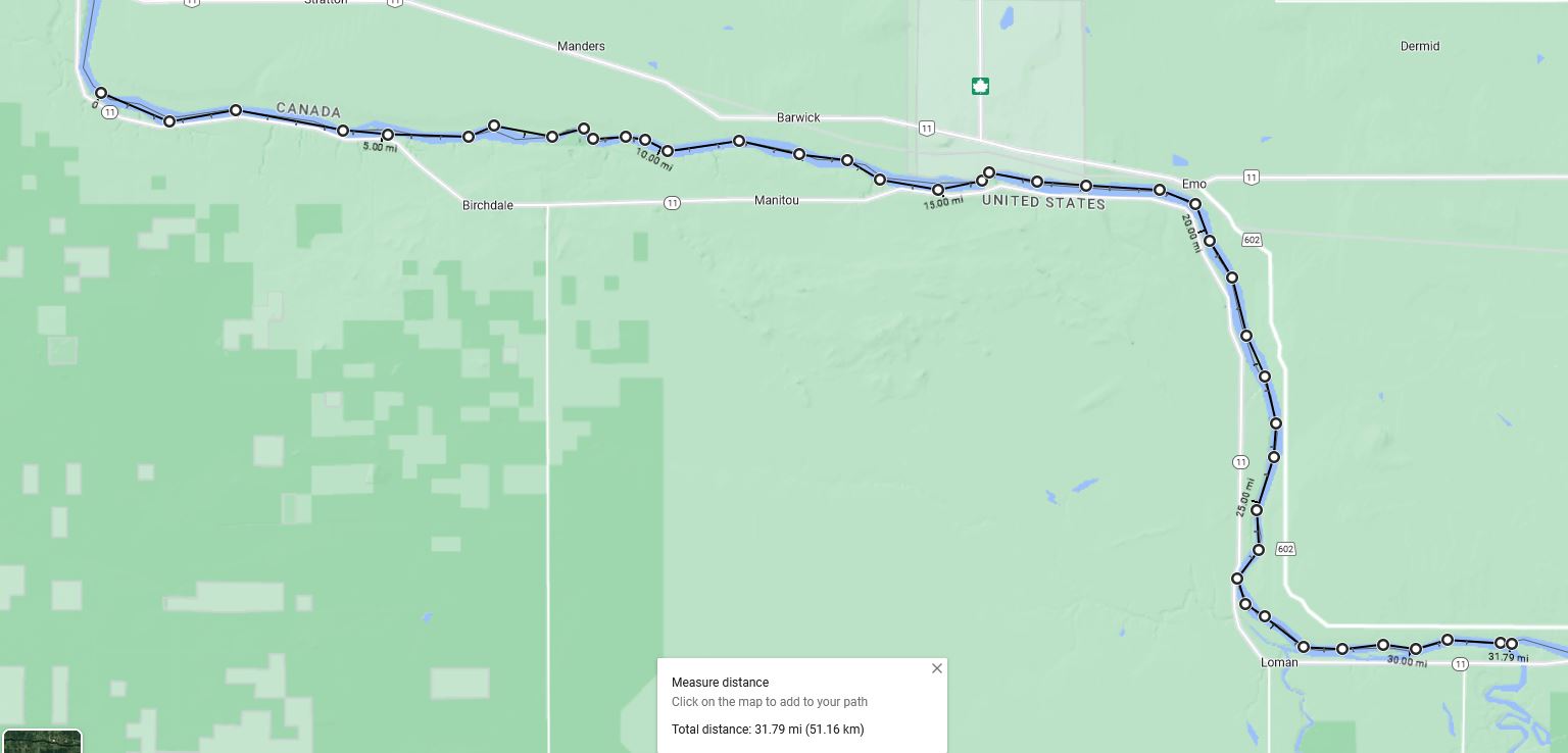
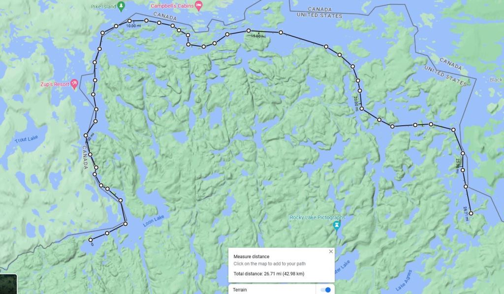
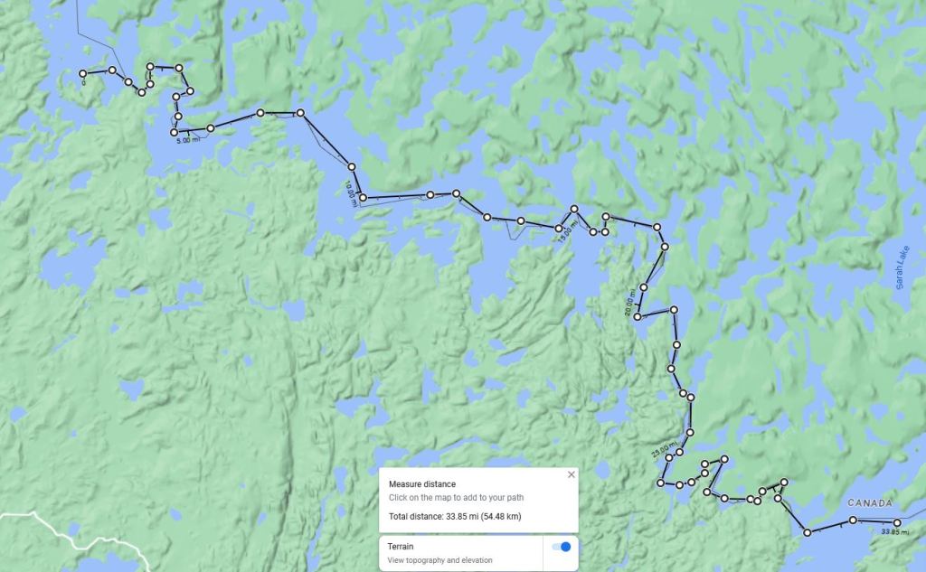
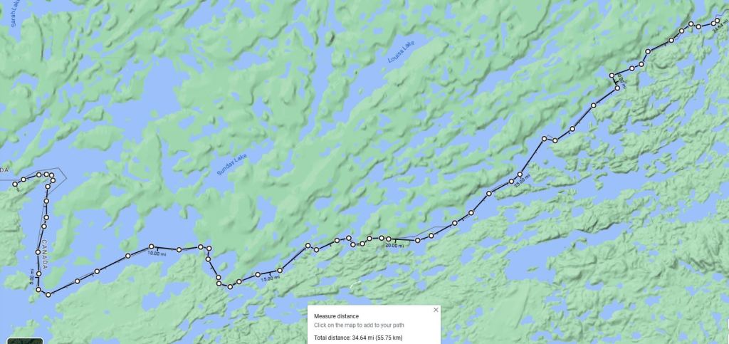
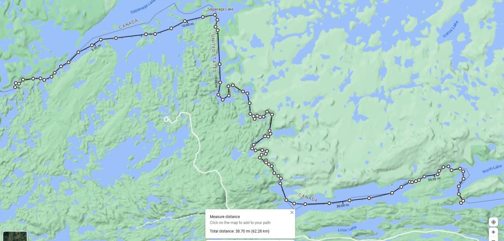
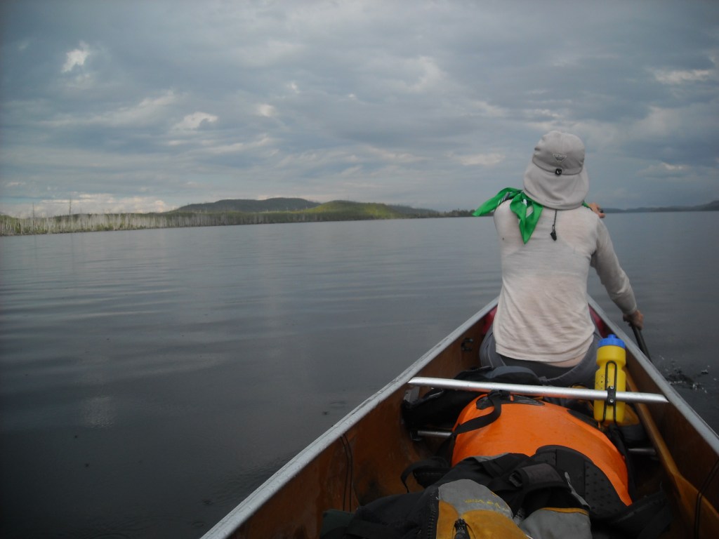
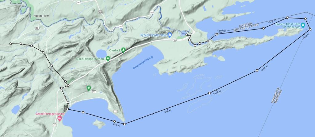
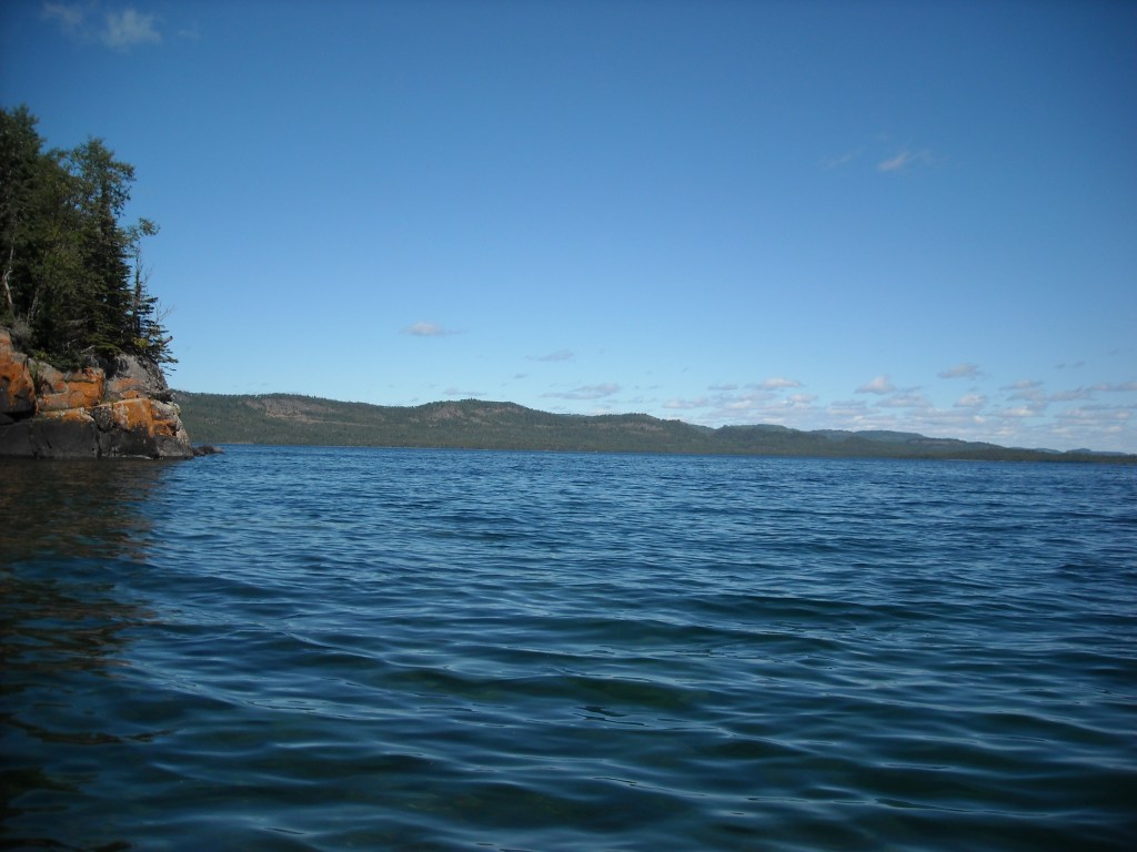
The Minnesota-Ontario border is quite unique in that it is 99.9% water with the exception of an 80 rod portage between North and South Lakes on the Continental Divide (water flowing to the Hudson Bay versus Great Lakes) and a second more minor watershed divide 160 feet higher, on an 89 rod portage between Watap and Mountain Lakes on the far east side of the Boundary Waters Canoe Area. From west to east the main bodies of water are Lake of the Woods, the Rainy River, Voyager’s National Park, the Boundary Waters Canoe Area Wilderness, and finally the Pigeon River. We only had two weeks to paddle this route – some 400 miles. We spent the first 12 days paddling and portaging almost 600 feet uphill, before hitting the height of land on day 13, from there dropping 1,057 feet to Lake Superior over the last 2.5 days, loosing most of our elevation on portages.
While I mostly prepared the trip food, Erik fixed up the Minnesota 3. We bought the National Geographic maps of Voyager’s National Park and the Boundary Waters (East and West) so we only needed three for the bulk of the trip.

Day One 8/23/14: Lake of the Woods – Angle Inlet, west to Manitoba border, and east to Penasse Island
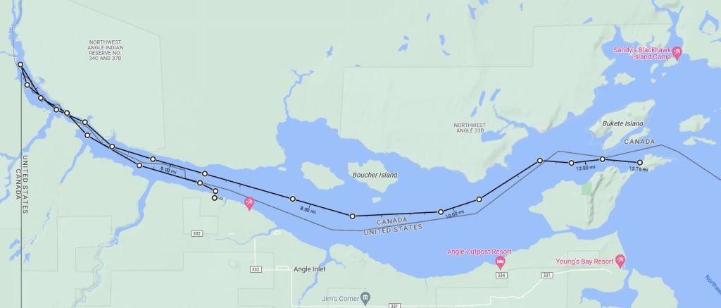
It’s almost unnecessarily hard to get to the Northwest Angle of Minnesota, the beginning of our route. My mom and brother, who live in Bemidji, were gracious enough to give us a ride to the start and then to shuttle our car and meet us at the end. Because this route follows the United States – Canadian Border, there’s some red tape involved. Our understanding was that all we needed was the RABC (Remote Area Border Crossing) permit and we’d be good to go. What we failed to realize is that this is only honored by Canada and not the good ol’ US of A. Hence we had no issues with Canadian customs, only our own domestic services.
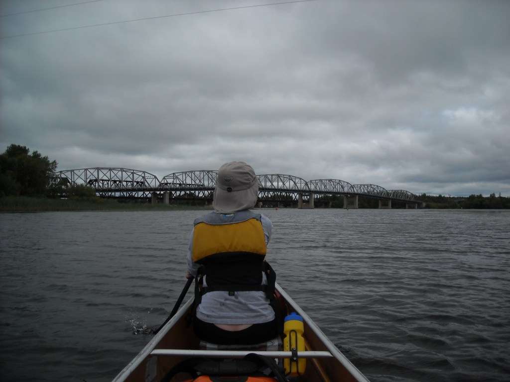
To get to the Northwest Angle of Minnesota we first had to cross into Canada and then cross back into the United States. The customs in the Northwest Angle is little more than a remote phone booth. After waiting in line with all the Minnesotans who have cabins on the Northwest Angle, we finally proceeded to Angle Inlet where we launched our canoe at 2 pm and began our trip. I’d heard there was a cut in the trees marking the United States – Canadian border west of Lake of the Woods (except I assume where there is prairie). I was quite determined to see this and so instead of heading east from Angle Inlet, we first paddled west to find this famed cut. First we found the triple border (Ontario-Manitoba-Minnesota) marker buoy. Once we got there we were a bit discouraged but upon turning around (we had been heading north but now turned to the south), our cut opened up.


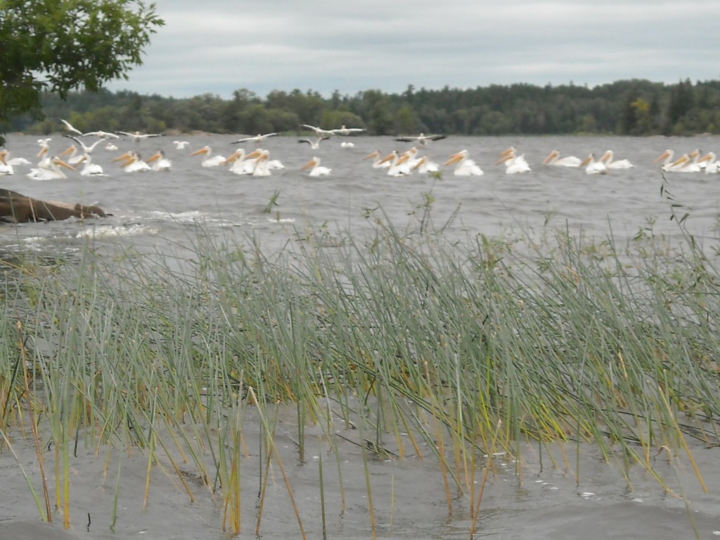
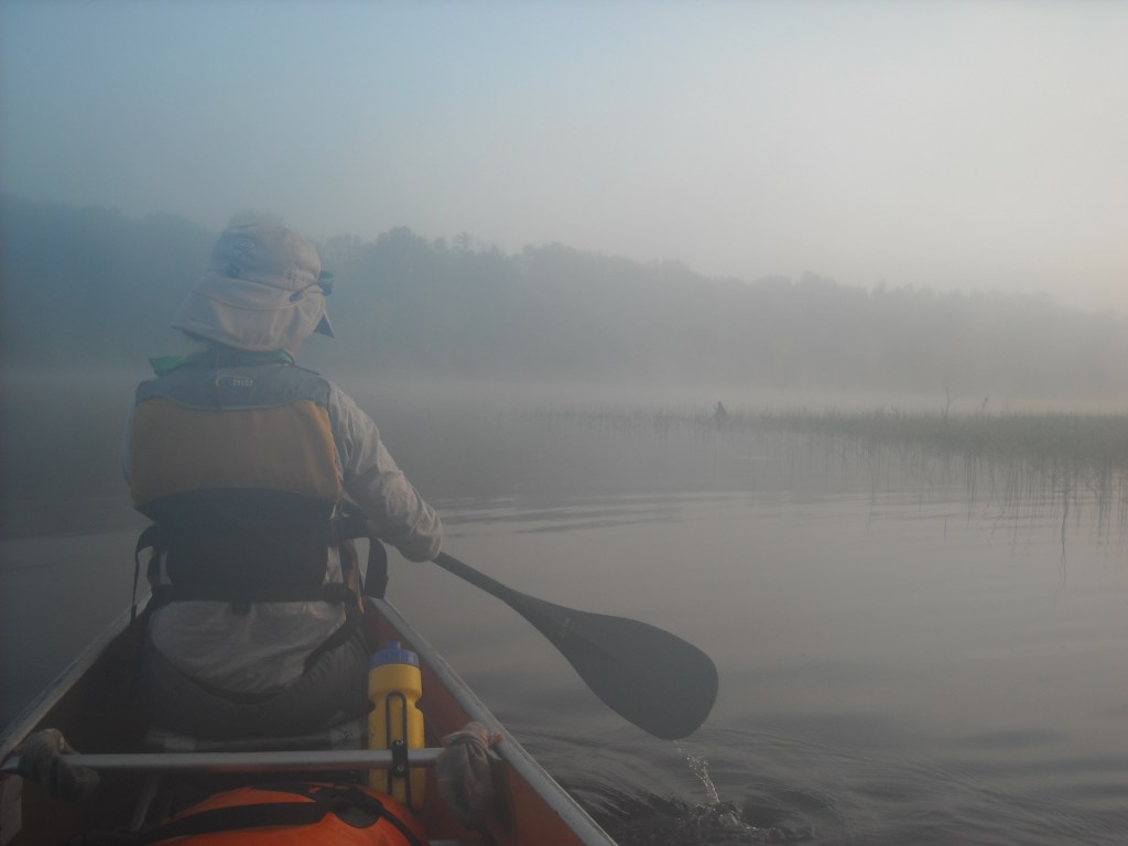
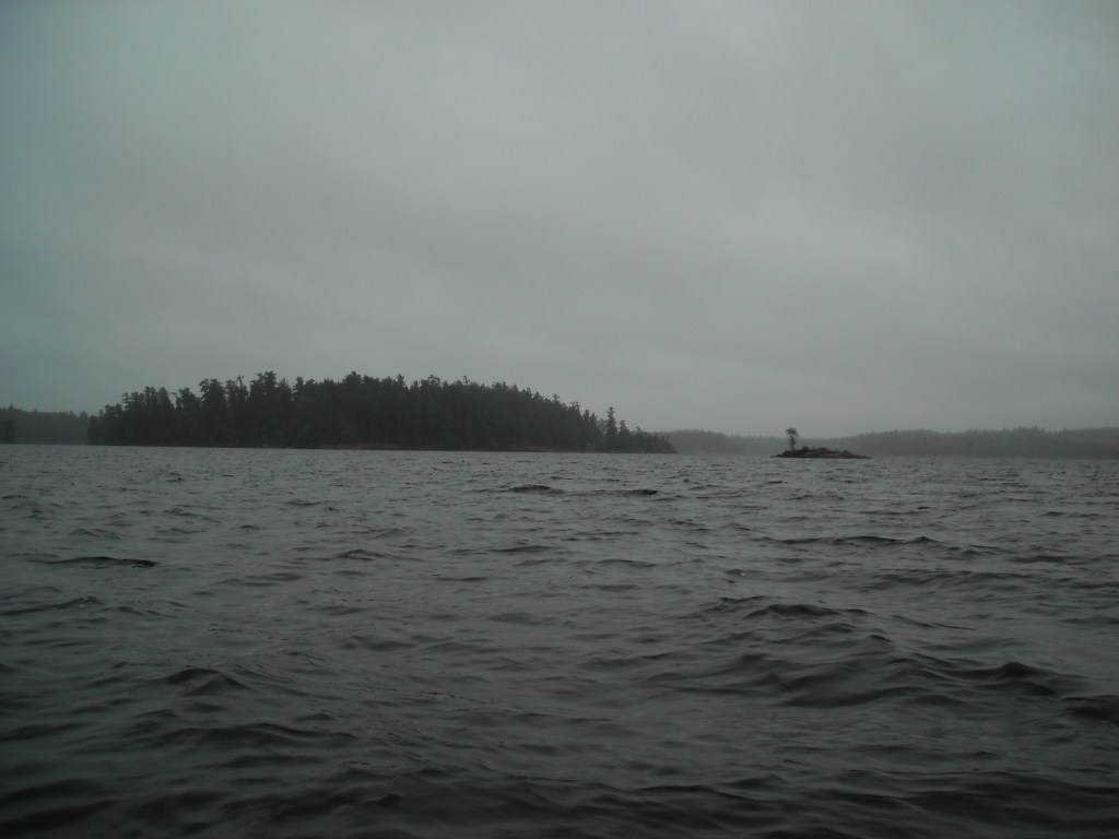
There was some chop out on Lake of the Woods and threatening clouds but fortunately the rain held for a few hours. There aren’t any designated campsites on Lake of the Woods and so as it got near the dinner hour we began looking for a suitable camping spot. We were nearing American Point when it began to rain and we decided to back-track a bit to where we had saw some people hanging out by their cabin. We asked if we could camp on their land and they kindly agreed.


Day Two 8/24/14: Lake of the Woods – Penasse Island to Firebag Island

Because we only had 15 days to do this trip, we had a previous agreement that if winds, and hence waves, were unfavorable for the mighty Lake of the Woods – some 70 miles in length and covering an area of 1,679 miles squared, we would skip this section and just put in on the Rainy River. We simply didn’t have time to be wind-bound and I don’t have the resolve anyway. Winds weren’t forecasted to be favorable. True, they were only to be 10-ish miles per hour, initially from the southeast and then swinging around to come from the west, but Lake of the Woods is shallow and kicks up big rollers even in modest winds. Erik was more determined than I to paddle the big waters and so we went for it, getting up early to begin our day when winds were lighter.
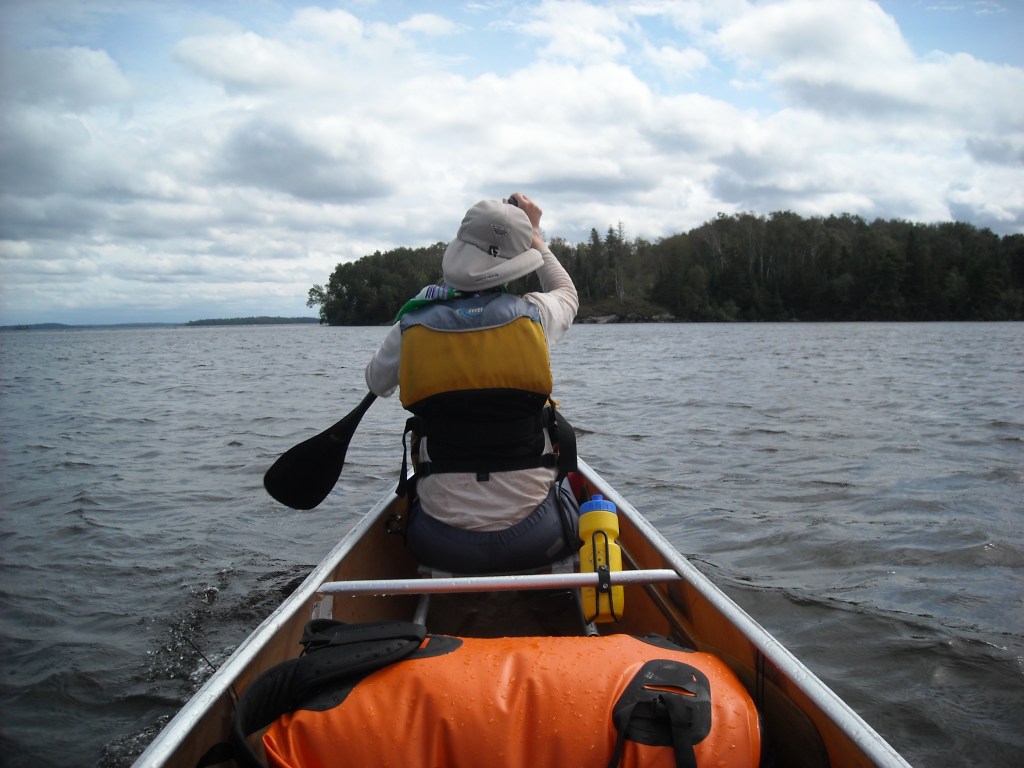
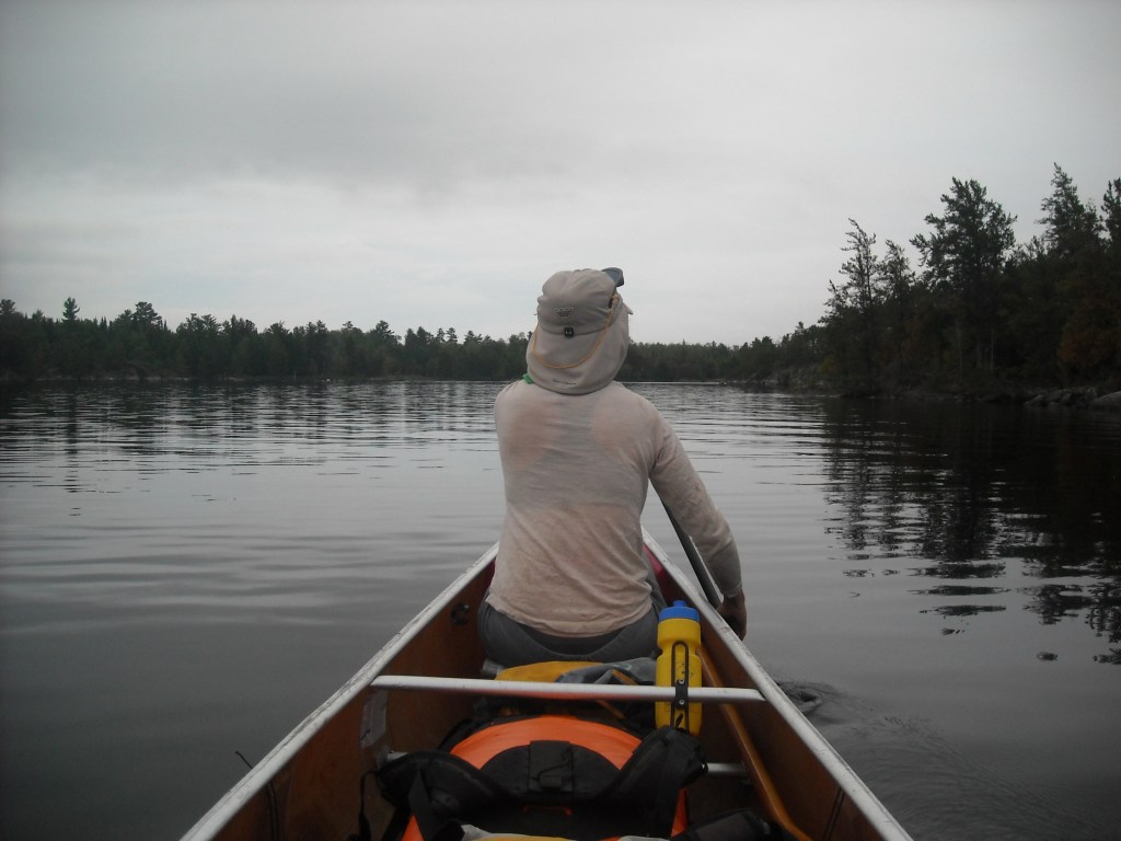
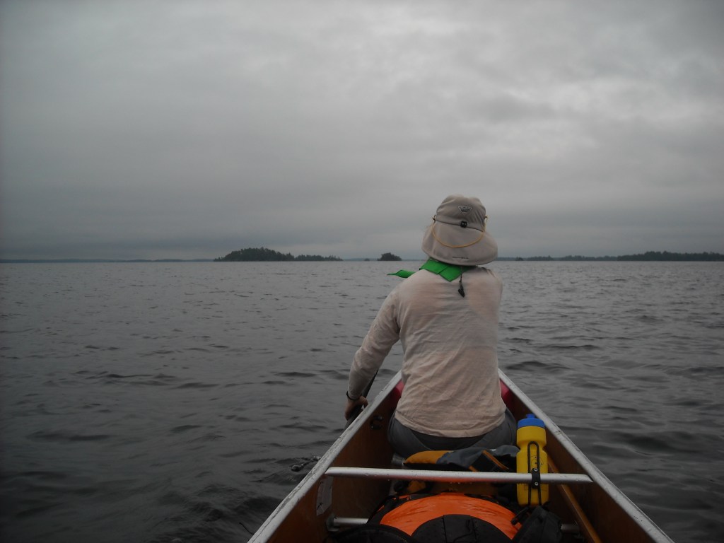
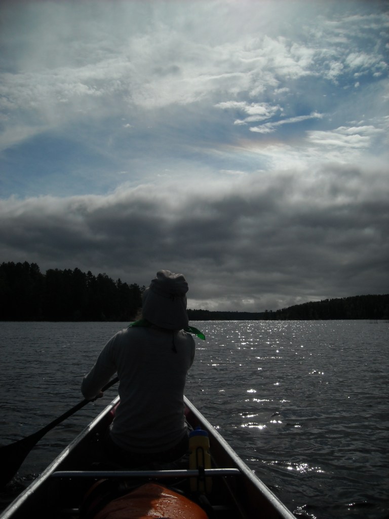
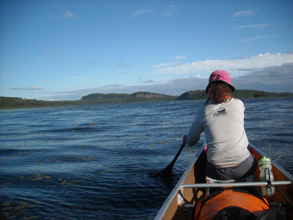
Emily took to the bow seat as my butt simply couldn’t hack it. We took as many breaks as we could while still making progress. For the most part we were island hopping along the main north part of the lake and were able to tuck behind and between enough islands (in the Canadian waters) that the wind wasn’t too bad. We also took more photos in the morning before the wind and waves really picked up in the afternoon.

I the afternoon we’d paddle with just abut all our strength, sprint style, between islands, then take a break. This wasn’t terribly efficient from an endurance standpoint.
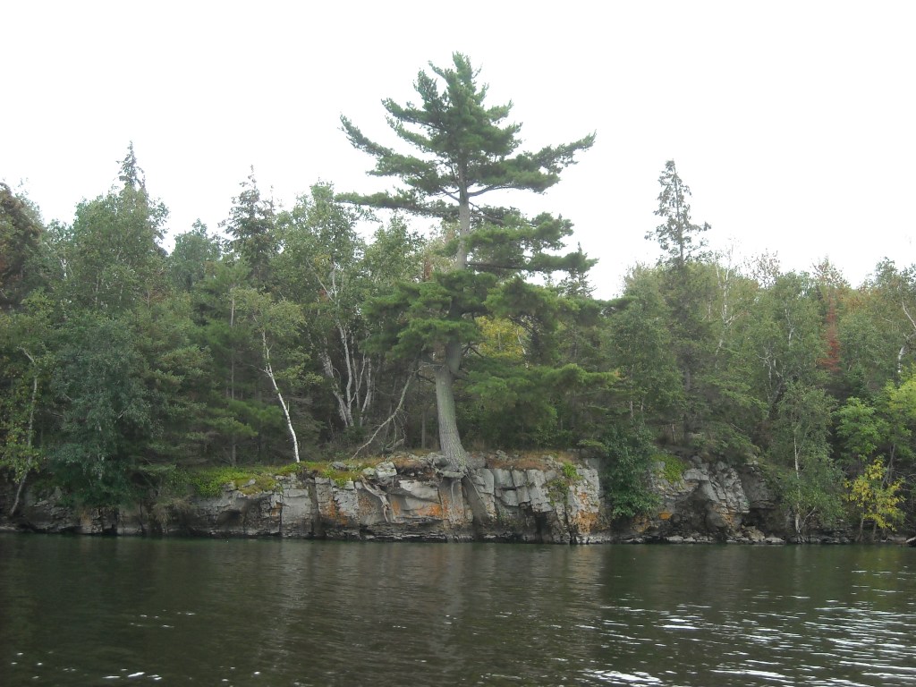
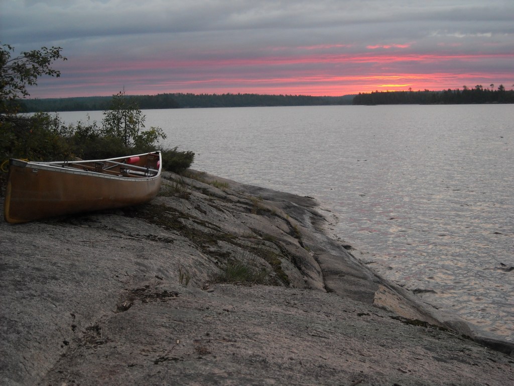
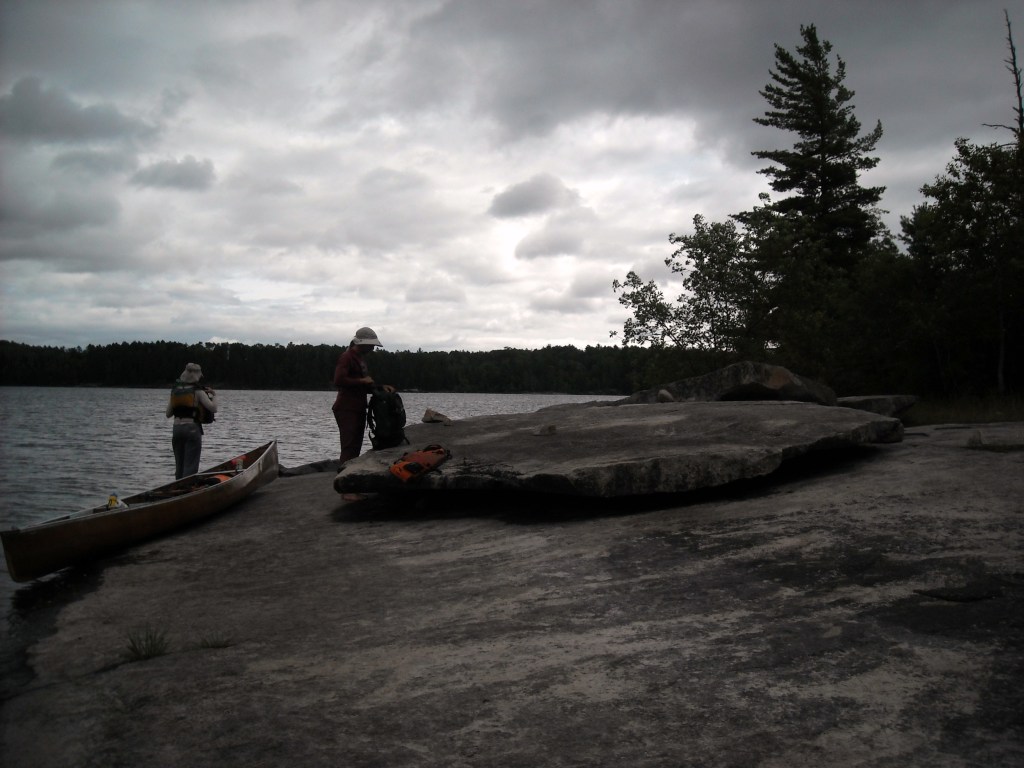
Even though we still had some daylight left, by the time we got to Firebag Island, we called it a day. Water levels were high and so many of the beaches I’d spotted on Google Satellite were underwater. When we found this rocky outcropping on Firebag Island, we decided this was it. After we stopped the chop settled down. Classic, but we needed rest.

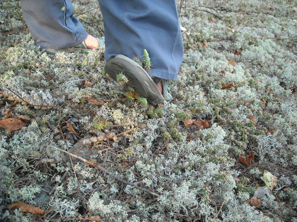
Erik and I went for a little walk on our island after dinner. It was fairly open without a lot of dense vegetation – perhaps because this island had some elevation – and then we found some cacti! Hardy tundra cacti.
Day Three 8/25/14: Lake of the Woods – Firebag Island to Nestor Island
So inevitably like a lot of things in life, we didn’t perfectly prepare for this trip. When we looked at google maps zoomed out there appeared to be a few big islands. I’m not sure what prompted me a couple days before the trip, but I zoomed in on the island route of Lake of the Woods on Google Maps and learned there were infinitely more islands than we had thought, some arranged in an interesting centrifugal pattern. Indeed, there’s over 14,000 islands on Lake of the Woods! Erik hastily printed out some Google Maps at work.
Day Three was rough. The wind was strong from the beginning. Between islands the waves came in sideways over the sides of the canoe. We all paddled as hard as we could, sprinting, to make it to the shelter of the next island where we rested to do it all over again. We kept at it like this most of the day until we could tuck behind the bigger islands.


By mid-afternoon the waves were getting bigger and bigger. We island-hopped for as long as we could, seeking refuge behind the big Bigsby Island until we were left with a three mile expanse between us and the south Canadian shore. The crossing looked unsafe, so we pulled up on Nestor Island and planned to camp there.
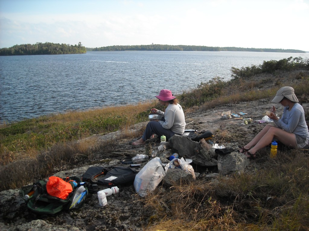
This was a terrible small campsite that smelled like dead fish. There seemed to be some swamp on this island and a bunch of dead small critters. Where the thick granite slab ended, the vegetation was exceedingly thick. Erik spent some time breaking bushes so we’d have enough room to set up our tent and get our stakes in some dirt. We didn’t want to back-track for a better site. After dinner we debated our plans for the final crossing and called our friend Craig, who could navigate the Internet technology with an adeptness not allowed by my mom in her seventh decade of life. He noted the wind would be calmest at midnight. We assumed it would take a couple hours for the lake to settle down.
Before bed we looked out at our crossing and could still see white caps. We’d have to canoe parallel to those waves. If we swamped and couldn’t get back in our canoe, hypothermia would overtake us after a few hours in the 70 degree water, trapped, too far to swim to shore.
Day Four 8/26/14: Nestor Island on Lake of the Woods to near Frontier, Minnesota on the Rainy River

We set our watches for 4 am and settled in for a fitful night of sleep before our alarms sounded. We arose and packed up our sleeping bags, tents, and other gear into the canoe in the dark, choking down a bit of cold breakfast in the process. The sun wasn’t yet on the horizon and there was no moon. It was too dark to determine if there were still white caps on the lake. This didn’t detour us. We loaded our canoe, promptly got in, and paddled away from our tiny island.
On the leeward side of our island the water was calm, but once out on the open lake we could feel, but not see, the rollers. Traveling by compass only, we began our traverse with each wave knocking us off balance. We were as good as blind.
None of us said out loud what all three of us were thinking simultaneously: if we continued with this nighttime crossing we were going to die.
Finally one of us suggested we return to the safety of our island. In unanimity and relief, we turned our canoe back around, thankful we could still make out the faint outline of our small island of safety. Once back onshore we knew we had skirted death.
It was only a couple hours until daylight and so we laid out our sleeping pads and bags on the bare rock and tried to sleep without success.
At daybreak we arose. It was difficult to determine if there were still white caps out there on our three mile crossing. I was ready to go either way, at least now we could see the waves coming at us.
I was the most determined of us to not be wind-bound. There was no way I was going to spend the day on this stinky little island.
So we loaded back up our canoe and took off.
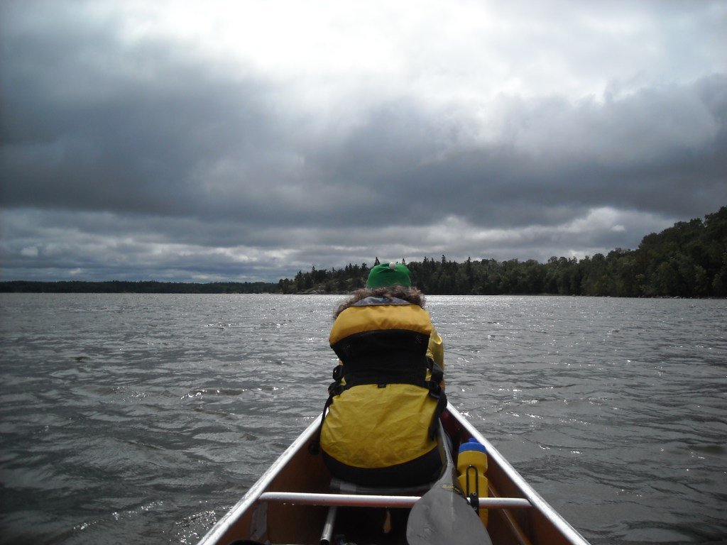
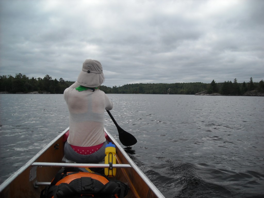
Once out on the open water, away from the protection of the islands, the waves picked up. We briefly rode on top of each one before falling into the trough. Emily paddled in bow, me in the middle, and Erik in the stern. We took long strokes, maximizing our paddle contact with the water to steady the canoe and allow for instant bracing should we get off balance. To maintain that contact with the water, I paddled on the left side for the entire crossing while Emily and Erik switched sides as needed for steering.
Down in the trough, we couldn’t see the distant shore, only the water in front of us. A couple times the waves broke under us, and the canoe squirmed. We braced hard and kept upright.
My breath and heart rate were higher than usual. My legs were tight against my foot brace. If we made one mistake, if we swamped our canoe, there was no way we could do a self deep water rescue in these waves. We would die of hypothermia as the waves slowly pushed us to a distant shore some ten miles away while we floated along.
After an hour of paddling and bracing and heavy breathing and worry, we reached the safety of a small harbor on the Canadian spit of land that juts out towards Snake Island. The water was calm here. We could finally relax. And my knees were so stiff I could hardly stretch them out.
It was never our intention to do something so stupid. We’d highly underestimated the risk.
“That was the dumbest thing I’ve done since climbing Half Dome!” I realized.
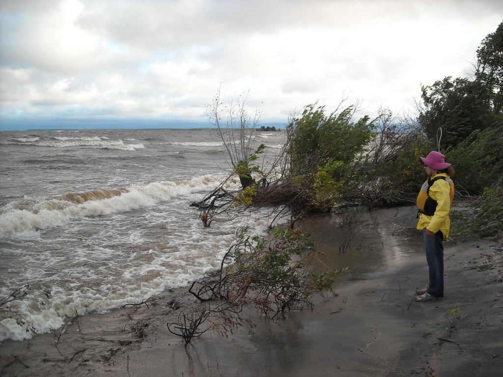
We beached our canoe on the leeward side of the spit. We could hear the wind howling and the waves crashing ashore on the other side of the spit and we hobbled over to investigate and take some photos.

From the safety of our spit we had a decision to make. To officially paddle the entire border we would need to paddle out into the waves south for two miles until we could tuck behind a long barrier island. We knew we were running short on time and were already behind schedule. Hence, we sought an alternative which was to paddle behind the spit we were on to the Harris Hill Lake of the Woods Resort and then either try to get a ride or do a long portage to the Rainy River. After much debate, we decided on this option. We paddled down to the resort and were lucky enough to get a ride with our canoe and gear, to the US Customs at Baudette.
We had had a brief phone conversation with my mom when we were on the stinky island and when she and my brother crossed back into the US they had been read the riot from US customs and told my mom that we needed to check back in to US customs when we got off Lake of the Woods. So we did. We left our canoe and paddles out back and walked in with our giant soaking wet bags.
What ensued was rather comical. Fortunately we had our passports. The agent searched our big dry bag. After finding nothing, he decided to leave our wet nasty bag alone and after an intimidating hour we were back on our way, with the strict instructions that we needed to check back in with customs in Grand Portage when we were done with our trip. He apparently wasn’t too concerned with all the drugs we were hiding in our paddle shafts that we had procured between island # 2,354 and #2,357 in our tippy canoe:)
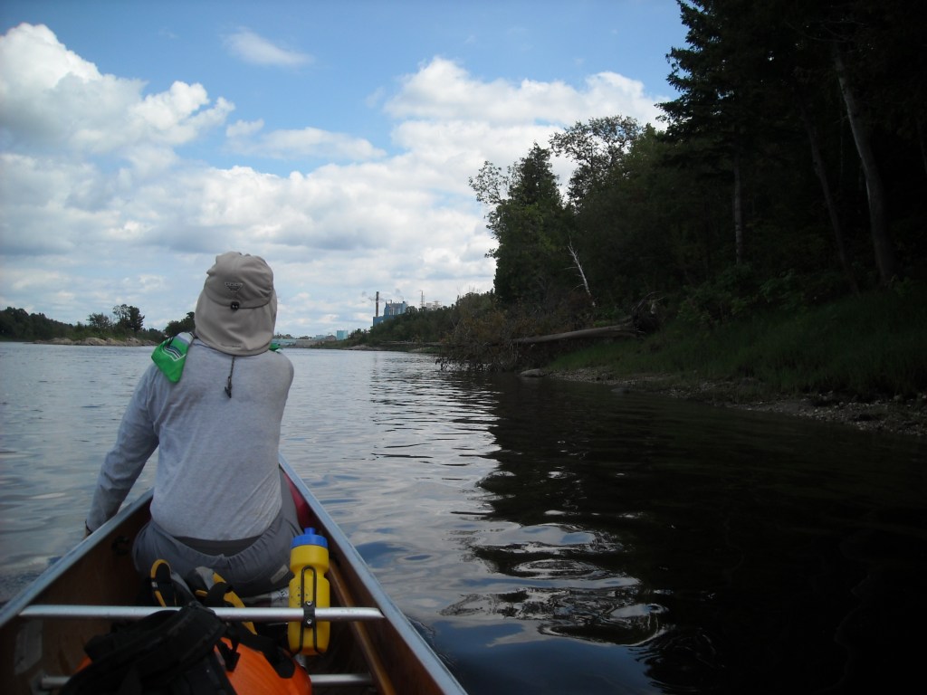
We put-in on the Rainy River near the international bridge and even though it was cloudy and we were paddling upstream, the wind was at our back and for the first time in days we could relax and make good time.
As the day wore in it got progressively more sunny. By dinnertime we were searching for a spot to camp but there were houses on either side of the bank. We looked for anyone who might be out so we could ask if we could stay on their property. Eventually we found someone on the Minnesota-side, a retired guy who had a tinyhouse cabin and lots and lots of mowed land. He was staying there with his girlfriend. He was more than willing for us to camp on his property. He even had an outhouse back up a ways in the woods.
As we sat around talking, he asked Emily where she got her Finlandia hat and I wished we had captured it for our Minnesota Finlandia Promo Video. I suspect he had different political views than us but I greatly appreciated his comment about mowing so much land that I found rather metaphorical: “I often wonder why I mow so much. It takes a lot of time and uses a lot of gas. It sure is nice though.”
Day Five 8/27/14: Farther up the Rainy River to the confluence with the Big Fork
Finally we had ourselves a bluebird day.
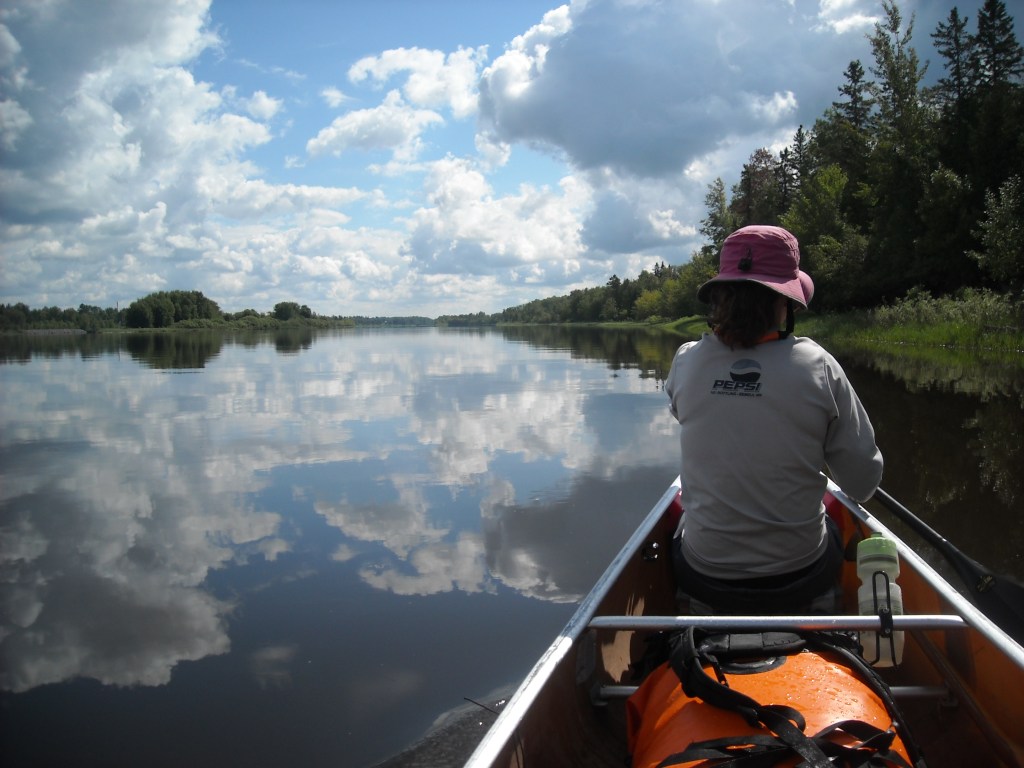
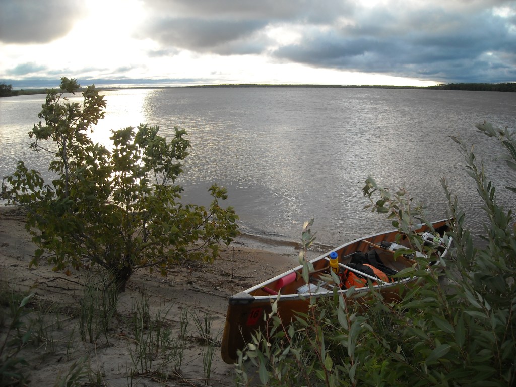
This day was easy by all standards. We passed by Minnesota’s undeveloped Franz Jevne State Park. We were looking for a good place to stop but found none there. Next was Manitou Rapids. These were short and we weren’t quite able to paddle up them so we portaged along the rocks on the Minnesota-side. We didn’t encounter any other rapids. By the time we reached the confluence with the Big Fork River, the sun was getting low in the sky and we decided to camp on some muddy ground where the rivers met. We used our canoe as a picnic table.
Day Six 8/28/14: Confluence of the Big Fork on the Rainy River to Rainy Lake

We got an early and excited start to our day as today would mark the beginning of our wilderness trip. From here on out there would be designated campsites until we got to the Pigeon River.
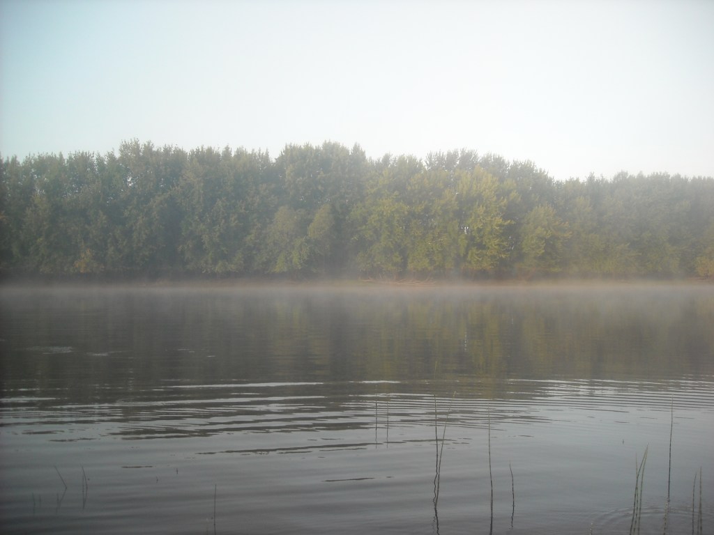
As it warmed up, the fog lifted. The breeze was still light.

We made good time and before noon we were approaching the big dam and infrastructure at International Falls.
There’s no established portage around the dam but we got out just before the wastewater treatment plant where we found an established social trail. We clamored up to 9th Avenue and took this to 2nd Street which brought us by Smokey Bear Park.

We continued portaging and eventually put back in at the east end of 2nd Street. Then we stopped at Voyageurs National Park Headquarters where we secured a permit for a campsite (R26, aka Sunrise Point) out on Rainy Lake. We put back in on their nice dock and paddled through the marked channel.


We paddled by houses, lots of houses, and some were probably just cabins that were twice the size of our house. Although it was overcast, we were glad the winds were mild. Eventually the mini-mansions came to an end and we were in Voyageurs National Park. It was evening by the time we made it to the R26 campsite, a much welcome reprieve after our make-do site the previous night.
Day Seven 8/29/14: Rainy Lake to Kettle Falls Motel

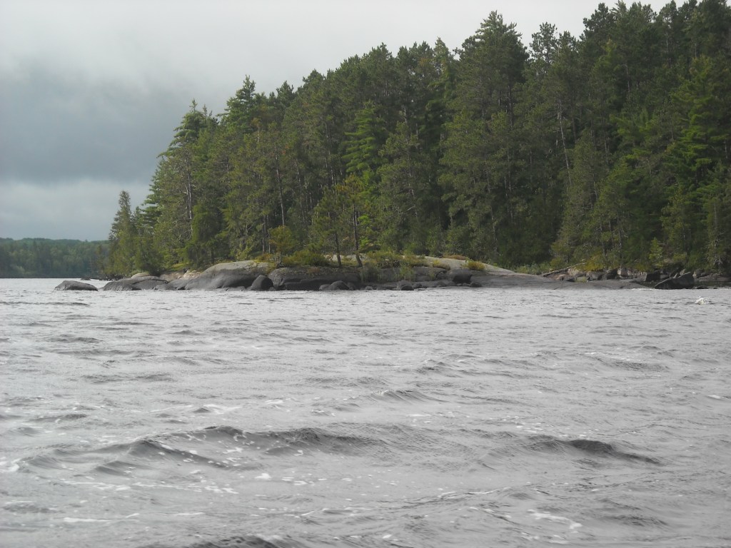
The next morning was cloudy but at least there wasn’t much wind. We hugged the south shore of Rainy Lake, tucking behind islands whenever we could to still cover a relatively short distance and paddle around the peninsulas.


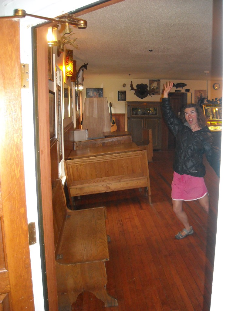
Given the mild winds, we were really able to cruise the twenty plus miles to the Kettle Falls Hotel where we’d reserved a room and our only food re-supply of the trip. We arrived there by mid-afternoon. It was a bit rainy, so we stayed inside, checking out the hotel and having dinner at their restaurant.
Day Eight 8/30/14: Kettle Falls Motel to Loon Lake

The previous day’s clouds had blown over and we got an early start.
Sunny days without wind usually meant a lot of photos and quite frankly, more shenanigans.
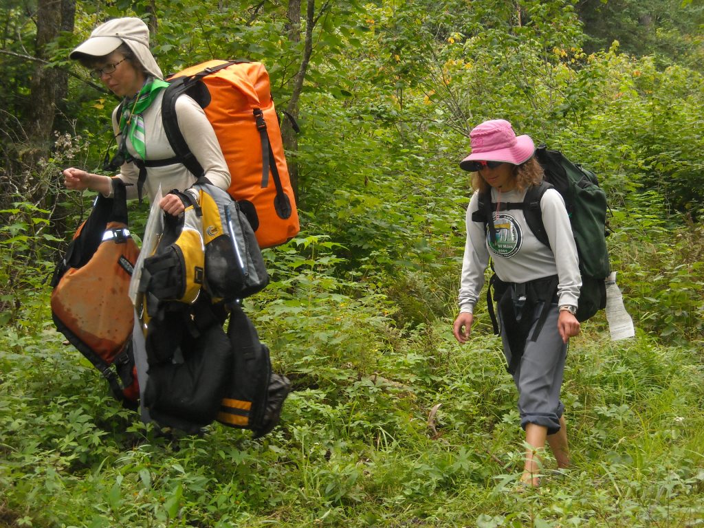
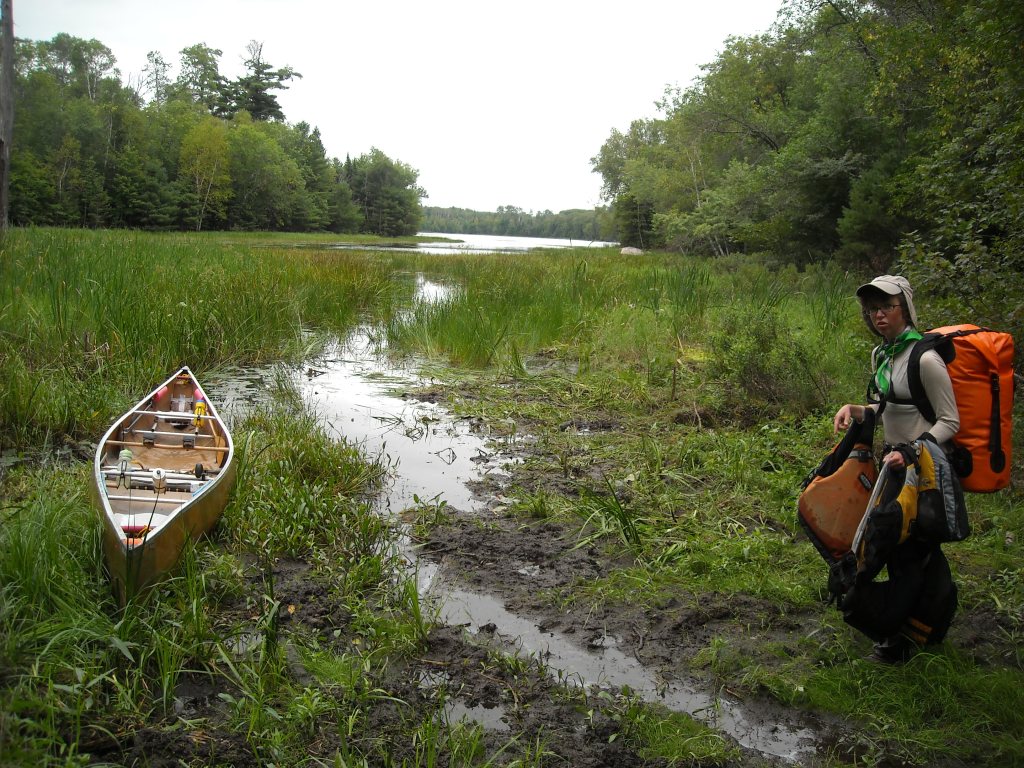
We had some route choice options at this point. We debated how important it was to stick to the exact border versus cutting off some distance and staying out of the big lakes. We’d already gotten a ride for some of Lake of the Woods so we decided to take the Grassy Portage to cut off a few miles.
From here we were closing in on the Boundary Waters and nearing the end of our time in Voyagers National Park. We paddled through many small lakes and channels.


And then we saw this sign…


For both Voyagers National Park and the Boundary Waters we used the National Geographic Topo Maps. These were incredibly frustrating for paddling the border as there’s a wide line exactly through the border and Canada is faded out. Hence it was often difficult for us to follow where we were.


After we used the dock on the downstream end and no one seemed to notice, we planned to not use the dock when we put back in on the upstream side. The put-in was super muddy again and I had so much water in my pack (this was because we wanted to limit our exposure to our Aquamira chemicals over the duration of our trip). As I got ready to get my pack off, I suddenly found myself turtled. So much for being clean after my one shower on the trip! At least hubby didn’t laugh at me and nicely picked me and my giant pack up in one of his most chivalrous moves ever. Maybe we should’ve just paid the fee.
We didn’t paddle too much longer and when we found the farthest west site on Loon Lake unoccupied, we claimed it.
Day Nine 8/31/14: Loon Lake to southeast end of Lac La Croix
After a brief, relatively short paddle across Loon Lake, some more channel, river, and another brief Motor Portage which didn’t leave me turtled, we entered into Lac La Croix where we’d paddle for the entire rest of the day. We had first lunch at a sandy campsite on the west end and then the wind picked up.
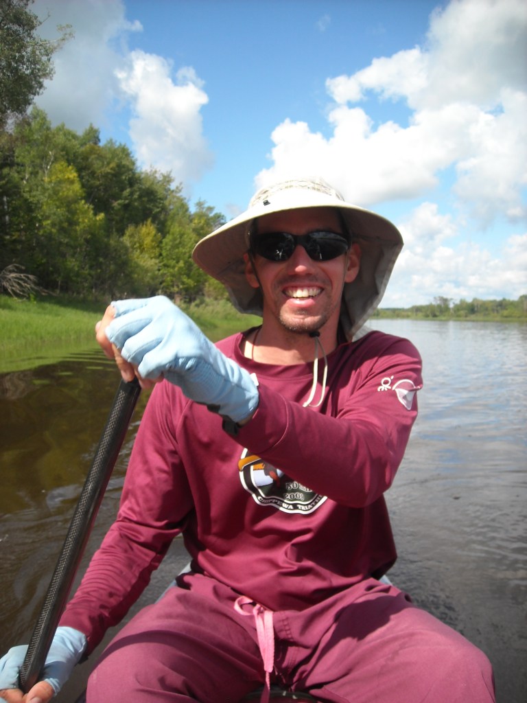
We paddled north, then began making our way northeast, and finally east. The waves and the outdoor exposure were getting to all of us and collectively we had our energy low-point of the trip. It was only early afternoon and we’d wanted to quit hours before. Again we debated how closely to follow the border versus tuck in behind some islands and we chose the latter. Hours after we really wanted a break, we paddled into a sheltered bay to check out the campsite and there Maroon Man nearly collapsed in the shade.

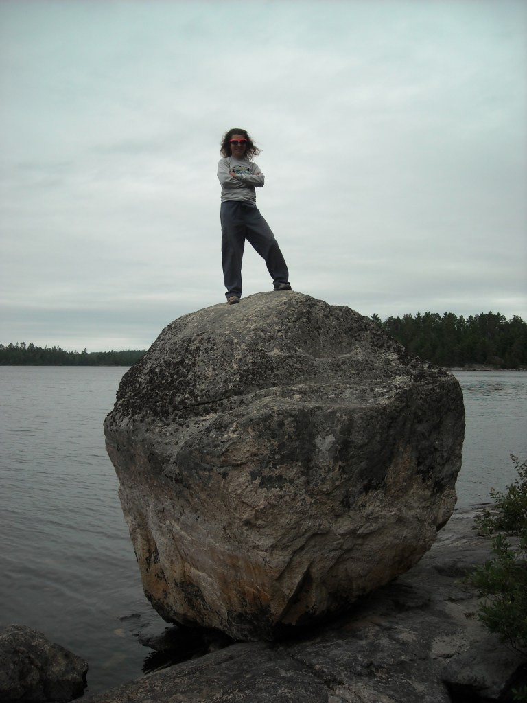
Alas, it was only early afternoon and we still wanted to make some miles so after a respite, we battled into the headwind some more until we conceded to its power. The campsite where we stayed was magnificent with more camp furniture, a great bouldering rock, and the most amazing puffer mushrooms.
Day Ten 9/1/14: Southeast side of Lac La Croix to west side of Basswood Lake
Despite some low clouds, we woke with renewed energy. The only bummer was knowing that we had a muddy portage around the Bottle Rapids through Canada coming up early on. Erik and I had done part of this route in the opposite direction back in 2006 and I didn’t forget the mud. Somehow it wasn’t quite as bad as I remembered, or perhaps that’s only cause by now I’d done the Mud Pond Portage in Maine.

By the time we got to Curtain Falls, the clouds were lifting ever so slightly.
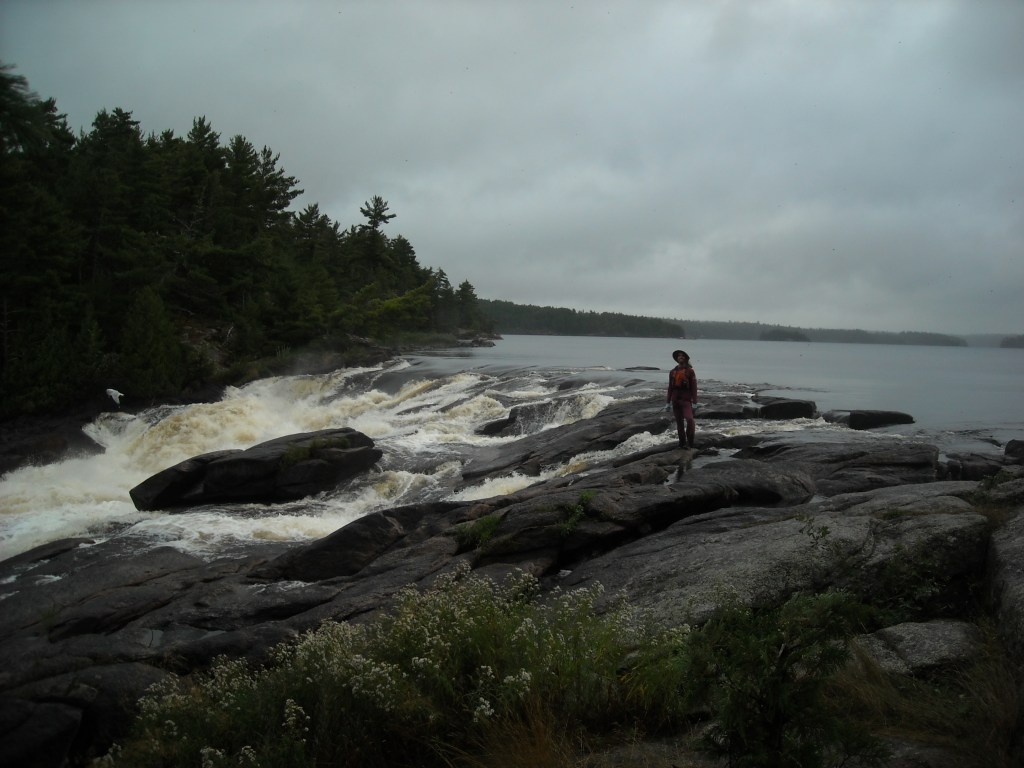

Next up was Crooked Lake where we paddled through a series of bays named after the days of the week. The wind picked up and we had some waves, but nothing too bothersome.
I’m not sure what happened after the Table Rock Campsite but I’m pretty sure that endurance mode crept in. We seemed to forget that we had a camera along, even though it’s blue case was strapped to a thwart. The sun came out. We simply kept paddling the bays and up the Basswood River. We portaged Wheelbarrow Portage and another one that was almost hidden on our map and by the time we got to Basswood Falls Portage, it was dinnertime.
We paddled out into Basswood Lake and found a nice campsite on the first peninsula that had a tiny spot for swimming and was a giant rock slab. Our tent site was at the top of the slab and I remember sitting out with Erik on that slab as the stars came out.
Day Eleven 9/2/14: West side of Basswood Lake to BWCA Campsite #338
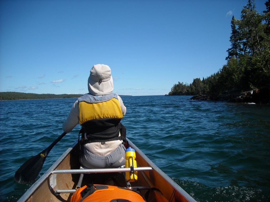
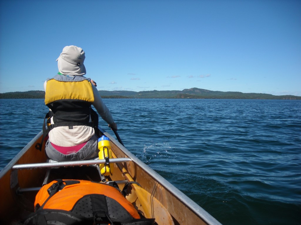
We were greeted to another sunny day and relatively calm winds as we paddled northeast along our peninsula in Basswood Lake, then back south, then northeast again to the end of Basswood Lake and southeast to Prairie Portage. Erik said we’d already taken enough photos of trees and lakeshore and waves and cute islands and we were in cruise mode so we didn’t take a single photo all day. I guess there was nothing of note.
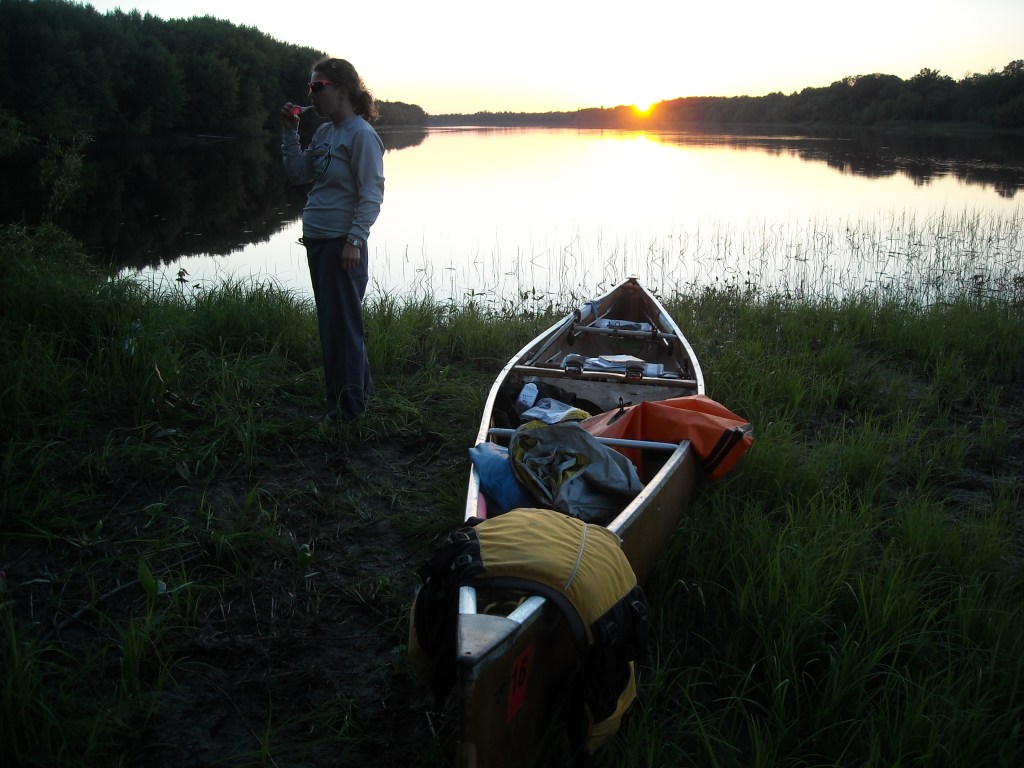
After Prairie Portage, there were a few more smaller lakes until we got to Knife Lake where we were treated to quite the tailwind and we simply cruised. The going was too good to stop. But alas, eventually the sun was waning and it was time for us to find a campsite. We debated stopping at Ottertrack Lake but then decided to go a bit farther, finding a site that had a “couple” rooms (this got us into a whole conversation about Boundary Waters campsites with multiple rooms), and a lackluster water access. This site was on a small nameless lake or bay. By the time we’d finished dinner, it was about dark and so we crawled inside our tent and went to sleep.
Day Twelve 9/3/14: BWCA Campsite #338 to South Lake
Again we woke to more sunshine but also had some fog.


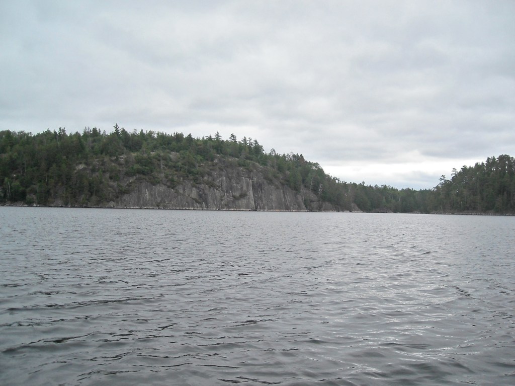
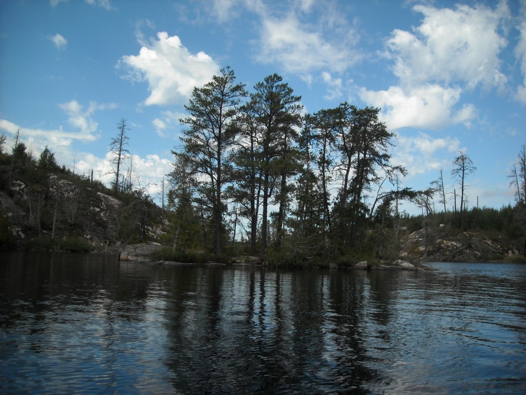
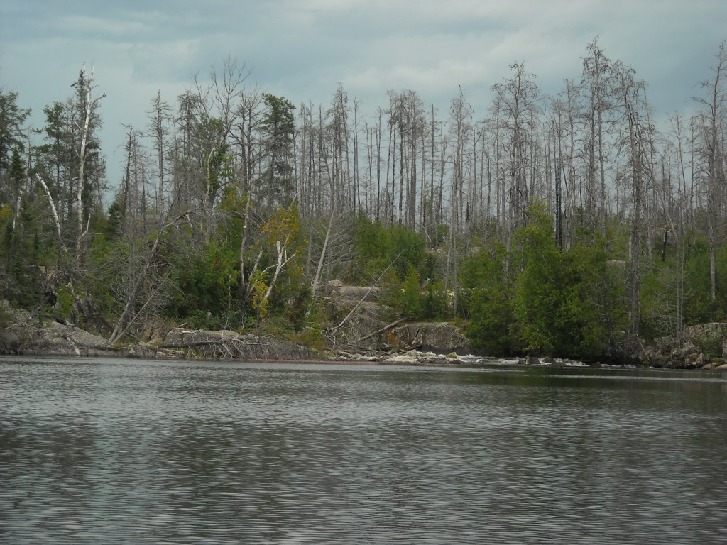
Today I would finally see Saganaga or “Sag.” I’d heard this lake talked of for years and my parents had a photograph of it in our living room when I was a kid. As we paddled on to Sag, we were greeted by forest fire damage, exposing the rocks in the gradually increasing topography that characterizes this farthest northeast section of the Boundary Waters.

Then we turned south and began paddling up the Granite River, getting ever so close to our height of land for the trip.
As we paddled and portaged the clouds were building, often threatening but dropping almost no rain on us.
Despite the threatening weather, we really liked the area. Maybe it was because it was more clear from the recent fire, or maybe because we were farther north, or maybe because we just felt that we were on higher ground. The rocks, the trees, and the flora were all just interesting.
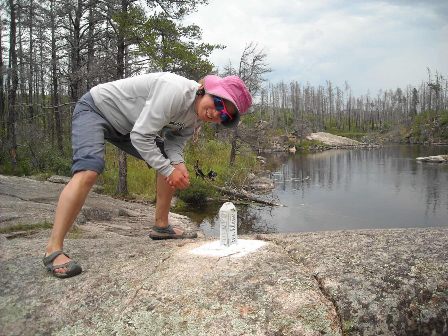
Then on one of the portages we found some old border markers.

Emily and Erik liked the Magnetic Lake name and they were surmising all kinds of stories about how the lake got its name and its relation to magnetic fields.
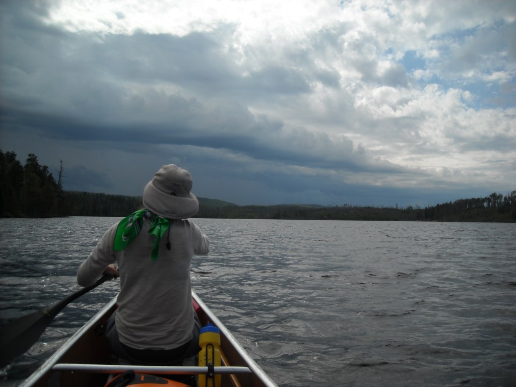
By the time we paddled onto Gunflint Lake we felt like we were getting somewhere – but the clouds were also getting more threatening.

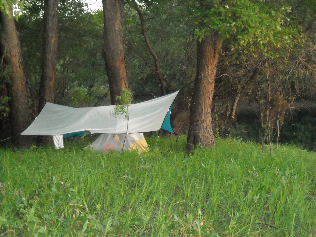
Gunflint Lake is long, like seven miles, and we debated stopping at Gunflint Lodge but we had plenty of food and sometimes it’s hard to take brief breaks in civilization so we kept paddling. We thought there was a storm brewing so towards the end of Gunflint Lake we found an unoccupied island campsite and stopped there and cooked our dinner under Emily’s tarp while it rained a bit. Then the sky cleared and we we figured it was time to push on as it was barely dinnertime.
There’s a funky sandspit heading into Little Gunflint Lake that somewhat threw us but we found the channel and enjoyed our evening paddle.
We passed a bunch of campsites, not really sure how far we’d keep going, all of us constantly debating stopping for the night versus continuing on.
After paddling all of North Lake it was getting dark and we made a plan to take the first campsite on South Lake if it was open. After a bit of a muddy portage over the Continental Divide (we noticed that the western part of the Boundary Waters has less topography but is rockier near shore while the eastern half has many more hills but a muddy shore), we stopped at the first campsite on South Lake and cleaned off our feet in the water. We had just enough time to set up our tent before it got dark.
Day Thirteen 9/4/14: South Lake to South Fowl Lake
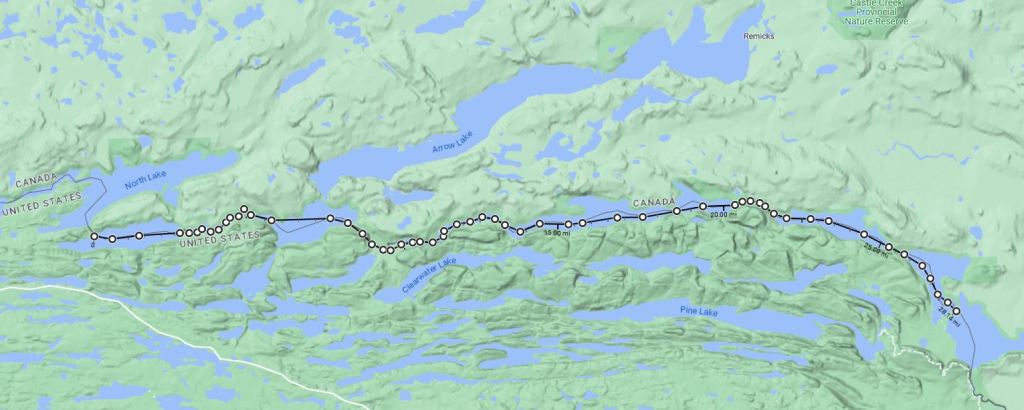
We rose to brooding clouds but that didn’t stop us from an early start. Today we’d finally make it to our height of land and from there it’d be all downhill to Lake Superior!

Once out on the water it rained but it didn’t last long and then slowly the skies cleared.

After a short portage that we had a bit of difficulty locating, we headed up the narrow stream towards Rose Lake.

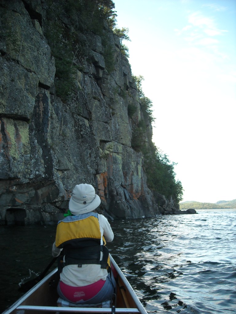
The cliffs above Rose Lake are fairly notorious, largely because there aren’t many cliffs in Minnesota. I’d been stoked to get to Rose Lake for years but it turned out the best views of the cliffs were back to our west. The Border Route Trail goes up on top of the cliffs. We had significant difficulty locating and then following the long portages between Rose and Rove Lakes where our zoomed-out map and border shading exactly in the area we needed it most, wasn’t terribly clear. After taking the wrong route a couple times, eventually we made it to Rove Lake.
Rove and Watap Lakes are at the same elevation and drain west back into Rose Lake (as does South Lake) and from there north to Arrow Lake and down the Arrow River which joins with the Pigeon River after the take-out on the Grand Portage Trail. Between Watap and Mountain Lakes we had an 89 rod portage that brought us to the start of the Pigeon River. From there we had a few short portages to Moose Lake and then another one to North Fowl Lake. By now the sun was out in full force and it was only mid afternoon.
Even though it was relatively early in the day, we camped on the island between North and South Fowl Lakes since it was a legit Boundary Waters campsite and we weren’t sure what we’d find downstream on the Pigeon River.
That night as I lay under the sleeping quilt trying to fall asleep, my feet burned something fierce. I wondered if they’d gotten too much sun that day, but in my Keen sandals they’d been getting sun the whole trip so that didn’t totally make sense.
Day Fourteen 9/5/14: South Fowl Lake to old hwy 61 on Grand Portage Trail
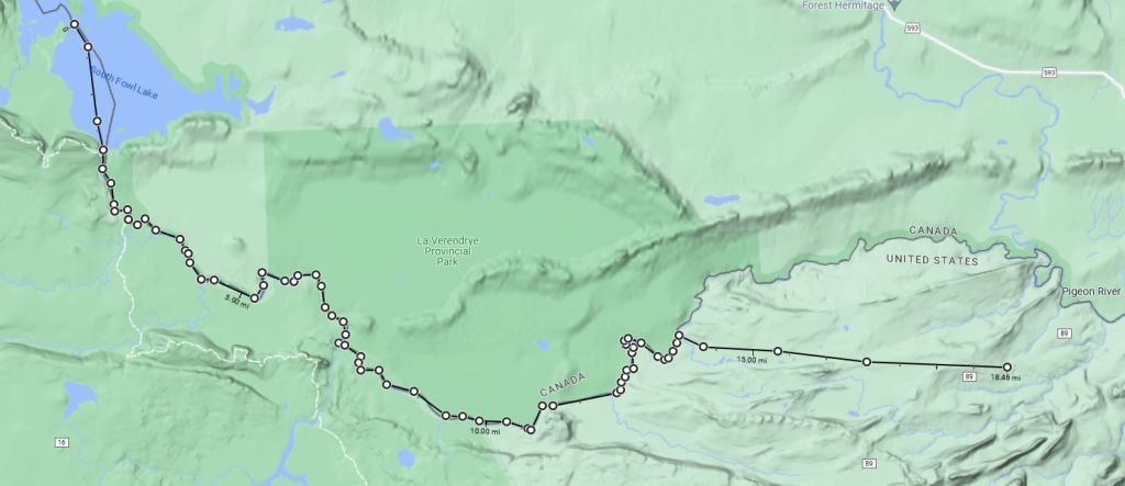
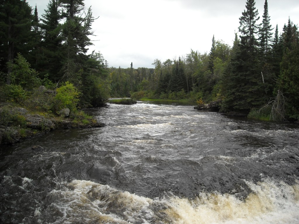
Today was our day to paddle the Pigeon and embark on the Grand Portage. Owing to its inaccessibility to roads, the Pigeon is rarely paddled and there’s not a lot of info about paddling it. We’d heard that if water levels were low it would be a drag.
After a very easy and short paddle across South Fowl Lake, we arrived at the outlet and a dam on the Pigeon River. We’d done some homework on this part of the route, but not enough. We portaged on a large man-made boulderfield on the right (west side) of the dam. I’m not good at boulderfields and this was difficult. When we went to put back in on the Pigeon, it was incredibly small, boulder and rapidy.
We didn’t make it very far before we realized this wasn’t exactly canoe-able. Emily and I hopped out of the canoe and began bush-walking through the Canadian woods while Erik stayed in the river, literally in the river, walking the canoe through minor rapids. At one point we had gotten ahead of Erik and saw there was a class III drop coming up. We yelled to Erik and now he took to the woods – trying to bash the 20 foot canoe between trees and shrubs. Sometimes he could yoke it, but often he just pulled it with brute force.
Finally the river settled and was deep enough that we could paddle comfortably without worrying about getting hung up on rocks.
After the trip, when we talked with some friends, we learned that there was a portage in Canada that we had missed. It took us a long time to find it but eventually we did on hillmap.com, but only on the CalTopo layer.

The sun kept shining and the land seemed to be gradually giving way. Other than an inaccessible completely undeveloped shoreline with thick vegetation, the upper Pigeon River is clearly Minnesota’s best-kept paddling secret. We were largely mute other than occasional “oohs” and “aahs” as we rounded the gentle bends of the Pigeon.
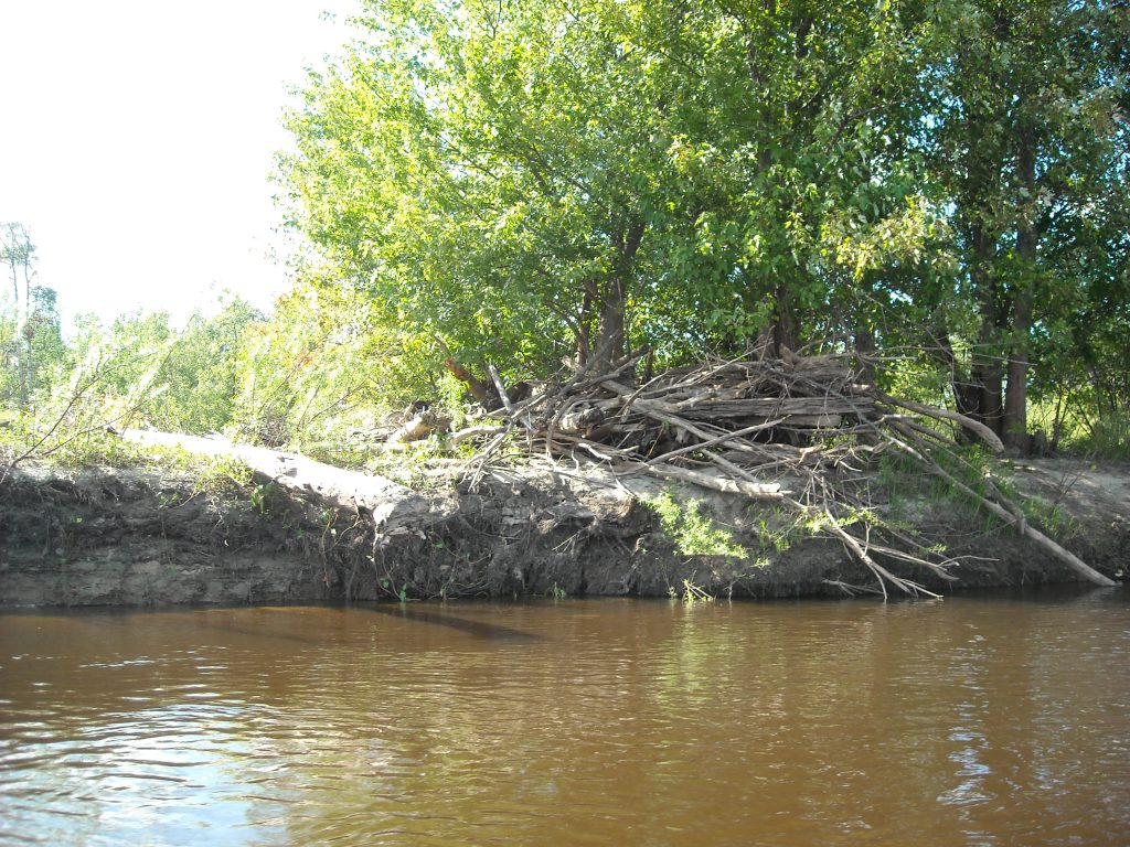
By now we were getting hungry and the best place we could find to stop was on a beaver lodge. Hopefully the beavers didn’t mind when we peed on them:)

But alas, all good things must come to an end (perhaps that’s what makes them so good) and soon we found ourselves at Partridge Falls where we had a short portage.

Then only a couple miles farther downstream we came to the Grand Portage. I was really tired of having wet feet all the time so I dried my Keen sandals as best I could and then put on some dry socks.
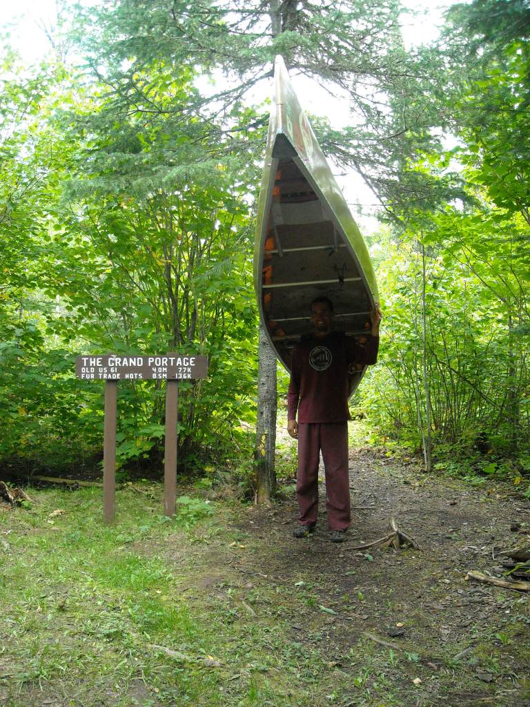
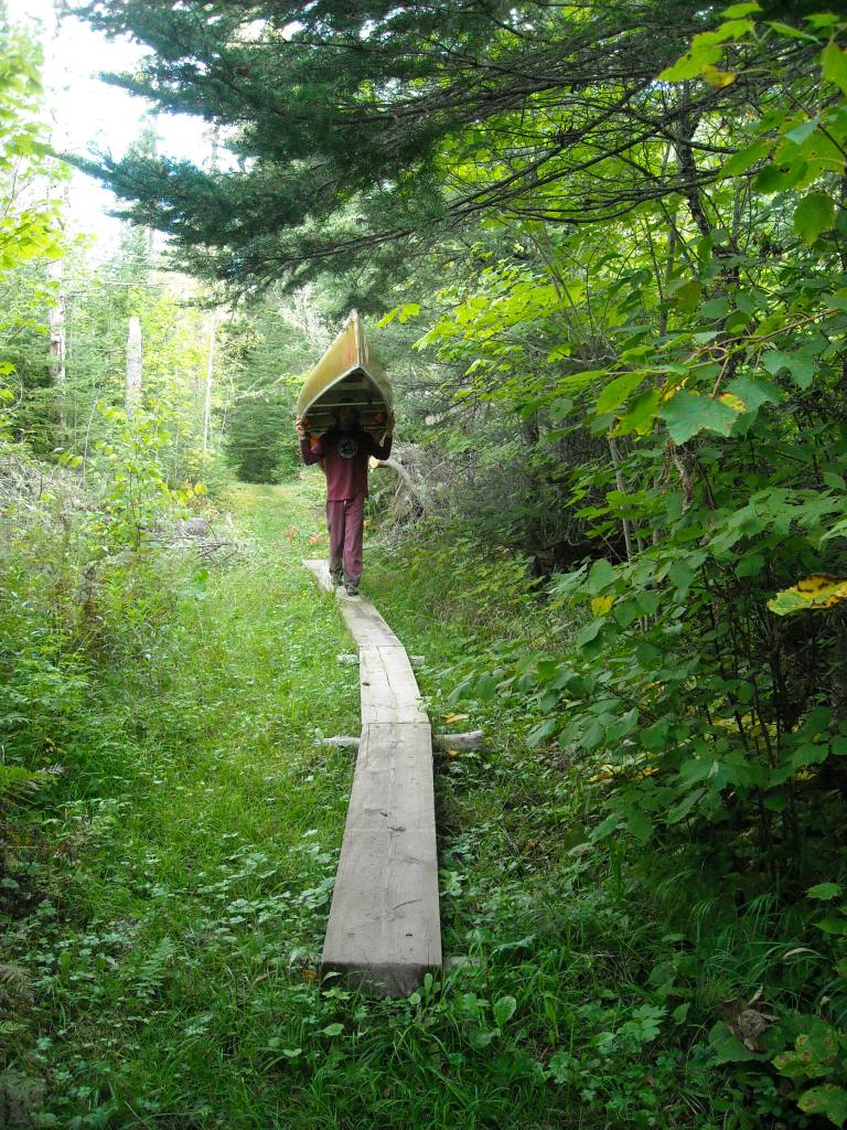
The Grand Portage Trail was very flat and fairly wide – about 10 feet in width or so. Mostly it was dry walking but sometimes there was boardwalk and occasionally there were puddles the entire width of the trail. I was determined to have dry feet and so I gingerly skirted many a puddle, often slightly into the bushes.
It had been a wet summer, even though it had barely rained during out trip, and there were lots and lots of ‘shrooms.

While Emily and I each carried a pack that by now were quite light and comfortable as we had almost no food left (even though we were carrying water), the 70 pound canoe was left to Erik. About every 10 minutes he’d ask for a break. Then Emily and I looked for good Y’s in trees for Erik to rest the canoe on and we’d take what the voyagers called a “pause.”

We weren’t entirely certain where we were going to camp but as it was nearing 7 pm and we approached the old hwy 61 about halfway through the portage, we decided this was the spot. That evening Erik and I watched the planes flying high overhead heading north, trying to guess where they were heading it. We suspected Europe.
Day Fifteen 9/6/12: Old hwy 61 crossing on Grand Portage Trail to Lake Superior
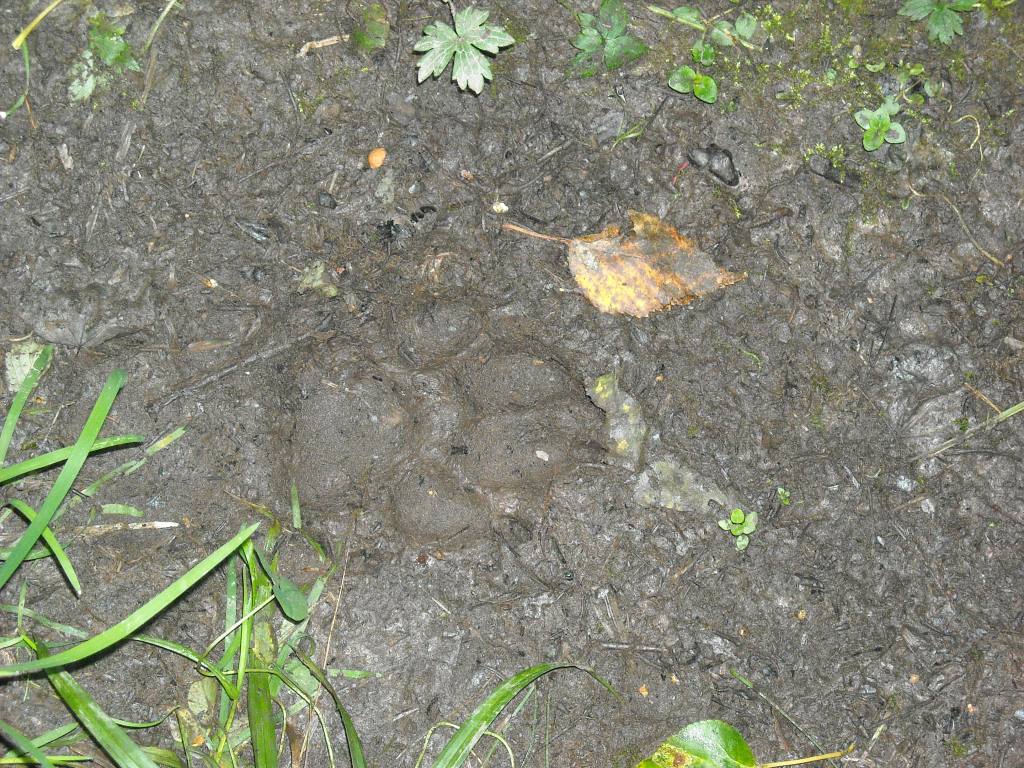
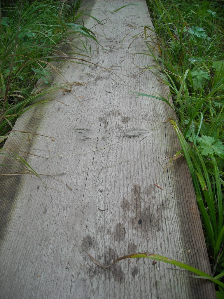
After getting up and taking down some breakfast we were back on the Grand Portage Trail. The wettest areas had boardwalk – often just a single plank of wood, and there were fresh wolf tracks on one of the early ones we came to.
We kept up with the pauses to give Erik’s shoulders a break but it wasn’t long before we started dropping serious elevation and then we came out onto Hwy 61 and stopped for another pause at the Grand Portage Trail sign. Previous to the final descent the Grand Portage Trail had been remarkably flat.
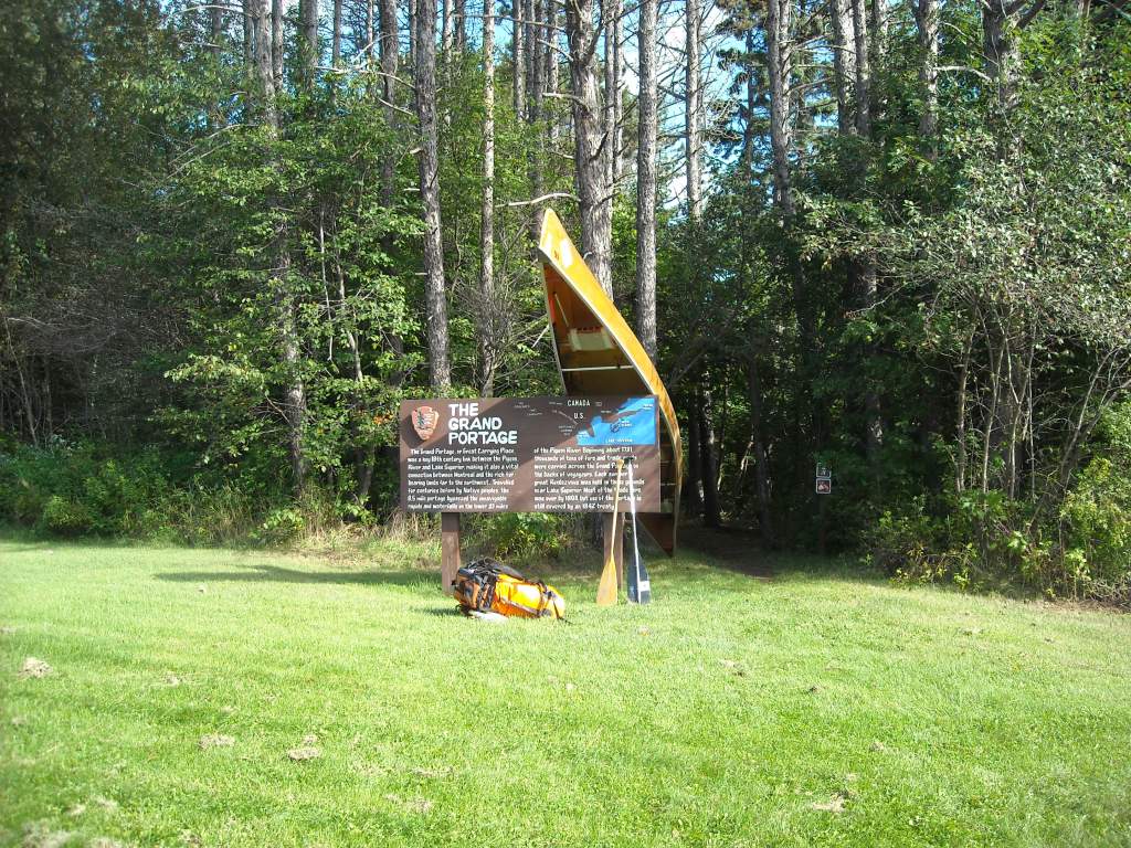
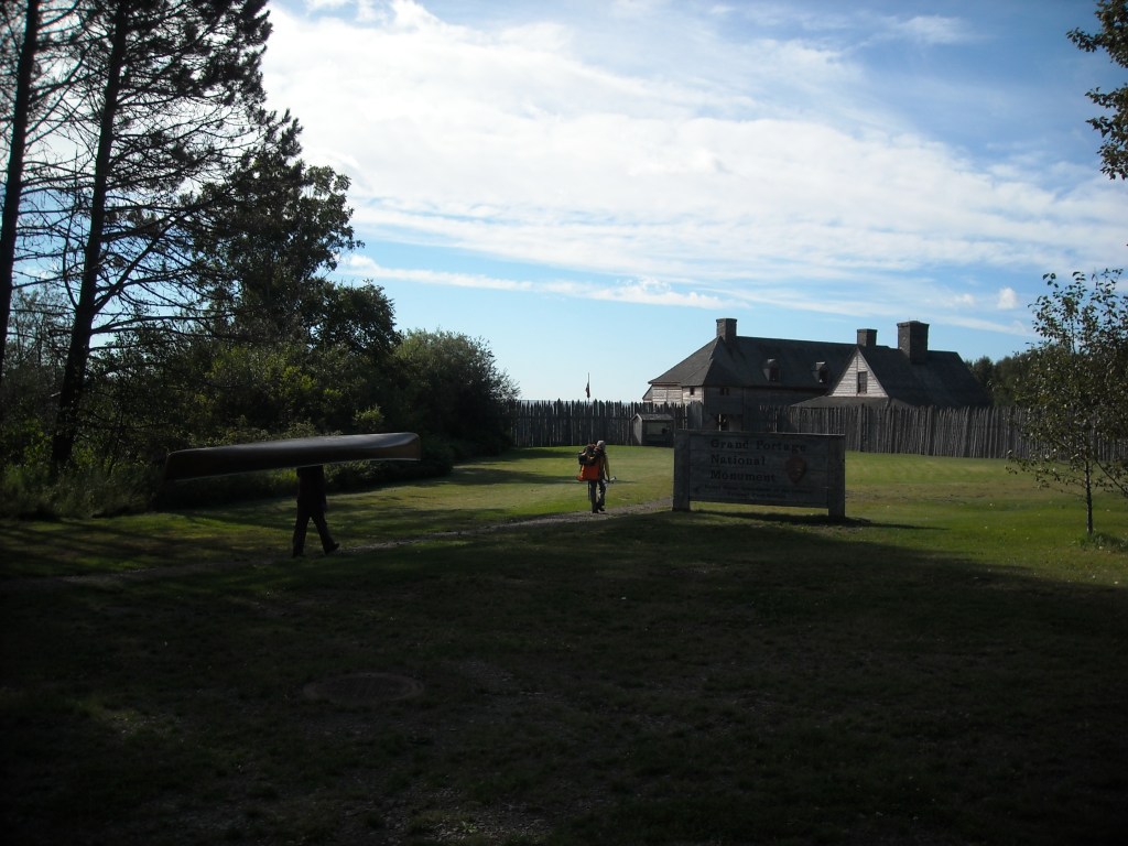
Since it was still early in the day and we’d made it to Lake Superior, we took a tour at the Grand Portage National Monument. We felt a bit like time travelers since we had arrived via canoe portage. During the whole tour my feet were super itchy and on fire.
After the tour Erik and I figured out logistics to tell my mom and brother, who were bringing back our car, that we’d made it to Grand Portage but we still had some unfinished business with Pigeon Point and so we actually wanted them to pick us up at Grand Portage State Park. They didn’t answer on my cell phone we’d left them and so we left a message and hoped for the best. Then we put in on Lake Superior to paddle the last few miles of our journey.
Once out of the shelter of Grand Portage Bay the waves picked up but these were big rollers, unlike the chop on Lake of the Woods, and we were able to negotiate these fairly well.


After paddling around Pigeon Point we veered back west into the mouth of the Pigeon River.

As we neared in on the Pigeon River we may or may not have stopped to pee on Canada (well out of sight of the international bridge) and then we continued up the Pigeon River.

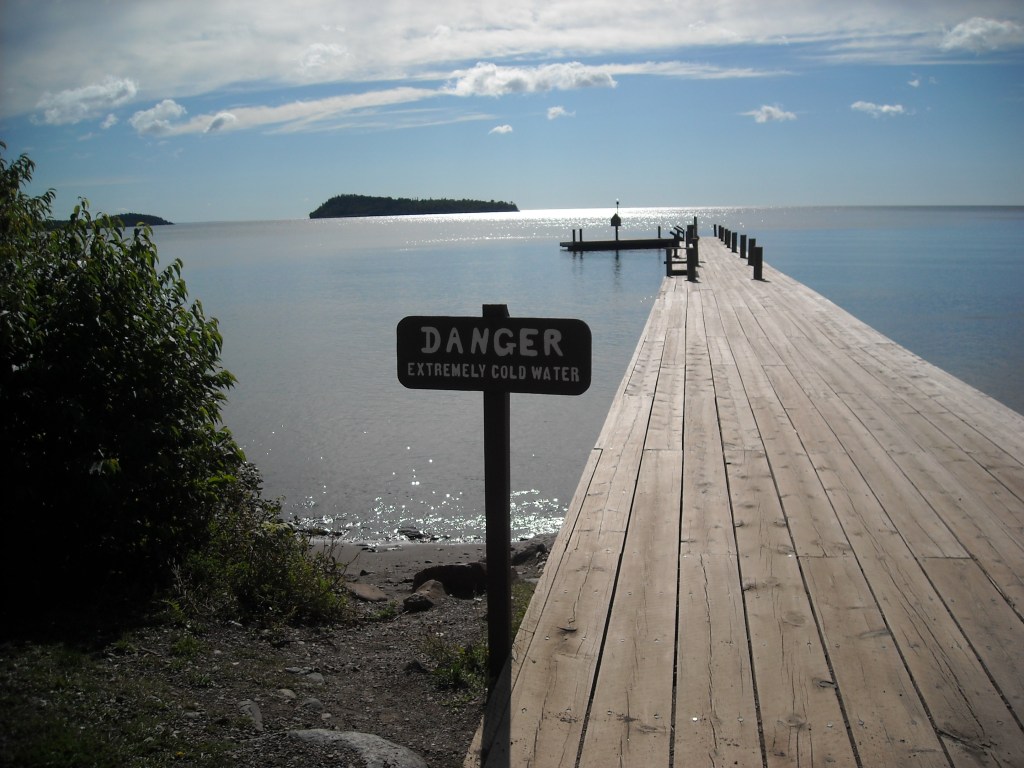
We weren’t quite certain how the take-out in Grand Portage State Park was going to go because we knew the river was in a gorge there but a bit upstream of the international bridge there were a bunch of islands and the bank was just gradual enough that we were able to haul up from the river without too much difficulty.
My mom and brother had gotten the message and were there to greet us. We were glad that had worked well.

Best Decision: I was a bit surprised at how quickly I got over getting that ride on Lake of the Woods. I guess it was because (1) the rest of the trip largely depended on it and using our time to walk on the road didn’t seem worth it and (2) unlike the Northern Forest Canoe Trail, having an FKT isn’t as big of a thing.
If I had to do it again: Well, I think this trip mostly went well. In hindsight, I’m glad we went for Lake of the Woods. Of course, we would’ve known about the Fowl Portage but challenges always make for better stories.
After some thinking and a few medical conferences, I figured the reason I probably had such bad foot burning/itching towards the end of the trip is that I have a relatively common neoprene allergy, exacerbated by wet neoprene.
I don’t think I’d do this trip again but I do want to paddle more of the Boundary Waters. The Pigeon River was absolutely spectacular but it’s probably one of those things to just do once, savoring the memory of the good time.

2 thoughts on “Canoeing the Minnesota-Ontario Border”