
As we paddle all the designated Minnesota water trails, Erik is often intrigued by the non-designated waterways and in particular, loop connections. He found such a one, the Rabbit River, that almost forms a connection with the Mississippi between highway 6 and Riverton. And so an adventure was born. In addition, we’d take almost a week and paddle up the Pine River to Cross Lake and include a route through Erik’s old camp, the Star Lake Wilderness. We figured no matter the COVID-19 situation, this trip was a sure bet.
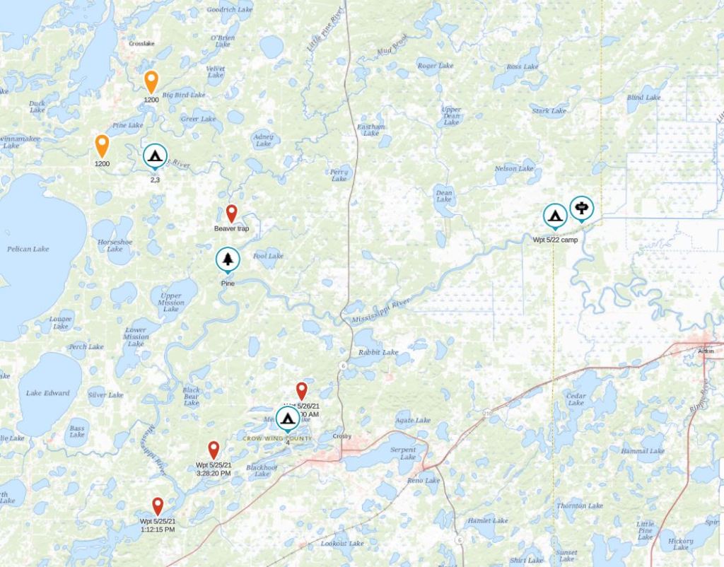
Day one (5/22/21): Paddle up the Mississippi from the hwy 6 put-in to the Aitkin Diversion Channel

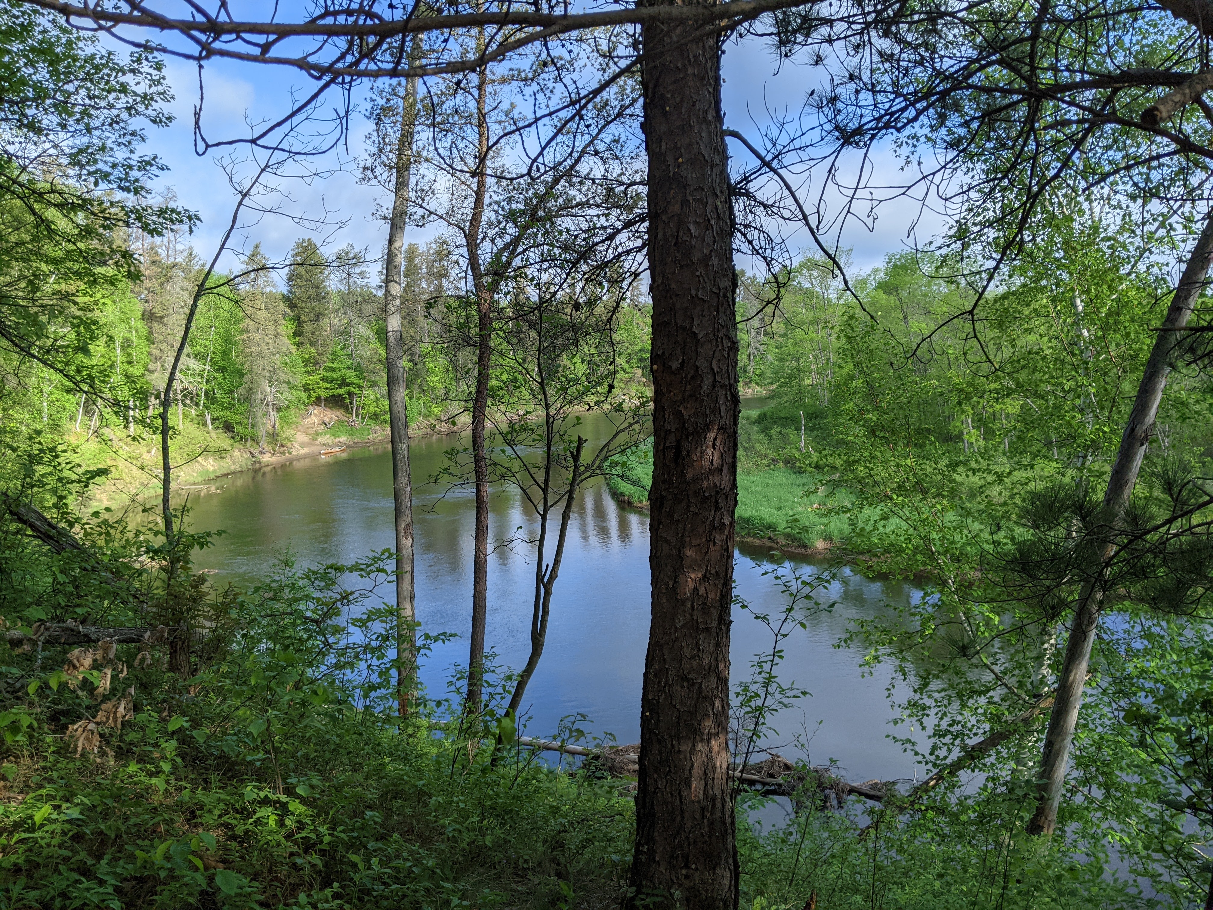
This out-and-back was arguably not the most exciting part of our trip, but nonetheless had to be done if I was to get all the water trails (Erik had previously paddled this section during a canoe trip on the Mississippi from Lake Itasca to Saint Paul in college). Since there are few put-ins in this section, we just decided it would be easy enough to paddle upstream and then back downstream.
Unfortunately the weather was quite hot for May in Minnesota, with temps in the 80s and high humidity when we started. At least we had a tailwind, that although it didn’t cool us off much, did help our upstream progress. Our plan was to paddle up to the Aitkin Diversion Channel (last year we paddled from Big Sandy, to the downstream end of the Aitkin Diversion Channel, then back up the Aitkin Diversion Channel to take out at Kimball), make the small loop at the downstream section of the channel, and then paddle downstream to the Lone Pine campsite.
As we neared the Lone Pine campsite paddling upstream, there were two guys and a motor boat there. They planned to spend the night and had others in their group we saw as we continued paddling upstream- a kayaker towing another kayak, a solo canoe, and a double canoe with one paddler sleeping. Knowing that campsite was full left us with no other legal campsite options and so as we paddled upstream, we looked for potential places to camp. Most of the land flanking the shore was private and uninviting anyway. Near the Lone Pine campsite there was an island that would work but it was overgrown. Owing to a bit of recent rain, as we paddled near the shore where the current was less, we were stirring up some mosquitoes, hence we knew those nasty buggers would attack us once we got to camp, especially if camp didn’t have any breeze.
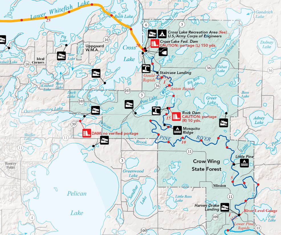
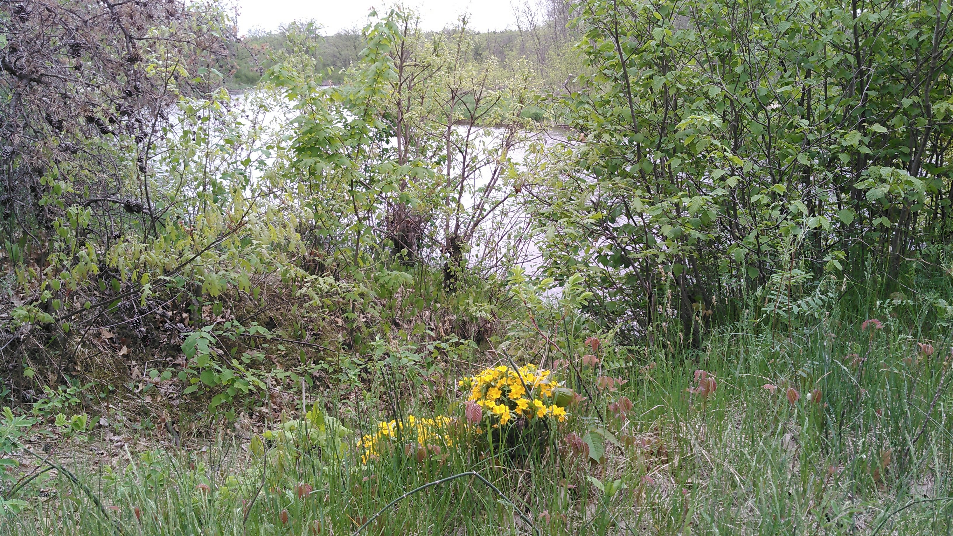
Just downstream of the Aitkin Diversion Channel we found a long skinny island without much vegetation as it was low and looked like it flooded often. On the downstream side of the island, facing the wind, was an open area where we could likely eat dinner in peace from the mosquitoes.
After we paddled our short loop around the Aitkin Diversion Channel, we headed back to “our island.” Even though we’d only been paddling for 3 hours, this camping spot was too good to pass up. The banks in this section of the Mississippi are incredibly muddy but fortunately weren’t too bad at the tail of the island. We set up our tent and made dinner. We were right, we were able to eat dinner out in the breeze. Before bed we even went for a little walk on our island.

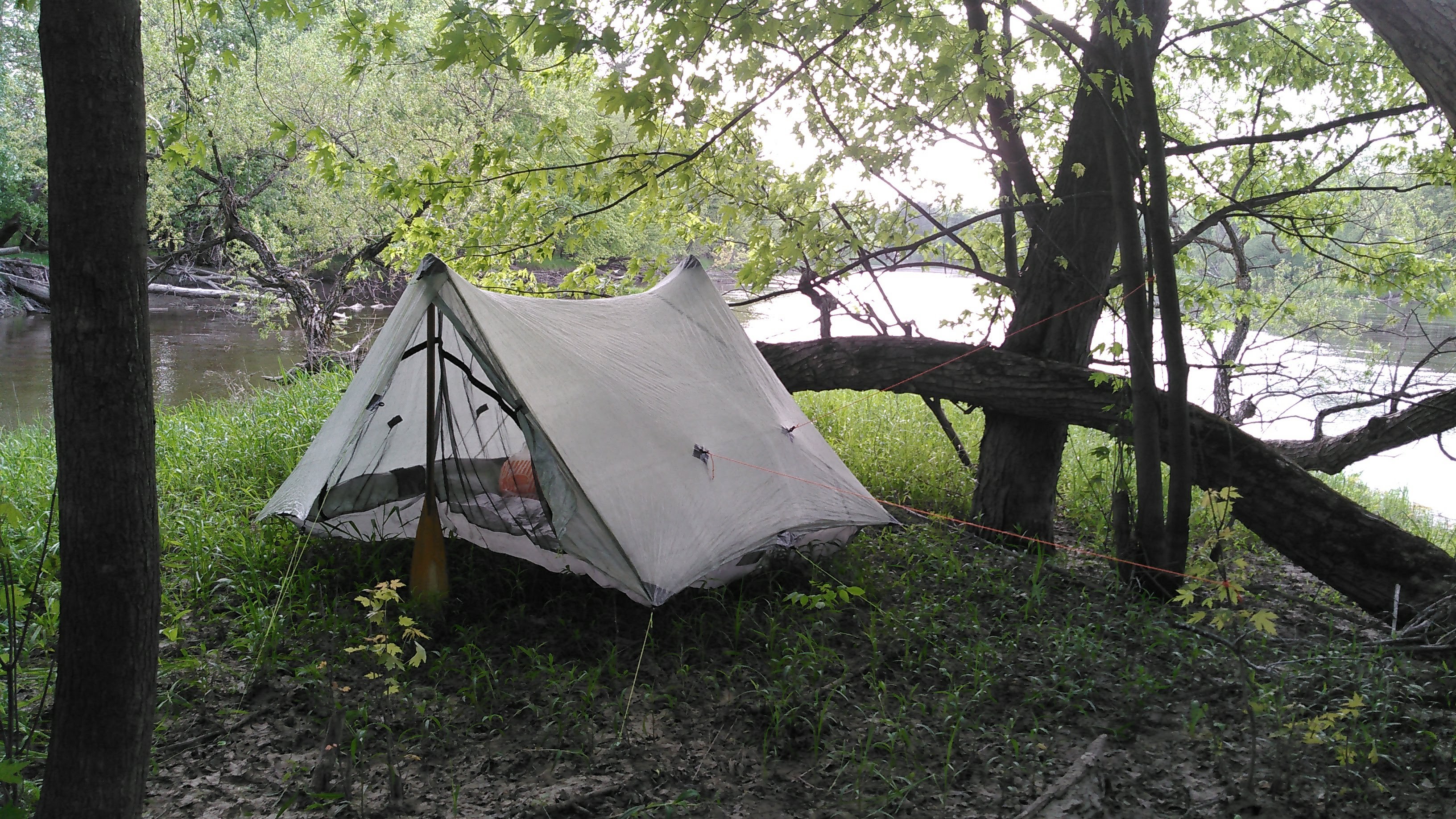
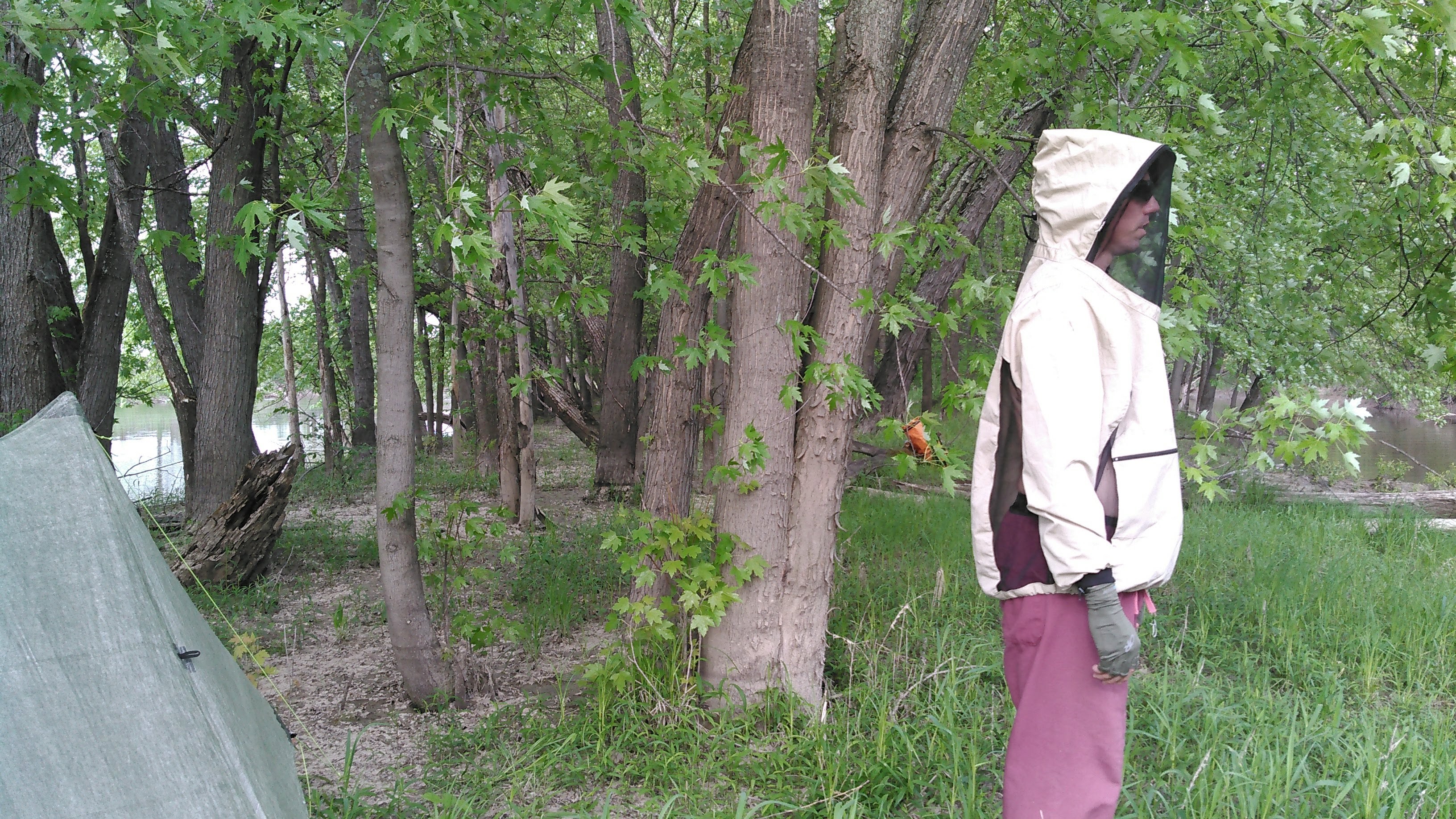

As we went for our hike, the wind shifted directions from the southwest to the northeast. A cold front was coming! This was our first time camping in several months and we were slow getting in the tent and a bijillion mosquitoes followed us in. We spent several minutes trying to kill as many of the buggers as we could. Then when we had a brief rainstorm in the night we got a bunch more mosquitoes in the tent after Erik closed up the flaps. It was too hot and humid for a really good night’s sleep anyway.
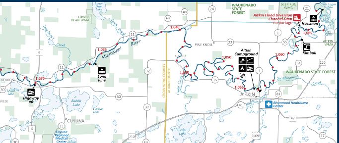
Day two (5/23/21): Canoe from Mississippi River near Aitkin Diversion Channel, downstream to Pine River, then up the Pine River to near the Pelican Brook
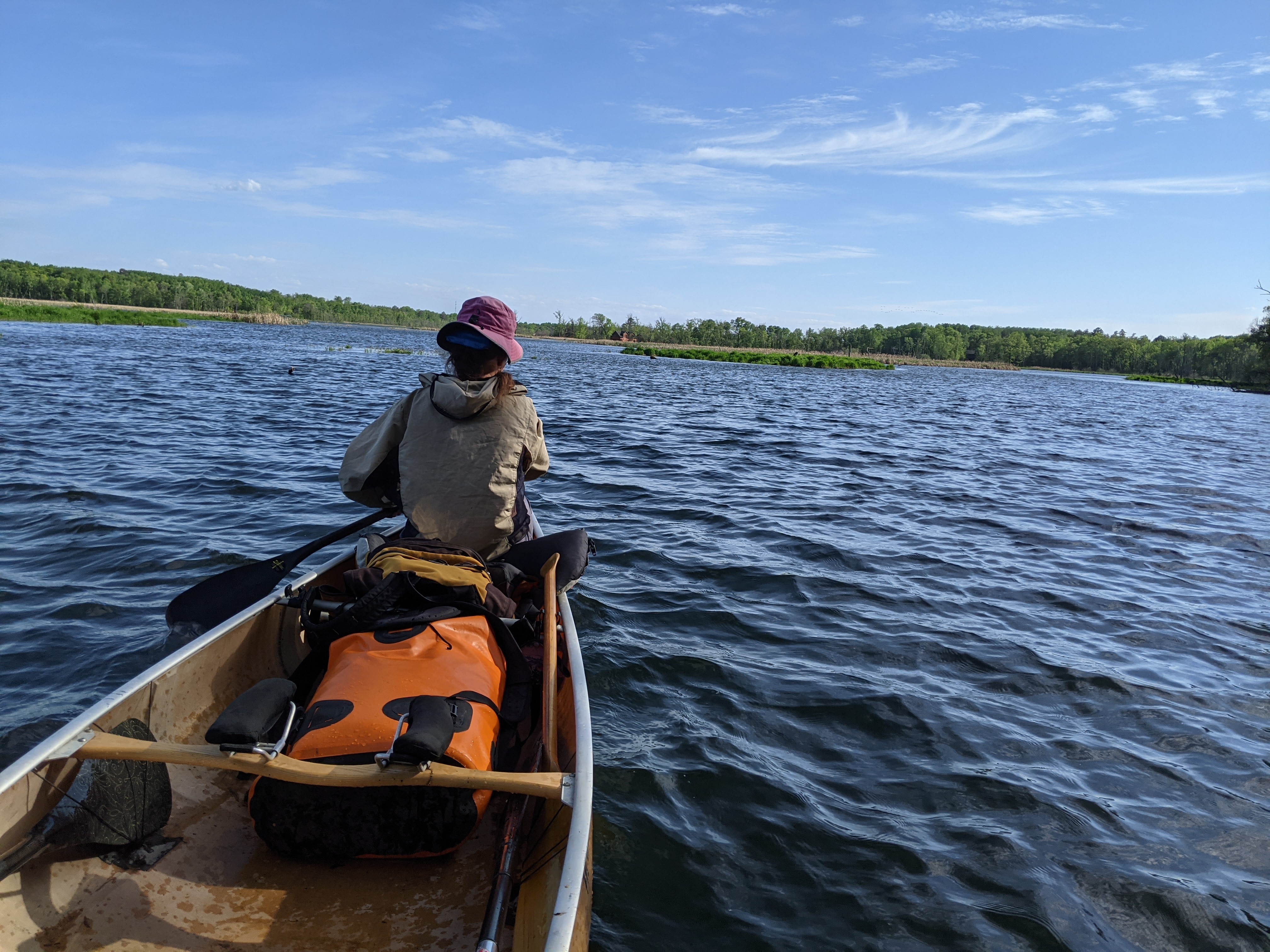
The cold front slowly came in all day as we put on more and more clothes. What a change from yesterday! We enjoyed a second day of tailwind since the wind had swapped directions 180 degrees and so had we, now cruising downstream.
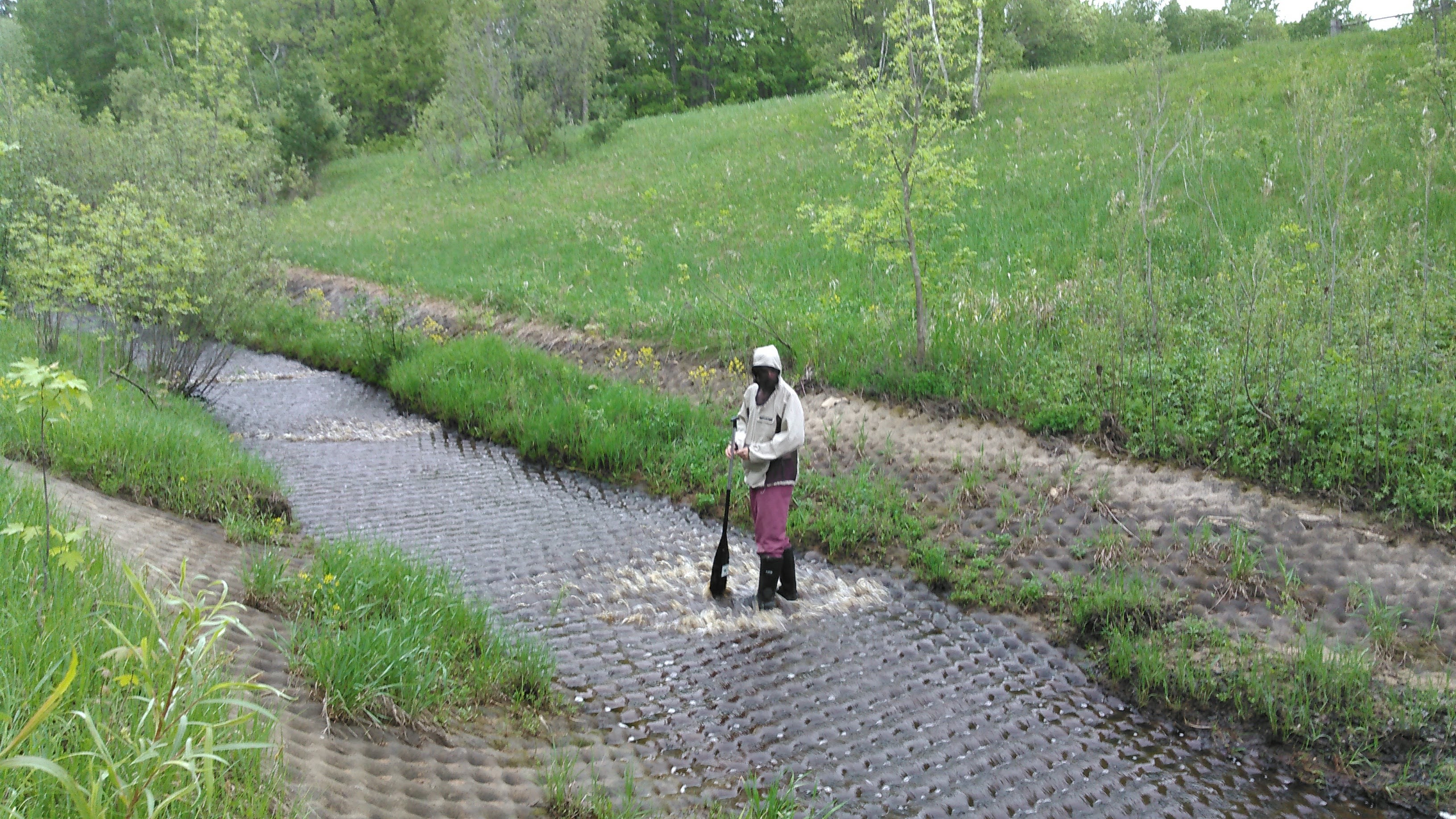
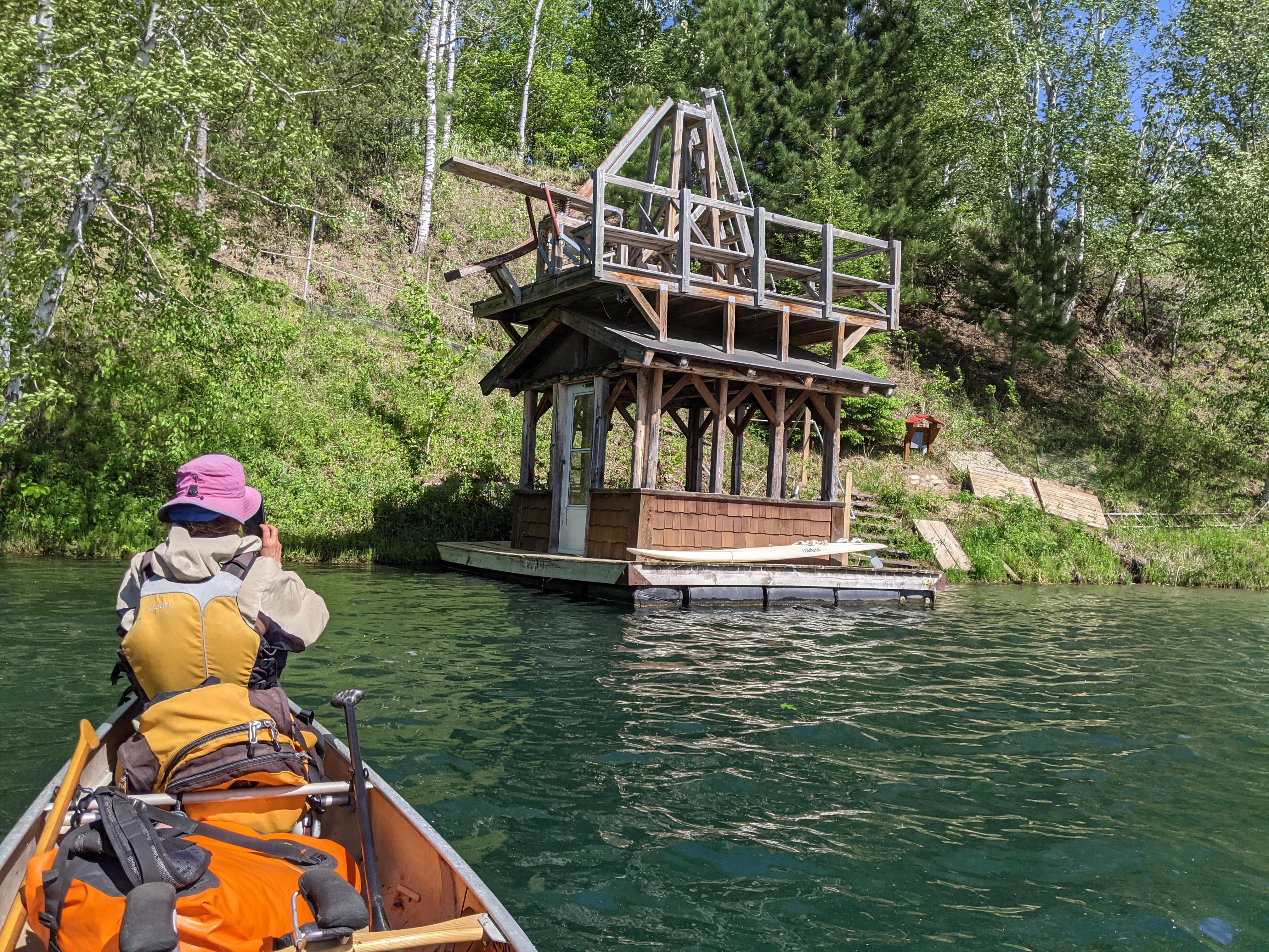
Our first stop was at a most unusual water erosion control surface where the water came down in slow spaced apart waves. Erik wanted to stop and check it out. I was reluctant but we stopped. This seemed to be on private land. Erik got out on the structure while I hiked to the top where there was a normal stream and a homemade bridge.


After our stop we kept paddling downstream, taking another break at the hwy 6 put-in seeing as it was one of the few places to get out of the boat. We dropped off one of our water containers, our 5 L Franzia bag, as we didn’t think we’d need it again. Given the Mississippi River water is quite muddy, we elected to bring clean water from home rather than use Aqua Mira chemical water treatment.
We paddled another hour down the Mississippi until we got to the mouth of the Pine River and then started heading up the Pine.
After some brief slack water, we began paddling up the Lower Pine Rapids. These are Class I, barely any waves, but the water was moving fast through here. This was a bit tough but not impossible. At the top of the rapids, we stopped at the Harvey Drake Landing for peanut butter-dried fruit tortillas. Then we kept paddling upstream. After a mile the river wound around a swamp area with less current.
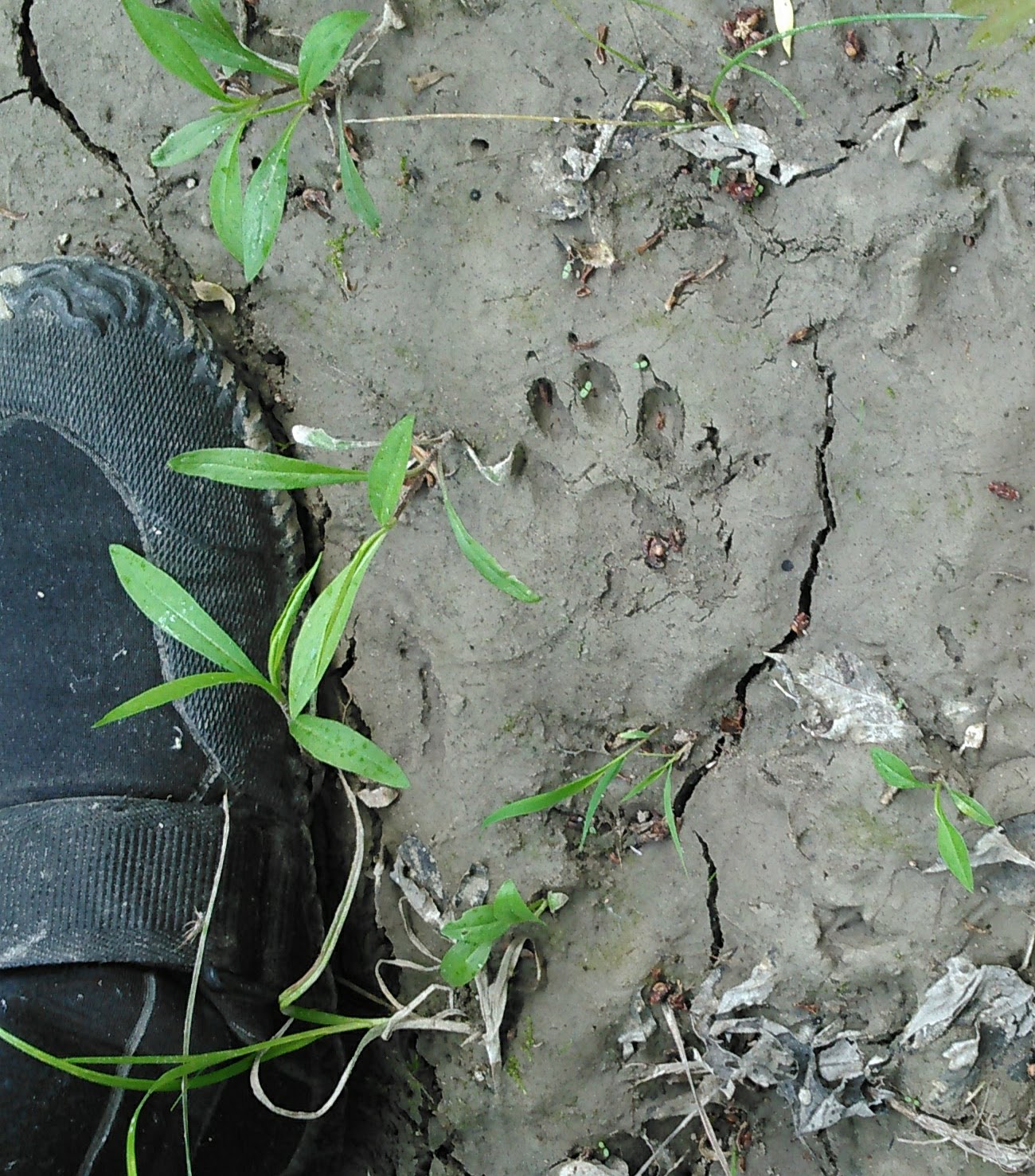
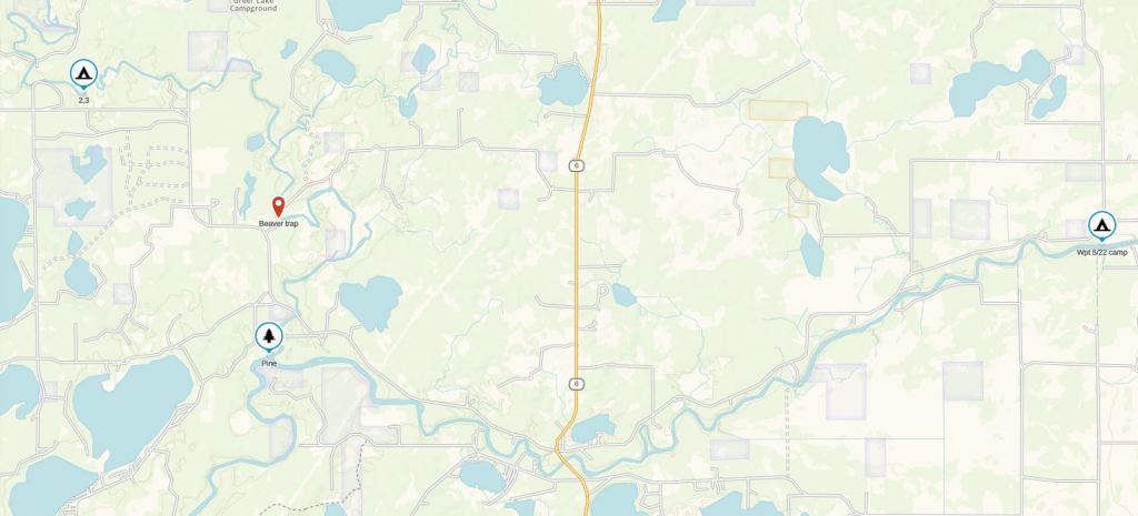
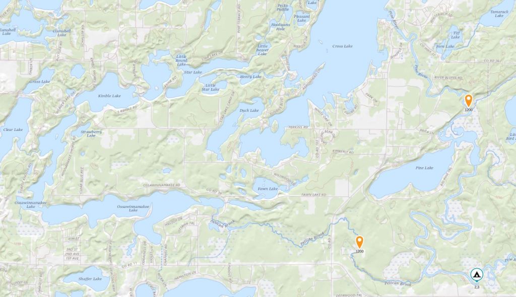
Erik had paddled this stretch of river a number of times and so acted as my unofficial tour guide, although he had never paddled upstream. He told me about a couple sandy places where there was state land and logging trails and suggested that we stop. He knew exactly where these places were. The first we came upon just before mile 5 as we got out of the swamp. Erik and his fellow camp counselors called this place Beaver Trap, and it’s marked on the map above.
We spent some time here, walking on a logging trail that went farther than we wanted to go, since we still had some upstream paddling to do on the day. So we got back in the boat and kept paddling. Unlike the muddy Mississippi, we welcomed the clear Pine River where we could see several feet down. There were a few fish and a nice sandy bottom.
We passed the Little Pine campsite and the confluence with the Little Pine River and many many turns later, we came upon an unofficial put-in on a gravel road with an eroded away sand bank. It wasn’t yet 5 pm but Erik and I had been having a debate about whether to go up or down the Pelican Brook and finally we decided to paddle up the Pelican Brook as he recalled it being “deep and swampy” and we thought this would be more favorable than paddling 9 miles up the Pine River to Cross Lake, a mile of which was labeled as class I rapids.
So we set up camp above the Pine River and did an evening hike on the gravel roads by our campsite.


We slept much better with the cooler temps but the early sunrise got us up before 6 am.
Day 3 (5/24/21): Pelican Brook, Star Lake Chain, Pine River
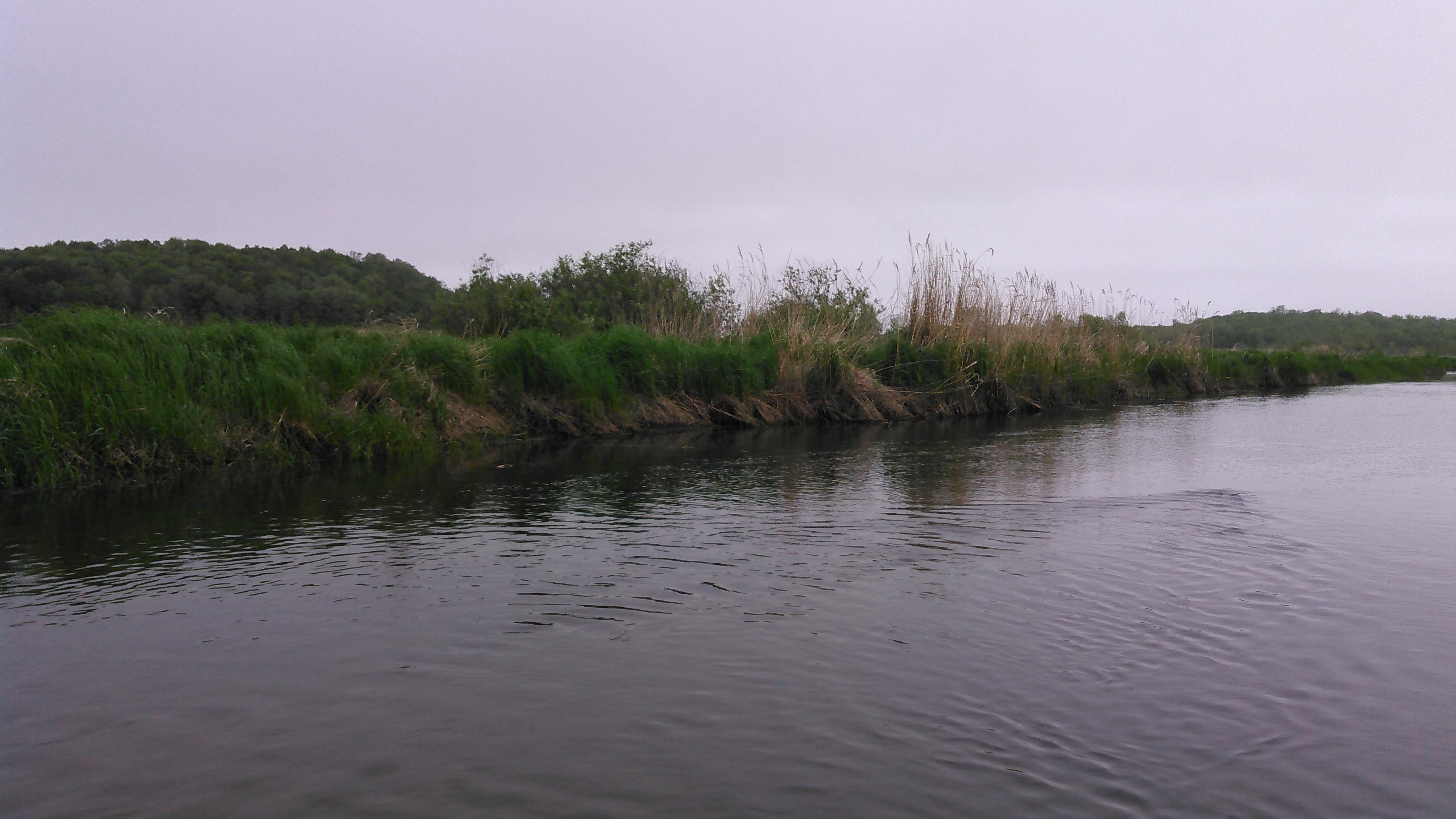
We were on the water by 7 am, paddling a half mile up the Pine River before we got to the confluence with the Pelican Brook where we paddled under an impressive snowmobile bridge at the mouth of the Pelican Brook. Erik was right about the swampy part, but it was shallow, not deep, so we mostly resorted to poling off the bottom of the sandy brook with our beater paddles. There’s a technique calling “poling,” using actual poles for shallow upstream canoeing that we always talk about when we paddle upstream but thus far haven’t yet invested in the poles or learned the technique. So we paddled and pushed off the bottom for 3 hours until we got to Lake Ossawinnamakee.


Half way up the Pelican Brook we paddled under the hwy 3 bridge. This was a good landmark to check our progress. Two thirds the way between hwy 3 and Lake Ossawinnamakee we shoved up a good sized beaver dam and from here the water was deep and we could use our good paddles to the Lake Ossawinnamakee dam. The Ossawinnamakee dam is small and we hoped to paddle up it. If paddling up (or down) a dam sounds incredibly dangerous or just plain ridiculous, I’ll tell you it depends on the dam.
My dad first taught me about shooting dams back when I was a kid and we shot the Lake Onamia dam. That was a small dam that has since been replaced with a rock dam. At high water levels, small dams get washed out. Such was the case with the Lake Ossawinnamakee dam. It was about a foot drop. As we paddled up it, our bow got stuck. I stood on one of the cement pillars, making sure it wasn’t too slippery first. Once I got out, I pulled the bow up some, then got back in. Of course, there was a brief bit when I pulled the canoe up too far and it started going crazy in the current but we got that in check real quick.
From here we paddled out into Lake Ossawinnamakee but thought it was pretty funny to see a “dead end” sign for the Pelican Brook we had just paddled up.

Once out on Lake Ossawinnamakee we headed to the boat launch on the east side to have our first tortilla lunch, then started paddling west. As we resumed paddling, it began misting. Erik checked the weather, saw it was only supposed to mist for a few minutes, and that it was supposed to be sunny and 80 degrees in 2 hours, so we didn’t get out the rain gear. It’s handy to have access to the weather on our adventures.
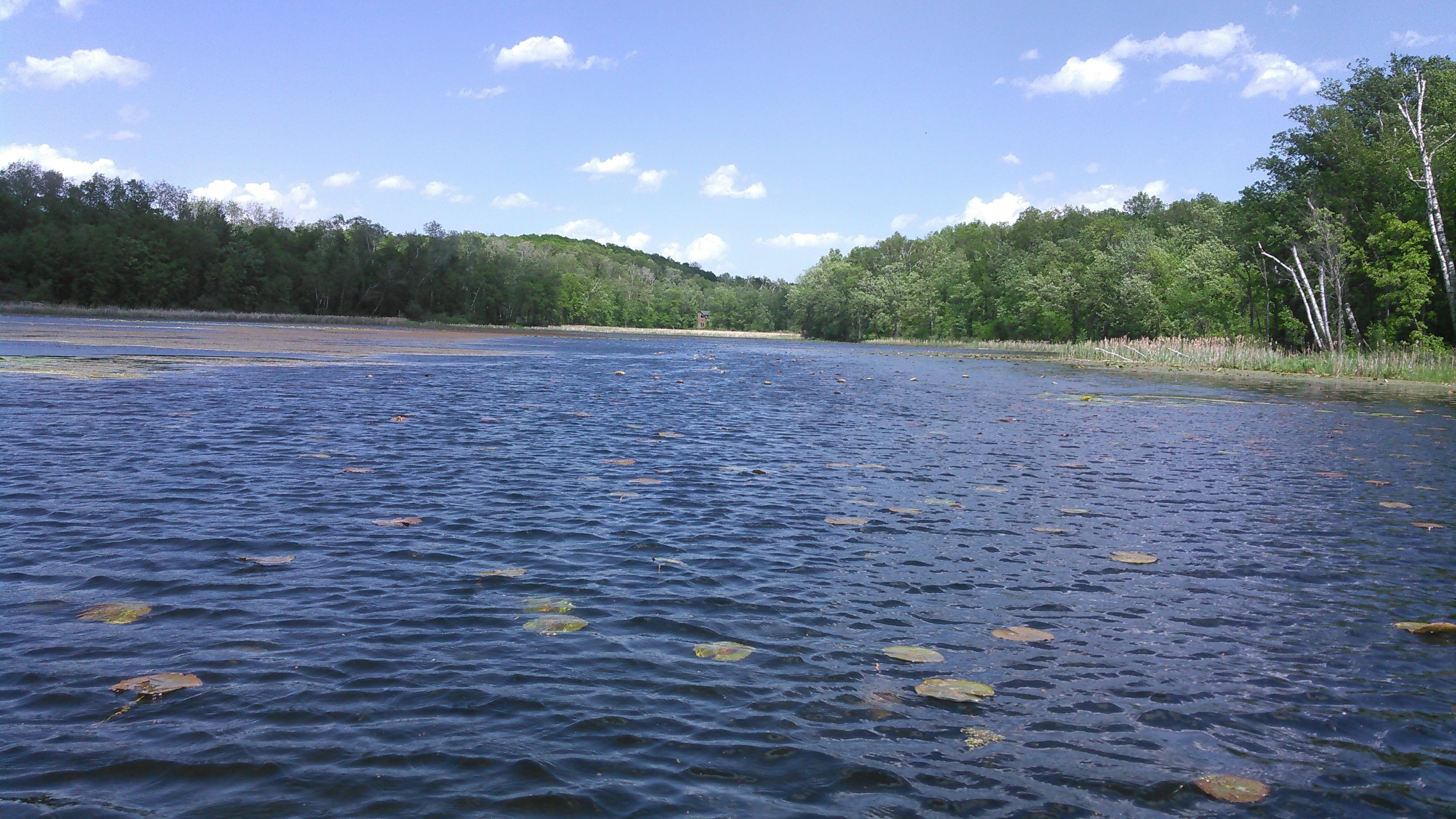
Lake Ossawinnamakee is very funny shaped, almost like an L. There’s a small channel into Kimble Lake where we found a couple fun things.


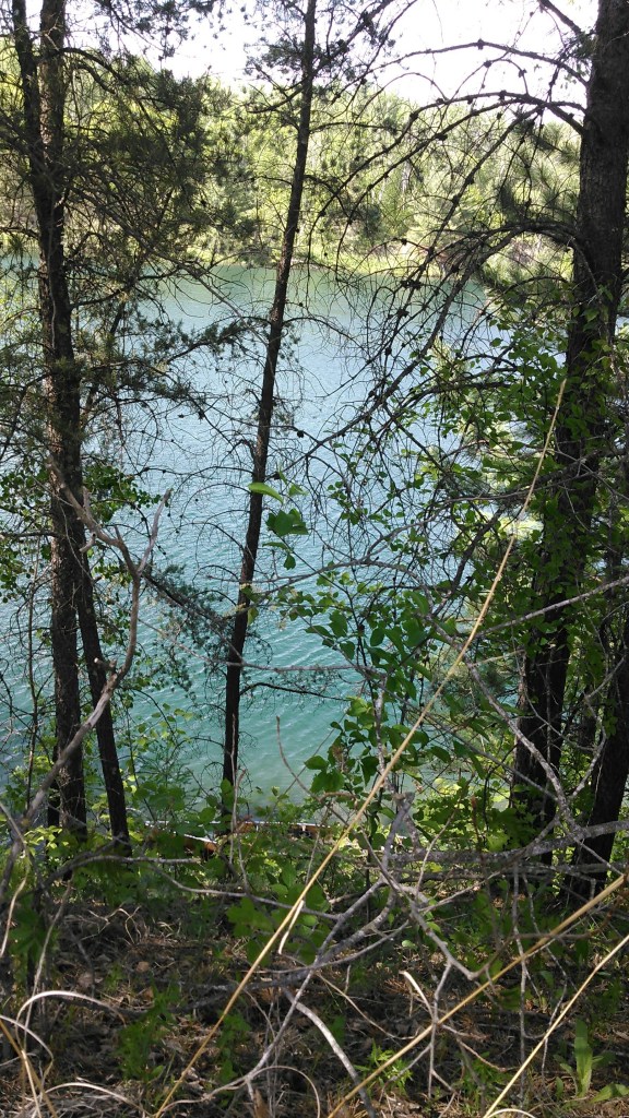
As we paddled across Kimble Lake, proceeded through the very shallow channel to Bass Lake, and then on to Little Bass Lake, the houses became almost nonexistent. We paddled through Round Lake, then Star Lake, and finally to Little Star Lake. Because Star Lake Wilderness Camp is a wilderness camp, Little Star Lake is completely undeveloped.

By now it was 1 pm and as promised by the forecast, 80 degrees. We poked around camp and didn’t see anyone. We went swimming at the beach and had our second tortillas for the day. My plan had been to camp here but that was assuming we paddled up the Pine River and canoed some of Cross Lake and possibly the Whitefish Chain to get to camp around 4 pm. Since it was too early to camp, we pushed on. Given there were few campsite options, we decided to paddle all the way back to our camp from the night before.

From Little Star Lake, we paddled up an unnamed creek I’ll call Star Creek to Henry Lake which is also owned by the camp. The creek posed a few difficulties. First we had to get our canoe over an old bridge that was laying across the creek. Then we had to go up several beaver dams, some quite overgrown with cattails.

Paddling across Henry Lake didn’t take long and soon we were going up more beaver dams to unnamed lakes above Henry. Google satellite shows these lakes to be a pretty green color. This is likely because at the head of the lakes is a big dike that keeps the water in Cross Lake and hence these lakes are spring fed. The water in them was quite cold. When we got to the last lake, we portaged up the dike to the road and then into Cross Lake.
We rode a tailwind across Cross Lake to the dam where the Pine River leaves the lake. After portaging around the dam, we paddled down the Pine River. Initially it was fairly shallow but after a couple miles we had a bit of excitement paddling through the mile long Gould and Anton Rapids. Erik is an expert canoer and he shot us a clean line through the Class I rapids. It was easy but we were glad water levels weren’t any lower.
After a few more turns, the river became more swamp-like near Pine Lake. The channel was a bit difficult to follow and we used GAIA GPS a couple times.
After the swampy section, the river turns to the west briefly as it narrows and heads towards the new Rock Dam. This dam was recently created to allow fish to travel upstream better and to make it safer. This new Rock Dam adds more height than the old one which is probably why the river was so wide and swampy near Pine Lake.
Erik eyed the Rock Dam while standing in our canoe to see if it was “runnable.” It was a bit hard to see what was going on from sitting in the bow of the canoe but once we got out to portage on river right, I saw the dam was a series of rocky steps, each about 2 feet high and gradually sloping. Had we run it we would have slid over a lot of rocks.
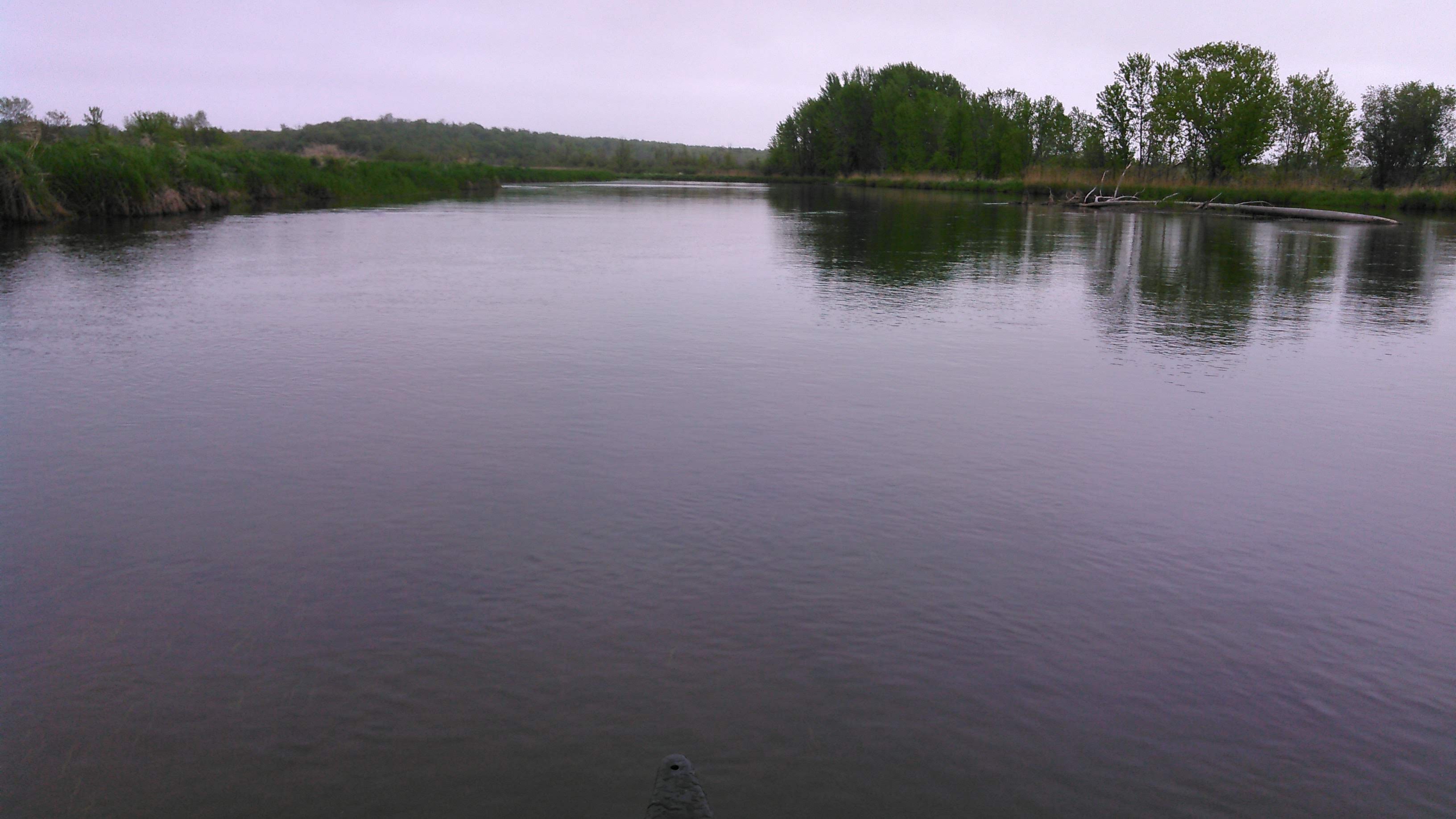
The river was again narrowed after the rock dam. From here it meandered back to our campsite. Often it was shallow enough that we could see the bottom. I was really hungry and Erik was really hot but I still tried to enjoy this section of river, especially as it’s some of the best paddling in the state I’ve yet to do. It was after 7 pm, a full 12 hours from when we’d left this campsite, that we arrived back. We got to work making dinner, putting up the tent, and then eating dinner. Erik kept dunking his head in the river as he was hot. Too bad we didn’t have colder weather for sleeping.
This was the sweetest day of the trip and I’d propose it as the ultimate Strava segment for the serious Minnesota canoer (although we admittedly didn’t use our GPS- we didn’t know we were doing this when we started in the morning). In a days paddle it has just about everything- a shallow upstream segment, a dam, resort lakes, wilderness lakes, a few beaver dams, a mile of Class I rapids, and nice downstream flatwater. This is it folks- this is the best one day loop outside the Boundary Waters in Minnesota for the adventure seeker.
Day 4 (5/25/21): Pine River, down the Mississippi to Rabbit River and through Cayuna

It was warm when we woke up. We broke camp, had breakfast, and were off paddling within an hour. We knew we were in for another warm day, one last day before a cold front came in, and that it would be windy, mostly in the wrong direction.
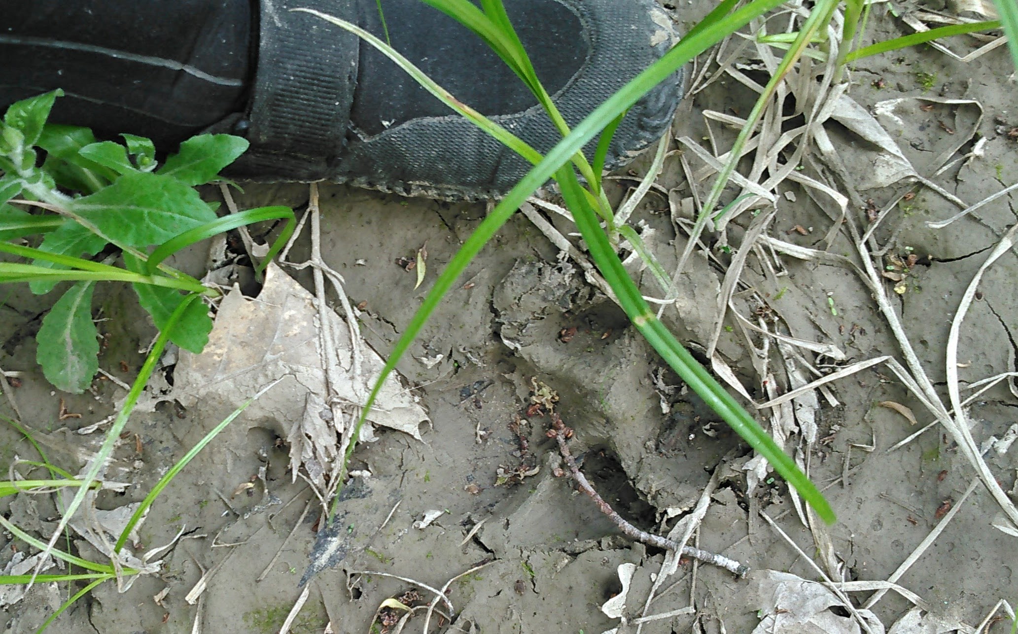
We took our first break at Beaver Trap. This time we walked downstream to a good view (and what would be a great unofficial campsite). Although we were paddling downstream the current was mild and there were many more turns than I remembered.
After we got back in the canoe the rest of the Pine River went by quickly through the swampy section and then the Lower Pine Rapids were much shorter than we remembered. Apparently it’s much faster and easier going downstream! We knew then that we had made the right decision, paddling up the Pelican Brook as opposed to up the Pine River to Cross Lake.
Then we were to the mouth of the Pine River and back on the wide muddy Mississippi River. The river makes a series of long turns in this stretch and whenever we paddled in the southwest direction we battled into the wind. This made the current negligible. We were trying to get to the Trommald Landing for a lunch break, but we got too hungry before then and stopped on some national forest land where there was a brief small rocky shoreline. It was good we stopped because it took another half hour to get to the Trommald Landing. It did look like a nice place to stop but we kept going.
Erik wanted to stop at the Half Moon campsite which was located in some nasty backwater. I wanted to keep going but Erik steered us into the murky backwater. When we saw the take-out would be muddy, Erik relented to my demands and we pushed out of the backwater and kept paddling. Twice Erik had stayed at the Half Moon campsite and both times there were tons of mosquitoes. I don’t quite understand some of these DNR water trail campsites as their locations are less than ideal. I value backcountry campsites with good water access, both for washing and drinking. I wouldn’t want to do either from the Half Moon campsite.
Shortly thereafter we came upon the Half Moon Landing. We got out to explore. Presumably there used to be a picnic area on the bluff just upstream where there is an old crumbling retaining wall. Erik made his way up there but I walked down the road instead as there was some poison ivy towards the old picnic area. The day was warm and I walked the road back to some pine trees to take in my favorite pine scent that comes out when the weather is hot. On the way I saw a dead salamander, quite a rarity in the northwoods.
Our plan for the day was to paddle down to the dam in Brainerd, then turn around and paddle back upstream until we found a suitable place to camp. There are no designated campsites in this stretch. The next day we would paddle back up to the Rabbit River and then take the Rabbit River almost all the way back to our car, paddling through a number of lakes. As we neared the Rabbit River, we were getting hot, wanted a swim, and passed under a number of power lines.
After the Rabbit River came in, the Mississippi turned to the southwest. The river here was wide and open and we battled the whitecaps. A few times the bow went under the water as the waves poured into the canoe. I contemplated the futility of our route. We were canoeing out and back on a boring section of river, hot, fighting the waves. There was likely no good place to camp. I wanted a camp with a sandy beach and some clear water to go swimming. This just wasn’t fun.
We sought refuge in some cattails. I expressed my thoughts to Erik. He thought it reasonable to give up on this section of the Mississippi for today. We turned around and surfed on the waves back to the Rabbit River. This was easy! And even fun!
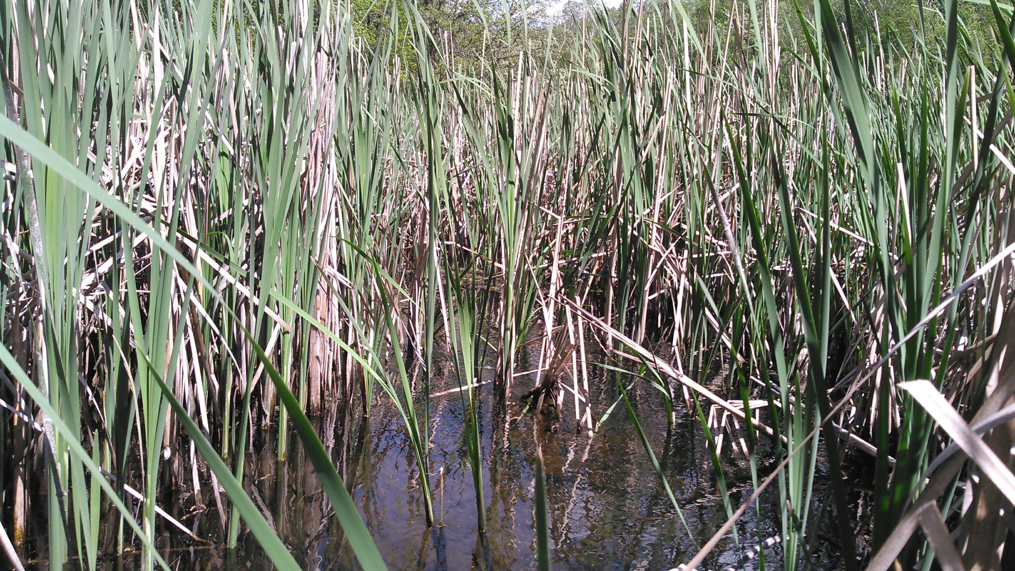
By now we were ready for second lunch so we stopped at the west boat launch on Rabbit Lake. Even though I was barely in the grass, the ticks must’ve been bad as I picked two off me. Then we were back in the canoe heading up the Rabbit River. After paddling through Rabbit Lake, Little Rabbit Lake, and an unnamed lake, we came to the Rabbit River. Immediately we were bombarded by cattails. There was obvious water flowing through the cattails, but no obvious channel.
Erik pushed and shoved our canoe in a ways, compromising his seat in the process. I wasn’t having it and didn’t help him at all. I was hoping for an easier channel. Maybe with some beaver dams, but at least a channel to follow. Something. This was potentially endless miles of cattails and maybe some blow downs. We could be out here for days with nowhere good to camp.
Besides, there was another route through Cayuna.
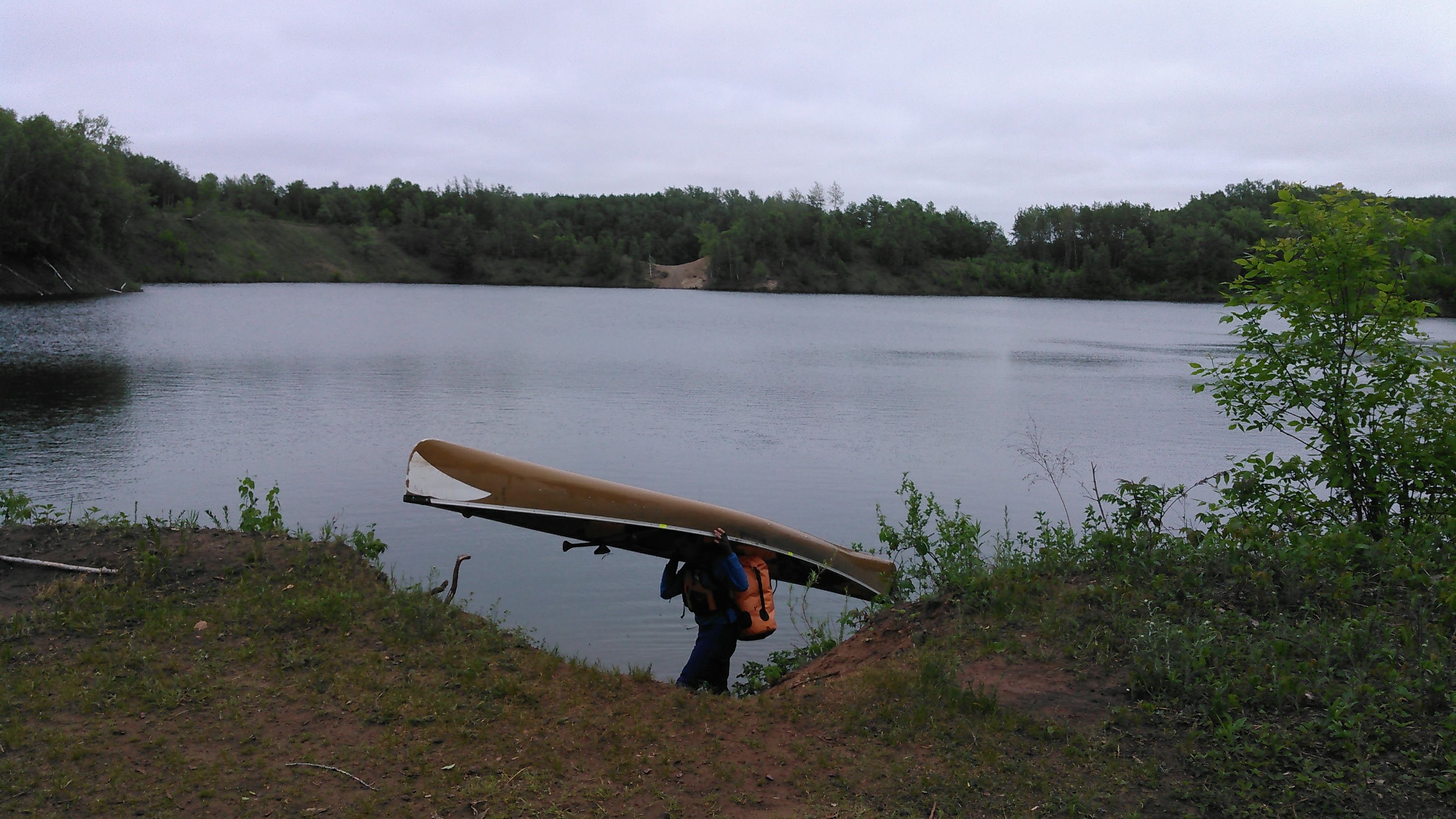
So we backtracked to the boat launch on the east side of Rabbit Lake, although we did check out the Ironton Creek, which was again more cattails and even less promising than the Rabbit River. From the boat launch we portaged into Rowe Mine Lake. This lake was pretty blue and had a ridiculously steep drop off on the boat ramp. With the tailwind, we were across the small Rowe Mine Lake in no time. There was a small stream trickling in from Carlson Mine Lake, most appropriate for a small toy boat, and completely un-navigable for our 18-foot canoe. Erik took off to scout a portage and found a social trail and then a newly bulldozed four-wheeler trail, albeit with some poison ivy.

The put-in on Carlson Lake was very steep and bushwacking. I was so glad Erik took the canoe. Carlson Lake was also deep and blue, down in a bowl. We paddled around the small lake, mostly to get a good view of a tall pontoon with a crazy high slide and diving board.
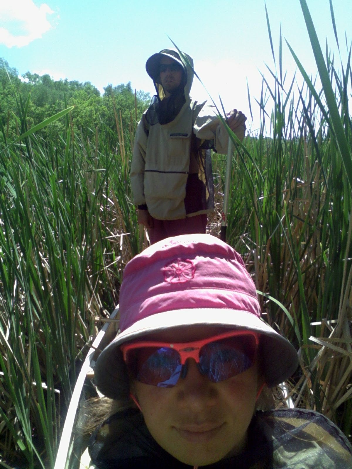
Then we embarked on our next portage up an almost impossibly steep bank on the south side to the bike trail. I wasn’t happy about this portage. There was lots of poison ivy and it was so steep it was the kind of hillside where it’s hard not to use my hands to grasp onto trees or plants or anything to help climbing the hill. It was too steep for Erik to climb with the canoe on his shoulders so instead he shoved the canoe up the hill, but not before he had taken a load up with our dry bag and his lifejacket and placed them in a pile of poison ivy next to the bike trail. In his defense, there was poison ivy pretty much everywhere. Oh, and there was a high rickety wood fence to climb over/under before we got to the bike trail.
Poison ivy is not my friend. I got my first case when I was seven and wiped with it when I was 19. I’m super allergic. I wasn’t happy that we had so much exposure. True, I was wearing pants and boots so hadn’t directly touched it, but it was over all our gear, clothing, and canoe.
As we portaged down the bike trail I was having a fit about the potential poison ivy exposure. We had the option of a shorter portage into Little Blackhoof Lake, an upstream section to Blackhoof Lake, and then a short portage into Huntington Mine Lake, or a longer portage on the bike trail to Huntington Mine Lake. Given the ubiquitous poison ivy growing in the “disturbed soil” and concerns about an overgrown cattail Ironton Creek between the Blackhoof Lakes, we elected for the longer portage into Huntington.
This was likely the best choice. There was a steep fishing trail heading into Huntington Mine Lake. Again we enjoyed a nice tailwind on this long lake but by now it was 5 pm and we were thinking about camping options. There’s no camping in the Cayuna area save for a campground on Portsmouth Mine Lake. I wasn’t ready yet to completely give up on the Rabbit River and that campground was out of the way. So we canoed and portaged our way across Cayuna, towards Lake Menomin (note here that the Menomin spelling denotes a natural lake on the Rabbit River whereas Mahnomen refers to the mine almost adjacent to the natural lake) which was on the Rabbit River. By now Erik had declared we end our trip a day early given we were out of places to paddle and had the poison ivy snafu. I thought this a good idea.

Once on Penington Mine Lake there was a channel into Mahnomen No 1 Mine Lake and into Mahnomen No 2 Mine Lake. It was 7 pm by the time we found a suitable place to bush camp, fortunately with a sandy shore where we could do some good handwashing and body washing for poison ivy mitigation. We bagged our adventure clothes and planned to paddle in our sleeping clothes the next day since we would be done with our trip. As it got dark we set up the tent and then the winds shifted and the temps dropped down into the 40s which made for good sleeping!
Day 5 (5/26/21): Cayuna, Rabbit River, Run shuttle to car

Every map I found of this area was radically different. As the mines got neglected and filled with water, some maps either didn’t show all the lakes or others showed land bridges where none really existed. We started the morning with a short paddle on Mahnomen No 2 Mine Lake and then did a ridiculously steep sand bank portage into an unnamed lake.
From here we portaged into Menomin Lake using GAIA maps which. We paddled towards the inlet of the Rabbit River but encountered cattails just like the previous day, only instead of under sunny warm skies, we were under cloudy cold skies. Erik again stood in the canoe but didn’t see any good channel through. So we turned around with the plan to paddle back to Crosby through the Cayuna Lakes.
As we portaged back to the lake with the steep sand banks, I decided to break up the portage with a very brief paddle through the lake marked at 1171 feet of elevation. We got in the canoe and Erik decided we should paddle the “long” way around the lake. He pointed our canoe what he thought would be the “long” way but was instead the right way to go. He was like “you mean we’re only paddling 50 feet in this lake?”
“Well, you complained about the long portage last time so, yes.” This was incredibly funny to me and sent me into hysterics. I laughed really really hard.
We did paddle around that small lake and saw two crazy rope swings! Then we portaged back into the steep sand bank lake and back over the steep sand bank. It was still early in the morning so we paddled almost the entire lakeshore of the Mahnomen-Alstead-Arco Mine Lakes. Water depth greatly varied. Often we were paddling over large down trees that stuck up from the bottom. It was a bit spooky. We saw another crazy rope swing. The northwest corner of this lake was all flooded, with the old road acting as a dam.
Then we portaged into Portsmouth Mine Lake and paddled across it to the southeast side near the bike trail. We got out there and Erik ran four miles back to our car. It was a short shuttle given we had been paddling for five days. On our way to Bemidji, our next adventure to see my family, we crossed over the pathetic Rabbit River. It would have been an incredibly difficult challenge!
Days 6-9 (5/27/21-5/30/21): Family time in Bemidji (and some running)
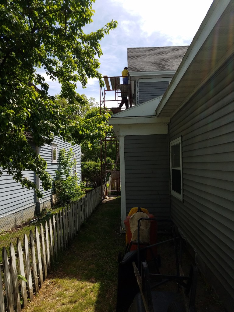
In previous years, we’ve helped my mom with a number of house projects. Even though we didn’t have any serious house projects planned for this visit, my mom found a bird nesting above one of her third-story windows. When Erik went to investigate, he declared we set up the scaffold and re-side the peak on the north side of her house. So that’s what we did. And yes, my mom owns scaffold!
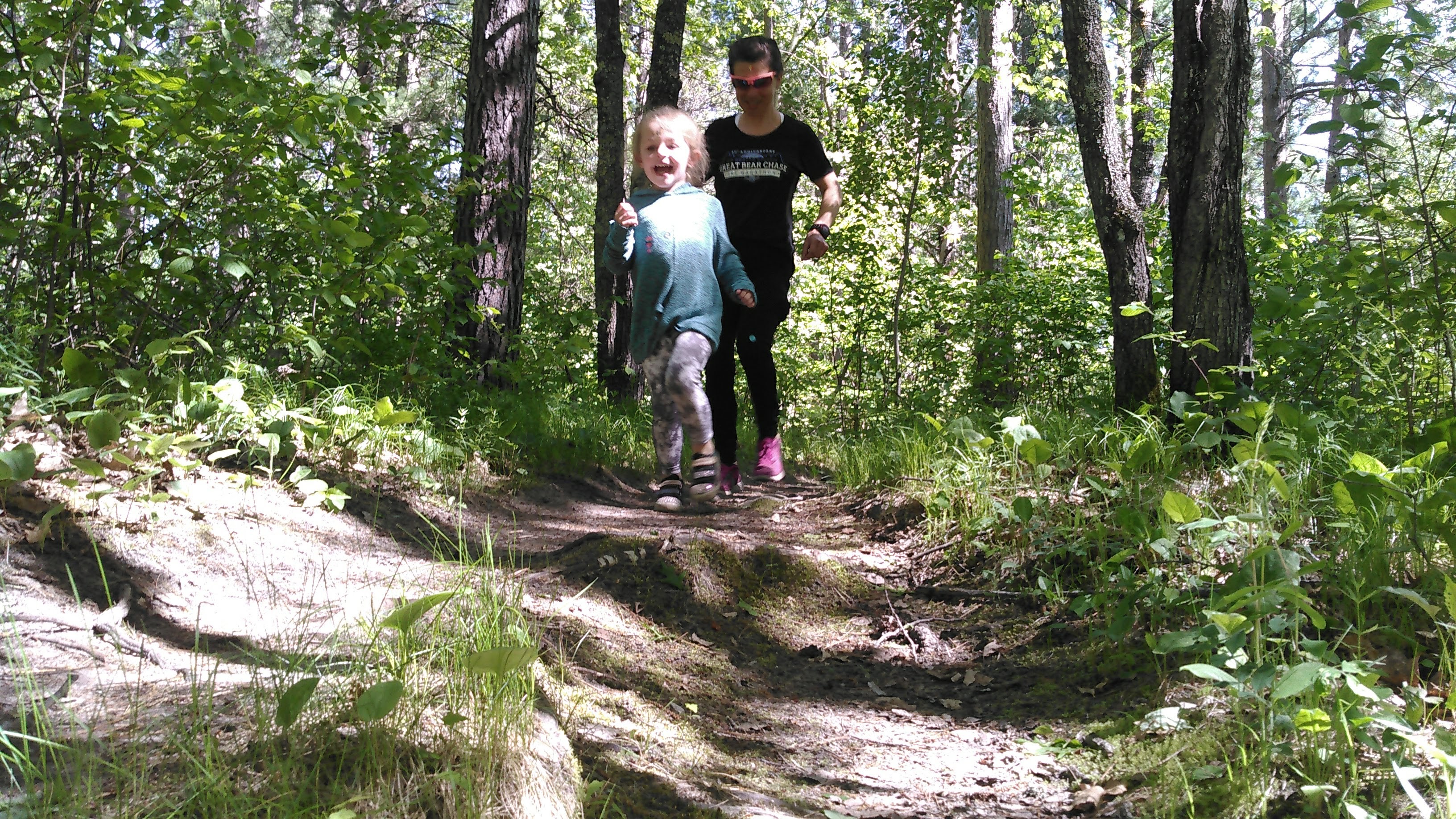
Oh, we also did some running and had adventures with my almost 4-year old niece.
Day 10 (5/31/21): Mississippi River from Rabbit River to Brainerd Dam
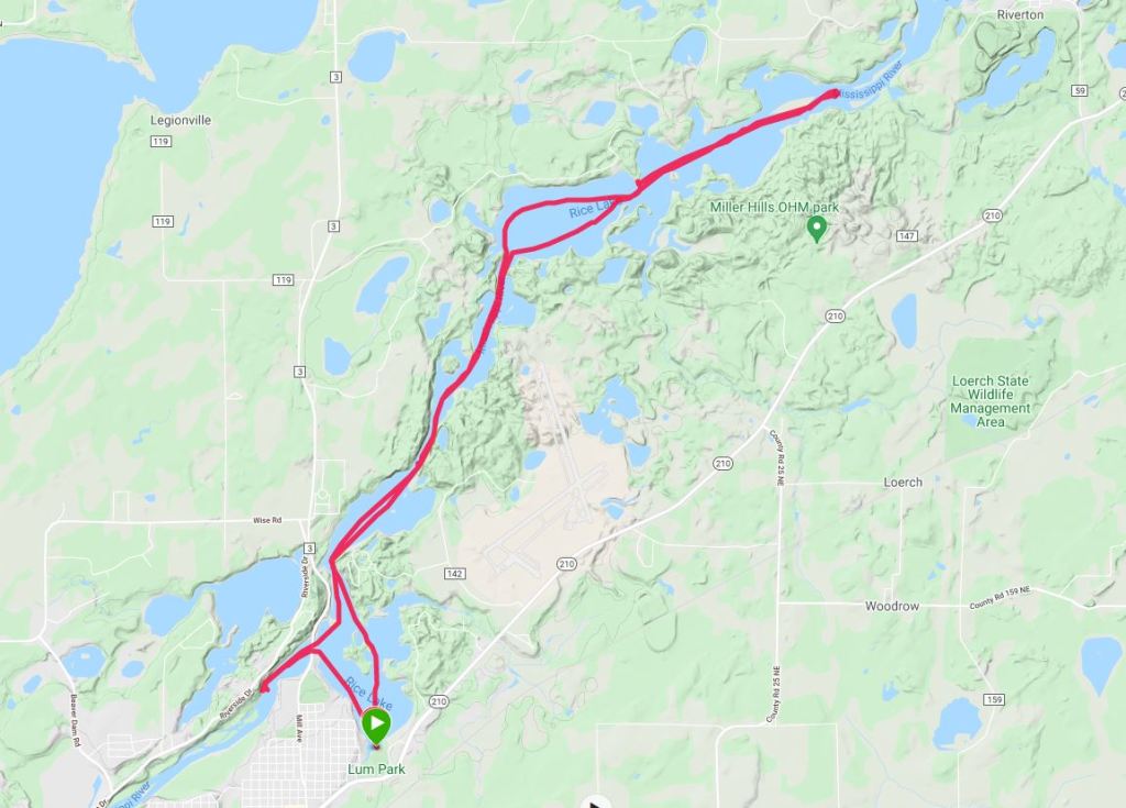
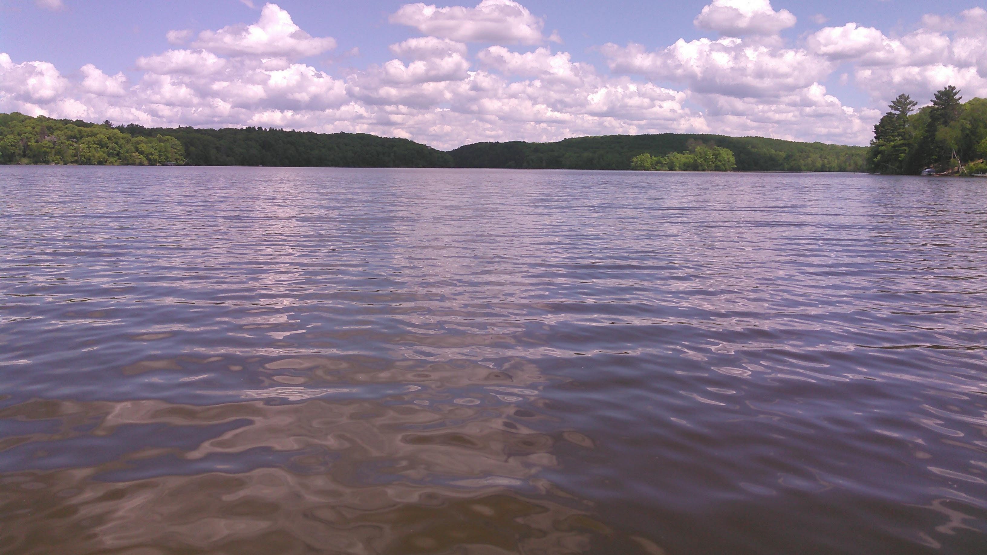
I wasn’t ready to go home yet without completing this section of the Mississippi. So we put in at Lum Park in Brainerd and paddled up to where we had turned around five days earlier. This time the wind wasn’t so strong. The skies were a fantastic blue. There isn’t much to report from this section of river. Paddling upstream from Brainerd it was initially lake-like, likely owing to the rather large Brainerd Dam, then there’s a narrower channel through an area labeled French Rapids (there aren’t any rapids here although perhaps there were some before the dam was in place), and then it got swampy.
In the French Rapids section there was a rope swing that Erik eyed. On the way back downstream, we stopped here and Erik said “one more time!” after every swing Then we paddled down to the Brainerd Dam, got out to walk the portage (very nice and there are even pit toilets) and finally paddled back to our car at Lum Park.

Overall this was a successful trip, even if we deemed the Rabbit River “unpaddle-able.” I would highly recommend the lower Pine River for its clear water and sandy bottom. Oh, and I’ll be looking for the Strava records for the Pine-Pelican-Star loop for those hardy paddlers!

Really enjoyed reading this & seeing the pics. Greatly envy the beautiful rivers and lakes you have over there (although I do live on a beautiful river here in the UK). Oh, and I would recommend giving poling a go (pelican River). I started using a home-made pole a couple of years back and wish I hadn’t waited so long. Excellent for upstreaming in shallow water.
LikeLike
Thanks for the comment. Was is your pole made from and how long is it?
LikeLike
Forgot to add, optimum length for standing is reckoned to be 10 – 11’ depending on your body height. Max depth for poling about 3’.
LikeLike
I made the pole by laminating three long strips of wood using epoxy glue, then shaping to round and tapered. It is very strong yet slightly flexible which is nice. Blunt metal spike at bottom end plus a thick epoxy coating round the bottom 6”. Only 8’ long, as I use it from a kneeling position due to a historic injury which affects my balance. A useful reference is ‘Beyond the Paddle – A Canoeists’ Guide to Expedition Skills: Poling, Lining, Portaging, Maneuvering Through Ice’ by Garrett Conover 1991. An American book – you may know of it / have it already. I use my pole all the time when my paddle would otherwise catch the bottom. Faster, easier, avoids wear and tear to paddle tips. Best wishes!
LikeLike
Thanks! We’ll have to check out the book!
LikeLike