
Located in eastern central Minnesota, the Snake River flows largely south from McGrath to Mora before turning east and winding its way to the Saint Croix River. The watershed to the north flows into Lake Superior, but the water on the Snake will eventually make its way to the Gulf of Mexico. Spanning nine years, my husband, Erik, and I paddled the Snake in four different trips. Here are the reports, not in chronological order, but rather in river mile order. Click here for the Minnesota DNR map of the Snake River.
Part One: 9/22/19 from McGrath (mile 83) to County Road 3 (mile 56)
Water levels: 7.37 feet at McGrath; 950 cfs at Warman
The impetus for paddling this section of river on this date was my coworkers wedding near Willow River. We went to the wedding on Saturday, stayed on the grounds in a tent, and then paddled on Sunday.


While the river certainly starts above McGrath, the first official put-in on the river is at McGrath (technically at the Bear Creek Landing). Shortly above there, the river divides into ditches and would be conventionally considered un-paddle-able.
Around mile 74, the river gets rough with a series of rapids. Hoping to run a few of these, we used our packraft instead of our kevlar canoe. This section is 28 miles and would make for a long day in our slow packraft, even with both of us continuously paddling.
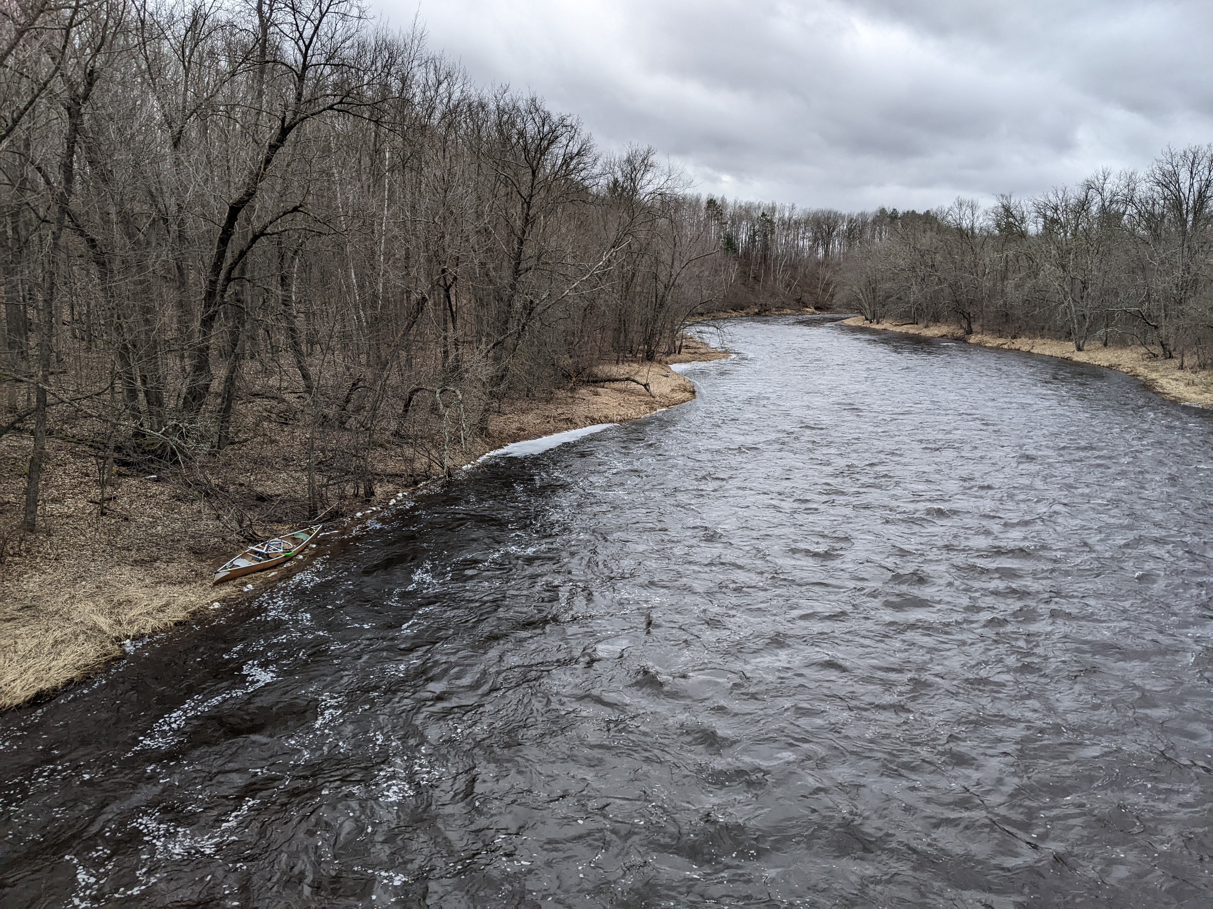
Temps were fairly mild for late September in central Minnesota at 55 degrees but the water was getting a bit cold. We strapped our dry bag to the front of the raft and shoved off. The first several miles were placid flatwater.
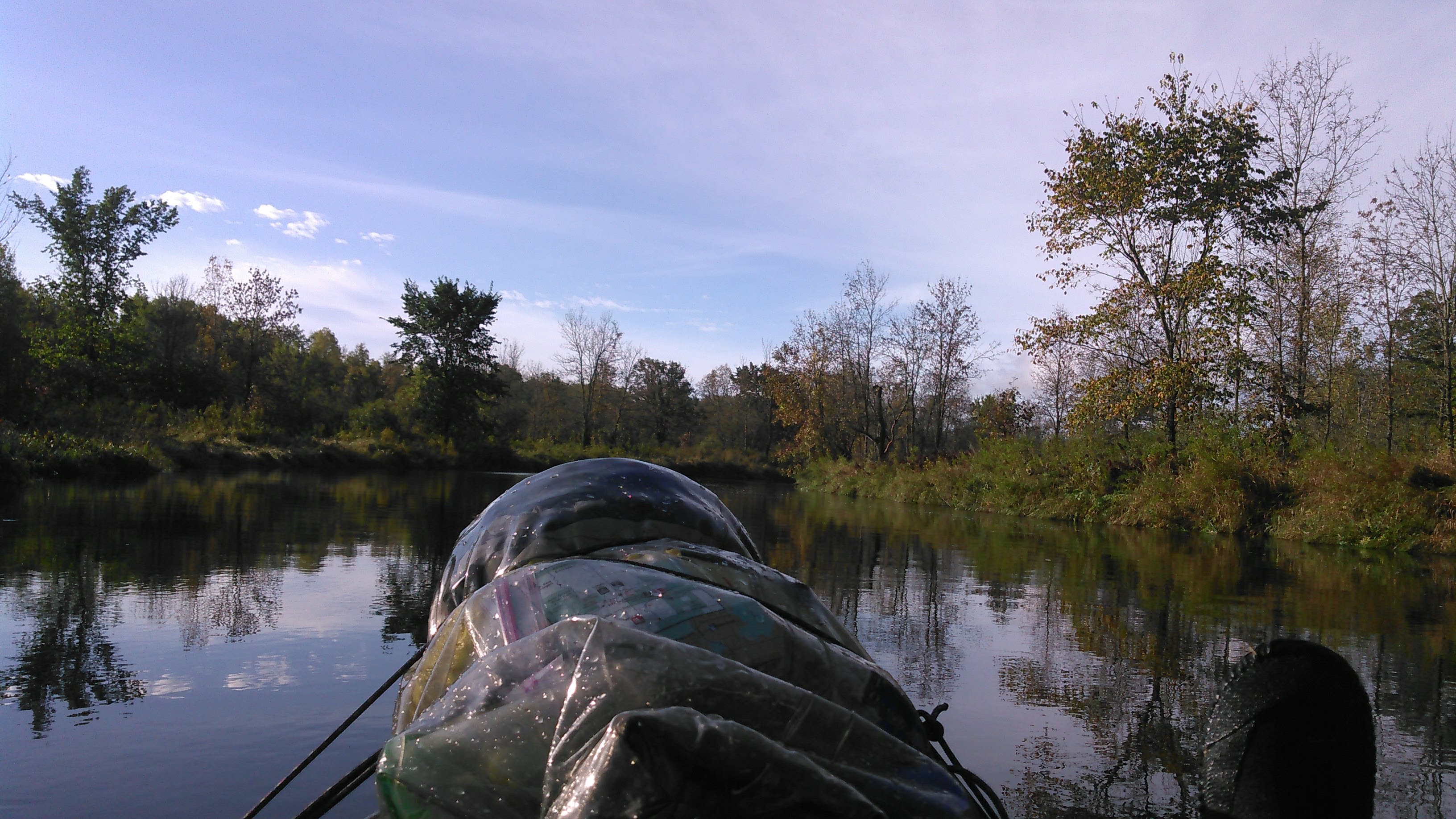
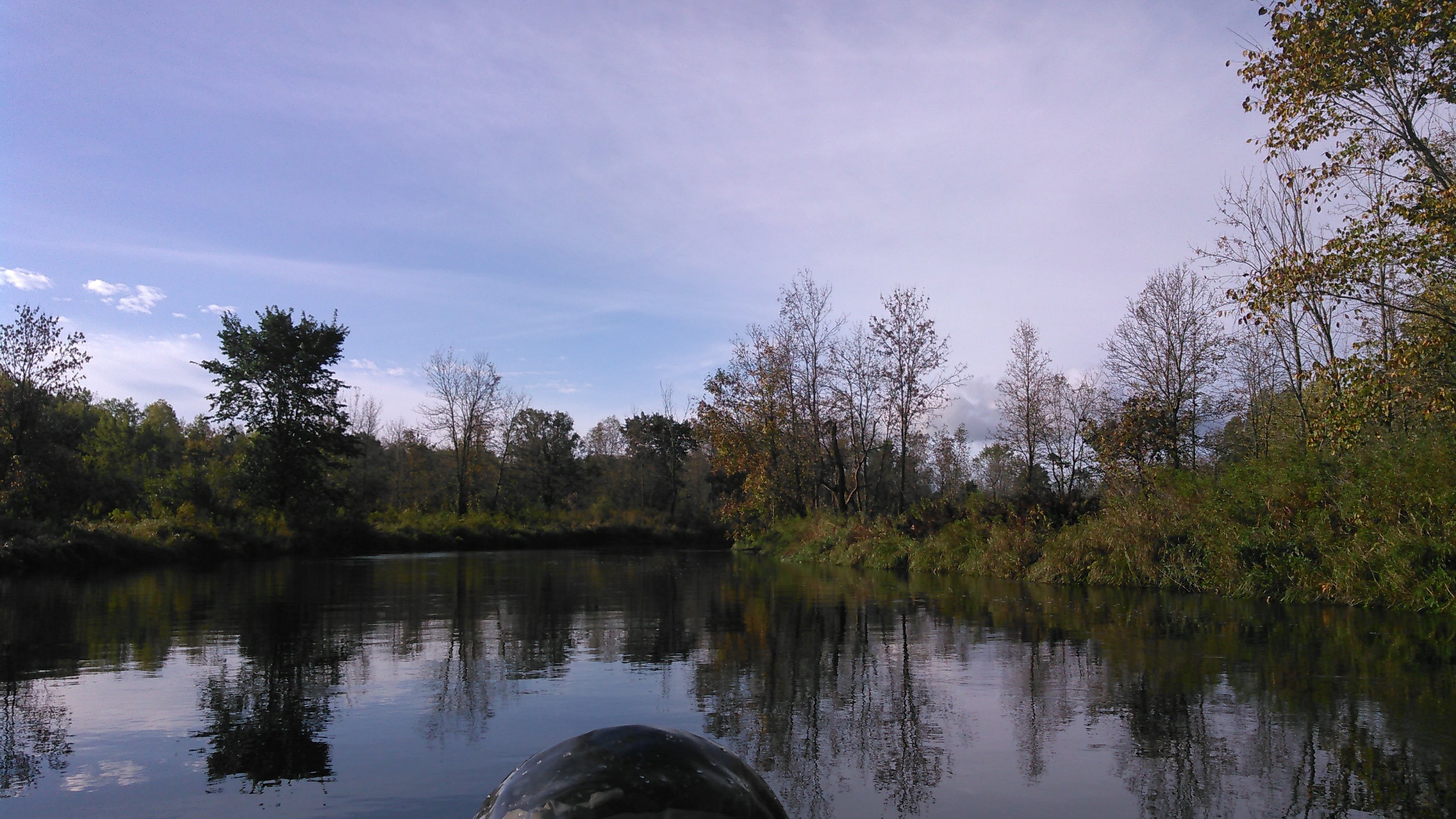
Erik and I kept a steady pace with our kayak paddles and the miles slowly ticked by. We took some photos to break up the monotony.


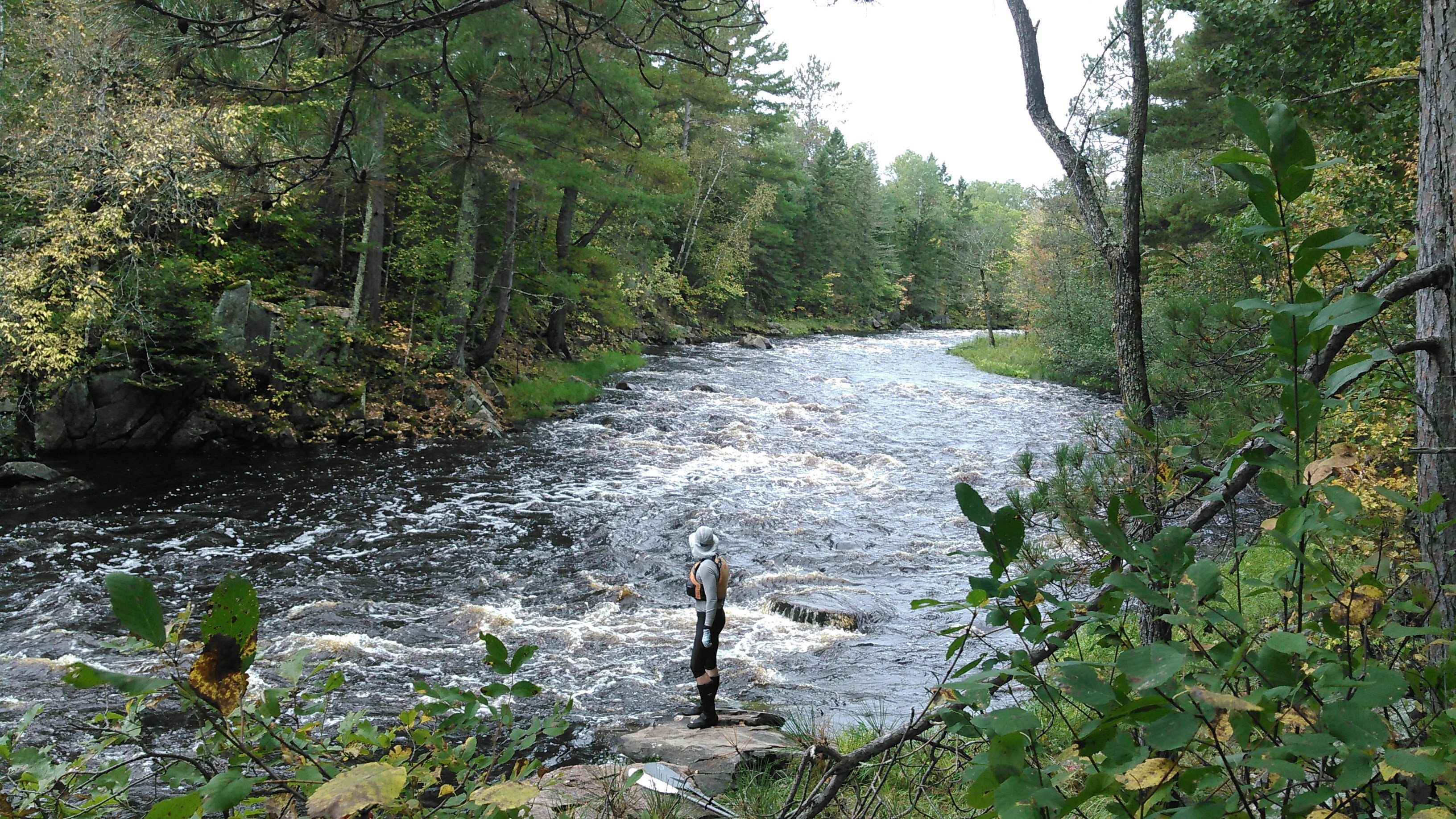
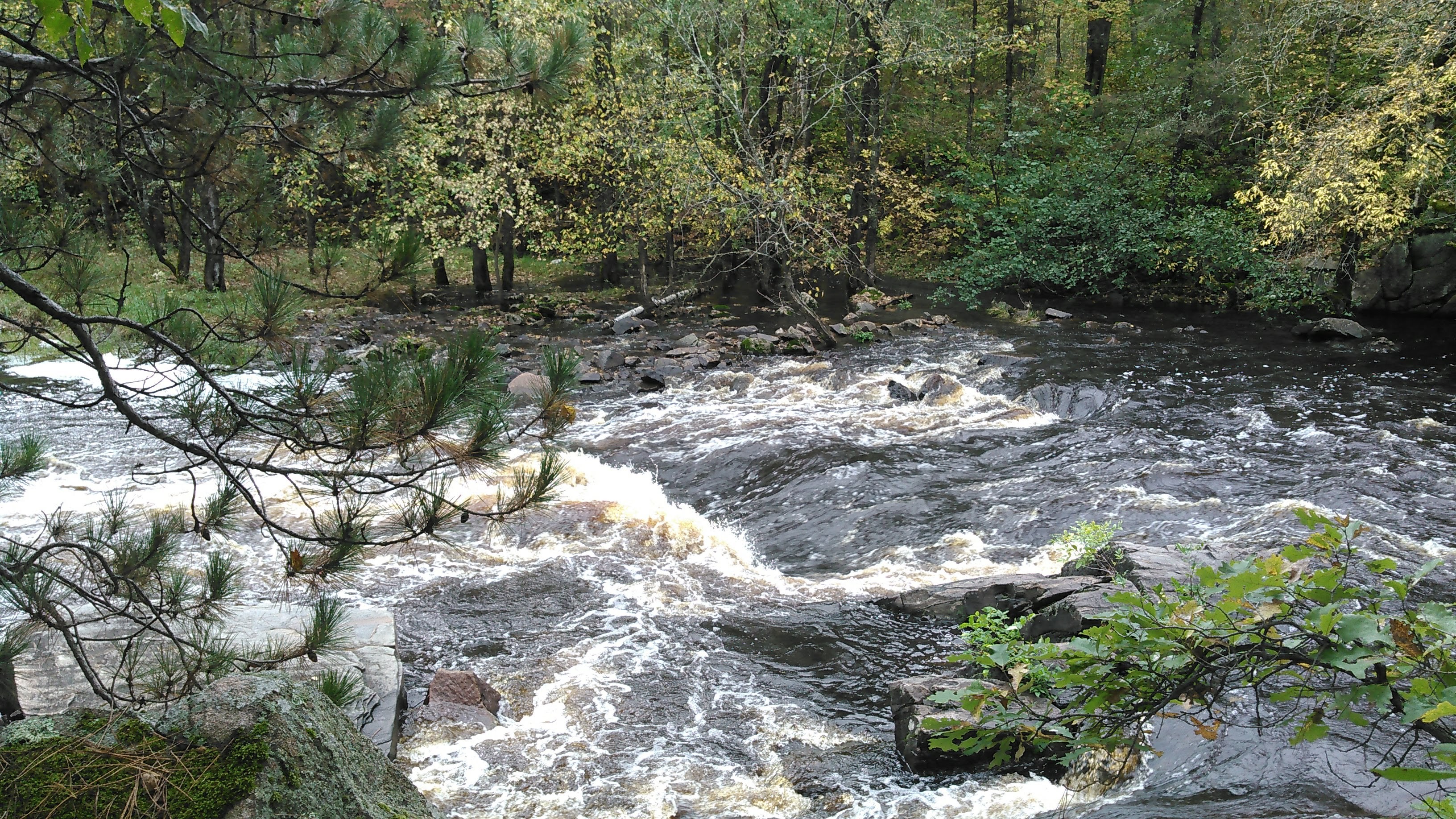
I’m always leery of whitewater. The first rapids, not named on our map starting at mile 73.6, were nothing more than riffles despite being marked as Class II. The second rapids, Upper Snake River Falls, is definitely not deserving of anything that implies a waterfall but was still intense. The map rates it a II-III. Erik of course wanted to run it and so we did without scouting. It wrapped around to the left with the main drop on the right- the kind of rapid I don’t much like because I have no idea how to steer through it. Fortunately I could leave that up to Erik and he kept us from crashing into the right bank.
After that we encountered a few more riffles/Class I rapids until we got to the portage for Lower Snake River Falls. This was was marked III-IV and we don’t do IV’s so we didn’t debate running it versus portaging. As we embarked on the portage we stopped to marvel at the “falls”- a several feet drop in the shape of a V pointed upstream that left no good line to run. Downstream of the “falls” were a series of rapids. As we portaged along, I kept looking at the river, deciding if we should get back in and run some of it. About half way through the portage there’s a campsite and we stopped there for some food. Shortly thereafter the trail again had an opening and easy access to the river. It looked like a solid run-able Class II so we got back in the packraft and ran it and then a series of Class I’s after that.
After that it was flatwater until the County 3 bridge. Erik and I got to work paddling steadily with the kayak paddles. At mile 66.6 there is the Old Wooden Dam that we never saw, presumably because water levels were high. Again at mile 64.2 there’s another dam- a rock dam marked as class I-II, but we only saw some riffles.
Eventually we stopped for another break and Erik said I should take up the stern to break it up. I did and not much steering was required but it did keep me more engaged.
After 6 hours of paddling time, another 48 minutes for a couple lunch breaks, we arrived at the County 3 take-out where we had stashed Erik’s bike the day before on the way to the wedding. Erik rode the 21 mile shuttle while I killed time.
Overall, we averaged just 4.7 miles per hour. It made for a long day. This section is a bit odd with a couple miles of whitewater in the middle. I’d consider doing it again because it’s a pretty wild stretch, but definitely in the packraft because the rapids were kind of fun. And of course at high water levels.
Part Two: 5/4/13 from County Road 3 (mile 56) to Mora during the Snake River Canoe Race (mile 41)
Water levels: data no longer available at Warman or Mora

The Vasaloppet puts on the Snake River Canoe Race annually the first Saturday in May. Erik and I raced this together in 2013. It was a chilly start at 34 degrees. The current was steady and we averaged 6.7 mph to complete this 15 mile stretch in 2 hours and 15 minutes.
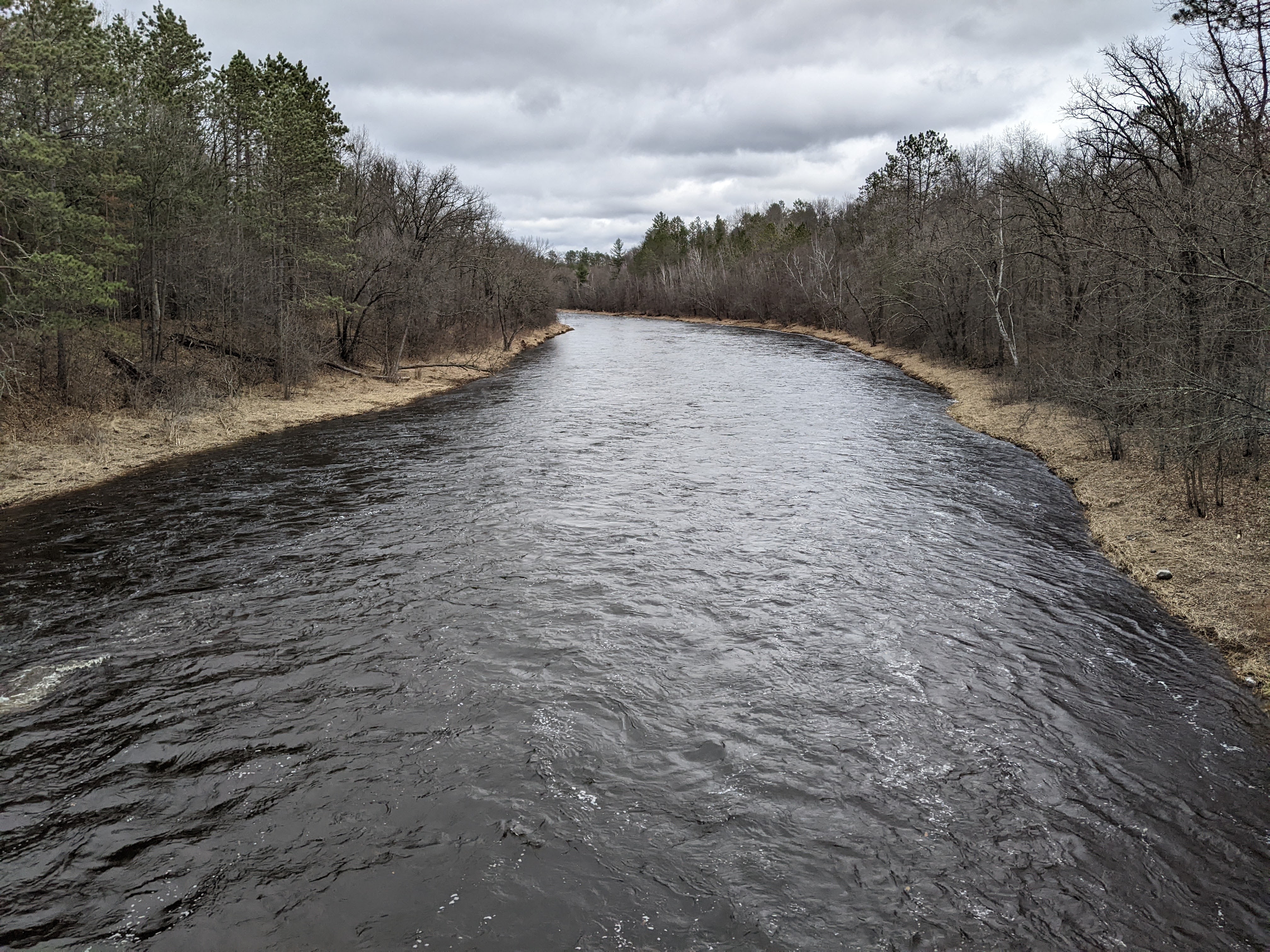
When racing, the miles went by quickly. We were working hard, dodging other canoes, and sometimes getting passed, and didn’t have much time to look at the scenery. Water levels were medium to high and there were some occasional riffles and rocks that were easily avoidable. This is a good stretch, again, assuming medium to high water levels.
Part Three: 4/27/18 Mora (mile 41) to Pine City (mile 13)
Water levels: 4200 cfs at Grasston (very high)

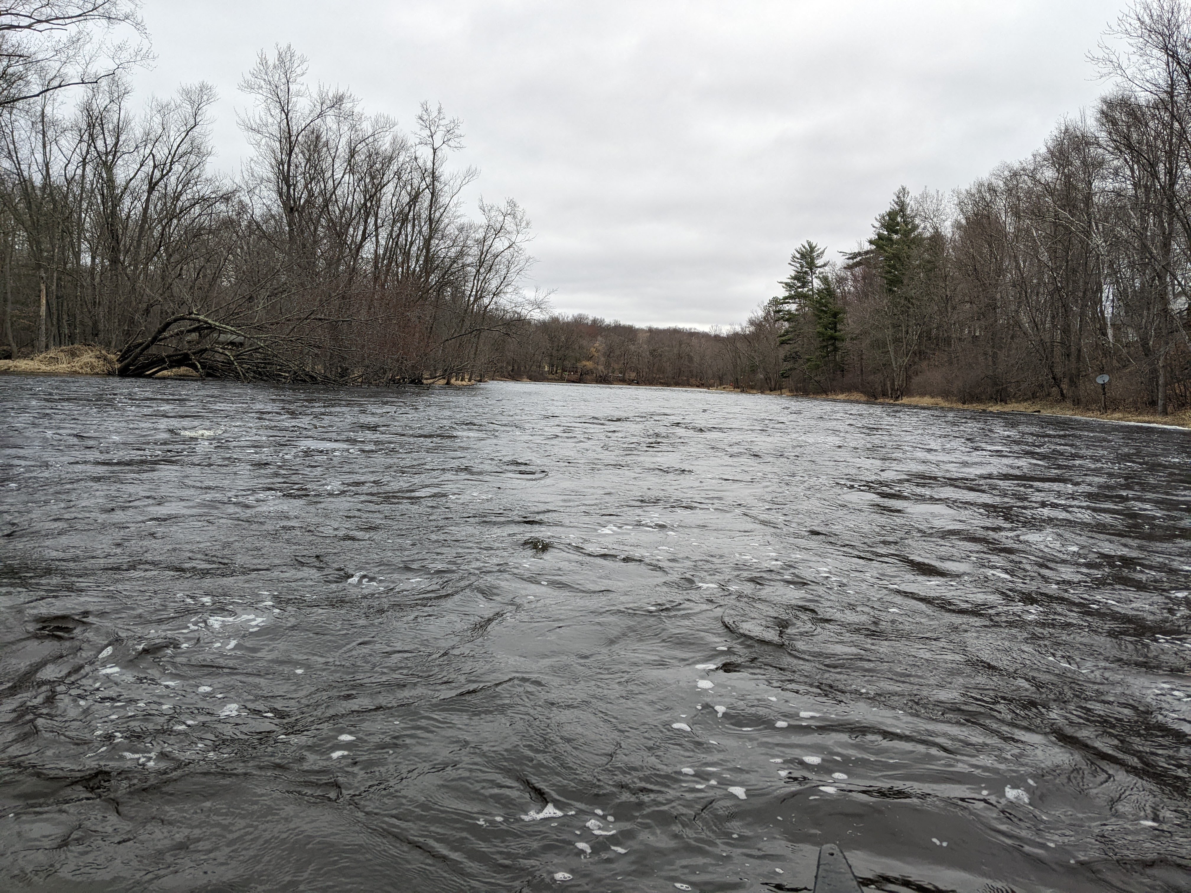
I had taken the day off from work and Erik had it off as well. Water levels were again high and so we decided to do this stretch of the Snake River. This is the gentlest of the parts with no rapids or dams. The current slows markedly by Pokegama Lake as it starts to get backed up from the Cross Lake Dam.

The river was flooded as we paddled but we didn’t try for any shortcuts, mostly because the river is relatively straight.

At 28 miles plus a bike shuttle, this got to be a long day. Fortunately we had the high water levels and a fast current to boot.

Part Four: 4/24/22 Pine City (mile 13) to the Saint Croix (mile 0)
Water levels: 4.87 ft at Pine City
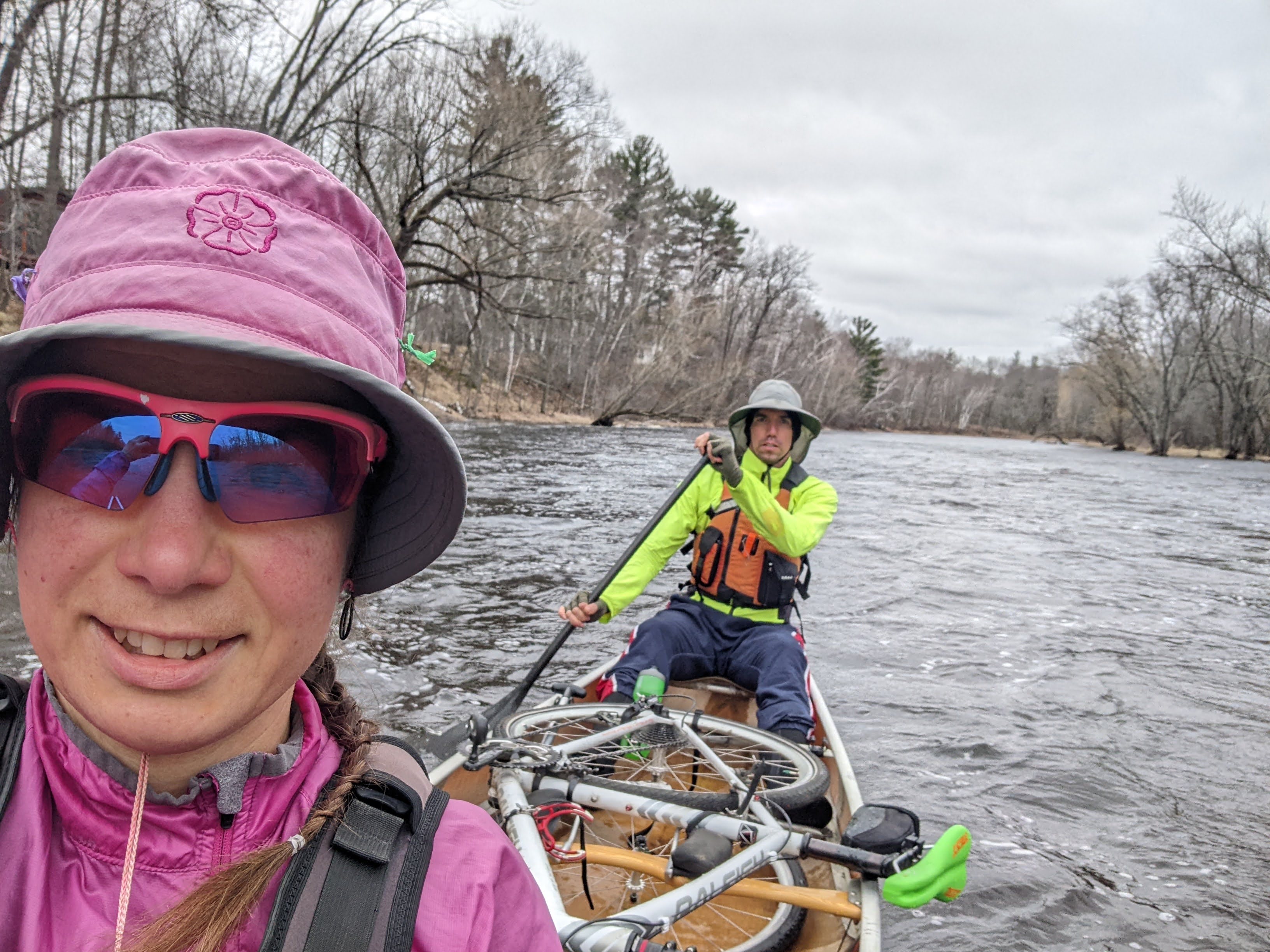
I’d had tribulations about doing this stretch of river for a few years since there’s almost continuous rapids marked downstream of the Cross Lake Dam. I debated using our kevlar canoe versus packraft every time I thought about running this stretch. In the spring of 2022 we had very high water levels and our pick of rivers in the state. Finally, I decided it was time to tackle this last stretch of the Snake.
Our spring was quite late, hence cold, often rainy, and windy. And so at 43 degrees with a wind whipping from the south, and sprinkles falling from the sky, we carefully untied our canoe from the car and held it tight so it wouldn’t blow away. We launched and after a brief section of river, were out on Cross Lake. By all means, this should’ve been the easiest part of the trip, but with ice-out just a week prior, sideways swells, and our canoe loaded down with Erik’s bike for the shuttle, this quickly became the most dangerous thing I had done since our glacier traverse over a half year earlier.
Once we left the comfort of shore, I realized if we capsized we would likely die and for sure there would be no saving the canoe and Erik’s bike.
Fortunately the lake is less than a mile wide, we remained calm and kept our composure, even as the waves squirreled under us, and soon we were near the far shore and turned to travel with the wind. I breathed many sighs of relief, knowing that if we did tip, we could easily make it to shore and likely save the canoe in the process.
The dam at Cross Lake has been somewhat recently converted from concrete to rock. We certainly weren’t about to shoot it in our kevlar canoe, but maybe just maybe had we brought the packraft, although we most definitely would’ve hit a few rocks, so maybe with even higher water levels. So we portaged the dam.
Downstream of the dam we got to paddling and the current was cruising. “We just did a 7:30 mile!” Erik yelled to me above the drone of the current. The river was definitely moving fast and there were almost continuous riffles but the water levels were just high enough we could use our good carbon paddles without worrying about hitting rocks. I believe we hit the water levels perfect-deep enough there were no obstructions but not so crazy it was out of control.
We were a bit surprised to come upon another canoe seeing as the weather conditions were less than favorable, but they were locals and knew the river well and seemed to be enjoying themselves.

A couple hours in it started to rain. Soon we were getting cold. Very cold. Eventually we lodged the canoe into shore, hung onto some tree branches, and one at a time got on our rain jackets to get warm. It stopped raining shortly thereafter, but kept threatening for the rest of the paddle so we kept them on, and it got us warm.
After an hour and 43 minutes and 10.4 miles since the dam, we came to the Willard Munger State Trail Bridge. This is a fairly fancy bridge. We got out, ate some food, took in the view, and walked around for a bit to get the blood flowing to our feet again.
Finally warm, we got back in the canoe and paddled the last 1.5 miles to the St. Croix, again at a blistering pace. From here we actually kept going down the St. Croix to the Steven’s Creek Landing to get in more paddling time and because the St. Croix wrapped back west, it was about the same bike shuttle distance.
This may have been our favorite part of the Snake, perhaps because we hit water levels just perfect. So fun to go so fast!
Minnesota’s Snake River is a gem and located within a 2 hours drive of the Twin Cities. The scenery isn’t terribly amazing and paddling the whole river might get a bit boring. I’d highly recommend the last 11 miles from the Cross Lake Dam to the St. Croix during high water and also a small stretch above Mora as well. And definitely the Snake Rapids for anyone who likes a little whitewater:)

Awesome description and guide to this river. Helped me organize a trip from Cross Lake to the St Croix and further. Thanks!
LikeLike
Do you think the section downstream of the dam to the St Croix could be floated in a tube?
LikeLike
Yes, definitely, but caution with high water (wear a lifejacket and make sure everyone can swim). I’m guessing at low water this would be a great way to get down the river.
LikeLike