
Nestled in southeastern Minnesota, the Zumbro River has multiple branches and forks that come together to make their way to the mighty Mississippi. Carving through the driftless region, this designated Minnesota Water Trail passes bluffs, farms, and quaint towns. Water levels are often low, so it’s imperative to check gauges before setting out. Usually Erik and I like to paddle when the readings are high or very high, or at the very least, on the high side of medium. Given the Zumbro is fairly close to our house and includes some 150 total miles, we plan to paddle the river over a number of day trips.

4/8/23: North Fork of the Zumbro: Zumbrota to Zumbro Falls
Gauge CSAH7 near Mazeppa read 663 cfs which is on the high side of medium and Zumbro Falls gauge read 9.69 ft = high
The North Fork is small and winding. It drops a precipitous by Minnesota standards 5.7 feet per mile over this section. At these water levels, the current was strong and even looked a little intimidating as we went to put-in at the Covered Bridge park in Zumbrota. This was our first time paddling in 10 months and combined with cold fast water this wasn’t necessarily the smartest decision.


The guidebook, Paddling Minnesota, warned of log jams and we hadn’t even gone a mile when we came upon the first one.

Although the bank here wasn’t terribly high, it was steep. We both had to use our hands to clamber out. Then we had trouble putting back in as again as it was an undercut 10 foot muddy bank. That first mile took us 19 minutes. We hoped there wouldn’t be too many more logjams.


Our next mile took us just over 9 minutes. We thought perhaps we were clear of logjams but just upstream of the first bridge, the pillars from the old bridge were still in place, creating another log jam. At least this time the banks were gradual and other than fighting with a downed tree onshore, the portage went much faster and that mile took us only 14 minutes. Back on the water the miles were ticking by, all in the low 9’s.

Near the town of Mazeppa there was a down tree across the entire river, submerged just enough to create a half foot drop and odd standing wave. We floated over, the stern bumping on the log.
Our edition of the guidebook, published in 1999, said there was an 18 foot dam in Mazeppa that the county was planning on removing that would presumably leave some rapids. We checked these out on Google Satellite, which is only relevant at the captured water level. Erik always wants to run rapids but I was like “That dam was 18 feet. I’ve never ran an 18 foot dam before!”
As we approached the rapids in Mazeppa, the first wave looked pretty big. I demanded that we scout which Erik agreed to, although instead of getting out of the canoe, he merely stood up in the canoe to get a better view and then decided we could run them. This was fairly audacious seeing as the water was still very cold, we were in our Kevlar Jensen 18, and we also had a bike strapped down in the boat. I saw the size of the wave trains and knew I was about to get soaked and sure enough the bow went under in the first wave train. Water poured into the front and some got down my tall boots. Then we got horribly thrown sideways and I braced as hard and fast as I could, absolutely determined NOT to tip. Erik did something in the back (later he admitted to actually dropping his paddle and grabbed the gunwales) but was able to lean us well enough to right the canoe and my brace ended up being not that hard and short-lived. We bounced through a few more waves and then took a break at the city park on river right. The first thing I did was take off my “Alaska” boots and dump out the extra water.


We took a lunch break, walking near the river and taking photos from two bridges. While doing so, a woman from the local Mazeppa-Zumbro Falls Messenger came to interview us. She had been on the bridge when we shot the rapids and wanted to write a piece about us because not many people boat this section of river. Classic. Last year, in our well over 200 miles of paddling Minnesota Waterways, we saw just two other canoes. This is exactly why I write this blog and do these things. Because our Minnesota rivers are amazing.

After Mazeppa the river picked up even more steam, sweeping around near constant river bends. I thought about taking a photo, but the river demanded attention. We didn’t have any close calls or near misses, but we were occupied picking the deepest channel, avoiding wave trains, and powering past sweepers when the current threatened to push us into the outside bank. It was a bit like we were on a ride. The snowy south bank would come near, casting us in shadow and emitting its cold air, then we would turn away to the open valley, basked in sunshine once more and warm air. We caught occasional wafts of manure. But mostly we focused on the river.

And then, just like that, the main branch of the Zumbro came in from our right. Suddenly the river got much wider and the riffles and navigating the deepest channel ended. The river got boring as we paddled the last 7.5 miles to Zumbro Falls, but the current was still chucking and we made crazy good time, even aided by a tail-wind at times. Our fastest mile was 8 minutes on the dot.


We were cruising so fast we didn’t need to stop for any more breaks and soon enough, without much effort in the strong current, the second bridge in Zumbro Falls came into view and we took out at the canoe carry-in access immediately downstream of the bridge on our left.
Of note, according the the guidebook, the low falls for which [the town of Zumbro Falls] is named has eroded to become a stretch of rapids. Per the map these look to be downstream of where we took out.
Uffda…this was one engaging paddle until we hit the main Zumbro. 23 miles in 4 hours and 18 minutes including portaging two log jams, a lengthy lunch break complete with a newspaper interview, snowy bluffs, fast current, and a solid Class II in Mazeppa made for a fulfilling adventure!
5/10/25: Zumbro Falls to Funk Ford
River gauge at Zumbro Falls read low at 6.5 feet.
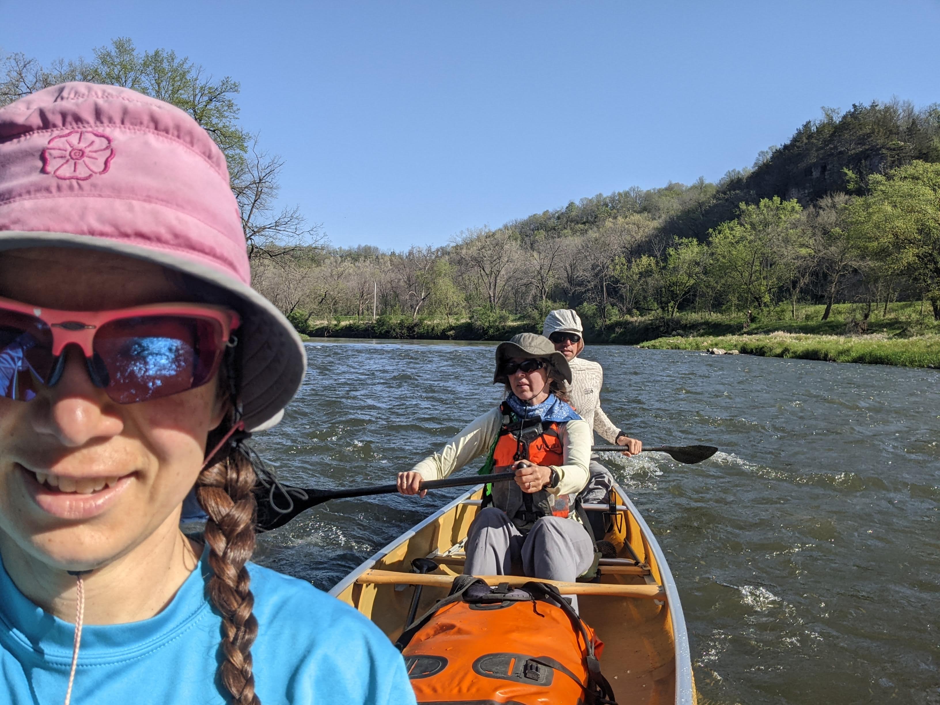
We paddled this section with some of our friends. There were six of us total and thanks to our friend Emily, we used two Wenonah Minnesota 3 canoes. Erik and I startled paddling with our friend Emily at 8:30 am sharp after we drove down from the Twin Cities. Water levels were markedly lower than our previous paddle on the North Fork and we tried to find the deepest channel. If we missed that channel we were in “suck water:” very shallow water where the boat slows down, steering is difficult, and our paddles hit the bottom if we put them in all the way.
Despite the low water levels, the current was still good and we made good time, often averaging just under 10 minutes per mile according to Erik’s Garmin. There were frequent riffles/Class I rapids not noted on our map. It’s probably a stretch to call these Class I as the waves were all very small and it was more about finding the deeper channel.
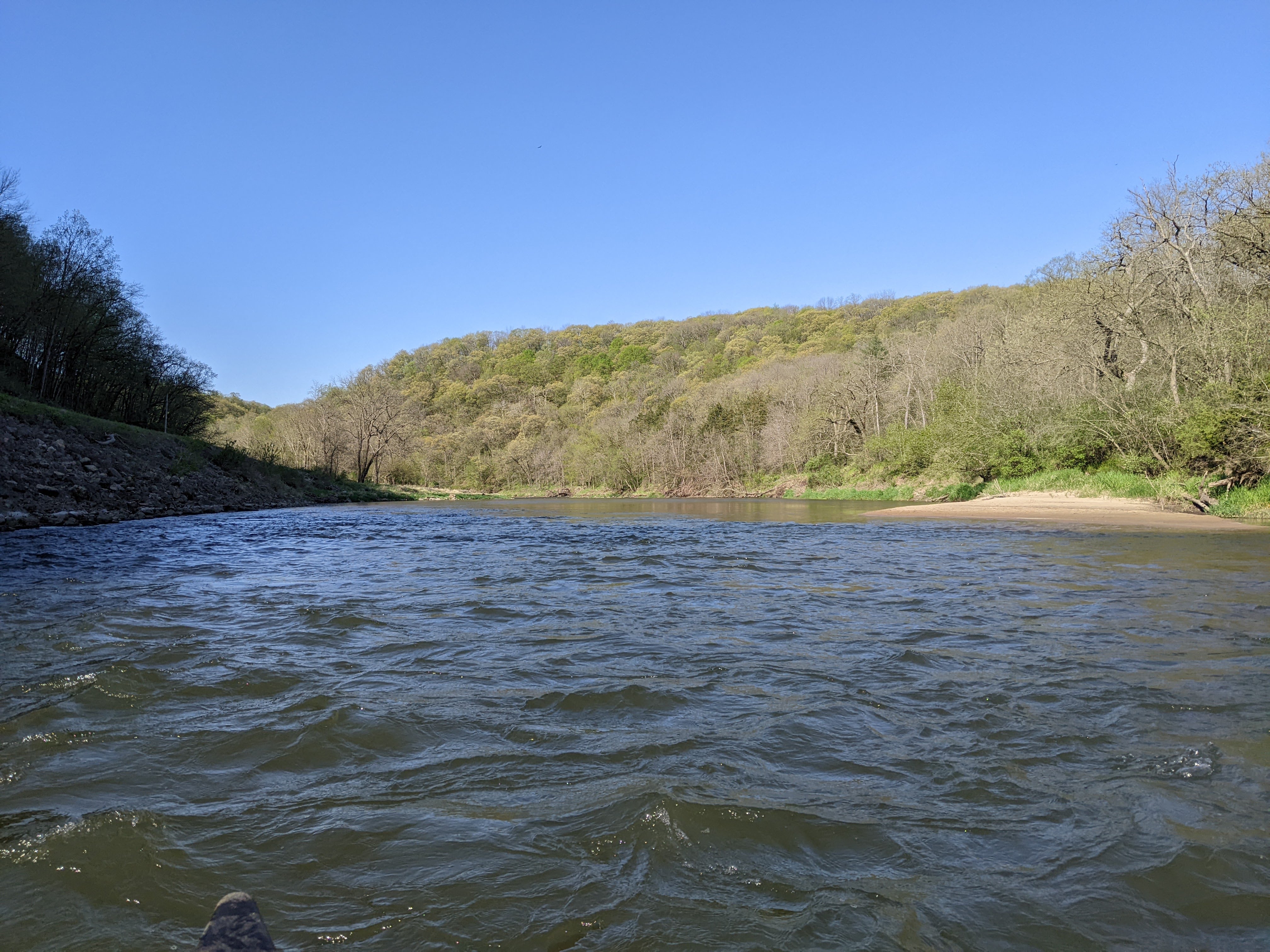
The scenery was interesting with near constant bluffs and even a couple cliffs.

In the town of Hammond there was a Class I rapid marked on our map. At these water levels this was a large section of shallow ripples that we mostly floated through with minimal paddling.
At 10 am sharp, my planned time, we arrived at the Hammond Watercraft Campsite where we met the other three in our party. They’d actually started the day before in Mazeppa and would only be going as far as Funk Ford. They said a couple times they’d had to get out of the canoe the previous day when water levels were too shallow.
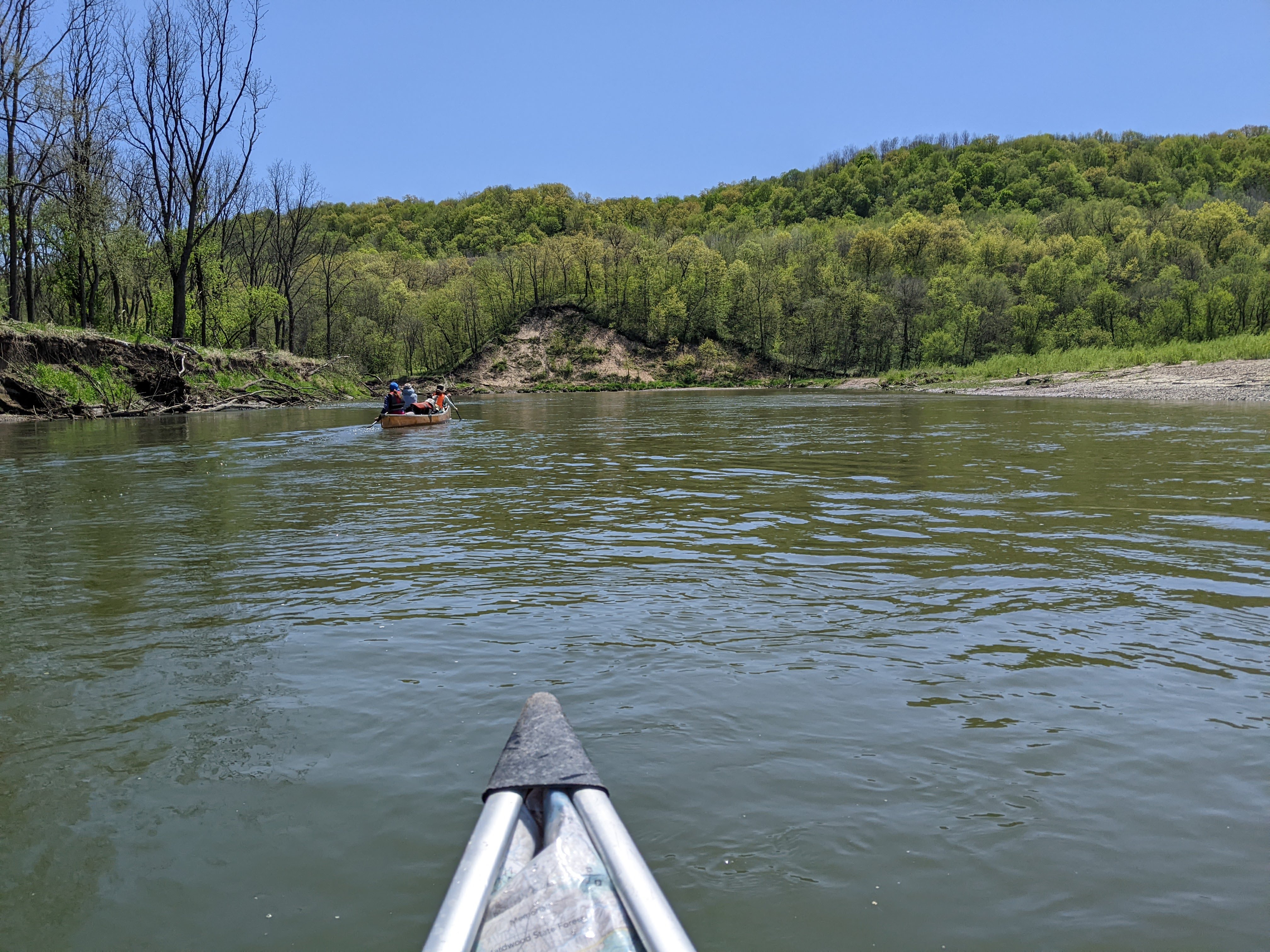
We mixed up who was canoeing with whom and got to paddling downstream. We started to encounter more trees down in the river. Unlike many other rivers where there are log jams before the trees have fallen down and crossed the river, most of the trees appeared to have been carried downstream in flooded waters. Thus we never had to get out of the boat but occasionally the trees were taking up the deepest line with the most current. Every once in awhile we got caught in a shallow channel or took a corner too tight.

We stopped for lunch and then another brief break to let our friend’s dog out of the canoe on sand bars. We passed a couple guys jamming out to music from their kayaks who were fishing from a sandbar and another large party of kayakers who were mostly floating.
By 3:30 pm we’d made it to Funk Ford where we sent Emily and Craig to shuttle cars while the rest of us paddled a little less than a mile downstream to the campsite. Not unlike many of the DNR watercraft campsites, this one was in need of some work. There was at least a fire pit, grate, and picnic table. Erik had brought a saw and got to work clearing brush while Eva cleaned up some leftover buns, beans, and brats. I walked back to the Funk Ford Bridge on the Zumbro Bottoms trails to lead Emily and Craig to camp.
Once everyone was back in camp we made some dinner and a campfire. We listened to the birds (whip-poor-will, swans, owls) and one loud frog. Then we headed to bed.
5/11/25: Funk Ford to the Mississippi River, then upstream to Wabasha
Gauge at Kellogg read scrapable at 671.50 feet
In the morning, we got up early with the sun (although never as early as I’d like) and by the time we got to paddling at 7:30 am, the wind was picking up. Emily, Erik, and I said bye to the remainder of our group who was canoeing back upstream to Funk Ford and we got to cruising through many a miles. The scenery persisted as we first went around a big bend with a high bluff. There were a few more high bluffs and then within a couple miles we were down in the valley and passing a few farms. The current remained good and the river twisty until we headed under the Hwy 61 bridge.

From here the river flowed directly east for a couple miles without any bends. We pondered if the river had been dredged. The channel in this section was nearly impossible to follow. It weaved back and forth even though there were no bends. We’d go from nice deep paddling to soft strokes with our paddles barely in the water if we just followed one side of the shore. Eventually we turned south and just before it drained into the Mississippi, we went around a nice bend with a sand bar where we stopped for lunch.
Once back in the boat it wasn’t long before we paddled into the wide Mississippi. The wind was howling from the south, bringing in some hot air for May, and we were glad to turn north and surf some waves even if that meant paddling upstream. The wind was ferocious here and we would have made good time to the Alma Dam except that we tried to take some back channels and really just ended up adding miles.
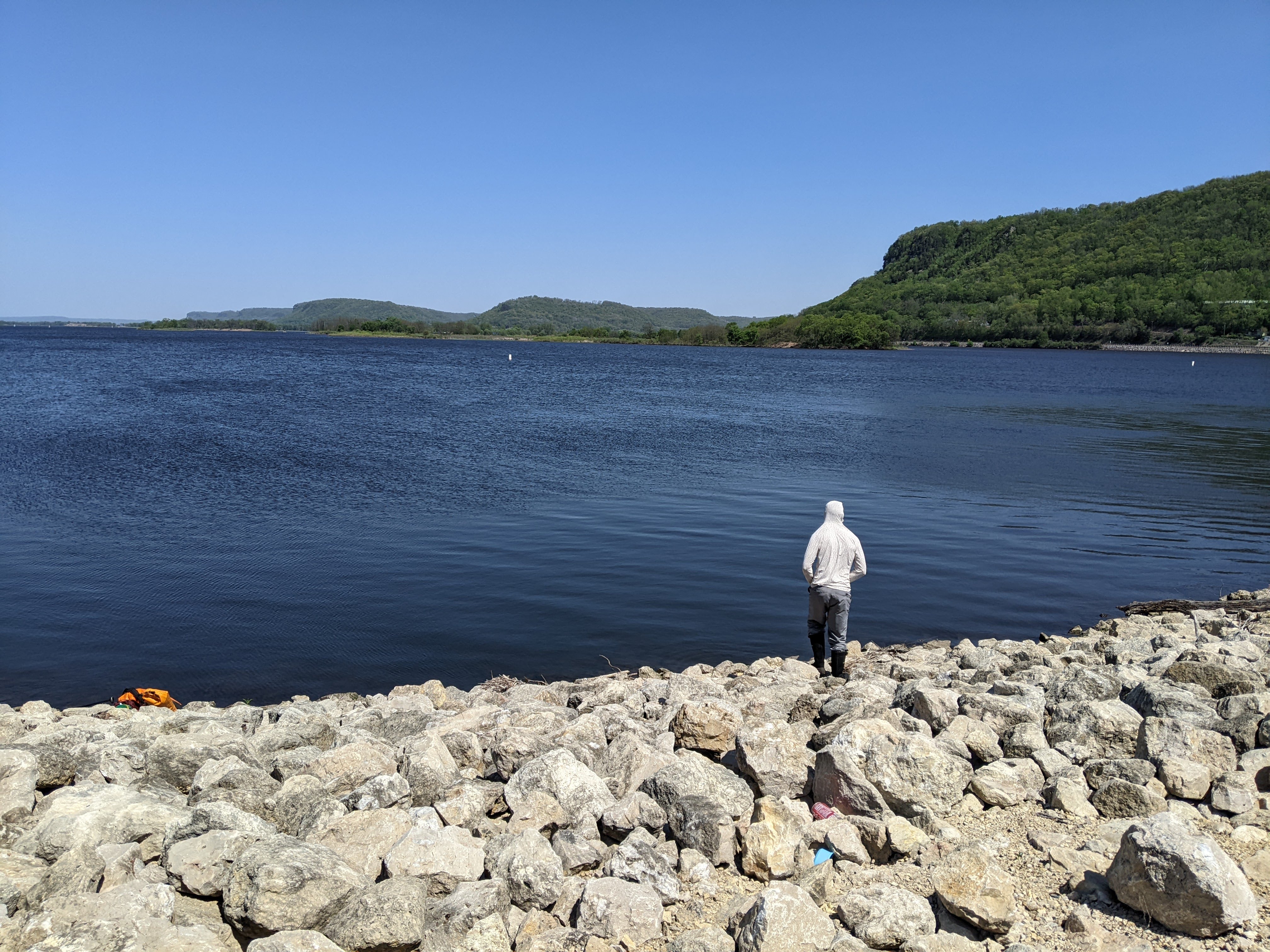
Instead of taking the lock, we decided to portage the dam. Perhaps this would’ve been a good idea except that they’d dumped a bunch of boulders. I got some practice on the rocks for off-trail hiking in my future but it’s really hard carrying a canoe.
And there were snakes! We saw two. One was a garter and we think the other two were milk snakes. One was pretty long and was in our way so we forced it to swim while we portaged along the shore. I love seeing snakes swim — as long as I’m not in the water with them!!!
After the portage we kept paddling north, first with a fairly strong wind that lessened as we turned more west-northwest. There were a couple giant sand banks that Erik thinks is from dredging the shipping channel.
By the time we got to Wabasha, temps were in the upper 80s and we were ready to be done for the day after paddling 27 miles.

One thought on “Canoeing the Zumbro River”