
This year in my ongoing quest to combine state high-pointing and medical conferences, I’d decided on Asheville which would set us up well for a day-hike to the top of North Carolina and a backpacking trip in Great Smoky Mountains National Park to include Tennessee’s highest land.
I was stoked for this trip until a few days before when I checked the weather forecast. While home in Minnesota predicted perfect dry fall conditions of sunny and 70s, Asheville predicted two inches of rain the night we’d arrive and be camping. Then it was four inches of rain. But wait, what causes four inches of rain??????? A hurricane!
Thursday 9/26/24: Fly to Charlotte
Our flight into Charlotte was scheduled for mid-day on Thursday September 26th. We weren’t sure this was going to happen but it did. The pilots immediately warned us of rough air for the second half and had flight attendants take their seats an entire hour early. We hit some brief turbulence half way through the flight and then it was completely smooth for the remainder. Our national forest campground reservation at Black Mountain had been canceled given the forecast so Erik suggested we get a hotel in downtown Charlotte since it was the most “walk-able” location he could find and the weather was supposed to be much worse up in Asheville.
It was raining when we arrived in Charlotte but not crazy hard and it wasn’t very windy, but this was just the beginning. We got our rental car, an electric Polestar which Erik would subsequently test its acceleration in coming days, and drove to the hotel. I wasn’t too enthused to go walk around in the rain so I killed time in the hotel room, occasionally looking out the window at the steady rain and checking for any wind.
Friday 9/27/28: Drive to Asheville (or not)
The highest winds were to come around dawn. Hence, once I got out of bed I opened the shades to check on the wind situation. I could see some gusts pushing sheets of rain on the top of the parking garage across the street but the few trees we could see weren’t swaying much. It was supposed to stop raining by late morning. We kept busy at the hotel gym and enjoyed a lengthy continental breakfast. By then it had mostly stopped raining so we took a brief walk around the city. It was reassuring to learn that the Twin Cities aren’t alone in our homeless problem.
We checked Google Maps and the Blue Ridge Parkway appeared open so we decided to head up for the Mount Mitchell road. There was one freeway closed to Asheville but it would be easy enough to go a different way so we took off driving west. Within half an hour we were seeing some occasional trees down. Then we noticed the power was out at most of the stop lights we were passing. Then I noticed the Internet wasn’t working very well. We passed over flooded streams with swiftly flowing brown water. There was stagnant brown water in some of the lower forests next to the freeway. Sometimes an exit ramp was partially blocked by a down tree and occasionally a lane of the main freeway was as well. Our phones kept going off with emergency notification of flash flooding but said nothing about road closures.
But Google Maps still showed the Blue Ridge Parkway was open and once we turned west onto I-40 near Hickory, North Carolina, the road looked to be closed on Google but instead was open. So we kept going. Then it dawned on us that we’d need electricity to charge our rental car. We passed one overflowing stream with a stuck car, water pouring through it’s open windows, an image I’d only previously seen on TV. We got off I-40 in the town of Marion. There was no power but Waffle House was open and people were in there eating with the lights off. We’d scouted a charging station but alas, the road there was blocked off by some state troopers. And just about every road out of town was closed. And cars just seemed to be driving through the intersections without any regard for a default four-way stop. After all, the lights weren’t even blinking red.
At this point we decided to bail on the Blue Ridge Parkway and just make our way to Asheville so we got on I-40 heading west. But a couple minutes later traffic came to a standstill. An hour and a mile later, we were routed across the median and back eastbound. Not knowing what to do, we stopped at the Pilot gas station in West Marion with a lot of other confused people.
The gas station didn’t have power and was closed. They handed out bottled water and plain foot-long Subway sandwiches. Our Internet was spotty. Erik turned on NPR. They noted they were back on the air but were broadcasting from the BBC until they could get their regular programming back up and running. I suggested we get out and talk to people. I wasn’t getting much information but one particularly talkative guy said “we aren’t going anywhere! I talked to a trucker who had a tree fall on his rig as he was getting back eastbound on I-40.” It was very 19th century.
It was unclear if we’d make it to Asheville and I said to Erik, “Even if we can get to Asheville, I’m not sure if we should go.” I tried calling our hotel in Asheville numerous times and it didn’t go through. I got an email an hour later from my conference stating that the power was out at the conference hotel. Then another hour later and the conference got changed to livestream only. Apparently the conference administrators forgot that one needs power to livestream a conference.
An hour Erik remarked that he hadn’t seen any of the same cars come back on the side road that headed towards Asheville. I was looking for some physical activity so Erik suggested I run down the road and see what was up. As I started running, I noted there were no longer any cars driving east. After half a mile I learned why. There was a bend in the road and a tree obstructing half of it. We had already learned there was a big mudslide on I-40 and that freeway was likely to be closed for a few days.
When I got back we talked to a couple people. One said that the side road wasn’t passable. Another said the river in Asheville had breached its bank and that everything was flooding. Erik got enough service to pull a map up of power outages in North Carolina. It was dismal for the entire western half of the state. We still had eight full days on this trip and it looked like it was time for Plan B. Erik reasoned that even if we could backpack in the Smokies there would be tons of blowdowns. The next closest state high points were Virginia and Kentucky but these were also in the path of the storm so I suggested we go north to bag Pennsylvania, Maryland, and West Virginia which are all within a couple hours drive of each other.
Even though my conference had been changed to livestream it was very unclear if I’d have any power to charge my phone so we made a plan to drive a ways east and then start driving north. We got back on I-40 and saw the truck the guy had told me about, stopped dead in its tracks when a giant tree fell on it. Our plan proved futile as we couldn’t get north due to flooding rivers. So we kept driving east on I-40 and finally ended up in downtown Hickory, North Carolina where we found a car charging station with power. There was also an exterior outlet where I could charge my phone. It was getting late and there weren’t any good camping options nearby so we started looking for hotels. And these were almost all full but we did find a nearby Comfort Inn.
And so after eight hours of transit on Interstates, by the end of the day we’d made it a whopping net 50 miles. It was dark inside the candlelit lobby of the Comfort Inn. They still didn’t have power. They did have running water though. We debated staying and had a fun conversation with the receptionist and owners. Eventually we decided to stay. Luckily 20 minutes later the power came back on and we celebrated!
Saturday 9/28/24: Conference Streaming, a Sketchy Run, and a Demolition Derby
Despite no Wi-Fi, I was able to livestream my conference on my phone. It cut out a few times but I got through five hours of content. I spent the next couple hours trying to use the Internet to plan the remainder of our trip once the three-day conference was over. This was pointless. My mom always says I’m too impatient when using technology but I’d literally type in a location to Google Maps and then have to walk away.
Erik found a car charger that morning but warned me there were no sidewalks to get there and he’d resorted to walking in the ditch on the way back to the hotel. He had however, found some promising Wi-Fi at Lowe’s. And so at 3 pm I left the hotel room for the first time that day (Erik had brought me breakfast) to go on a run with Erik, the long way to pick up the car and use that Wi-Fi at Lowe’s.
It was immediately obvious that the suburban area of Hickory/Conover, North Carolina scores a zero in terms of walk-ability. Somehow we navigated an intersection with like six lanes of traffic and no WALK signal. Then we ran on some roads that were way too busy and had no shoulders. I’m usually pretty daring when it comes to cars but there was a point where I just stopped and waited for a line of cars to go by before proceeding.
If I could describe Hell, it would be exactly that run. Tons of traffic and no shoulder or sidewalk. I declared if I didn’t get run over by a car the run would be a success.
“There’s a sidewalk!” we shouted as we were able to complete our last half mile of the run in some peace. Only afterwards could I fully appreciate the experience of being somewhere so hostile to human-powered traffic. I take living in a metropolitan area and state which are significantly more bike/ped friendly for granted way too often.
I browsed the Halloween department at Lowe’s and then got to planning the adventure part of our trip. After dinner at the hotel (I’m cheap so we cooked a backpacking meal) Erik had discovered that the Tour of Destruction was at the famed Hickory Motor Speedway and he really wanted to go. There was nothing else to do so I went with him. It was literally a half mile walk but because the ped infrastructure was so abysmal and it would be dark when we went back to the hotel, we drove. I don’t think I’ve ever driven somewhere that was only half a mile away in my entire life.
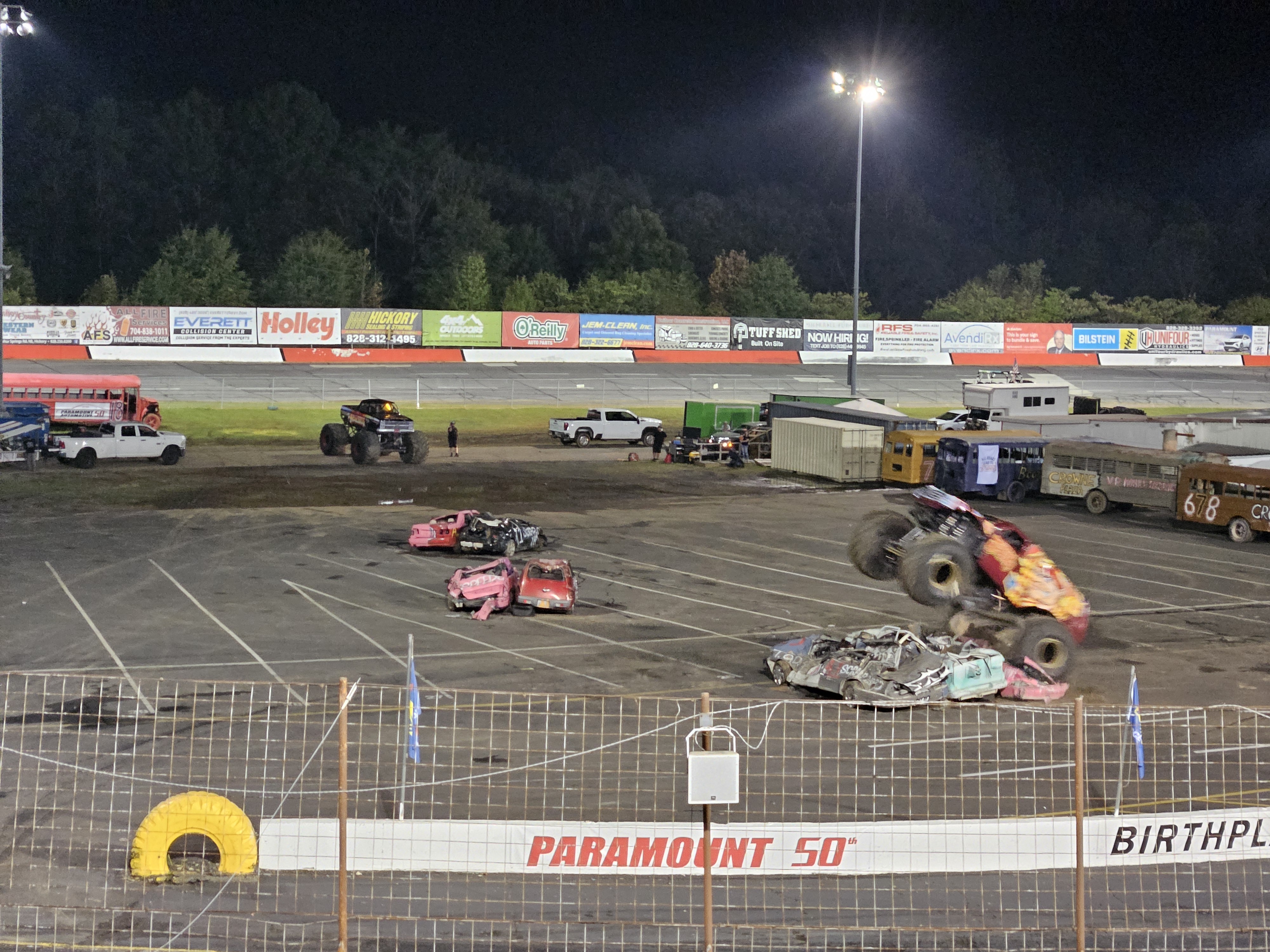
I wasn’t sure what to expect but it turned out there were lots of different races (like driving backwards, one car pushing another, a trailer race), smoking tires, monster trucks jumping over junked cars, jumping cars, and my favorite, a school bus race! It was all better with ear plugs and I got more secondhand smoke than I’ve had in the last 20 years but I suppose that’s all part of the experience.

Sunday 9/29/24: More Conference and Better Running
Still no Wi-Fi but I streamed the conference using data anyway and it only cut in and out for two of the five hours. I did more trip planning in the afternoon. The Internet still sucked but it wasn’t type-something-in-and-walk-away bad. That afternoon I made the running route. We took a smaller road into Conover proper, found some sidewalks and actually saw two other runners, and then we found a park that had the best outdoor fitness equipment area we’ve ever seen!
Wi-Fi came on that evening so I looked up more about our upcoming high points and got excited about West Virginia.
Monday 9/30/24: Last of the Conference and Virginia Adventuring
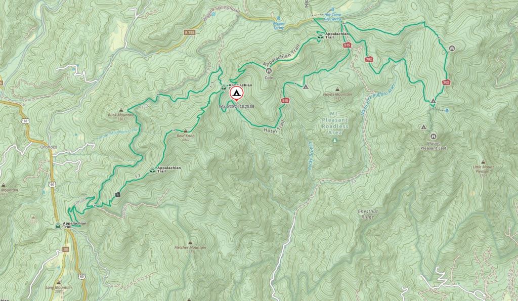
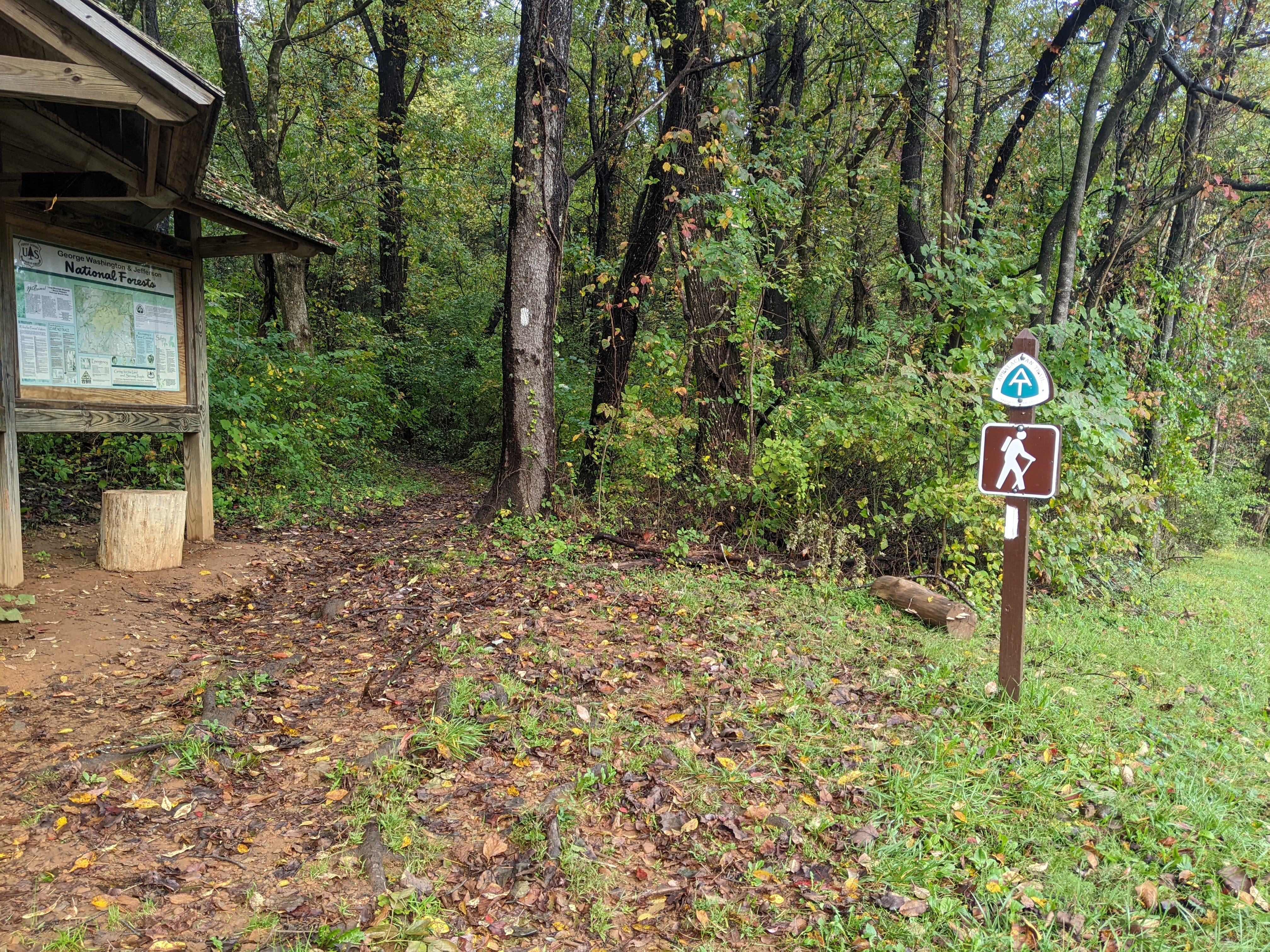
I livestreamed the final day of my conference, on Wi-Fi this time, except we left to start driving to Virginia for the last hour. Our plan was to charge our car in Roanoke while we explored the town and then do a one night backpacking trip in the Mount Pleasant National Scenic Area. As I’d scouted the map for areas to hike/camp/backpack throughout Virginia, western Maryland, and eastern West Virginia, I’d found an overwhelming number of small wilderness areas and state parks. I didn’t have time to research them all, but we’d decided on the Mount Pleasant National Scenic Area because we could make a 19 mile loop, hiking one-way on the Appalachian Trail (AT) and the other way on the Mount Pleasant trails. It also included one of the many Bald Knobs in the tri-state area, which we assumed meant a good view.
The forecast was less than ideal, calling for rain on Monday and Tuesday, but it was to be clearing by Tuesday evening and the remainder of the week looked promising. While we charged our car at the free medium-fast charger at the Berglund Center, we poked around Roanoke. We found a nice underpass under I-581 and then hiked up to the Basilica of Saint Andrew which was a beautiful old church and offered a good view of downtown. From here I hoped to find a quaint old neighborhood but instead we found one of yesteryear. Finally we made our way to the revitalized downtown where Erik was disappointment the Virginia Museum of Transportation was closed but there were still a few things to look at.
Then we got back to driving up to the Long Mountain Wayside to begin our hike. While it hadn’t rained on us in Roanoke, there were clouds over the mountains. We crossed under the old bridge of the Blue Ridge Parkway and then began our hike to the Cow Camp Gap Shelter where we’d planned to spend the night, in a cloud. It was around 70 degrees and 100% humidity. I’ve heard about the cloud forest in South America and made a mental note to not go there as I hate heat and humidity, but here in Virginia on the last day of September, I’d found exactly that. Sweat soaked my shirt as we hiked briskly for over two miles uphill, trying to make the most of our waning daylight since we hadn’t gotten on trail until 5 pm.
Bald Knob was not bald. There was a lookout to the west but we were all in the clouds. As we descended to Cow Gap Shelter, after the gap, it got completely dark. We had a headlamp though. Once we arrived at the empty shelter at 7:30 pm, we discovered we’d forgotten to pack the food. I’d been hungry the whole hike but now we wouldn’t get dinner. Or breakfast. We could’ve hiked out but then we’d have to find a hotel. We rationed that we wouldn’t die going without food for 16 hours so we might as well stay. Nothing seemed to be going right on this trip.
There must’ve been a nearby apple tree though, because there were a couple on the picnic table. Erik scrounged around and found three more apples so we had apples for dinner. These were small, tart, apples with some questionable spots that Erik told me I’d better just chow down or he’d take my allotment:) Then we set up the tent in the shelter so I didn’t have to worry about any mice scurrying over me and we went to bed.
Tuesday 10/1/24: Hike out and drive to Maryland
It rained most of the night. For some reason, instead of a consistent patter on the shelter roof, it sounded like someone was playing the piano, alternately stroking pianissimo and forte. We didn’t sleep the best. It was drizzling in the morning. We’d already decided that without food we were going to hike straight back out but had we had food, or had it been really nice, we would have had a tough decision to make as the loop I wanted to do (to hopefully get some views) was 15 more miles which would take us most of the day and not set us up well for getting to our planned state park campsite that evening.
We both dealt fine with the hunger on the way out although the Bald Knob view was still in the clouds. As we descended the last mile I deliberated over my enjoyment of hiking. Do I even like hiking? I asked myself. I’ve pondered this question numerous times previously, mostly when walking through a forest with nonexistant views or in dense fog or rain. My answer in the moment was a resounding NO. I largely go backpacking for the scenery and the off-trail routes and scrambles (that ideally work out).
Back at the car, still in the clouds, we ate some breakfast and then started driving, stopping at a fast charger at the Walmart in Staunton, Virginia on our way to Deep Creek Lake State Park. The route brought us through West Virginia, which despite fog and clouds, we quickly learned was amazingly beautiful. The roads went over one mountain ridge after another. It was still cloudy when we made it to the state park and found ourselves the only tent campers on the loop. I’m not gonna lie, I kinda wanted to stay here for the flush-toilet bathrooms and car access. Cush camping but not at all scenic. We poked around before dinner, exploring the closed interpretive center and beach before finding the aviary with a couple owls, a red-tailed hawk, and a turkey vulture. It began raining once back at camp so we made a quick dinner that we ate in the car and then discovered we could get YouTube on our electric car screen. That was the first time we saw the devastation in the Asheville area.
We also watched some YouTube about the Spruce Knob Wilderness from Bacon N Backpacking and learned about the Dolly Sods Wilderness. I’d seen it on the map but this video convinced me that we needed to go there. We had loose plans so it was totally possible.
Wednesday 10/2/24: Pennsylvania High Point and Hiking Deep Creek Lake State Park
We woke to fog and I wasn’t happy. It had been forecasted to be sunny and 70. Never mind, we got up and headed for our primary destination of the day: Mount Davis, the Pennsylvania high point at 3,213 feet. But we decided to use a slow charger along the way in Grantsville, Maryland. As I sat in the car eating my breakfast, car charger plugged in, I perused the 2024 getaway: To the Potomac Highlands and Beyond tourist magazine we’d picked up. It noted Grantsville to be “charming.” Meanwhile Erik was outside in a light rain reading some signs.
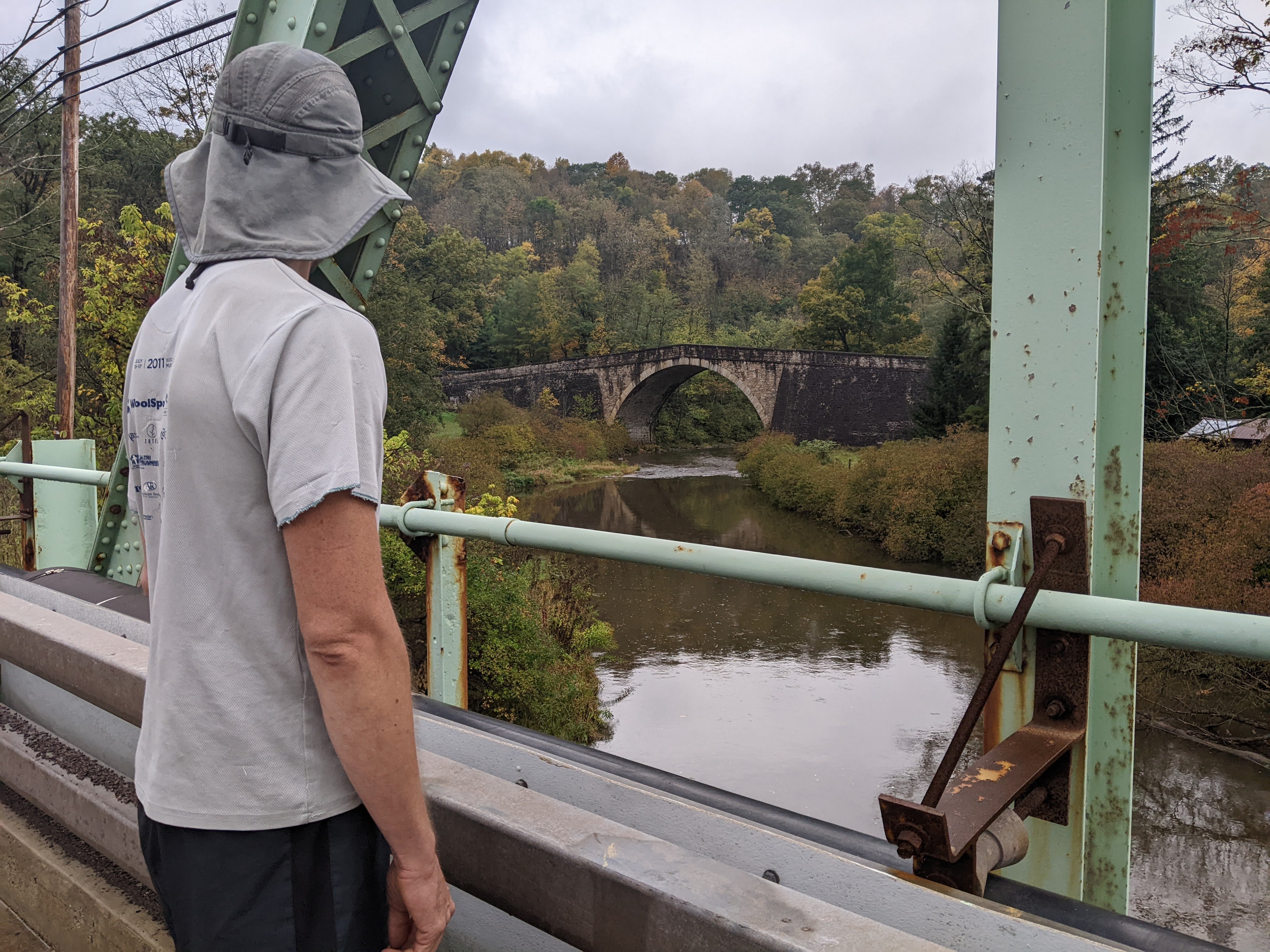
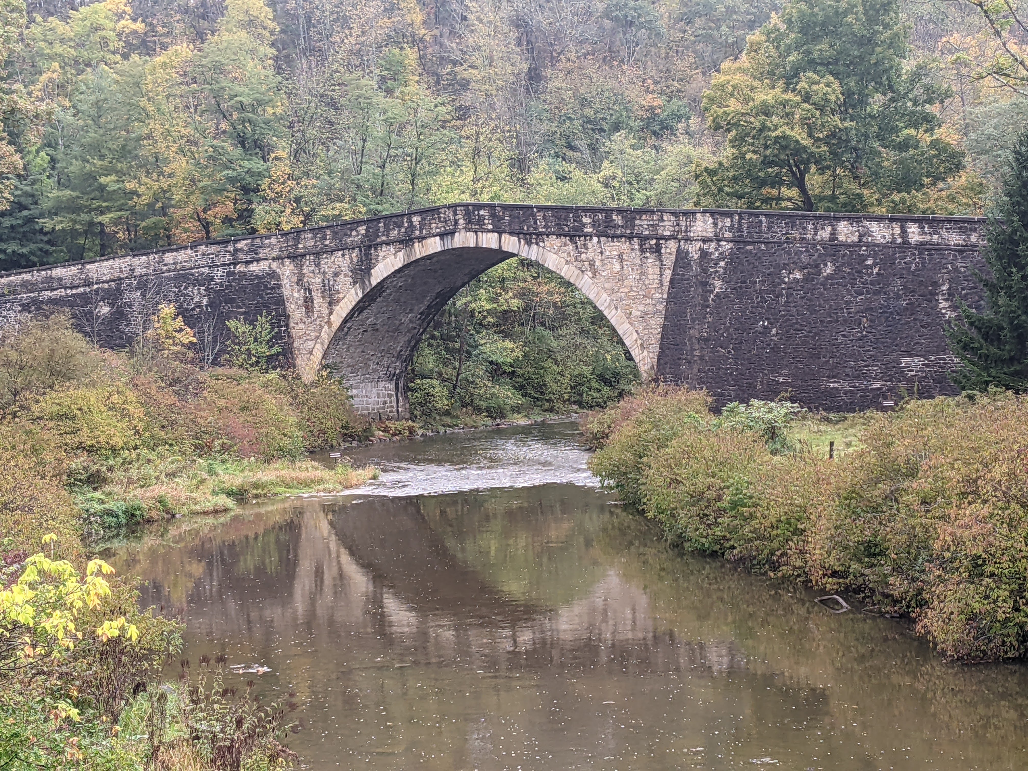
It soon stopped raining and we walked around town, finding some old houses including an old inn, and then we walked to the Casselman River Bridge which was constructed back in the 1830s during the stagecoach era.
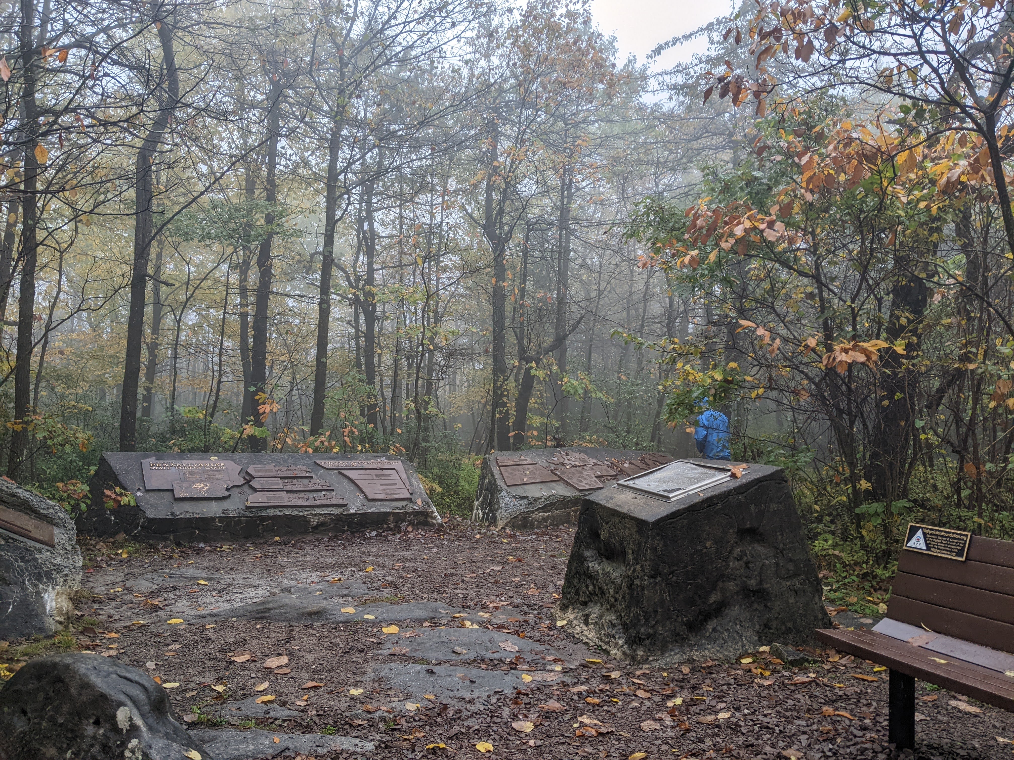
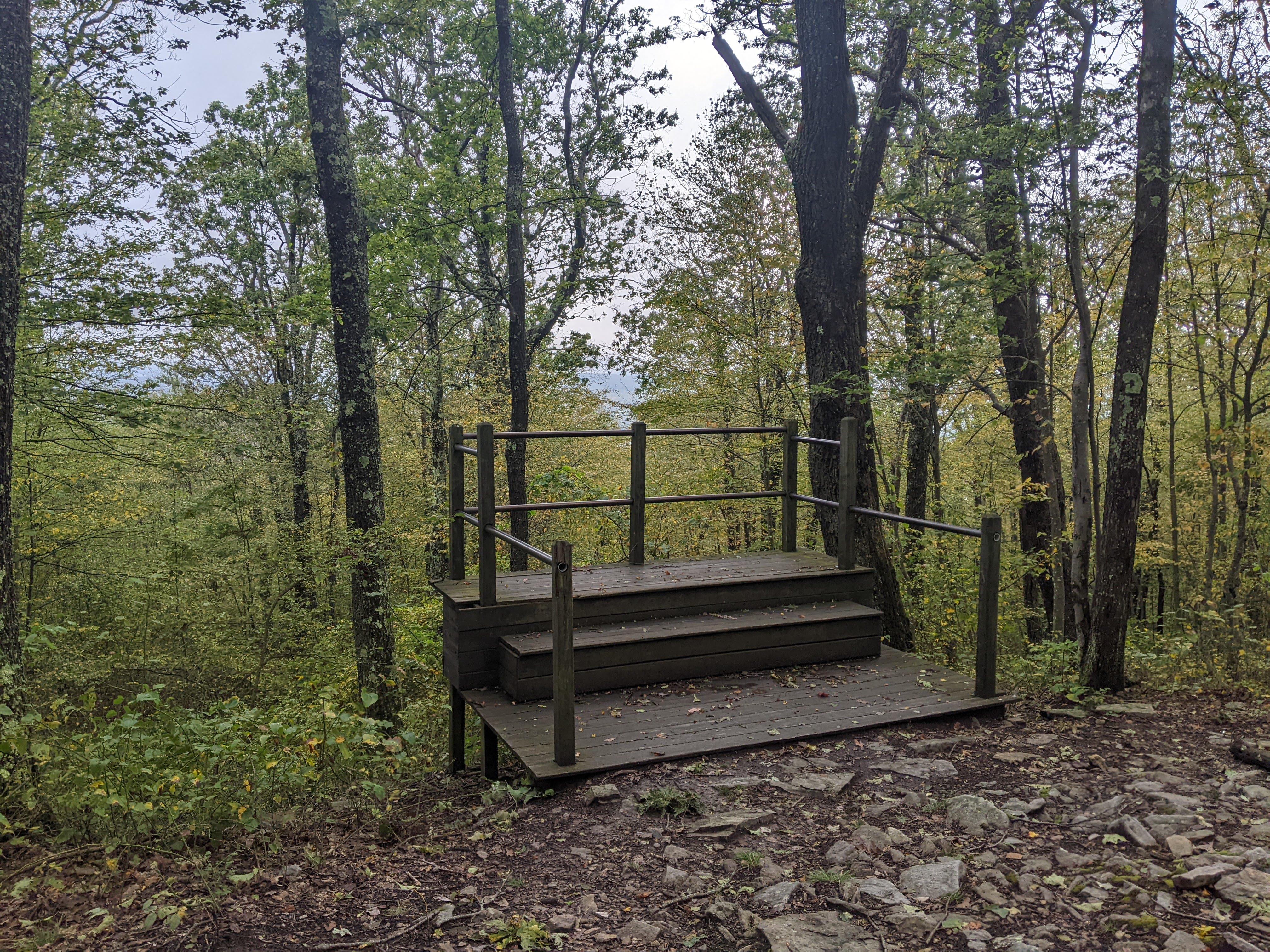
As we got back to the car, it began misting again but we drove north to the Pennsylvania high point, approaching from the southeast on a gravel road. The leaf colors put on a display for us even if the clouds loomed low. There are a bunch of hiking trails in the area but given the weather, we decided to drive to the parking lot near the top. It was a short walk to the actual top (a rock) and then there was a fire tower which we climbed. It was certainly disappointing to not get any good views but I guess such is life.

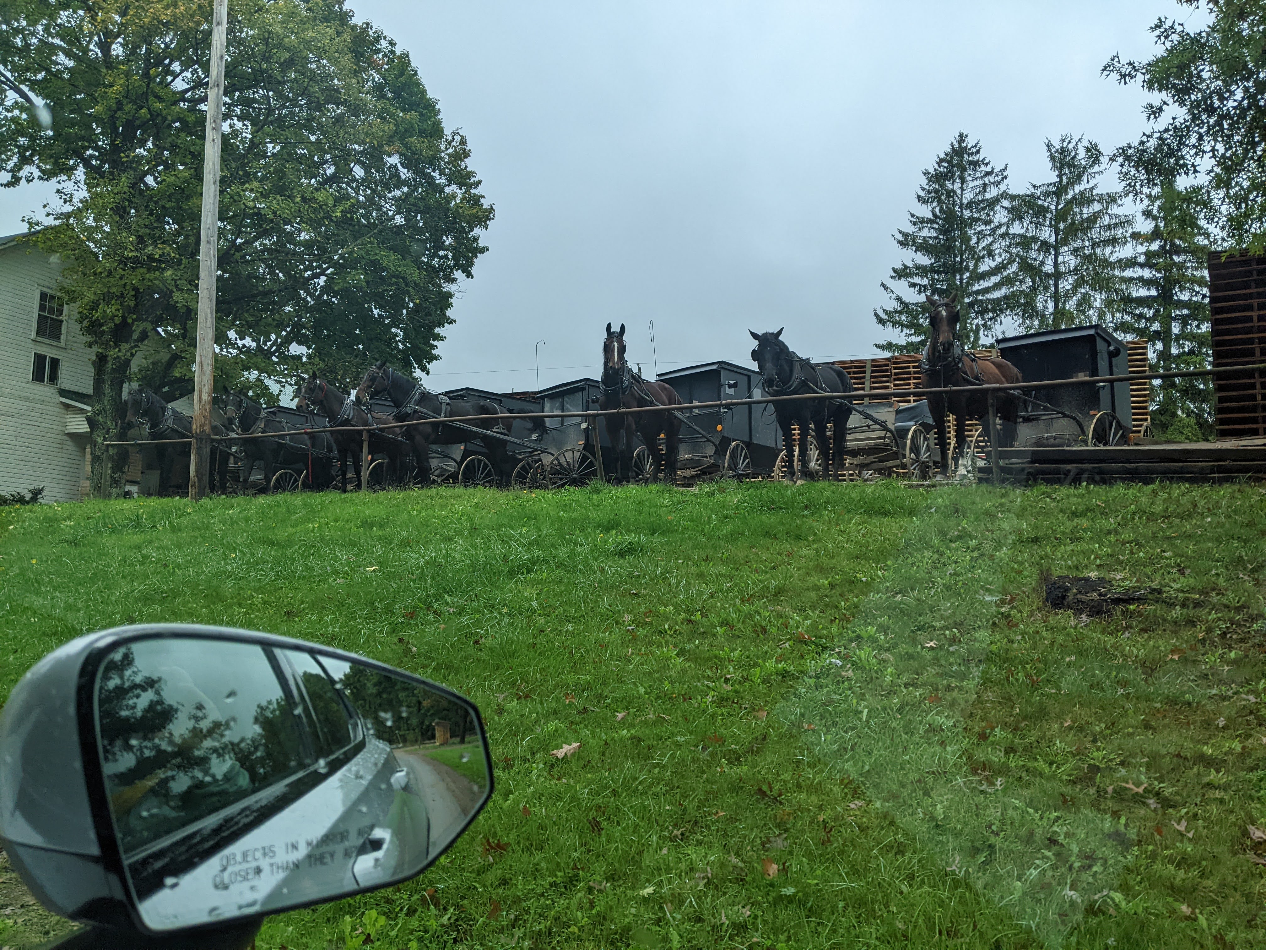
We debated driving back the way we’d come or taking the paved road to the northeast and fortunately we did the latter. If the view from on top was dismal, we at least were rewarded with finding ourselves in Amish country and the most elaborate maple syrup harvesting system we’d seen since Mount Van Hoevenberg in New York.


In the lower areas there was some sun but as we got back to Deep Creek Lake we were all in the clouds again. “Can we go home now?” I whined to Erik. My weather app promised sun at 4:00 pm and again called for more sun the subsequent days. I’d chosen Deep Creek Lake State Park because I assumed we could get up on the hillside and there would be some good views. So we went for a hike and at 4:00 pm the sun did come out but we were in the east and so there were no views:(
We had dinner in the car again and then more YouTube (this time a real artsy video on the Dolly Sods) and I read in the bathroom where there was light and we charged our phones and went to bed.
Thursday 10/3/24: The Maryland High Point, and the Dolly Sods and Spruce Knob Wilderness
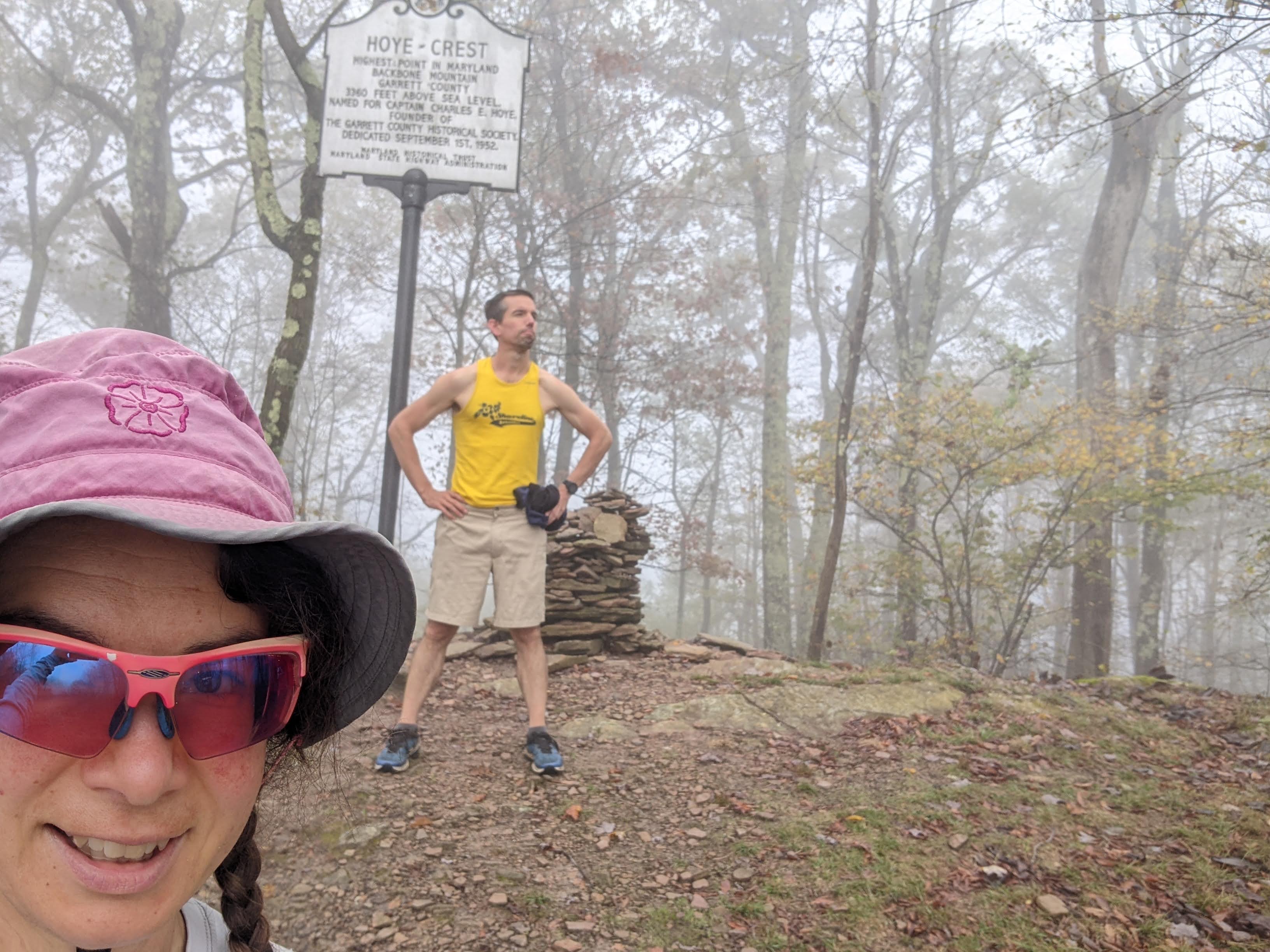
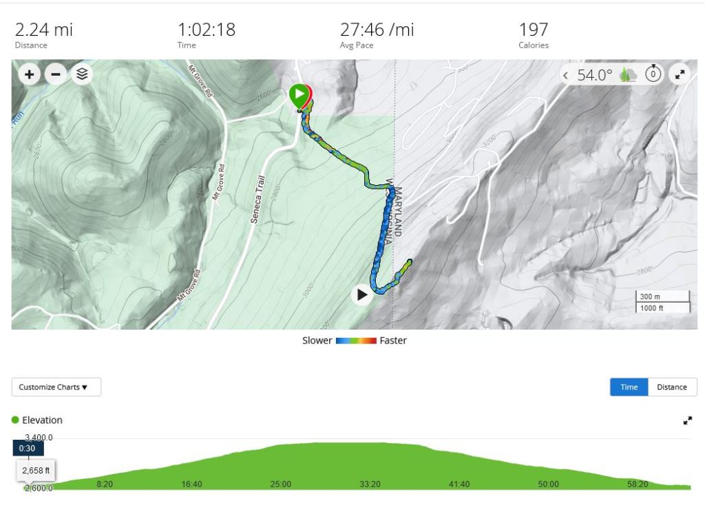
We woke to more fog. OK, maybe it’s just always foggy in the mornings out here. Despite this, we drove down to the Maryland high point, Hoye-Crest at 3,346 feet, which is accessed via a mile long trail from West Virginia. There was a very small pull-out, big enough for about three cars, just past the trail where we parked. The hike itself climbed 800 feet. About half way we hiked through a logged area and had a good view of the valley. On top there was a view to the east, but we were in a cloud.
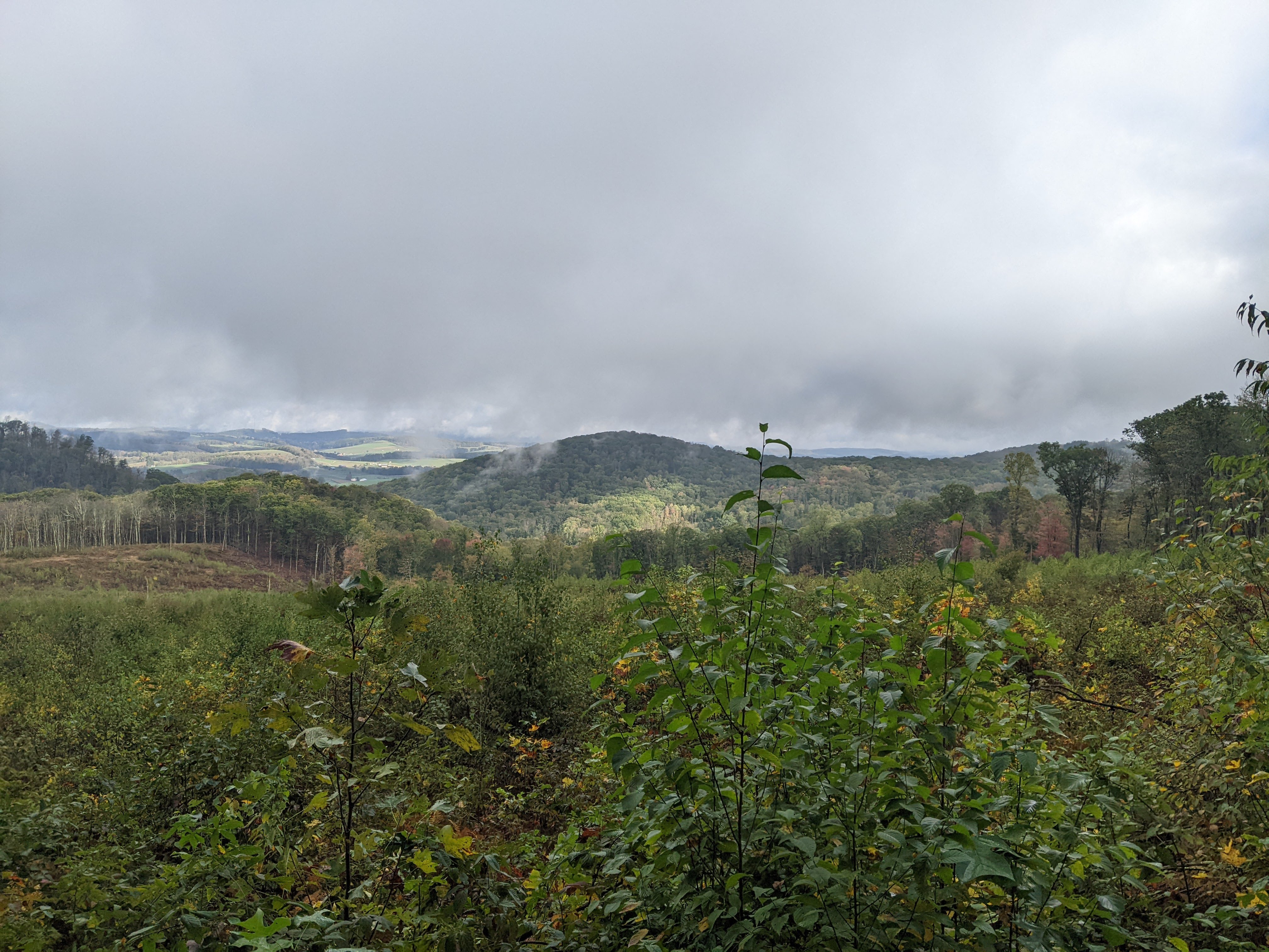
As we drove south towards the Dolly Sods we were still in the clouds but within half an hour these dissipated and we had more spectacular views. Erik even stopped in the small town of Thomas with its picturesque main street.

But alas, clouds now cleared around 11:00 am, we had to find some place to park overnight for the Dolly Sods Wilderness. This proved much more challenging than anticipated and apparently we didn’t do our homework. The first two places I’d picked on the map turned out to be private driveways. So we headed up the mountain to the Blackbird Trailhead Access (we were trying to be good cross-country skiers and walk up the hill) but this was on wildlife preserve land and there was no overnight parking except with a permit. Now Erik said we should have stopped at the Fish and Wildlife Visitor Center but why would we have stopped there if we weren’t fishing or hunting?
Perhaps if we were normal people we would’ve just drove the 15 minutes back down the mountain to the visitor center, but that would’ve meant driving 15 minutes back up the mountain and one of our principles in life is to drive as little as possible. We’d already driven up the mountain once and that was one time too many for us. So Erik, with limited cell phone service, tried calling every US Fish and Wildlife number he could find to secure us a permit but only was able to leave voicemails. After an hour of this we decided to park anyway and leave a hand-written note on the dashboard and hope for the best.
I’ve hiked in the east enough to know that the trails are wet and this was certainly true for the Dolly Sods as well. Our YouTube video had warned of this but it’s still frustrating to me. We took some time to work on some trail drainage but then kept a hiking, our minds rarely leaving our concern that our rental car might get towed.
After an hour and a half of hiking we came to our first good view. Here Erik had cellphone service and decided to make one last call to the US Fish and Wildlife Service. They weren’t the local branch but said that cars were indeed getting towed. Hence we both came to the same conclusion: we should give up on the Dolly Sods backpacking and head back to the car and move onto the Spruce Knob Wilderness.
So we took in the view for awhile and then hiked the three miles back to our car which looked to be untouched. I was frustrated by this really nice road that had very limited day parking for hiking and made overnight backpacking access so cumbersome. It didn’t seem very people friendly.
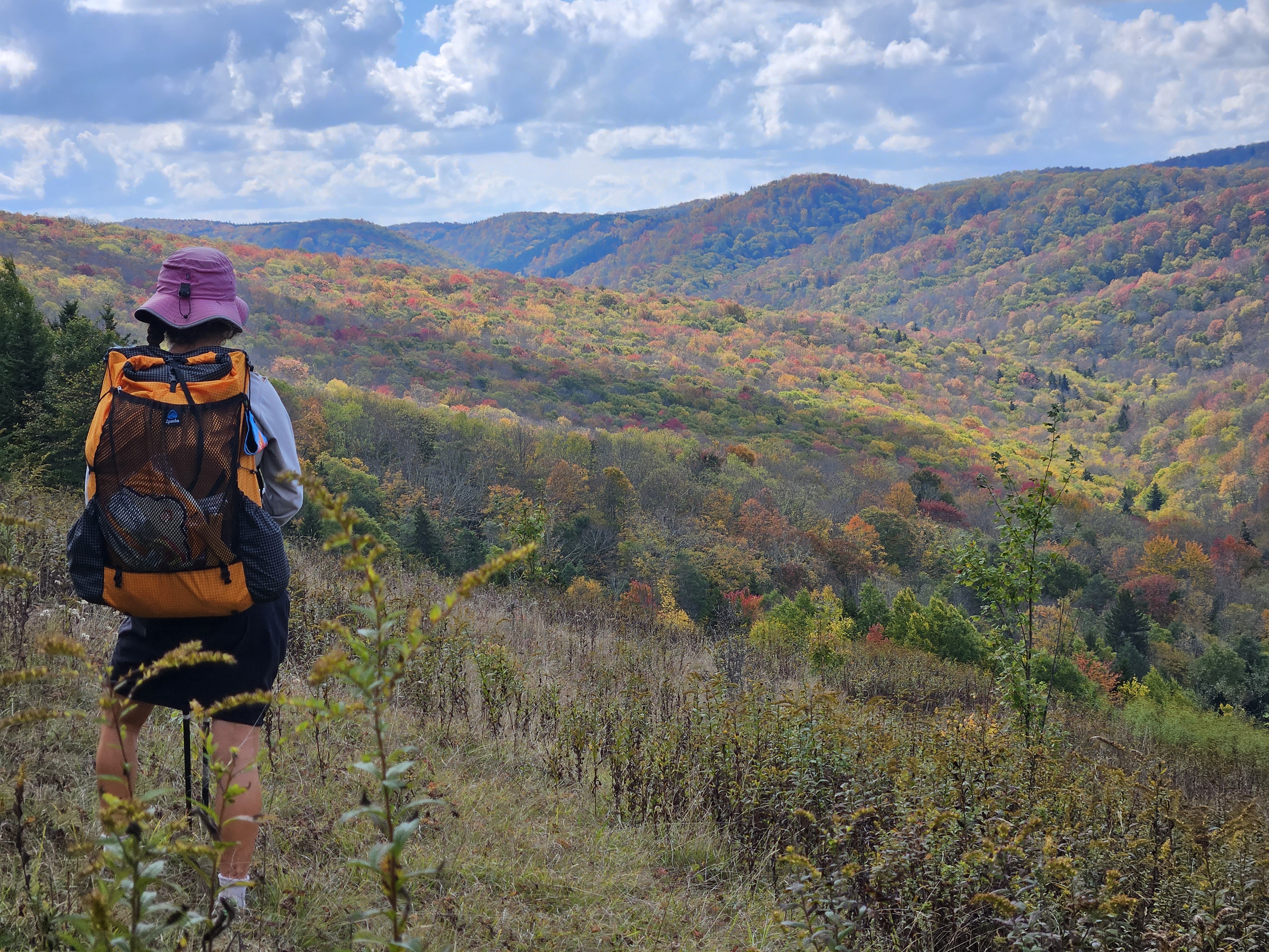
But as we kept driving south, over hill and dale, it was hard to be mad in this magnificent West Virginia countryside. It was all so stunning and we passed by the Seneca Rocks.
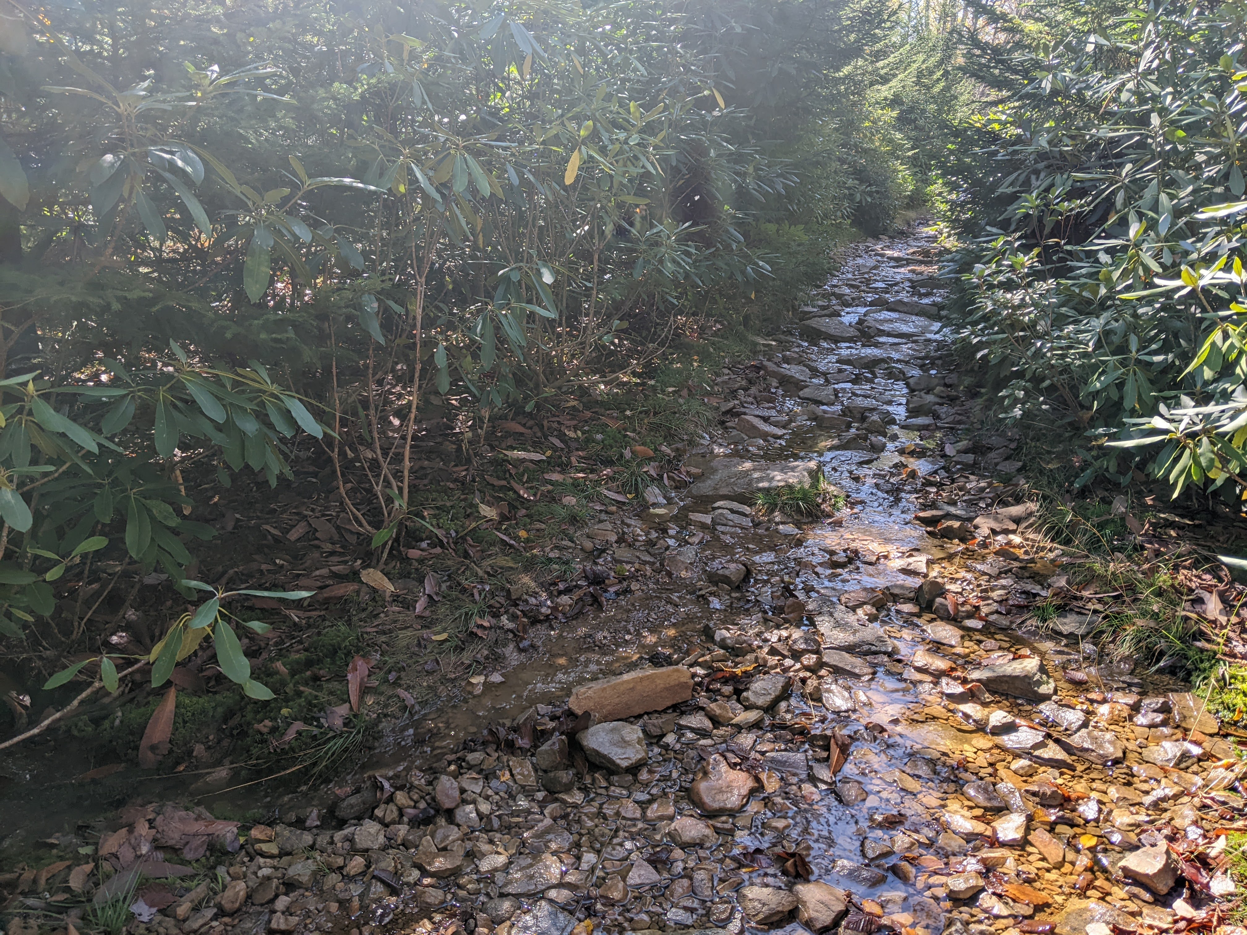
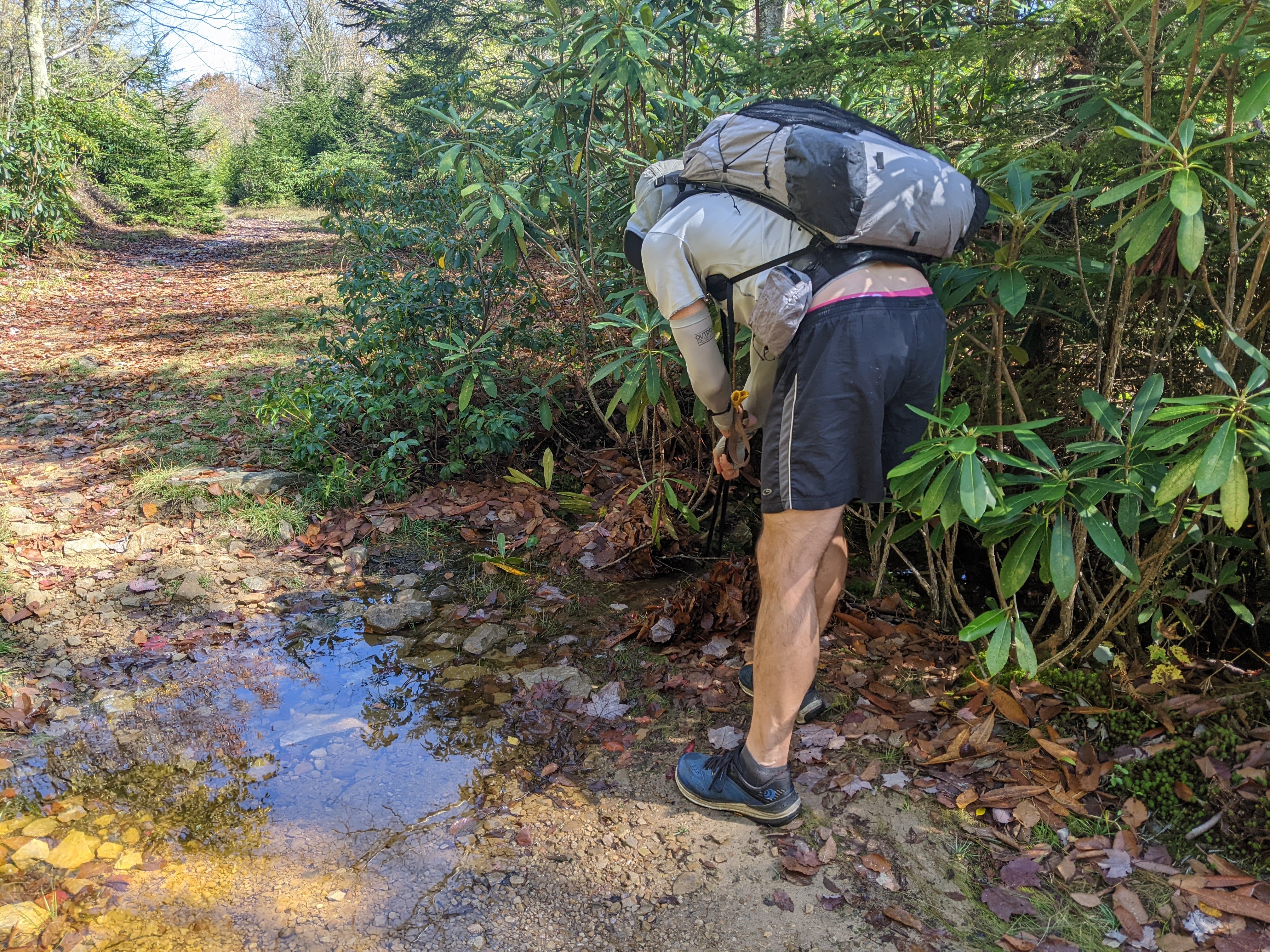
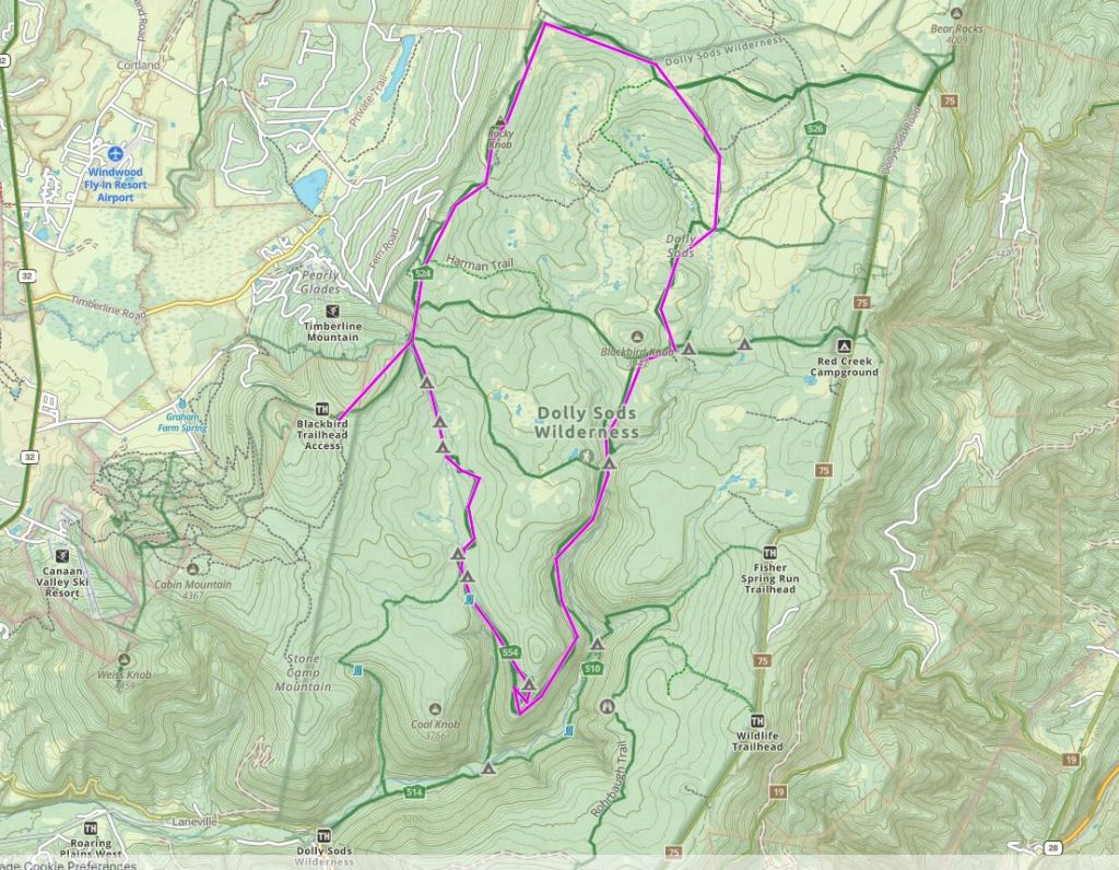
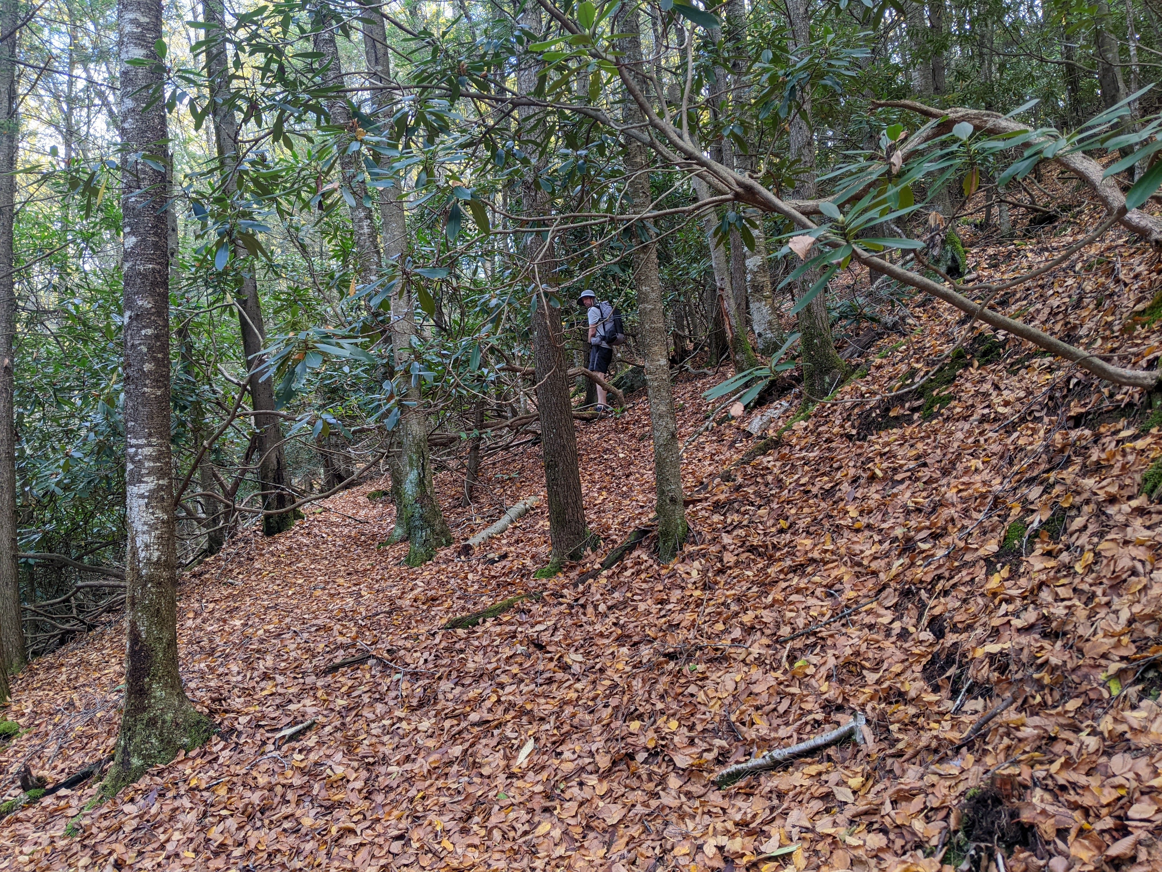
We drove a good distance up the small road to Spruce Knob (the West Virginia high point), and parked at a very small pull-out where we accessed the Spruce Knob Wilderness on an old overgrown road. Our plan was to hike up a couple miles and dry camp on the same mountain ridge as Spruce Knob. The trail was a bit overgrown and wet and muddy in a few places but this really came to a head as we turned onto the single-track hiking trail and were greeted by a small stream.
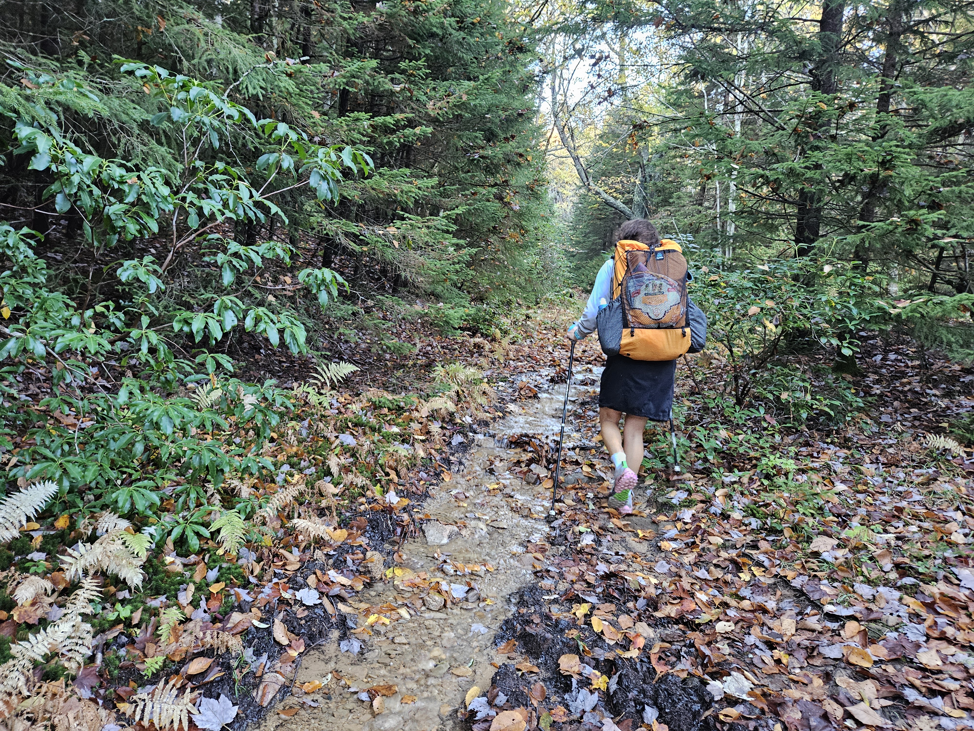
Now, there had been a lot of rain recently but I don’t understand why these easterners put up with hiking through so much water. There’s a better way, people! It’s called stream diversion. And so Erik and I couldn’t help but get to work creating some stream diversions. Erik loves doing this, what he calls trail maintenance, and has gotten me quite hooked as well. We did the best we could and when there weren’t places to divert the stream I just tried to walk on the dry bank of the small eroded trail.
After an hour we came to our first well established campsite at a trail junction. We decided to proceed for another six minutes of walking time, per Erik’s calculations, to the second marked campsite and set up camp there for the night, just off the trail. We were at 4,400 feet, about 400 feet below Spruce Knob. There was no view but it was adequate. It was getting dark just after 7:00 pm and so we wanted to make a fire but there was no downed wood nearby and the little we could scrounge up was simply too wet.
Friday 10/4/24: Hike Spruce Knob and surrounding Wilderness
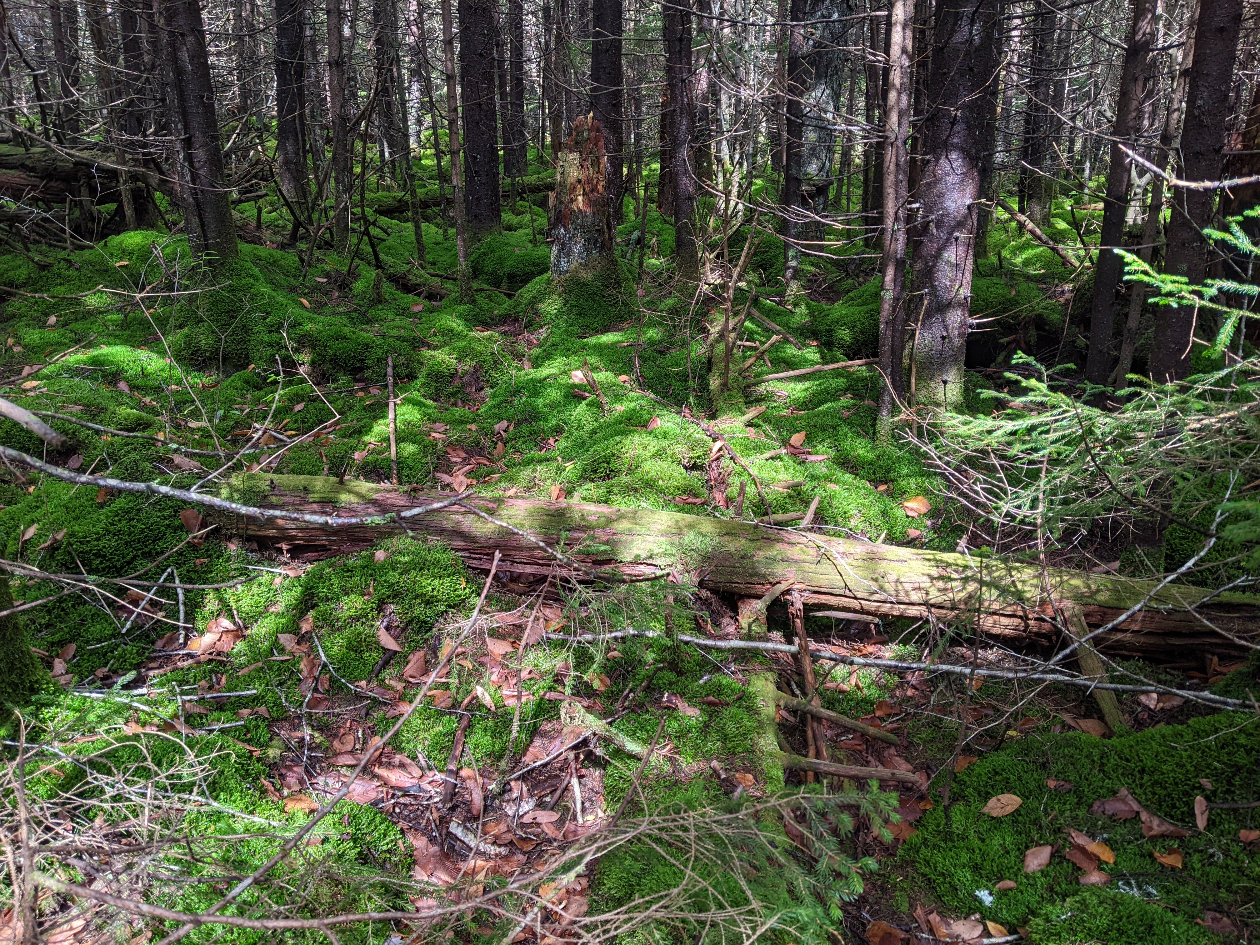
We woke to more fog. Typical. By now at least I was expecting this and since we were relatively near the summit we stayed in the tent awhile longer, giving the clouds time to dissipate. Hence we didn’t get to hiking until almost 9:00 am. When we did, we found the woods covered in moss and boreal forest.
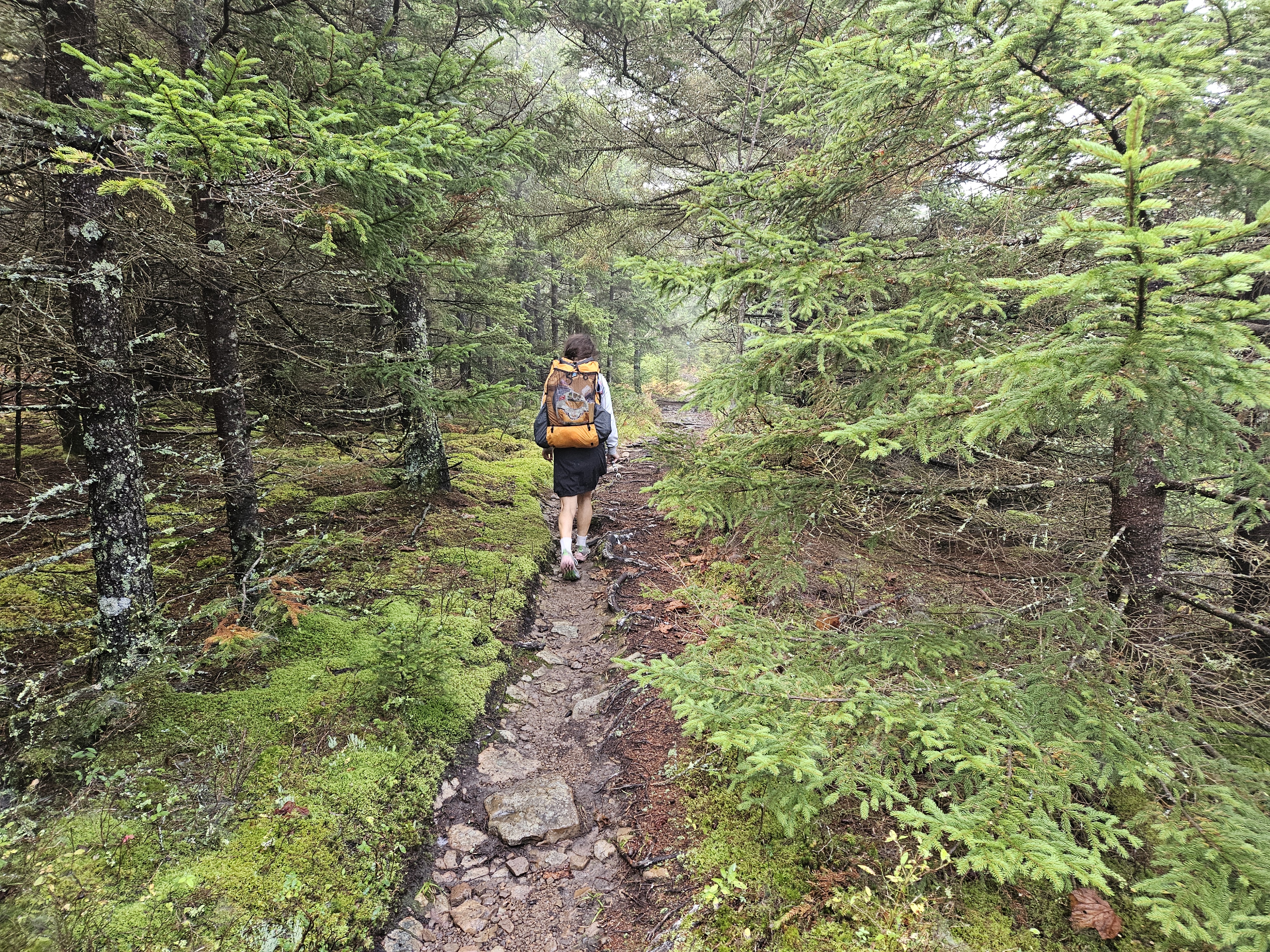
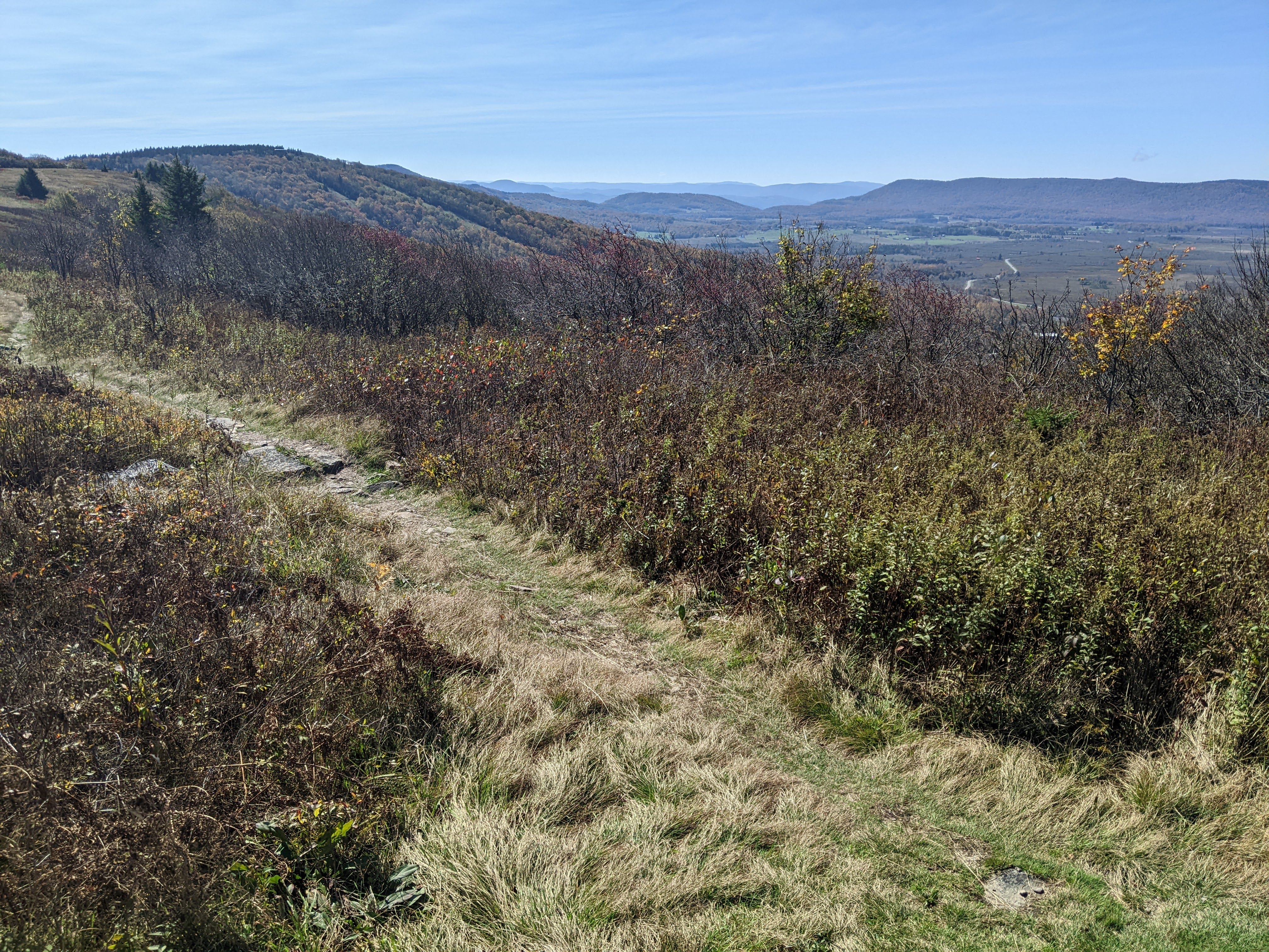
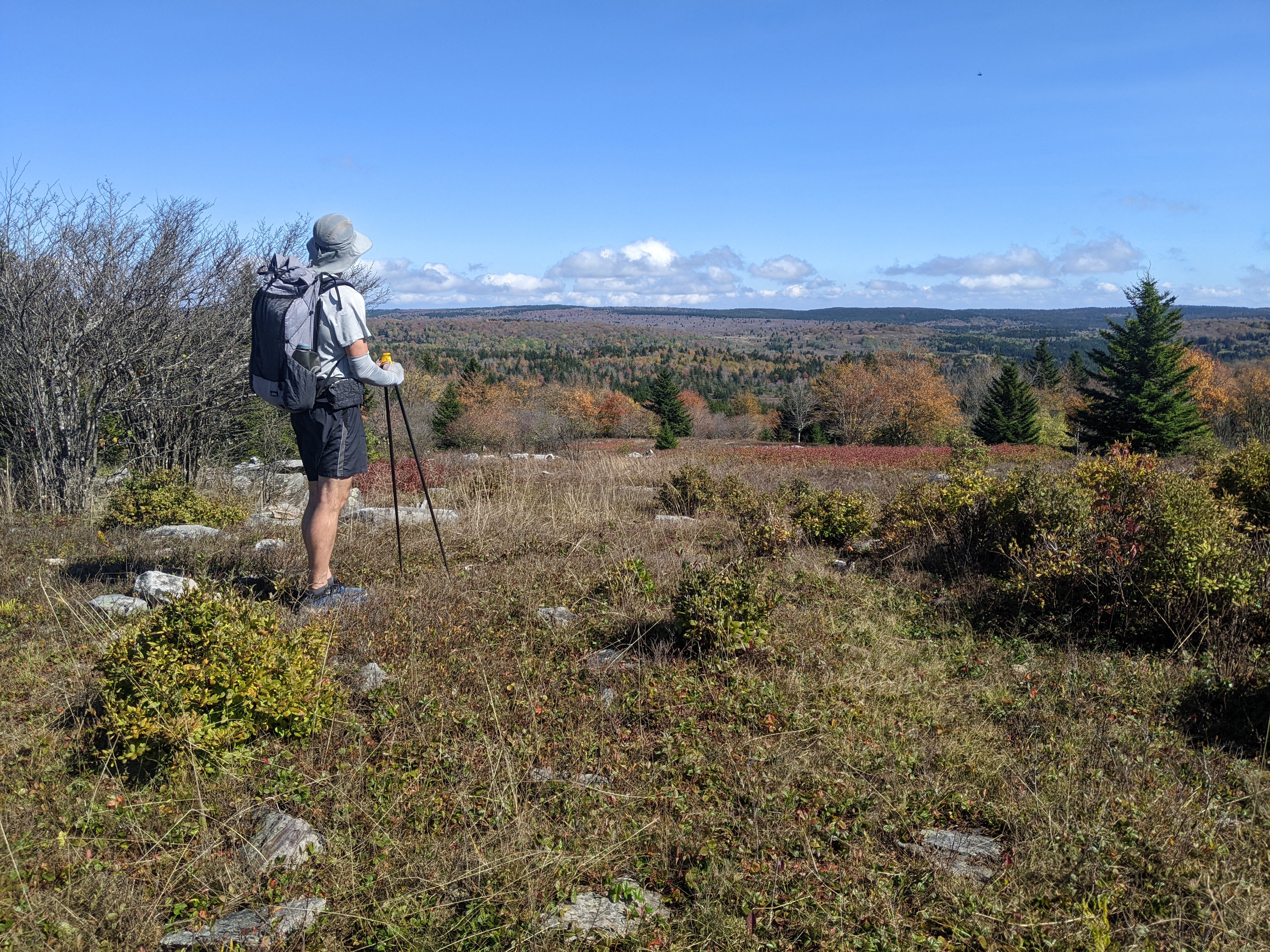
The three miles to the Spruce Knob parking lot was all in the woods, occasionally wet, and all above 4,400 feet. The clouds had indeed cleared by the time we got to the parking lot just after 10:00 am, but the views were scarce. In the 1970s they had build a small tower on top and cleared away the trees but they have since grown in so there was a very limited view. We did catch views to the west, south, and east from the trail that circles the top.
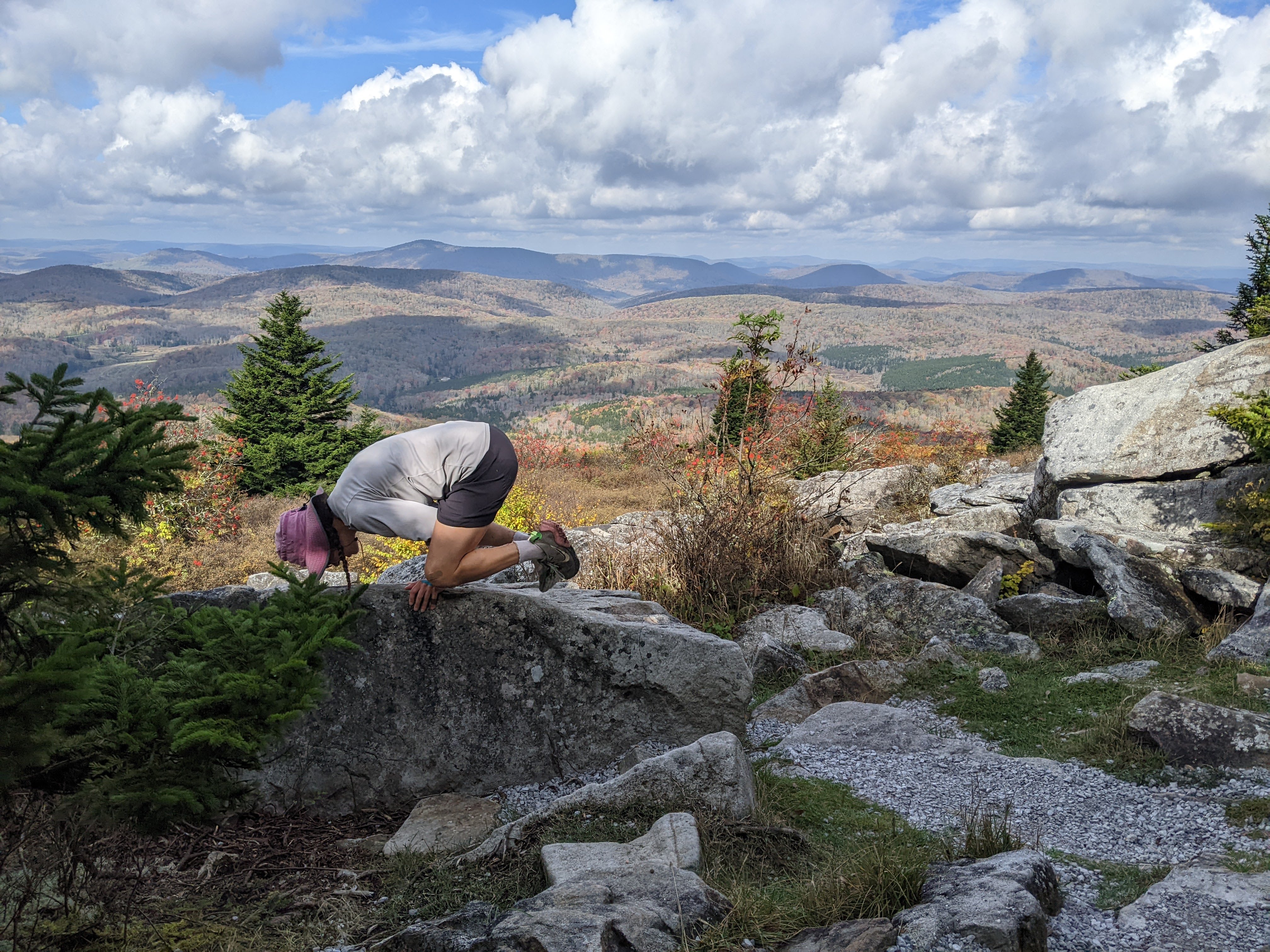
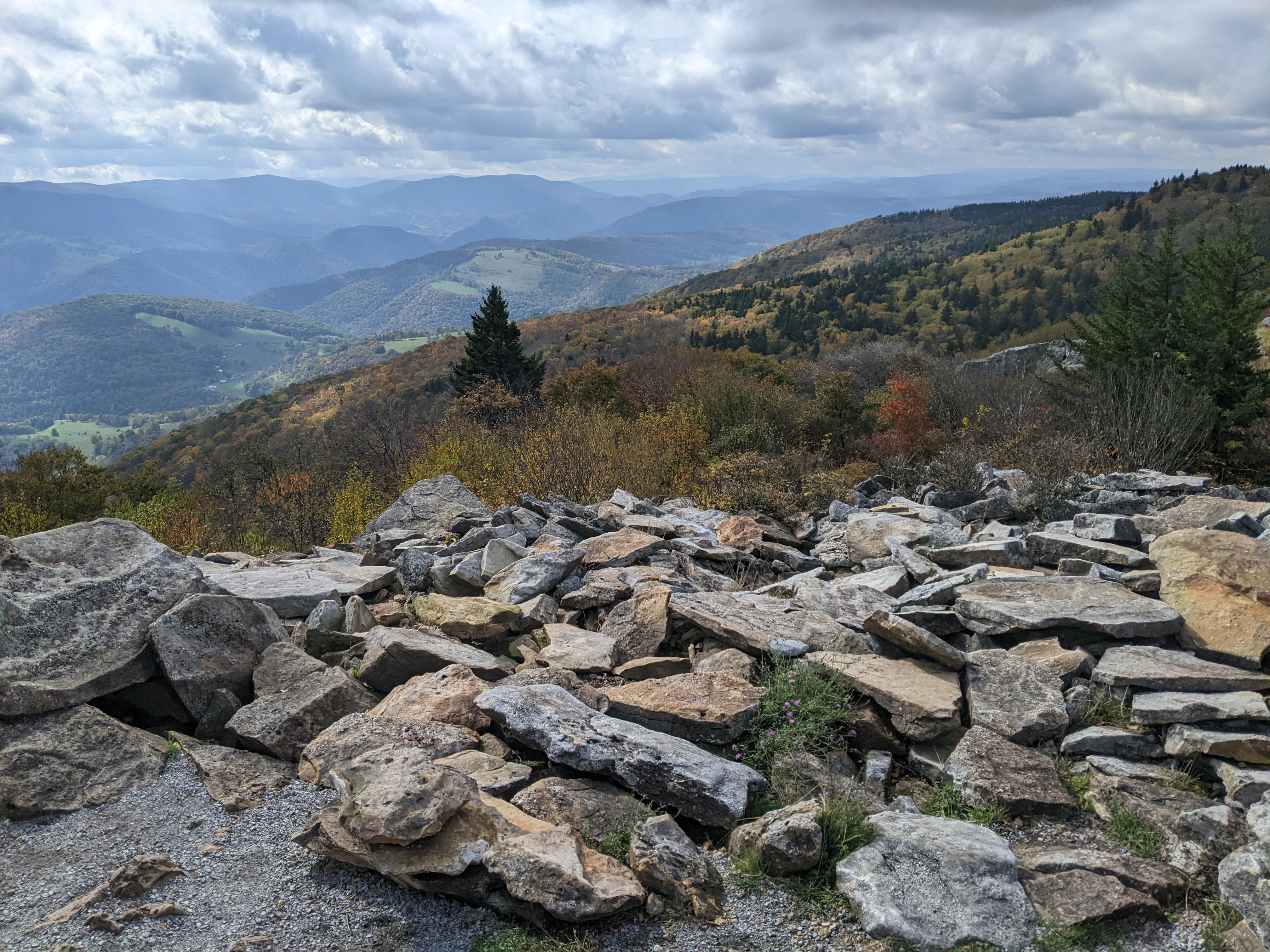
After enjoying the surroundings and taking some photos, we hiked back on the trail we’d come and then eventually turned west, hiking down to Seneca Creek. On the way we hiked past some well-developed campsites and through a meadow where we got some great views of the wilderness and took our time to enjoy them.

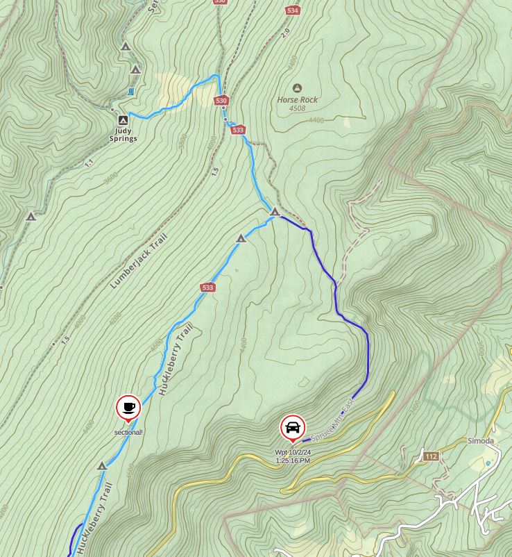
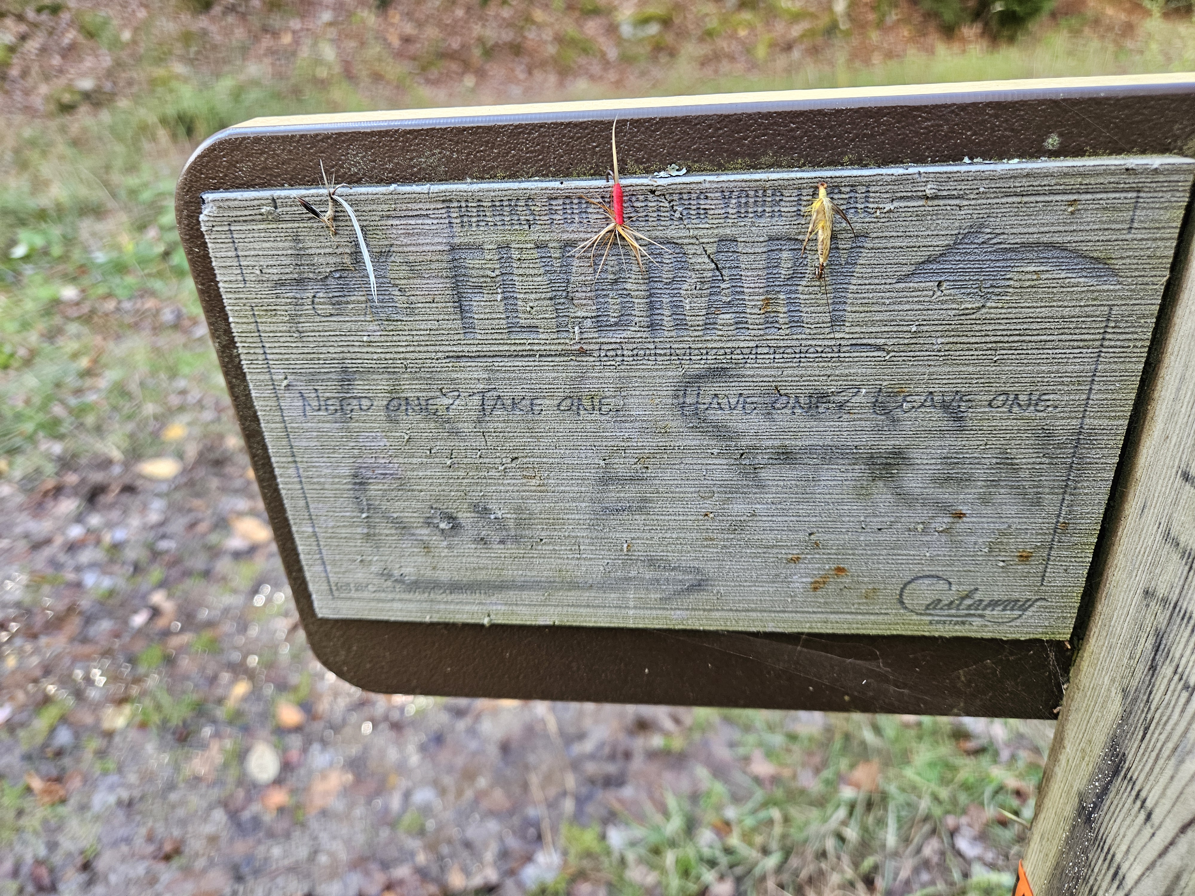
Once down at the creek, we found a nice campsite by Judy Springs complete with a couple flat rock recliner chairs. We stopped for second lunch, tortillas with cheddar cheese and turkey sticks, made better with some more apples we found from a nearby tree. It was only 2:30 pm so it seemed a bit early to stop for the day but if we hiked down the creek on the trail there were a bunch of stream crossings and the water was high. After lunch we entertained ourselves by walking above the spring and then since we didn’t want to do all the stream crossings, we tried bushwalking for awhile. I suppose one of our adventures isn’t complete without going off-trail. Once this got difficult, we bailed and headed back to the campsite by Judy Springs.
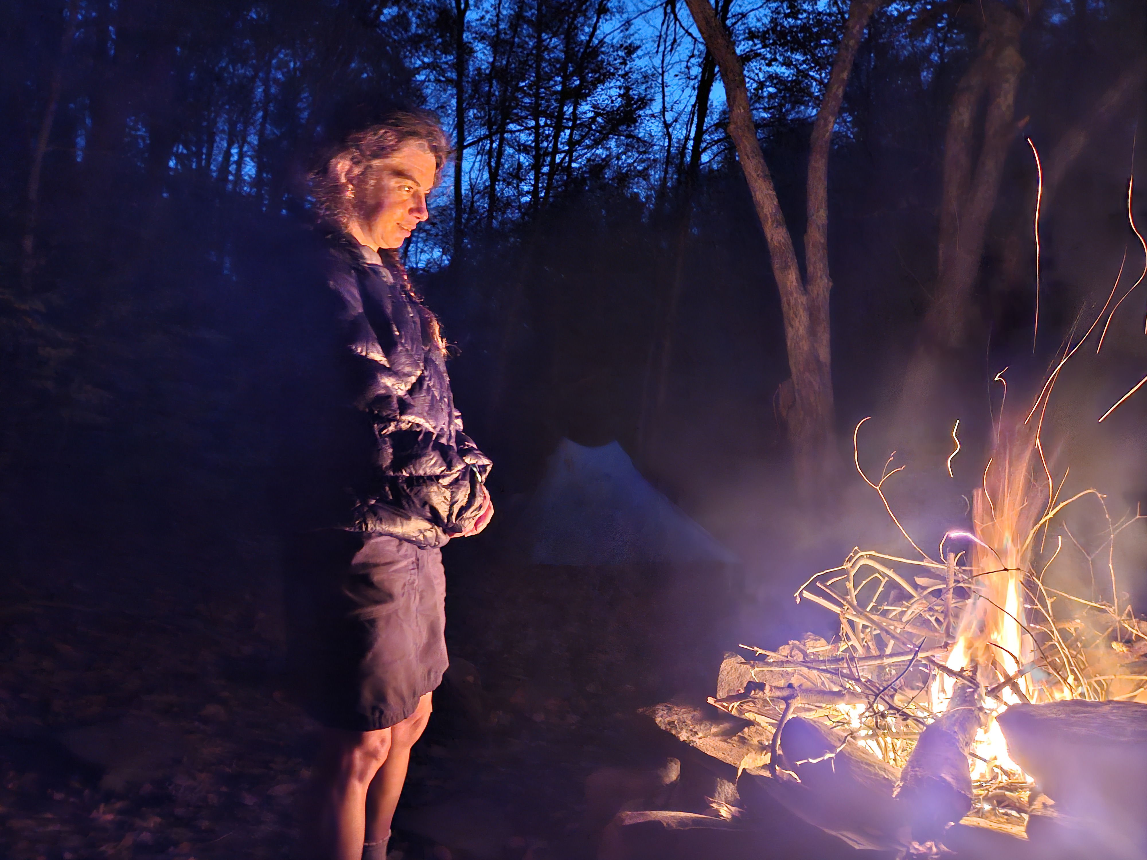
By now it was a little after 3:00 pm. There was a bridge across the creek here and we took that and hiked downstream until the first stream crossing. I was less than enthused so we returned to the campsite at Judy Springs and decided this would be it for the night. I still wanted to hike some though so I went back across the stream and hiked on the trail heading up the creek. I didn’t last long though because the trail was just wet, wet, wet. I did a little trail maintenance but there weren’t many good stream diversion options so I returned to camp and made myself busy collecting downed skinny branches that were dry enough to burn as firewood.

We made dinner and then got our fire going in the big stone fireplace. We’d collected more wood than the previous night and our fire lasted longer. And then it came to me. The answer to that question about whether I even like hiking. I’ve been searching for an answer for the past few years and down there, next to Seneca Creek, I realized what Erik and I most like doing is “poking around.” Perhaps this would be better described as times when we don’t have an agenda and go out for a walk (or a run) without a timeline and just find all kinds of unique or interesting things. This includes playgrounds and plants and cars and bikes and buildings and houses and maple syruping lines and everything in-between. When I reflect on some of my most enjoyable times with Erik, it’s been when we’ve simply had the time to go exploring without any clear destination.
I slept better that night than I had in the last few.
Saturday 10/5/23: Hike out of Spruce Knob Wilderness and drive to Charlotte
I was surprised to wake up to clear skies. Erik thought it was just because we were in the valley but as we hiked back up through the meadow, even though it was early, there wasn’t a cloud in sight. It was kinda lame but because we hadn’t hiked down the creek, we essentially hiked back to the car the same way we’d come, taking all the short sections of different trail branches we hadn’t on the way down. Because it hadn’t rained in the past three days and due to some of our stream diversion work, the trails were significantly drier as we headed down to the car, albeit there were still some wet muddy areas.
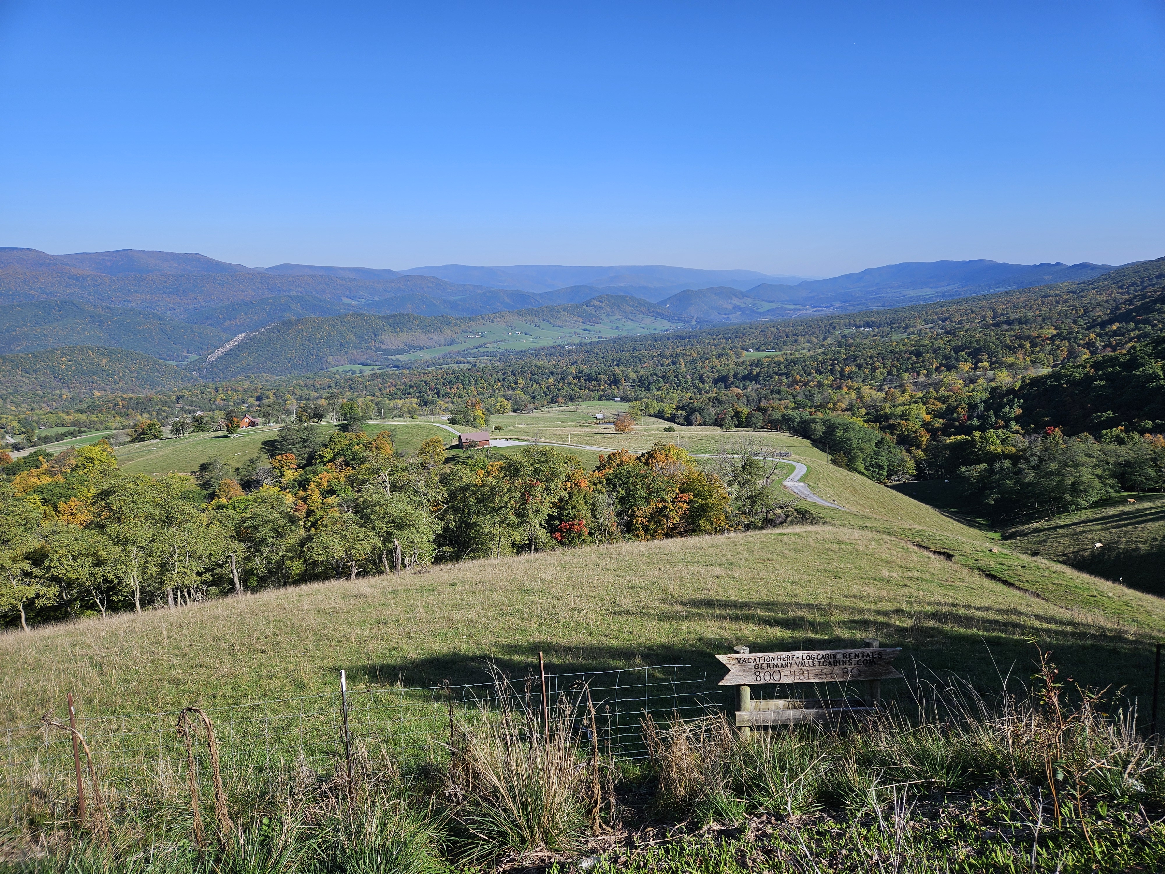
We arrived to the car before 10:00 am and began driving back to the Charlotte area. Our drive on Highway 33 took us up a mountain road where we stopped at an overlook of the Germany Valley. As we continued driving, up and over mountain ridges, the scenery continued. Finally, at the Virginia border we crested our final hill. There was a parking lot here and a trail to the High Knob Fire Tower Lookout. It was over a mile one way and likely would’ve taken us an hour and a half between the hiking and view enjoying. We still had some driving and charging to do so we skipped the fire tower but I was kinda sad to have done so. Perhaps next time.
Sunday 10/6/24: Fly Home!
We’d spent the night at a hotel in Gastonia, North Carolina. We found a cheap charger at the Shiele Museum of Natural History that we’d plugged in at the night before (and then walked back to the hotel, finding a few sidewalks). In the morning we did an adventure run to go back and get the car and not only found some sidewalks and old houses but a paved hiking/biking trail (the Avon/Catawba Greenway) as well! We also saw some evidence of Hurricane Helene storm damage with tree debris and enough water in the tunnel on the Greenway that we took the road over.
After the run and continental breakfast at the hotel, we drove to the airport and flew back to Minnesota.
If we had to do this trip again: Other than the flight, rental car, and last night in the hotel, we had to completely change all of our plans for this trip. Obviously, had we had it our way, not Hurricane Helene’s, this would’ve been a story about day hiking Mount Michell in North Carolina and then backpacking the Smokies.
Obviously, in hindsight, we should have stayed put in Charlotte, or perhaps found a more hiking/walking/running friendly town to livestream the conference (well away from the path of Hurricane Helene), but the conference didn’t even get cancelled until the middle of the afternoon the day before.
Instead we were part of the problem. But when we left Charlotte on Friday the 27th, I don’t think anyone comprehended the magnitude of the storm damage and arguably the flooding that would come. It would also have been extremely helpful if instead of warning of flash flooding, NCDOT had simply closed roads, told people not to travel, and said not to come to the areas without power. But I think this also speaks to the apocalyptic nature and how dependent we are on technology. The technology failed us to adequately provide information.
Best decisions: Had the weather cooperated in Virginia (and had we not forgotten our food) and Pennsylvania I’m sure I would have said my decision to go north was great. I’m still glad we went but am bummed to have missed out on some views.
Next time: Perhaps it’s fair to say I was enamored by West Virginia. OK, not the mornings in the clouds or the entire days of rain/threatening rain. Life is always better when it’s sunny, no matter where I am. I’ve definitely learned that about myself.
After this trip, I definitely want to spend some more time in West Virginia, although I think a primarily driving tour might be best, not leaving the hotel/lodging until late morning (to allow the clouds to lift) and then only driving two to three hours to the next location (because there are so many places to stop and the mountain roads take longer than Google says). The views often aren’t much better up high on the trails anyway with all the trees. It’s a good thing I plan on paddling 50 miles in each of the 50 states in my 50s so I’ll have a good reason to return to West Virginia then.

One thought on “A Different Kind of Adventure: A Hurricane and the Pennsylvania, Maryland, and West Virginia High Points”