In April of 2016 I found myself with more vacation time than my hubby and my best friend from elementary and middle school, Amy, ready to go adventuring. After not much debate given limited options in mid spring, we settled on Utah. We flew to Salt Lake City, rented a car, and were off to see the sights.

Day One (4/5/16): Mount Olympus in the Wasatch
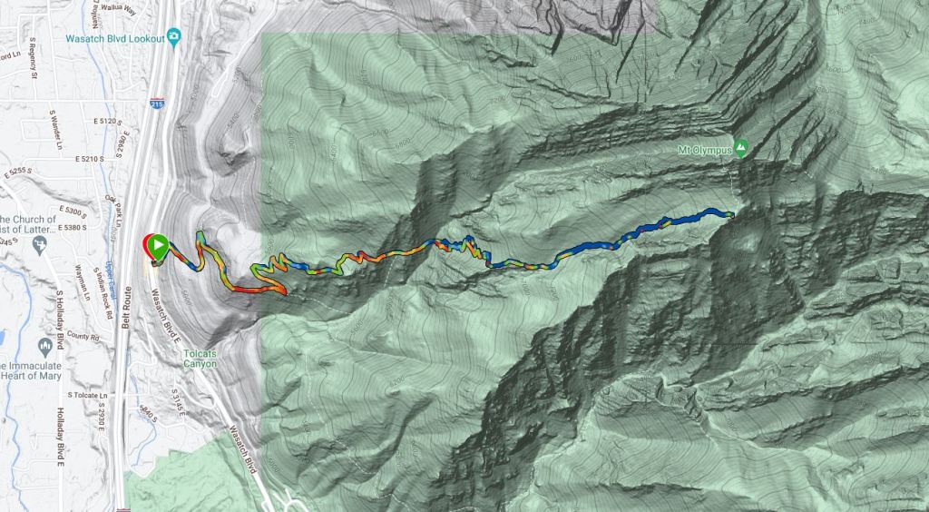
After landing and learning our rental car was a red minivan, we headed into Salt Lake City where we met up with my good friend from high school, Kathryn, at a Taqueria, for the best fish tacos ever. Then it was time for our first hike: 3,500 foot of vertical ascent in an attempt to climb Mount Olympus.
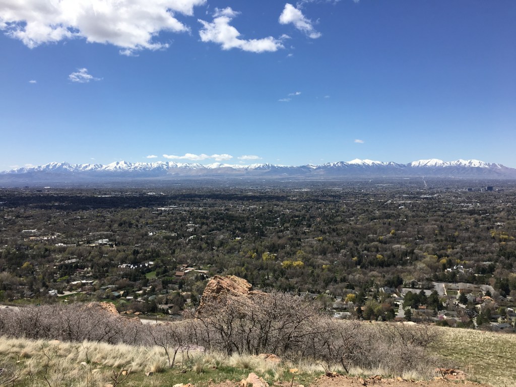
The first part of the hike is very open and dry, winding through dessert sagebrush as we got good views of the Salt Lake Valley and mountains beyond.
A little while after crossing the creek, we hit snowline and continued hiking on a well packed down trail.
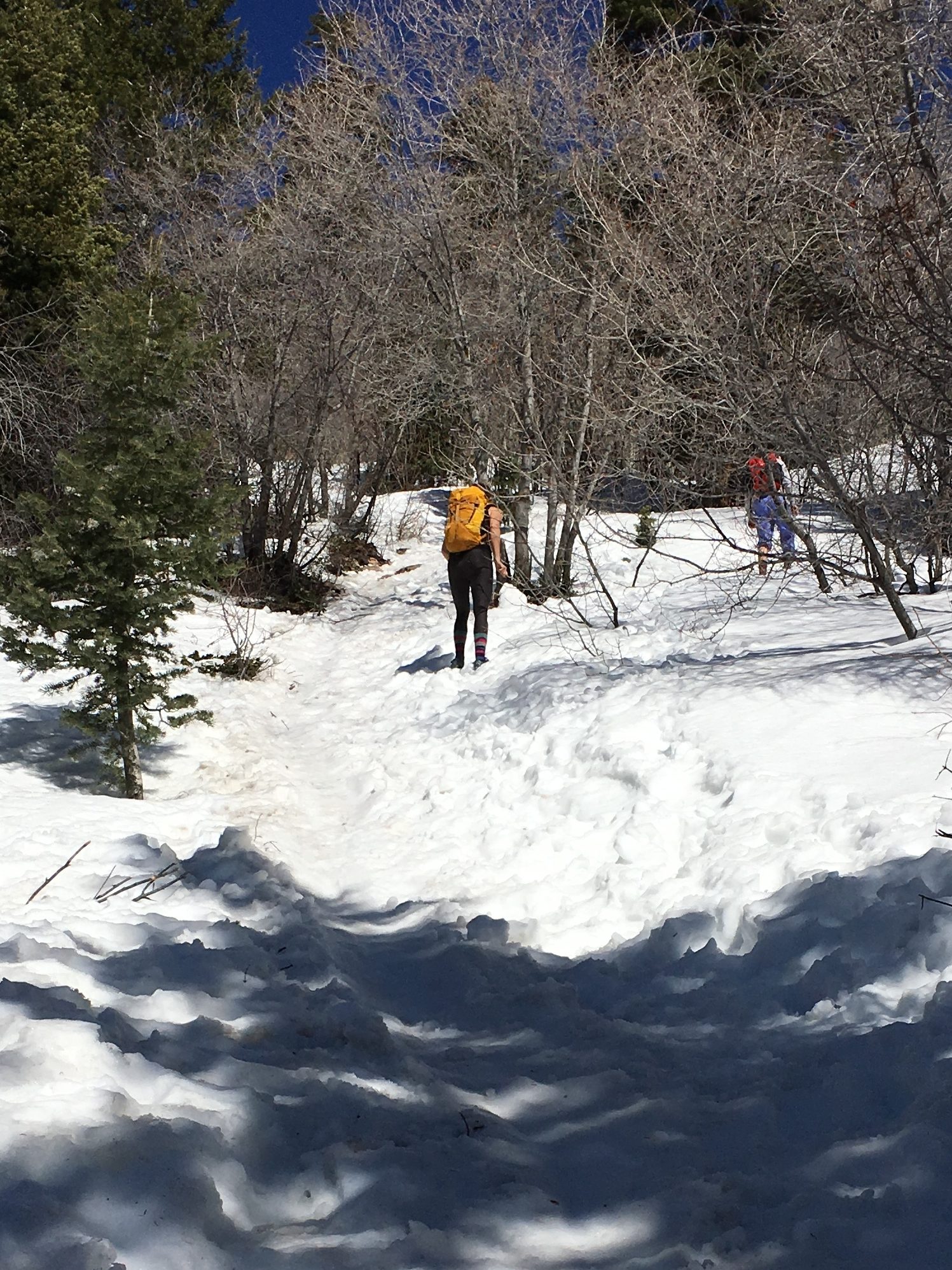
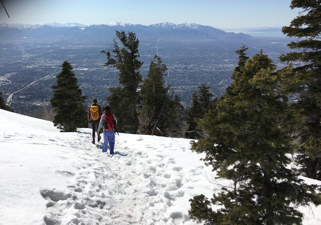
We hiked up to the saddle where the views farther into the Wasatch opened up. We also had good views back to the south. After some debate, we turned around here rather than going for the summit as it was getting late in the day and Kathryn said the climbing was more class 3 from here- not a big deal but we figured there might be some ice. This was Amy’s first mountain climb and being a flatlander (I know cause I’m one too), she was a bit surprised at how the trail just kept going up and up and up.
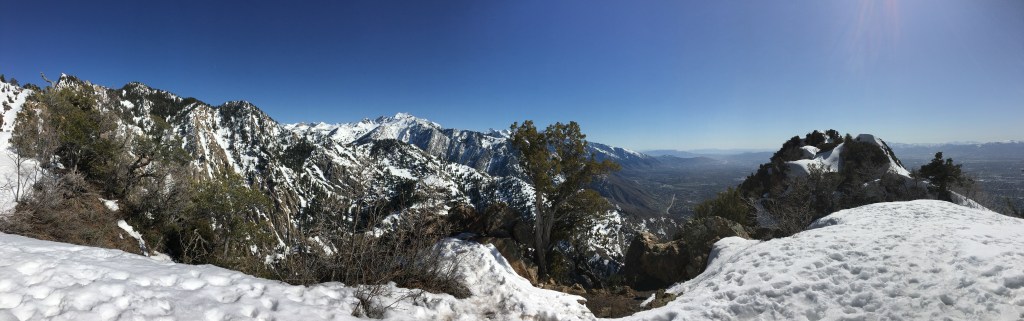
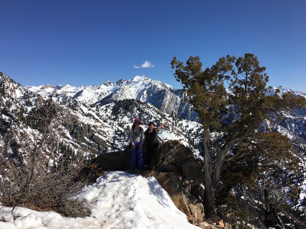
It was close to dark when we got back so I think we made the right decision.
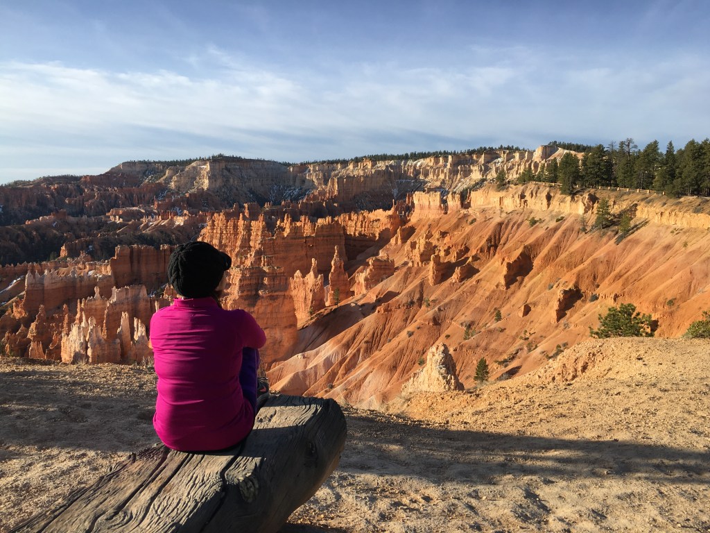
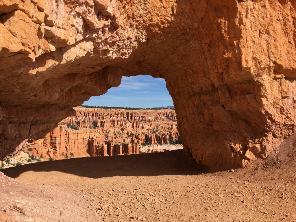
Day Two (4/6/16): Bryce Canyon National Park’s Fairyland Trail
After spending the night at Kathryn’s apartment, Amy and I got on I-15 heading south towards Bryce Canyon National Park. Of course we jammed out to 90s music in our red minivan and didn’t quite drive the 85 mph Utah speed limit, cause again, we’re from Minnesota, the land of slow drivers.
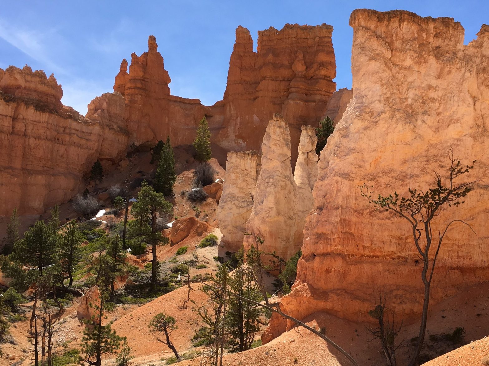
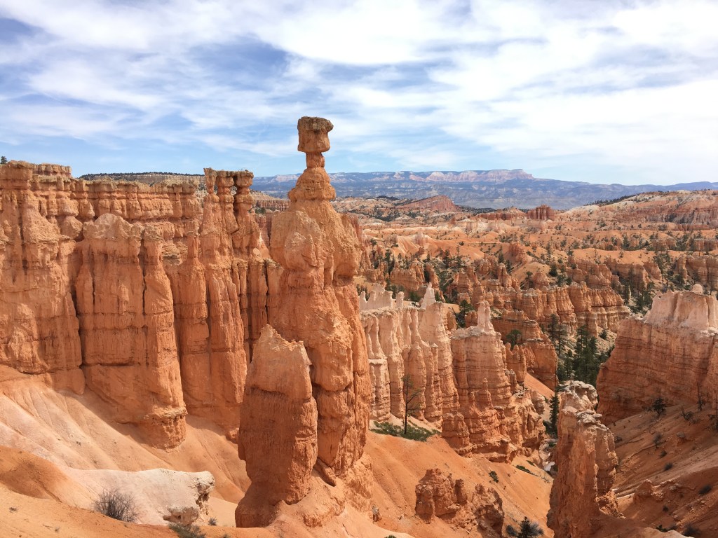
Once arriving at Bryce, we found our campsite in the north campground, set up our tent, and got out on our afternoon hike on the Fairyland Trail.
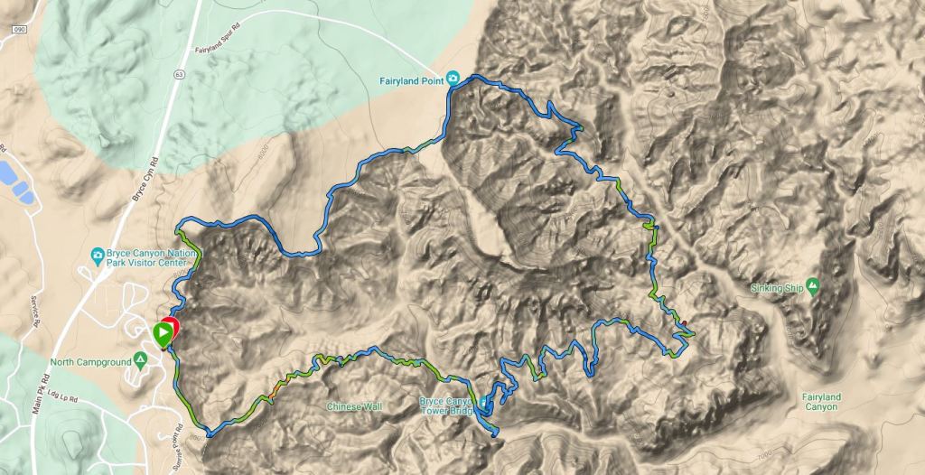
If I had my pick of the best day hike in the United States, this would probably be it. The scenery was no doubt spectacular, but the trail flow was equally as special. Gentle grade, rolling, completely smooth.
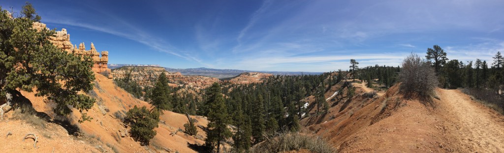
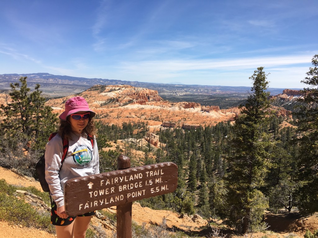

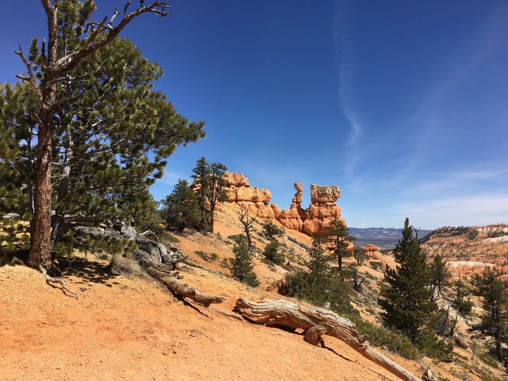

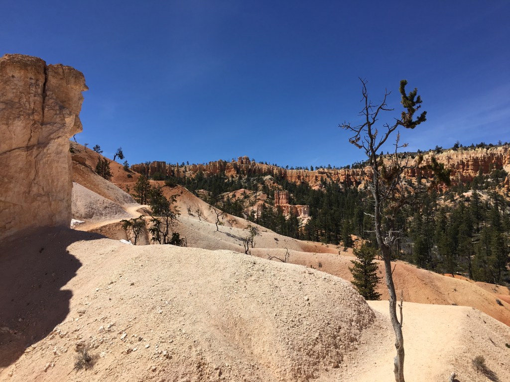
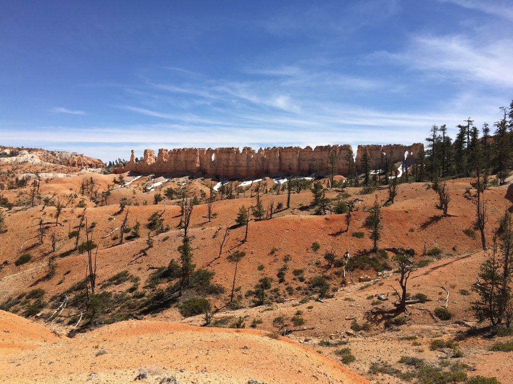
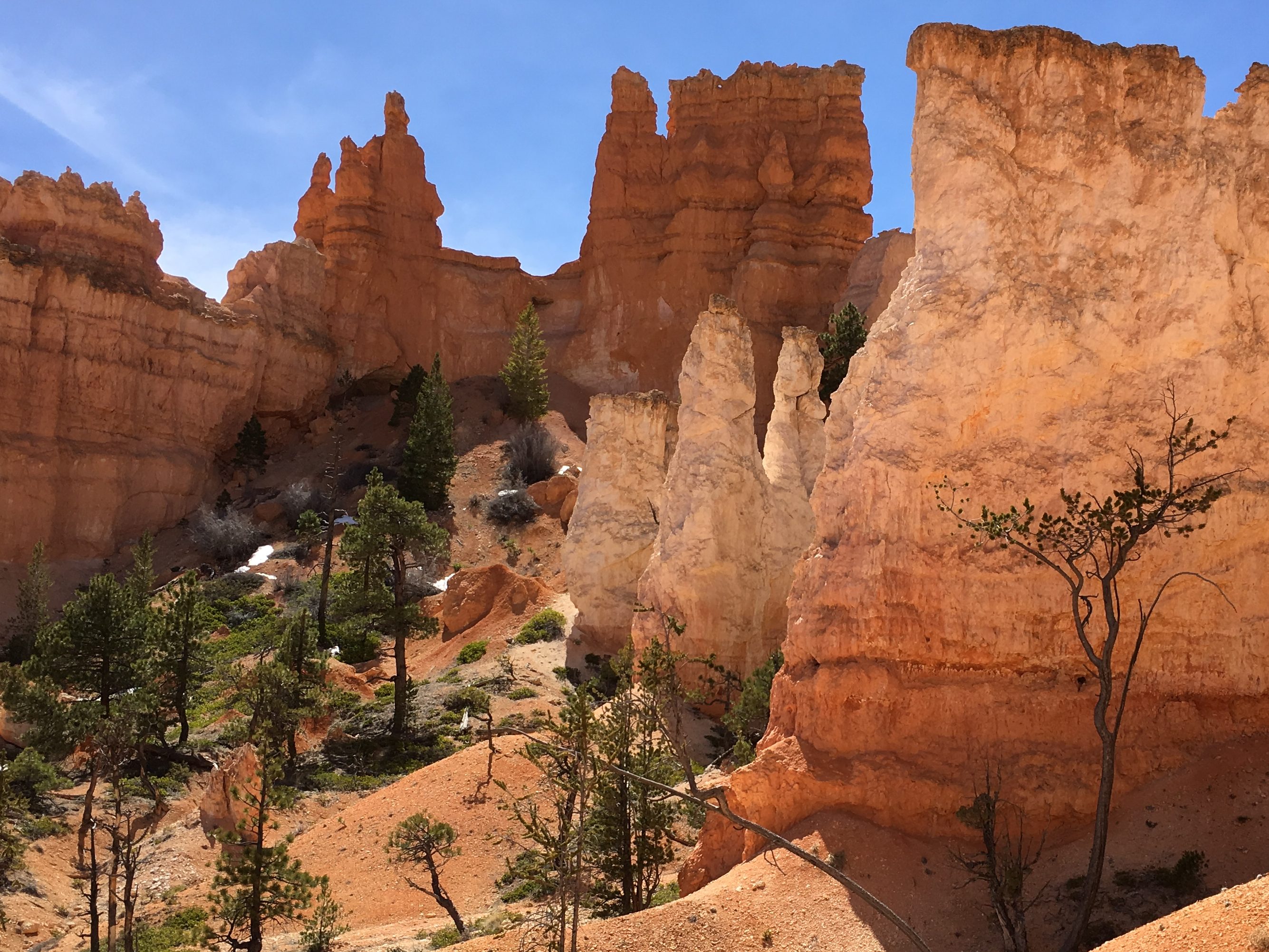
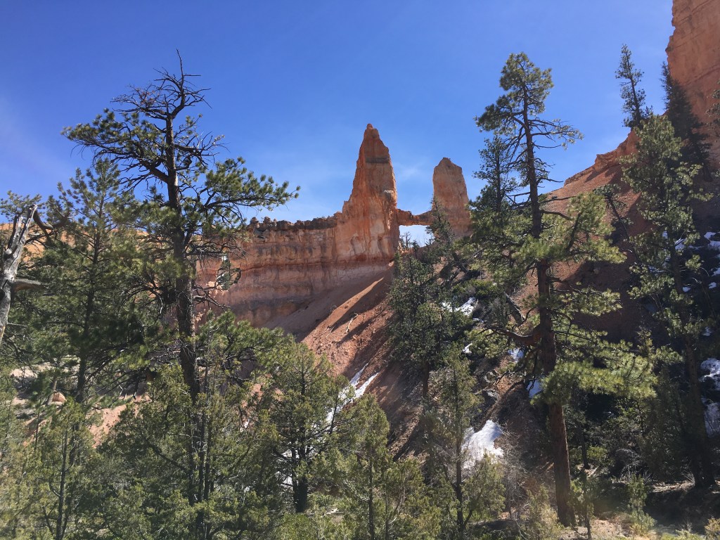
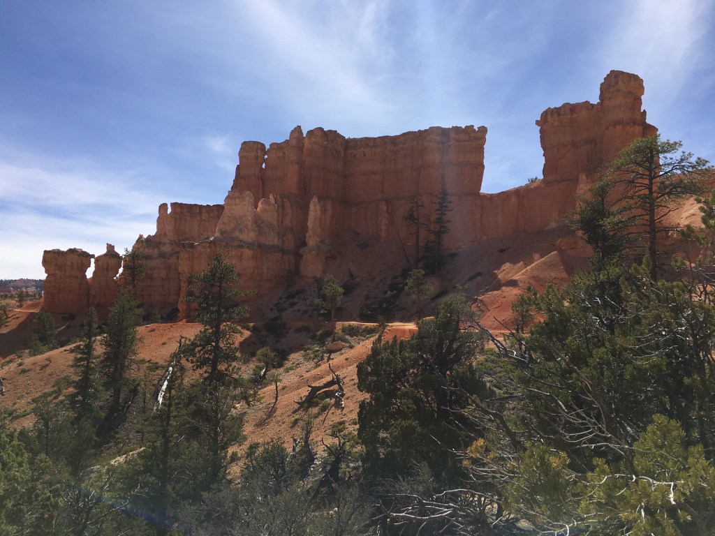
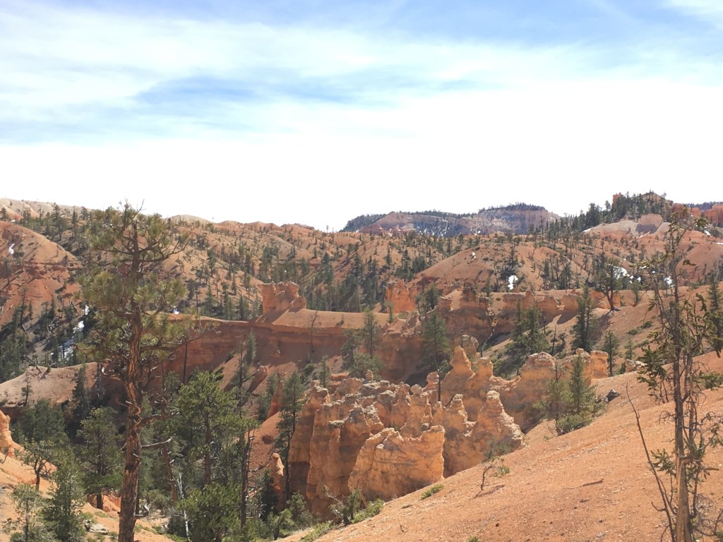

As the pictures and map show, the trail wound around, up and down, up and down, gradually, mystically. Finally we ended with a bit of a continuous uphill back to the rim that felt long compared to the other climbs but that really only took 10 minutes.

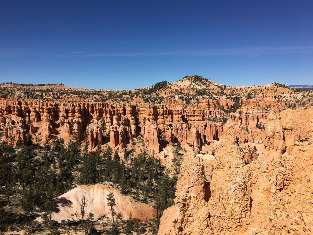
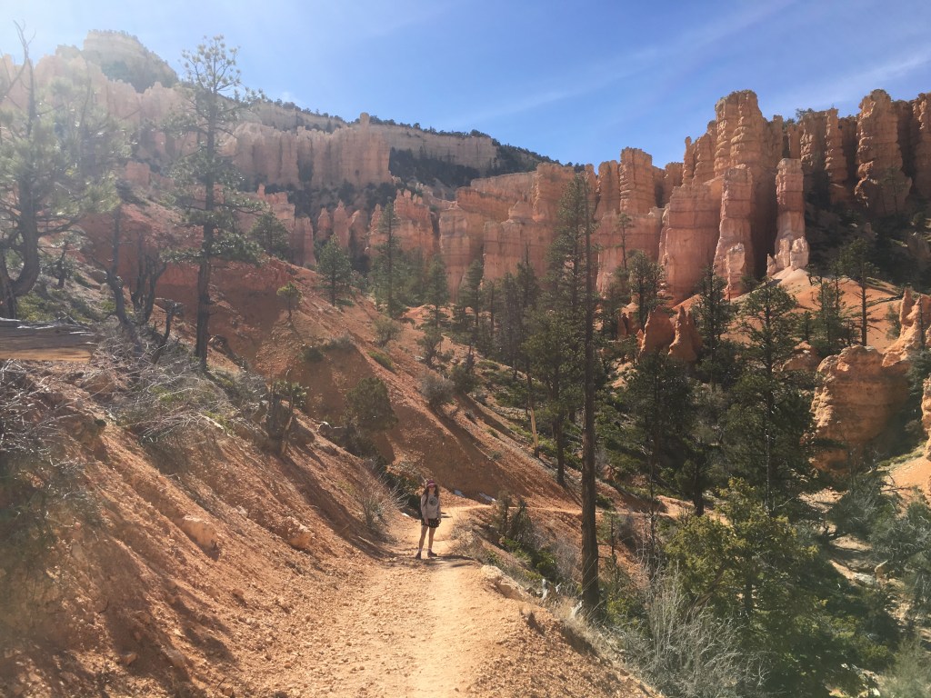
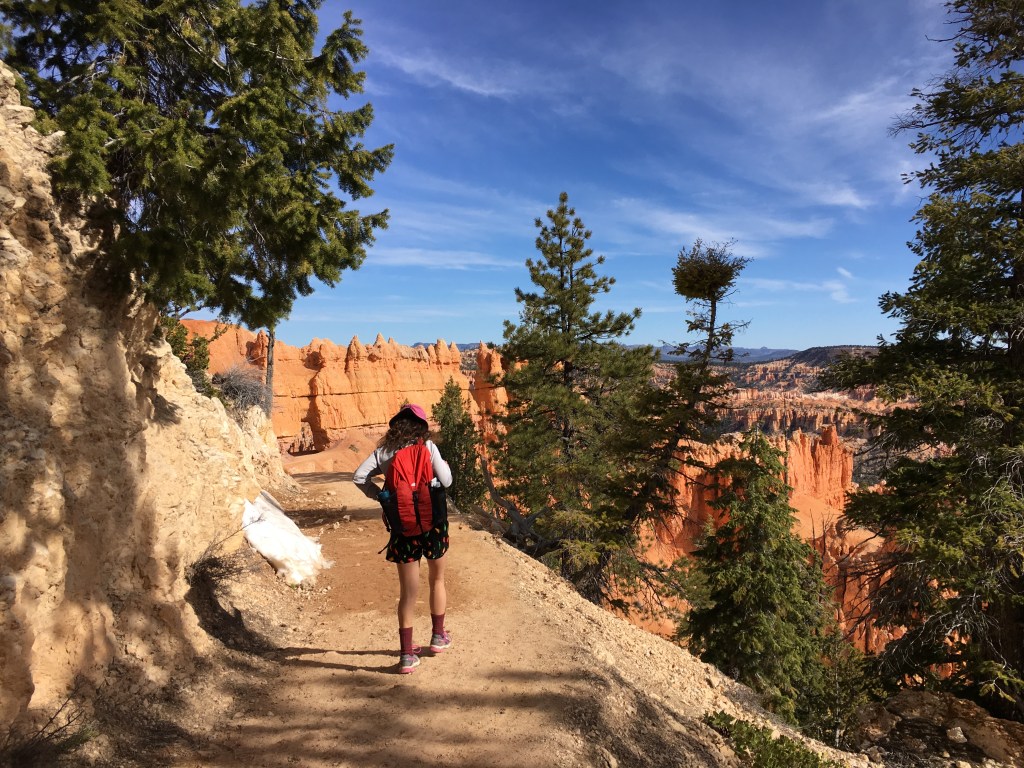
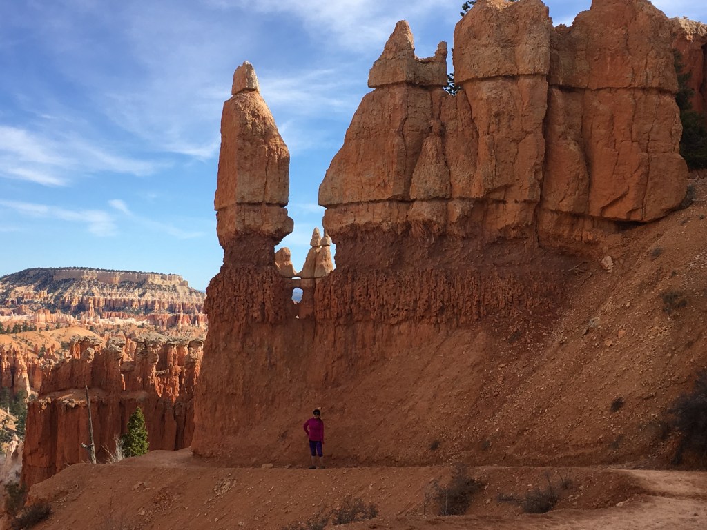
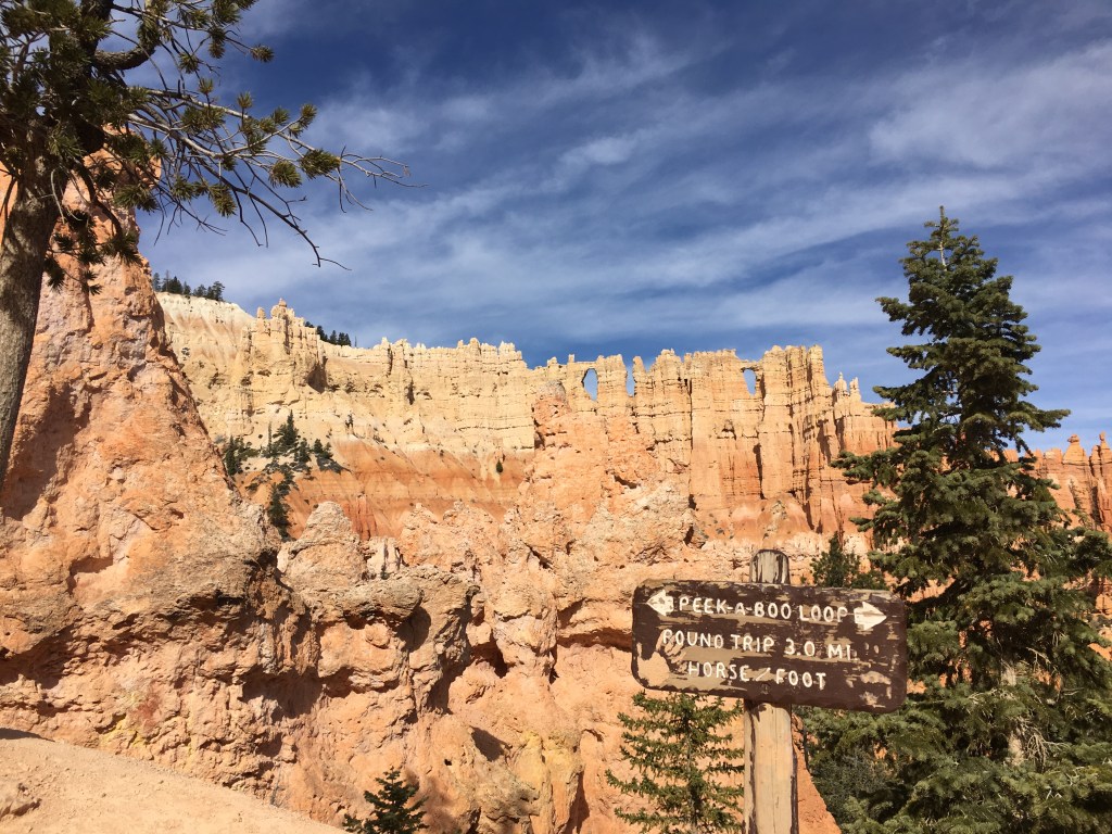
Day Three (4/7/16): Rim Trail from north campground to Bryce Point, then Peekaboo and Navajo Trails and back to the campground
It got cold overnight- well into the 30s and we were up early trying to get warm- we may have jumped in the van and cranked up the heat:)
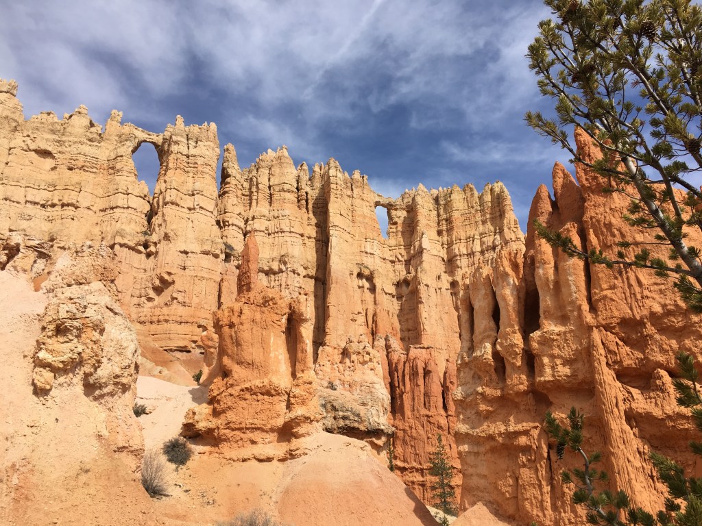
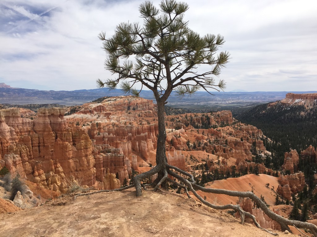
But we didn’t drive the van anywhere and instead took off from our campsite hiking south to Sunset Point even if it was sunrise. This was going to be our big day of hiking, taking the Rim Trail all the way to Bryce Point before dropping into the canyon on the Peekaboo Trail (clockwise direction only), and then up the Navajo Trail back to Sunset Point and then Rim Trail to our campground again for about 11 miles of hiking.


It was a cold beginning to the day and we were happy to have the warm sunlight on us but it still took awhile to get warm as we hiked along the easy Rim Trail.

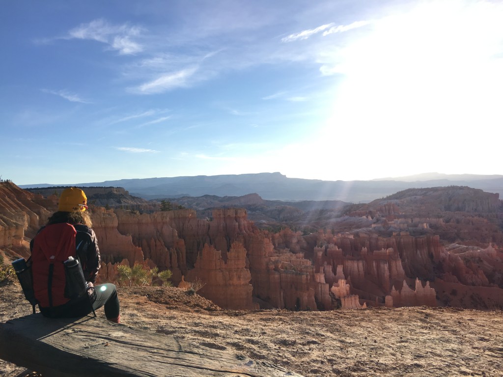
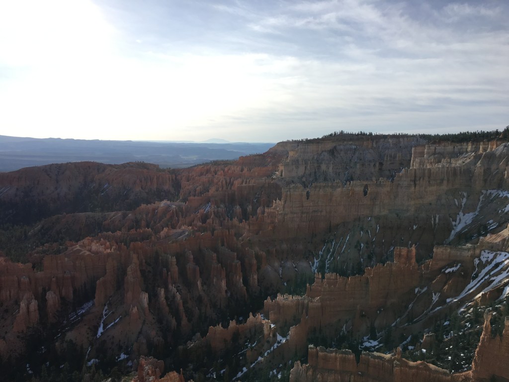
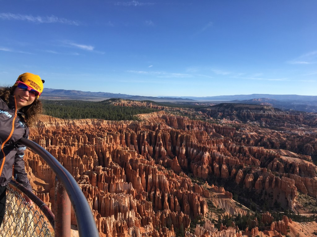
Maybe had we not stopped for so many photos we would’ve gotten warmer faster but the views were spectacular and so much different from Minnesota.


It was mid-afternoon by the time we got back to our campsite. We drove into the local town for dinner, stopped by the visitor center, and then drove to the far end of the park to kill some time before it got dark.
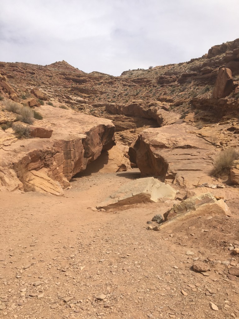
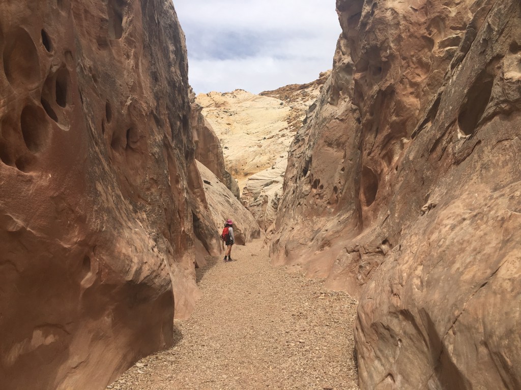
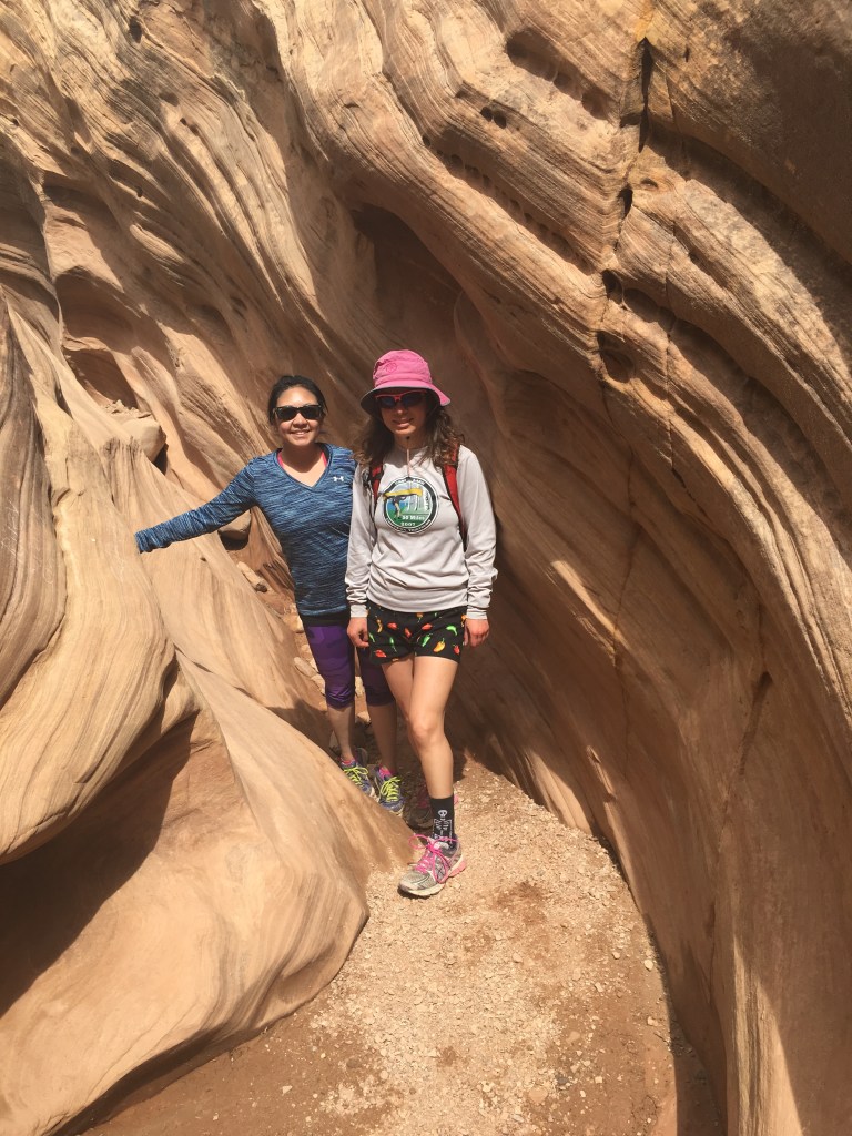
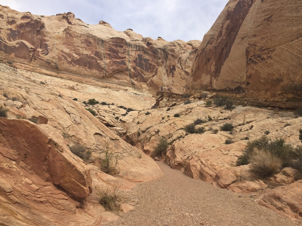
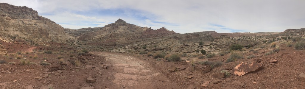
Day Four (4/8/16): Little Wildhorse and Bell Slot Canyons
The next morning, we threw our tent into the van without so much as rolling it up and left Bryce and it’s freezing mornings. After driving through numerous scenic canyons, we finally arrived by Goblin State Park where Kathryn had given us the 411 on a couple slot canyons that should be dry.
We didn’t technically go to Goblin Valley State Park but we drove by the sign on the road to Little Wildhorse and Bell Canyons.
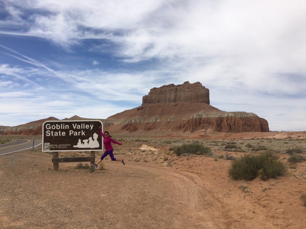
From there we continued down gravel road 1013 marked on the map below until we got to where there were a bunch of cars parked. We then set out on the loop in the clockwise direction.
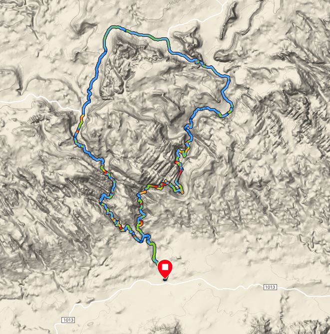
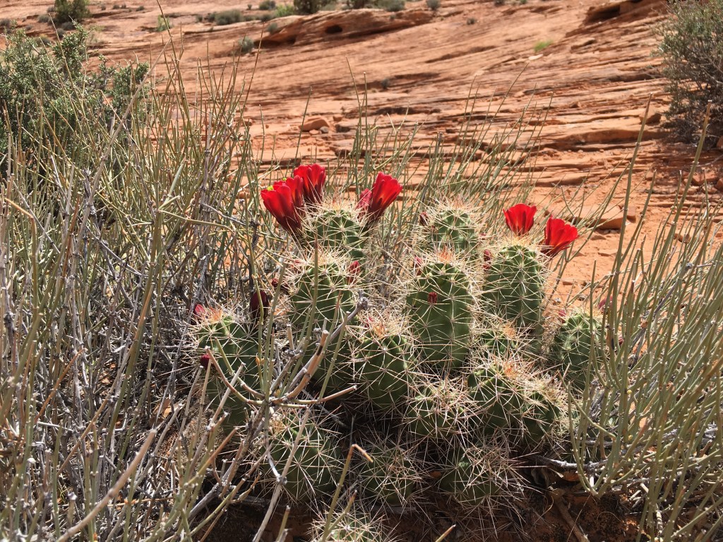
The scenery was arid and a little boring at first but eventually got more exciting.


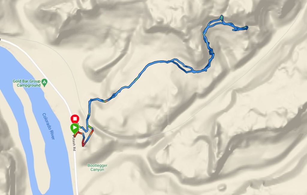
After our dry canyon hike, we continued our drive to the Moab area where we planned to camp at a Bureau of Land Management (BLM) campground along the Colorado River. There are several of these campgrounds and they are all first-come-first-serve without reservations. Somehow we didn’t think these would be so popular and failed to realize it was Friday night in April, aka prime dessert time. We drove through the first campground (Goose Island) we got to and it was all full. Ditto for the second (Drinks Canyon) and third (Hal Canyon) and so on and so forth past a bunch until we got to the Lower Onion Campground. This one was full, too, but we didn’t really want to keep driving farther down the road and it was getting dark. On our second lap of Lower Onion Campground, we found two girls occupying some open land but not a real site and we asked if we could stay with them. They had a whole set-up from their hatchback complete with peace flags. It looked like they were ready to stay a week. They were certainly nice enough and so even though it wasn’t a legit spot, we decided to stay.
The girls were from northern Utah, childhood friends, who had fallen from the Mormon church. As the sky got dark, they got out the alcohol and talked about boys and pot, lots of pot, and we learned that “cush” was the good stuff. They offered us some.
The irony of the situation wasn’t lost on me. Somehow Amy and I managed to make it through middle school at the lowest test-performing institution in the state without ever being offered drugs together and here we were, age 31, twenty years after DARE, in Utah of all states, being offered weed by two Mormon girls 10 years our junior.
We politely declined. Part of us thought about trying, but we were innocent back in first grade when we got called to the principal’s office and we decided to keep our innocence now.
The girls kept partying but we had lots of arches to see the next day. Us shorties slept in the van.

Day Five (4/9/16): Tour de Arches
The next morning we were up early with the plan of snagging a legit campsite in one of the campgrounds closer to Moab. We got lucky at Goose Island and placed our tag on the site number and headed out for our day’s adventures.
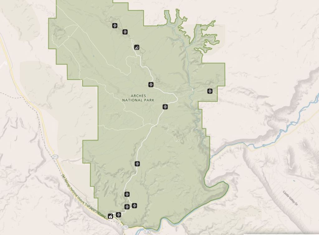
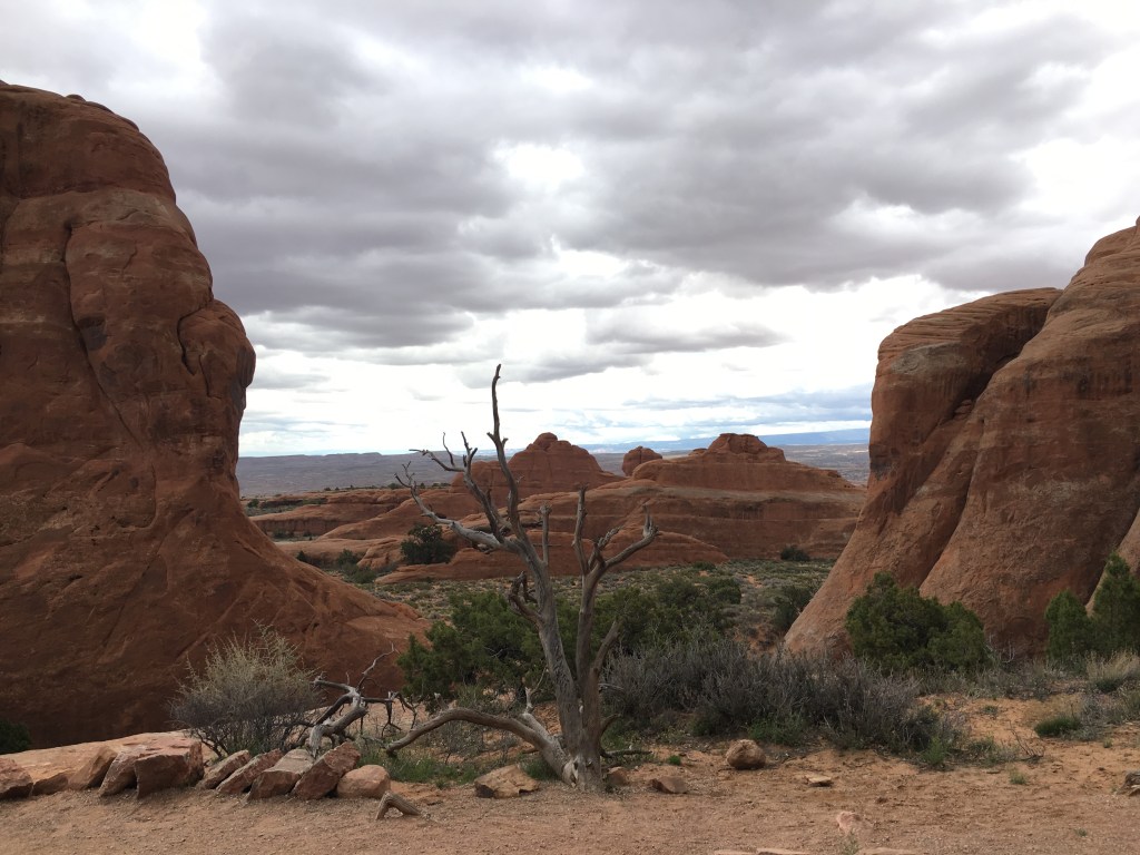
Arches National Park
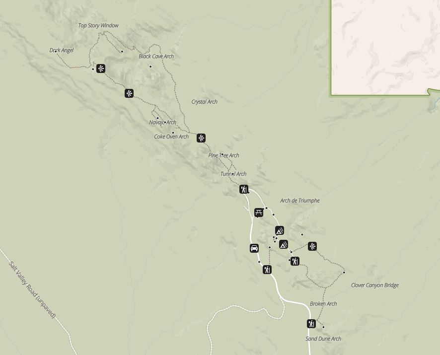
Arches is big and doesn’t really have trails connecting many of the arches so we mostly drove and then hiked to a few arches at a time. Not my usual way of going but I really wanted to hit up a bunch of arches.
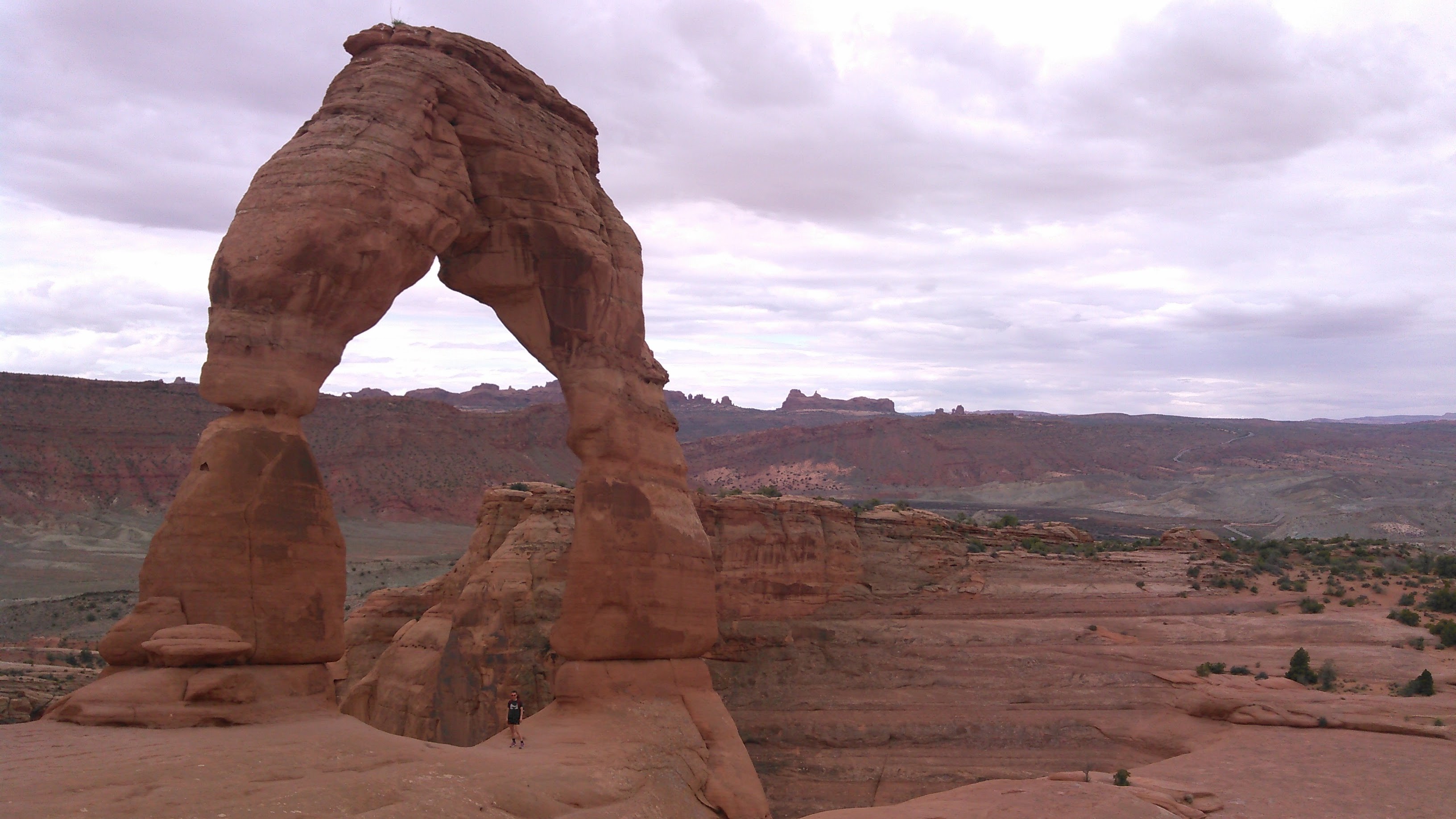
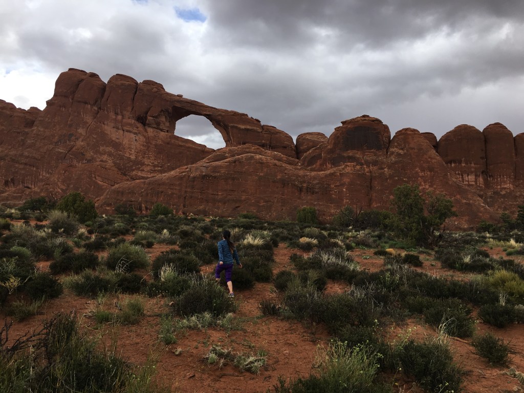
Our first stop was the trail to Delicate Arch because that one is most iconic (I mean, it’s on the Utah license plate) and so we had to get there.

Under cloudy skies we took off for Delicate Arch, trying to acclimate to the vast dry terrain.

When we finally got near the Delicate Arch I was really struck by how it was in this seemingly off-camber bowl that looked nearly impossible to walk along. But the rain held and it wasn’t impossible to get footing so we lined up with everyone else to each get our photos under the Delicate Arch.

The skies got sunnier on our way back to the car and we were able to chill out a bit more and enjoy the scenery.
Next we got back in the van and drove north to an area with a higher concentration of arches.


The skies were turning again and we weren’t jazzed about rain so we decided we’d had enough and ran back to the car.
After the short drive back to the south part of the park the skies were looking a little less threatening so we hit up a few more arches. I was really glad we did.


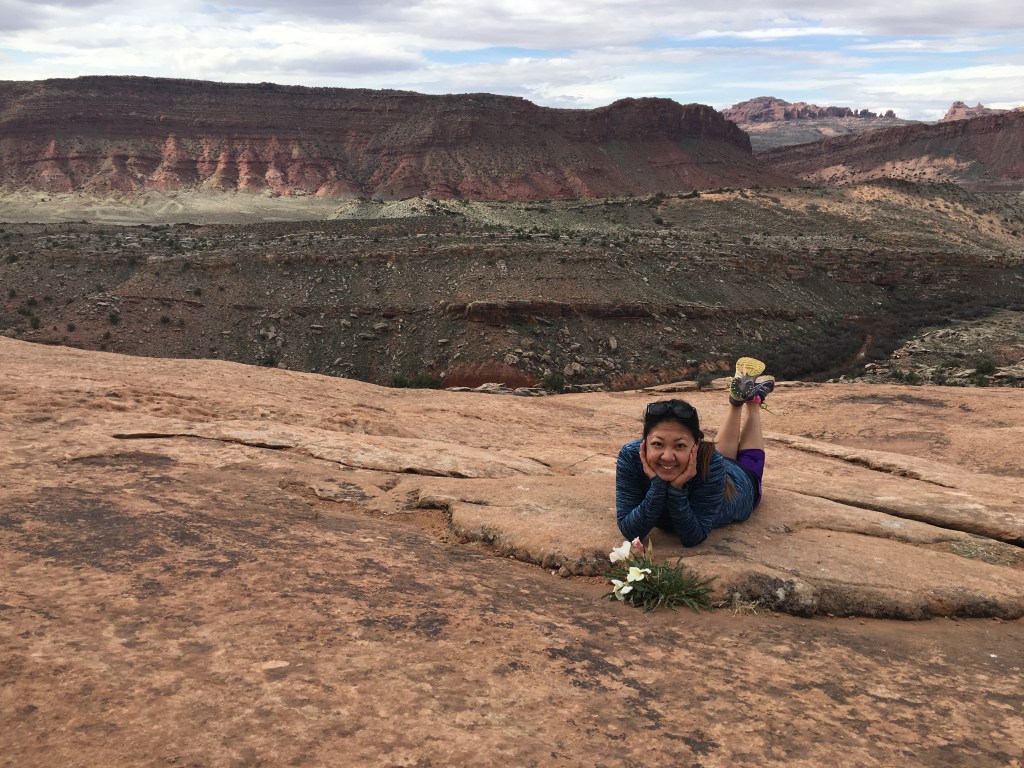
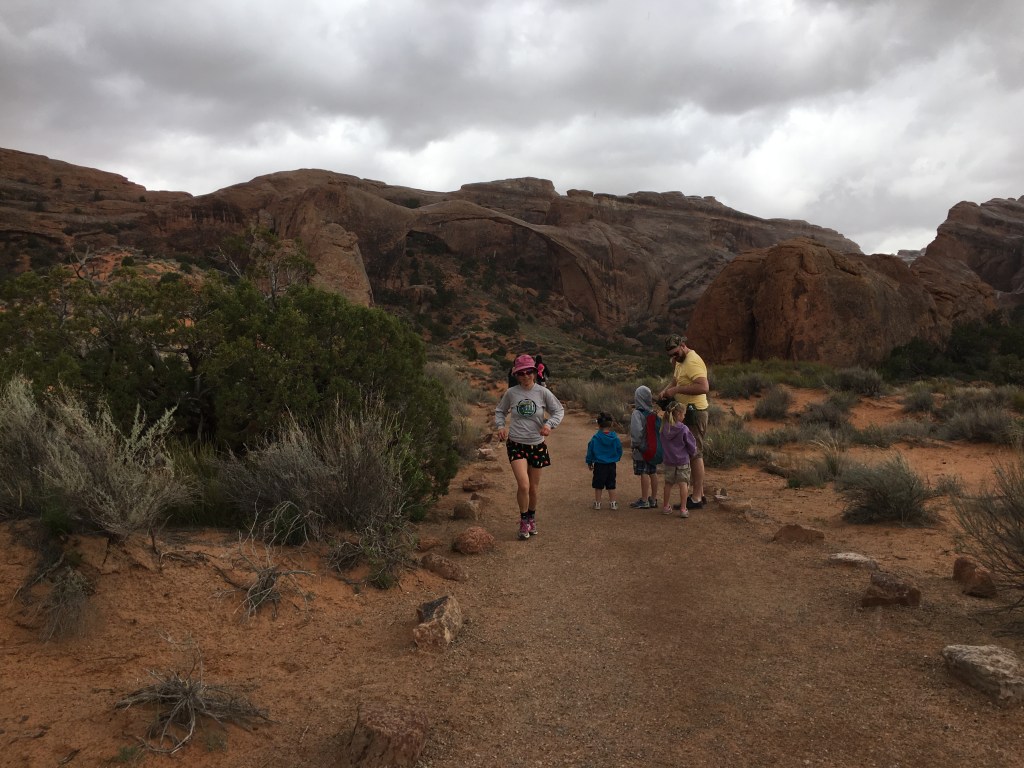
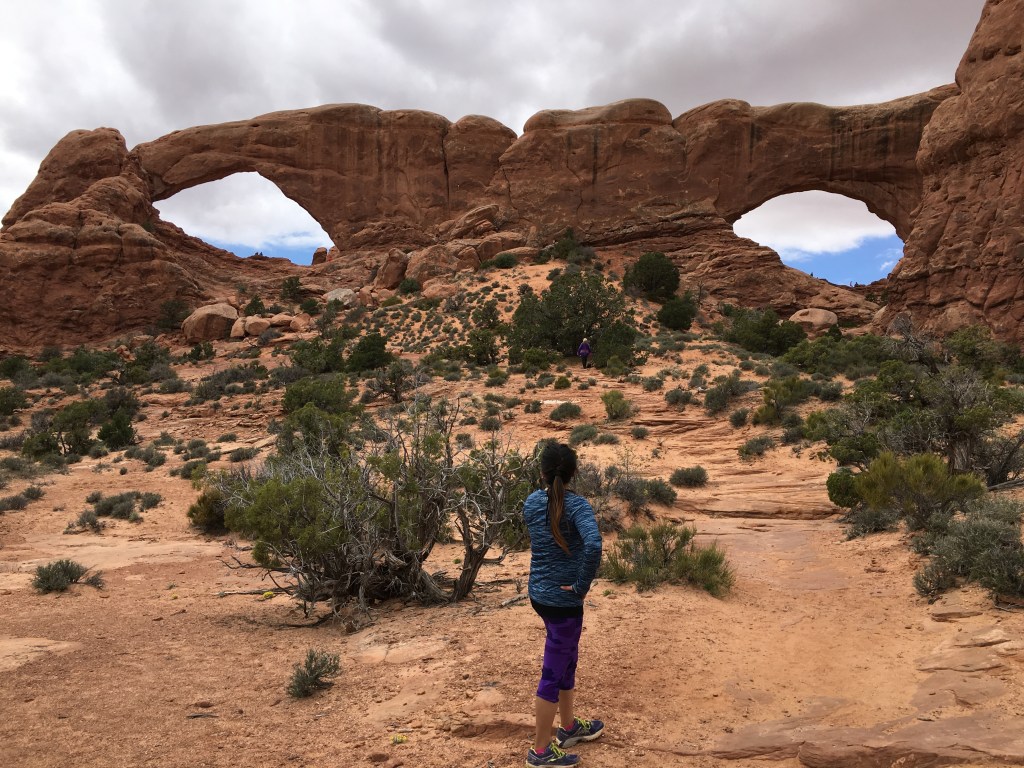
Then we hiked the trail around the North and South Windows and I loved the view looking out to the Colorado River and beyond to the La Sal Mountains (see map above).


Then we said good-bye to Arches and headed out highway 279 to the Corona Arch Trailhead.
Corona and Bowtie Arches
This arch was made famous by this YouTube video and so of course I had to see it.

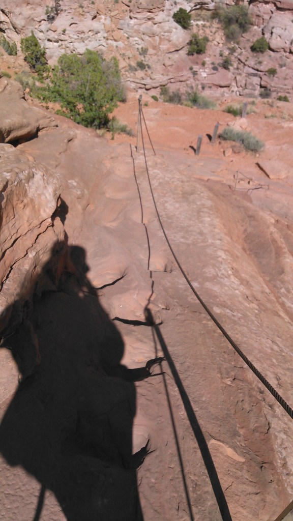
Back in 2012 when we hiked the John Muir Trail and Half Dome as part of it, I’d seen some photos of the cable route and assumed it was optional, such as the cables in the Adirondacks. But I was completely wrong and using the cable was absolutely necessary to climb that route up Half Dome. There was a small cable on the way to Corona Arch and due to some really good carved foot holds, this one was optional as well.


Even though the photos don’t necessarily show it, there were some threatening clouds AND we were getting a bit arched-out. Hence, we took the opportunity to refuel at Pasta Jay’s back in Moab and were not disappointed.
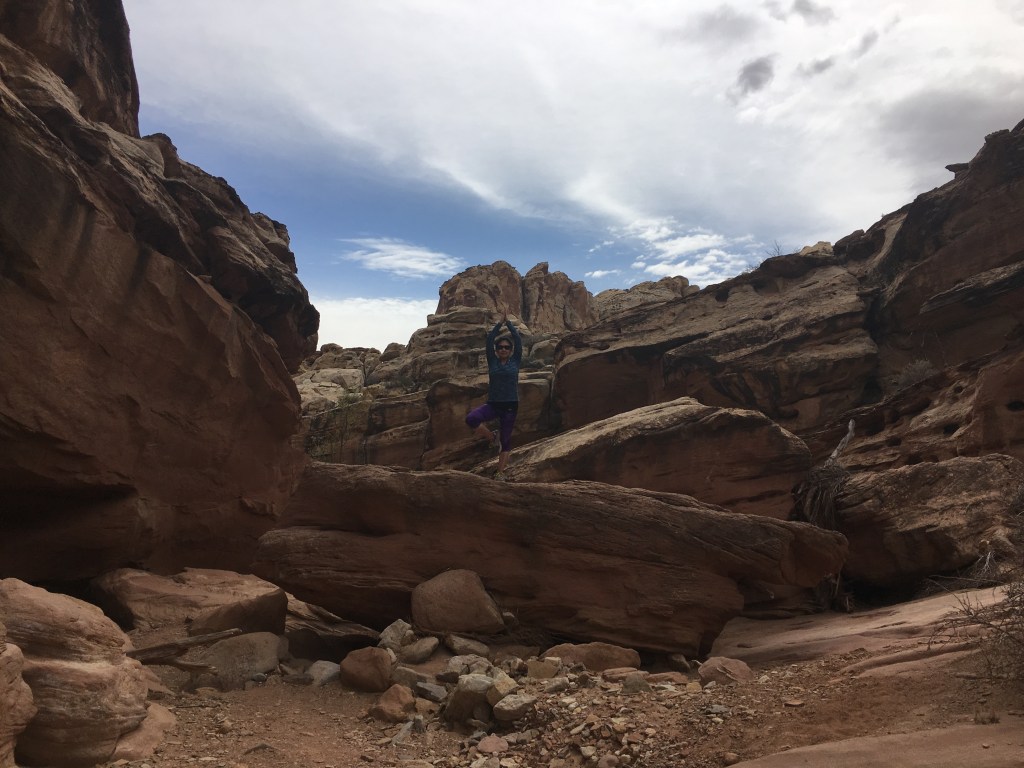
Funnel Arch
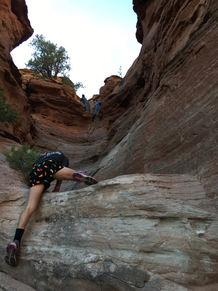
Kathryn turned us onto this arch. It’s also called Cable Arch as people have placed a cable to climb on top of the arch. Even though I was kinda nervous of climbing up that cable, we still went for it.

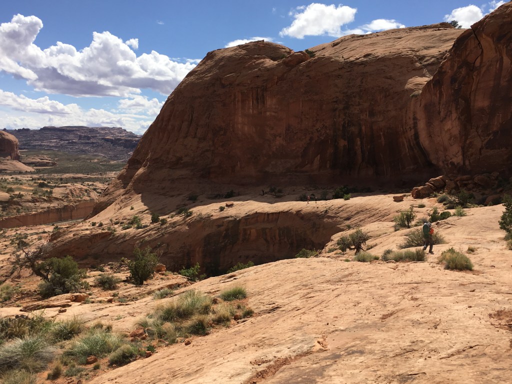
It turns out the first part of the hike was pretty intense with some bouldering on very worn smooth rock.
“I learned how to do this from YouTube before we went,” Amy reassured me. Somehow, despite me being the one with way more bouldering experience and longer arms and legs, I struggled more than her. Maybe I should’ve been watching those YouTube videos!
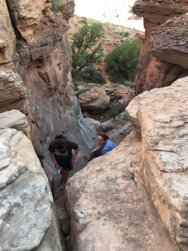
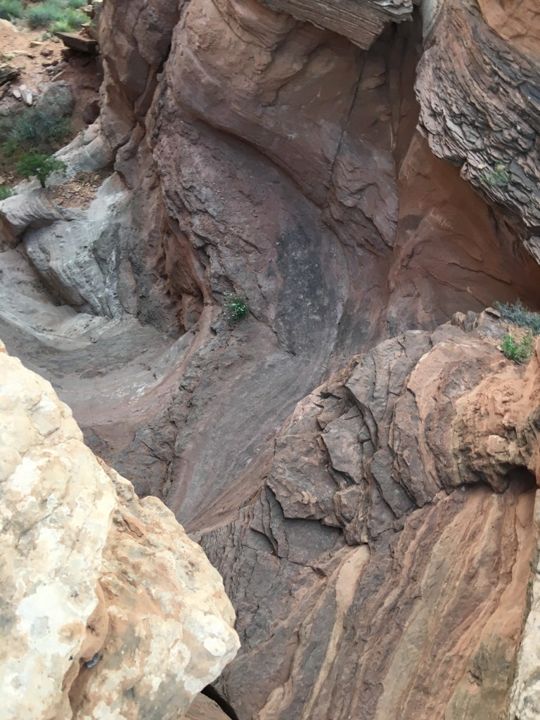
After the initial steep section, the route flattened out but we had trouble following any kind of trail. The route turns to the right (east) but we weren’t certain which way to go as everything required some hand use and it’s not until the next rise that we could actually see Funnel Arch. See instructions on the photo below.

After winding our way up the gully on the south side of the bowl and gaining a couple contours, we spotted Funnel Arch.

As we kept getting closer and closer to Funnel Arch we didn’t see any cable going up it. And indeed, there was none. To be honest, I was relieved.

Then we retraced our steps back to the trailhead but that crux section was intimidating. Amy did awesome again and even did some route finding.
We arrived back to our campsite quite tired only to learn it had been hijacked!!! Since we were planning to sleep in Bertha (nickname for the red minivan) anyway, we were nice enough about it.
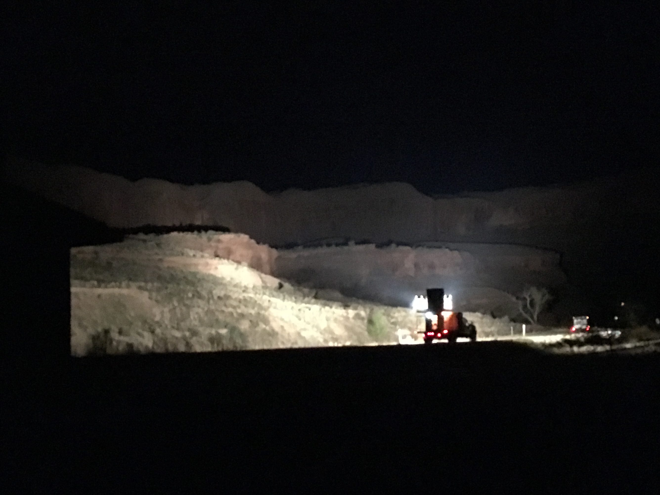
Once it got dark, we watched some truck drive through the canyon with super bright lights that seemed to be illuminating the canyon walls. We weren’t quite sure what this was about.
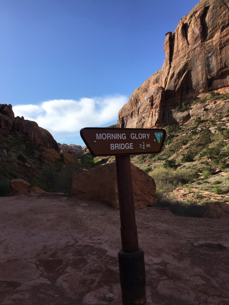
Day Six (4/10/16): Morning Glory Bridge and Diamond Fork Road Hot Springs
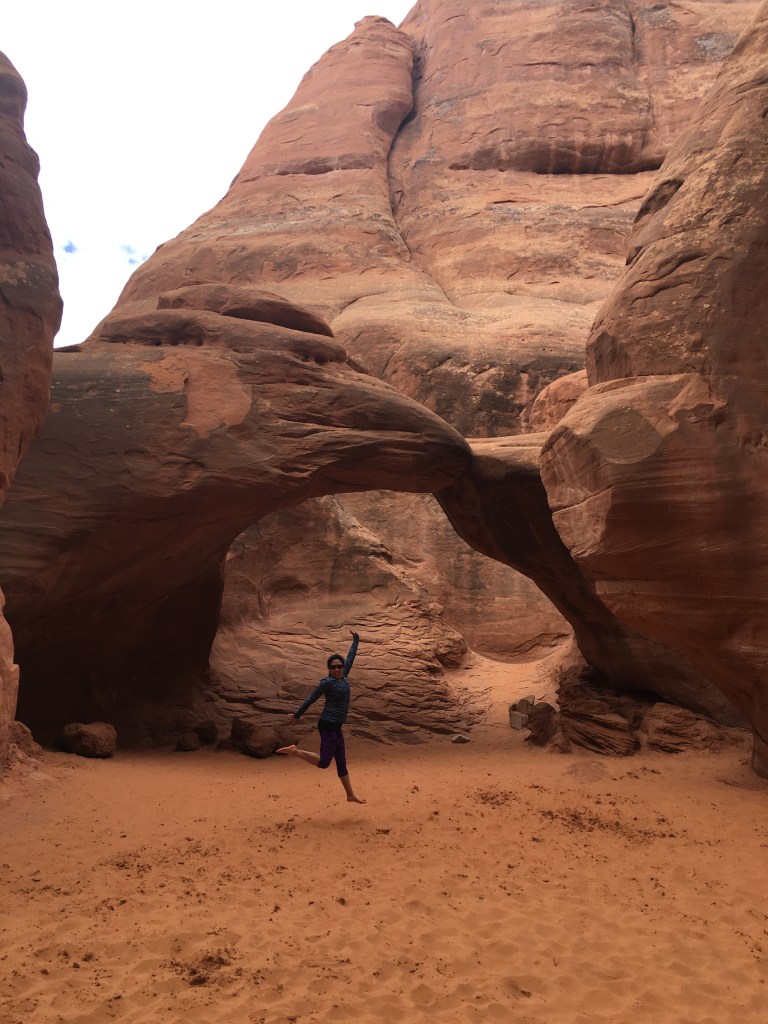
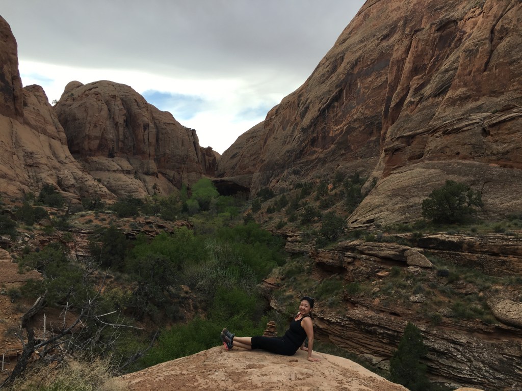
The next morning, we ran/walked to one final arch (Morning Glory Bridge) before driving back to the Salt Lake City area.

There was a nice paved trail along the Colorado River and then a hiking trail from the trailhead. It was mostly run-able.

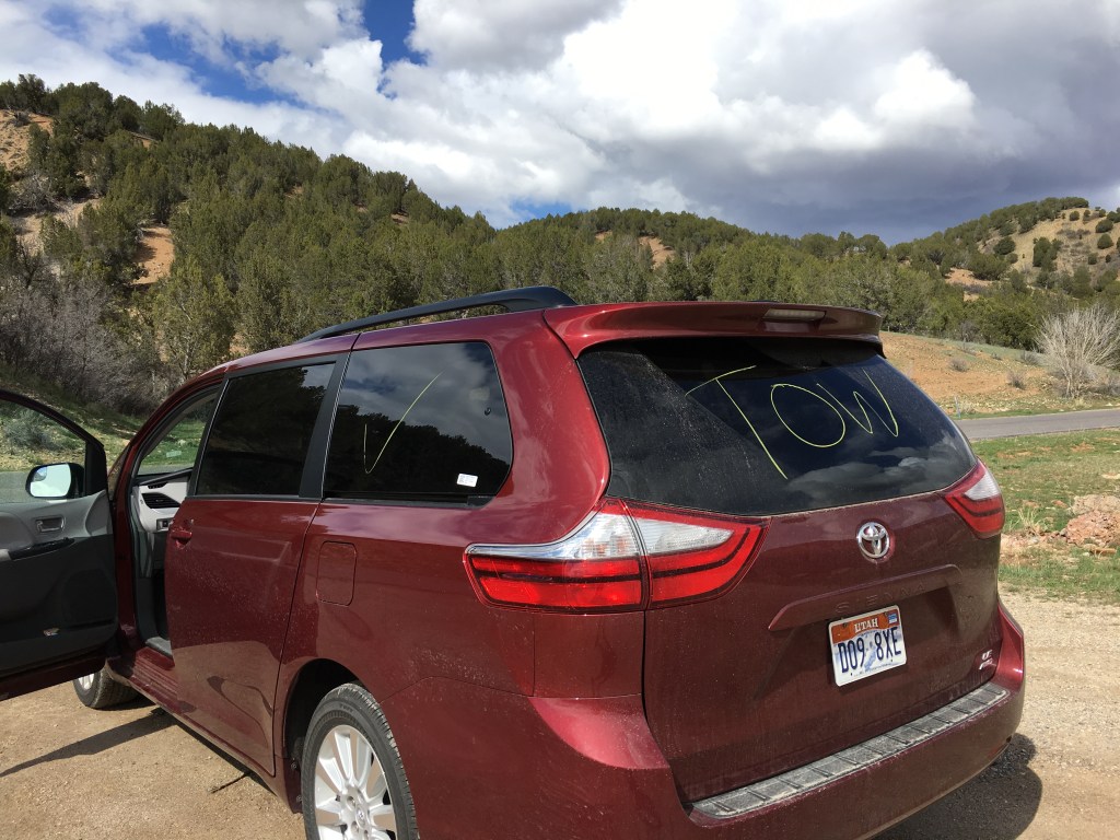
Morning run complete, we hopped in Bertha and drove towards the Diamond Fork Road Hot Springs. To get there, take 6 southeast from I-15 near Spanish Fork. These were popular and we parked a ways from the trailhead on the road with a godzillion other cars.

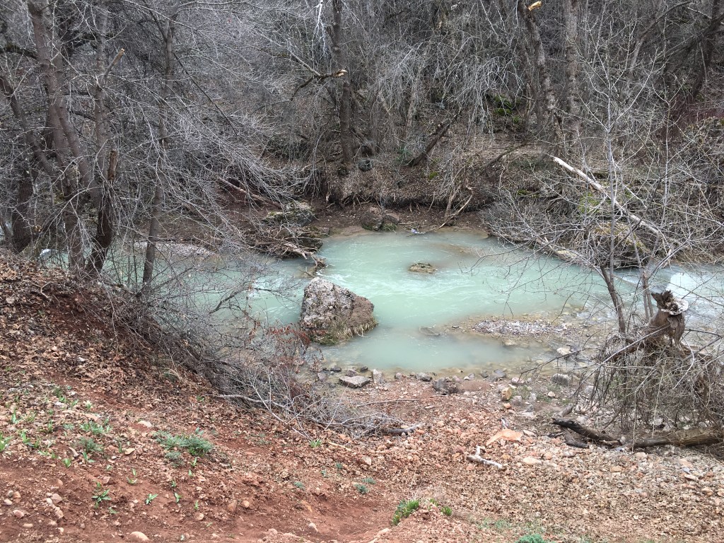
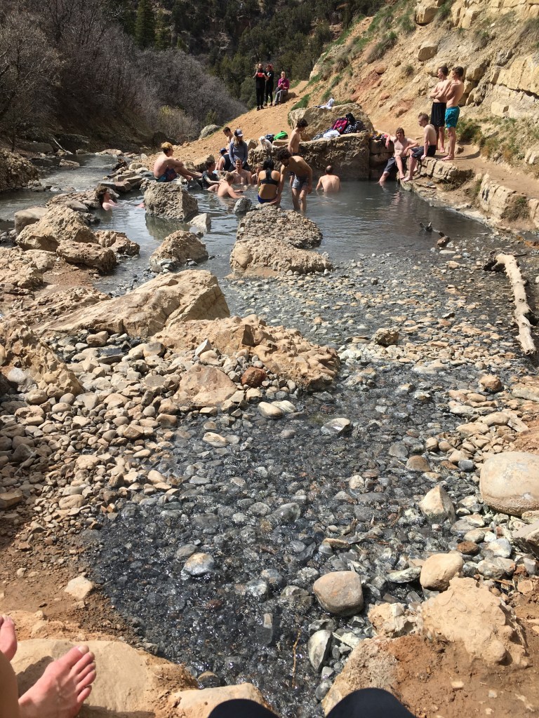
We stayed for awhile and checked out the different temps of the various pools but after not too long we hiked back to Bertha and were sure glad we did as every car was marked with a “tow.” We weren’t sure if this was just a warning or if they’d taken down our rental license plate but after we drove away, we parked Bertha for a photo before wiping off the chalk.
The rest of the ride back to Salt Lake City was uneventful and we sang off-key to more 90s music and then met back up with Kathryn.
Day Seven (4/11/16): Downhill Skiing
Kathryn and I went downhill skiing at Solitude (free pass for me because Kathryn worked there) while Amy headed down to a coffee shop to prep for her upcoming accelerated nursing program. We reconvened for a yummy dinner at Kathryn’s.
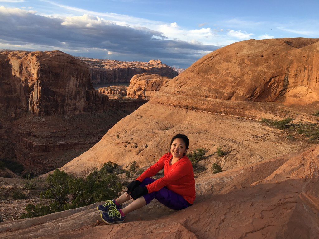
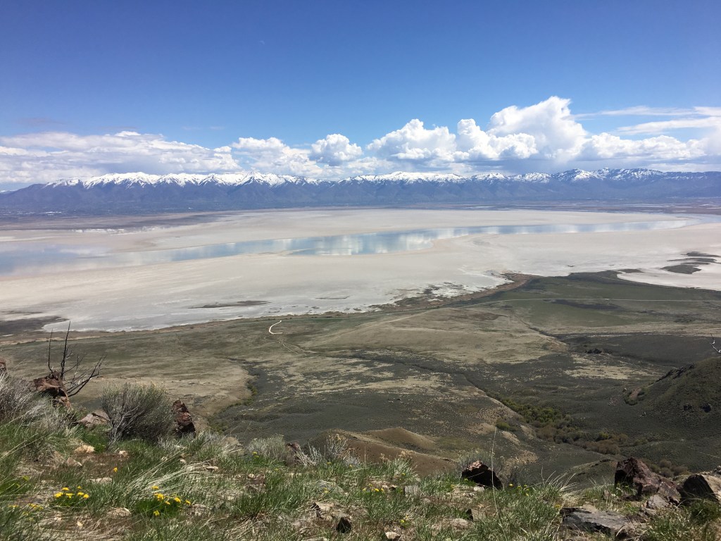
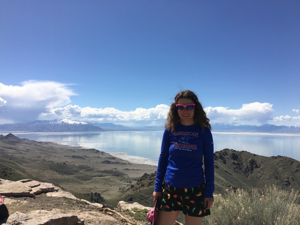
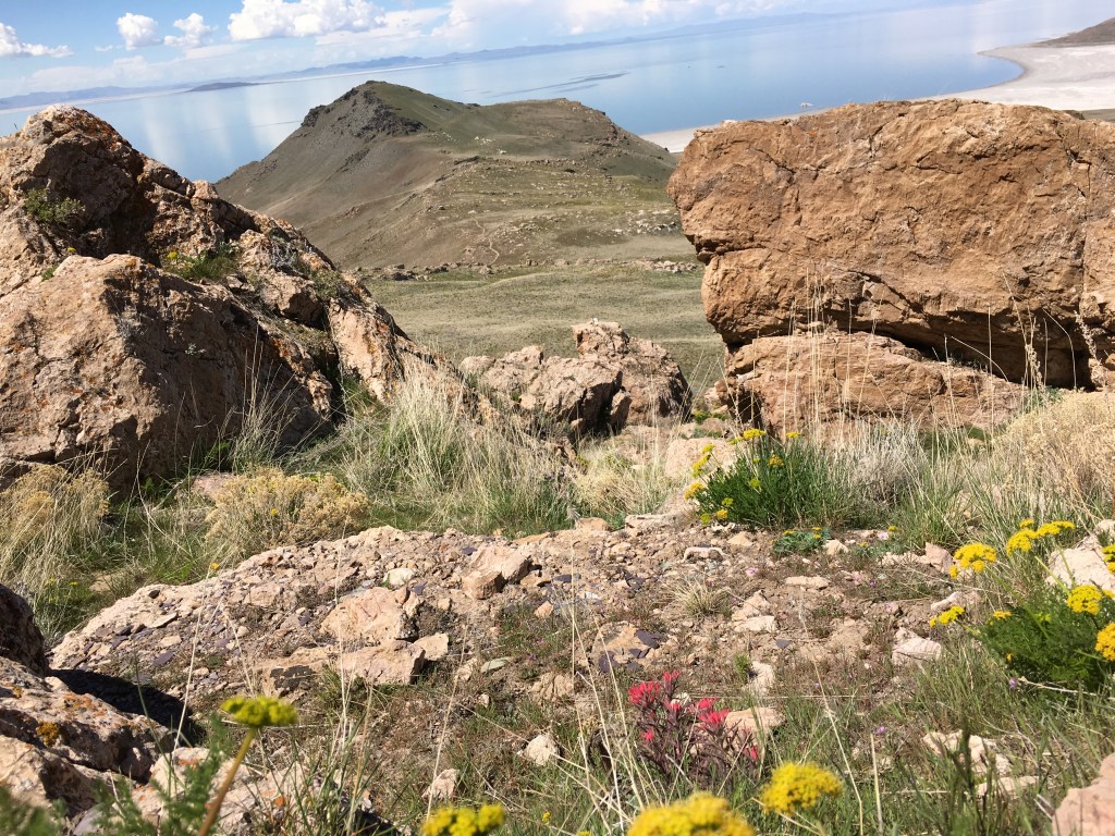
Day Eight (4/12/16): Frary Peak on Antelope Island in the Great Salt Lake
Ever since I learned about the Great Salt Lake I’ve wanted to see it and go swimming in it. Upon researching this trip, I learned about Antelope Island State Park and its Frary Peak, a mountain that rises over 2,300 feet above the lake


The hike was sunny with wide open views of Antelope Island, the Great Salt Lake, the Wasatch Range to the east and the lesser ranges to the south and west. The trail itself was smooth and we made descent progress although false summits are always a let down.


As for swimming in the Great Salt Lake, well, the photo below shows a lot. After driving across the causeway we got to the water, it was very smelly and there were lots of birds pooping so I wasn’t even inclined to stick a toe in.
After the hike we said good-bye to Kathryn and Bertha and headed to the airport.

I felt so grateful to take this trip with Amy. It was my first ever “girls” road trip and we had so much fun singing and dancing to 90s music and just being silly in general that I never get with my much more serious husband. Early April was definitely a busy time at Bryce and Arches but we escaped the crowds on the longer hikes and the Fairlyland Trail is not to be missed.

Inspiring narrative and beautiful pics, as always.
LikeLike