
Erik and I planned a late May canoe trip in Minnesota months ago in conjunction with a family wedding near Nisswa, Minnesota. We knew we’d canoe part way home from the wedding on a section of the Mississippi Erik had done twice before but that I’d never done. We had the week off before the wedding though and were up in the air in regards to what river to canoe after the driest winter on record followed by little rain all spring. We’re always in search of high water and despite the drought, water levels were high on the Minnesota River due to some recent rain. Then a couple days before we left, a few days shy of her 92nd birthday, my great aunt died. She was the last of my “great” generation. And so we decided to paddle part way to her memorial on the Red River of the North.
The Red River
Last year we didn’t have the best experience paddling the first 65 miles of the Red. The banks were ridiculously muddy and any time we got out of the canoe we had to fight our way through the mud. Hence, expectations were low for continuing our journey on the Red. But we did have paddling to the Canadian Border to look forward to, so we set out.
We had a couple obligations on Saturday and so left on Sunday. As usual, packing took longer than we thought and it was well after 9 am when we finally began our drive to Grand Forks where we’d leave our car and canoe to Canada. The Memorial was on Thursday which would give us some time on Sunday and then three full days plus a couple morning hours on Thursday to get to Pembina, North Dakota where my mom (driving from Bemidji) would pick us up and take us to the memorial in Hallock, Minnesota. Erik didn’t want to paddle too many miles per day but after considering our options, it made the most sense to push from Grand Forks to the Canadian Border, starting just below the confluence of the Red Lake River.
The Red River Valley is mildly depressed from the surrounding country but the land is flat, flat, flat owing to ancient Glacial Lake Agassiz.
Day One (5/19/24) 22 miles from Grand Forks to Mile 280
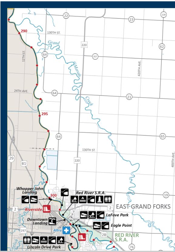
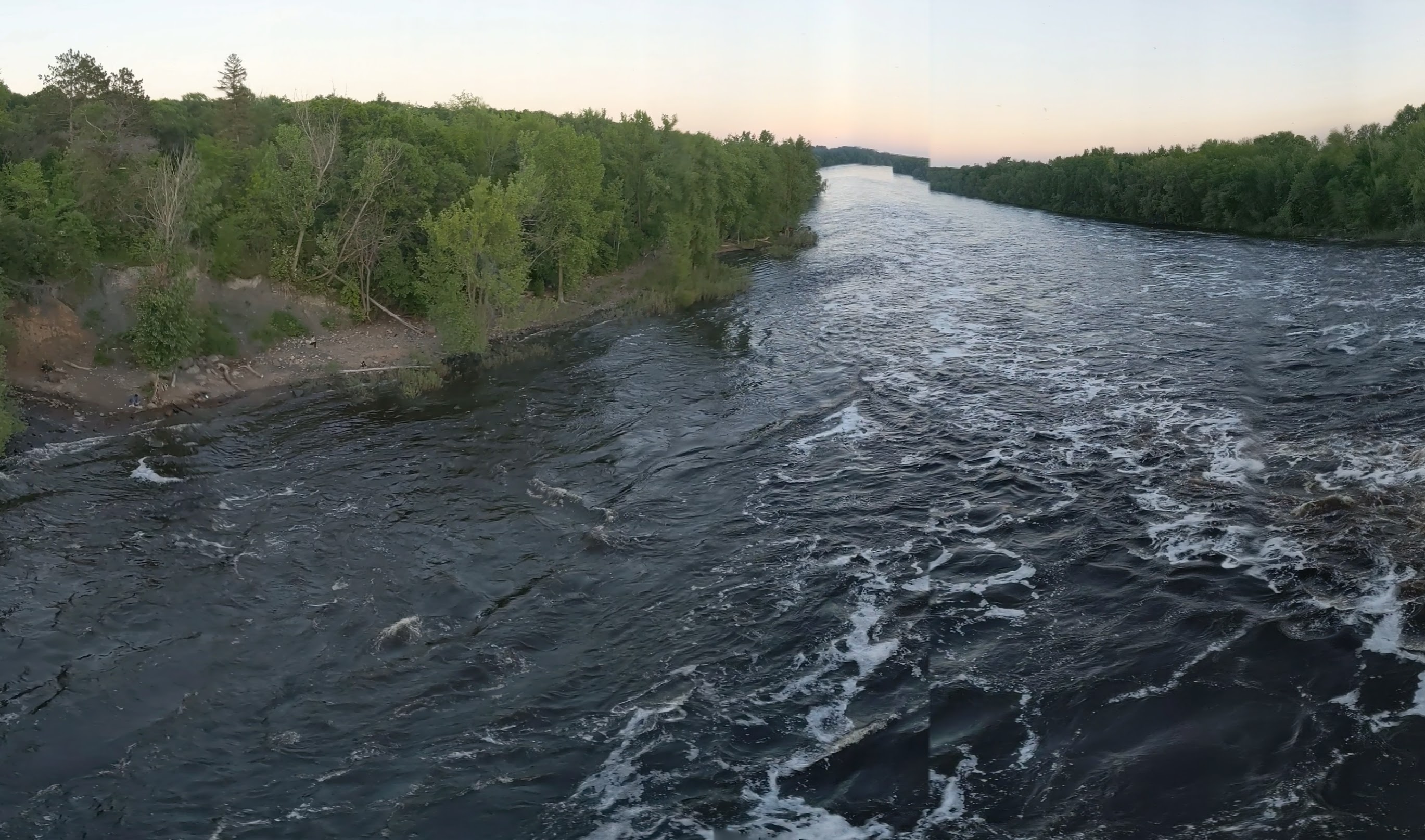
By the time we got to Grand Forks and got on the water, it was 4 pm. This gave us five hours of paddling time until we’d want to establish camp before it got totally dark. We were aiming for the small hamlet of Oslo, Minnesota, where there was supposed to be a watercraft campsite at the boat launch. Grand Forks has historically flooded badly, most notably in 1997, and has since made considerable efforts at levees and dykes. We spent our first couple miles passing through town and under a handful of bridges. After a couple blocks of downtown, the shoreline became tree-lined. We waved to a few people onshore.
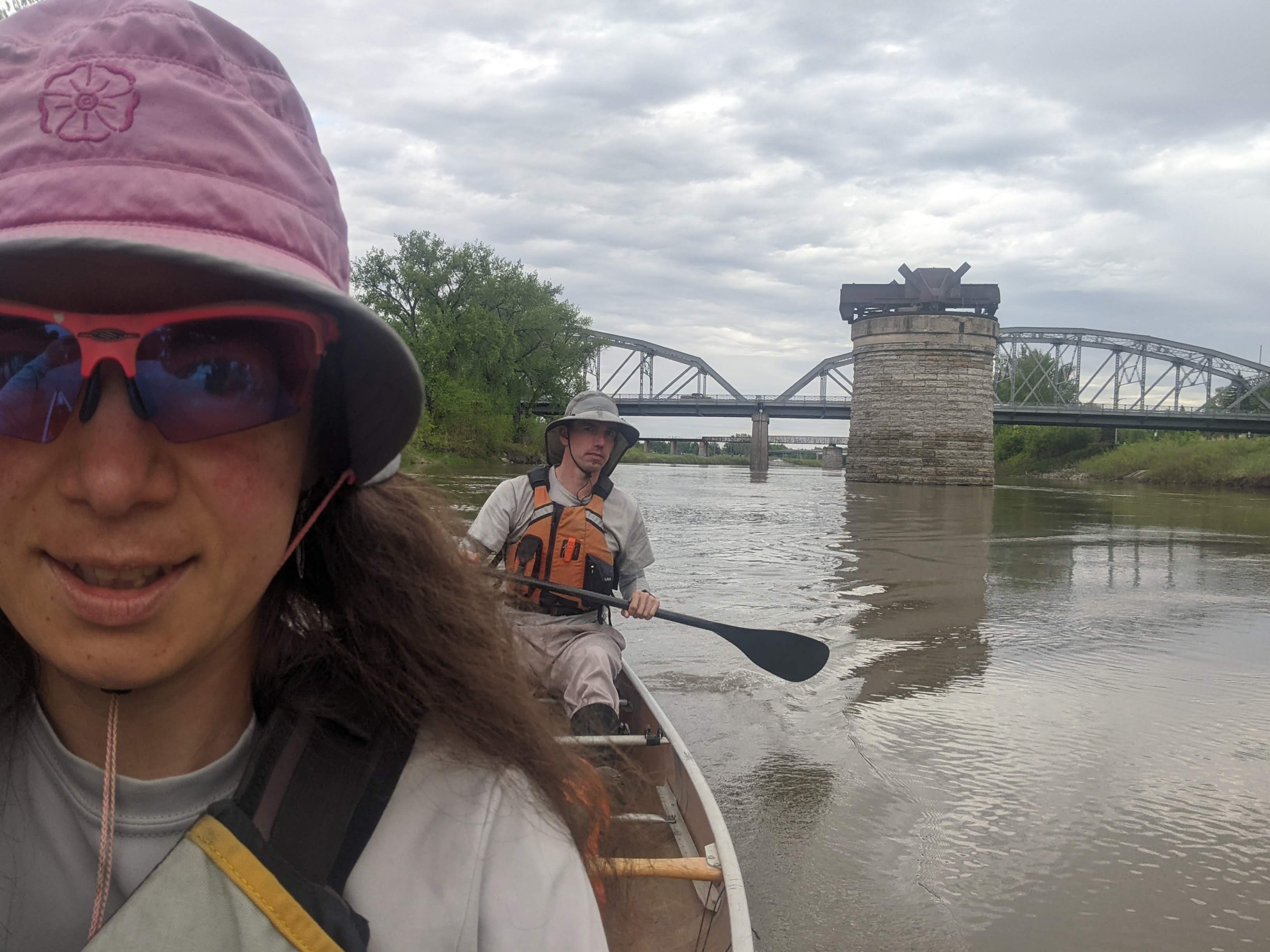
The sky was threatening but there wasn’t supposed to be any significant rain. It sprinkled on us from time to time. A couple miles in we came upon the Grand Forks Dam. Many of the dams on the Red have been reconstructed from low-head dams to rock dams, including the Grand Forks Dam. Per usual, Erik was hoping we might be able to shoot this dam but as we got close, that seemed unlikely. We landed just above the dam to scout and found a solid Class IV rapids that if we attempted it, I gave us a 100% chance of tipping and it didn’t look like a fun swim. So we portaged the dam, Erik hopeful we’d be able to run the one in Drayton.
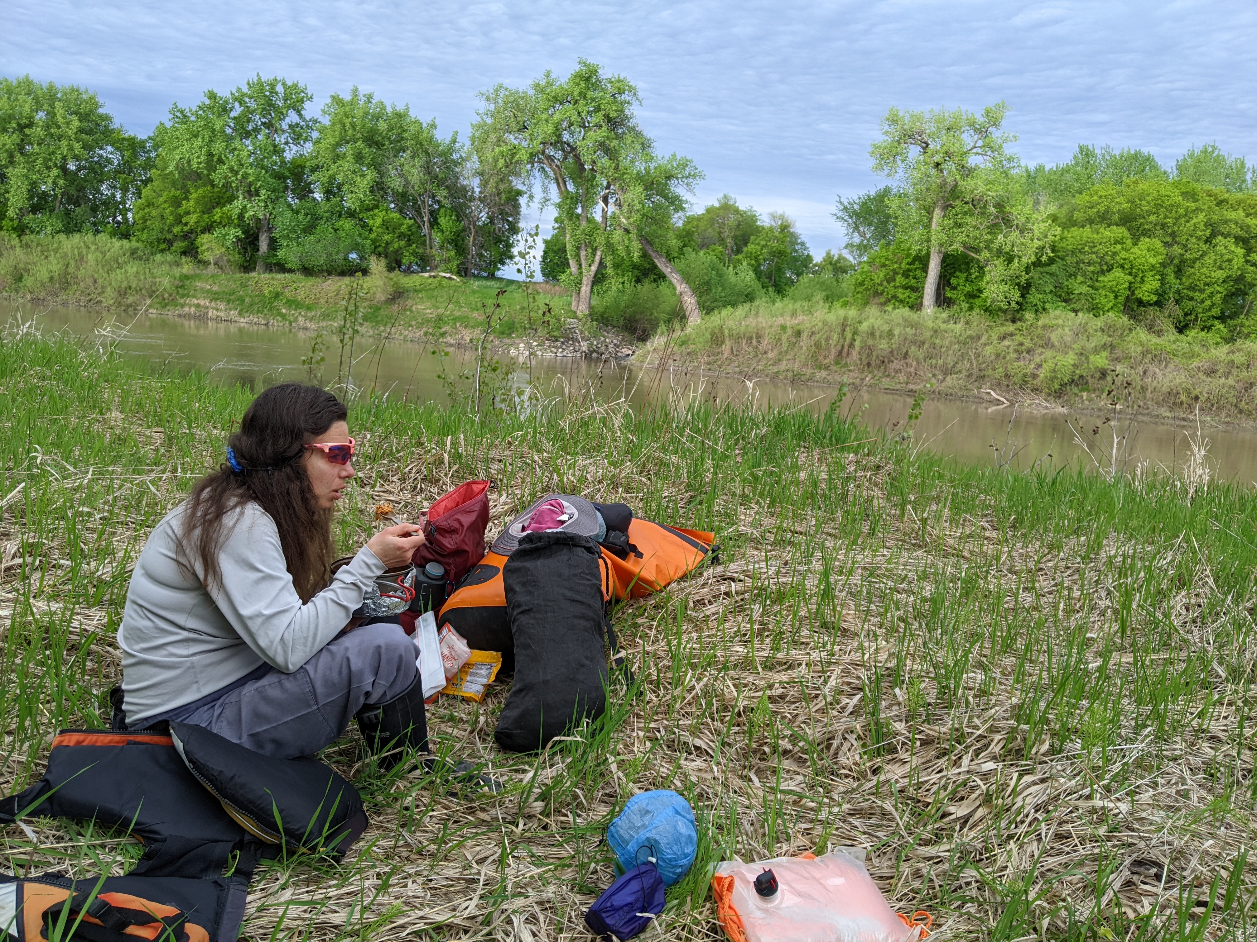
We got back to paddling after the dam. We’d been busy with some house projects and life this spring and hadn’t prioritized paddling very much. Hence, it didn’t take many miles before my wrists started getting sore. Sometime after 6 pm we began looking for a suitable place to stop and cook dinner. Eventually we found a wild-looking bank that appeared easy enough to step out on. We hiked up through some tall grass and found a place to cook and picked a couple woodticks off us during the cooking and eating time. Our dinner location was directly across from where the Grand Marais Creek cascaded into the Red over a small drop.

After dinner we got back in the boat and paddled more. We surprised quite a few beaver who quickly slid down the bank into the river with a big splash. There weren’t many beaver lodges but instead lots of tunnels dug into the mud just at water level. Around 9 pm, five miles shy of Oslo, Erik declared it was time to find a place to camp. We saw a “bench” half way between the river and the bank that looked reasonable to stay a few hours and so that’s where we set up camp, trying to get our tent under a tree to provide some protection from dew. That night a beaver slapped its tail and woke me up!
Day Two (5/20/24) 45.5 Miles from River Mile 280 to 234.5
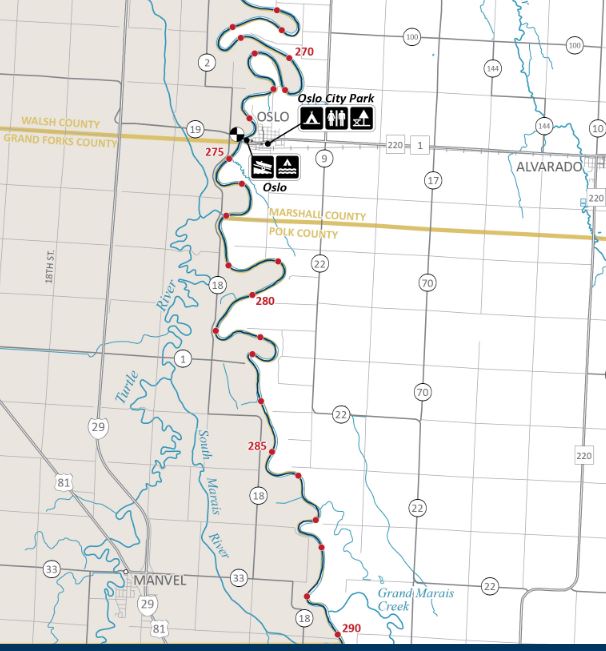
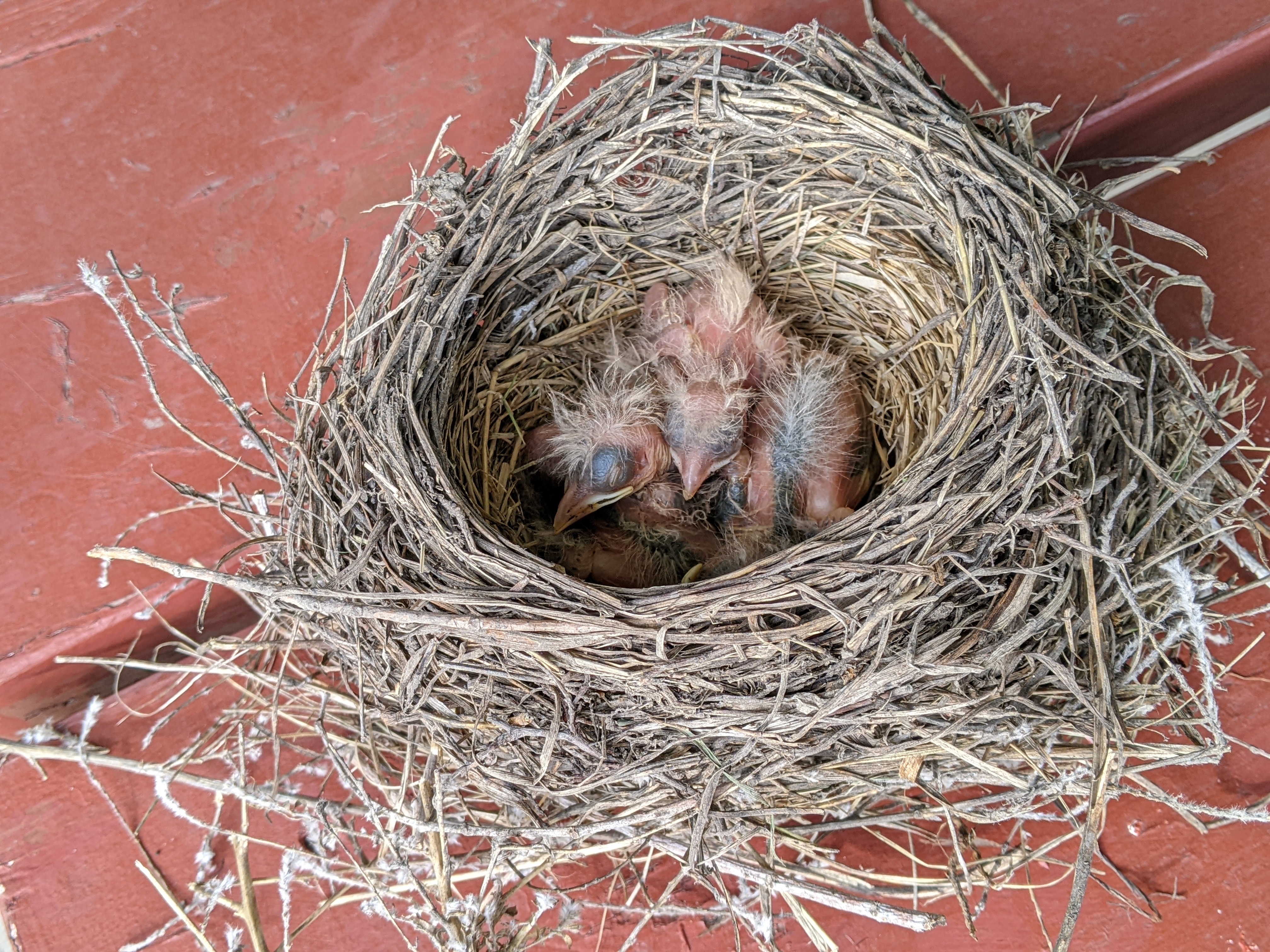
We woke early and after breakfast and breaking camp and packing the canoe (always takes about an hour) got on the water just after 7 am. The wind was predicted to slowly build over the next few days from the north, the direction we would be mostly heading, and so we wanted to make some easy miles before the wind picked up too much. After an hour we arrived in Oslo and walked around town. There wasn’t much to do but we found the park where a robins nest had presumably fallen and was now sitting on a picnic table.
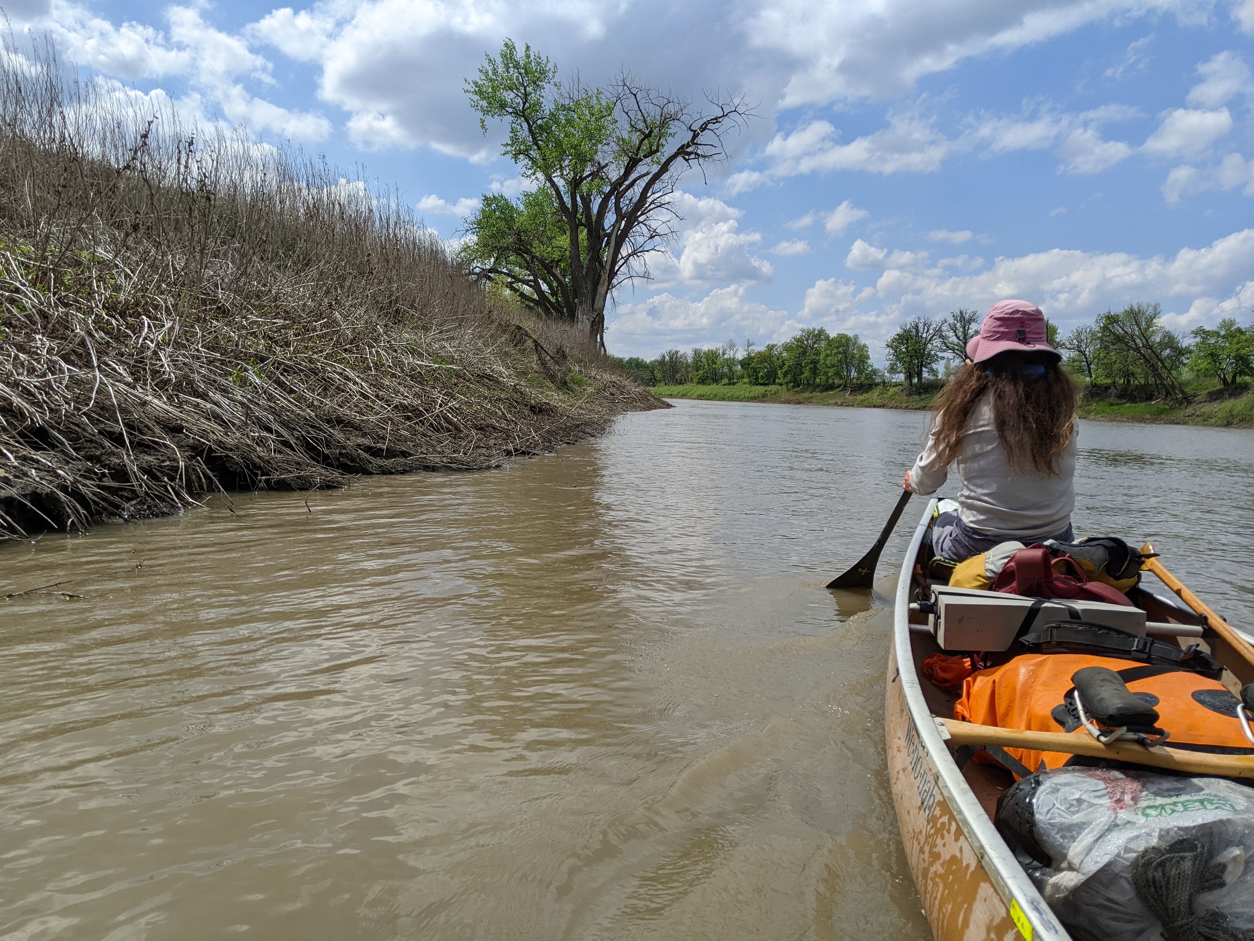
There wasn’t much going on in Oslo and so before long (and checking out their town dyke), we got back in the canoe and began a series of significant meanders that kept us within a couple miles of town for the next couple hours. The day kept on like this, meanders and meanders. Neither of us talked much. Fortunately the wind built slowly and it wasn’t until late in the day that it was noticeable. We stopped a couple times for lunch and once for snack. We found that because the spring had been so dry and then we’d had some recent rain the river was rising and as such the banks were reasonably dry and as long as we made good decisions about where to get out of the canoe (i.e. avoid the obviously low muddy patches), we really didn’t have to fight with the mud.


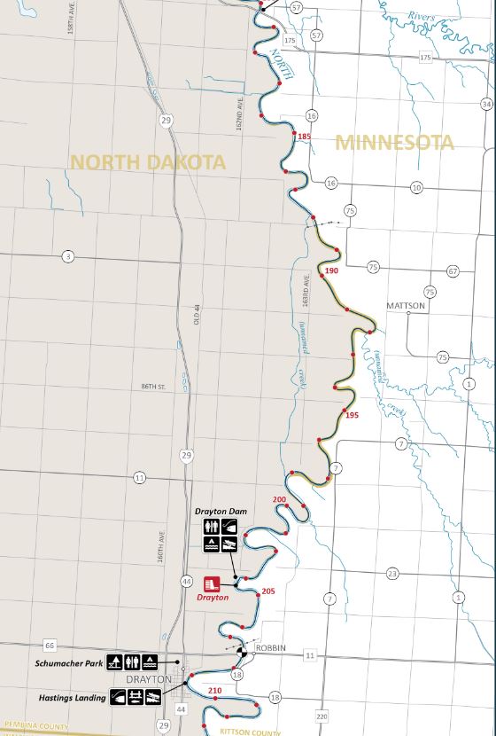
There aren’t many watercraft campsites along the Red. We weren’t quite ready to stop when we passed the Joliet Ferry campsite, which we didn’t see anyway, nor as we passed the Frank Rose Aquatic Management Area, but as we reached the small tip of the Red River of the North Wildlife Management Area, it was near 6 pm and we were ready to stop for the night.
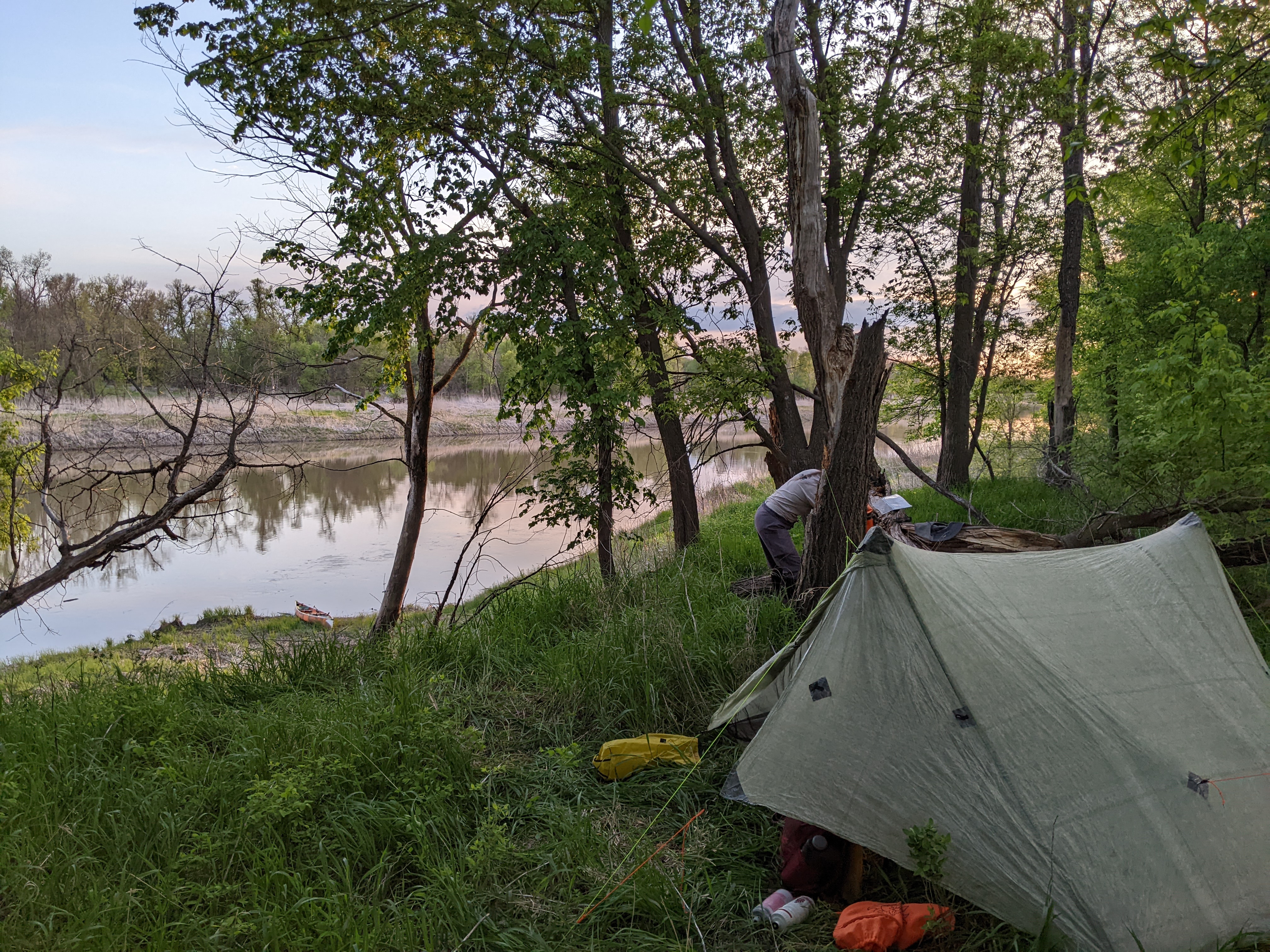
We hiked up high on the bank and established our camp near a deer stand which we used as our evening activity. Erik thought it was a good idea to cook dinner on a downed tree stump and started a small fire which he then had to pee on to extinguish. I was glad that other than a few woodticks, the bugs hadn’t come out yet for the season.
Day Three (5/21/24) 41 Miles from River Mile 235.5 to 194.5
Our big entertainment for the day would be spending some time in Drayton, North Dakota. We stopped once along the way for first lunch, paddling over 25 miles before noon. The meanders were getting noticeably larger. The wind picked up and we had to do battle in the sections heading north but most of the time we were heading east or west. Erik was more chatty, or perhaps I was more chatty, and we had all sorts of random discussions as we paddled along.
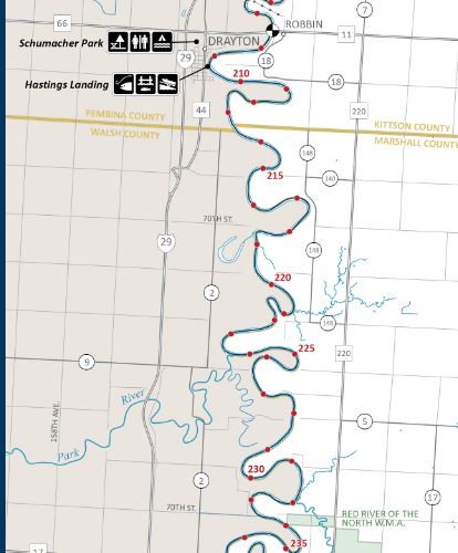
We left our canoe and most of our gear unattended at the boat launch in Drayton as we set off to explore town. We found a few closed bars but no restaurants. We walked to Schumacher Park where there were nice bathrooms and a small campground. The wind was howling and since it was just under 60 degrees and mostly cloudy, it felt cold and we had on our lifejackets for warmth. After Erik checked out all the playground equipment and we had second lunch, we ambled back down to the river and kept paddling.
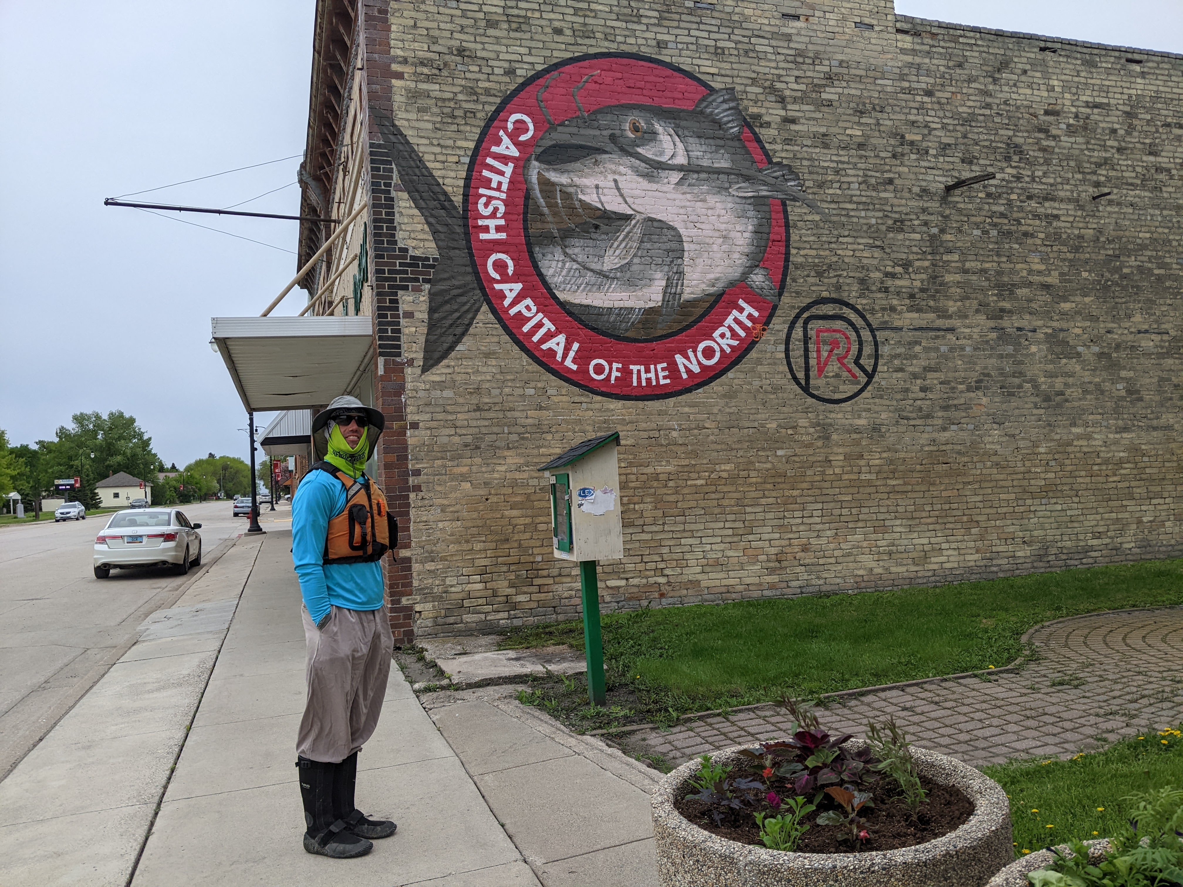

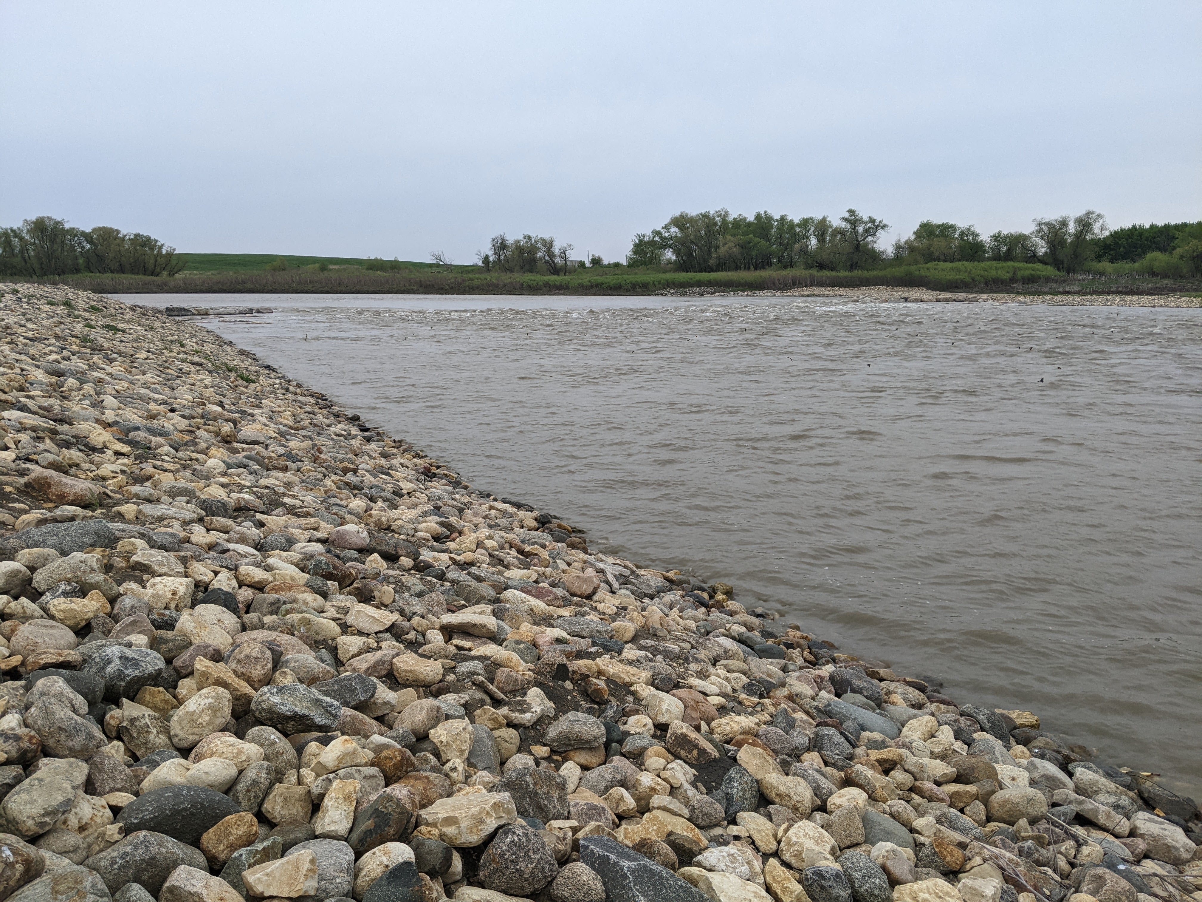
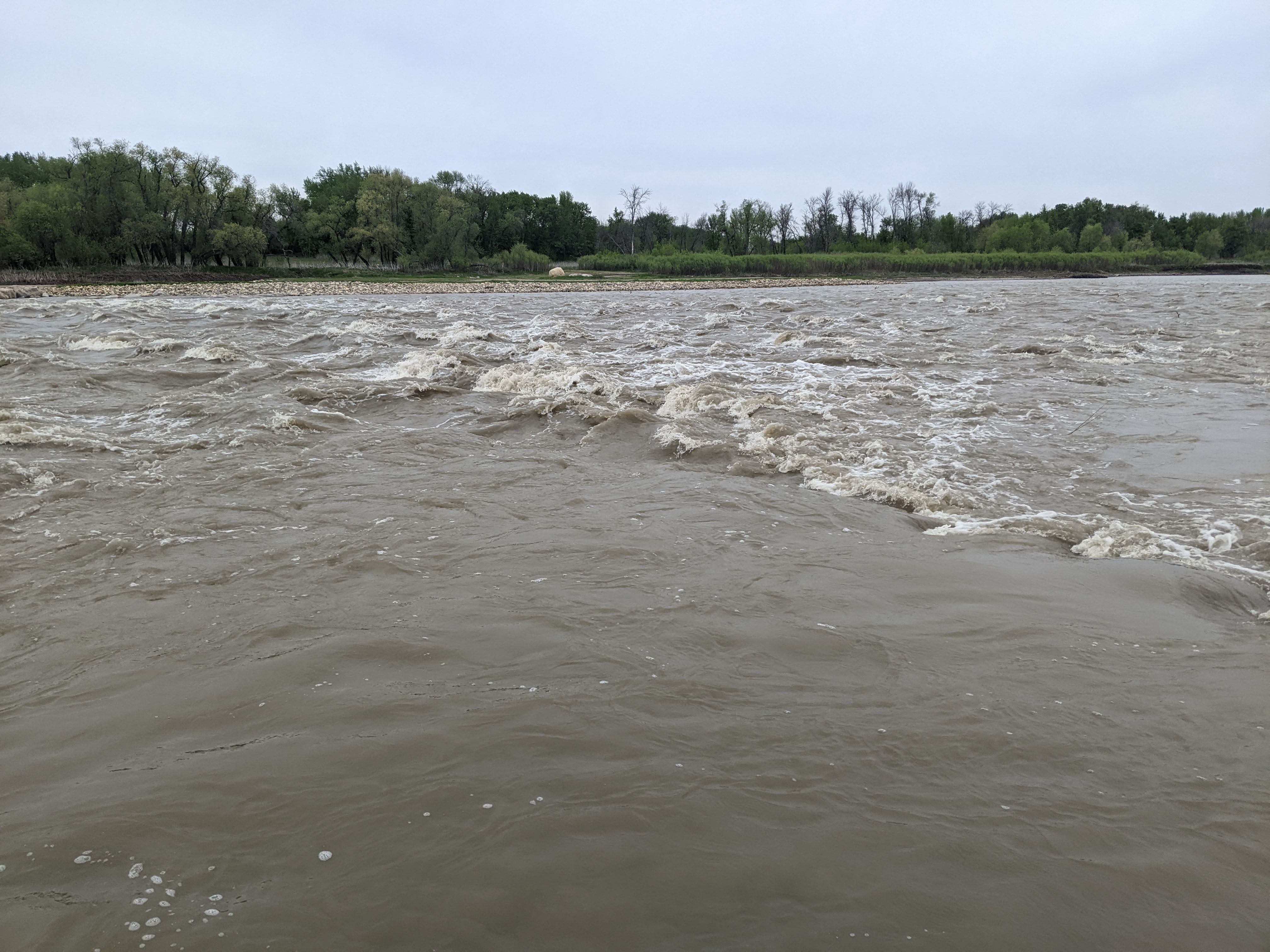
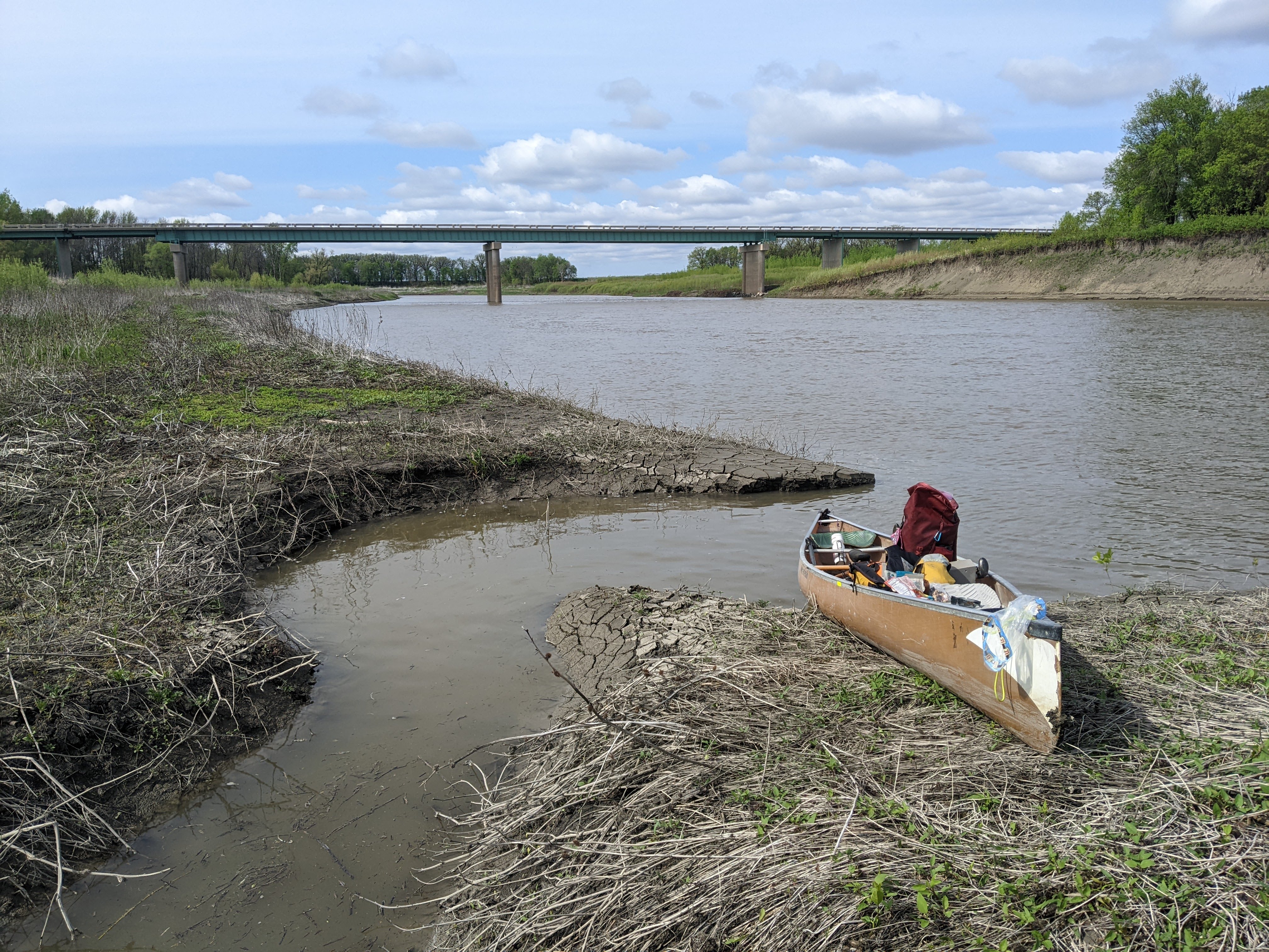
After a couple bends we came upon the Drayton Dam. When I first saw the whitewater I yelled “portage, portage!” We had been paddling on the right bank and the official portage, boat ramp, “facilities” (didn’t see any) were on the left shore. The current here was quite strong though so we ended up backtracking to the right shore. Our map said this dam was also a low-head one but Erik had done some research and learned they’d changed it to a rock dam last year. As we began unloading our gear, I was looking at the rapids, wavering between “this looks totally run-able” and “the portage is easy enough.” Erik went to scout and decided it would be fine to run but since we had almost all the gear unloaded, we decided to portage the gear. I continued to debate running it with Erik or having him go solo but then decided I shouldn’t be such a wimp and off we went.
Our canoe is not a whitewater one but it was a straightforward class II. I ended up kneeling in the front which gave us better stability and we managed to avoid all the big waves and ran it clean. It was a bit exhilarating and we had some trouble landing because the rocks kept going but eventually they ended and we landed and went back to retrieve our gear. Erik was happy he got to shoot the dam.

We kept paddling after the dam, trying to make a few more miles so we wouldn’t have as many to do the following day. The weather called for more wind and low 40s on Thursday morning so we wanted to get all our paddling done on Wednesday. Around 6 pm we found a good camping area protected from the wind on a short meander. It was about a 40 foot haul up from the river and we were shocked to find flood debris, likely from two years ago when we’d thought about paddling the Red (but ultimately decided on the Big Fork). It was another bugless superb weather evening to enjoy time outside. I watched a beaver chucking upstream against the current next to the bank who promptly crossed the river to switch to the inside of the next bend!


Day Four (5/22/24): 41.5 Miles from River Mile 194.5 to the Canadian Border and back to Pembina
We got another early start before 7 am to get in some miles before the wind picked up. I pushed us 14.5 miles to the first bridge at the Golden Grain boat launch, only to discover this launch has since been abandoned.
Erik was upset I made him paddle for so long (we were averaging 5 miles per hour paddling so this meant we’d been in the canoe for almost 3 full hours) before our first stop. While canoeing the next section, I caught a glimpse of something black and relatively low to the ground that scampered into the woods at the top of the bank. I think it was a black bear. Around the next meander a coyote watched us from the edge of the river. We saw a few otter as well, playful as usual.
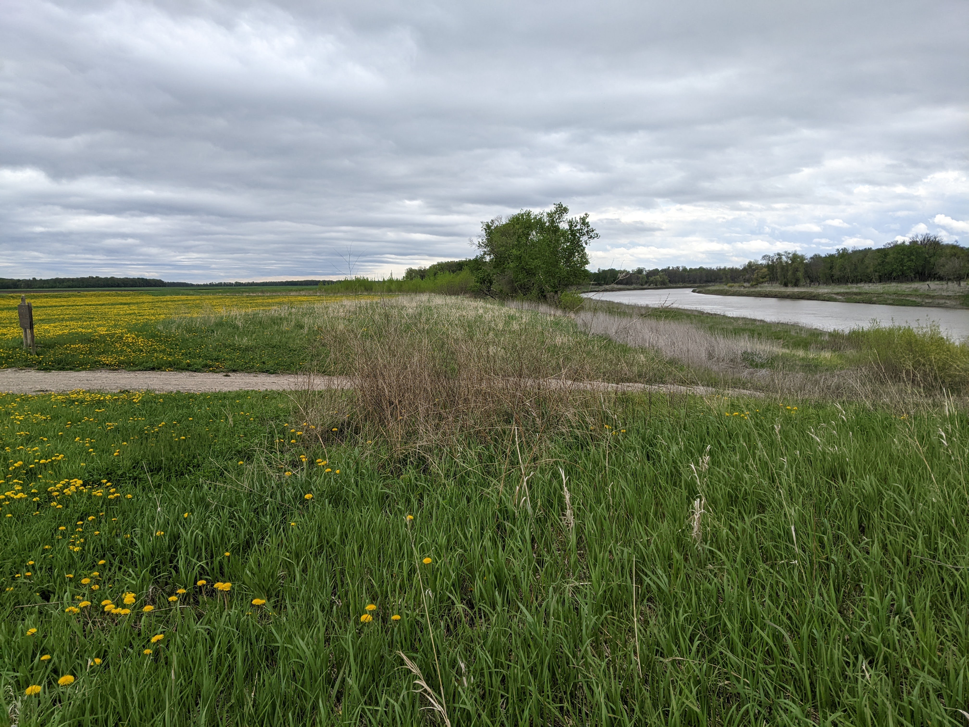
I’d been diligently following the map on every meander, perhaps why I didn’t get a good view of the suspected bear, which then got me to get my head up a bit more. Thus, I almost missed us coming upon the Hilltop boat launch. It had been less than nine miles since our last stop but Erik proposed we stop anyway and we were glad we did because it was a nice remote place that gave us good perspective on the flatness of the land.

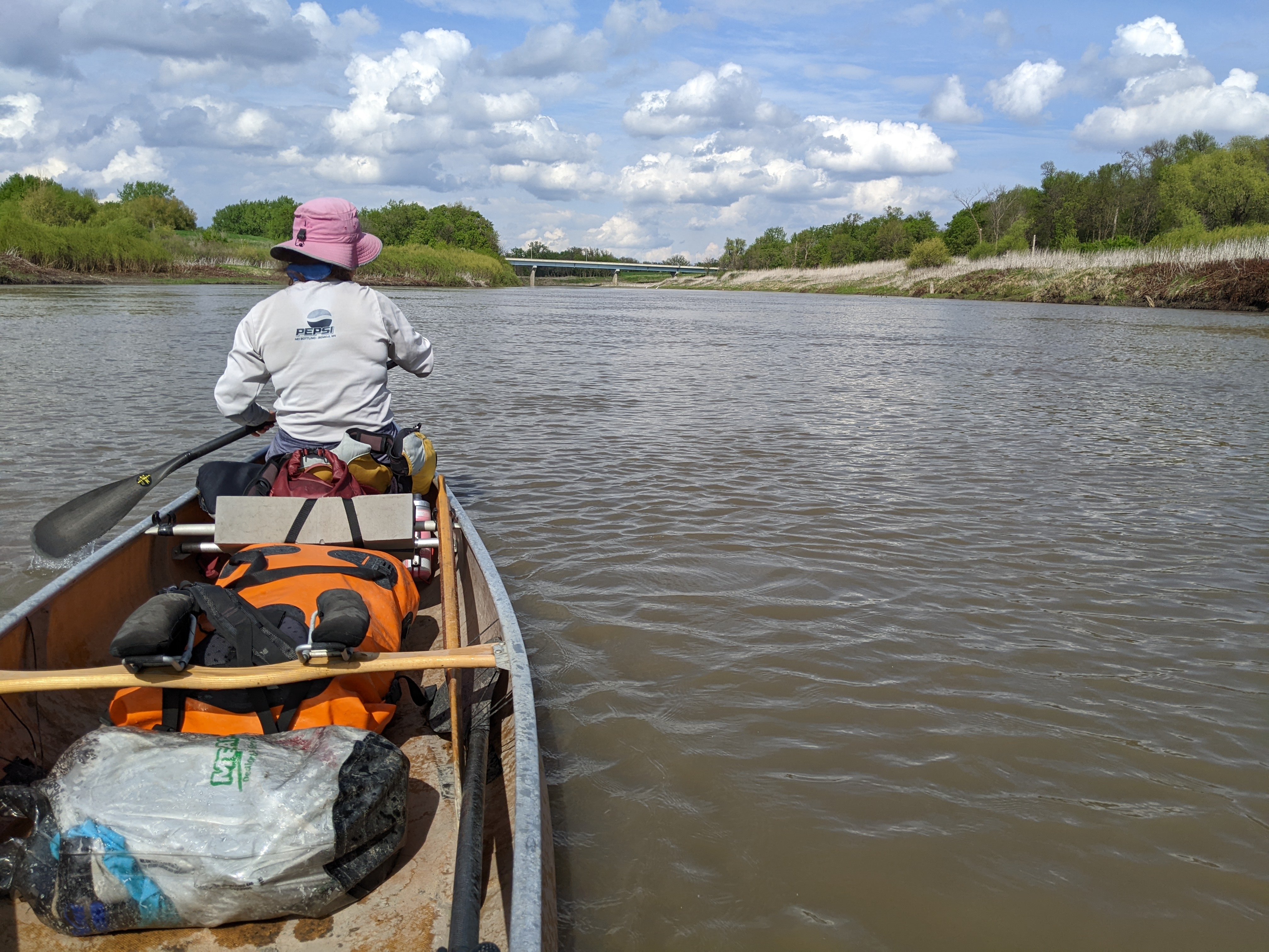
From here we only had 13 miles to the campground in Pembina. The wind wasn’t as strong as predicted but still made paddling more difficult as we tried to find the more protected shore. On the last bend before Pembina we saw the first boat we’d seen since Sunday, some guys fishing with a bunch of catfish on their stringer.
It was mid-afternoon when we pulled out at the Pembina boat launch at the Fort Daer Campground. We found some picnic tables, a row of sites for campers, and a nicely mowed area, presumably for tents. It was empty save for one small camper. Unfortunately the bathrooms were closed. At least there was water at the camper sites.
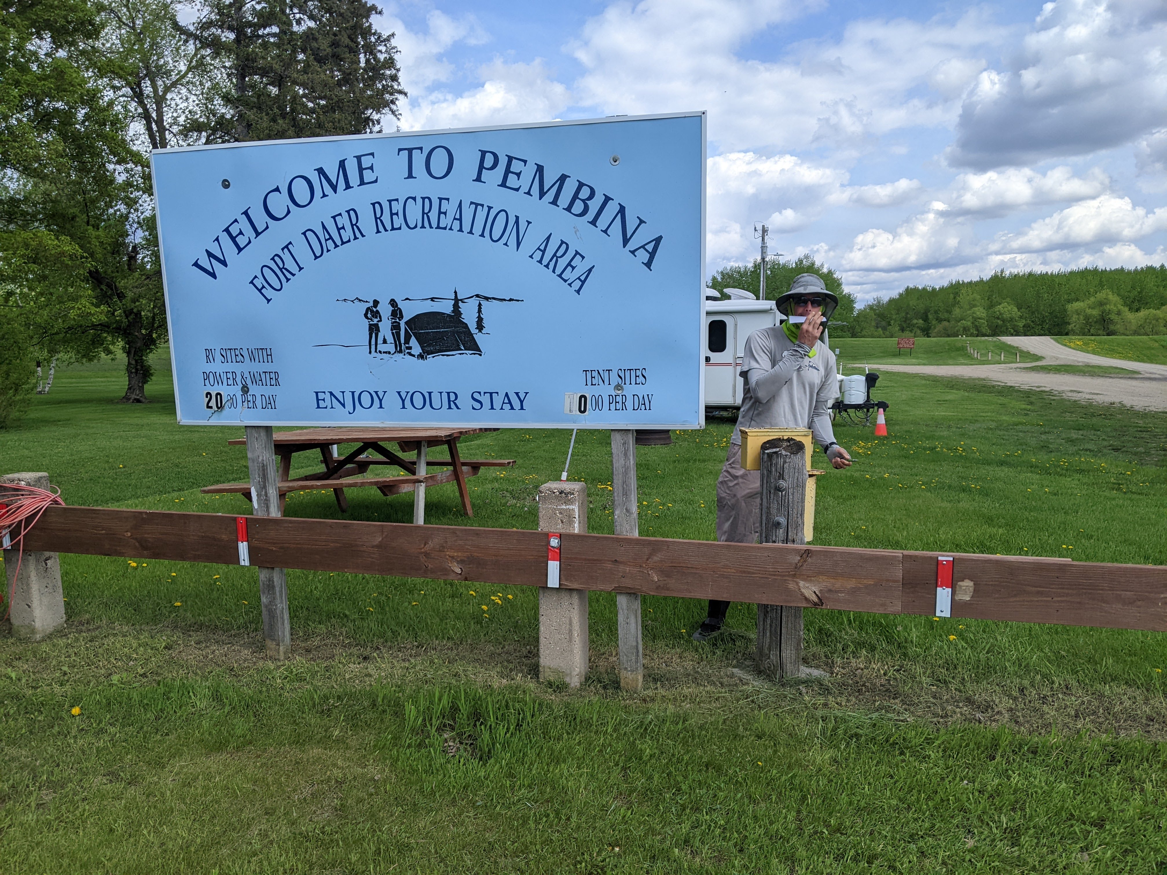
After checking out the area which included a rec center, a small playground, more closed bathrooms, and the dilapidated fort building with some nearby ball fields, all within a dyke, we ate a snack and then got back on the river headed north to Canada. We were both excited for this, although from our previous canoe trips along the Minnesota-Ontario border and the Quebec-Vermont border, we suspected it would be anticlimactic.
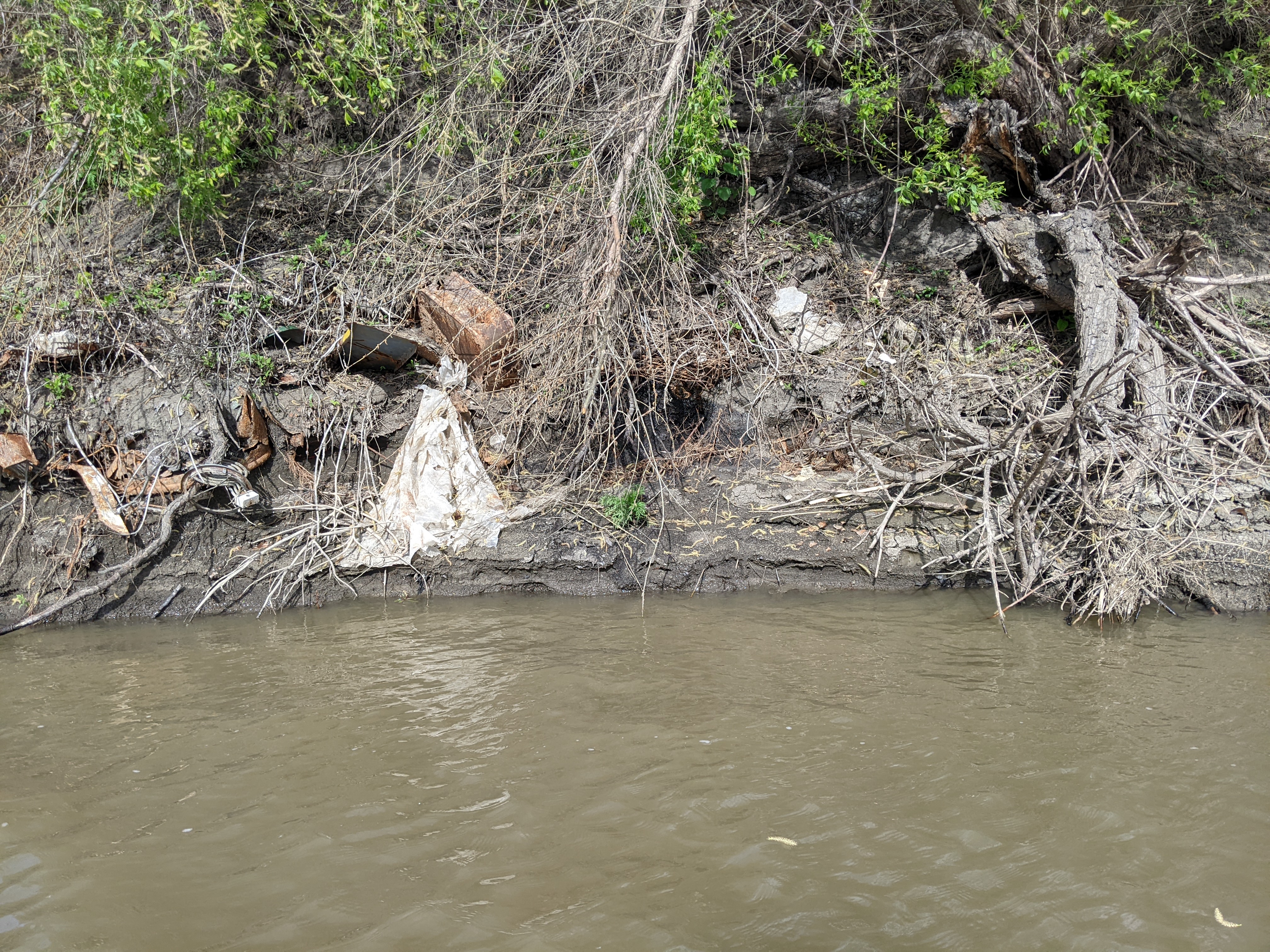
As we began paddling, Erik maneuvered us close to the right bank which he had read on the map was the farthest west point in Minnesota. Seeing as we’ve previously paddled past the farthest northwest and northeast points in Minnesota, Erik took particular interest in this bank which mostly just oozed trash from multiple past decades.
We paddled north into a headwind. On the left bank we could see very high industrial lights at the border station but otherwise the bank was as wild as any we’d seen, with large trees, completely uprooted, sometimes bark peeled off, lodged up high in the trees. As we made the final bend and could see down the river into Canada. We expected some kind of sign, or at the very least a buoy, or perhaps be able to see the cut in the trees, to notify us we’d made it to Canada. But there was nothing. Soon a bridge popped into view. That bridge wasn’t on our map so we knew it was in Canada. Erik got out his phone in airplane mode, looked at the GPS, and saw we were in Canada. We weren’t really expecting a bunch of helicopters to swarm down on us or border patrol boats to overtake us in the river and this didn’t happen. There was nothing remarkable to take a photo of other than a Canadian bridge that looked the same as the American bridge.
As we turned around in the middle of the river, the current pulled us downstream. We began paddling upstream but made little progress until we reached the inside shore and then we began steadily paddling back to the United States and then back up to the boat launch in Pembina. The paddling was slow going but we were aided by the tailwind. It’s amazing how our cadence jacked up and we made quick work of those 2.5 miles and got back to camp before 6 pm.
I found myself more hungry than usual on this trip and so once back in camp we cooked dinner, a meal compliments of our friend Eric Boxer who works for RightOnTrek. It was good!

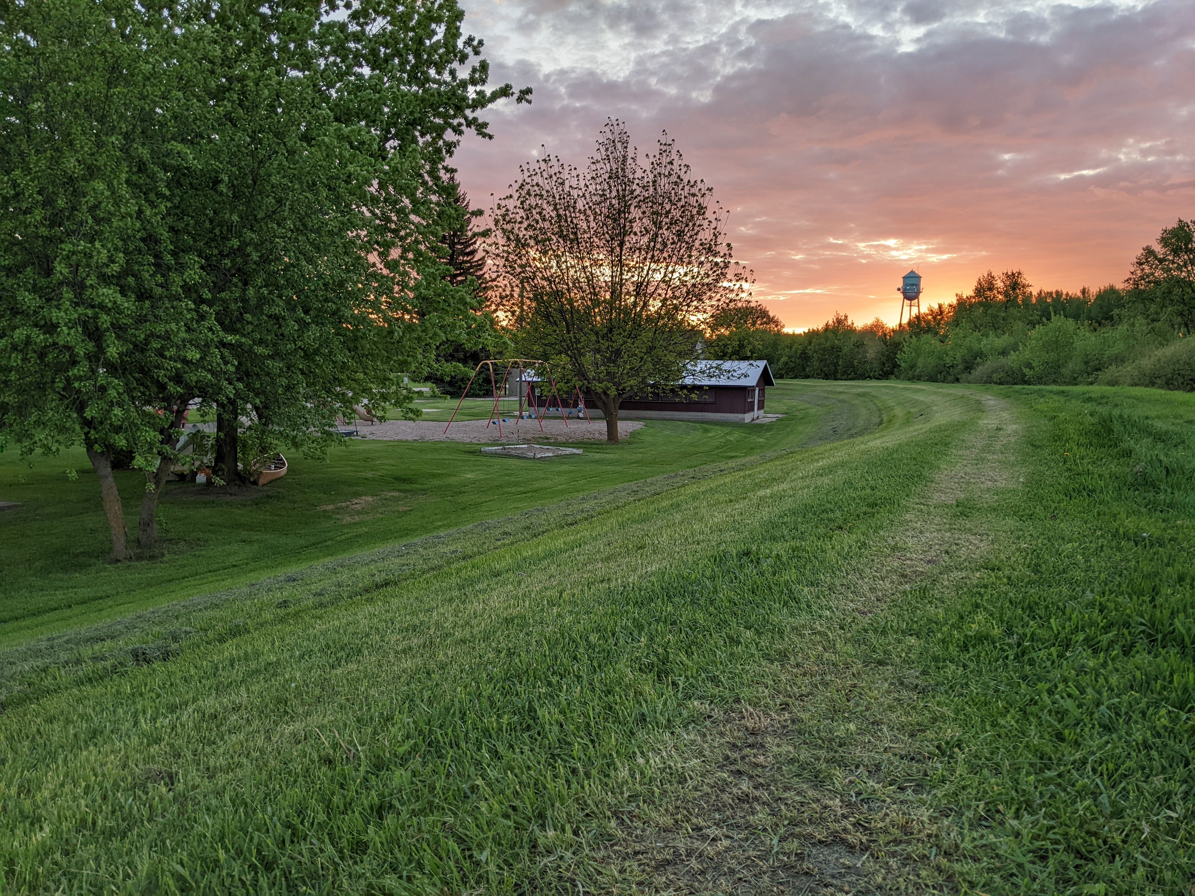
After dinner we picked our tent site and then wandered into town where we found a number of stores that hold items for Canadians that had been shipped to the United States. We also found the Pembina State Museum where we made plans to meet my mom the next morning.
A Funeral
We got up early and did a run into Minnesota around the tiny town of St. Vincent and then down to the second oldest Icelandic church in the United States, just south of our campground. I knew I’d get cold after the run seeing as temps were in the 40s and I would be all sweaty but we did it anyway and sure enough I got cold. We had intentions to get warm and clean up at the truck stop but by the time we took down camp and portaged into town, it was near time to meet my mom so we did our business at the Pembina State Museum which opened at 9 am. My mom arrived shortly thereafter. We spent $2 per person to go up in the observation tower which wasn’t quite high enough to appreciate the lay of the land but we did see the the windmills in Manitoba.
After some finagling, we got our canoe loaded on my mom’s car and we were headed off to Hallock. Erik was surprised to see a garbage truck in action, thinking that the whole town would’ve shut down for the matriarch.

This is afterall an adventure blog so I won’t comment much on the day other than that the family was delighted to know we’d canoed part way and I heard many stories of canoeing adventures with my dad. I learned things about the family, like that my grandma’s first language was likely Swedish, her parents having recently emigrated. I read my great aunt and uncle’s courting story. I saw literally long lost relatives and some we’ve stayed in closer touch with, too.

In the evening we drove back to Bemidji by way of East Grand Forks to pick up our car which was thankfully still there intact.
The Pine River
Pine River Dam to Upper Whitefish Lake, 9 miles (5/24/24); 550 cfs at Jenkins
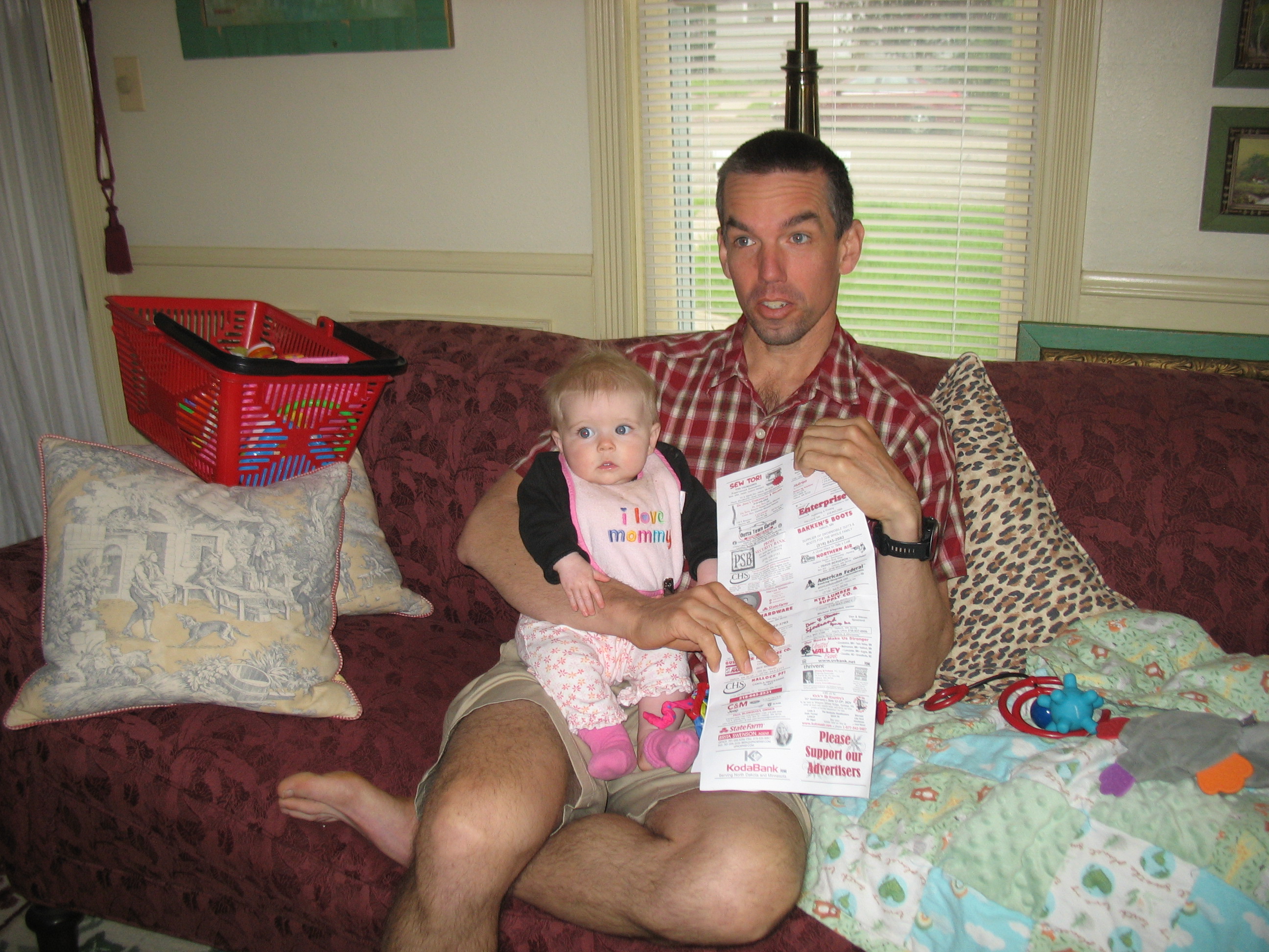
We woke to a rainy morning in Bemidji. The weather forecast called for rain until mid-afternoon so we spent the morning in Bemidji with my mom who cares for our 7 month old niece. Erik thought it would entertain her to read the Kittson County snowmobile map we’d picked up at the truck stop in Pembina, much to her bewilderment!
After lunch, we headed south towards Nisswa for Erik’s cousin’s wedding but I was determined to paddle some of the Pine River. We had a pre-wedding party at 6 pm and so all we had time for was this nine mile stretch that per the map had lots of class I rapids. Water levels were high and so we decided to go for it.
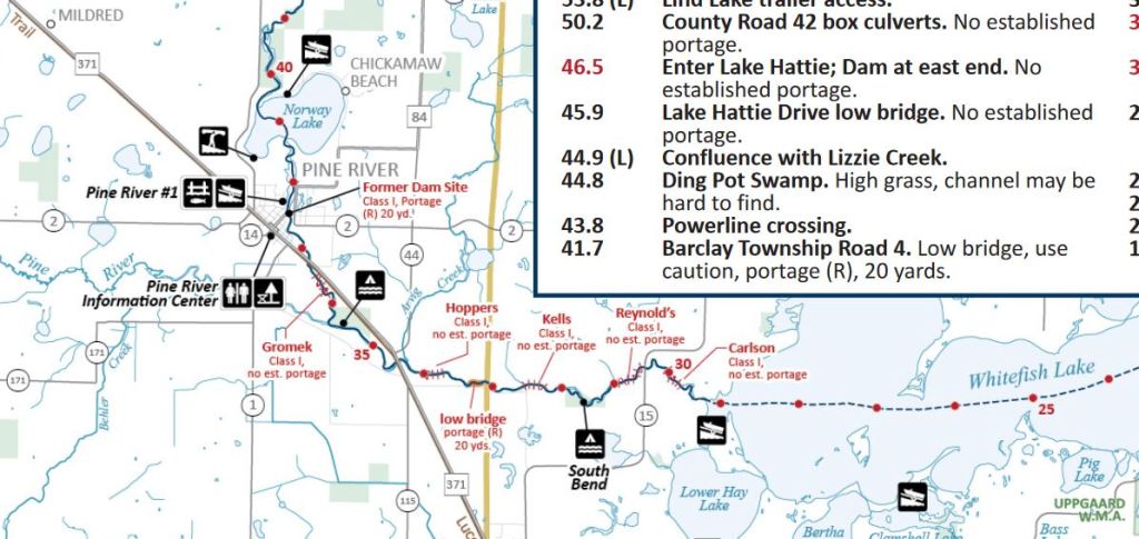
Per usual, Erik was hoping to run the rock dam at Pine River. This may have been possible in the middle but likely would’ve been a bumpy ride so we put in just below the dam. From here we were treated to a narrow and clear river with a sandy bottom that was quite the juxtaposition from the Red. Initially there were some houses and cabins as we meandered through town, but soon we were paddling through a mix of forested banks where there were some small rapids and flatwater marshes.


The South Branch of the Pine joined up with us in one of the swampy sections. Once we headed back under the 371 bridge though, the pace quickened and we had near continuous riffles as we paddled along. There was a mandatory portage sign for a low bridge but even though the water levels were high, we had no trouble paddling under the bridge.
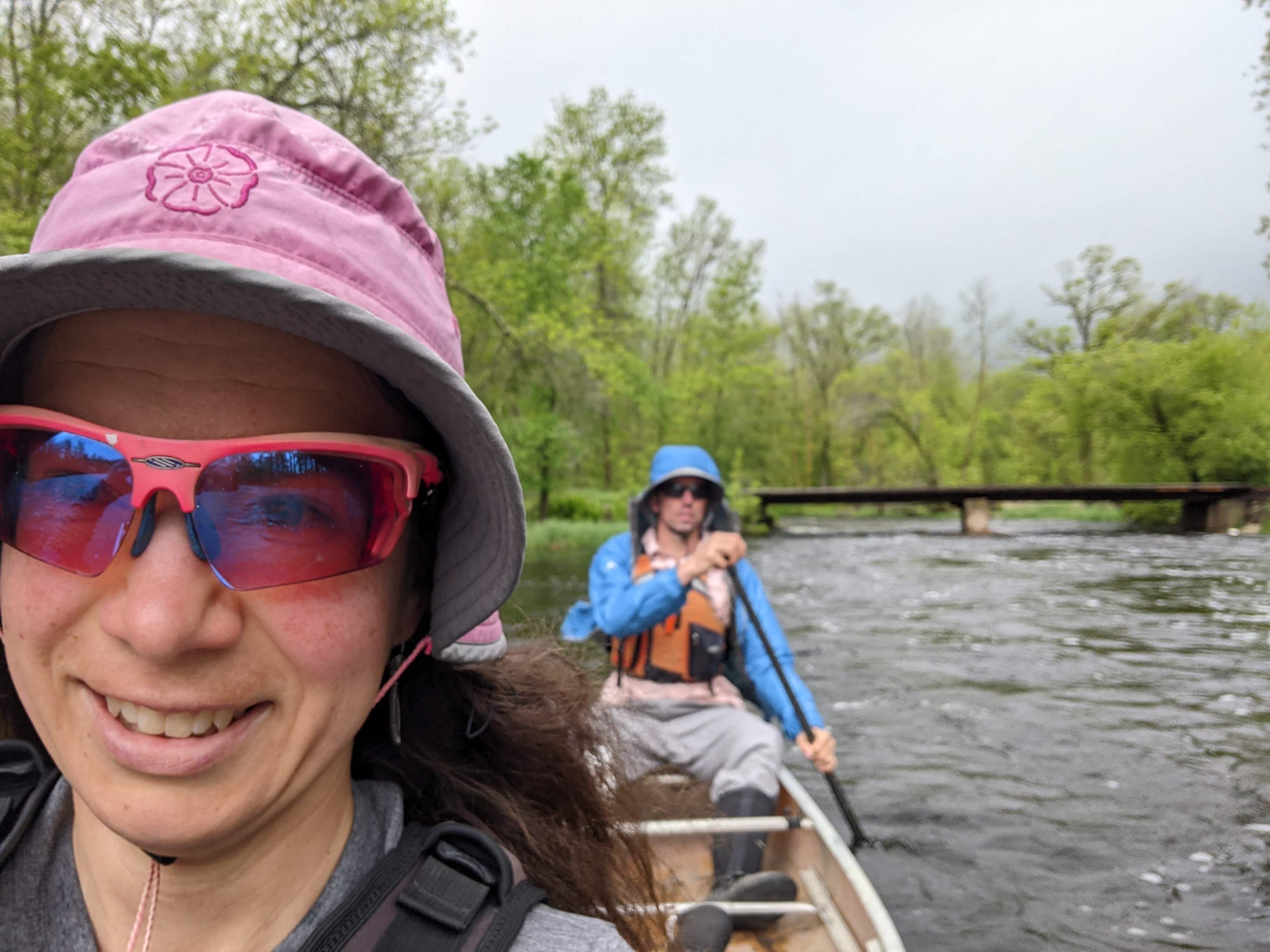
The miles cruised by with this fast current. We had to pay attention to look out for some rocks but there were no significant waves, pillow rocks, or down trees and river levels were perfect. Erik was completely enamored with this stretch and said he preferred it to the lower Pine. The day certainly rivaled our cruise on the lowest part of the Snake River and also last year’s trip down the North Fork of the Zumbro, likely because this section of the Pine River has a gradient of seven feet per mile!
We took out at the Upper Whitefish Lake Public Boat Access where Erik’s parents (who were nearby for the wedding) provided us a car shuttle.
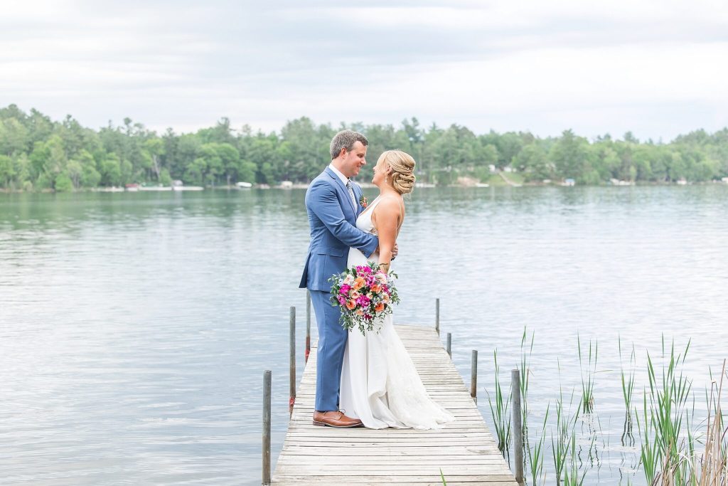
A Wedding
Erik’s cousin got married at Nature Link Resort, a wedding venue outside Nisswa on Clark Lake. We stayed onsite as there are some cabins and a small lodge. The morning of the wedding, Erik and I did an eight mile run along the Paul Bunyan Trail. Prior to the late afternoon wedding, we also canoed some on the lake, thoroughly checking out that the channel to Nisswa Lake was truly impassable. The venue marketed a “private island with nature trail.” We mostly just found poison ivy.
The wedding was outdoors and beautiful and very fun per usual.
The Mississippi River
I had yet to paddle the Mississippi from Brainerd to the Sartell Dam and since this was on our way home and Erik’s parents were again gracious enough to shuttle our car, off we went. After dry winter and spring conditions, the recent rain contributed to some high water levels.
Link to Mississippi River maps here.
Day One (5/26/24): Cemetery Hill Boat Launch to just below Blanchard Dam, 50 miles
As we unloaded our canoe and gear at the Cemetery Hill Boat Launch (also called Evergreen on our map), we learned the mosquitoes had come out in force. I technically hadn’t paddled the section upstream to the Brainerd dam, so we began paddling against the current on the narrow side of some islands. We only had a half mile to go to the dam before we could start cruising downstream. We didn’t exactly cruise, but it’s easier paddling downstream and the mild wind was favorable.
There wasn’t much of note in this section other than passing under a few bridges and save for a couple parks on the east bank, the part through town is largely wooded and undeveloped. The banks were remarkably high and therefore the bridges as well. We passed under the 371 bridge and from here there wasn’t another bridge for 23 miles. Shortly after the 371 bridge there was Overlook Park on our right that offered a watercraft campsite. Soon Crow Wing State Park was on our left which offered a few places to get out (canoe launches and boat launches). We stopped at the former for our “first lunch” but had to keep walking around to avoid the bugs. There was also some poison ivy that digs pine areas in central Minnesota.
Once back on the water we noted some areas of riffles that may have been small rapids in shallower conditions. Camp Ripley was on our right for the next couple hours. Occasionally we passed by some islands. We were nearing half way from first lunch site to Little Falls, where we planned to make dinner, when we came upon this island that looked too good to not stop, especially seeing as there was no stopping on the Camp Ripley side of the bank and previous options were limited with the higher water.
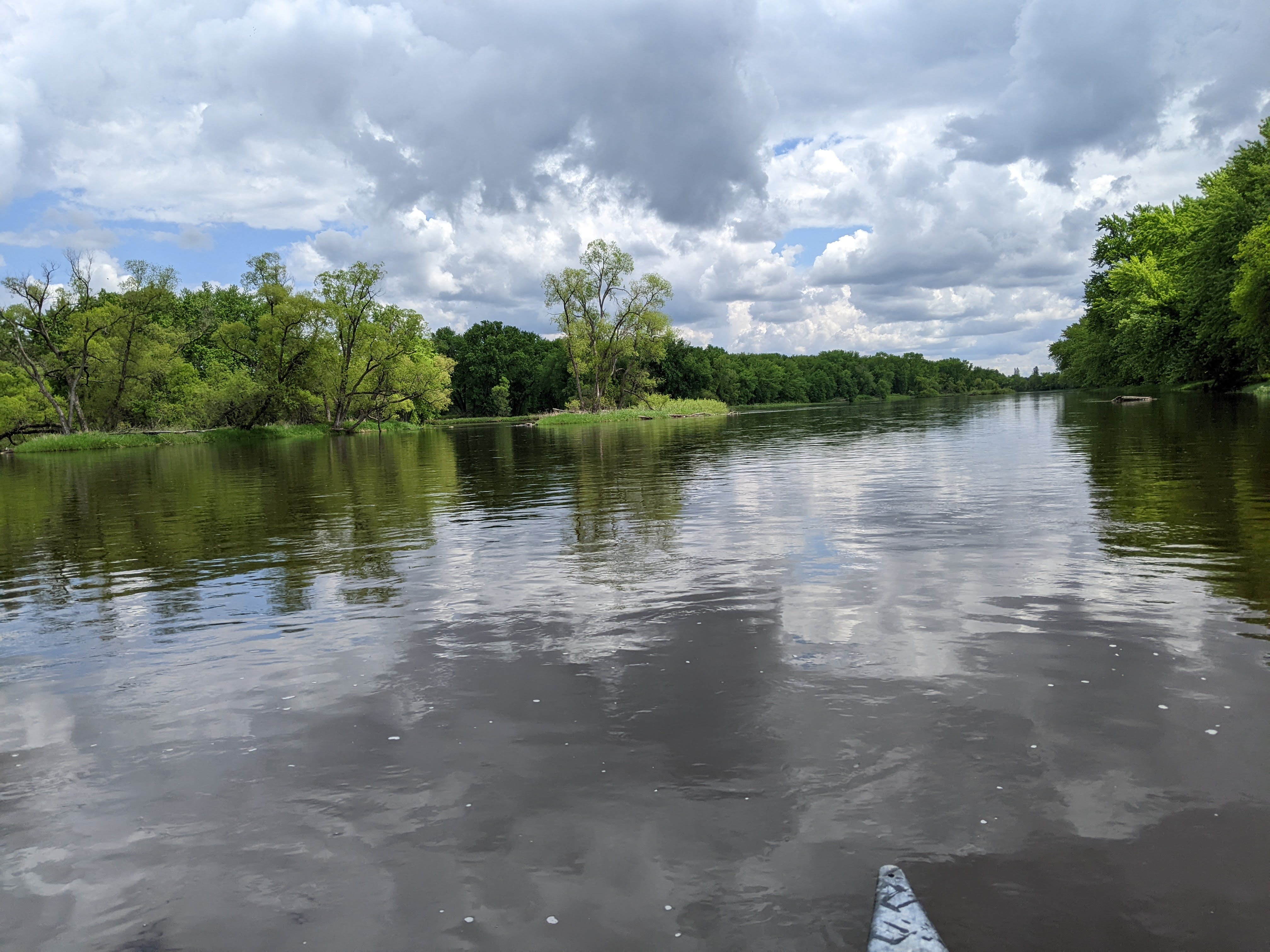

Then we kept paddling and were somewhat excited for the County Road 115 bridge that appears to be an old train bridge turned into a road. From here the current slowed from the backup behind the dam in Little Falls. Gradually there got to be more and more houses and cabins along the shore. Finally we closed in on the Highway 10 bridge, a bridge I must’ve driven over at least a hundred times. Erik took us down the smaller channel on the left which was likely a bit farther than had we stayed to the right.
There was more infrastructure and an old train bridge as we neared the main part of Little Falls. There were buoys up across all but the farthest left arch of the main Little Falls bridge marking danger for the dam but the portage was just beyond the bridge and marked. We took out and found a place to make dinner in the park.
After a lengthy stop, we got back to paddling. I was hoping for some swift current as the water was really boiling below the dam, but this didn’t last long and soon we were in the backwater behind the Blanchard Dam. This area was also lined with houses/cabins and was a mecca for the motorboats, wakeboarders, jet skiers, etc. So much for a nice evening paddle.
There was a big sign on the left side of the Blanchard Dam that was hard to miss marking the portage.
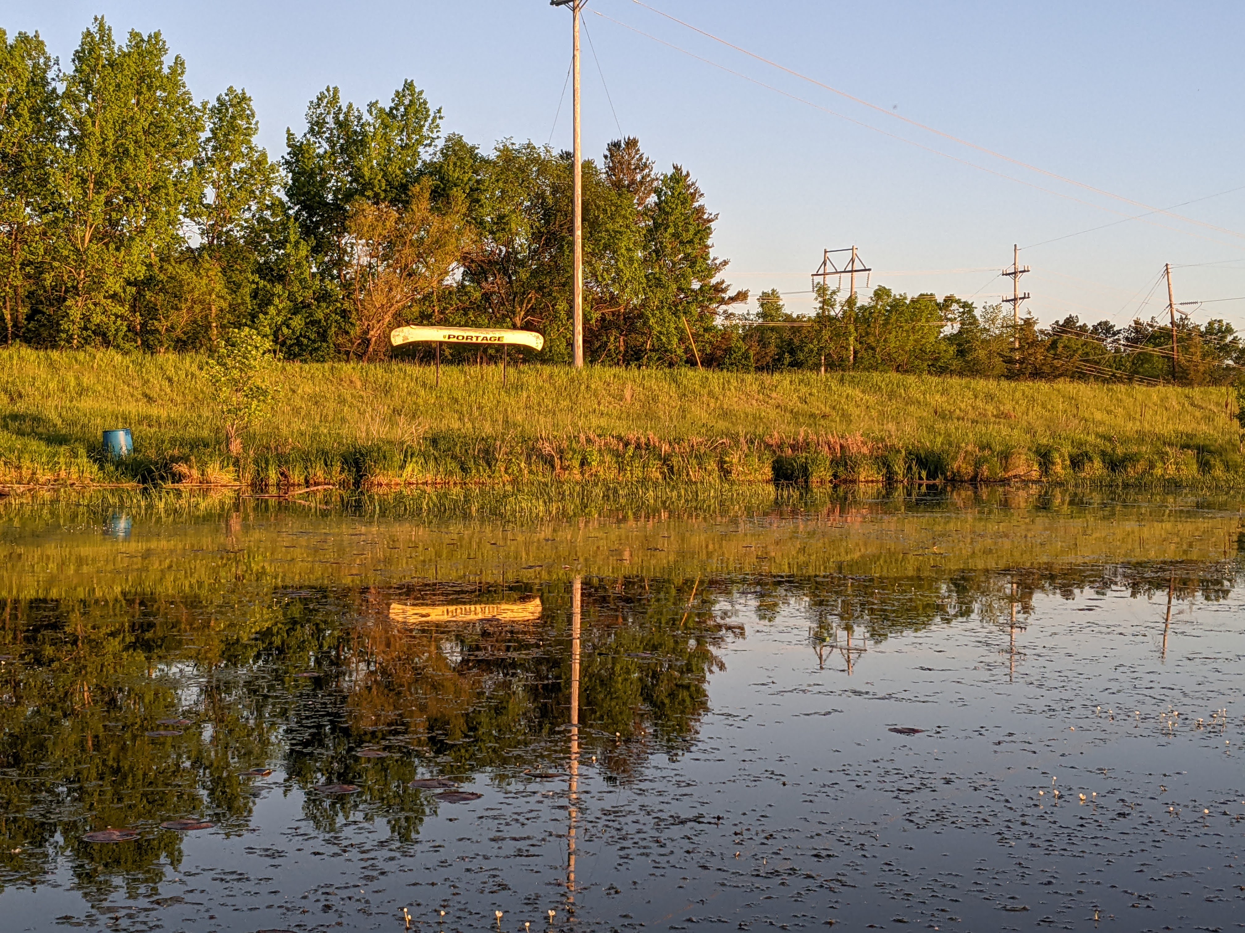
The portage itself was well marked but somewhat long, mostly on single track trails. There was one super steep section after the first uphill that I slid out on, although I managed to remain upright, and Erik took an angle through the tall grass. We had to stop twice during the portage to take detours so Erik could admire the dam, the second one being on the Soo Line Rail Trail.

The river was still really rocking with waves crashing ashore where the official portage ended so we kept walking downstream until we found a reasonable cove to get in. By now it was after 9 pm and getting dark. The current was strong and carried us quickly by many slightly flooded islands. Erik noted a farm field on our right and was eyeing a bush camp up there, a few feet above the river. We found a clearing and headed up, camping on a small flat patch that almost seemed to be a dyke.
I’m always leery of tall grass due to both ticks but moreso, poison ivy. Growing in the tall grass were some woodbine and grape vine. Even though I’ve learned to identify both of these as they grow prolifically on my city lot, I still never trust that there isn’t some poison ivy I’m missing. Hence I wasn’t too excited to help Erik set up the tent and as soon as he had done so decently, I got inside and started blowing up the sleeping pad. I hadn’t slept well the night before and crashed hard this night for which I was thankful given our more precarious camping situation.
Day Two (5/27/24): Below Blanchard Dam to Sartell Dam. 24 Miles
The forecast called for rain but favorable winds. Technically the rain wasn’t supposed to start until 10 am. Hence, I was hoping to get out of camp dry but when I woke around 6:30 am, it was lightly raining. Erik checked the radar on his phone and thought it would pass in 45 minutes so I rolled over and went back to sleep. By the time I woke up again the rain was indeed fizzling out but we discovered we’d set the tent up poorly and there were a few puddles inside. I was a tad bit miserable but quite glad we only had a few hours of paddling and it was reasonably warm and then I could go home to a shower.
It had completely stopped raining by the time we got on the river. The current remained strong for a couple miles and then died down. The weather looked more promising and we took off our rain gear. The river kept up with some islands and not many houses until after Bend in the River County Park where we stopped to stretch our legs. After that the bank was completely lined with houses and there were no more islands.

There was a big bend in the river where the Little Rock River came in and shortly after that some rocky outcroppings including a high cliff, at least on the left bank. The river was wide enough here that we couldn’t see well to the right bank. We can only surmise that prior to the Sartell Dam this section of river would’ve been a bit more wild.
Erik’s parents had left our car at the Sartell Boat Ramp. Erik proposed we stop there to drop off some gear and take a lunch break before we paddled down and back to the Sartell Dam so that I could canoe every inch of canoeable river for it to count. So we did all that and made it the 1.5 miles downstream and back upstream from the boat ramp to the dam. Then we loaded up our car and drove home.
It downpoured a couple times on us on the drive home. I guess if we got unlucky with weather on our Wind River Range trip last summer, this adventure we skirted almost all the precipitation during an unusually rainy week in Minnesota.
If I had to do this trip again: We got insanely lucky on the water levels and weather on the Red, Pine, and the Mississippi. Hence, I would try my best to pick these exact same weather conditions, but that’s just about impossible.
Best Decisions: Well, the Red River trip really came about because my great aunt died. I guess the moral here is to be flexible. For the Pine it was about seizing the day when I saw those high water levels and that part of the Mississippi was all about convenience.
Next Time: I don’t think there will be a next time for any of these rivers, although possibly this section of the Pine which the Paddling Minnesota book stated to be “unheralded.” We couldn’t agree more.
