First a disclaimer. I started this website and blog in the early months of the COVID pandemic in 2020. I’d been planning it for years but was busy finishing my book. I wanted to write about all my trips, to provide the know-how and inspiration for others. That means that most of my blog reports have been back-dated. It also means that sometimes my memory fails me and I struggle to find my voice. This post is also difficult because there’s significant overlap with Chapter 11 of my book. So even though it will look like this was published in 2020, I’m actually writing it in early 2024, a solid 11 years after the fact. By writing this disclaimer though, I can better set the tone and get into my writing.
The South Dakota High Point: 7/20/13 – 7/21/13
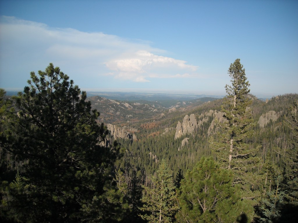
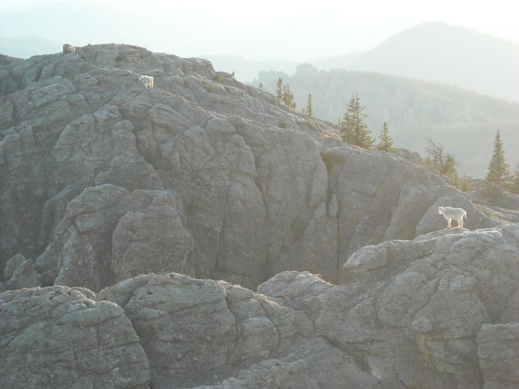
Please note that the first time I attempted this mountain it was called Harney Peak. It got renamed to Black Elk Peak in 2016.
The back story for this mountain is heavily detailed in my book so I won’t recall it here. Not everything in life is free so I’ll encourage you to buy it, or you can find me and I’ll give you a copy. Instead I’ll log more of the logistics in this post. Our friend from cross-country skiing, Craig, tagged along with us for this hike.
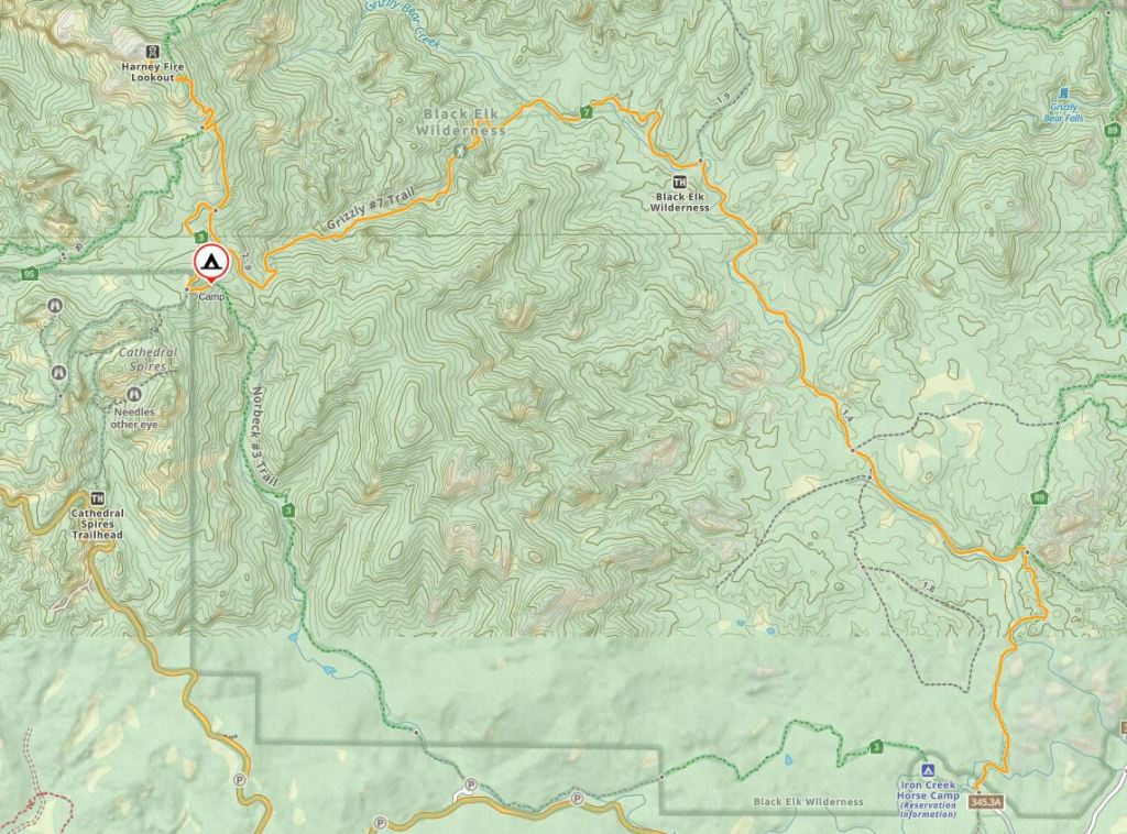
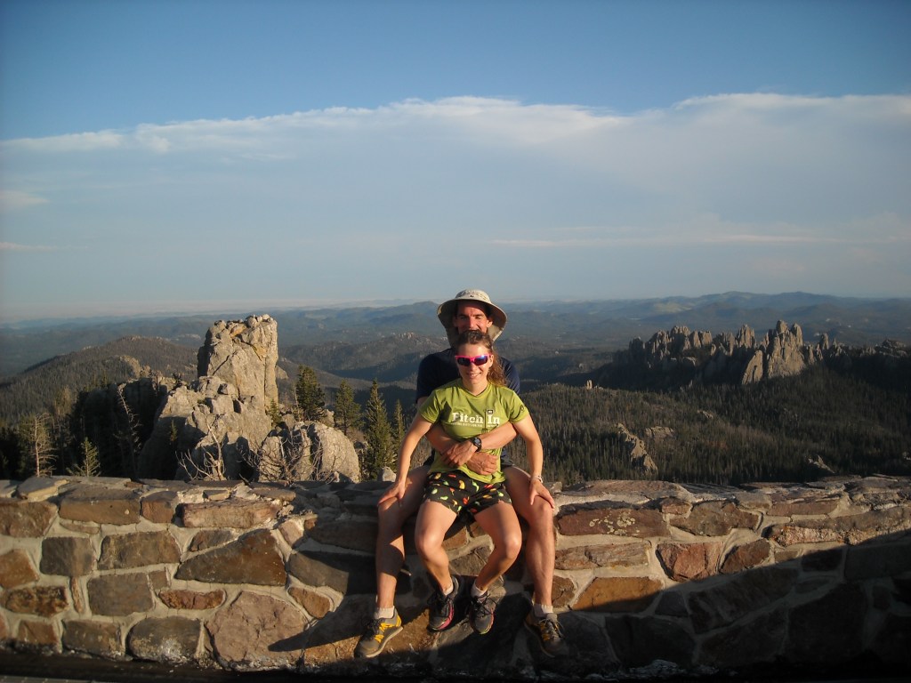
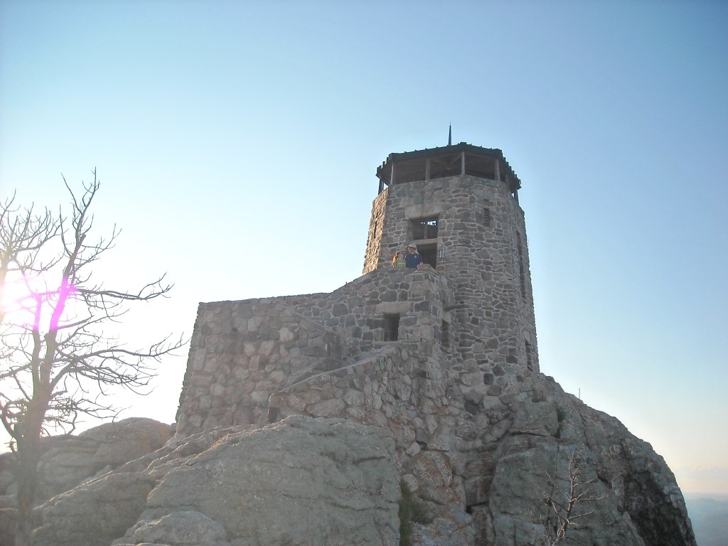
We left the Twin Cities after work on Friday and spent the night camping at Blue Mounds State Park. From there it was a six hour drive to our trailhead at the Iron Creek Horse Camp. We planned mostly a counter-clockwise loop with a short out-and-back spur to Harney Peak in the Black Elk Wilderness. It was mid-afternoon when we got to hiking, first north on the Centennial Trail #89, then west on the Grizzly Bear Creek Trail #7. We had plans to stop at a flat spot and camp for the night but it was still early, and we’d passed by the best campsites just four miles in, and the weather was holding (we’d been thwarted by a thunderstorm on my first attempt) and we hadn’t gone very far yet. Then we hit the steeper section before the summit where there was neither flat camping nor water and we ran into some people coming down from Harney Peak who told us there was a cistern on top and so we made a plan to summit that evening and have dinner with the water from the cistern.
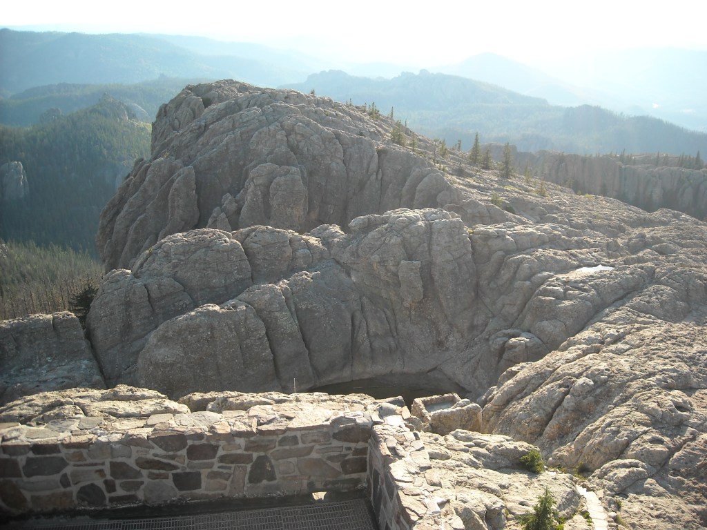
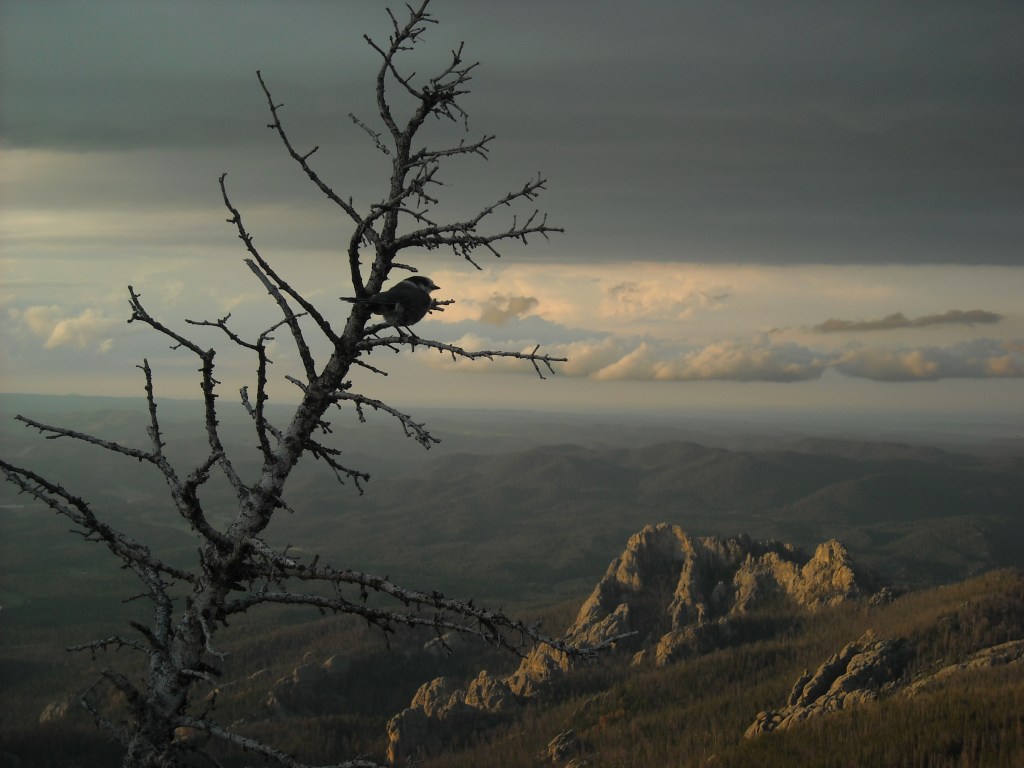
We did just that and took a bunch of photos.


By the time we were heading down it was near sunset. We retraced our steps back to the Grizzly Bear Creek #7 trail. We knew there wasn’t any good camping in this area but we planned to complete our loop on the Norbeck Trail #3 and hoped to find some flat tent sites but as we kept walking, it was nearing dark and we still hadn’t found any flat spots. We found the best we could but ended up with a couple slanted sites in fairly dense vegetation.
It was less than stellar, a theme that continued with Craig in 2017 for our first two nights in the Beartooths. Since then though we’ve made up for it and had some of the most spectacular campsites ever in the North Winds.
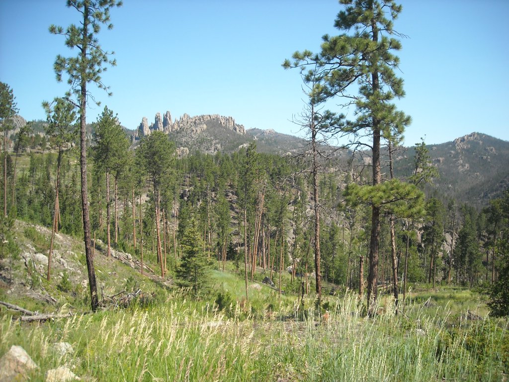
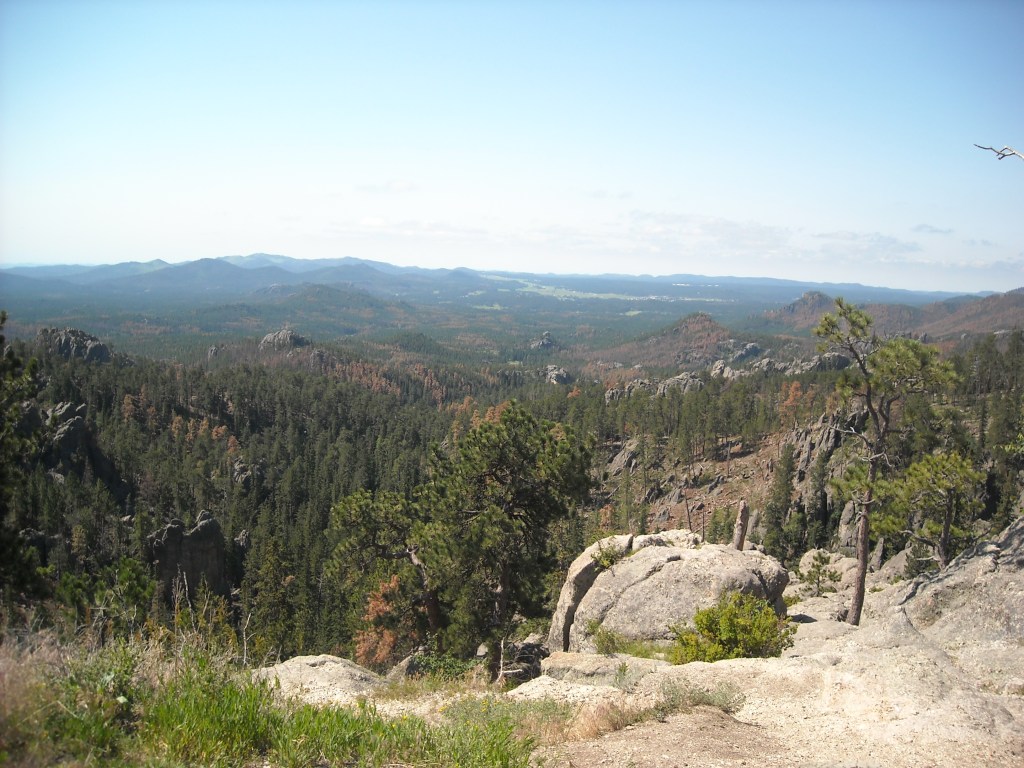
The next morning we woke early and completed our loop on the Norbeck Trail #3 and got back to our cars early. This gave us the entire afternoon to spend at Evan’s Plunge in Hot Springs, South Dakota.


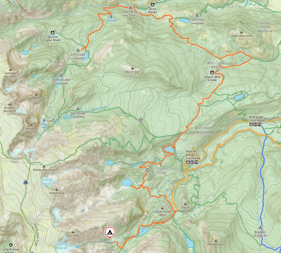
Backpacking Rocky Mountain National Park
The real impetus for this trip was to summit Longs Peak. Again, backstory and more details can be found in my book: Going the Distance: Piecing Together a Life of Adventure. But if we drove all the way to Colorado we wanted to do some backpacking so came up with this interesting loop where we’d never be more than a few hours hike from our car and even once we’d walk within less than a mile of it. Kinda weird but it worked.

National Parks almost all require backcountry permits (Gates of the Arctic is one exception) and these can be hard to come by. At least back in 2013, when we had to change our route some, I called the rangers at Rocky Mountain and they were super easy to work with and even provided some trip ideas.
Day One 7/22/13: Hike to the Boulderfield
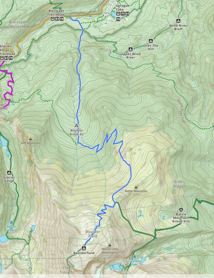
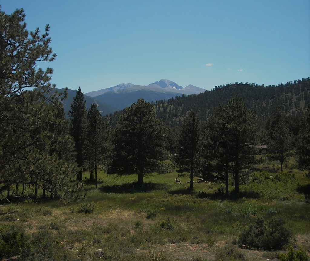
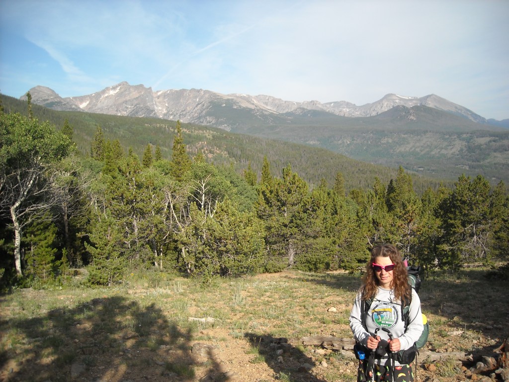
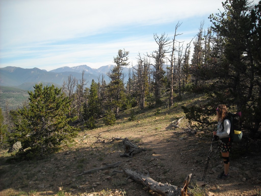
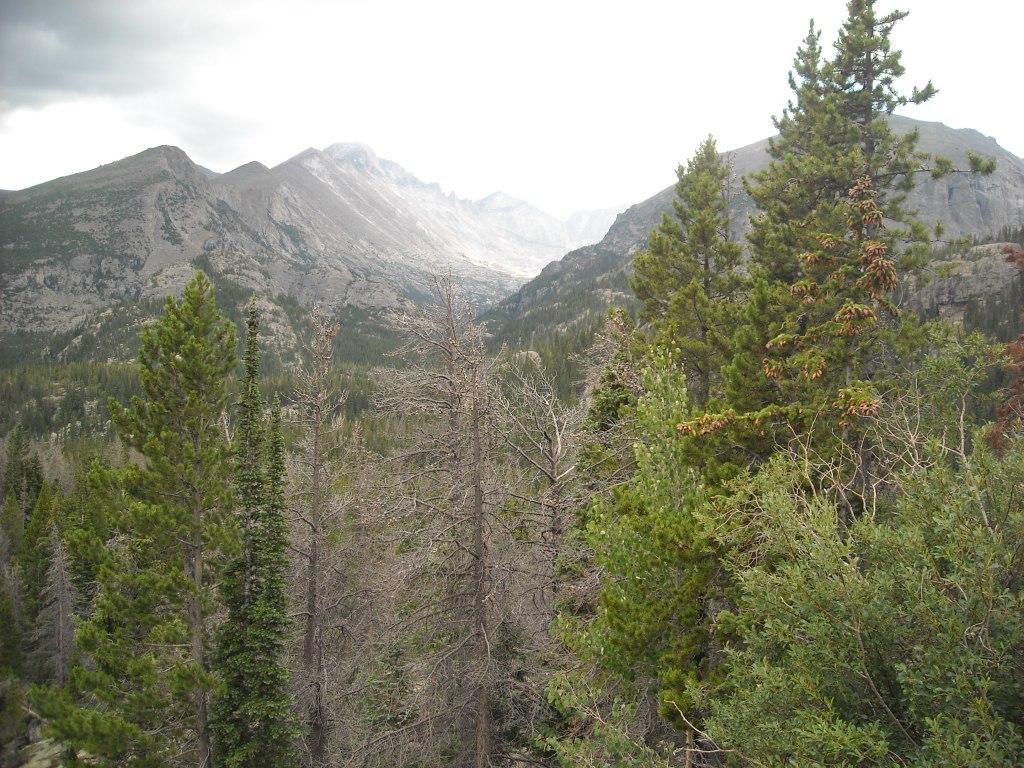
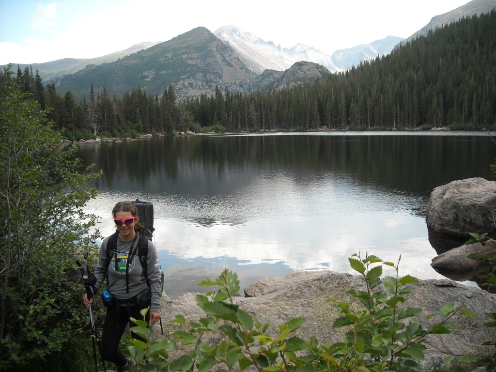
After driving here from Hot Springs, South Dakota, we didn’t get to hiking until late afternoon. The Boulder Brook Trail is steep and in the trees. Shortly after turning onto the North Longs Peak Trail we busted out of the trees and got some sweeping views.


It was nearing dusk when we arrived at the Boulderfield campground. This is a backcountry campground that requires a permit. It is literally in a boulderfield and at each site rocks have been moved to form a windbreak around a mostly flat less rocky tent site. There are a couple outhouses built up on platforms that require some boulder walking to get to.

Fortunately our night at the Boulderfield campsite wasn’t super windy or cold but at 12,700 feet it was still kinda breezy despite the rocky windbreak.
Day Two 7/23/13: Boulderfield – Longs Peak – Moore Park
This was our day to summit Longs Peak and then get all the way down to the campsite at Moore Park.

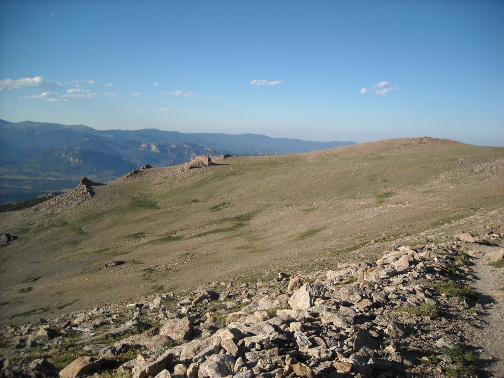
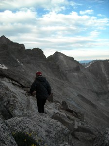
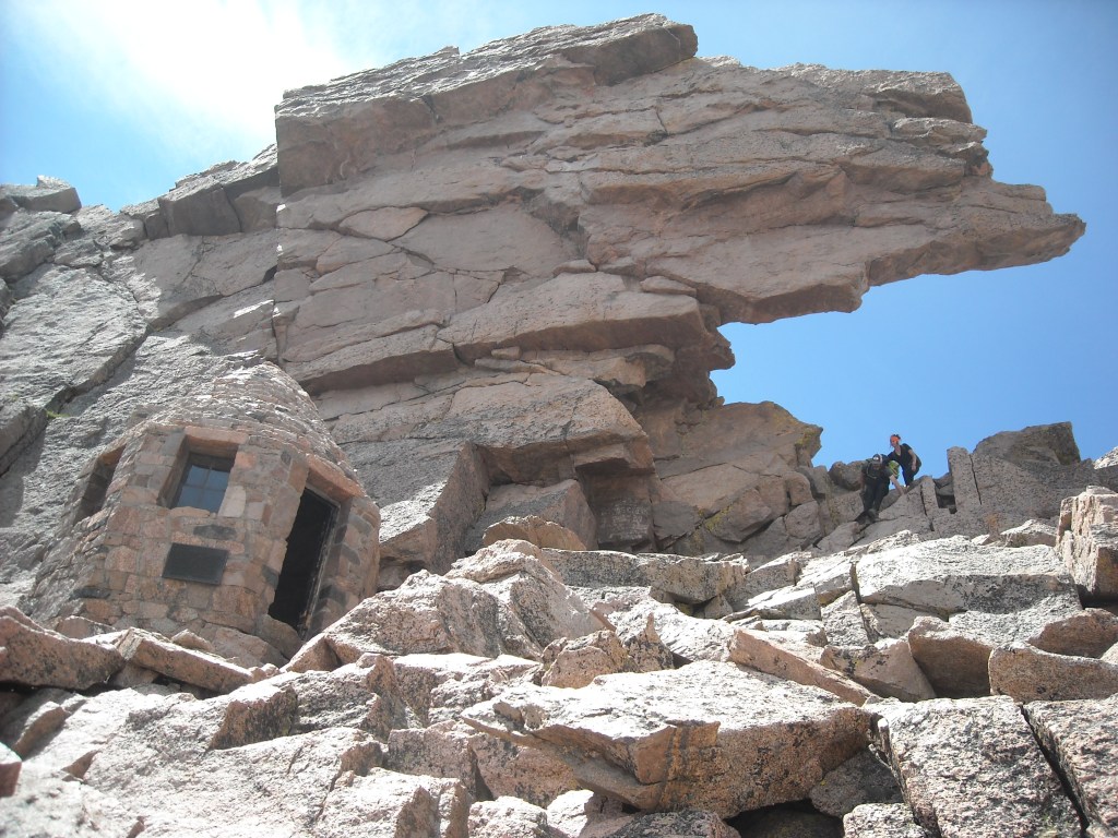
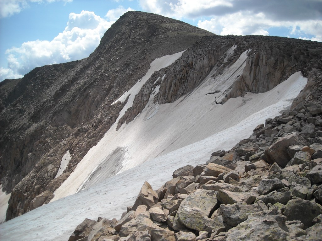
Rocky Mountain National Park has a brochure about the Keyhole Route on Longs Peak. This is class 3 and the brochure says in bold: The Keyhole Route is NOT a hike! Just past the Keyhole, the route is broken down into sections with descriptive names: The Ledges, The Trough, The Narrows, and The Homestretch. Despite the name of the last one, it is still vertigo-inducingly steep.

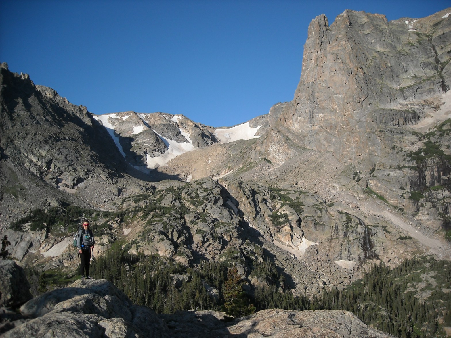
We got up once it got light and after a quick breakfast, began our trek up to the Keyhole. This was mostly small sized boulders. Nothing too difficult but on the other side of The Keyhole there was quite the drop-off. I’m not one to be afraid of heights, but the exposure definitely got me there and I almost turned around. I was glad I kept going though as we side sloped along The Ledges. I think the photo below speaks for itself.

After The Ledges we climbed up The Trough. At the top of this there was a bit of bouldering on which Erik had to help me. Now that I have more experience I’d probably do OK with this but it was one of those bouldering moves that doesn’t work so well for those of us with short stature. Next up was The Narrows which was similar to The Ledges.

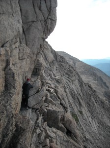
The Homestretch was like The Narrows except now we climbed again to the summit.


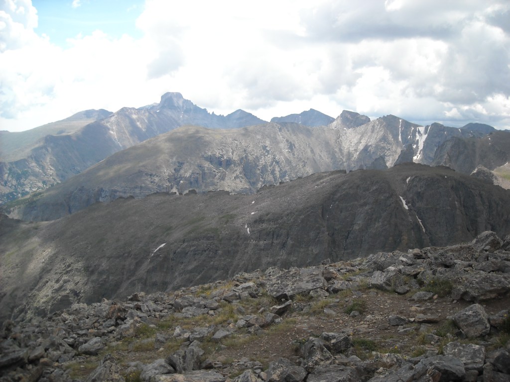
One of the things I’d heard from my father-in-law who climbed Longs with his family as a 10 year-old boy back in 1964, was that the summit was flat and about as big as a football field. Well, other than some rocks, his boyhood memory was correct.


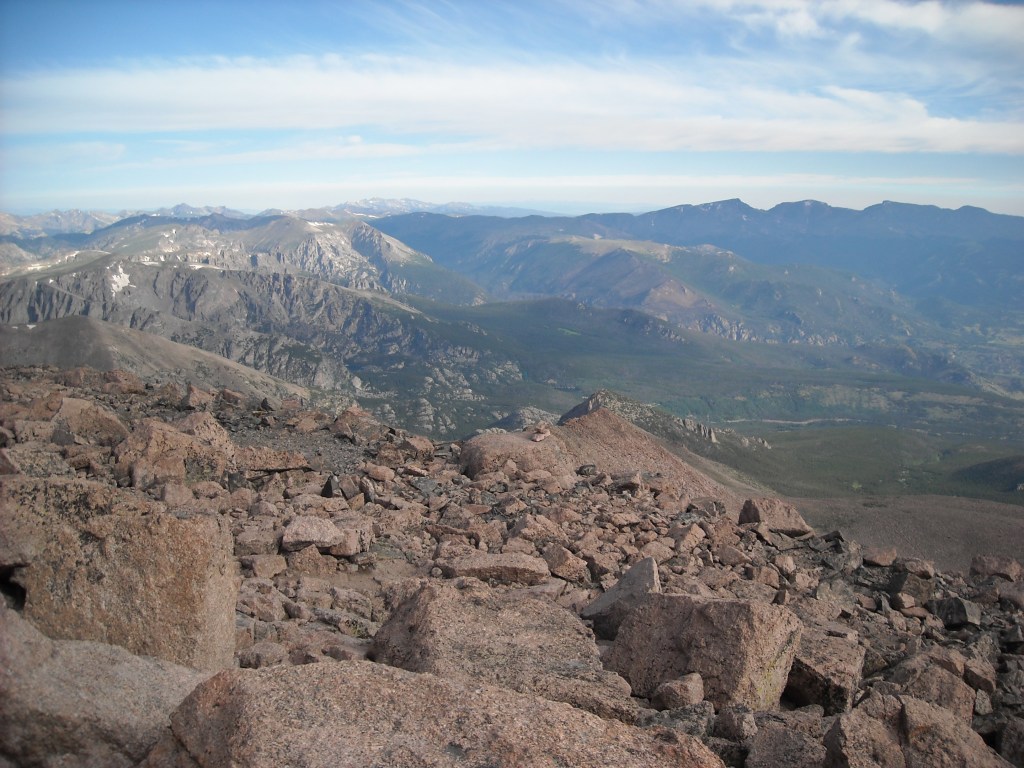
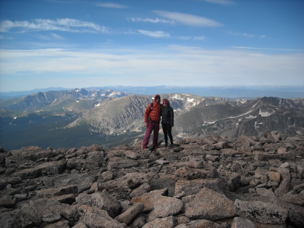
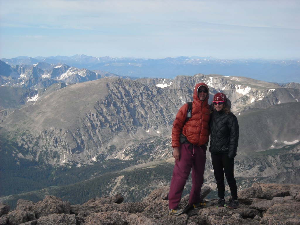

Alas, even though the weather was perfect, we couldn’t stay up there all day so after an hour we headed back down. It was time consuming to get back to the Boulderfield campsite but not terribly difficult.

Once back at the Boulderfield we packed up camp and then headed down the main Longs Peak Trail. The day started to get quite long, probably because the three miles to the summit of Longs and back is tedious and we spent a generous amount of time on top. We kept hiking down and down and it seemed to take forever to get to Moore Park but eventually we made it.
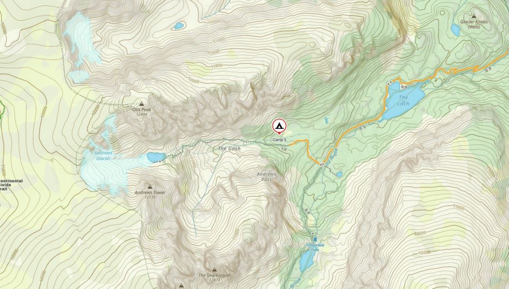
Day Three 7/24/13: Moore Park to Andrews Creek
We woke to a pleasant but cool day. I’d had some thoughts of bagging Estes Cone but we doubted there was much of a view from there and seeing as we were admittedly a little tired from the previous day, we decided to just get underway on our destination to Andrews Creek campground. Most of the early part of the hike was in the trees with occasional views. We passed within a mile of our car but kept going.


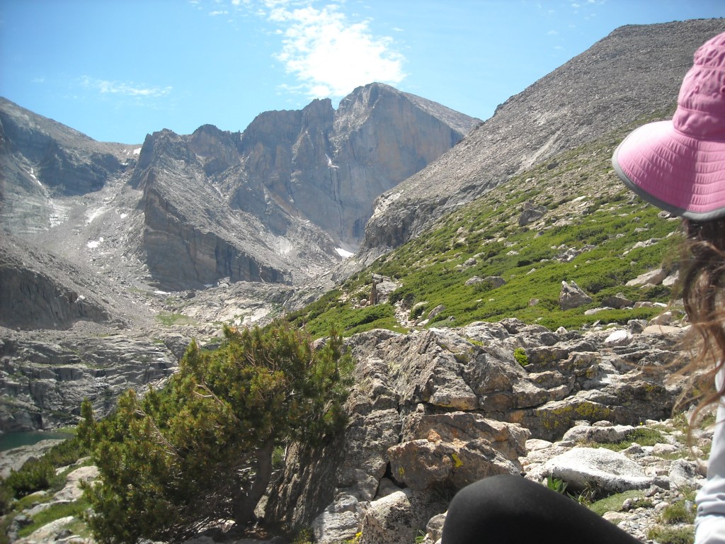
Our plan for the next day involved hiking off-trail past the Andrews Glacier Trail, up the Andrews Glacier to get up on the divide, then hiking Otis Peak, Hallett Peak, before finally regaining the trail on Flattop Mountain. From there we would hike most of the way down the Flattop Mountain Trail before heading north to our campsite at Fern Lake. Looking up at Andrews Glacier I had serious doubts about my ability. I’d never really been on a glacier before and they freaked me out. We didn’t have any technical equipment. I’d also never done any serious off-trail hiking.
Just before Andrews Creek we passed The Loch, a beautiful lake with views up into Glacier Gorge. We stopped for a photo shoot:)

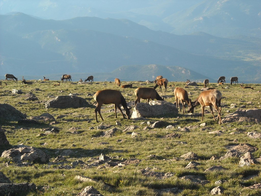
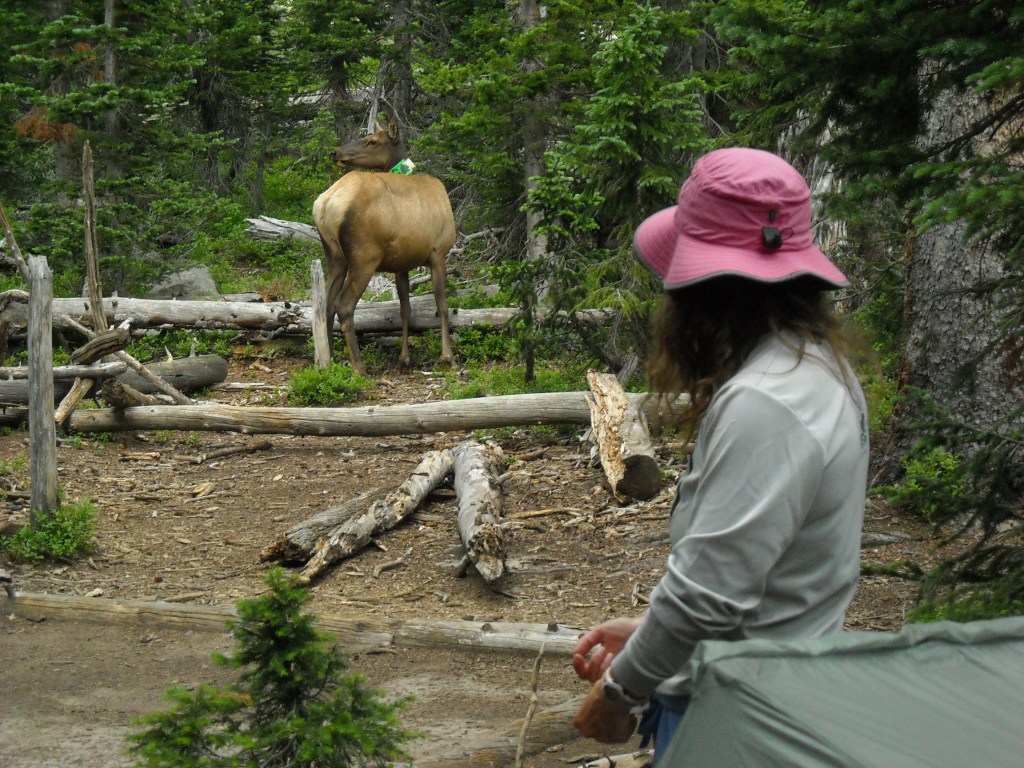
Shortly thereafter we arrived at our campsite at Andrews Creek. It was mid-afternoon but thunderstorms brooded. As we set up our tent, some elk came to greet us. They were almost tame.

It rained on and off and I worried about our plan for the following day and that sketchy Glacier crossing that looked quite steep on our map. Erik tried to reassure me that most of it had melted but I wasn’t so sure.
Day Four 7/25/13: Andrews Creek to Fern Lake
While we had a designated campsite at Fern Lake we had to get to, the weather turned on us. We woke to cloud cover. Erik thought we should give our off-trail route a go so we began hiking up towards Andrews Glacier. Not long after leaving camp we ran into a couple guys who were coming down from Andrews Glacier and said the weather up there was bad. So we turned around instead of doing our route up to the divide and down Flattop and to Fern Lake campground. Instead we kind of flip-flopped our plans for the following day to stay lower today.
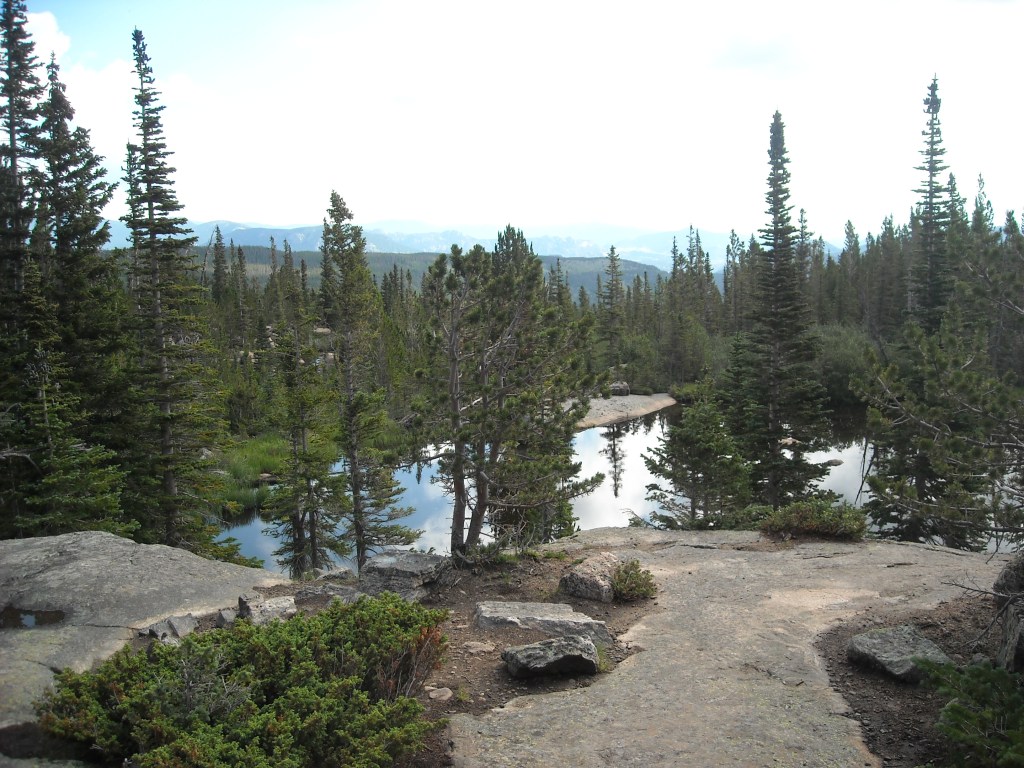
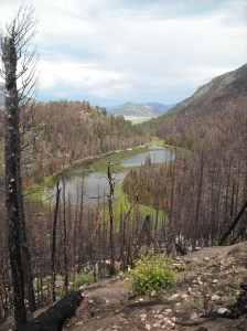
The weather got a little better and the tourists more numerous as we made our way down to the Bear Lake area which has multiple alpine lakes.
The area was pretty enough but I felt a bit torn about giving up on our much more difficult route. This is always how it was for me, and little did I know, how it always would be for me. I set challenges for myself, summit and route attempts at the peak of my ability, sometimes beyond my ability. When I achieve them I’m elated but if I give up, even though it is physically easier, mentally I’m deflated.
After we left all the day hikers and got out on the Mill Creek Trail I started to feel a bit better, but then it started to rain.

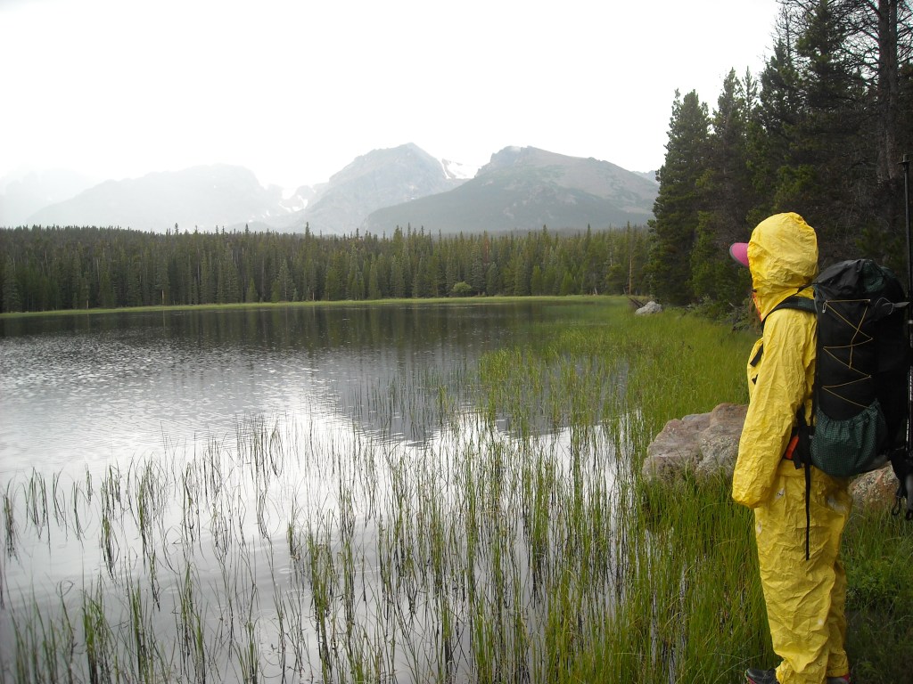

Next we hiked through an area that had relatively recently been ravaged by forest fire.

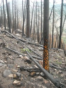
We hiked down to the low area on the day at The Pool before we began climbing up to Fern Lake and got out of the fire area. The sky continued to threaten but gradually seemed to be clearing.

Day Five 7/26/13: Fern Lake Campground to Bear Lake Trailhead with Flattop Mountain
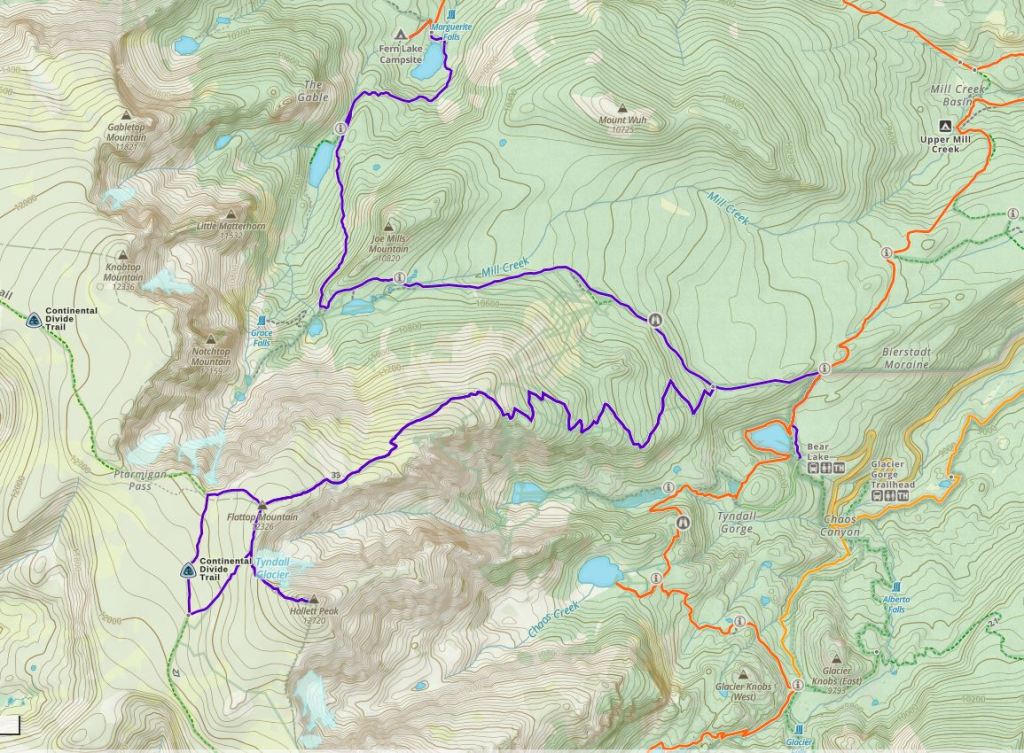
We decided if the weather was clear, we would hike up Flattop Mountain and even bag Hallett. I’d intended to do Flattop back in 2006 when I was here with my family, but after making it to the Boulderfield, my bro and I were wrecked and we gave up on Flattop. That story is in my book. Morning came and it was sunny and clear so Erik and I got an early start and kept up a hasty pace as we had 13 miles with 4,300 feet of elevation gain and loss to cover before our dinner date with my cousins in the greater Denver area.


The day’s route was definitely kind of goofy. We knew it would be faster to stay on trail but this meant descending 1,000 feet to almost turn around and hike back up it again. Kinda dumb, but usually that’s easier than heading cross country on rocky terrain. We really kept a move on and by late morning we’d gained the summit of Flattop. The skies were clear so we kept going on a social trail to the summit of Hallett Peak.


It was early afternoon when we made it back to Bear Lake. Erik suggested we take the shuttle back to our car at Bierstadt Lake Trailhead instead of hike. It took some convincing but eventually I agreed. Then we drove down to the Denver area before driving home the next day.
Best Decisions: Doing Longs Peak our first day. The weather was absolutely perfect which is never a given.
If I had to do this trip again: I’ve been to Colorado in 2006 (story in my book), 2013 (this post), 2015 (ski trip), 2016 (Mount Elbert and Maroon Bells backpacking), and 2024 (another ski trip). Somehow between 2016 and 2024 I largely forgot about Colorado. I suppose this is because in those intervening years we went to Alaska three times, Italy twice, and to the North Winds. But in 2024 between a winter ski trip to Colorado, writing this blog, and speaking with our friend who lives in Greeley, Colorado, I’m reminded that there is so much more to explore in Colorado, and even in Rocky Mountain National Park.
While I was disappointed to not really give Andrews Glacier a try, that day was the worst weather of the trip and we definitely made the right decision.
Next time: I’d be fairly inclined to do a route that would go up to the Glacier Gorge Trail, then do a side hike to Sky Pond before making a serious attempt of Andrews Glacier, up on the divide, and back down the Flattop Mountain Trail all out of the Bear Lake Trailhead. But our Greeley friend tells us there’s more to Rocky Mountain National Park. He says the trail-less valley of Arrowhead, Inkwell, and Azure Lakes also looks really appealing. And indeed it does from the map.
As far as Black Elk Peak, well, I wouldn’t mind doing it again but it’s certainly not high on the list.
