
Nine years ago, in 2015, Erik and I had our first backpacking trip in Wyoming’s south Wind River Range. We hit all the highlights – Wind River Peak, Lonesome Lake and Cirque of the Towers, Shadow Lake, Washakie Pass, and our favorite – the Lizard Head Trail. Since then we’ve been to the north Winds twice, in 2021 and 2023, both times trying to climb Gannett Peak, Wyoming’s highest. Erik and I don’t often go back to the same place twice, but the Cirque’s jagged peaks coupled with only a 15 hour drive seemed too good to only see once.
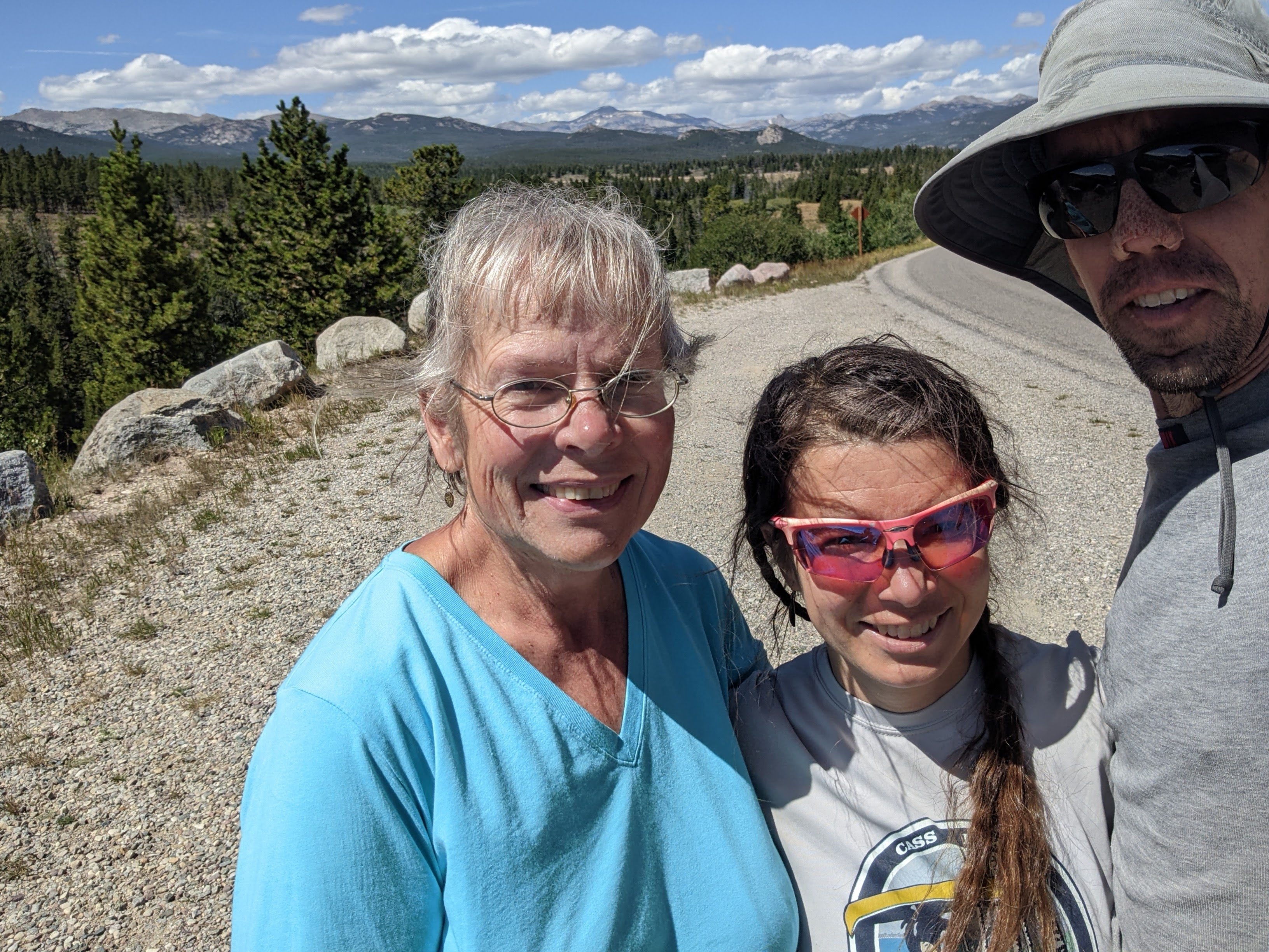
We’d been thinking about returning to the north Winds to attempt Gannett again, this time from the east face, when my mom asked if she could tag along, drop us off, and continue to Utah to spend a week with her sister. This meant we should take advantage of hiking a point-to-point route. After debating a few options, we decided to stick to the south Winds to minimize drive time for my mom.
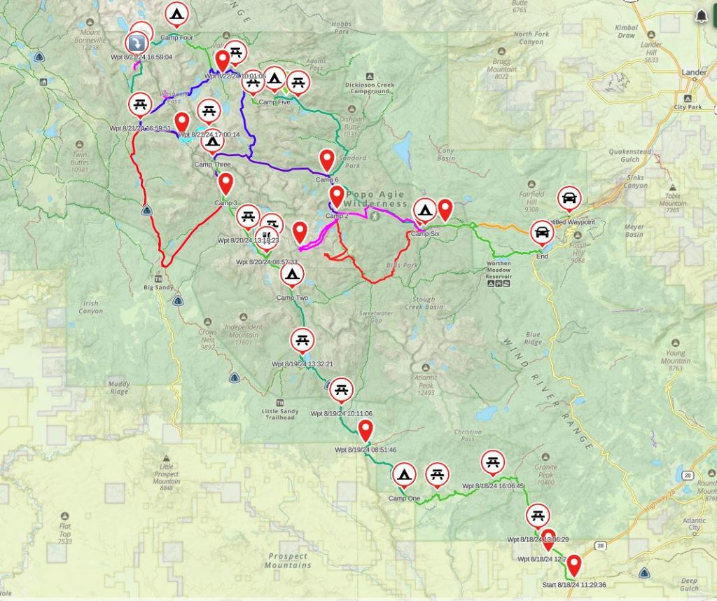
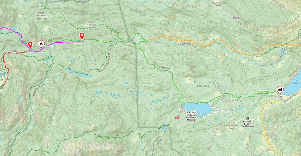
Day One 8/18/24: From the CDT on Hwy 28 to near Mill Creek
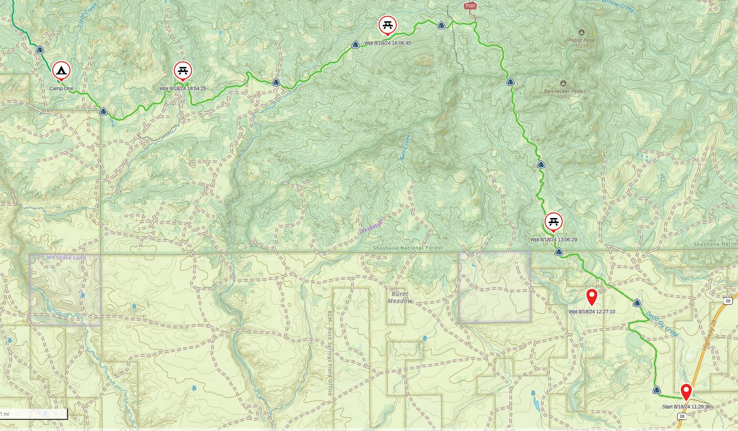
It was exactly 11:30 am when we got on trail. Initially we had planned to start a bit farther northeast as it was shorter, but when we got to that location, there was a locked gate with a No Trespassing sign so we diverted to where the CDT (Continental Divide Trail) crosses the highway. It was sunny and hot and the trail, which in this section were all-terrain vehicle roads, was sometimes marked. We saw a couple south-bounders, then got off the official CDT, above where we have the wpt (waypoint) that is not on our route. Just about every base map in this area showed different trails/roads. Fortunately we have GAIA GPS on our phone and were able to correct our course.
I felt a bit like an imposter on the CDT. Almost everyone had smaller packs than us, and by normal standards, our packs are pretty small. Erik brings a scale to weigh our packs starting and ending. Erik’s topped out at 29 pounds and mine at 19, including three liters of water and all our food.
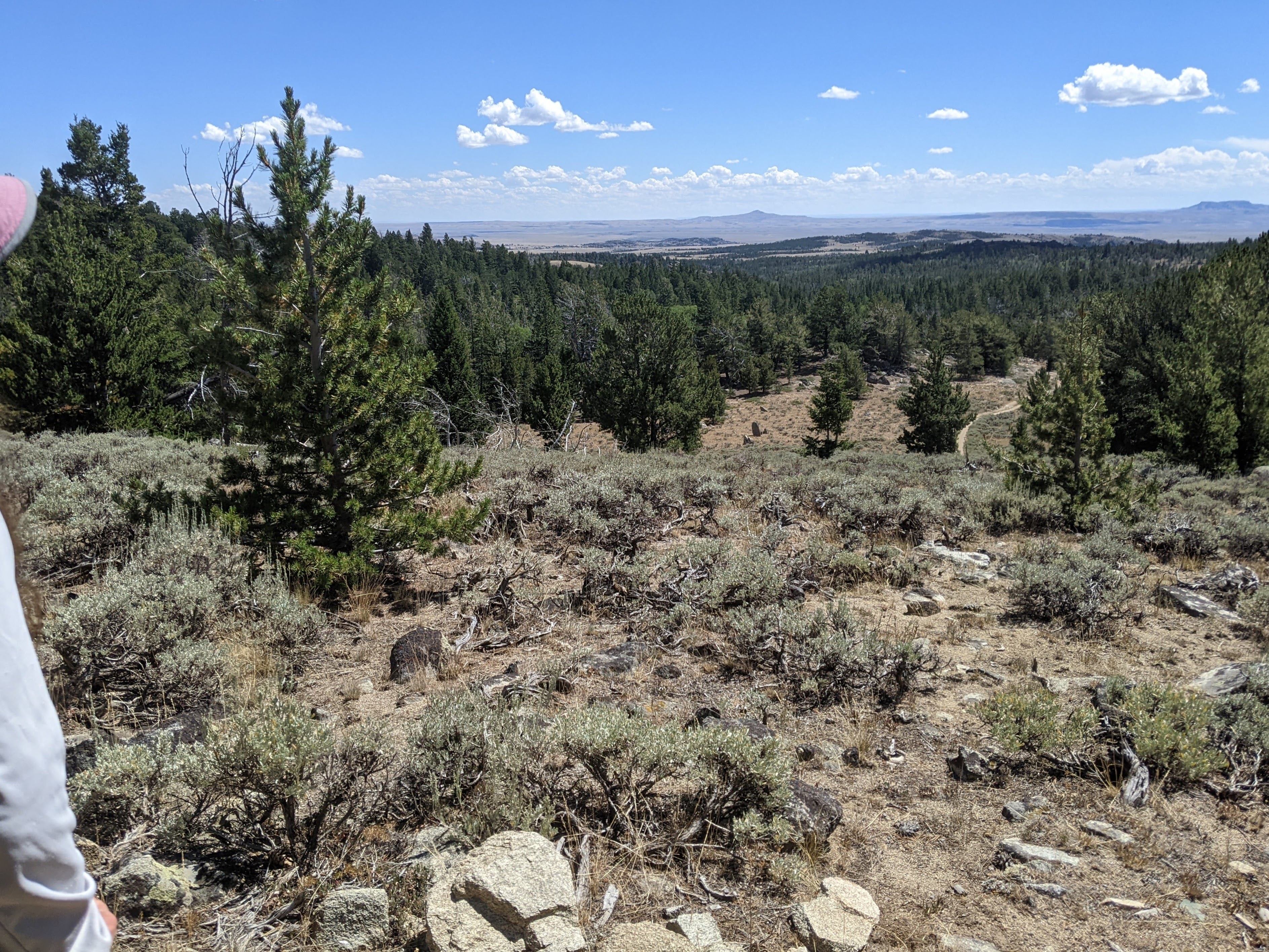
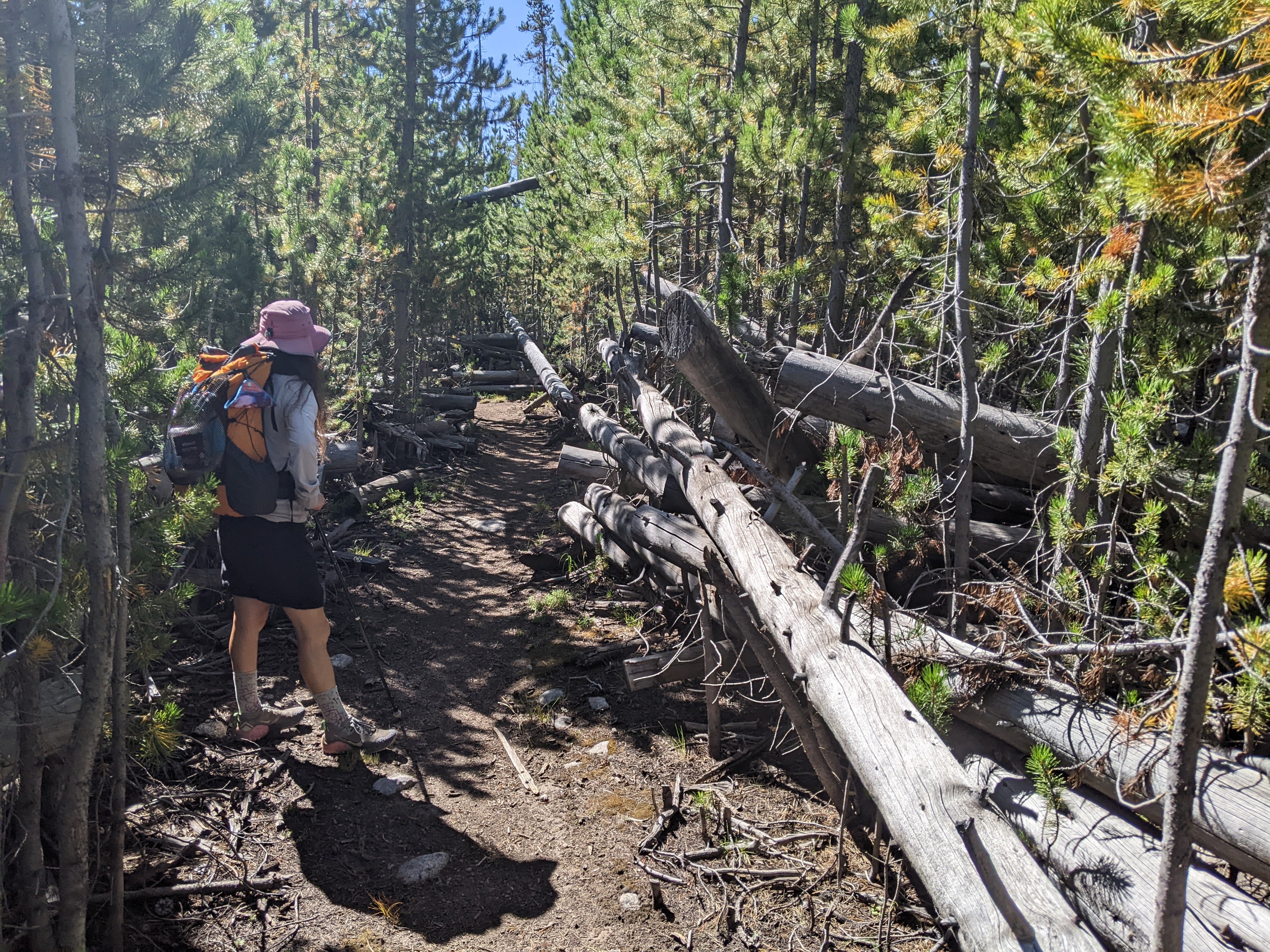
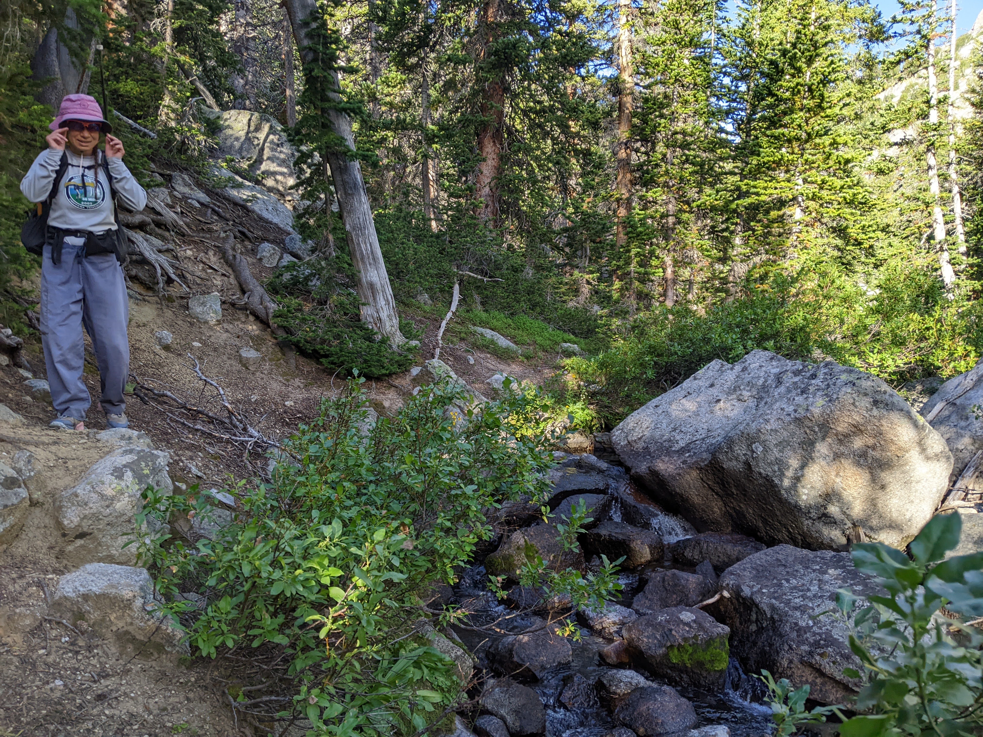
After an hour we began hiking mostly north on a road that goes along the Little Pine Creek. Eventually the road petered out and a single track trail led into the woods. That meant more shade coverage. The trail was largely easy to follow (there were a few small re-routes due to blow-downs). Most of the blow-downs had been cut but there were still a few to navigate over (or under). The trail underfoot was nice, not too many rocks, and the elevation changes were gradual.
I wasn’t sure where we’d first come across a reliable stream and was even a bit surprised to find water the first time we crossed the East Sweetwater River. We never did see the trail junction for the Sioux Pass Trail but instead were led over a nice bridge to cross the East Sweetwater River for the second time. We then found ourselves heading back south across the right side of a meadow. Initially we were a bit confused but soon found the trail as it headed west. We made good time and found more water in each of the next two creeks we crossed before rock-hopping as we crossed the East Sweetwater River for the third and final time.
By the time we crossed the Little Sweetwater River it was nearing 6 pm and we stopped for dinner. Erik wanted to camp here but I suggested we push on for another hour or so to get a bit farther. I won out and so after dinner we kept going, having filled up on enough water (we had the capacity to carry three liters) to dry camp. Now it was cloudy but not exactly threatening rain. We crossed paths with more south-bounders and then as we neared a ridge, Erik began in earnest to find us a place to camp. We got a good site, albeit it wasn’t quite flat. I should note here that there are no designated campsites in the Wind River Range.
Day Two 8/19/24: Near Mill Creek to Little Sandy Creek Valley
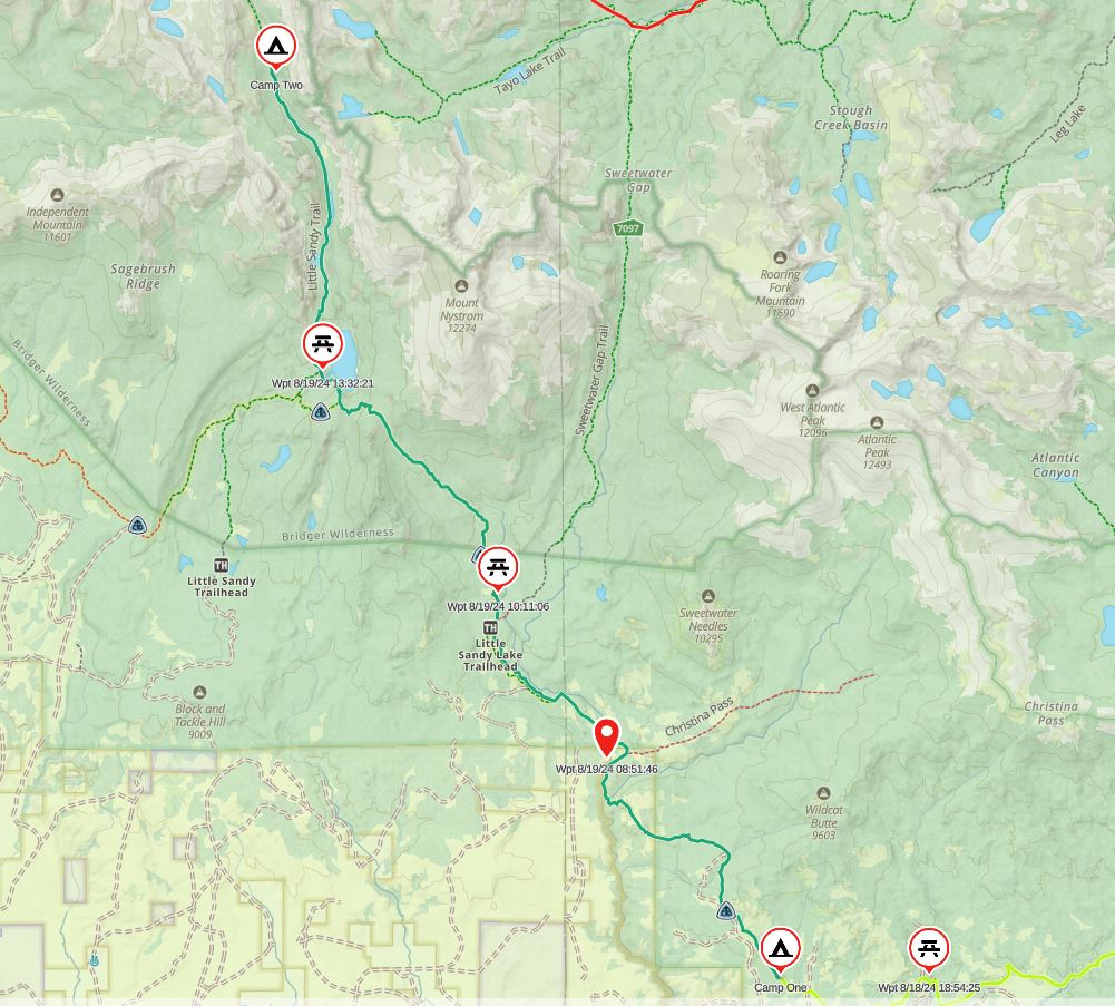
After spending nine hours in the tent, essentially the duration of darkness, we got up and kept hiking. We climbed up some, then down again where it got cold in the valley. We climbed above another creek, then back down. We encountered a couple more south-bounders, one who told us there was some “trail magic” ahead. Sure enough, as we hiked along the bend in the Sweetwater River, we saw a sign pointing to the campground with some optimally placed rocks in the river.
We hopped across and talked with the Trail Magic guy. He had south-bounded the CDT over a couple years (I believe 2021 and 2022) and was returning the favor. We were plenty stocked up on food and only a day into our adventure so Erik only ate a cookie while I declined the offerings. Then we decided to continue on down the road (a rough dirt road) rather than the CDT trail to the official Little Sandy Lake Trailhead. The road steadily climbed and once we made it to the official trailhead, the trail did too, up towards an unnamed pass on the Dutch Joe Larsen Creek Trail, our first time crossing the Continental Divide of the trip.
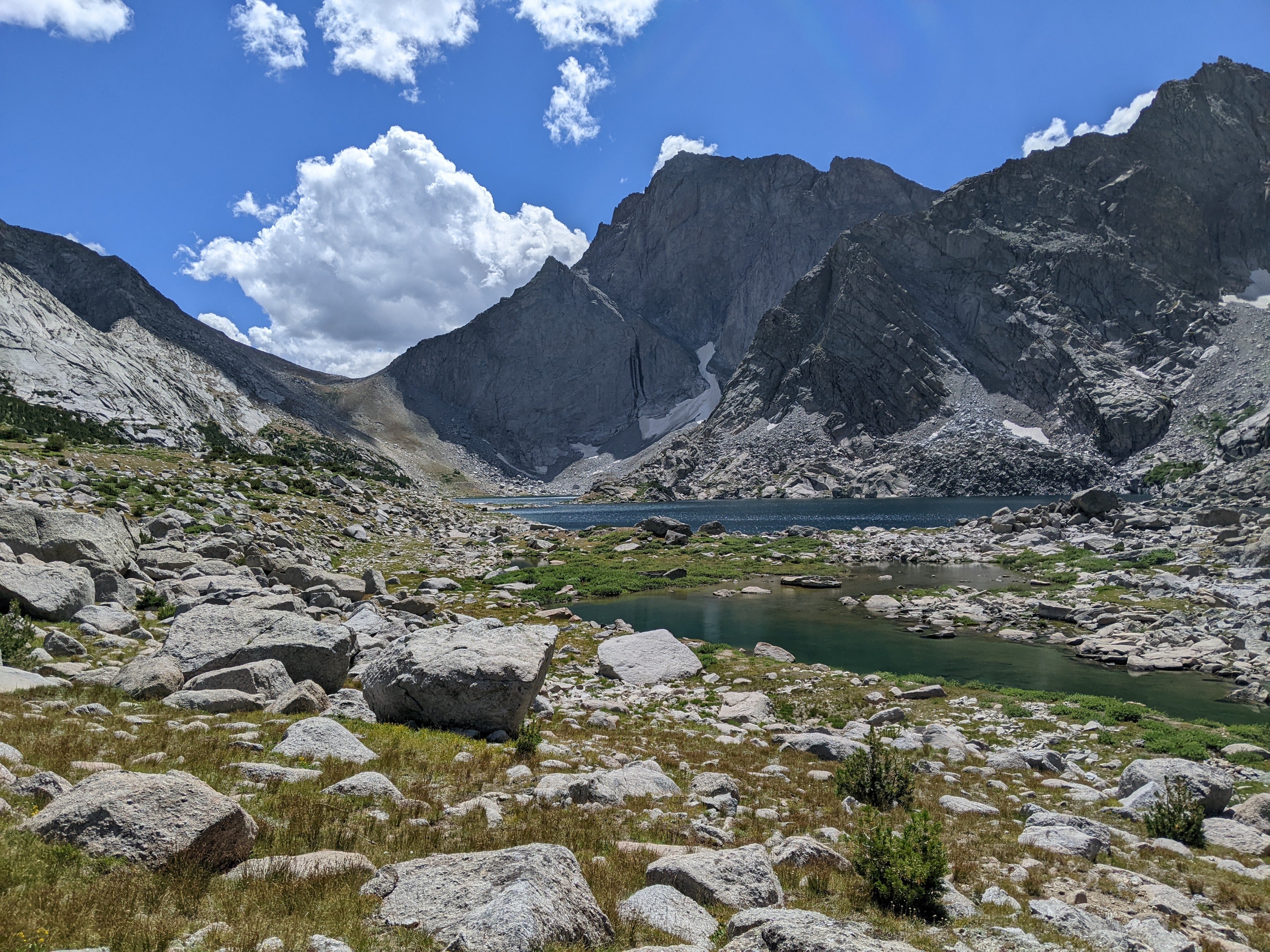
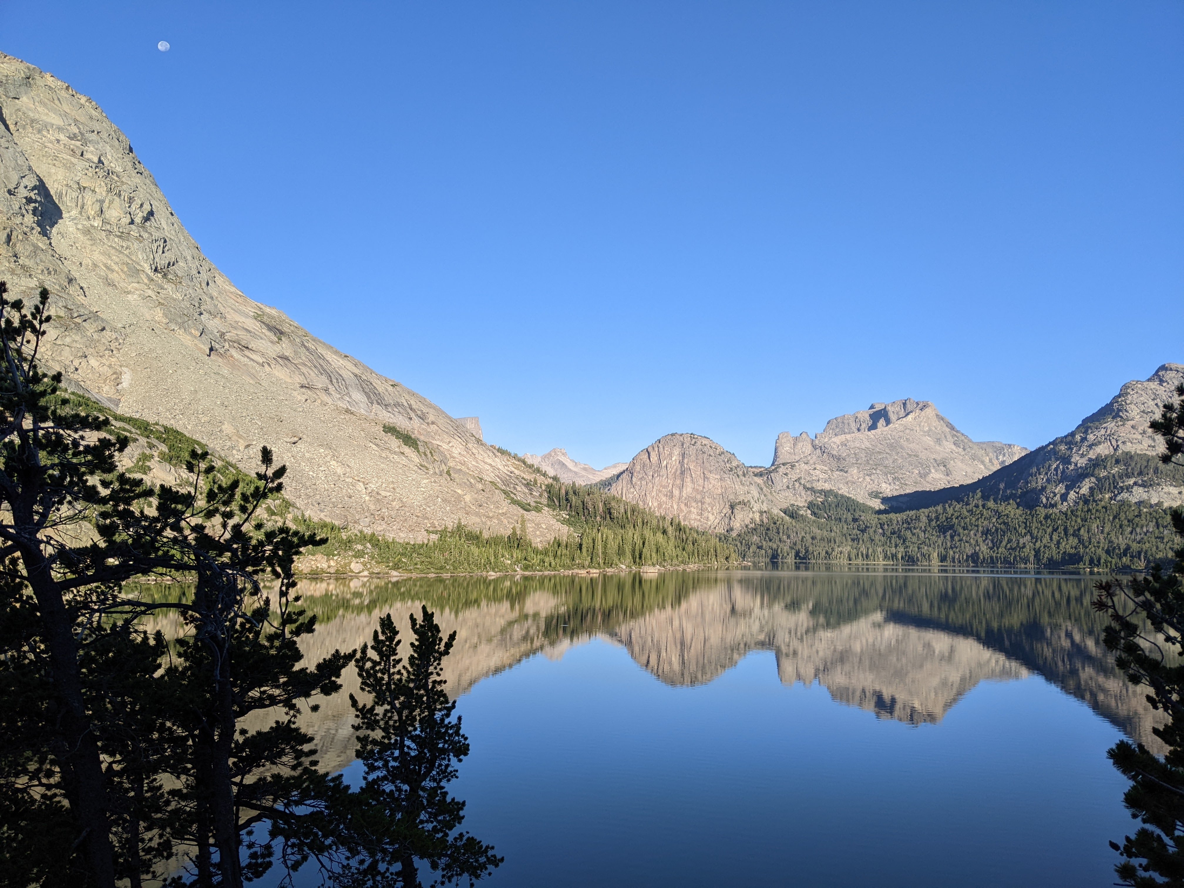
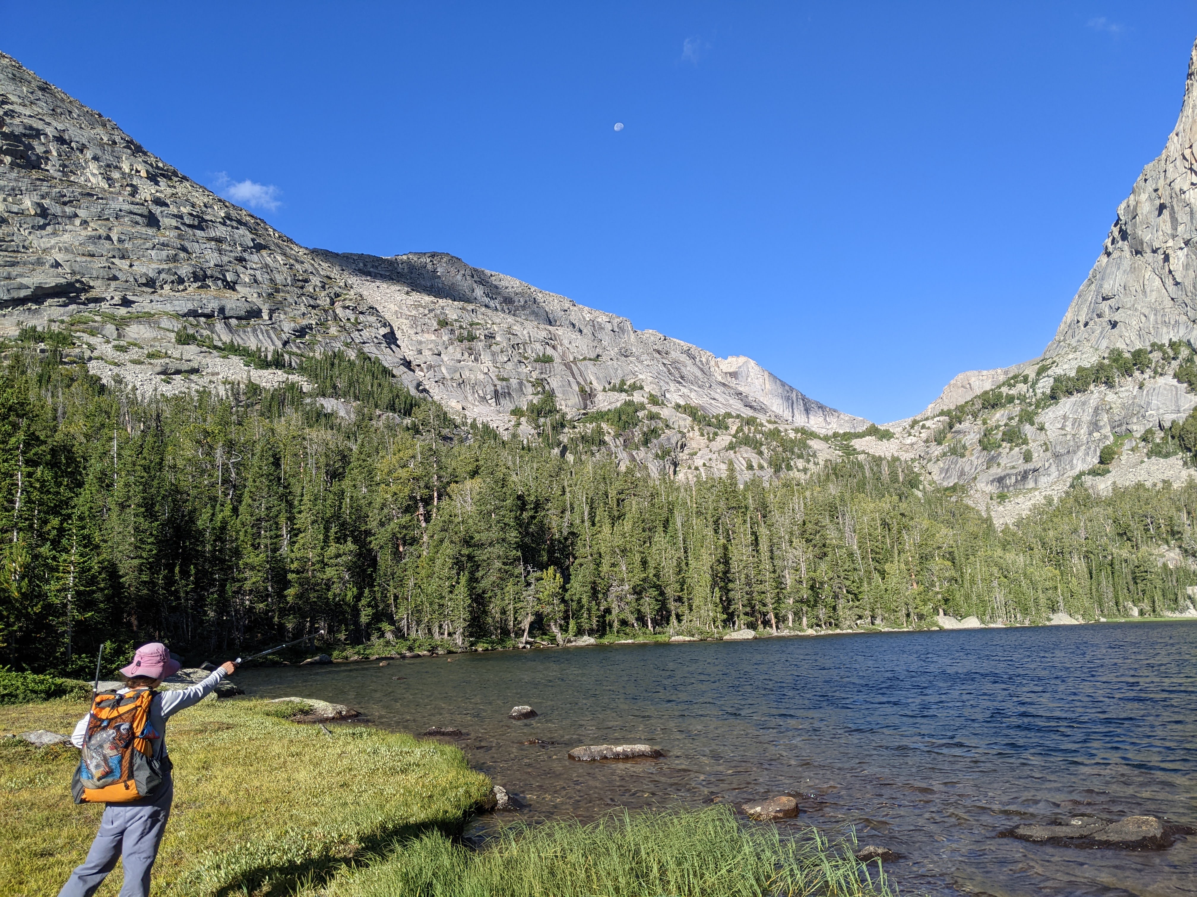
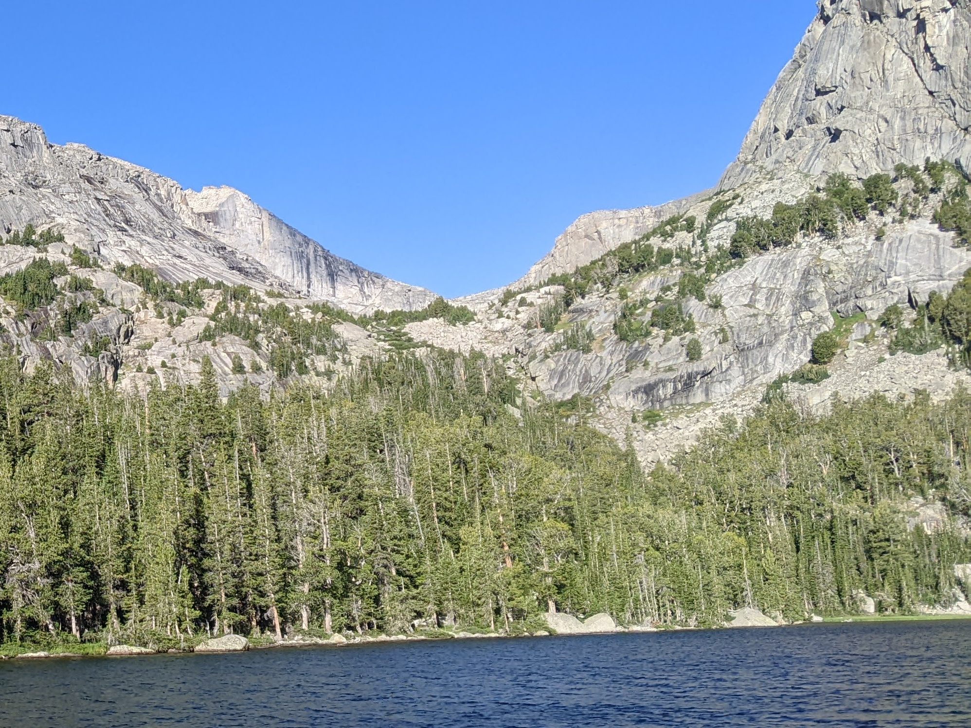
The pass was all in the trees. We crossed a boulderfield on the way down where we finally had a look at Little Sandy Lake along with Wind River Peak and East Temple Peak. Following the initial descent, then a creek crossing, and a bit of climbing, we came to a slightly exposed ridge. Here there’s a social trail, and a much more exciting variant of the CDT that heads steeply down to Little Sandy Lake. We were mostly able to follow cairns down which led us across an old dam. After filling up on water and eating second lunch, we got back on the social trail which initially was quite difficult to follow. As we climbed towards the lake at 9,800 feet, we briefly followed a couple with three dogs and then met a series of CDT south-bounders who all made it easier stay on trail.
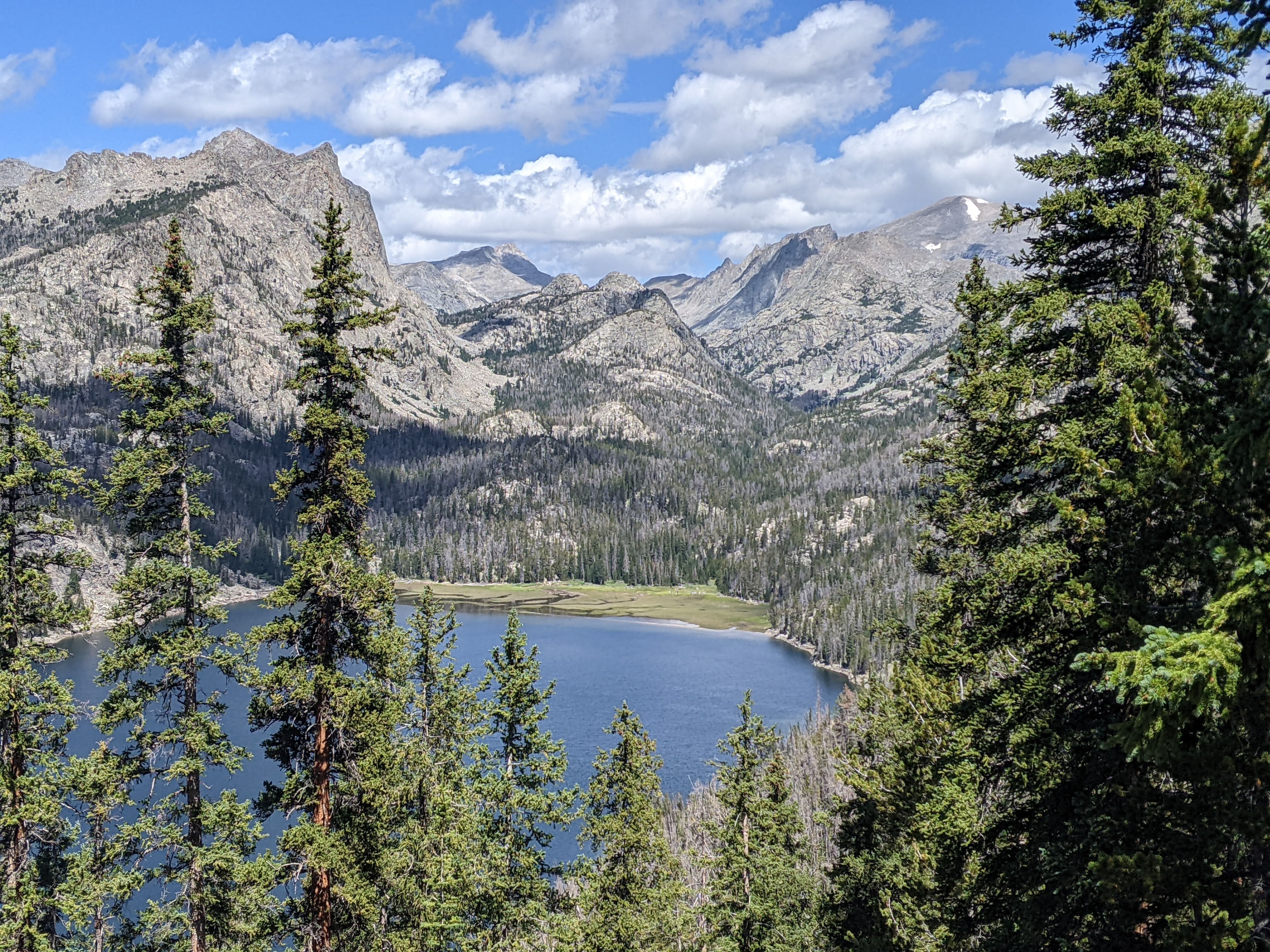

The lake at 9,800 feet was spectacular and we briefly stopped to appreciate the view but failed to take any photos. Then we headed down towards the Little Sandy Creek; however, we missed the main social trail which went steeply down to the river. After another minute the contouring trail ended and instead of backtracking, we bouldered down to the social trail we could see in the meadow. Once back on the social trail we had some easy meadow walking.
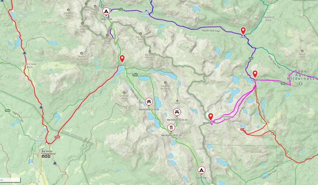
But soon the clouds rolled in and it began to rain. We sought some brief shelter under a big rock. It was raining so finely we couldn’t see it, only feel it, so we continued on, but the clouds were threatening. It was nearing 4 pm. I wanted to camp above treeline up at Lake 10,839; Erik did not. It started thundering and finally I relented. Erik went off in a clump of trees to find a campsite but I ended up finding another one right off trail. We quickly set up the tent and got inside. There ended up being a lot of thunder but not much rain.
It looked clear enough to cook dinner so we got out of the tent and did so but by the time we were done, clouds seemingly descended on us out of nowhere. Although technically the clouds weren’t above us. Despite this, it was raining in a type of sun shower. This wasn’t heavy and didn’t last long and then the clouds all disappeared and I enjoyed some time outside looking at the mountains.
Day Three 8/20/24: Little Sandy Creek Valley to Cirque of the Towers
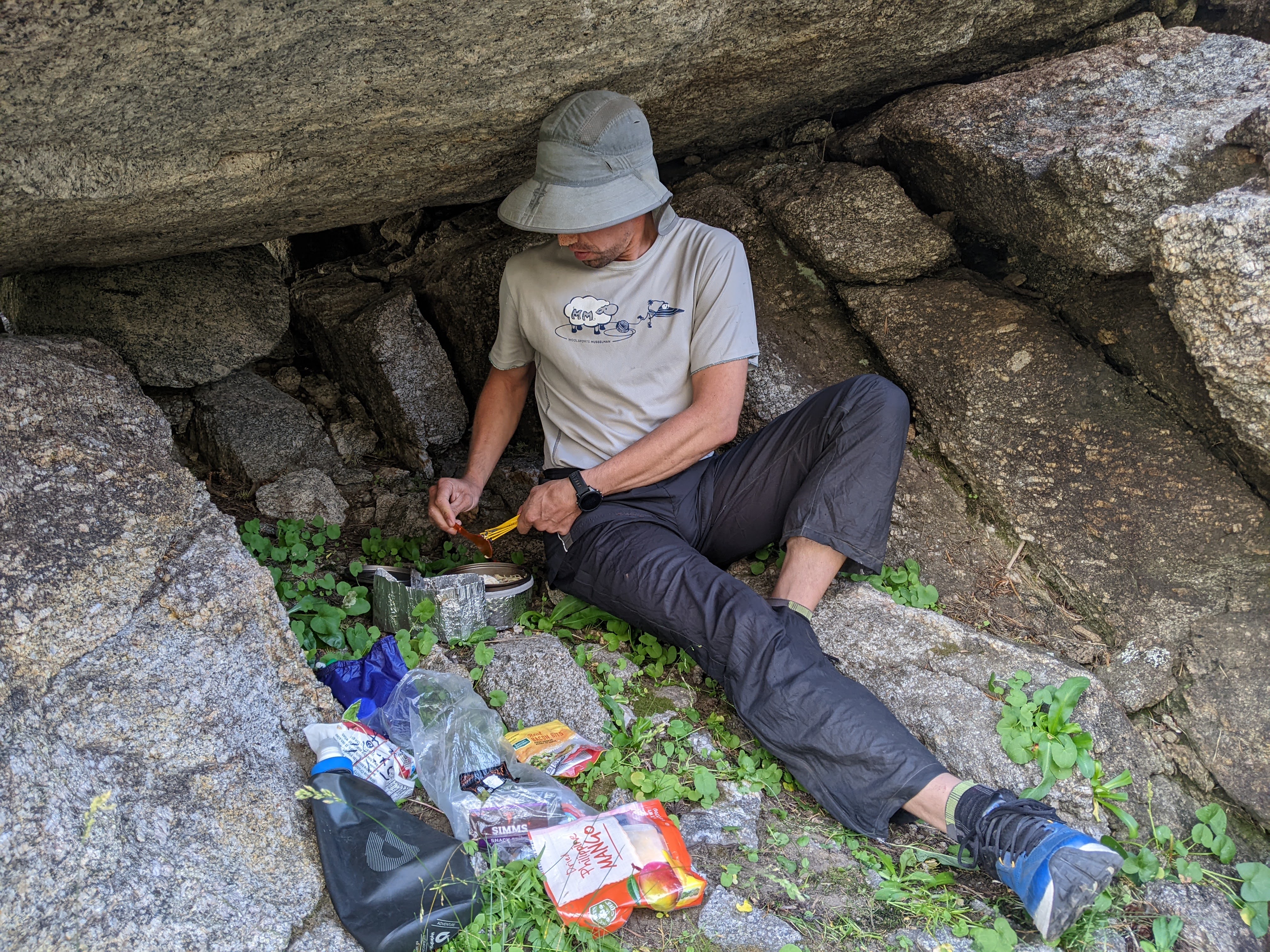
We started moving at first light knowing we had a big day ahead of us. I pack up the inside of the tent (sleeping quilt, double sleeping pad) and arrange my clothes while Erik unties our Ursack (food bag) and prepares our cold breakfast (literally adding cold water to our granola mix). Ideally Erik is done eating by the time I get out of the tent and then while I eat, he packs up the tent. Then we pack up our bags and brush our teeth. It’s usually never quite ideal and if it’s really cold, I have to take extra time to warm my hands. It usually takes us an hour, give or take 5 minutes, to pack up camp and eat breakfast, whether we’re canoeing or hiking.
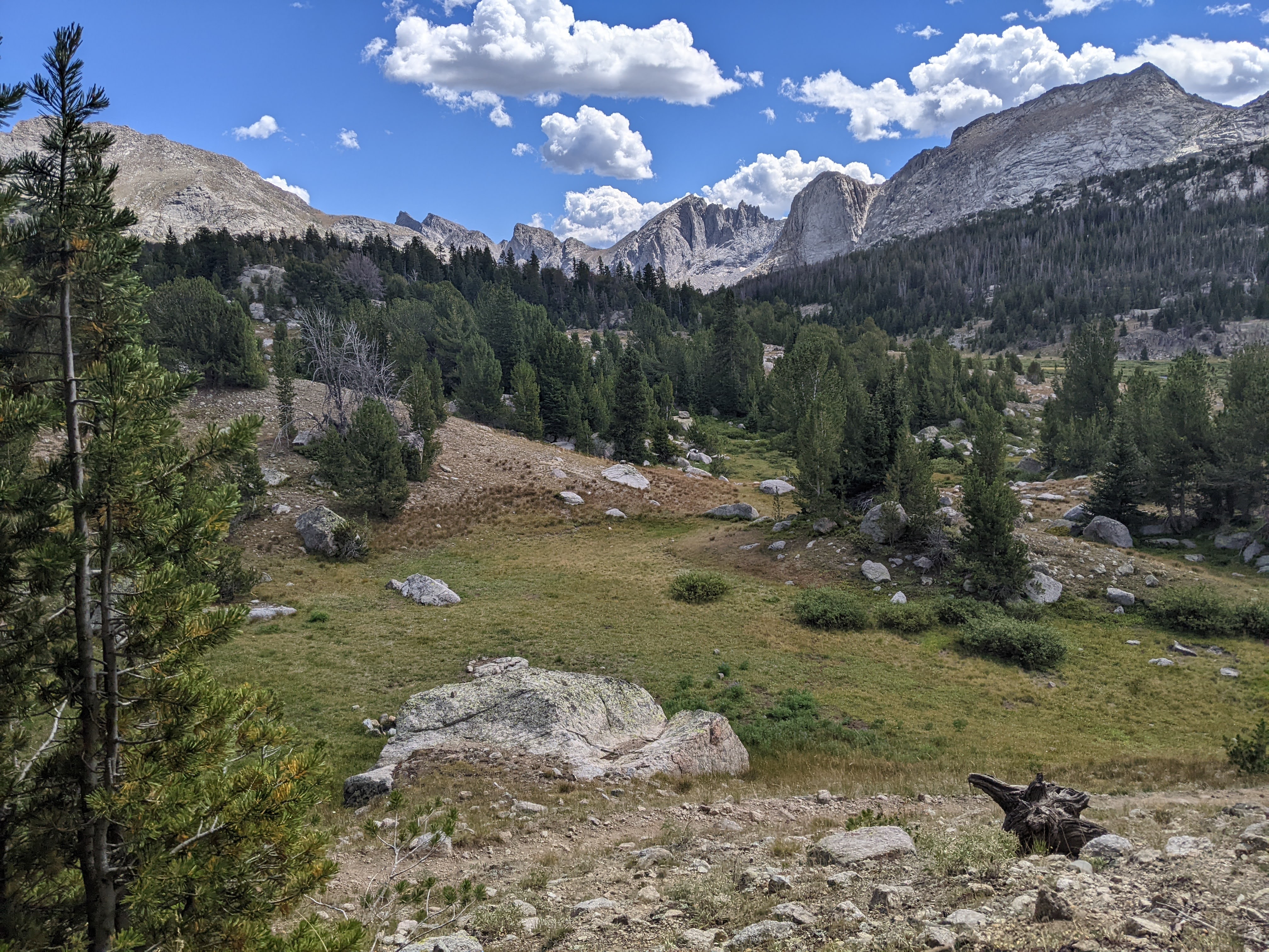
Given the plan to meet my mom at noon on Saturday, we had to stick to our itinerary. That being said, our route had four possible cut-off points plus two optional summits. I was most committed to an off-trail section near the end of the route so wanted to set ourselves up well for that. Hence, the third day, this day, I had planned Temple Pass, East Temple Peak, Jackass (Big Sandy) Pass, and Texas Pass. I knew this would be a whopper of a day for us. If we skipped either East Temple Peak or stopped short of Texas Pass in the Cirque of the Towers though, the day would be quite do-able for us. Erik didn’t think we needed to skip any summits yet so we decided to camp that night in the Cirque of the Towers, and hold off on Texas Pass until the next day. I definitely felt some pressure lift when we made this decision.
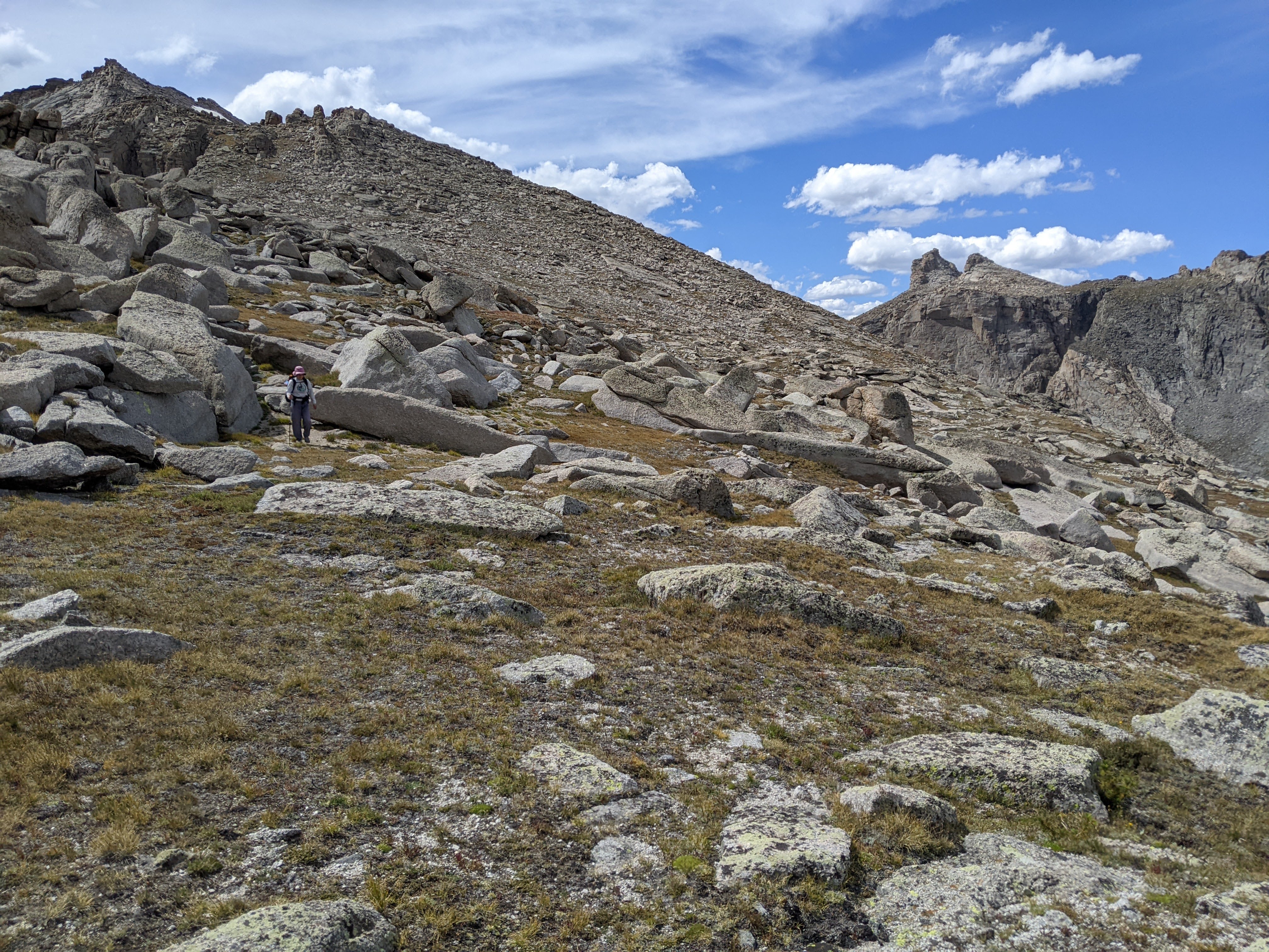
So at 7 am we began hiking up the Little Sandy Creek Valley. Shortly thereafter we saw a herd of elk behind us. This was technically a “route” not on our official Wind River map, although it was on Gaia and again, a CDT variant. The trail was easy to follow until about half way between treeline and the lake at 10,839 feet. Here we lost the trail and so took turns leading as we climbed up towards the lake. There were some trees growing up along the creek but I found a good place to cross the creek just below a slide waterfall. We still were off trail so found the best looking ramp leaving the lake (on the northeast side of the lake) and took this.
Most of the way up the ramp we stumbled on the trail. There were even a couple switchbacks. Near the pass, quite high up, there was a minor cliff section. Here the trail was very loose gravel. I’m not one to quip about exposure, but that’s assuming I’m on stable rock or ground and this wasn’t. I was glad to be going up and took my time in this brief section to make sure I didn’t slip. Erik, who came up behind me, said he even kicked in a couple steps into the gravel.
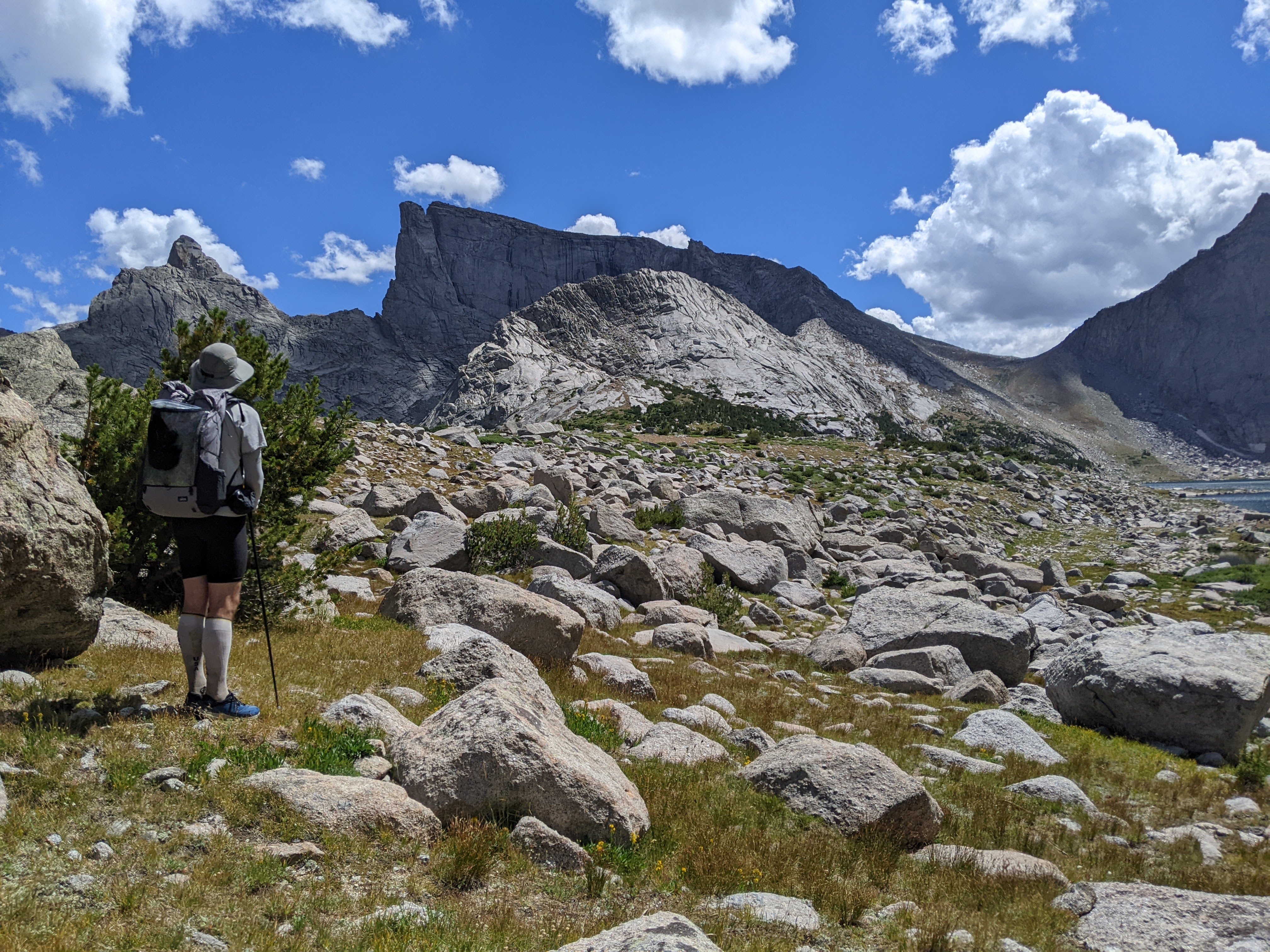
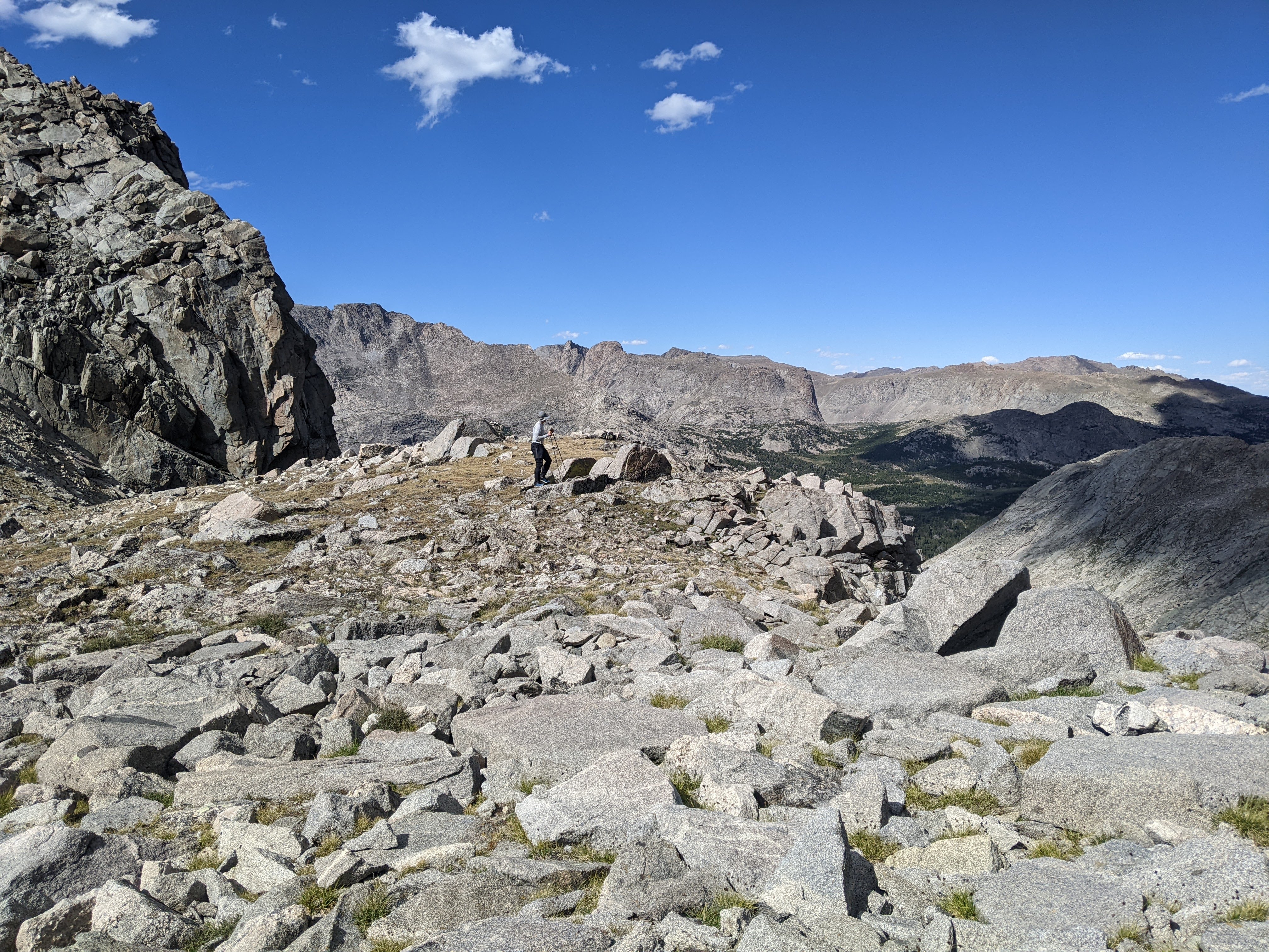
Soon that part was over and we headed onto the broad Temple Pass. Erik and I veered east and began climbing East Temple Peak. Initially the grade wasn’t very steep, but soon it got steeper. We were mostly able to find alpine sidewalk for our walking pleasure but did have to navigate a few boulders. After half an hour we came out on more of a plateau. Even though I’d studied the map a bunch and knew we had to hike a ways north to avoid a more southerly false summit, I still let Erik who was using the Gaia App, navigate me up to the false summit which got quite steep and required some bouldering near the top.
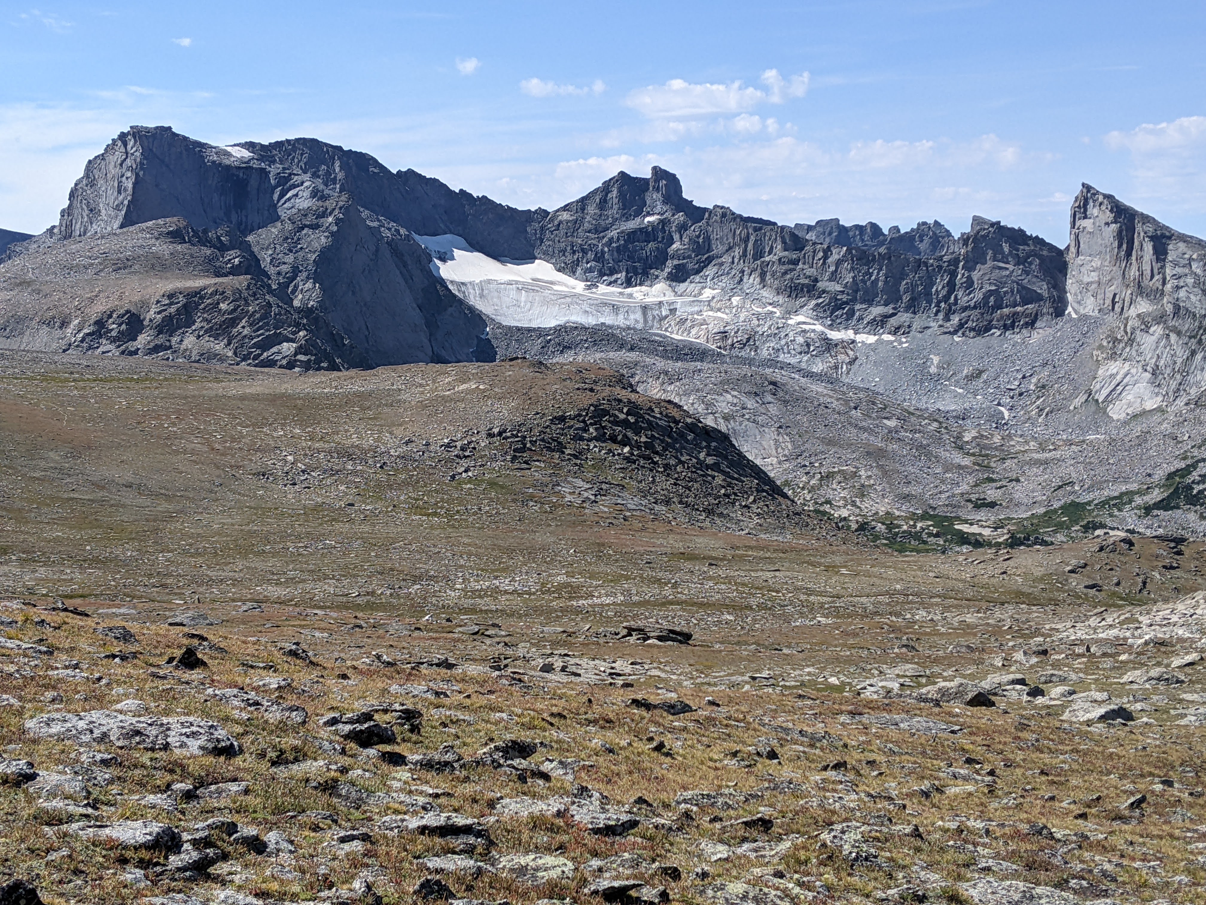
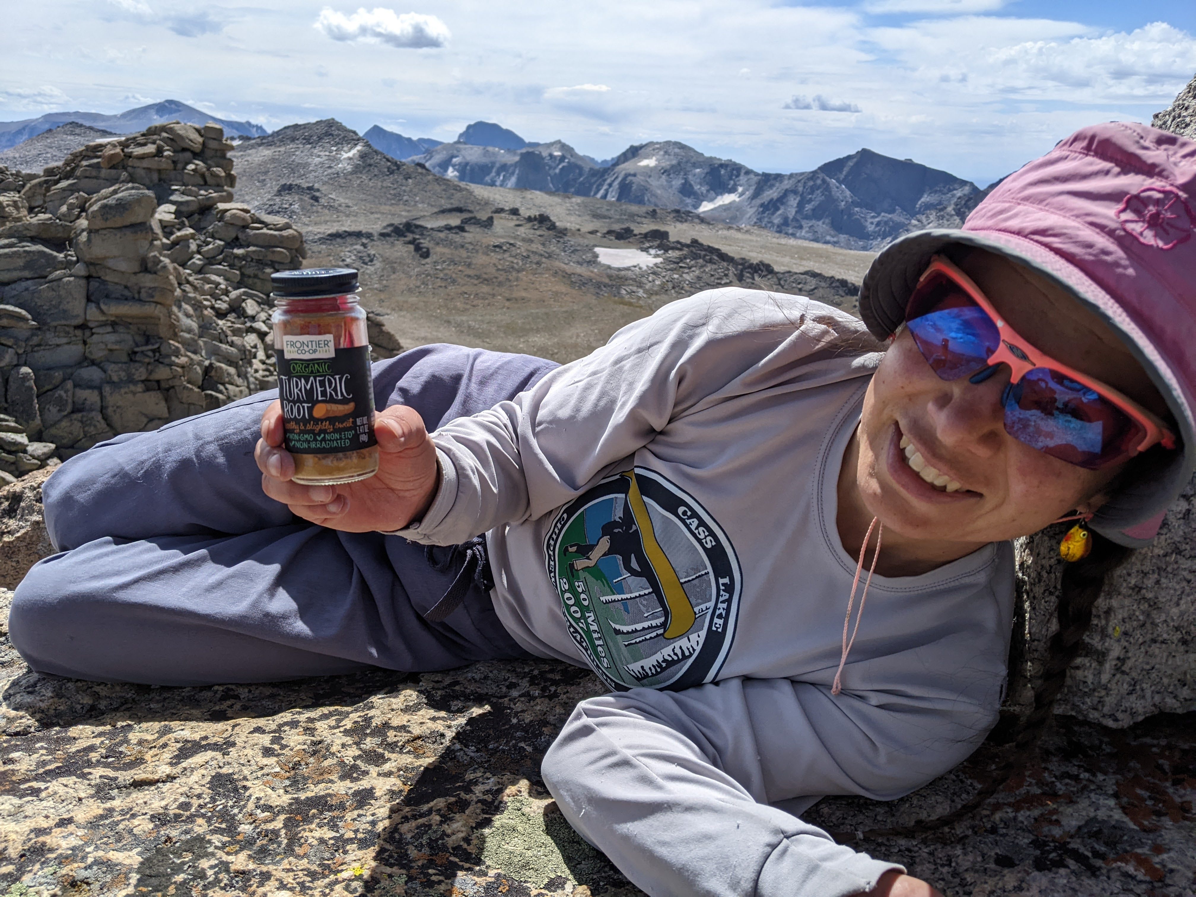
After realizing it was a false summit we made our way north to the real summit. It was a bit hard to determine where the real summit was but it was an upside down V formation of two rocks. There were a couple other guys up there with us but otherwise we didn’t see anyone else. The view was of course, amazing. I wasn’t quite prepared to be able to see all the way to Gannett Peak and its associated disappointment from last year, but it’s east face is quite discernible with it’s large high glacier. I liked looking immediately down to the east where there was still a glacier-colored lake. We took our time on the summit, eating first lunch and taking in all the mountains around us.


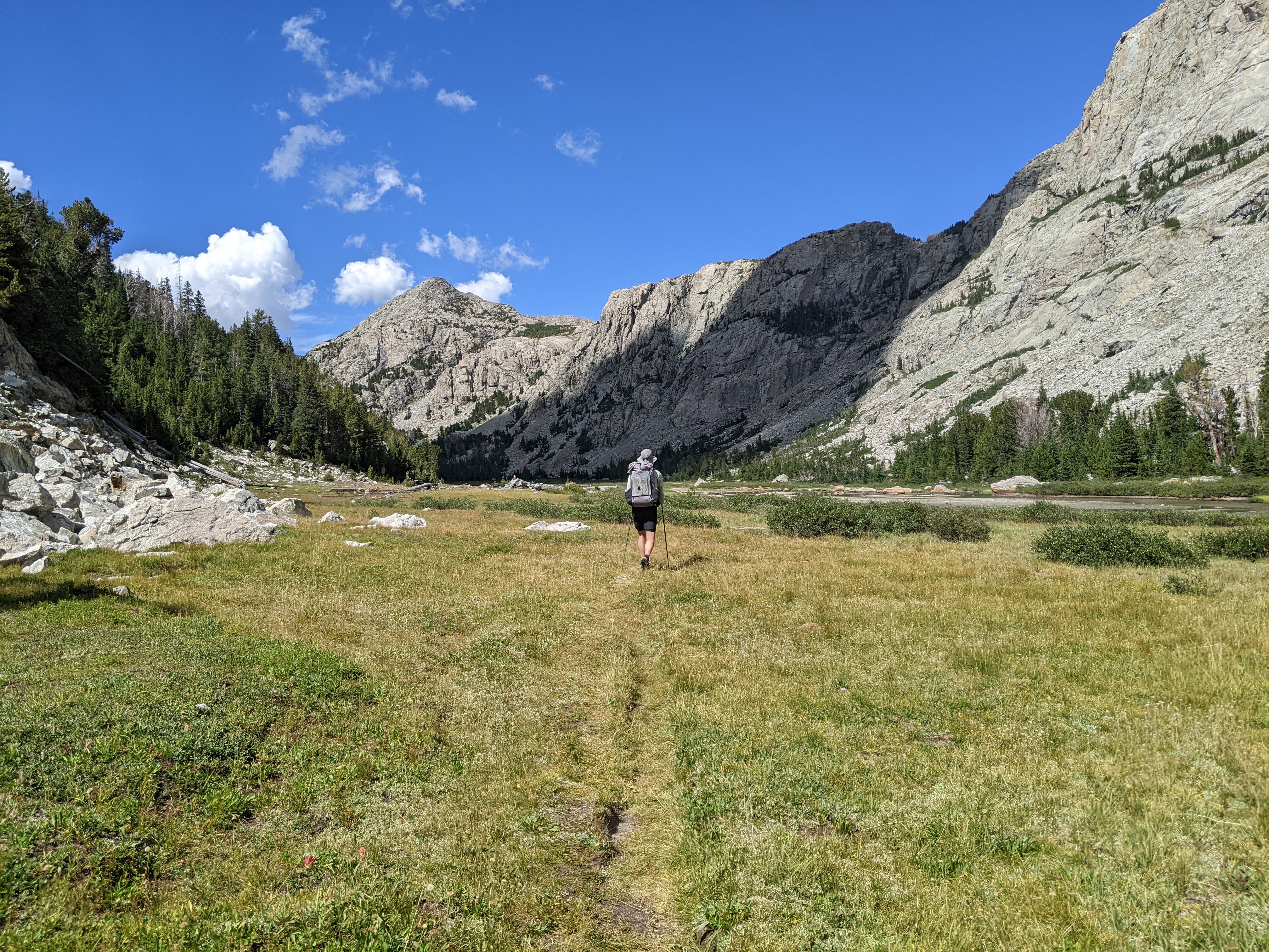
Then we descended. Overall it was an easy peak with mostly alpine sidewalk and almost no bouldering. In contrast, the route off the north side of Temple Pass was quad-busting steep. More loose gravel. Not terrible but not exactly enjoyable either. It was sunny when we got down to Temple Lake and so we washed up in the lake which felt very good. From here we continued down to Big Sandy Lake. We caught some views looking back to East Temple and the meadow above Miller and Rapid Lakes had more stunning scenery.

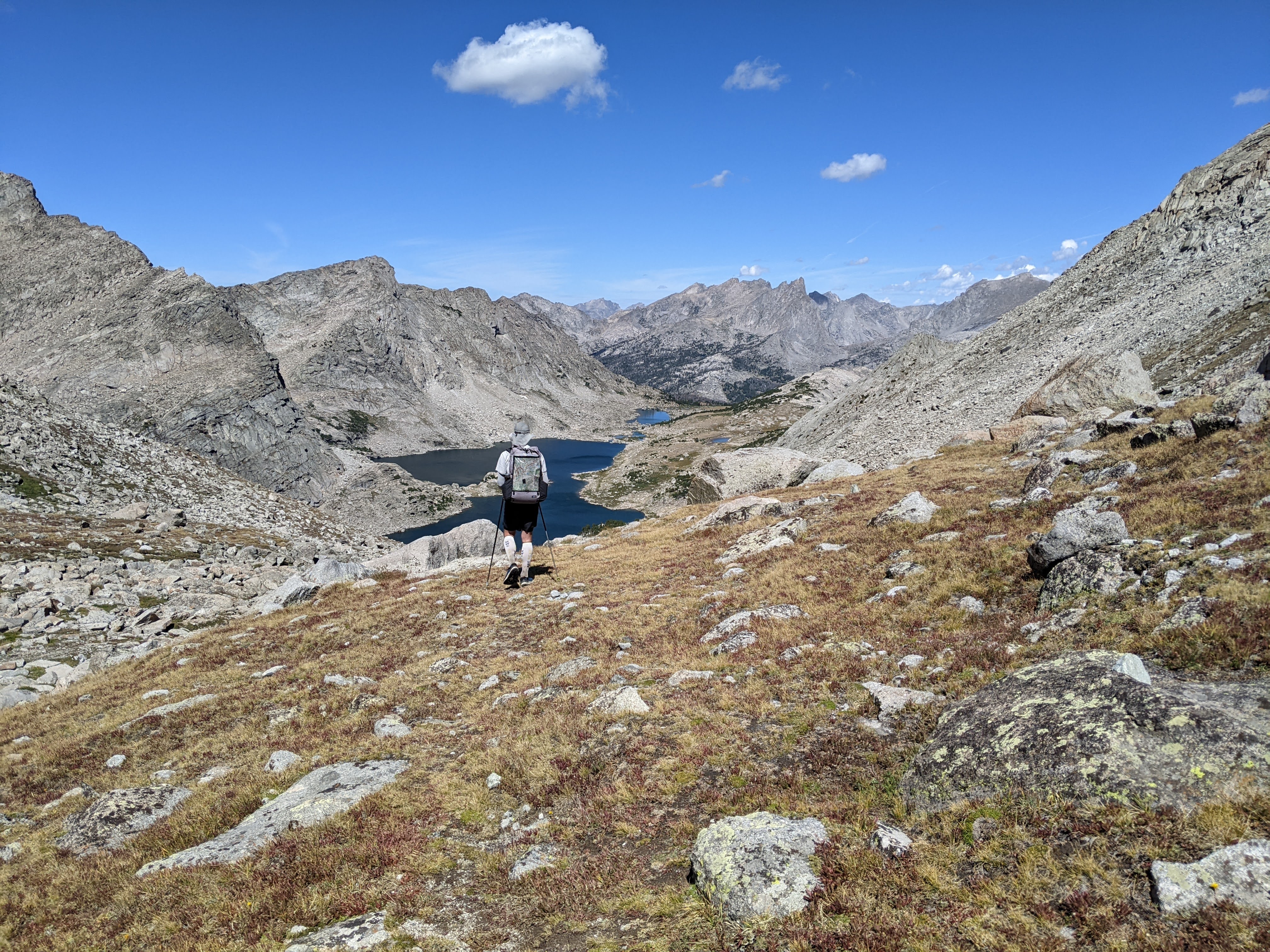
By the time we got down to Big Sandy Lake, we’d only seen a total of five people. This changed quickly as we got back on the popular route. The trail was much more worn and rocky. I made a bad decision crossing Black Joe Creek. I took the many channel route on rocks and by the last little channel, I lost my balance on a moving rock and got my feet wet. This was super frustrating to me as I’d debated a different route (which I then took and was super stable and easy, albeit slightly bushy) and Erik took the log “bridge.” I stopped and wrung out my socks and insoles and then was so mad at myself I ran to catch up to Erik. I caught him just as we began the climb up to Jackass Pass.
When we hiked down from Jackass Pass previously, we recalled taking the wrong trail and hence doing some bouldering around Arrowhead Lake. This time we were determined to take the real “hiking” trail. I also recall last time there were some threatening clouds so we were moving quickly down to Big Sandy Lake. Perhaps because of these factors, or perhaps merely because we were going down, I had it in my head that the trail was relatively easy. I didn’t find that to be quite the case this time. There were big steps and rocks and what seemed like a million people. I thought we were near the top of the pass but soon learned we still had one more lake. Here we took the farther east “hiking” trail rather than the “climbers” trail and found this one climbed quite a bit of elevation before descending and then finally climbing again to Jackass Pass. It wasn’t difficult, but certainly more demanding than I’d remembered.
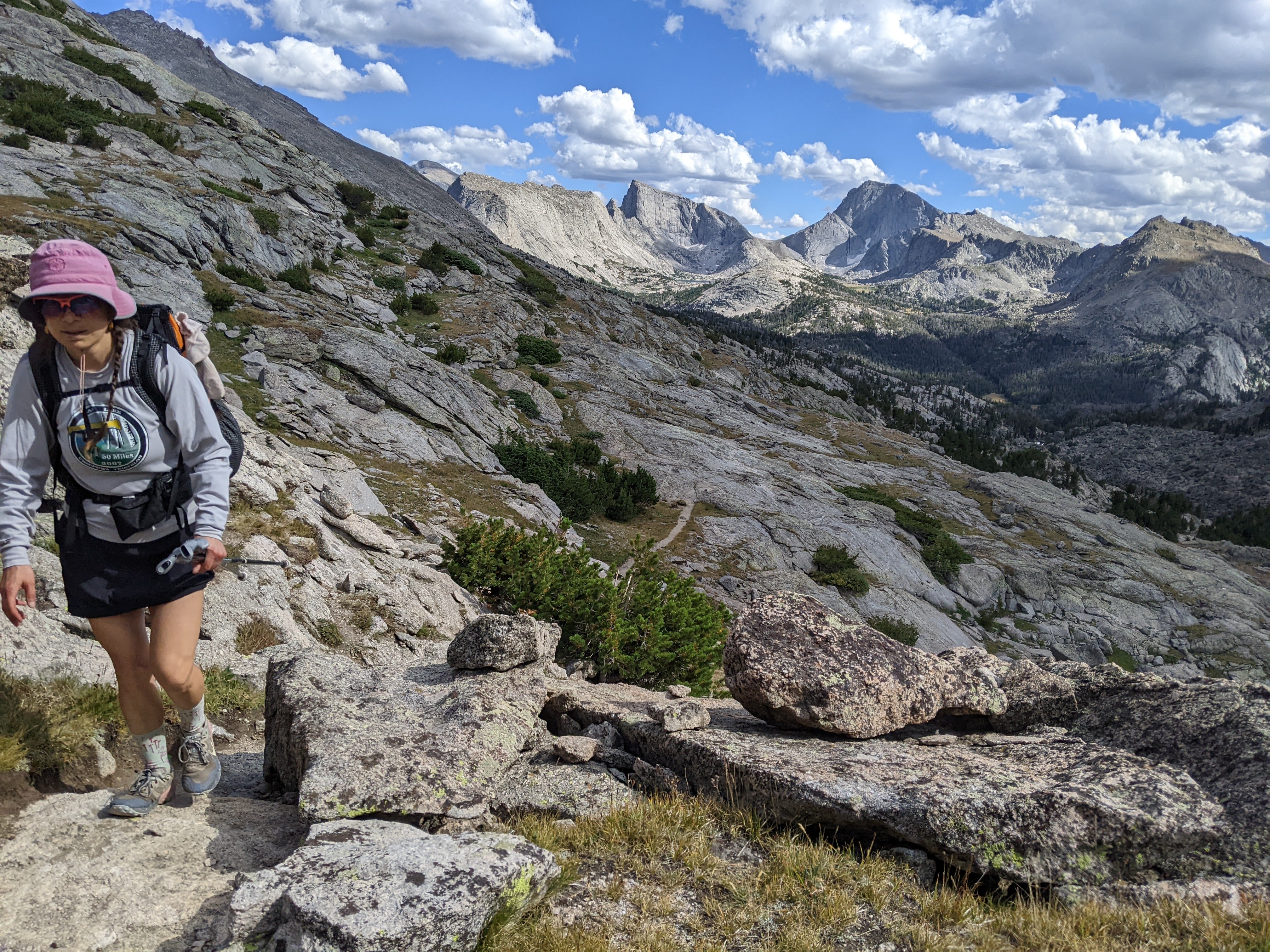
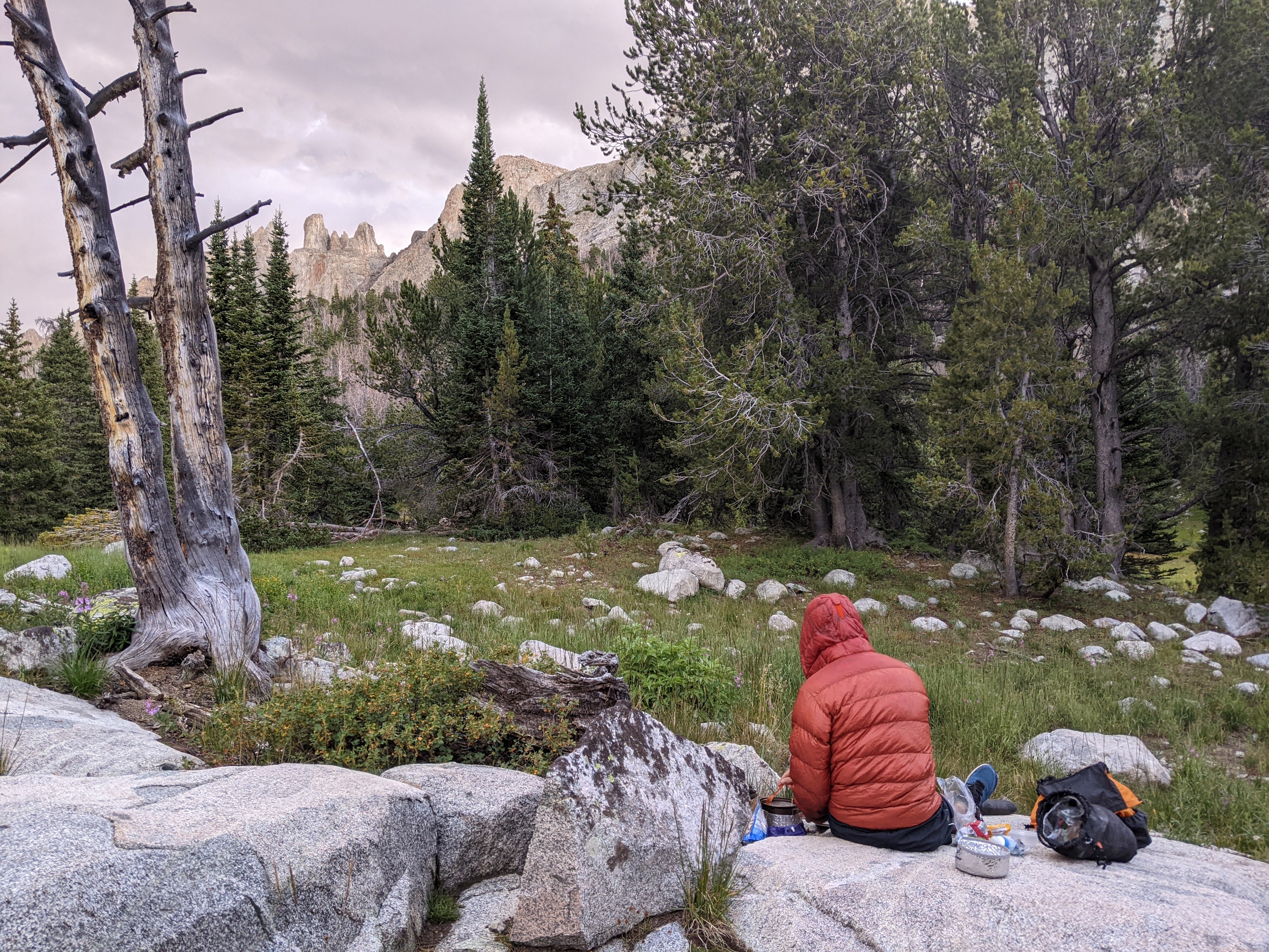
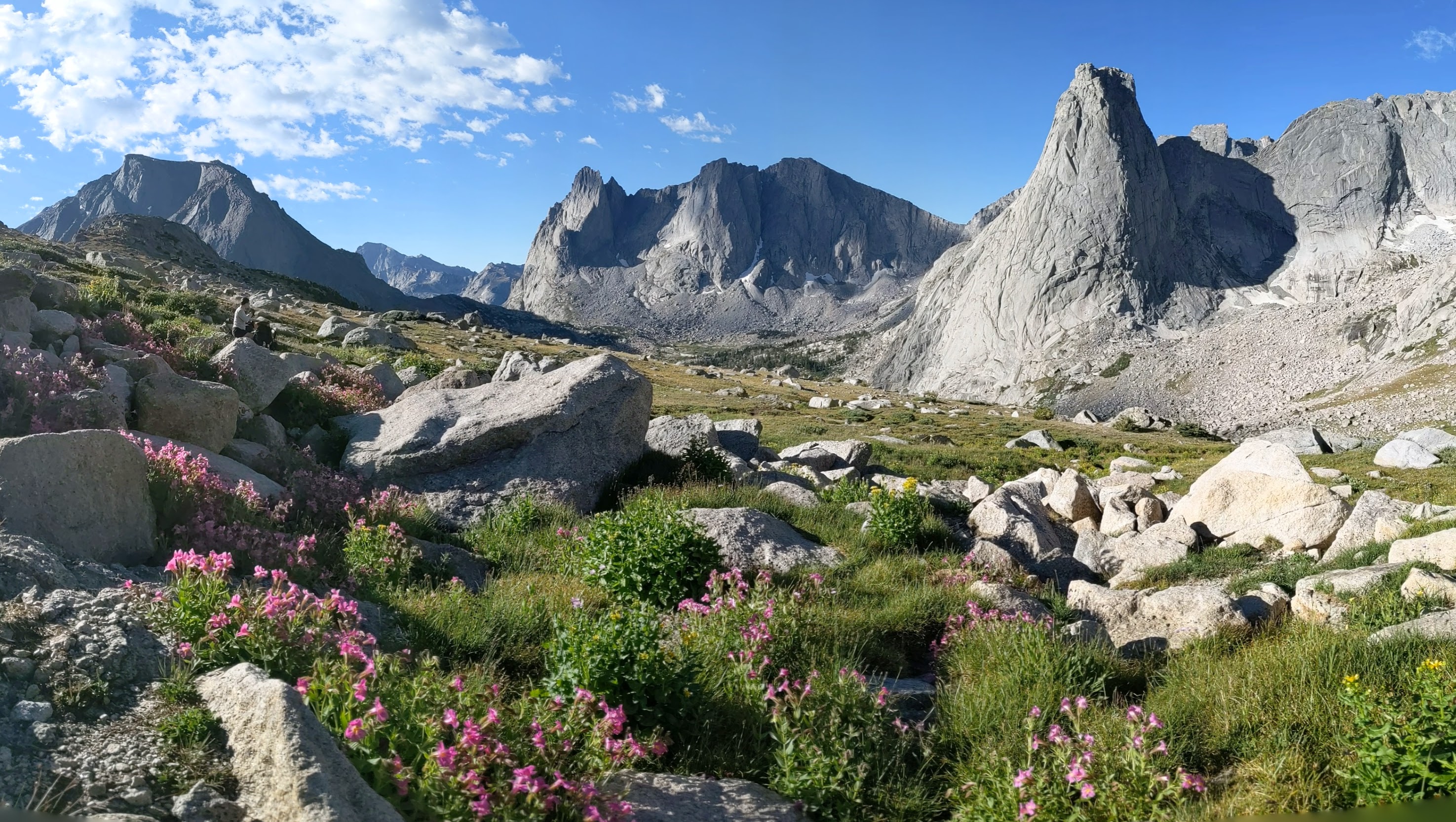
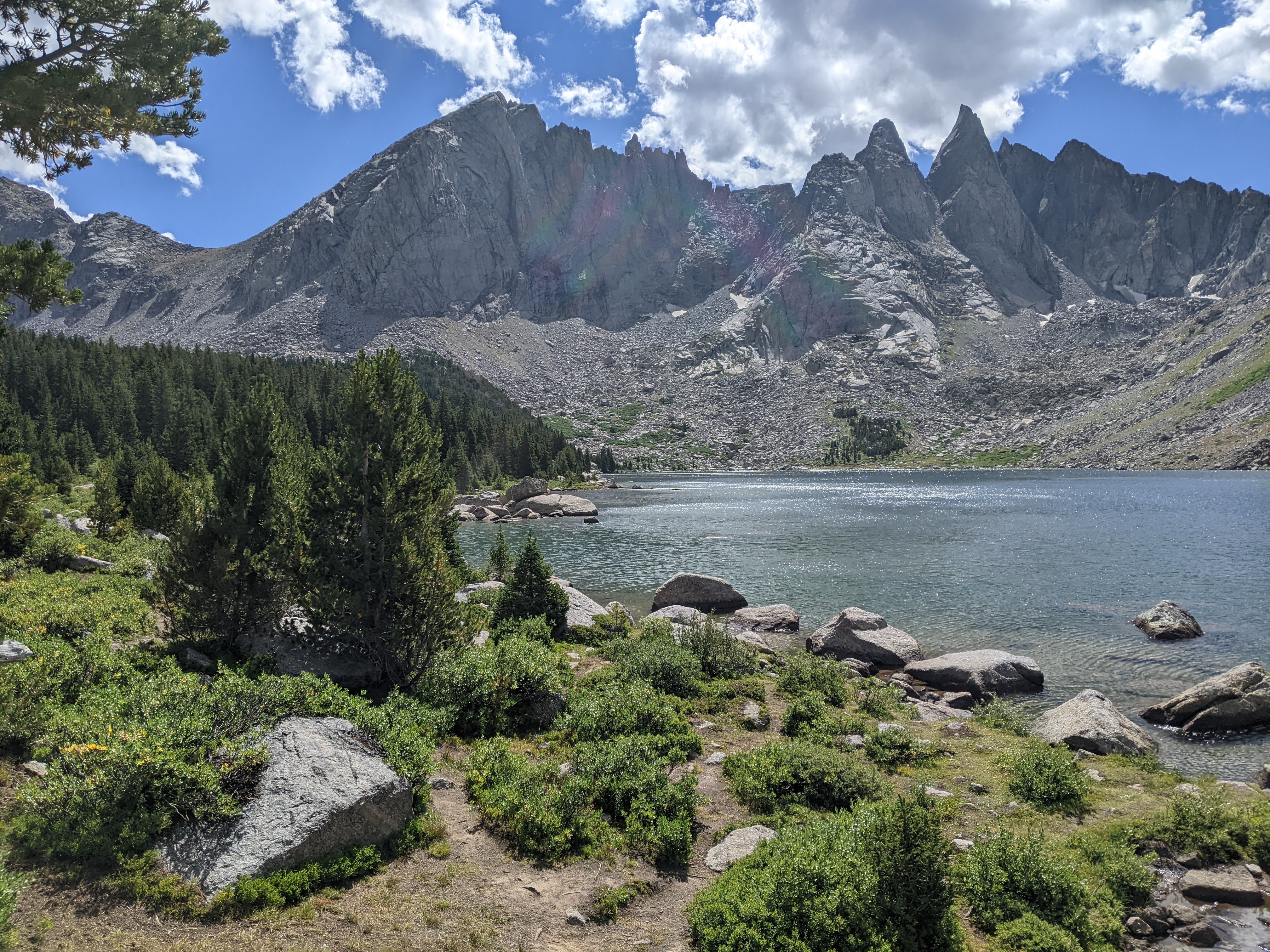
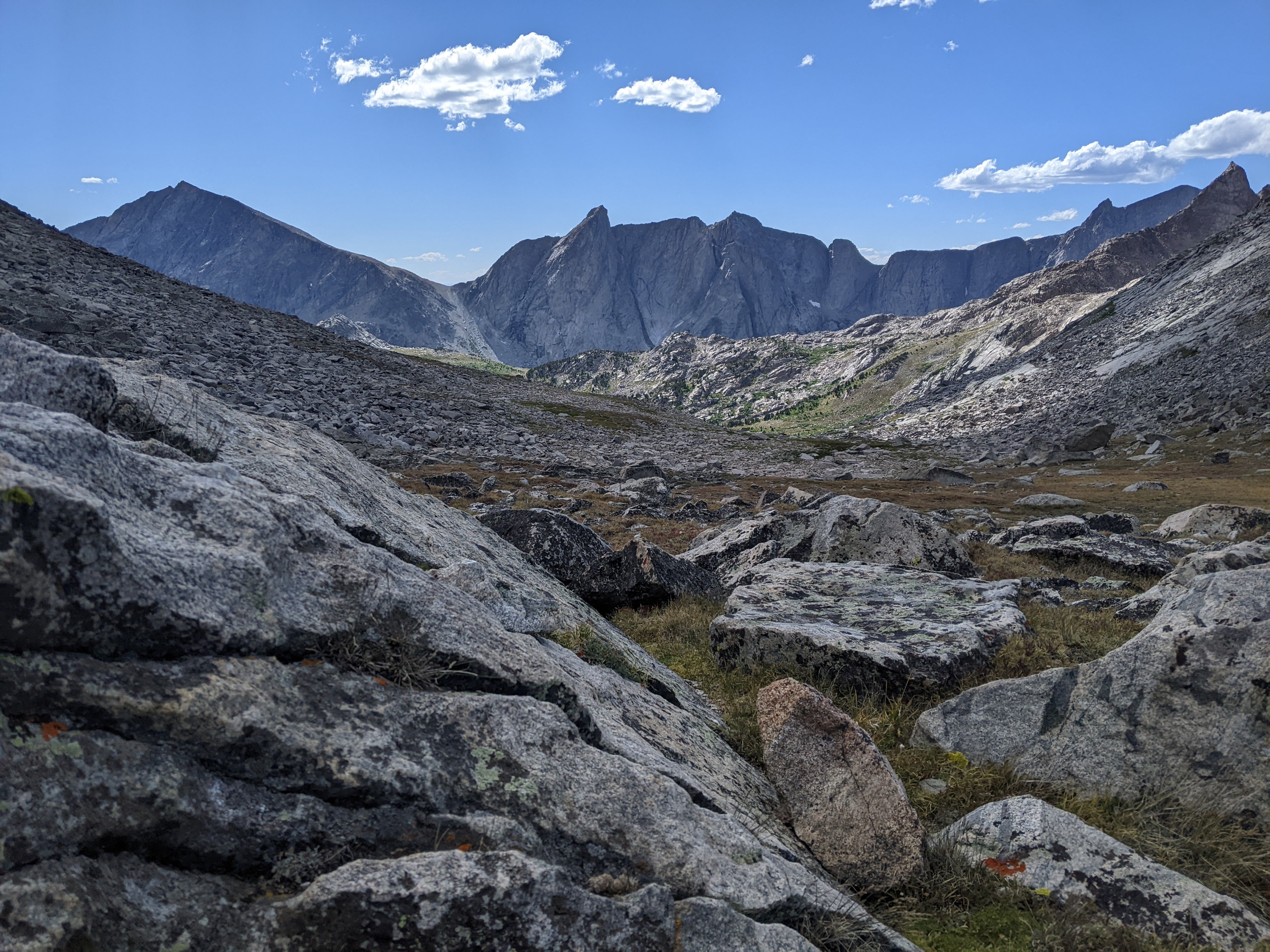
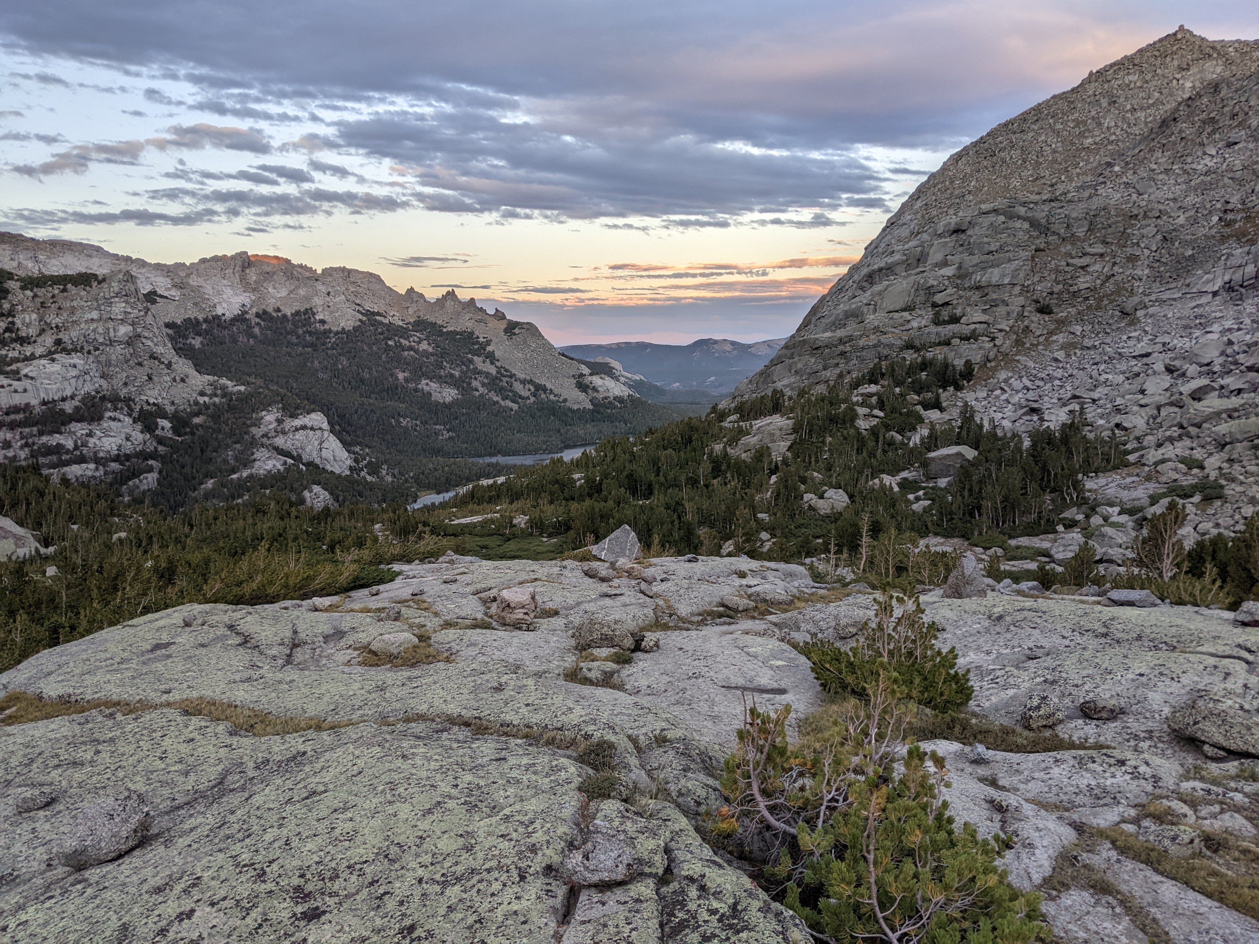
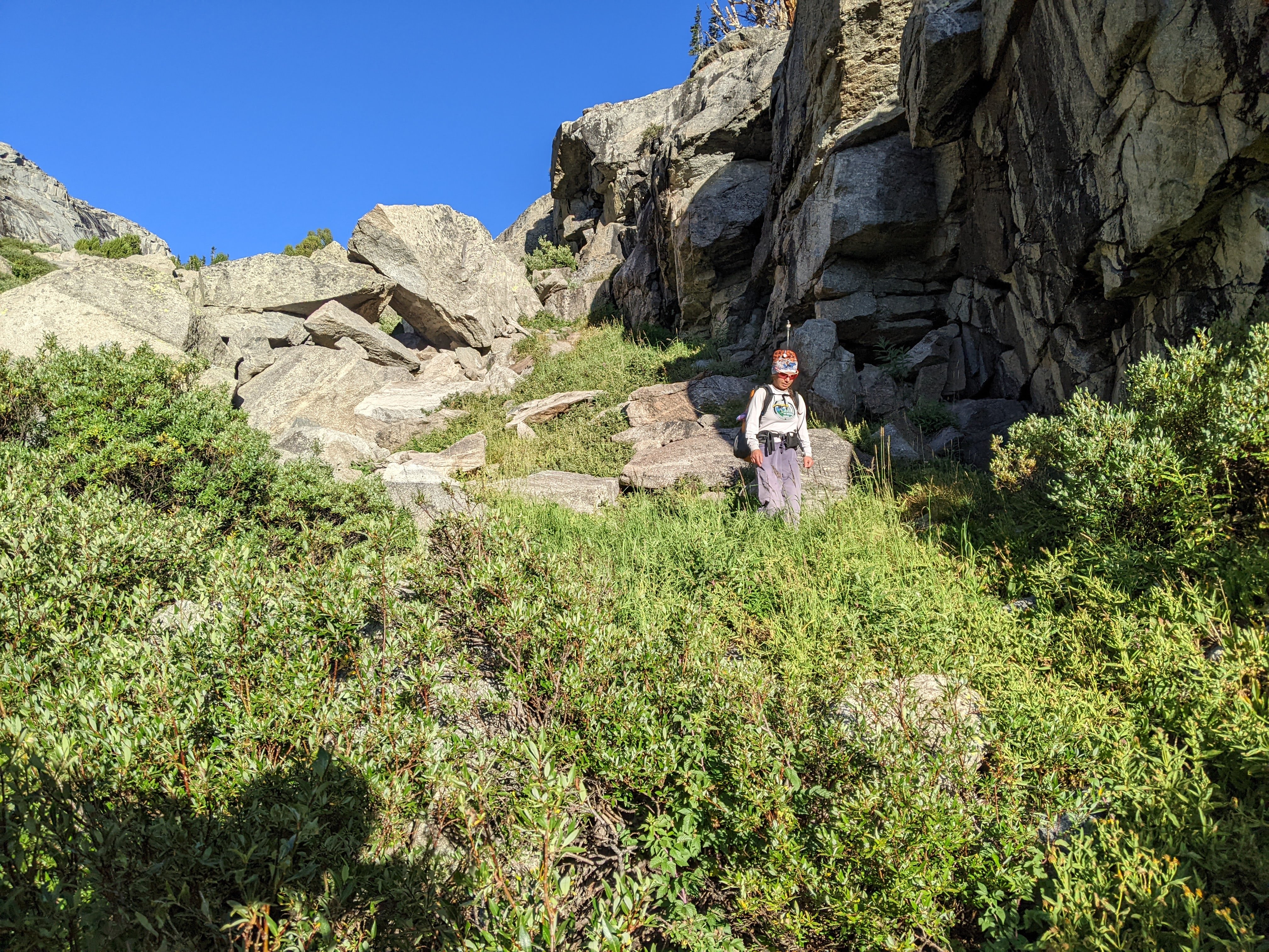
Once we got to Jackass Pass the impressive Cirque of the Towers opened up before us. It was only 4 pm but we’d already decided to not do Texas Pass. It took us nearly an hour to find a place to camp that was somewhat protected (the wind was blowing like crazy) and not near too many people. We ended up just about the required quarter mile from Lonesome Lake. After cooking dinner and setting up the tent, we found a small stream for rinsing off our faces and then enjoyed the scenery while lounging on some giant rocks.

Day Four 8/21/24: Cirque of the Towers to Grave Lake via Texas and Hailey Passes
Once again we woke early. The wind had howled all night and it had briefly rained but the sky was blue once the sun came up. After packing up camp and eating breakfast we regained the trail down to Lonesome Lake. There were definitely a couple big steps along the trail, although most of it was relatively easy. Then we started on the social trail along the north side of the lake. We’d had a good view of the route from the previous evening camp and knew we were heading for a small meadow that emerged from the lake with a few trails. This spot was on the cover of our map.
We made it to the meadow and weren’t sure what we were going to find but heading directly north found a social trail. There were a few branches here and after going up a gully for awhile, found a trail that headed northwest that we took. This was of course super steep but I told myself to just keep moving. Eventually we popped out to some more gentle terrain above treeline. Here the pink wildflowers growing along the creek were simply amazing. Erik stopped to poo and I took the opportunity to do a fancy braid in my hair. At this point we were merely aiming for the Twin Lakes to camp for the night so thought we had plenty of time.

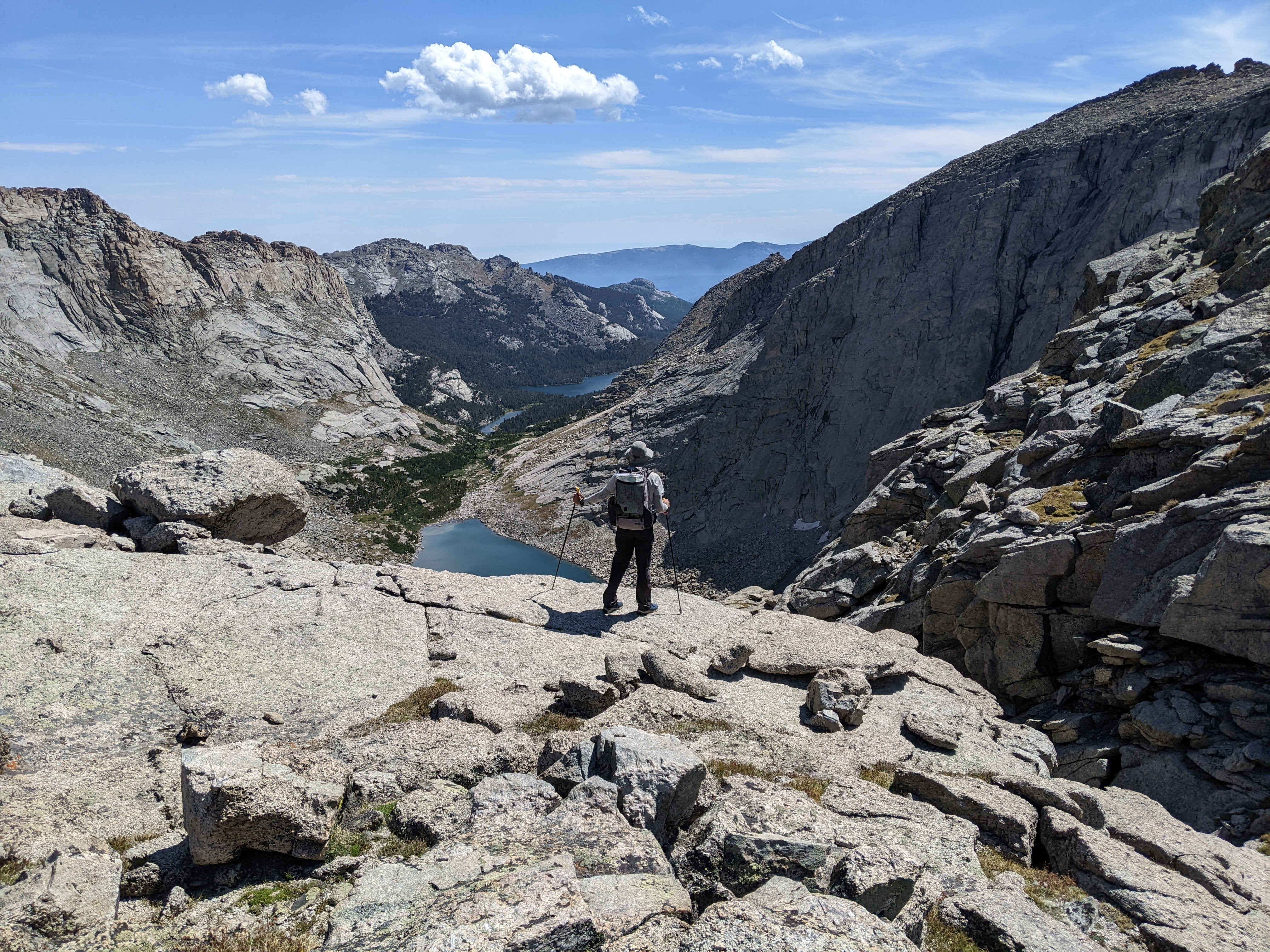
Eventually the meadow hiking ended and the trail took to some rock slabs, marked by cairns. The trail then briefly crossed a snowfield before we emerged on the summit. Erik likes to glissade, so we both did a number of runs before hiking to the pass where we talked a bit with a couple CDT through-hikers.
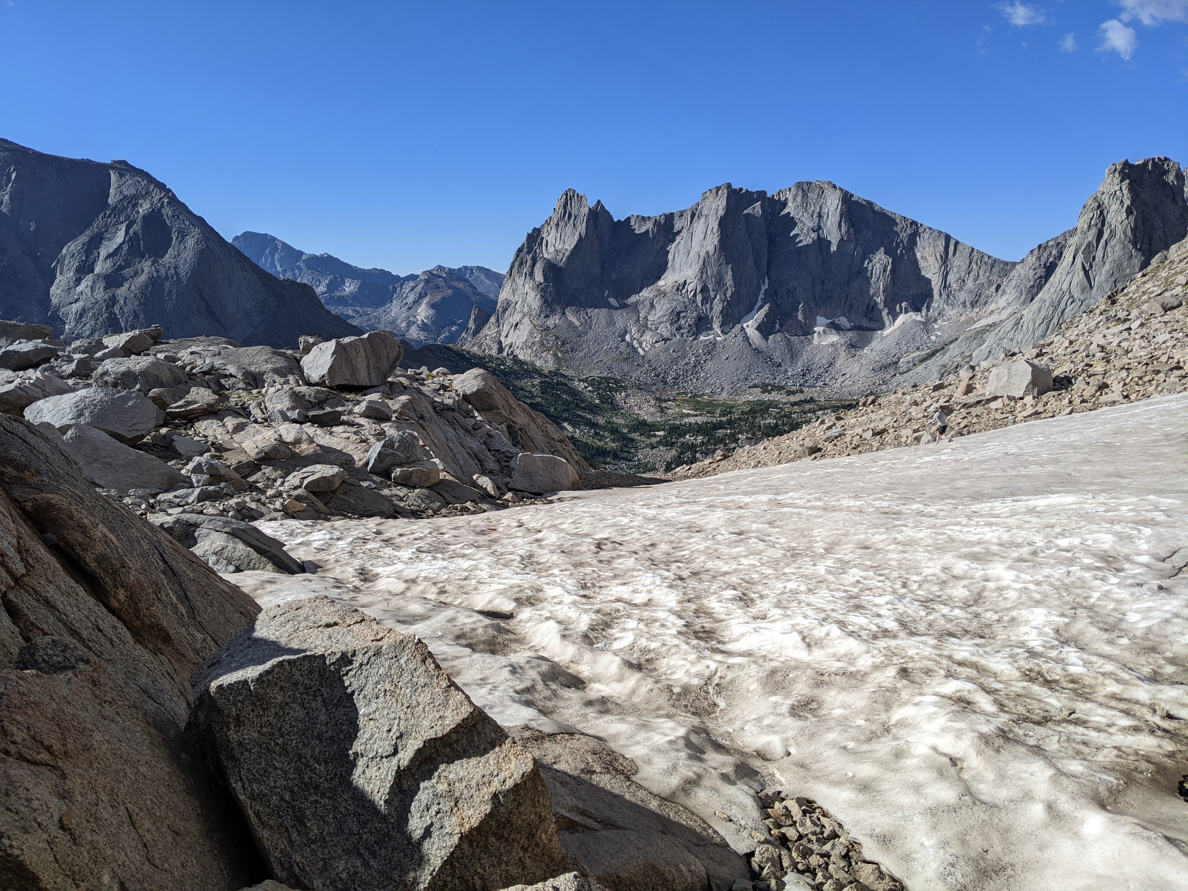
I was not expecting what happened next. Back in 2015 when we were here before, we’d hiked up to the north side of Texas Pass. We had a couple hours to kill from our campsite at Shadow Lake and I wanted to check it out. The pass looked a bit crazy and we had different route plans so we didn’t do it then. Zoom ahead to now, 2024. We began descending off the pass. There was an obvious trail that was again steep, often somewhat loose gravel. About half way down, we started encountering a lot of people heading up Texas Pass. There was a group of four, gallon jugs hanging off their packs. There was a couple with big backpacks. Another group of three. A through-hiker passed them all up. And more people kept coming up the trail. I was super surprised to see so many people on such a rugged trail, but then I remembered how steep the official trails are in Alaska’s Chugach State Park and realized perhaps I’m just Minnesota wimpy.
From the time we left camp to to reaching Texas Lake it took us three hours. Sure, we could have done this the previous evening but we probably would’ve been slower as we were more tired. We had lunch at Texas Lake while we watched a group slowly navigate the boulders along the lake. They seemed to be struggling some and yet they were Texas Pass bound. After our lunch, I was determined to hike quickly through the boulders. It was easy. But then we kept encountering group after group heading up to Texas Pass. Like everybody and their brother. I just couldn’t believe it.
As we descended to Shadow Lake, we took in the views. I was particularly intrigued by New York Pass, thinking every time I ought to do something harder and if everyone is doing Texas Pass, then I should do New York Pass. We found an amazing camping area on the peninsula of Billy’s Lake. Then we proceeded down to Shadow Lake where we stopped awhile to look at the backside of the Cirque.
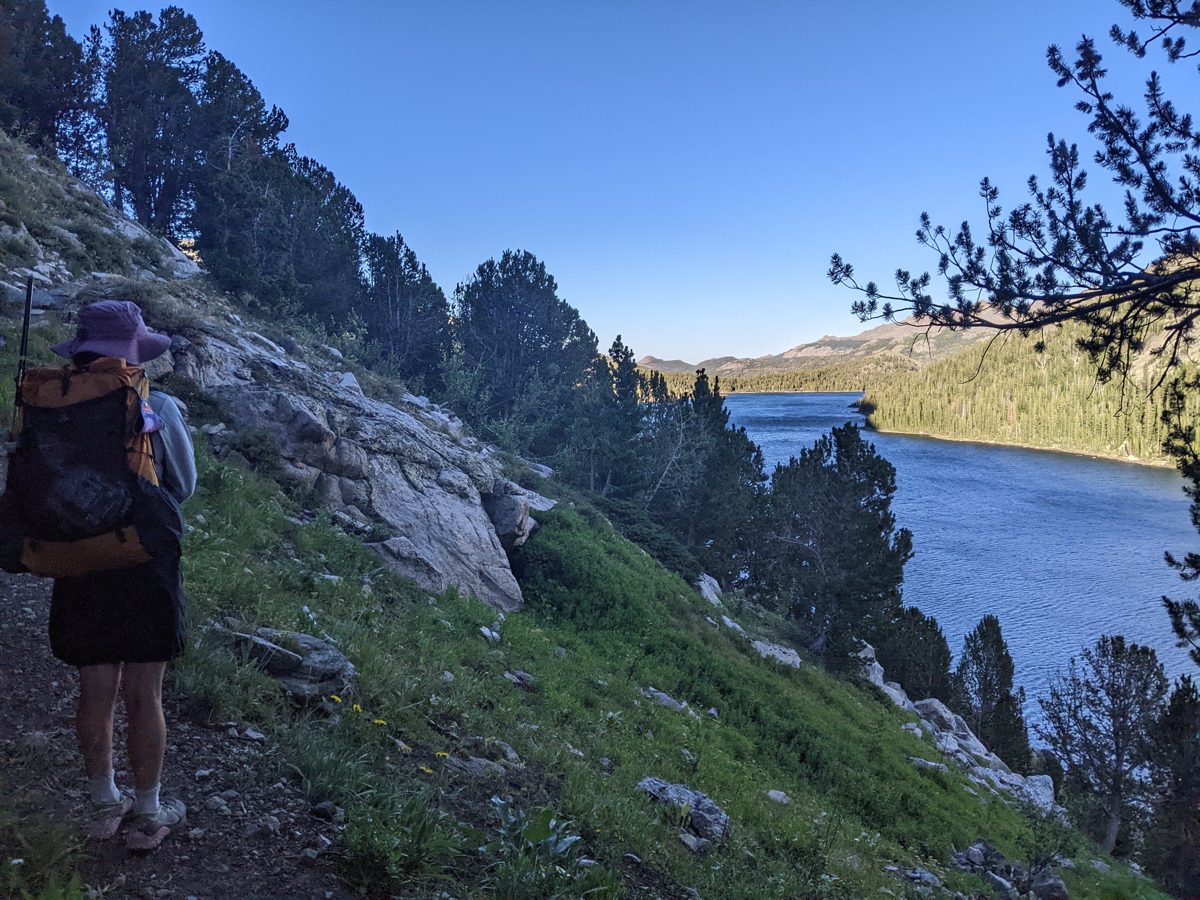
The trail west out of Shadow Lake is boring and I was determined to keep up a quick pace, which we did. It’s an hour or so back out to the trail that heads north towards Washakie and Hailey Passes. We’d been on this section before but I didn’t remember the specifics. We stopped for lunch after crossing Washakie Creek where we found both shade (for Erik) and a vista (for me).
Then we got back to hiking. After the trail branched off to Washakie Pass we started seeing some new sights towards Mount Hooker and Pyramid Peak — which we were tentatively planning to climb the next day. At the intersection of Hailey Pass Trail and Pyramid Lake trail, we dawdled. It wasn’t even 2 pm yet. Should we hike out and back to Pyramid Lake? Finally we decided to proceed up above Mae’s Lake and find a camping spot where the creek crossed the trail.
It was 2:30 pm when we were looking for a sheltered tent site above Mae’s Lake. This was really too early for me to quit for the day. Finally Erik suggested we get out the maps and add up some mileage and see how much farther we had to go until we met my mom. Once we did this, we realized that if we didn’t keep going down to Grave Lake today that we were going to have a very very long day two days later. The bummer about all this meant that (1) it was crazy windy and time was running out to climb Pyramid Peak and (2) our guidebook showed an amazing beach at Grave Lake that I wanted to hit in the middle of the day.
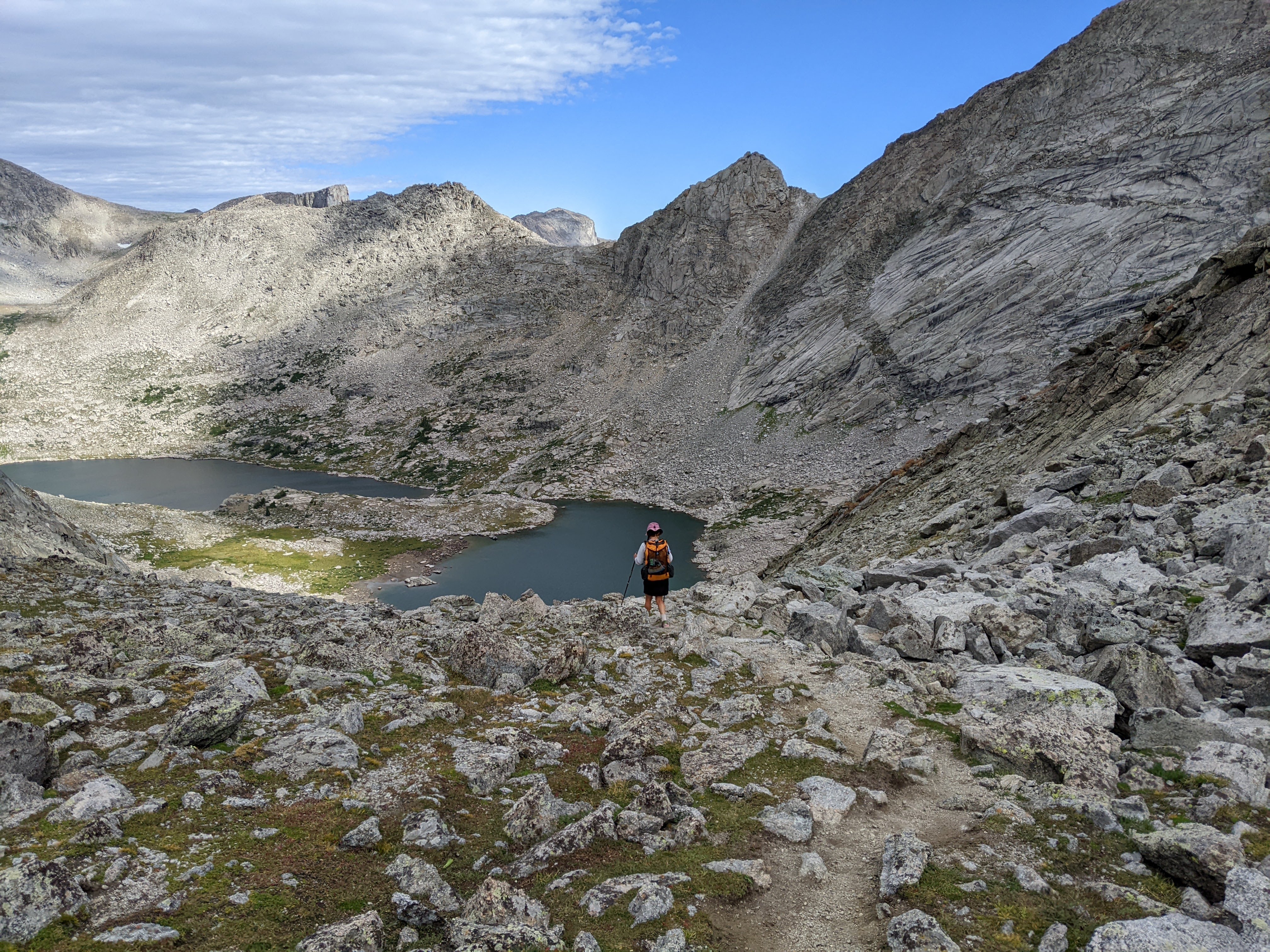
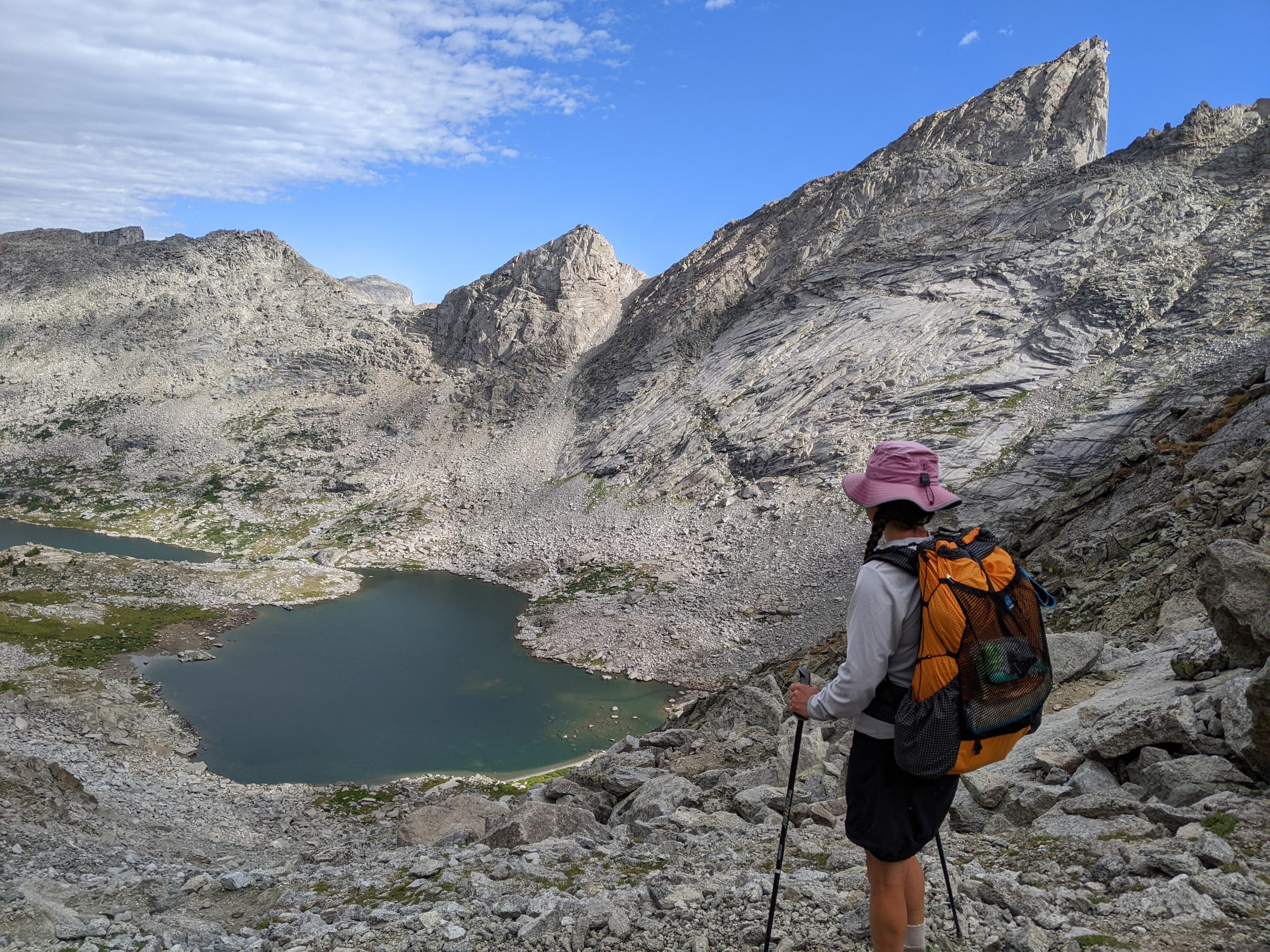
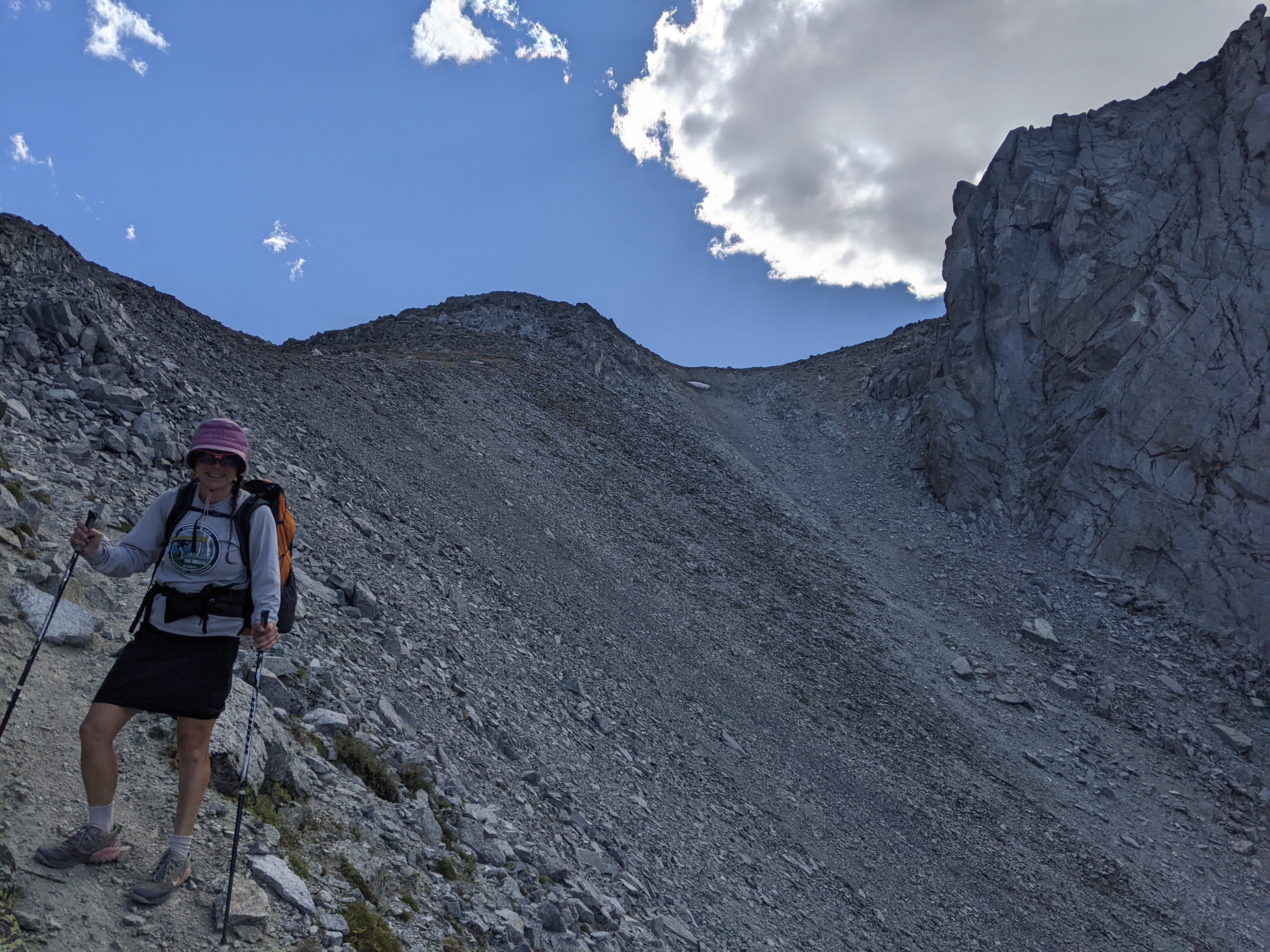
Now with summit plans, crazy wind, and darkness in 5.5 hours, I took off hiking at quite a brisk pace. The wind was whipping like mad out of the south. I had been eyeing the Twin Lakes, just to the south of Hailey Pass, as a good place to camp but in reality the lower lake was completely lined by rocks and the trail even climbed high above the lake to avoid a cliff section. There would’ve been some camping potential along the north and northeast sides of the upper Twin Lake but it was all quite barren and very exposed. We stopped to get water and have a snack between the two Twin Lakes. The wind was so ferocious it blew up the water in the small creek onto my legs. Hailey Pass from the south side is a mere bump on the horizon and soon we were on the pass. I thought we’d immediately turn west and start going for Pyramid Peak but Erik wanted to stop and contemplate our options. I suggested that we at least reach the next higher pass between Pyramid and Hooker. Erik agreed so we took off walking. It was so windy I had to keep my head down to brace. With my hat on, I almost ran into a large rock. If I wasn’t careful, the wind would place my legs where it wanted, not where I did.
The terrain got steeper and steeper and there was a small cliff band just before the pass. I was leading and found a grassy gully to climb a bit farther to the south between the cliffs. When we popped out on the pass I wanted to keep going to the summit but we could see the remainder of the way were boulders, some quite large, and Erik said it was too windy and we didn’t have enough time to continue even though the summit would’ve only taken us another 30 minutes. But we would’ve spent a bit of time on top and then we’d have to scamper down. We noted the grass down to Pyramid Lake looked nice for some off-trail hiking.

We descended back to Hailey Pass and then dropped off the significantly steeper north side which our map says is “impassable to livestock.” It was definitely very steep and a bit loose, similar to Texas Pass. At the very bottom of the steep section Erik went over to try glissading on a snowfield which he reported wasn’t very good. As we followed the stream downhill, I suggested we stop and cook dinner as we were both hungry. We found a relatively wind sheltered area and felt better after eating.

After dinner we kept hiking down the valley towards Grave Lake. There was a stream crossing of Bapstiste Creek. The small rock hopping didn’t look possible. Erik bushwacked upstream to find a large rock hopping crossing. I followed him for awhile until his route became both bushy and rocky and I retreated, deciding to ford the stream. By the time I had my shoes and socks off, Erik had already completed his crossing with dry feet. I’ve certainly done a number of stream crossings in my day but for some reason I forgot how slippery the rocks can get and tried to treat this more like I was rock hopping. Hence, my foot slipped off the top of a submerged rock, I couldn’t get my balance with my other foot or poles, and I took a super slow fall into the shallow stream as I heard my right pole crack. I only got my right butt cheek and forearm wet but now without my right pole I was completely flailing for the remainder of the 20 foot crossing. I mostly leaned over, holding onto the bigger above water rocks in the stream.
I was super upset with myself for falling and breaking my pole. I didn’t care so much that I was a tad bit wet. It was warm enough. I’m just a perfectionist and I don’t like to fall over my own stupidity. This was twice in two days and now I’d have to hike the next three days with only one pole.
I sat on a rock and put my shoes and socks on. Erik tried to be helpful. I should’ve followed him and done his rock hopping just as I should’ve followed him the previous day.

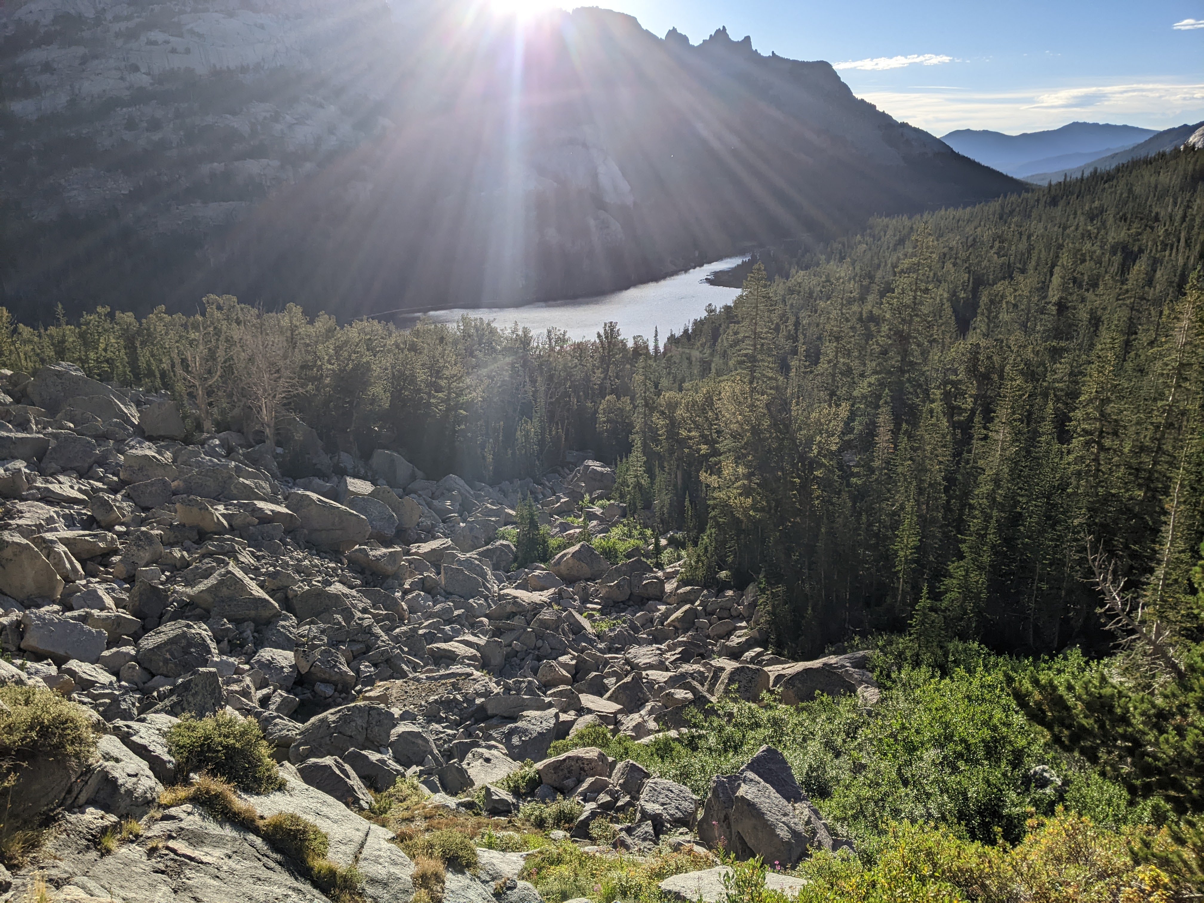
We continued on down to Grave Lake, passing a big waterfall that was very obstructed by trees. Once we got almost down to Grave Lake, the trail climbed again to skirt the big boulderfield off Grave Lake Dome. Finally the trail descended once more. We almost stopped to camp at what appeared to be a very sheltered spot just before the unnamed creek that drains the backside of Grave Lake Dome but I wanted to keep going a bit farther. As soon as we did, we got out of the wind protection zone and the trees tops swayed like mad creating quite the commotion.
After we crossed Grave Creek, which was a difficult rock hop, we searched for a camping spot. The first giant beat-down area was taken so we kept going until we found something suitable. By now it was almost 8 pm so we got the tent set up and brushed our teeth and went to bed.
Day Five 8/22/24: Grave Lake to Cathedral Lakes Area
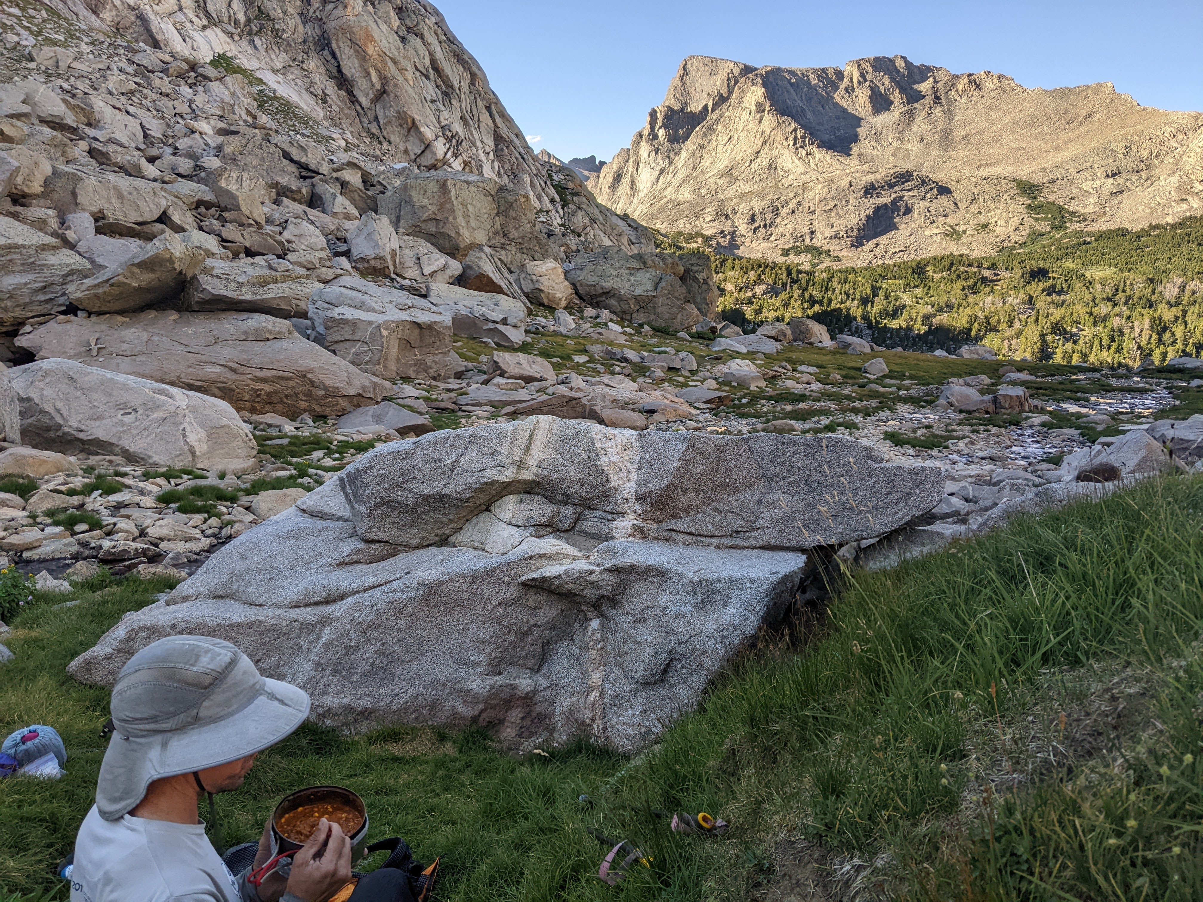
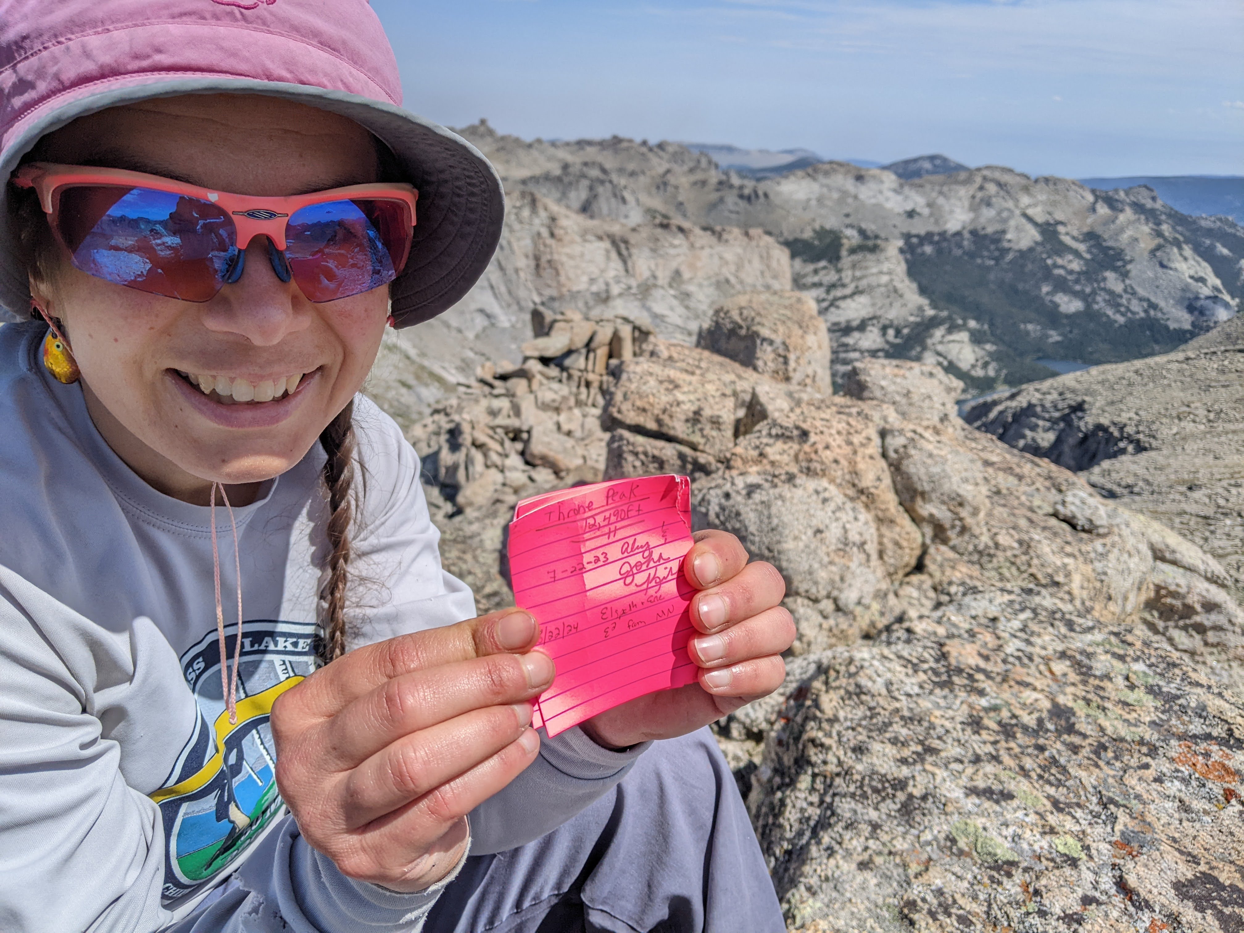
The wind finally died down overnight and we woke to quiet. I said we needed to get going ASAP while we had a calm window even though it would be several hours until we were doing our summit and surely the wind would pick up by then. Today I was planning on an off-trail route that would have us leave the Lizard Head Trail, climb up the peak at 12,490 feet, then descend on a plateau between the Cathedral Lakes and the upper Cook Lake Basin before heading down a ramp between the Upper and Lower Cathedral Lakes. This morning was by far our coldest and I wore all my bottom layers as we packed up camp and ate breakfast. We got out of camp quickly but then stopped at the end of Grave Lake to brush our teeth and shed layers. Just as our guidebook had showed sand beaches, we found two such beaches at Grave Lake. It was too bad we still had some miles to go and it was so cold so we didn’t want to go swimming. Next time.
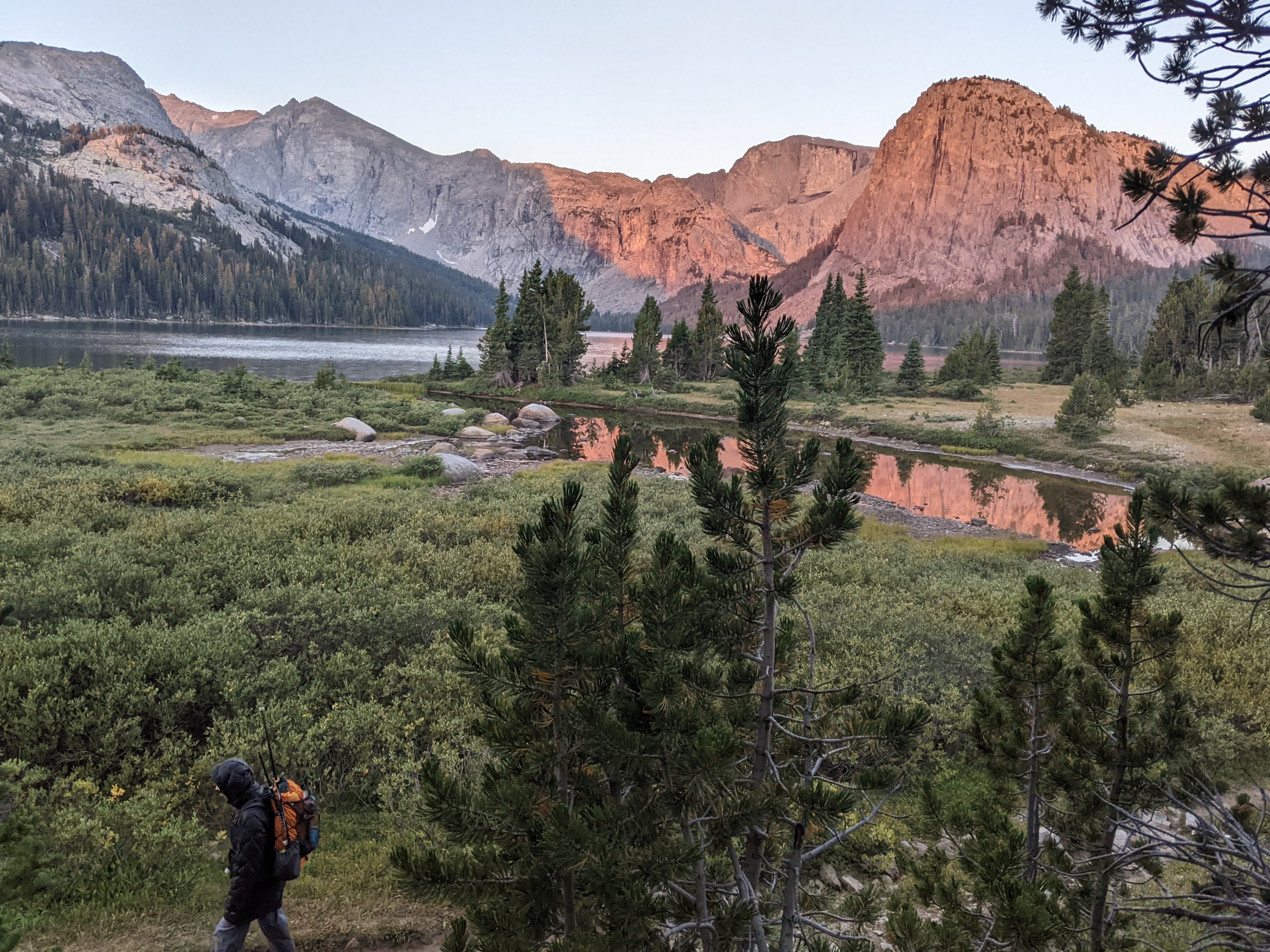

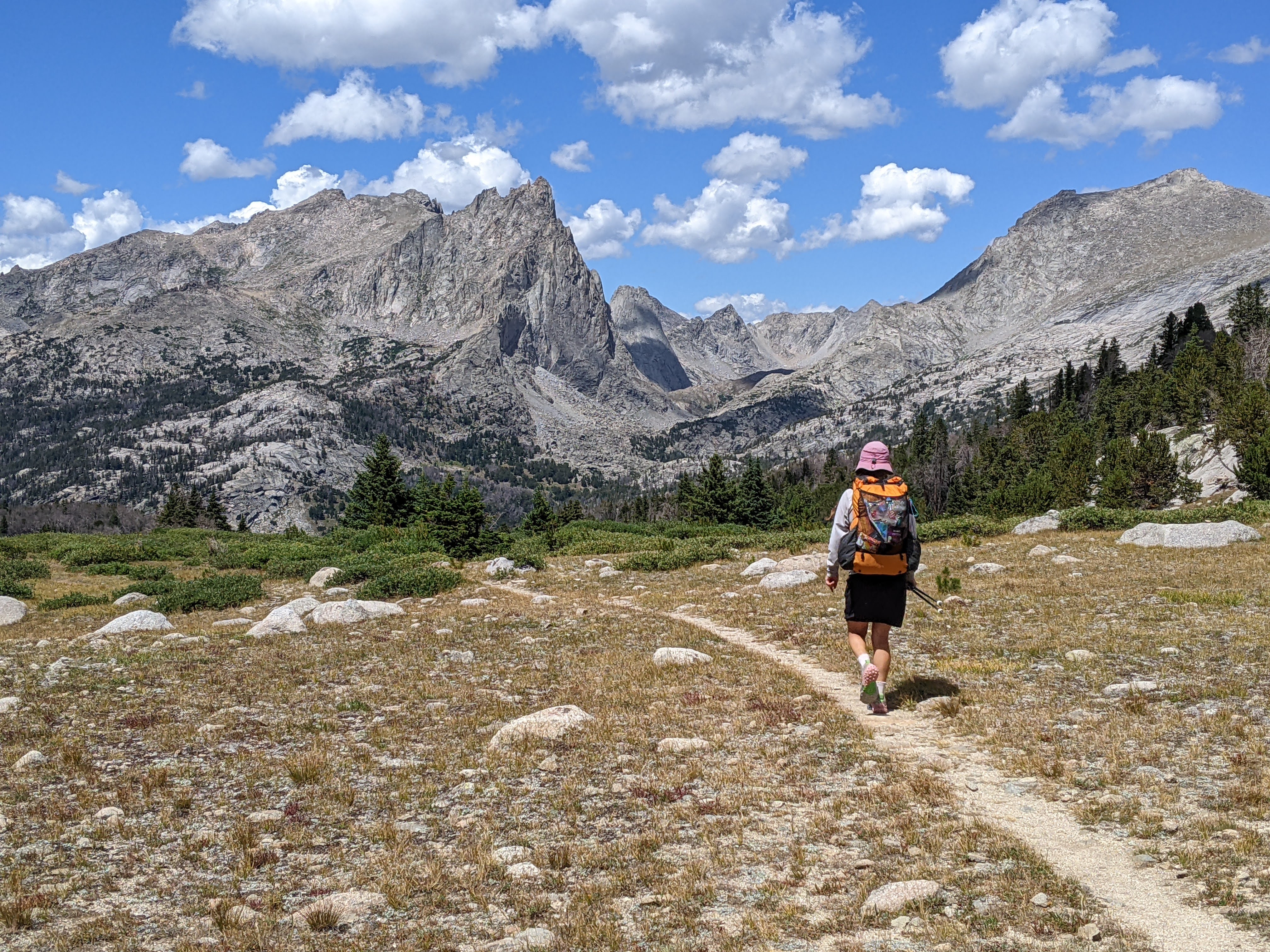
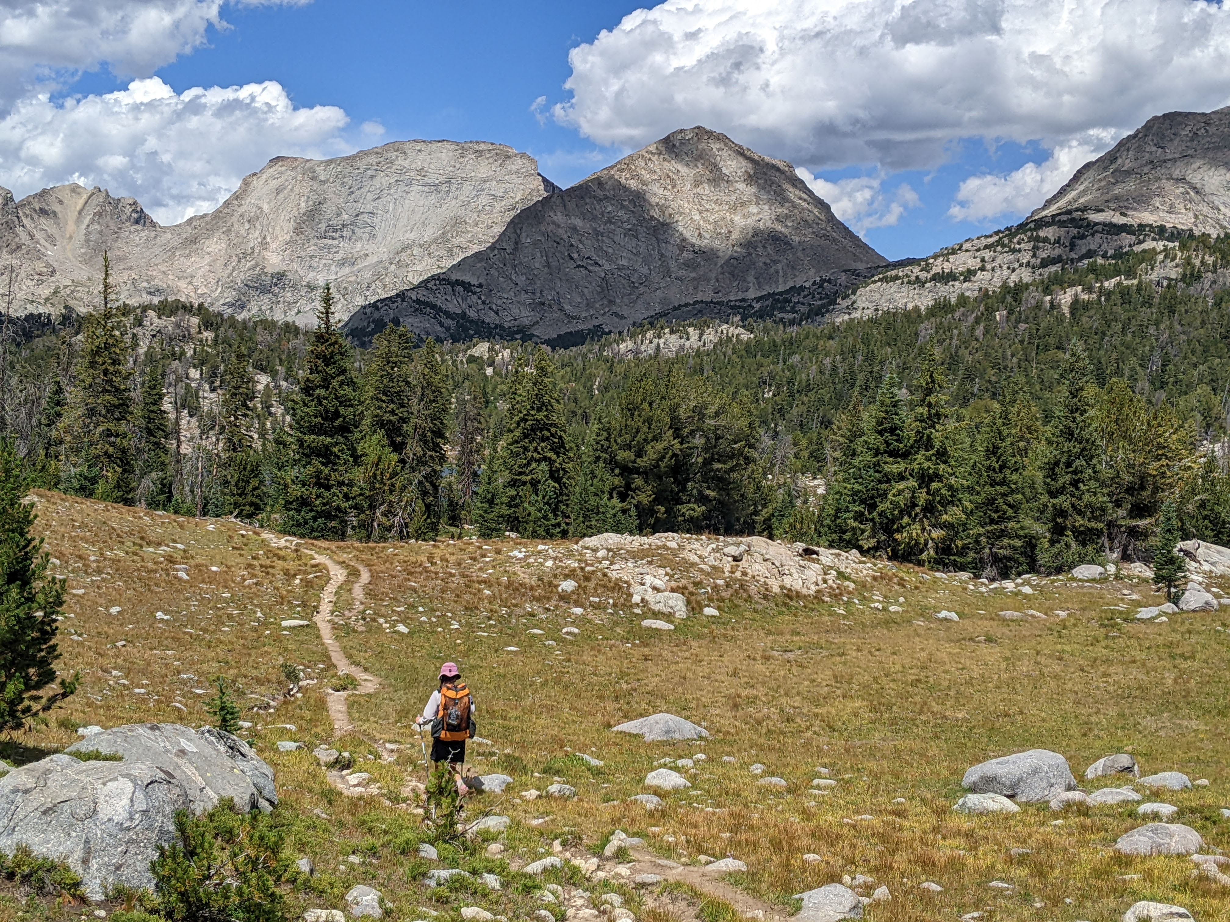
I led with a brisk pace and we flushed out an elk from a small meadow before we met up with the Valentine Mountain Trail. From here we had some good views with meadow hiking before the junction with the Bears Ears Trail. We’d done the next part nine years prior. I didn’t quite remember the ford of the South Fork of the Little Wind River. I was determined to be patient after the past two days of stream crossings. And I was ridiculously so, sinking my bare feet deep into the rocks with each step until they rested in a stable position. Erik crossed like three times faster while my feet started to pain in the chilly water. We dried our feet, put our shoes and socks back on, and began the long climb up the Bears Ears Trail.
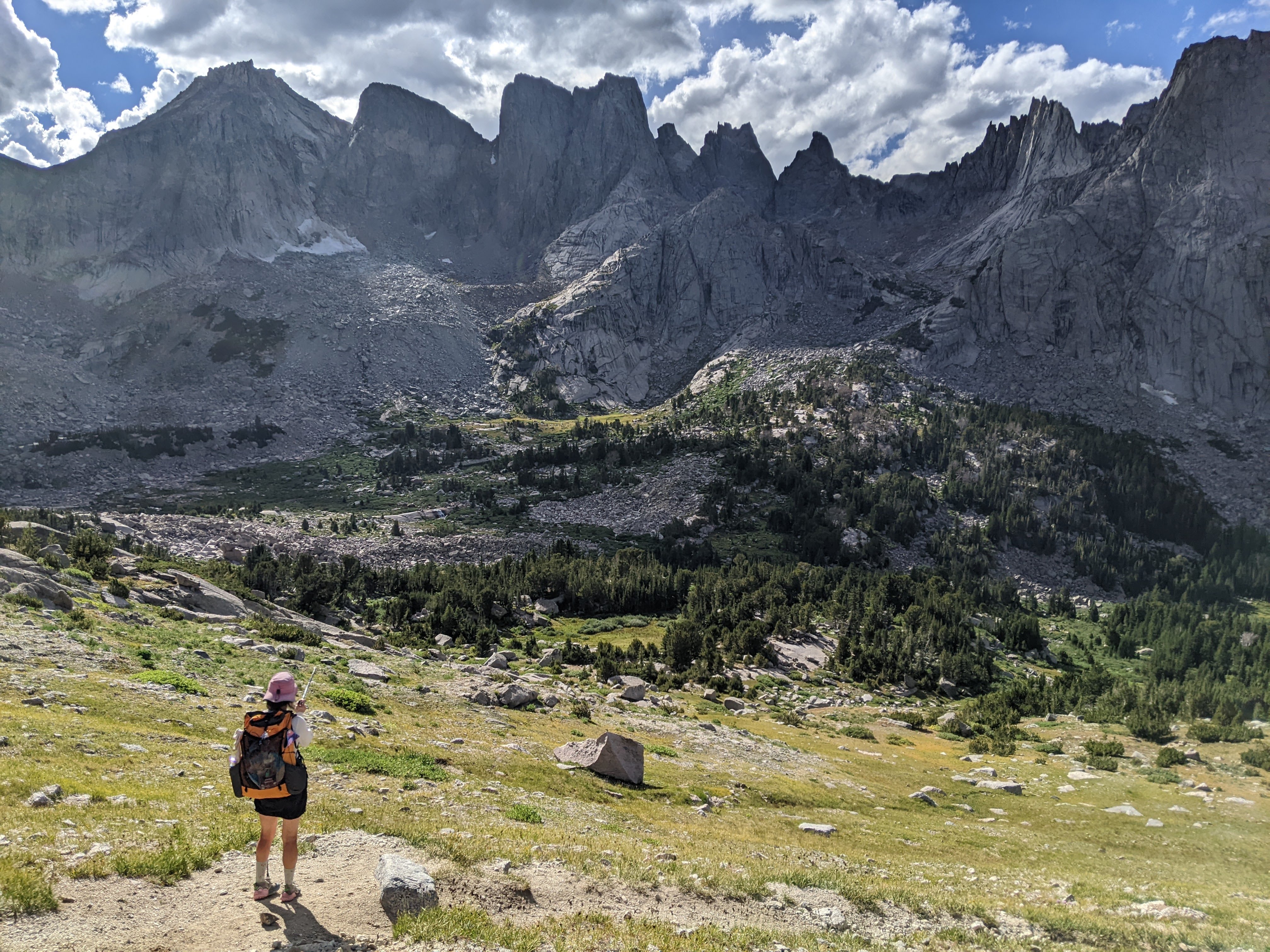
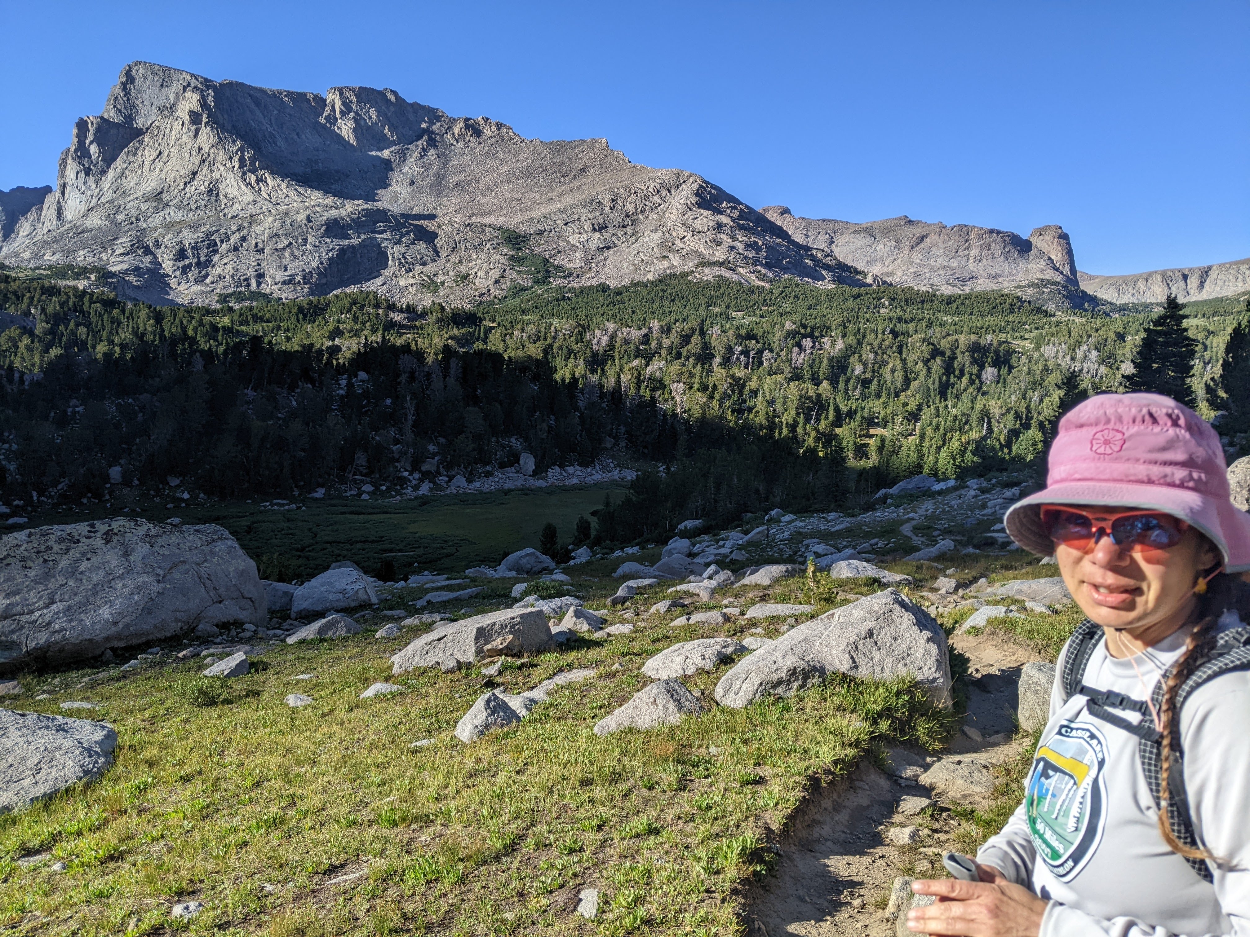
While I certainly remembered some of this trail, much of it I’d forgotten. Previously we’d camped on the west side of Valentine Lake. As we briefly stopped to take in the sunny view at Valentine Lake, I realized one of our screensaver photos that I couldn’t place had actually been taken at Valentine Lake. Last time we’d done Cathedral Peak and this time we noted how it has a temple shape on top. We stopped for first lunch with Cathedral Peak in view. As we ascended the final upper meadow, Erik headed over to the creek to fill up on water while I proceeded up the incredibly worn Bears Ears Trail. Even though the grade wasn’t steep, there were so many loose rocks on the trail I couldn’t cruise and really had to pay attention to every foot step. Meanwhile Erik took a more direct route on virgin alpine meadow and made good time on me.
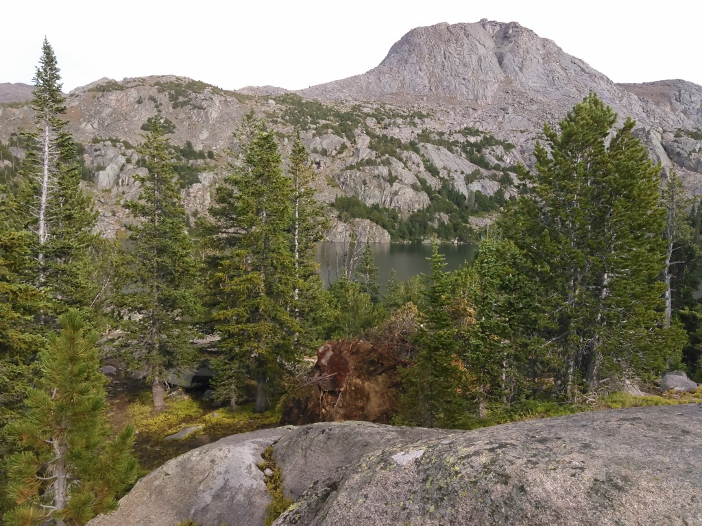
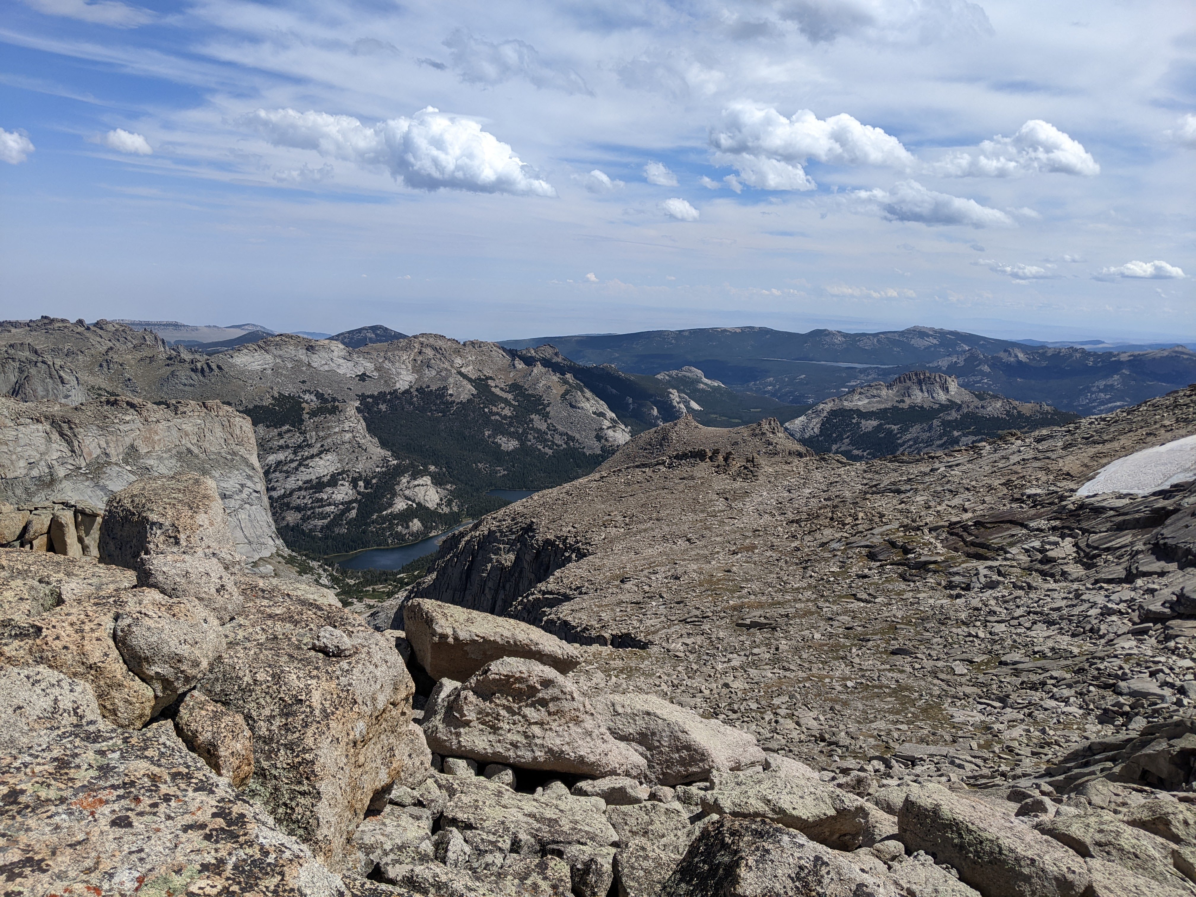
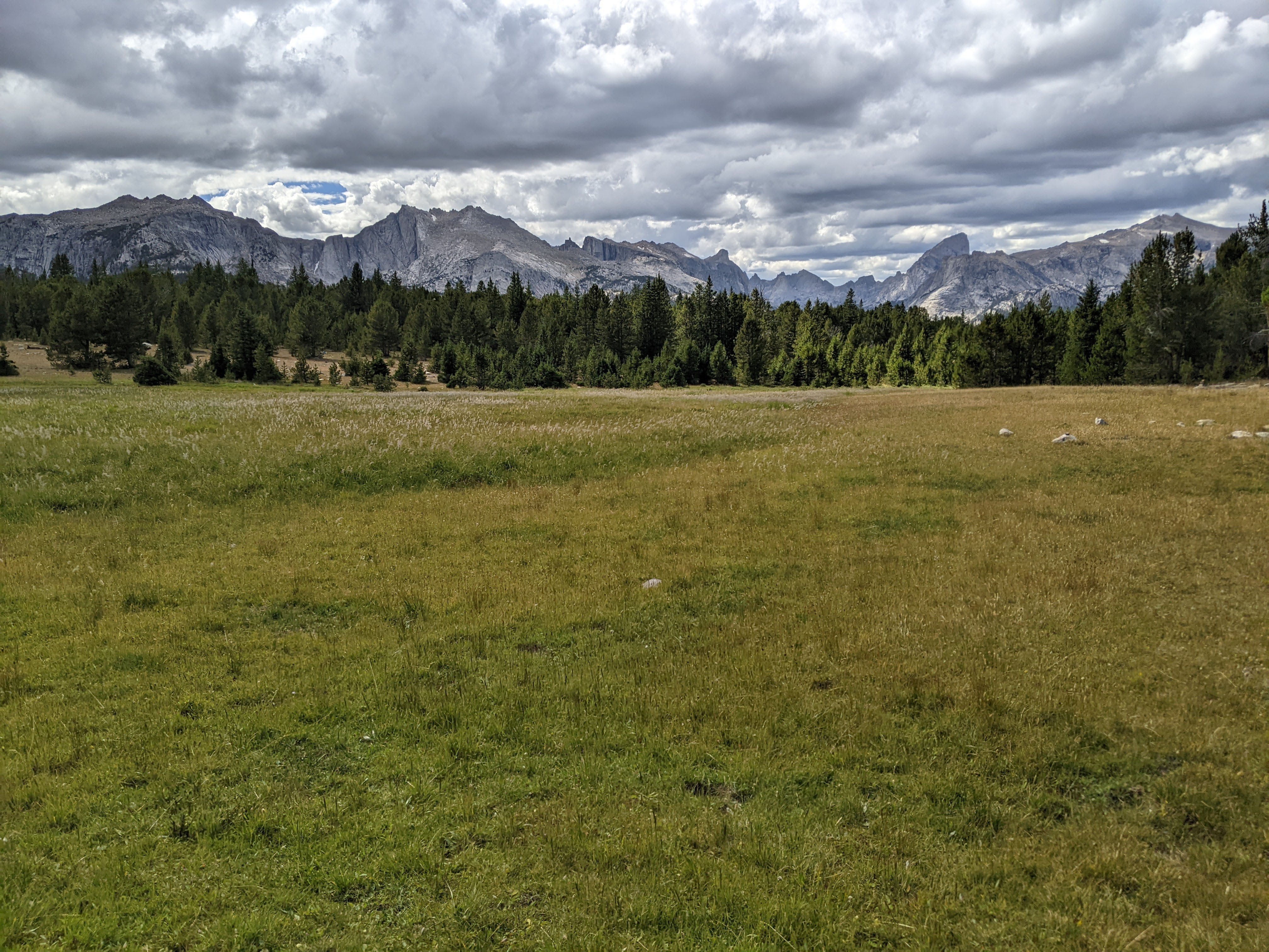
By the time we were at the junction with the Lizard Head Trail, we’d only seen five people all day and we wouldn’t see any more. We hiked up onto the Lizard Head Plateau and took in the amazing view. Apparently everyone is doing Texas Pass and Cirque of the Towers but to us, the Lizard Head Plateau is every bit as stunning. Plus it provides a vista of the glacier on the north side of Lizard Head Peak.
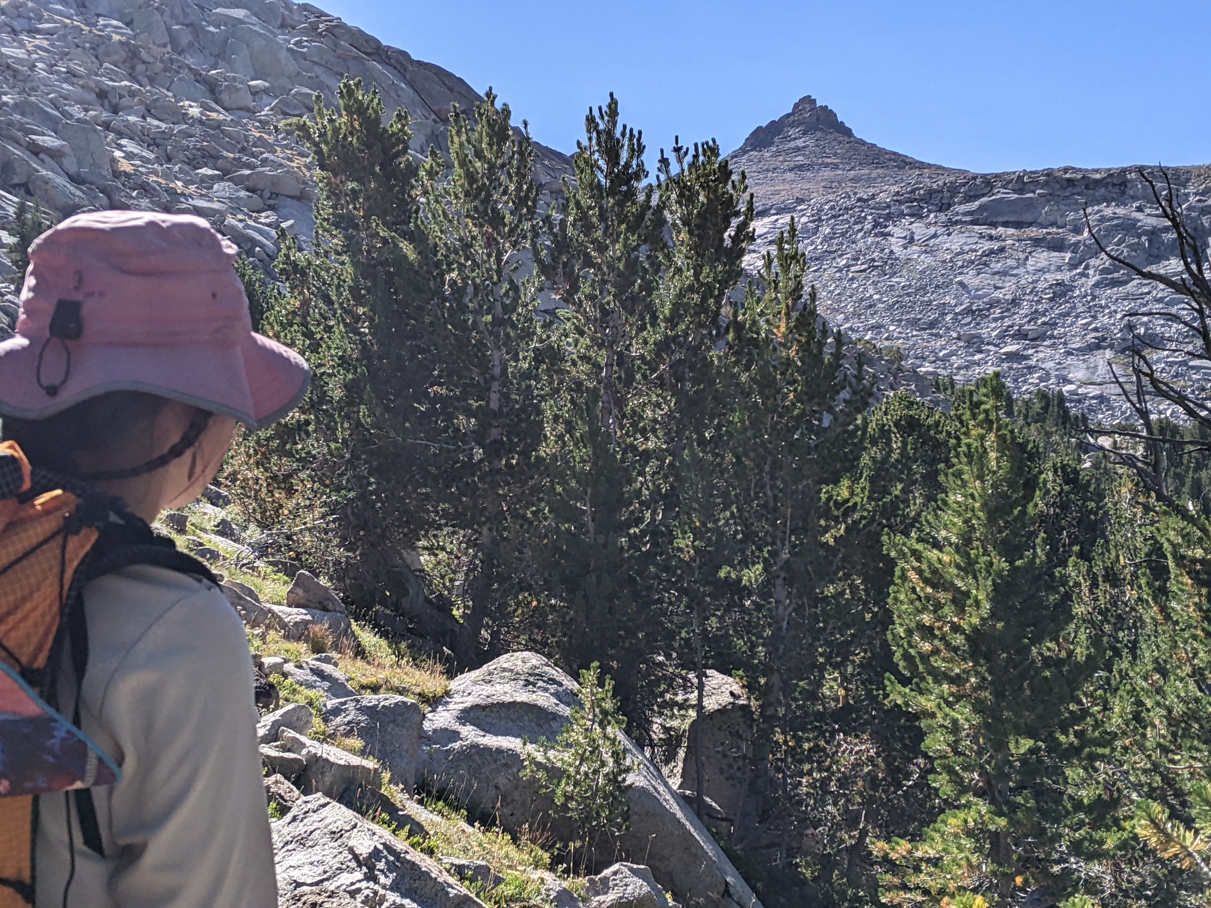
When it made sense, we began contouring to the pass between Cathedral and 12,490 Peak. Even though the grade wasn’t much, my feet never like side sloping. At least it didn’t take long to achieve the pass. Here we took some photos and looked in the valley where we planned to descend off-trail.
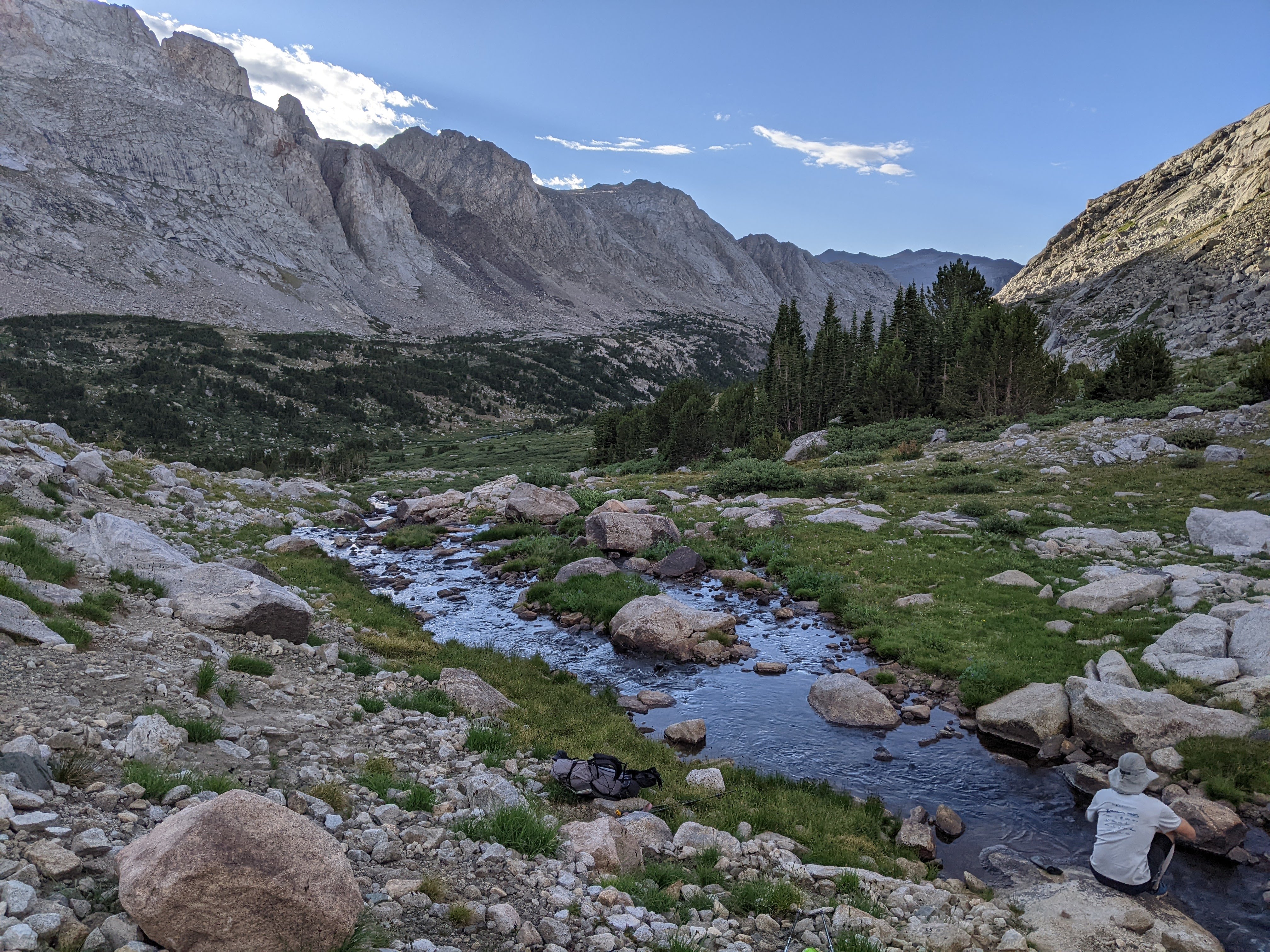
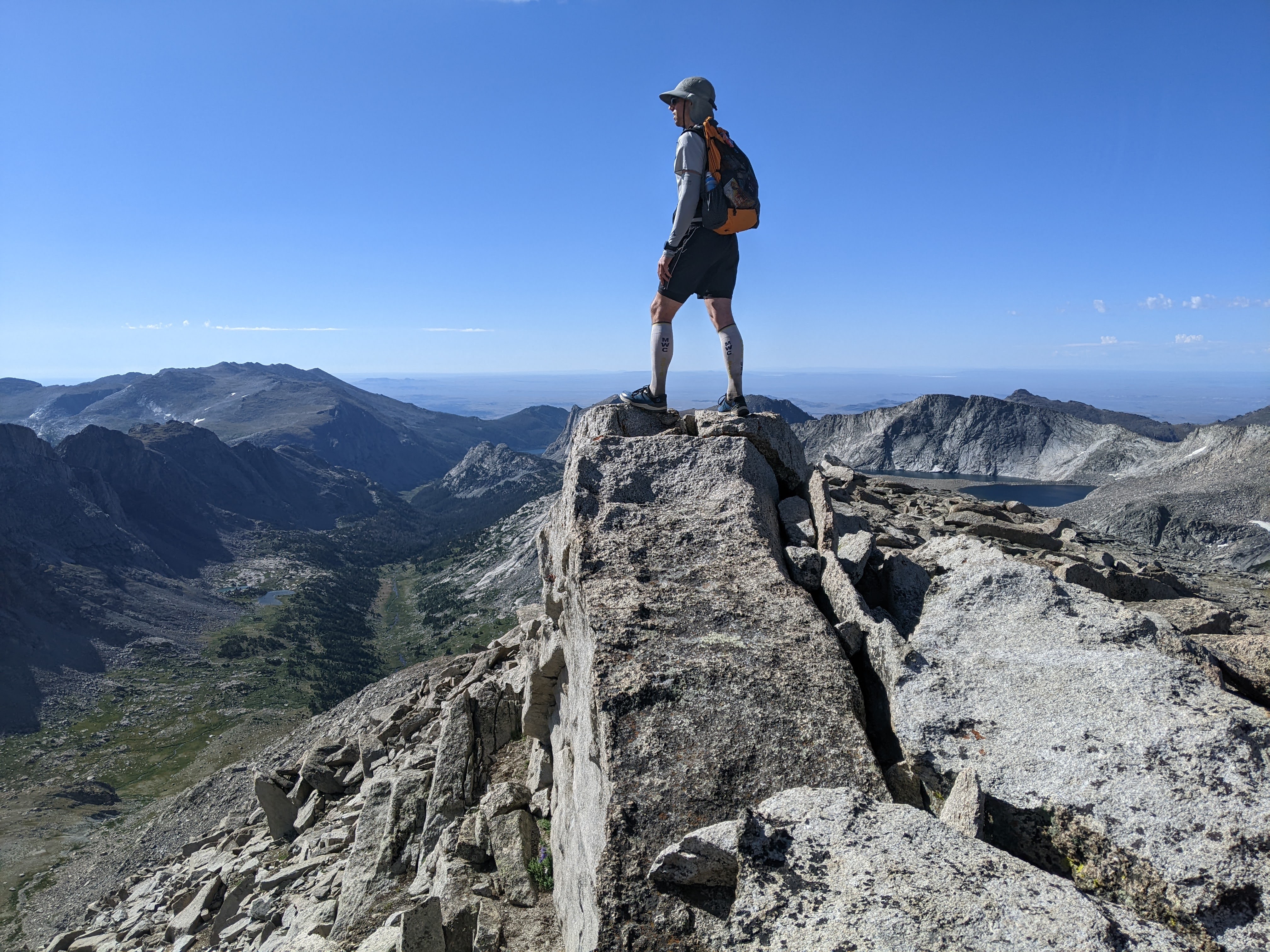
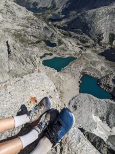
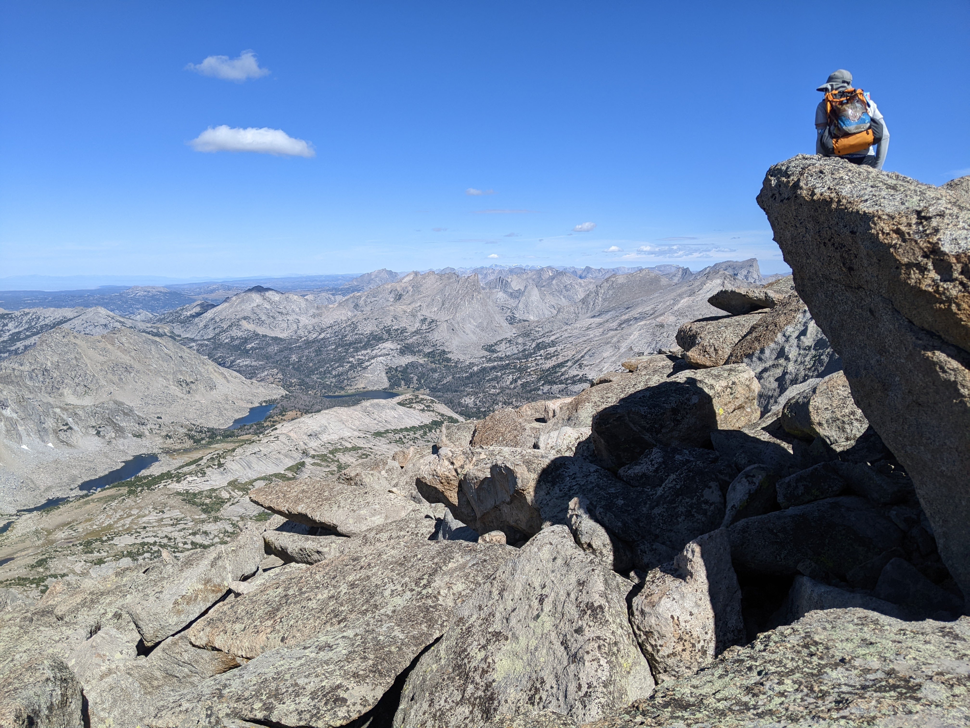
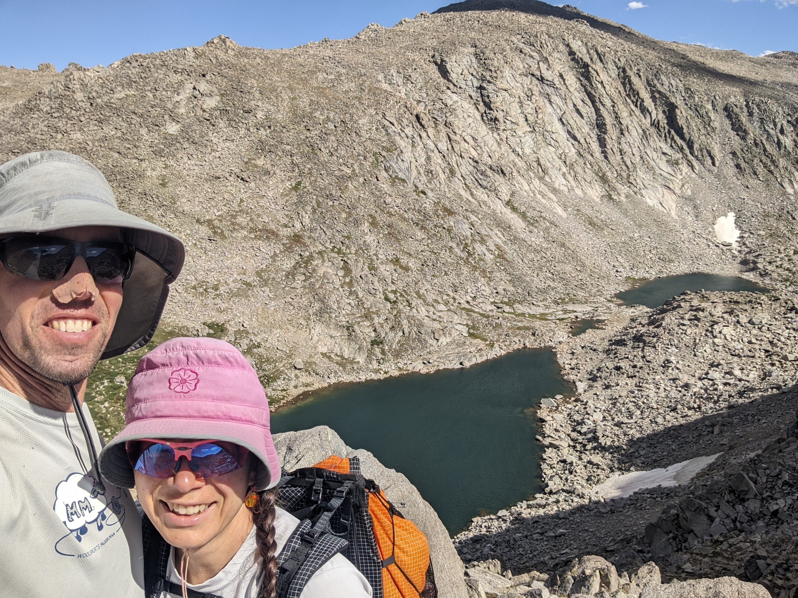
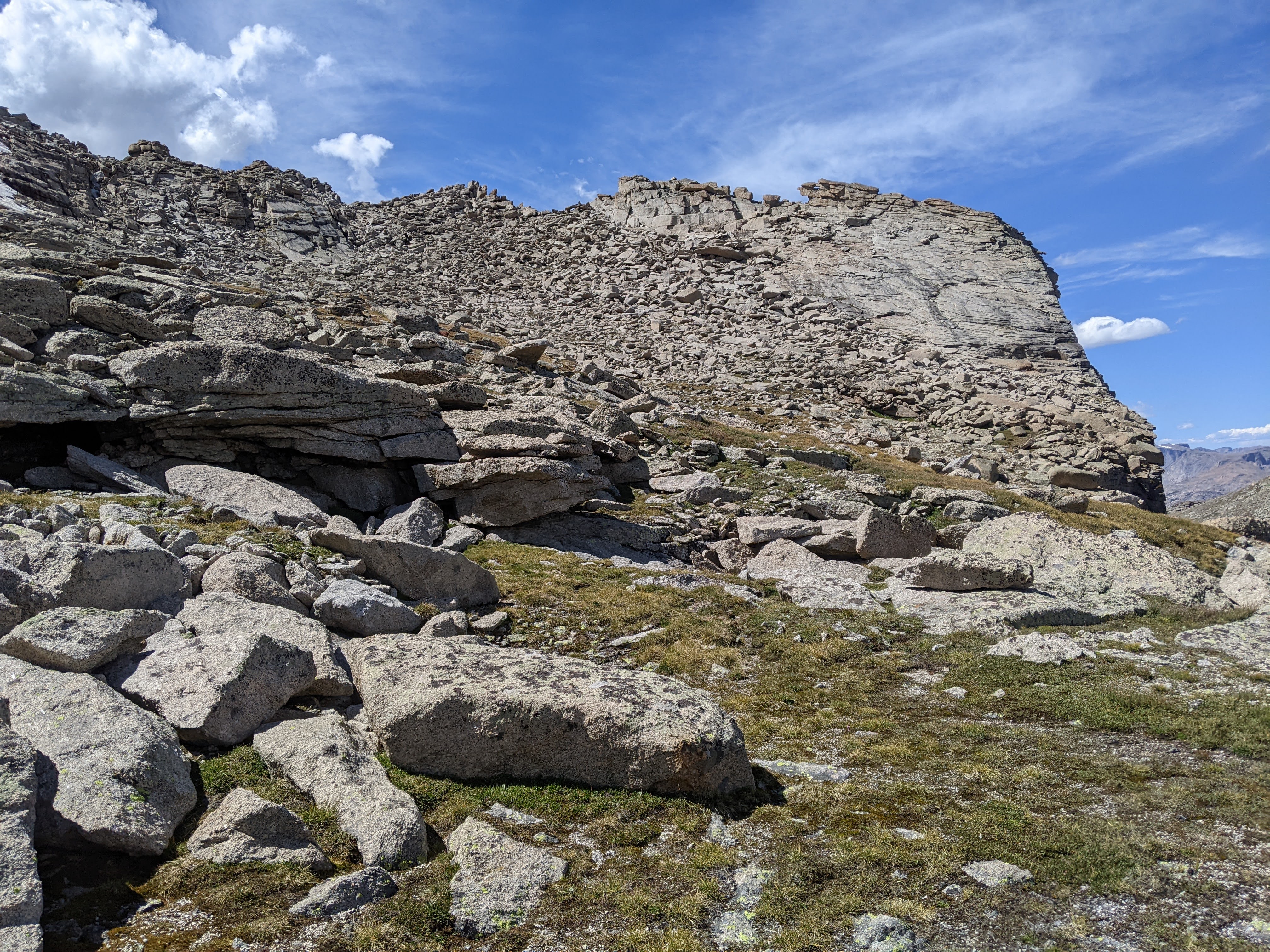
We also looked at Peak 12,490 which looked a bit steep from this side. We debated whether we could just walk up the slabs high up or if they’d be too steep. We began ascending on mostly alpine sidewalk but slowly this ran out. High up Erik and I went separate ways as I found some more areas of alpine sidewalk. But eventually this ran out and Erik and I ended up back together on another slab. After some debate, we both climbed up this different ways. For some reason the exposure was bothering me a little. We certainly weren’t on a cliff, but it was steep. Now Erik led us through a few bouldering pitches. We ended up being too far east of the actual summit and found ourselves in some giant boulders. Eventually we ditched our poles and one pack . Then I found a better way to the summit up the backside. It turns out it would’ve probably been easier had we stayed on the trail longer and then hiked up to the saddle.

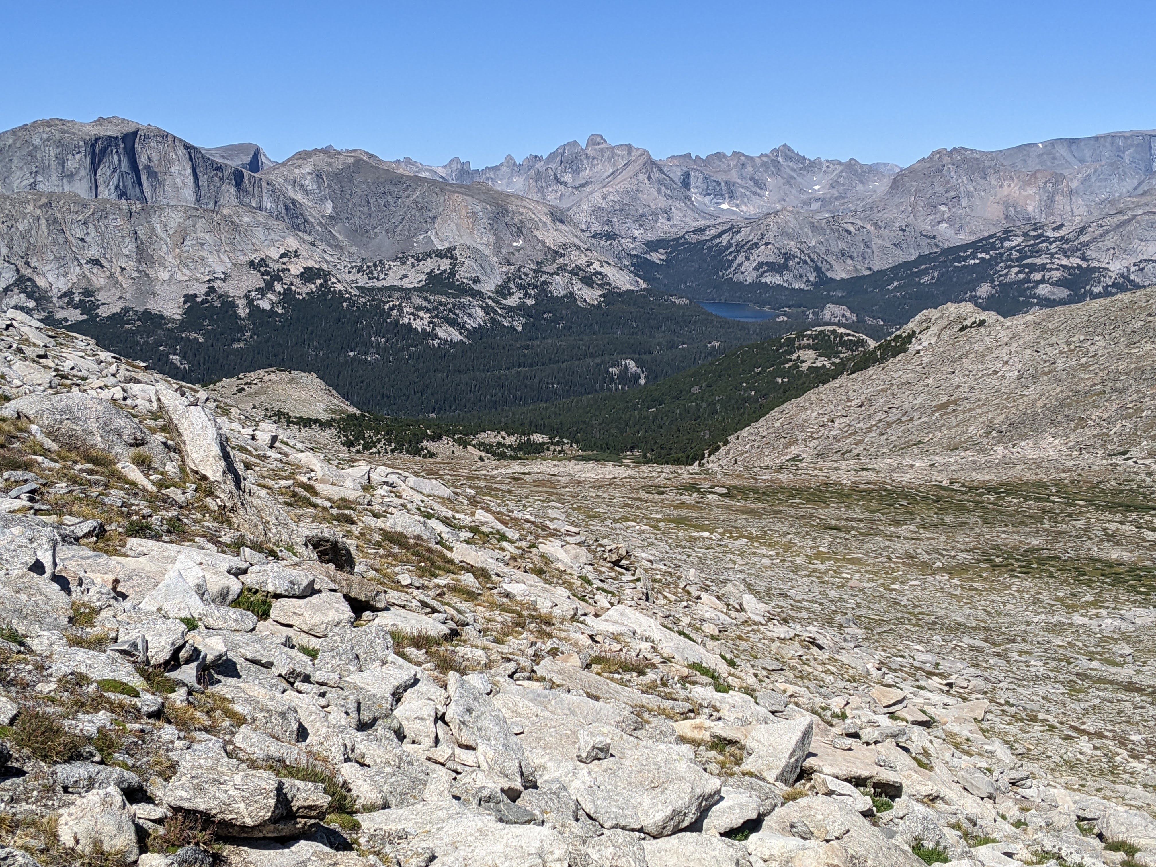
It wasn’t too windy on top and we lingered over second lunch, taking in our route from the previous few days and looking north to the higher peaks, including Gannett. I saw Shoshone Lake to our east. I was glad the weather was holding and that we had time to just enjoy where we were.
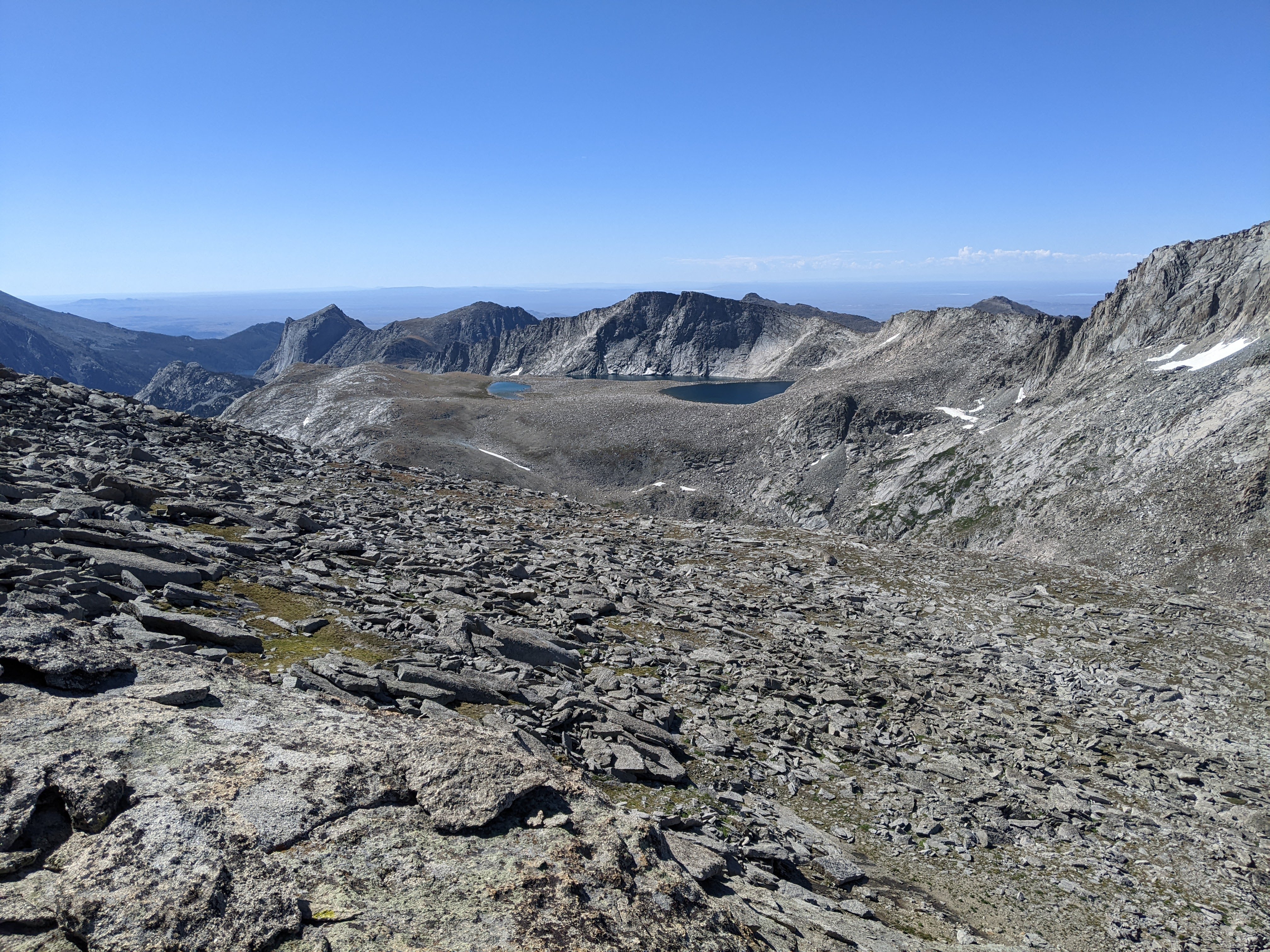
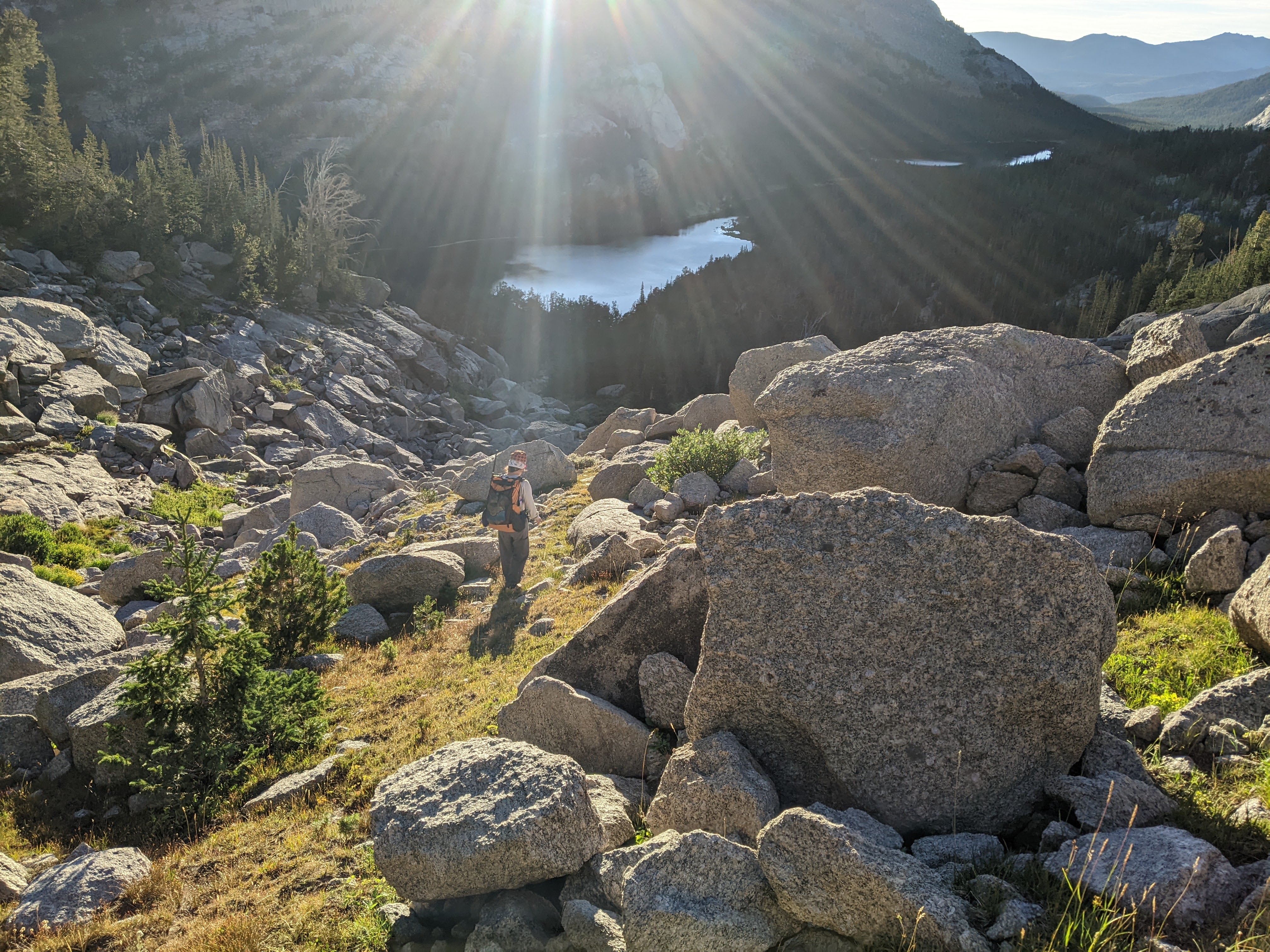
I’ve come up with some pretty terrible off-trail routes over the years but from this peak, we could see that at least the start of my route would be alpine sidewalk. The initial descent off the east side was mostly smaller boulders and soon we hit alpine sidewalk. This was easy and we made good time. The plateau was long and we just kept catching alpine sidewalk. I don’t think Erik could quite believe this, or the crazy views into the valley to the south. Once we finally got down to the gully that would lead us off this plateau that was otherwise all cliff we could see more alpine sidewalk and we rustled up a big horn sheep.


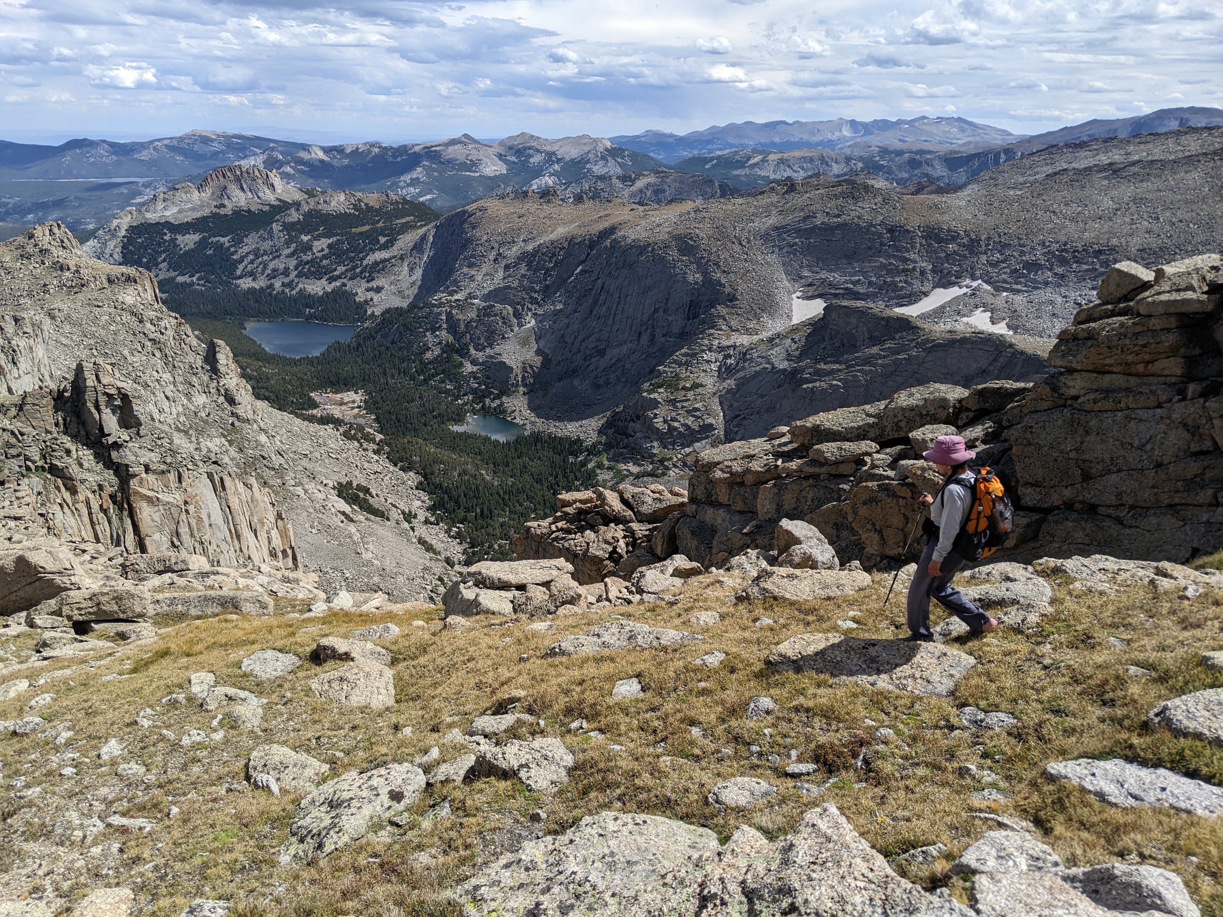

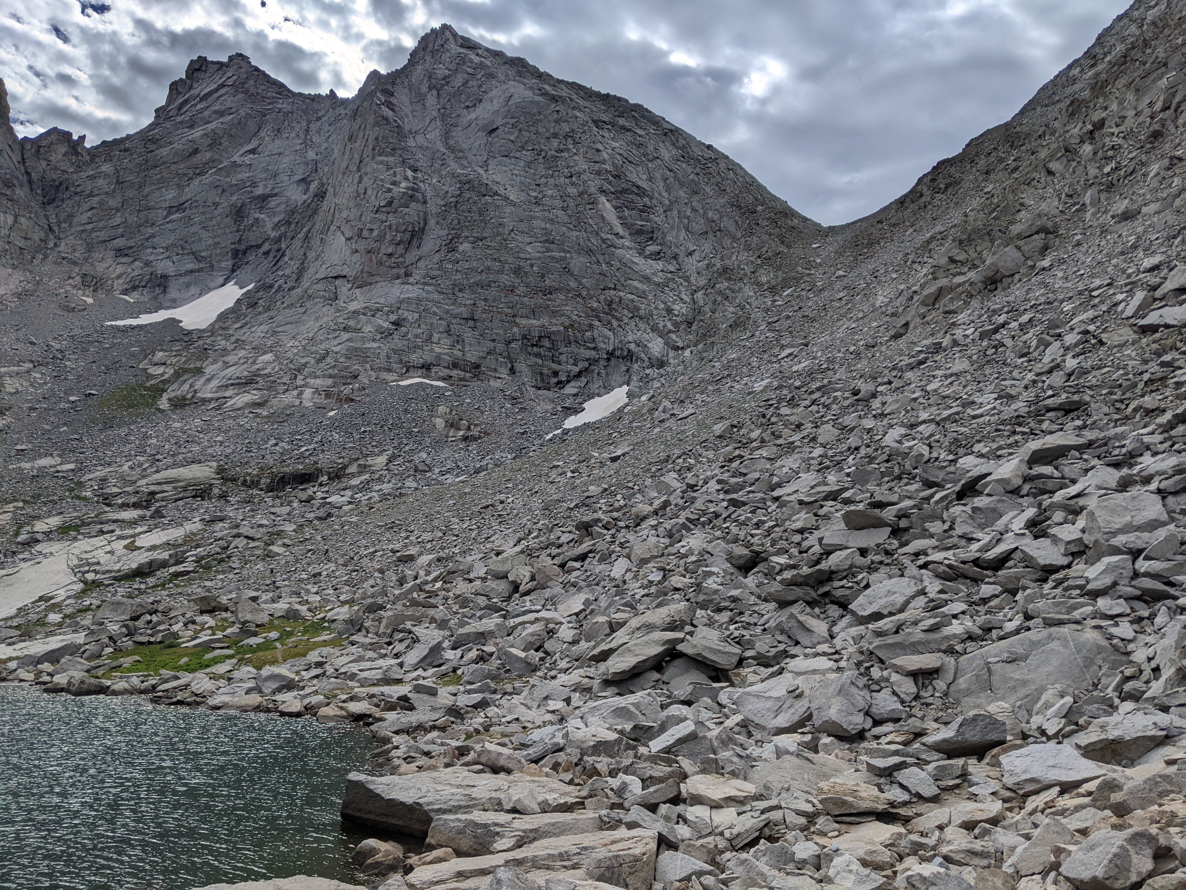
At the top of the gully there were a few boulders. Then we had to negotiate a couple cliff bands as we came out onto a bench where we stopped for a snack. These bands were small and by hiking a few feet in one direction we were able to find an easy enough way down. It looked like the final gully might be a boulderfield but with the exception of a couple moves, we mostly found more alpine sidewalk on the east side. It was nearing 4 pm as we got down to the creek. We still had some more off-trail to go but we had plenty of time the next day so I thought we should set up camp. Erik didn’t need to be convinced. We also conveniently found some good water access — a sandy pool in the small creek — where we washed up.


In the evening we still had enough time and energy for a hike. I really wanted to get up to see Upper Cathedral Lake. I naively believed we could see this from the closest rock slab. Some bushes, a couple creek crossings, and gaining the highest rock slab later, we still couldn’t see the lake. Perhaps had we hiked off this rock slab, waded through some bushes and hiked up the next rock slab we would’ve been able to see the lake, but by now it was starting to get dark. We took a different way to get back to camp that involved some boulderfields and then when we missed our alpine sidewalk back to camp, so bouldered off a couple cliffs. Just a little evening hike:)
Day Six 8/23/24: Cathedral Lakes Area to Three Forks Park

Despite our dream-like off-trail hiking the previous day, which I told Erik I was going to name the #RoRoRoute, we still had to descend down to Lower Cathedral Lake off-trail. I was somewhat hopeful to catch a social trail around the south side of that lake, but it certainly wasn’t promised. We’d seen some rock slabs from above so we tried to find these to head down to the lake but they quickly ran out. We found some alpine sidewalk instead although this quickly turned into boulderfield. When the boulderfield ran out we had some prickly berry plants to contend with on a steep grade. Then one more boulderfield. I had suggested we just run that boulderfield out but Erik kept trying to find some trail over on the south side of the boulderfield. It never worked out.
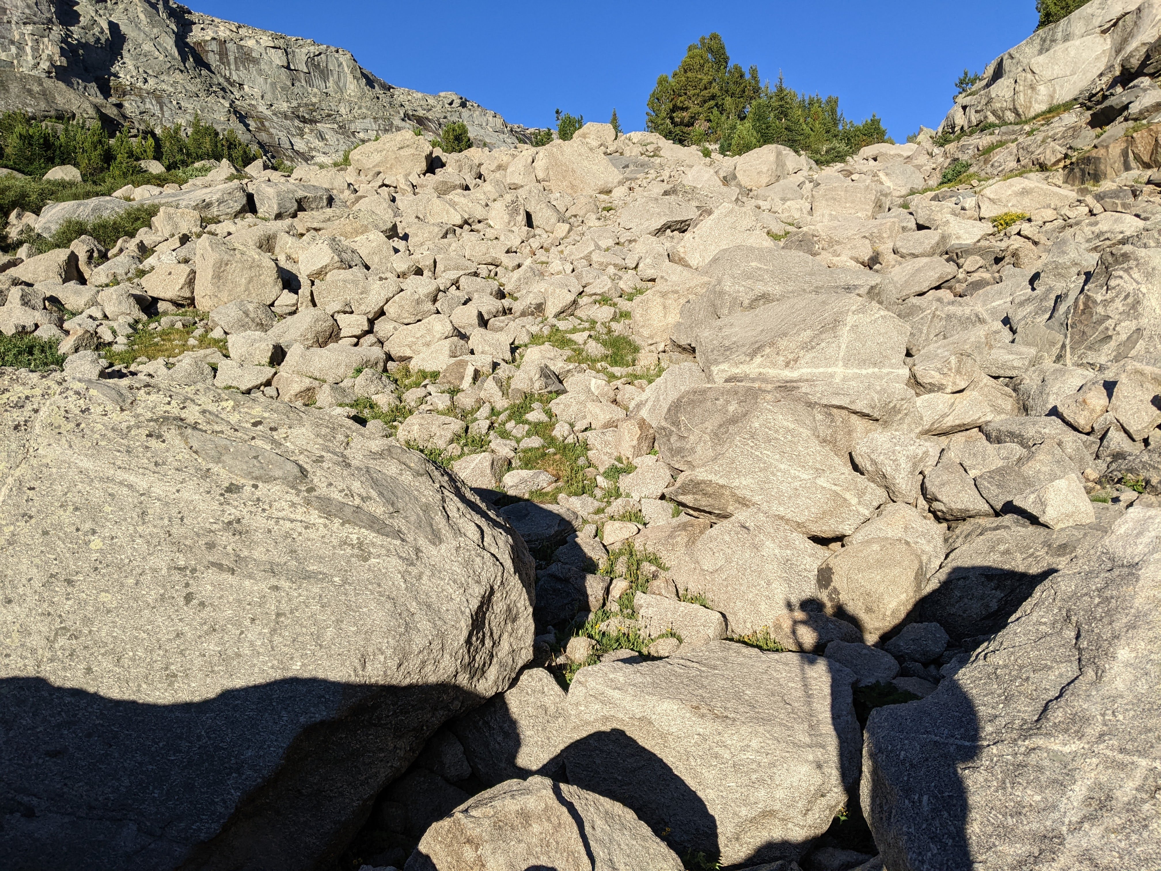
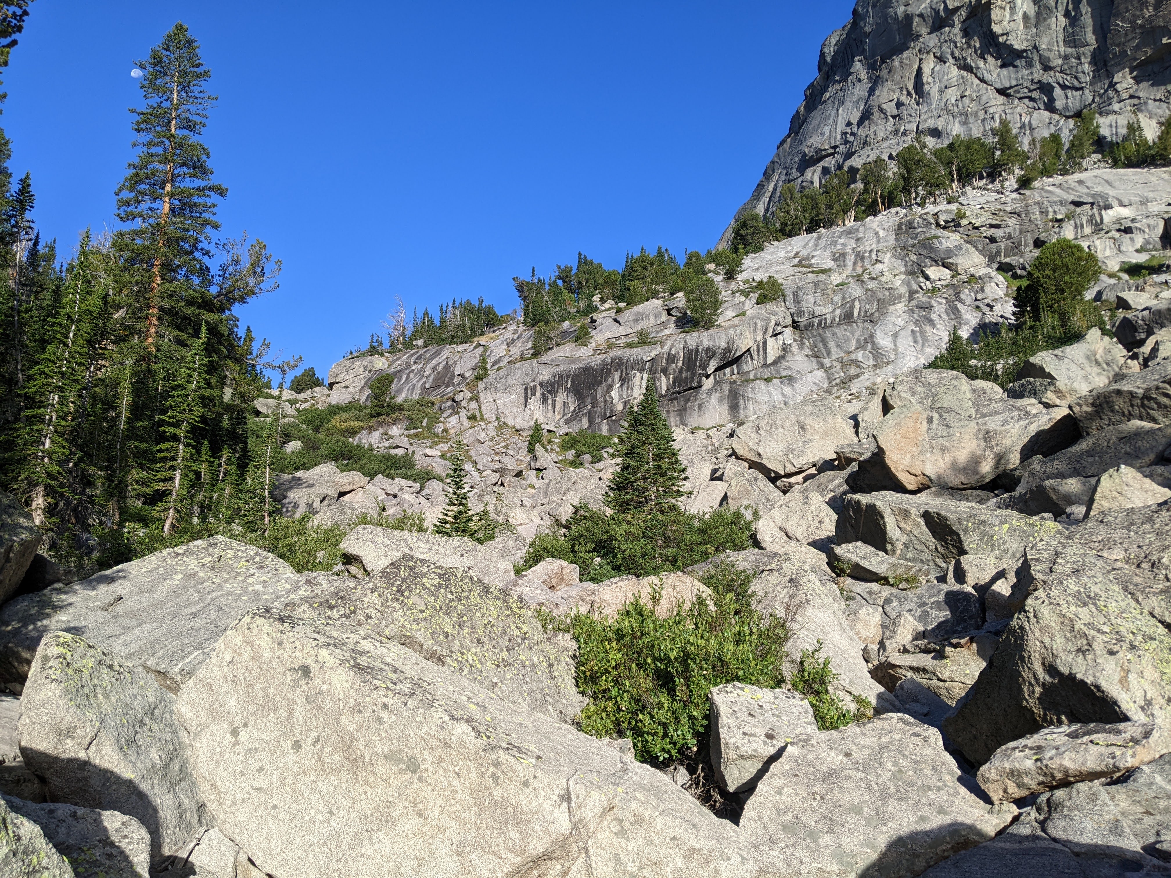
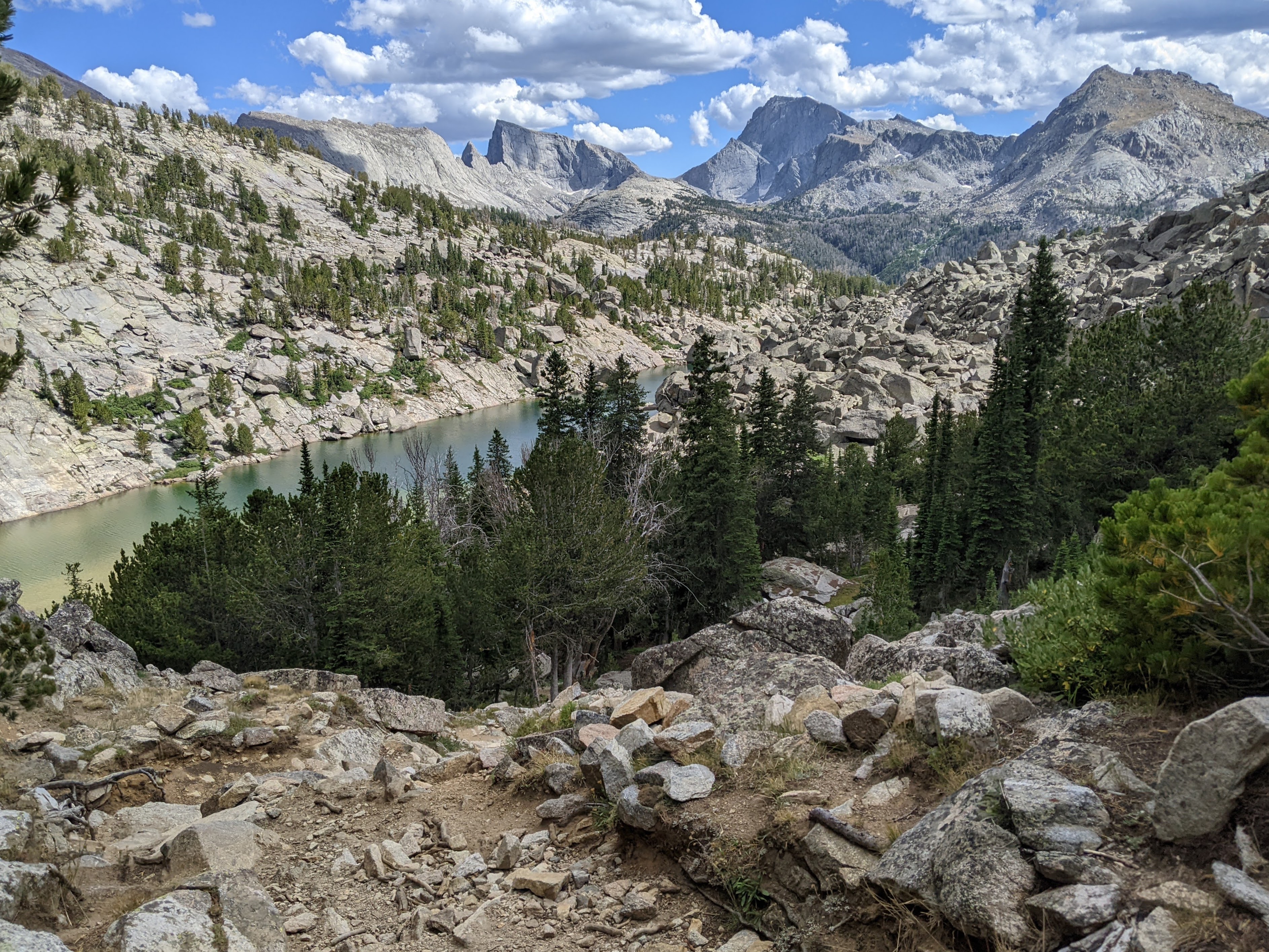
At the bottom of the second boulderfield though, on our right (south side) we picked up the beginnings of a trail. The trail mostly got better and better as we hiked through a well established campsite on Lower Cathedral Lake. There may have been several ways across the stream, but we found some easy rock hopping immediately at the outlet. Erik couldn’t get in enough of the granite wall across the lake so we stopped to admire Mother Nature and have a look at the least appealing part of the #RoRoRoute. The social trails were incredibly braided before we finally came out to a massive camping area on the northwest side of Middle Lake. There were some guys there having a very smokey fire. Now we were back on trail. It had taken two hours to reach the trail, about an hour of which was the unpleasant boulderfield and prickly plant part. Not bad for off-trail hiking.


Now the trail was largely in the forest. We had to stop and wait for a big horse train that kicked up quite the dust. The views were mostly nonexistant. We crossed Smith Lake Creek again in a meadow. I wanted to keep my feet dry and so spent some time straddling a giant rock before finagling my foot onto a much smaller rock. We climbed up and then down and then up again before we finally came out along the dusty, wide, and mostly easy cruising trail that heads up alongside the North Fork of the Popo Agie River.

We saw our only hiker of the day, a solo woman, where we had to ford the North Fork of the Popo Agie River. Again I went very slowly, carefully placing each bare foot deep into the rocks. Two-thirds of the way across the river I was able to switch to rock hopping which also helped dry out my feet. From here we had a near 1,500 foot climb up to Pinto Park. We both got hungry and stopped for second lunch along the way. Pinto Park was a nice meadow from which we could look west to the Cirque of the Towers.
As we continued down to Three Forks Park, where we planned to camp for the night, we both got tired. Initially I had good energy but then I zoned out. We were running low on toilet paper so I was trying not to poo again, hence I hadn’t been eating as much. Eventually I entered a trance-like state. Near the end of the trail though I had to pay attention as it got steeper and there was more horse poop and I always like to avoid stepping in the horse poo.
Once down at Three Forks Park we started looking for a place to camp. This had felt like our longest day and I wanted a site not too far off the trail with easy water access. It wasn’t too long before we found an area between the trail and creek that was quite close to the latter. The wind was still blasting. We didn’t feel so much as hear it rustling the trees. It was so loud it drown out the sound of the creek.
We got dinner going, no small feat with our cat food can alcohol stove but then a cloud came over threatening rain so we got the tent set up ASAP. Just as we did it began to rain. The rain was short-lived and soon Erik was out of the tent trying to cook dinner. He really had trouble with the stove despite making a good wind block. After dinner we tried to create more of a wind block for our tent with all the downed wood. I figured that if we got it high enough, if a tree fell on us overnight, the wind block would at least soften the blow!
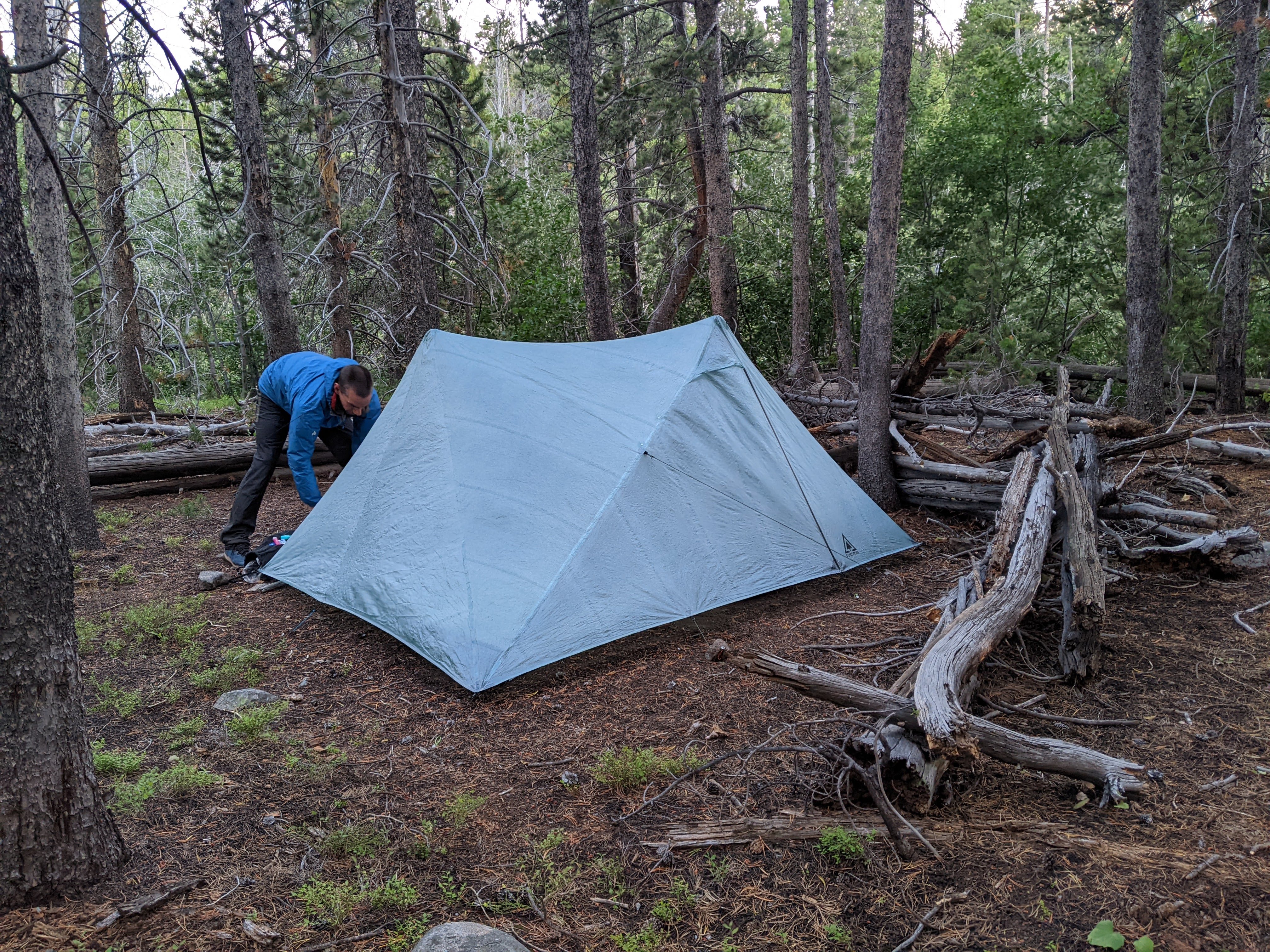
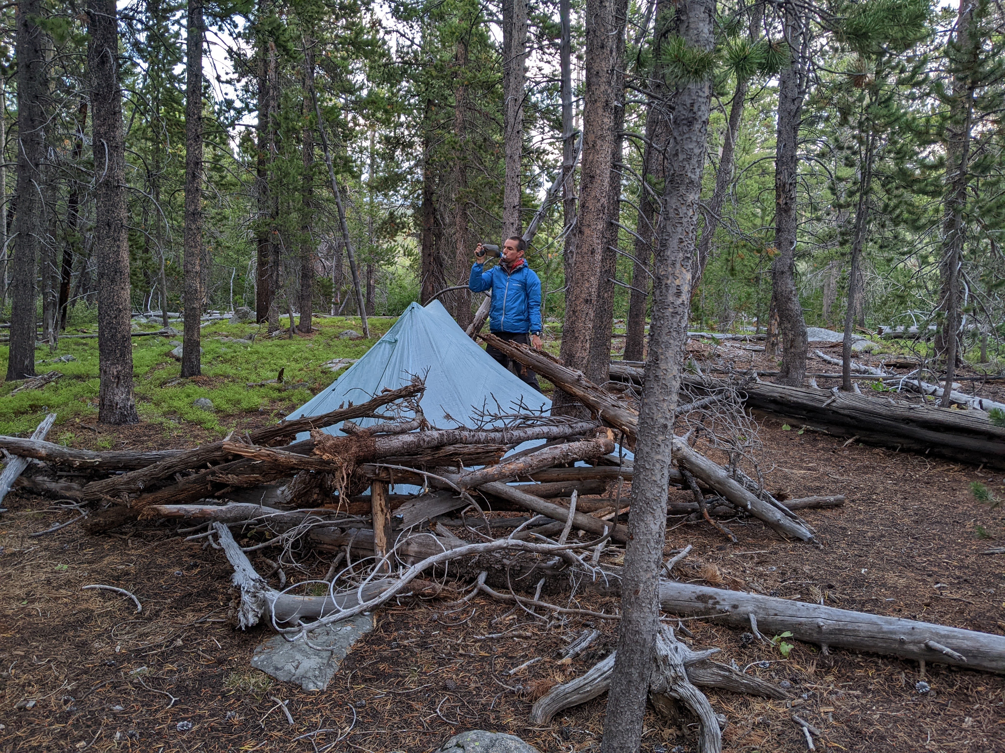
We got a new tent for this trip, the Durston X-Mid Pro 2+ Dyneema. Erik geeks out on camping gear and he purposely was looking for something that would be a bit more wind-friendly after our backpacking trips the past two years to the Chugach and north Winds. He certainly succeeded. We found our new tent to have less ventilation, thus was warmer and also made of a bit softer material so it wasn’t so noisy in the wind.
Between the wind, the lack of view, and the damp earth from the rainstorm, I was glad this was our last night camping. At some point overnight the wind died down and I could hear the stream but when we woke in the morning the trees were moving just as fiercely as the previous evening.
Day Seven 8/24/24: Three Forks Park to Frye Lake
We didn’t know exactly how far we had to go but we were guessing around 10 miles which would be reasonable to do in five hours. We enjoyed a pleasant downhill grade on trail to Sheep Bridge. Then we had a 500 foot climb up to Deer Park. There were some really nice gradual switchbacks in this section. We passed a dad and his two adult sons who all had giant packs and at least a couple tents/sleeping pads each strapped on. I inquired as to their route. They were also out six nights but went about a quarter the distance we did and stayed much lower. They marveled at our small packs while we marveled at their large ones.
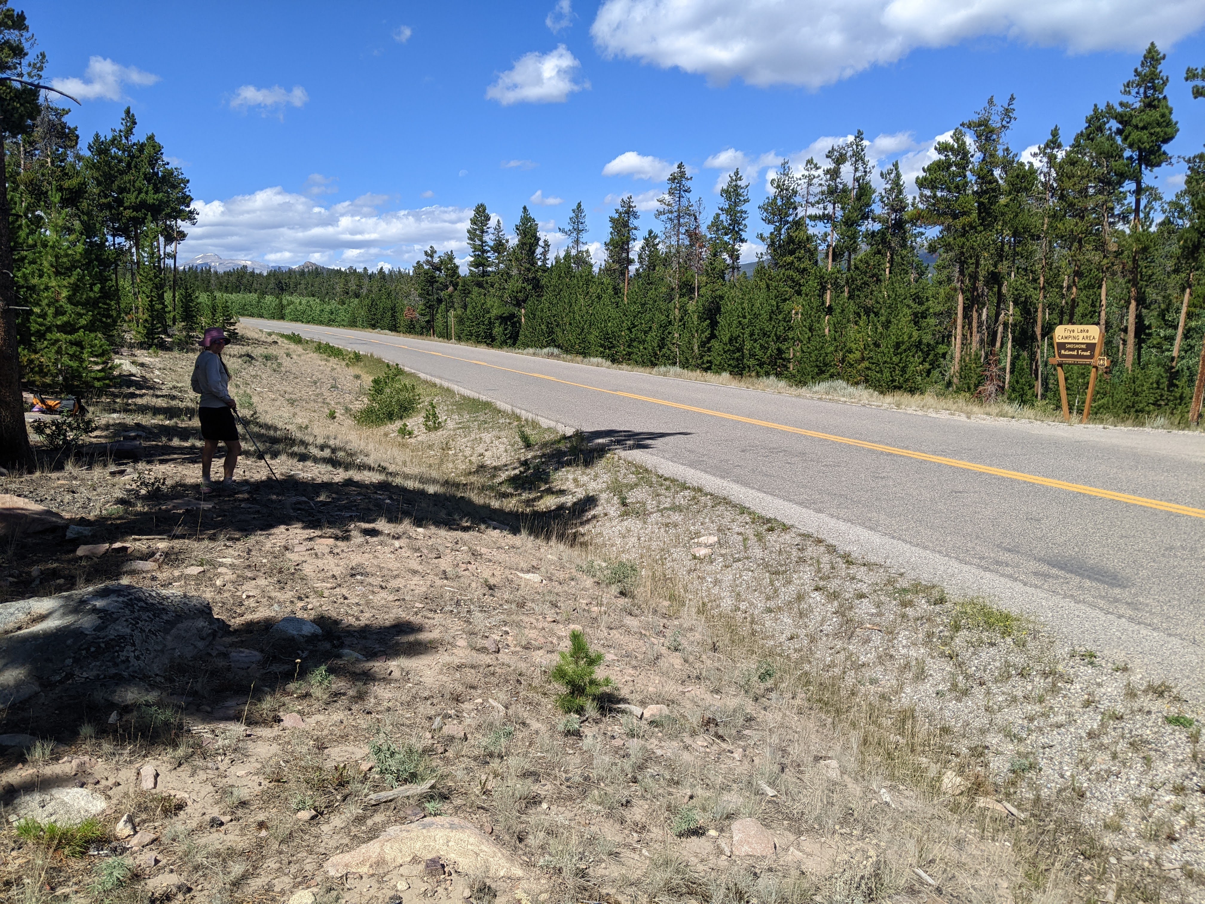
We hiked down to High Meadow Lake and then caught the mountain bike trail that heads towards Frye Lake. Initially the trail was nice as we hiked along the lake. While the trail remained nice, the section between High Meadow and Frye Lakes got long, as the final few miles of a trip always get long. Finally we could see Frye Lake. I’d scouted this area on satellite and even though there was supposed to be a “road” that intersected with the trail I wasn’t so sure. Erik was convinced there was. Eventually it looked like we’d have to bushwack through some willows to get to the National Forest campground. I had put on my hiking skirt today instead of my adventure pants and wasn’t having it. I declared I’d finish on the mountain bike trail before I bushwacked and so somewhat hastily we separated without a great plan.
I found a different “road” of sorts, something relatively overgrown but still definitive that took me to the sandy/dried mud lakeshore which I then followed to the campground where I met back up with Erik. We arrived at 11:30 am, hiked out to the Louis Lake Road, and a tad after noon my mom came down the road to pick us up to drive back to Minnesota.
We had a bit of food leftover (always the nuts and two tortillas as we are tortilla’d out). My pack weighed in at 10 pounds and Erik’s at 12.
If we had to do this trip again: Well, this trip worked out really well. I was sad though to not climb Pyramid Peak, lured by Pyramid Lake, and really want to swim at Grave Lake. Hence I think there will have to be a next time. Plus, this area is simply too close to Minnesota and too beautiful to never see again.
Best Decisions: Making time for the #RoRoRoute. Essentially, the Lizard Head Trail connection to Middle Lake via Throne Peak, the plateau off Throne Peak to the east, and the Lower Cathedral Lakes section.
Next time: I just might have at least a couple more trips in this area to do. Maybe I will finally make it to Shoshone Lake and swim in Grave Lake on the “beach tour” but there are certainly other intriguing areas like Tayo Lake, the Valentine Mountain Trail, and more off-trail routes. Erik says he wants to hike into the South Fork Lakes. And then there’s the Winds High Route over on the west side of the divide. In summary, we’ll be back:)

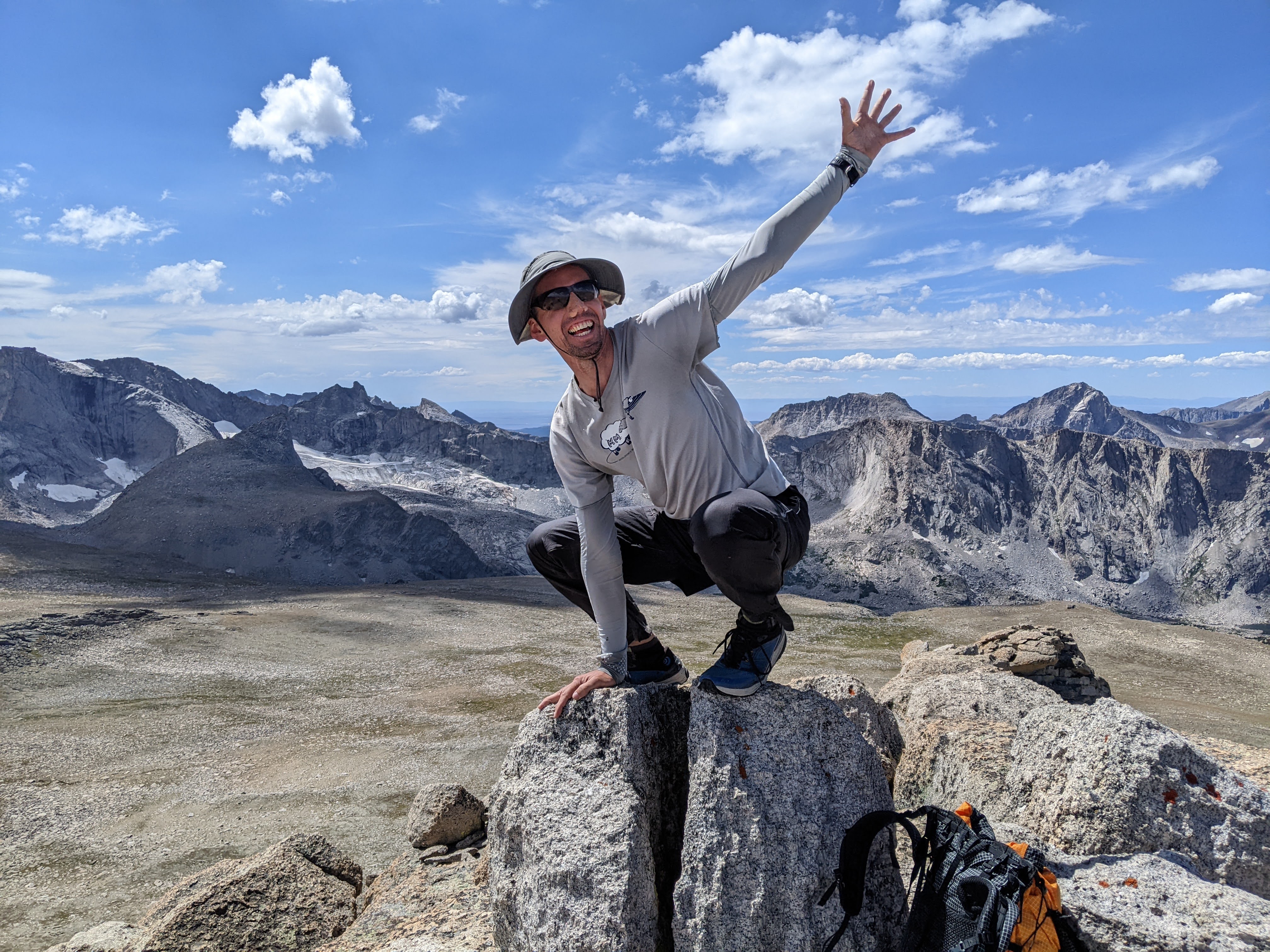
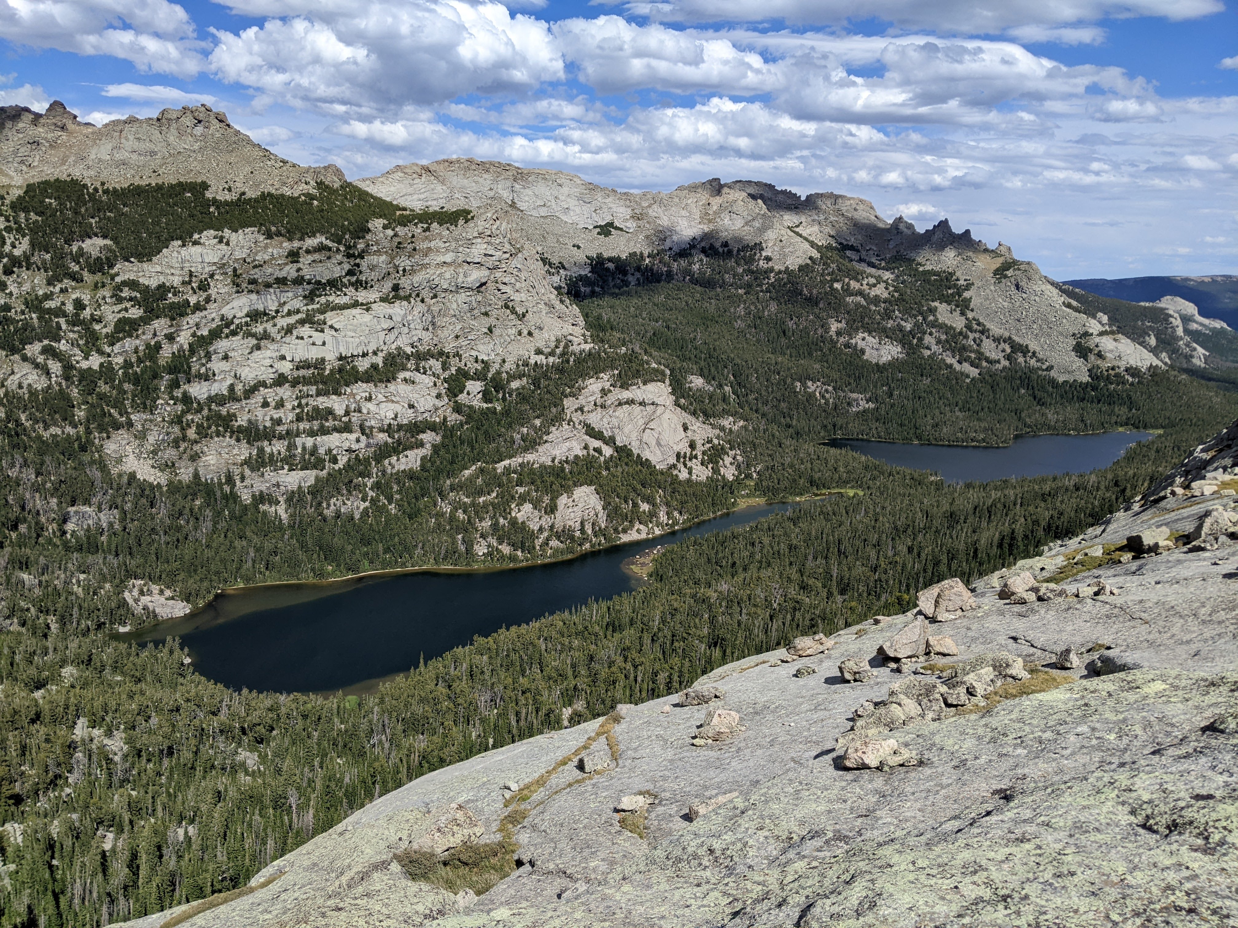
Elspeth— Well done!! The photos add nicely to the text you read last week. That view of the 2 “lakes” from top of Steeple Peak was scary (since I don’t have much depth perception)!!! I hope you two were sitting at the time and not standing up. I would have been on my belly or standing 3 feet away from the edge. No way I’d do what you did. Where’s my parachute! See you on the 19th. — JimC
LikeLike
Thanks! Yes, we were sitting for that photo:)
LikeLike
Thanks. Whew. I shudda remembered that any intelligent, experienced, mountain climbing RN would not do anything else! 👍
LikeLike