
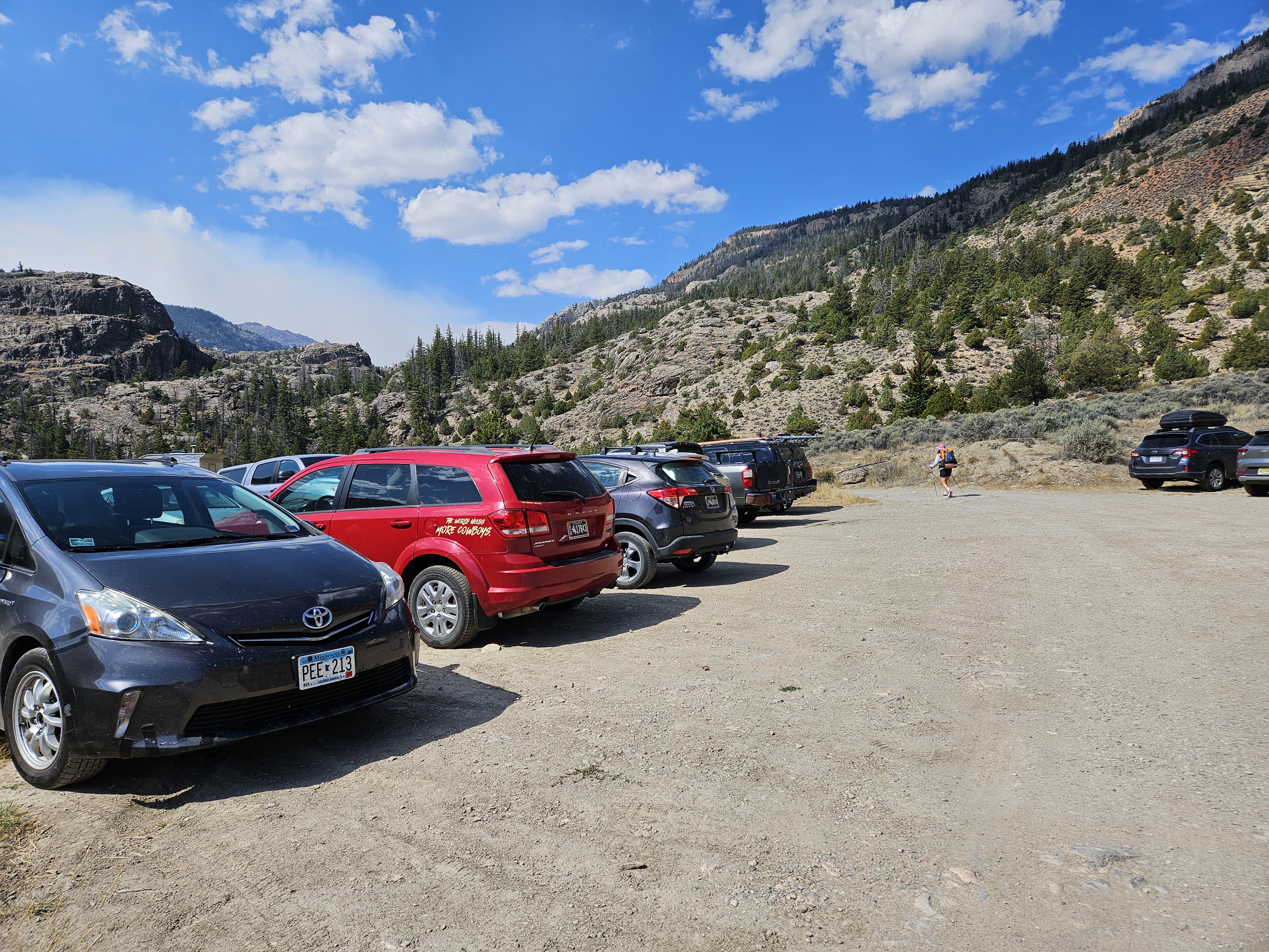
This was supposed to be a post about how on our third attempt, after not even seeing the mountain from our approach in 2021 and then deterred by bad weather in 2023, we finally summited the Wyoming high point. But for reasons you’ll soon read, it didn’t happen. Our planned route was from the Glacier Trail Trailhead (on Google called Trail Lake Trailhead) by the Torrey Lakes near the town of Dubois in the Wind River Range. From there it would be a couple days of hiking to a high camp just above 11,000 feet where ideally we would bag Gannett before heading back to our car along the Wind River Range High Route over Downs Mountain and No Mans Pass.
We were more prepared than ever having purchased ice axes, ice screws, and a snow picket in addition to our crampons, harnesses, glacier rope, and hardware. We practiced using all of the above a few times and I was so determined. And so just after 11 am on Friday August 22nd we found ourselves leaving the trailhead under sunny skies. We hiked slowly but steadily up to the junction with the Whiskey Mountain Trail and New Glacier Trail and took the latter where there was a nice bridge above Torrey Creek.

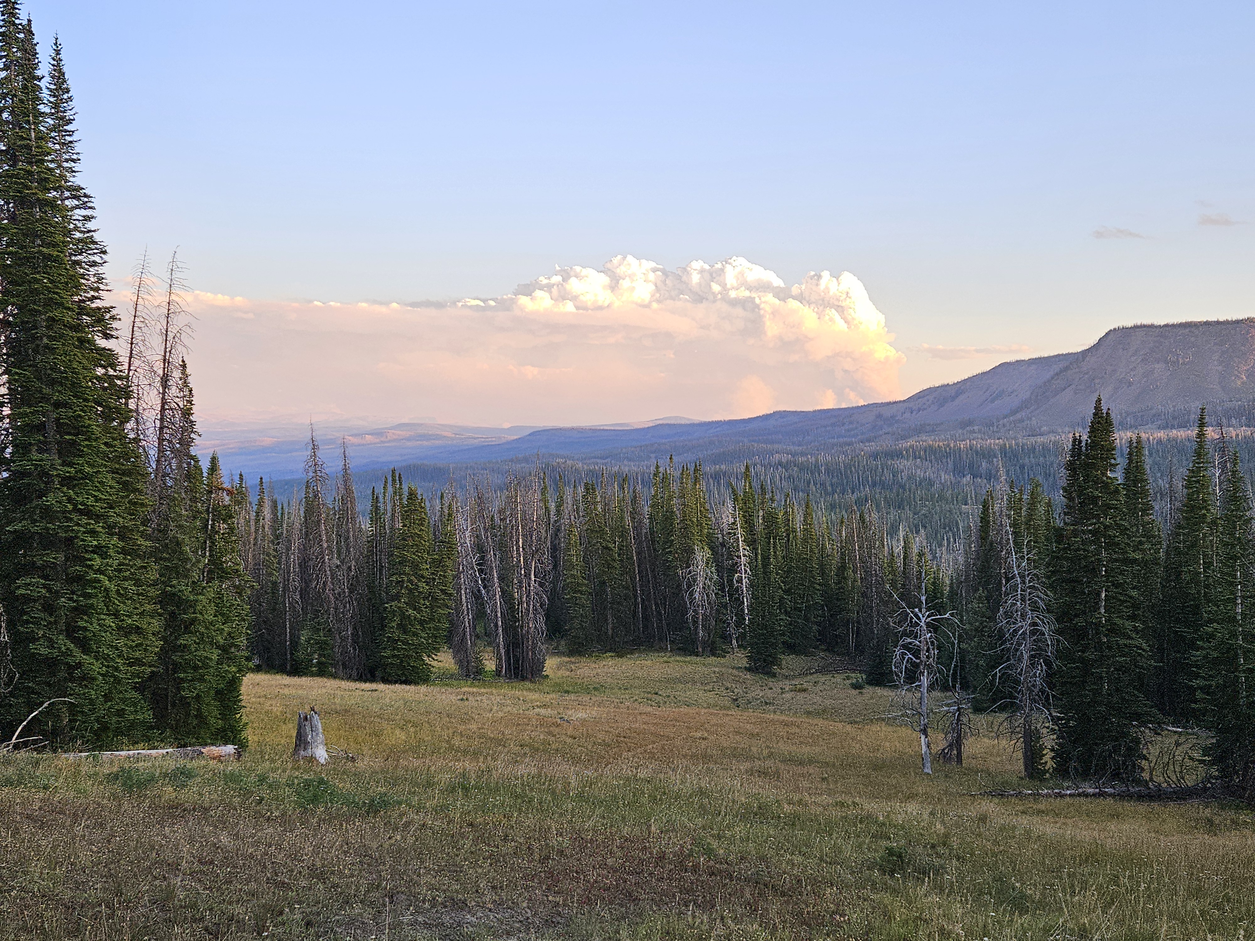
From here the trail flattened out as we gradually made our way up the valley towards Bomber Basin. We ran into a guy coming out who gave us some beta on the Wind River High Route (that it was not a good idea to go via Downs Fork as there were many, many downed trees) and then after about an hour and a half we stopped to eat our first round of bagels. We remarked that the sun was very orange. By the time we’d chowed down our lunch, we couldn’t see the sun anymore.
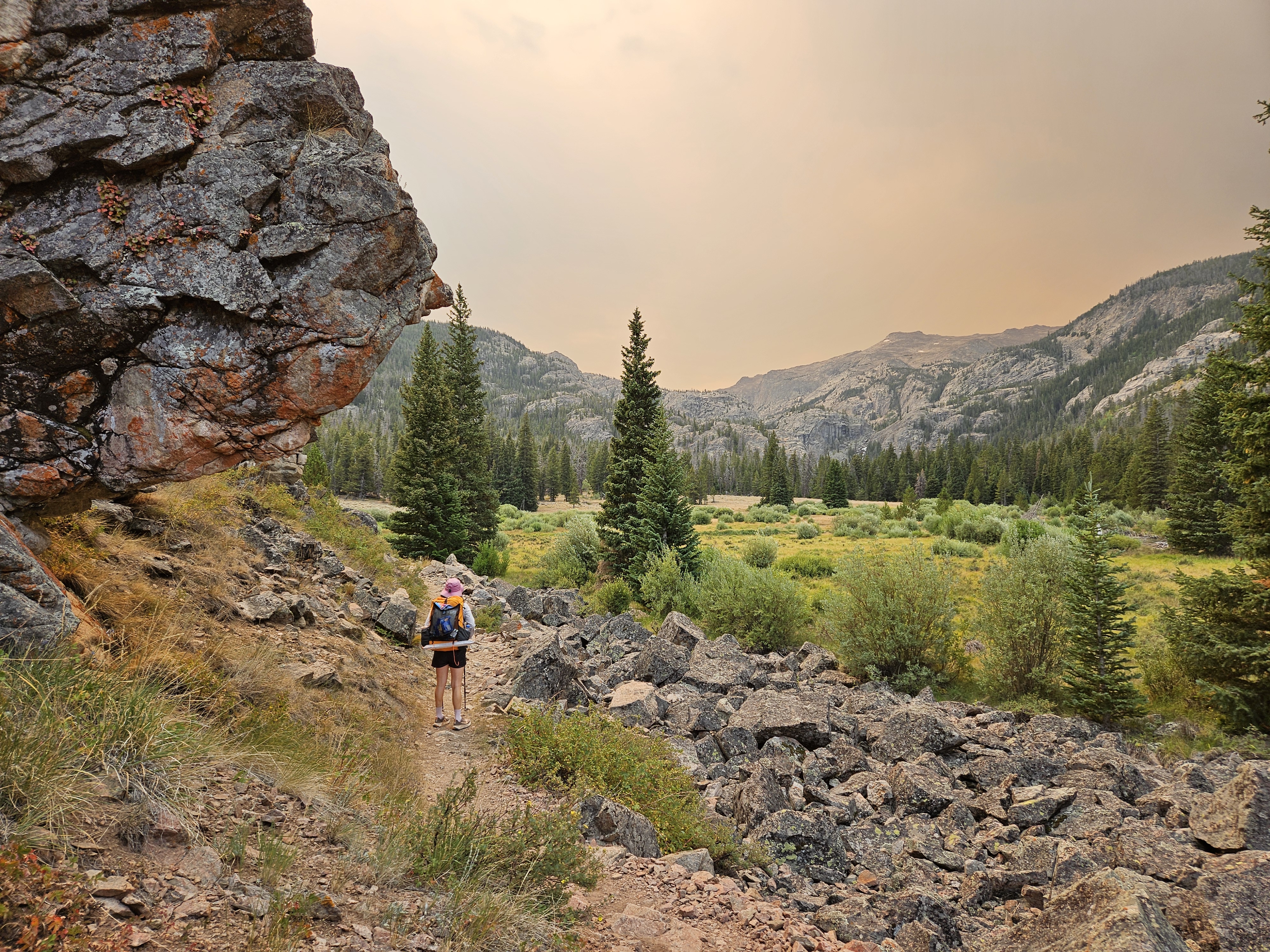
Not long after our pit stop I thought I saw some ash. Shortly thereafter we encountered a group of two guys. They remarked that ash was falling and that around 4 pm the previous day a fire had broke out on the other side of the Goat Flat. They surmised the fire was in the valley on the other side of the Continental Divide.
We weren’t ready to turn around yet so we began hiking up the switchbacks to the plateau. But now the ash floated down in earnest. Listen to yourself, Elspeth, you smell smoke and there is ash falling. Of course you should leave. But I was going for Gannett or bust, worried about that bergshrund on the Gooseneck Glacier. We weren’t supposed to encounter a forest fire. Erik had looked yesterday, and there was no fire then.
“Let’s reassess when we get on the plateau,” I said to Erik.
But when we came to the next switchback we were looking up towards the divide and there appeared to be thick smoke. Enough that I just kinda stopped.
“Has ash ever fallen on you before?” Erik asked me.
“I don’t think so. I wonder how close that means the fire is,” I responded.
We sat down and contemplated our options, the sun completely obscured by the smoke cloud. I thought about the Teton Crest Trail, another bucket-list option. Finally we surmised the following:
- We didn’t really know where the fire was other than presumably it was on the other side of the divide. That meant if we kept up on our route where we’d get to tall rocky and fairly glaciated peaks, we’d likely be safe from wildfires, but after breathing smoke from the fires in Manitoba all summer, we wanted clean air and views that weren’t obstructed by smoke.
- We knew the area well enough to know that the divide was much lower up from our car and that hence our car and the forest between our car and where we’d be going for Gannett was not safe and as a result we were going to be really worried for the next six nights. So we ought to just bail before we hiked any higher.
As we hiked out, the cloud followed us and ash kept falling on us. And it followed us into Dubois where we got some info from spotty internet. The fire in question was called Dollar Lake and had rapidly expanded over the course of a few hours and was about 20 miles away along the road into the Green Lakes Trailhead where we had parked two years previous. So ash can travel at least 20 miles. Now we knew.
The weather, as forecasted, continued to be sunny and so instead of getting a hotel, I suggested we dry camp up a ways on the Continental Divide Trail where it crosses hwy 26. We did just such after cooking our dinner next to the Wind River by where we parked our car on a side road. After hiking up a couple hundred feet we had an impressive view of the fire smoke and spent a nice night in the tent, occasionally wakened by elk bugling.
The next morning we drove to Grand Teton National Park and went to the ranger station at Jenny Lake. We told them we’d been deferred by the Winds but wanted to hike the Teton Crest Trail and had five possible nights and could hike as much or as little as needed depending on what camping was available. Erik and I have largely avoided backpacking in the national parks due to the tedious permit regulations that mandate camping locations. Permits can be hard to get in the lottery system months in advance but we’d read online the night before that two-thirds of permits are available as walk-up and maybe it was just because that’s what we were doing, but it seemed to work out well. Here’s the link to more info on backcountry camping in Grand Teton National Park and a map of the backcountry campsites/zones.
Day One 8/23/25: Granite Canyon Trailhead to Upper Granite Canyon, 8 miles + evening hike
The ranger said a monsoon was coming in Monday or Tuesday so he wanted to give us the best shot at getting up high while the weather held. That meant we had to drive down to the Granite Canyon Trailhead. It was 10 am by the time we got to hiking and initially walked with some day hikers. The most intense part of the day came less than an hour into the hike when we passed a horse train from behind. I’ve heard those horses can kick but also didn’t want to walk into the woods to go around them.
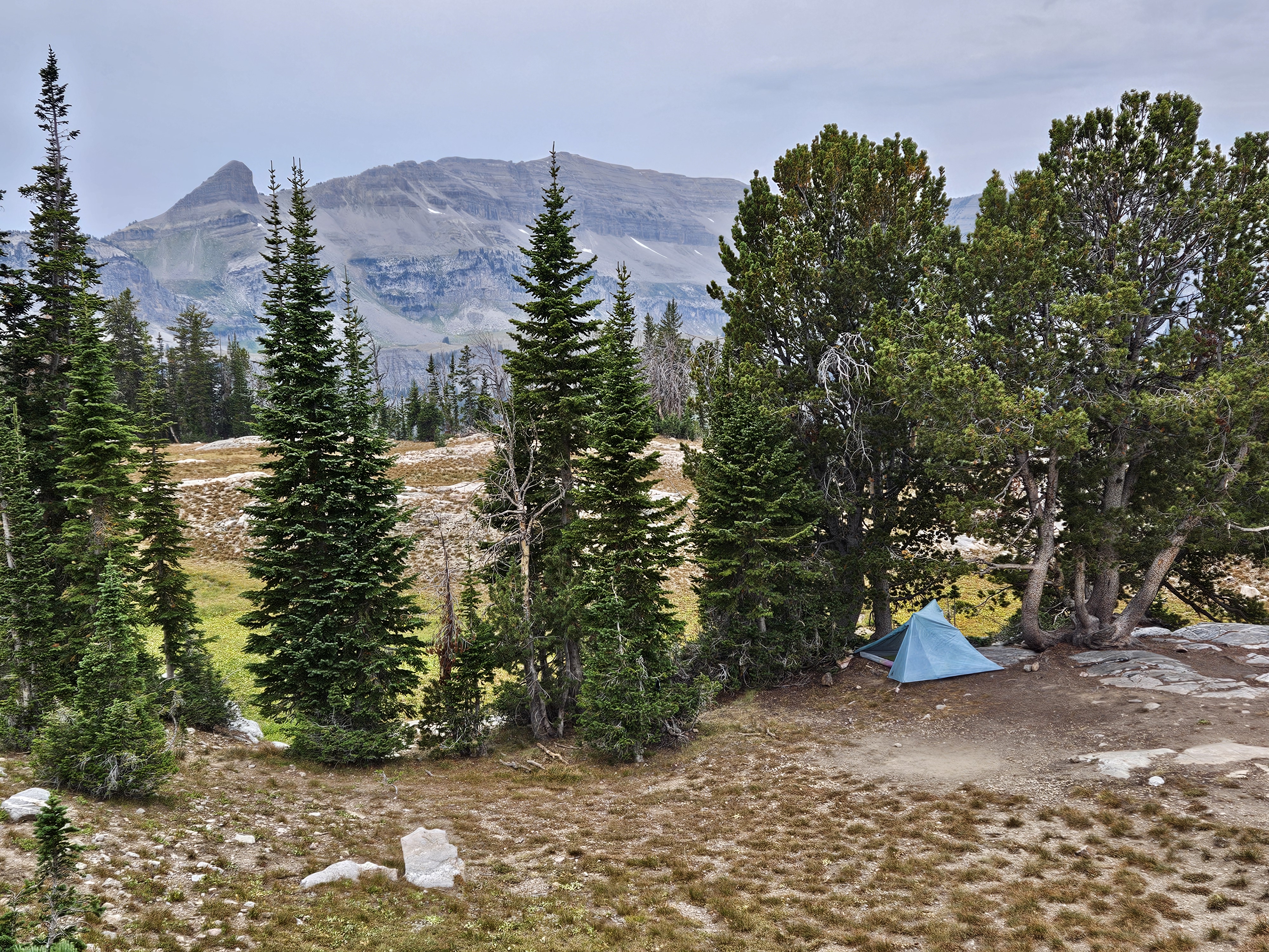
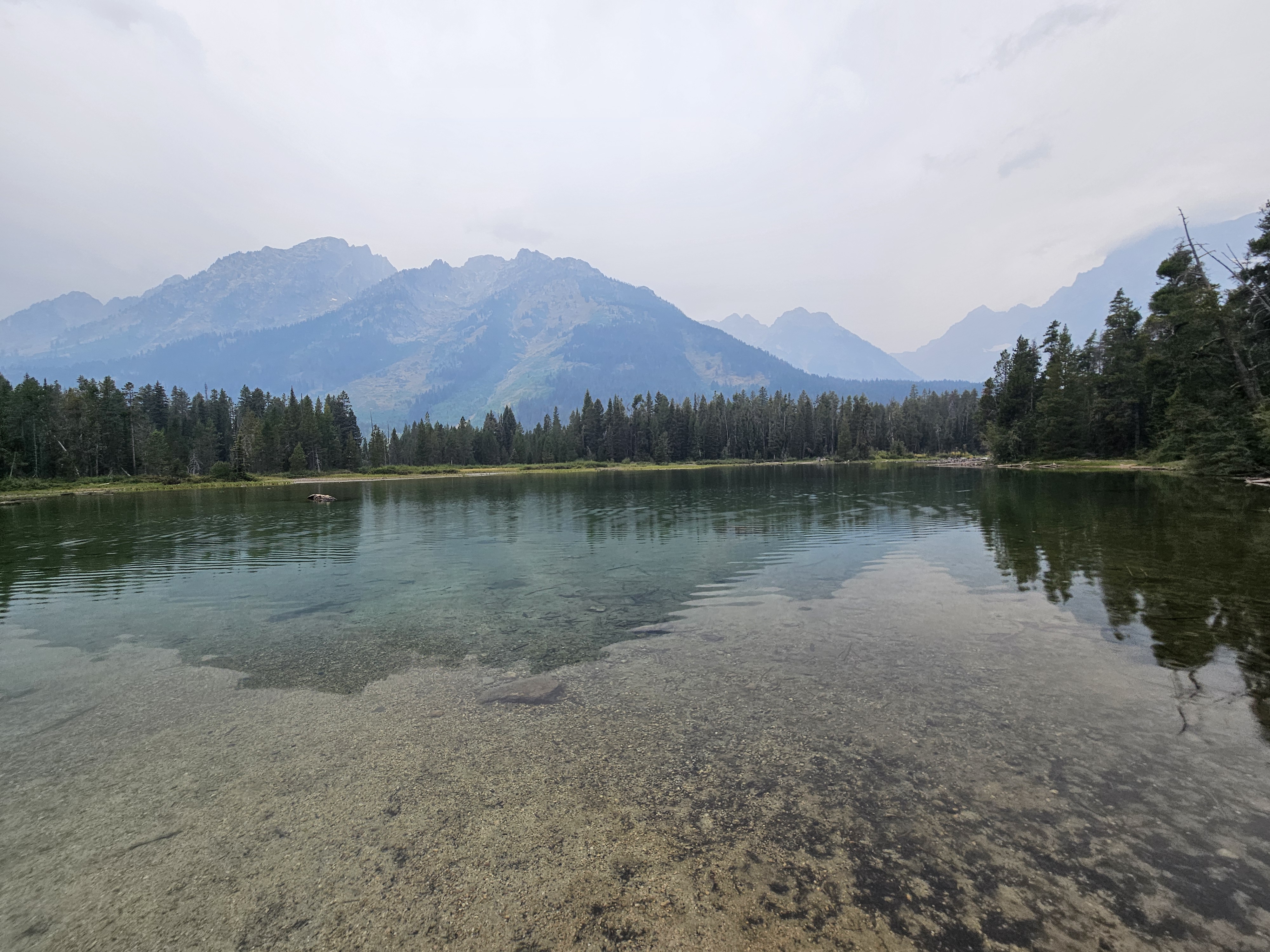
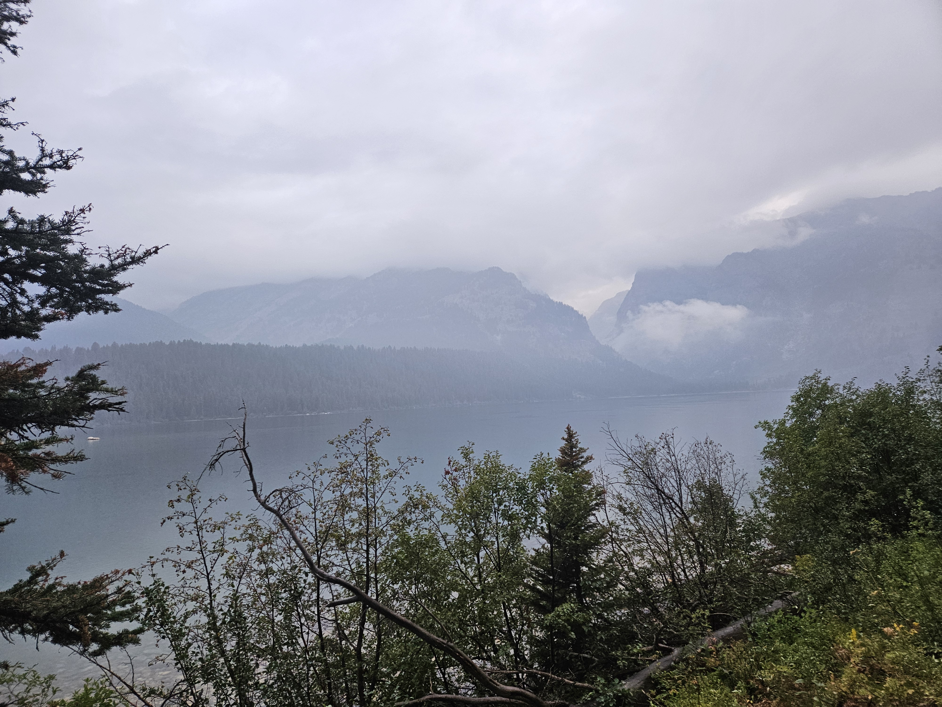
Soon we were ascending Granite Canyon and noted several marked campsites. It was warm and even though we were often in the trees, sometimes we were in more meadow and we were hot. There were several places that the swimming would’ve been great along the creek but we thought we should keep moving even though we only had less than 8 miles to hike to our camping zone in the Upper Granite Canyon. Mostly, I wasn’t having this hike so much. I found the scenery drab. After all, we were supposed to be hiking the Glacier Trail with views of the massive Dinwoody Glacier for most of the day.
It was barely after 2 pm when we reached the upper limit of the camping zone which was near treeline. We backtracked to the last best campsite we had seen (some zones have marked campsites while others are dispersed) which had some private creek access. After eating our “second lunch,” we set up the tent and then headed down to the creek to wash up. It seemed we were above the day hiker zone and I felt sorry for all the day hikers who came all the way to Grand Teton National Park to walk in the forest.
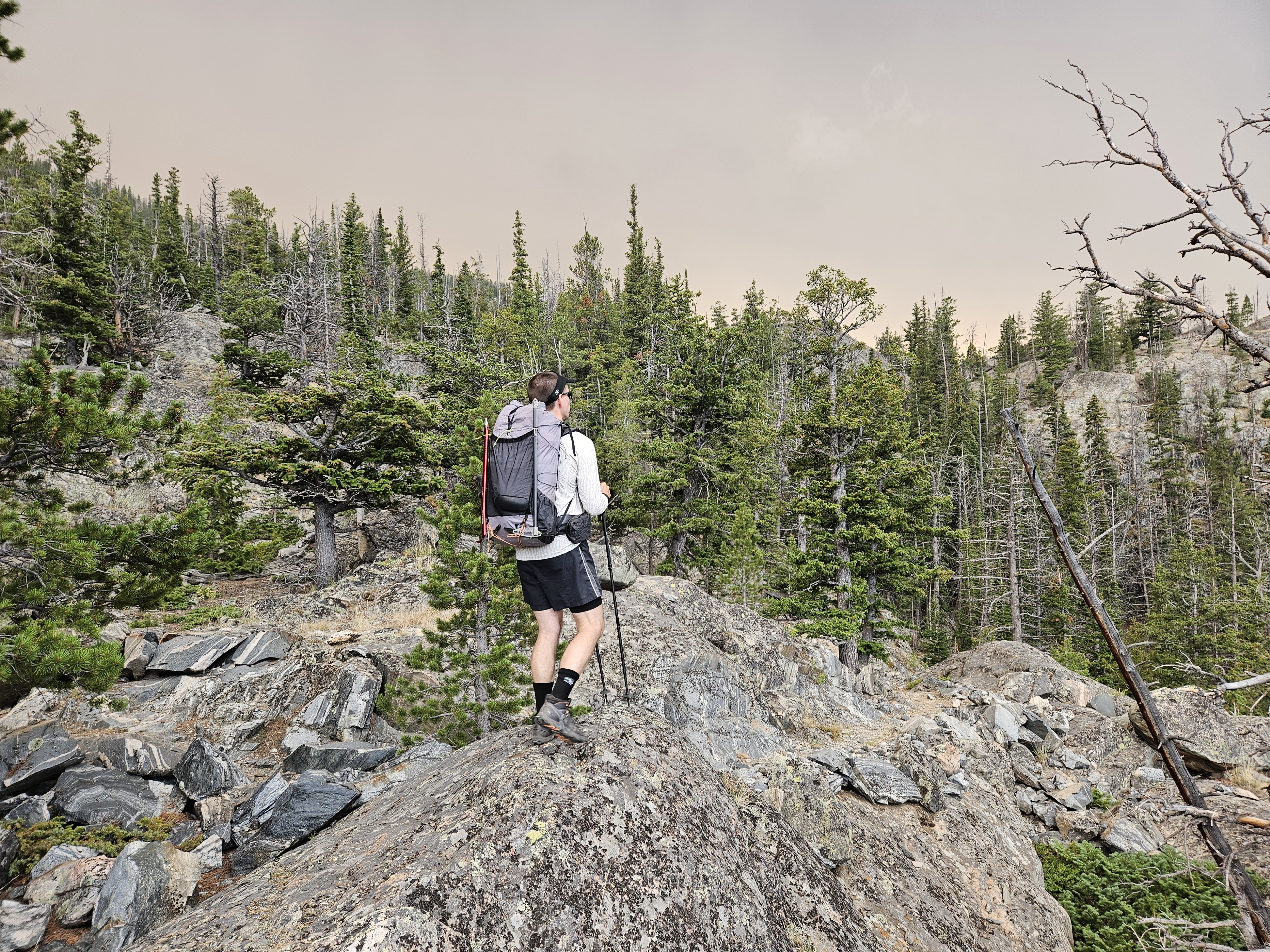
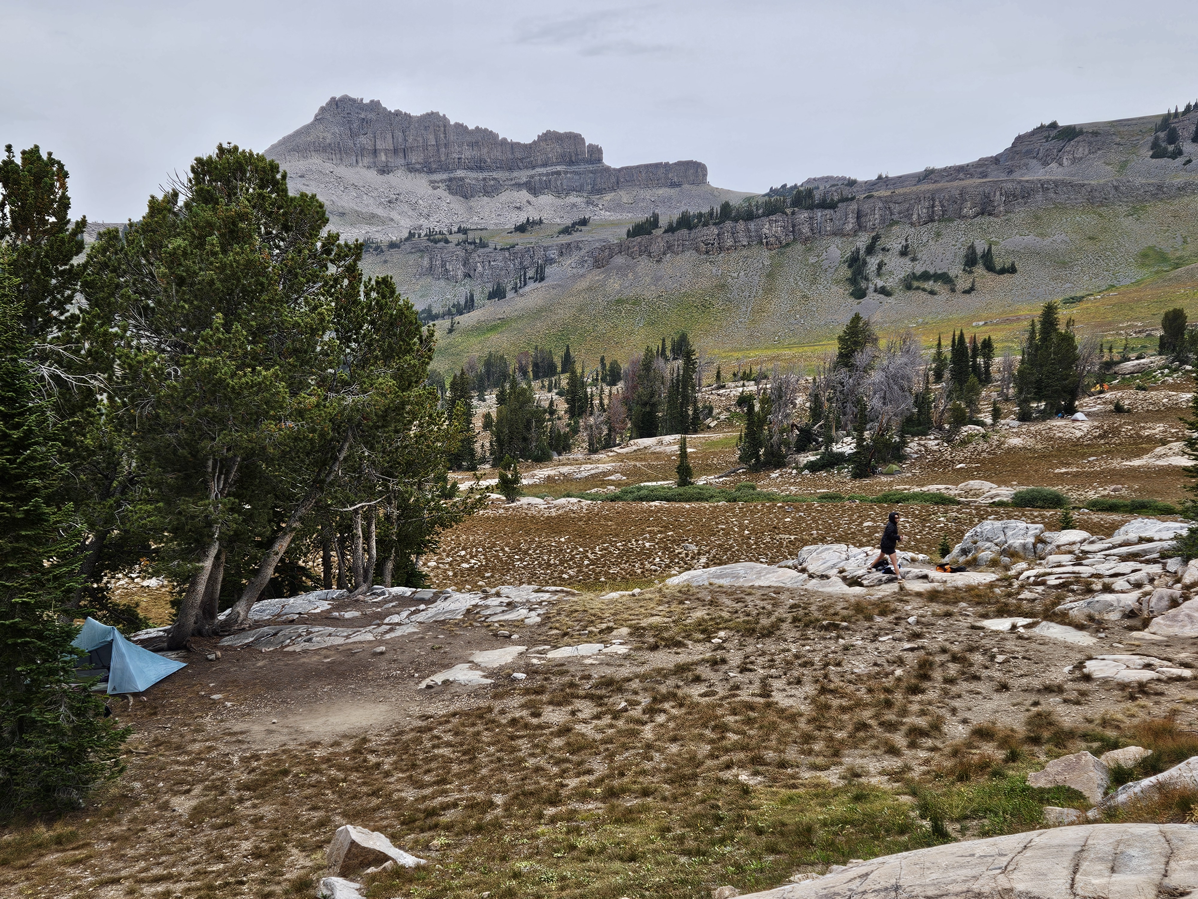
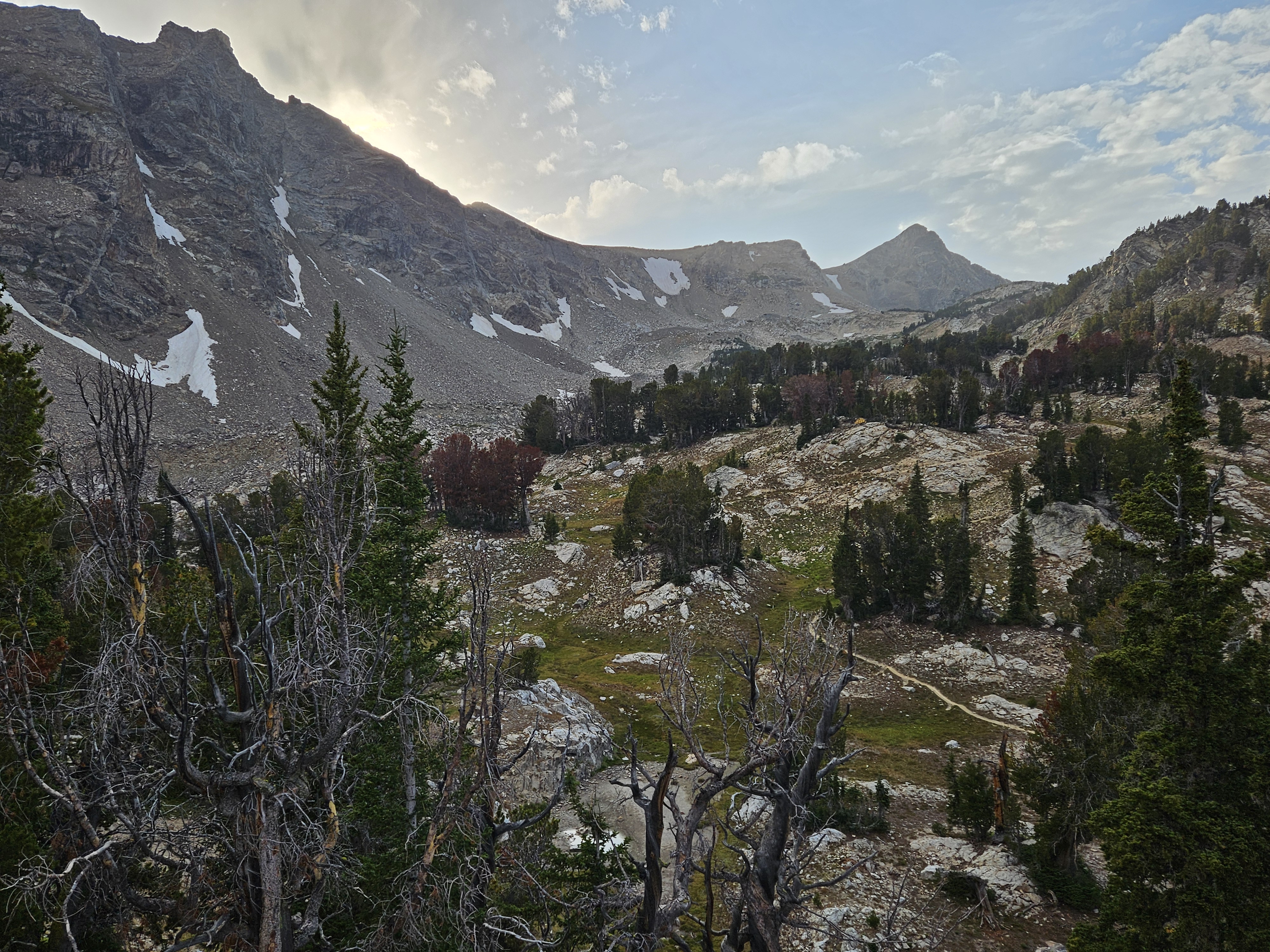
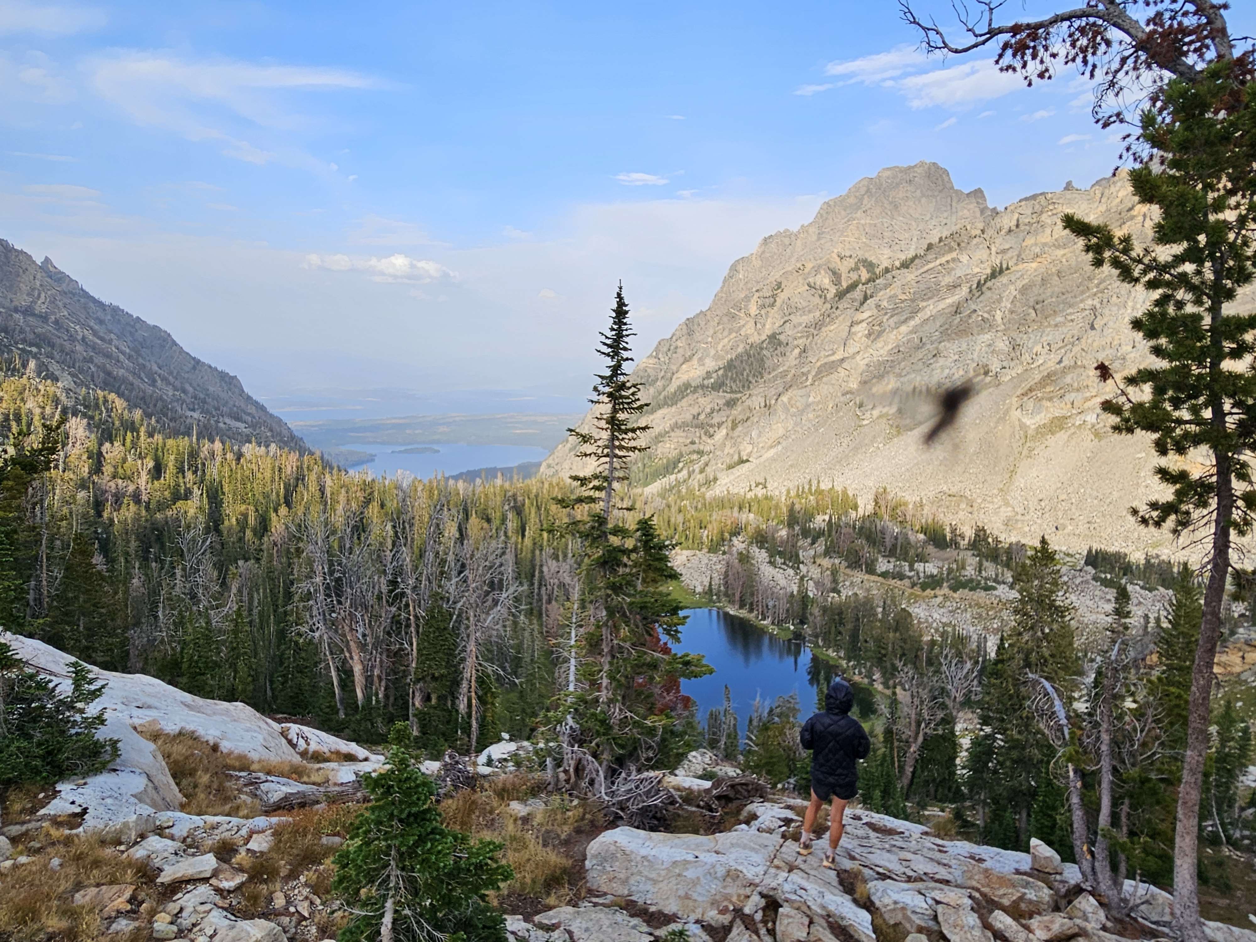
After dinner I declared we needed to do some side hiking and get up high. I chose the mountain that was directly to the north of us. Unfortunately it was a bit bushy, full of wildflowers post-bloom and lots of kinds of burs. I was stubborn though and didn’t even put on pants. We hiked up a ridiculously steep slope for half an hour, contoured west, and then came down a bit more gentler terrain.
This hike served two purposes. First, it got me up high and we got some better views to the head of the valley. Second, although we could barely get a look back to the Winds, from what we could see, that Dollar Lake Fire was still raging, cementing our decision to depart from the Winds.
Day Two 8/24/25: Upper Granite Canyon to Alaska Basin, 14+ miles via Buck Divide
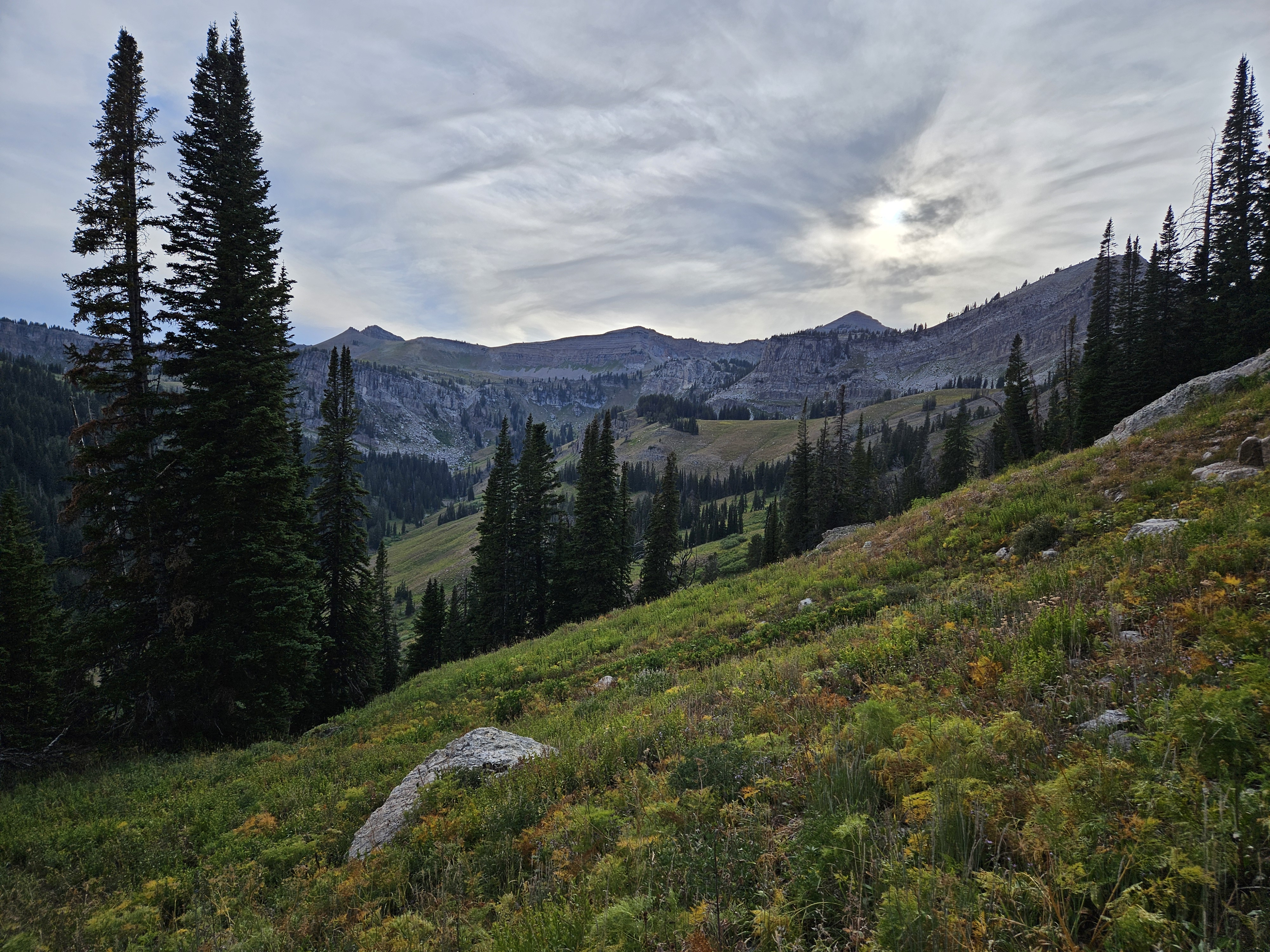
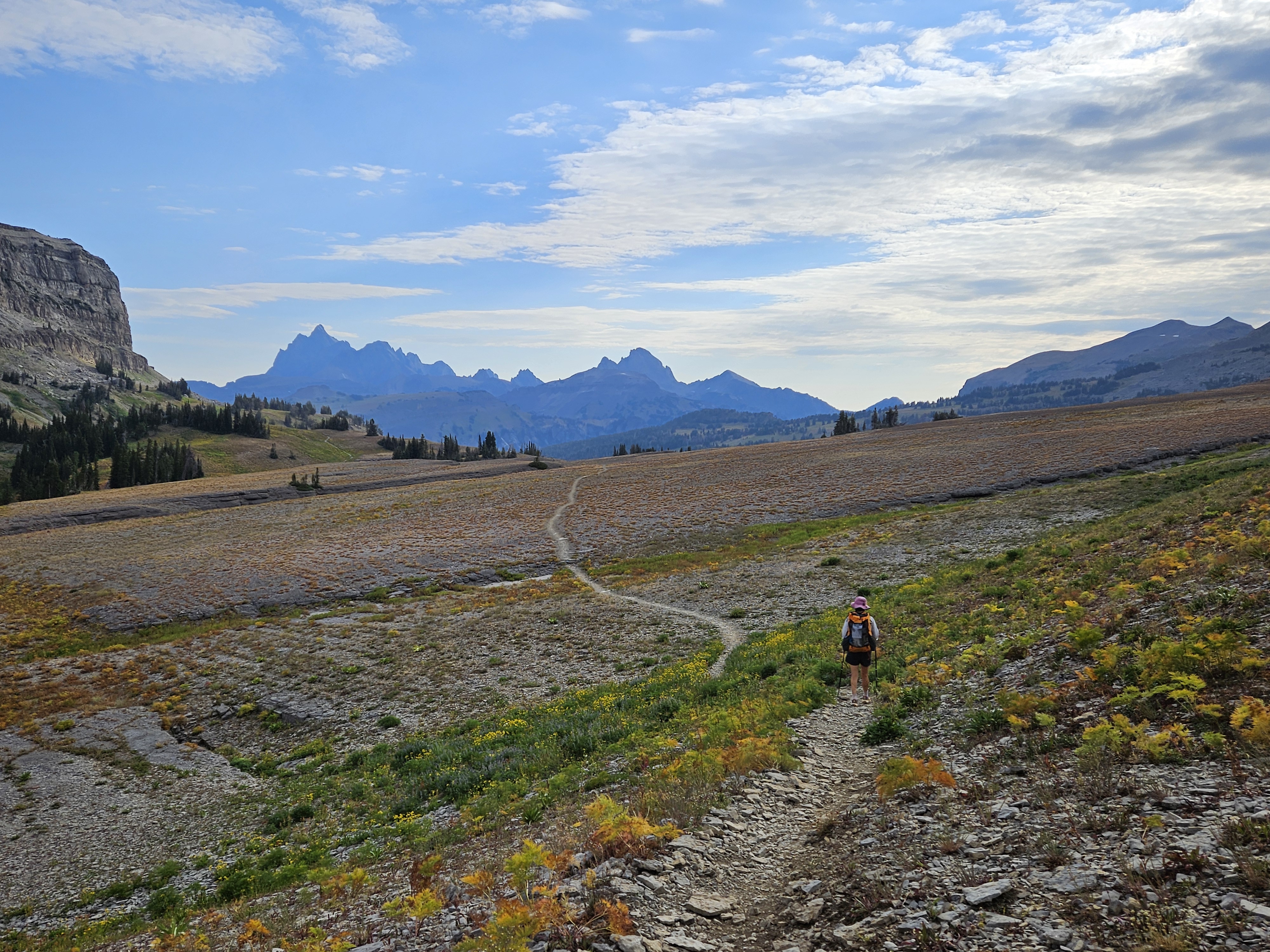
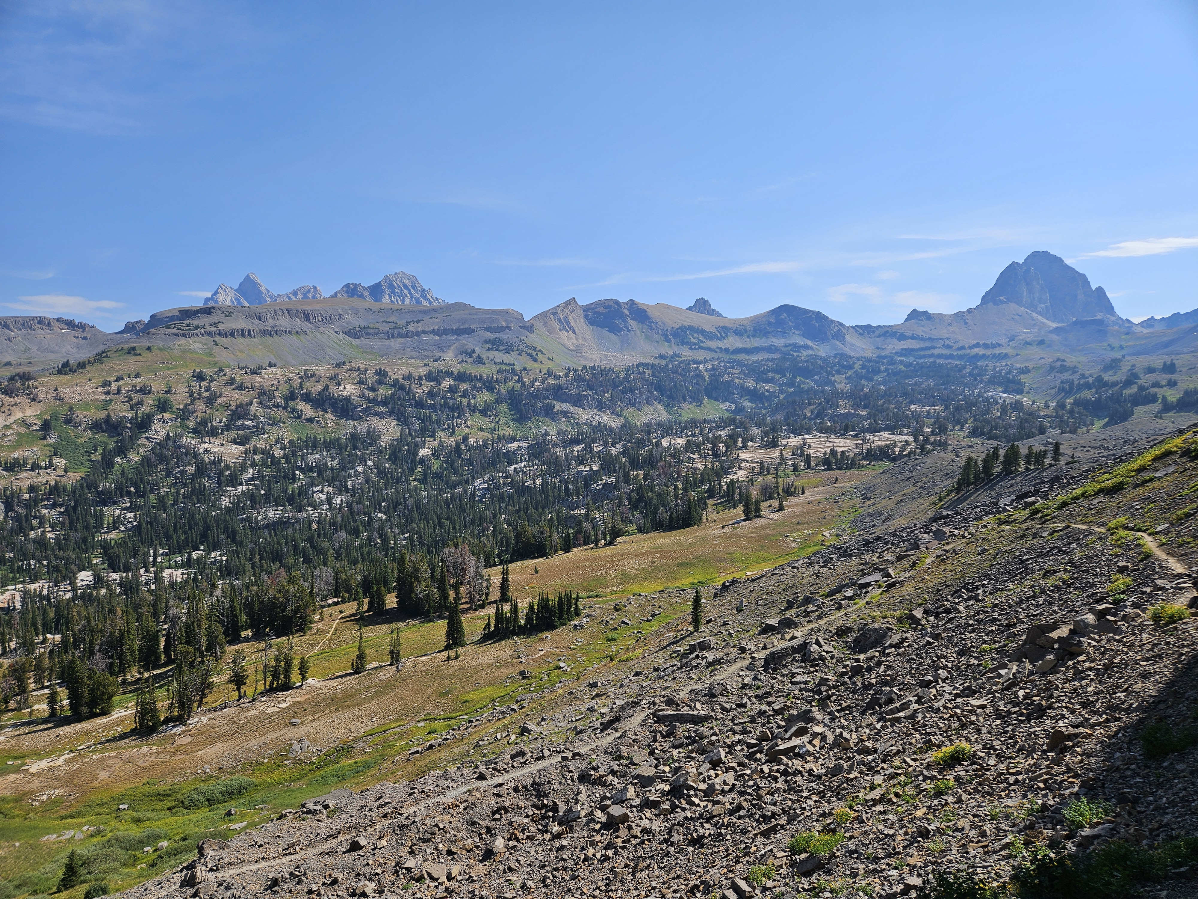
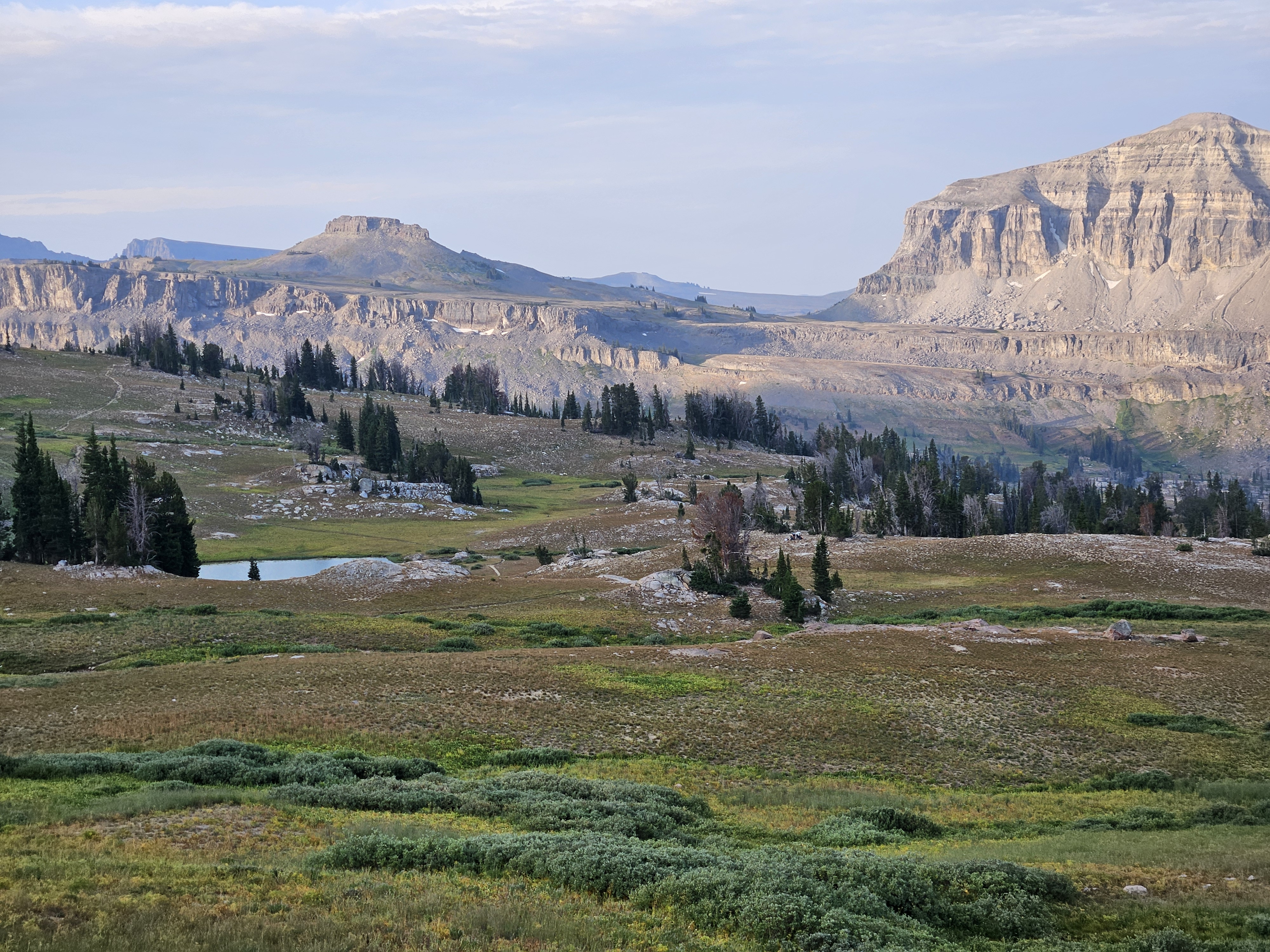
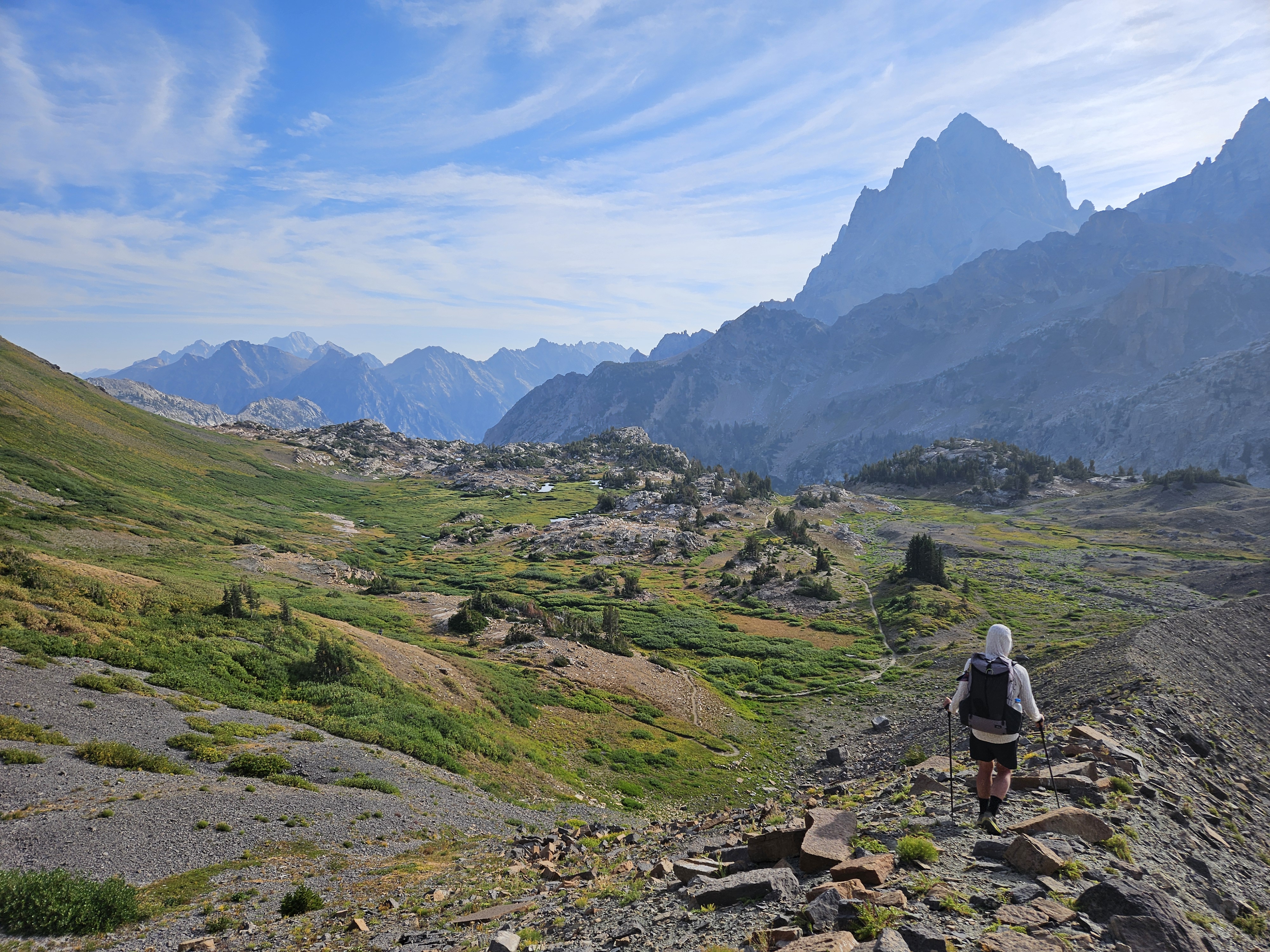
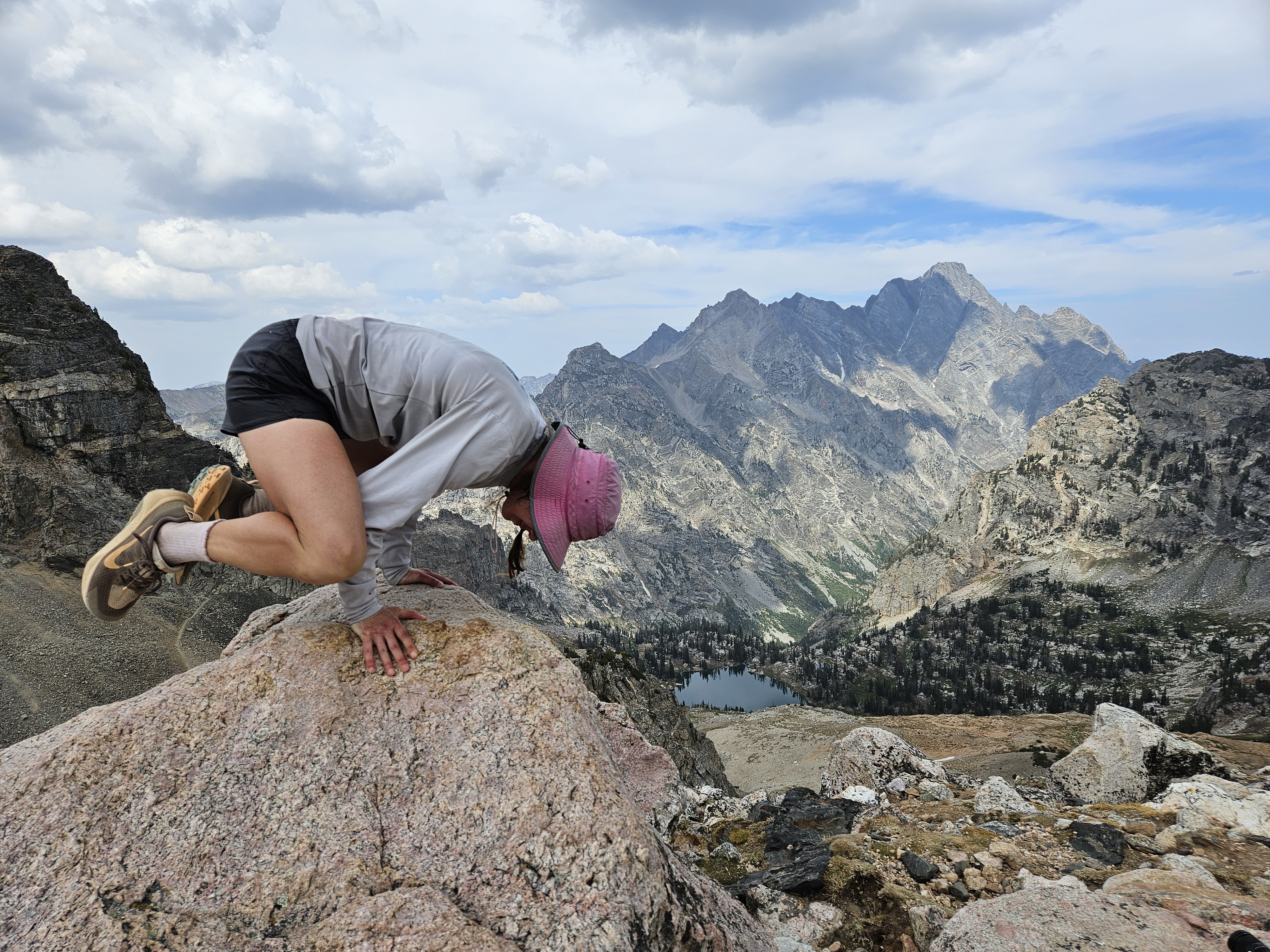
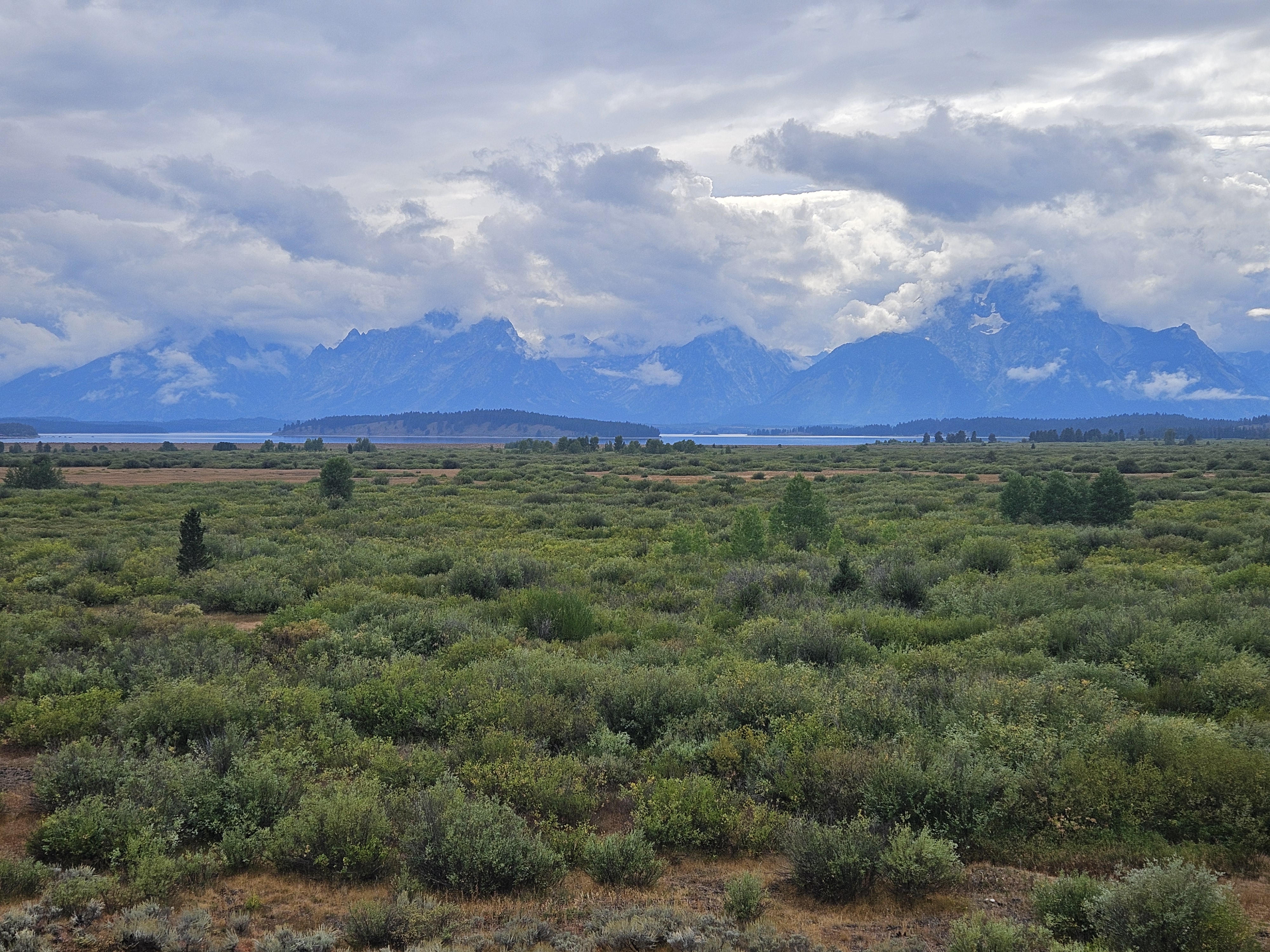
I hoped this day would hold more promise and it certainly did as we hiked uphill to Marion Lake. The campsite at Marion Lake had been full the night before and there were several guys milling about as we hiked by, then we continued up to the plateau leading to Fox Creek Pass. Once we broke out onto the plateau, and incidentally into the Caribou-Targhee National Forest (where perhaps we should have dry-camped the previous night), stunning views of the Grand Teton popped into view. I couldn’t help remark though how much the mountains around here reminded me of the Uintas.


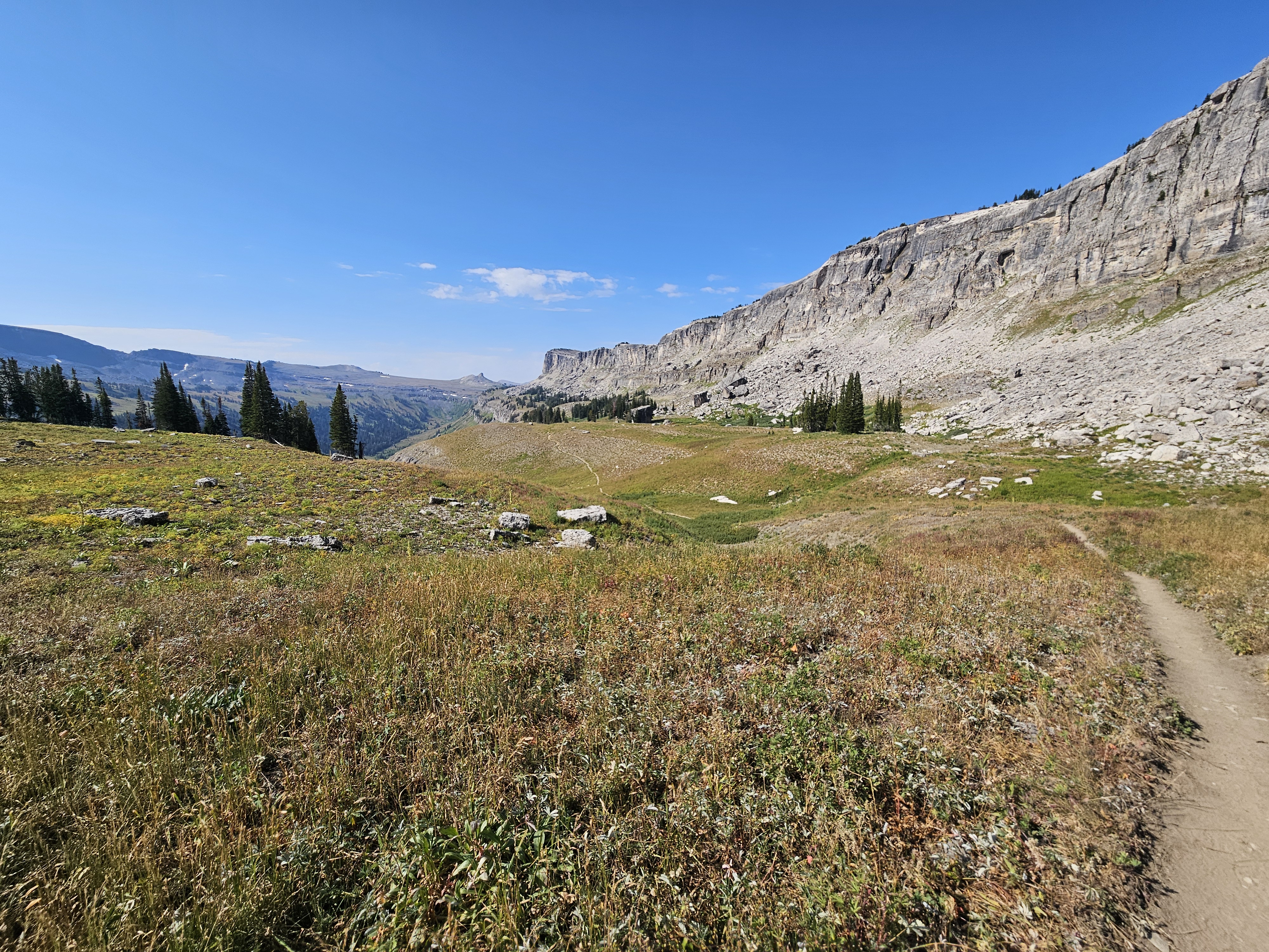
Eventually we made it to Fox Creek Pass where we then had a short climb up onto the Death Canyon Shelf which was a highlight. We got good vistas of The Grand and there were marmots everywhere, including some with really black fur that we’d never seen before. We walked close to a fox, although I chuckled to myself cause I’ve definitely seen a fox on my running commute along the Mississippi River near downtown Minneapolis in past years.
Death Canyon Shelf went on and on a bit, 3.4 miles according to the map. The trail rolled along the plateau, almost always dropping or gaining elevation, but it was great being up high and the panorama didn’t disappoint.


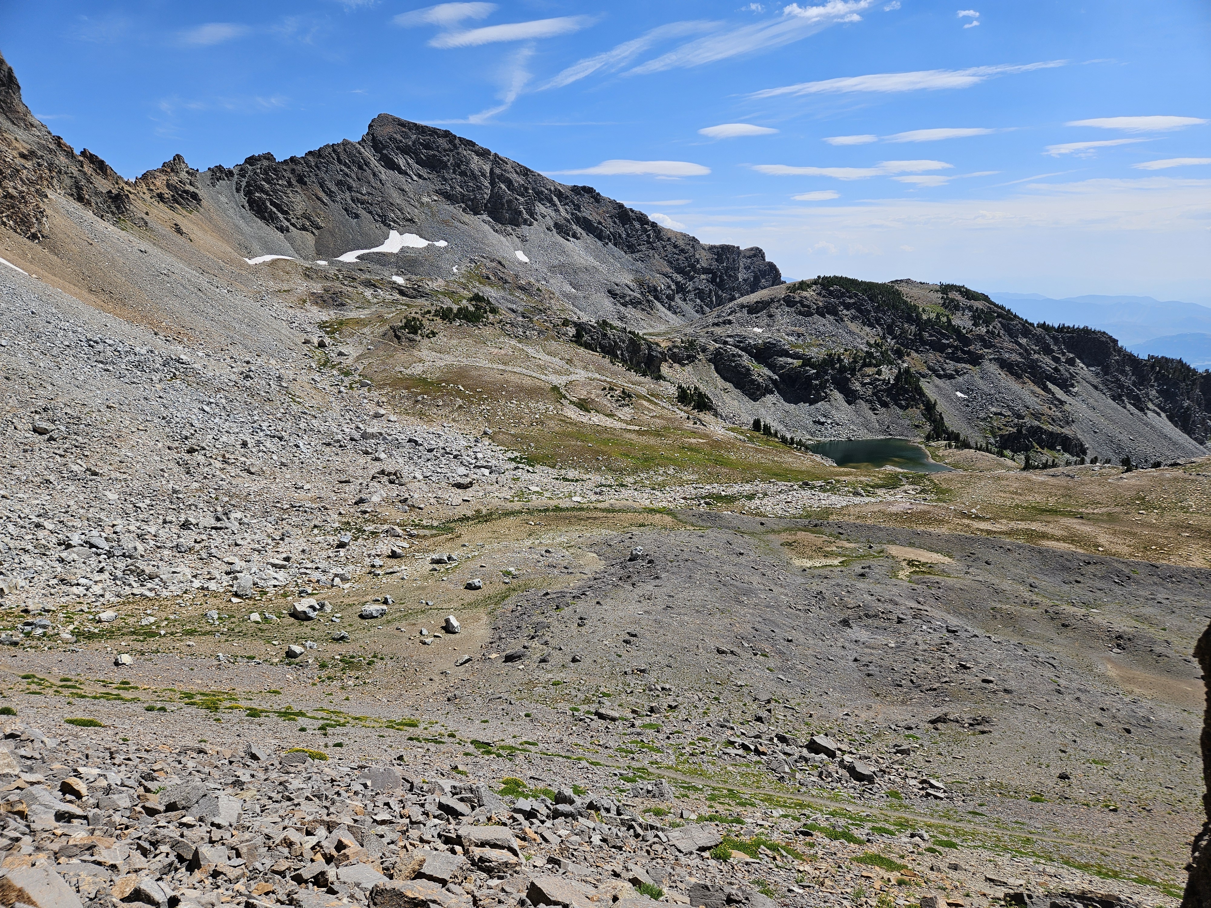
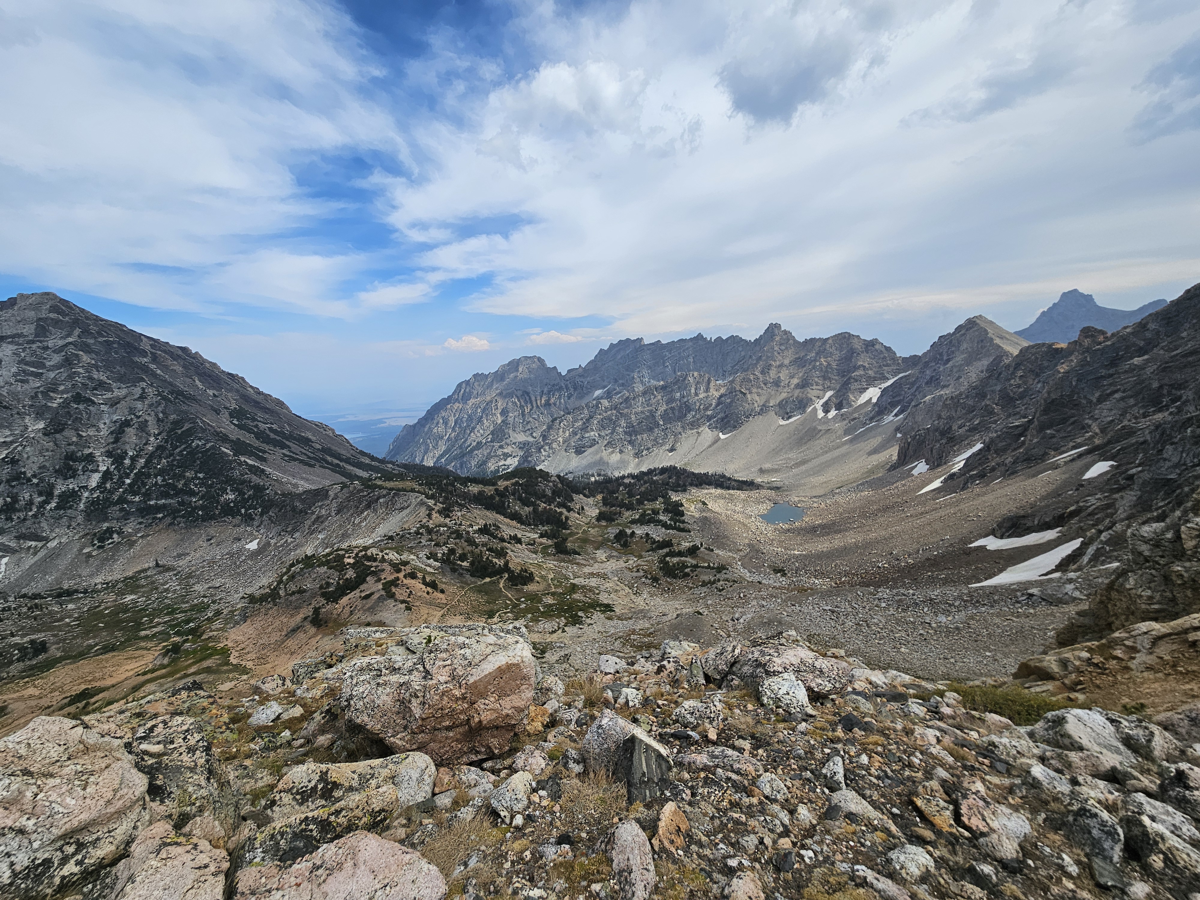
Eventually we made it to Mt. Meek Pass at 9,726 feet of elevation where we caught our first glimpse into the Alaska Basin where the Teton Crest Trail enters back into the Caribou-Targhee National Forest. This meant we were back into dispersed camping land for the night. I’d heard about the Alaska Basin and as we peered in, I noticed all the granite slabs, kinda like the Sierras. The Basin though didn’t appear too stunning to me.
It’s nice, but no Cirque of the Towers,” Erik summed up the scenery.
We dropped down a few hundred feet into the Basin on nice switchback trails, filled up our water, and given it was only noon, decided we ought to do a loop in the Basin and head up to Buck Mountain Pass.


Now here I’ll admit that we didn’t have a paper topo map. The free paper map showing camping zones, in combination with the well marked intersections, was plenty adequate to navigate the Teton Crest Trail. But Erik and I don’t always stay on trail, especially if we have a few hours to kill. Now we did have Gaia GPS topo map on an APP on our phone; however, in our haste and spotty internet when we switched course to do the Teton Crest Trail, we’d failed to realize that it hadn’t properly downloaded for the entire Teton Crest Trail. Hence, our map only showed the large 200 foot contour lines, and so prior to seeing the actual mountain, we had thought about climbing Buck or just the Teton Crest, but once we saw these peaks, they appeared technical and completely out of our capability.
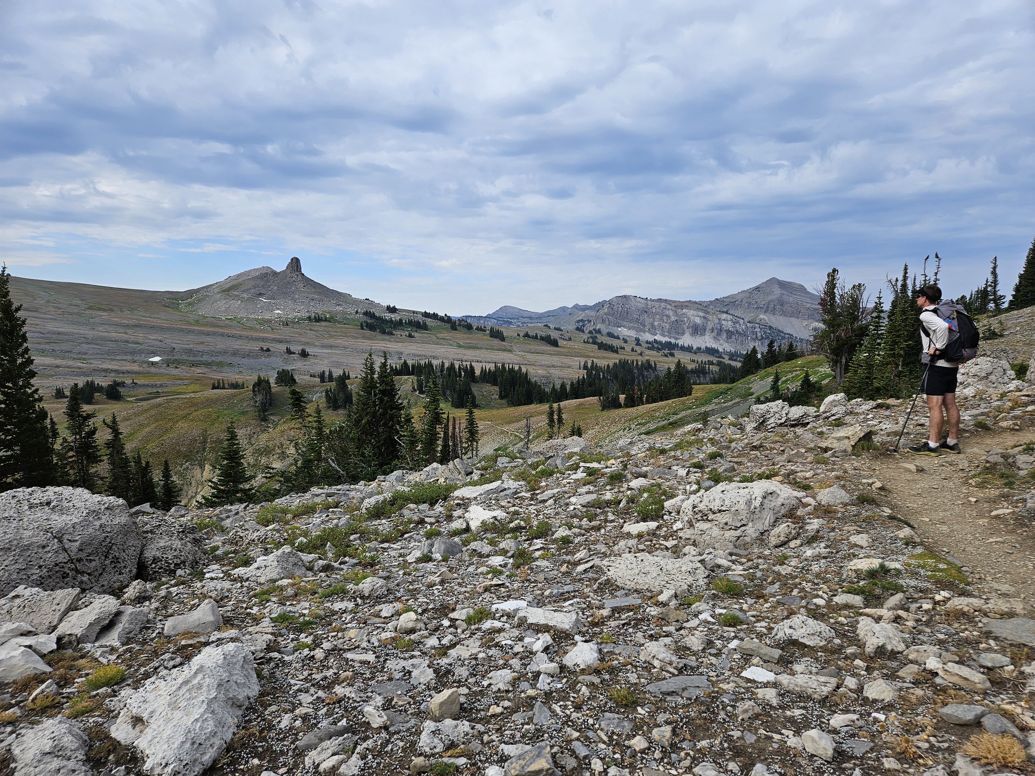
At Buck Pass we tried to climb the few spires just to the north of the pass but quickly gave up and found a shady spot for our second tortilla lunch and here we made out the trail to Static Divide, Erik saw on Gaia that we should have been going for Static Peak, a short off-trail route (technically with a social trail per Gaia) that would have been well within our wheelhouse. We thought about going for this now but we were running low on water and time if we wanted to get to camp by late afternoon so we turned around and hiked the higher trail down the Alaska Basin.
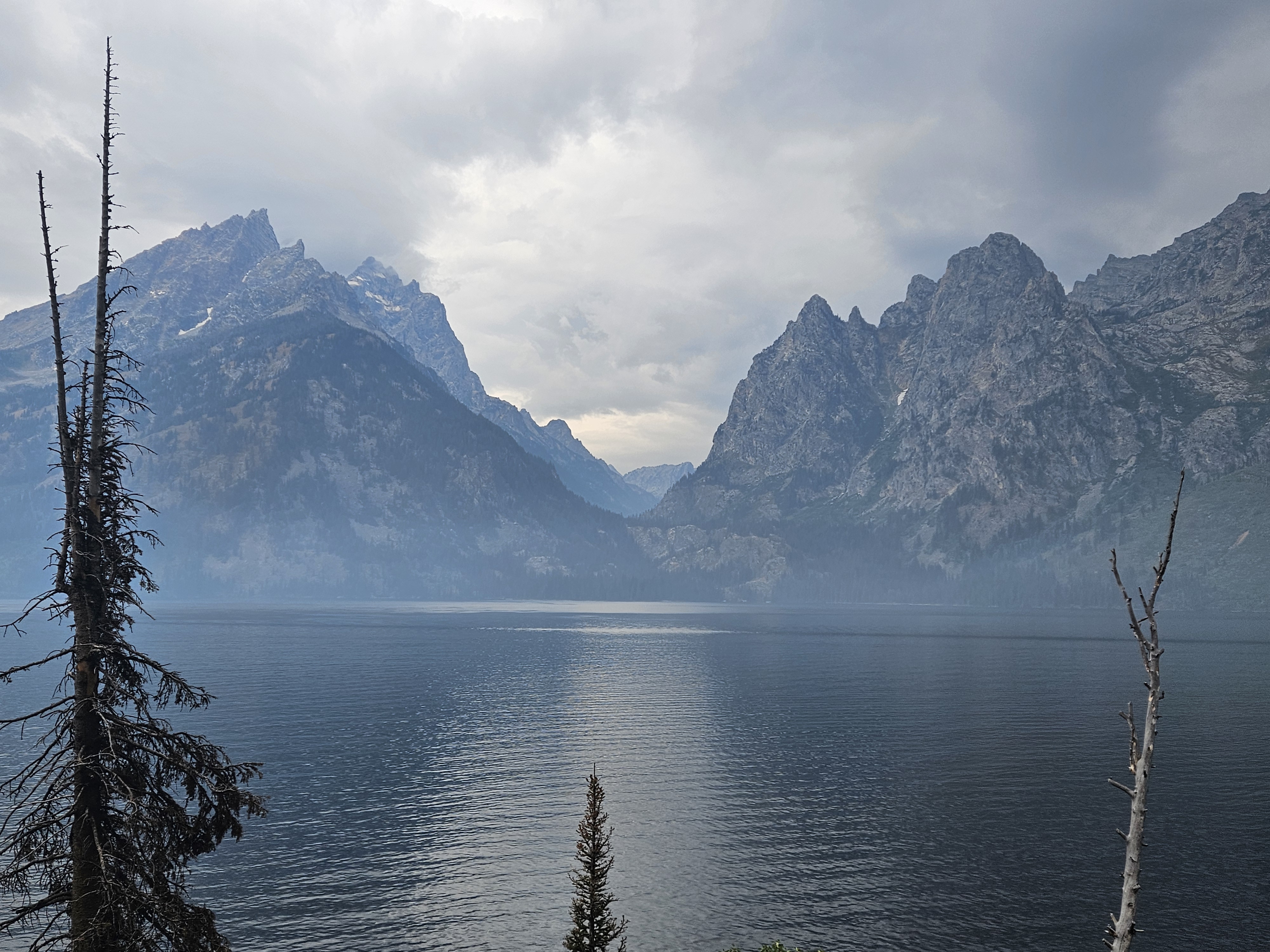
Perhaps the fun part about not having a good map was that we encountered a couple surprises along the route. The first such surprise was Sunset Lake in the northeast part of the Alaska Basin. We were trying to camp closer to Hurricane Pass and didn’t know our options but when our trail rounded the bend, there was a lake below us and as we descended, we saw a great camping site on the south side, a bit above the lake that gave us a perfect view of the lake and The Grand through the pass above the lake.
We got to camp early enough that we had time to wash up before cooking dinner, enjoying the area (not my best view campsite ever, but good enough for what I like) and then went to bed early to get up and do it all over again.

Day Three 8/25/25: Alaska Basin to Upper Paintbrush Canyon, 13 miles
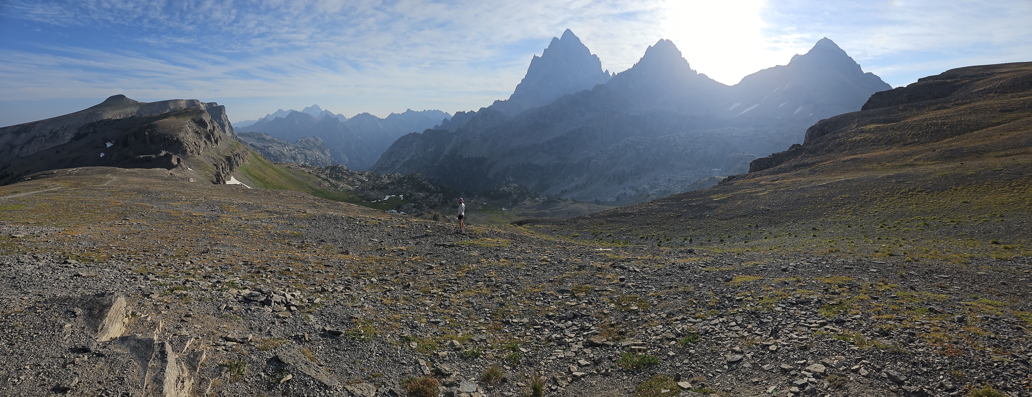
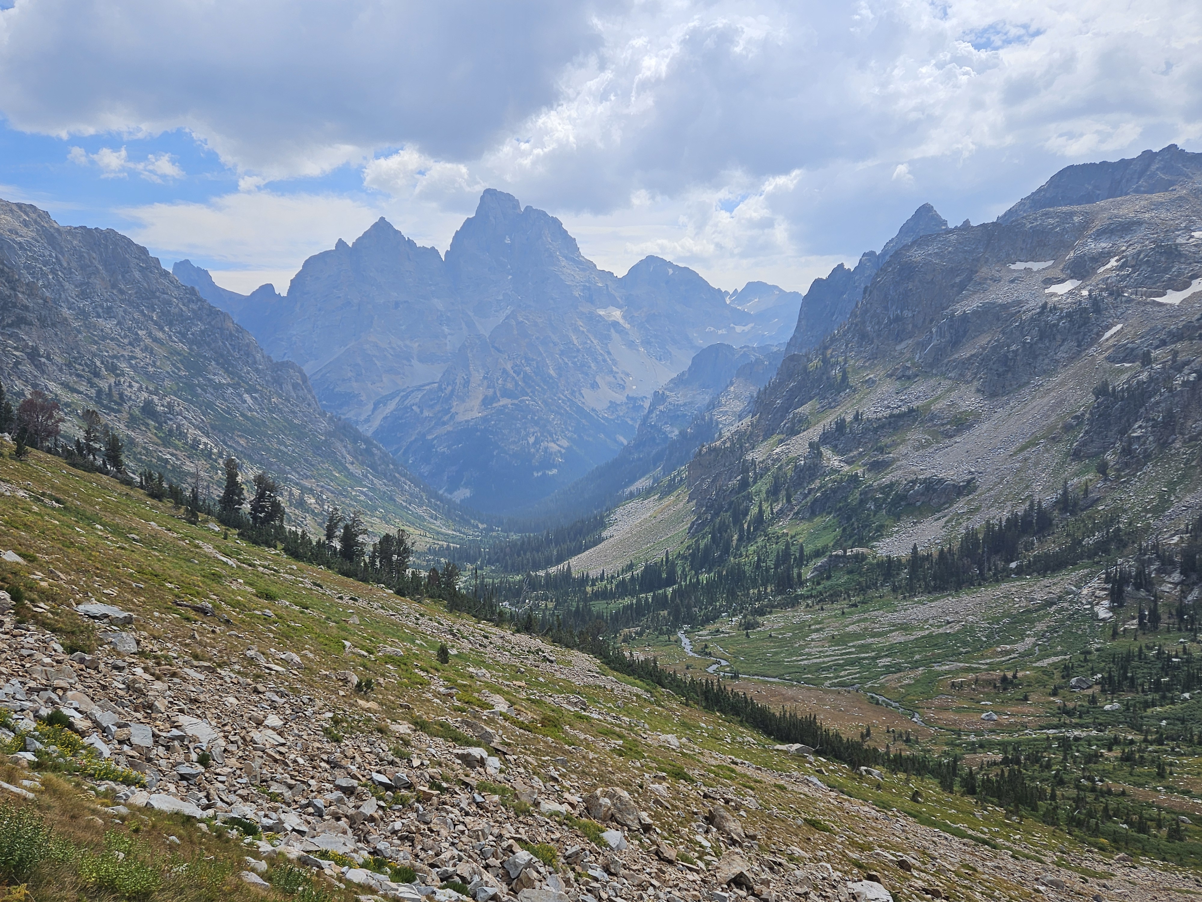
The ranger had said the monsoon was coming in this day, Monday, so I wanted to get an early start and keep up a swift pace. Even though we only had 13 miles on the day, I wanted to accomplish these by early afternoon. Our hike up to Hurricane Pass was easy enough on good switchbacks and we didn’t dawdle too much taking in the views.

Once over Hurricane Pass though, it was another story. The land form features were simply too breathtaking to not linger. First, Erik had us to play on a snowfield. Then we realized there was still some glacier left of the Schoolhouse, which Erik lamented we should have hauled along our glacier gear to practice climbing down this hunk of snow and ice, complete with crevasses.
Then we got derailed by the cirque on the lake below the Schoolroom Glacier and I wanted to go walk on it, so we did for even more dramatic scenery.


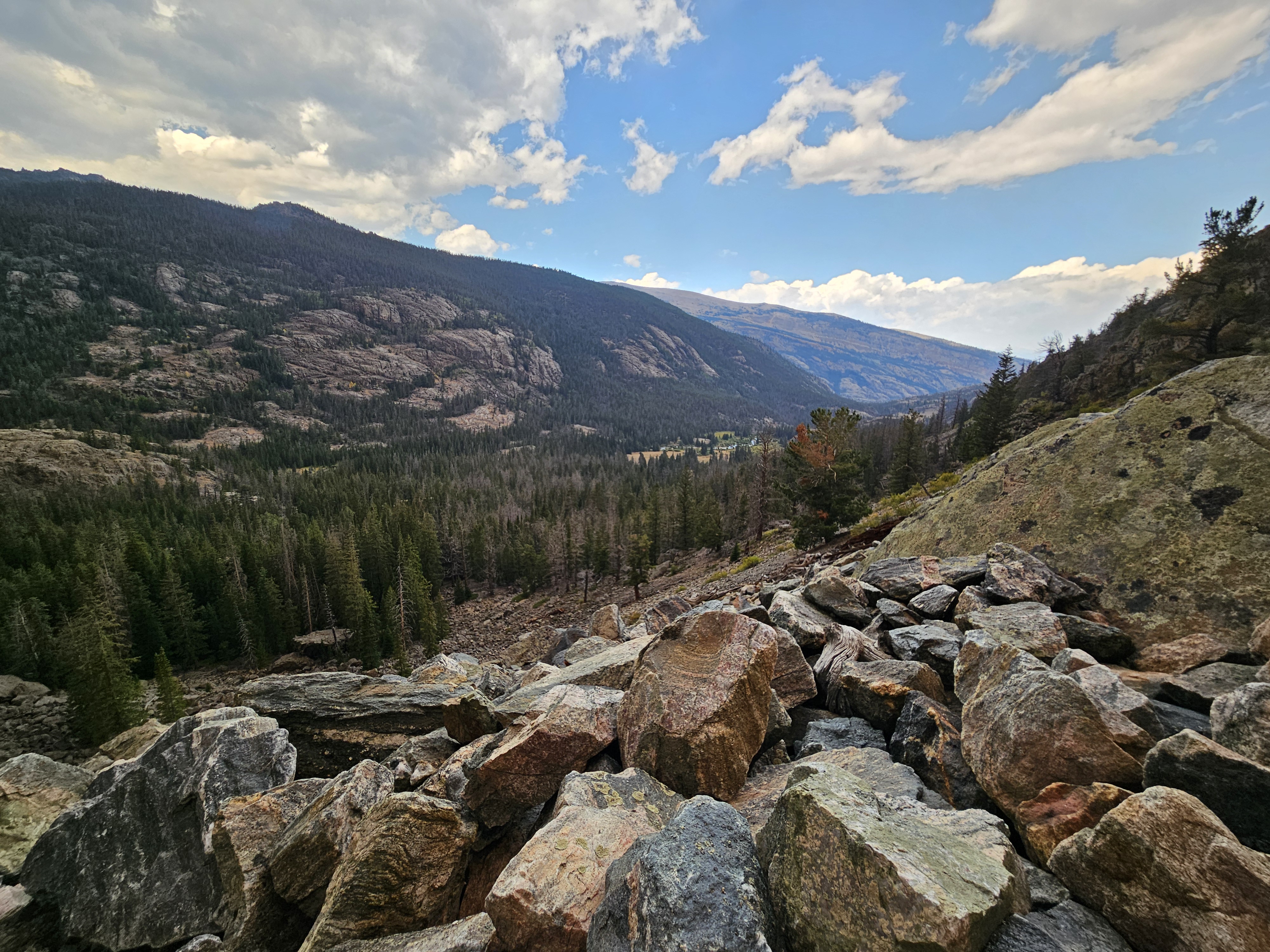
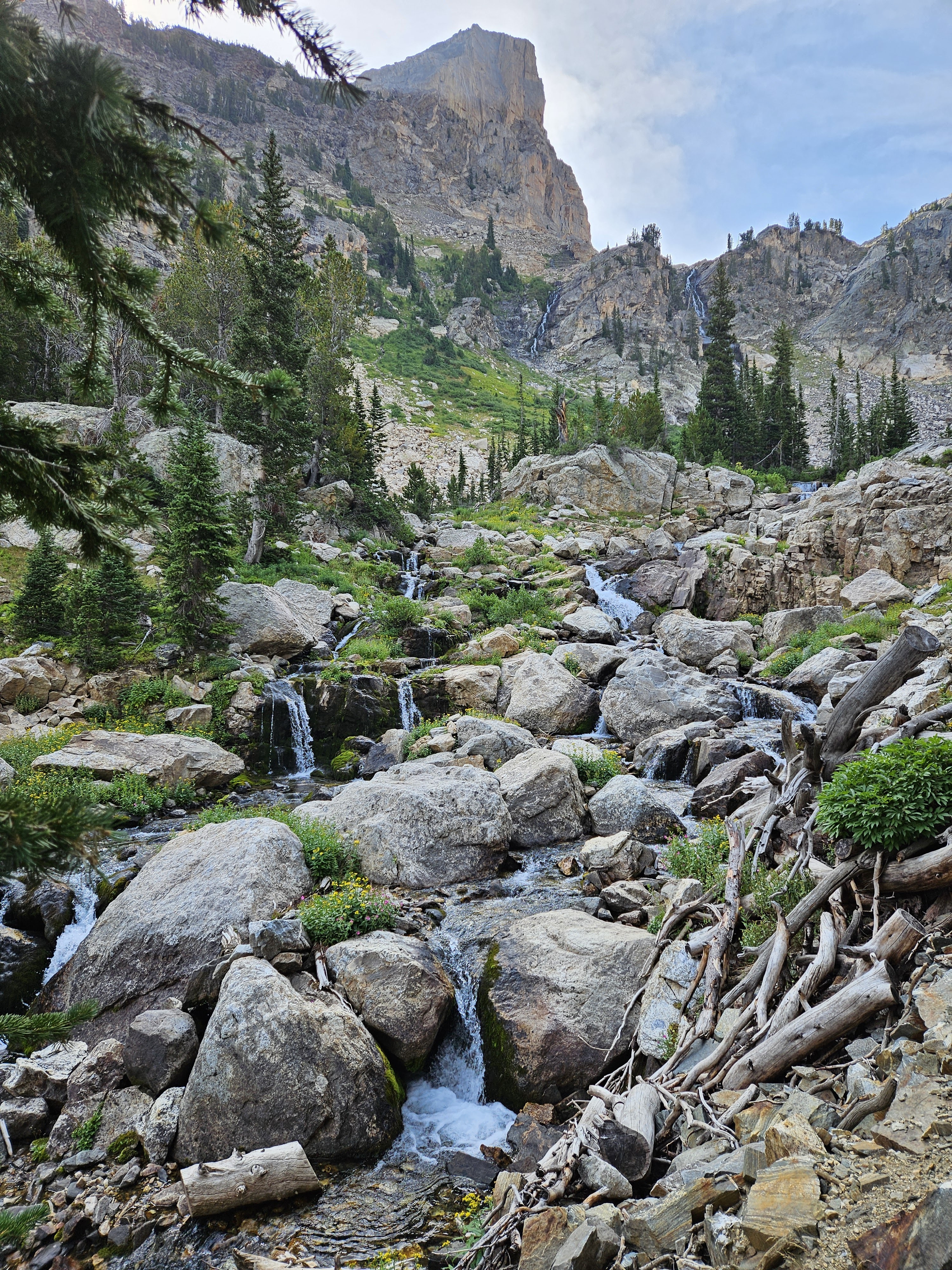
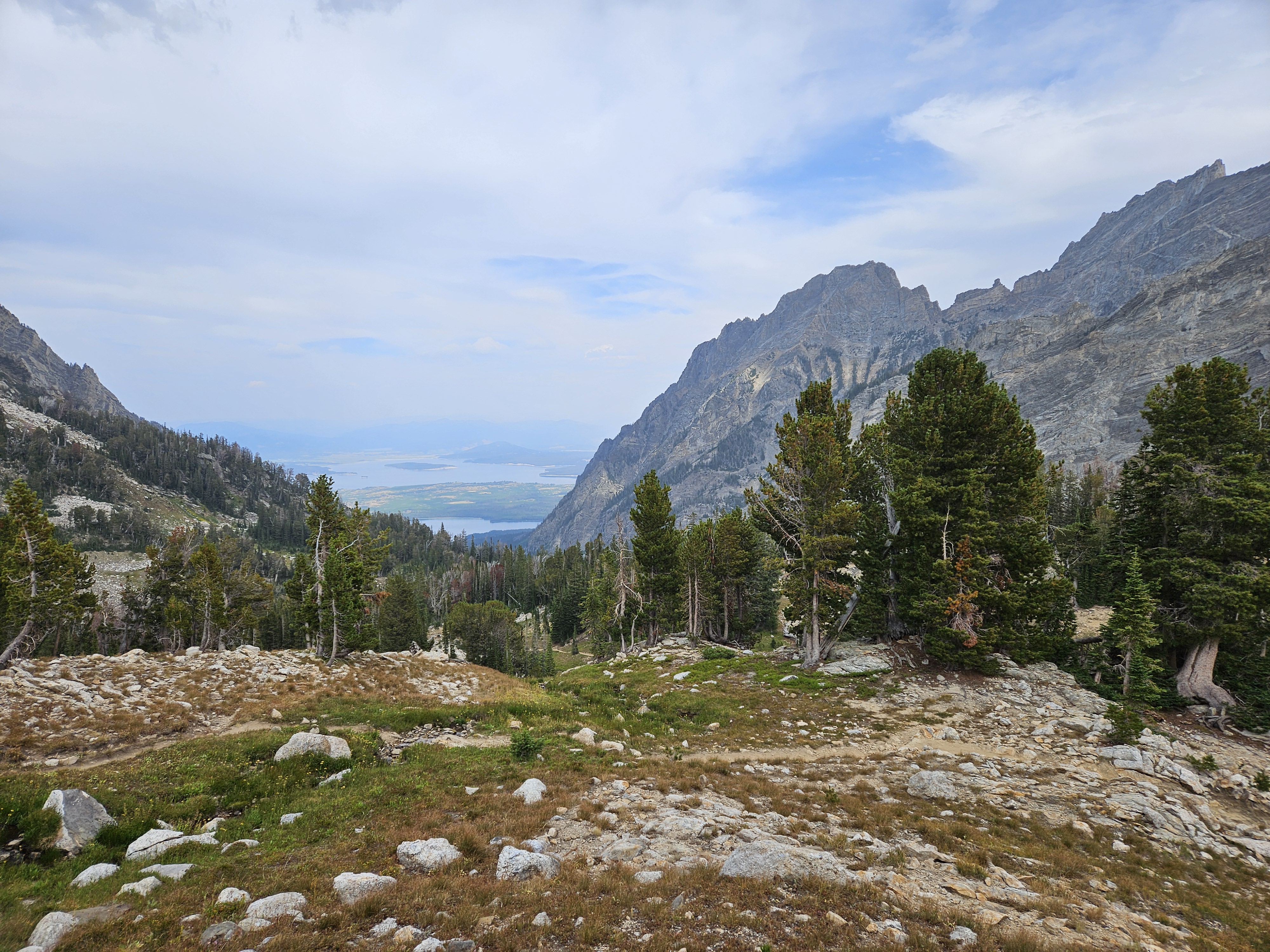
But alas, all good things must come to an end and we had to descend the South Fork of Cascade Canyon. There were still good views and lots of waterfalls, or cascades which likely gave the trail its name. We also saw a trail heading up to Avalanche Pass that looked enticing. Now we were also back in abundant day hiker land.

Eventually we made our way down into the forest, then the intersection with the Cascade Canyon Trail, and then started hiking up the North Fork of the Cascade Trail. This was the first time in two days I thought perhaps, we were hiking the wrong direction as the most dramatic topography was to our backs. I kept turning around to take in the big mountains. But this was short-lived.

Some approaching hikers said they had seen a moose in the meadow. Erik saw said moose from too far away to get a good photo (I was hiking on a ways ahead). Once up at Solitude Lake, we stopped for a nut snack and to fill up on water before our hike up to the Paintbrush Divide. There were lots of day hikers sitting, and milling about, and swimming.
Upon leaving Solitude Lake, the trail contoured back south along the valley, gradually gaining significant elevation, demonstrating truly exceptional trail infrastructure navigating cliffs, talus, scree, and boulderfields. Once again we seemed to be heading the “right” direction. On hiking trails I have a hard time balancing and not tripping if I don’t look at the ground where I’m going, but the jaw-dropping view of the tallest mountains was exceptional and we took our time along this stretch.

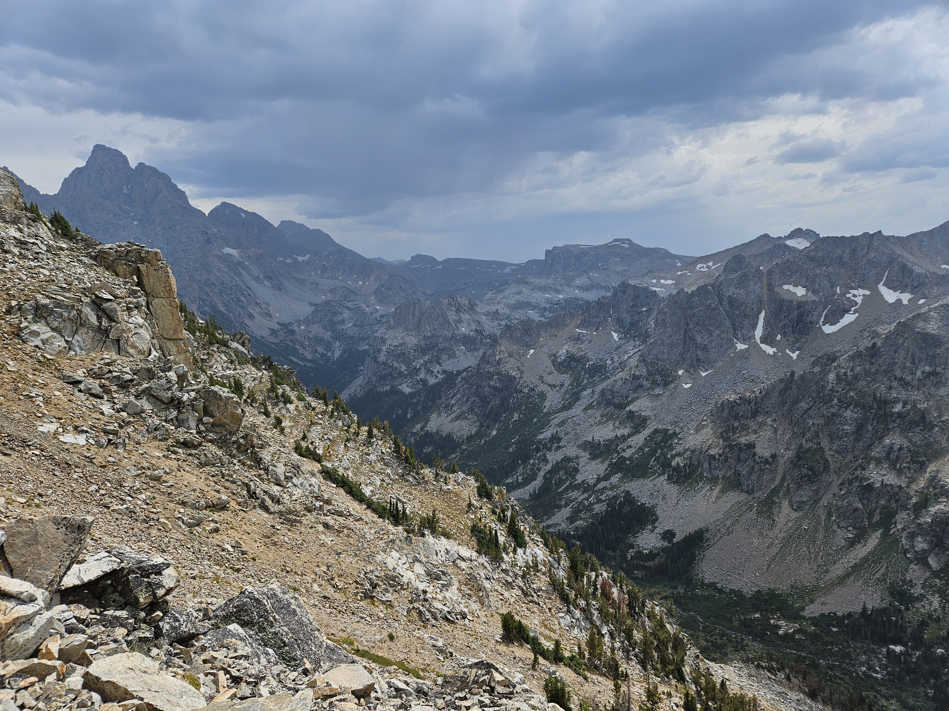
As we climbed higher, we caught the vista back to Hurricane Pass as well as some threatening clouds so we quickened the pace, enjoyed the scenery less, and once we finally made it to Paintbrush Divide, we didn’t stay as long as we would’ve liked.
The terrain down the start of Paintbrush Divide was steep and there were some good switchbacks, albeit with the steepest and most loose rocks we encountered in the national park. There was even a short snowfield we had to cross despite it being so late season. This loop route – Cascade, Solitude Lake, Paintbrush Divide and Canyon – is the best day hiking in the park but it’s a long trek at just under 20 miles and near 4,000 feet of elevation gain. And even requires some technical snow crossing in the early season.
Our camp for the night was in the Upper Paintbrush Canyon. Unlike some other camping zones, we soon learned this one was truly dispersed camping. Ideally we would have camped in the upper reaches of the zone, but we had over 20 miles to walk the next day, so we camped down near the lower end of the zone where we found an area with good beat-down tent pads.

Despite the threatening clouds on the way to Paintbrush Divide, the weather was holding enough to wash up in the creek and set up the tent, although it got quite windy. After dinner we hiked up to the top of the knob to the north of our tent site and took in some more views. And no monsoon yet!
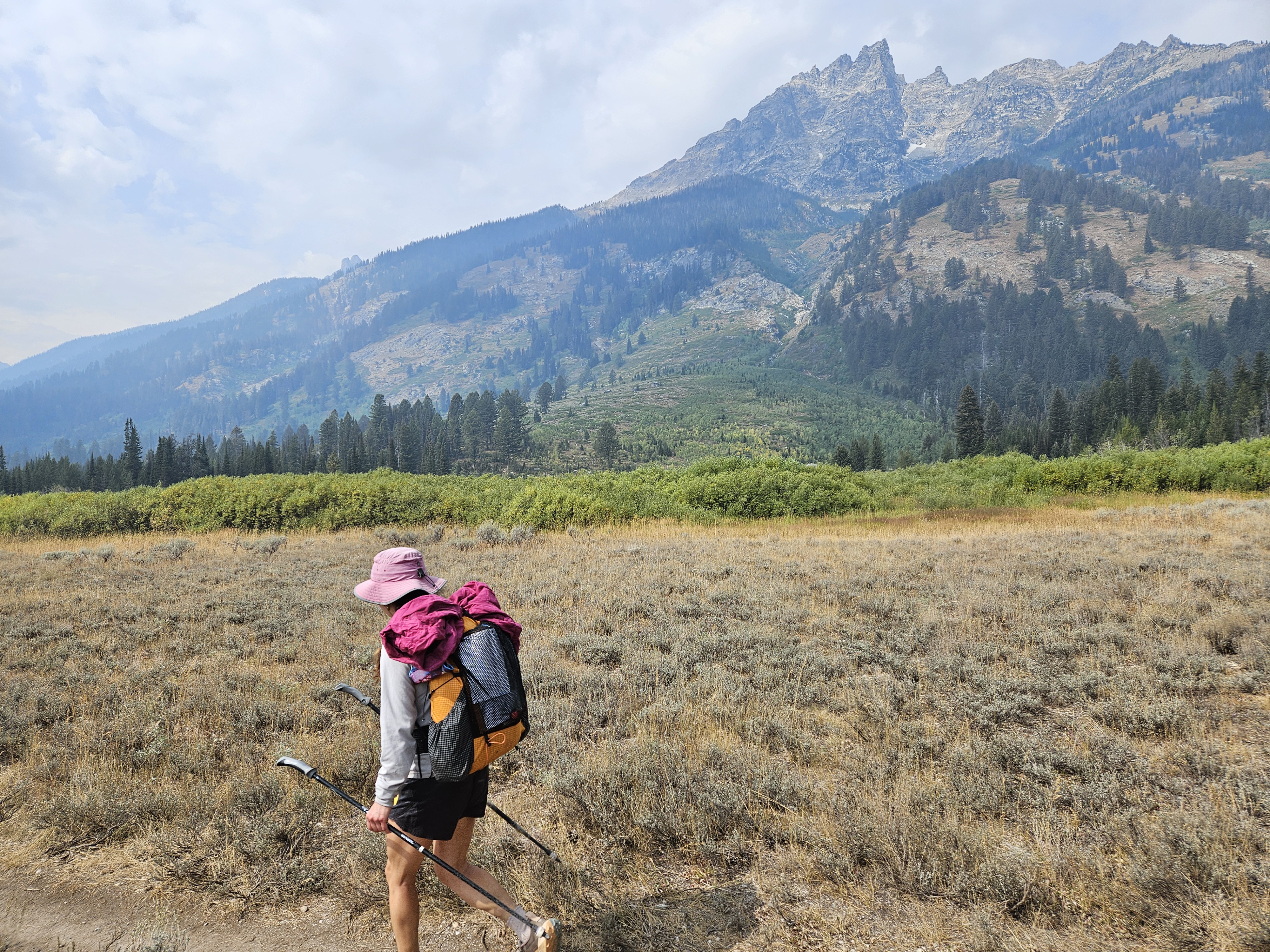
Day Four 8/26/25: Upper Paintbrush Canyon to Phelps Lake, 23+ miles
Overnight my dreams were disturbed by rock slides. In the morning the air smelled smokey, even before we got out of the tent and once out of the tent, we saw the smoke from the Dollar Lake Fire had moved into the valley.
When we told the ranger we could hike as much or as little as needed, today was “as much.” Of course he half expected us to bail and get a hitchhike back to our car as most of this route was along the main valley with a road, especially seeing as I had told him I was a fair weather camper and the monsoon was to descend in full force.

Although we thought the mileage was slightly farther, we decided to walk on the far side of String and Jenny Lakes as we suspected the trails would be easier and the views better. It started to rain as we got to Jenny Lake and we got on our raingear but soon it stopped and we were getting hot and took it off again.
Given we had so many miles to make, we mostly just kept up walking. Along Jenny Lake we saw lots of tourists, a couple whom shushed us as they took video of deer.
“They must not get out much,” I quipped. I mean, I live in the city and can go on runs and see deer. And turkeys. And coyotes. And fox. And bald eagles.
We took our first sit down break on the porch of the store at Jenny Lake and ate tortillas. By now the sun had come out and the weather forecast was more promising. The rain kept getting delayed each day. Our break was efficient and soon we were back on trail, heading south. There was a short section without trail and we hiked the road to Lupine Meadows Trailhead. Soon we began climbing up to the intersection with Surprise Lake and we encountered lots of people, including a group we had seen the day before on Paintbrush Divide. The trail was wide but as soon as we spurred off on the Valley Trail, it got much narrower again.
At Bradley Lake we stopped for second lunch. Everywhere near Jenny Lake there were signs warning about being Bear Aware. But I got harassed by a chipmunk at Bradley Lake. Sometimes I wonder if they just put up those signs for the tourists. I wish they would have something more practical though about the chipmunks. Those buggers can be relentless.

As we continued on to Taggart Lake the trail got more popular again. Lots of day hikers. But eventually when we continued along on the four mile section of the Valley Trail towards Death Canyon Trailhead, we were again alone. Here the trail was so minimally used that the surface often was covered in pine needles. There were many interesting things along the way including areas of ferns and giant thistles with multiple flowers. It was only bushy by a few stream crossings. And there was some impressive water diversion engineering where the trail was banked and there was an adjacent channel made for the water. Those people out east should take some hints!

At the Death Canyon Trailhead intersection we began our final climb of the day to the Phelps Lake Overview before descending down to the lake. We met some people on trail who said there was a black bear by Phelps Lake. As we got closer, we saw some scat from scrumptious fresh chokecherries but never saw the bear.
There were three campsites at Phelps Lake, the first two of which we came to were occupied. The third one was empty though so all was good. All of the sites were on their own trails above the lake and main trail. Seeing as it was sunny, we decided to swim before setting up camp and then cooked dinner by the water. Before doing so, Erik thought we should “claim” our campsite and so he hung up his ultralight (fairly expensive) rain jacket. We had a great swim and dinner but upon returning to camp, Erik’s rain jacket was nowhere to be found.
It’s possible an animal took off with it but we searched around and didn’t see anything. There were lots of downed trees by the camp so if an animal had grabbed it, it may have gotten hung up in the branches. More likely someone saw the jacket from the trail (it wasn’t super easy to see) and then hiked up the campsite trail (which is a bit taboo because usually these campsites are considered private) and took the jacket. And the weather forecast called for rain the next day:(
Day Five 8/27/25: Phelps Lake to Granite Canyon Trailhead, 4 miles, and other Teton Adventures
It rained lightly on and off overnight but wasn’t raining at dawn the next morning so we got up and broke camp and took off. We had six miles to hike on trail but if we cut back to the Moose Wilson Road, it would only be four miles. The road was super narrow and I kind of thought I had saw signs on the way in that said “no walking” but rain threatened and Erik didn’t have a rain jacket so we took the shortest way out and sure enough, it rained on us. At first it was a light rain and then it even stopped. But just before we got to the road, it was a medium rain. We even ran about half the distance we had to go on the road. Once back at the car, we did some regrouping and it kept raining. We certainly were glad to be in an enclosed shelter, although had the whole day to kill and no sleeping plans.
Erik reported his rain jacket missing and then we checked out the Laurence S Rockefeller Preserve. There was a large modern and beautiful visitor center although there wasn’t much inside other than the reading room with a bunch of interesting books. While it rained more, we got to sit in on a Road Scholar lecture.
Then we continued to the Moose junction where the rain held long enough for us to check out the Snake River (it was moving really fast but shallow) and the Craig Thomas Discovery and Visitor Center. Here we learned there was some availability left in the park’s campgrounds. Eventually we decided on a site at Colter Bay that cost $66. This seemed quite steep, especially seeing as we’ve gotten hotel rooms for less than $100 in the past few months! But it would give us someplace to stay, be much cheaper than a hotel in the area, and if it was raining, we could sit in the car.
We made our way farther north, stopping at multiple view points, Erik read many signs, and then we had a longer stop at the Jackson Lake Dam where the weather cooperated. By the time we got to our campsite, the weather threatened again. Ideally we would’ve taken our dinner and a social trail down to Jackson Lake but instead we ate in the car (the picnic bench seat was wet). We wandered down to the lake after dinner but then it began raining again so I retreated to the car for a couple hours and Erik to the tent.
Sure, it was nice to have running water and flush toilets at the lighted bathrooms, but all the campers sure are ugly and the sites themselves all in the woods. I much prefer camping out in the wilderness, albeit, when it’s not raining:)
8/28/25: Driving through Yellowstone
It wasn’t raining when we got up so we hiked the trails on a couple peninsulas by the visitor center. The views of the Tetons across Jackson Lake should have been stunning, but they were all in the clouds. We ducked in the visitor center as it began raining again. When it stopped, we walked back to our campsite and packed up our soggy sleeping pad and tent and drove north to Yellowstone National Park.
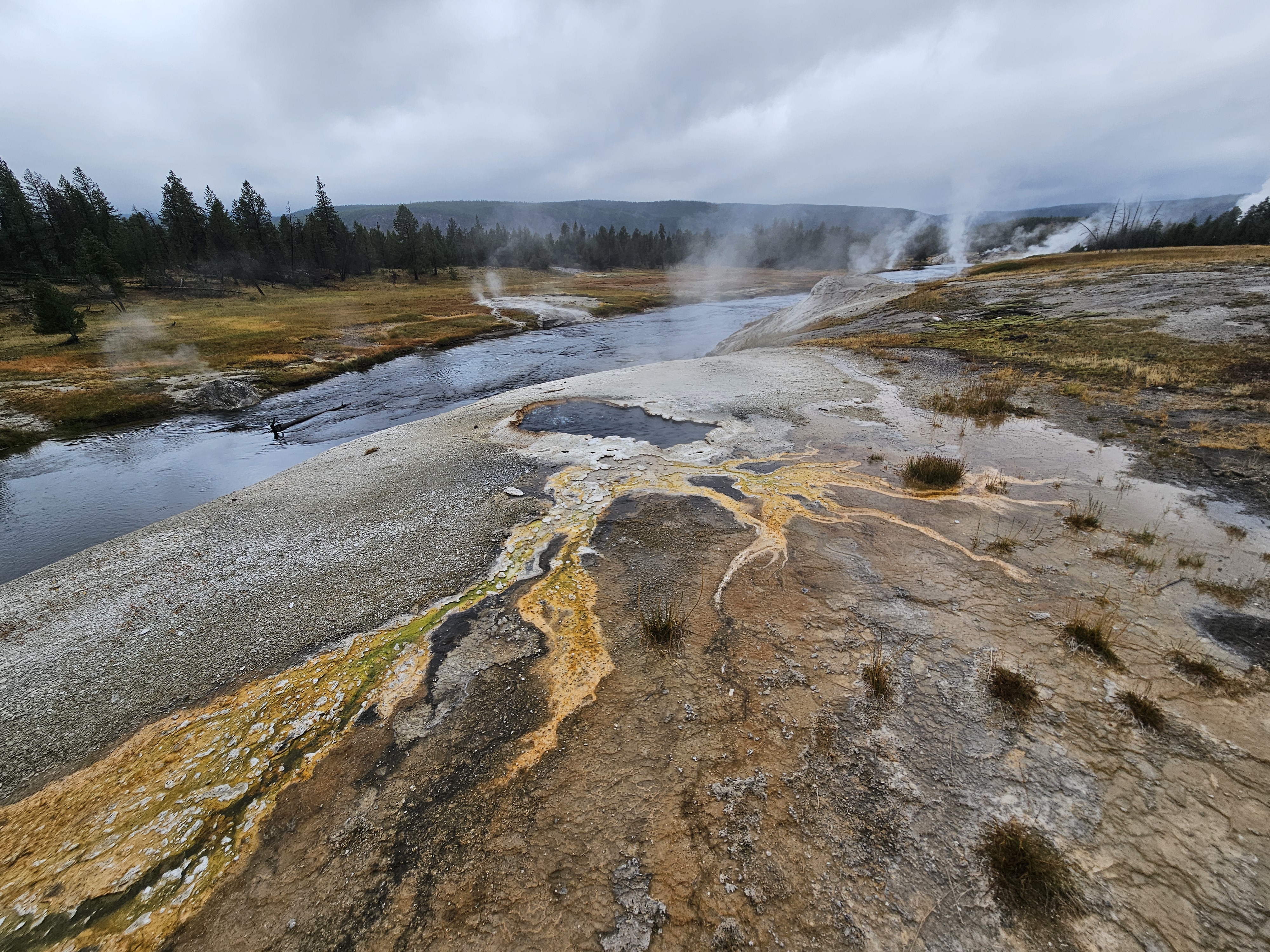
We were in Yellowstone National Park in 2012, both on our way to and from the John Muir Trail. I thought the thermal features were pretty cool then and wanted to see them again. On our way, we got out at a few waterfalls and canyons as it continued to rain. By the time we pulled into the Old Faithful parking lot it was raining even harder. But after 5 minutes it let up and we got out, as serendipitous timing would have it, just in time to see Old Faithful erupt. It’s really cool and went super high and on for a long time. Then we walked around the Upper Geyser Basin taking in a bunch of thermal features.
Back in 2012 I’d seen photos of the Grand Prismatic Spring in the brochure and we went to have a look but I wasn’t impressed. I since learned that one has to get above the spring for a better look and some searching on Google found the Grand Prismatic Spring Overlook which is accessed from the disguised Fairy Falls Trailhead. Despite the on and off rain, this was one of the busiest trails I’ve ever been on.

This was our last stop in Yellowstone before we drove up to Big Sky where I had a medical conference to attend.
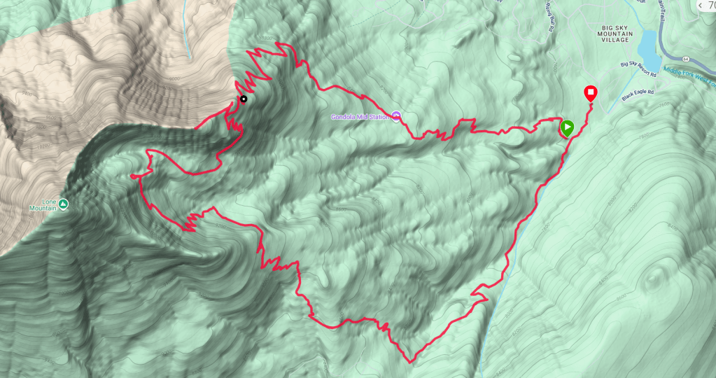
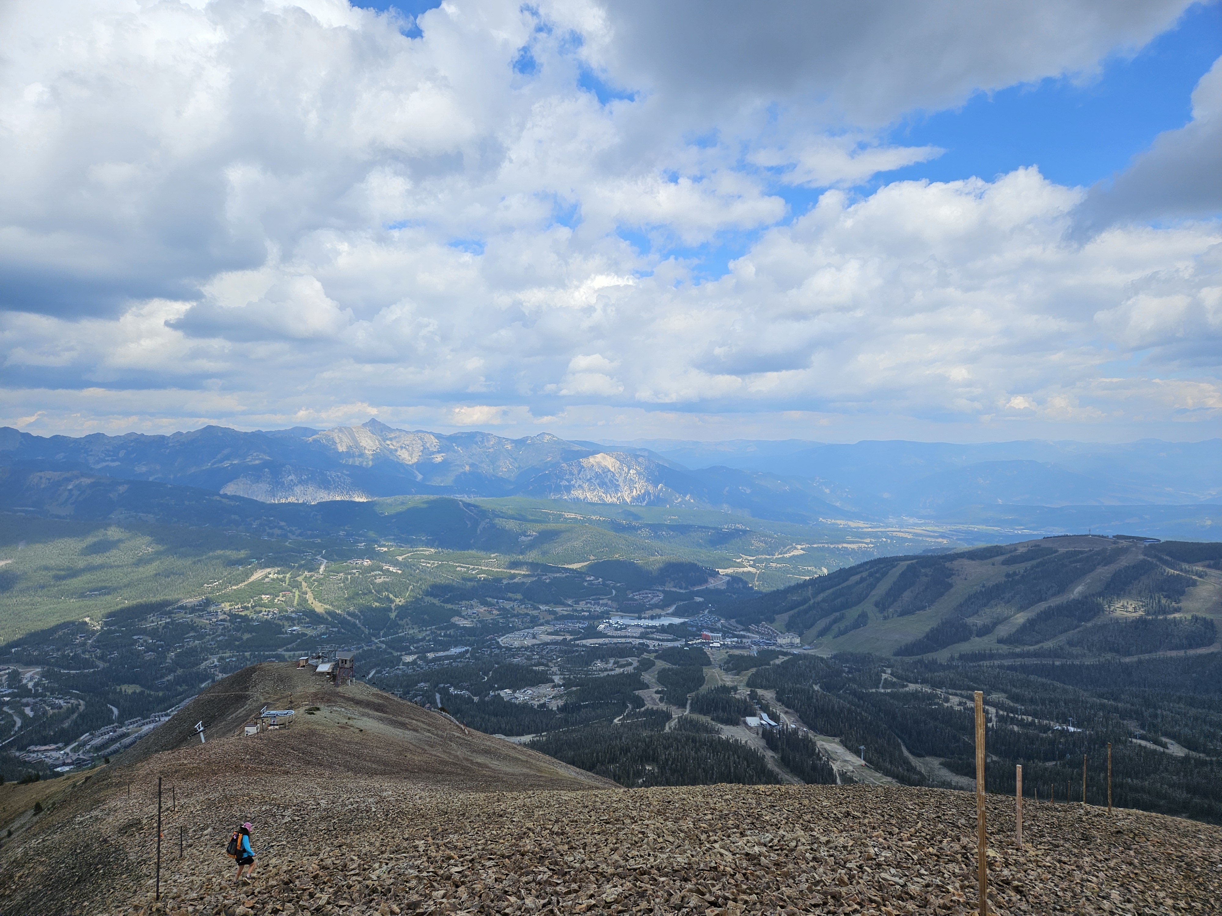
Day Hiking at Big Sky
My conference was in the morning but by noon I was free. Big Sky has been installing a new gondola to the top of Lone Peak so unfortunately the hiking trail to the top was closed. Not to worry though, there were a few other trails to take that got us up pretty high. Indeed, these trails crossed a surprising number of talus fields and at times felt like some of the most difficult and exposed trails of our whole trip.

Day Hiking Beehive Basin
On our last day we drove to the Beehive Basin Trailhead and hiked up the basin and then to a side peak which ended up being the only hike of the entire trip we completed that I had planned before leaving home! The lower reaches of this trail were very popular and we met lots of people heading down, likely because we hadn’t started until after noon. Initially the trail is on private land but soon enough we were in the Spanish Peaks Wilderness in the Gallatin National Forest.
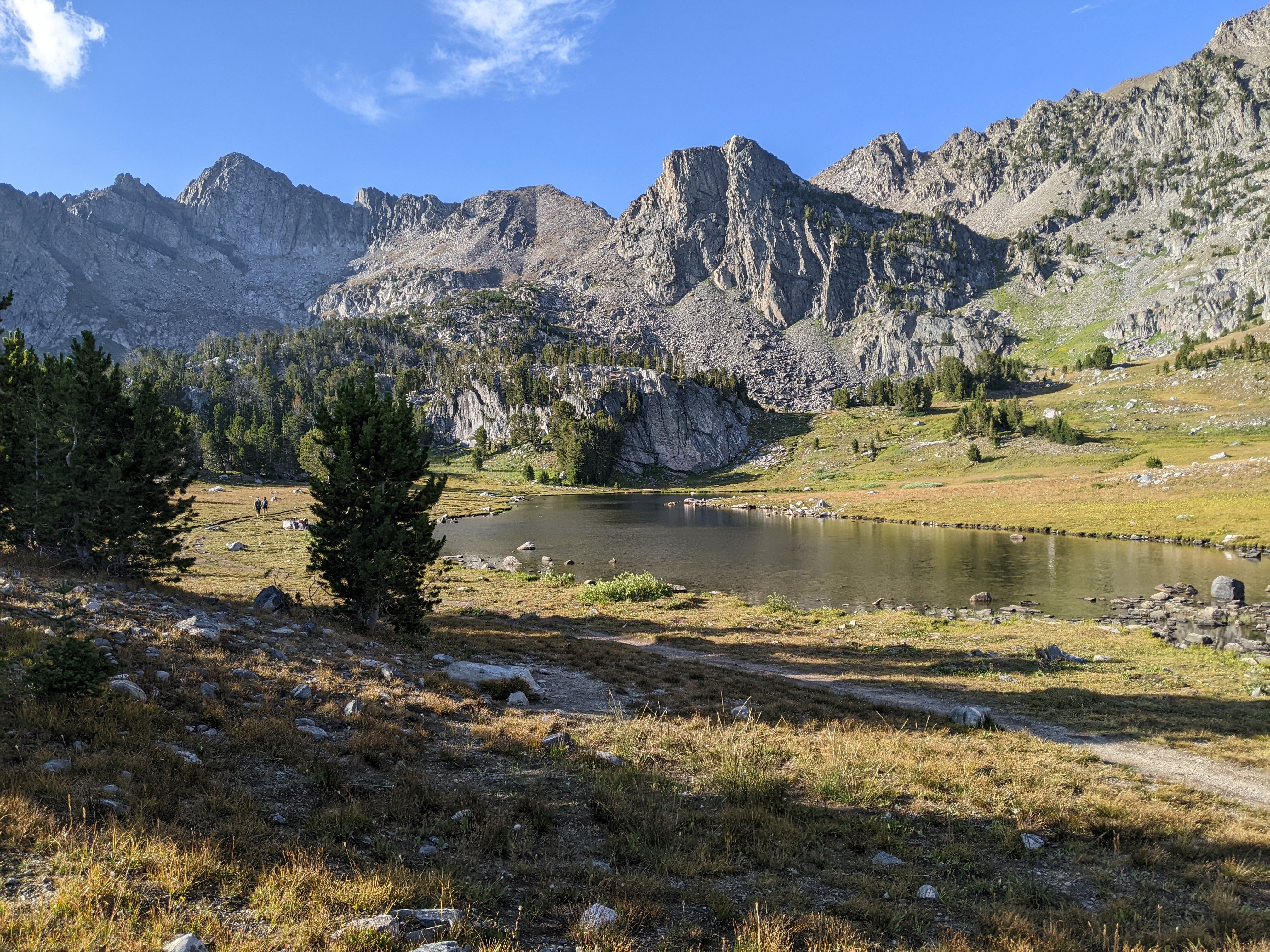
Once up at the unnamed lake at 9,200 feet, we weren’t quite done yet. We wanted to get to the pass, if not climb Beehive Mountain. So we kept going and found a very good social trail that took us almost to the pass. The view north from the pass was spectacular with jagged peaks and Summit Lake essentially sitting on a pass to our northeast framed by Gallatin Peak.
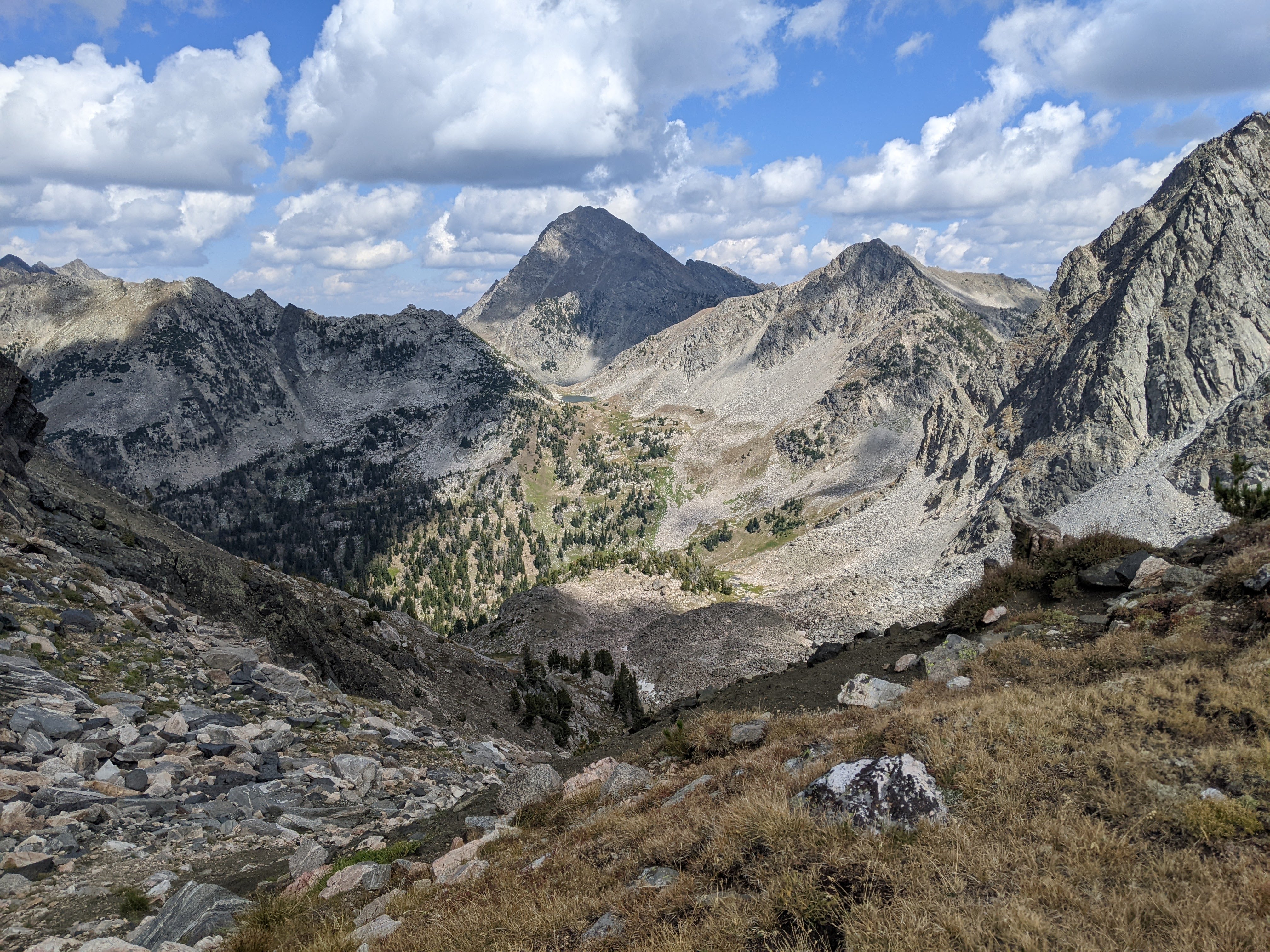
From here we began ascending the steep slope to a sub-peak of Beehive. We were mostly able to hike up on grass but there were a few rocks and occasional hints at a trail. Once we gained the ridge, we saw it looked like quite the class 4 scramble to the top of Beehive Mountain and looked sketchier than we wanted to attempt, although part of me wished we had at least tried. So we took in the view instead.


The bummer with being up high is that we always have to head back down. As we descended into the Beehive Basin it was getting just late enough to stop and cook dinner. I’m super cheap and to that end, I don’t like to eat out. Instead, we brought dinner with us to cook out with a herd of bighorn sheep. I told Erik that some people would pay big money to do as we were doing, eating dinner in the wilderness. After dinner we hiked back to our car.

If I had to do this trip again: Given the fire situation and then weather, I think we pretty much did the best we could. We would’ve fully downloaded our topo map and aimed for Static Peak and the trail to Lone Peak wouldn’t have been closed, but the latter was out of my control.
Best Decisions: Probably leaving the Winds. It was hard, but less hard when the ash was falling on us. It was amazing how within an hour I went from “we are soooo going to bag Gannett” to “uh, this is NOT happening.” Otherwise, defecting to the Teton Crest Trail since it’s on “the list.” Allowing ourselves some time in Yellowstone and stopping at Old Faithful and the Grand Prismatic Spring Overlook. That hike at Big Sky and of course the one to Beehive Basin AND ABOVE.
Next time: When I was younger I used to say, “I’ve been there, done that, now I don’t have to go back.” The more that I see the more I’ve learned what I like: jagged peaks, high alpine lakes, glaciers, and some challenging routes. Even better if I consider it within driving range cause I don’t like to fly that much.
We already have dates (early August) for a repeat attempt at Gannett. I’m hesitant to consider this year an “attempt.”
But that third day on the Teton Crest Trail was absolutely amazing and I know we have to get back there, too. We’ve already planned our route: start at the Devil’s Canyon Trailhead, hike up to Static Divide, bag off-trail Static Peak, drop down into the Alaska Basin, back over Hurricane Pass, up the Avalanche Trail and down to Snowdrift Lake, back down South Fork of the Cascade and up North Fork of the Cascade, up Paintbrush Divide, down to Paintbrush Canyon, Valley Trails, but then up to Surprise and Amphitheater Lakes, hike into Garnet Canyon, and back to the Devil’s Canyon Trailhead.
Oh, and if I go back to another summer conference at Big Sky I’d like to do Idaho’s high point, Mt. Borah, and then do some backpacking in the Spanish Peaks Wilderness.
